| PalestineRemembered | About Us | Oral History | العربية | |
| Pictures | Zionist FAQs | Haavara | Maps | |
| Search |
| Camps |
| Districts |
| Acre |
| Baysan |
| Beersheba |
| Bethlehem |
| Gaza |
| Haifa |
| Hebron |
| Jaffa |
| Jericho |
| Jerusalem |
| Jinin |
| Nablus |
| Nazareth |
| Ramallah |
| al-Ramla |
| Safad |
| Tiberias |
| Tulkarm |
| Donate |
| Contact |
| Profile |
| Videos |
Welcome To al-Fatur - الفاتور (אל-פאתור)
|
District of Baysan
Ethnically cleansed days ago |
العربية Google Earth |
 |
Gallery (5) |
- Statistics & Facts
-
Before & After

- Satellite View
- Articles 2
- Pictures 5
- Members
- Wikipedia
- Videos 2
- Guest Book 2
- Links
| Statistic & Fact | Value | ||||||||||
| Occupation Date | May 12, 1948 | ||||||||||
| Distance From District | 11.5 (km) South of Baysan | ||||||||||
| Elevation | (-225) (meters) | ||||||||||
| Before & After Nakba, Click Map For Details |
|||||||||||

|
|||||||||||
| Map Location | See location #29 on the map View from satellite |
||||||||||
| Military Operation | Gidion Operation | ||||||||||
| Attacking Units | Most likely Golani Brigades | ||||||||||
| Defenders | Arab Liberation Army | ||||||||||
| Acts of Terror | Massacre occured by Zionist troops against the town's inhabitants. | ||||||||||
| Village Temains | al-Fatur was completely destroyed, and only house rubble left behind. | ||||||||||
| Ethnically Cleansing | In mid February 1948, al-Fatur inhabitants were mostly terrorized and displaced out of their homes by the racist Zionists. | ||||||||||
| Pre-Nakba Land Ownership |
**Town Lands' Demarcation Maps |
||||||||||
| Land Usage As of 1945 |
|
||||||||||
| Population |
|
||||||||||
| Number of Houses |
|
||||||||||
| Near By Towns |
|||||||||||
|
|||||||||||
| Town's Name Through History | The village was also known by al-Shaykh al-Fatur too. | ||||||||||
| Water Supply | The village still has the spring of al-Fatur which used to supply it with drinking water. | ||||||||||
| Archeological Sites | The village has two khirbas: the 1st is Shaykh al-Fatur and the 2nd Shaykh Radgha. | ||||||||||
| Exculsive Jewish Colonies That Usurped Village Lands |
No Israeli settlements on village lands. | ||||||||||
| Featured Video | |||||||||||
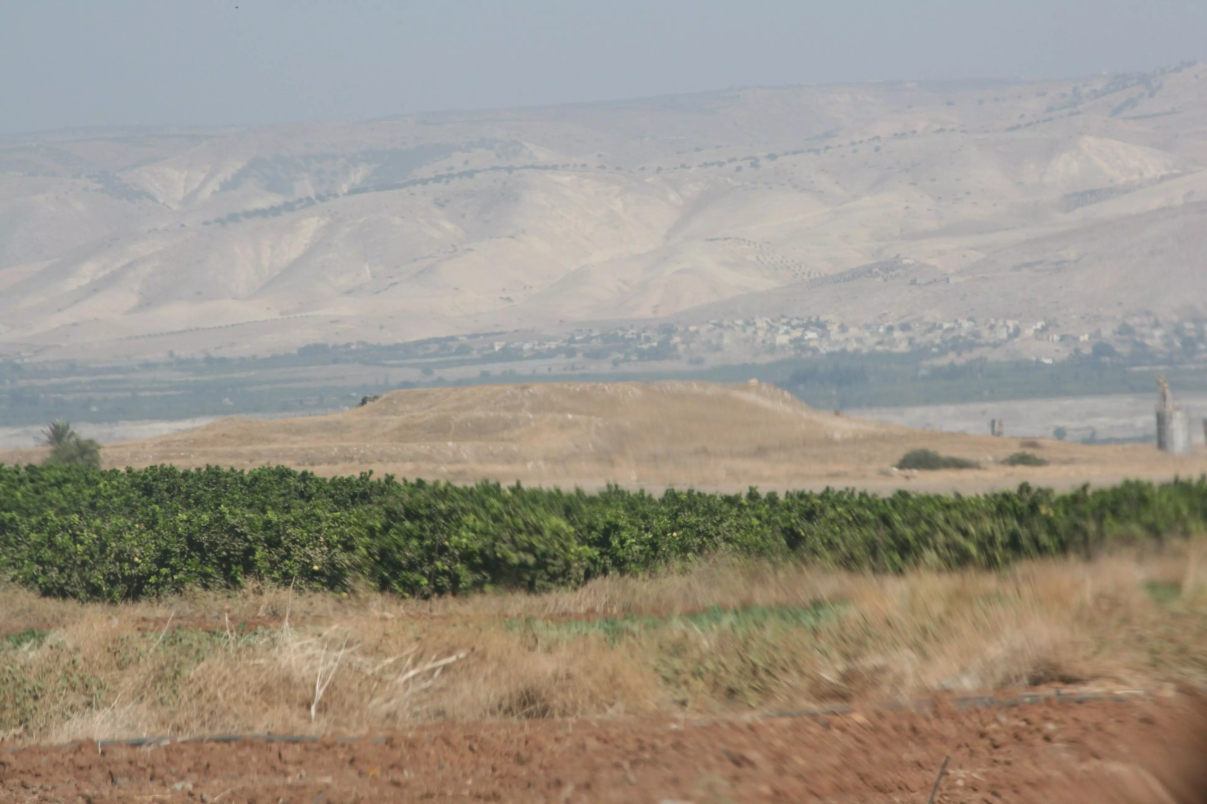
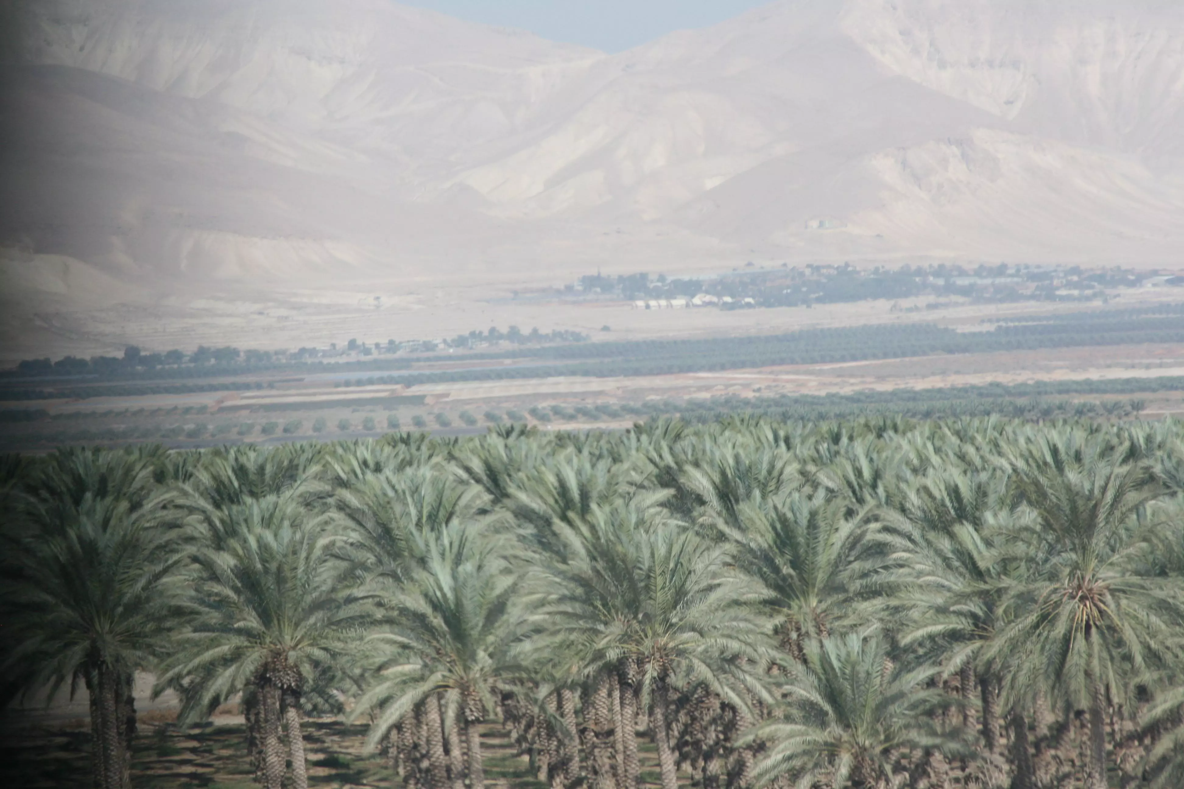
Village Before NakbaThe village stood on a level plain that gradually sloped westward, and overlooked wide areas to the east in the Jordan Valley. It was bordered on the northern and southern sides by the tells of Shaykh al-Fatur (which contained a well built of ancient materials) and Shaykh Radgha. A dirt path linked the village to the Baysan-Jericho highway, which ran a short distance to the west. The villagers earned their living from the cultivation of perennial crops, mainly grain and vegetables. In 1944/45 a total of 709 dunums was allocated to cereals.Village Occupation and Ethnic CleaningThe people of al-Fatur may have been displaced in mid-February 1948, as a result of a battle between Zionist forces and the Arab Liberation Army around the nearby Jewish settlement of Tirat Tzvi. Alternatively, they may have held out for three more months until Operation Gideon (see al-Ashrafiyya, Baysan sub-district). The nearby village of al-Zarra'a is reported to have been evacuated on 20 May; it is not known whether it suffered a direct military assault, or whether its people fled under the influence of the exodus from nearby communities. AI-Fatur was close to the subsequent armistice lines.Zionists Colonies on Village LandsThere are no Israeli settlements on village lands. The nearest settlement is that of Tirat Tzvi , founded in 1937, north of the village. Mechola, founded in 1968, is about 5 km southwest of the village site; its inhabitants cultivate some of the village lands.Village TodayThe village has been destroyed, and the surrounding land has been planted in wheat by the Israeli colony of Mechola. The rubble of structures from Shaykh al-Fatur is overgrown with thorns and doum palm trees. The spring of al-Fatur lies immediately to the north of the rubble.SourceDr. Walid al-Khalidi, 1992: All That Remains. |
|||||||||||
| Related Maps | Town Lands' Demarcation Maps خرائط للقضاء توضح حدود القرى والاودية Town's map on MapQuest View from satellite Help us map this town at WikiMapia |
||||||||||
| Related Links | Wikipedia's Page Google Search Google For Images Google For Videos |
||||||||||
| More Information | في كتاب كي لا ننسى في كتاب بلادنا فلسطين المزيد من موقع هوية |
||||||||||
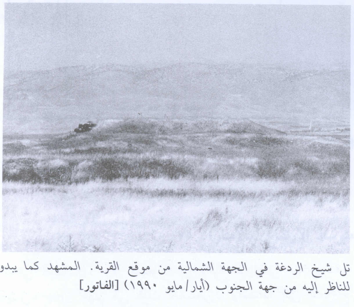
- تل الردغة تاريخ الصورة 26/10/2007
Posted by مخلص الغرير 2 - Village Site View From The South in 1990
Scanned from "All That Remains" by Dr. Walid Khalidi - اراضي عشيرة الغرير في قرية الفاتور زرعت باشجار النخيل والحمضيات من قبل المعتصبين اليهود تاريخ الصورة 26/10/2007
Posted by مخلص الغرير 1 - مشهد من اراضي الغرير في قرية الفاتور - بيسان
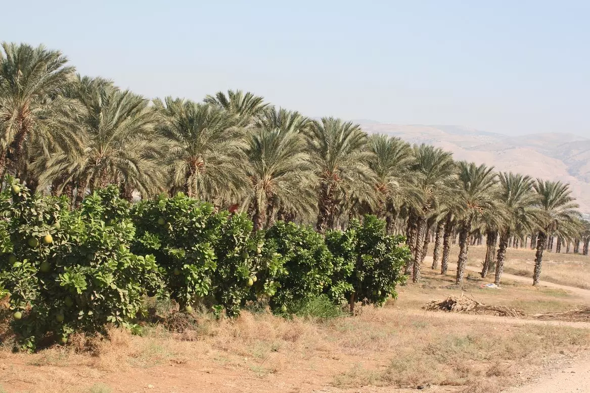
Posted by مخلص الغرير 1 - اراضي قرية الفاتور - بيسان
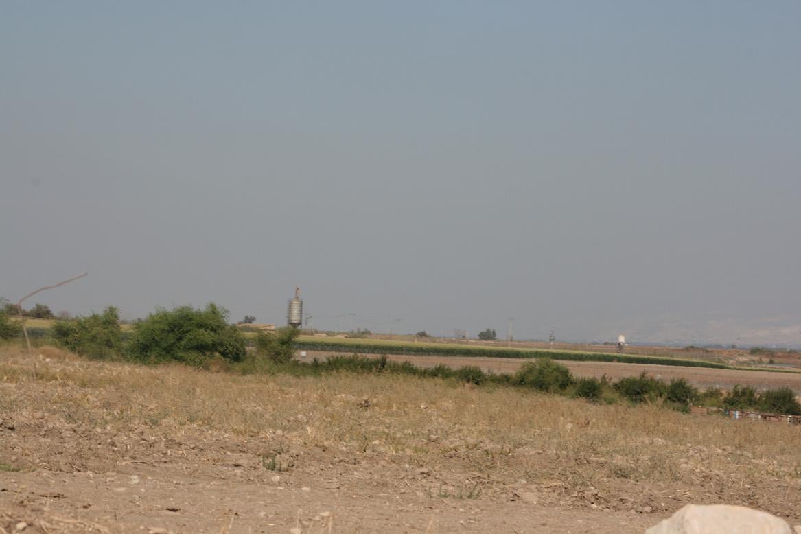
Posted by مخلص الغرير
Want to browse more? 80,000 pictures were grouped in these gallaries:
| Display Name | Clan/Hamolah | Country of Residence |
- في محيط قرية الفاتور المهجرة (قضاء بيسان) وبجانب عين غدرة Duration: min 37 sec
- التعرف على تاريخ الفاتور في بيسان وتل الردغة الشهير ومعاقل عرب ابو غرير والعيون على حدود أراضي طوباس Duration: min 38 sec
No links have been shared yet, be free to the first to share the first link.
 Fake Valor: Why Did Zionist Jews Hoist Nazis Flag on Their Ships in the 1930s?
What is new?
-
Facts About Oct. 7th Gaza Raid
-
Remined Us Please: Who Did Rape Whom? Was it Palestinians who raped Israelis? Or, was the other way around? You'll be the judge
-
When Prof. Edward Said was invited to debate Bibi Netanyahu in the 1980s, watch what happened!
-
Ezra Klein of the NY Times on the "Jewish Race".
-
Abusing Blood Libel!
-
How and why Israeli Jewry has become the most hated cult?
-
Did Israeli Soldiers Activate The Hannibal Direective On Oct. 7th? You Be The Judge
-
Zionist FAQ: Isn't it true that Palestinians don't want peace? Palestinians never accepted the two-state solution
- Facts about Haavara (Transfer) Agreement between Ben-Gurion & Hitler
-
Haavara FAQs: Why Did Zionist Jews Hoist Nazis' Flags on Their Ships in the 1930s?
- Haavara FAQs: When Chaim Weizmann met FDR in mid-1943, why was he silent about rescuing European Jewry?
-
Dear ChatGPT: How did Palestinians resist Napoleon's invasion of their country in 1799?
-
Dear ChatGPT: Gaza had a vibrant Jewish community in the mid-17th century. What happened to them?
-
Dear ChatGPT: Why did the Jewish Agency suppress news of the Holocaust during WWII?
-
Video Playlist: Jews share their DNA tests to end the conflict for good.
-
A Tale of Two Conflicts: Examining the Definition of Genocide
-
Prof. Abraham Polak And The Suppressed History of the Khazars and European Jewry
-
How Ronald Reagan would have framed the genocide in Gaza if he were still alive?
-
Haavara FAQs: Let us do the math: how many German Jews did The Haavara Agreement save?
-
Zionist FAQs: The Hebron Massacre of 1929, "clearly proves" that Palestinians are antisemitic, how could you deny it?
-
Zionist FAQs: Why Anti-Zionist Is Not Antisemitism?
-
Zionist FAQs: Isn't it true that the KGB created Palestinian Nationalism in the early 1960s?
- Zionist FAQs: Muslims are killing Muslims all the time; why are Israeli Jews being singled out in the media?
- Zionist FAQs: How is Israel an apartheid state when 20% of its citizens are Arabs who enjoy full rights?
-
Haavara FAQs: Why Did Dorothy Thompson Flip From A Zionist Advocate to A Silenced Dissenter?
-
Haavara FAQs: Analysis of Herzl's Uganda Scheme and how it could have saved millions of Jews.
-
Haavara FAQs: Why did Hayim Greenberg describe American Jewry as "morally bankrupt" in early 1943?
-
Haavara FAQs: What if the Evian Conference was a resounding success? What would have been the impact of saving European Jewry on Zionism?
- Haavara FAQs: What if the six million were saved, how that would have impacted the Zionist project?
-
Haavara FAQs: How did Zionist leaders react when Europe's Jews lingered in the DP camps after WWII ended?
-
Why does the American Jewish community repeat lies that David Ben-Gurion had debunked before he died?
-
Who has the power to rename the Tatar/Khazar Gene Marker to Jewish IV?
-
Zionist FAQs: Why won't Egypt, Syria, and Jordan take their people back? Jews are indigenous to Palestine, and Arabs immigrated after Jews developed the country. Arabs should leave.
-
Haavara FAQs: Did Hitler and the Nazis conflate between Judaism and Zionist? If that wasn't case, then why?
-
Haavara FAQs: Winston Churchill and antisemitism, a collection of articles written Churchill.
-
Haavara FAQs: Broken by country, how many Jews survived vs. killed during the Holocaust?
-
Haavara FAQs: Why did European Jews vote with their feet and to immigrated to the Americas, not Palestine, after WWII?
-
Watch this American Jewish Girl describing Israeli Jews' cognitive dissonance like no other in under two minutes
-
Haavara FAQs: When the Nazis went out of their way to hide the Holocaust, Israeli Jews did the exact opposite by broadcasting their genocide of Gazans. But why?
-
Haavara FAQs: How Zionist Jews went out of their to show their appreciation to Nazism and Fascism?
- Haavara FAQs: Why Zionist leaders were against bombing the death camps & the Railroads leading to them?
-
Haavara FAQs: Hitler's message to the British and American people: If Jews are such noble citizens and you care about them, how come you're not letting them in? I will gladly ship them to you at my expense, even on luxury liners!
-
A shortlist of Zionist and Israeli false flag operations in the name Jews.
-
The Most Moral Army
- The Land of Kapos (Israel): Where the brave are boycotted and Kapos walk free.
- Why did early Zionists often named their communal enterprises "colonial"?
- Zionist Relations with Nazi Germany by Faris Glubb
-
Two NY Times advertisements by Zionists in the early 1943 that exposes Zionists' treason at the height of the calamity
- Facts Not Lies about the Palestinian-Israeli Conflict.
- Site's pictures have been categorized
- Campgain Against Lice
- A Survey of Palestine, the official source about Palestine before Nakba produced by the British Mandate; over 1200 pages.
- Satellite View & Google Earth: Over 6,000 placemarks identifying all destroyed towns, W. Bank & Gaza Strip Towns, & refugee camps.
- PalestineRemembered.com and its Nakba Oral History Project were featured on al-Jazeera Satellite TV.
- Nakba Oral History Video Podcast:
 Over 700 Oral History interviews (including 3,500+ hours of recording) can be viewed online.
 - Palestine Village Statistics Project
- Gaza Jail Break
- النسخة العربية للموقع الان متوفرة
- Videos: Documenting the destroyed villages in video: Tracing all that remains since Nakba.
- Videos: Responding to Zionist Propaganda
- Interview: The ethnic cleansing of Palestine: George Galloway interviews Israeli Historian Ilan Pappe.
- For Palestinians, memory matters. It provides a blueprint for their future By George Bisharat.
- Zionist FAQ now available in Hebrew שאלות שציונים שואלים, עכשיו בעברית
- Video: The Stephen Walt and John Mearsheimer report on the influence of the Israel Lobby on U.S. Foreign Policy
- The Palestinian-Israeli conflict for beginners
