| PalestineRemembered | About Us | Oral History | العربية | |
 Menu Menu |
Pictures | Zionist FAQs | Haavara | Maps |
| Search |
| Camps |
| Districts |
| Acre |
| Baysan |
| Beersheba |
| Bethlehem |
| Gaza |
| Haifa |
| Hebron |
| Jaffa |
| Jericho |
| Jerusalem |
| Jinin |
| Nablus |
| Nazareth |
| Ramallah |
| al-Ramla |
| Safad |
| Tiberias |
| Tulkarm |
| Donate |
| Contact |
| Profile |
| Videos |
Welcome To Biyar 'Adas - بيار عدس (ביאר עדס)
|
District of Jaffa
Ethnically cleansed days ago |
العربية Google Earth |
 |
Gallery (17) |
- Statistics & Facts
-
Before & After

- Satellite View
- Articles 3
- Pictures 17
- Oral History 2
- Members 8
- Families
- All That Remains
- Wikipedia
- Videos 1
- Guest Book
- Links
| Statistic & Fact | Value | |||||||||||||||||||||
| Occupation Date | April 12, 1948 | |||||||||||||||||||||
| Distance From District | 19 (km) Northeast of Jaffa | |||||||||||||||||||||
| Elevation | 25 (meters) | |||||||||||||||||||||
| Before & After Nakba, Click Map For Details |
||||||||||||||||||||||

|
||||||||||||||||||||||
| Map Location | See location #3 on the map View from satellite |
|||||||||||||||||||||
| Attacking Units | The Stern terror gangs | |||||||||||||||||||||
| Defenders | Arab Liberation Army | |||||||||||||||||||||
| Acts of Terror | On the 5th of March 1948, some Haganah terror units murdered 15 people including women and children. | |||||||||||||||||||||
| Exodus Cause | Military assault by Zionist troops | |||||||||||||||||||||
| Village Temains | In June 1948, the village was destroyed based on the orders of Yosif Weitz, a Jewish National Fund official, and only few houses survived the destruction. | |||||||||||||||||||||
| Ethnically Cleansing | Biyar 'Adas was completely ethnically cleansed. | |||||||||||||||||||||
| Pre-Nakba Land Ownership |
**Town Lands' Demarcation Maps |
|||||||||||||||||||||
| Land Usage As of 1945 |
|
|||||||||||||||||||||
| Population |
|
|||||||||||||||||||||
| Number of Houses |
|
|||||||||||||||||||||
| Near By Towns |
||||||||||||||||||||||
|
|
||||||||||||||||||||||
| Exculsive Jewish Colonies That Usurped Village Lands |
'Adanim and Elishama' | |||||||||||||||||||||
| Featured Video | ||||||||||||||||||||||
Village Before NakbaThe village was situated on an uneven, southwestward-sloping spot on the central coastal plain. The coastal highway and railway line ran 2.5 km and 1.5 km east of it, respectively. A number of secondary roads linked it to neighboring villages. Its name, which meant 'wells of lentils,' probably referred to the rock-hewn, underground storage pits that were found in the village and were used for storing lentils. In the late nineteenth century, Biyar 'Adas was a village built of adobe bricks, with a well on its eastern side. The houses of Biyar 'Adas were bunched close together. When new houses were built, late in the Mandate period, they were erected to the southeast of the older buildings. The population was predominantly Muslim. Citrus and other fruit trees, as well as grain and vegetables, were grown on village land. In 1944/45 a total of 1,604 dunums was devoted to citrus and bananas and 3,413 dunums were allocated to cereals; 181 dunums were irrigated or used for orchards. Rainfall and wells supplied the water necessary for cultivation. On the northern and northwestern sides of the village were remains of Roman–Byzantine structures.Village Occupation and Ethnic CleaningAccounts describing the events in this village during the war differ greatly. The History of the Haganah states that the villagers left after a Haganah attack in early March 1948. 'After soldiers of the Arab Liberation Army attacked Migdal a platoon of the Alexandroni Brigade's Third Battalion] went forth at dawn on 5 March 1948 and attacked the village of Biyar 'Adas, whose inhabitants rushed to evacuate it.' At the time, a press report in the New York Times said that fifteen Arabs were killed in the attack. The Haganah claimed that the victims belonged to a group that had attacked nearby Jewish settlements. The Palestinian press reported battles around the village in late February and early March, beginning with an attack by a Jewish force on 27 February. The Jaffa-based daily Filastin stated that on the morning of that day, Arab workers picking oranges in a grove outside the village were fired upon by a Jewish unit. This raid led to continual engagements between the Jews and the village militia. Tension intensified on 1–2 March, and culminated in an infiltration attempt into the village on the night of 4–5 March. However, the paper does not say that the population was driven out as a result.In their descriptions of events that took place in April, Israeli historian Benny Morris and other press reports present different pictures of how the village was occupied. 'Jewish military activity around Biyar 'Adas,' Morris writes, '… had led to the evacuation of that village on 12 April.' A New York Times dispatch provides more details. On 5 April the Stern Gang announced that its units had blown up 30 houses. A member of the terrorist group stated that the houses were fortified with sandbags, making them a military objective; the group also claimed that the village had been a base for attacks on a nearby Jewish settlement. However, the Times reported that the Haganah and the local population had concluded a truce agreement in the area and that the attackers met with no opposition, as the villagers fled from the impending assault. By early June, the village had been slated for destruction by the Jewish National Fund. Israeli military and political leaders had decided that the coastal area between Tel Aviv and Hadera should form the core of the Jewish state, thus necessitating that it be 'Arab-free.' On 16 June, Israeli prime minister David Ben-Gurion recorded in his diary that Biyar 'Adas had been levelled. Zionists Colonies on Village LandsThe settlement of 'Adanim (141171) was established in 1950 on village lands, southwest of the village site. The settlement of Elishama' (143173) was built one year later, also on village lands; it is closer to the site than 'Adanim.Village TodayThe site is marked by cactuses, fig trees, palm trees, and the debris of houses. Some houses and sections of houses that were built among citrus groves still stand, deserted, amidst wild vegetation. All are made of concrete and possess a variety of architectural designs, ranging from the elaborate to the Simple. Their roofs are flat, slanted, or gabled, and their doors and windows are rectangular. The land in the vicinity, is cultivated and is covered in places by Israeli fruit orchards.SourceDr. Walid al-Khalidi, 1992: All That Remains. |
||||||||||||||||||||||
| Related Maps | Town Lands' Demarcation Maps خرائط للقضاء توضح حدود القرى والاودية Town's map on MapQuest View from satellite Help us map this town at WikiMapia |
|||||||||||||||||||||
| Related Links | Wikipedia's Page Google Search Google For Images Google For Videos |
|||||||||||||||||||||
| More Information | في كتاب كي لا ننسى في كتاب بلادنا فلسطين المزيد من موقع هوية |
|||||||||||||||||||||
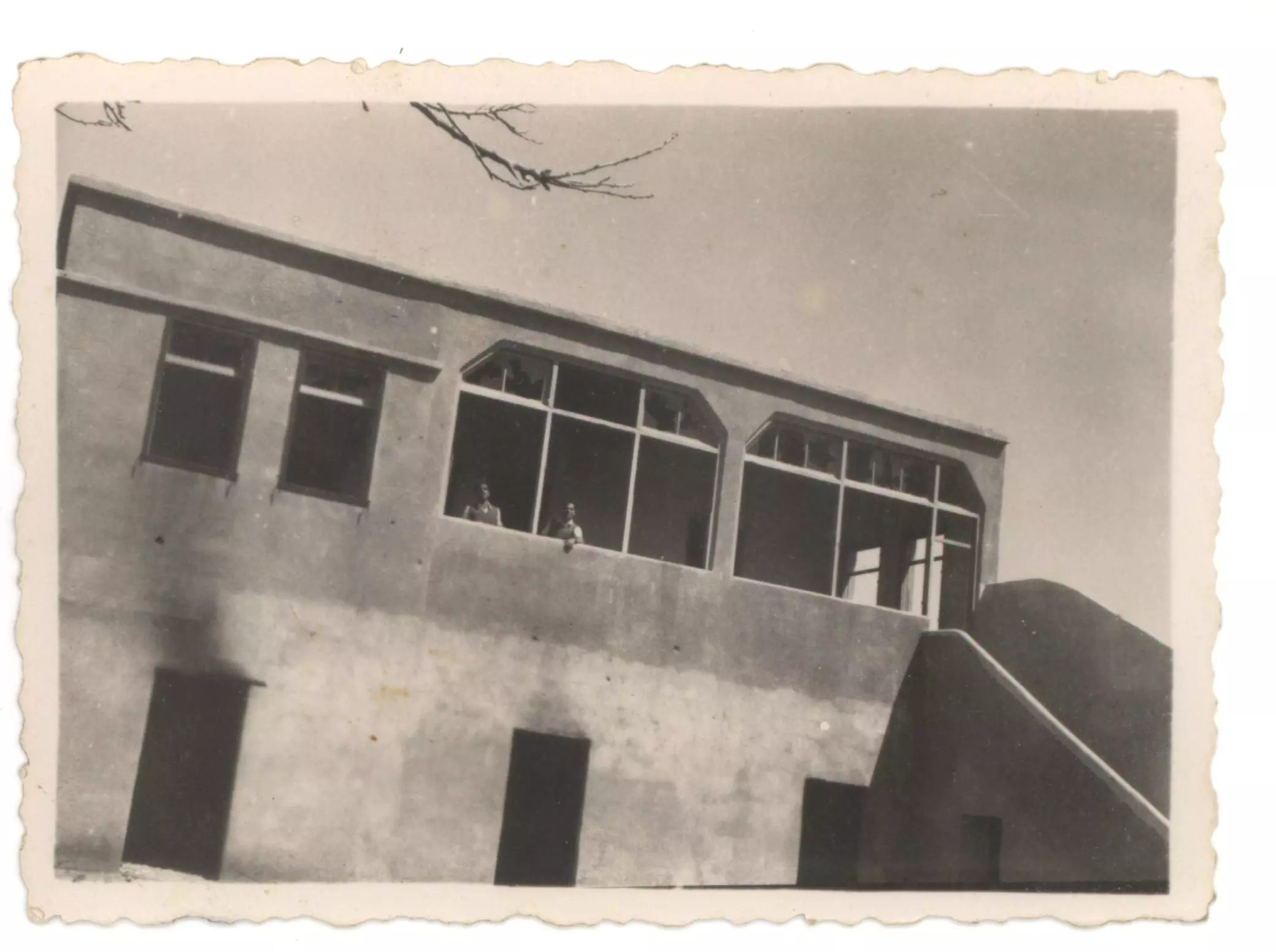
- إحدى بيوت القرية المدمرة.

Scanned from "All That Remains" by Dr. Walid Khalidi - بيت الشنتي قبل النكبة
- إحدى بيوت القرية المدمرة
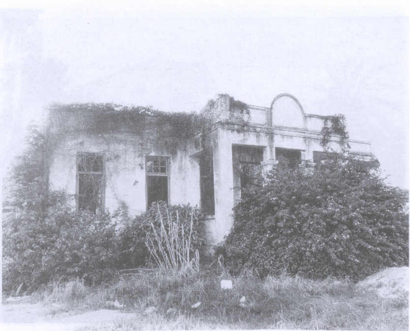
Scanned from "All That Remains" by Dr. Walid Khalidi - بيوت القرية المدمرة

Scanned from "All That Remains" by Dr. Walid Khalidi - The same house as in the 1st image. Near Gil-Amal.
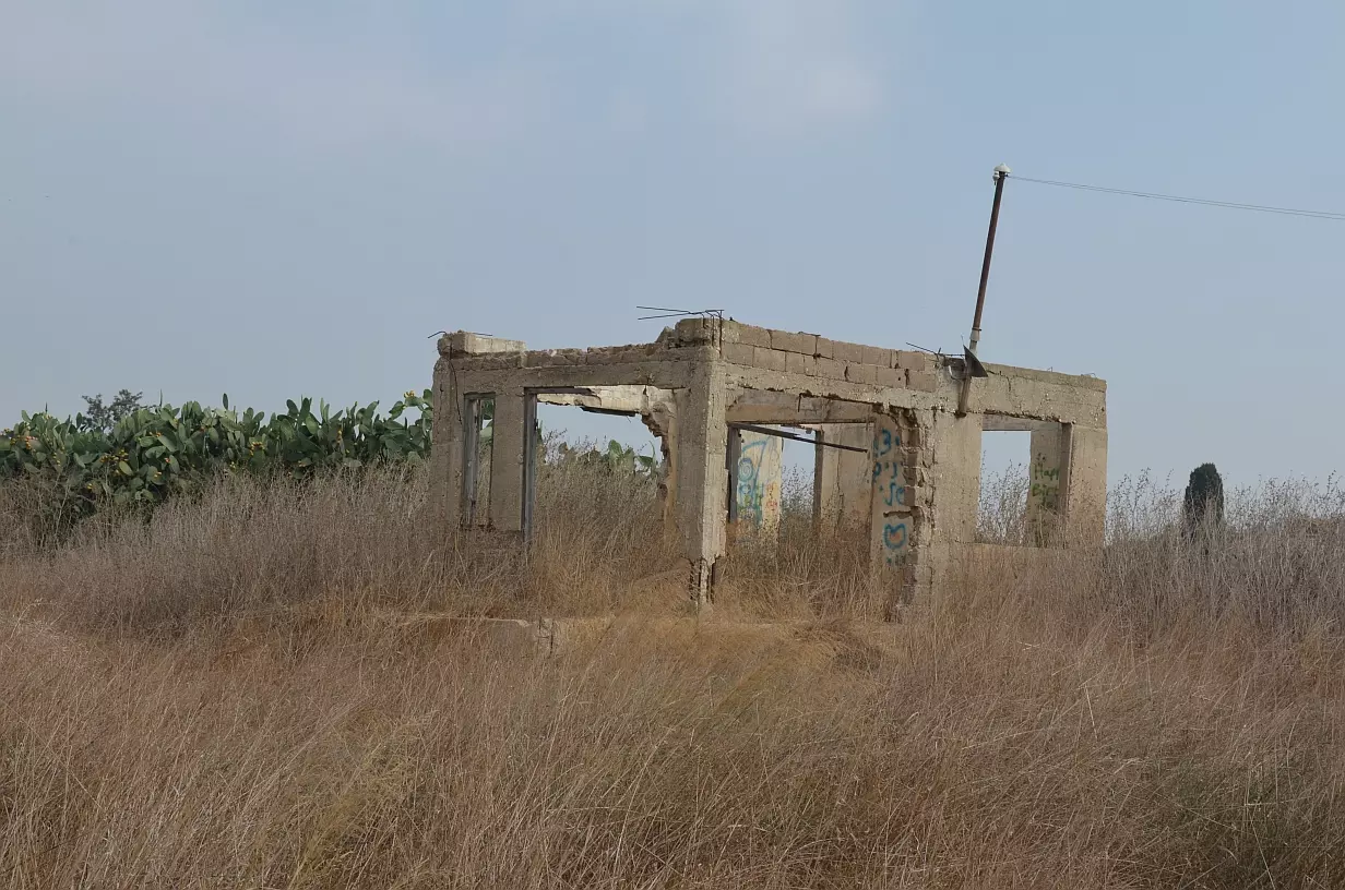
Posted by Uri Zackhem - Inside the house
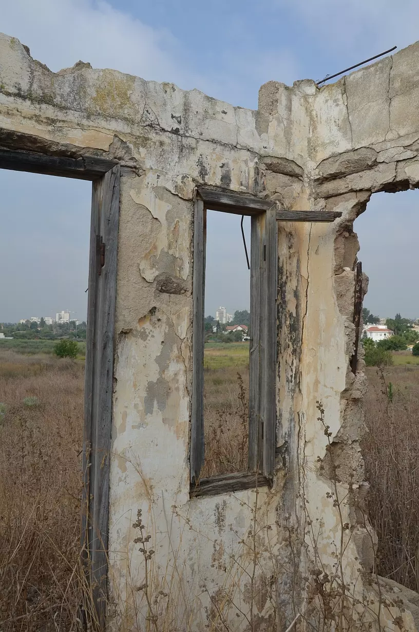
Posted by Uri Zackhem - A filled-up well nearby
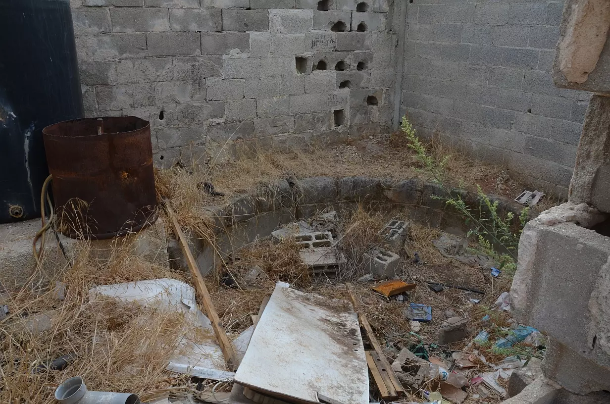
Posted by Uri Zackhem - التقطت هذه الصورة في ديوان عشيرة آل زيد الجنوبي عام 1957م. يشاهد في الصف الخلفي سعيد يوسف هلال. وفي الصف الأمامي: سعيد حامد النيص (مختار بيار عدس قبل النكبة)

Posted by سمير الصوص 1 - موقع القريه

Posted by abu raya - اراضي القريه

Posted by abu raya - موقع القريه وطريقها

Posted by abu raya - من اثار بيوت القريه

Posted by abu raya - بقايا بيوت القريه

Posted by abu raya - من بيوت القريه والمستوطنه المقامه على اراضيها

Posted by abu raya - اراضي القريه

Posted by abu raya - اراضي القريه

Posted by abu raya - بيوت بيار العدس

Posted by abu raya
Want to browse more? 80,000 pictures were grouped in these gallaries:
| Display Name | Clan/Hamolah | Country of Residence |
| مهند النيص | - | - |
| سميح | ألنيص | قلقيليه |
| محمد عباس | عباس | عمان, الاردن |
| ضياء | عباس | عمان, الاردن |
| محمود السوقي | السوقي | الاردن, اربد |
| رواء أبوهويدي | - | نابلس |
| mohamad suki | alsuki | - |
| Khaled Al Souqi | AL SOUQI | ONTARIO, CANADA |
No links have been shared yet, be free to the first to share the first link.

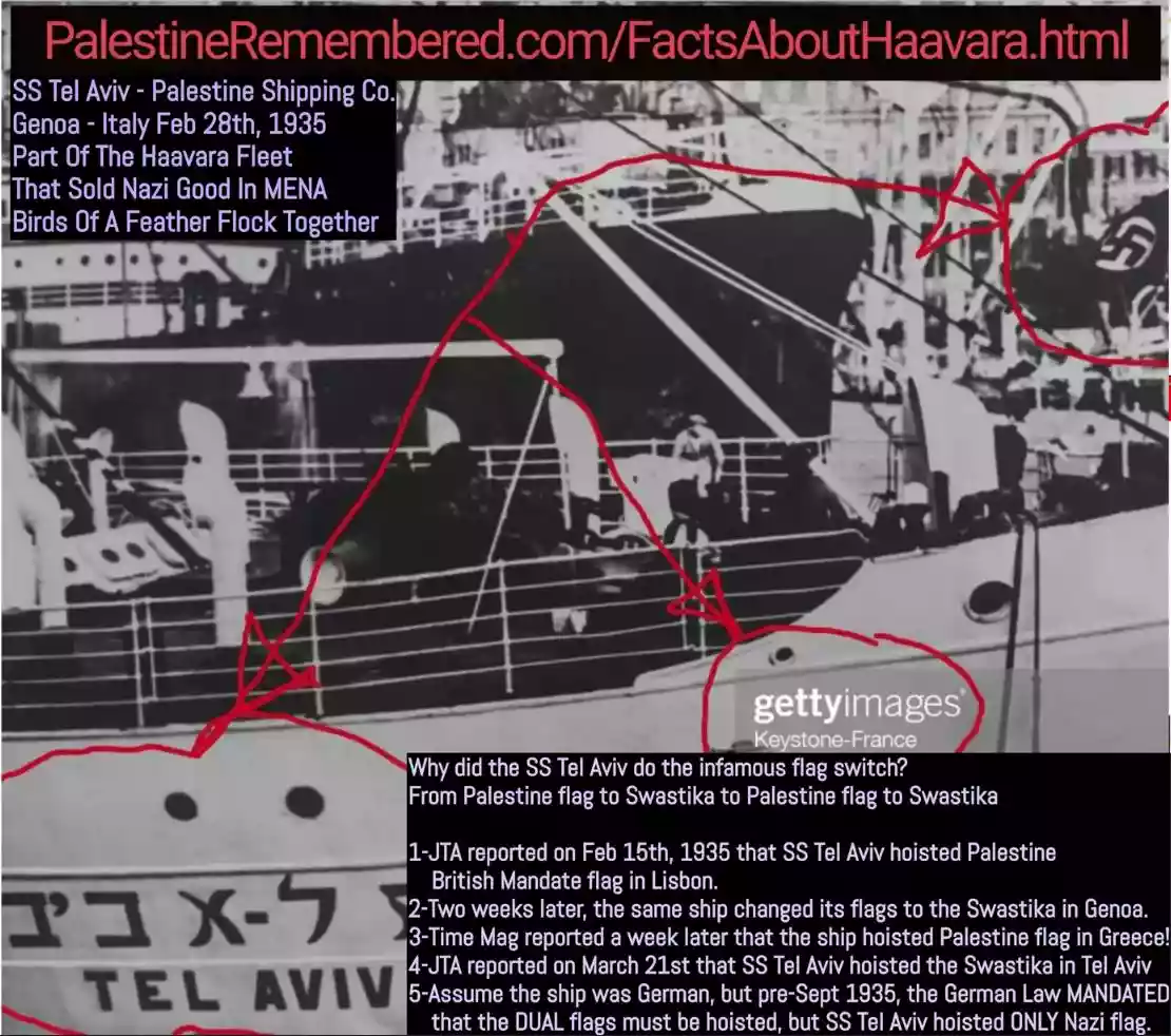 Fake Valor: Why Did Zionist Jews Hoist Nazis Flag on Their Ships in the 1930s?
What is new?
-
Facts About Oct. 7th Gaza Raid
-
Remined Us Please: Who Did Rape Whom? Was it Palestinians who raped Israelis? Or, was the other way around? You'll be the judge
-
When Prof. Edward Said was invited to debate Bibi Netanyahu in the 1980s, watch what happened!
-
Ezra Klein of the NY Times on the "Jewish Race".
-
Abusing Blood Libel!
-
How and why Israeli Jewry has become the most hated cult?
-
Did Israeli Soldiers Activate The Hannibal Direective On Oct. 7th? You Be The Judge
-
Zionist FAQ: Isn't it true that Palestinians don't want peace? Palestinians never accepted the two-state solution
- Facts about Haavara (Transfer) Agreement between Ben-Gurion & Hitler
-
Haavara FAQs: Why Did Zionist Jews Hoist Nazis' Flags on Their Ships in the 1930s?
- Haavara FAQs: When Chaim Weizmann met FDR in mid-1943, why was he silent about rescuing European Jewry?
-
Dear ChatGPT: How did Palestinians resist Napoleon's invasion of their country in 1799?
-
Dear ChatGPT: Gaza had a vibrant Jewish community in the mid-17th century. What happened to them?
-
Dear ChatGPT: Why did the Jewish Agency suppress news of the Holocaust during WWII?
-
Video Playlist: Jews share their DNA tests to end the conflict for good.
-
A Tale of Two Conflicts: Examining the Definition of Genocide
-
Prof. Abraham Polak And The Suppressed History of the Khazars and European Jewry
-
How Ronald Reagan would have framed the genocide in Gaza if he were still alive?
-
Haavara FAQs: Let us do the math: how many German Jews did The Haavara Agreement save?
-
Zionist FAQs: The Hebron Massacre of 1929, "clearly proves" that Palestinians are antisemitic, how could you deny it?
-
Zionist FAQs: Why Anti-Zionist Is Not Antisemitism?
-
Zionist FAQs: Isn't it true that the KGB created Palestinian Nationalism in the early 1960s?
- Zionist FAQs: Muslims are killing Muslims all the time; why are Israeli Jews being singled out in the media?
- Zionist FAQs: How is Israel an apartheid state when 20% of its citizens are Arabs who enjoy full rights?
-
Haavara FAQs: Why Did Dorothy Thompson Flip From A Zionist Advocate to A Silenced Dissenter?
-
Haavara FAQs: Analysis of Herzl's Uganda Scheme and how it could have saved millions of Jews.
-
Haavara FAQs: Why did Hayim Greenberg describe American Jewry as "morally bankrupt" in early 1943?
-
Haavara FAQs: What if the Evian Conference was a resounding success? What would have been the impact of saving European Jewry on Zionism?
- Haavara FAQs: What if the six million were saved, how that would have impacted the Zionist project?
-
Haavara FAQs: How did Zionist leaders react when Europe's Jews lingered in the DP camps after WWII ended?
-
Why does the American Jewish community repeat lies that David Ben-Gurion had debunked before he died?
-
Who has the power to rename the Tatar/Khazar Gene Marker to Jewish IV?
-
Zionist FAQs: Why won't Egypt, Syria, and Jordan take their people back? Jews are indigenous to Palestine, and Arabs immigrated after Jews developed the country. Arabs should leave.
-
Haavara FAQs: Did Hitler and the Nazis conflate between Judaism and Zionist? If that wasn't case, then why?
-
Haavara FAQs: Winston Churchill and antisemitism, a collection of articles written Churchill.
-
Haavara FAQs: Broken by country, how many Jews survived vs. killed during the Holocaust?
-
Haavara FAQs: Why did European Jews vote with their feet and to immigrated to the Americas, not Palestine, after WWII?
-
Watch this American Jewish Girl describing Israeli Jews' cognitive dissonance like no other in under two minutes
-
Haavara FAQs: When the Nazis went out of their way to hide the Holocaust, Israeli Jews did the exact opposite by broadcasting their genocide of Gazans. But why?
-
Haavara FAQs: How Zionist Jews went out of their to show their appreciation to Nazism and Fascism?
- Haavara FAQs: Why Zionist leaders were against bombing the death camps & the Railroads leading to them?
-
Haavara FAQs: Hitler's message to the British and American people: If Jews are such noble citizens and you care about them, how come you're not letting them in? I will gladly ship them to you at my expense, even on luxury liners!
-
A shortlist of Zionist and Israeli false flag operations in the name Jews.
-
The Most Moral Army
- The Land of Kapos (Israel): Where the brave are boycotted and Kapos walk free.
- Why did early Zionists often named their communal enterprises "colonial"?
- Zionist Relations with Nazi Germany by Faris Glubb
-
Two NY Times advertisements by Zionists in the early 1943 that exposes Zionists' treason at the height of the calamity
- Facts Not Lies about the Palestinian-Israeli Conflict.
- Site's pictures have been categorized
- Campgain Against Lice
- A Survey of Palestine, the official source about Palestine before Nakba produced by the British Mandate; over 1200 pages.
- Satellite View & Google Earth: Over 6,000 placemarks identifying all destroyed towns, W. Bank & Gaza Strip Towns, & refugee camps.
- PalestineRemembered.com and its Nakba Oral History Project were featured on al-Jazeera Satellite TV.
- Nakba Oral History Video Podcast:
 Over 700 Oral History interviews (including 3,500+ hours of recording) can be viewed online.
 - Palestine Village Statistics Project
- Gaza Jail Break
- النسخة العربية للموقع الان متوفرة
- Videos: Documenting the destroyed villages in video: Tracing all that remains since Nakba.
- Videos: Responding to Zionist Propaganda
- Interview: The ethnic cleansing of Palestine: George Galloway interviews Israeli Historian Ilan Pappe.
- For Palestinians, memory matters. It provides a blueprint for their future By George Bisharat.
- Zionist FAQ now available in Hebrew שאלות שציונים שואלים, עכשיו בעברית
- Video: The Stephen Walt and John Mearsheimer report on the influence of the Israel Lobby on U.S. Foreign Policy
- The Palestinian-Israeli conflict for beginners
