| PalestineRemembered | About Us | Oral History | العربية | |
| Pictures | Zionist FAQs | Haavara | Maps | |
| Search |
| Camps |
| Districts |
| Acre |
| Baysan |
| Beersheba |
| Bethlehem |
| Gaza |
| Haifa |
| Hebron |
| Jaffa |
| Jericho |
| Jerusalem |
| Jinin |
| Nablus |
| Nazareth |
| Ramallah |
| al-Ramla |
| Safad |
| Tiberias |
| Tulkarm |
| Donate |
| Contact |
| Profile |
| Videos |
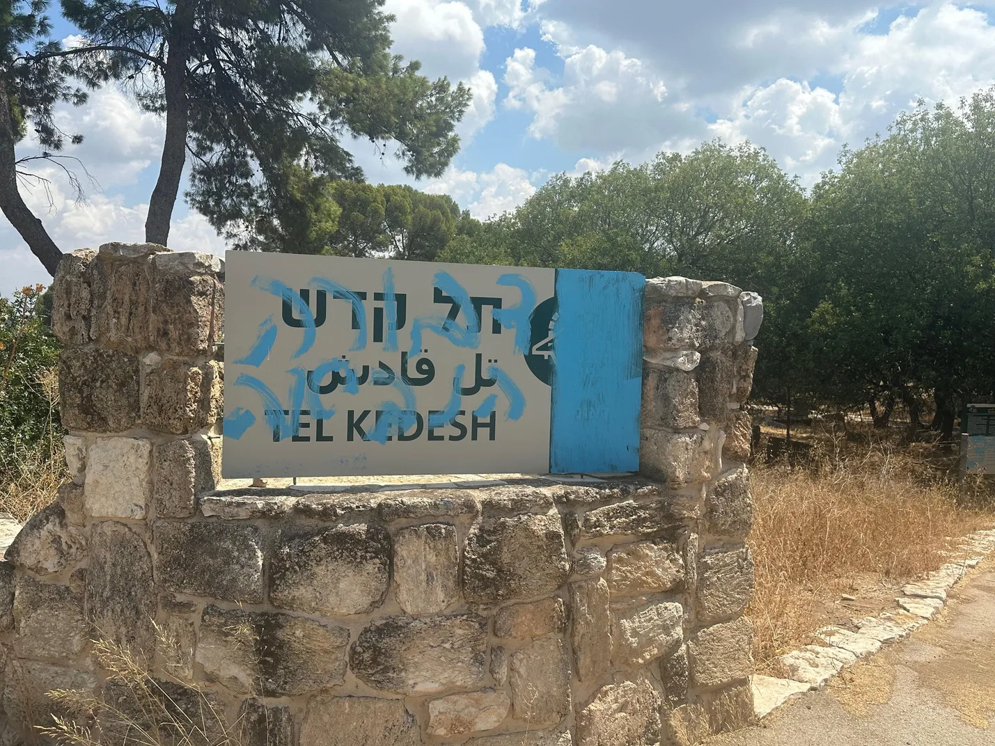
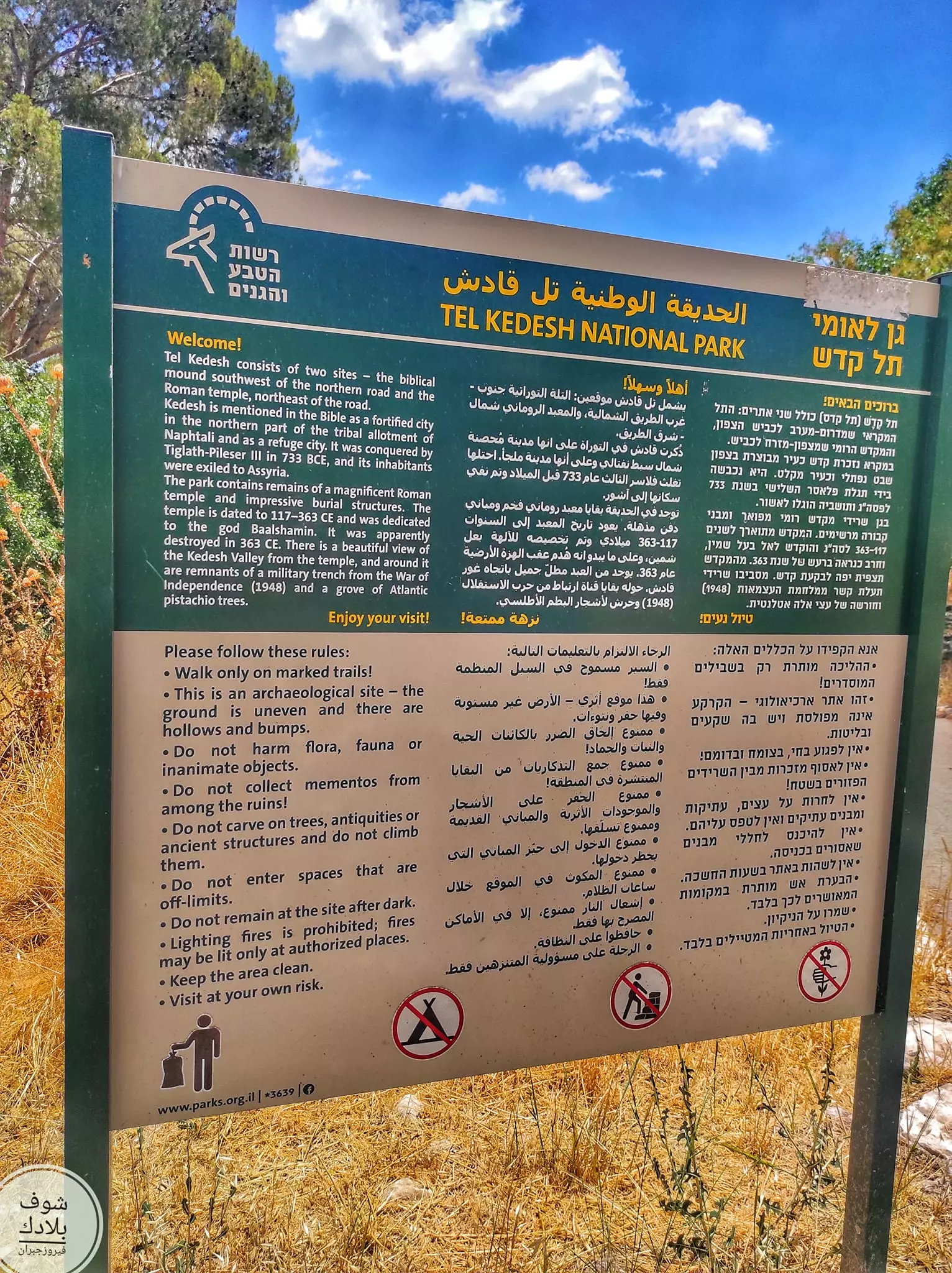
Welcome To Qadas - قدس (קדס)
|
District of Safad
Ethnically cleansed days ago |
العربية Google Earth |
 |
Gallery (97) |
- Statistics & Facts
-
Before & After

- Satellite View
- Articles 2
- Pictures 97
- Oral History 10
- Members
- All That Remains
- Wikipedia
- Videos 1
- Guest Book 42
- Links
| Statistic & Fact | Value | |||||||||||||||||||||
| Occupation Date | May 28, 1948 | |||||||||||||||||||||
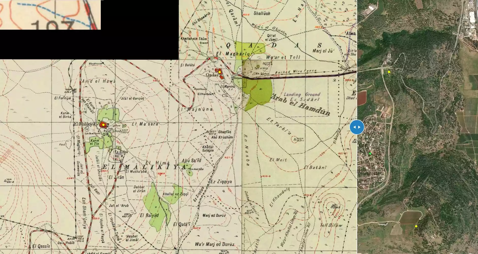
| Distance From District | 17 (km) North East of Safad | |||||||||||||||||||||
| Elevation | 245 (meters) | |||||||||||||||||||||
| Before & After Nakba, Click Map For Details |
||||||||||||||||||||||
|
||||||||||||||||||||||
| Map Location | See location #27 on the map View from satellite |
|||||||||||||||||||||
| Military Operation | Operation Hiram | |||||||||||||||||||||
| Defenders | Lebanese Army & Arab Liberation Army | |||||||||||||||||||||
| Exodus Cause | Influence of fall of, or exoduce from, neighboring town | |||||||||||||||||||||
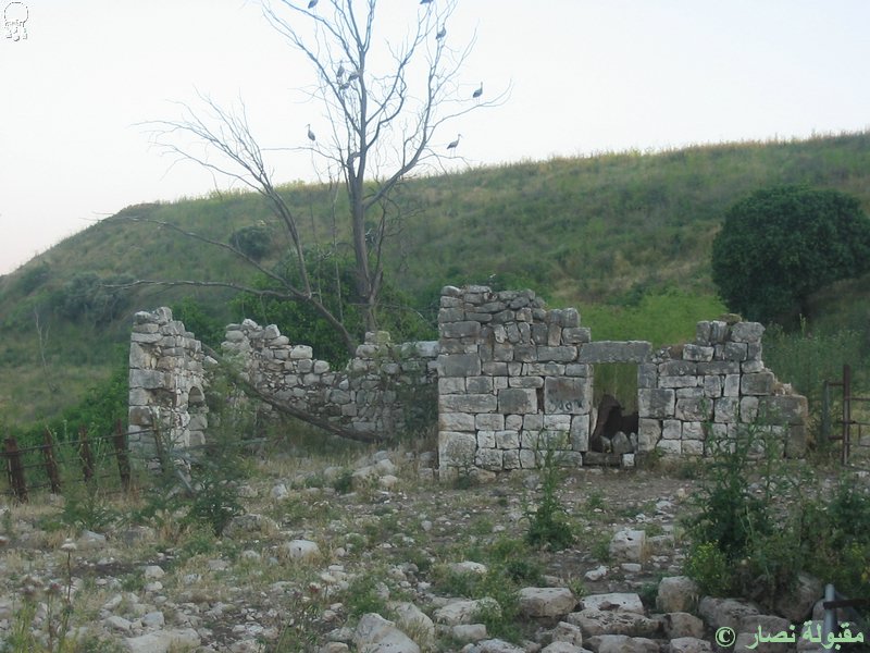
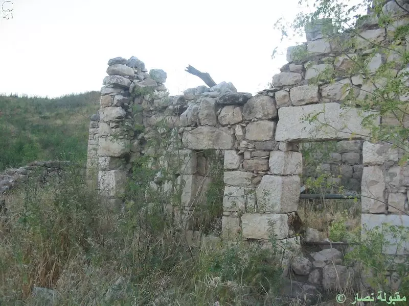
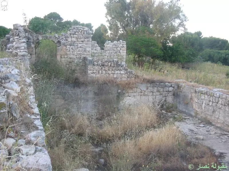
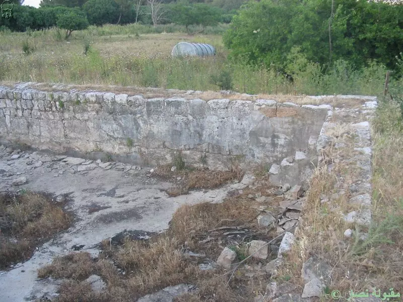
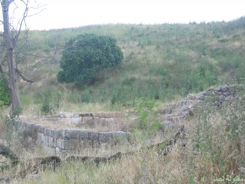
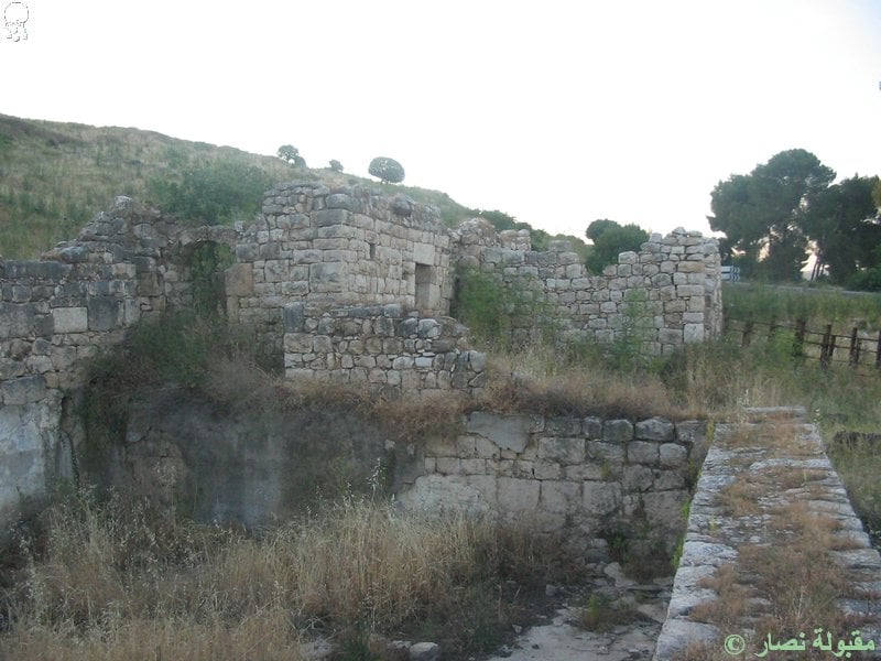
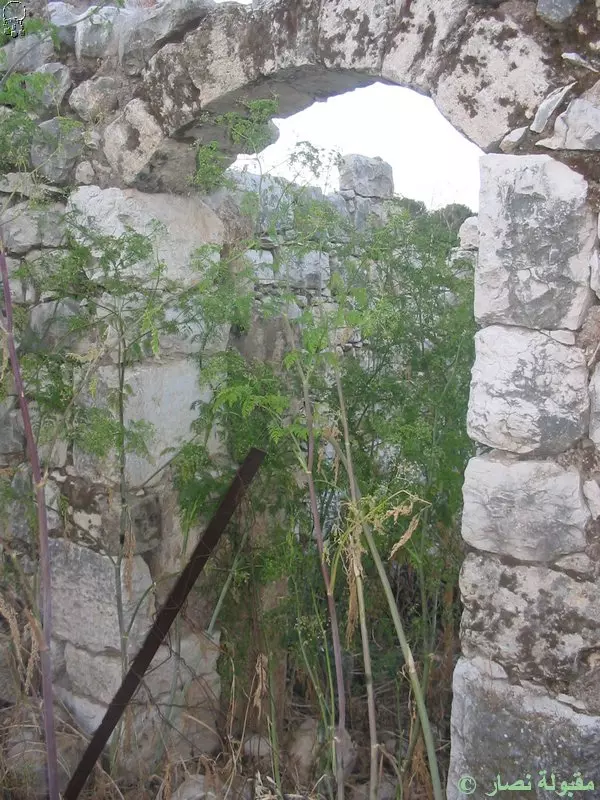
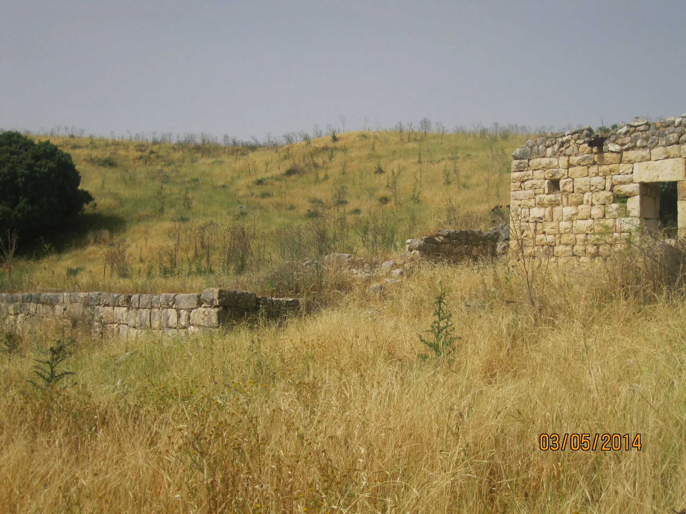
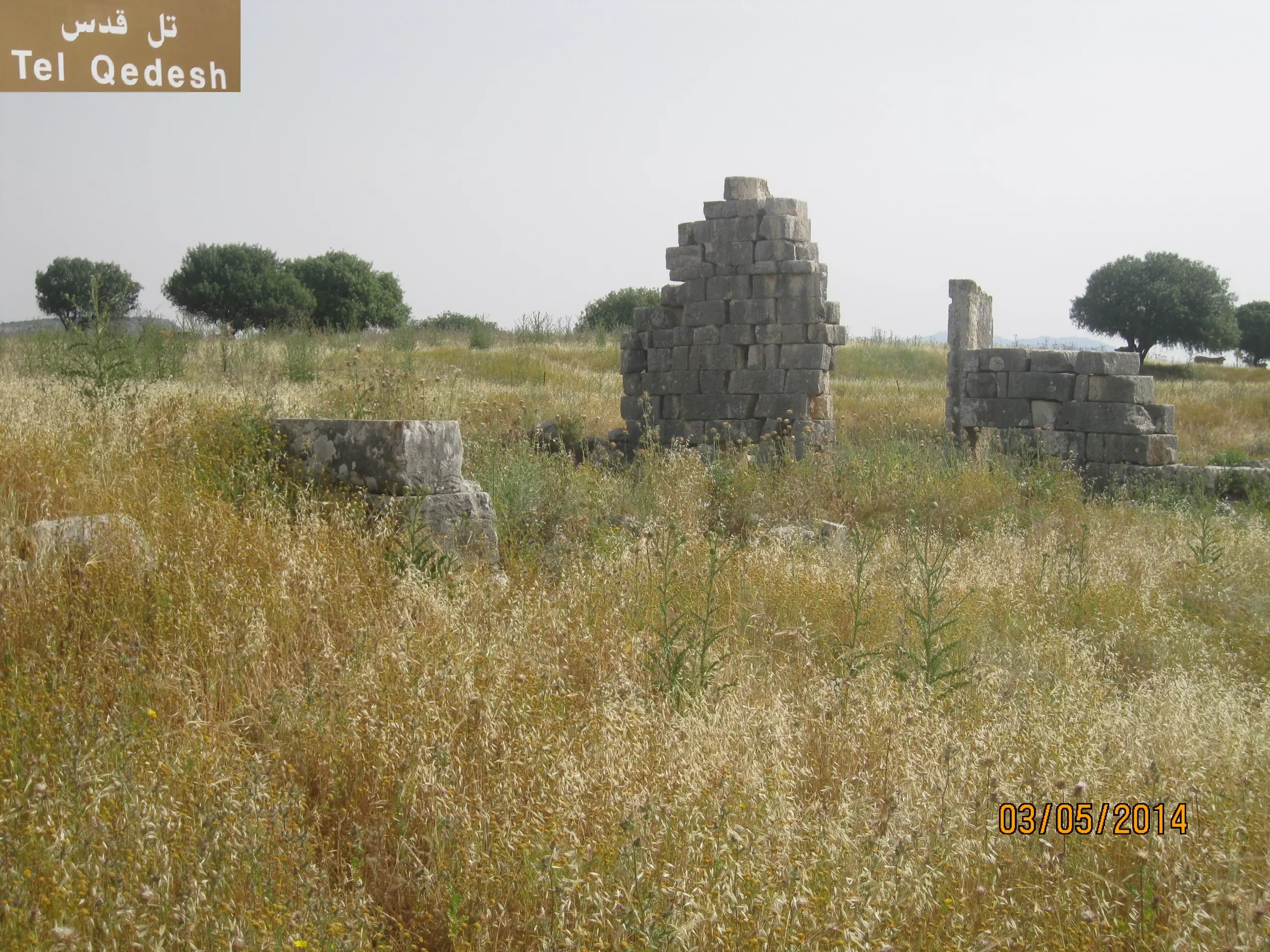
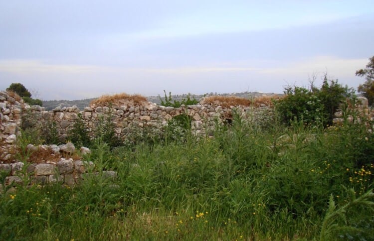
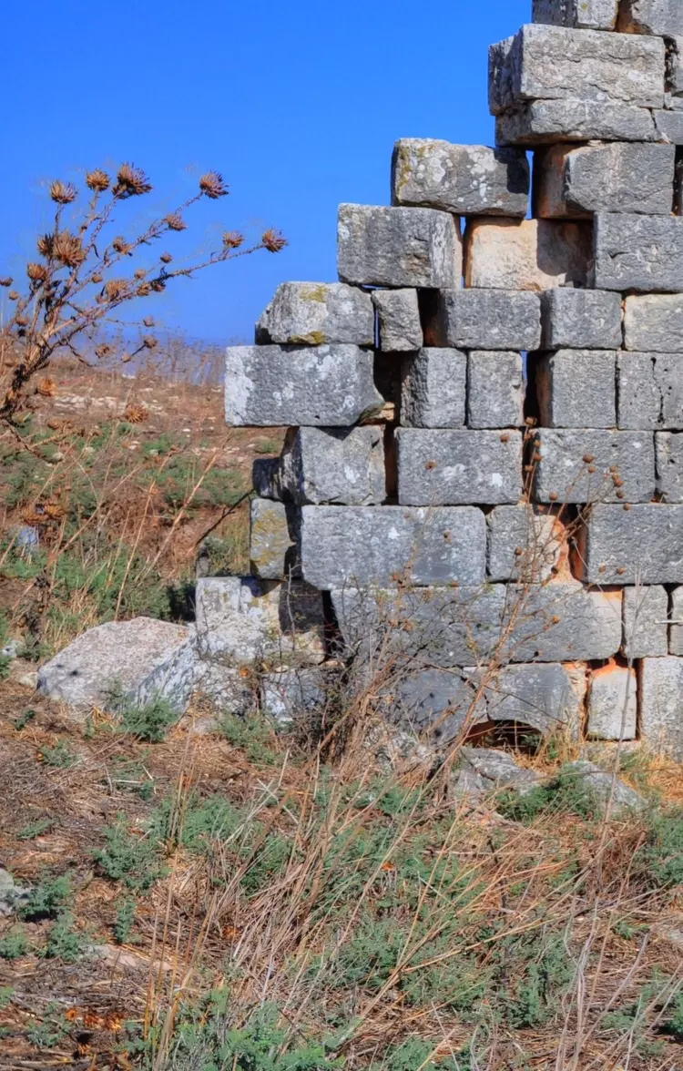
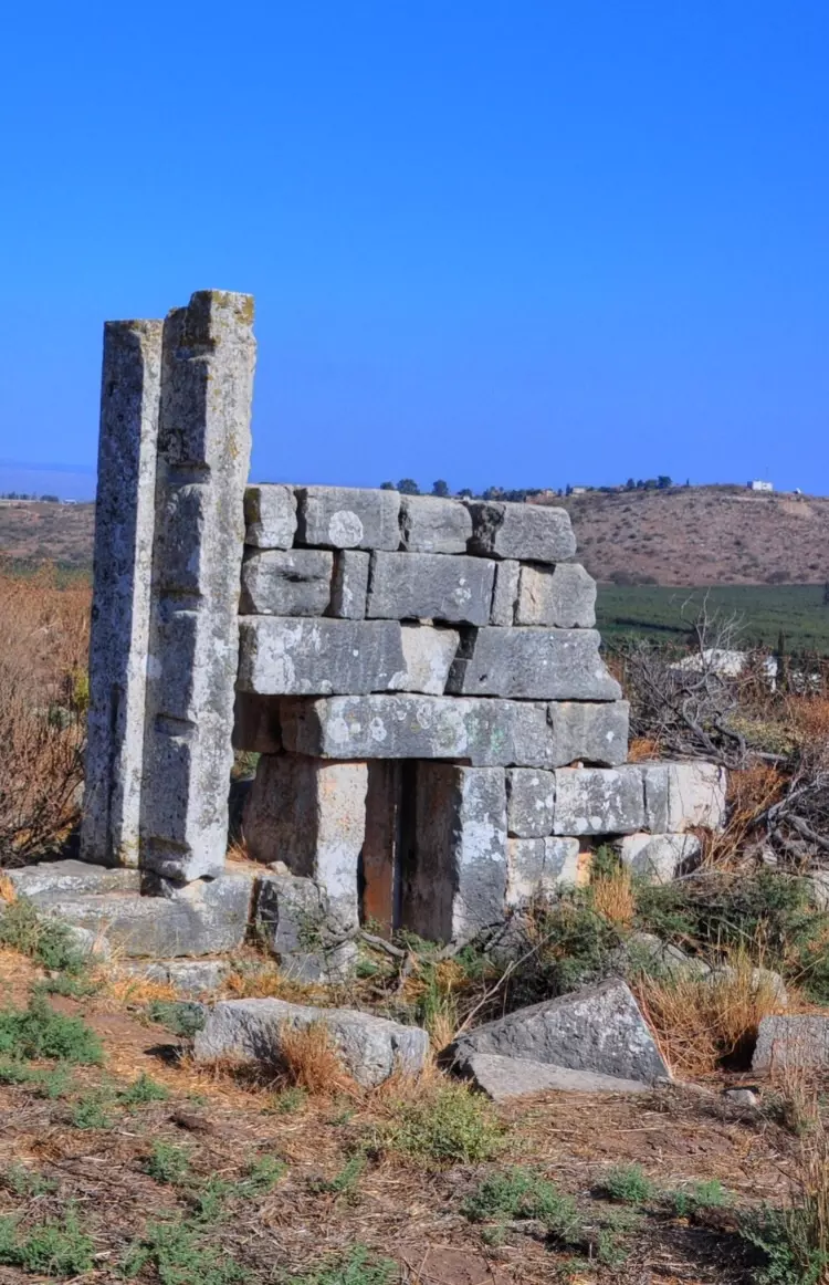
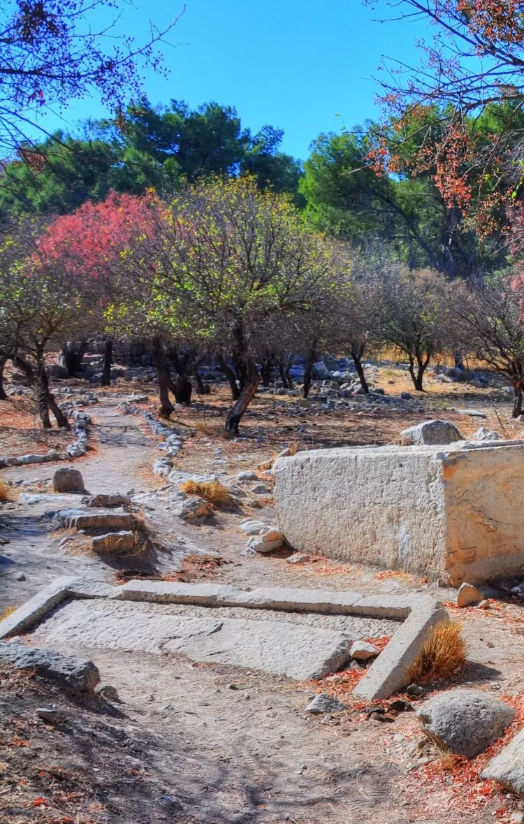
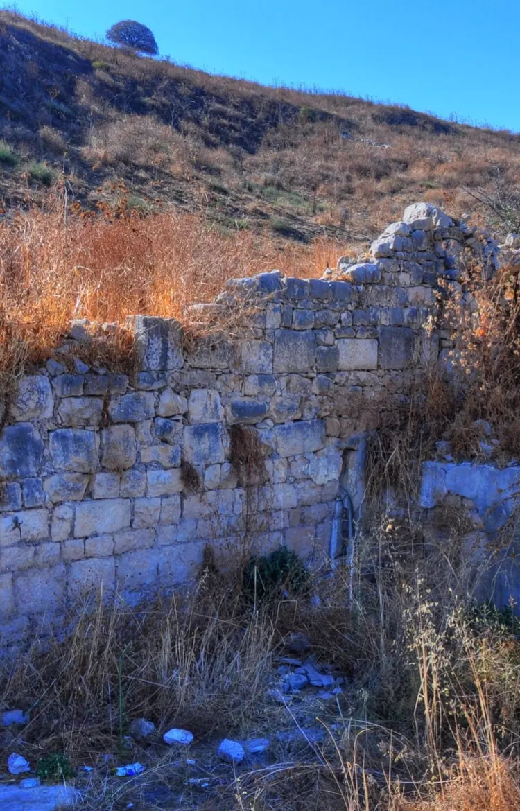
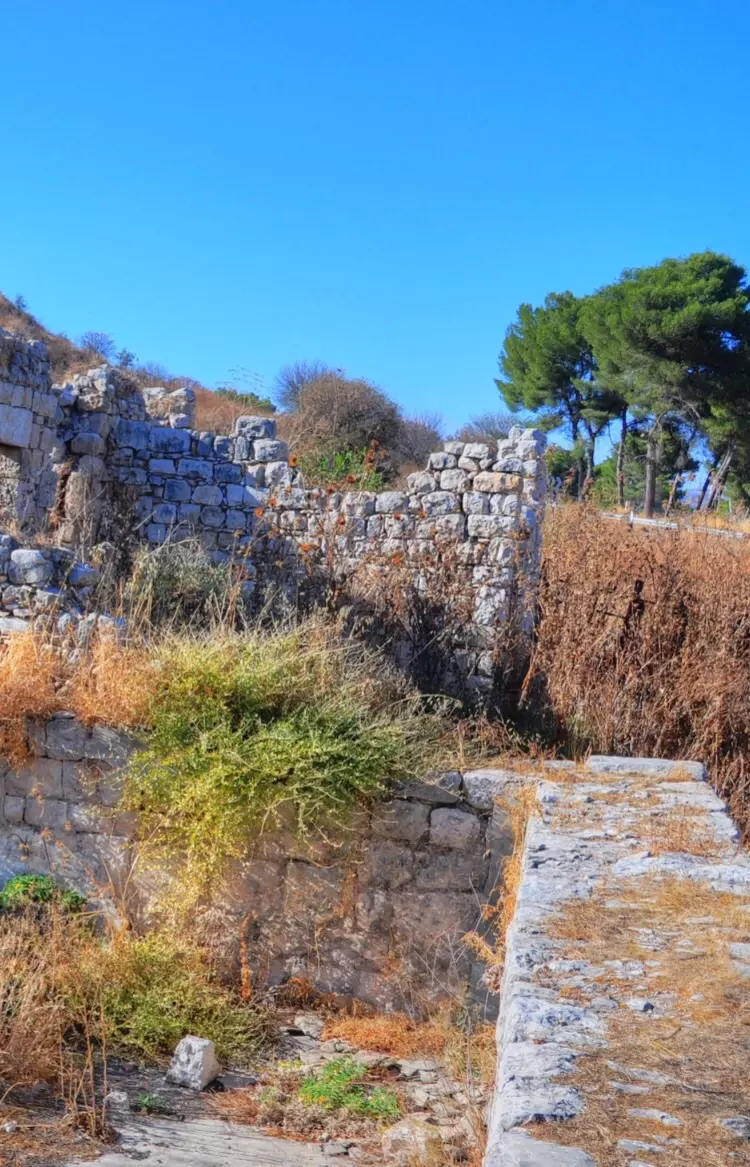
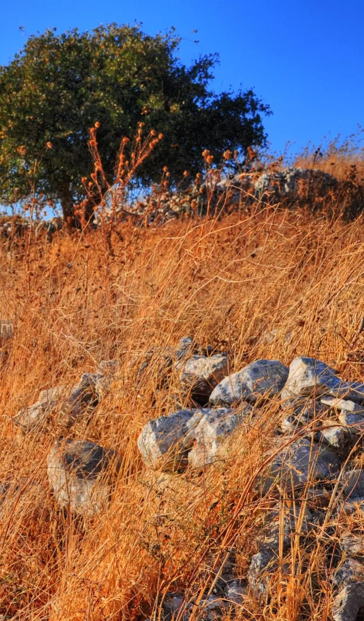
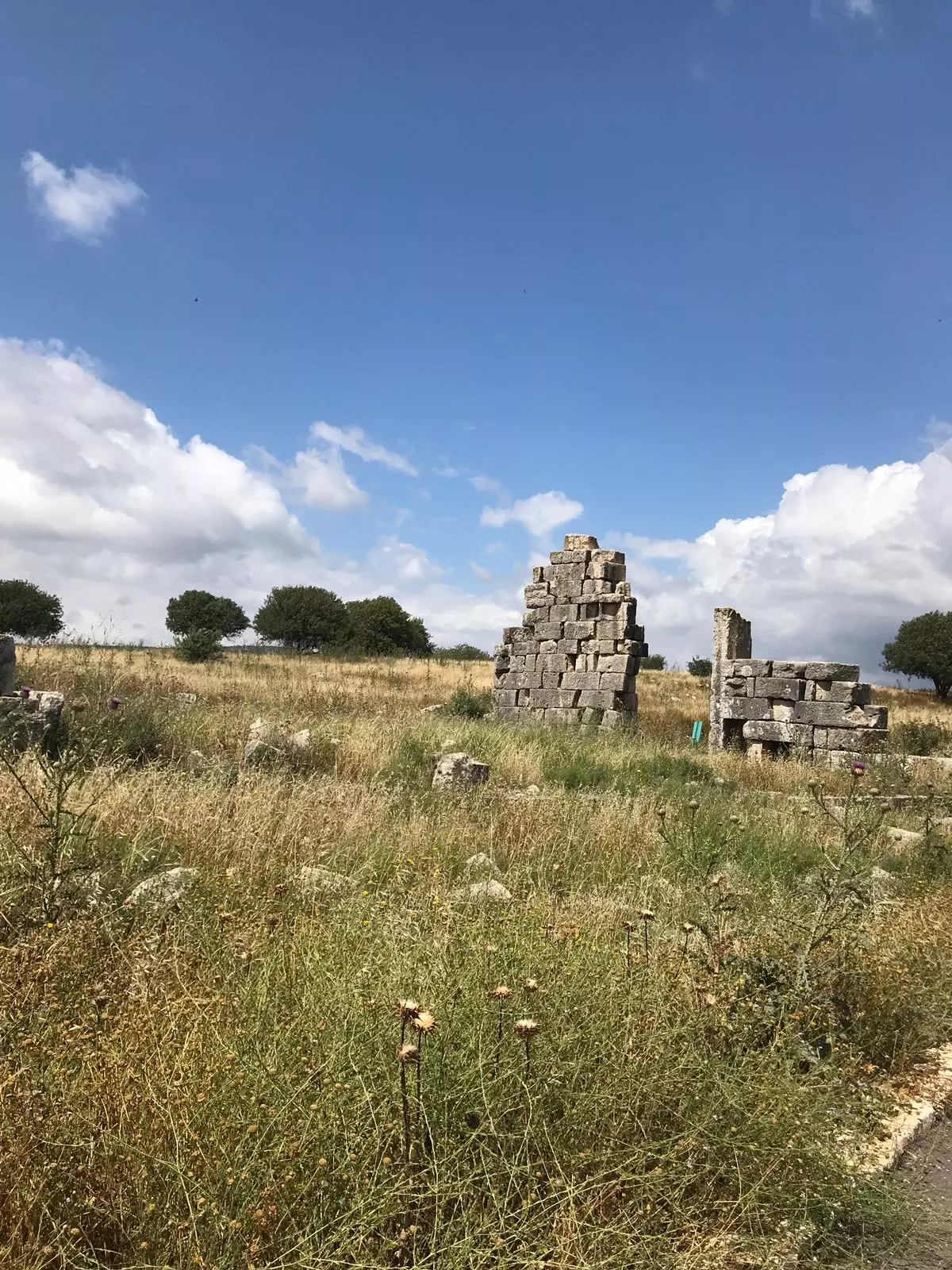
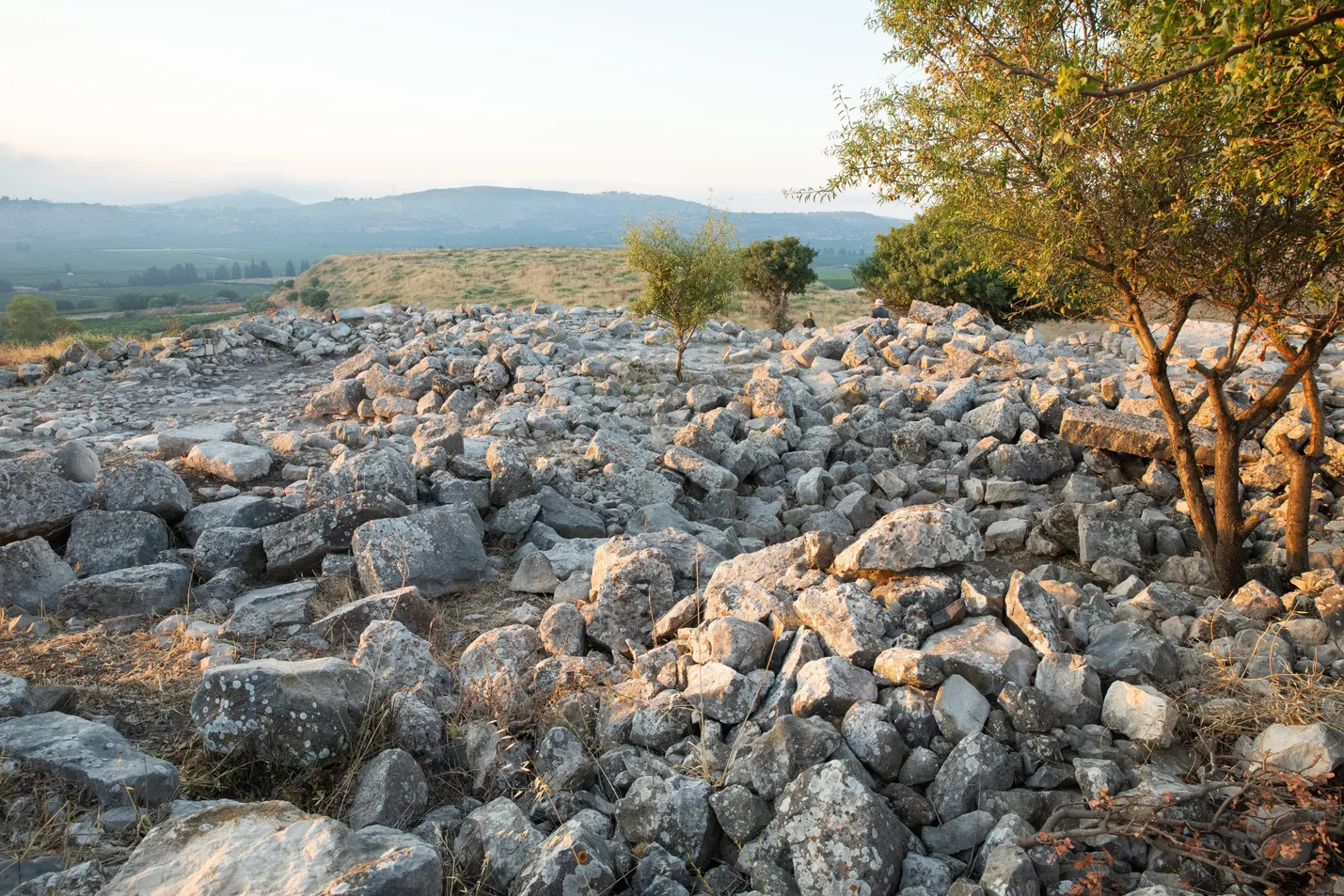
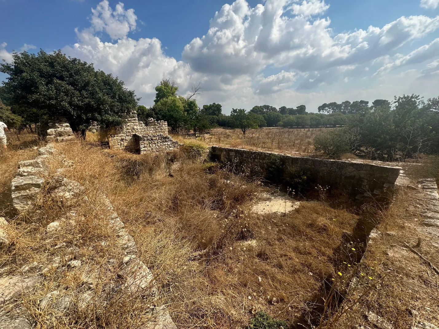
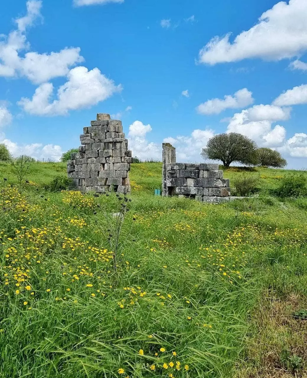
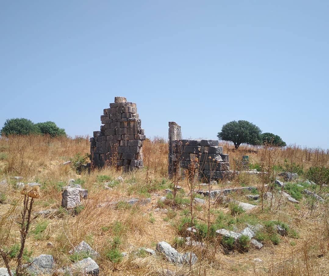
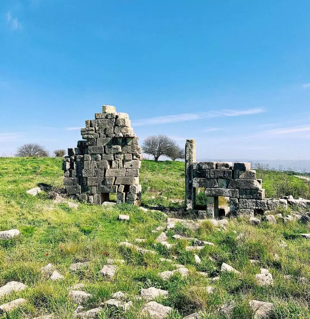
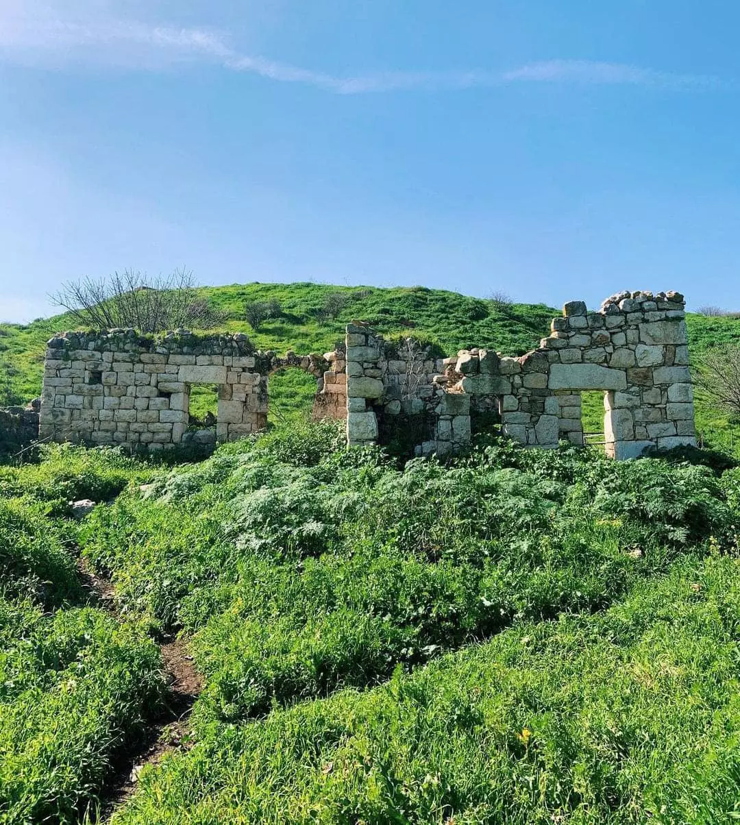
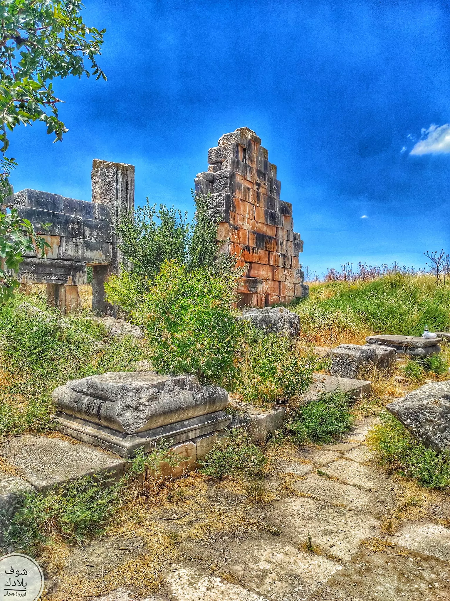
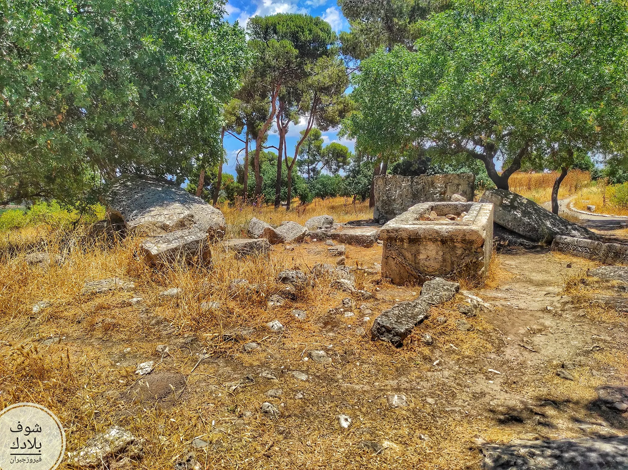
| Village Temains | The village has been completely destroyed, and only house walls and rubble left behind. | |||||||||||||||||||||
| Ethnically Cleansing | Qadas inhabitants were completely ethnically cleansed. | |||||||||||||||||||||
| Pre-Nakba Land Ownership |
**Town Lands' Demarcation Maps |
|||||||||||||||||||||
| Land Usage As of 1945 |
|
|||||||||||||||||||||
| Population |
|
|||||||||||||||||||||
| Number of Houses |
|
|||||||||||||||||||||
| Near By Towns |
||||||||||||||||||||||
|
||||||||||||||||||||||
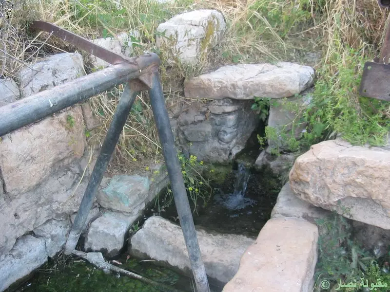
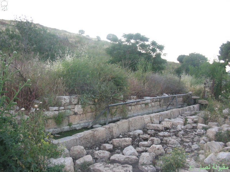
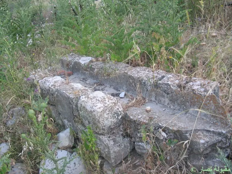
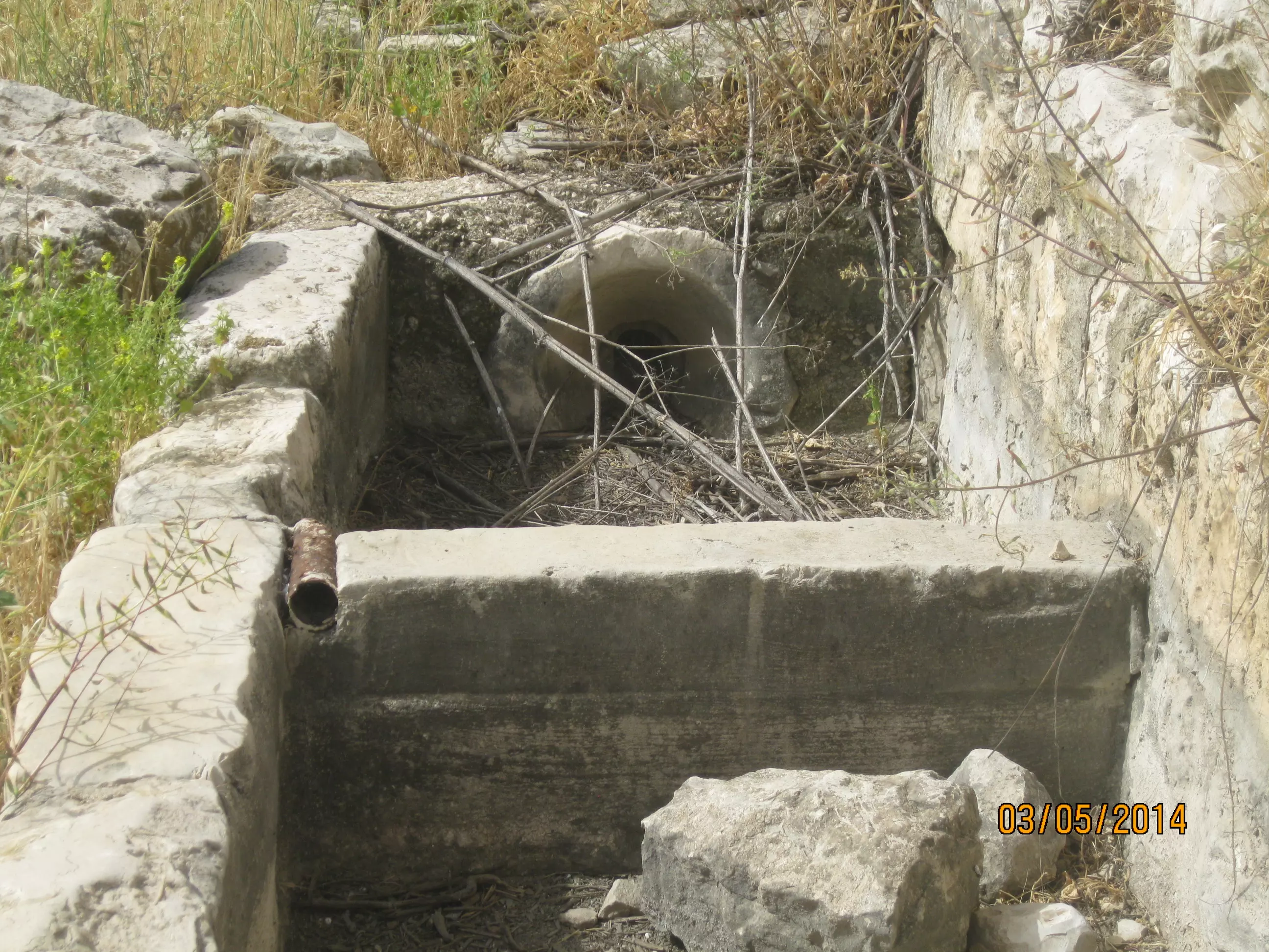
| Water Supply | Qadas draw it water supplies from a small nearby wadi which contained many springs | |||||||||||||||||||||
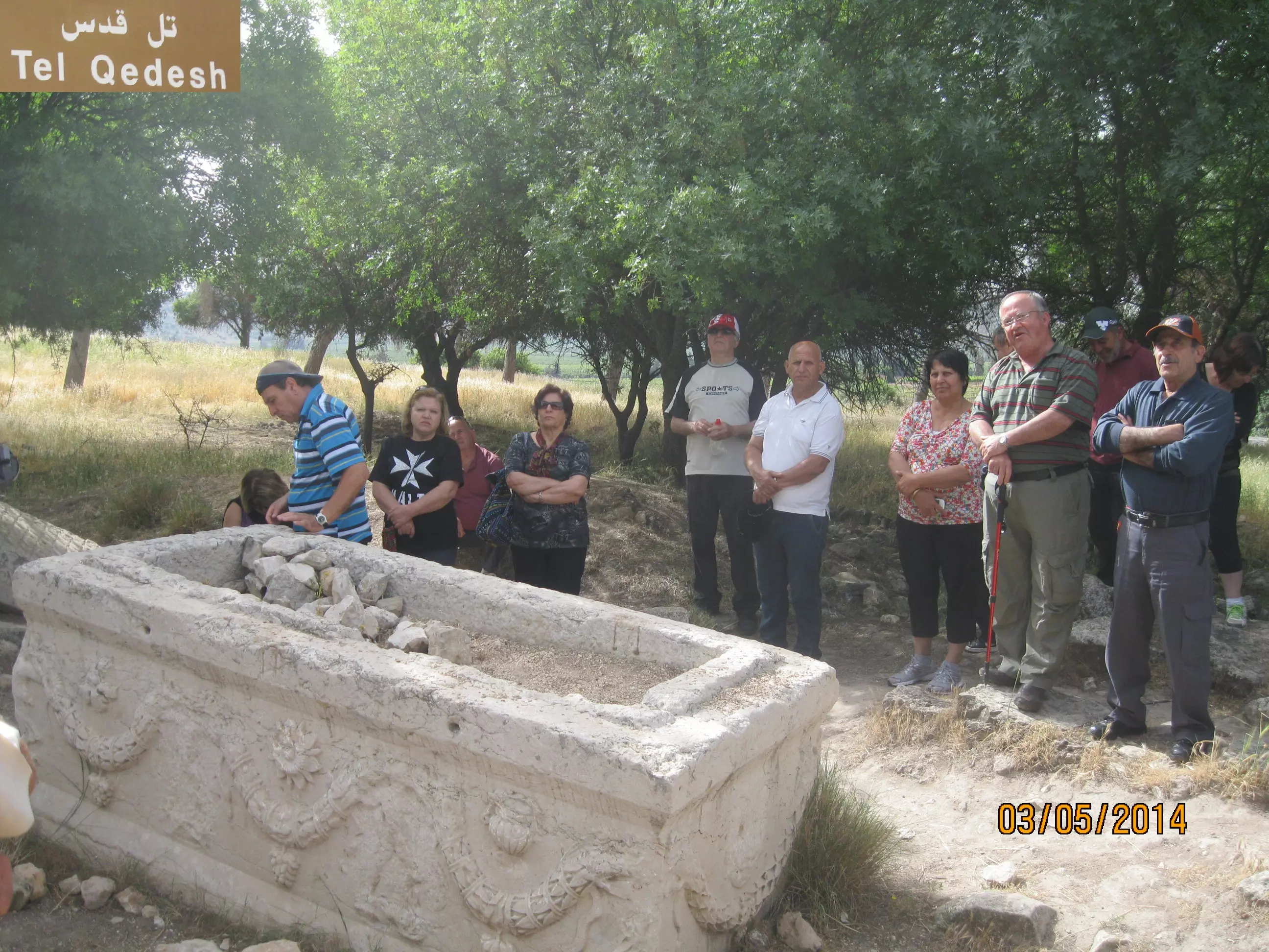
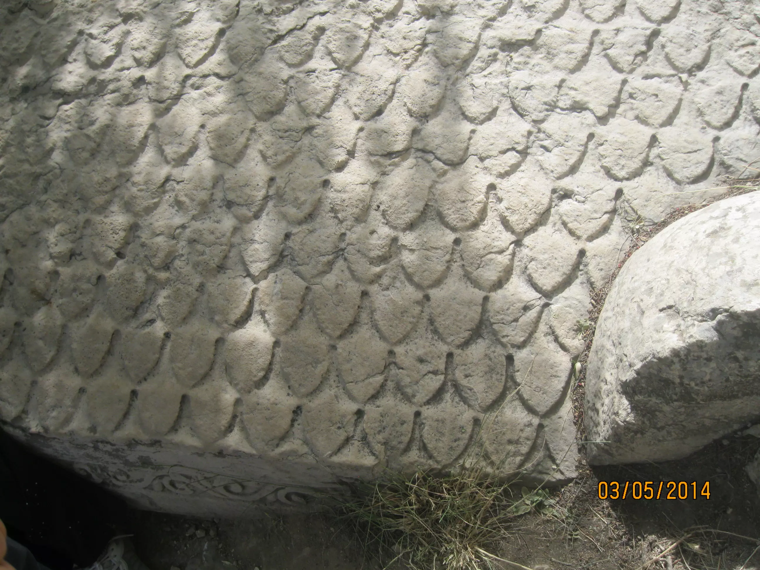
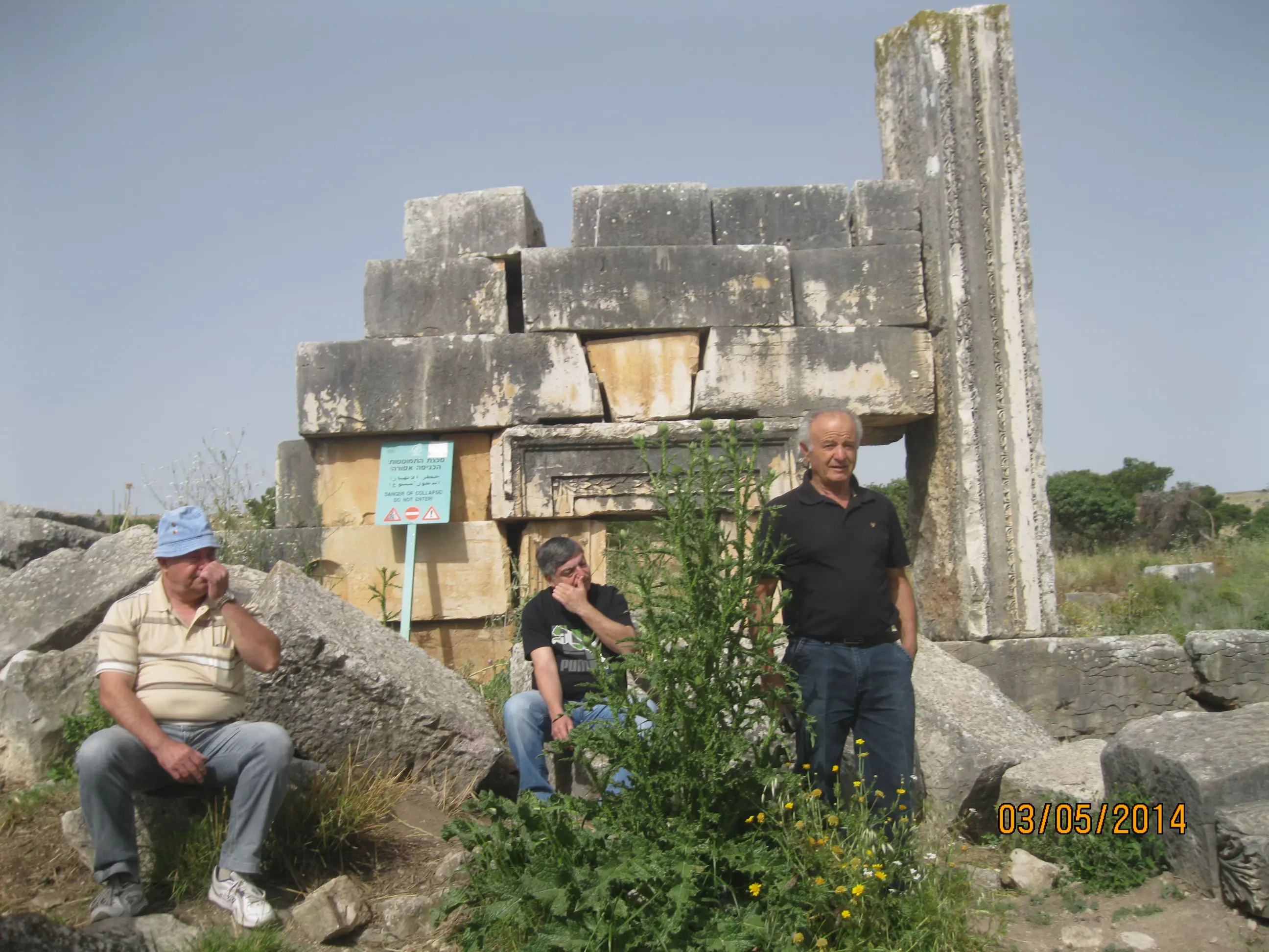
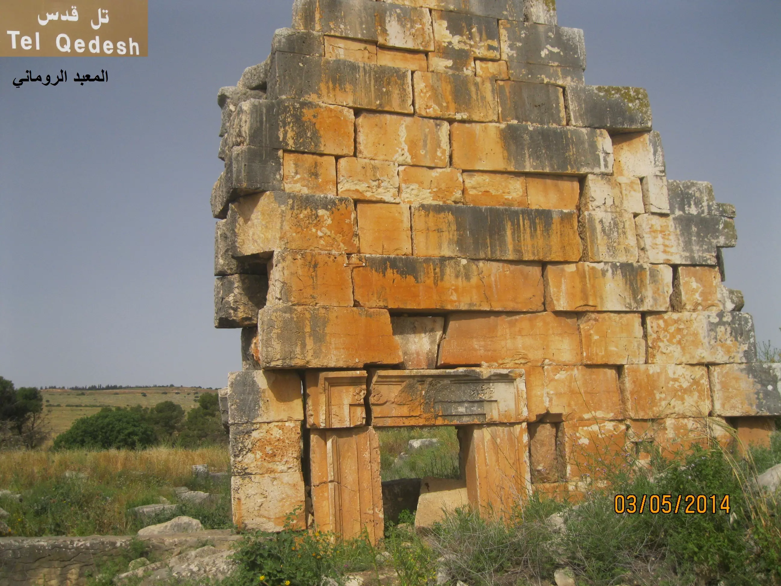
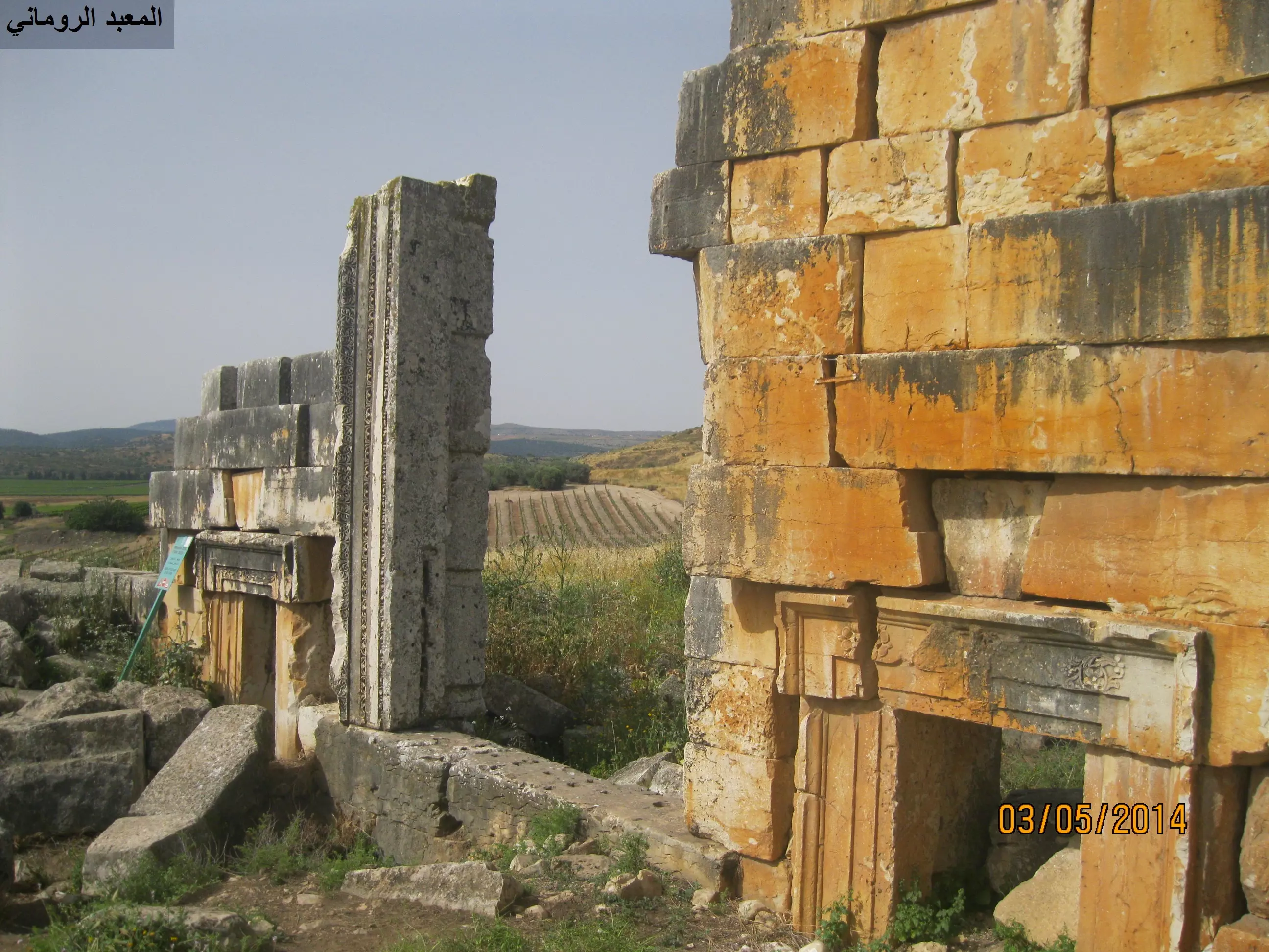
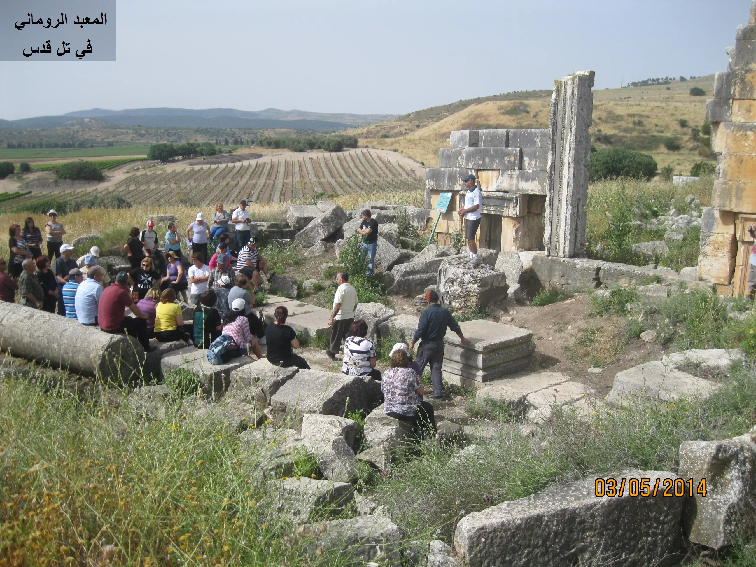
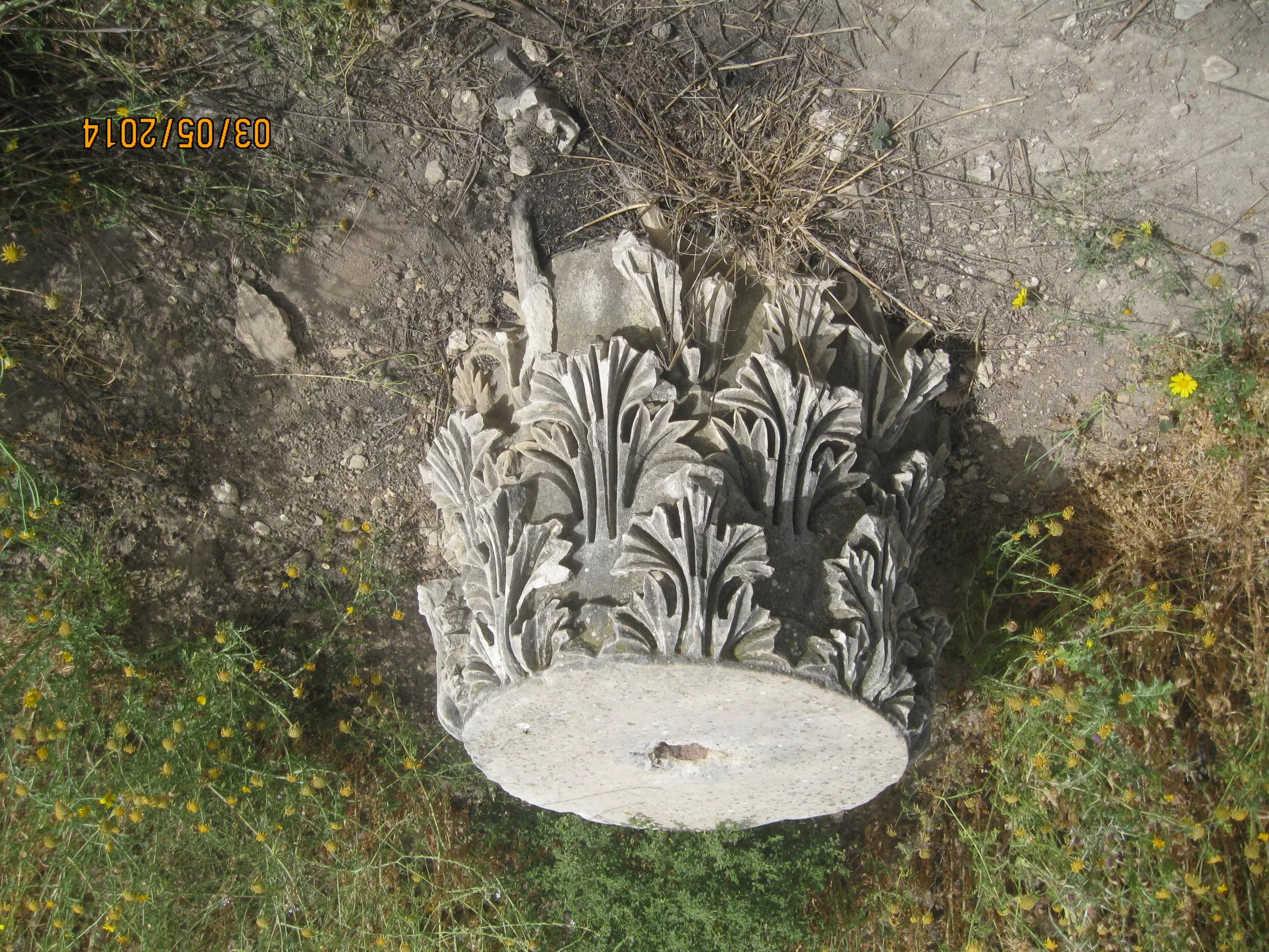
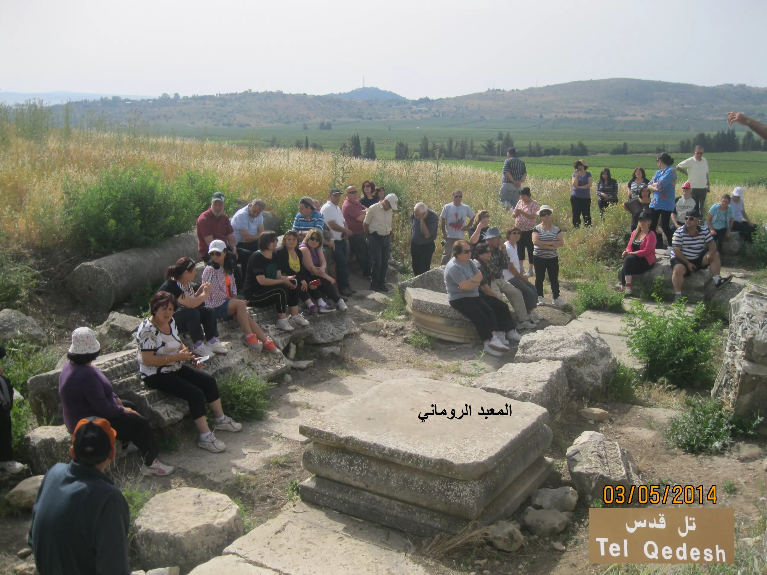
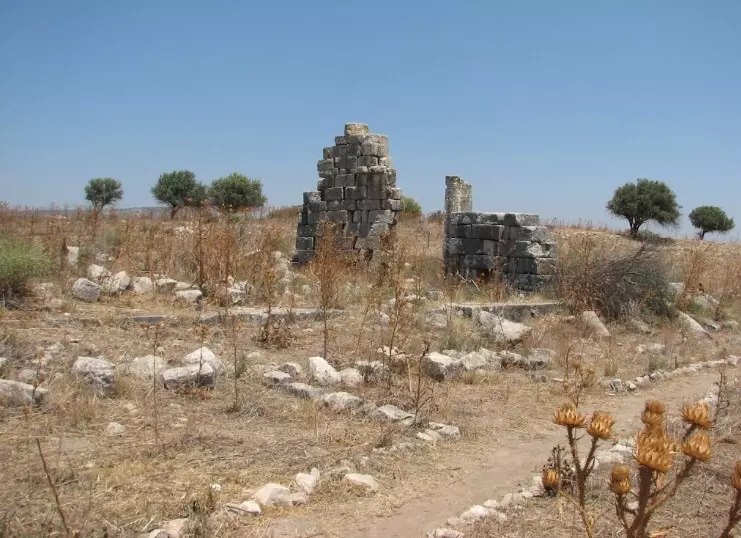
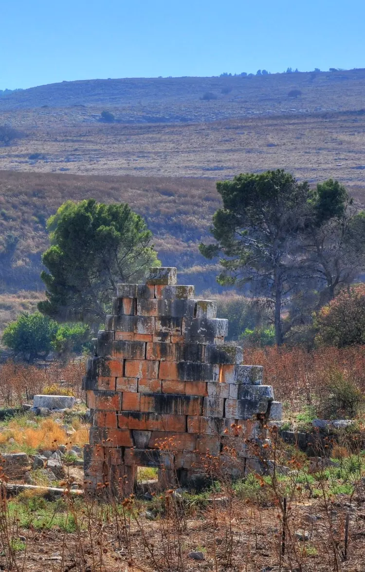
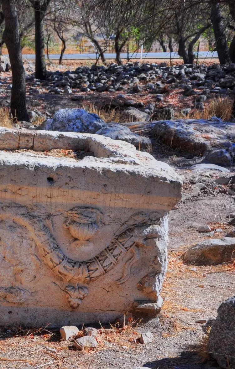
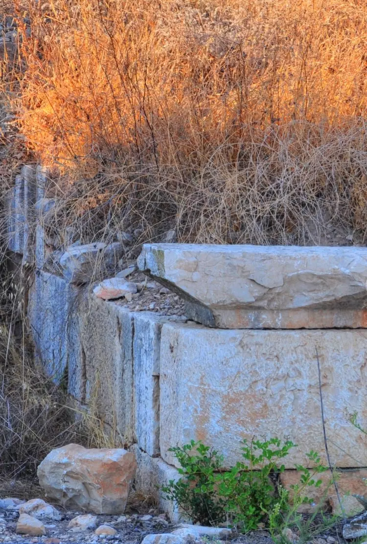
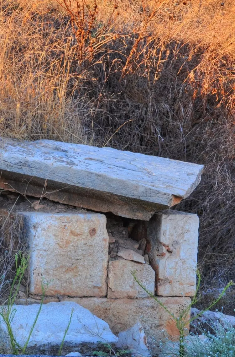
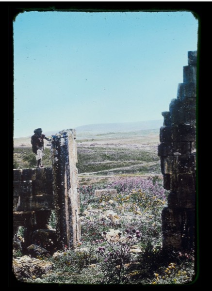
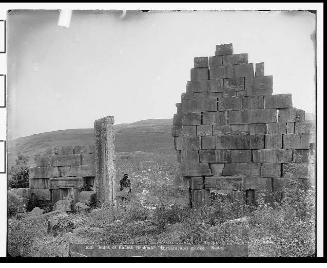
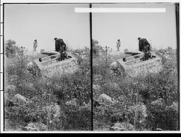
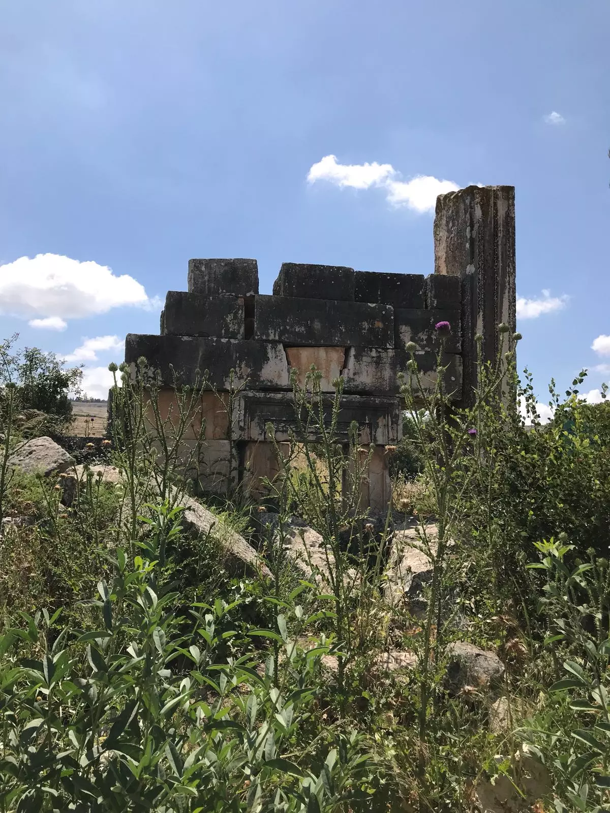
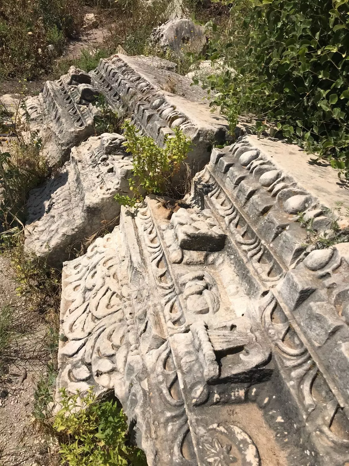
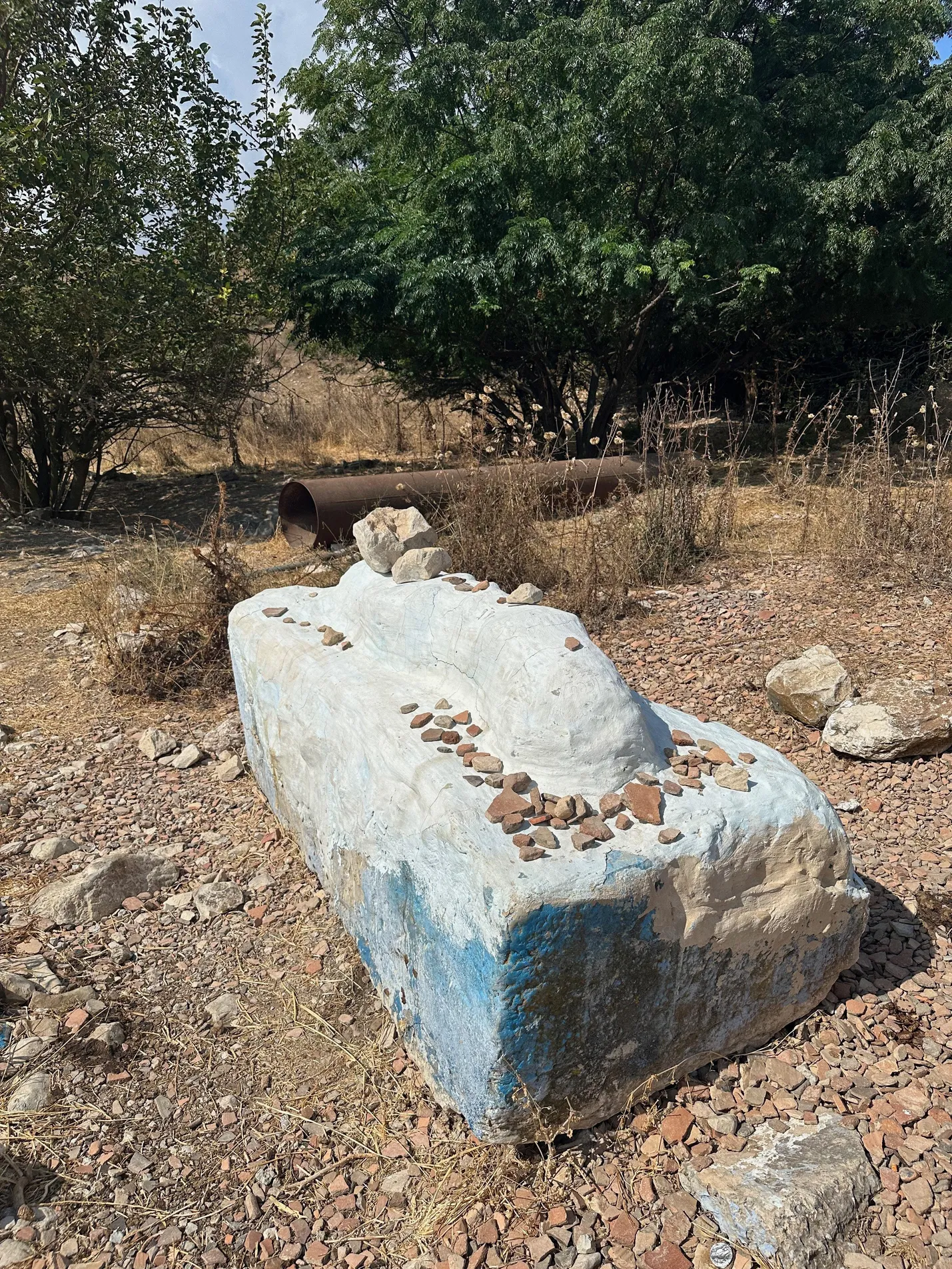
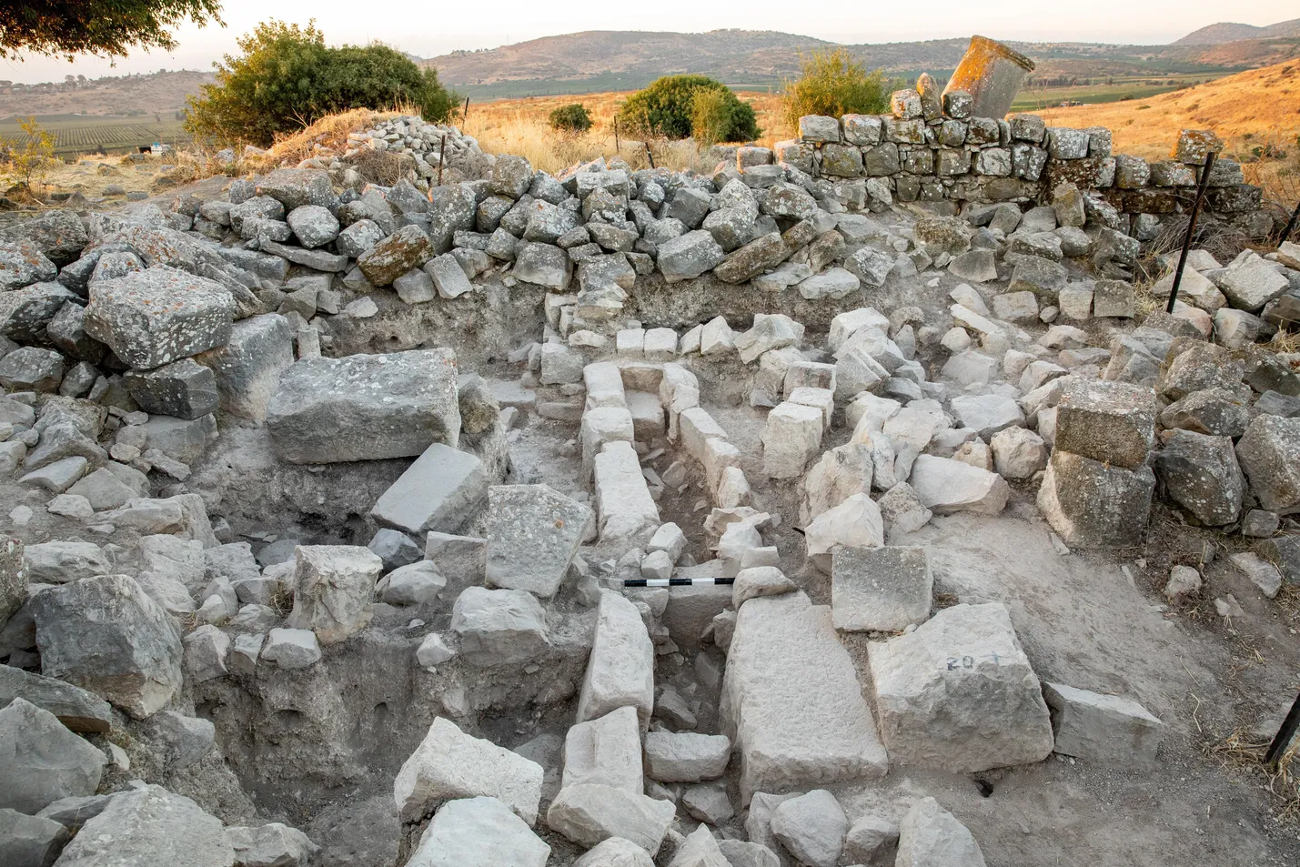
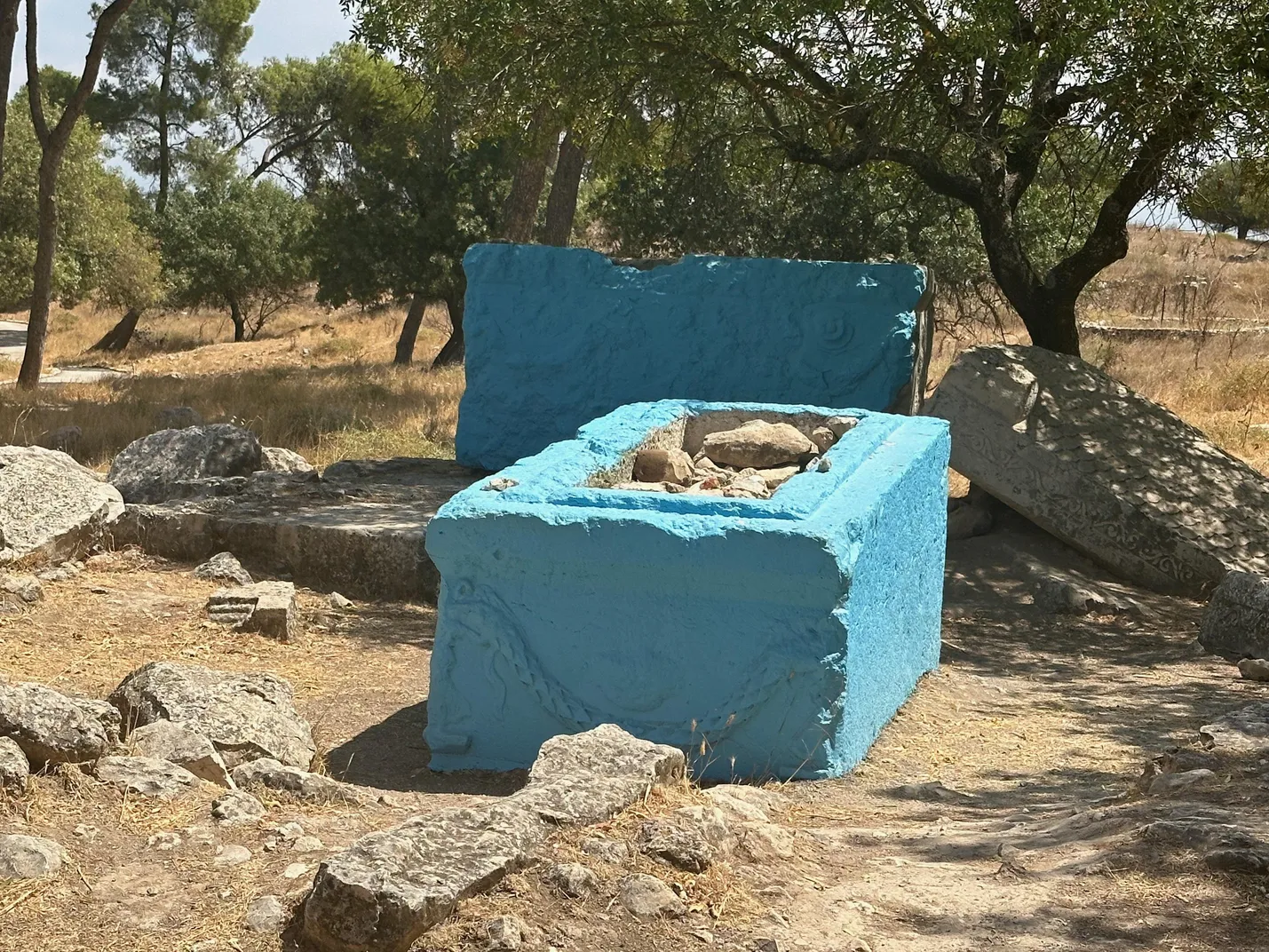
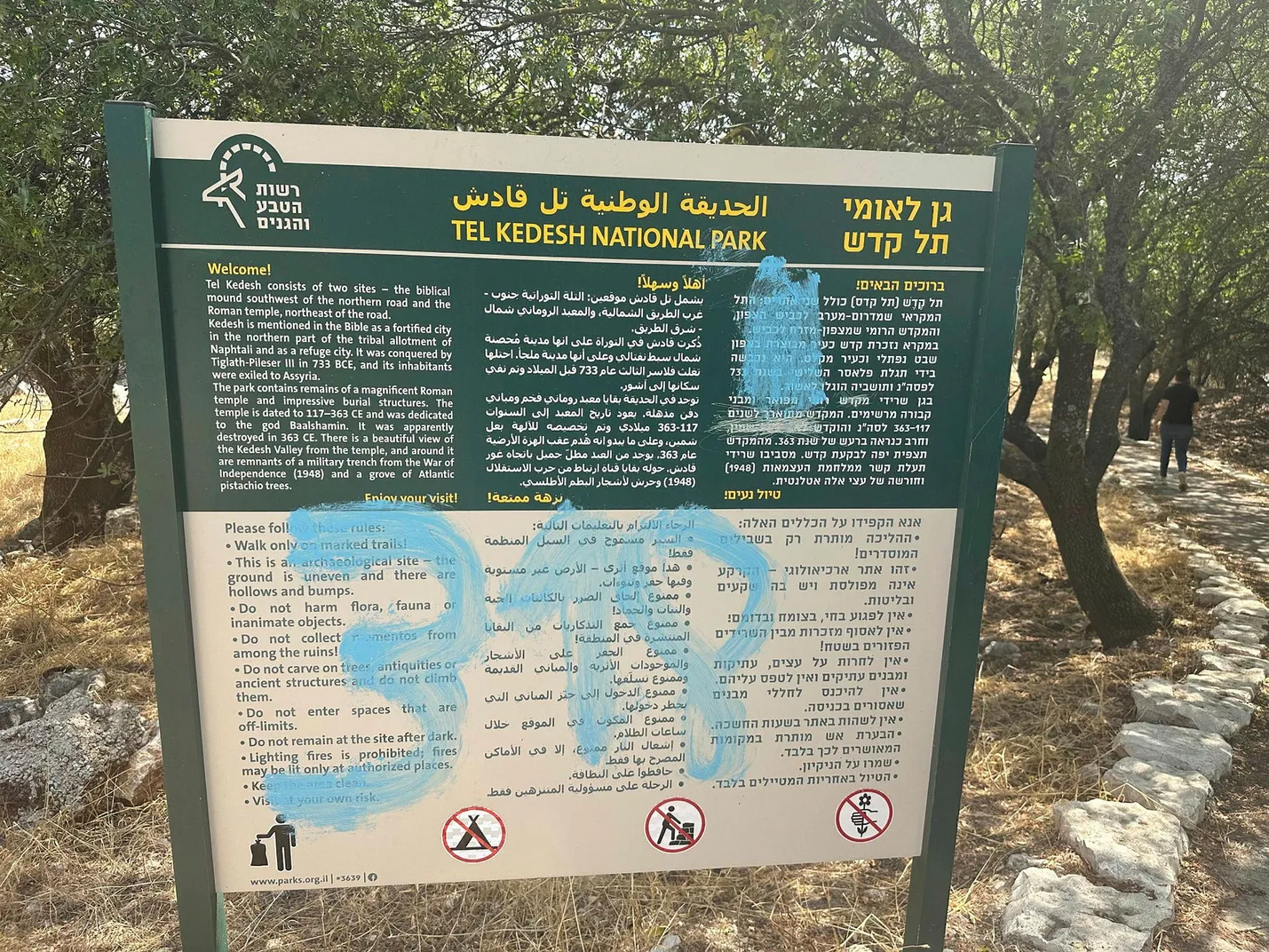
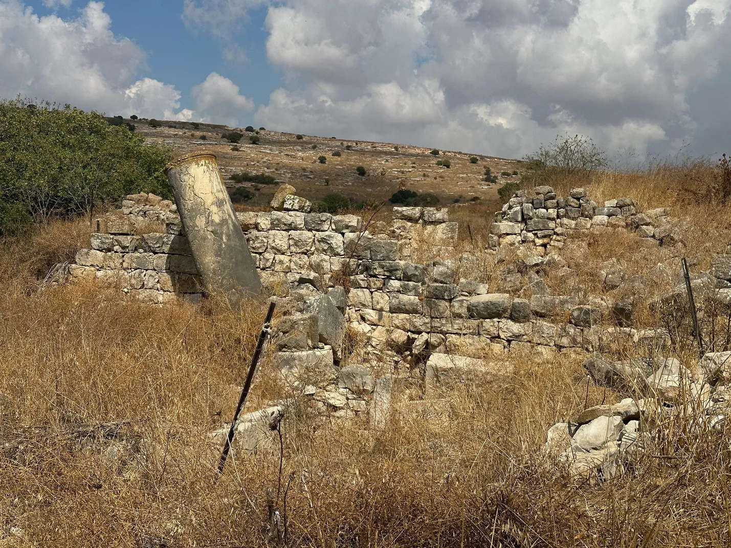
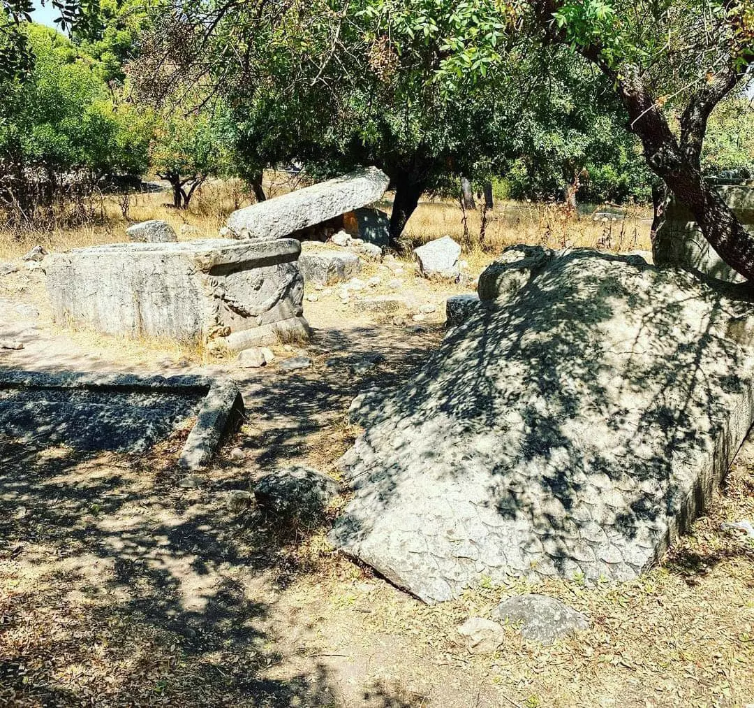
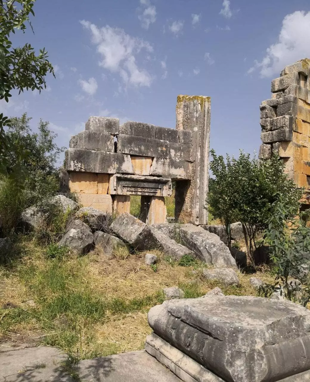
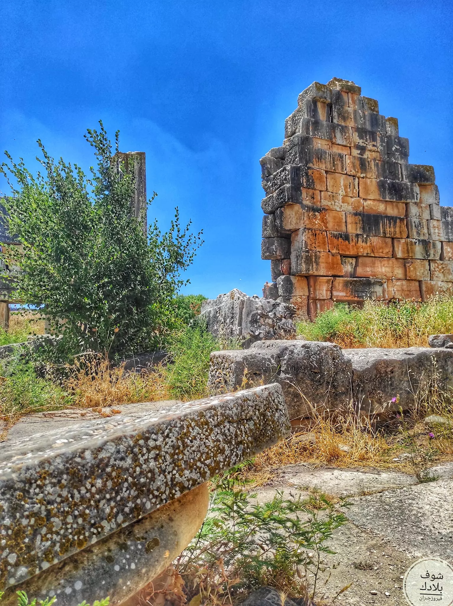
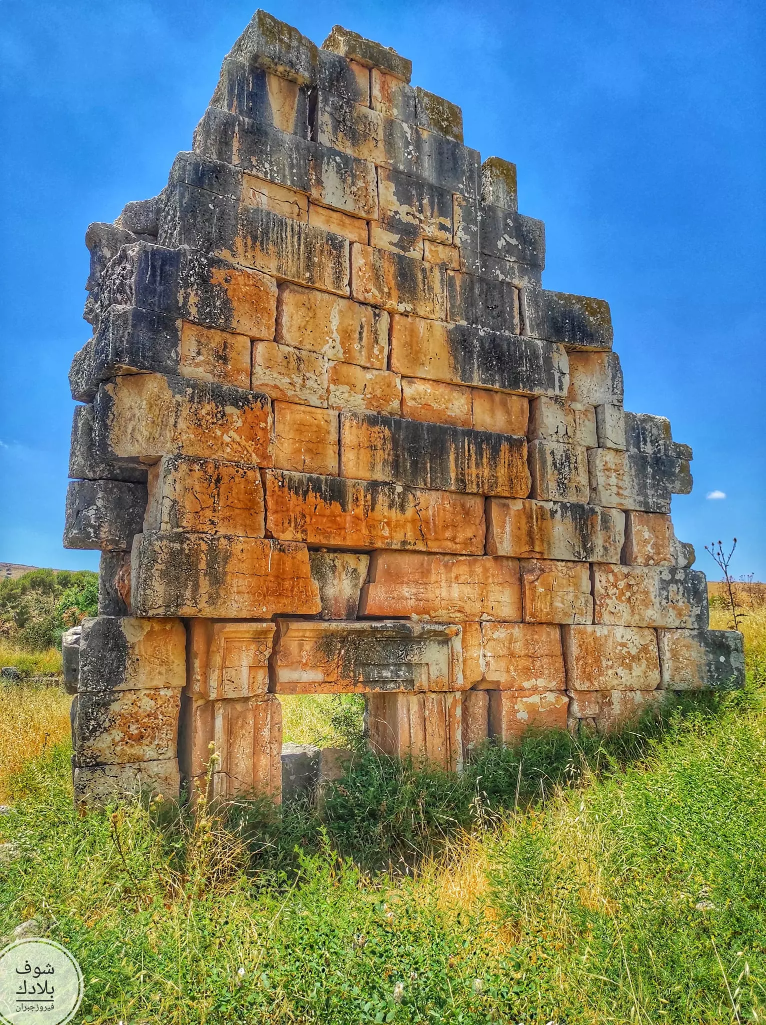
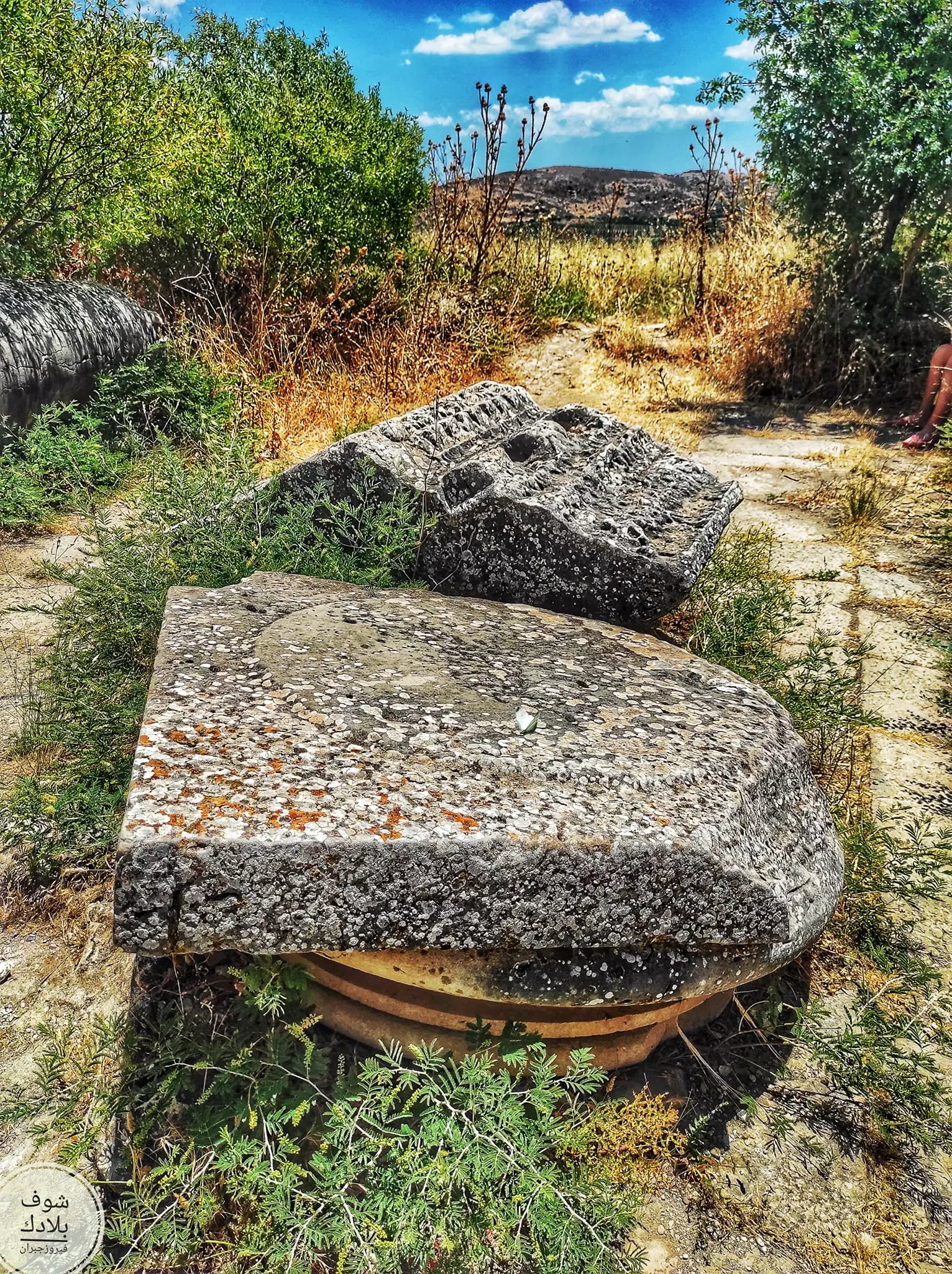
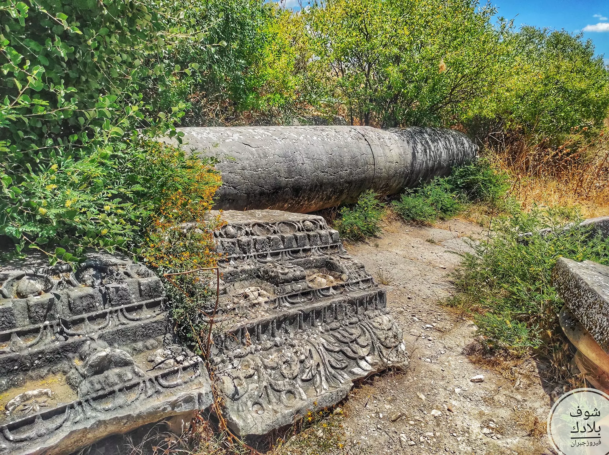
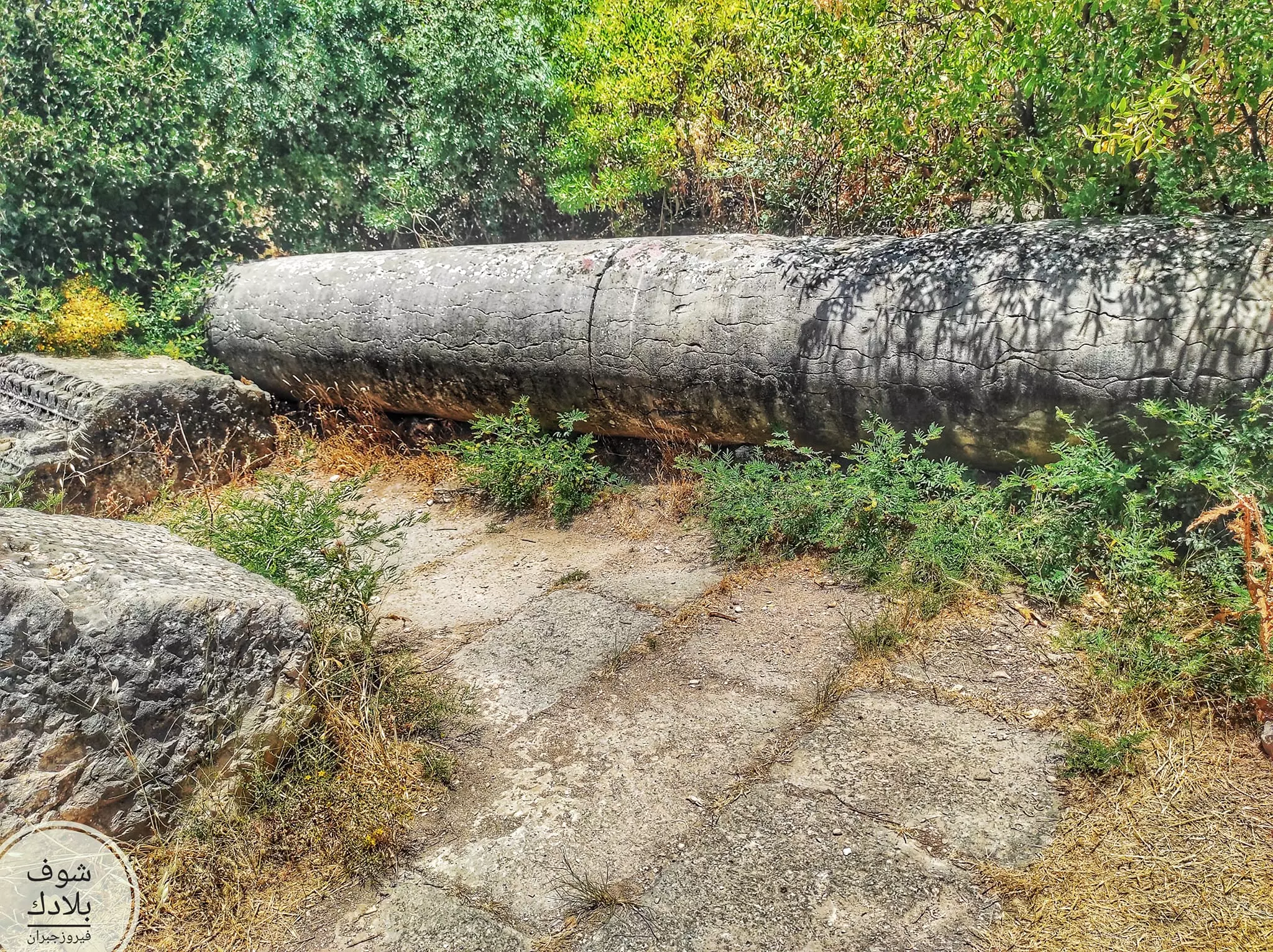
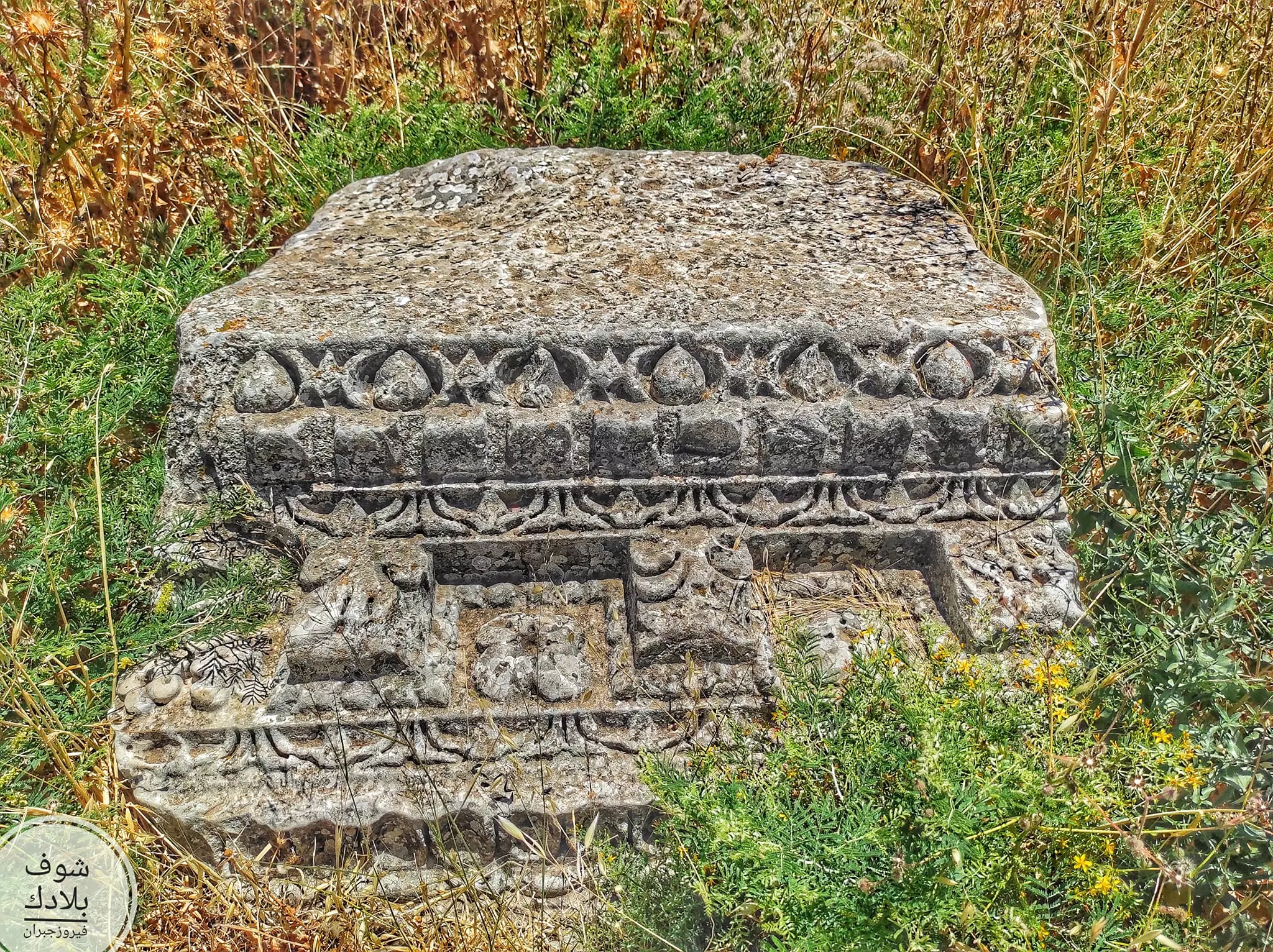
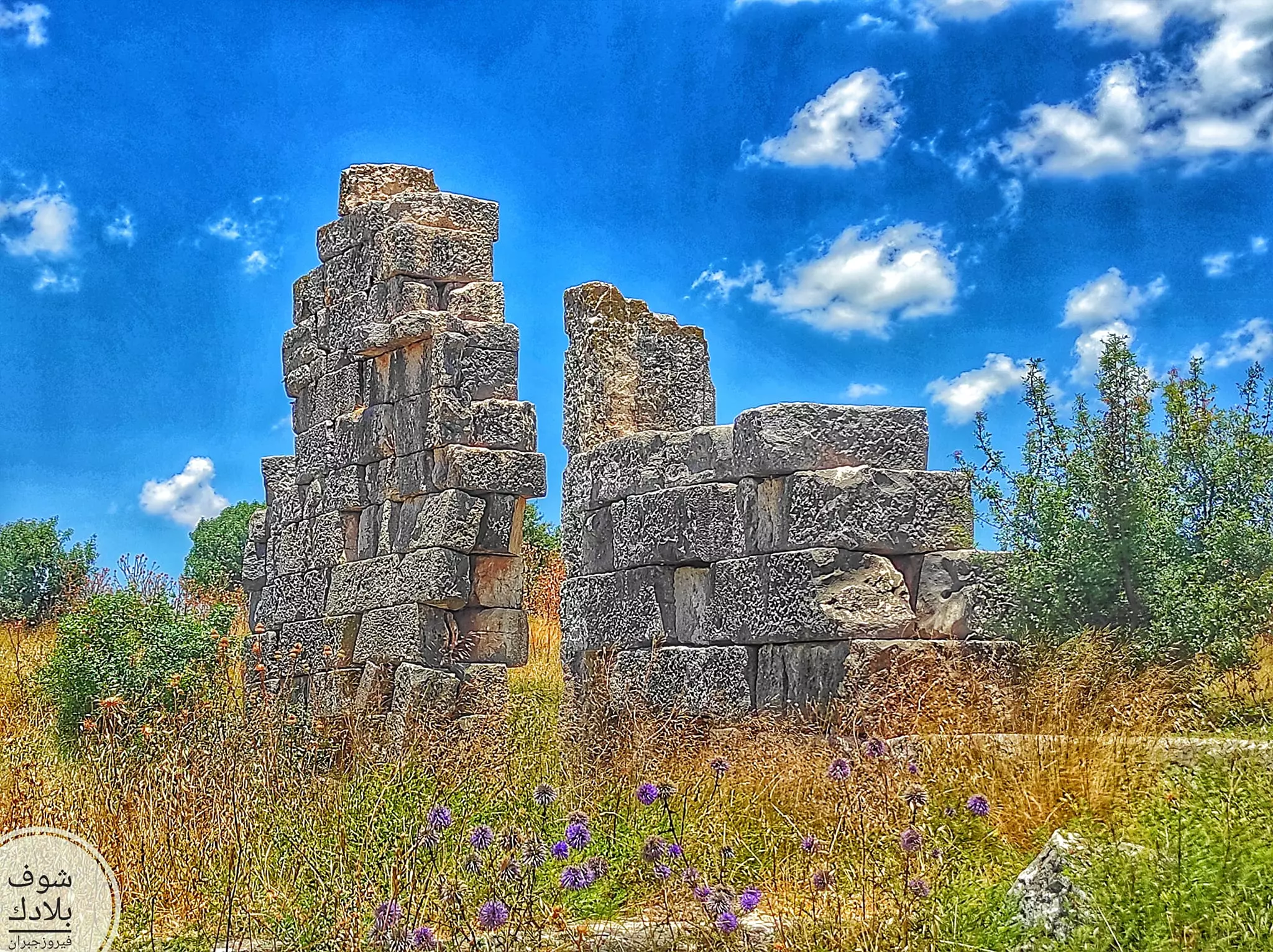
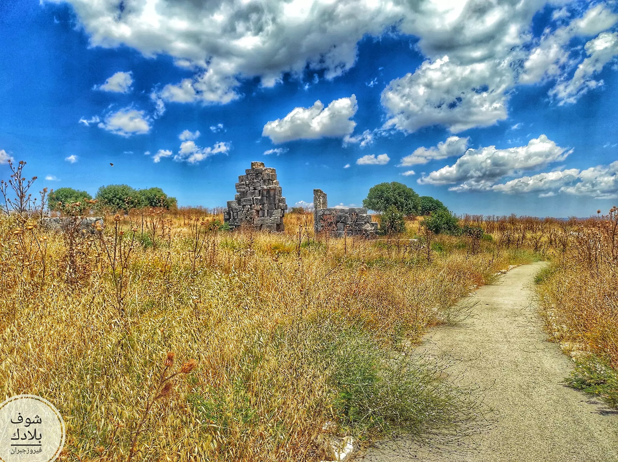
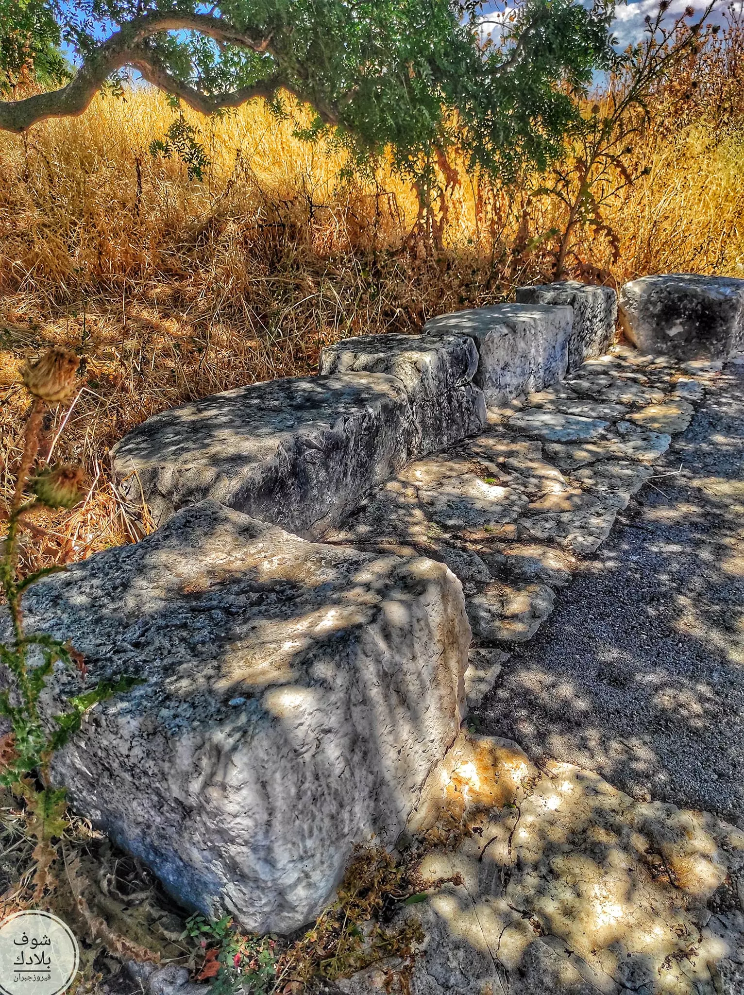
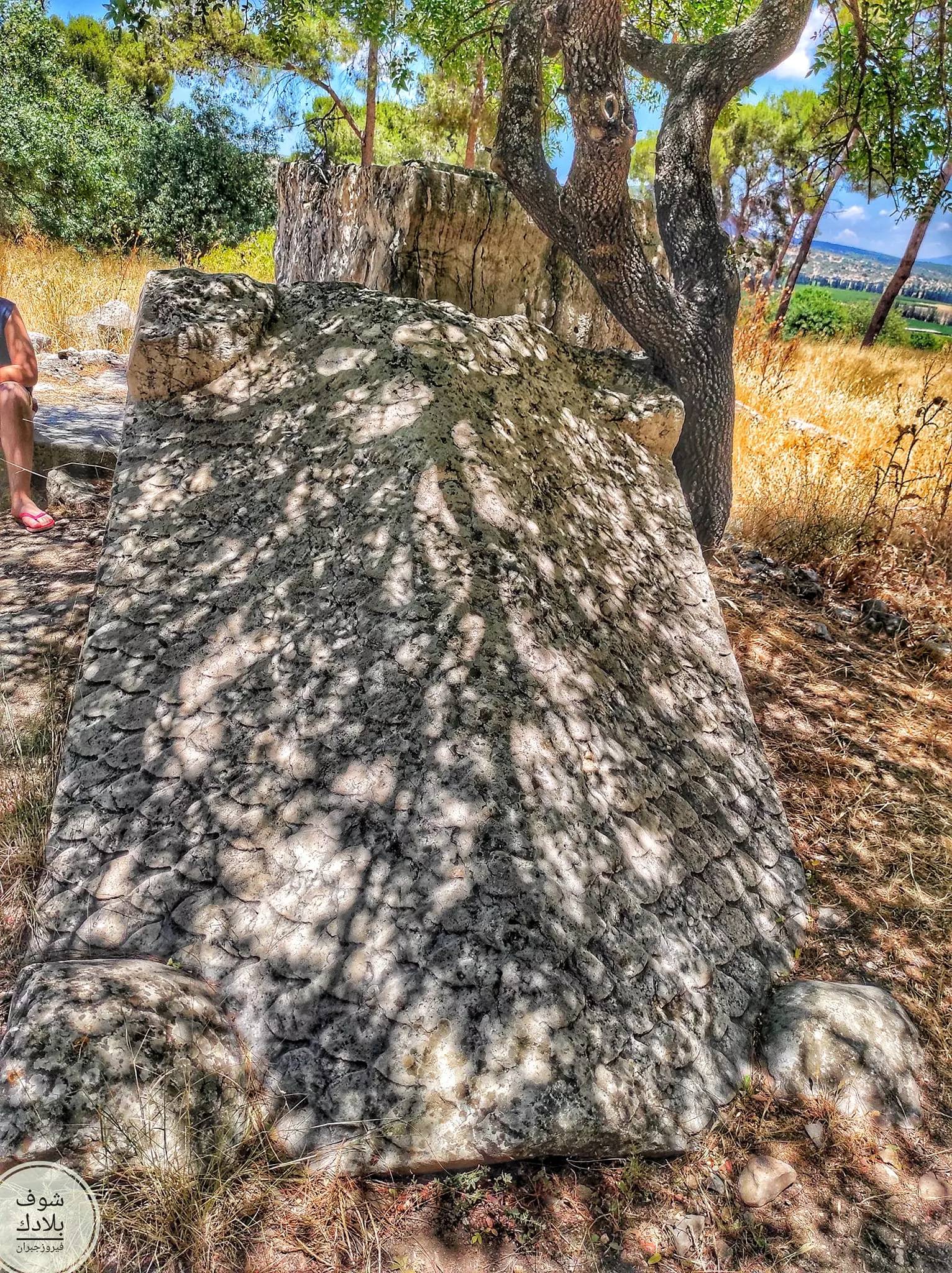
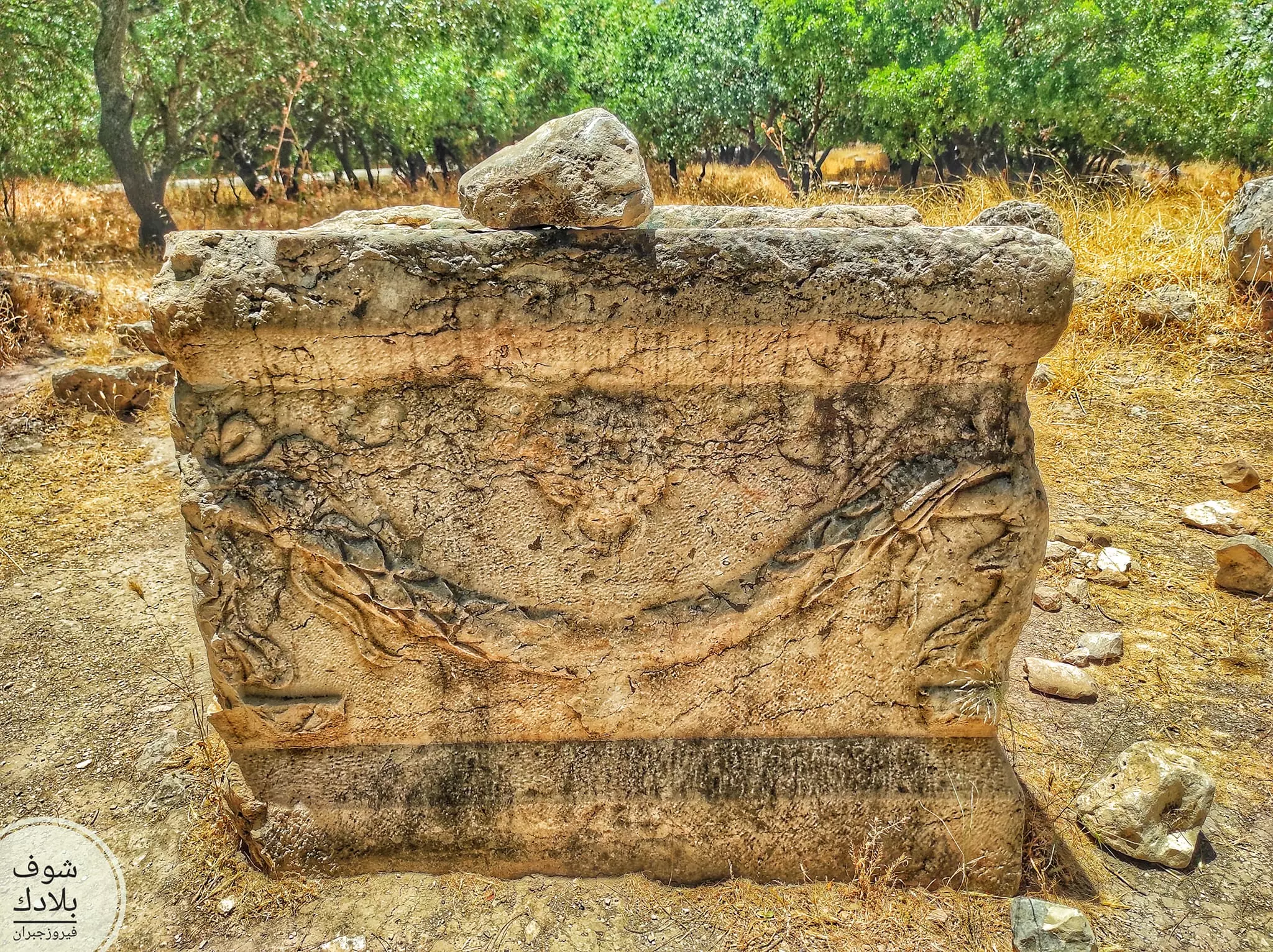
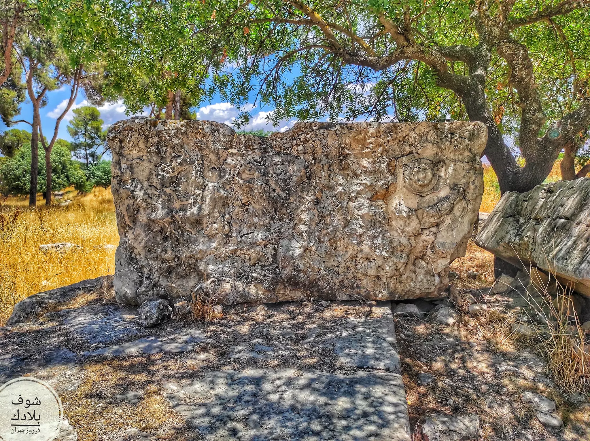
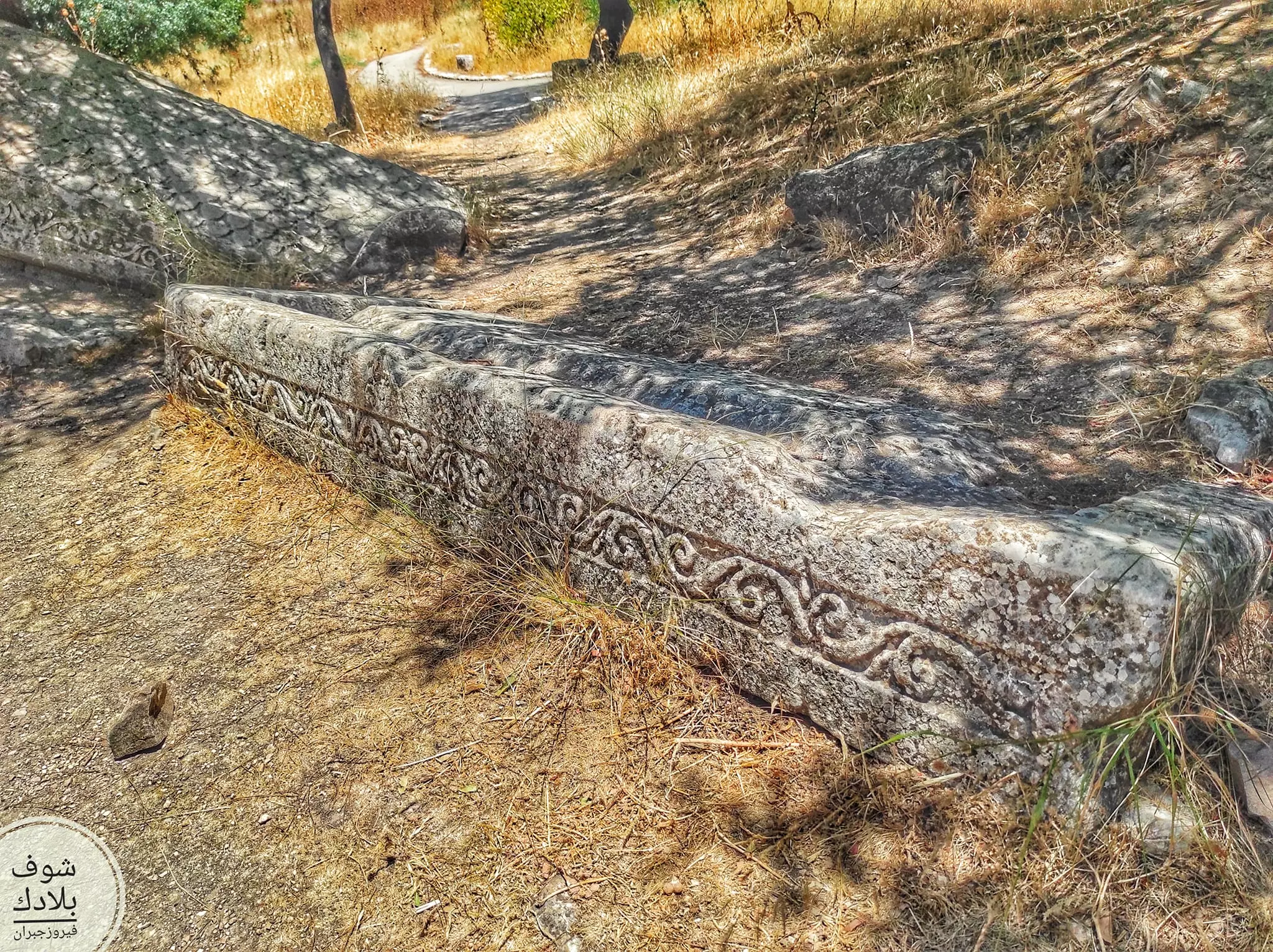
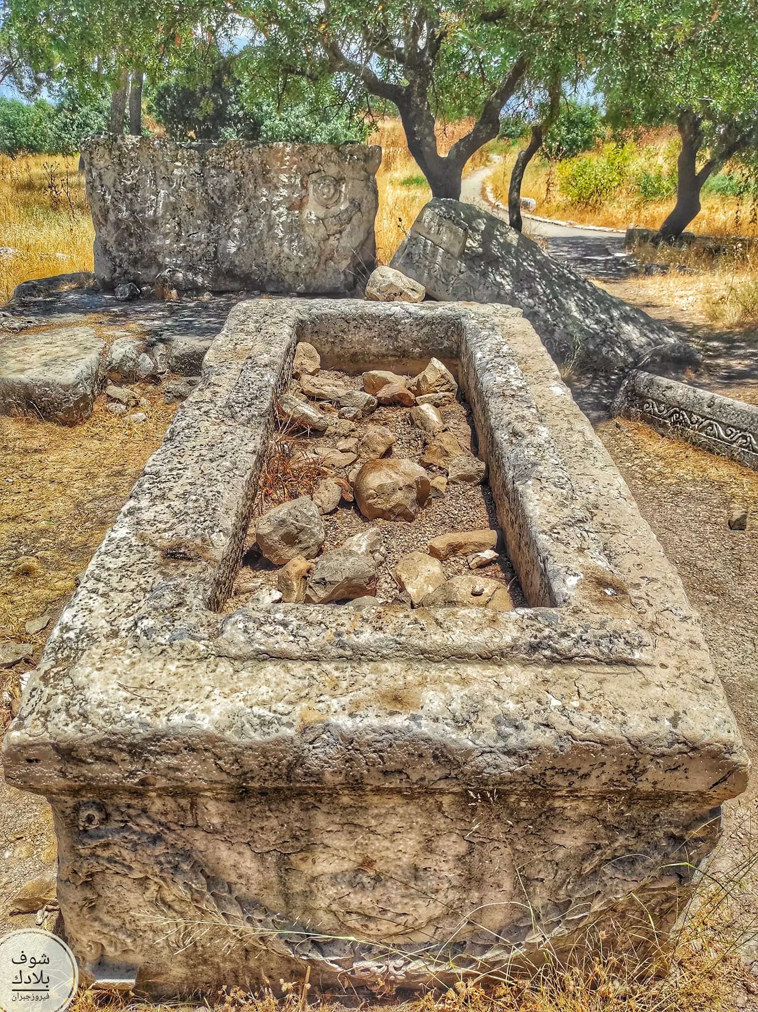
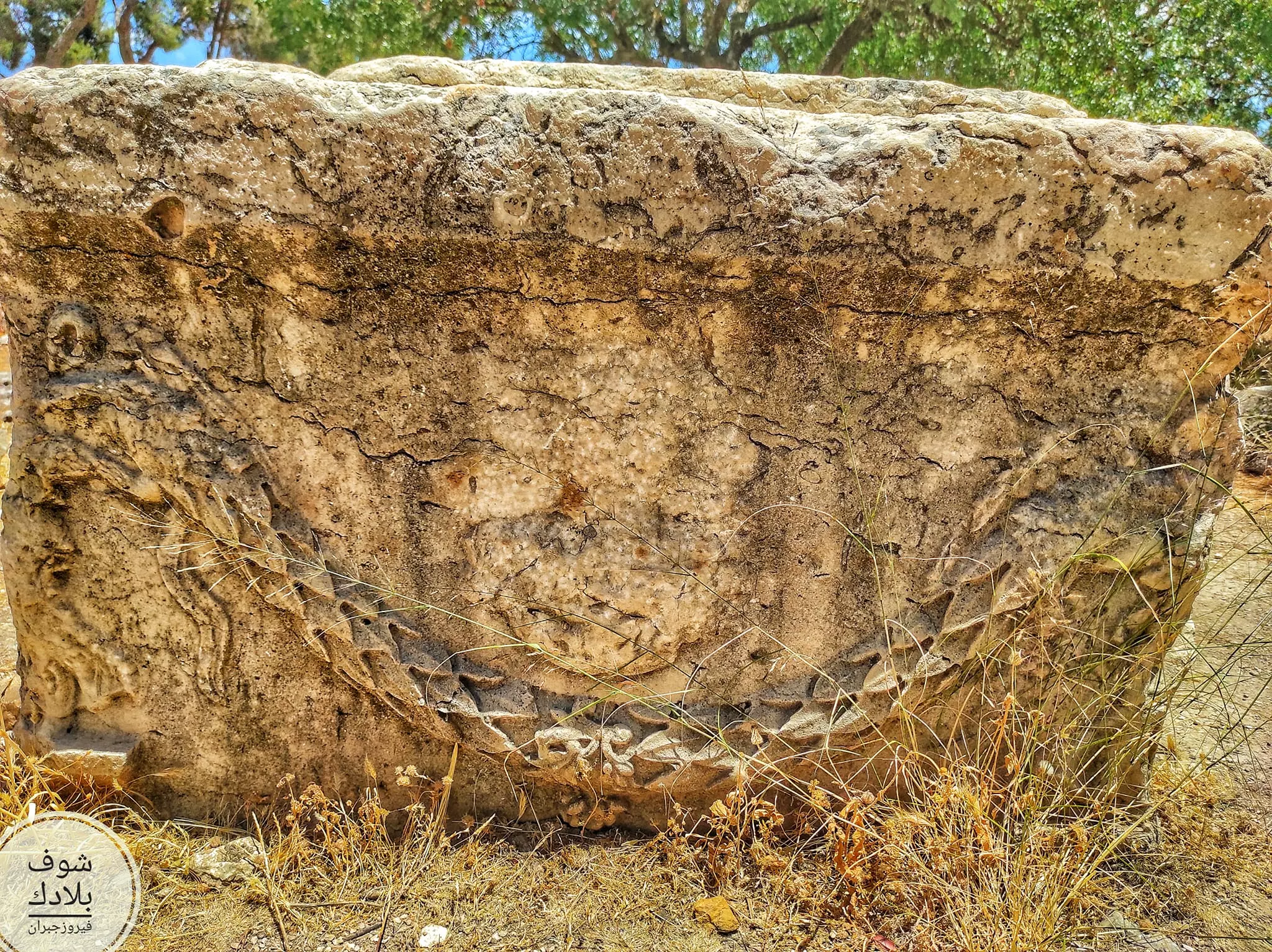
| Archeological Sites | The village contained a Roman temple at the site dated to the first two centuries A.D | |||||||||||||||||||||
| Exculsive Jewish Colonies Who Usurped Village Lands |
Yiftach, Malkiyya, and Ramot Naftali | |||||||||||||||||||||
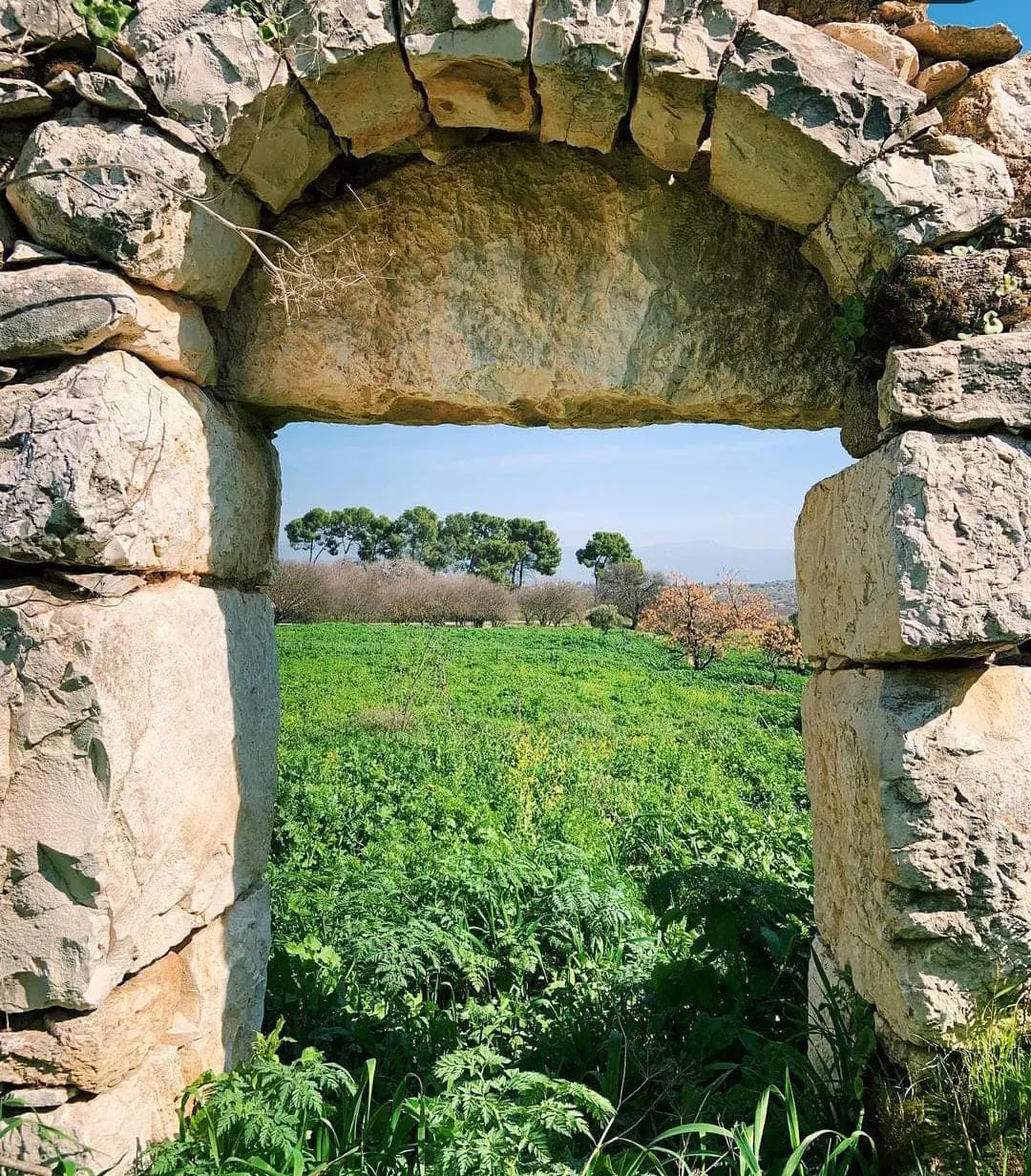
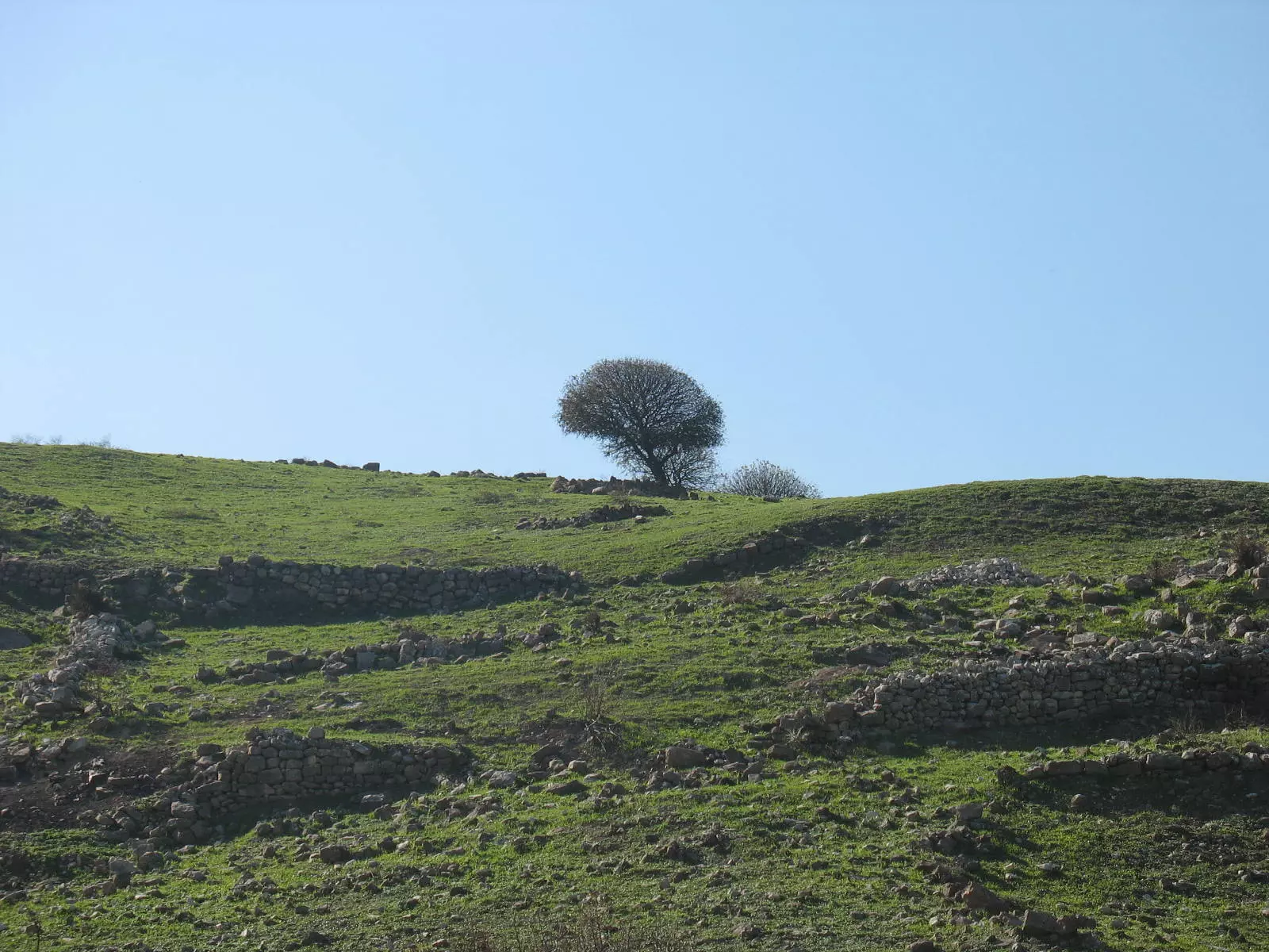
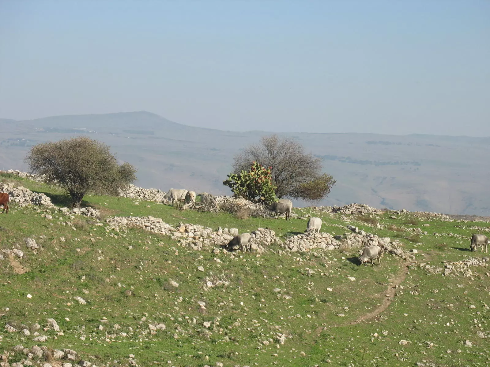
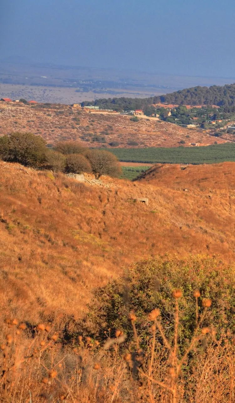
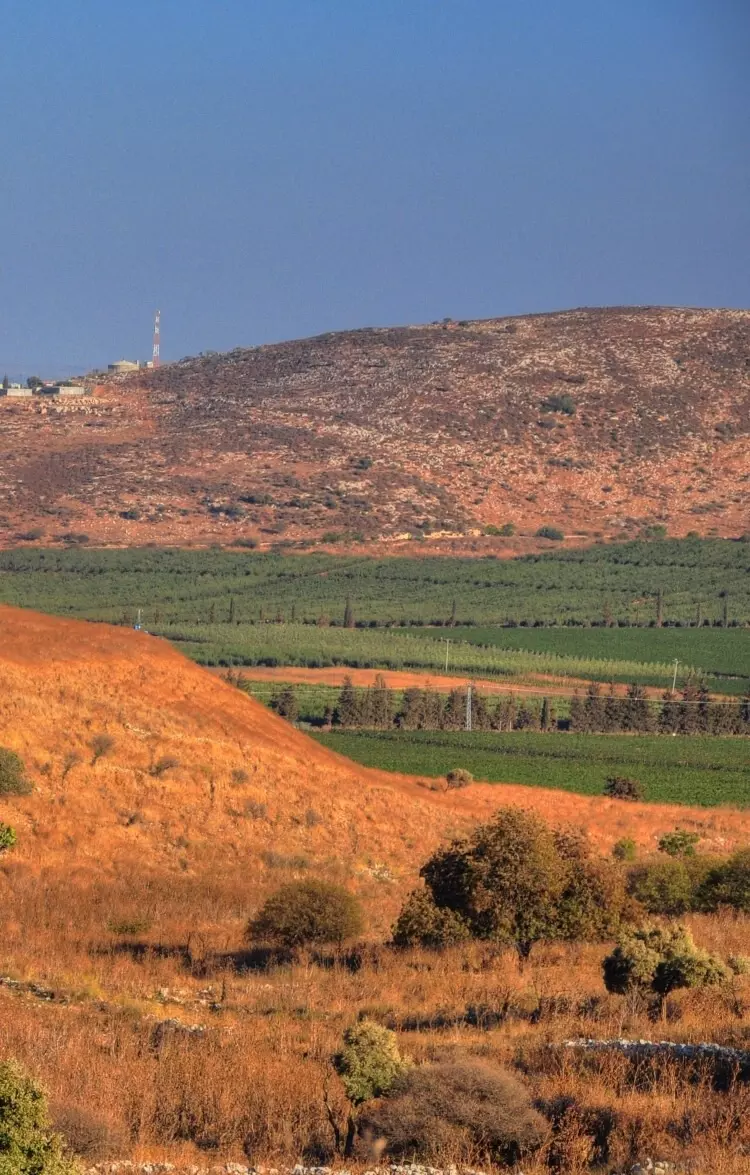
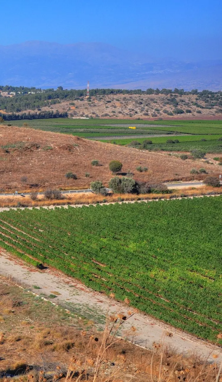
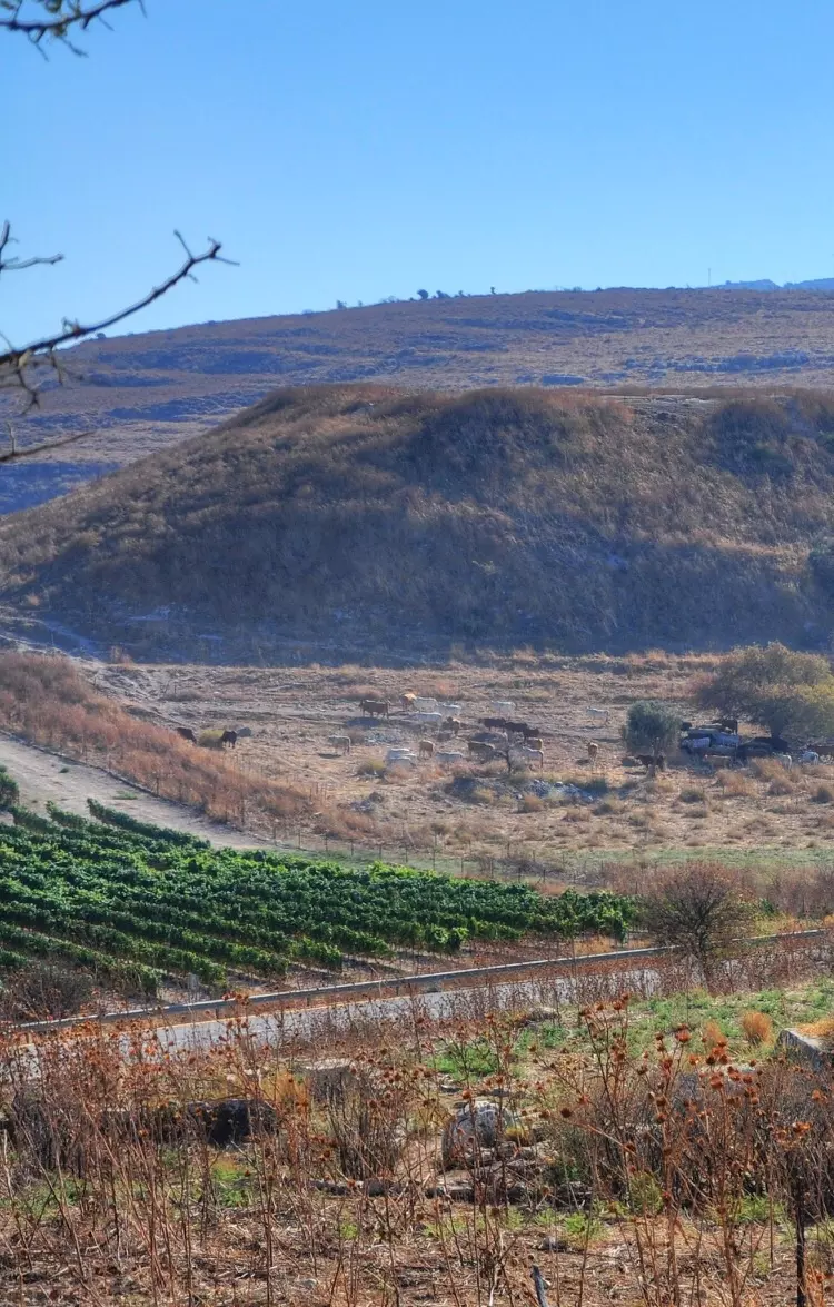
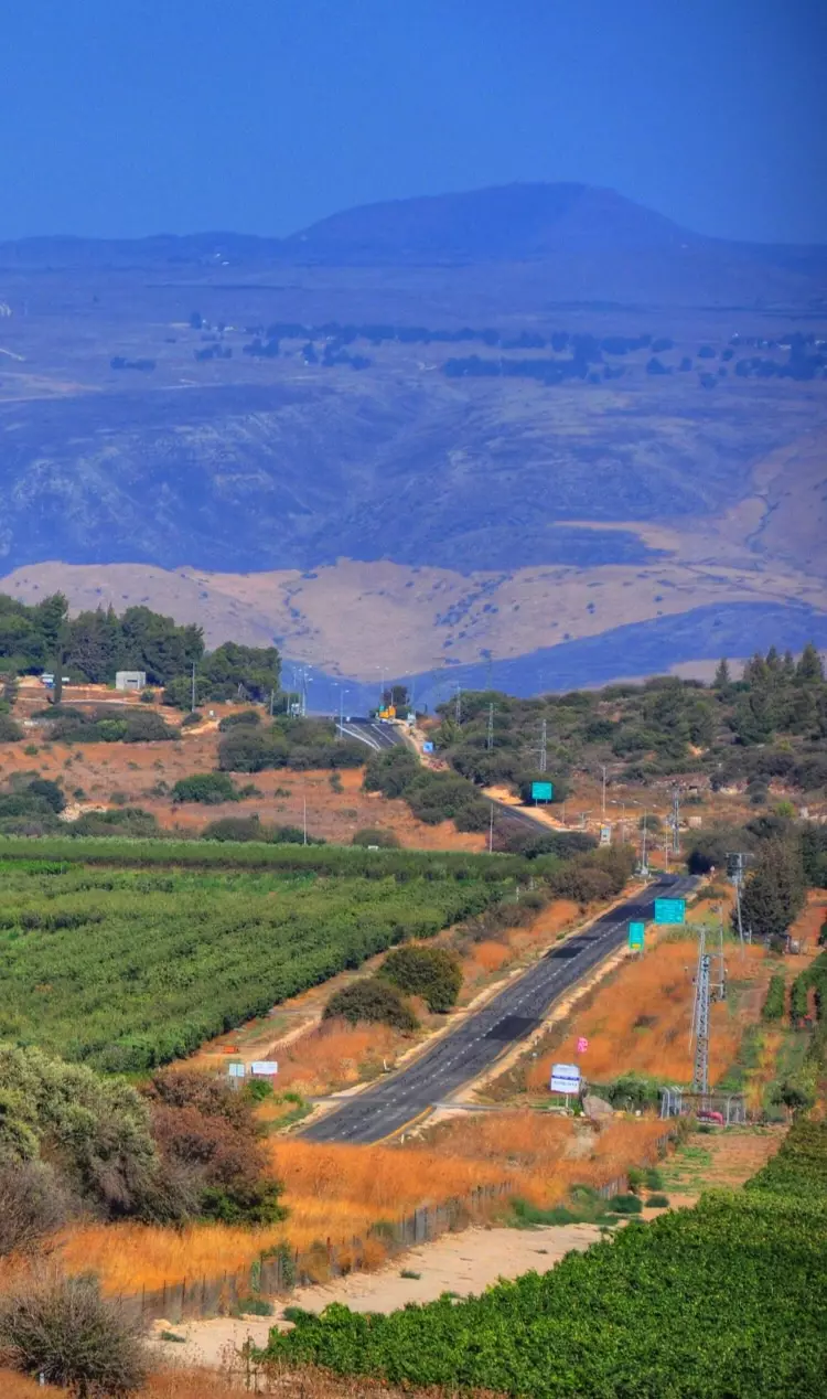
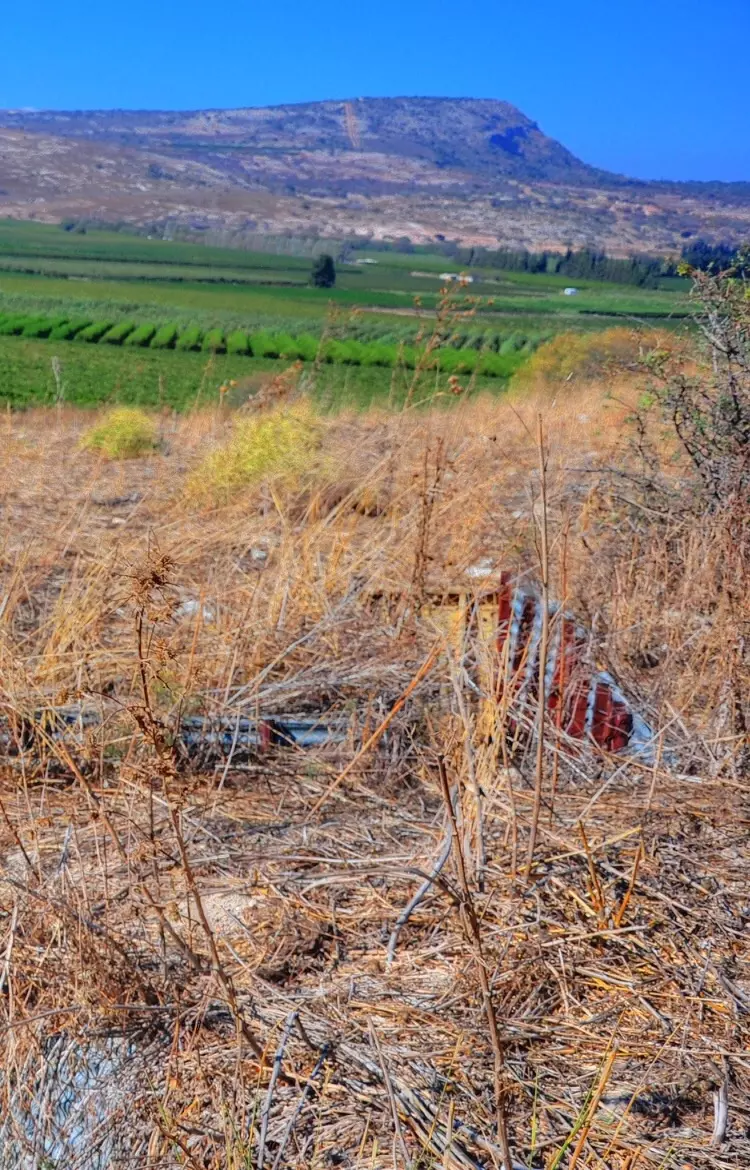
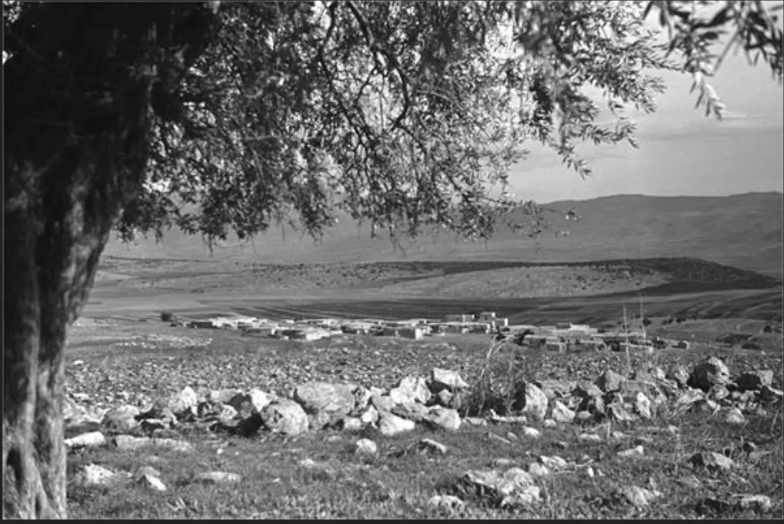
Village Before NakbaThe village stood on a plateau on the edge of a small wadi through which a spring flowed. The villagers obtained water for domestic use from this wadi. A secondary road that passed through the neighboring village of al-Nabi Yusha' linked it to a highway leading to Safad. Both archaeological and epigraphic evidence indicates that the area just east of the village was an important Roman and Byzantine town. Late nineteenth century British surveys described in detail the surface remains of this early town [[SWP (1881) I:226-30]] , and recent excavations have uncovered a Roman temple at the site dated to the first two centuries A.D. During the early Islamic period Qadas was a town in what was then the province of Jordan. The Arab geographer al-Maqdisi, writing in A.D. 985, described it as a small town on the slope of a verdant mountain, with three springs and a bath beneath the town. Moreover, it had a mosque with a palm tree located in the marketplace. [[D 6/2:224; Le Strange 1965:468]] In 1596, Qadas was a village in the nahiya of Tibnin (liwa' of Safad) with a population of 319. It paid taxes on a number of crops, including wheat, barley, olives, and cotton, as well as on other types of produce and property, such as goats, beehives, orchards, and a press that was used for processing either olives or grapes. [[Hut. and Abd.:181]]In the late nineteenth century, Qadas was described as a stone-built village, situated on a spur of a ridge. The population, which they estimated to be between 100 and 300, cultivated fig and olive trees. [[SWP (1881) I:202]] Qadas was part of Lebanon until 1923, when the borders with Palestine were delineated. All of its residents were Muslim. The amount of rainfall in the area and the water from springs was more than sufficient for farming and allowed Qadas to develop a sound agricultural economy, based on grain, fruit, and olives. In 1944/45 a total of 5,709 dunums was allotted to cereals and 156 dunums were irrigated or used for orchards. The village had an olive press. Village Occupation and Ethnic CleaningAfter the occupation of Safad on 11 May 1948, the forces participating in Operation Yiftach (see Abil al-Qamh, Safad sub-disctrict) were ordered to move northwards. On the night of 14‒15 May, the Palmach's First Battalion advanced on Qadas and the neighboring al-Malikiyya, according to the History of the Haganah. The account claims that Qadas fell into their hands by the morning, but that Lebanese units crossed the border later that day and mounted a large counteroffensive, forcing the Palmach to withdraw from the village. However, the Lebanese force was stopped at Qadas and advanced no further, because of its heavy losses during the operation and the simultaneous Israeli raids on targets within Lebanese territory.The Lebanese army remained in the village for two weeks. On 28-29 May, after the formal end of Operation Yiftach, the Israelis implemented an elaborate ploy to recapture Qadas and al-Malikiyya. The official Haganah account states that they sent an armored column into Lebanon, via another route, and returned southwards towards al-Malikiyya, pretending to be a unit of Lebanese reinforcements. Thus surrounded, the two villages soon fell into Israeli hands. But a little over a week later, Lebanese forces regrouped in this sector and made another attempt to take the two villages. Qadas was recaptured on 7 June, following the Lebanese entry into al-Malikiyya the previous day, and Arab forces once again had a means of entering the country from Lebanon. The Haganah claims that Arab Liberation Army (ALA) units were soon deployed in central Galilee in anticipation of an Israeli offensive. It is possible that Lebanese and ALA forces remained in the village until after the second truce of the war, when Qadas fell again into Israeli hands during Operation Hiram (see 'Arab al-Samniyya, Acre sub-disctrict), at the end of October 1948, probably at the same time as al-Malikiyya. [[NYT:8/6/48; S:1596; T:173 ‒76, 184; see T:325 ‒26]] It is not clear when the villagers left, but they may have been driven out by the first attack on 14 ‒15 May, according to circumstantial evidence gathered by Israeli historian Benny Morris. Shortly after the first attack, a neighboring Jewish settlement (Kibbutz Manara) voiced its designs on the village lands and expressed a desire to seize them, indicating that they were 'suitable for winter crops.' Morris adds that this request indicates 'an interest in more than ephemeral cultivation.' However, the kibbutz' wish was probably not granted until the time of the second occupation of Qadas, in October. Zionists Colonies on Village LandsThe settlement of Yiftach (202281) was built in 1948 to the northeast of the village site on lands belonging to Qadas. The village land is used by the settlements of Malkiyya (198278), founded in 1949, and Ramot Naftali (202278), established in 1945.Village TodayStones from the destroyed houses are strewn over the fenced-in site, and a few partially destroyed walls near the spring are visible. A variety of cactuses and trees, including eucalyptus, fig, and mulberry trees, are scattered over the site. The flat portions of the surrounding lands are planted with apple trees; the spring provides drinking water for cattle.SourceDr. Walid al-Khalidi, 1992: All That Remains. |
||||||||||||||||||||||
| Related Maps | Town Lands' Demarcation Maps خرائط للقضاء توضح حدود القرى والاودية Town's map on MapQuest View from satellite Help us map this town at WikiMapia |
|||||||||||||||||||||
| Related Links | Wikipedia's Page Google Search Google For Images Google For Videos |
|||||||||||||||||||||
| More Information | في كتاب كي لا ننسى في كتاب بلادنا فلسطين المزيد من موقع هوية |
|||||||||||||||||||||
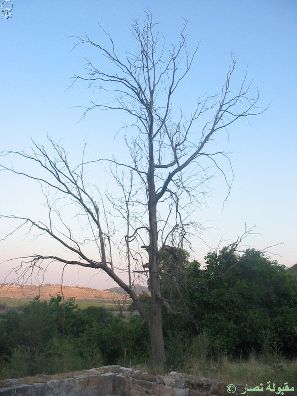
- آثار باقية من قرية قدس , مجرى النبع الموصل الى مجمع خاص ومباني تابعة له .- 7.5.2005 ؟, تصوير : مقبولة نصار
Posted by Makbula Nassar 1 - آثار باقية من قرية قدس , مجرى النبع - 7.5.2005 , تصوير : مقبولة نصار
Posted by Makbula Nassar - آثار باقية من قرية قدس , مجرى النبع الموصل الى مجمع خاص ومباني تابعة له .- 7.5.2005 ؟, تصوير : مقبولة نصار
Posted by Makbula Nassar - آثار باقية من قرية قدس , مجرى النبع - 7.5.2005 , تصوير : مقبولة نصار
Posted by Makbula Nassar - آثار باقية من قرية قدس , مجرى النبع الموصل الى مجمع خاص ومباني تابعة له .- 7.5.2005 , تصوير : مقبولة نصار
Posted by Makbula Nassar - آثار باقية من قرية قدس , قطعة من قناة الماء - 7.5.2005 , تصوير : مقبولة نصار
Posted by Makbula Nassar - آثار باقية من قرية قدس , بركة ماء فارغة استعملت لتجميع الماء- 7.5.2005 , تصوير : مقبولة نصار
Posted by Makbula Nassar - آثار باقية من قرية قدس , بركة الماء - 7.5.2005 , تصوير : مقبولة نصار
Posted by Makbula Nassar - آثار باقية من قرية قدس ,(صور مختلفة) - 7.5.2005 , تصوير : مقبولة نصار
Posted by Makbula Nassar - آثار باقية من قرية قدس , ( صور مختلفة) - 7.5.2005 , تصوير : مقبولة نصار
Posted by Makbula Nassar - منظر عام اراضي القرية - 7.5.2005 , تصوير : مقبولة نصار
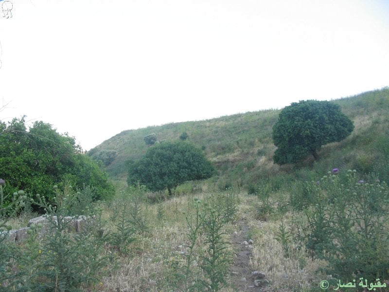
Posted by Makbula Nassar - منظر عام اراضي القرية - 7.5.2005 , تصوير : مقبولة نصار
Posted by Makbula Nassar - Ruins of the destroyed Palestinian village
Posted by Noga Kadman - Ruins of the destroyed Palestinian village
Posted by Noga Kadman - Ruins of the destroyed Palestinian village
Posted by Noga Kadman - Ruins of the destroyed Palestinian village
Posted by Noga Kadman - نبع ماء عين قدس جاف يوم 3 أيار 2014
Posted by سهيل مخول - قدس المهجرة كما تظهر يوم 3 أيار 2014
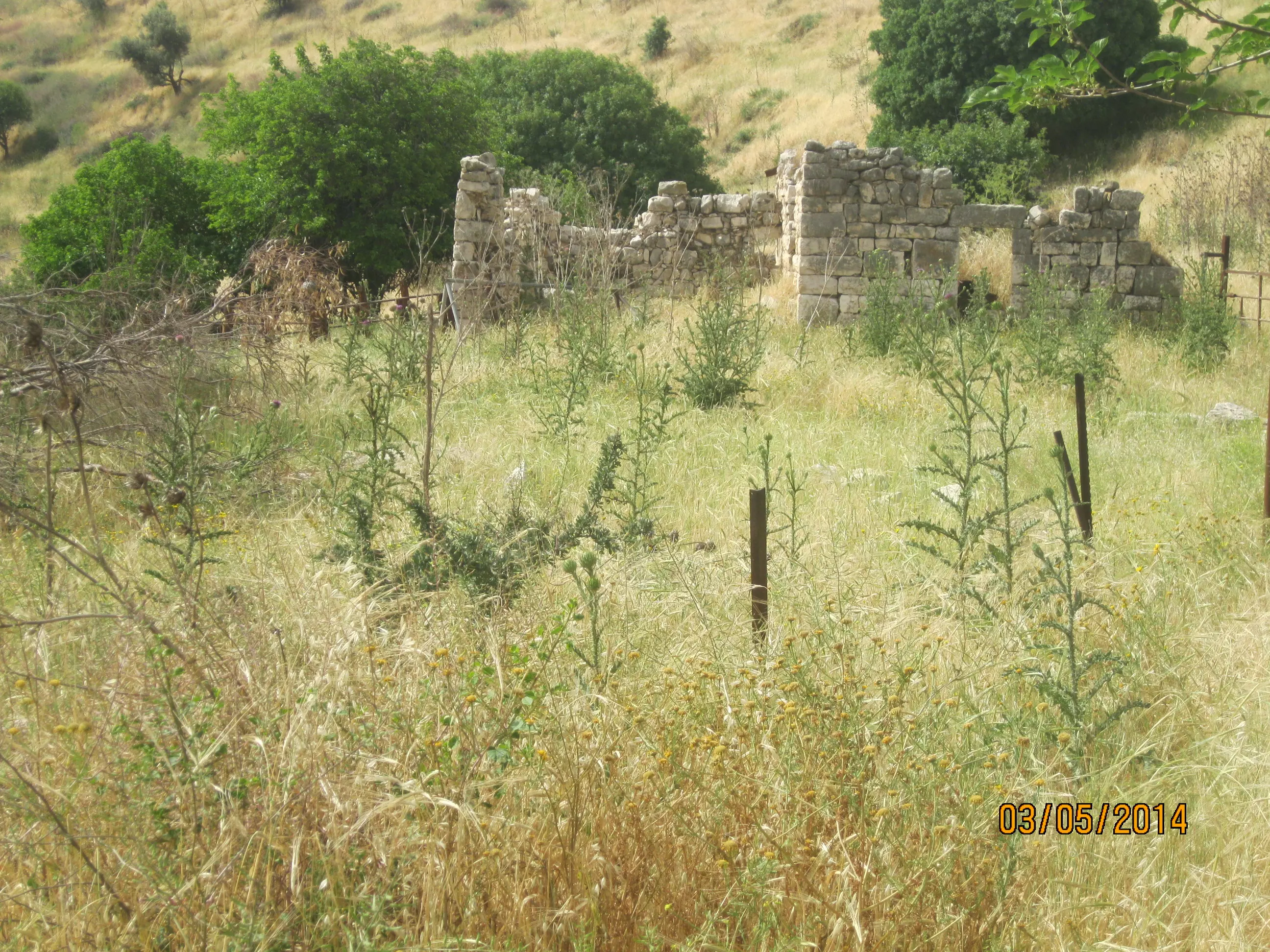
Posted by سهيل مخول - قدس المهجرة كما تظهر يوم 3 أيار 2014 - تصوير سهيل مخول
Posted by سهيل مخول - تل قدس - أثار رومانية - تصوير سهيل مخول
Posted by سهيل مخول - تل قدس - أثار رومانية - تصوير سهيل مخول يوم 3.5.2014
Posted by سهيل مخول - تل قدس - أثار رومانية - تصوير سهيل مخول يوم 3.5.2014
Posted by سهيل مخول - تل قدس - أثار رومانية - تصوير سهيل مخول يوم 3.5.2014
Posted by سهيل مخول - تل قدس - أثار رومانية - تصوير سهيل مخول يوم 3.5.2014
Posted by سهيل مخول - تل قدس - أثار رومانية - تصوير سهيل مخول يوم 3.5.2014

Posted by سهيل مخول - تل قدس - أثار رومانية - تصوير سهيل مخول يوم 3.5.2014
Posted by سهيل مخول - تل قدس - أثار رومانية - تصوير سهيل مخول يوم 3.5.2014
Posted by سهيل مخول - تل قدس - أثار رومانية - تصوير سهيل مخول يوم 3.5.2014
Posted by سهيل مخول - تل قدس - أثار رومانية - تصوير سهيل مخول يوم 3.5.2014
Posted by سهيل مخول - قدس
Posted by abu raya - اشجار قدس القديمه
Posted by abu raya - اثار قدس
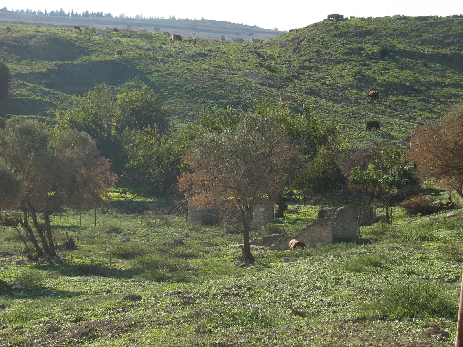
Posted by abu raya - اراضي القريه
Posted by abu raya - اثار القريه
Posted by abu raya - قدس
Posted by abu raya - اراضي قدس
Posted by abu raya - اراضي قدس
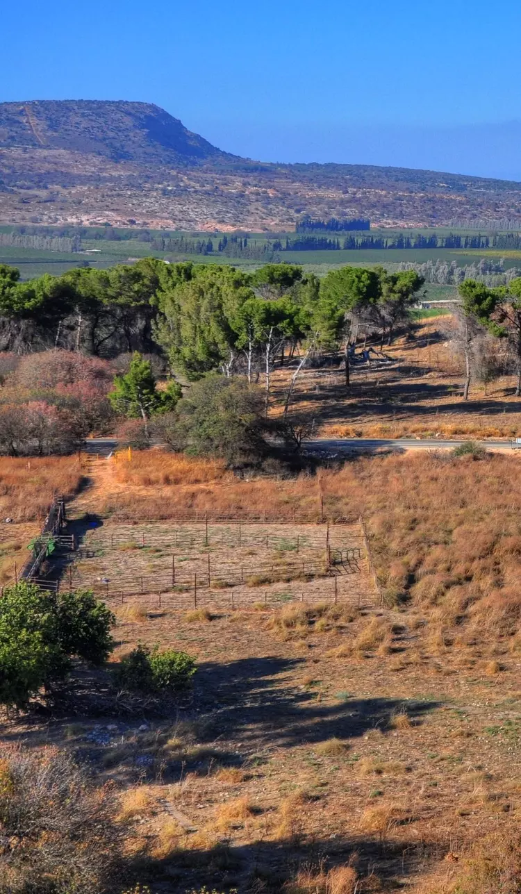
Posted by abu raya - اراضي قدس

Posted by abu raya - اراضي قدس
Posted by abu raya - قدس
Posted by abu raya - قدس
Posted by abu raya - قدس
Posted by abu raya - قدس
Posted by abu raya - قدس
Posted by abu raya - قدس
Posted by abu raya - الباقي من بيوت قدس
Posted by abu raya - بيوت قدس
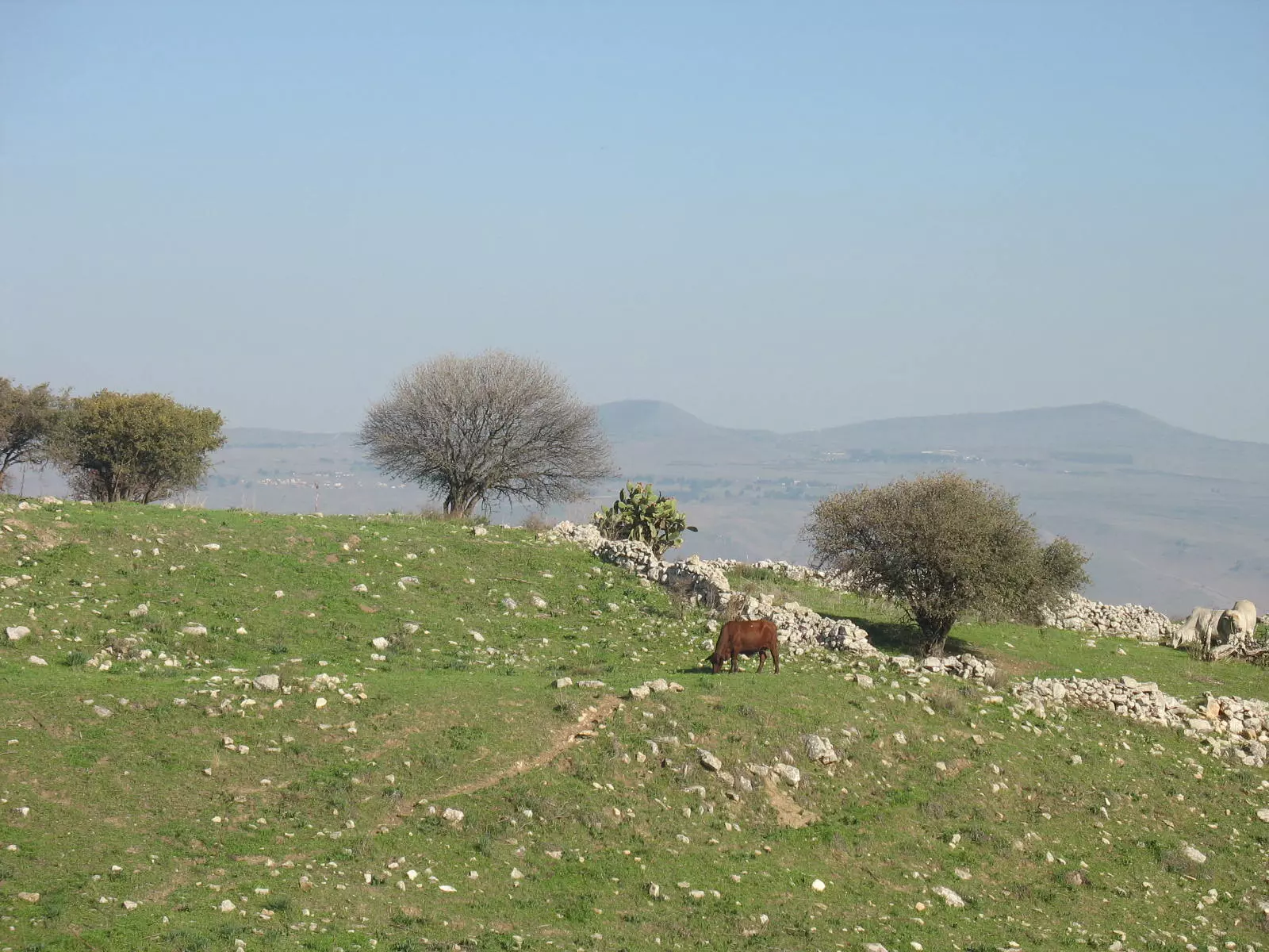
Posted by abu raya - منظر من اراضي قدس باتجاه مرتفعات الجولان
Posted by abu raya - قدس

Posted by abu raya - اراضي قدس
Posted by abu raya - اثار بيوت قدس
Posted by abu raya - اثار بيوت قدس
Posted by abu raya - اثار بيوت قدس
Posted by abu raya - قريه قدس قبل النكبه
Posted by abu raya - قدس قبل النكبه
Posted by abu raya - قريه قدس قبل النكبه
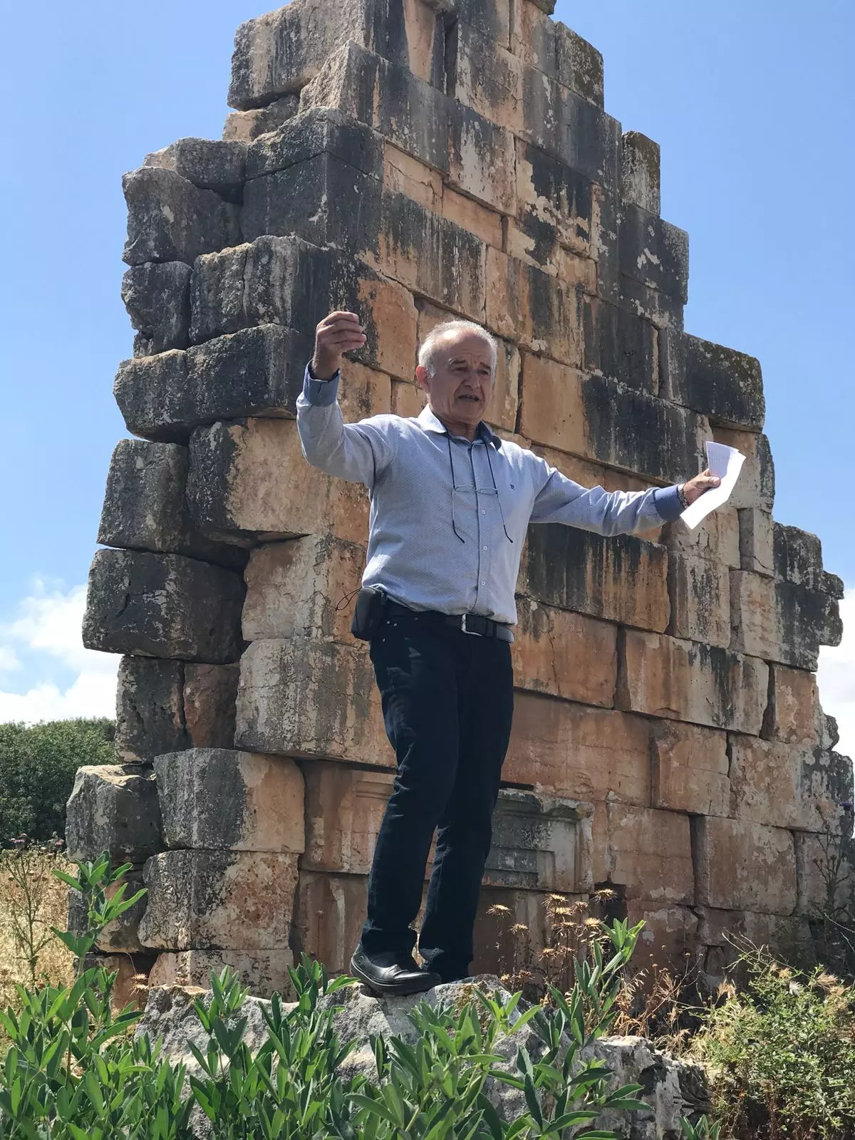
Posted by abu raya - سهيل مخول في موقع المعبد الروماني في قدس
Posted by سهيل مخول - جدار المعبد الروماني في قدس
Posted by سهيل مخول - نقوش التي كانت في المعبد الروماني في قدس
Posted by سهيل مخول - اطلال المعبد الروماني في قدس
Posted by سهيل مخول - A journey between Qadas' destroyed homes and its graves - جولة بين انقاض وقبور قرية قدس المهجرة
- A journey between Qadas' destroyed homes and its graves - جولة بين انقاض وقبور قرية قدس المهجرة #2
- A journey between Qadas' destroyed homes and its graves - جولة بين انقاض وقبور قرية قدس المهجرة #3

- A journey between Qadas' destroyed homes and its graves - جولة بين انقاض وقبور قرية قدس المهجرة #4
- A journey between Qadas' destroyed homes and its graves - جولة بين انقاض وقبور قرية قدس المهجرة #5
- A journey between Qadas' destroyed homes and its graves - جولة بين انقاض وقبور قرية قدس المهجرة #6
- A journey between Qadas' destroyed homes and its graves - جولة بين انقاض وقبور قرية قدس المهجرة #7
- A journey between Qadas' destroyed homes and its graves - جولة بين انقاض وقبور قرية قدس المهجرة #8
- A journey between Qadas' destroyed homes and its graves - جولة بين انقاض وقبور قرية قدس المهجرة #9
- Qadas during the pre-Nakba in 1939 - قدس قبل انكبة عام
- جولة بين الاثار الموجودة على ارض القرية
- جولة بين الاثار الموجودة على ارض القرية #2
- جولة بين الاثار الموجودة على ارض القرية #3
- جولة بين الاثار الموجودة على ارض القرية #4
- جولة بين الاثار الموجودة على ارض القرية #5
- That is how the "civilized" erased and replaced us: Qadas was completely obliterated, as you see -- قدس باتت أثر بعد عين. من هنا مر الهمجّ
- That is how the "civilized" erased and replaced us: Qadas was completely obliterated, as you see -- قدس باتت أثر بعد عين. من هنا مر الهمجّ #2
- جولة رائعة في المعبد الروماني الموجود في اراضي القرية-- Fairouz Jubran -- June 2022
- جولة رائعة في المعبد الروماني الموجود في اراضي القرية-- Fairouz Jubran -- June 2022 #2
- جولة رائعة في المعبد الروماني الموجود في اراضي القرية-- Fairouz Jubran -- June 2022 #3
- جولة رائعة في المعبد الروماني الموجود في اراضي القرية-- Fairouz Jubran -- June 2022 #4
- جولة رائعة في المعبد الروماني الموجود في اراضي القرية-- Fairouz Jubran -- June 2022 #5
- جولة رائعة في المعبد الروماني الموجود في اراضي القرية-- Fairouz Jubran -- June 2022 #6
- جولة رائعة في المعبد الروماني الموجود في اراضي القرية-- Fairouz Jubran -- June 2022 #7
- جولة رائعة في المعبد الروماني الموجود في اراضي القرية-- Fairouz Jubran -- June 2022 #8
- جولة رائعة في المعبد الروماني الموجود في اراضي القرية-- Fairouz Jubran -- June 2022 #9
- جولة رائعة في المعبد الروماني الموجود في اراضي القرية-- Fairouz Jubran -- June 2022 #10
- جولة رائعة في المعبد الروماني الموجود في اراضي القرية-- Fairouz Jubran -- June 2022 #11
- جولة رائعة في المعبد الروماني الموجود في اراضي القرية-- Fairouz Jubran -- June 2022 #12
- جولة رائعة في المعبد الروماني الموجود في اراضي القرية-- Fairouz Jubran -- June 2022 #13
- جولة رائعة في المعبد الروماني الموجود في اراضي القرية-- Fairouz Jubran -- June 2022 #14

- جولة رائعة في المعبد الروماني الموجود في اراضي القرية-- Fairouz Jubran -- June 2022 #15
- جولة رائعة في المعبد الروماني الموجود في اراضي القرية-- Fairouz Jubran -- June 2022 #16
- جولة رائعة في المعبد الروماني الموجود في اراضي القرية-- Fairouz Jubran -- June 2022 #17
- جولة رائعة في المعبد الروماني الموجود في اراضي القرية-- Fairouz Jubran -- June 2022 #18
- جولة رائعة في المعبد الروماني الموجود في اراضي القرية-- Fairouz Jubran -- June 2022 #19
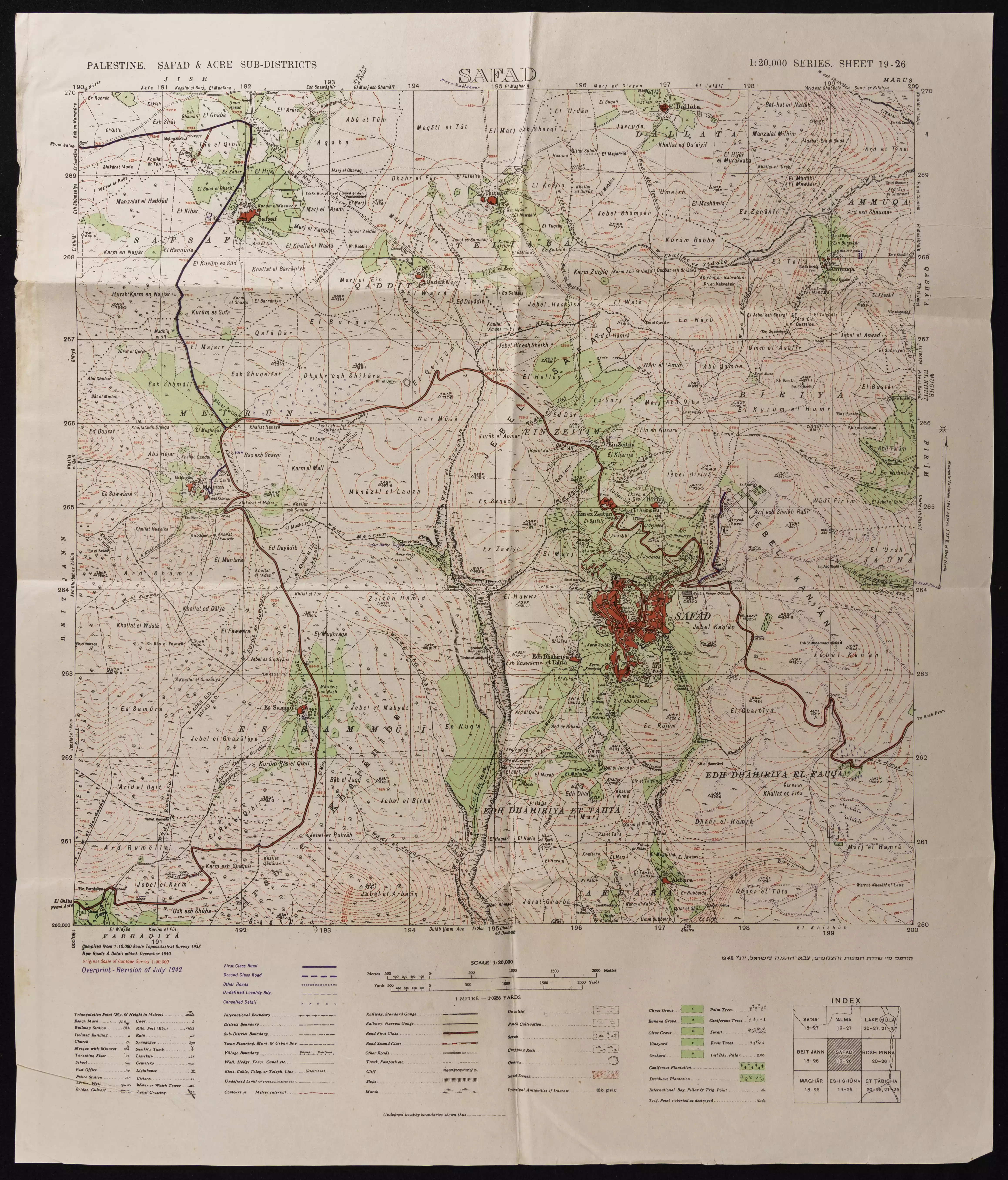
- خارطة تُظهِر الحدود والطرق بأنواعها والأماكن المقدسة والطبيعة الطوبغرافية من تلال وسهول ومنحدرات والتشكيلة الطبيعية للأرض وأنواع المزروعات. نُشرت الخريطة فترة الانتداب البريطاني، تم إضافة تعديلات عليها من قِبَل خدمة الخرائط والصور التابعة للقوات العسكرية الاسرائيلية فترة الأربعينيات.
Want to browse more? 80,000 pictures were grouped in these gallaries:
| Display Name | Clan/Hamolah | Country of Residence |
- The remains of Qadas, Safed District Duration: min 42 sec
No links have been shared yet, be free to the first to share the first link.
 Fake Valor: Why Did Zionist Jews Hoist Nazis Flag on Their Ships in the 1930s?
What is new?
-
Facts About Oct. 7th Gaza Raid
-
Remined Us Please: Who Did Rape Whom? Was it Palestinians who raped Israelis? Or, was the other way around? You'll be the judge
-
When Prof. Edward Said was invited to debate Bibi Netanyahu in the 1980s, watch what happened!
-
Ezra Klein of the NY Times on the "Jewish Race".
-
Abusing Blood Libel!
-
How and why Israeli Jewry has become the most hated cult?
-
Did Israeli Soldiers Activate The Hannibal Direective On Oct. 7th? You Be The Judge
-
Zionist FAQ: Isn't it true that Palestinians don't want peace? Palestinians never accepted the two-state solution
- Facts about Haavara (Transfer) Agreement between Ben-Gurion & Hitler
-
Haavara FAQs: Why Did Zionist Jews Hoist Nazis' Flags on Their Ships in the 1930s?
- Haavara FAQs: When Chaim Weizmann met FDR in mid-1943, why was he silent about rescuing European Jewry?
-
Dear ChatGPT: How did Palestinians resist Napoleon's invasion of their country in 1799?
-
Dear ChatGPT: Gaza had a vibrant Jewish community in the mid-17th century. What happened to them?
-
Dear ChatGPT: Why did the Jewish Agency suppress news of the Holocaust during WWII?
-
Video Playlist: Jews share their DNA tests to end the conflict for good.
-
A Tale of Two Conflicts: Examining the Definition of Genocide
-
Prof. Abraham Polak And The Suppressed History of the Khazars and European Jewry
-
How Ronald Reagan would have framed the genocide in Gaza if he were still alive?
-
Haavara FAQs: Let us do the math: how many German Jews did The Haavara Agreement save?
-
Zionist FAQs: The Hebron Massacre of 1929, "clearly proves" that Palestinians are antisemitic, how could you deny it?
-
Zionist FAQs: Why Anti-Zionist Is Not Antisemitism?
-
Zionist FAQs: Isn't it true that the KGB created Palestinian Nationalism in the early 1960s?
- Zionist FAQs: Muslims are killing Muslims all the time; why are Israeli Jews being singled out in the media?
- Zionist FAQs: How is Israel an apartheid state when 20% of its citizens are Arabs who enjoy full rights?
-
Haavara FAQs: Why Did Dorothy Thompson Flip From A Zionist Advocate to A Silenced Dissenter?
-
Haavara FAQs: Analysis of Herzl's Uganda Scheme and how it could have saved millions of Jews.
-
Haavara FAQs: Why did Hayim Greenberg describe American Jewry as "morally bankrupt" in early 1943?
-
Haavara FAQs: What if the Evian Conference was a resounding success? What would have been the impact of saving European Jewry on Zionism?
- Haavara FAQs: What if the six million were saved, how that would have impacted the Zionist project?
-
Haavara FAQs: How did Zionist leaders react when Europe's Jews lingered in the DP camps after WWII ended?
-
Why does the American Jewish community repeat lies that David Ben-Gurion had debunked before he died?
-
Who has the power to rename the Tatar/Khazar Gene Marker to Jewish IV?
-
Zionist FAQs: Why won't Egypt, Syria, and Jordan take their people back? Jews are indigenous to Palestine, and Arabs immigrated after Jews developed the country. Arabs should leave.
-
Haavara FAQs: Did Hitler and the Nazis conflate between Judaism and Zionist? If that wasn't case, then why?
-
Haavara FAQs: Winston Churchill and antisemitism, a collection of articles written Churchill.
-
Haavara FAQs: Broken by country, how many Jews survived vs. killed during the Holocaust?
-
Haavara FAQs: Why did European Jews vote with their feet and to immigrated to the Americas, not Palestine, after WWII?
-
Watch this American Jewish Girl describing Israeli Jews' cognitive dissonance like no other in under two minutes
-
Haavara FAQs: When the Nazis went out of their way to hide the Holocaust, Israeli Jews did the exact opposite by broadcasting their genocide of Gazans. But why?
-
Haavara FAQs: How Zionist Jews went out of their to show their appreciation to Nazism and Fascism?
- Haavara FAQs: Why Zionist leaders were against bombing the death camps & the Railroads leading to them?
-
Haavara FAQs: Hitler's message to the British and American people: If Jews are such noble citizens and you care about them, how come you're not letting them in? I will gladly ship them to you at my expense, even on luxury liners!
-
A shortlist of Zionist and Israeli false flag operations in the name Jews.
-
The Most Moral Army
- The Land of Kapos (Israel): Where the brave are boycotted and Kapos walk free.
- Why did early Zionists often named their communal enterprises "colonial"?
- Zionist Relations with Nazi Germany by Faris Glubb
-
Two NY Times advertisements by Zionists in the early 1943 that exposes Zionists' treason at the height of the calamity
- Facts Not Lies about the Palestinian-Israeli Conflict.
- Site's pictures have been categorized
- Campgain Against Lice
- A Survey of Palestine, the official source about Palestine before Nakba produced by the British Mandate; over 1200 pages.
- Satellite View & Google Earth: Over 6,000 placemarks identifying all destroyed towns, W. Bank & Gaza Strip Towns, & refugee camps.
- PalestineRemembered.com and its Nakba Oral History Project were featured on al-Jazeera Satellite TV.
- Nakba Oral History Video Podcast:
 Over 700 Oral History interviews (including 3,500+ hours of recording) can be viewed online.
 - Palestine Village Statistics Project
- Gaza Jail Break
- النسخة العربية للموقع الان متوفرة
- Videos: Documenting the destroyed villages in video: Tracing all that remains since Nakba.
- Videos: Responding to Zionist Propaganda
- Interview: The ethnic cleansing of Palestine: George Galloway interviews Israeli Historian Ilan Pappe.
- For Palestinians, memory matters. It provides a blueprint for their future By George Bisharat.
- Zionist FAQ now available in Hebrew שאלות שציונים שואלים, עכשיו בעברית
- Video: The Stephen Walt and John Mearsheimer report on the influence of the Israel Lobby on U.S. Foreign Policy
- The Palestinian-Israeli conflict for beginners
