| PalestineRemembered | About Us | Oral History | العربية | |
| Pictures | Zionist FAQs | Haavara | Maps | |
| Search |
| Camps |
| Districts |
| Acre |
| Baysan |
| Beersheba |
| Bethlehem |
| Gaza |
| Haifa |
| Hebron |
| Jaffa |
| Jericho |
| Jerusalem |
| Jinin |
| Nablus |
| Nazareth |
| Ramallah |
| al-Ramla |
| Safad |
| Tiberias |
| Tulkarm |
| Donate |
| Contact |
| Profile |
| Videos |
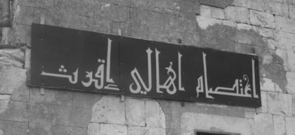
Welcome To Iqrit - إقرت (איקרית)
|
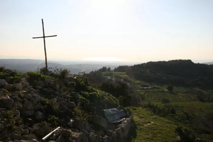
District of Acre
Ethnically cleansed days ago |
العربية Google Earth |
 |
Gallery (121) |
- Statistics & Facts
-
Before & After

- Satellite View
- Articles 6
- Pictures 121
- Oral History 1
- Members 10
- All That Remains
- Wikipedia
- Videos 4
- Guest Book 4
- Links 3
| Statistic & Fact | Value | ||||||||||||||
| Occupation Date | November 1, 1948 | ||||||||||||||
| Distance From District | 25.5 (km) Northeast of Acre | ||||||||||||||
| Elevation | 550 (meters) | ||||||||||||||
| Before & After Nakba, Click Map For Details |
|||||||||||||||
|
|||||||||||||||
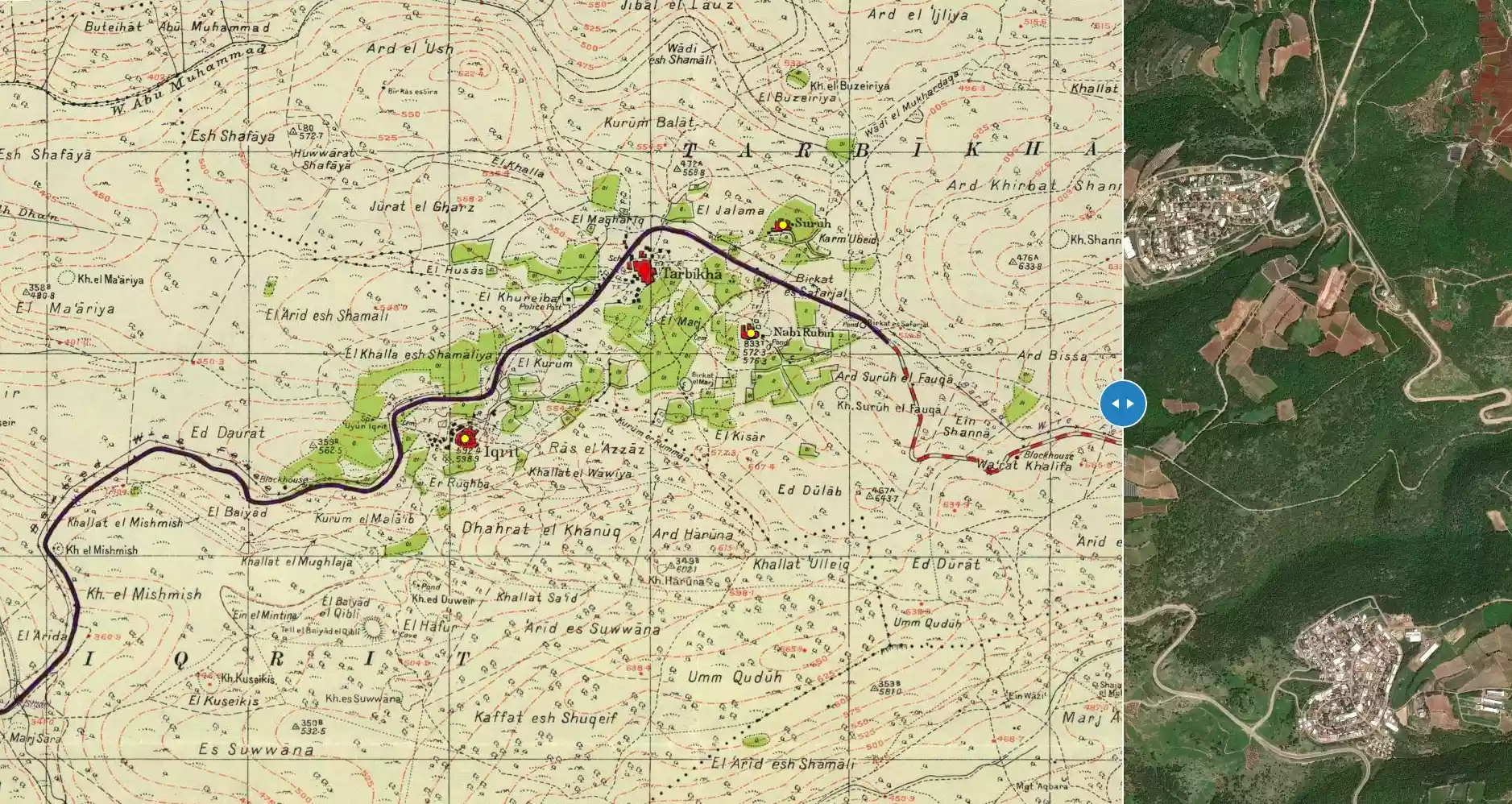
| Map Location | See location #6 on the map View from satellite |
||||||||||||||
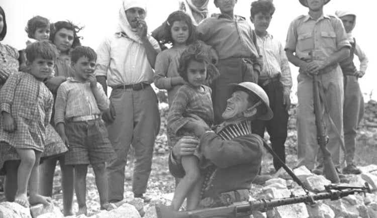
| Military Operation | Operation Hiram | ||||||||||||||
| Attacking Units | 'Oded Brigade | ||||||||||||||
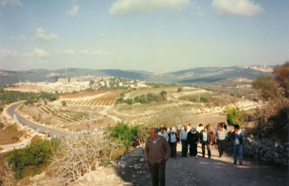
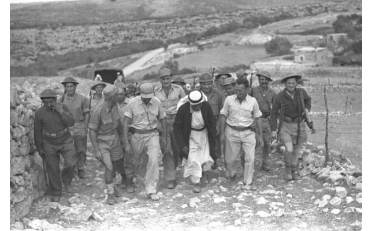
| Refugees' Migration Routes | Some of the refugees were bused to Lebanon, to al-Rashedyah refugee camp, and the rest were bused al-Rama, 20 km south. | ||||||||||||||
| Exodus Cause | Expulsion by Zionist troops | ||||||||||||||
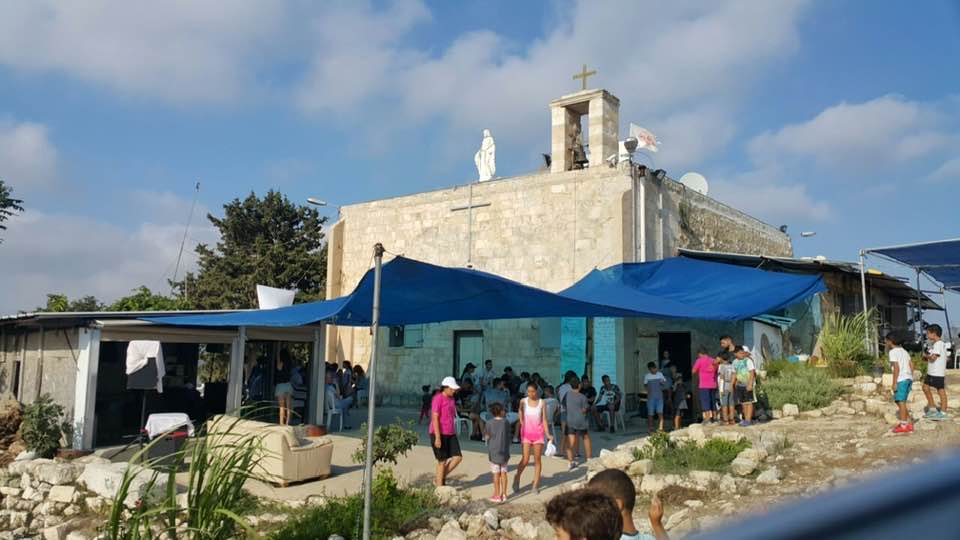
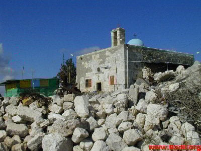
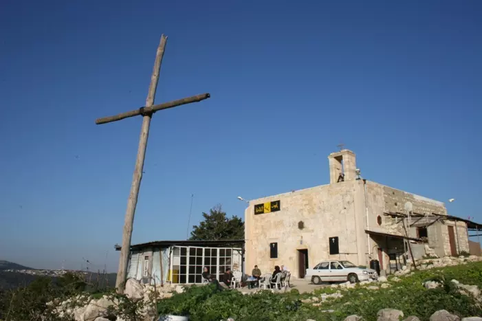
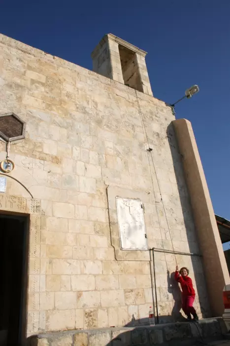
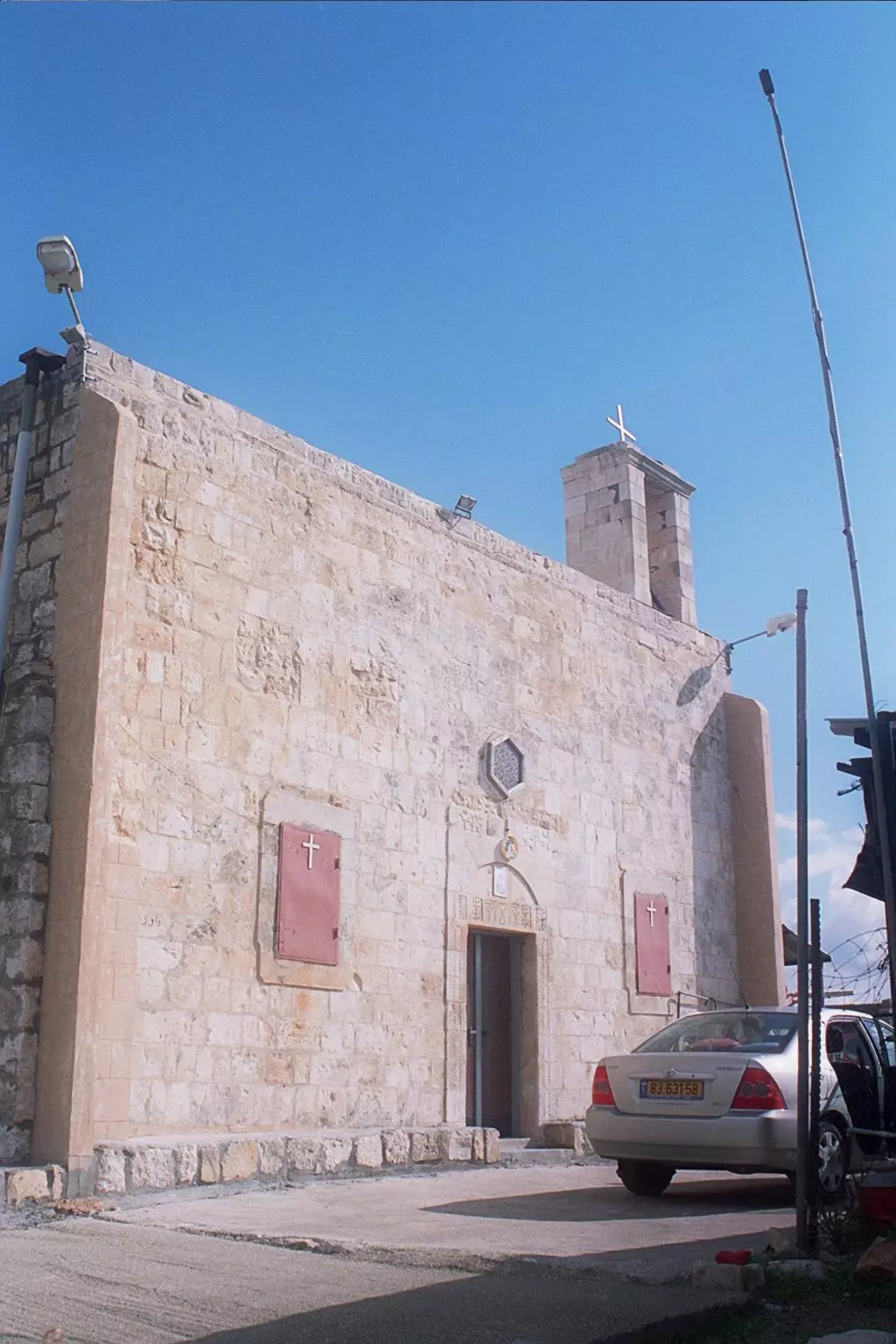
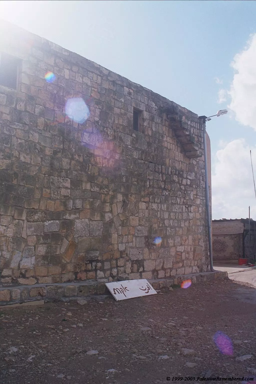
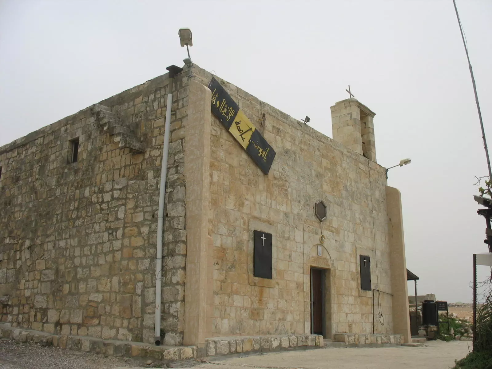
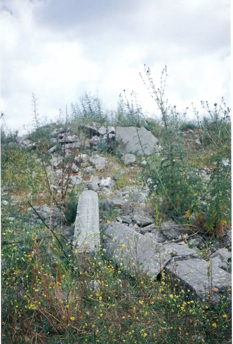
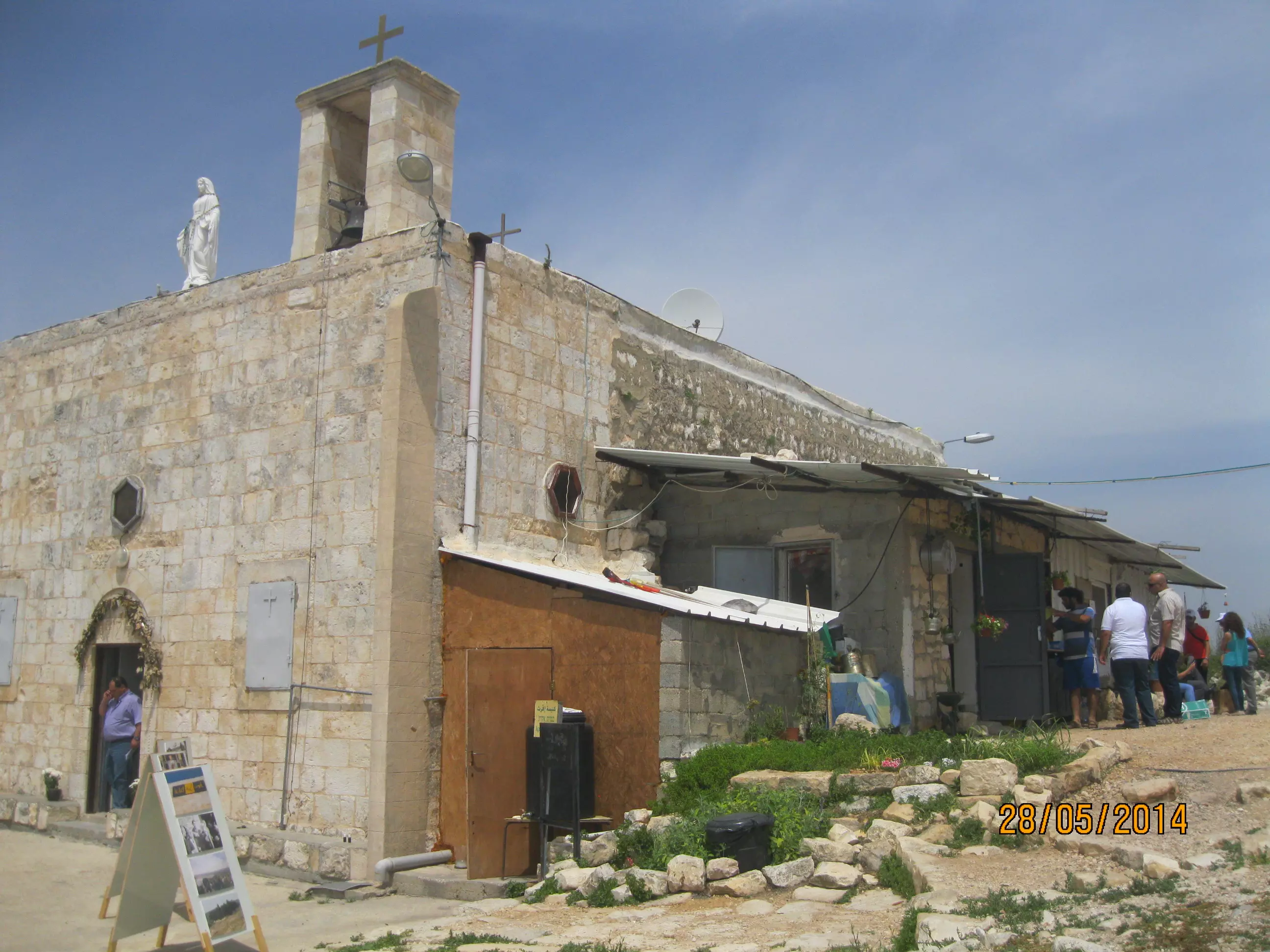
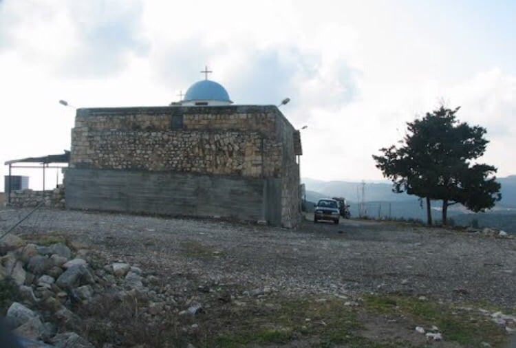
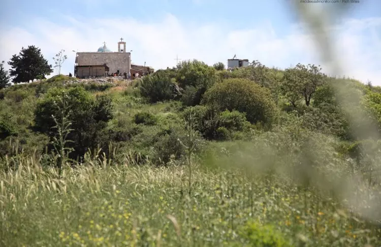
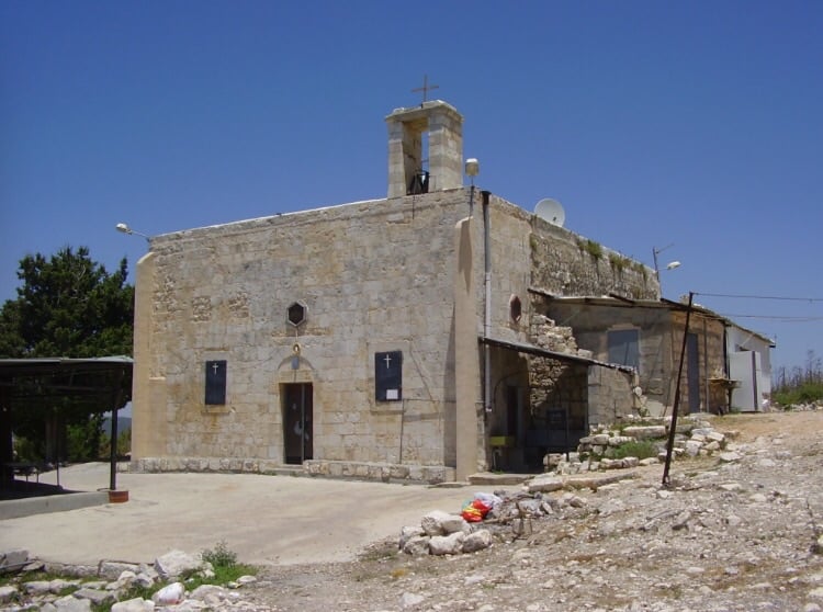
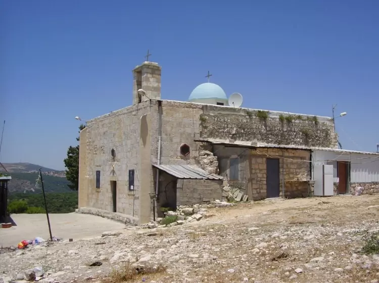
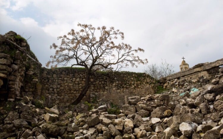
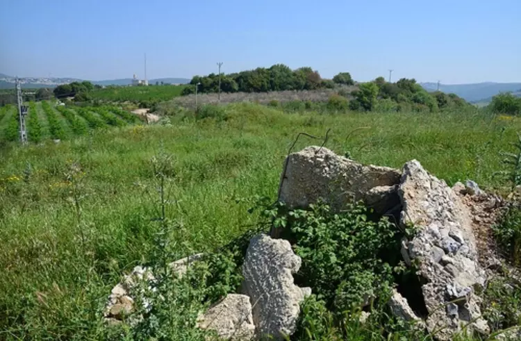
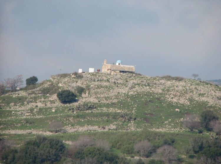
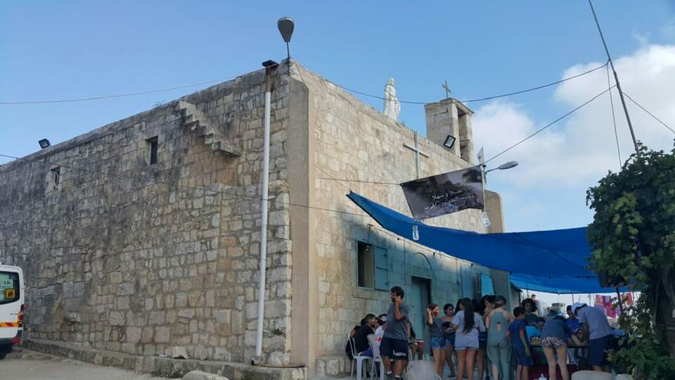
| Village Temains | Iqrit was mostly destroyed with the exception of the village church. However, it requires renovations, any volunteers guys! | ||||||||||||||
| Ethnically Cleansing | In November 1948, Iqrit was completely ethnically cleansed. | ||||||||||||||
| Pre-Nakba Land Ownership |
**Town Lands' Demarcation Maps |
||||||||||||||
| Land Usage As of 1945 |
|
||||||||||||||
| Population |
|
||||||||||||||
| Number of Houses |
|
||||||||||||||
| Near By Towns |
|||||||||||||||
|
|
|||||||||||||||
| Town's Name Through History | The Crusades referred to Iqrit by Acref. | ||||||||||||||
| Schools | A private elementary school which was administrated by the Greek Orthodox Archdiocese. | ||||||||||||||
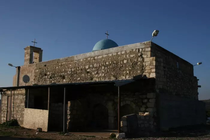
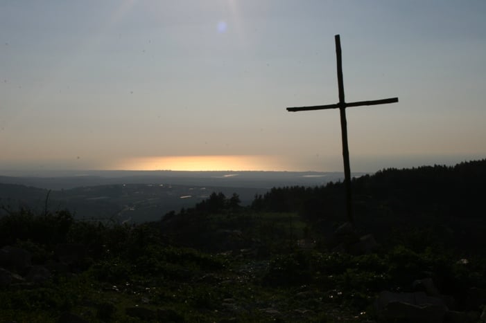
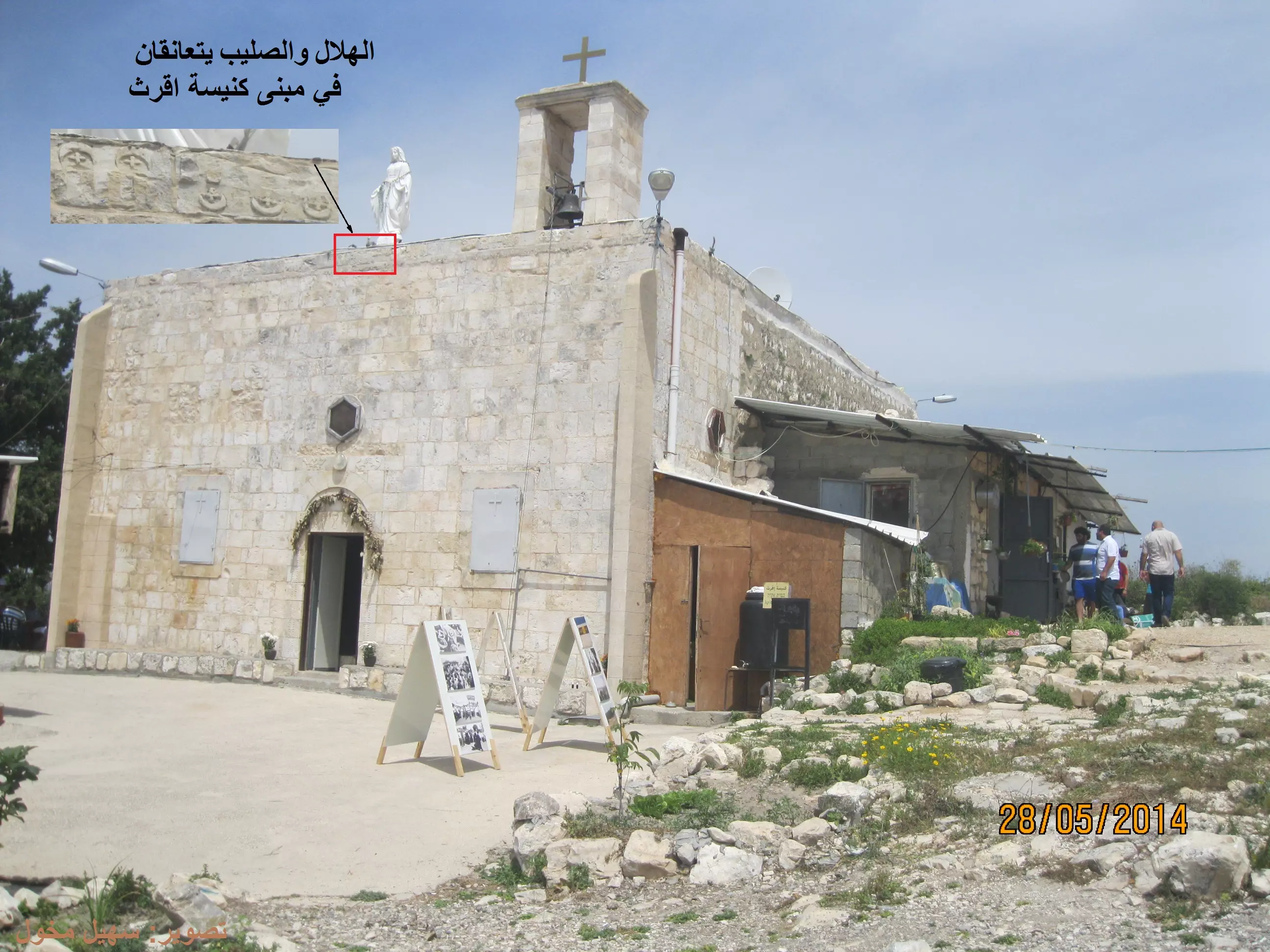
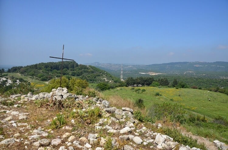
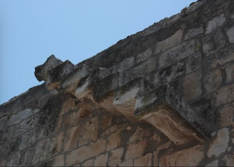
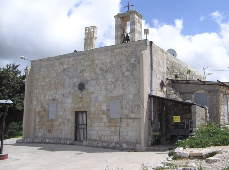
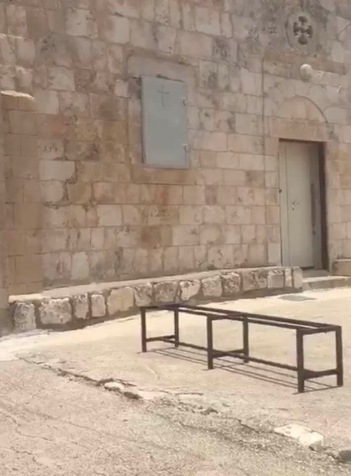
| Places of Warship | Big Greek Orthodox church remain standing, see Pictures section for details. | ||||||||||||||
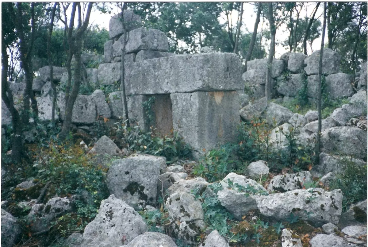
| Archeological Sites | Iqrit contains mosaic floors, remains of a wine press, rock-hewn tombs, cisterns, and granite implements. The village also has many other archaeological sites in its vicinity. | ||||||||||||||
| Exculsive Jewish Colonies That Usurped Village Lands |
Shomera, Even Menachem, Goren, Gomot ha-Galil, & Yoqrat | ||||||||||||||
| Featured Video | |||||||||||||||
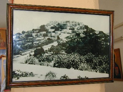
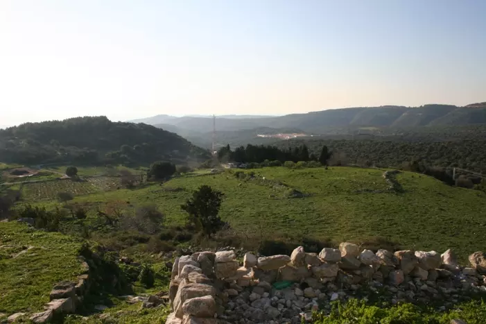
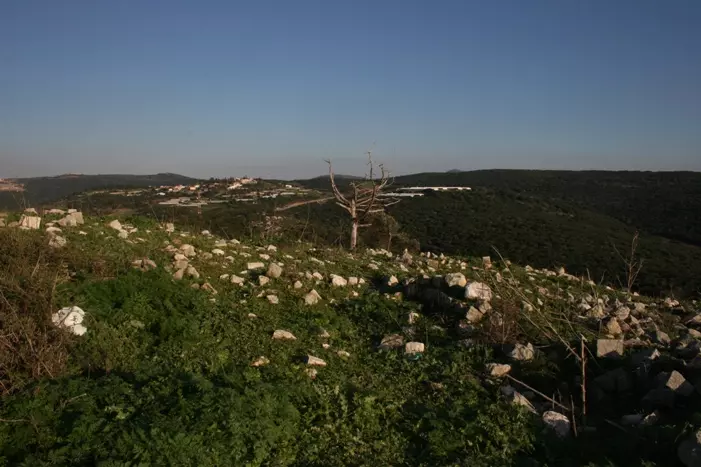
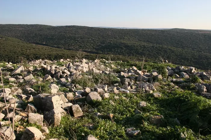
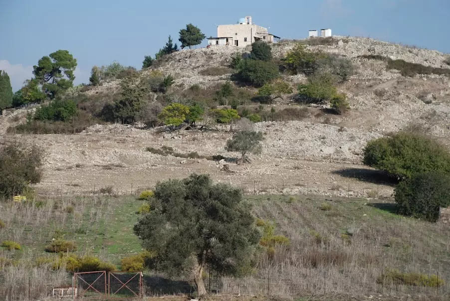
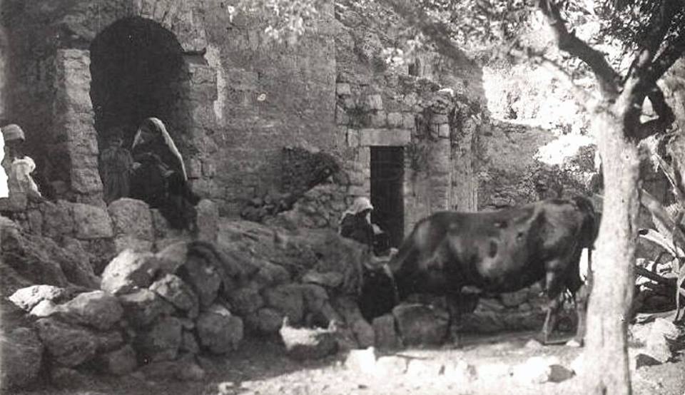
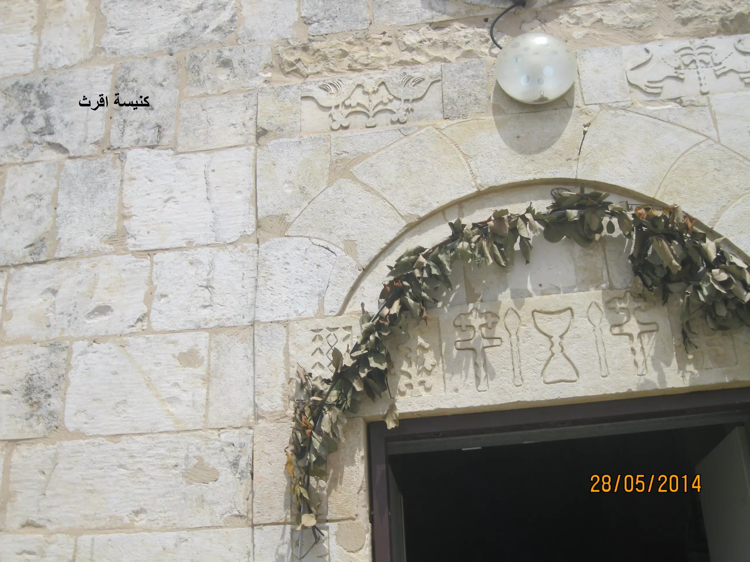
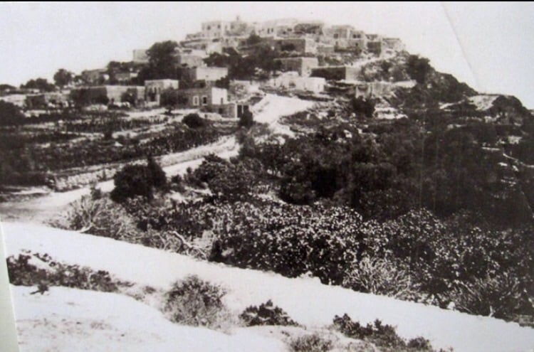
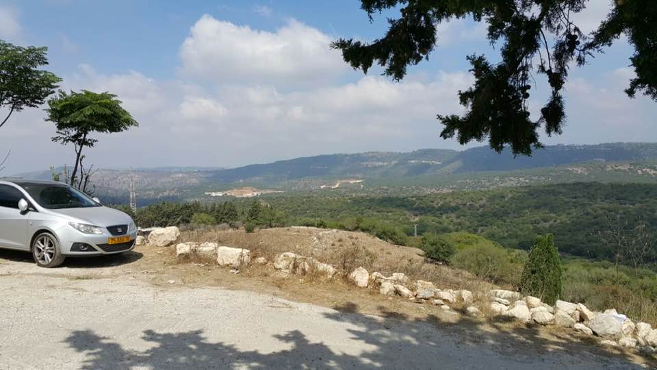
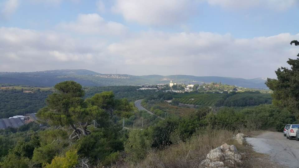
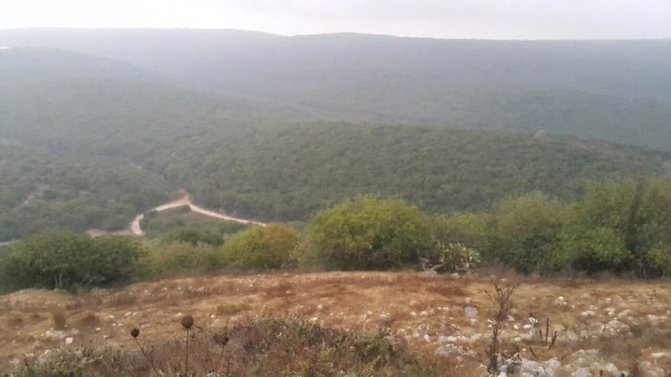
Village Before NakbaThe village was located on a steep hill a few kilometers from the Lebanese border. It overlooked uneven terrain on the east and Wadi al-Bassa (which descended towards the sea) on the west. A secondary road, on which a good number of villages were also located, linked it to the Acre-Ra's al-Naqura coastal highway. Iqrit could be traced back to the Canaanites, who erected a statue on the site representing the god Melqart of Tyre. The Crusaders occupied it and called it Acref. Like other villages in Palestine, Iqrit was devastated by the events of the Crusades. It was subsequently rebuilt, and by 1596 this village in the nahiya of Tibnin (liwa' of Safad) had a population of 374. It paid taxes on goats and beehives and on its press, which was used for processing either olives or grapes. In the late nineteenth century, Iqrit had a population of about 100. The buildings in the village were made of stone and included a modern chapel. Situated on a tell, the village was surrounded by arable land, which the villagers planted with fig and olive trees.When the British and French defined the border between Lebanon and Palestine in 1923, they included Iqrit in Palestine. Iqrit's population was made up of 460 Christians and 30 Muslims. The Greek Catholic Archdiocese built and ran a private elementary school in the village. Numerous crops were cultivated on its land, such as wheat, barley, olives, figs, grapes, and tobacco. In 1944/45 a total of 1,888 dunums was allocated to cereals; 458 dunums were irrigated or used for orchards, of which 80 dunums were planted in olive trees. Most of the land, however, was wooded with oak and pine trees. The tell over which Iqrit was built contained mosaic floors, the remains of a wine press, rock-hewn tombs, cisterns, and granite implements. Other archaeological sites were located in the vicinity. Village Occupation and Ethnic CleaningThe History of the War of Independence states that Iqrit was one of the villages captured at the very end of Operation Hiram, after most of northern Galilee had already fallen. In a scramble to seize the rest of the region, the Israeli army's 'Oded Brigade continued to advance along the road parallel to the border with Lebanon, taking Iqrit and Tarbikha on 31 October 1948. The account adds that the villages surrendered to the Israeli army, and the villagers apparently remained in their homes.They did not remain there for long, however. Some ten days after the end of the battles on the northern front, they were summarily expelled. Along with several other villages, Iqrit fell prey to the 'principle of an Arab–less border strip,' according to Israeli historian Benny Morris. This was approved by the General Staff of the Israeli army in the second week of November 1948. At Iqrit, the soldiers told the villagers that their eviction would be temporary and that they would soon be allowed to return. Some were dispersed to Lebanon; others were trucked by the Israelis to the Palestinian village of al-Rama, some 20 km to the south. For some years there-after, and together with the inhabitants of several other villages that had received similar treatment, the people of Iqrit continued to plead with the Israeli authorities that they be allowed to return to their villages, to no avail. Morris writes that the case of Iqrit and two other border villages in particular illustrates how deeply rooted was the IDF's [Israel Defense Force's] determination from November 1948 onwards to create a northern border strip free of Arabs.' Zionists Colonies on Village LandsThe settlements of Shomera, founded in 1949, and Even Menachem, founded in 1960, are on the border between the village lands and the lands of Tarbikha, northeast and east of the village site. Goren, established in 1950, is on village lands west of the site. Gornot ha-Galil was established on village lands in 1980.Village TodayThe only extant landmark is the Greek Catholic church—a stone structure with a flat roof from which a rectangular belfry rises. It has a rectangular doorway with a decorative round arch and carvings atop the lintel. An assortment of crosses is placed in niches of the front facade, including a cross above the arch and a large Latin cross on the (locked) door, flanked by two smaller crosses on the upper quadrants of the door. The church is untended and discolored. Otherwise the site contains nothing but stone rubble, and is overgrown with fig and pomegranate trees and other flora. There is a cow shed on village land.SourceDr. Walid al-Khalidi, 1992: All That Remains. |
|||||||||||||||
| Related Maps | Town Lands' Demarcation Maps خرائط للقضاء توضح حدود القرى والاودية Town's map on MapQuest View from satellite Help us map this town at WikiMapia |
||||||||||||||
| Related Links | Wikipedia's Page Google Search Google For Images Google For Videos |
||||||||||||||
| More Information | في كتاب كي لا ننسى في كتاب بلادنا فلسطين المزيد من موقع هوية |
||||||||||||||
- Justice for Ikrit and Biram by Ha'aretz Daily
- Ha'aretz Daily: Sharon asks court to reject appeal of Ikrit, Biram residents
- قناديل لا تنطفئ على درب العودة . . د. إبراهيم رزق عطاالله
- نبذة تاريخية عن قرية إقرت (قضاء عكا) من كتاب (
كي لا ننسى ) - الصليب يعانق الهلال في قرية إقرث
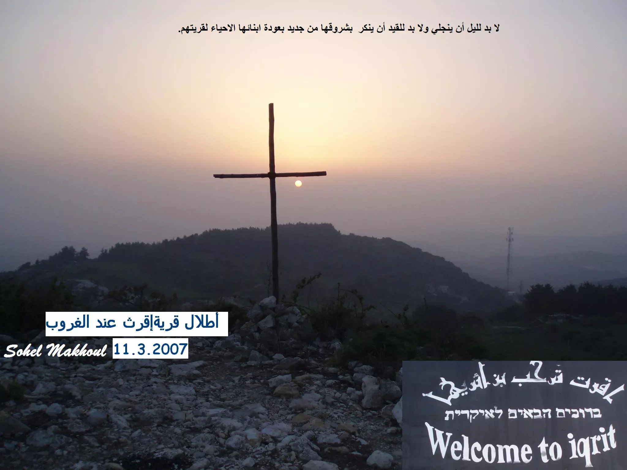
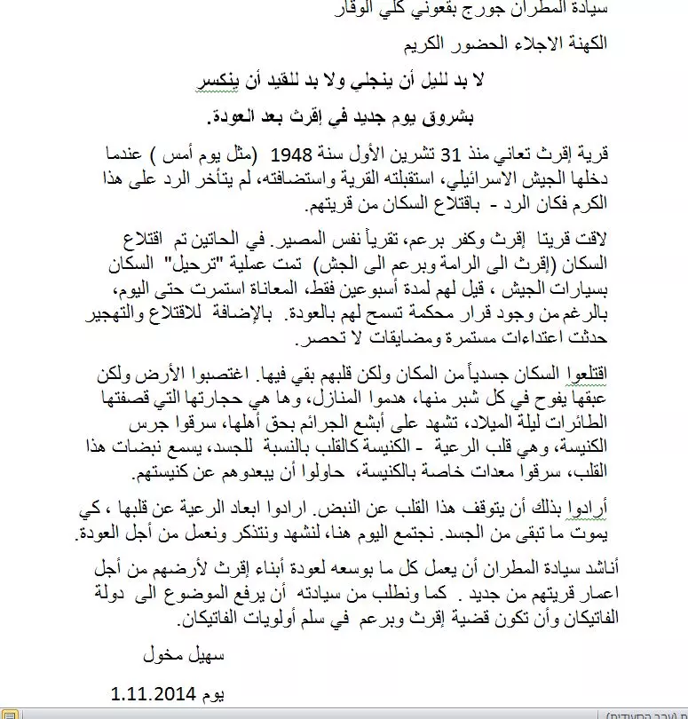
- لا بد لليل أن ينجلي ولا بد للقيد أن ينكسر بشروق يوم جديد في إقرث بعد العودة.
- Iqrit Church In 1990
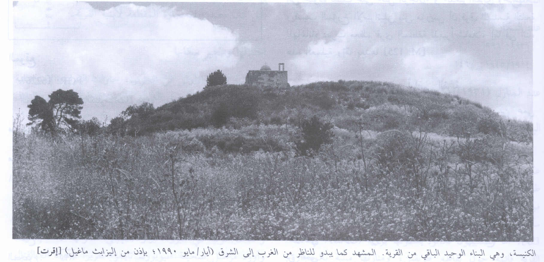
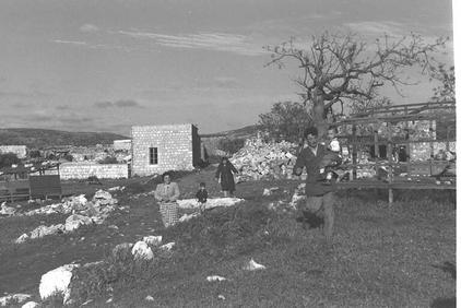
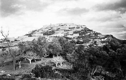
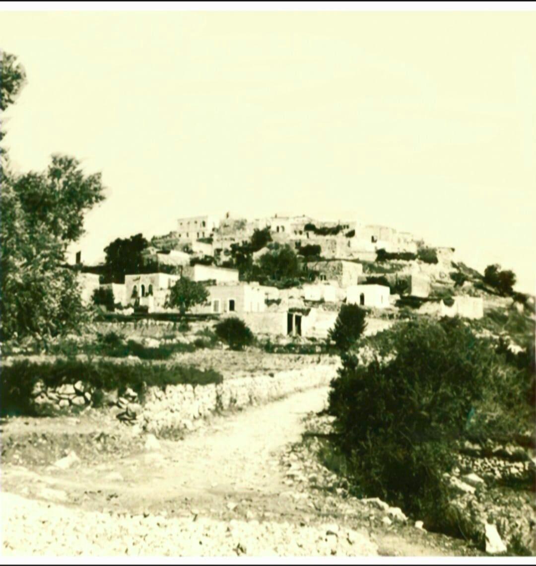
Scanned from "All That Remains" by Dr. Walid Khalidi - Village Site Before Destruction In 1935
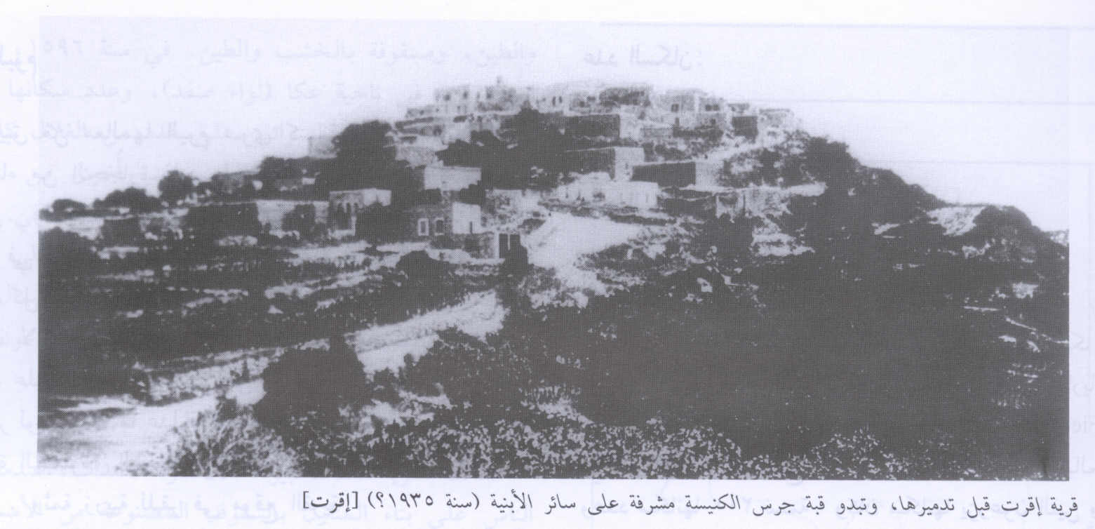
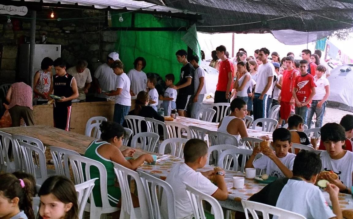
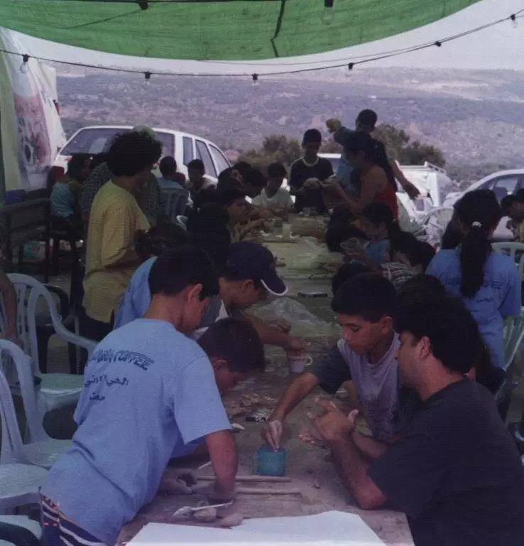
Scanned from "All That Remains" by Dr. Walid Khalidi - مخيم الجذور العاشر لمهجري إقرث, 23 حتى 27 تموز 2005
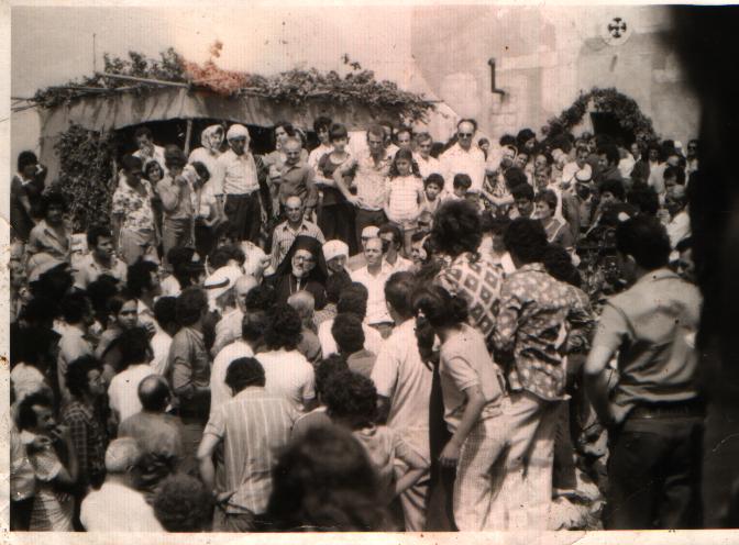
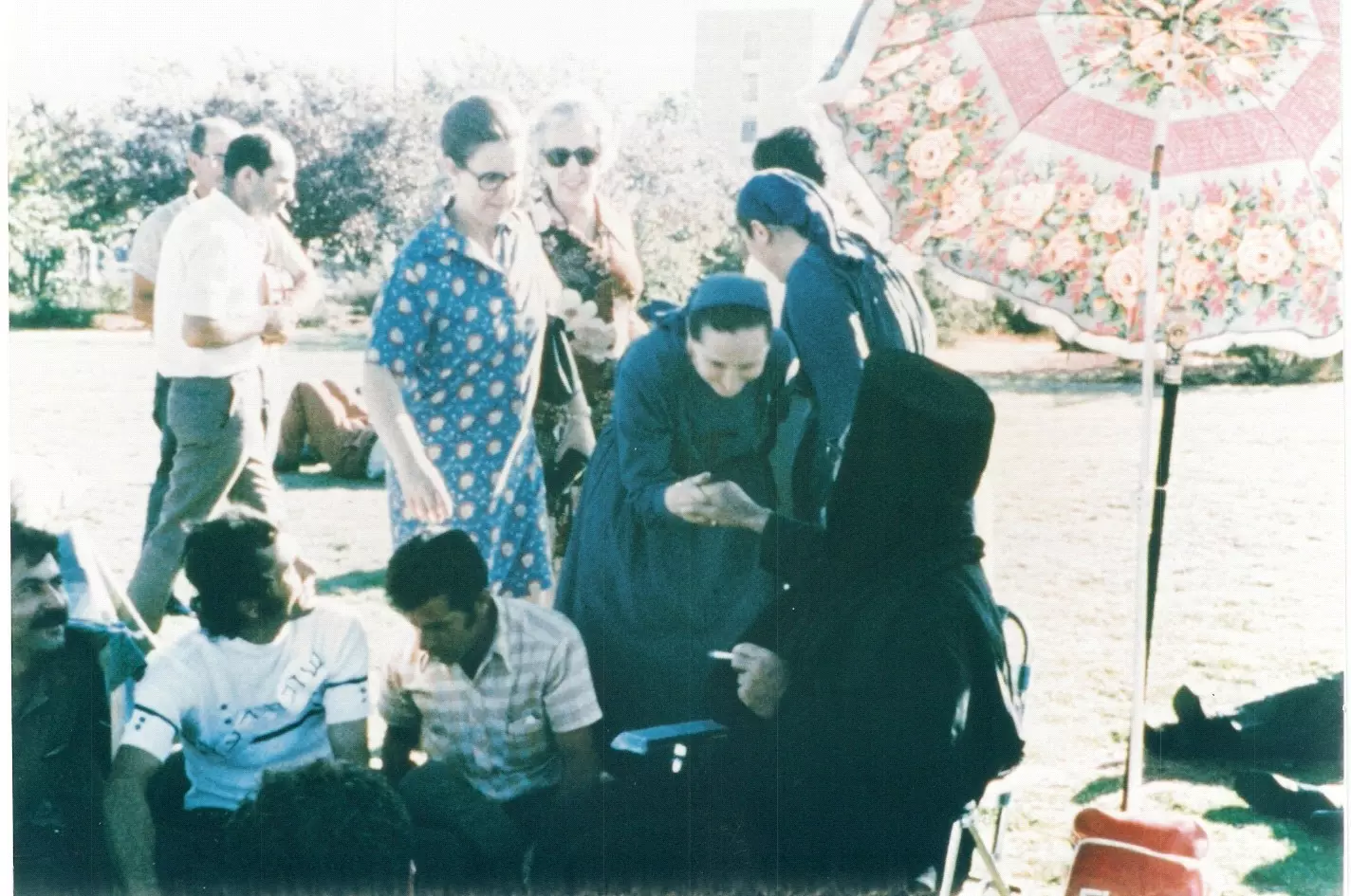
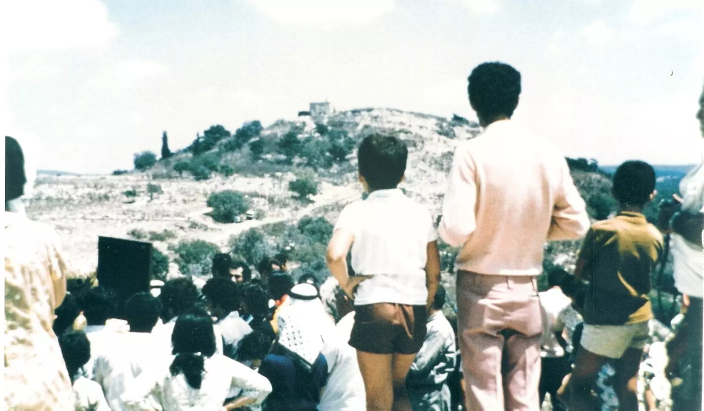
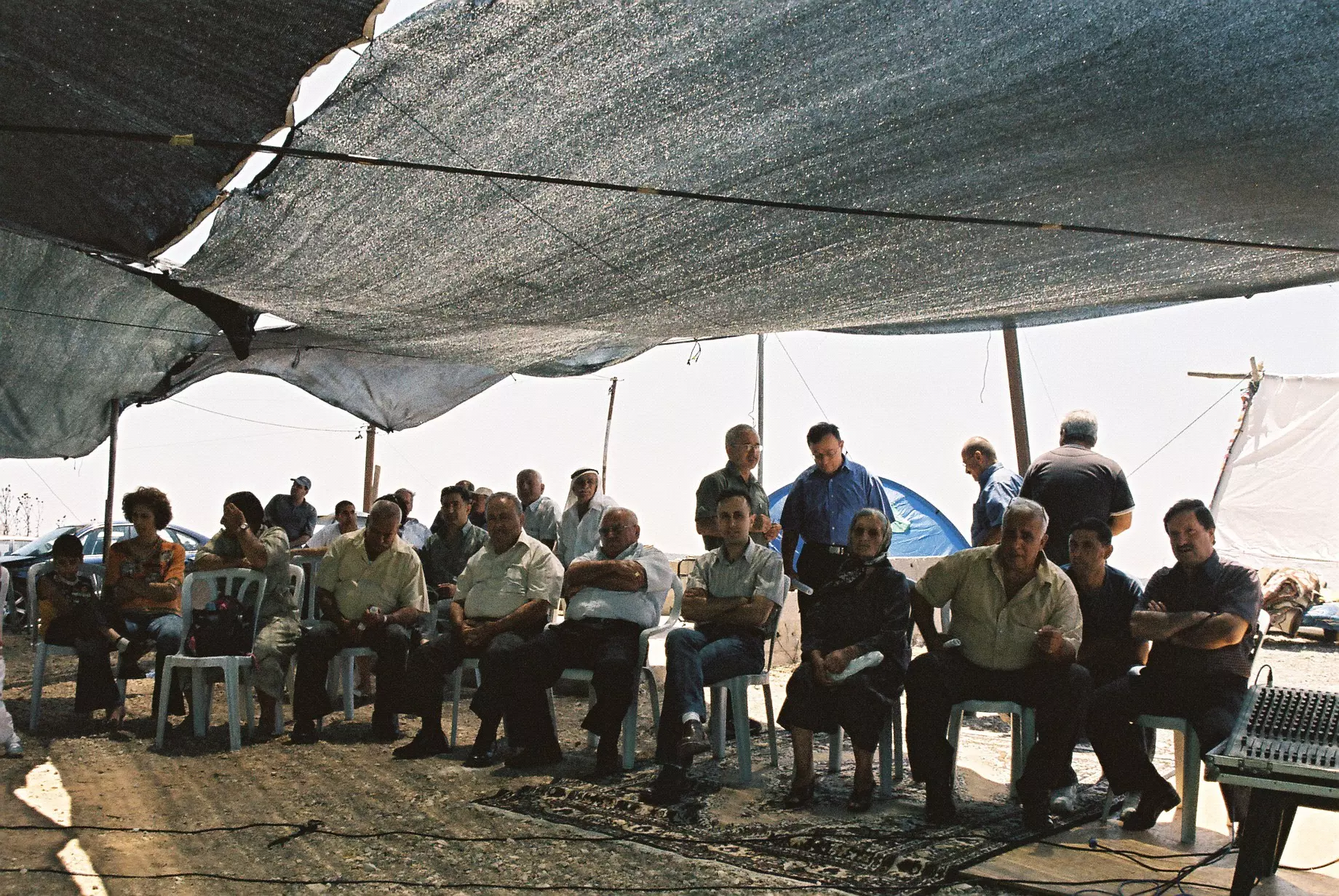
Posted by د.إبراهيم رزق عطاالله - سفرة تضامنية مع أهالي إقرث في 5 آب 1972 شملت طلاب ومحاضري الجامعات وأدباء وفنانين . يظهر في مركز الصورة المطران يوسف ريا يقوي عزائم المعتصمين في القرية.
Posted by د.إبراهيم رزق عطاالله - إعتصام مهجري إقرث, 14 تشرين الأول 1995 حتى آب .1996
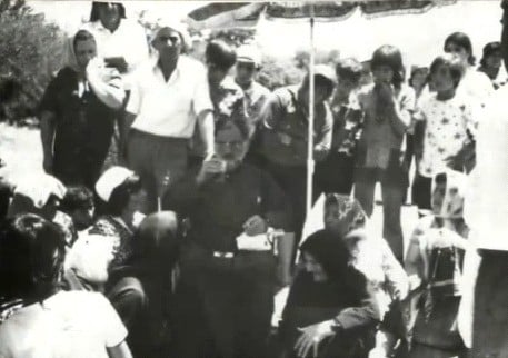
Posted by د.إبراهيم رزق عطاالله - إعتصام أهالي إقرث ومؤيدوهم في القدس أمام مباني الكنيست في 15 تموز 1973.
Posted by د.إبراهيم رزق عطاالله - An old picture of Iqrit in 1935
Posted by BADIL Organization - تأبين مثلث الرحمة المطران يوسف ريا في إفتتاح مخيم الجذور العاشر لمهجري إقرث لما له من تاريخ نضالي من أجل عودة المهجرين, 23 تموز 2005
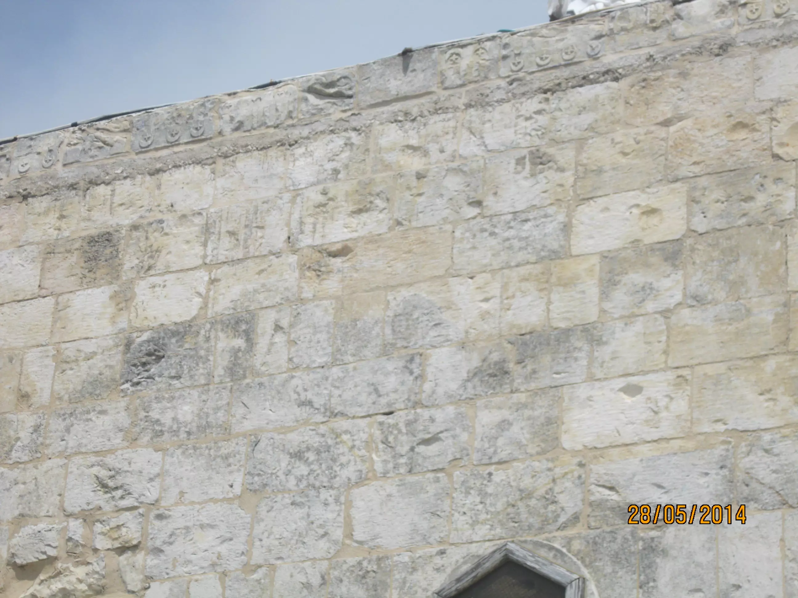
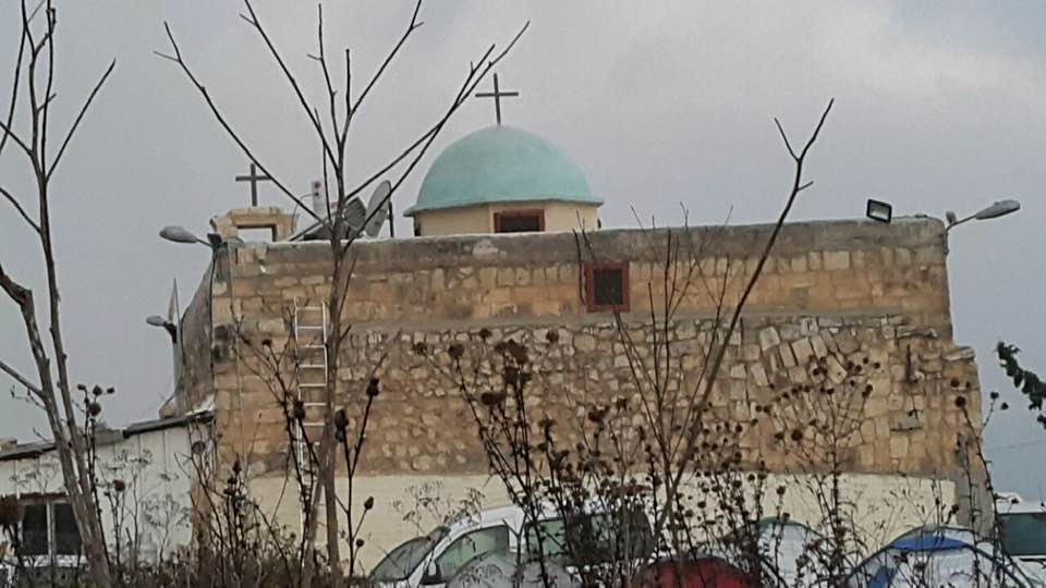
Posted by د.إبراهيم رزق عطاالله - Iqrit's church, the sole remaining building on village lands
Posted by BADIL Organization - Inside the village Church
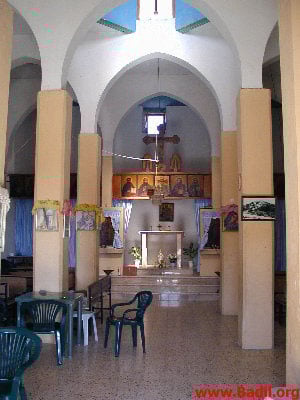
Posted by BADIL Organization - Village Church #2
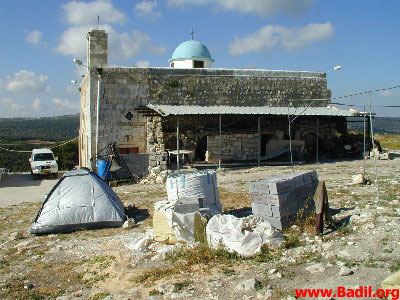
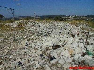
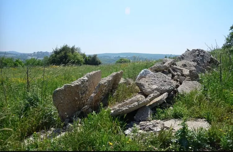
Posted by BADIL Organization - Village house rubble
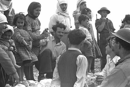
Posted by BADIL Organization - Jewish immigrants in Iqrit soon after occupation, 1950
1 - كنيسة اقرث - 18.2.2006 - تصوير مقبولة نصار
Posted by Makbula Nassar - كنيسة اقرث - 18.2.2006 - تصوير مقبولة نصار
Posted by Makbula Nassar - اقرث عائدة الى اهلها - 18.2.2006 - تصوير مقبولة نصار
Posted by Makbula Nassar 1 - طفلة تقرع جرس الكنيسة 18.2.2006 تصوير مقبولة نصار
Posted by Makbula Nassar - منظر عام للغرب 18.2.2006 تصوير مقبولة نصار
Posted by Makbula Nassar - منظر عام للغرب 18.2.2006 تصوير مقبولة نصار
Posted by Makbula Nassar 1 - اثار الهدم 18.2.2006 تصوير مقبولة نصار
Posted by Makbula Nassar - اثار الهدم 18.2.2006 تصوير مقبولة نصار
Posted by Makbula Nassar - البحر في الافق 18.2.2006 تصوير مقبولة نصار
Posted by Makbula Nassar - The only remain structure in Iqrit, its church
Posted by Uri Zackhem - The only remain structure in Iqrit, its church #2
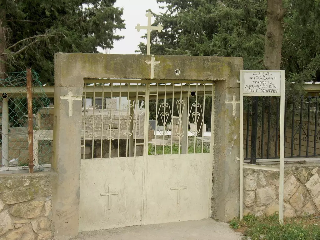
Posted by Uri Zackhem - The village's cemetery still being matained by the internal Palestinian refugees
Posted by Noga Kadman - The Church, the only remaining structure
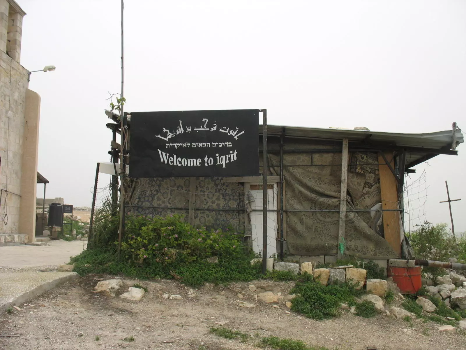
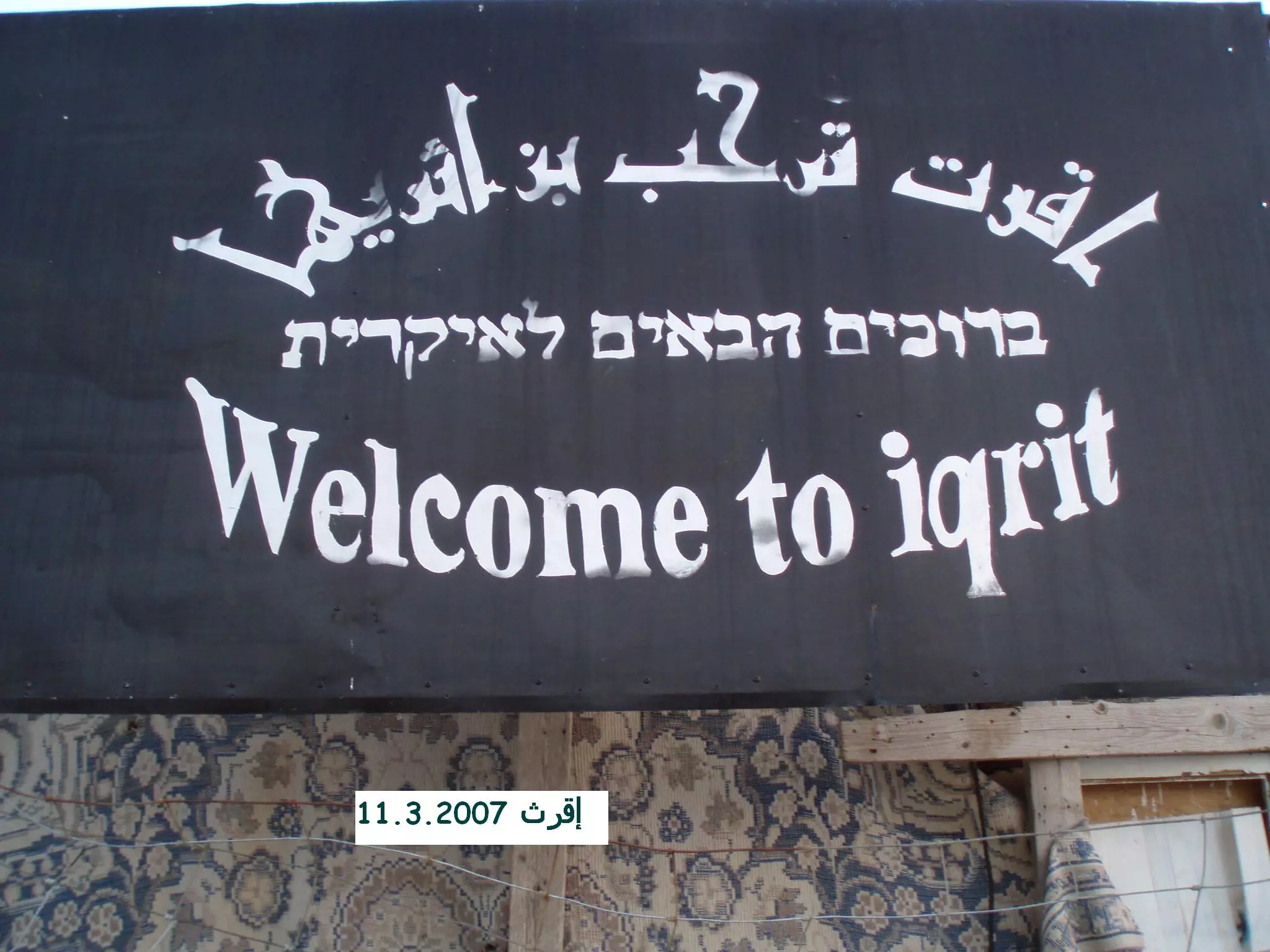
Posted by Noga Kadman - Welcome to 'Iqrit
Posted by Noga Kadman 1 - خربة مشمش - إقرث - تصوير د.إبراهيم عطاالله بتاريخ 5 أيار 1995
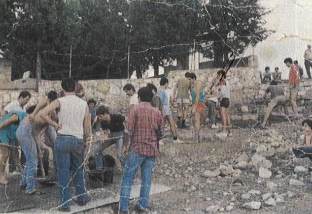
Posted by د.إبراهيم رزق عطاالله - مخيم عمل في إقرث 11 حتى 13 نيسان 1984 - ترميم الطريق المؤدية للمقبرة - عن كتاب 'إقرث قضية شعب, حق وأمل' للدكتور إبراهيم عطاالله
Posted by د.إبراهيم رزق عطاالله - أهالي إقرث تعود للإعتصام في الكنيسة بعد صد إعتداء مستوطني شوميرة في 18 تشرين الثاني 1995 - عن كتاب 'إقرث قضية شعب, حق وأمل' للدكتور إبراهيم عطاالله
Posted by د.إبراهيم رزق عطاالله - إعتصام أهالي إقرث في 20 تشرين الأول 1995 - عن كتاب 'إقرث قضية شعب, حق وأمل' للدكتور إبراهيم عطاالله
Posted by د.إبراهيم رزق عطاالله - سيادة المطران يوسف ريا يستقبل المؤيدين في الإضراب عن الطعام أمام الكنيست 15-17تموز1973 - عن كتاب 'إقرث قضية شعب, حق وأمل' للدكتور إبراهيم عطاالله
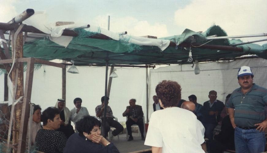
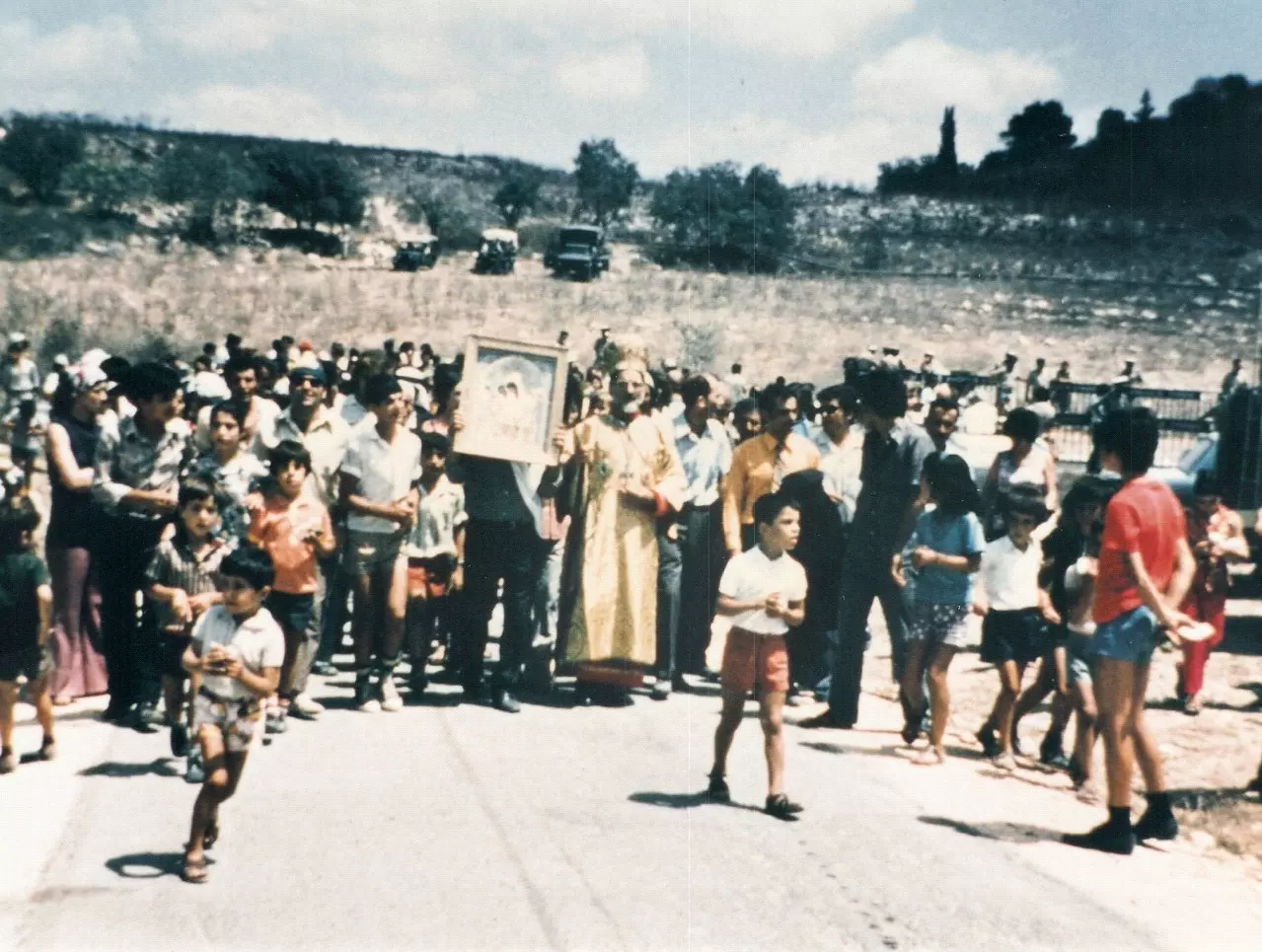
Posted by د.إبراهيم رزق عطاالله - الصلاة الإحتجاجية على 'ظهر البلاط', بعد أن منعت قوات الجيش الأهالي من الوصول لكنيستهم - 13 آب 1972 - عن كتاب 'إقرث قضية شعب, حق وأمل' للدكتور إبراهيم عطاال
Posted by د.إبراهيم رزق عطاالله - صف السحجة في إكليل راضي خياط على أرض إقرث 1974- عن كتاب 'إقرث قضية شعب, حق وأمل' للدكتور إبراهيم عطاالله
Posted by د.إبراهيم رزق عطاالله - قوات الجيش تحاصر تلة الكنيسة وتمنع وصول الأهالي إليها في 13 آب 1972. عن كتاب 'إقرث.. قضية شعب, حق وأمل' للدكتور إبراهيم رزق عطاالله.
Posted by د.إبراهيم رزق عطاالله - قوات الجيش تحاصر تلة الكنيسة وتمنع وصول الأهالي إليها في 13 آب 1972. يتوجه المهجرون لتلة البياض لتتميم مراسيم الصلاة من فوق 'سطح البلاط'. عن كتاب 'إقرث.. قضية شعب, حق وأمل' للدكتور إبراهيم رزق عطاالله.
Posted by د.إبراهيم رزق عطاالله - The Iqritian people start a sit-in strike in the Church, 24 june 1972. from 'Iqrit : Case of people, Justice & Hope". Dr. Ibraheem Attalla
Posted by د.إبراهيم رزق عطاالله - الإضراب عن الطعام مقابل الكنيست في القدس - 15 حتى 17 تموز 1973, عن كتاب 'إقرت, قضية شعب,حق وأمل' للدكتور إبراهيم رزق عطااللة
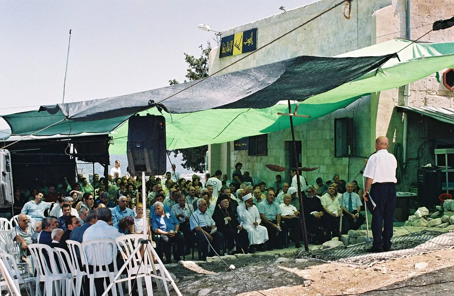
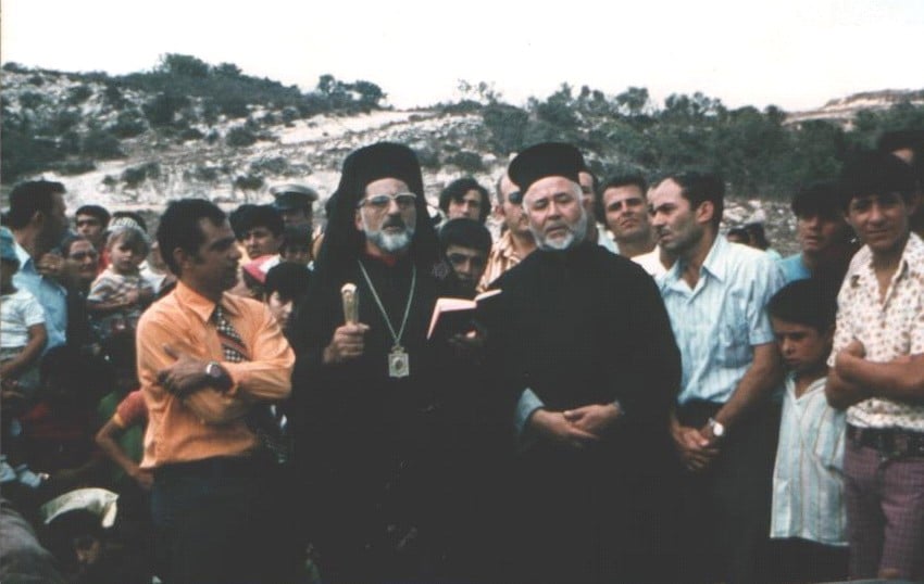
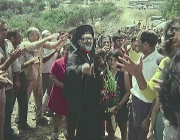
Posted by د.إبراهيم رزق عطاالله - تأبين مثلث الرحمة المطران يوسف ريّا في إقرث 23 تموز 2005, عن كتاب 'إقرت, قضية شعب,حق وأمل' للدكتور إبراهيم رزق عطاالله
Posted by د.إبراهيم رزق عطاالله - قبيل القداس الإحتفائي في إقرث 27 كانون الأول 1995 , عن كتاب 'إقرت, قضية شعب,حق وأمل' للدكتور إبراهيم رزق عطااللة
Posted by د.إبراهيم رزق عطاالله - تأبين مثلث الرحمة المطران يوسف ريّا في إقرث, 23 تموز 2005, عن كتاب 'إقرت, قضية شعب,حق وأمل' للدكتور إبراهيم رزق عطااللة
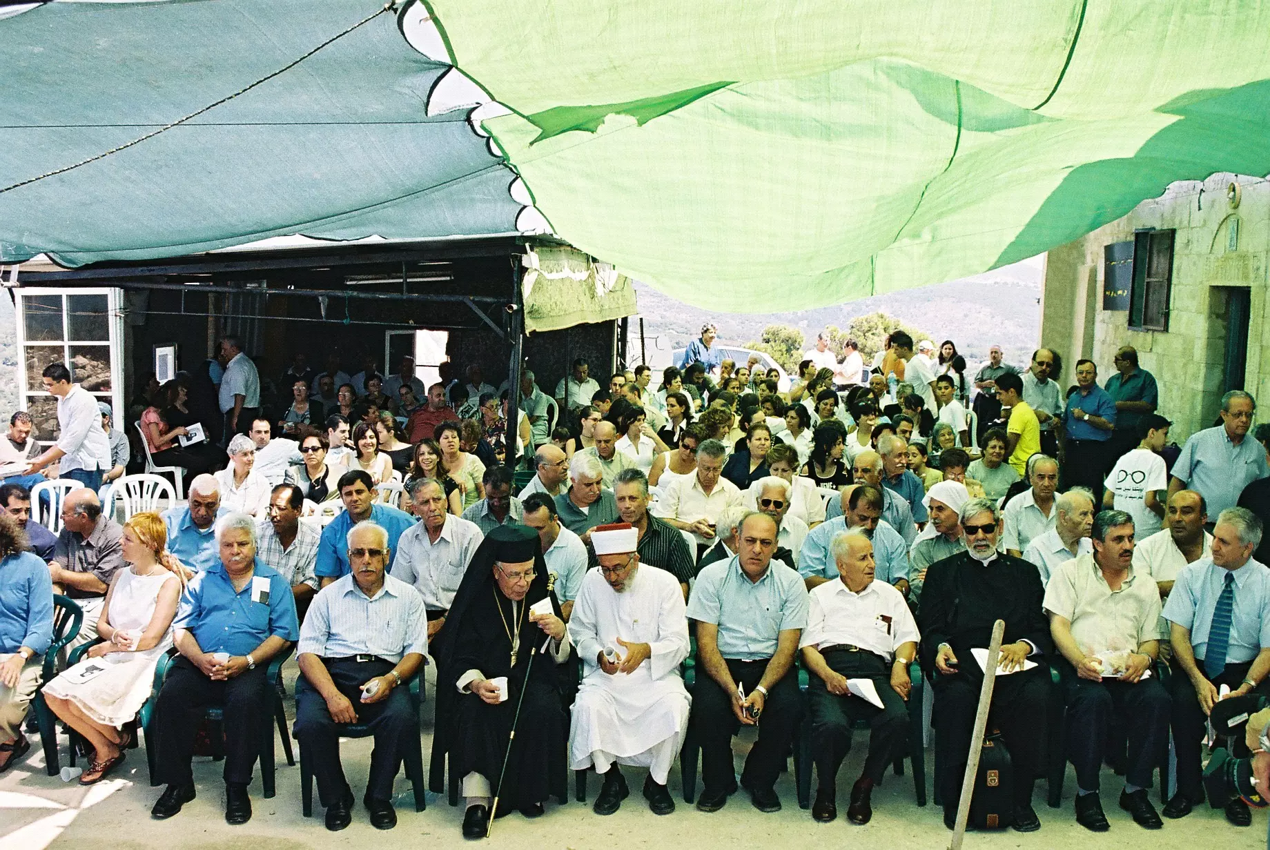
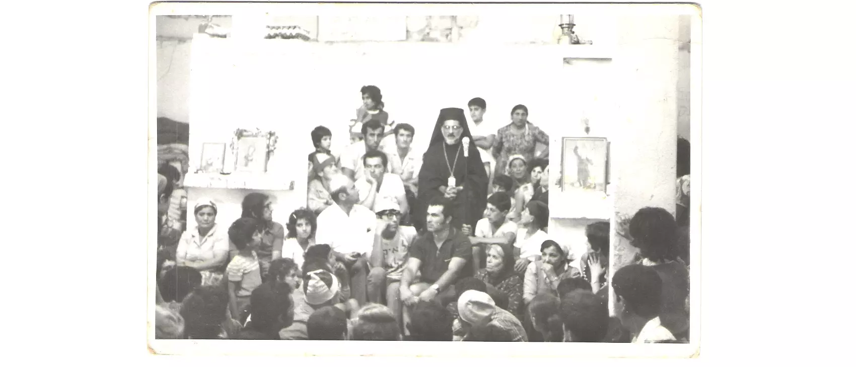
Posted by د.إبراهيم رزق عطاالله - سيادة المطران يعلن عن إقرت رعية مستقلة - كانون الثاني 2006 - د. إبراهيم رزق عطاالله.
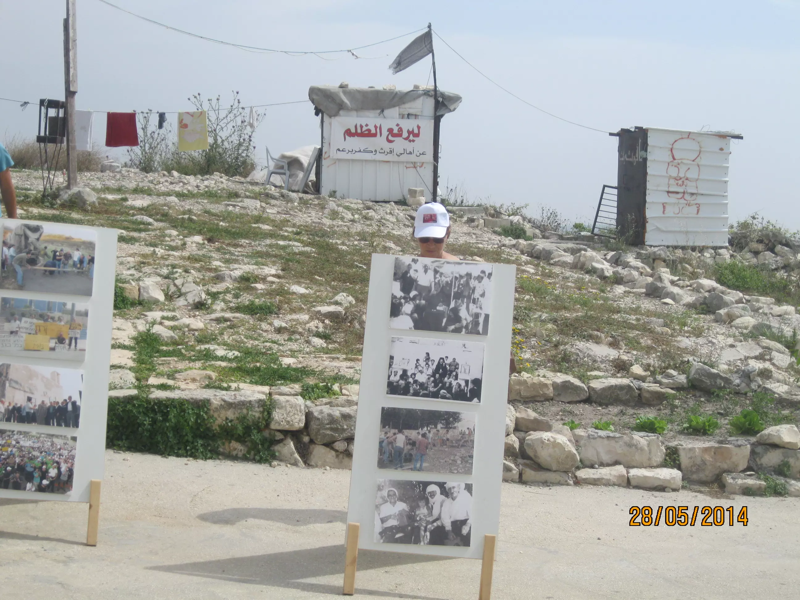
Posted by د.إبراهيم رزق عطاالله - لافتة الإعتصام تشرين الأول 1995 -تصميم وتصوير د.إبراهيم رزق عطاالله.
Posted by د.إبراهيم رزق عطاالله - أنقاض بيت مدمر نيسان 1995 - عن كتاب 'إقرث قضية شعب, حق وأمل', د.إبراهيم رزق عطاالله
Posted by د.إبراهيم رزق عطاالله - مخيم أهالي إقرت 2001- عن كتاب 'إقرث قضية شعب, حق وأمل', د.إبراهيم رزق عطاالله
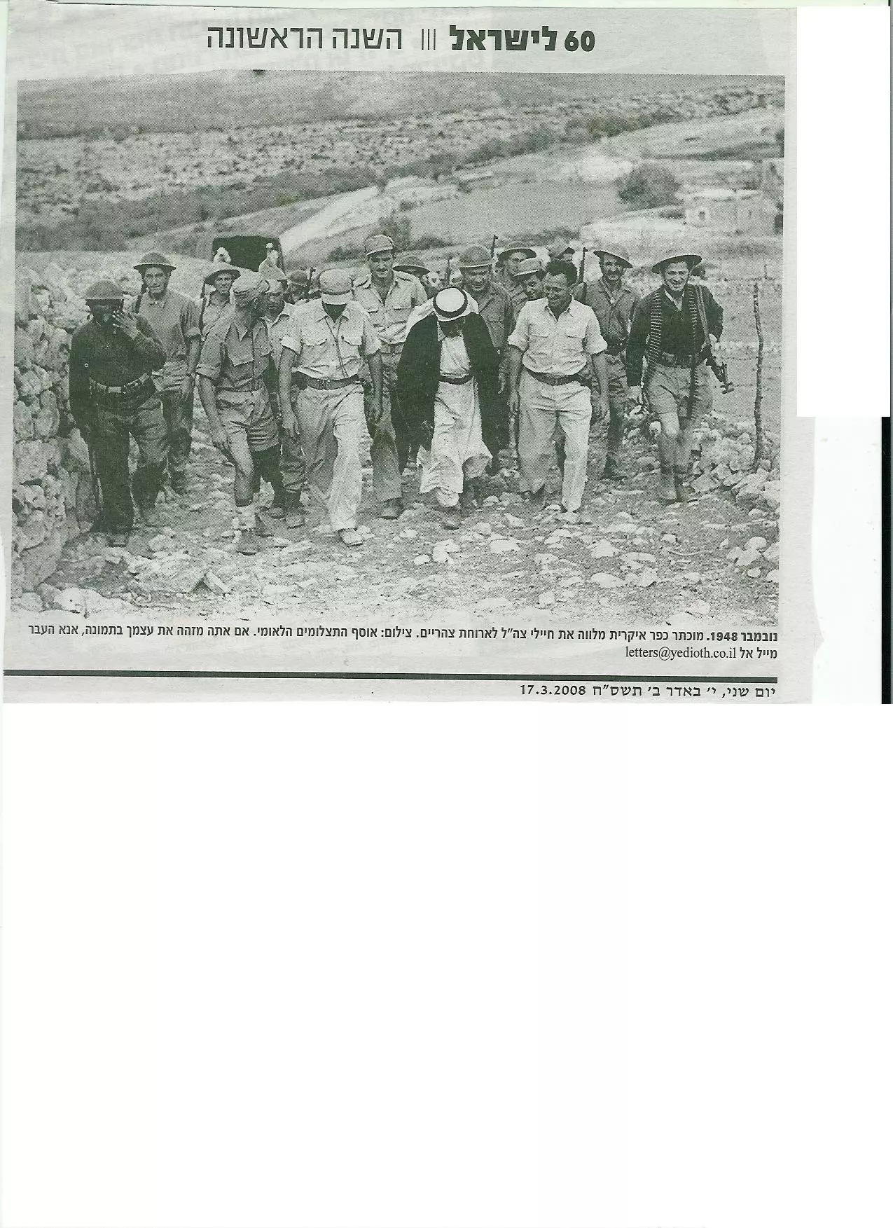
Posted by د.إبراهيم رزق عطاالله - الجيش في إقرت , تشرين الثاني 1948
Posted by د.إبراهيم رزق عطاالله - قدس الأب سهيل خوري في القداس في إقرث - 23 تموز 2007 - تصوير د. إبراهيم عطاالله.

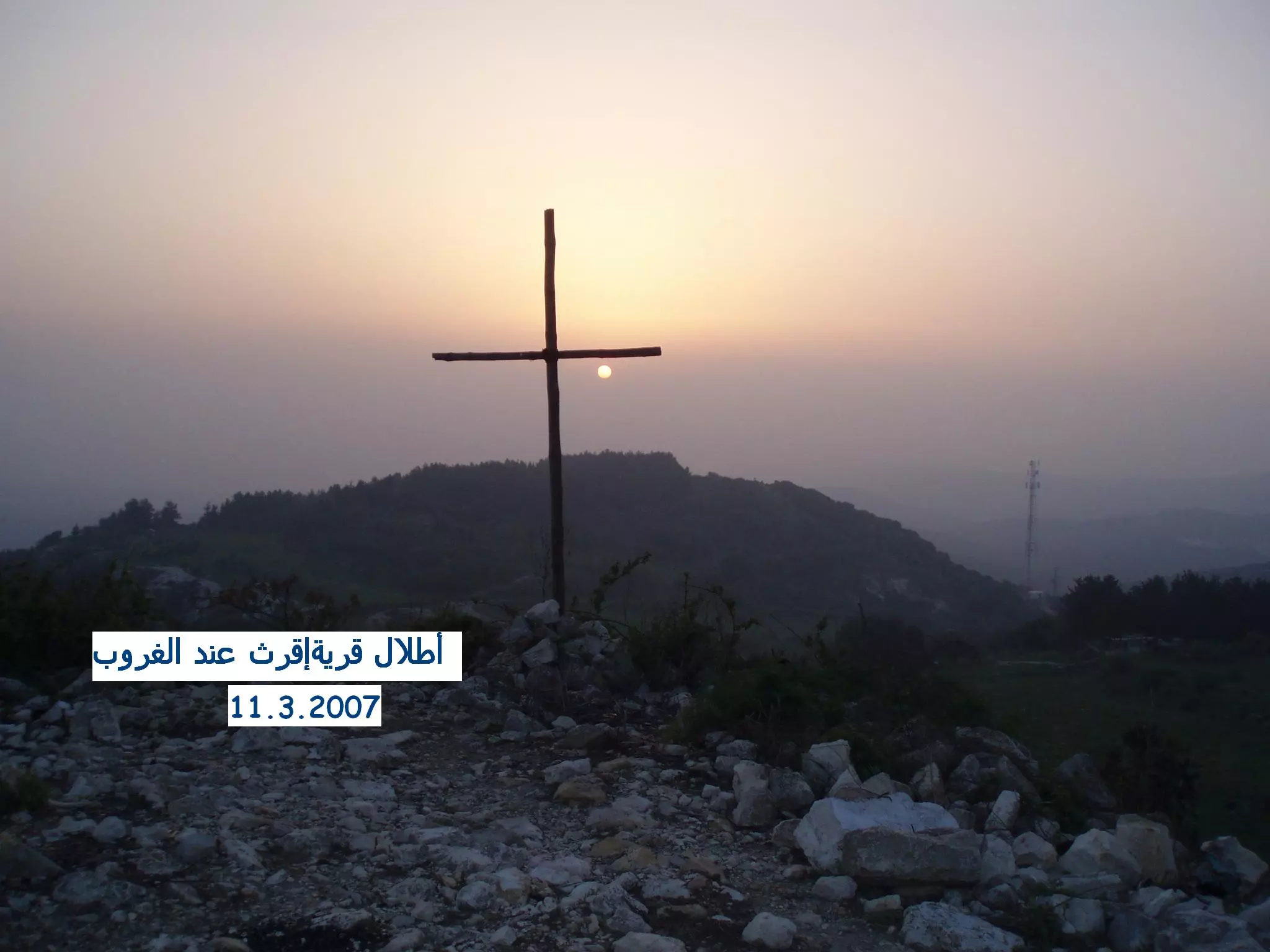
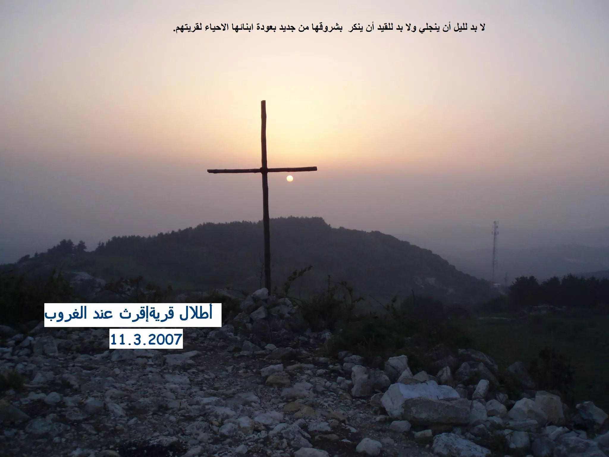
Posted by د.إبراهيم رزق عطاالله - أطلال قرية إقرث عند الغروب - تصوير سهيل مخول
Posted by سهيل مخول - قرية إقرث ترحب بكم للعودة أحياء - تصوير الاستاذ سهيل مخول
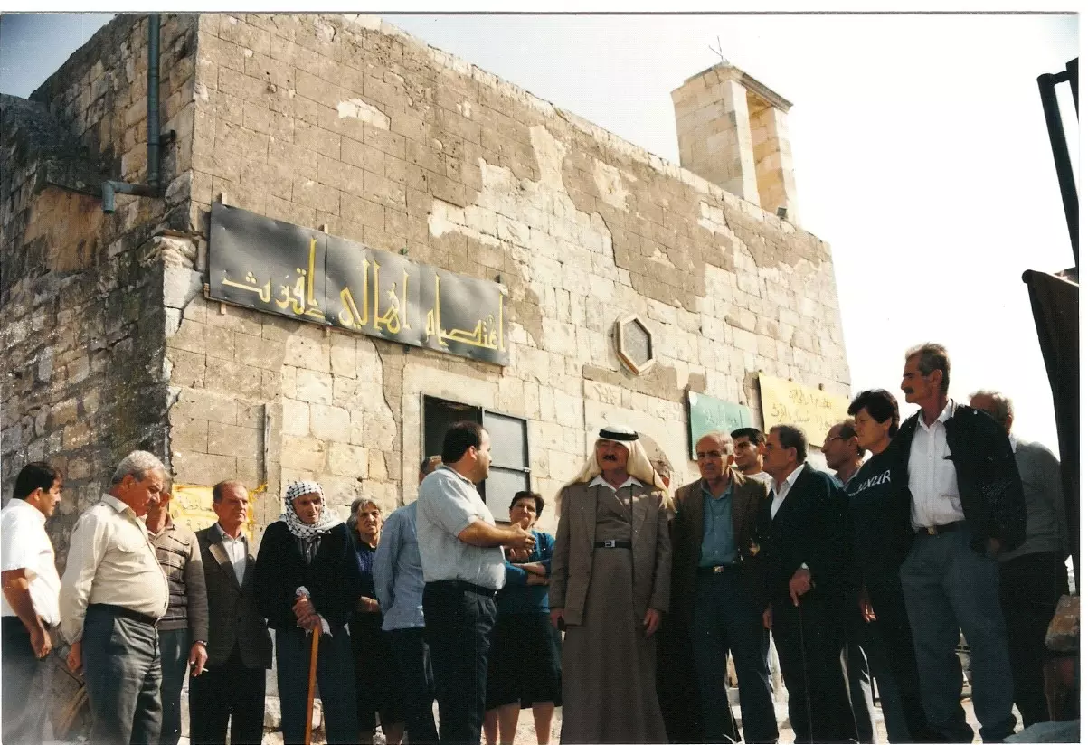
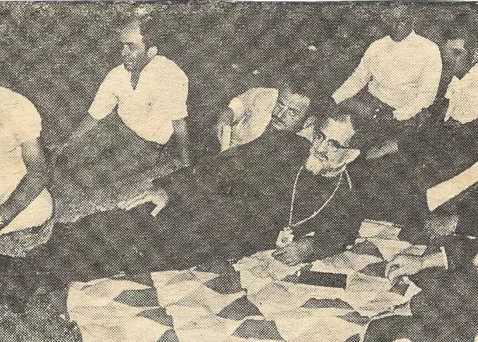
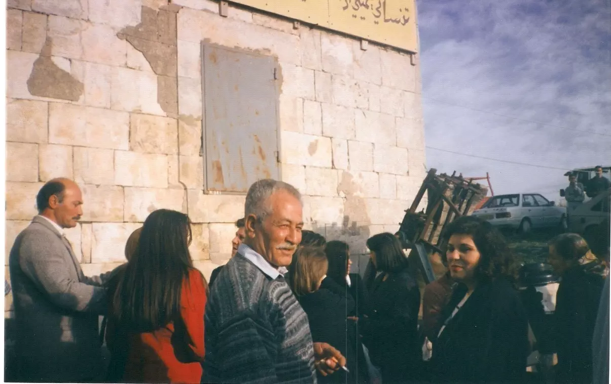
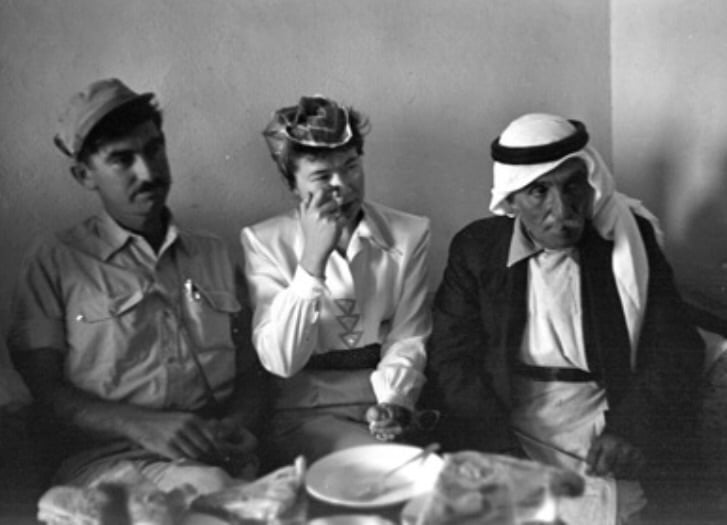
Posted by سهيل مخول - مختار اقرث والحاكم العسكري
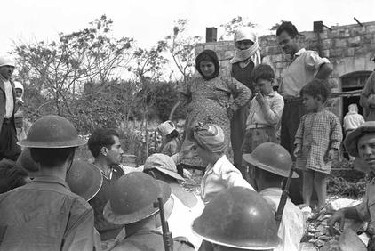
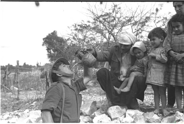
Posted by Raneen G. 2 - Iqrit 1948 - Villagers and IDF soldiers in Iqrit, 3 November 1948
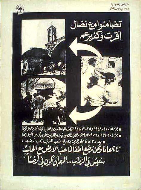
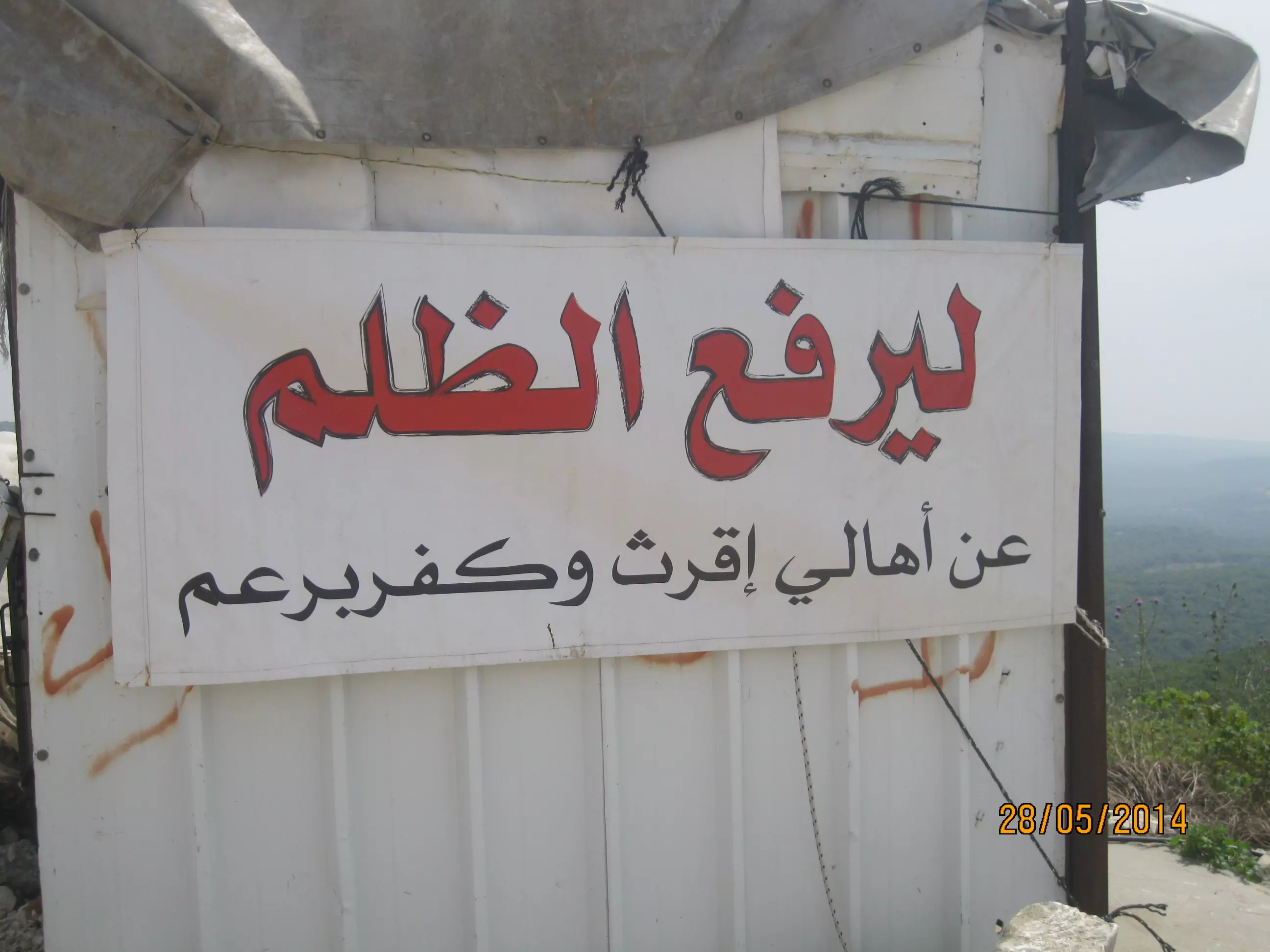
Posted by issam mattar - Iqrit and Kafr Bir'im/Arabic translation: We are in solidarity with the fighters of Iqrit and Kfar Bir'im
Posted by issam mattar - صورة رائعة لإقرت وتظهر كنيستها الشامخة
- صورة لقرية اقرث عام 1932، أحمد مروات
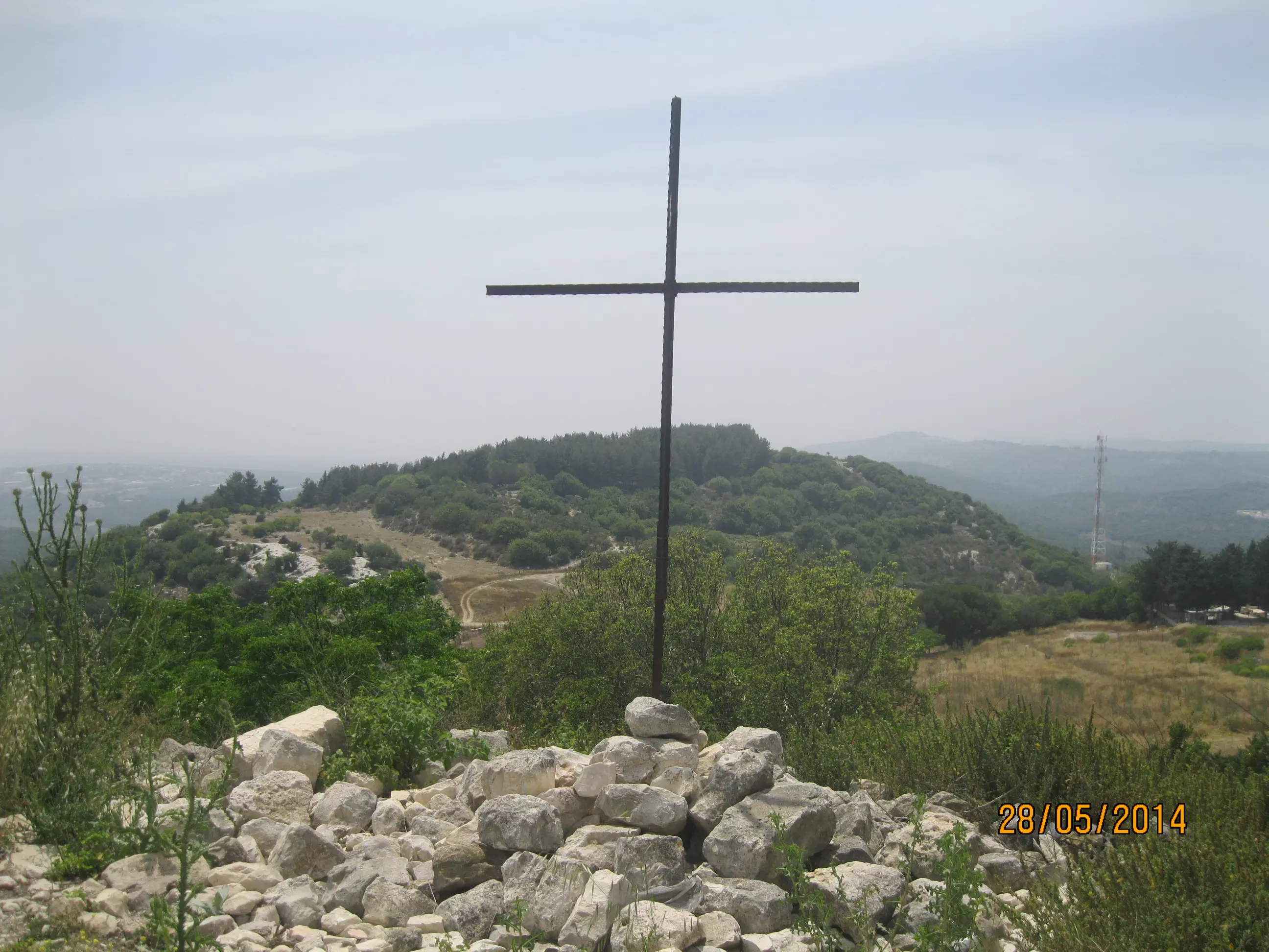
- كنيسة اقرث - الصليب والهلال يتعانقان - تصوير سهيل مخول يوم 28.5.2014
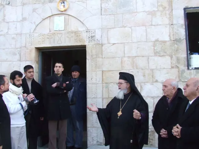
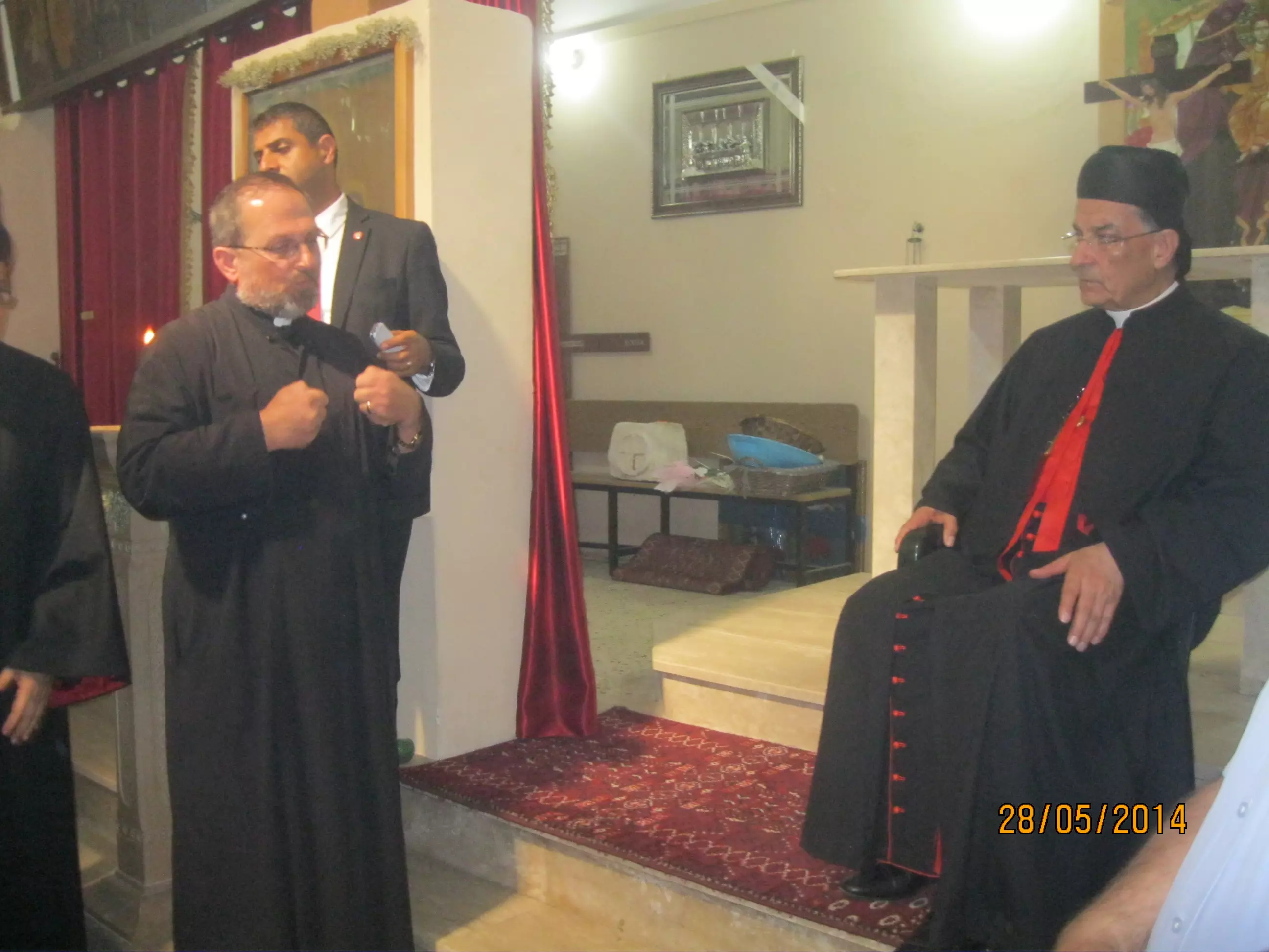
Posted by سهيل مخول - كنيسة اقرث - قبيل وصول البطرك بشارة الراعي والوفد المرافق لزيارة الكنيسة والقرية المهجرة - تصوير سهيل مخول يوم 28.5.2014
Posted by سهيل مخول - زيارة البطريرك بشارة الراعي لقرية اقرث يوم 28.5.2014 - تصوير سهيل مخول
Posted by سهيل مخول - زيارة البطريرك بشارة الراعي لقرية اقرث يوم 28.5.2014 - تصوير سهيل مخول
Posted by سهيل مخول - زيارة البطريرك بشارة الراعي لقرية اقرث يوم 28.5.2014 - تصوير سهيل مخول
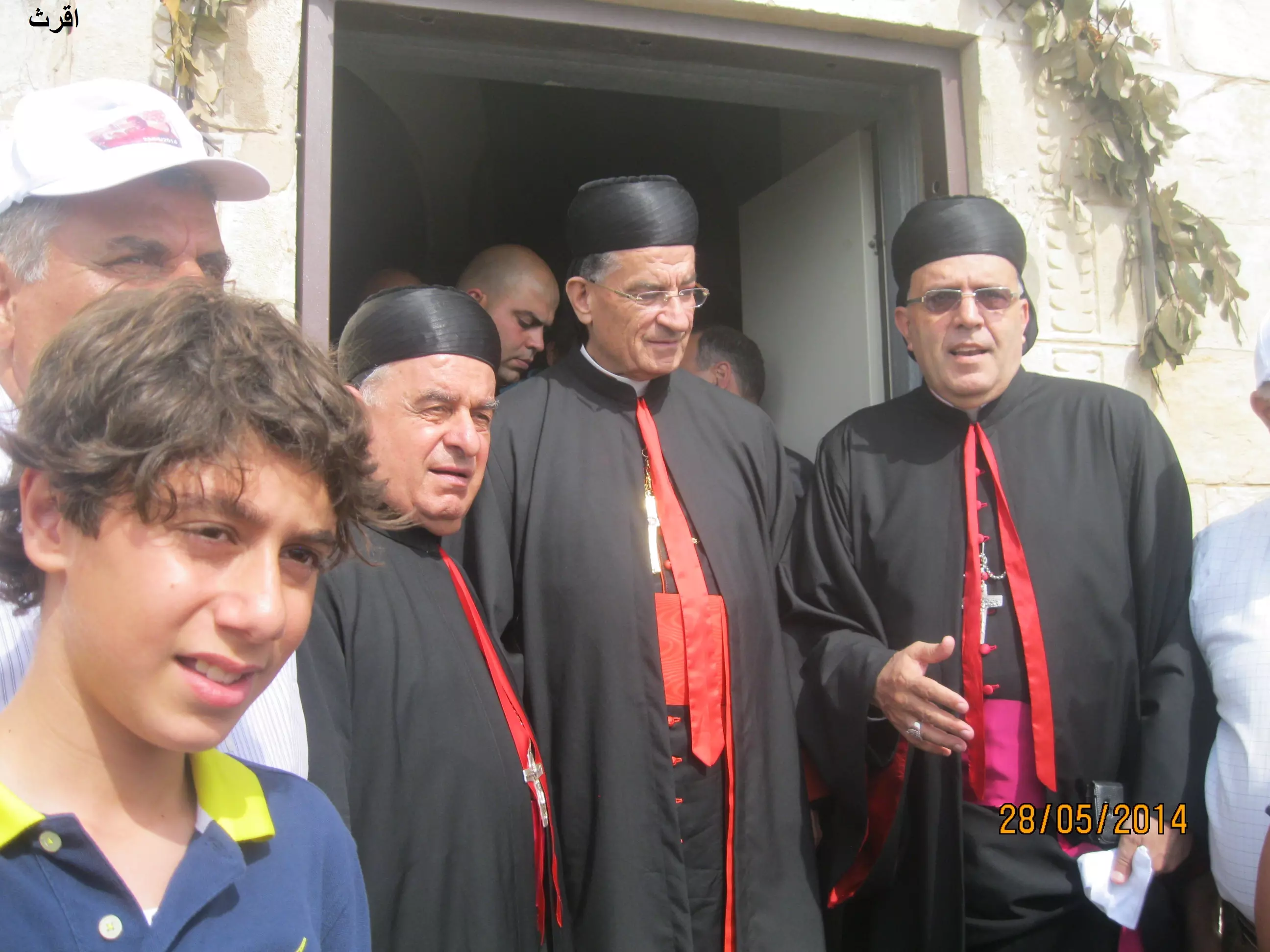
Posted by سهيل مخول - زيارة البطريرك بشارة الراعي لقرية اقرث يوم 28.5.2014 - تصوير سهيل مخول
Posted by سهيل مخول - زيارة البطريرك بشارة الراعي لقرية اقرث يوم 28.5.2014 - تصوير سهيل مخول
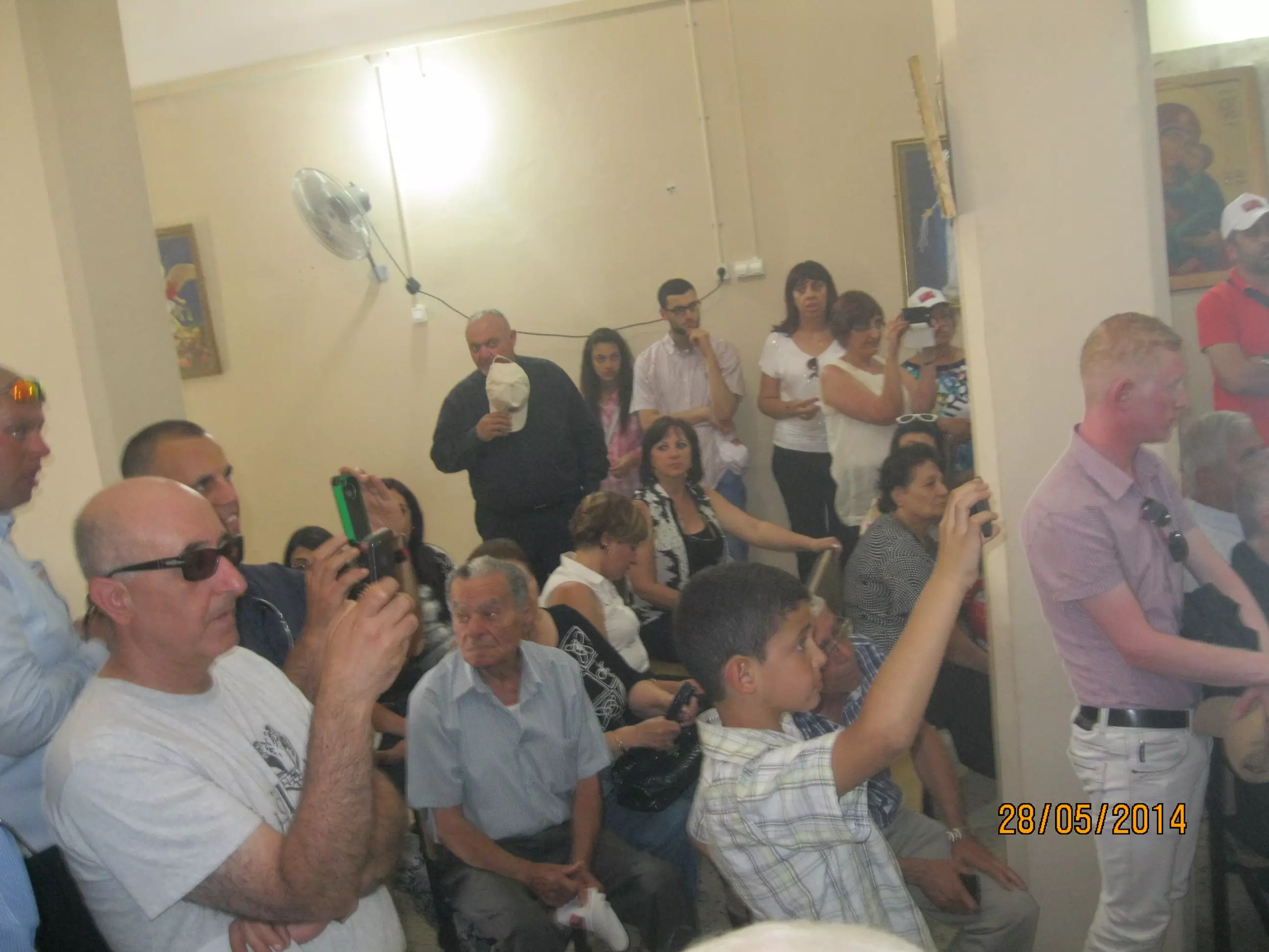
Posted by سهيل مخول - زيارة البطريرك بشارة الراعي لقرية اقرث يوم 28.5.2014 - تصوير سهيل مخول
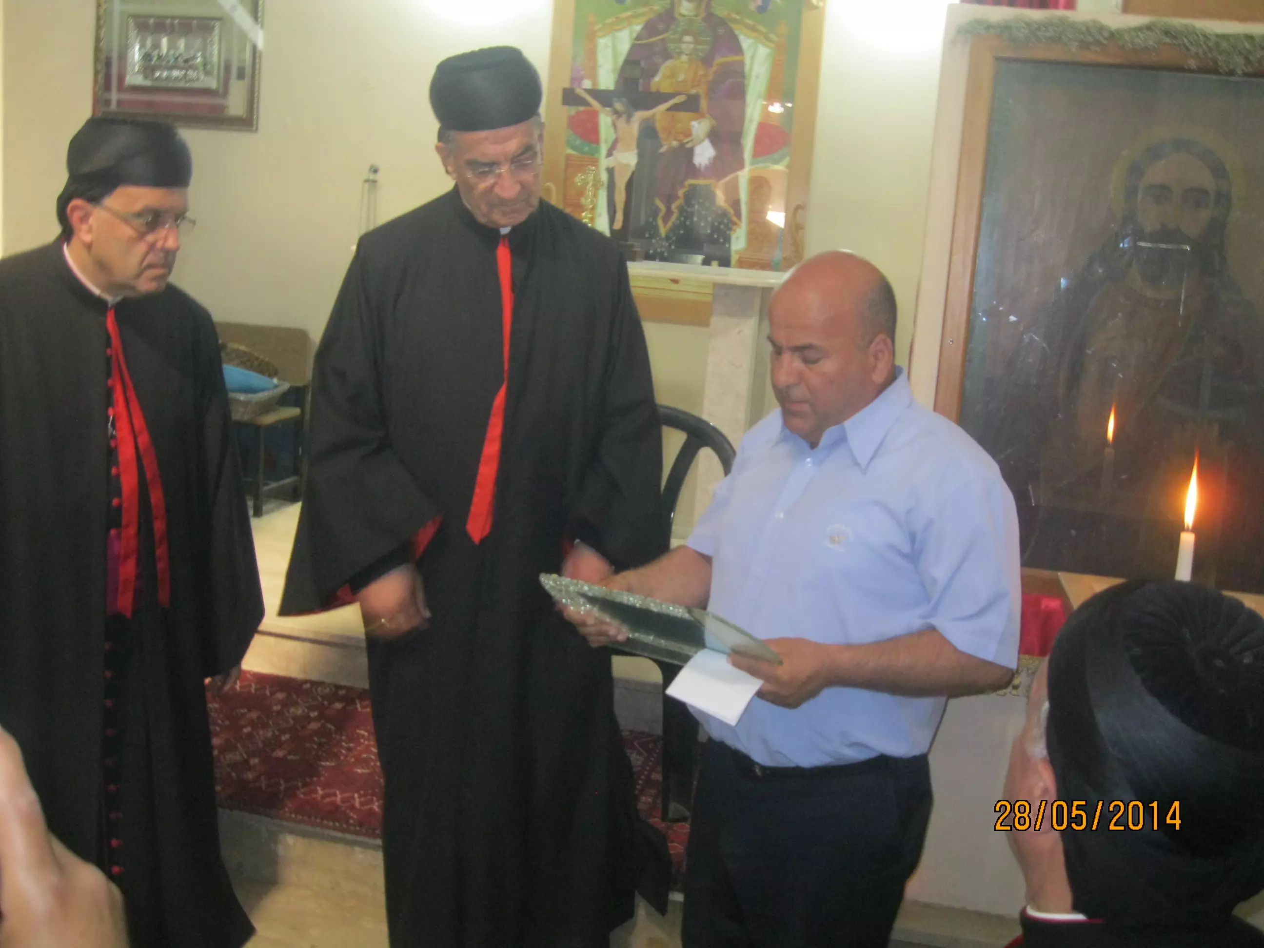
Posted by سهيل مخول - زيارة البطريرك بشارة الراعي لقرية اقرث يوم 28.5.2014 - تصوير سهيل مخول
Posted by سهيل مخول - زيارة البطريرك بشارة الراعي لقرية اقرث يوم 28.5.2014 - تصوير سهيل مخول
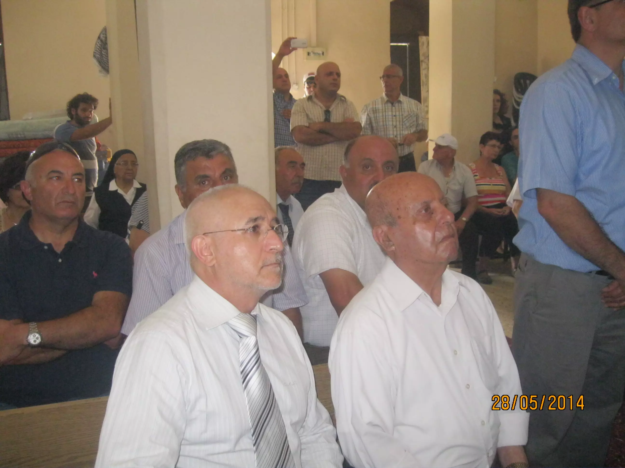
Posted by سهيل مخول - زيارة البطريرك بشارة الراعي لقرية اقرث يوم 28.5.2014 - تصوير سهيل مخول
Posted by سهيل مخول - كنيسة اقرث - الصليب والهلال يتعانقان - تصوير سهيل مخول يوم 28.5.2014
Posted by سهيل مخول - كنيسة اقرث - قبيل وصول البطرك بشارة الراعي والوفد المرافق لزيارة الكنيسة والقرية المهجرة - تصوير سهيل مخول يوم 28.5.2014
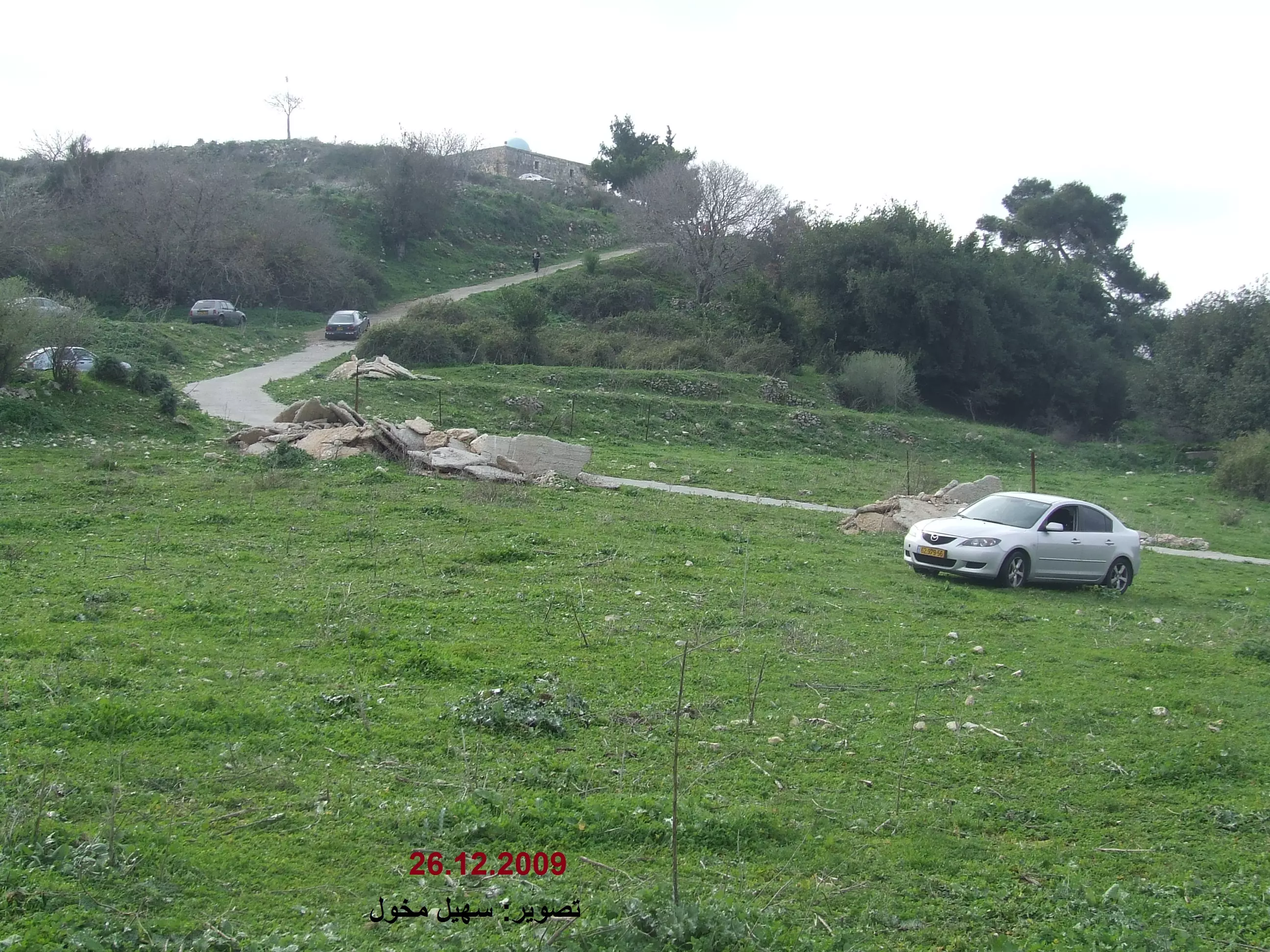
Posted by سهيل مخول - الطريق لكنيسة السيدة في إقرث تصوير سهيل مخول يوم 26 كانون الأول 2009
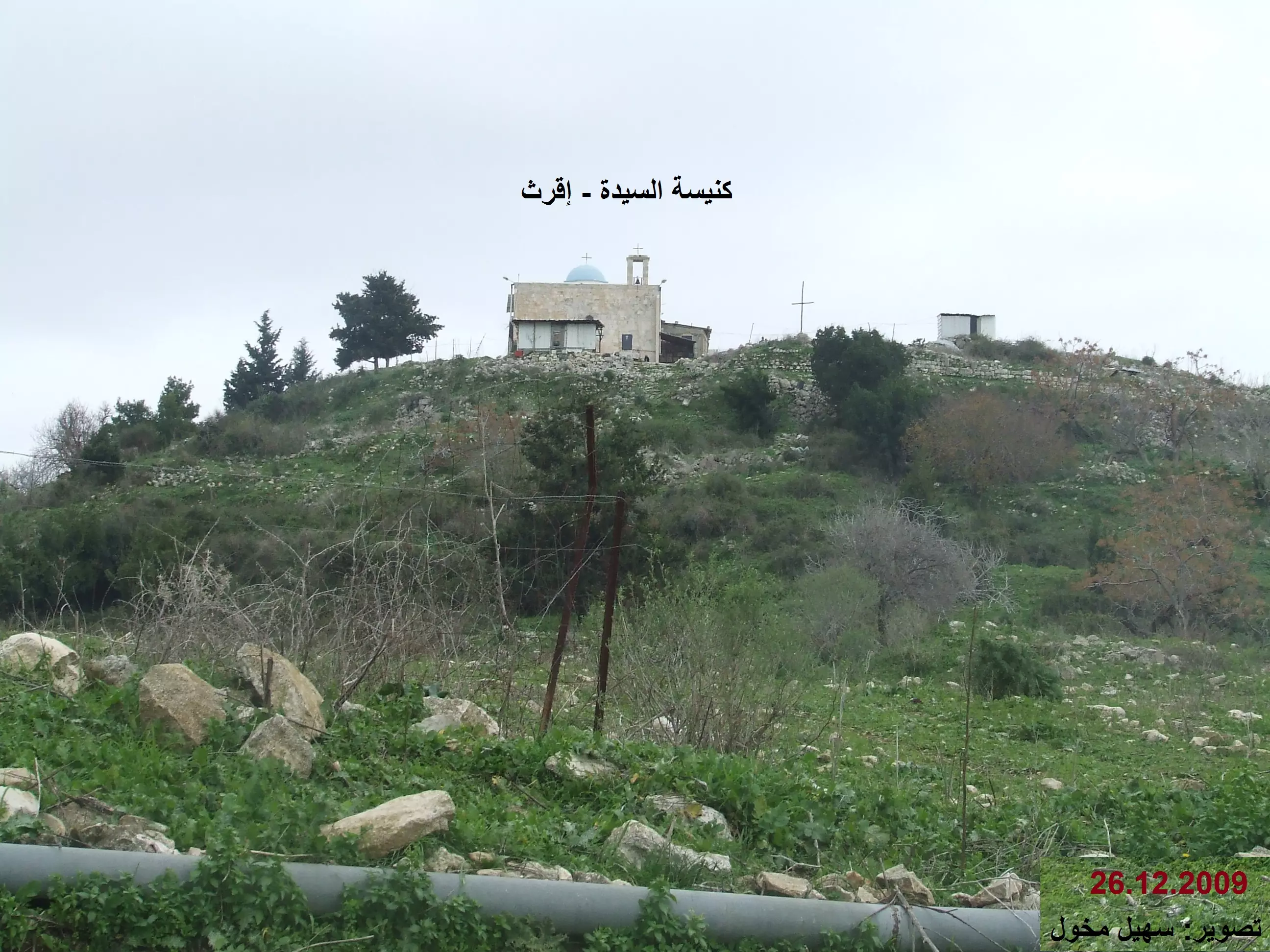
Posted by سهيل مخول - كنيسة السيدة في إقرث تصوير سهيل مخول يوم 26 كانون الأول 2009
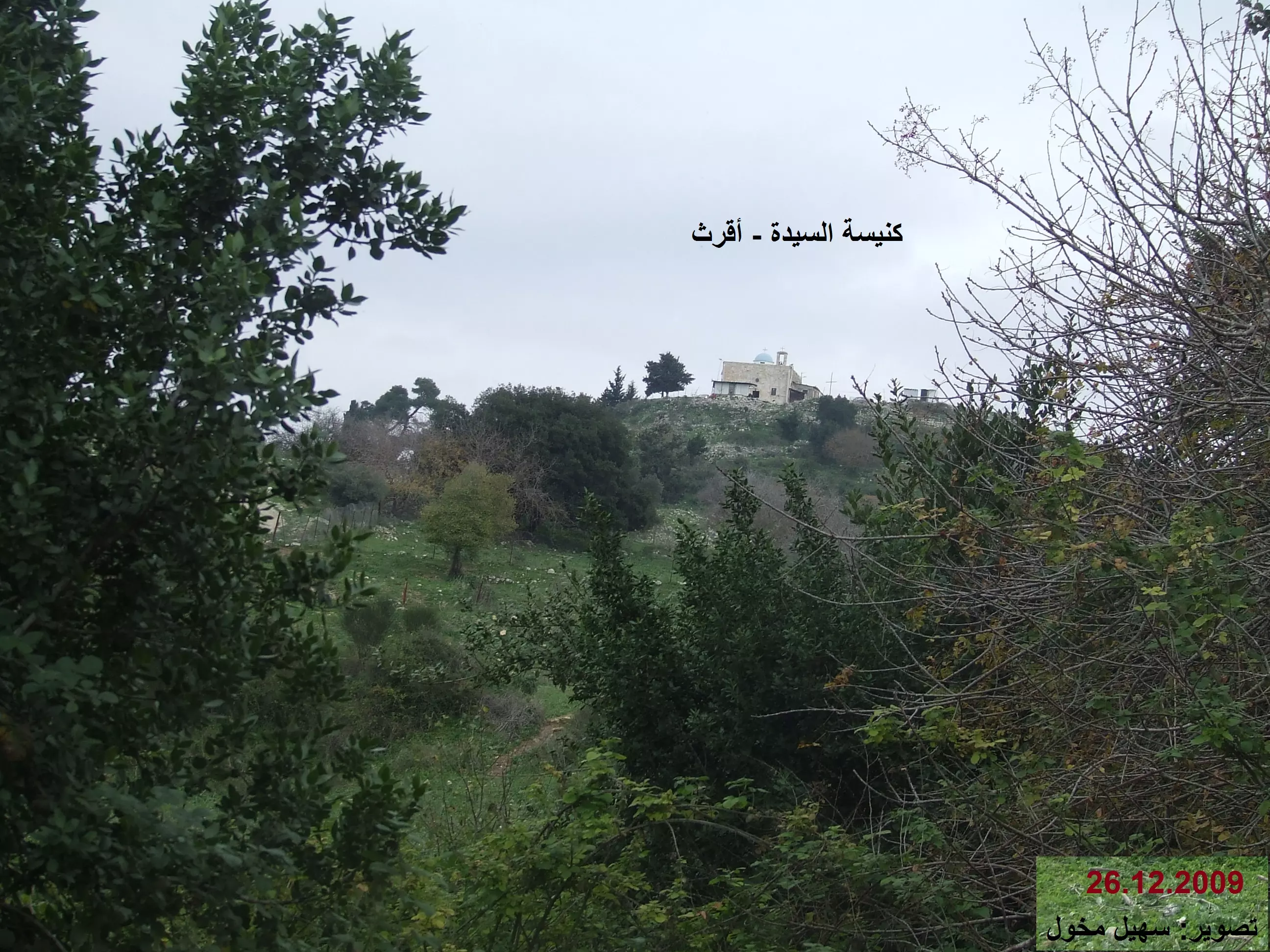
Posted by سهيل مخول - كنيسة السيدة في إقرث تصوير سهيل مخول يوم 26 كانون الأول 2009
Posted by سهيل مخول 1 - أطلال اقرث عند الغروب - بعدسة سهيل مخول 2007
Posted by سهيل مخول - لا بد لليل أن ينجلي بعودة أهلها
Posted by سهيل مخول - لا بد لليل أن ينجلي ولا بد للقيد أن ينكسر
Posted by سهيل مخول 1 - اقرت منظر عام 1939
Posted by فتحي ابو رضا \ العايدي - كنيسه اقرث
Posted by abu raya - منظر عام لقريه اقرث قبل النكبه
Posted by abu raya - منظر لكنيسه اقرث
Posted by abu raya - كنيسه اقرث
Posted by abu raya - منظر لكنيسه اقرث من الجهه الخلفيه
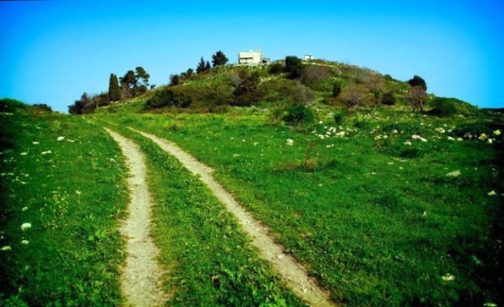
Posted by abu raya - منظر من الطريق الترابي المودي الى القريه
Posted by abu raya - اثار ردم بيوت القريه
Posted by abu raya - اثار بيوت اقرث
Posted by abu raya - اثار البيوت المهدومه
Posted by abu raya - منظر من القريه باتجاه اراضيها
Posted by abu raya - درج الكنيسه القديم
Posted by abu raya - اثار بيوت اقرث
Posted by abu raya - صوره قديمه من سنه 1948 لمختار القريه مع الحاكم العسكري
Posted by abu raya - منظر راىع لكنيسه اقرث
Posted by abu raya - كنيسه اقرث
Posted by abu raya - صوره قديمه لعصابه الهاغانا مع اهل اقرث سنه 1948
Posted by abu raya - العصابات الصهيونيه في اقرث
Posted by abu raya - اقرث بعد احتلالها
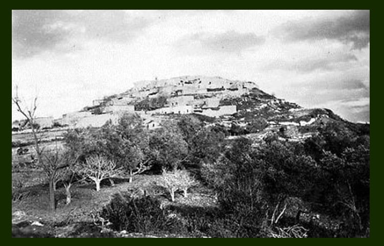
Posted by abu raya - قريه اقرث سنه 1939
Posted by abu raya - صورة ساحرة لقرية إقرث قضاء عكا عام 1936..
- That is how the "civilized" erased and replaced us: Iqrit was completely obliterated except for the church, as you see -- إقرت باتت أثر بعد عين بإستثناء بالكنيسة. من هنا مر الهمجّ
- That is how the "civilized" erased and replaced us: Iqrit was completely obliterated except for the church, as you see -- إقرت باتت أثر بعد عين بإستثناء بالكنيسة. من هنا مر الهمجّ #2

- That is how the "civilized" erased and replaced us: Iqrit was completely obliterated except for the church, as you see -- إقرت باتت أثر بعد عين بإستثناء بالكنيسة. من هنا مر الهمجّ #3
- That is how the "civilized" erased and replaced us: Iqrit was completely obliterated except for the church, as you see -- إقرت باتت أثر بعد عين بإستثناء بالكنيسة. من هنا مر الهمجّ #4
- That is how the "civilized" erased and replaced us: Iqrit was completely obliterated except for the church, as you see -- إقرت باتت أثر بعد عين بإستثناء بالكنيسة. من هنا مر الهمجّ #5
- That is how the "civilized" erased and replaced us: Iqrit was completely obliterated except for the church, as you see -- إقرت باتت أثر بعد عين بإستثناء بالكنيسة. من هنا مر الهمجّ #6
- That is how the "civilized" erased and replaced us: Iqrit was completely obliterated except for the church, as you see -- إقرت باتت أثر بعد عين بإستثناء بالكنيسة. من هنا مر الهمجّ #7
- That is how the "civilized" erased and replaced us: Iqrit was completely obliterated except for the church, as you see -- إقرت باتت أثر بعد عين بإستثناء بالكنيسة. من هنا مر الهمجّ #8
- That is how the "civilized" erased and replaced us: Iqrit was completely obliterated except for the church, as you see -- إقرت باتت أثر بعد عين بإستثناء بالكنيسة. من هنا مر الهمجّ #9
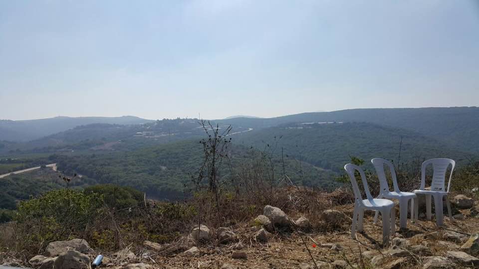
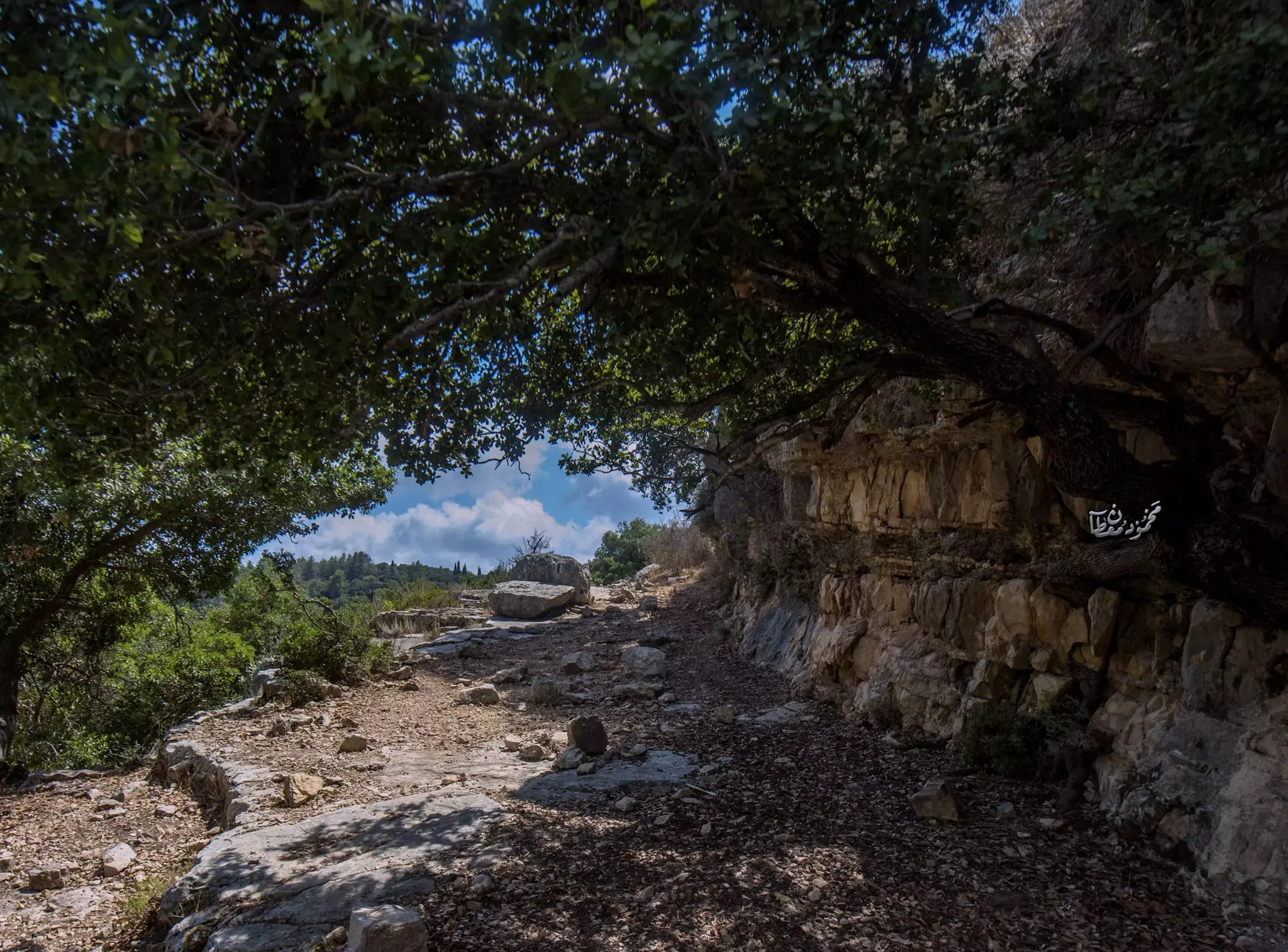
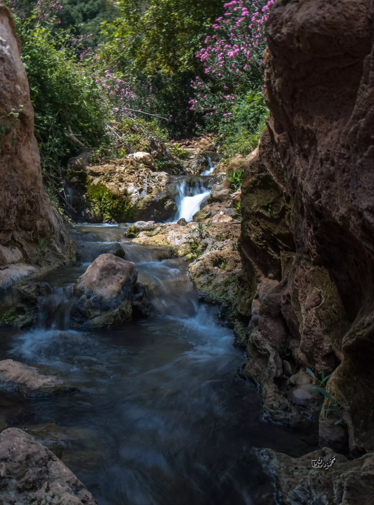
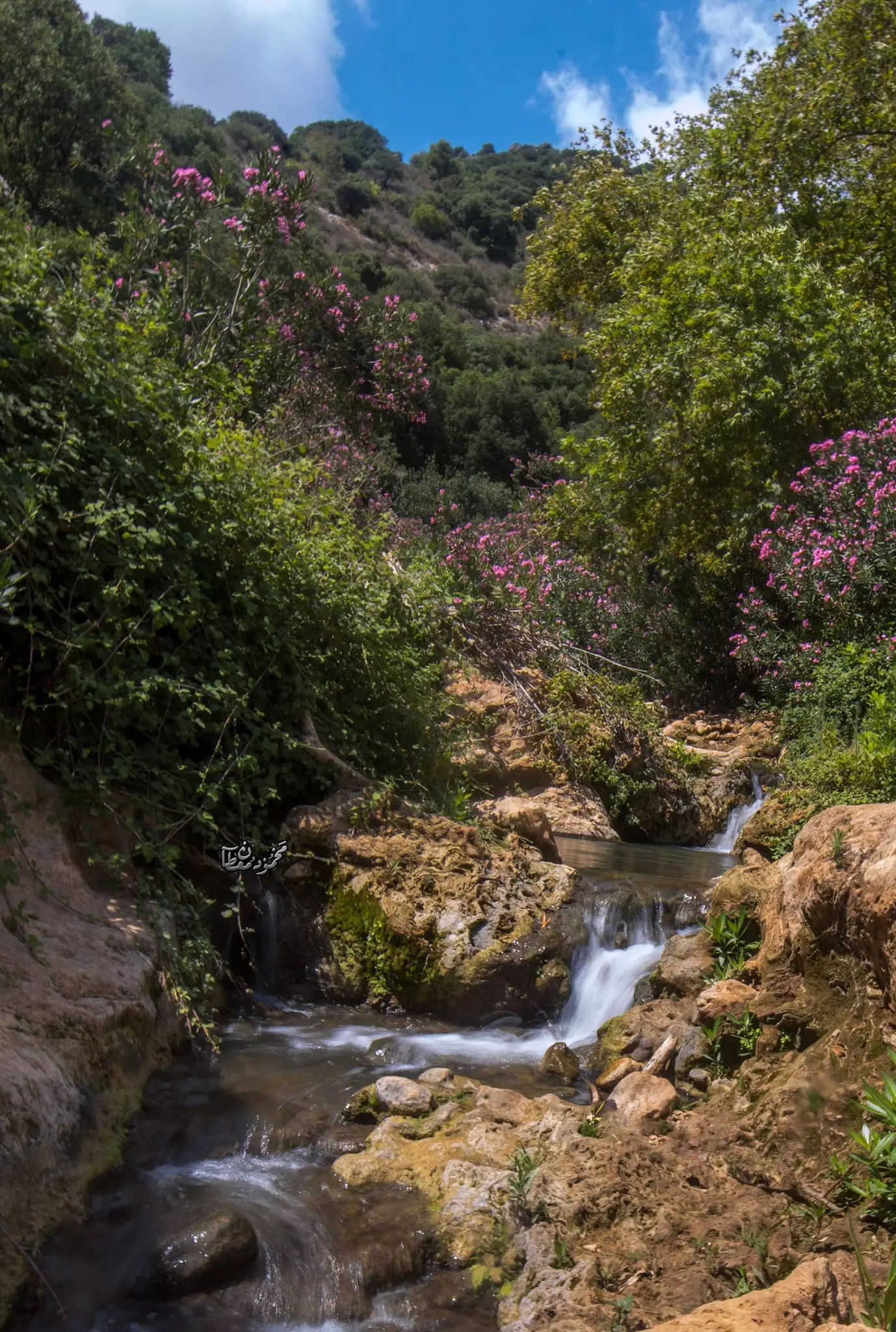
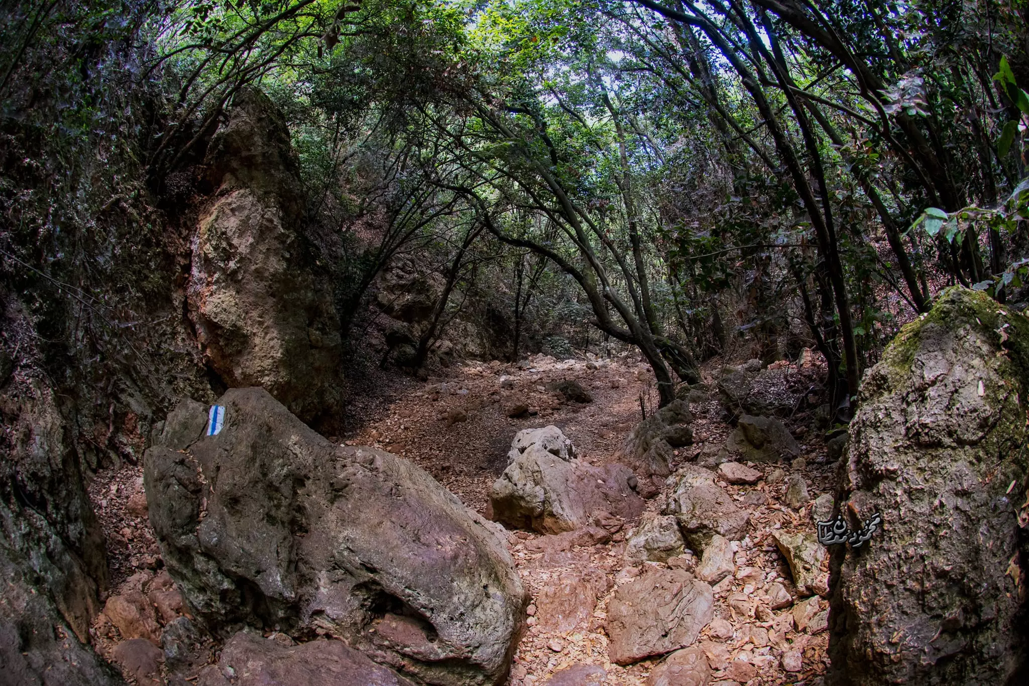
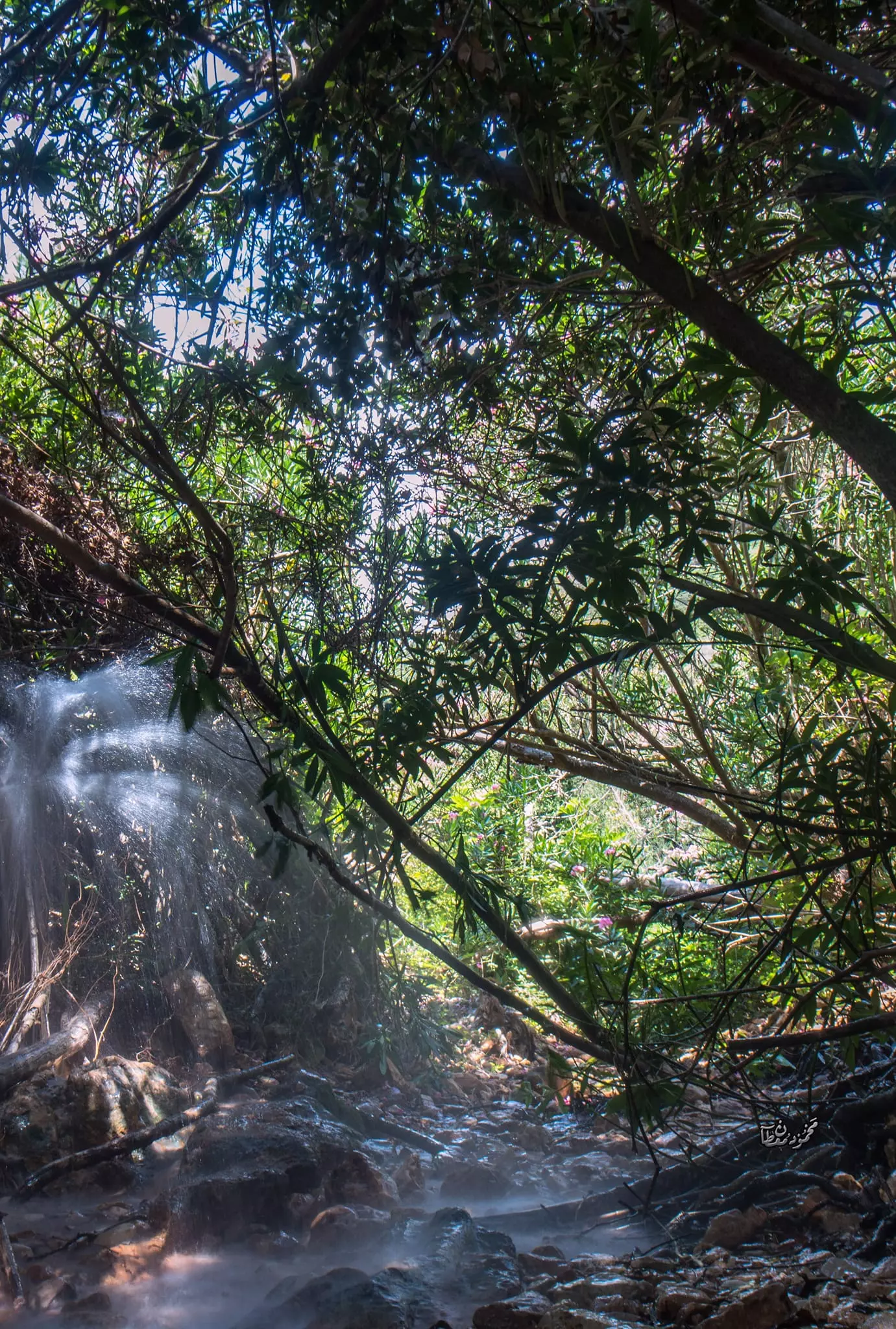
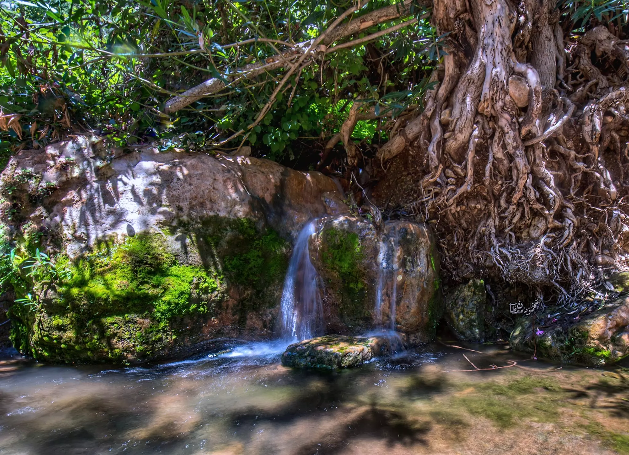
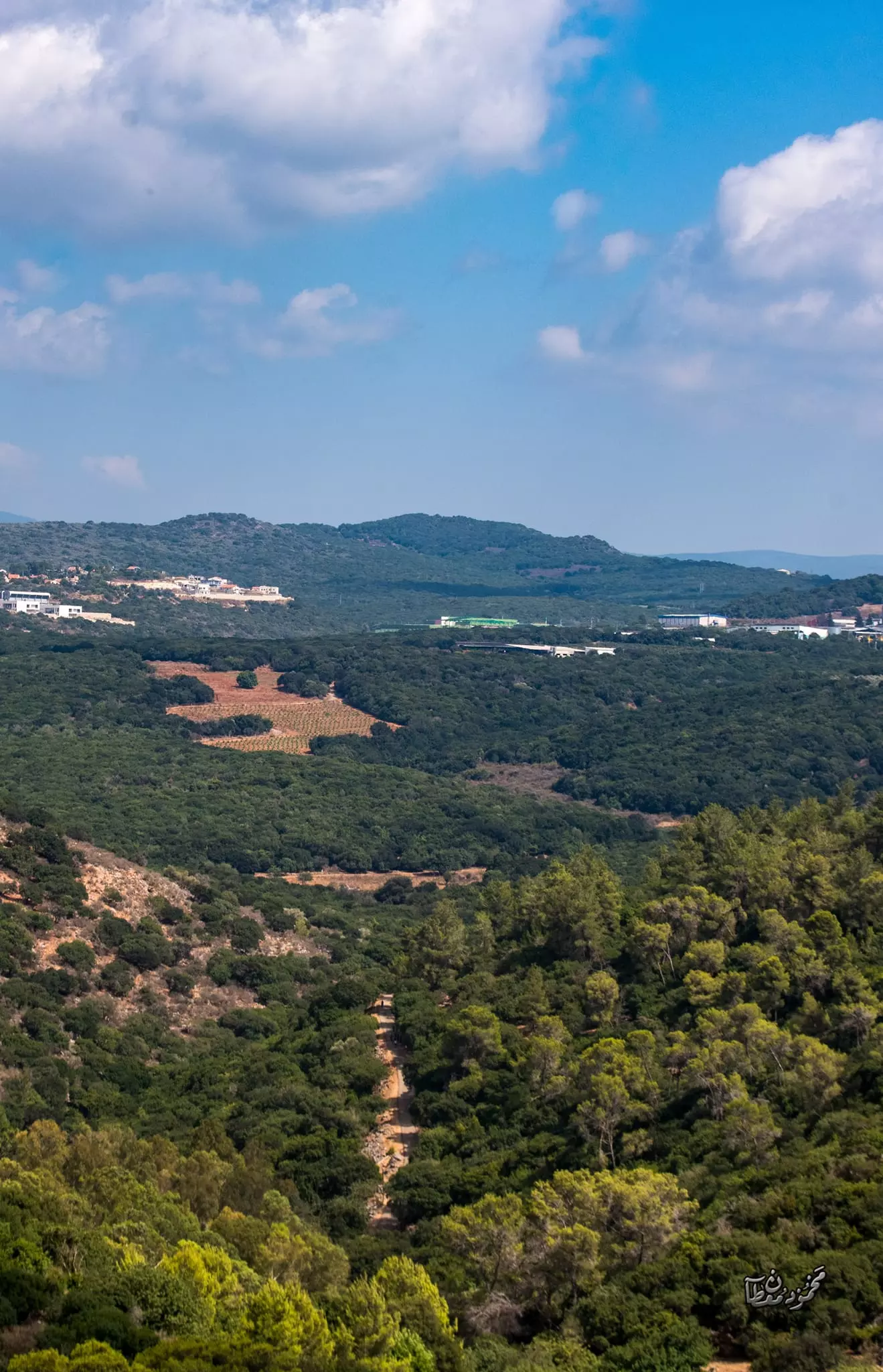
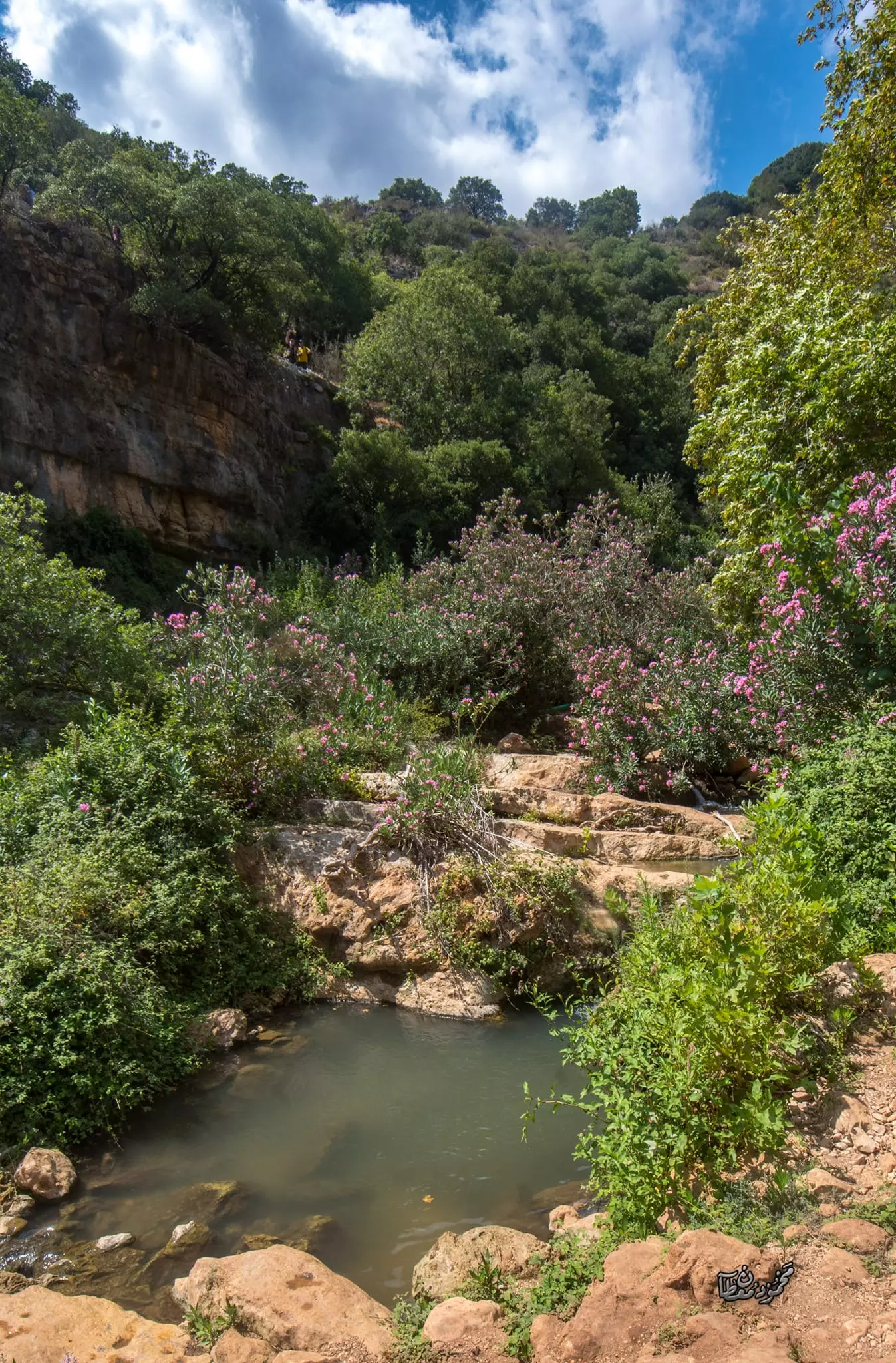
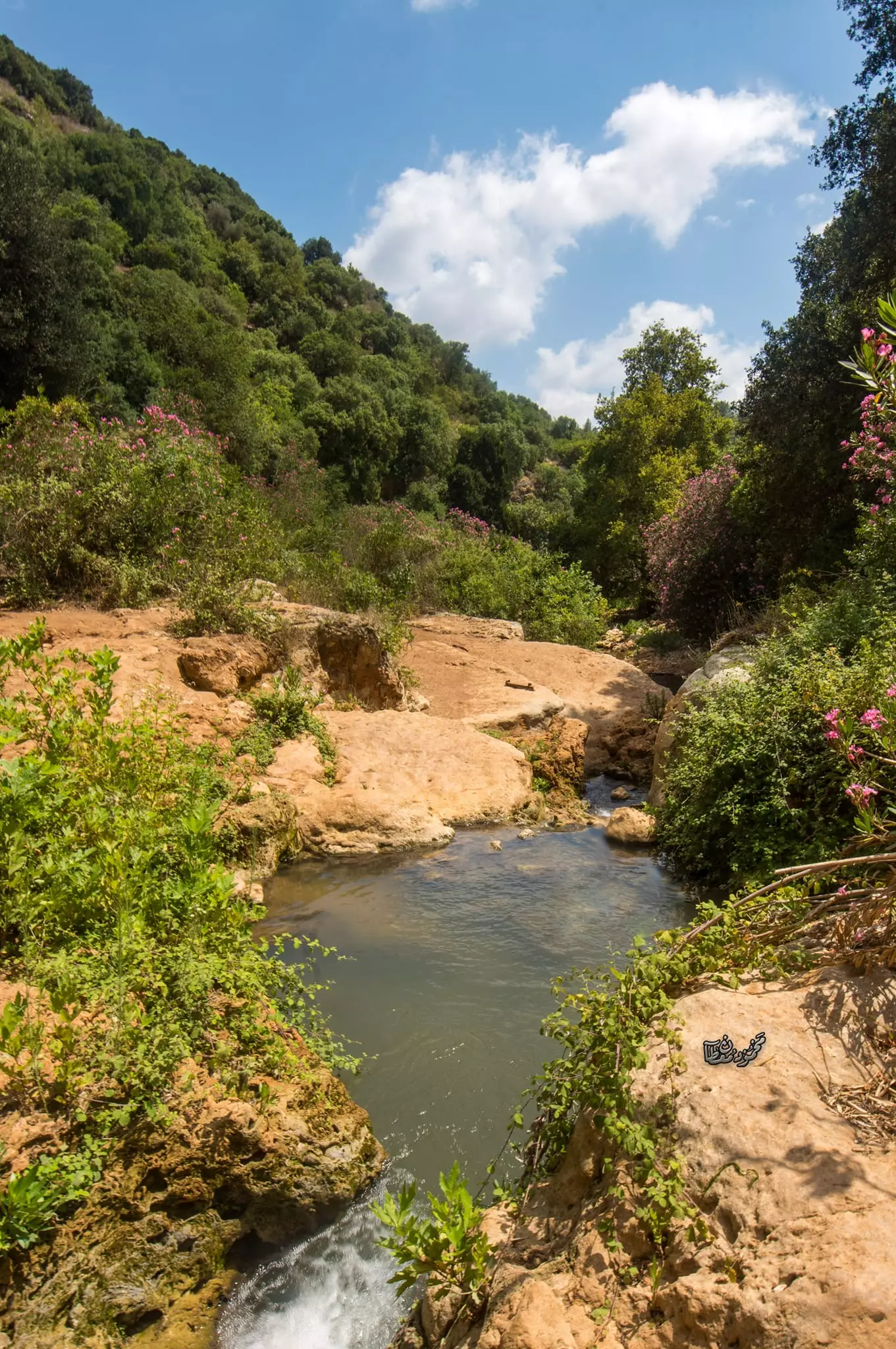
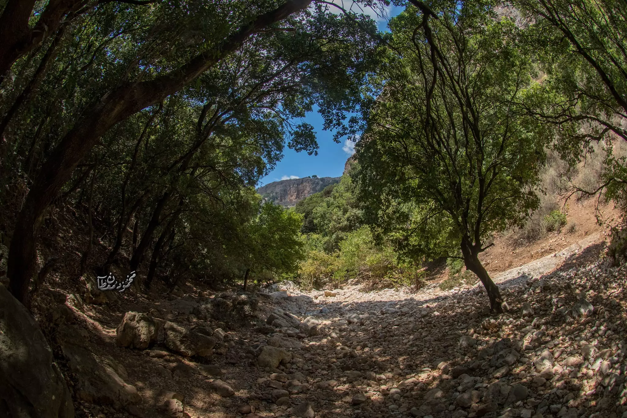
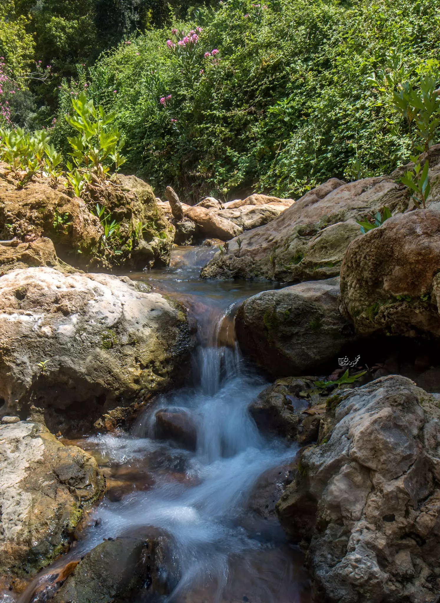
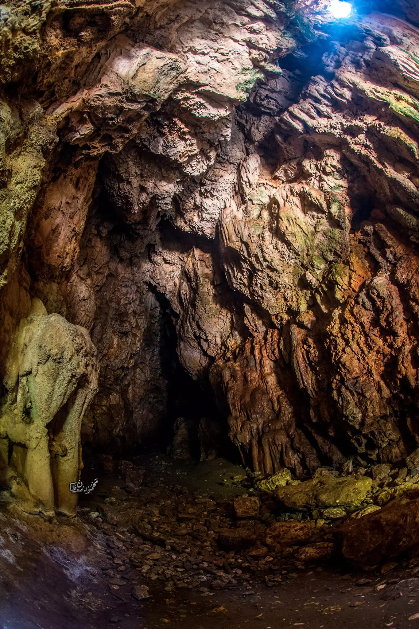
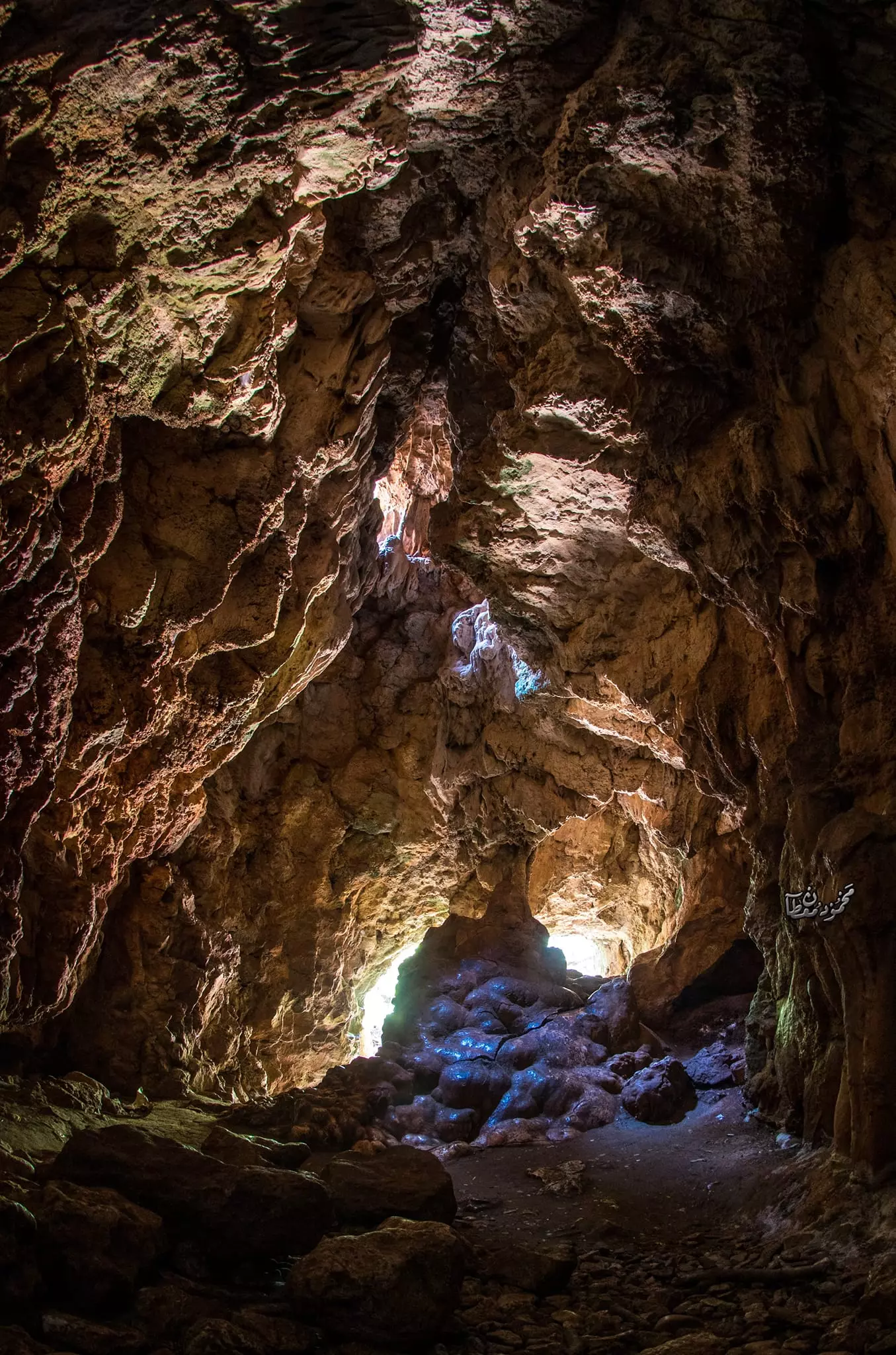
- جولة ساحرة في وادي البصة (وادي كررة) القريب من القرية -- June 2022 -- Mohammad Moutan
- جولة ساحرة في وادي البصة (وادي كررة) القريب من القرية -- June 2022 -- Mohammad Moutan #2
- جولة ساحرة في وادي البصة (وادي كررة) القريب من القرية -- June 2022 -- Mohammad Moutan #3
- جولة ساحرة في وادي البصة (وادي كررة) القريب من القرية -- June 2022 -- Mohammad Moutan #4
- جولة ساحرة في وادي البصة (وادي كررة) القريب من القرية -- June 2022 -- Mohammad Moutan #5
- جولة ساحرة في وادي البصة (وادي كررة) القريب من القرية -- June 2022 -- Mohammad Moutan #6
- جولة ساحرة في وادي البصة (وادي كررة) القريب من القرية -- June 2022 -- Mohammad Moutan #7
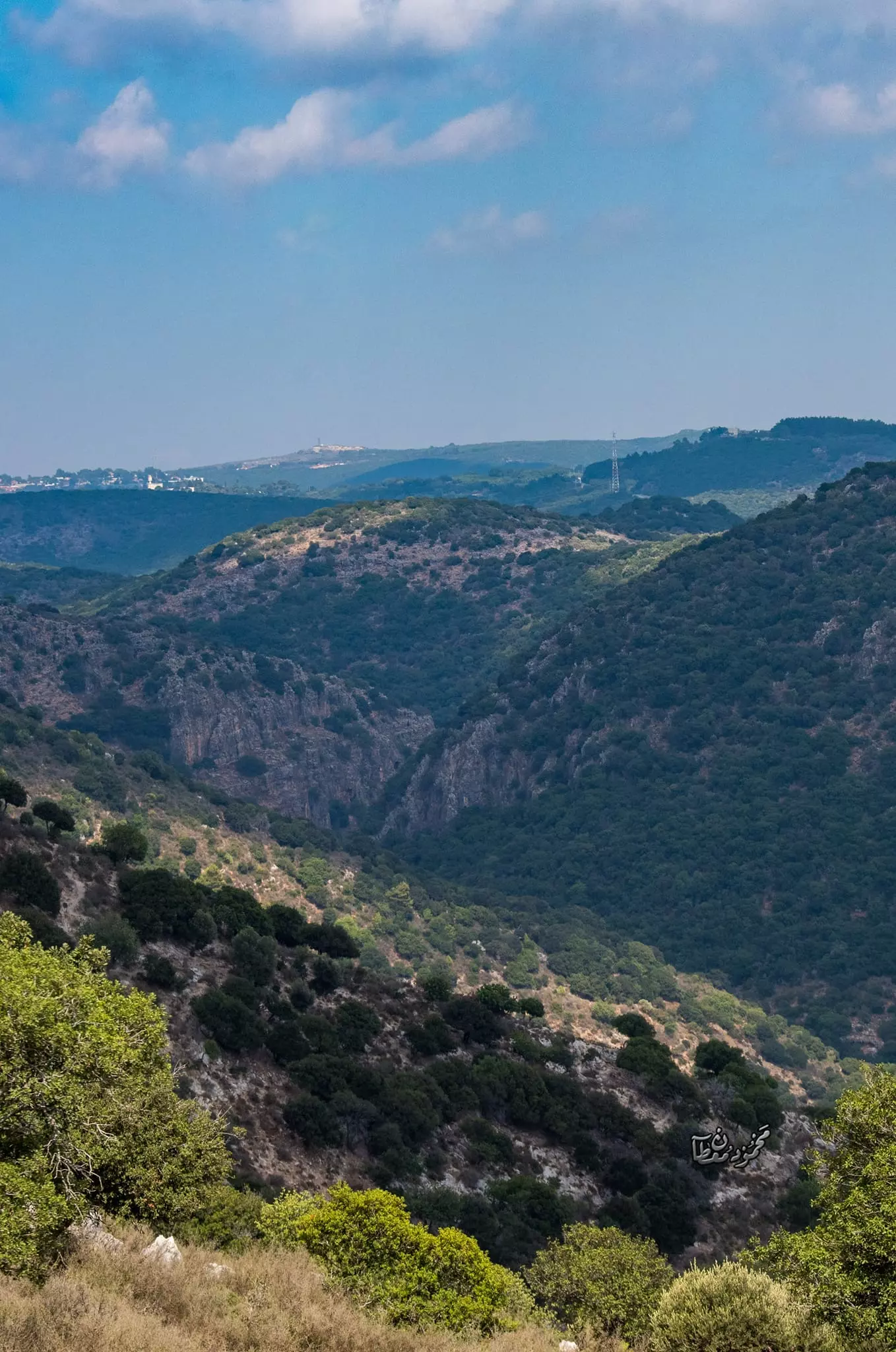
- جولة ساحرة في وادي البصة (وادي كررة) القريب من القرية -- June 2022 -- Mohammad Moutan #8
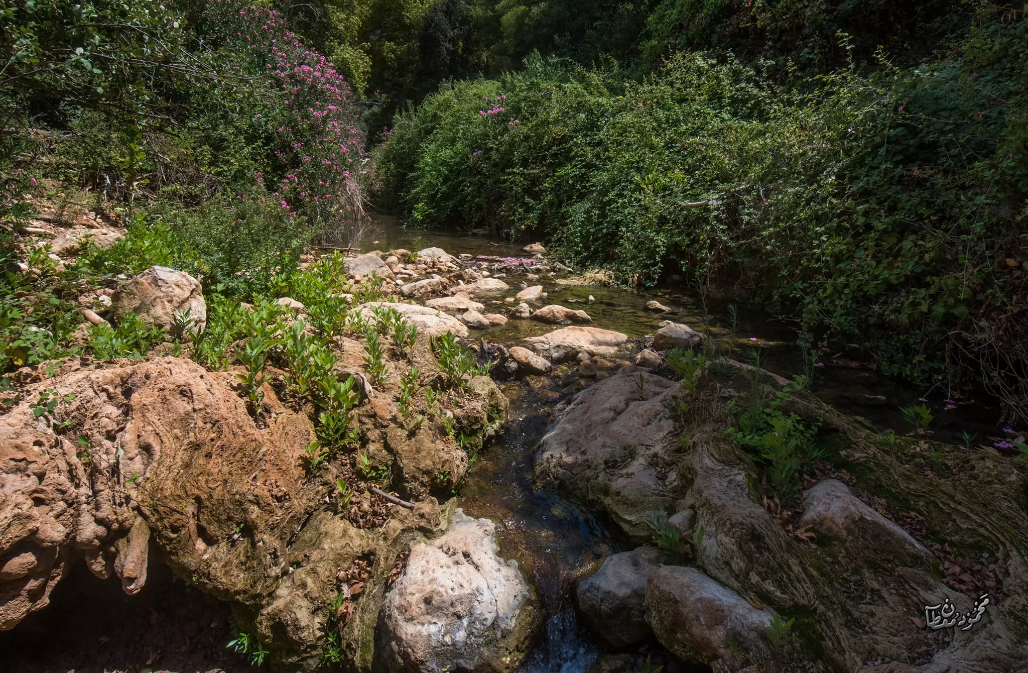
- جولة ساحرة في وادي البصة (وادي كررة) القريب من القرية -- June 2022 -- Mohammad Moutan #9
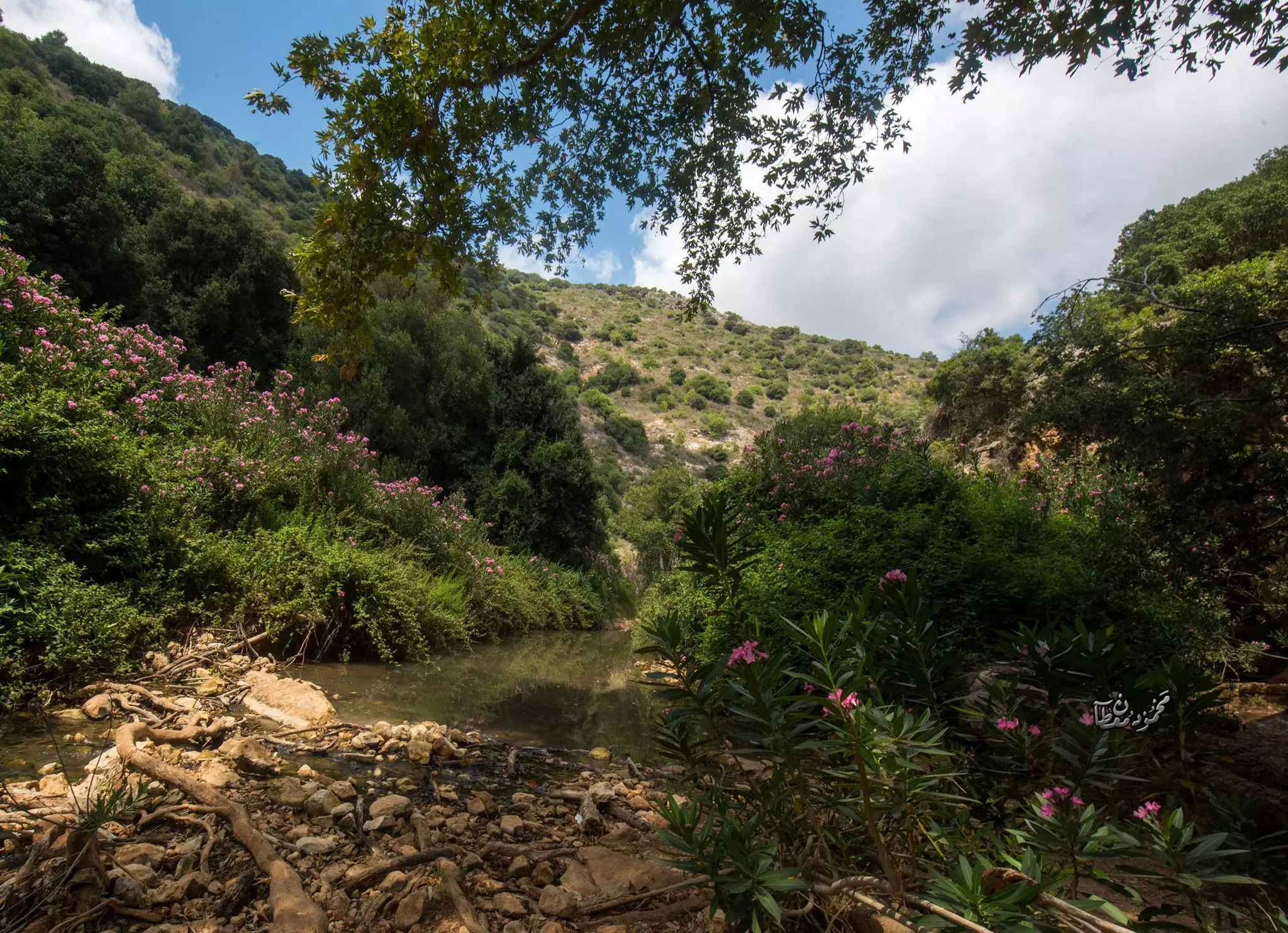
- جولة ساحرة في وادي البصة (وادي كررة) القريب من القرية -- June 2022 -- Mohammad Moutan #10
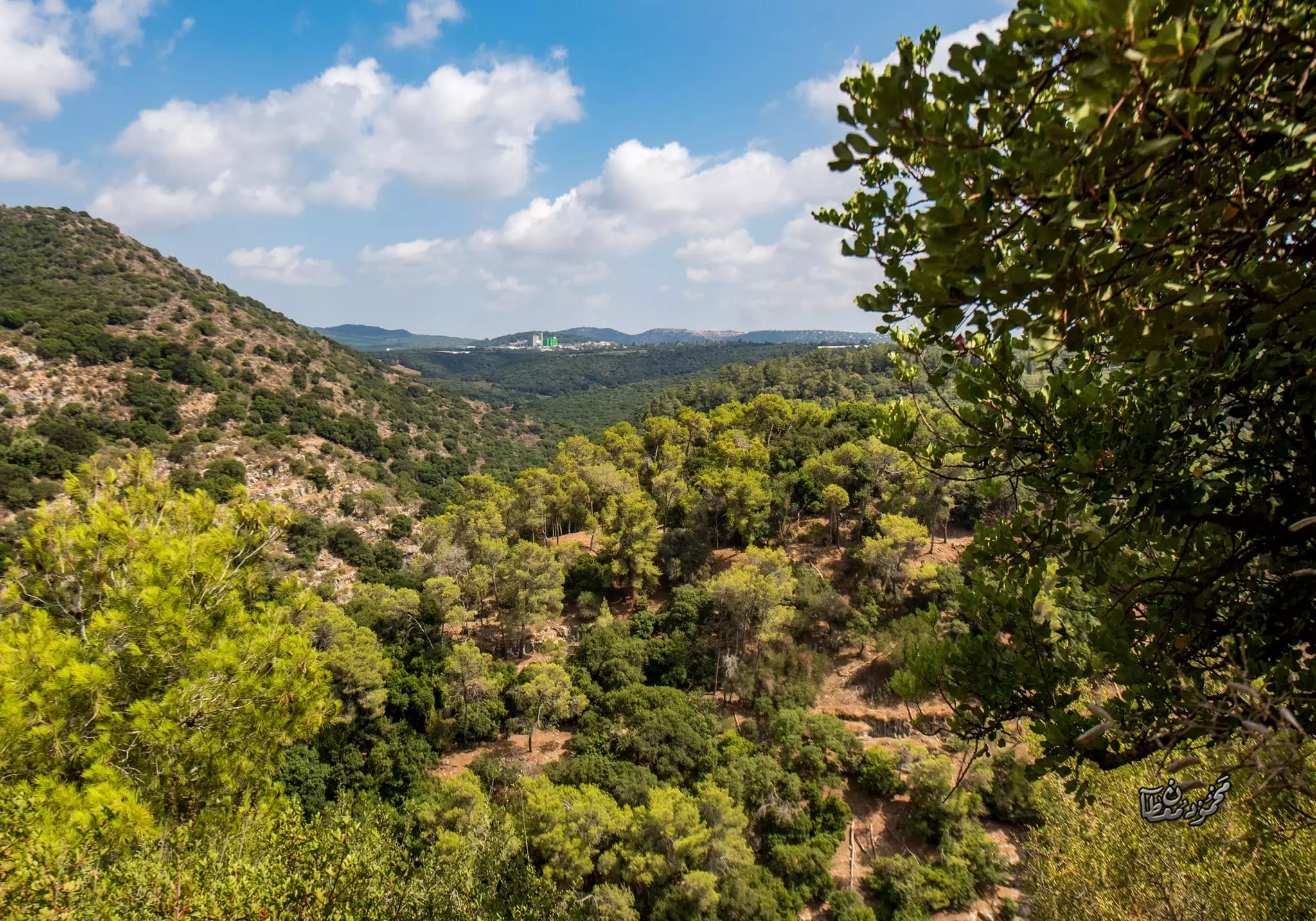
- جولة ساحرة في وادي البصة (وادي كررة) القريب من القرية -- June 2022 -- Mohammad Moutan #11
- جولة ساحرة في وادي البصة (وادي كررة) القريب من القرية -- June 2022 -- Mohammad Moutan #12
- جولة ساحرة في وادي البصة (وادي كررة) القريب من القرية -- June 2022 -- Mohammad Moutan #13
- جولة ساحرة في وادي البصة (وادي كررة) القريب من القرية -- June 2022 -- Mohammad Moutan #14
- جولة ساحرة في وادي البصة (وادي كررة) القريب من القرية -- June 2022 -- Mohammad Moutan #15
- جولة ساحرة في وادي البصة (وادي كررة) القريب من القرية -- June 2022 -- Mohammad Moutan #16
- جولة ساحرة في وادي البصة (وادي كررة) القريب من القرية -- June 2022 -- Mohammad Moutan #17
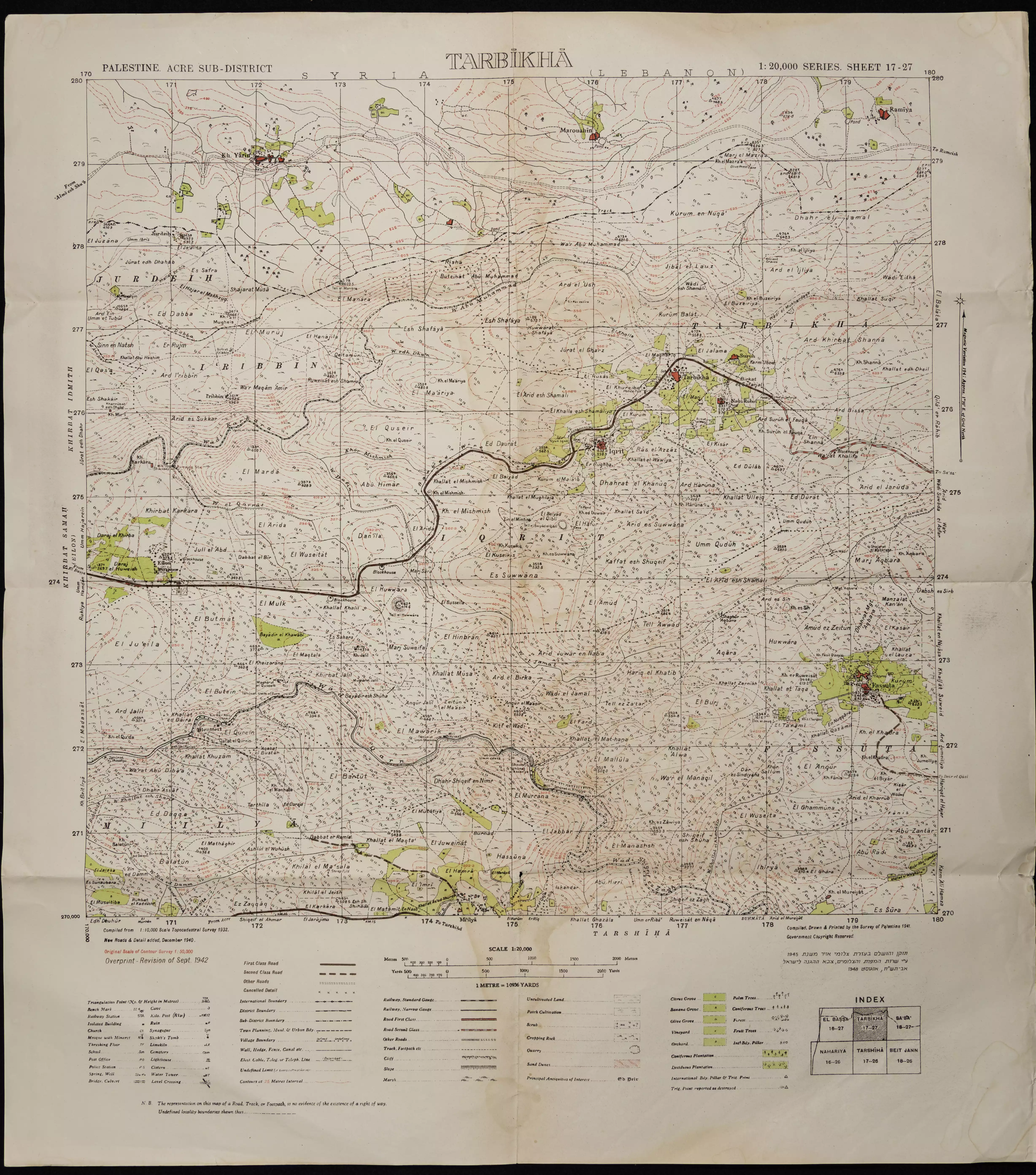
- خارطة تُظهِر الحدود والطرق بأنواعها والأماكن المقدسة والطبيعة الطوبغرافية من تلال وسهول ومنحدرات والتشكيلة الطبيعية للأرض وأنواع المزروعات. نُشرت الخريطة فترة الانتداب البريطاني، تم إضافة تعديلات عليها من قِبَل خدمة الخرائط والصور التابعة للقوات العسكرية الاسرائيلية فترة الأربعينيات.
Want to browse more? 80,000 pictures were grouped in these gallaries:
| Display Name | Clan/Hamolah | Country of Residence |
| Dokhi | Ashkar | Kufer Yasif, Israel |
| yousef ashkar | - | haifa |
| Fadeel El-Doukhy | El-Doukhy | Ontario, Canada |
| Ibraheem Attalla | - | Mazra'a Village |
| mmmm khayat | khayat | - |
| wisss | - | maker |
| Awnallah Attallah | Attallah | Taipei, Taiwan |
| Jennifer Attallah | Attallah | IL, USA |
| shady suleiman | - | Europe |
| hanna kassis | - | haifa, israel |
- Video Documentry ON IQRIT
- Return to Iqrit-االعودة لإقرط
- إيابـاً : قرية إقرث المهجرة .. مع سعيد سلامة وحنا ناصر Duration: 25 min 7 sec
- قرية اقرث المهجرة قضاء: عكا Duration: min 27 sec
 Fake Valor: Why Did Zionist Jews Hoist Nazis Flag on Their Ships in the 1930s?
What is new?
-
Facts About Oct. 7th Gaza Raid
-
Remined Us Please: Who Did Rape Whom? Was it Palestinians who raped Israelis? Or, was the other way around? You'll be the judge
-
When Prof. Edward Said was invited to debate Bibi Netanyahu in the 1980s, watch what happened!
-
Ezra Klein of the NY Times on the "Jewish Race".
-
Abusing Blood Libel!
-
How and why Israeli Jewry has become the most hated cult?
-
Did Israeli Soldiers Activate The Hannibal Direective On Oct. 7th? You Be The Judge
-
Zionist FAQ: Isn't it true that Palestinians don't want peace? Palestinians never accepted the two-state solution
- Facts about Haavara (Transfer) Agreement between Ben-Gurion & Hitler
-
Haavara FAQs: Why Did Zionist Jews Hoist Nazis' Flags on Their Ships in the 1930s?
- Haavara FAQs: When Chaim Weizmann met FDR in mid-1943, why was he silent about rescuing European Jewry?
-
Dear ChatGPT: How did Palestinians resist Napoleon's invasion of their country in 1799?
-
Dear ChatGPT: Gaza had a vibrant Jewish community in the mid-17th century. What happened to them?
-
Dear ChatGPT: Why did the Jewish Agency suppress news of the Holocaust during WWII?
-
Video Playlist: Jews share their DNA tests to end the conflict for good.
-
A Tale of Two Conflicts: Examining the Definition of Genocide
-
Prof. Abraham Polak And The Suppressed History of the Khazars and European Jewry
-
How Ronald Reagan would have framed the genocide in Gaza if he were still alive?
-
Haavara FAQs: Let us do the math: how many German Jews did The Haavara Agreement save?
-
Zionist FAQs: The Hebron Massacre of 1929, "clearly proves" that Palestinians are antisemitic, how could you deny it?
-
Zionist FAQs: Why Anti-Zionist Is Not Antisemitism?
-
Zionist FAQs: Isn't it true that the KGB created Palestinian Nationalism in the early 1960s?
- Zionist FAQs: Muslims are killing Muslims all the time; why are Israeli Jews being singled out in the media?
- Zionist FAQs: How is Israel an apartheid state when 20% of its citizens are Arabs who enjoy full rights?
-
Haavara FAQs: Why Did Dorothy Thompson Flip From A Zionist Advocate to A Silenced Dissenter?
-
Haavara FAQs: Analysis of Herzl's Uganda Scheme and how it could have saved millions of Jews.
-
Haavara FAQs: Why did Hayim Greenberg describe American Jewry as "morally bankrupt" in early 1943?
-
Haavara FAQs: What if the Evian Conference was a resounding success? What would have been the impact of saving European Jewry on Zionism?
- Haavara FAQs: What if the six million were saved, how that would have impacted the Zionist project?
-
Haavara FAQs: How did Zionist leaders react when Europe's Jews lingered in the DP camps after WWII ended?
-
Why does the American Jewish community repeat lies that David Ben-Gurion had debunked before he died?
-
Who has the power to rename the Tatar/Khazar Gene Marker to Jewish IV?
-
Zionist FAQs: Why won't Egypt, Syria, and Jordan take their people back? Jews are indigenous to Palestine, and Arabs immigrated after Jews developed the country. Arabs should leave.
-
Haavara FAQs: Did Hitler and the Nazis conflate between Judaism and Zionist? If that wasn't case, then why?
-
Haavara FAQs: Winston Churchill and antisemitism, a collection of articles written Churchill.
-
Haavara FAQs: Broken by country, how many Jews survived vs. killed during the Holocaust?
-
Haavara FAQs: Why did European Jews vote with their feet and to immigrated to the Americas, not Palestine, after WWII?
-
Watch this American Jewish Girl describing Israeli Jews' cognitive dissonance like no other in under two minutes
-
Haavara FAQs: When the Nazis went out of their way to hide the Holocaust, Israeli Jews did the exact opposite by broadcasting their genocide of Gazans. But why?
-
Haavara FAQs: How Zionist Jews went out of their to show their appreciation to Nazism and Fascism?
- Haavara FAQs: Why Zionist leaders were against bombing the death camps & the Railroads leading to them?
-
Haavara FAQs: Hitler's message to the British and American people: If Jews are such noble citizens and you care about them, how come you're not letting them in? I will gladly ship them to you at my expense, even on luxury liners!
-
A shortlist of Zionist and Israeli false flag operations in the name Jews.
-
The Most Moral Army
- The Land of Kapos (Israel): Where the brave are boycotted and Kapos walk free.
- Why did early Zionists often named their communal enterprises "colonial"?
- Zionist Relations with Nazi Germany by Faris Glubb
-
Two NY Times advertisements by Zionists in the early 1943 that exposes Zionists' treason at the height of the calamity
- Facts Not Lies about the Palestinian-Israeli Conflict.
- Site's pictures have been categorized
- Campgain Against Lice
- A Survey of Palestine, the official source about Palestine before Nakba produced by the British Mandate; over 1200 pages.
- Satellite View & Google Earth: Over 6,000 placemarks identifying all destroyed towns, W. Bank & Gaza Strip Towns, & refugee camps.
- PalestineRemembered.com and its Nakba Oral History Project were featured on al-Jazeera Satellite TV.
- Nakba Oral History Video Podcast:
 Over 700 Oral History interviews (including 3,500+ hours of recording) can be viewed online.
 - Palestine Village Statistics Project
- Gaza Jail Break
- النسخة العربية للموقع الان متوفرة
- Videos: Documenting the destroyed villages in video: Tracing all that remains since Nakba.
- Videos: Responding to Zionist Propaganda
- Interview: The ethnic cleansing of Palestine: George Galloway interviews Israeli Historian Ilan Pappe.
- For Palestinians, memory matters. It provides a blueprint for their future By George Bisharat.
- Zionist FAQ now available in Hebrew שאלות שציונים שואלים, עכשיו בעברית
- Video: The Stephen Walt and John Mearsheimer report on the influence of the Israel Lobby on U.S. Foreign Policy
- The Palestinian-Israeli conflict for beginners
