| PalestineRemembered | About Us | Oral History | العربية | |
| Pictures | Zionist FAQs | Haavara | Maps | |
| Search |
| Camps |
| Districts |
| Acre |
| Baysan |
| Beersheba |
| Bethlehem |
| Gaza |
| Haifa |
| Hebron |
| Jaffa |
| Jericho |
| Jerusalem |
| Jinin |
| Nablus |
| Nazareth |
| Ramallah |
| al-Ramla |
| Safad |
| Tiberias |
| Tulkarm |
| Donate |
| Contact |
| Profile |
| Videos |
Welcome To Kawkab al-Hawa - كوكب الهوا (כוכב אל-הוא)
|
District of Baysan
Ethnically cleansed days ago |
العربية Google Earth |
 |
Gallery (64) |
- Statistics & Facts
-
Before & After

- Satellite View
- Articles 3
- Pictures 64
- Aerial Views 1
- Oral History 2
- Members 4
- Families
- All That Remains
- Wikipedia
- Videos 2
- Guest Book 5
- Links 1
| Statistic & Fact | Value | ||||||||||||||
| Occupation Date | May 16, 1948 | ||||||||||||||
| Distance From District | 11 (km) North of Baysan | ||||||||||||||
| Elevation | 300 (meters) | ||||||||||||||
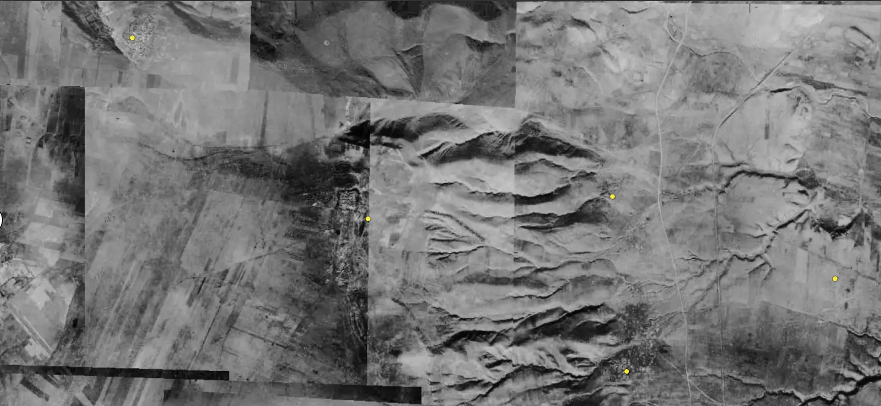
| Before & After Nakba, Click Map For Details |
|||||||||||||||

|
|||||||||||||||
| Pre-Nakba Aerial View |
|||||||||||||||
|
|||||||||||||||
| Map Location | See location #6 on the map View from satellite |
||||||||||||||
| Military Operation | Operation Gideon | ||||||||||||||
| Attacking Units | Third Battalion of the Golani Brigade | ||||||||||||||
| Defenders | Iraqi Army | ||||||||||||||
| Exodus Cause | Military assault by Zionist troops | ||||||||||||||
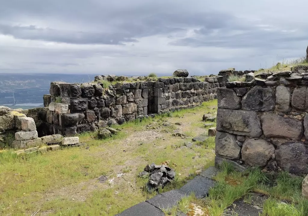
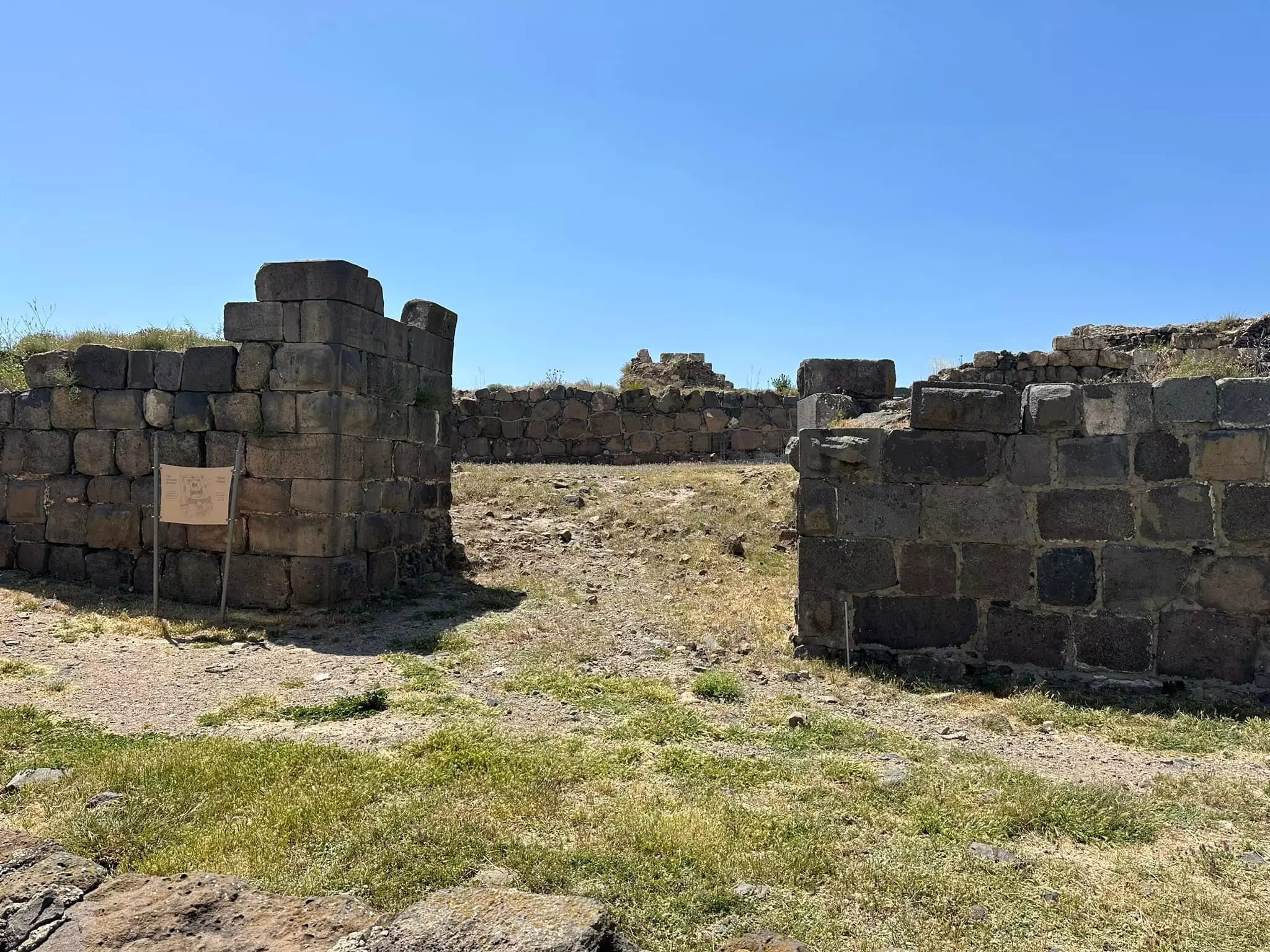
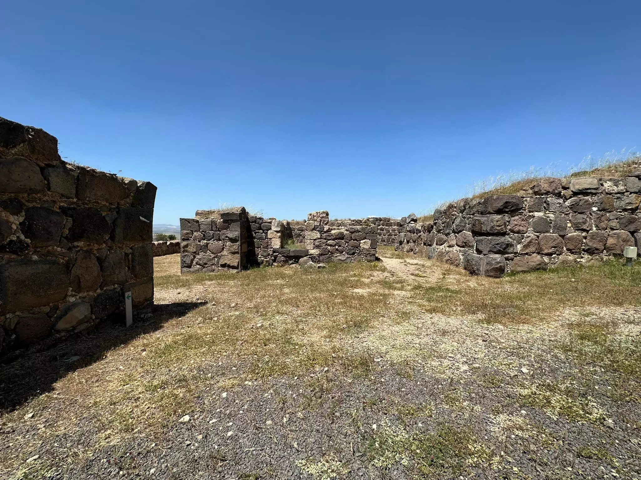
| Village Temains | In September 1948, Kawkab al-Hawa was completely obliterated. | ||||||||||||||
| Ethnically Cleansing | Kawkab al-Hawa inhabitants were completely ethnically cleansed. | ||||||||||||||
| Pre-Nakba Land Ownership |
**Town Lands' Demarcation Maps |
||||||||||||||
| Land Usage As of 1945 |
|
||||||||||||||
| Population |
|
||||||||||||||
| Number of Houses | In (1931): 46 (mentioned under Kaukab) | ||||||||||||||
| Near By Towns |
|||||||||||||||
|
|||||||||||||||
| Town's Name Through History | The ancient Egyptians referred to Kawkab al-Hawa by Yarmuta. | ||||||||||||||
| Water Supply | The village contains two springs:- 'Ayn al-Hiluw and 'Ayn al-Jirani which used to supply it with drinking water. | ||||||||||||||
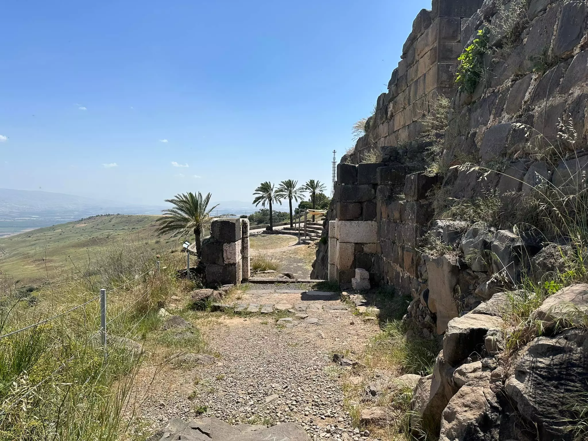
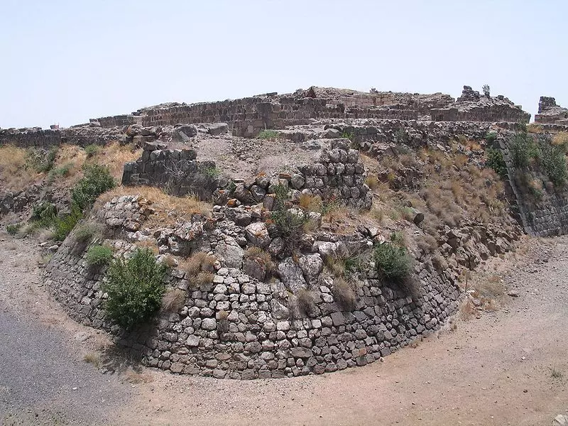
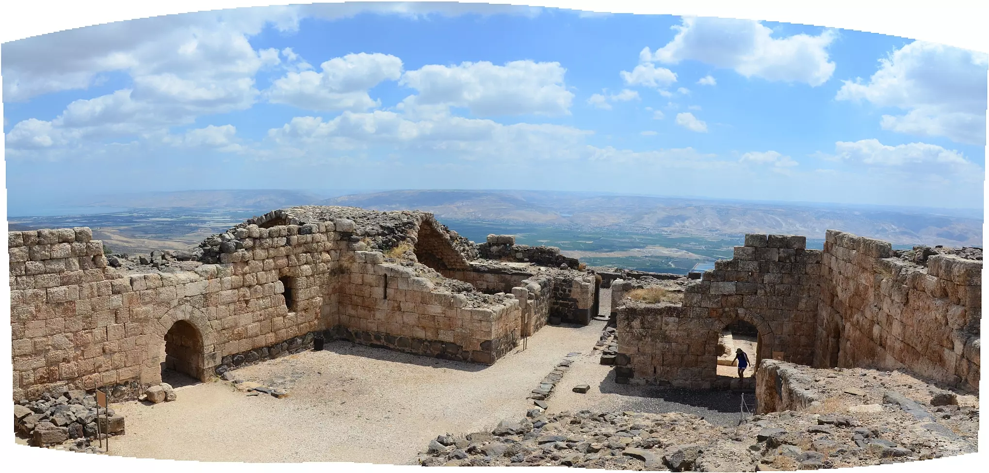
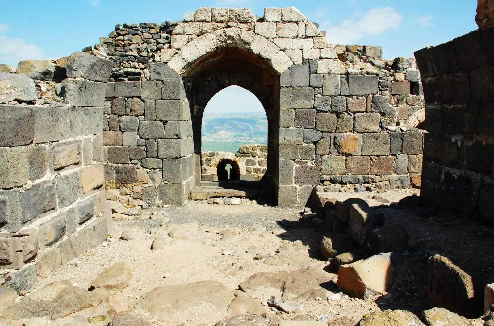
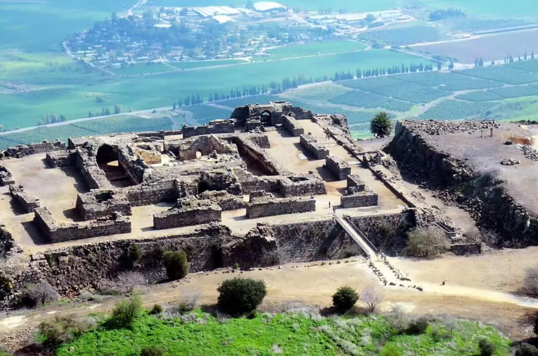
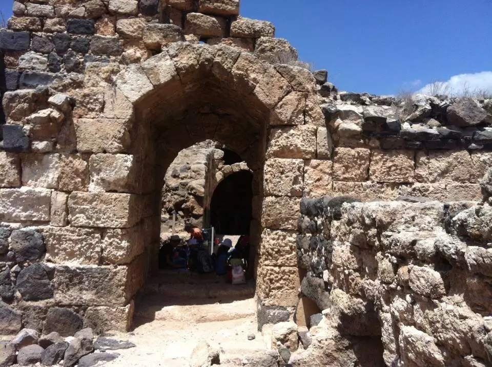
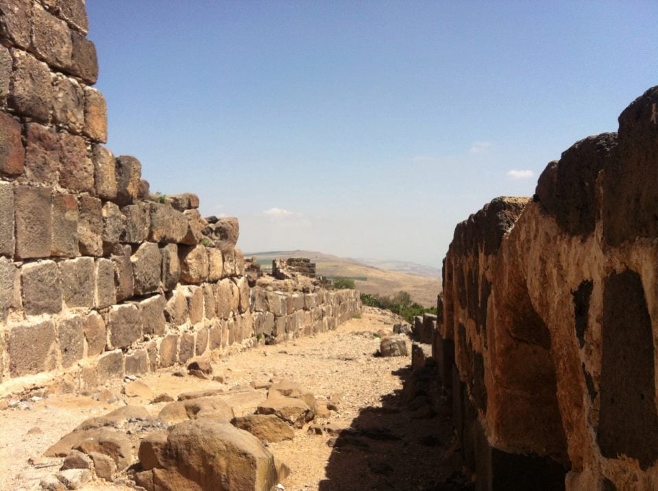
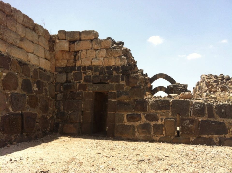
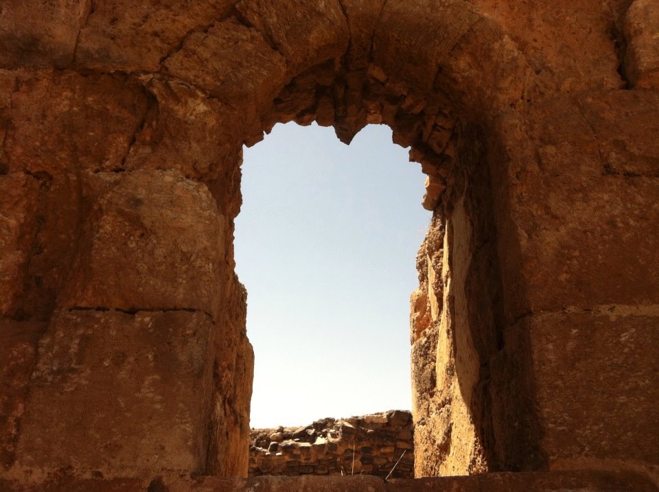
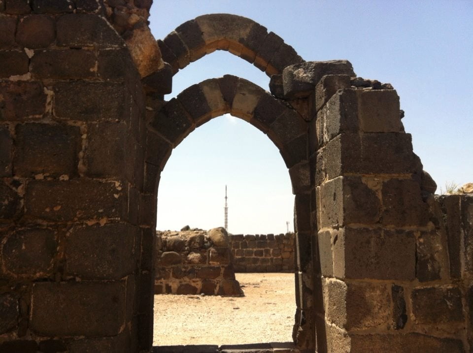
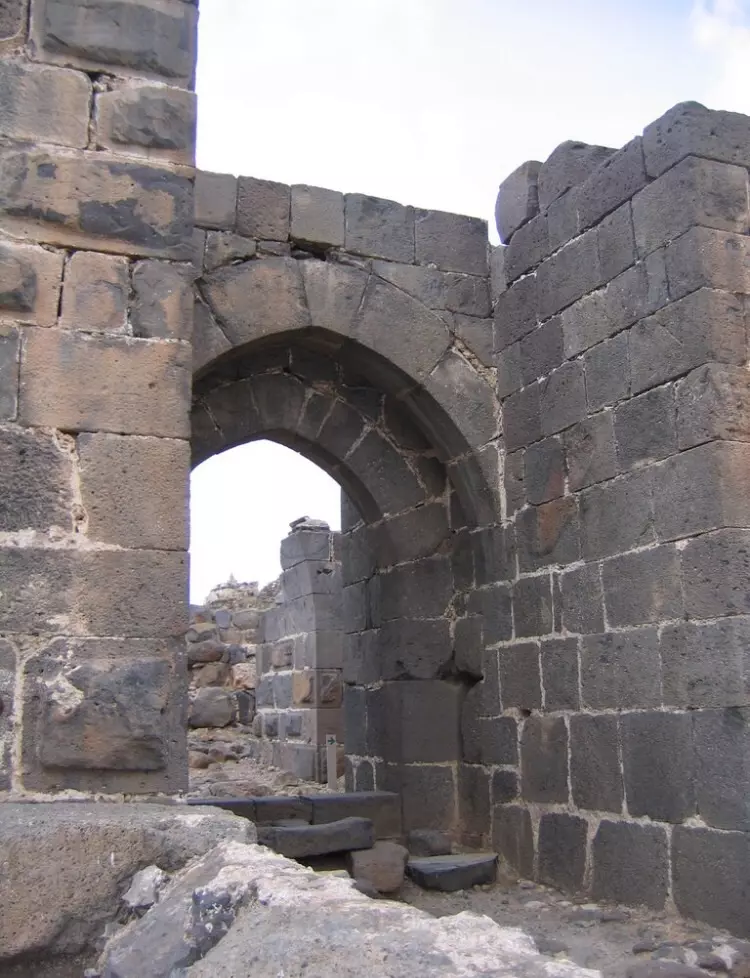
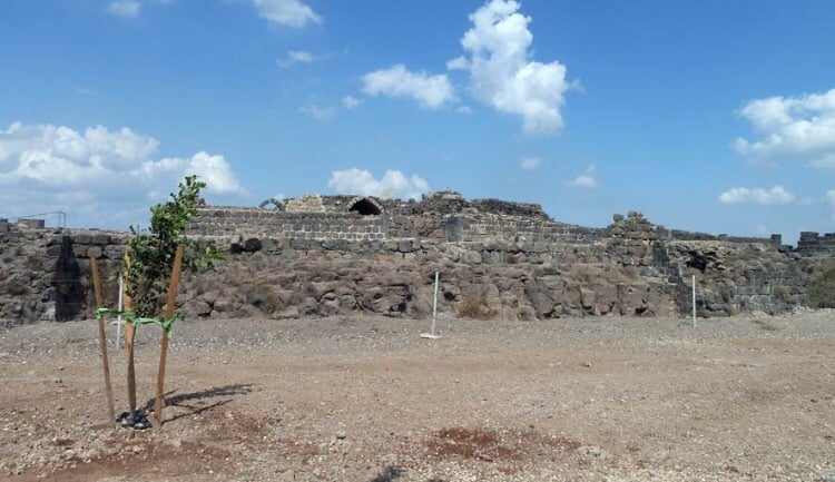
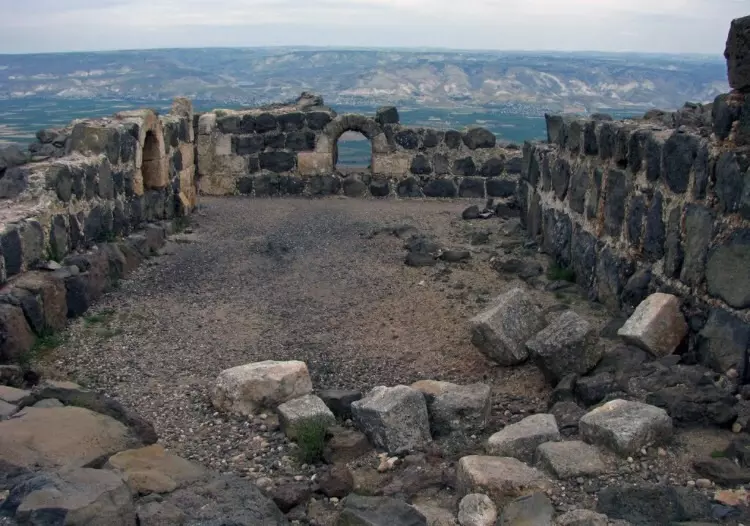
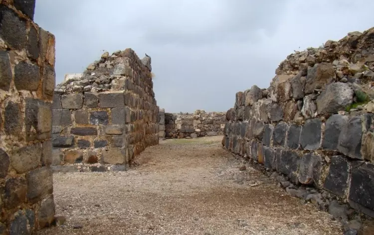
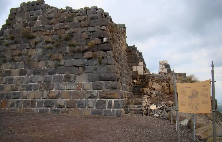
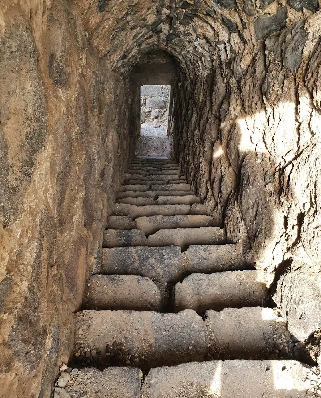
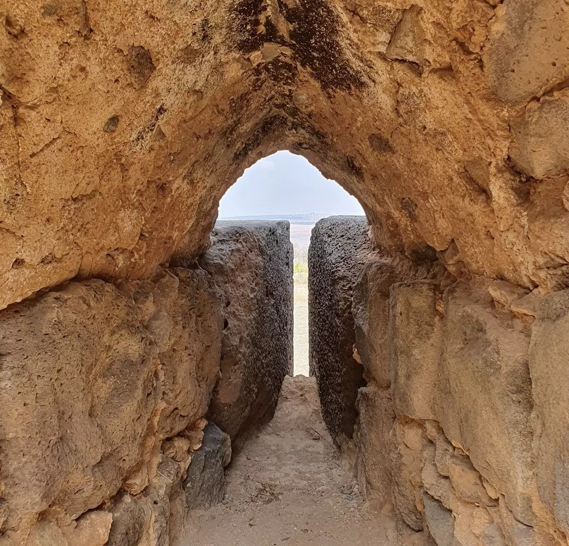
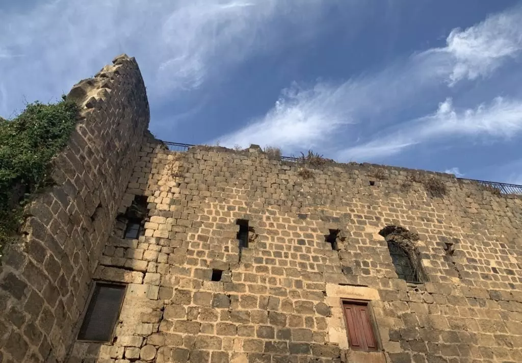
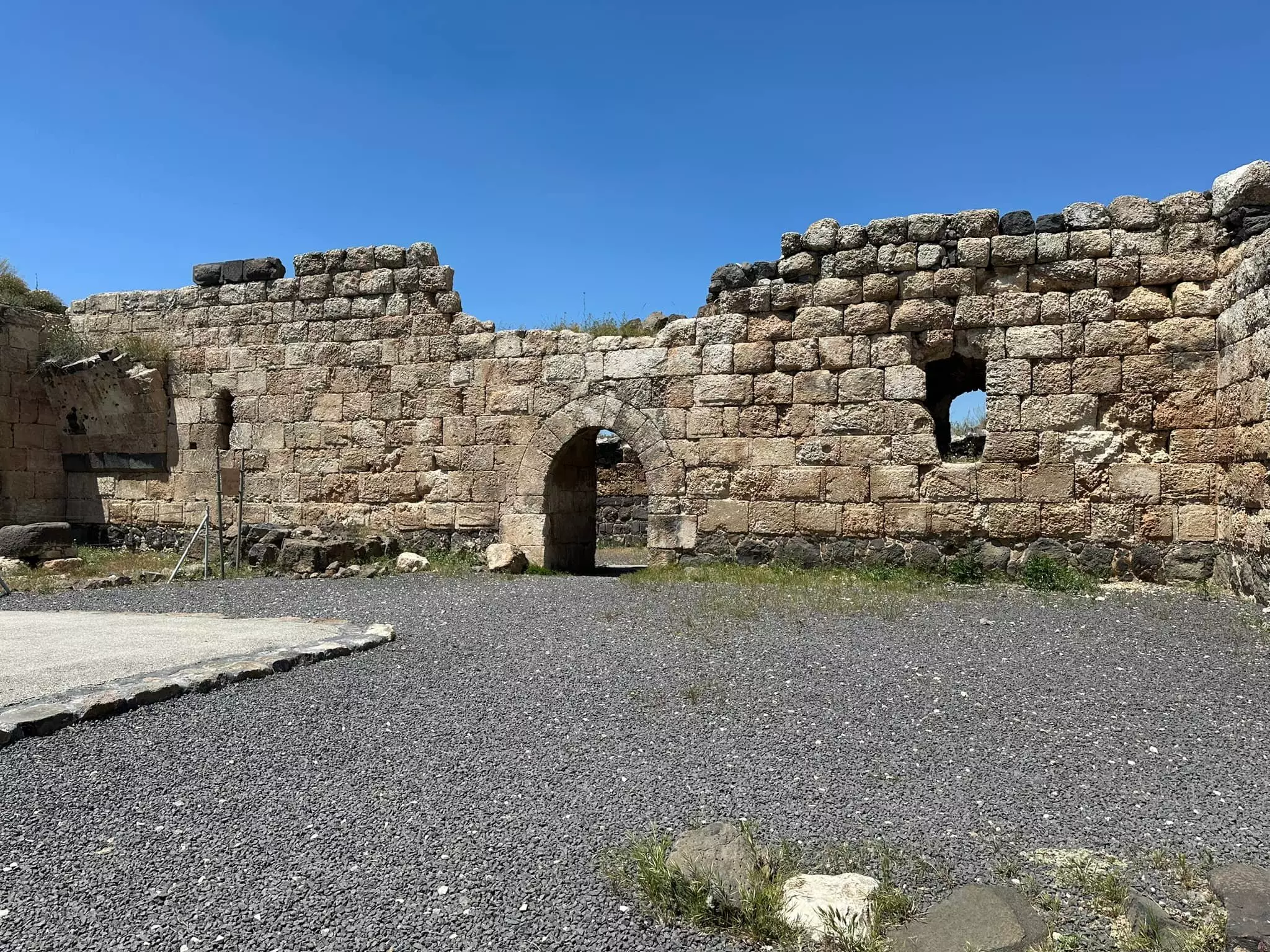
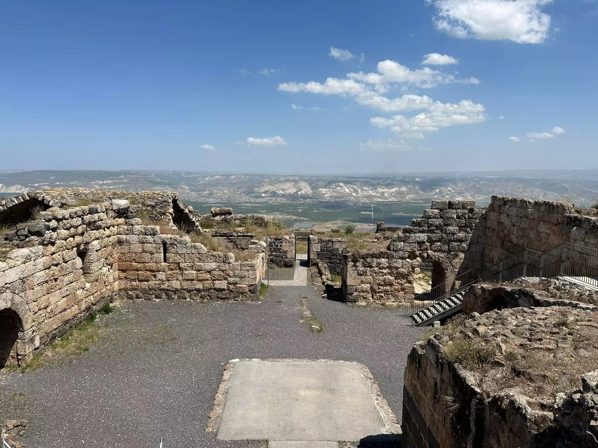
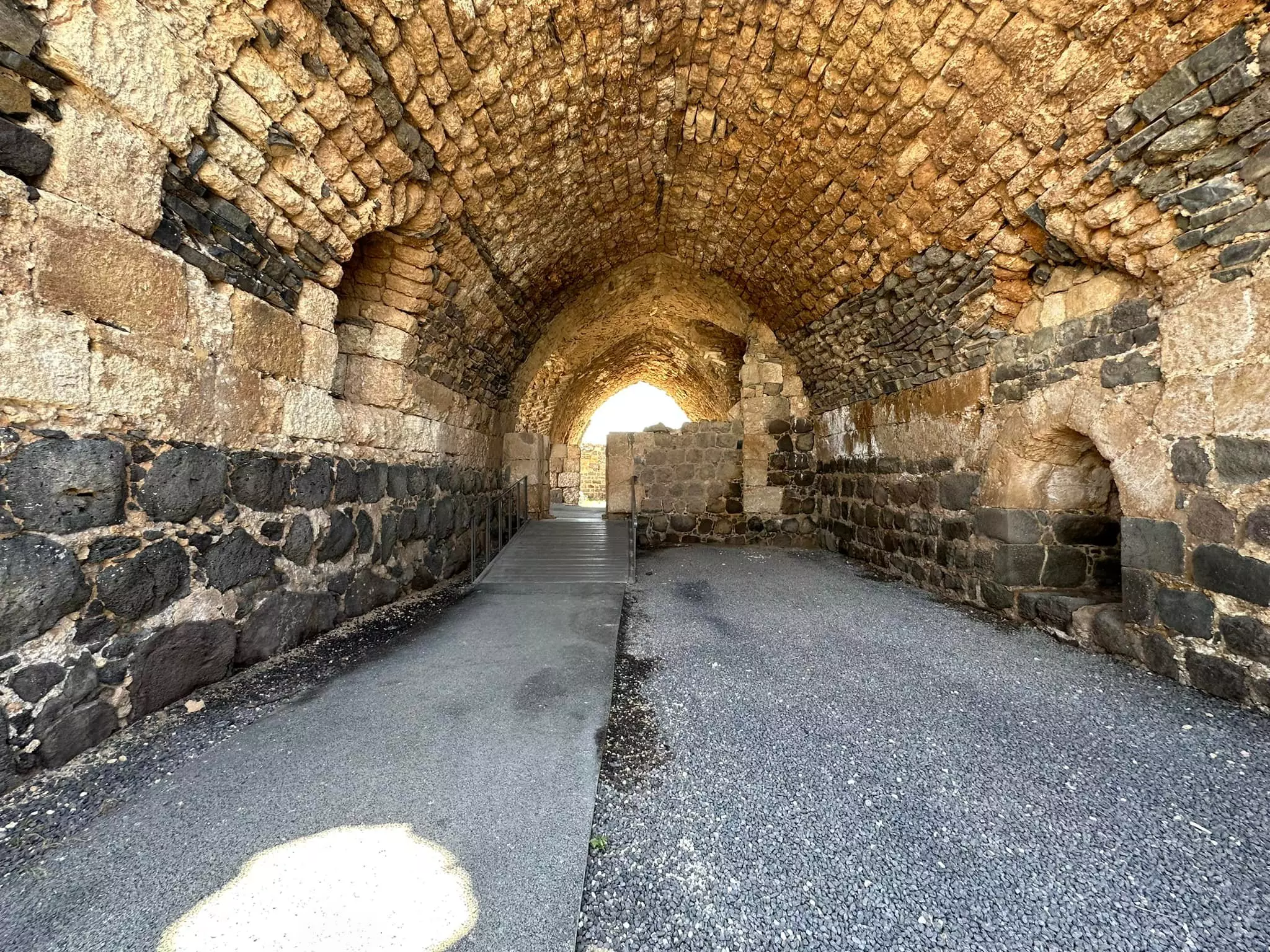
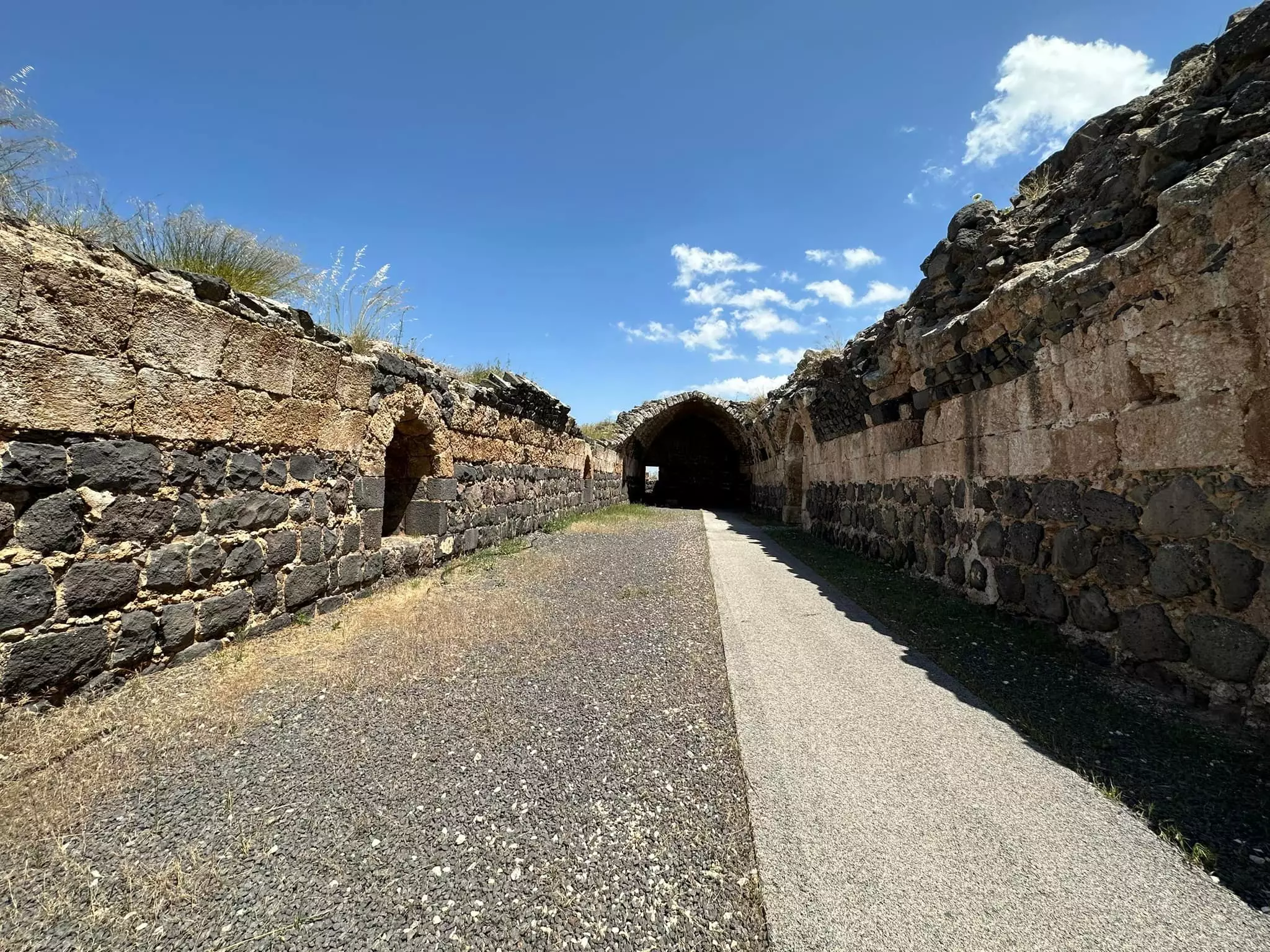
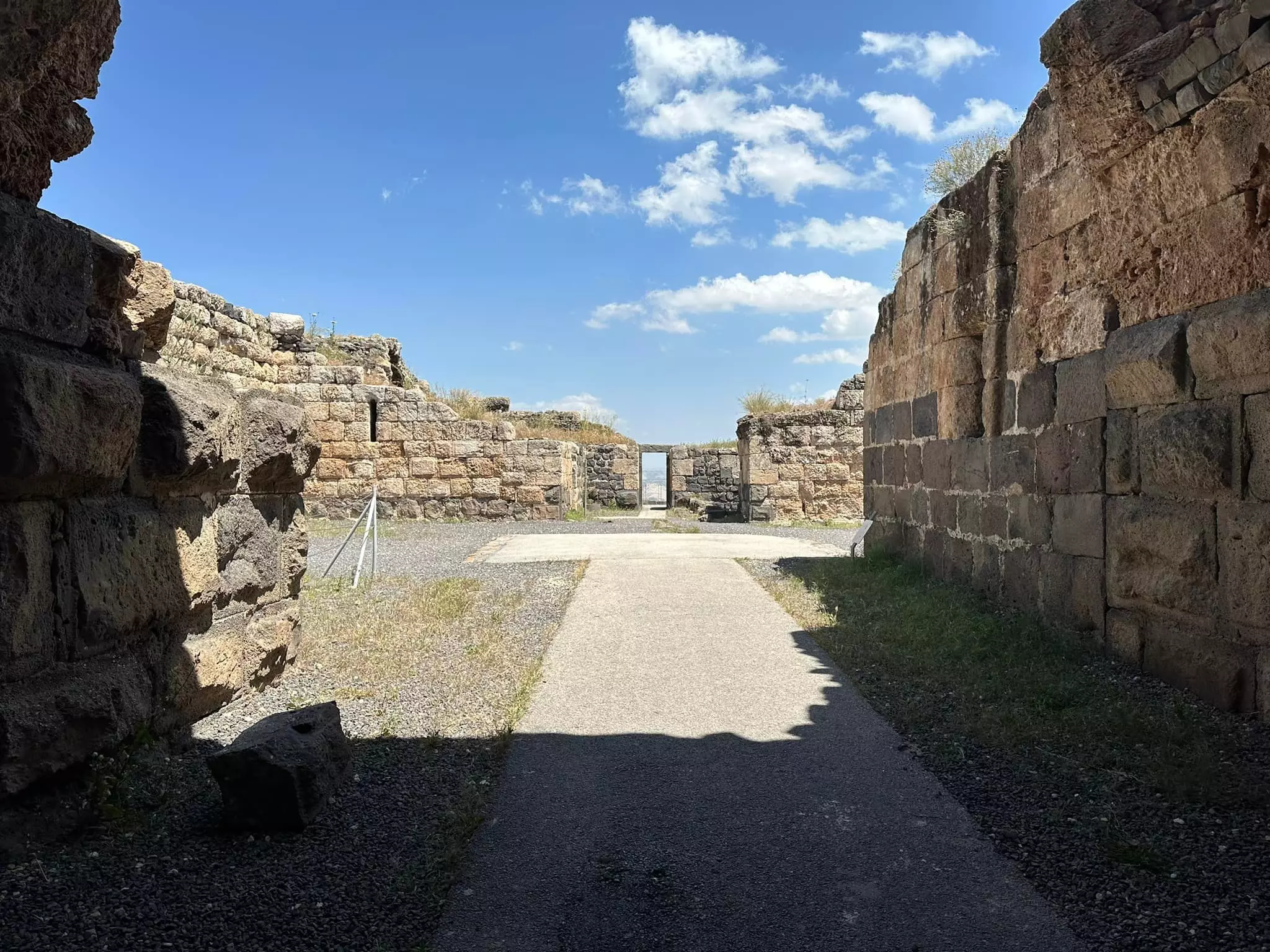
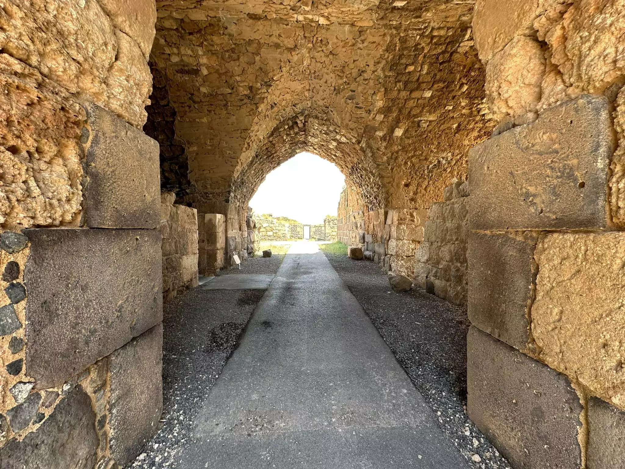
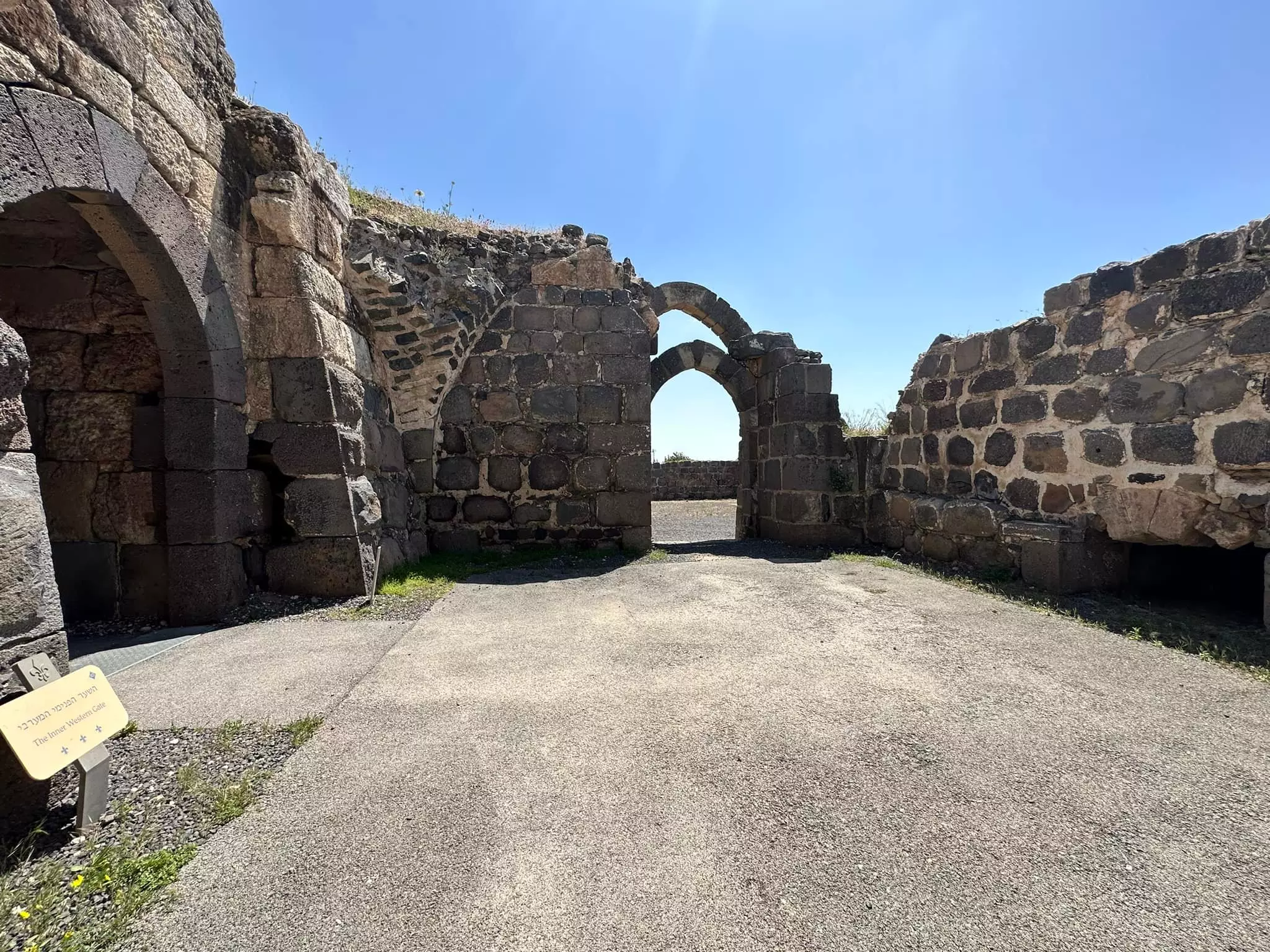
| Archeological Sites | Kawkab al-Hawa contains a Crusaders fortress, Egyptian stele, and possibly a Roman signal tower too. | ||||||||||||||
| Exculsive Jewish Colonies That Usurped Village Lands |
No Israeli settlements on village lands | ||||||||||||||
| Featured Video | |||||||||||||||
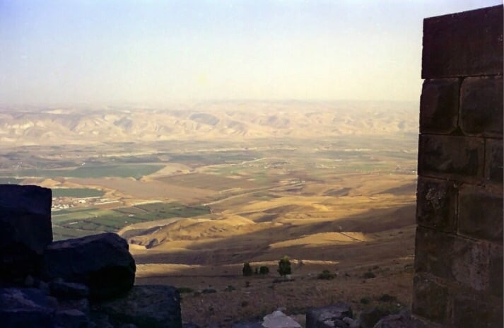
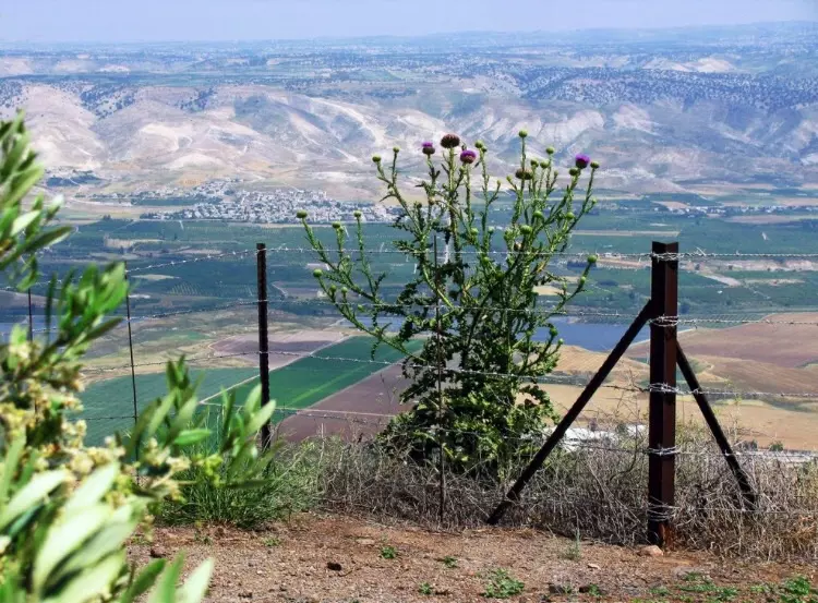
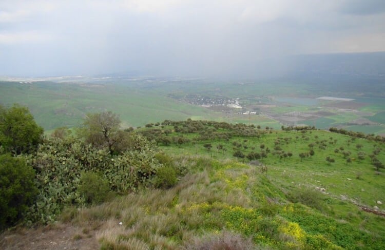
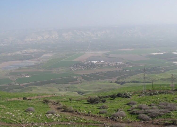
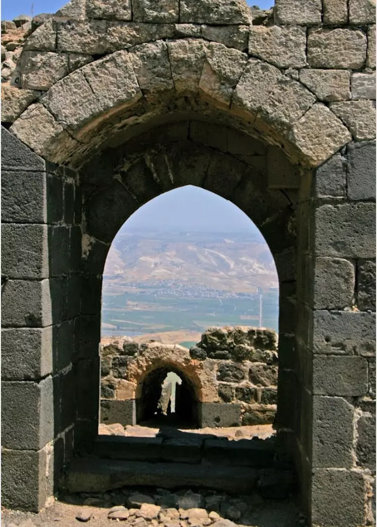
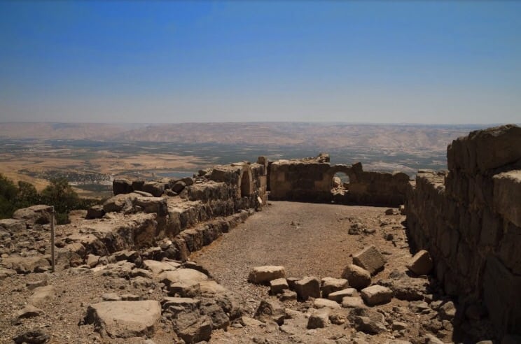
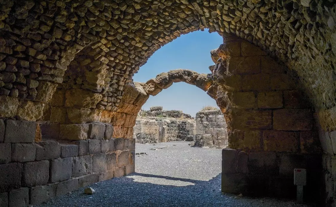
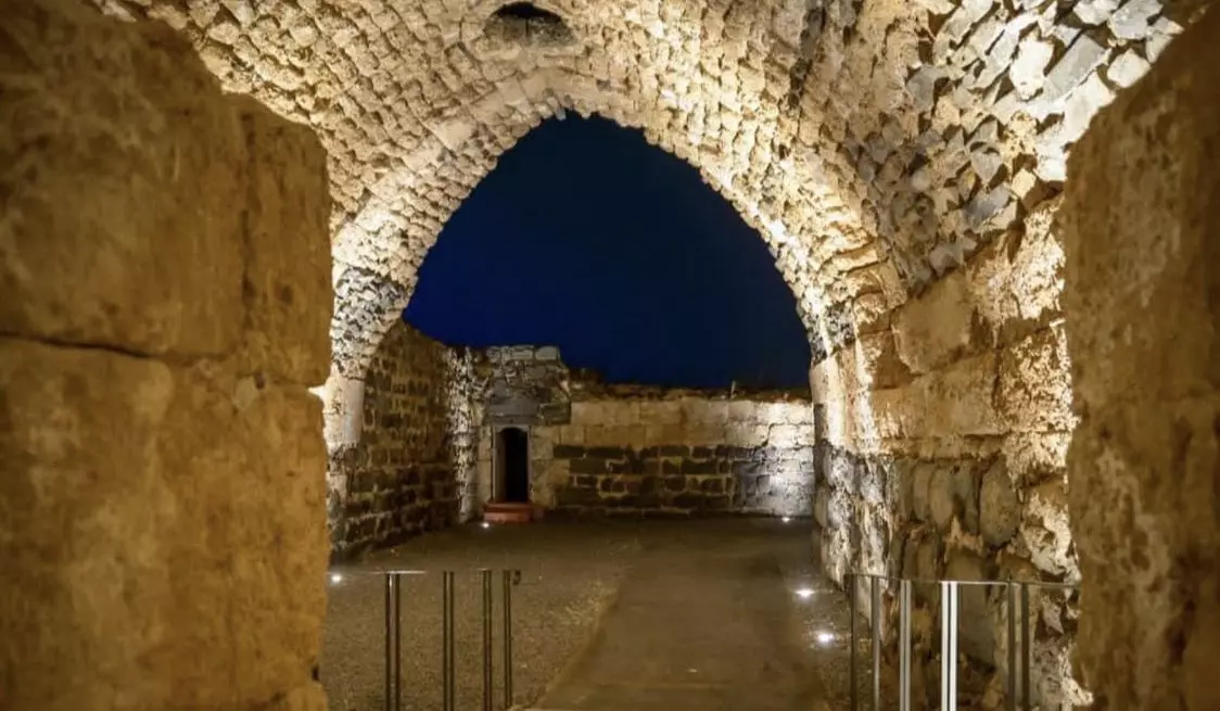
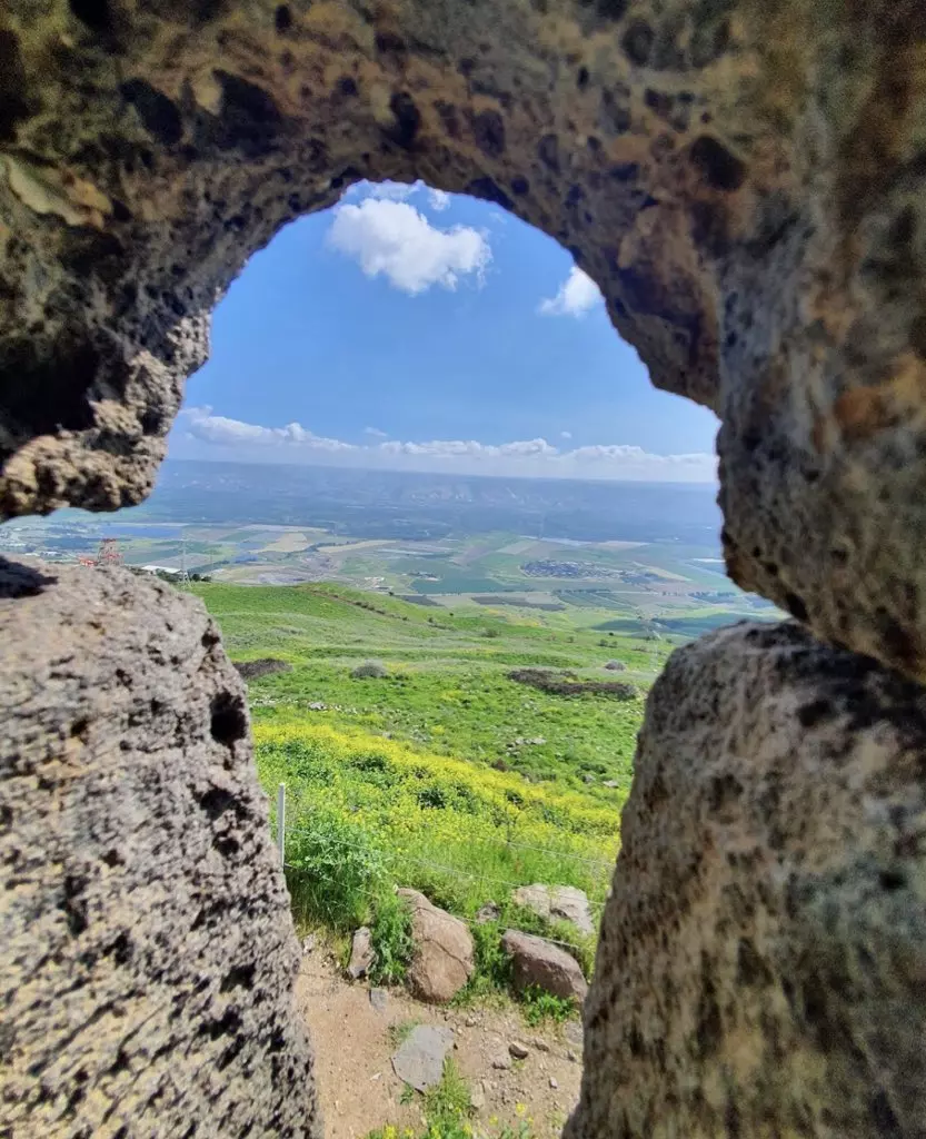
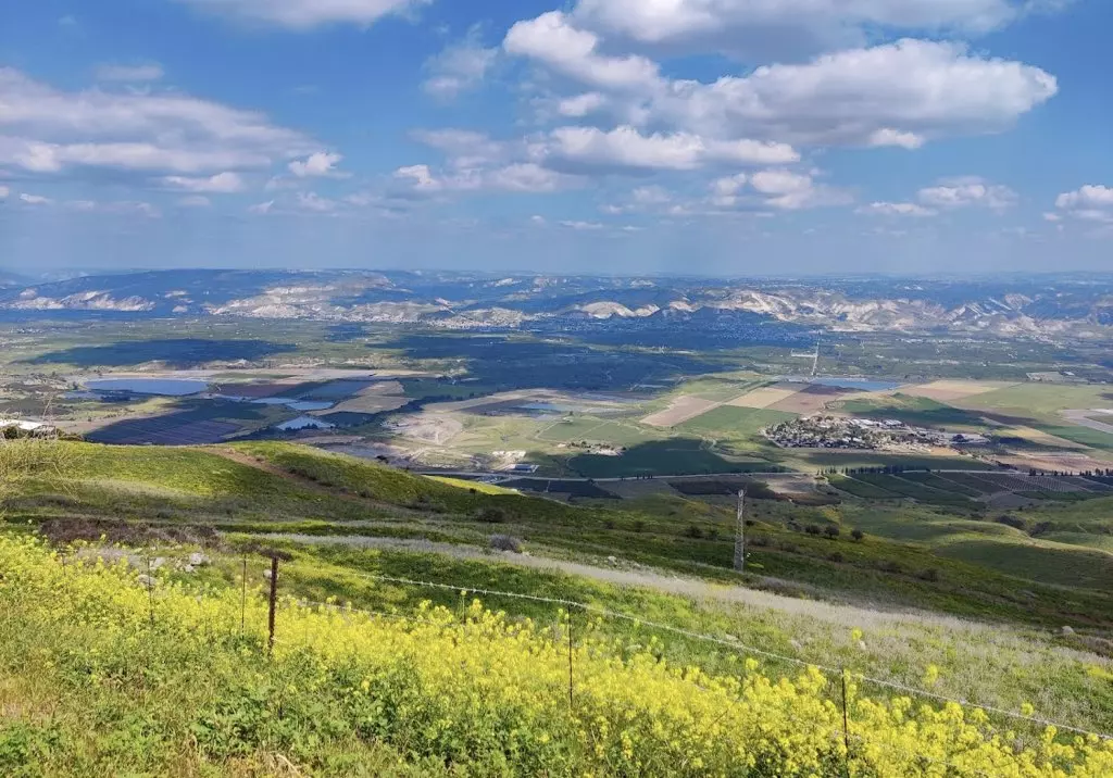
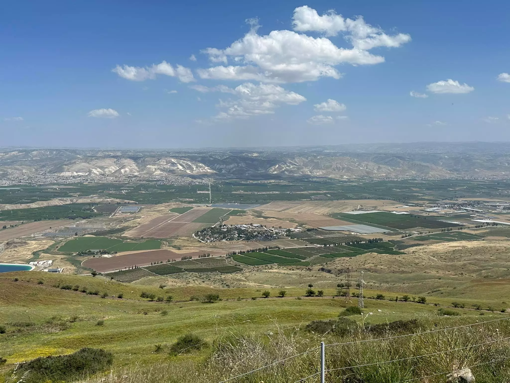
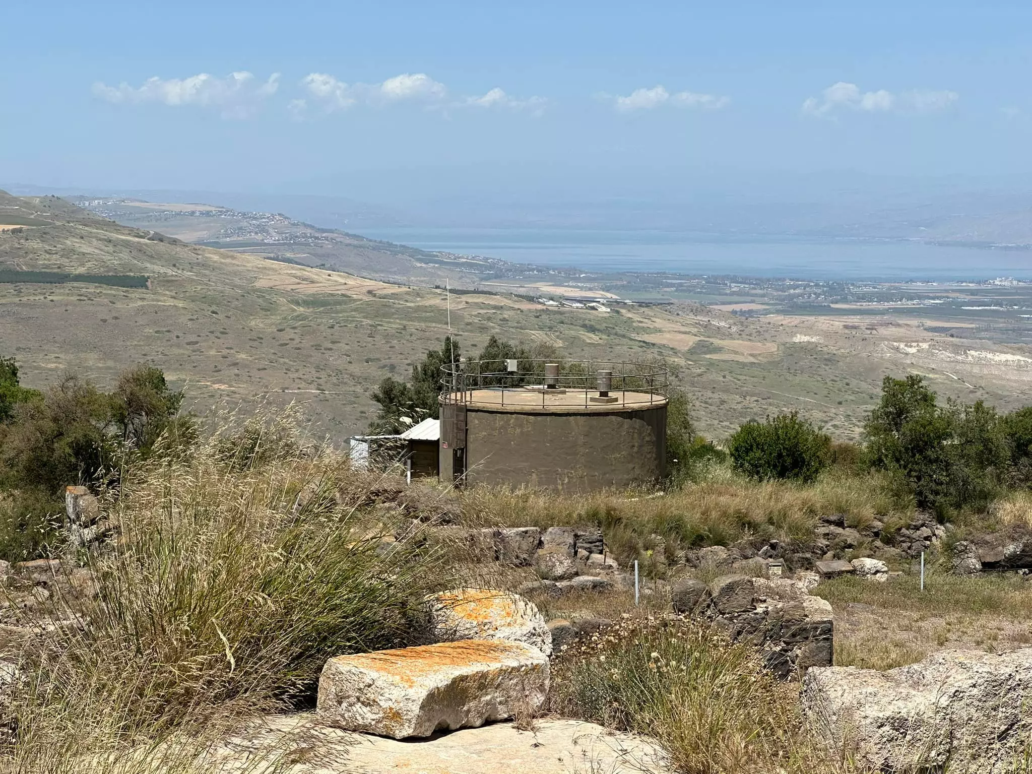
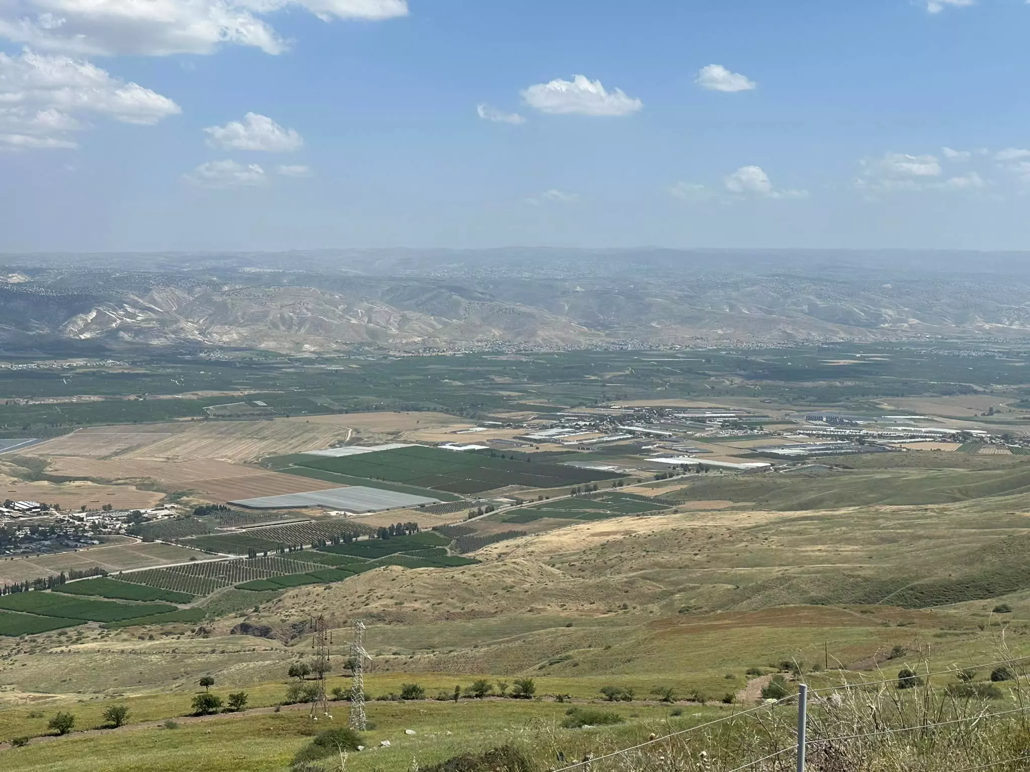
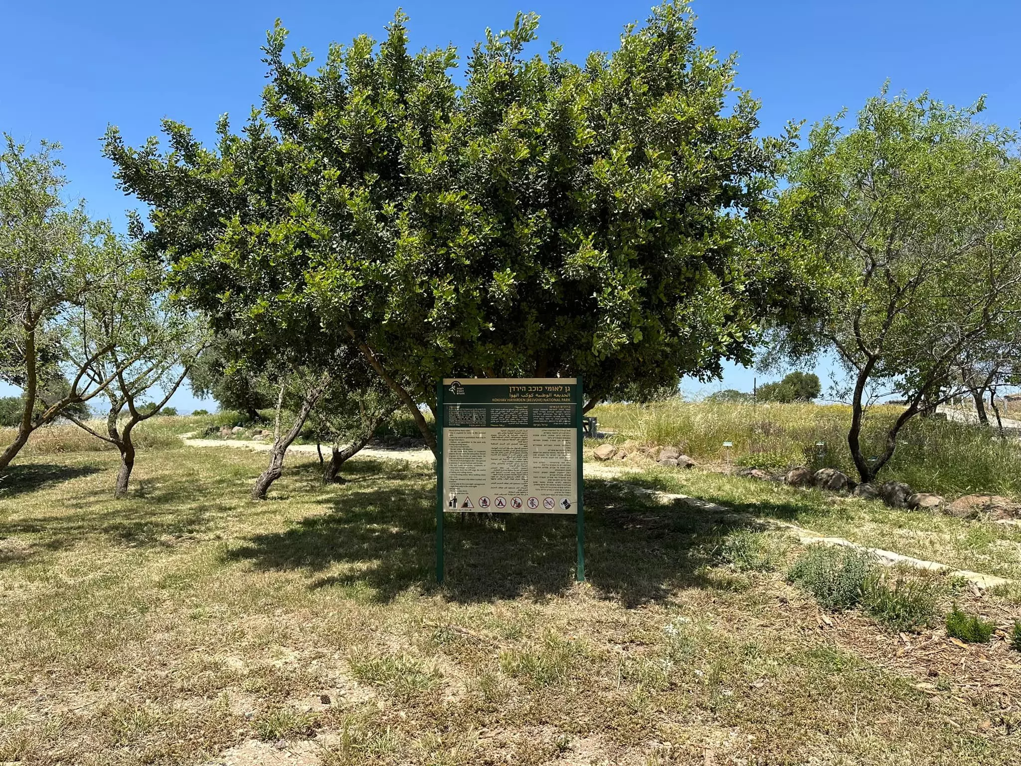
Village Before NakbaThe village stood on a hill that sloped gradually towards the north, west, and south. On the eastern side of the village the terrain dropped sharply; although the village was 300 m above sea level, the land lying only 1 km to the east was 100 m below sea level. To the south and southeast of the village were two springs, Ayn al-Hiluw and 'Ayn al-Jirani; a badly eroded Arabic inscription was found on a basalt block near the former in the late nineteenth century. The village's main link to the commercial centers of the area was a road that led to Khirbat al-Taqa this connected it to the Baysan-Jericho highway. Other secondary roads connected it with the area's villages. Because it overlooked the Jordan River in the east and Lake Tiberias in the northeast, Kawkab al-Hawa enjoyed a strategic location that gave it historical importance.Some scholars have identified Kawkab al-Hawa with a locality named Yarmuta that was named on an Egyptian stele the stele was found near the town of Baysan and dated to the late thirteenth century B.C. Nomadic Habiru tribes were located in this region at that time. (The name Yarmuta is not to be confused with that of the famous Canaanite royal city at Khirbat Yarmuk.) The Roman signal tower, Agrippina, may have stood on or near the site of Kawkab al-Hawa. In that area, also, the Crusaders constructed one of their most well-known and well-fortified castles, Belvoir, overlooking the Jordan Valley and Lake Tiberias. Kawkab al-Hawa was the site of a series of battles between the armies of Salah al-Din al-Ayyubi (Saladin) and those of the Crusaders. The Arab geographer Yaqut al-Hamawi (d. 1228) referred to it as a castle on the hill near Tiberias. According to him, it fell in ruins after the reign of Salah al-Din. In 1596, Kawkab al-Hawa was a village in the nahiya of Shafa (liwa' of Lajjun), with a population of fifty. It paid taxes on a number of crops, including wheat, beans, and melons, as well as on vineyards. Since the village was built within the outlines of the fortress of Belvoir, it was slow to expand. The villagers, who numbered about 110 in 1859, resided within the fortress walls and cultivated about 13 faddans outside of them. In time, however, houses were built in a circle around the fortress and extended to the north and west. The Muslim population of the village used their land, which lay outside the village walls, for agriculture. In 1944/45 a total of 5,839 dunums was allocated to cereals; 170 dunums were irrigated or used for orchards. Village Occupation and Ethnic CleaningA military assault on Kawkab al-Hawa took place on 16 May 1948, according to Israeli historian Benny Morris, in the wake of the occupation of the neighboring town of Baysan. But other sources state that the village was not completely captured until a few days later. The History of the Haganah states that the village was occupied on 21 May, adding that the operation was undertaken by the Third Battalion of the Golani Brigade. The account states that the village was 'ideal' for the placement of artillery units to shell the valley below, particularly with the advent of Iraqi forces into the country on 15 May. When an Iraqi platoon prepared to ascend to Kawkab al-Hawa, it was an easy target for the Israelis who occupied the village. The Haganah says that their forces attacked the Iraqis from above, at a distance of 50 meters. By the time the Iraqi forces withdrew, they had lost thirty men, while the Golani Brigade only had three men wounded, according to that account.Palestinian historian Arif al-Arif gives a slightly different account of what transpired at the village, indicating that Iraqi forces actually managed to enter and hold on to the village for a couple of days. He states that the village had been encircled by the Israelis just as Iraqi forces were entering the country on 15 May. The village's garrison put up some resistance but was defeated and routed. Just as Israeli forces were preparing to enter, the Iraqis arrived and wrested control of the village, staying from 15 to 17 May. An Associated Press dispatch from Baghdad on 18 May stated that Iraqi troops had occupied the village, which it described as 'a formidable concrete reinforced position.' However, al-Arif writes that on 18 May, the Israelis stepped up their attacks, in order to relieve the pressure on the nearby Jewish settlement of Gesher by sunset, the Iraqis had decided to withdraw, having lost twenty-three men. The following day, Israeli military headquarters issued a statement that did not acknowledge losing control of the village; it said only that their forces had repulsed an Arab attack on Kawkab al-Hawa. The communiqué, which was quoted by the New York Times, claimed that the Arab forces lost thirty dead in the battle for the village. In September 1948, a kibbutz leader in this area asked Israeli authorities for support and permission to destroy the village, along with three others in the vicinity. Morris does not mention whether permission was granted. Zionists Colonies on Village LandsThere are no Israeli settlements on village lands.Village TodayThe village has been eliminated, but the site of the Belvoir Castle has been excavated and turned into a tourist attraction. Fig and olive trees grow on the village site. The slopes overlooking the Baysan Valley and Wadi al-Bira are used by Israelis as grazing areas they also cultivate the other surrounding lands.SourceDr. Walid al-Khalidi, 1992: All That Remains. |
|||||||||||||||
| Related Maps | Town Lands' Demarcation Maps خرائط للقضاء توضح حدود القرى والاودية Town's map on MapQuest View from satellite Help us map this town at WikiMapia |
||||||||||||||
| Related Links | Wikipedia's Page Google Search Google For Images Google For Videos |
||||||||||||||
| More Information | في كتاب كي لا ننسى في كتاب بلادنا فلسطين في كتاب النكبة والفردوس المفقود المزيد من موقع هوية |
||||||||||||||
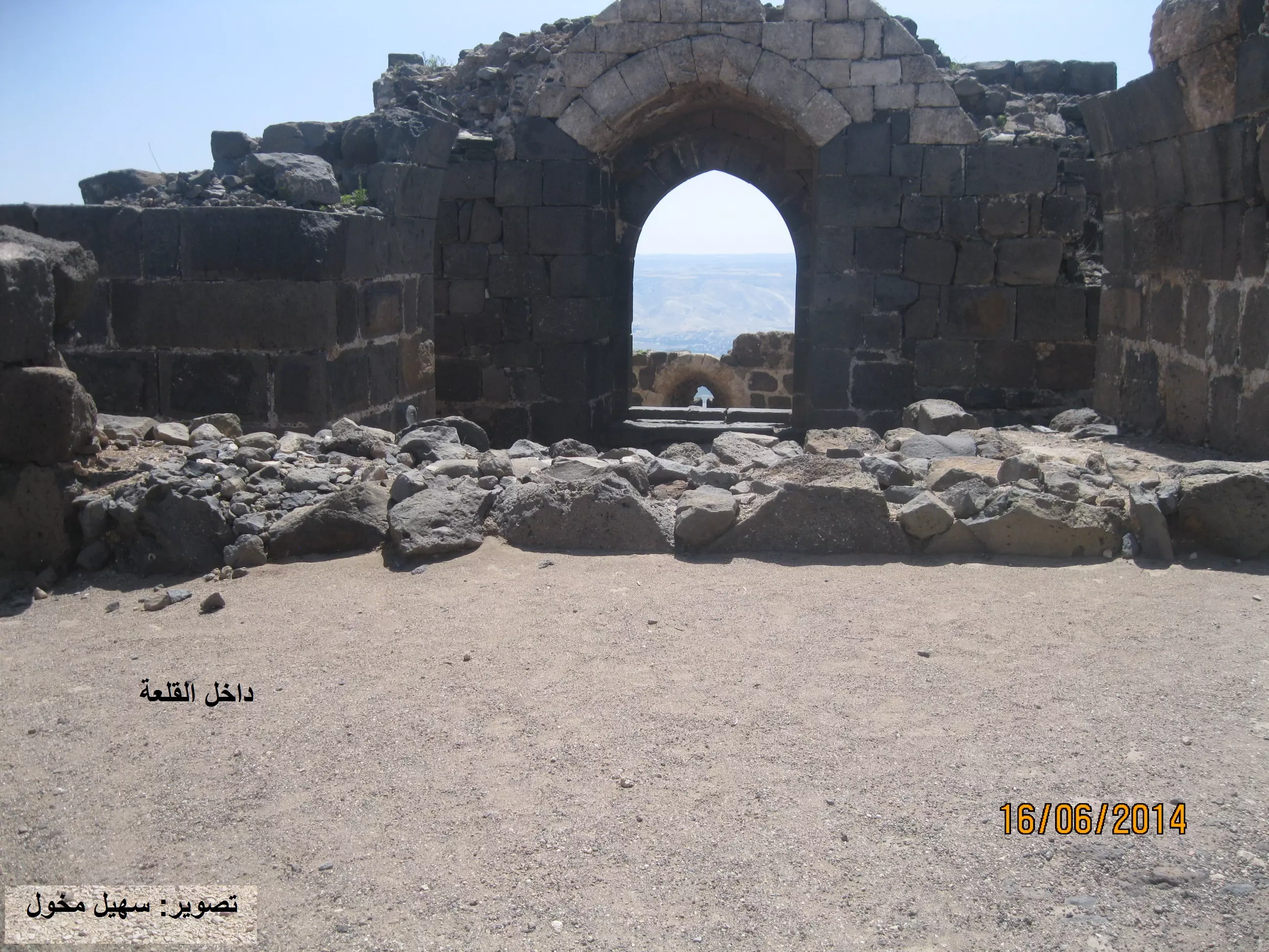
- القلعة
- Panorama looking east
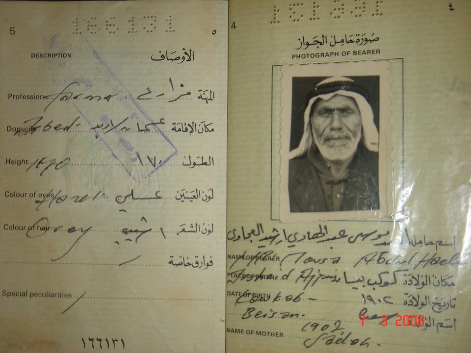
Posted by Uri Zackhem - صورة لجواز سفر السيد موسى عبدالهادي إرشيد العجاوي، الرحمة علية
- كوكب الهوا - الطريق للقلعة - تصوير سهيل مخول يوم 16 حزيران 2014

Posted by سهيل مخول - كوكب الهوا - القلعة - تصوير سهيل مخول يوم 16 حزيران 2014

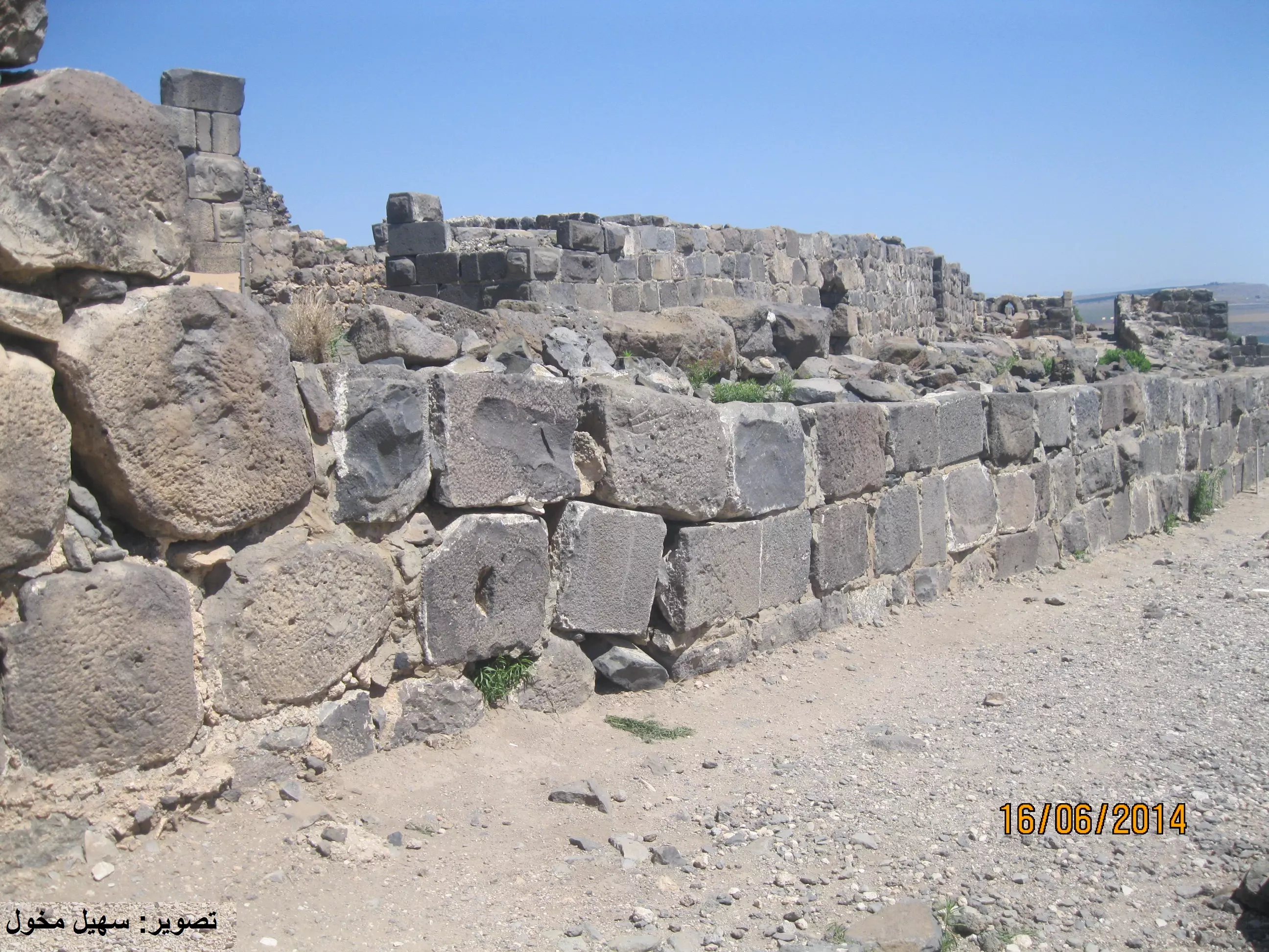
Posted by سهيل مخول - كوكب الهوا - القلعة - تصوير سهيل مخول يوم 16 حزيران 2014
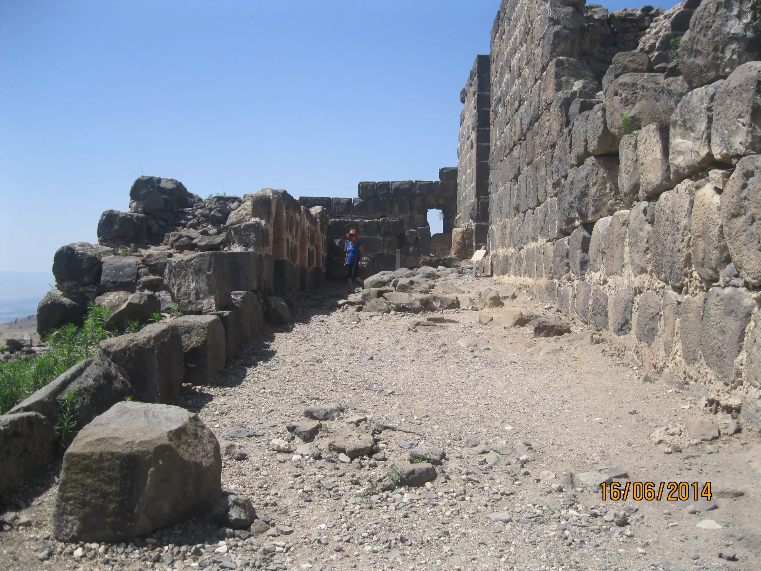
Posted by سهيل مخول - كوكب الهوا - القلعة - تصوير سهيل مخول يوم 16 حزيران 2014
Posted by سهيل مخول - كوكب الهوا - القلعة - تصوير سهيل مخول يوم 16 حزيران 2014
Posted by سهيل مخول - منظر عام من داخل القلعة
- كوكب الهوا يوم احتلالها 16.5.1948
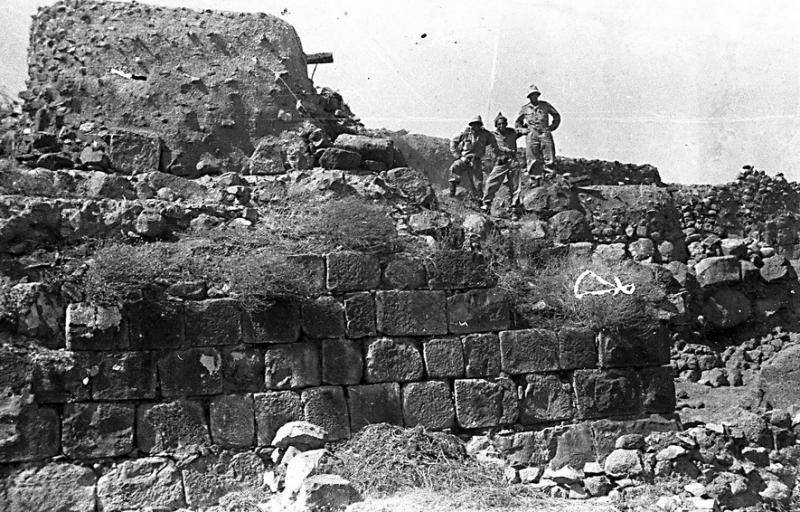
- كوكب الهوا يوم احتلالها 16.5.1948
- كوكب الهوا يوم احتلالها 16.5.1948
- منظر عام للقلعة
- اولاد من الطيبة الزعبية داخل القلعة
Posted by فتحي ابو رضا \ العايدي - من داخل القاعة

Posted by فتحي ابو رضا \ العايدي - القلعة والحفير
Posted by فتحي ابو رضا \ العايدي - الاقواس

Posted by فتحي ابو رضا \ العايدي - من داخل القلعة
Posted by فتحي ابو رضا \ العايدي - الاقواس
Posted by فتحي ابو رضا \ العايدي - الاقواس
Posted by فتحي ابو رضا \ العايدي - منظر من القلعه باتجاه الاردن
Posted by abu raya - المدخل الى القلعه
Posted by abu raya - من اسوار القلعه

Posted by abu raya - كوكب الهوا

Posted by abu raya - اثار كوكب الهوا
Posted by abu raya - اثار كوكب الهوا
Posted by abu raya - منظر من موقع القريه باتجاه الاردن
Posted by abu raya - كوكب الهوا
Posted by abu raya - موقع كوكب الهوا
Posted by abu raya - اثار القريه
Posted by abu raya - كوكب الهوا
Posted by abu raya - اثار كوكب الهوا

Posted by abu raya - كوكب الهوا
Posted by abu raya - اثار كوكب الهوا
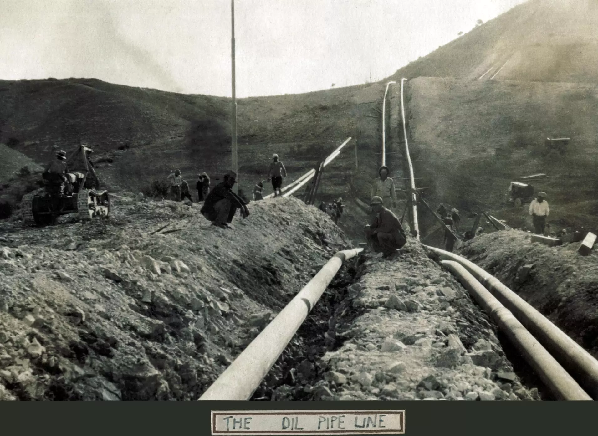
Posted by abu raya - تمديد خطوط البتلرول بين حيفا والعراق سنة 1933 - الموقع ...كوكب الهواة فوق جسر المجامع
- جولة في قلعة كوكب الهوا المهجرة
- جولة في قلعة كوكب الهوا المهجرة #2
- جولة في قلعة كوكب الهوا المهجرة #3
- جولة في قلعة كوكب الهوا المهجرة #4
- جولة في قلعة كوكب الهوا المهجرة #5
- جولة في قلعة كوكب الهوا المهجرة #6
- جولة في قلعة كوكب الهوا المهجرة #7
- نظرة نحو شرقي الاردن من قرية كوكب الهوا المهجرة
- Pre-Nakba Aerial view of the village / صورة من الجو للقرية اخذت قبل النكبة
- We lived inside and outside the castle. The village was occupied while it was intact, but the "civilized" destroyed our homes to hinder our return. How else will Jews be great again?
- We lived inside and outside the castle. The village was occupied while it was intact, but the "civilized" destroyed our homes to hinder our return. How else will Jews be great again? #2
- We lived inside and outside the castle. The village was occupied while it was intact, but the "civilized" destroyed our homes to hinder our return. How else will Jews be great again? #3
- We lived inside and outside the castle. The village was occupied while it was intact, but the "civilized" destroyed our homes to hinder our return. How else will Jews be great again? #4
- We lived inside and outside the castle. The village was occupied while it was intact, but the "civilized" destroyed our homes to hinder our return. How else will Jews be great again? #5
- We lived inside and outside the castle. The village was occupied while it was intact, but the "civilized" destroyed our homes to hinder our return. How else will Jews be great again? #6
- We lived inside and outside the castle. The village was occupied while it was intact, but the "civilized" destroyed our homes to hinder our return. How else will Jews be great again? #7

- We lived inside and outside the castle. The village was occupied while it was intact, but the "civilized" destroyed our homes to hinder our return. How else will Jews be great again? #8
- We lived inside and outside the castle. The village was occupied while it was intact, but the "civilized" destroyed our homes to hinder our return. How else will Jews be great again? #9

- We lived inside and outside the castle. The village was occupied while it was intact, but the "civilized" destroyed our homes to hinder our return. How else will Jews be great again? #10
- We lived inside and outside the castle. The village was occupied while it was intact, but the "civilized" destroyed our homes to hinder our return. How else will Jews be great again? #11
- We lived inside and outside the castle. The village was occupied while it was intact, but the "civilized" destroyed our homes to hinder our return. How else will Jews be great again? #12
- We lived inside and outside the castle. The village was occupied while it was intact, but the "civilized" destroyed our homes to hinder our return. How else will Jews be great again? #13
- We lived inside and outside the castle. The village was occupied while it was intact, but the "civilized" destroyed our homes to hinder our return. How else will Jews be great again? #14
- We lived inside and outside the castle. The village was occupied while it was intact, but the "civilized" destroyed our homes to hinder our return. How else will Jews be great again? #15
- We lived inside and outside the castle. The village was occupied while it was intact, but the "civilized" destroyed our homes to hinder our return. How else will Jews be great again? #16

- We lived inside and outside the castle. The village was occupied while it was intact, but the "civilized" destroyed our homes to hinder our return. How else will Jews be great again? #17
- خارطة تُظهِر الحدود والطرق بأنواعها والأماكن المقدسة والطبيعة الطوبغرافية من تلال وسهول ومنحدرات والتشكيلة الطبيعية للأرض وأنواع المزروعات. نُشرت الخريطة فترة الانتداب البريطاني، تم إضافة تعديلات عليها من قِبَل خدمة الخرائط والصور التابعة للقوات العسكرية الاسرائيلية فترة الأربعينيات.

- جدول مهم يبين الحالة المالية لأعضاء جمعية كوكب الهوا التعاونية للتسليف والتوفير لسنة 1947-- ومنهم ذكرت العائلات التاليه: الخطيب, أبو الرب, العجاوي -- أنقر الصورة لتكبيرها

- وثائق مهمة تبيين وضع جمعية كوكب الهوا التعاونية للتسليم ومراسلات مهمة معم منظم الجمعيات أحمد الشامي - 1947 -- ةأنقر الصورة لقرآءة اﻷسماء والتفاصيل

Want to browse more? 80,000 pictures were grouped in these gallaries:
| Display Name | Clan/Hamolah | Country of Residence |
| Feras | الشجراوي | Jordan |
| ReRe | شجراوي | - |
| mutaz sous | SOUS | DAMMAM |
| ahmad toubat | - | - |
- قهوتنا 6.10.2010: عن بلدي حكيلي...قرية كوكب الهوا المهجرة Duration: 5 min 29 sec
- زيارة لكوكب عام 1995 Duration: 20 min
 Fake Valor: Why Did Zionist Jews Hoist Nazis Flag on Their Ships in the 1930s?
What is new?
-
Facts About Oct. 7th Gaza Raid
-
Remined Us Please: Who Did Rape Whom? Was it Palestinians who raped Israelis? Or, was the other way around? You'll be the judge
-
When Prof. Edward Said was invited to debate Bibi Netanyahu in the 1980s, watch what happened!
-
Ezra Klein of the NY Times on the "Jewish Race".
-
Abusing Blood Libel!
-
How and why Israeli Jewry has become the most hated cult?
-
Did Israeli Soldiers Activate The Hannibal Direective On Oct. 7th? You Be The Judge
-
Zionist FAQ: Isn't it true that Palestinians don't want peace? Palestinians never accepted the two-state solution
- Facts about Haavara (Transfer) Agreement between Ben-Gurion & Hitler
-
Haavara FAQs: Why Did Zionist Jews Hoist Nazis' Flags on Their Ships in the 1930s?
- Haavara FAQs: When Chaim Weizmann met FDR in mid-1943, why was he silent about rescuing European Jewry?
-
Dear ChatGPT: How did Palestinians resist Napoleon's invasion of their country in 1799?
-
Dear ChatGPT: Gaza had a vibrant Jewish community in the mid-17th century. What happened to them?
-
Dear ChatGPT: Why did the Jewish Agency suppress news of the Holocaust during WWII?
-
Video Playlist: Jews share their DNA tests to end the conflict for good.
-
A Tale of Two Conflicts: Examining the Definition of Genocide
-
Prof. Abraham Polak And The Suppressed History of the Khazars and European Jewry
-
How Ronald Reagan would have framed the genocide in Gaza if he were still alive?
-
Haavara FAQs: Let us do the math: how many German Jews did The Haavara Agreement save?
-
Zionist FAQs: The Hebron Massacre of 1929, "clearly proves" that Palestinians are antisemitic, how could you deny it?
-
Zionist FAQs: Why Anti-Zionist Is Not Antisemitism?
-
Zionist FAQs: Isn't it true that the KGB created Palestinian Nationalism in the early 1960s?
- Zionist FAQs: Muslims are killing Muslims all the time; why are Israeli Jews being singled out in the media?
- Zionist FAQs: How is Israel an apartheid state when 20% of its citizens are Arabs who enjoy full rights?
-
Haavara FAQs: Why Did Dorothy Thompson Flip From A Zionist Advocate to A Silenced Dissenter?
-
Haavara FAQs: Analysis of Herzl's Uganda Scheme and how it could have saved millions of Jews.
-
Haavara FAQs: Why did Hayim Greenberg describe American Jewry as "morally bankrupt" in early 1943?
-
Haavara FAQs: What if the Evian Conference was a resounding success? What would have been the impact of saving European Jewry on Zionism?
- Haavara FAQs: What if the six million were saved, how that would have impacted the Zionist project?
-
Haavara FAQs: How did Zionist leaders react when Europe's Jews lingered in the DP camps after WWII ended?
-
Why does the American Jewish community repeat lies that David Ben-Gurion had debunked before he died?
-
Who has the power to rename the Tatar/Khazar Gene Marker to Jewish IV?
-
Zionist FAQs: Why won't Egypt, Syria, and Jordan take their people back? Jews are indigenous to Palestine, and Arabs immigrated after Jews developed the country. Arabs should leave.
-
Haavara FAQs: Did Hitler and the Nazis conflate between Judaism and Zionist? If that wasn't case, then why?
-
Haavara FAQs: Winston Churchill and antisemitism, a collection of articles written Churchill.
-
Haavara FAQs: Broken by country, how many Jews survived vs. killed during the Holocaust?
-
Haavara FAQs: Why did European Jews vote with their feet and to immigrated to the Americas, not Palestine, after WWII?
-
Watch this American Jewish Girl describing Israeli Jews' cognitive dissonance like no other in under two minutes
-
Haavara FAQs: When the Nazis went out of their way to hide the Holocaust, Israeli Jews did the exact opposite by broadcasting their genocide of Gazans. But why?
-
Haavara FAQs: How Zionist Jews went out of their to show their appreciation to Nazism and Fascism?
- Haavara FAQs: Why Zionist leaders were against bombing the death camps & the Railroads leading to them?
-
Haavara FAQs: Hitler's message to the British and American people: If Jews are such noble citizens and you care about them, how come you're not letting them in? I will gladly ship them to you at my expense, even on luxury liners!
-
A shortlist of Zionist and Israeli false flag operations in the name Jews.
-
The Most Moral Army
- The Land of Kapos (Israel): Where the brave are boycotted and Kapos walk free.
- Why did early Zionists often named their communal enterprises "colonial"?
- Zionist Relations with Nazi Germany by Faris Glubb
-
Two NY Times advertisements by Zionists in the early 1943 that exposes Zionists' treason at the height of the calamity
- Facts Not Lies about the Palestinian-Israeli Conflict.
- Site's pictures have been categorized
- Campgain Against Lice
- A Survey of Palestine, the official source about Palestine before Nakba produced by the British Mandate; over 1200 pages.
- Satellite View & Google Earth: Over 6,000 placemarks identifying all destroyed towns, W. Bank & Gaza Strip Towns, & refugee camps.
- PalestineRemembered.com and its Nakba Oral History Project were featured on al-Jazeera Satellite TV.
- Nakba Oral History Video Podcast:
 Over 700 Oral History interviews (including 3,500+ hours of recording) can be viewed online.
 - Palestine Village Statistics Project
- Gaza Jail Break
- النسخة العربية للموقع الان متوفرة
- Videos: Documenting the destroyed villages in video: Tracing all that remains since Nakba.
- Videos: Responding to Zionist Propaganda
- Interview: The ethnic cleansing of Palestine: George Galloway interviews Israeli Historian Ilan Pappe.
- For Palestinians, memory matters. It provides a blueprint for their future By George Bisharat.
- Zionist FAQ now available in Hebrew שאלות שציונים שואלים, עכשיו בעברית
- Video: The Stephen Walt and John Mearsheimer report on the influence of the Israel Lobby on U.S. Foreign Policy
- The Palestinian-Israeli conflict for beginners
