| PalestineRemembered | About Us | Oral History | العربية | |
| Pictures | Zionist FAQs | Haavara | Maps | |
| Search |
| Camps |
| Districts |
| Acre |
| Baysan |
| Beersheba |
| Bethlehem |
| Gaza |
| Haifa |
| Hebron |
| Jaffa |
| Jericho |
| Jerusalem |
| Jinin |
| Nablus |
| Nazareth |
| Ramallah |
| al-Ramla |
| Safad |
| Tiberias |
| Tulkarm |
| Donate |
| Contact |
| Profile |
| Videos |
Welcome To Masil al-Jizl - مسيل الجزل (عرب الزيناتي) (מסיל אל-ג'זל)
|
District of Baysan
Ethnically cleansed days ago |
العربية Google Earth |
 |
Gallery (18) |
- Statistics & Facts
-
Before & After

- Satellite View
- Articles 1
- Pictures 18
- Members
- All That Remains
- Wikipedia
- Videos 3
- Guest Book 4
- Links
| Statistic & Fact | Value | ||||||||||||||||||
| Occupation Date | May 31, 1948 | ||||||||||||||||||
| Distance From District | 6 (km) South East of Baysan | ||||||||||||||||||
| Elevation | -250 (meters) | ||||||||||||||||||
| Before & After Nakba, Click Map For Details |
|||||||||||||||||||
|
|||||||||||||||||||
| Map Location | See location #22 on the map View from satellite |
||||||||||||||||||
| Military Operation | Operation Gideon | ||||||||||||||||||
| Attacking Units | Golani Brigades | ||||||||||||||||||
| Exodus Cause | Expulsion by Zionist troops | ||||||||||||||||||
| Village Temains | The village was completely obliterated and defaced. | ||||||||||||||||||
| Ethnically Cleansing | Masil al-Jizl inhabitants were completely ethnically cleansed. | ||||||||||||||||||
| Pre-Nakba Land Ownership |
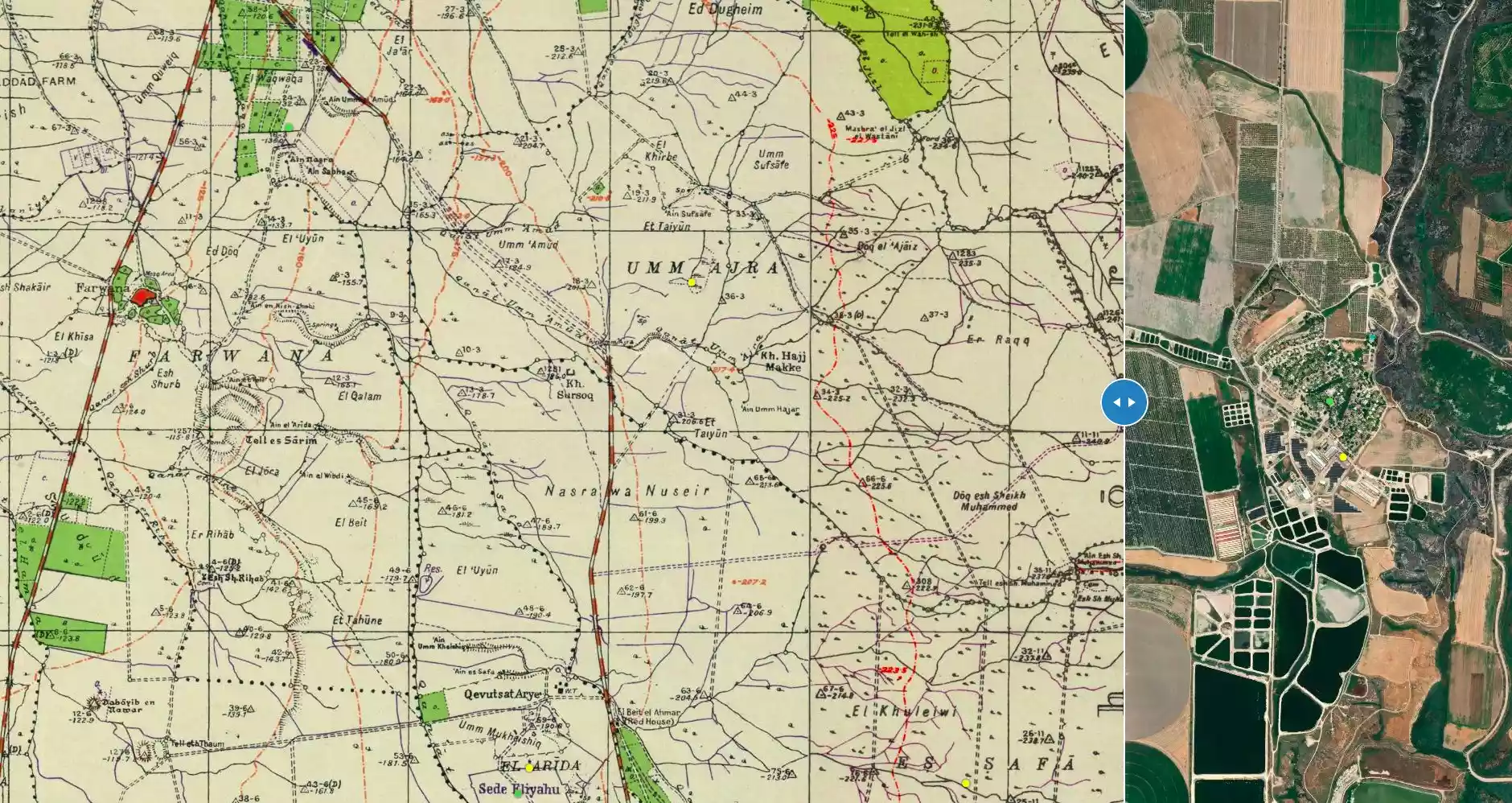
**Town Lands' Demarcation Maps |
||||||||||||||||||
| Land Usage As of 1945 |
|
||||||||||||||||||
| Population |
|
||||||||||||||||||
| Number of Houses |
|
||||||||||||||||||
| Near By Towns |
|||||||||||||||||||
|
|||||||||||||||||||
| Inhabitants Place of Origin | The village was initially founded by members of the 'Arab al-Zinati Bedouin tribe. | ||||||||||||||||||
| Archeological Sites | Masil al-Jizl has few Khirbas which contains pottery fragments, flint artifacts, the foundations of buildings, and the remains of a small mosque. | ||||||||||||||||||
| Exculsive Jewish Colonies That Usurped Village Lands |
Kefar Ruppin | ||||||||||||||||||
| Featured Video | |||||||||||||||||||
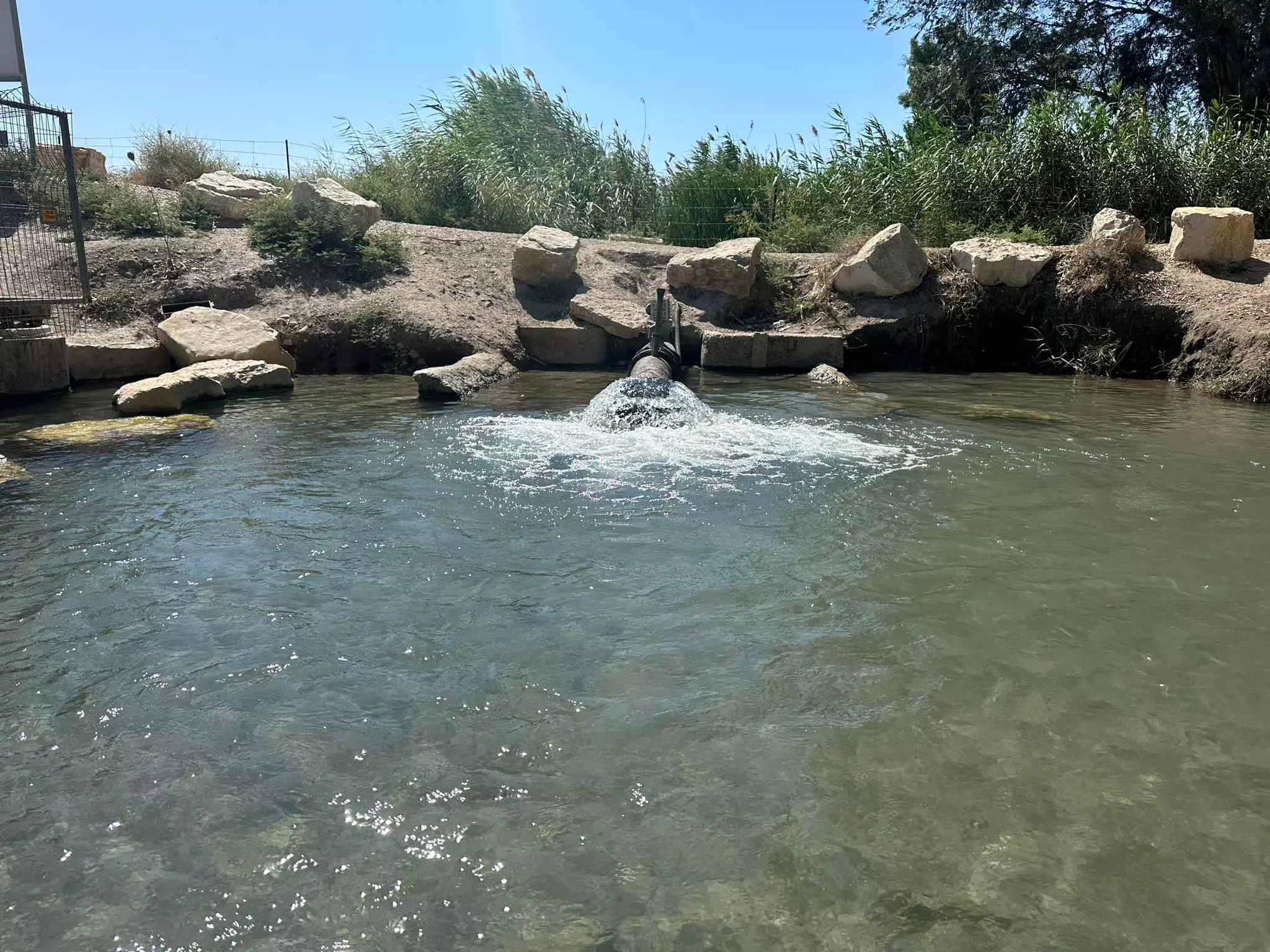
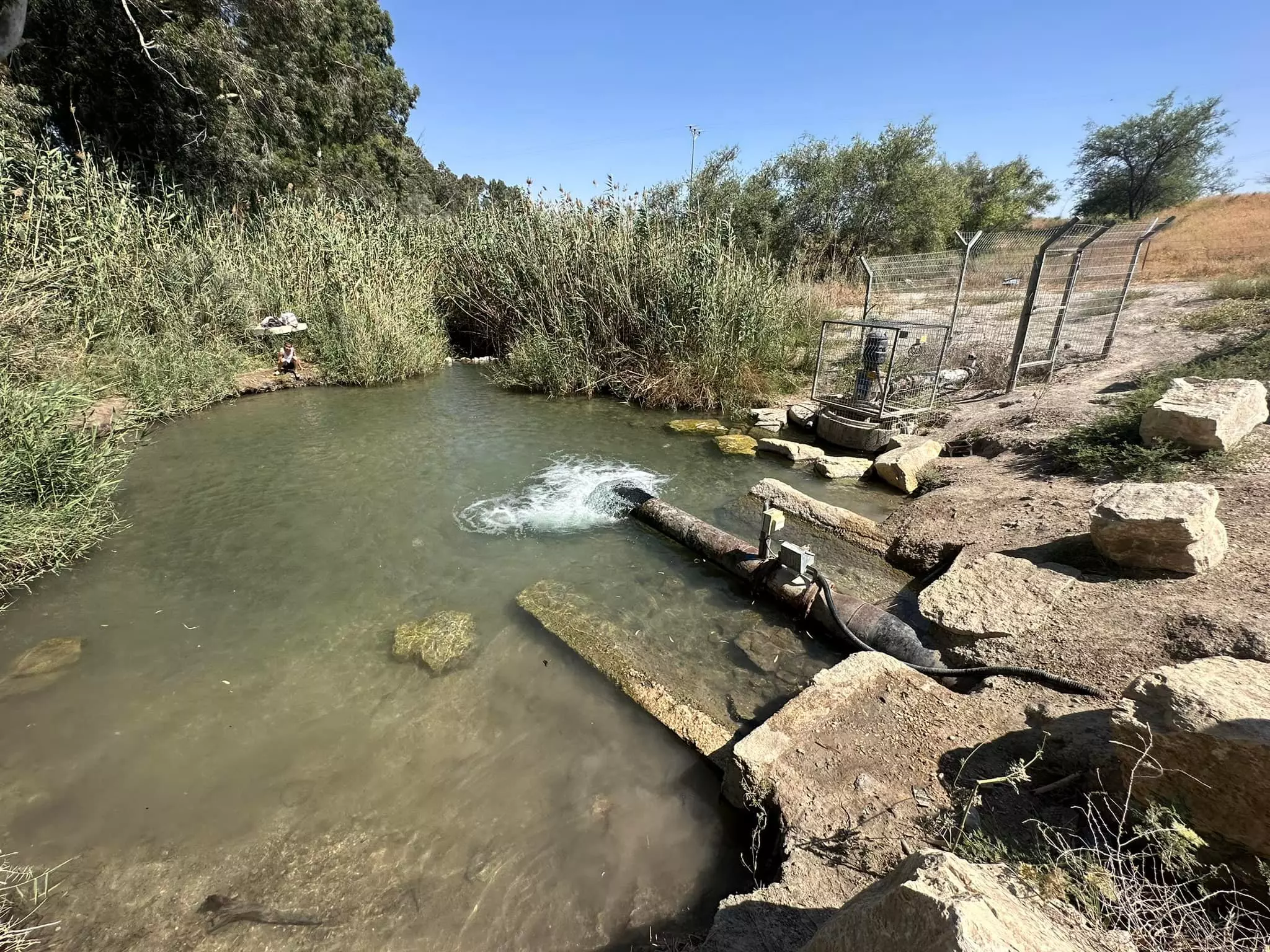
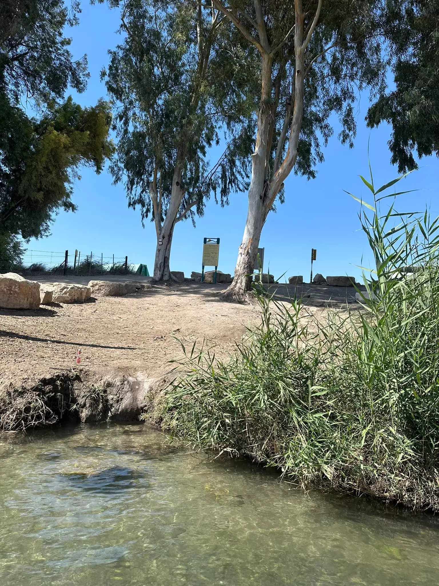
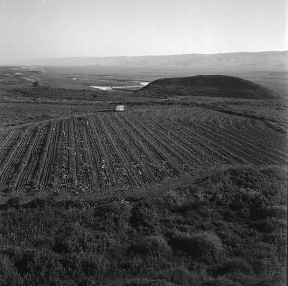
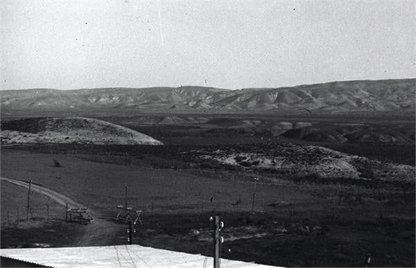
Village Before NakbaThe village stood on flat terrain and overlooked a wide, open area to the east, beyond which was the Jordan Valley. Two fords (makhadat ) across the Jordan called Makhadat al-Turaykhim and Makhadat al-Saghir constituted its gateway to the Jordan Valley in the east. One secondary road linked it to Baysan and another connected it to a highway leading from Baysan to Transjordan.Masil al-Jizl was initially founded by members of the Arab al-Zinati Bedouin tribe. Some of their houses were scattered among the various springs from which they drew their water; others were clustered along the roads linking Masil al-Jizl to Baysan and other villages. Most of these houses were made of adobe and cane. The villagers were Muslims and earned their livelihood by cultivating crops such as grains and vegetables. In 1944/45 a total of 702 dunums was allocated to cereals; 252 dunums were irrigated or used for orchards. To the south of the village stretched the katar , a narrow strip of waste land along the Jordan, which was marked by palm trees growing along its edges. At least three archaeological sites flanked Masil al-Jizl: Tall al-Qitaf, Khirbat aI-Hajj Mahmud, and Tall al-Shaykh Dawud. They contained pottery fragments, flint artifacts, and the foundations of buildings. The remains of a small mosque were found nearby, at Tall al-Shaykh Muhammad al-Qabu, in 1929. Village Occupation and Ethnic CleaningAlthough no specific information about the occupation of Masil al-Jizl is available, it can reasonably be assumed that the village was occupied at the same time as other villages on the Jordan River in the vicinity of Baysan. Most of those communities were overrun by the Golani Brigade at the end of May 1948. The villagers may have been expelled to Transjordan, as were other inhabitants of the area.Zionists Colonies on Village LandsZionists established the settlement of Kefar Ruppin to the north of the village in 1938 on what was traditionally village land.Village TodayThe site is partly covered by fish ponds and by warehouses that belong to the kibbutz of Kefar Ruppin. Wadi Masil al-Jizl passes through this kibbutz.SourceDr. Walid al-Khalidi, 1992: All That Remains. |
|||||||||||||||||||
| Related Maps | Town Lands' Demarcation Maps خرائط للقضاء توضح حدود القرى والاودية Town's map on MapQuest View from satellite Help us map this town at WikiMapia |
||||||||||||||||||
| Related Links | Wikipedia's Page Google Search Google For Images Google For Videos |
||||||||||||||||||
| More Information | في كتاب كي لا ننسى في كتاب بلادنا فلسطين المزيد من موقع هوية |
||||||||||||||||||
- Village site in 1990
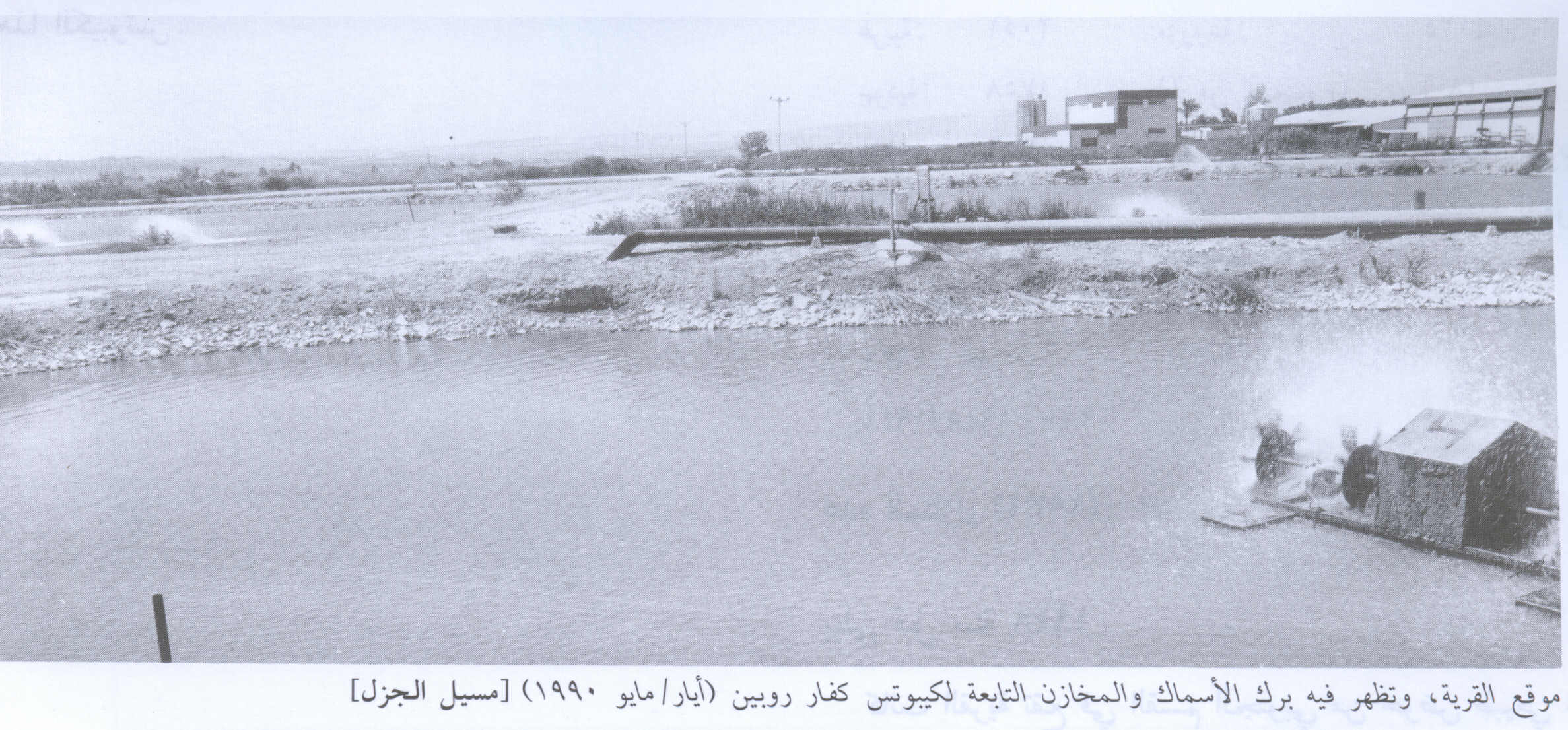
Scanned from "All That Remains" by Dr. Walid Khalidi 1 - منظر قريب من موقع القريه
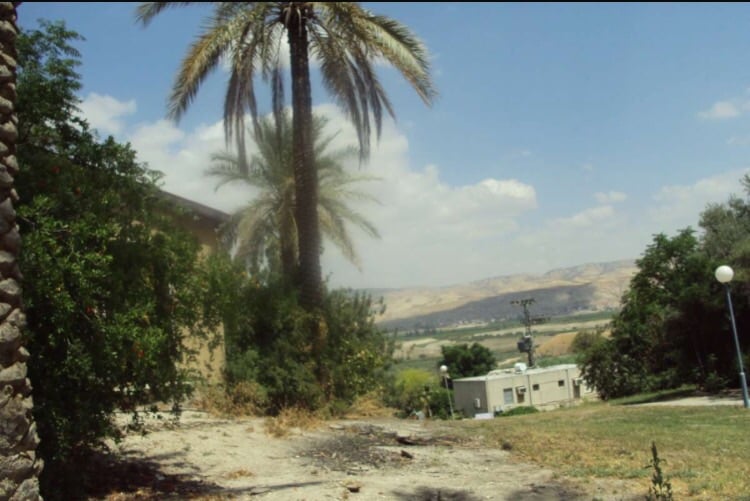
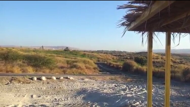
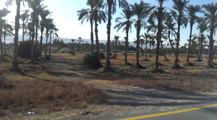
Posted by abu raya - من موقع القريه
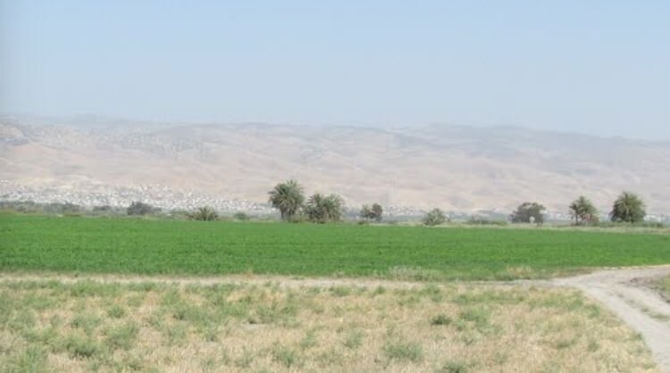
Posted by abu raya - اراضي القريه
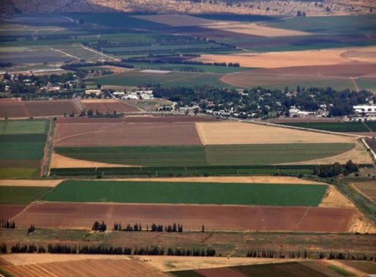
Posted by abu raya - اراضي القريه والمستوطنه المقامه على اراضيها
Posted by abu raya - من موقع القريه
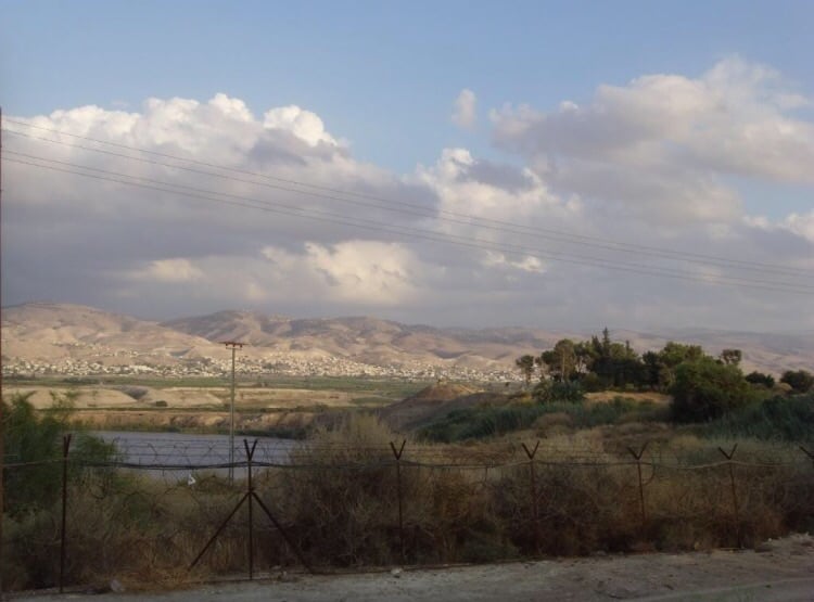
Posted by abu raya - من اراضي القريه
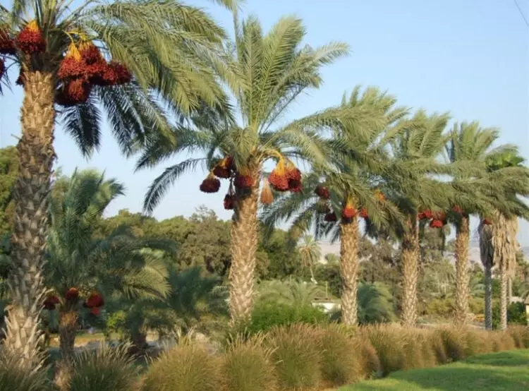
Posted by abu raya - اسجر النخيل في القريه
Posted by abu raya - منظر قريب من موقع القريه
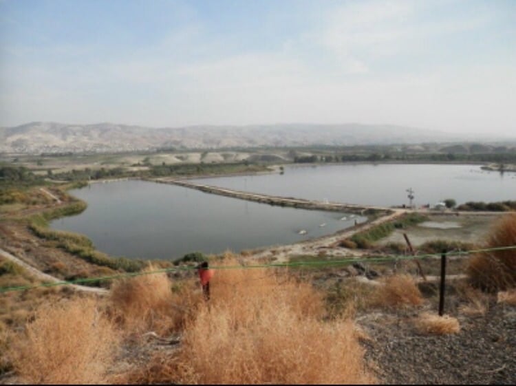
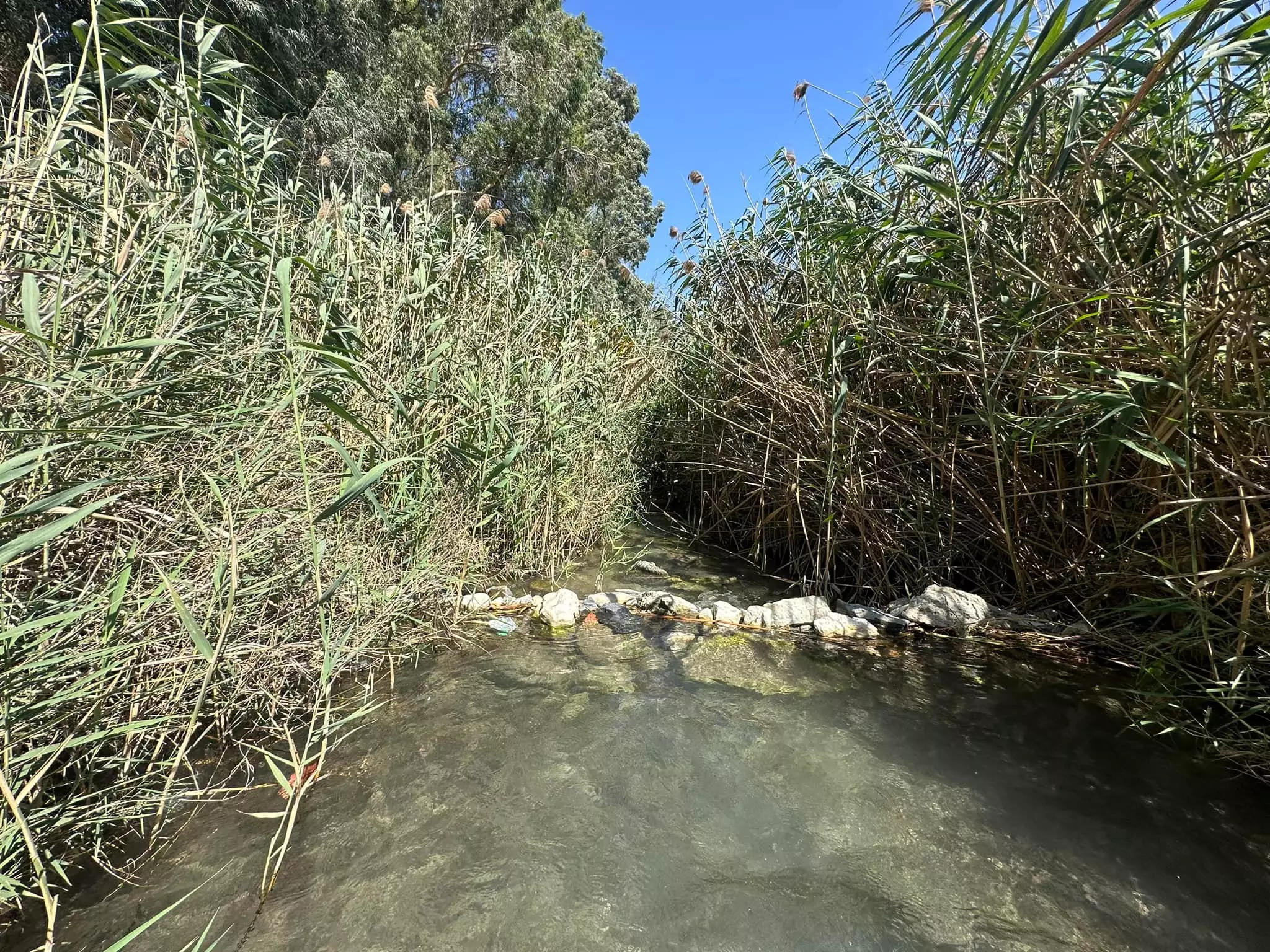
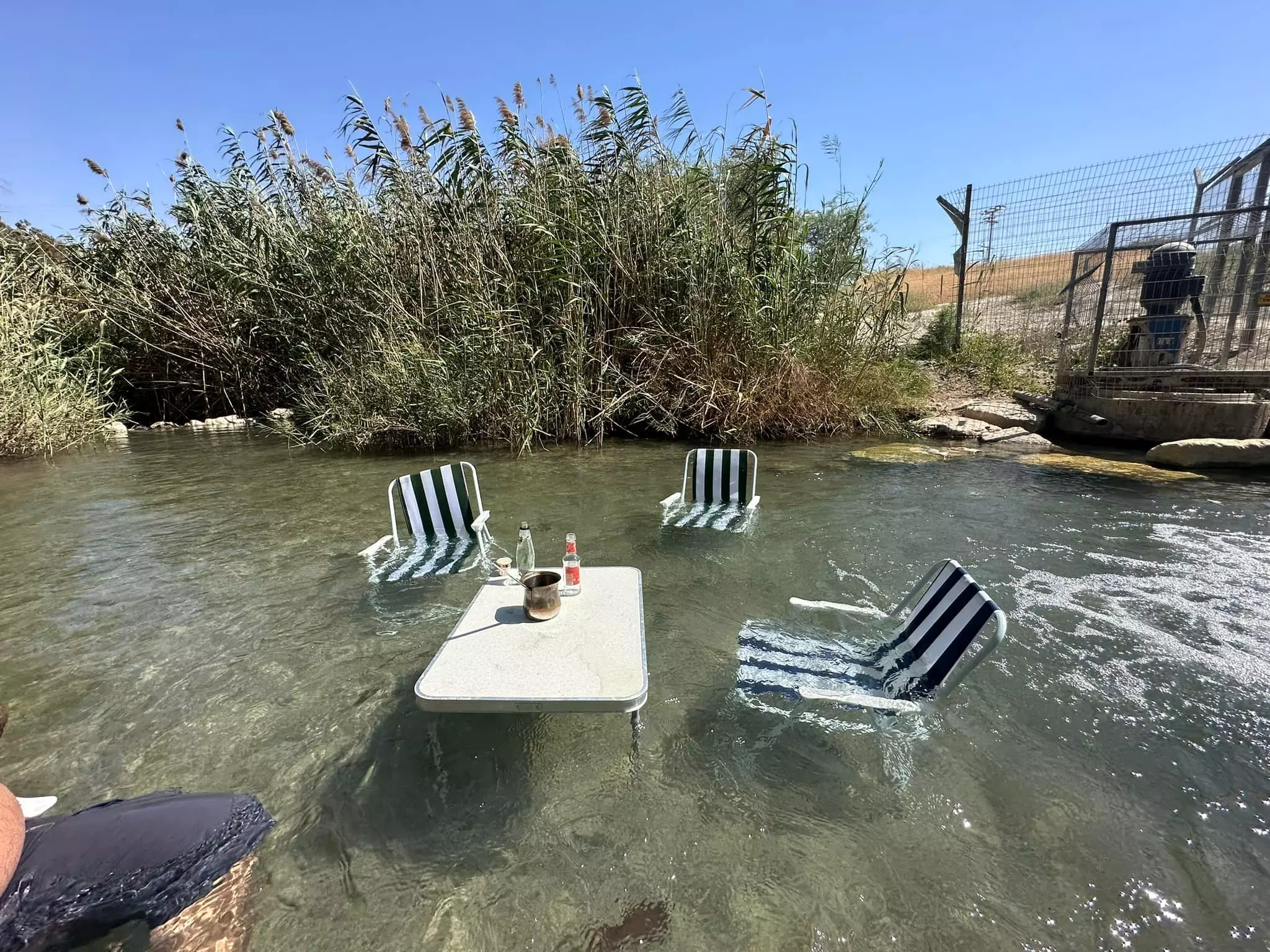
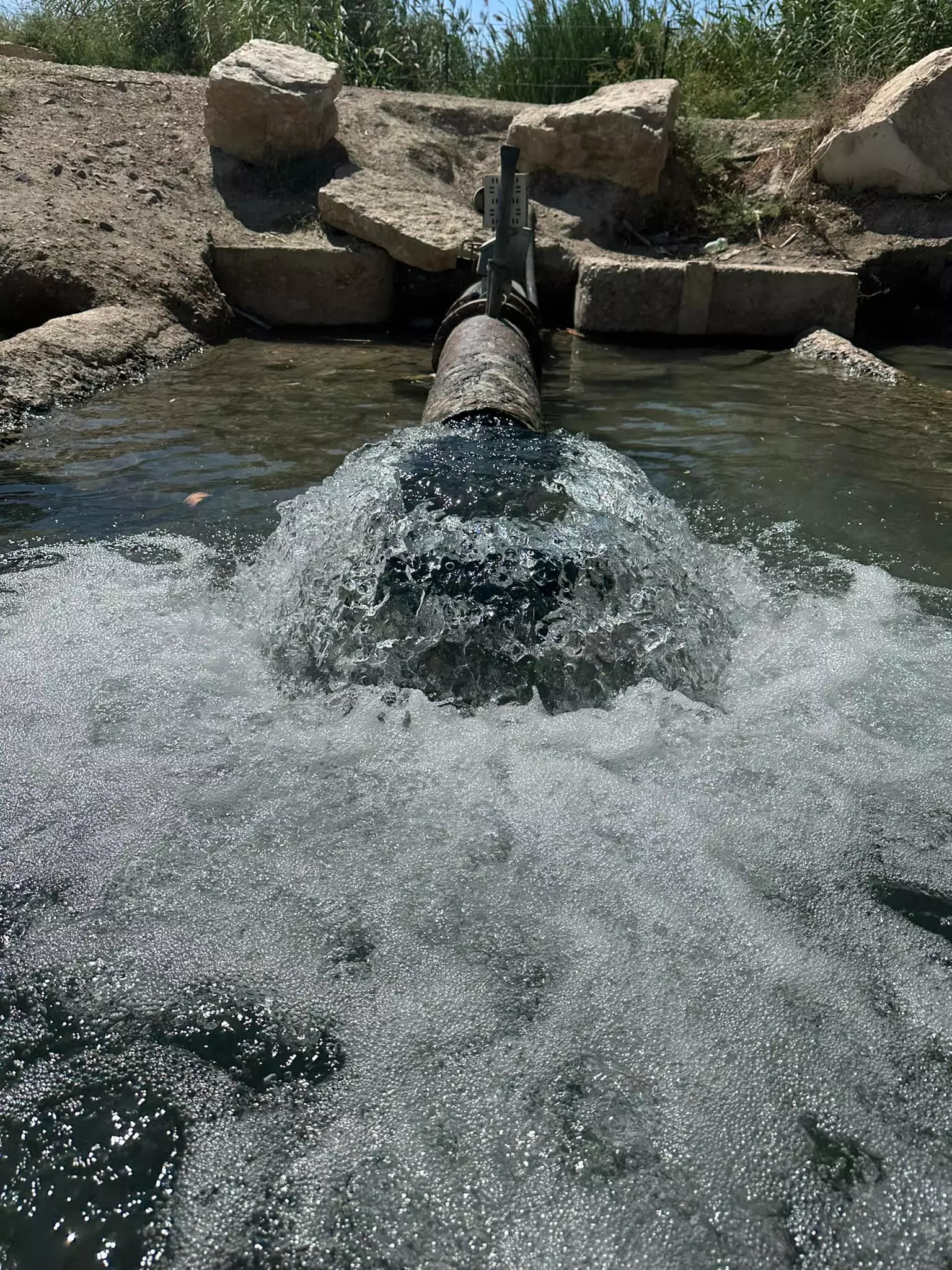
Posted by abu raya - جولة في عين المسيل، او عين الشيخ سماد( עין צמד) ...المزيد عنها في قسم التعليقات اسفل الصورة -- 2023 -- Iyad Jaber
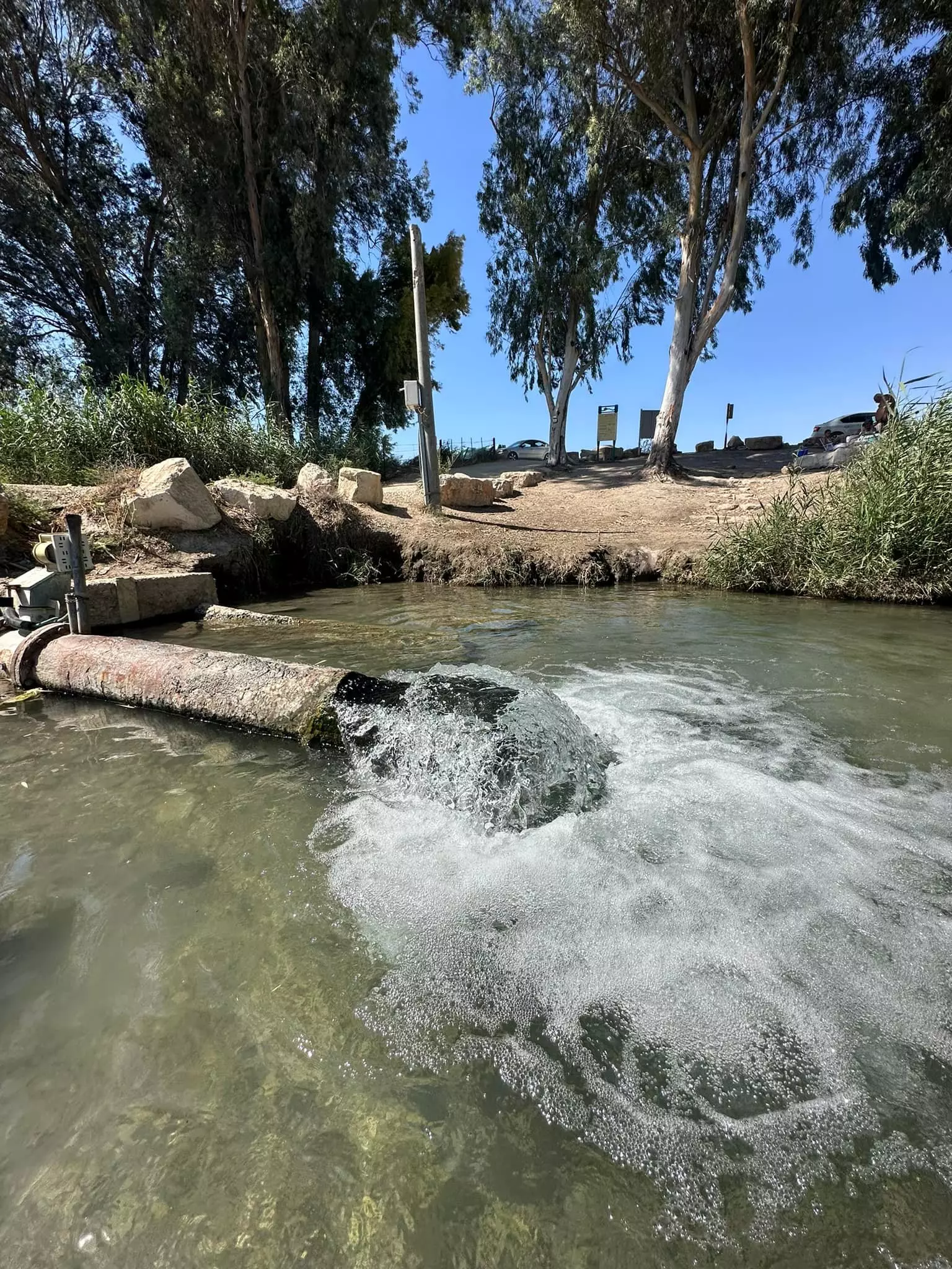
1 - جولة في عين المسيل، او عين الشيخ سماد( עין צמד) ...المزيد عنها في قسم التعليقات اسفل الصورة -- 2023 -- Iyad Jaber #2
- جولة في عين المسيل، او عين الشيخ سماد( עין צמד) ...المزيد عنها في قسم التعليقات اسفل الصورة -- 2023 -- Iyad Jaber #3
- جولة في عين المسيل، او عين الشيخ سماد( עין צמד) ...المزيد عنها في قسم التعليقات اسفل الصورة -- 2023 -- Iyad Jaber #4
- جولة في عين المسيل، او عين الشيخ سماد( עין צמד) ...المزيد عنها في قسم التعليقات اسفل الصورة -- 2023 -- Iyad Jaber #5
- جولة في عين المسيل، او عين الشيخ سماد( עין צמד) ...المزيد عنها في قسم التعليقات اسفل الصورة -- 2023 -- Iyad Jaber #6
- جولة في عين المسيل، او عين الشيخ سماد( עין צמד) ...المزيد عنها في قسم التعليقات اسفل الصورة -- 2023 -- Iyad Jaber #7
- Masil al-Jizl view of tell, 1946
- Masil al-Jizl view of tell, 1938
Want to browse more? 80,000 pictures were grouped in these gallaries:
| Display Name | Clan/Hamolah | Country of Residence |
- من قرى بيسان المهجرة: عين الشيخ محمد في مسيل الجزل. هنا كانت تقع مضارب الشيخ محمد الزيناتي ودفن اجداده Duration: 47 sec
- على تل قباب في محيط قرية مسيل الجزل المهجرة (قضاء بيسان) Duration: min 2 sec
- لدى تل الشيخ داود في محيط قرية مسيل الجزل المهجرة (بيسان) Duration: min 20 sec
No links have been shared yet, be free to the first to share the first link.
 Fake Valor: Why Did Zionist Jews Hoist Nazis Flag on Their Ships in the 1930s?
What is new?
-
Facts About Oct. 7th Gaza Raid
-
Remined Us Please: Who Did Rape Whom? Was it Palestinians who raped Israelis? Or, was the other way around? You'll be the judge
-
When Prof. Edward Said was invited to debate Bibi Netanyahu in the 1980s, watch what happened!
-
Ezra Klein of the NY Times on the "Jewish Race".
-
Abusing Blood Libel!
-
How and why Israeli Jewry has become the most hated cult?
-
Did Israeli Soldiers Activate The Hannibal Direective On Oct. 7th? You Be The Judge
-
Zionist FAQ: Isn't it true that Palestinians don't want peace? Palestinians never accepted the two-state solution
- Facts about Haavara (Transfer) Agreement between Ben-Gurion & Hitler
-
Haavara FAQs: Why Did Zionist Jews Hoist Nazis' Flags on Their Ships in the 1930s?
- Haavara FAQs: When Chaim Weizmann met FDR in mid-1943, why was he silent about rescuing European Jewry?
-
Dear ChatGPT: How did Palestinians resist Napoleon's invasion of their country in 1799?
-
Dear ChatGPT: Gaza had a vibrant Jewish community in the mid-17th century. What happened to them?
-
Dear ChatGPT: Why did the Jewish Agency suppress news of the Holocaust during WWII?
-
Video Playlist: Jews share their DNA tests to end the conflict for good.
-
A Tale of Two Conflicts: Examining the Definition of Genocide
-
Prof. Abraham Polak And The Suppressed History of the Khazars and European Jewry
-
How Ronald Reagan would have framed the genocide in Gaza if he were still alive?
-
Haavara FAQs: Let us do the math: how many German Jews did The Haavara Agreement save?
-
Zionist FAQs: The Hebron Massacre of 1929, "clearly proves" that Palestinians are antisemitic, how could you deny it?
-
Zionist FAQs: Why Anti-Zionist Is Not Antisemitism?
-
Zionist FAQs: Isn't it true that the KGB created Palestinian Nationalism in the early 1960s?
- Zionist FAQs: Muslims are killing Muslims all the time; why are Israeli Jews being singled out in the media?
- Zionist FAQs: How is Israel an apartheid state when 20% of its citizens are Arabs who enjoy full rights?
-
Haavara FAQs: Why Did Dorothy Thompson Flip From A Zionist Advocate to A Silenced Dissenter?
-
Haavara FAQs: Analysis of Herzl's Uganda Scheme and how it could have saved millions of Jews.
-
Haavara FAQs: Why did Hayim Greenberg describe American Jewry as "morally bankrupt" in early 1943?
-
Haavara FAQs: What if the Evian Conference was a resounding success? What would have been the impact of saving European Jewry on Zionism?
- Haavara FAQs: What if the six million were saved, how that would have impacted the Zionist project?
-
Haavara FAQs: How did Zionist leaders react when Europe's Jews lingered in the DP camps after WWII ended?
-
Why does the American Jewish community repeat lies that David Ben-Gurion had debunked before he died?
-
Who has the power to rename the Tatar/Khazar Gene Marker to Jewish IV?
-
Zionist FAQs: Why won't Egypt, Syria, and Jordan take their people back? Jews are indigenous to Palestine, and Arabs immigrated after Jews developed the country. Arabs should leave.
-
Haavara FAQs: Did Hitler and the Nazis conflate between Judaism and Zionist? If that wasn't case, then why?
-
Haavara FAQs: Winston Churchill and antisemitism, a collection of articles written Churchill.
-
Haavara FAQs: Broken by country, how many Jews survived vs. killed during the Holocaust?
-
Haavara FAQs: Why did European Jews vote with their feet and to immigrated to the Americas, not Palestine, after WWII?
-
Watch this American Jewish Girl describing Israeli Jews' cognitive dissonance like no other in under two minutes
-
Haavara FAQs: When the Nazis went out of their way to hide the Holocaust, Israeli Jews did the exact opposite by broadcasting their genocide of Gazans. But why?
-
Haavara FAQs: How Zionist Jews went out of their to show their appreciation to Nazism and Fascism?
- Haavara FAQs: Why Zionist leaders were against bombing the death camps & the Railroads leading to them?
-
Haavara FAQs: Hitler's message to the British and American people: If Jews are such noble citizens and you care about them, how come you're not letting them in? I will gladly ship them to you at my expense, even on luxury liners!
-
A shortlist of Zionist and Israeli false flag operations in the name Jews.
-
The Most Moral Army
- The Land of Kapos (Israel): Where the brave are boycotted and Kapos walk free.
- Why did early Zionists often named their communal enterprises "colonial"?
- Zionist Relations with Nazi Germany by Faris Glubb
-
Two NY Times advertisements by Zionists in the early 1943 that exposes Zionists' treason at the height of the calamity
- Facts Not Lies about the Palestinian-Israeli Conflict.
- Site's pictures have been categorized
- Campgain Against Lice
- A Survey of Palestine, the official source about Palestine before Nakba produced by the British Mandate; over 1200 pages.
- Satellite View & Google Earth: Over 6,000 placemarks identifying all destroyed towns, W. Bank & Gaza Strip Towns, & refugee camps.
- PalestineRemembered.com and its Nakba Oral History Project were featured on al-Jazeera Satellite TV.
- Nakba Oral History Video Podcast:
 Over 700 Oral History interviews (including 3,500+ hours of recording) can be viewed online.
 - Palestine Village Statistics Project
- Gaza Jail Break
- النسخة العربية للموقع الان متوفرة
- Videos: Documenting the destroyed villages in video: Tracing all that remains since Nakba.
- Videos: Responding to Zionist Propaganda
- Interview: The ethnic cleansing of Palestine: George Galloway interviews Israeli Historian Ilan Pappe.
- For Palestinians, memory matters. It provides a blueprint for their future By George Bisharat.
- Zionist FAQ now available in Hebrew שאלות שציונים שואלים, עכשיו בעברית
- Video: The Stephen Walt and John Mearsheimer report on the influence of the Israel Lobby on U.S. Foreign Policy
- The Palestinian-Israeli conflict for beginners
