| PalestineRemembered | About Us | Oral History | العربية | |
| Pictures | Zionist FAQs | Haavara | Maps | |
| Search |
| Camps |
| Districts |
| Acre |
| Baysan |
| Beersheba |
| Bethlehem |
| Gaza |
| Haifa |
| Hebron |
| Jaffa |
| Jericho |
| Jerusalem |
| Jinin |
| Nablus |
| Nazareth |
| Ramallah |
| al-Ramla |
| Safad |
| Tiberias |
| Tulkarm |
| Donate |
| Contact |
| Profile |
| Videos |
Welcome To al-Hamidiyya - الحميديه (אל-חמידיה)
|
District of Baysan
Ethnically cleansed days ago |
العربية Google Earth |
 |
Gallery (21) |
- Statistics & Facts
-
Before & After

- Satellite View
- Articles 1
- Pictures 21
- Land Deeds 1
- Members
- Families
- All That Remains
- Wikipedia
- Videos
- Guest Book
- Links
| Statistic & Fact | Value | |||||||||||||||||||||
| Occupation Date | May 12, 1948 | |||||||||||||||||||||
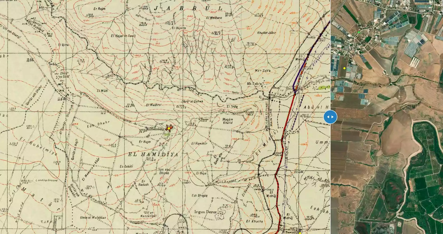
| Distance From District | 5 (km) North of Baysan | |||||||||||||||||||||
| Elevation | -10 (meters) | |||||||||||||||||||||
| Before & After Nakba, Click Map For Details |
||||||||||||||||||||||
|
||||||||||||||||||||||
| Map Location | See location #15 on the map View from satellite |
|||||||||||||||||||||
| Military Operation | Operation Gideon | |||||||||||||||||||||
| Attacking Units | Golani Brigade | |||||||||||||||||||||
| Exodus Cause | Influence of fall of, or exoduce from, neighboring town | |||||||||||||||||||||
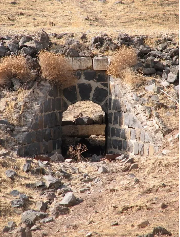
| Village Temains | al-Hamidiyya was completely destroyed, only house rubble and cemetery left behind. | |||||||||||||||||||||
| Ethnically Cleansing | al-Hamidiyya inhabitants were completely ethnically cleansed. | |||||||||||||||||||||
| Pre-Nakba Land Ownership |
**Town Lands' Demarcation Maps |
|||||||||||||||||||||
| Land Usage As of 1945 |
|
|||||||||||||||||||||
| Population |
|
|||||||||||||||||||||
| Number of Houses |
|
|||||||||||||||||||||
| Near By Towns |
||||||||||||||||||||||
|
|
||||||||||||||||||||||
| Town's Name Through History | The village was named after the Ottoman sultan 'Abd al-Hamid II (1876-1909). | |||||||||||||||||||||
| Shrines / Maqams | A shrine for a local sage known as Maqam Khalid. | |||||||||||||||||||||
| Exculsive Jewish Colonies That Usurped Village Lands |
Chamadya | |||||||||||||||||||||
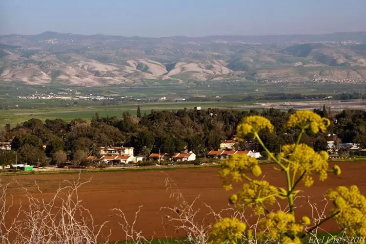
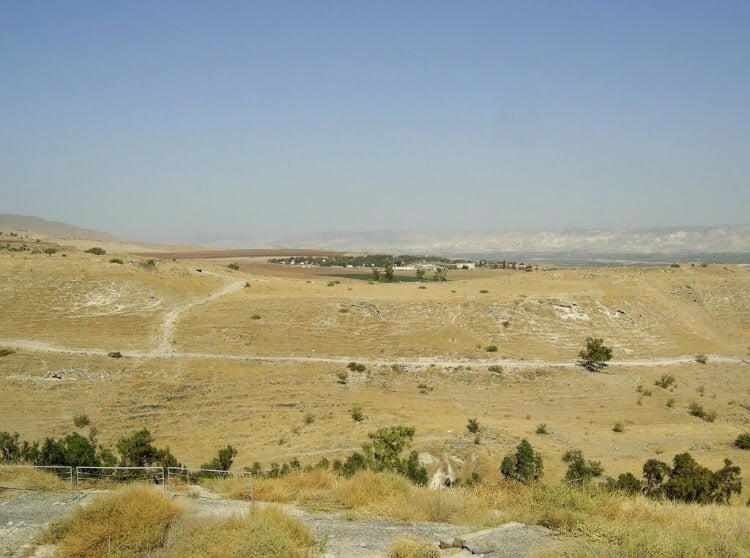
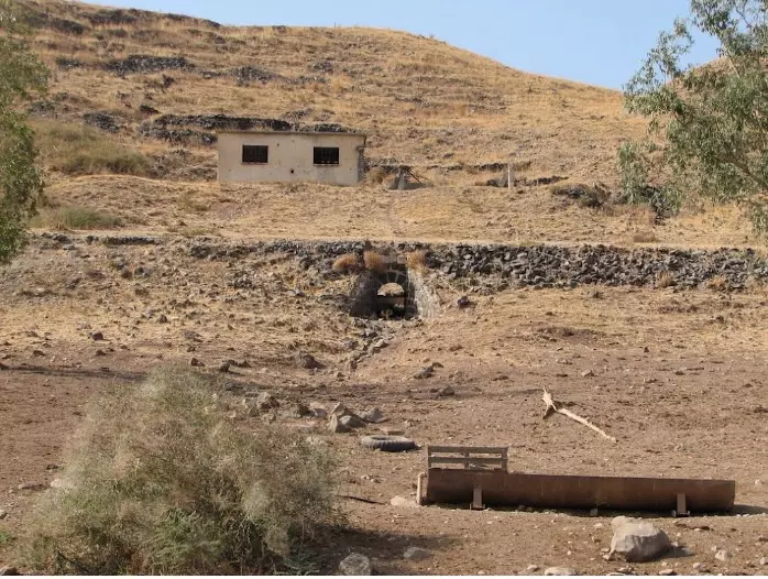
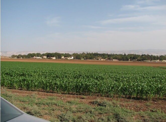
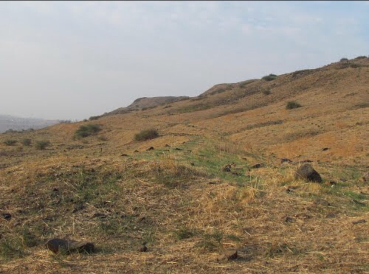
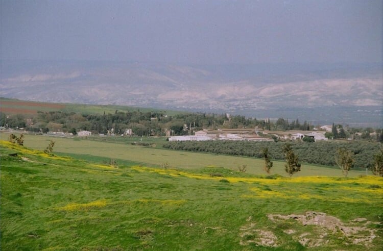
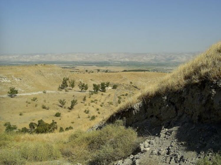
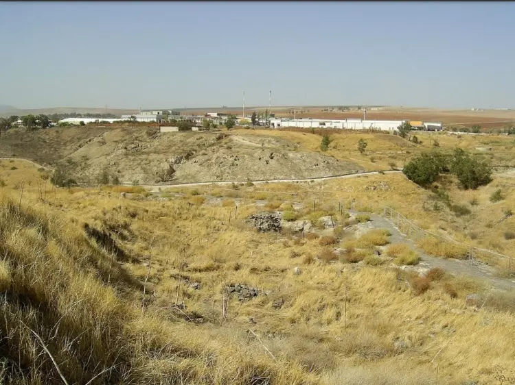
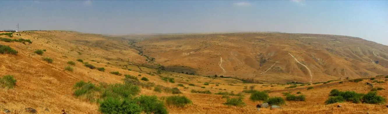
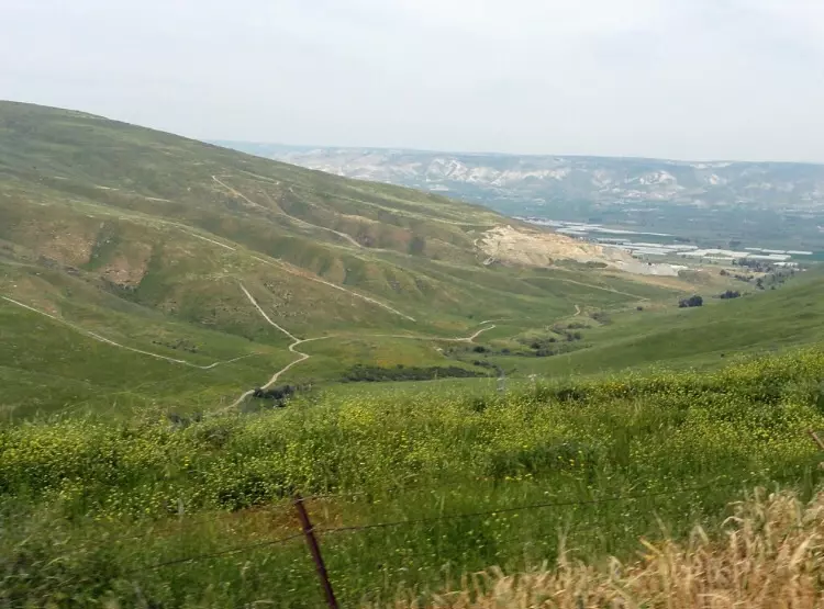
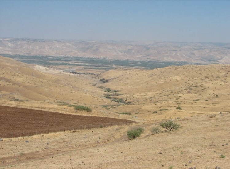
Village Before NakbaThe village stood on a hill overlooking the Baysan Valley to the east, Wadi Yubla to the north, and the lands of the town of Baysan to the south. The village, which relied on Baysan for administrative and commercial services, was named after the Ottoman sultan Abd al-Hamid II (1876-1909). It was linked to a highway leading to Baysan by a secondary road that was approximately 2 km long. Other roads connected it to four neighboring villages. It had a rectangular plan with narrow streets that intersected to form a grid. Its houses were built of adobe brick. During its slow expansion in the first half of this century, newer houses were built of cement along the roads that linked it to the nearby villages. The village was classified as a hamlet by the Palestine Index Gazetteer. In the northeastern part of al-Hamidiyya there was a shrine, Maqam Khalid, for a local Muslim saint. Al-Hamidiyya's population, which was Muslim, worked primarily in agriculture. The village lands were planted in grain and various vegetables. In 1944/45 a total of 164 dunums was devoted to citrus and bananas and 4,395 dunums were allotted to cereals; 8 dunums were irrigated or used for orchards.Village Occupation and Ethnic CleaningThe Golani Brigade successfully attacked Baysan and 'cleared' most of the Baysan Valley of its inhabitants in an offensive mounted in the first half of May 1948. Al-Hamidiyya was one of the few villages that had remained. Its people left on 12 May 'under the influence of the exodus from the town of Beisan and under pressure from the Haganah,' according to Israeli historian Benny Morris. He does not specify what kind of pressure was involved. In September, neighboring Zionist settlements applied to the Israeli authorities for permission to demolish the village (as well as three others in the area). It is not clear from Morris' account whether permission was granted or when the destruction was carried out.Zionists Colonies on Village LandsThe settlement of Chermonim, established 2 km south of the village site in 1942, is close to but not on village lands. Its name was changed to Chamadya in 1952 to resemble the Arabic name of al-Hamidiyya more closely.Village TodayAside from the ruins of the village's houses (which have been reduced to cement rubble), a cemetery, and a few wells, only thorns are found on the site. The lands in the vicinity are used by Israelis for agriculture and grazing.SourceDr. Walid al-Khalidi, 1992: All That Remains. |
||||||||||||||||||||||
| Related Maps | Town Lands' Demarcation Maps خرائط للقضاء توضح حدود القرى والاودية Town's map on MapQuest View from satellite Help us map this town at WikiMapia |
|||||||||||||||||||||
| Related Links | Wikipedia's Page Google Search Google For Images Google For Videos |
|||||||||||||||||||||
| More Information | في كتاب كي لا ننسى في كتاب بلادنا فلسطين المزيد من موقع هوية |
|||||||||||||||||||||
- Village Site Rubble In 1987
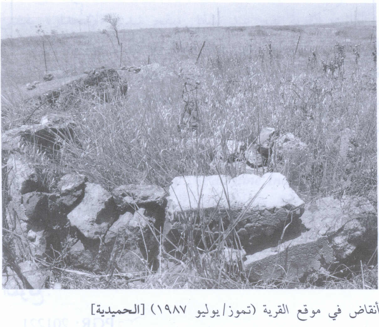
Scanned from "All That Remains" by Dr. Walid Khalidi - منظر لاراضي القريه والمستعمره المقامه عليها
Posted by abu raya - من موقع القريه
Posted by abu raya - موقع القريه وخط الحجاز القديم بجانب القريه

Posted by abu raya - جسر لخط الحجاز القديم من القريه
Posted by abu raya - القريه ومحطه القطار القديمه
Posted by abu raya - اراضي القريه
Posted by abu raya - موقع القريه
Posted by abu raya - موقع القريه والمستعمره المقامه مكانها حاليا
Posted by abu raya - موقع القريه من الشرق
Posted by abu raya - موقع القريه
Posted by abu raya - موقع القريه محاط بالسياج
Posted by abu raya - موقع القريه
Posted by abu raya - بالقرب من موقع القريه
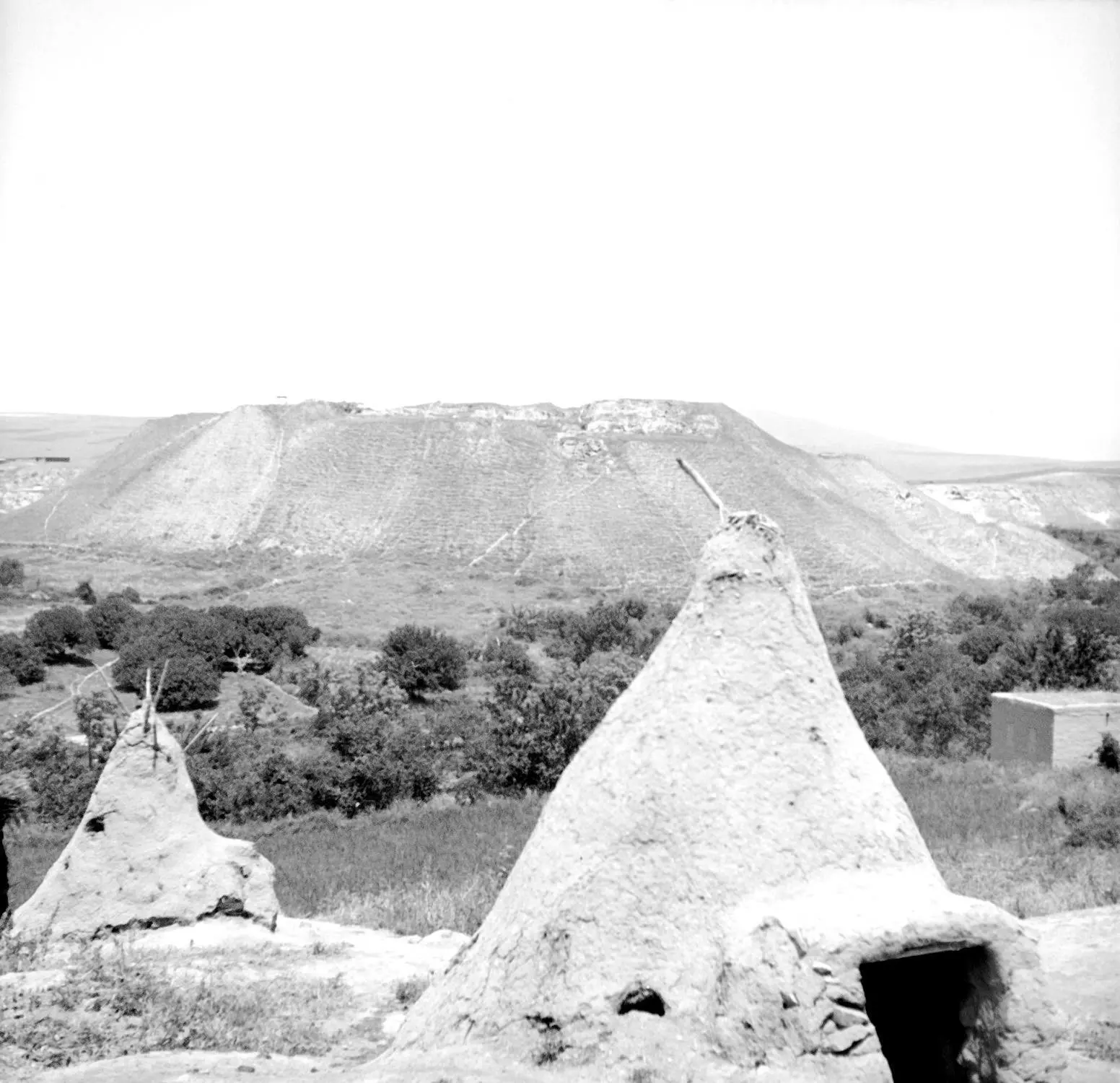
Posted by abu raya - قرية الحميدية قضاء بيسان سنة 1926....في الوجها تل بيسان ...في الوجة ..طوابين القرية
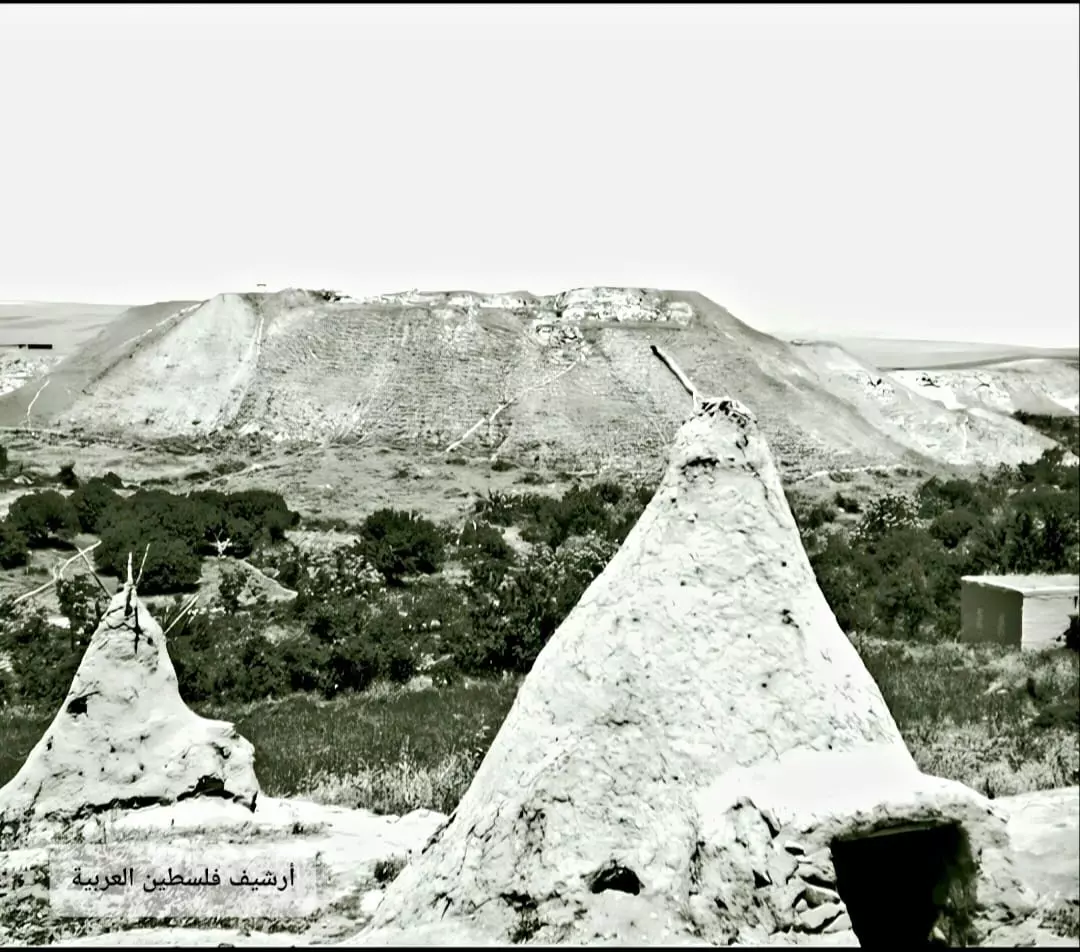
- مشارف قرية الحميدية قضاء بيسان وتبدو في مقدمة الصورة طوابين أهالي القرية للخبز عام 1926..
-
جداول قيّمة تبين الحالة المالية لأعضاء جمعية الجميدية التعاونية في بيسان للتسليف والتوفير لسنة 1945 و 1946 و 1947 -- أنقر الصورة لتكبيرها لقرآءة اﻷسماء والتفاصيل

-
رسالة من منظم الجمعيات في الناصرة إلى مسجل الجمعيات بخصوص تسيد قروضها: البعينة سددت بالكامل، حطين وطرعان سددتا جزئياً والحميدية لم تسدد -- 04-02-1947

- حساب الأرباح والخسائر في جمعية الحميدية التعاونية في بيسان لسنوات 1945, 1946 و1947 -- أنقر الصورة لتكبيرها

-
ميزانية جمعية الحميدية التعاونية في بيسان للتسليف والتوفير سنة 1944 مع تقرير فاحص الحسابات

- بيانات ورسائل مهمة تخص الجمعية التعاونية في القرية بين سنوات 1943 و 1947 -- أنقر الصورة لتكبيرها لقرآءة اﻷسماء والتفاصيل

Want to browse more? 80,000 pictures were grouped in these gallaries:
| Display Name | Clan/Hamolah | Country of Residence |
No links have been shared yet, be free to the first to share the first link.
 Fake Valor: Why Did Zionist Jews Hoist Nazis Flag on Their Ships in the 1930s?
What is new?
-
Facts About Oct. 7th Gaza Raid
-
Remined Us Please: Who Did Rape Whom? Was it Palestinians who raped Israelis? Or, was the other way around? You'll be the judge
-
When Prof. Edward Said was invited to debate Bibi Netanyahu in the 1980s, watch what happened!
-
Ezra Klein of the NY Times on the "Jewish Race".
-
Abusing Blood Libel!
-
How and why Israeli Jewry has become the most hated cult?
-
Did Israeli Soldiers Activate The Hannibal Direective On Oct. 7th? You Be The Judge
-
Zionist FAQ: Isn't it true that Palestinians don't want peace? Palestinians never accepted the two-state solution
- Facts about Haavara (Transfer) Agreement between Ben-Gurion & Hitler
-
Haavara FAQs: Why Did Zionist Jews Hoist Nazis' Flags on Their Ships in the 1930s?
- Haavara FAQs: When Chaim Weizmann met FDR in mid-1943, why was he silent about rescuing European Jewry?
-
Dear ChatGPT: How did Palestinians resist Napoleon's invasion of their country in 1799?
-
Dear ChatGPT: Gaza had a vibrant Jewish community in the mid-17th century. What happened to them?
-
Dear ChatGPT: Why did the Jewish Agency suppress news of the Holocaust during WWII?
-
Video Playlist: Jews share their DNA tests to end the conflict for good.
-
A Tale of Two Conflicts: Examining the Definition of Genocide
-
Prof. Abraham Polak And The Suppressed History of the Khazars and European Jewry
-
How Ronald Reagan would have framed the genocide in Gaza if he were still alive?
-
Haavara FAQs: Let us do the math: how many German Jews did The Haavara Agreement save?
-
Zionist FAQs: The Hebron Massacre of 1929, "clearly proves" that Palestinians are antisemitic, how could you deny it?
-
Zionist FAQs: Why Anti-Zionist Is Not Antisemitism?
-
Zionist FAQs: Isn't it true that the KGB created Palestinian Nationalism in the early 1960s?
- Zionist FAQs: Muslims are killing Muslims all the time; why are Israeli Jews being singled out in the media?
- Zionist FAQs: How is Israel an apartheid state when 20% of its citizens are Arabs who enjoy full rights?
-
Haavara FAQs: Why Did Dorothy Thompson Flip From A Zionist Advocate to A Silenced Dissenter?
-
Haavara FAQs: Analysis of Herzl's Uganda Scheme and how it could have saved millions of Jews.
-
Haavara FAQs: Why did Hayim Greenberg describe American Jewry as "morally bankrupt" in early 1943?
-
Haavara FAQs: What if the Evian Conference was a resounding success? What would have been the impact of saving European Jewry on Zionism?
- Haavara FAQs: What if the six million were saved, how that would have impacted the Zionist project?
-
Haavara FAQs: How did Zionist leaders react when Europe's Jews lingered in the DP camps after WWII ended?
-
Why does the American Jewish community repeat lies that David Ben-Gurion had debunked before he died?
-
Who has the power to rename the Tatar/Khazar Gene Marker to Jewish IV?
-
Zionist FAQs: Why won't Egypt, Syria, and Jordan take their people back? Jews are indigenous to Palestine, and Arabs immigrated after Jews developed the country. Arabs should leave.
-
Haavara FAQs: Did Hitler and the Nazis conflate between Judaism and Zionist? If that wasn't case, then why?
-
Haavara FAQs: Winston Churchill and antisemitism, a collection of articles written Churchill.
-
Haavara FAQs: Broken by country, how many Jews survived vs. killed during the Holocaust?
-
Haavara FAQs: Why did European Jews vote with their feet and to immigrated to the Americas, not Palestine, after WWII?
-
Watch this American Jewish Girl describing Israeli Jews' cognitive dissonance like no other in under two minutes
-
Haavara FAQs: When the Nazis went out of their way to hide the Holocaust, Israeli Jews did the exact opposite by broadcasting their genocide of Gazans. But why?
-
Haavara FAQs: How Zionist Jews went out of their to show their appreciation to Nazism and Fascism?
- Haavara FAQs: Why Zionist leaders were against bombing the death camps & the Railroads leading to them?
-
Haavara FAQs: Hitler's message to the British and American people: If Jews are such noble citizens and you care about them, how come you're not letting them in? I will gladly ship them to you at my expense, even on luxury liners!
-
A shortlist of Zionist and Israeli false flag operations in the name Jews.
-
The Most Moral Army
- The Land of Kapos (Israel): Where the brave are boycotted and Kapos walk free.
- Why did early Zionists often named their communal enterprises "colonial"?
- Zionist Relations with Nazi Germany by Faris Glubb
-
Two NY Times advertisements by Zionists in the early 1943 that exposes Zionists' treason at the height of the calamity
- Facts Not Lies about the Palestinian-Israeli Conflict.
- Site's pictures have been categorized
- Campgain Against Lice
- A Survey of Palestine, the official source about Palestine before Nakba produced by the British Mandate; over 1200 pages.
- Satellite View & Google Earth: Over 6,000 placemarks identifying all destroyed towns, W. Bank & Gaza Strip Towns, & refugee camps.
- PalestineRemembered.com and its Nakba Oral History Project were featured on al-Jazeera Satellite TV.
- Nakba Oral History Video Podcast:
 Over 700 Oral History interviews (including 3,500+ hours of recording) can be viewed online.
 - Palestine Village Statistics Project
- Gaza Jail Break
- النسخة العربية للموقع الان متوفرة
- Videos: Documenting the destroyed villages in video: Tracing all that remains since Nakba.
- Videos: Responding to Zionist Propaganda
- Interview: The ethnic cleansing of Palestine: George Galloway interviews Israeli Historian Ilan Pappe.
- For Palestinians, memory matters. It provides a blueprint for their future By George Bisharat.
- Zionist FAQ now available in Hebrew שאלות שציונים שואלים, עכשיו בעברית
- Video: The Stephen Walt and John Mearsheimer report on the influence of the Israel Lobby on U.S. Foreign Policy
- The Palestinian-Israeli conflict for beginners
