| PalestineRemembered | About Us | Oral History | العربية | |
| Pictures | Zionist FAQs | Haavara | Maps | |
| Search |
| Camps |
| Districts |
| Acre |
| Baysan |
| Beersheba |
| Bethlehem |
| Gaza |
| Haifa |
| Hebron |
| Jaffa |
| Jericho |
| Jerusalem |
| Jinin |
| Nablus |
| Nazareth |
| Ramallah |
| al-Ramla |
| Safad |
| Tiberias |
| Tulkarm |
| Donate |
| Contact |
| Profile |
| Videos |
Welcome To Umm Burj, Khirbat - خربة أم برج (ח'ירבת אום בורג')
|
District of Hebron
Ethnically cleansed days ago |
العربية Google Earth |
 |
Gallery (81) |
- Statistics & Facts
-
Before & After

- Satellite View
- Articles 1
- Pictures 81
- Oral History 1
- Members
- All That Remains
- Wikipedia
- Videos 3
- Guest Book 2
- Links
| Statistic & Fact | Value | ||||||||||||||
| Occupation Date | October 28, 1948 | ||||||||||||||
| Distance From District | 31 (km) Northwest of Hebron | ||||||||||||||
| Elevation | 425 (meters) | ||||||||||||||
| Before & After Nakba, Click Map For Details |
|||||||||||||||
|
|||||||||||||||
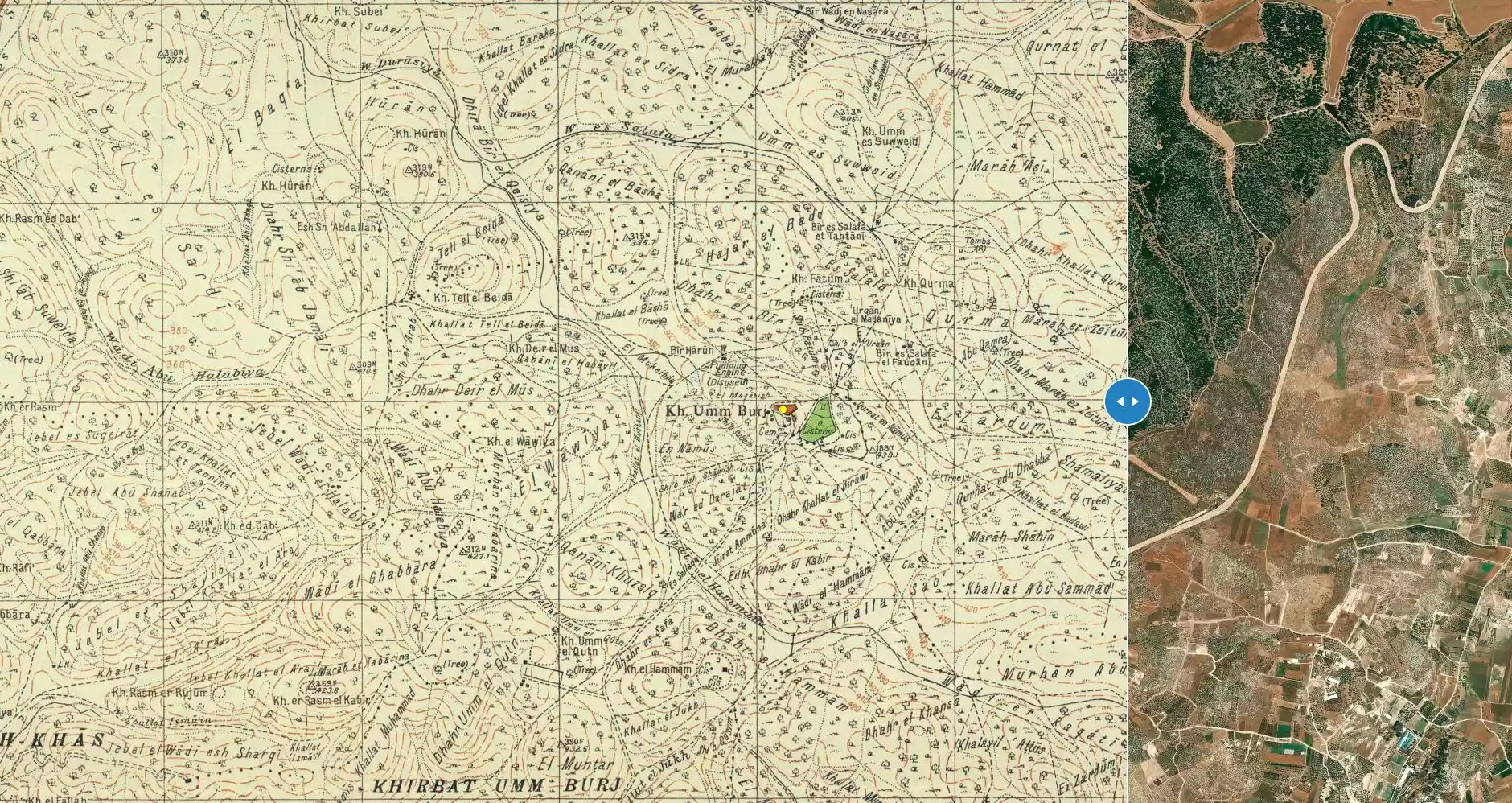
| Map Location | See location #12 on the map View from satellite |
||||||||||||||
| Military Operation | Third stage of Operation Yo'av (commanded by the ethnic cleansing champion Yigal Allon) | ||||||||||||||
| Attacking Units | Har'el Brigade | ||||||||||||||
| Defenders | Egyptian Army | ||||||||||||||
| Exodus Cause | Expulsion by Zionist troops | ||||||||||||||
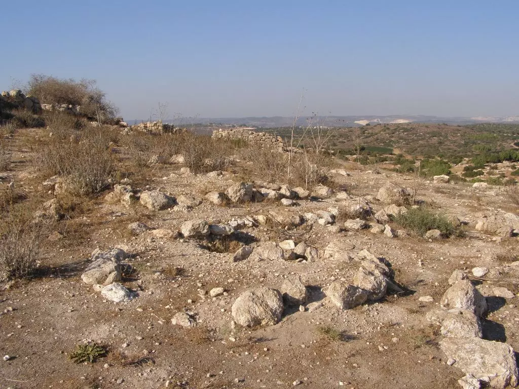
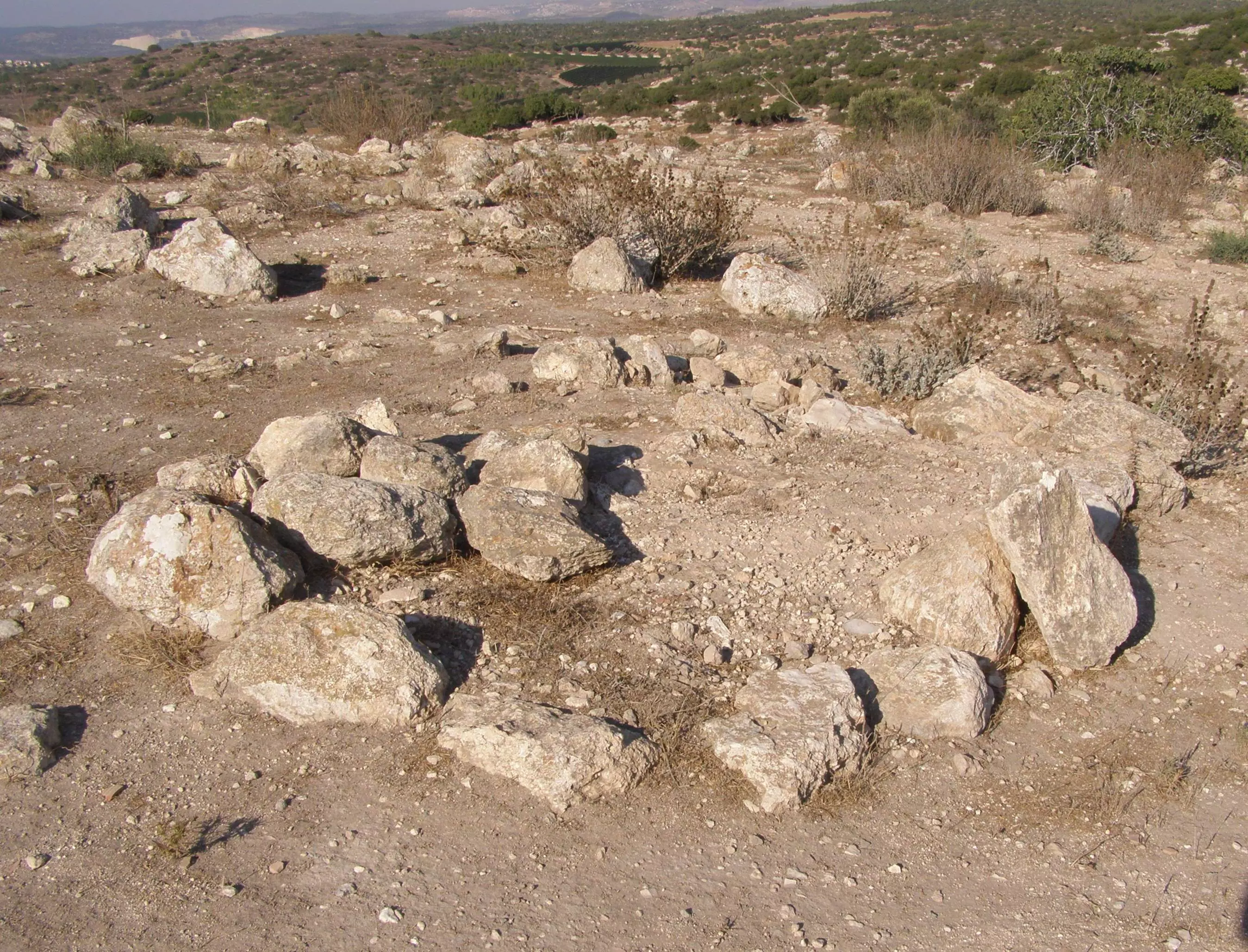
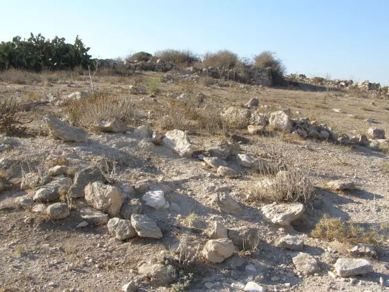
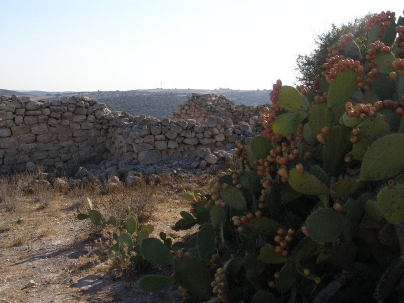
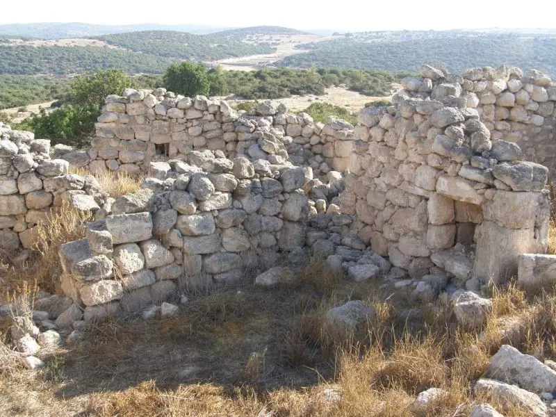
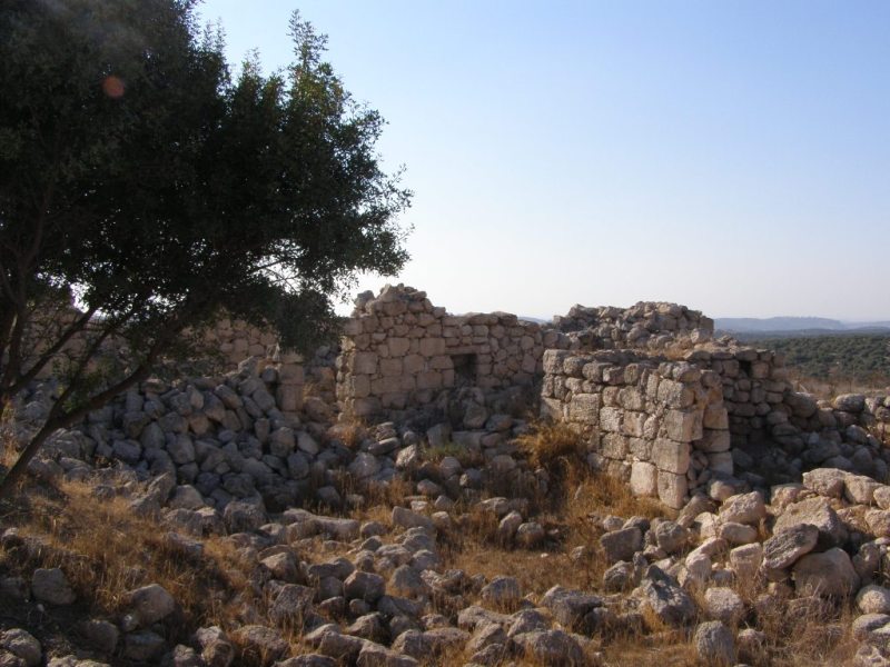
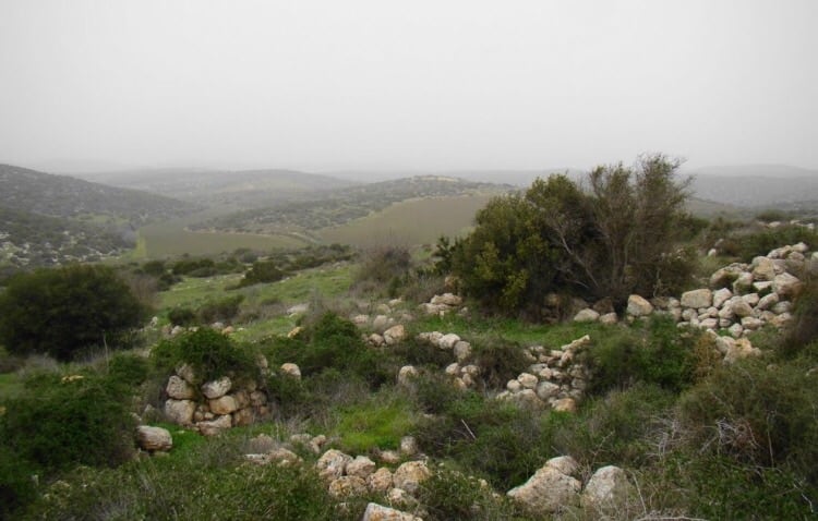
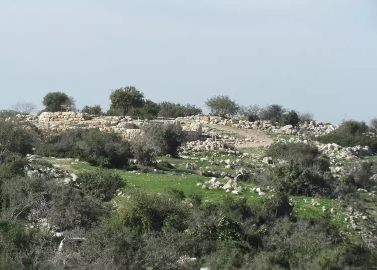
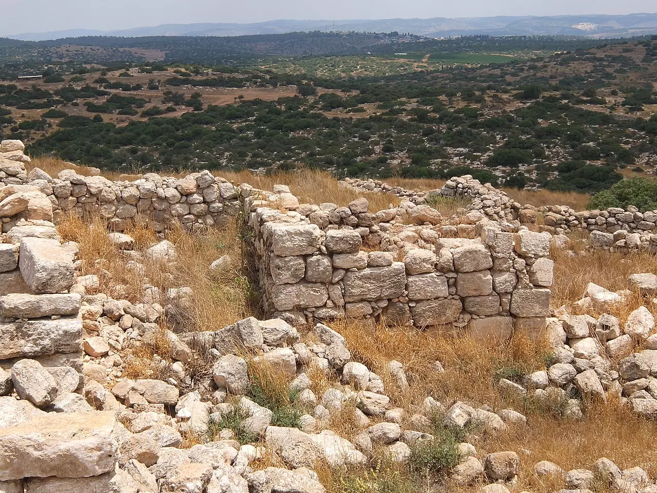
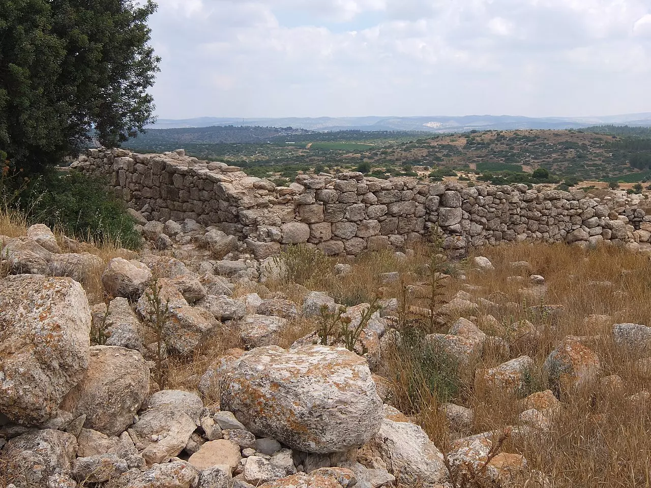
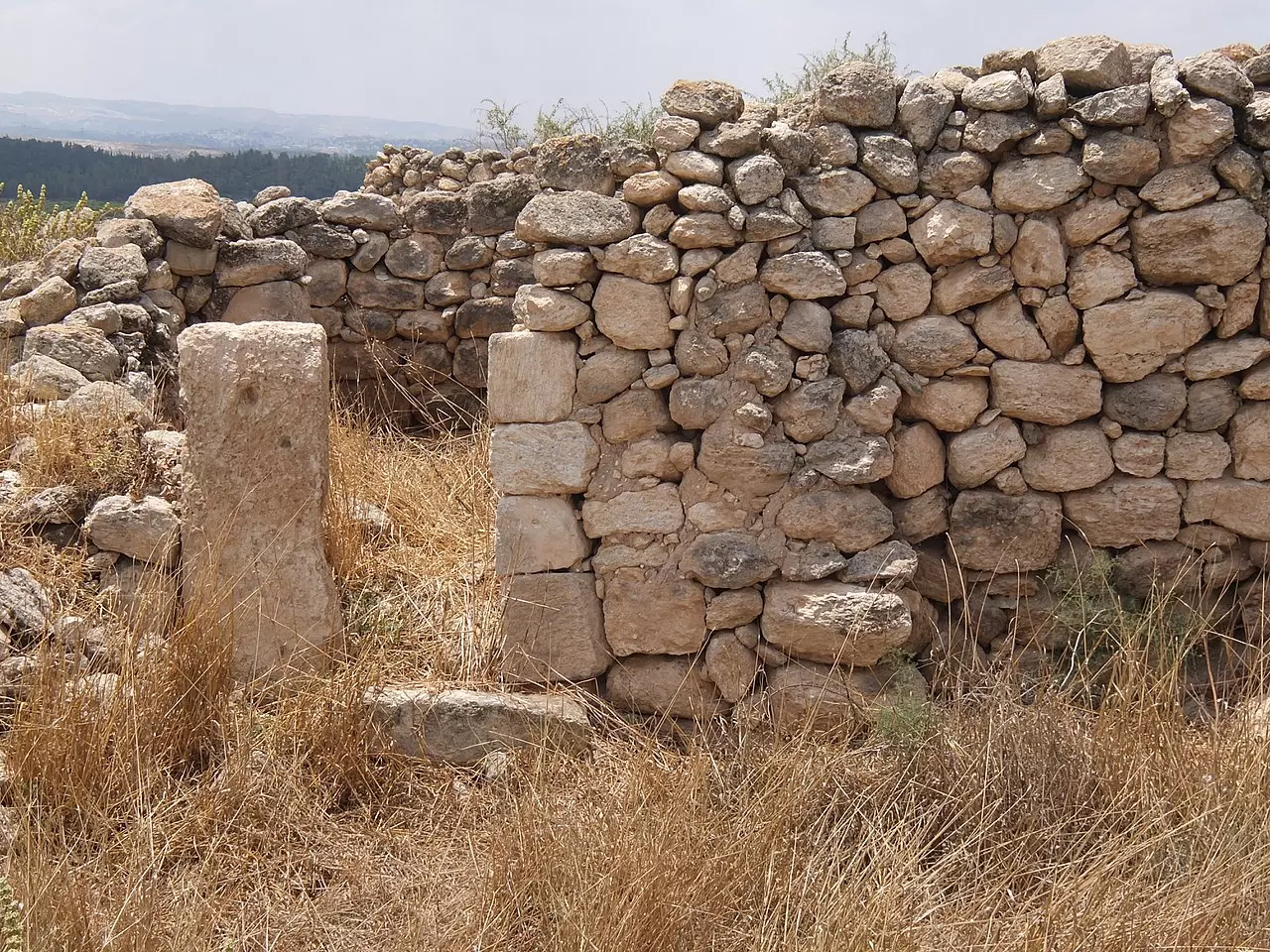
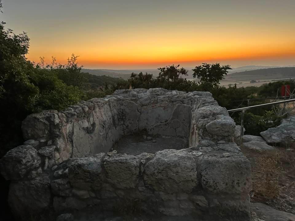
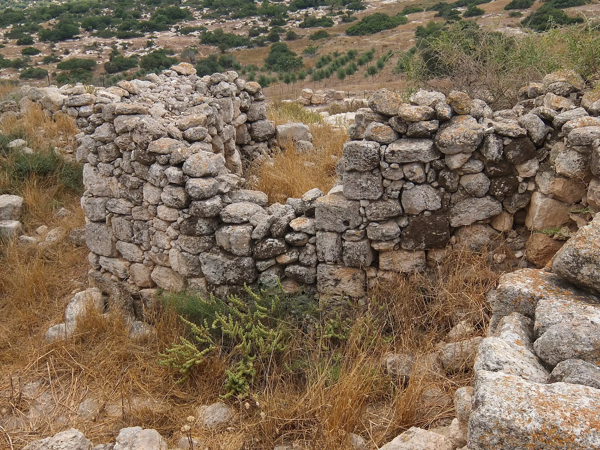
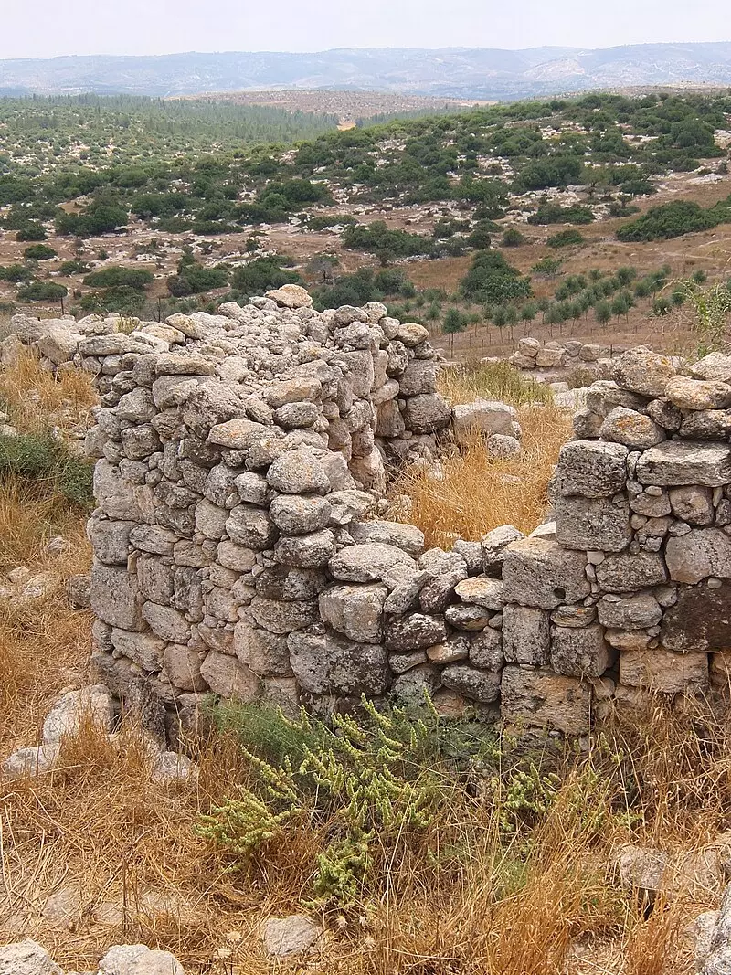
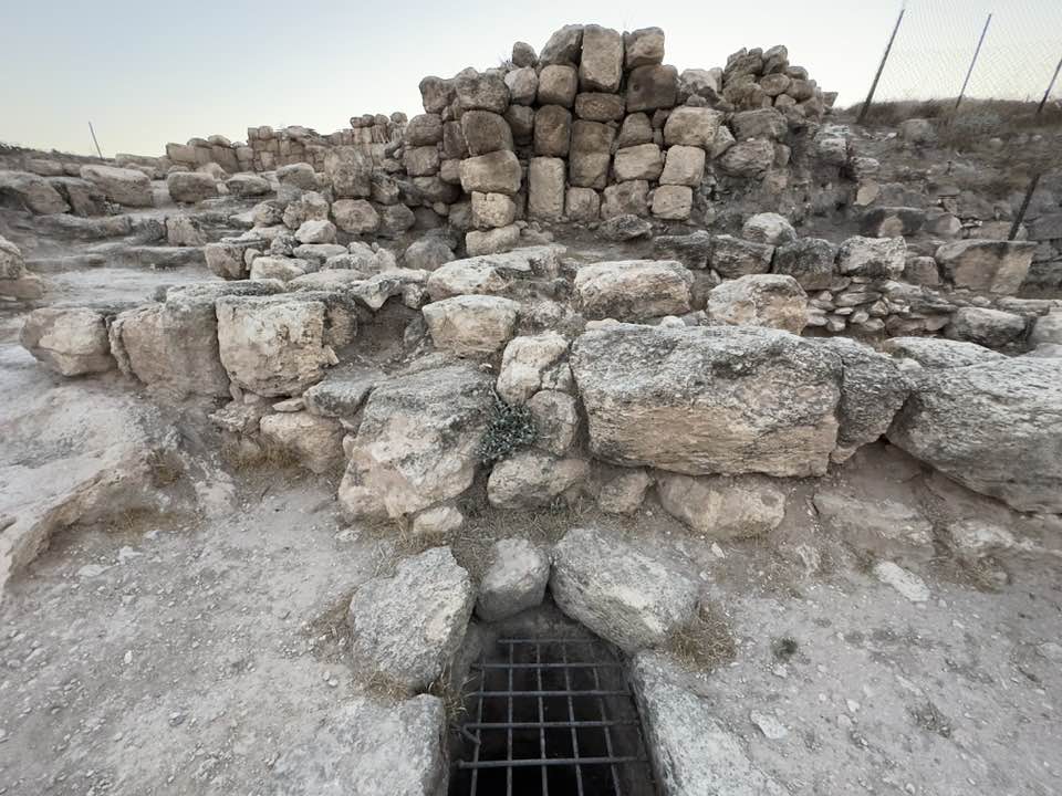
| Village Temains | Umm al-Burg was completely destroyed, and only house walls and rubble left behind. | ||||||||||||||
| Ethnically Cleansing | Umm al-Burg was completely ethnically cleansed between November and April, 1949 (see Zakariyya for more details). | ||||||||||||||
| Pre-Nakba Land Ownership |
**Town Lands' Demarcation Maps |
||||||||||||||
| Land Usage As of 1945 |
|
||||||||||||||
| Population |
|
||||||||||||||
| Number of Houses | In (1931): 26 | ||||||||||||||
| Near By Towns |
|||||||||||||||
|
|||||||||||||||
| Town's Name Through History | Umm al-Burg may have been named after the tower which was built in its center during the Roman period. | ||||||||||||||
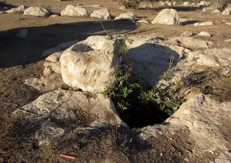
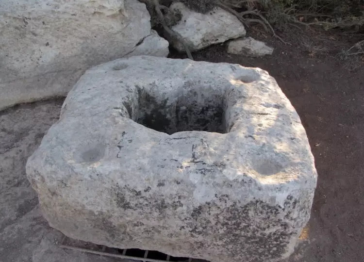
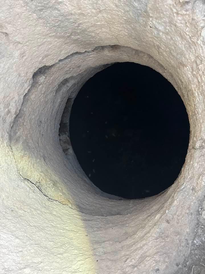
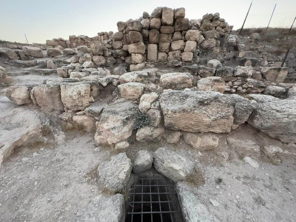
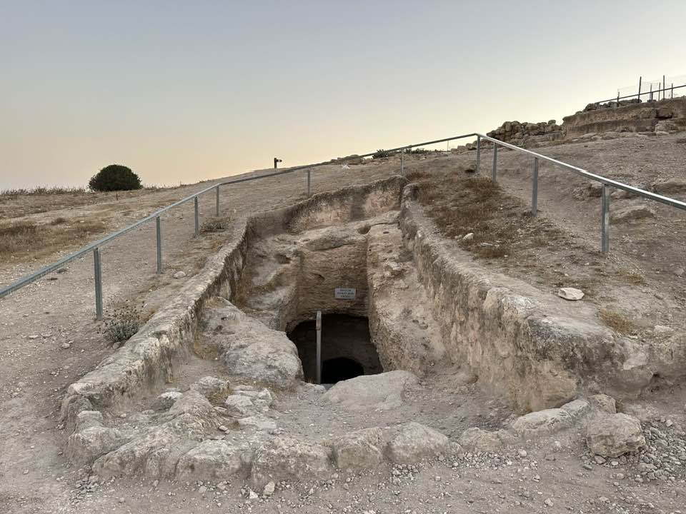
| Water Supply | The villagers used to obtain drinking water from three wells on the northern parts of the village. | ||||||||||||||
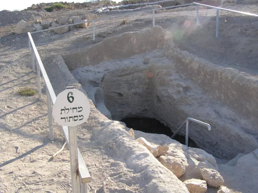
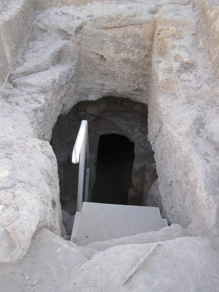
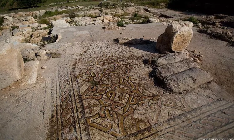
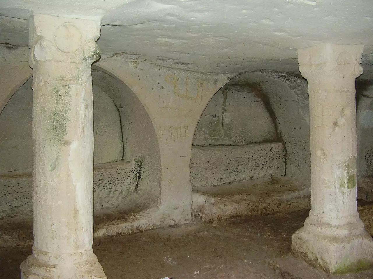
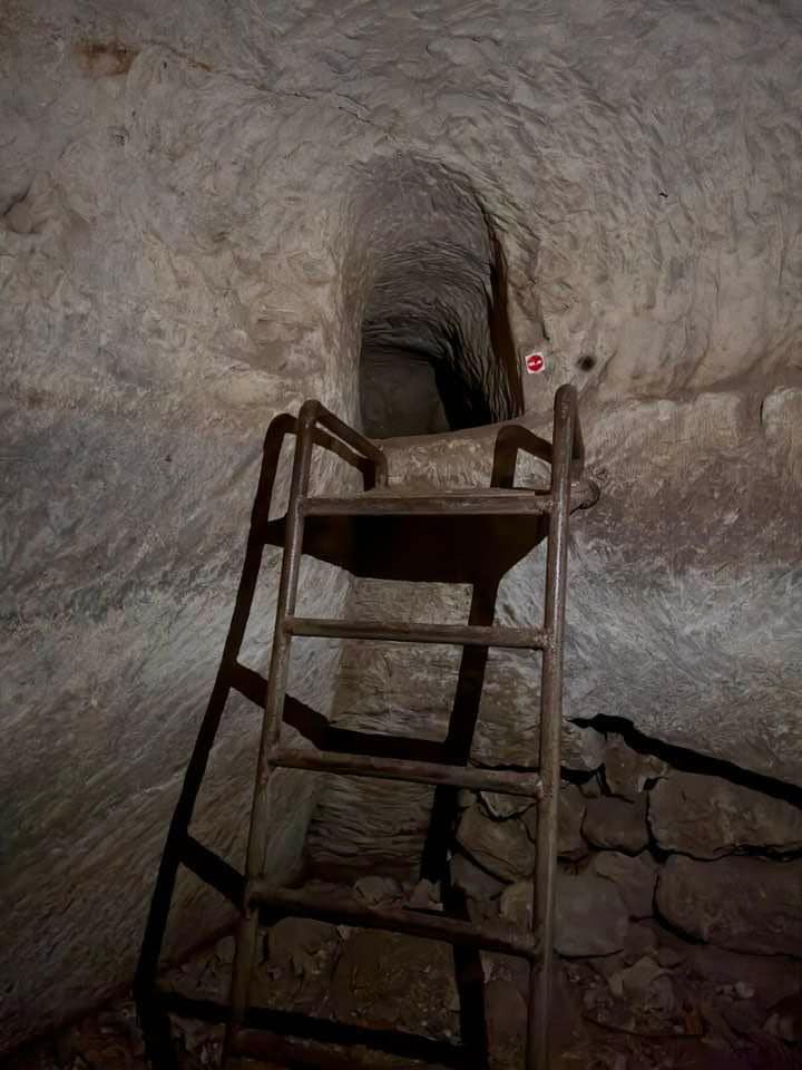
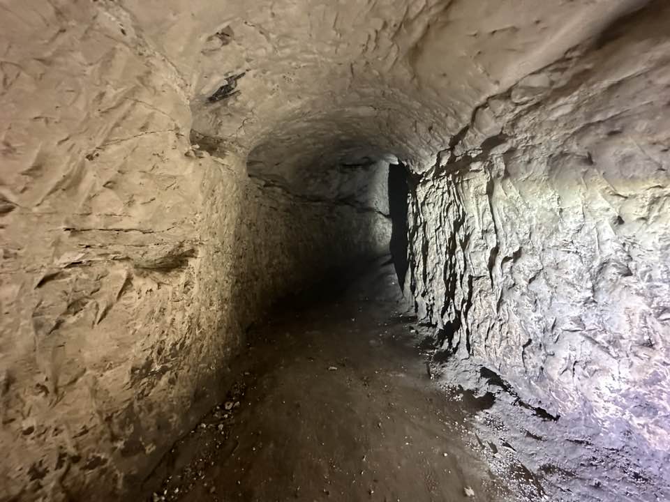
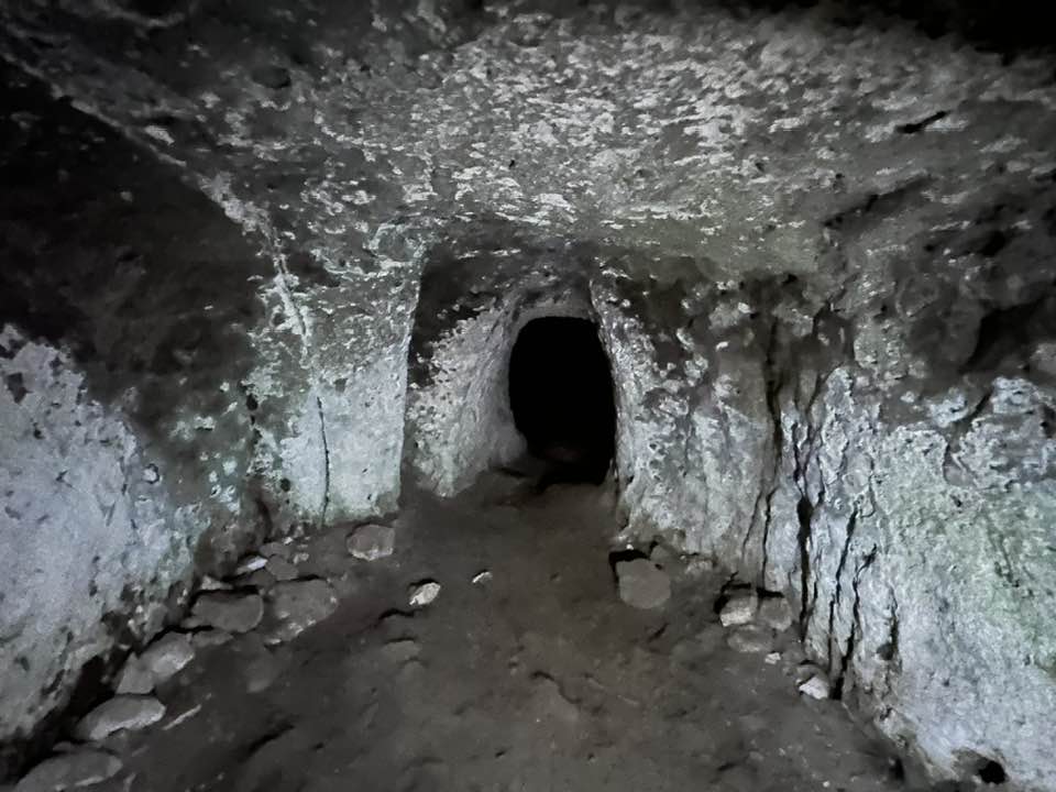
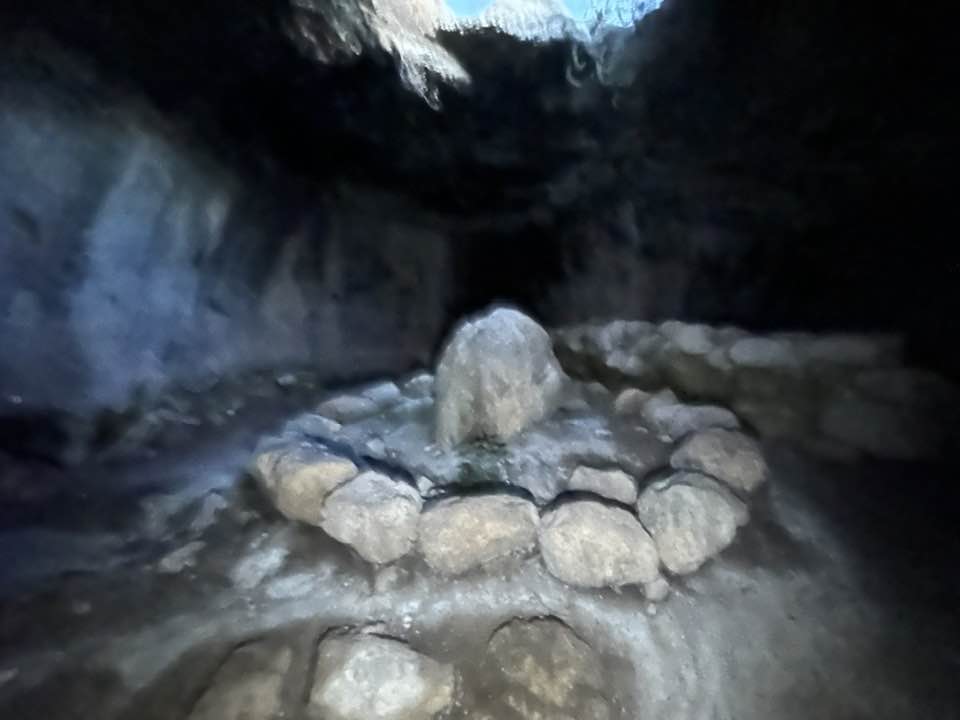
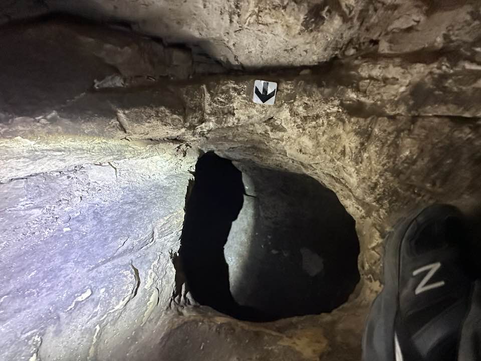
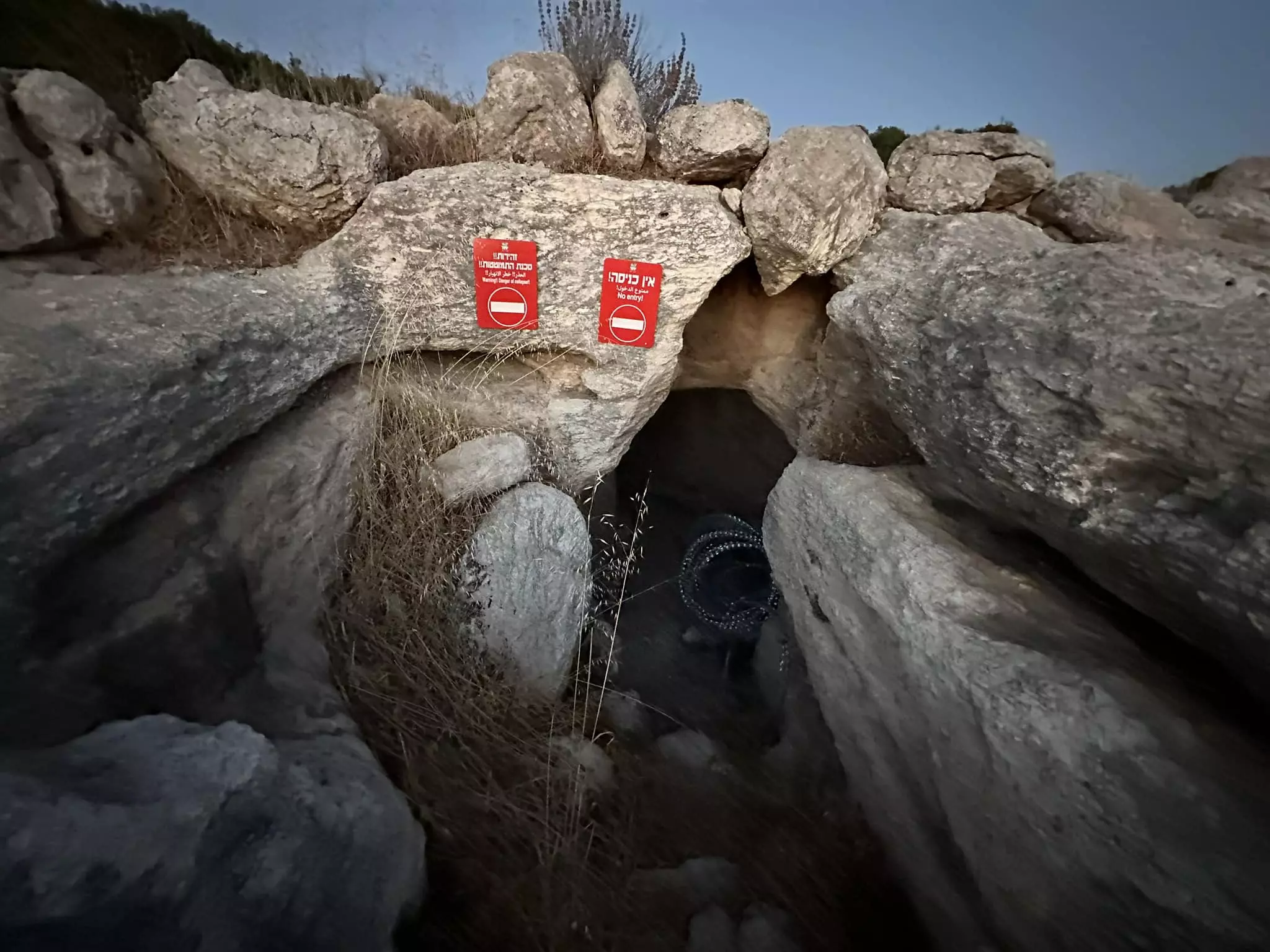
| Archeological Sites | Umm al-Burg contains at least twenty khirbas in its lands, many of which dates to the Romans period. | ||||||||||||||
| Exculsive Jewish Colonies Who Usurped Village Lands |
Nechusha | ||||||||||||||
| Featured Video | |||||||||||||||
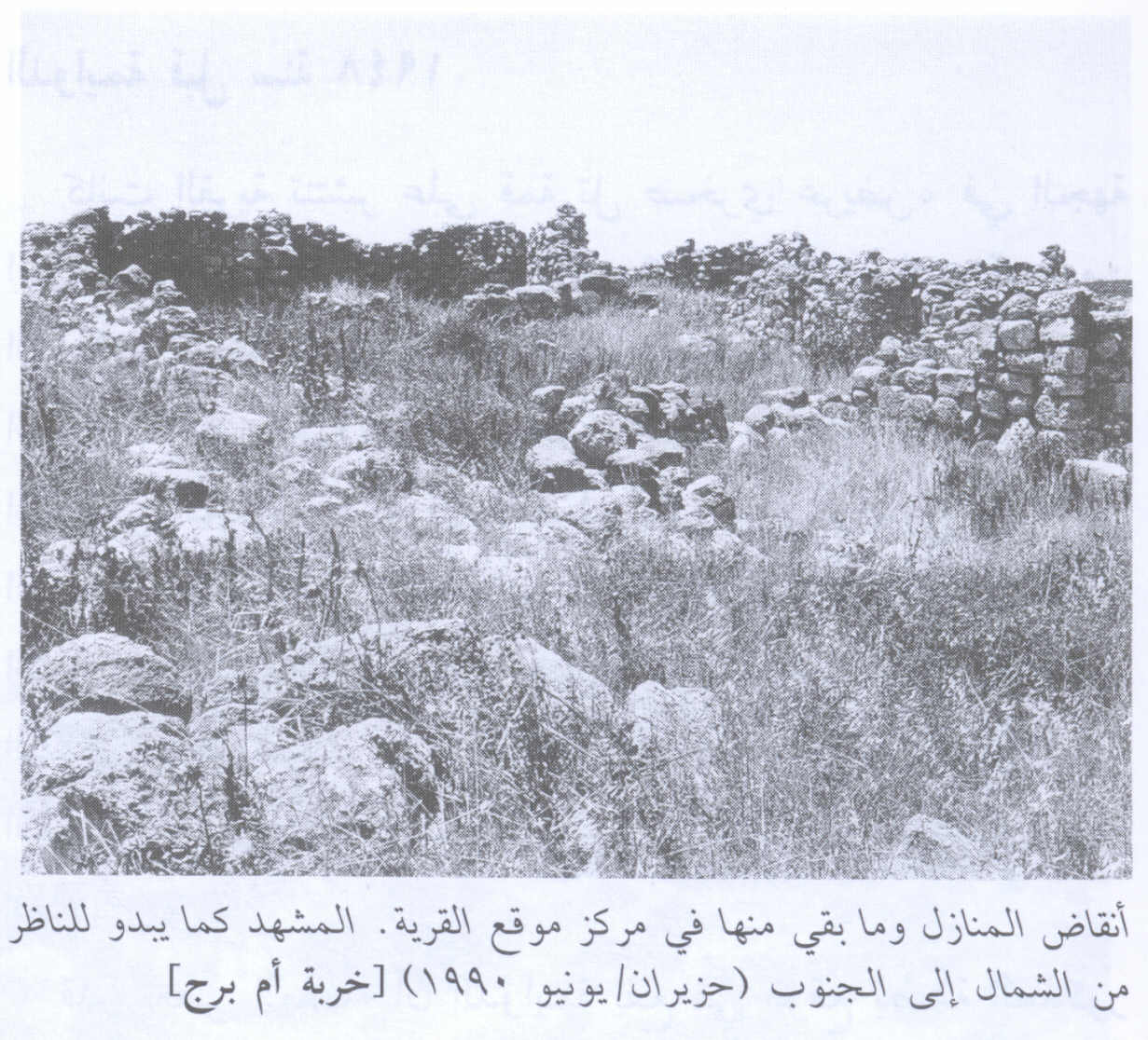
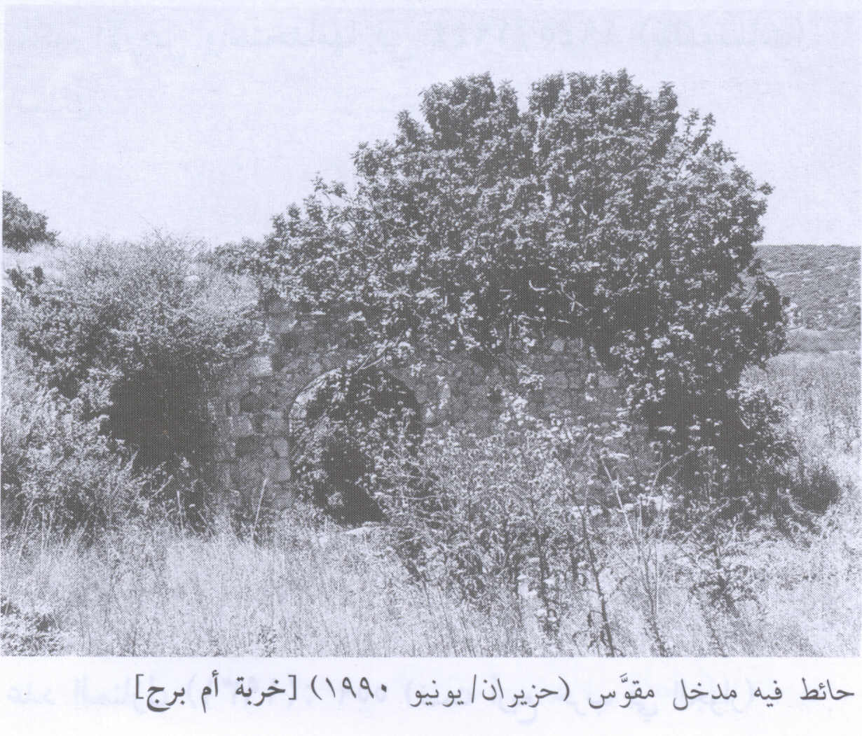
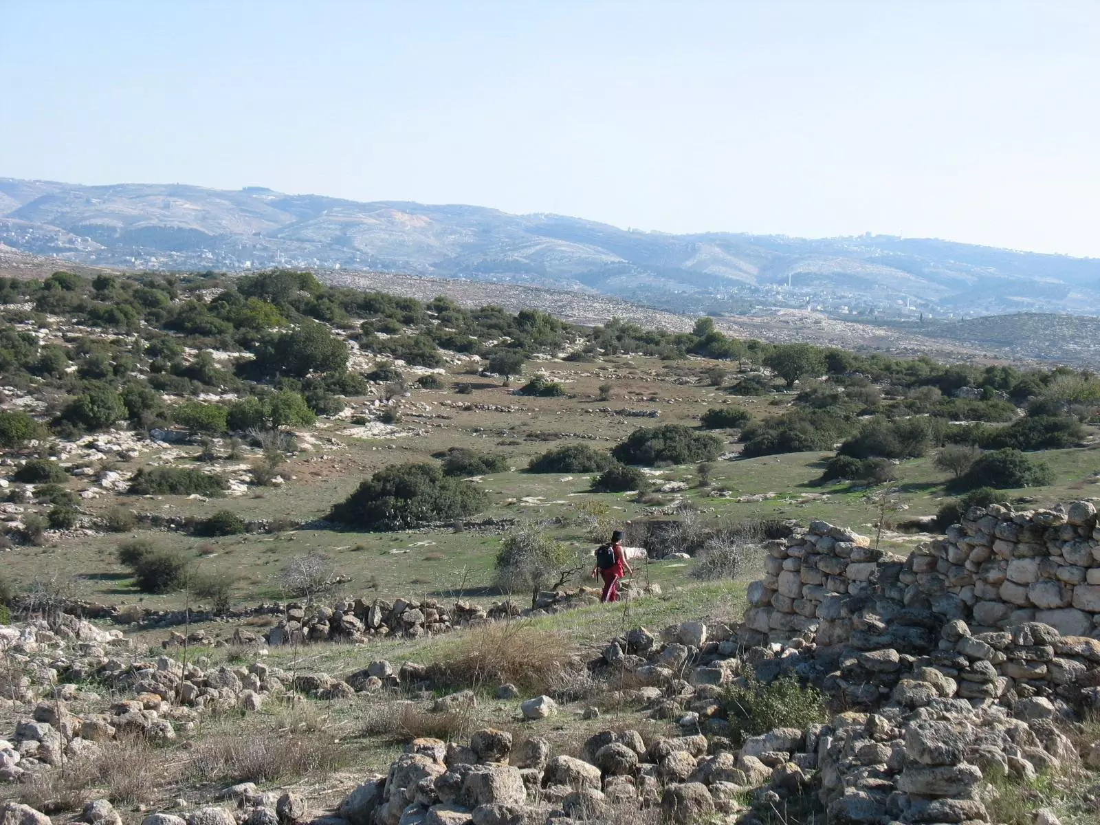
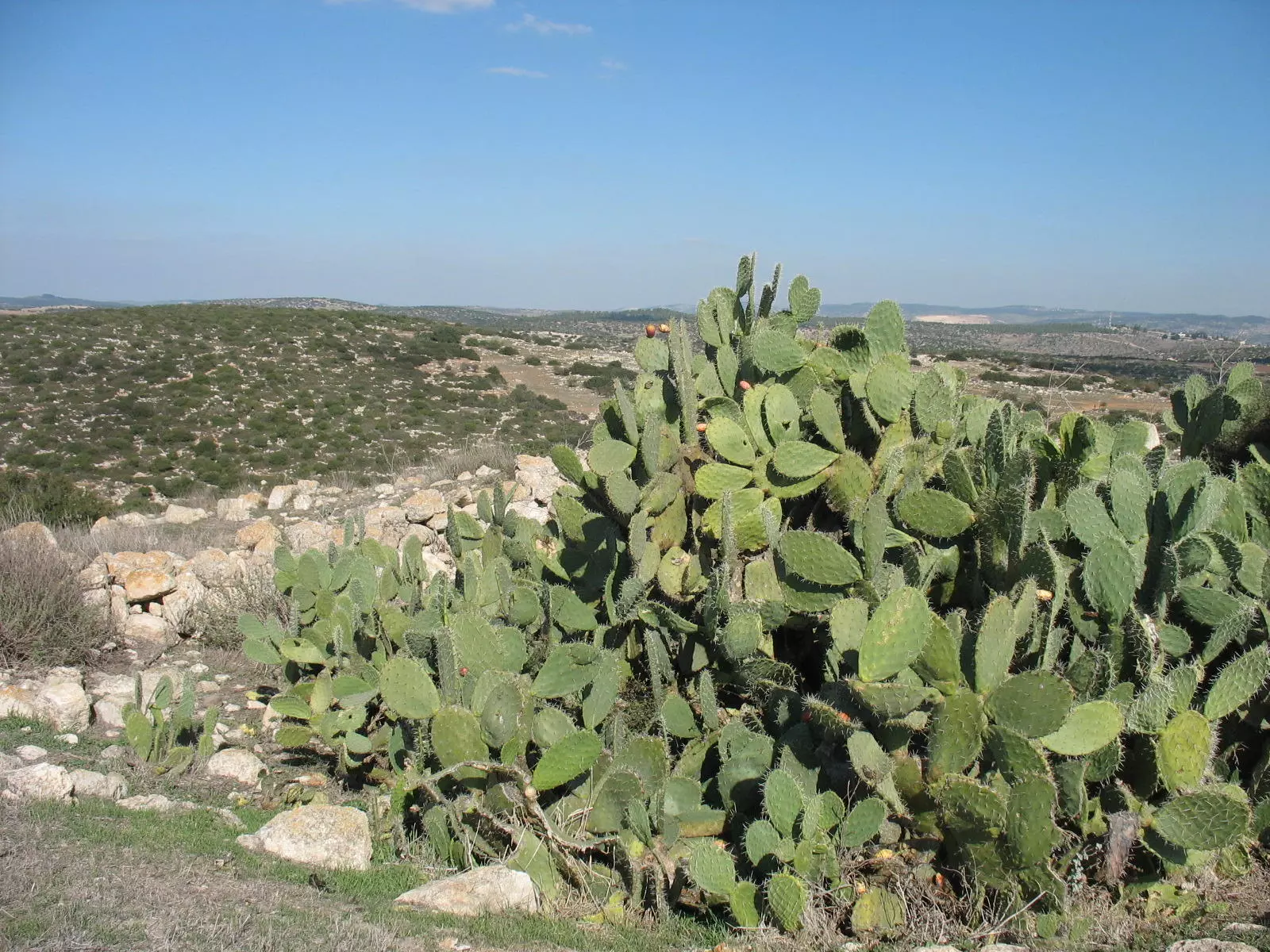
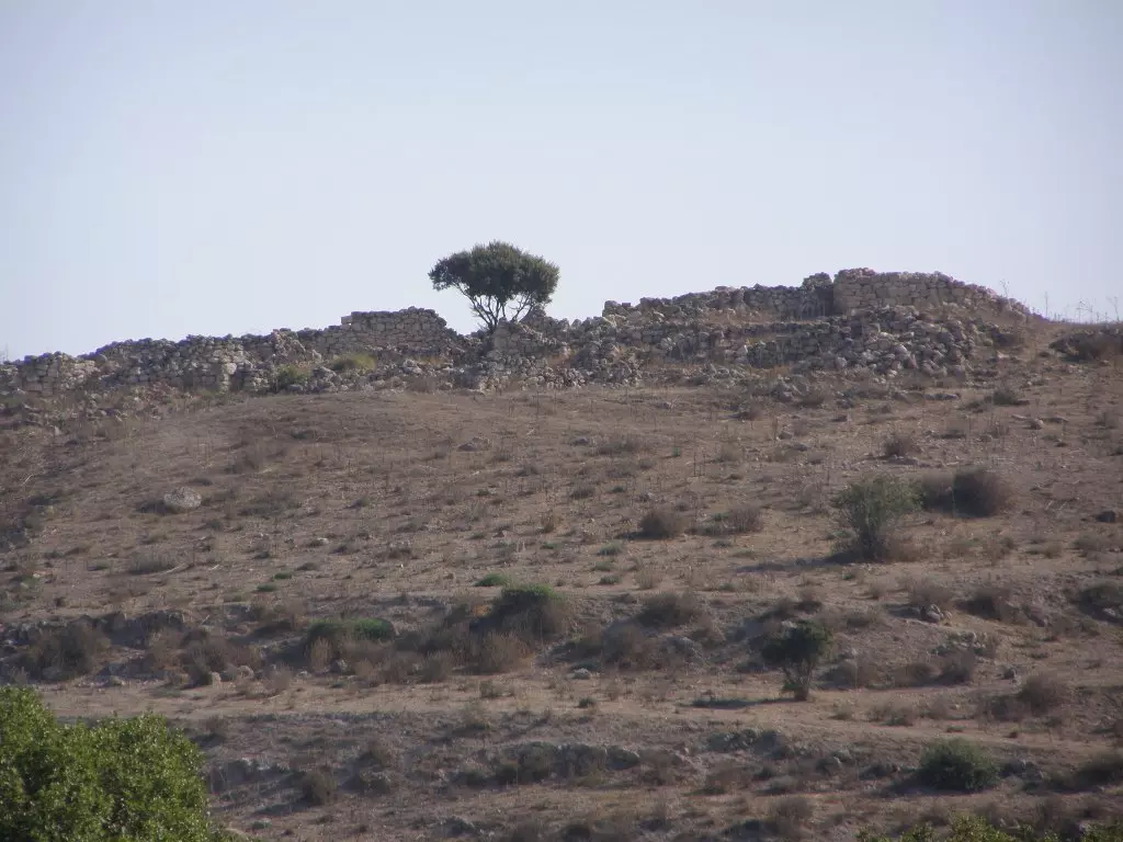
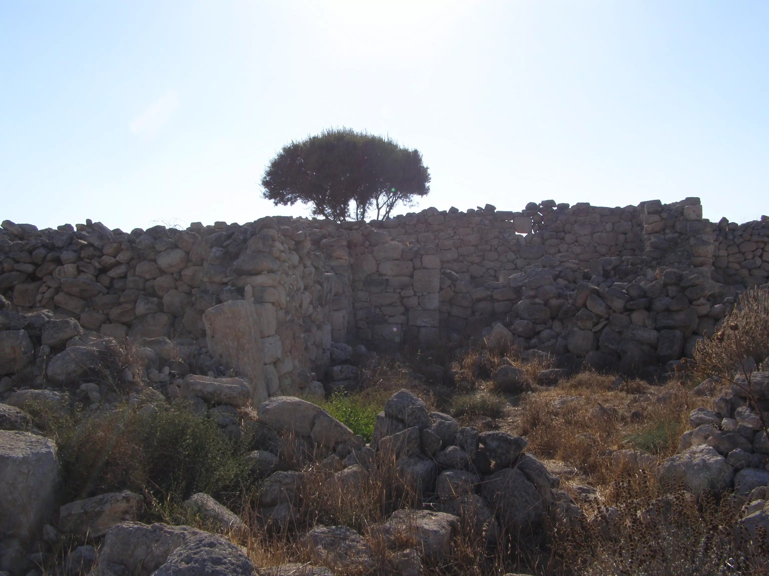
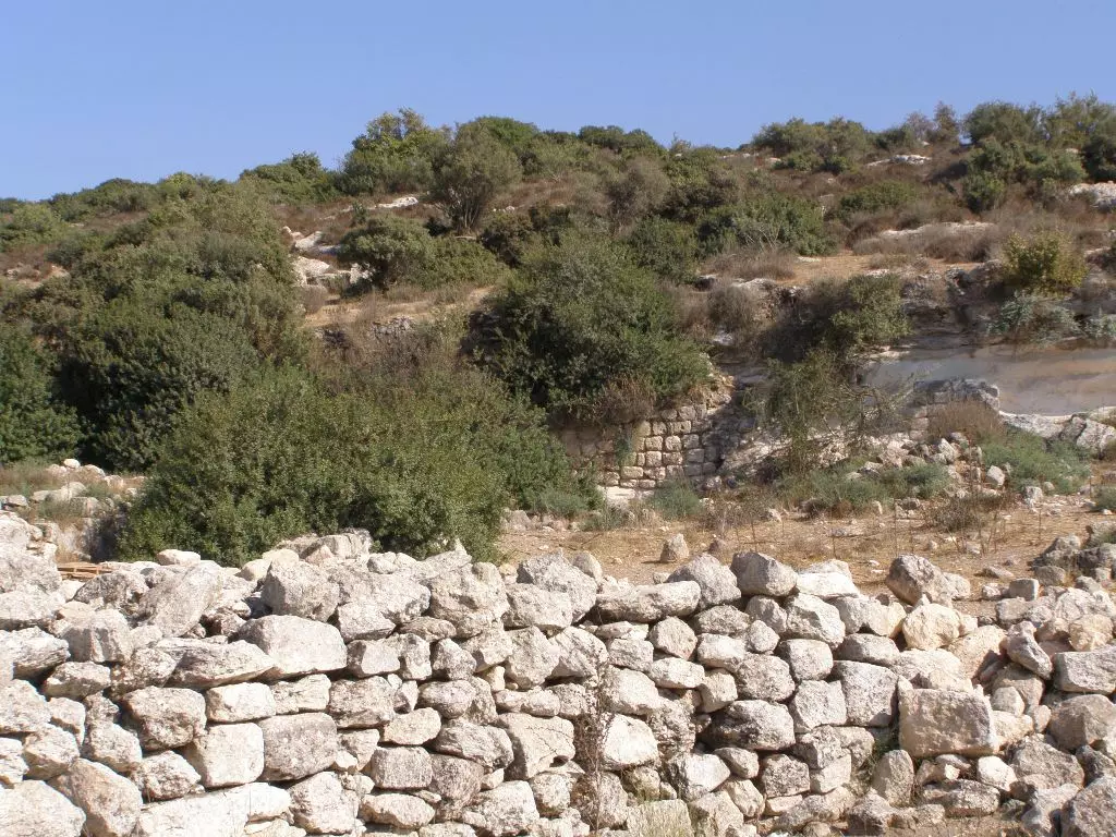
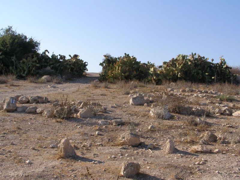
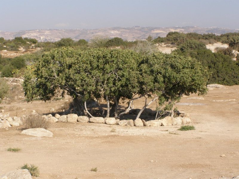
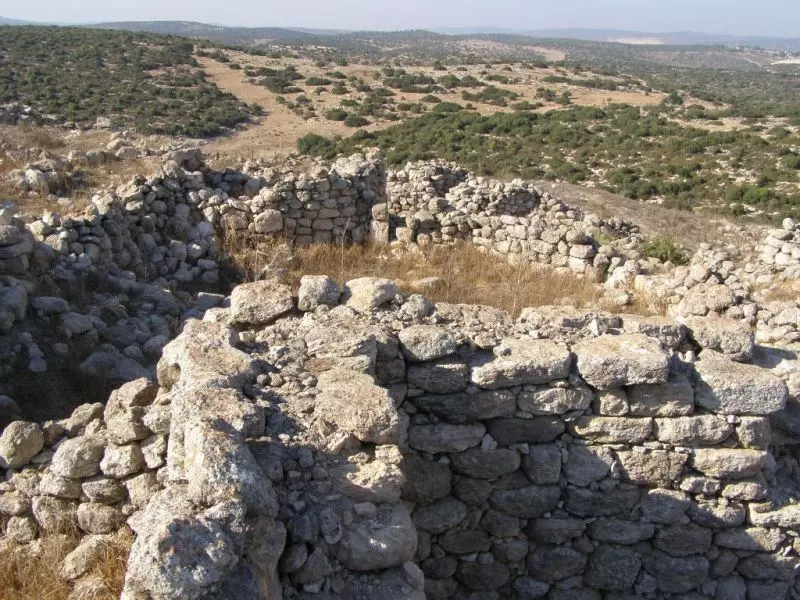
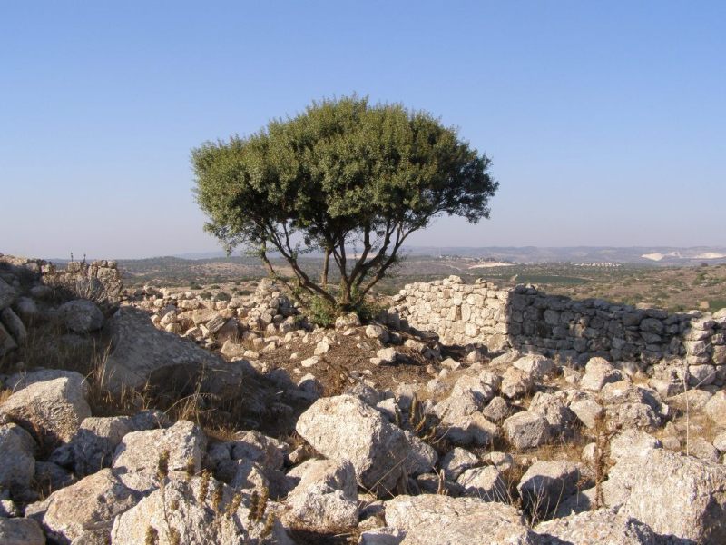
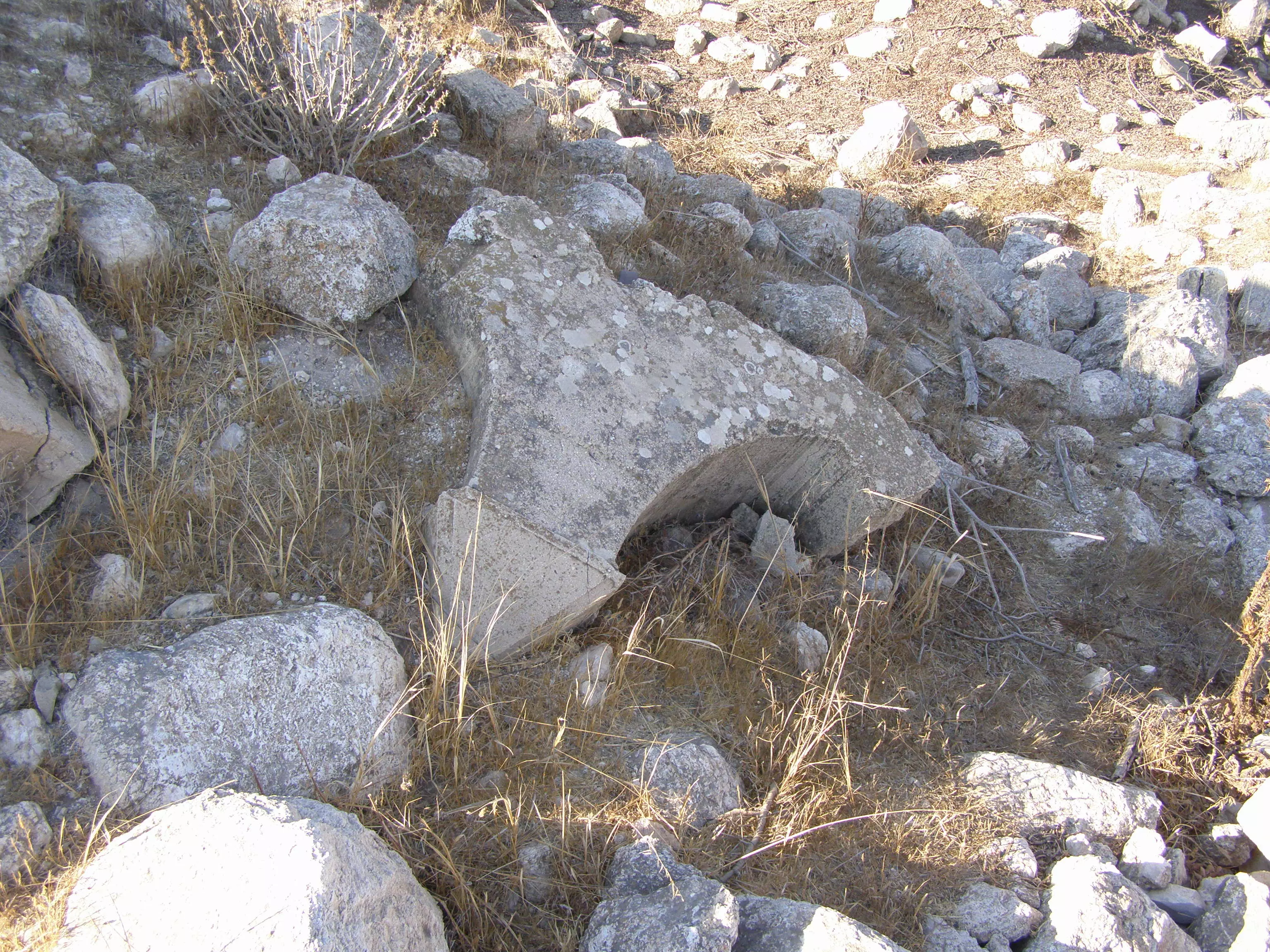
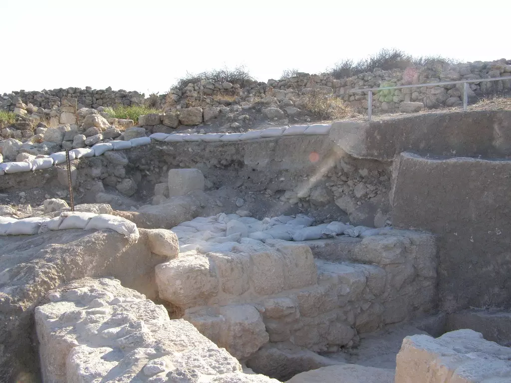
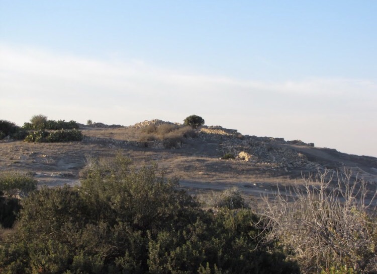
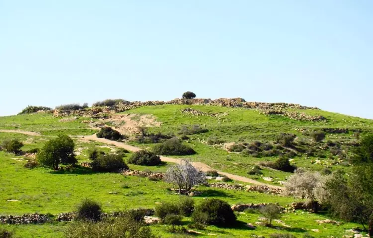
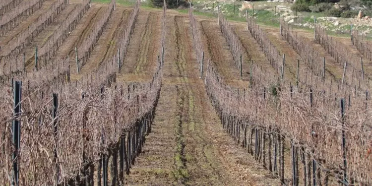
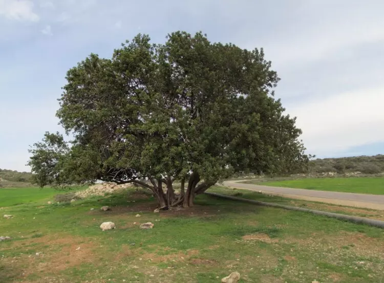
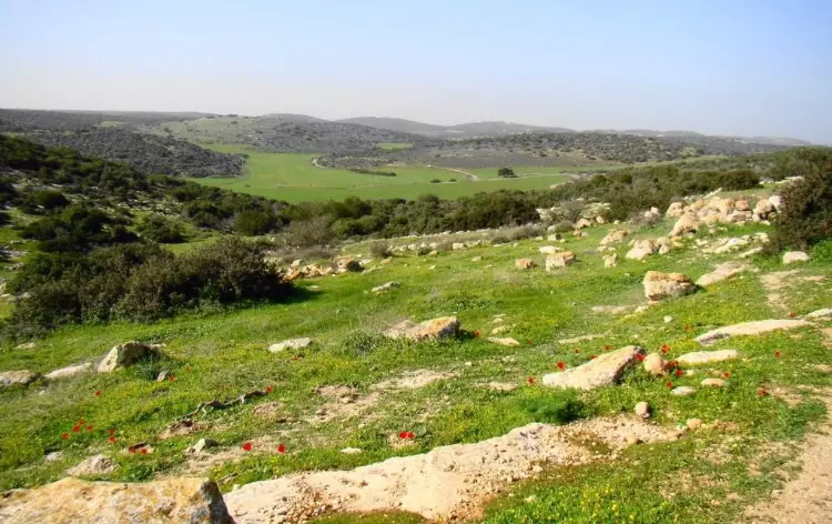
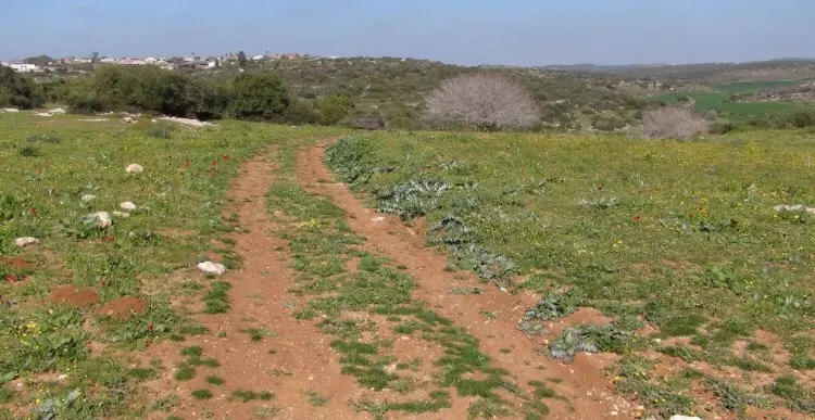
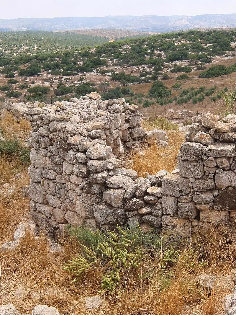
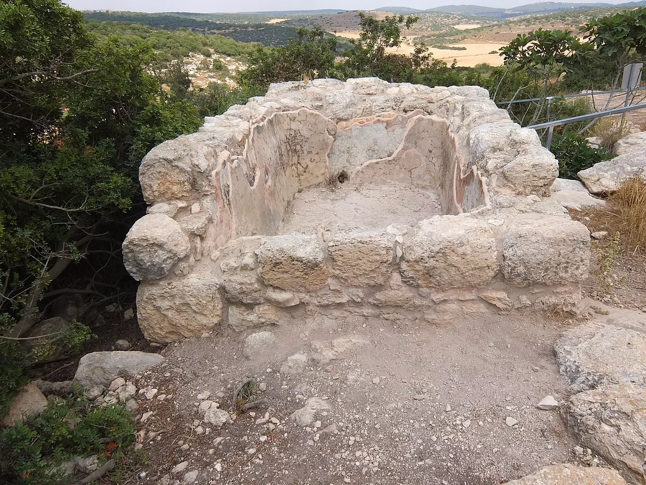
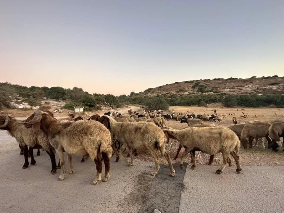
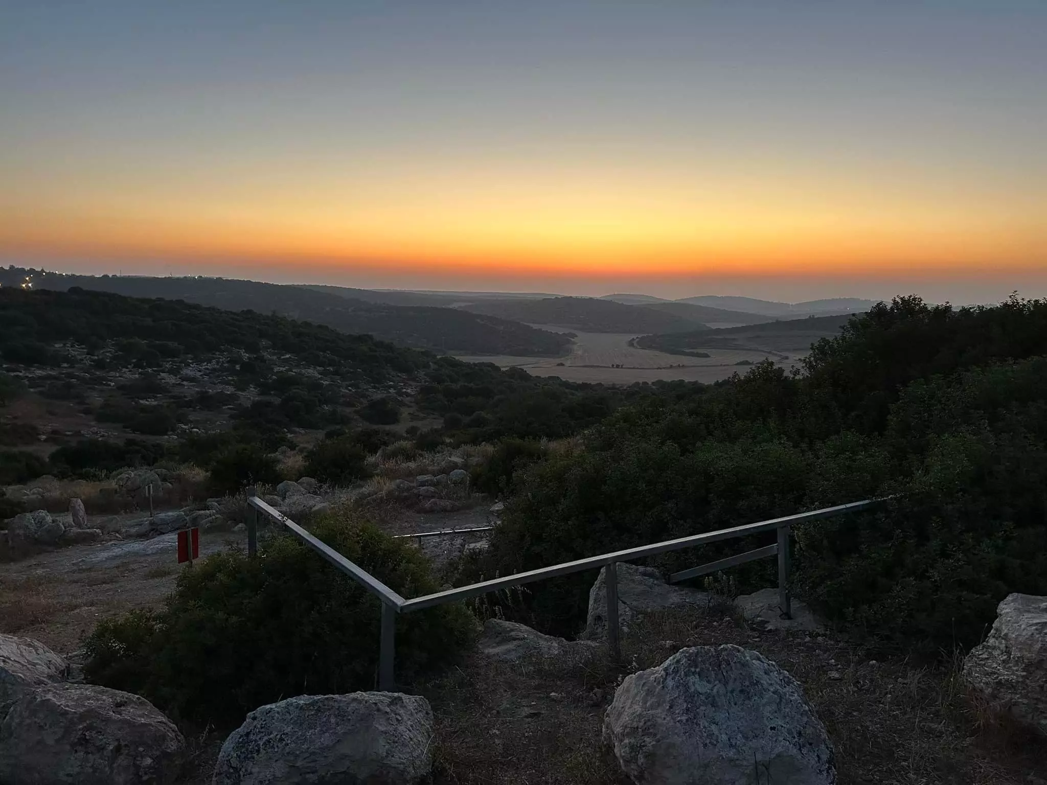
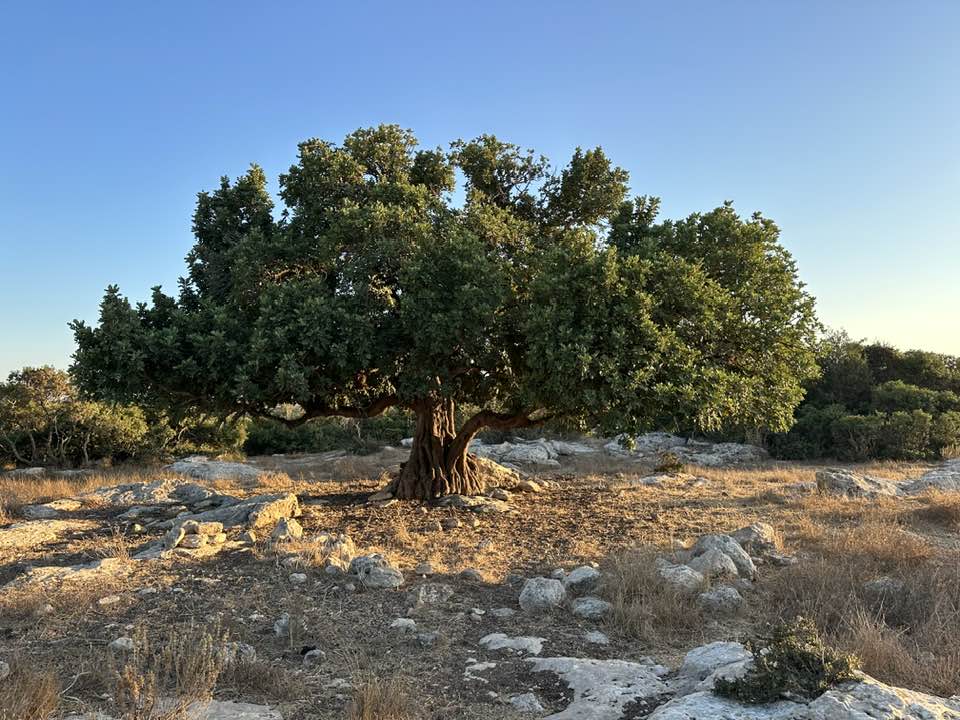
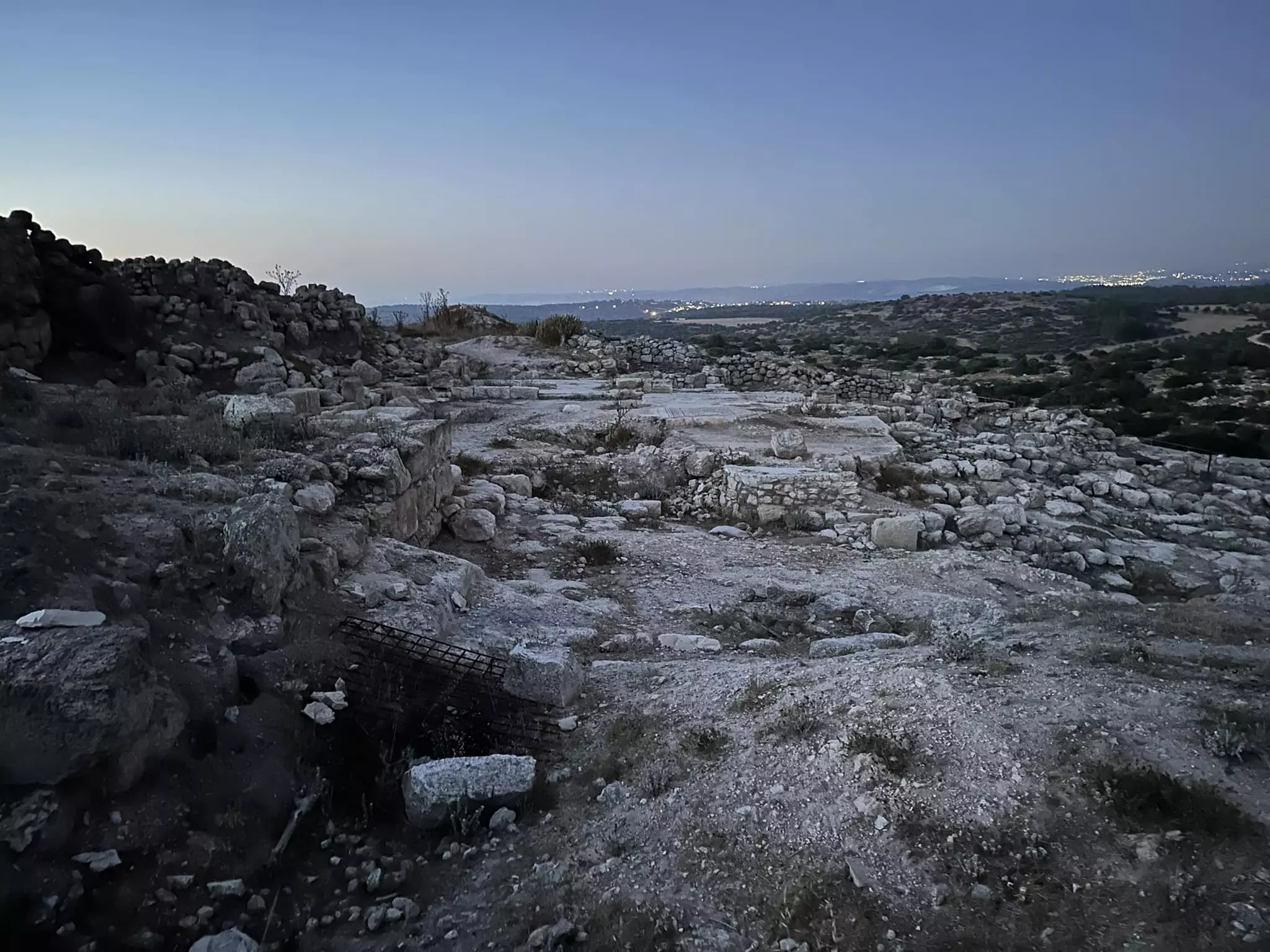
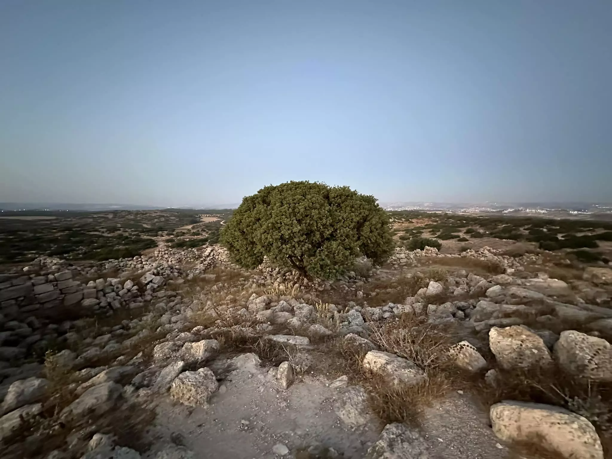
Village Before NakbaThe village stood on a hilltop, overlooking a broad expanse of land in all four directions. Its name was probably derived from a tower that had been erected in the center of the site. Khirbat Umm Burj was described in the late nineteenth century as a ruined village with a central tower that was (erroneously?) thought to be recently built. Its earlier name, which has not been preserved, may originally have contained the Greek word pyrgos ('tower'); Burj is an Arabization of this word. Two dirt paths gave the village access to a highway between Bayt Jibrin and Hebron and to another highway that ran from Bayt Jibrin northeast to the Jaffa-Jerusalem highway. Additional mountainous tracks linked it to the area's other villages, including Dayr Nakhkhas, Surif, and Nuba.Khirbat Umm Burj, classified as a hamlet in the Mandate-era Palestine Index Gazetteer, stretched out in an east-west direction, and its houses were made of stone. Its residents, who were Muslims, obtained their drinking water from three wells on the northern tip of the site. Their chief economic activities were rainfed agriculture and animal husbandry. They cultivated grain and fruits such as olives and grapes. In 1944/45 a total of 3,546 dunums was allocated to cereals 28 dunums were irrigated or used for orchards. The village was originally an uninhabited khirba that contained walls, cisterns, caves, and rock carvings. There were at least twenty khirbas on village land, including Jamrura, perhaps to be identified with Gemmruris in Roman times. The ancient history of the site remains to be determined, but the presence of cisterns and a columbarium suggests a Roman habitation. Village Occupation and Ethnic CleaningKhirbat Umm Burj was probably entered by Israeli forces in the third stage of Operation Yoav , on 28-29 October 1948. This stage was marked by 'panic flight' and 'some expulsions,' according to Israeli historian Benny Morris; there were also atrocities, notably at nearby al-Dawayima on 29 October. Despite these circumstances, some villagers apparently remained in their homes, for on 6 November, an Israeli unit was sent to 'expel refugees' in the area and found 150 villagers in Khirbat Umm Burj. Morris writes that the unit, a platoon from the Har'el Brigade (which had just occupied positions to the north), 'expelled about l00, apparently injuring some of them.' This raid, and others like it carried out between November 1948 and April 1949, aimed at 'clearing' areas along the front lines between Israeli- and Jordanian-held territory. The village eventually fell in close proximity to the armistice lines.Zionists Colonies on Village LandsNechusha, founded in 1982, is west of the site, on village lands.Village TodayThe crumbled houses that remain are attached to each other. Their windows and doors are clearly visible, although the roofs and sections of the walls are gone . A large arch stands amidst these remnants of houses. A large deserted structure (which formerly housed an irrigation pump) stands at the foot of the hill, on the western side of the village. It has an entrance on its eastern side. A carob tree grows inside it, and a pool and a well are located nearby. One can see caves that had formerly been habitations on the northern and northeastern periphery of the site cactuses grow on its southern edge.SourceDr. Walid al-Khalidi, 1992: All That Remains. |
|||||||||||||||
| Related Maps | Town Lands' Demarcation Maps خرائط للقضاء توضح حدود القرى والاودية Town's map on MapQuest View from satellite Help us map this town at WikiMapia |
||||||||||||||
| Related Links | Wikipedia's Page Google Search Google For Images Google For Videos |
||||||||||||||
| More Information | في كتاب كي لا ننسى في كتاب بلادنا فلسطين المزيد من موقع هوية |
||||||||||||||
- Ruins of the village houses looking east from the the center of the village, 1990
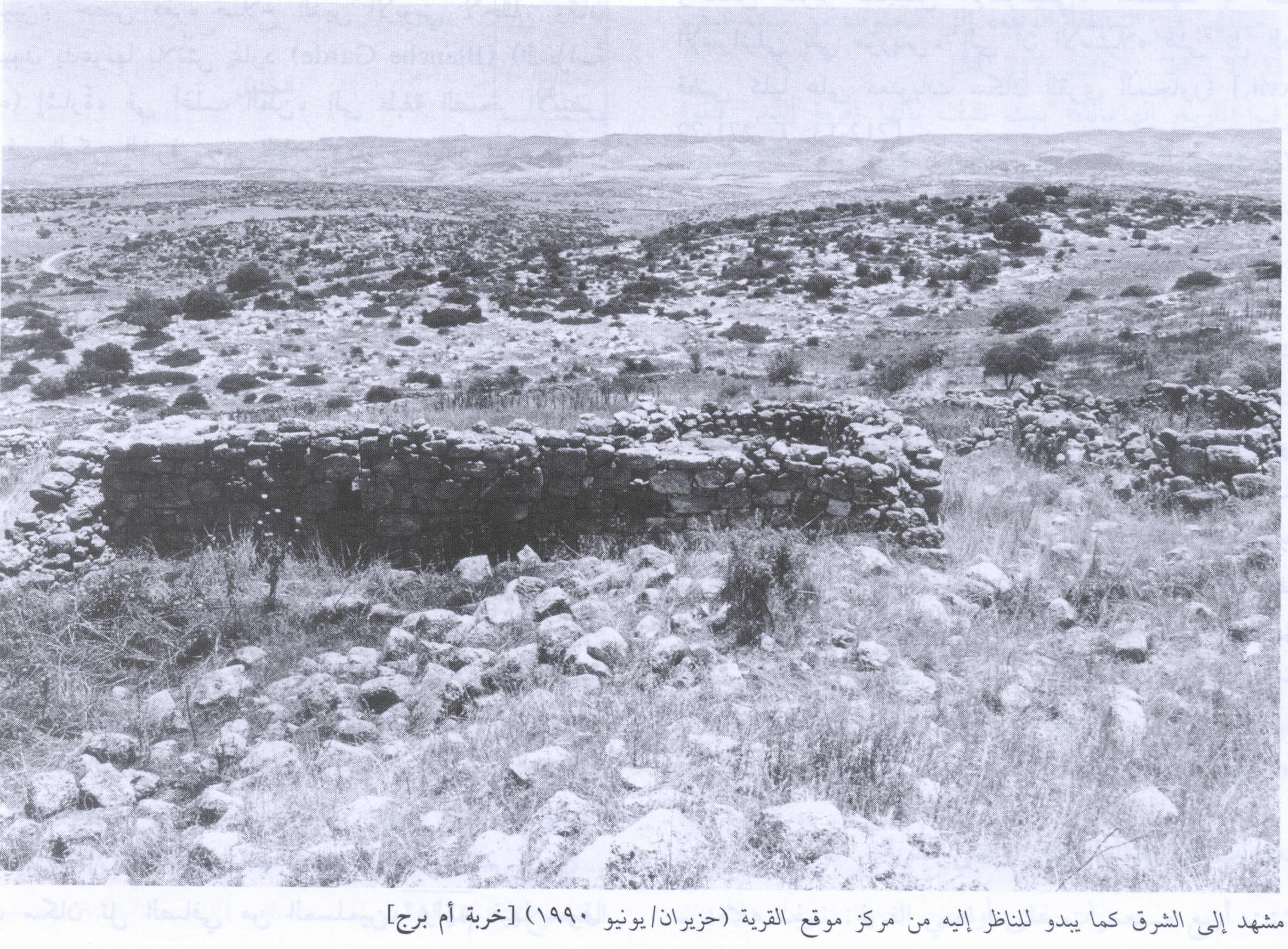
Scanned from "All That Remains" by Dr. Walid Khalidi - Ruins of the village houses looking south from the the center of the village, 1990
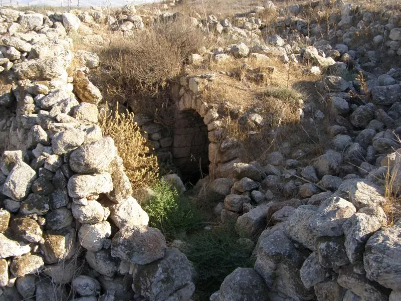
Scanned from "All That Remains" by Dr. Walid Khalidi - Wall with an arched entrance, 1990
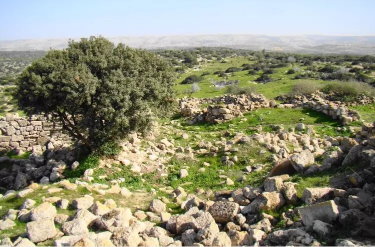
Scanned from "All That Remains" by Dr. Walid Khalidi - Remains of house ruins all over the place
Posted by Noga Kadman - Remains of house ruins all over the place
Posted by Noga Kadman - أم برج - آب 2008. تصوير: عمر اغبارية
Posted by Umar Ighbariyyeh - أم برج - آب 2008. تصوير: عمر اغبارية
Posted by Umar Ighbariyyeh - بئر هارون
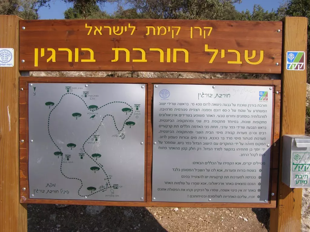
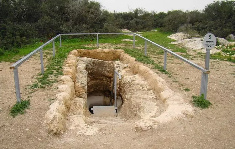
Posted by Umar Ighbariyyeh - حوّلها الاحتلال إلى متنزّه
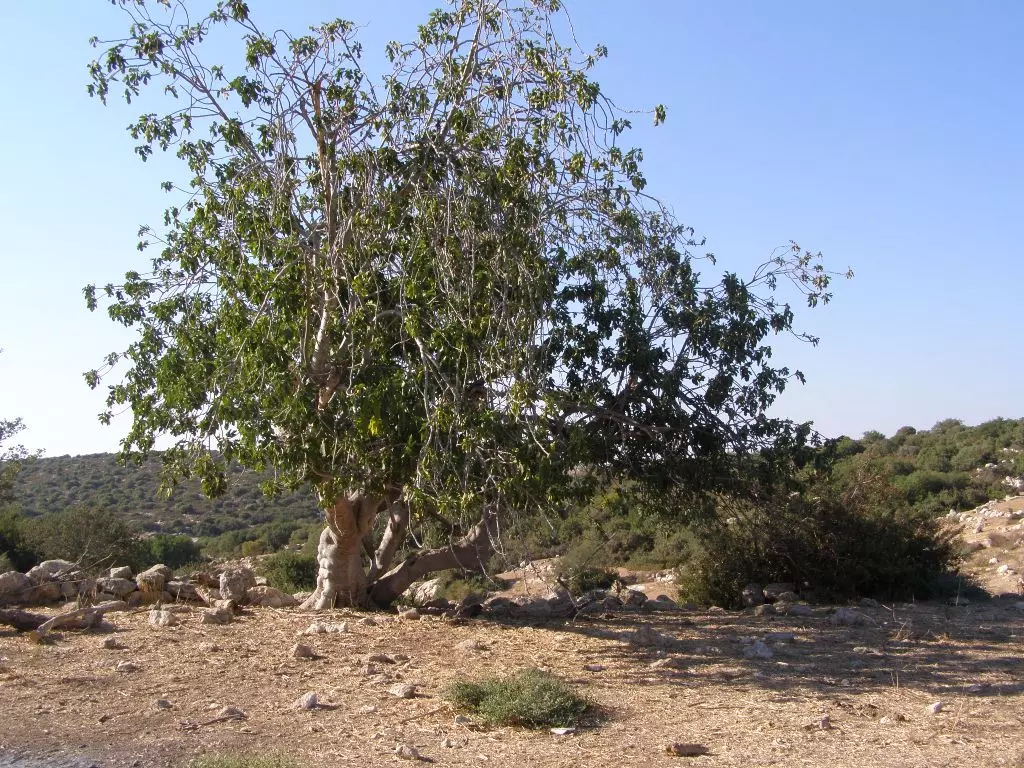
Posted by Umar Ighbariyyeh - وتينة..... آب 2008 - تصوير عمر غبارية
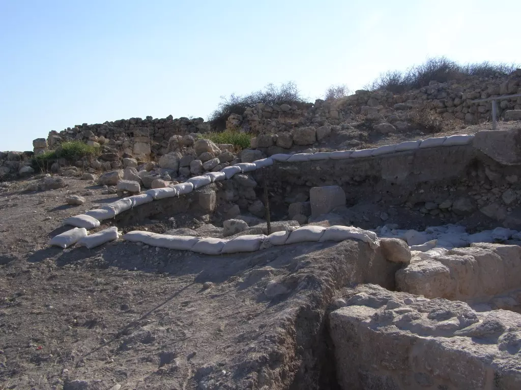
Posted by Umar Ighbariyyeh - حفريات إسرائيلية تحت أطلال القرية الفلسطينية، آب 2008، تصوير عمر غبارية
Posted by Umar Ighbariyyeh - قبور الفلسطنيين المهملة، آب 2008، تصوير عمر غبارية
Posted by Umar Ighbariyyeh - قبور الفلسطنيين المهملة، آب 2008، تصوير عمر غبارية
Posted by Umar Ighbariyyeh - قبور الفلسطنيين المهملة، آب 2008، تصوير عمر غبارية
Posted by Umar Ighbariyyeh - وتينة..... آب 2008 - تصوير عمر غبارية
Posted by Umar Ighbariyyeh - قبور الفلسطنيين المهملة، آب 2008، تصوير عمر غبارية
Posted by Umar Ighbariyyeh - أطلال وصبّار، آب 2008، تصوير عمر غبارية
Posted by Umar Ighbariyyeh - أطلال،آب 2008، تصوير عمر غبارية
Posted by Umar Ighbariyyeh - أطلال،آب 2008، تصوير عمر غبارية
Posted by Umar Ighbariyyeh - أطلال،آب 2008، تصوير عمر غبارية
Posted by Umar Ighbariyyeh - بيوت مهدمة، آب 2008، تصوير عمر غبارية

Posted by Umar Ighbariyyeh 2 - حوّلها الاحتلال إلى متنزّه، آب 2008، تصوير عمر غبارية
Posted by Umar Ighbariyyeh - أطلال،آب 2008، تصوير عمر غبارية
Posted by Umar Ighbariyyeh - حجارة بيت مهدوم، آب 2008، تصوير عمر غبارية
Posted by Umar Ighbariyyeh - أطلال مبنى أثري، آب 2008، تصوير عمر غبارية
Posted by Umar Ighbariyyeh - يبحثون عن تاريخ الزمن الغابر ويدفنون آثار العرب، أب 2008، تصوير عمر غبارية
Posted by Umar Ighbariyyeh - يبحثون عن تاريخ الزمن الغابر ويدفنون آثار العرب، آب 2008، تصوير عمر غبارية
Posted by Umar Ighbariyyeh - يبحثون عن تاريخ الزمن الغابر ويدفنون آثار العرب، آب 2008، تصوير عمر غبارية
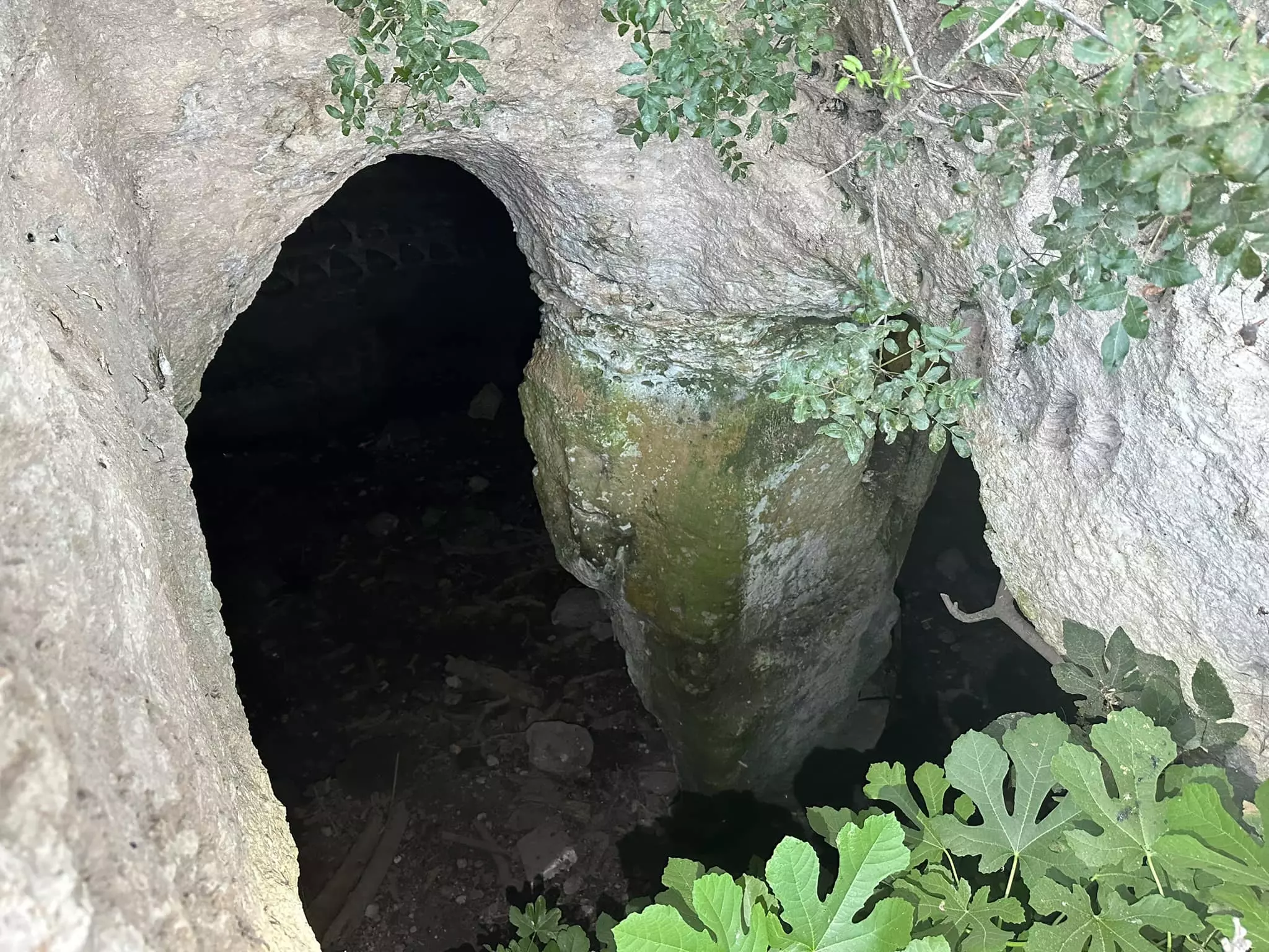
Posted by Umar Ighbariyyeh - مغر خربه ام برج
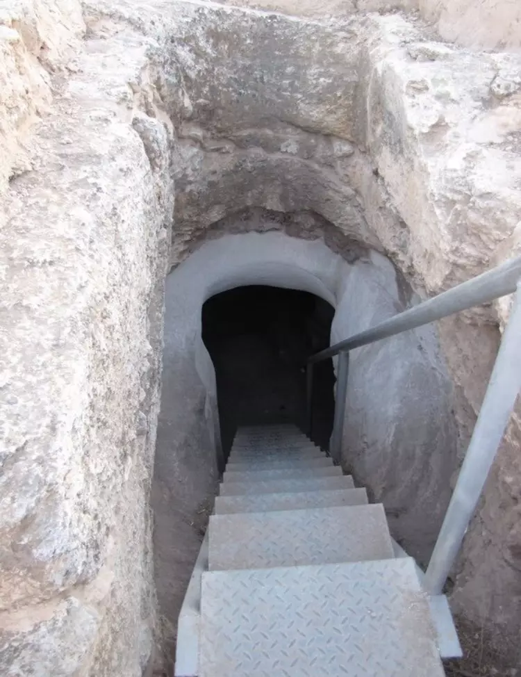
Posted by abu raya - ابار خربه ام برج
Posted by abu raya - خربه ام برج . موقع القريه
Posted by abu raya - خربه ام برج
Posted by abu raya - خربه ام برج
Posted by abu raya - اثار دمار قريه خربه ام برج
Posted by abu raya - خربه ام برج
Posted by abu raya - اثار خربه ام برج
Posted by abu raya - اثار بيوت خربه ام برج
Posted by abu raya - خربه ام برج
Posted by abu raya - اثار بيوت القريه
Posted by abu raya - خربه ام برج
Posted by abu raya - خربه ام برج
Posted by abu raya - خربه ام برج

Posted by abu raya - اراضي خربه ام برج
Posted by abu raya - منظر عام لانقاض القرية
- منظر عام لانقاض القرية
- منظر عام لانقاض القرية #2
- منظر عام لانقاض القرية #3
- منظر عام لانقاض القرية #4
- منظر عام لانقاض القرية #5
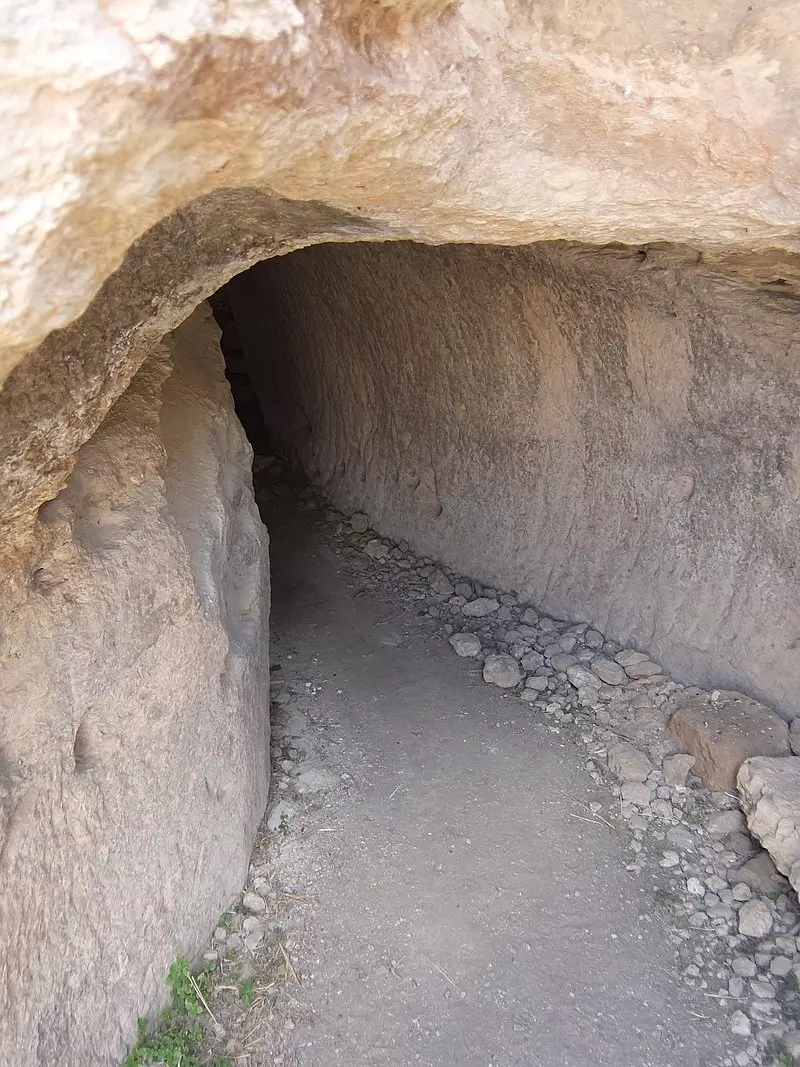
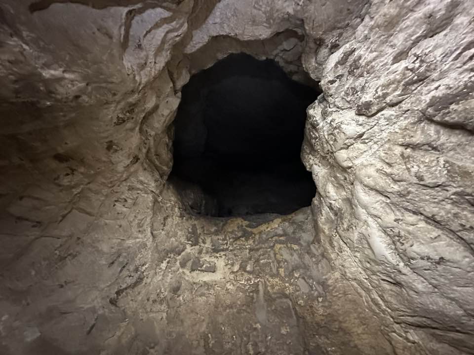
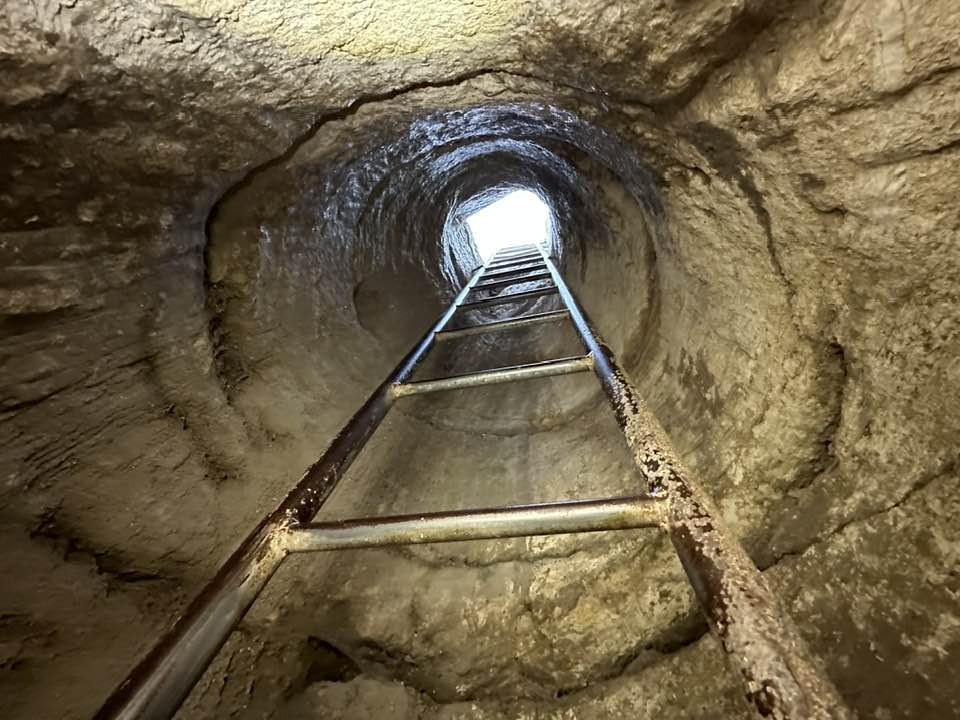
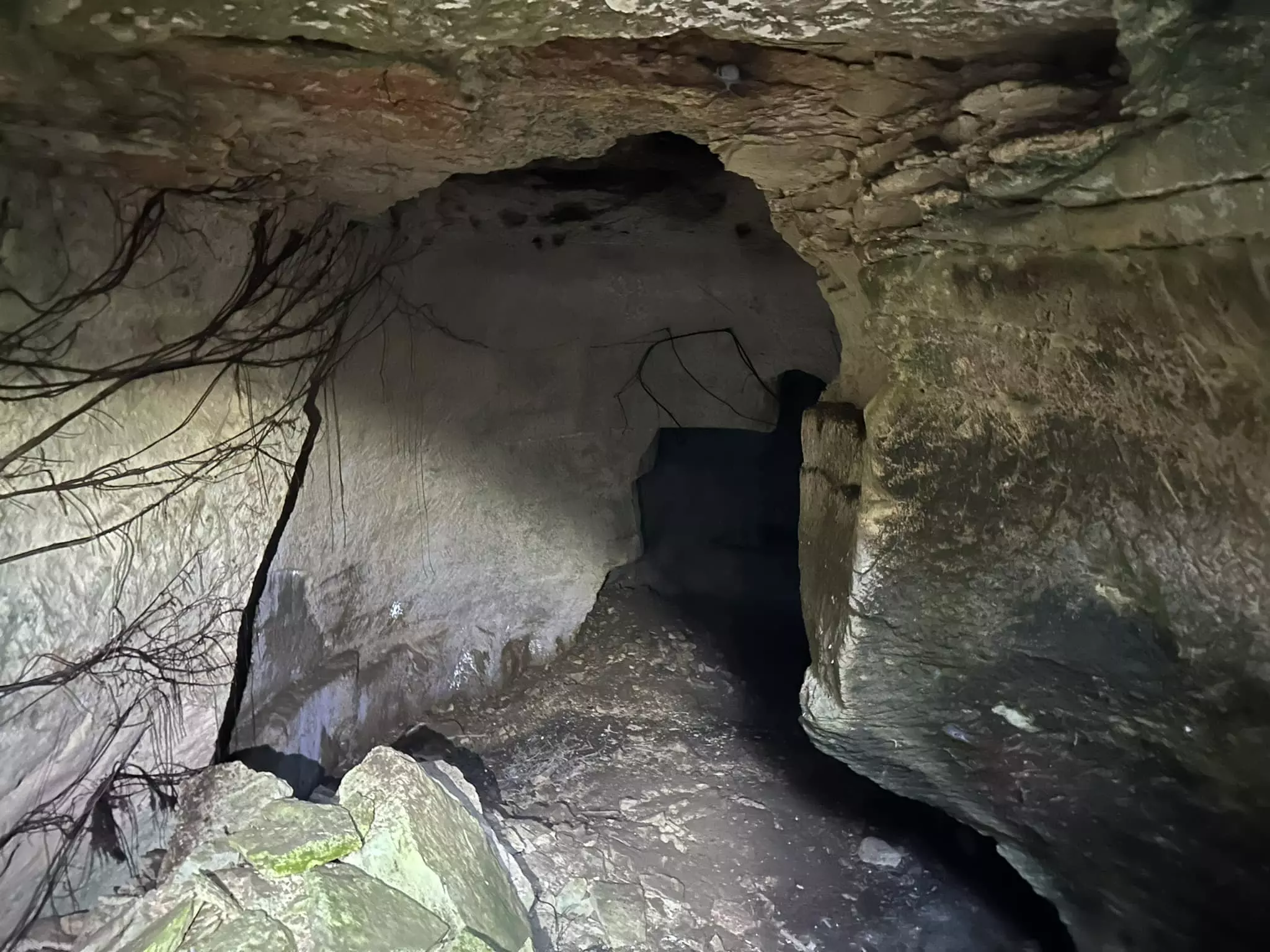
- كهوف في قرية ام برج المهجرة
- كهوف في قرية ام برج المهجرة #2
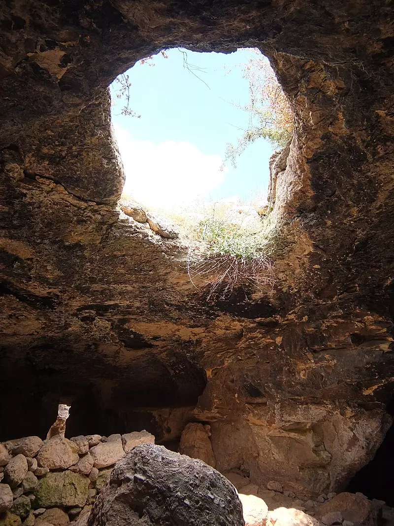
- كهوف في قرية ام برج المهجرة #3
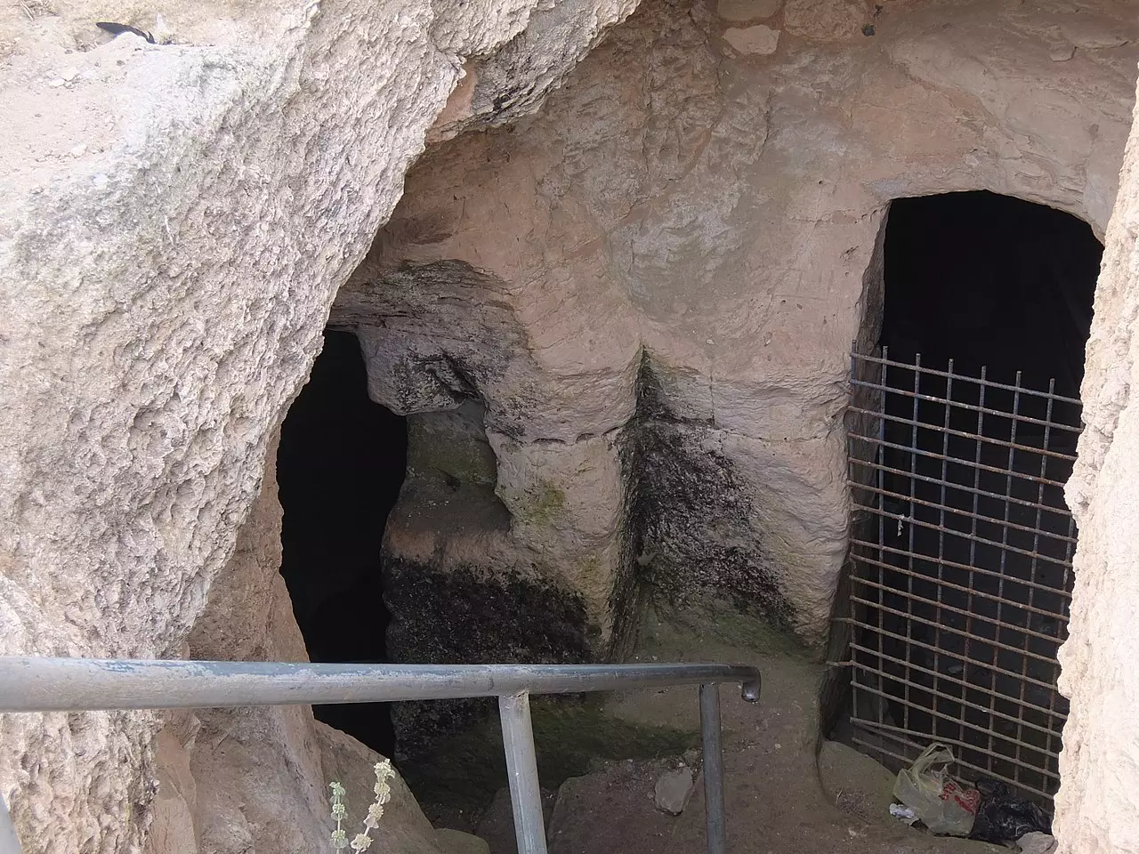
- كهوف في قرية ام برج المهجرة #4
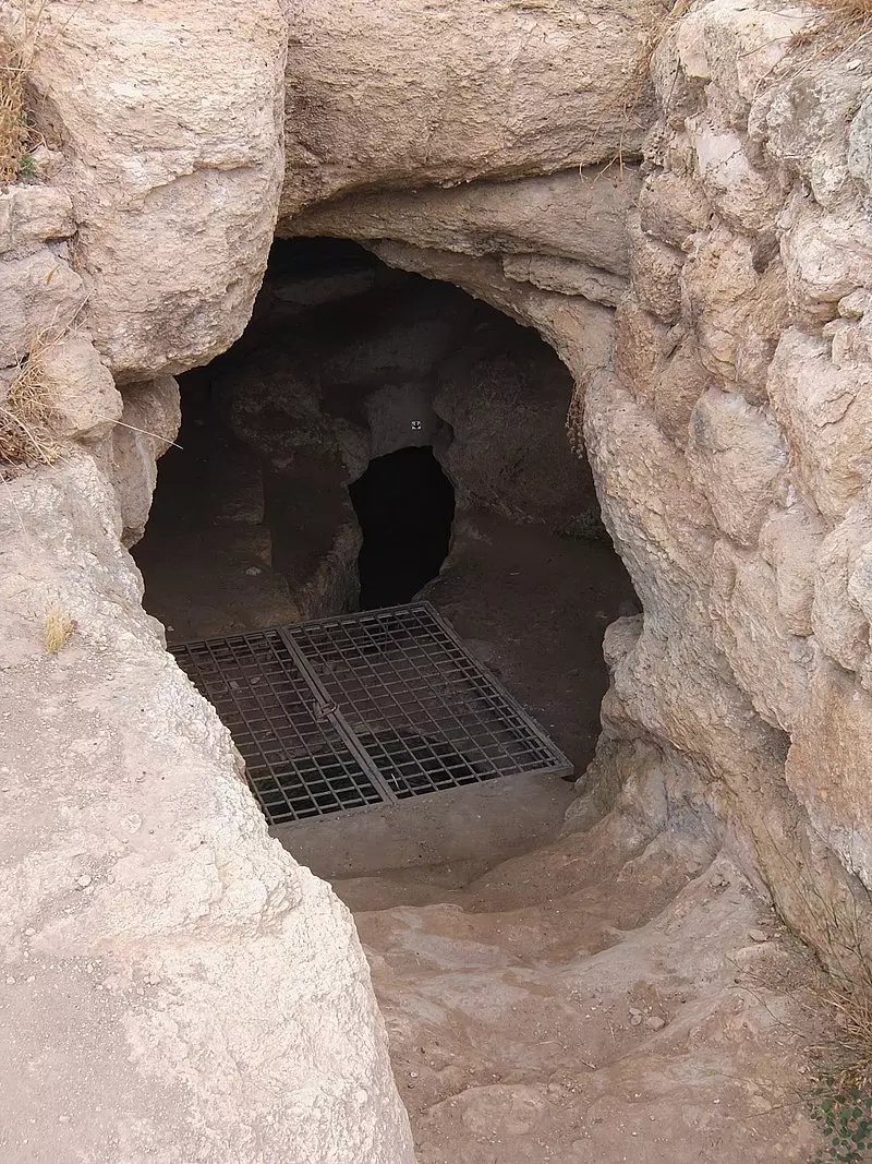
- كهوف في قرية ام برج المهجرة #5
- جولة بين حواكير قرية خربة أمّ برج المهجرة قضاء الخليل تصوير: إياد جابر
- جولة بين حواكير قرية خربة أمّ برج المهجرة قضاء الخليل تصوير: إياد جابر #2
- جولة بين حواكير قرية خربة أمّ برج المهجرة قضاء الخليل تصوير: إياد جابر #3
- جولة بين حواكير قرية خربة أمّ برج المهجرة قضاء الخليل تصوير: إياد جابر #4
- جولة بين حواكير قرية خربة أمّ برج المهجرة قضاء الخليل تصوير: إياد جابر #5
- That is how the "civilized" erased and replaced us: Umm Burg was completely obliterated, as you see -- خربة أم برج باتت أثر بعد عين. من هنا مر الهمجّ
- That is how the "civilized" erased and replaced us: Umm Burg was completely obliterated, as you see -- خربة أم برج باتت أثر بعد عين. من هنا مر الهمجّ
#2

- That is how the "civilized" erased and replaced us: Umm Burg was completely obliterated, as you see -- خربة أم برج باتت أثر بعد عين. من هنا مر الهمجّ
#3
- That is how the "civilized" erased and replaced us: Umm Burg was completely obliterated, as you see -- خربة أم برج باتت أثر بعد عين. من هنا مر الهمجّ
#6

- That is how the "civilized" erased and replaced us: Umm Burg was completely obliterated, as you see -- خربة أم برج باتت أثر بعد عين. من هنا مر الهمجّ
#2

- That is how the "civilized" erased and replaced us: Umm Burg was completely obliterated, as you see -- خربة أم برج باتت أثر بعد عين. من هنا مر الهمجّ
#5

- That is how the "civilized" erased and replaced us: Umm Burg was completely obliterated, as you see -- خربة أم برج باتت أثر بعد عين. من هنا مر الهمجّ
#6
- That is how the "civilized" erased and replaced us: Umm Burg was completely obliterated, as you see -- خربة أم برج باتت أثر بعد عين. من هنا مر الهمجّ
#7
- That is how the "civilized" erased and replaced us: Kh. Umm Burg was completely obliterated, as you see -- خربة أم برج باتت أثر بعد عين. من هنا مر الهمجّ
- That is how the "civilized" erased and replaced us: Kh. Umm Burg was completely obliterated, as you see -- خربة أم برج باتت أثر بعد عين. من هنا مر الهمجّ #2
- That is how the "civilized" erased and replaced us: Kh. Umm Burg was completely obliterated, as you see -- خربة أم برج باتت أثر بعد عين. من هنا مر الهمجّ #3
- That is how the "civilized" erased and replaced us: Kh. Umm Burg was completely obliterated, as you see -- خربة أم برج باتت أثر بعد عين. من هنا مر الهمجّ #4
- That is how the "civilized" erased and replaced us: Kh. Umm Burg was completely obliterated, as you see -- خربة أم برج باتت أثر بعد عين. من هنا مر الهمجّ #5
- That is how the "civilized" erased and replaced us: Kh. Umm Burg was completely obliterated, as you see -- خربة أم برج باتت أثر بعد عين. من هنا مر الهمجّ #6
- That is how the "civilized" erased and replaced us: Kh. Umm Burg was completely obliterated, as you see -- خربة أم برج باتت أثر بعد عين. من هنا مر الهمجّ #7
- That is how the "civilized" erased and replaced us: Kh. Umm Burg was completely obliterated, as you see -- خربة أم برج باتت أثر بعد عين. من هنا مر الهمجّ #8
- That is how the "civilized" erased and replaced us: Kh. Umm Burg was completely obliterated, as you see -- خربة أم برج باتت أثر بعد عين. من هنا مر الهمجّ #9
- That is how the "civilized" erased and replaced us: Kh. Umm Burg was completely obliterated, as you see -- خربة أم برج باتت أثر بعد عين. من هنا مر الهمجّ #10
- That is how the "civilized" erased and replaced us: Kh. Umm Burg was completely obliterated, as you see -- خربة أم برج باتت أثر بعد عين. من هنا مر الهمجّ #11
- That is how the "civilized" erased and replaced us: Kh. Umm Burg was completely obliterated, as you see -- خربة أم برج باتت أثر بعد عين. من هنا مر الهمجّ #12
- That is how the "civilized" erased and replaced us: Kh. Umm Burg was completely obliterated, as you see -- خربة أم برج باتت أثر بعد عين. من هنا مر الهمجّ #13
- That is how the "civilized" erased and replaced us: Kh. Umm Burg was completely obliterated, as you see -- خربة أم برج باتت أثر بعد عين. من هنا مر الهمجّ #14
Want to browse more? 80,000 pictures were grouped in these gallaries:
| Display Name | Clan/Hamolah | Country of Residence |
- الذاكرة مفتاح العودة -- الحلقة 99 -- أم برج
- خربة أمّ برج المهجرة قضاء الخليل Duration: 23 sec
- جولة رائعة في القرية المهجرة -- 2025 Duration: min 15 sec
No links have been shared yet, be free to the first to share the first link.
 Fake Valor: Why Did Zionist Jews Hoist Nazis Flag on Their Ships in the 1930s?
What is new?
-
Facts About Oct. 7th Gaza Raid
-
Remined Us Please:: Who Did Rape Who? Palestinians Raped Israelis? Or, was the other way around?
-
When Prof. Edward Said was invited to debate Bibi Netanyahu in the 1980s, watch what happened!
-
Ezra Klein of the NY Times on the "Jewish Race".
-
Abusing Blood Libel!
-
Zionist FAQ: Isn't it true that Palestinians don't want peace? Palestinians never accepted the two-state solution
- Facts about Haavara (Transfer) Agreement between Ben-Gurion & Hitler
-
Haavara FAQs: Why Did Zionist Jews Hoist Nazis' Flags on Their Ships in the 1930s?
-
Dear ChatGPT: How did Palestinians resist Napoleon's invasion of their country in 1799?
-
Dear ChatGPT: Gaza had a vibrant Jewish community in the mid-17th century. What happened to them?
-
Dear ChatGPT: Why did the Jewish Agency suppress news of the Holocaust during WWII?
-
Video Playlist: Jews share their DNA tests to end the conflict for good.
-
A Tale of Two Conflicts: Examining the Definition of Genocide
-
Prof. Abraham Polak And The Suppressed History of the Khazars and European Jewry
-
How Ronald Reagan would have framed the genocide in Gaza if he were still alive?
-
Haavara FAQs: Let us do the math: how many German Jews did The Haavara Agreement save?
-
Zionist FAQs: The Hebron Massacre of 1929, "clearly proves" that Palestinians are antisemitic, how could you deny it?
-
Zionist FAQs: Why Anti-Zionist Is Not Antisemitism?
-
Zionist FAQs: Isn't it true that the KGB create Palestinian Nationalism in the early 1960s?
- Zionist FAQs: Muslims are killing Muslims all the time; why are Israeli Jews being singled out in the media?
- Zionist FAQs: How is Israel an apartheid state when 20% of its citizens are Arabs who enjoy full rights?
-
Haavara FAQs: Analysis of Herzl's Uganda Scheme and how it could have saved millions of Jews.
-
Haavara FAQs: Why did Hayim Greenberg describe American Jewry as "morally bankrupt" in early 1943?
-
Haavara FAQs: What if the Evian Conference was a resounding success? What would have been the impact of saving European Jewry on Zionism?
- Haavara FAQs: What if the six million were saved, how that would have impacted the Zionist project?
-
Haavara FAQs: How did Zionist leaders react when Europe's Jews lingered in the DP camps after WWII ended?
-
Why does the American Jewish community repeat lies that David Ben-Gurion had debunked before he died?
-
Who has the power to rename the Tatar/Khazar Gene Marker to Jewish IV?
-
Zionist FAQs: Why won't Egypt, Syria, and Jordan take their people back? Jews are indigenous to Palestine, and Arabs immigrated after Jews developed the country. Arabs should leave.
-
Haavara FAQs: Did Hitler and the Nazis conflate between Judaism and Zionist? If that wasn't case, then why?
-
Haavara FAQs: Winston Churchill and antisemitism, a collection of articles written Churchill.
-
Haavara FAQs: Broken by country, how many Jews survived vs. killed during the Holocaust?
-
Haavara FAQs: Why did European Jews vote with their feet and to immigrated to the Americas, not Palestine, after WWII?
-
Watch this American Jewish Girl describing Israeli Jews' cognitive dissonance like no other in under two minutes
-
Haavara FAQs: When the Nazis went out of their way to hide the Holocaust, Israeli Jews did the exact opposite by broadcasting their genocide of Gazans. But why?
-
Haavara FAQs: How Zionist Jews went out of their to show their appreciation to Nazism and Fascism?
- Haavara FAQs: Why Zionist leaders were against bombing the death camps & the Railroads leading to them?
-
Haavara FAQs: Hitler's message to the British and American people: If Jews are such noble citizens and you care about them, how come you're not letting them in? I will gladly ship them to you at my expense, even on luxury liners!
-
A shortlist of Zionist and Israeli false flag operations in the name Jews.
-
The Most Moral Army
- The Land of Kapos (Israel): Where the brave are boycotted and Kapos walk free.
- Why did early Zionists often named their communal enterprises "colonial"?
- Zionist Relations with Nazi Germany by Faris Glubb
-
Two NY Times advertisements by Zionists in the early 1943 that exposes Zionists' treason at the height of the calamity
- Facts Not Lies about the Palestinian-Israeli Conflict.
- Site's pictures have been categorized
- Campgain Against Lice
- A Survey of Palestine, the official source about Palestine before Nakba produced by the British Mandate; over 1200 pages.
- Satellite View & Google Earth: Over 6,000 placemarks identifying all destroyed towns, W. Bank & Gaza Strip Towns, & refugee camps.
- PalestineRemembered.com and its Nakba Oral History Project were featured on al-Jazeera Satellite TV.
- Nakba Oral History Video Podcast:
 Over 700 Oral History interviews (including 3,500+ hours of recording) can be viewed online.
 - Palestine Village Statistics Project
- Gaza Jail Break
- النسخة العربية للموقع الان متوفرة
- Videos: Documenting the destroyed villages in video: Tracing all that remains since Nakba.
- Videos: Responding to Zionist Propaganda
- Interview: The ethnic cleansing of Palestine: George Galloway interviews Israeli Historian Ilan Pappe.
- For Palestinians, memory matters. It provides a blueprint for their future By George Bisharat.
- Zionist FAQ now available in Hebrew שאלות שציונים שואלים, עכשיו בעברית
- Video: The Stephen Walt and John Mearsheimer report on the influence of the Israel Lobby on U.S. Foreign Policy
- The Palestinian-Israeli conflict for beginners
