| PalestineRemembered | About Us | Oral History | العربية | |
| Pictures | Zionist FAQs | Haavara | Maps | |
| Search |
| Camps |
| Districts |
| Acre |
| Baysan |
| Beersheba |
| Bethlehem |
| Gaza |
| Haifa |
| Hebron |
| Jaffa |
| Jericho |
| Jerusalem |
| Jinin |
| Nablus |
| Nazareth |
| Ramallah |
| al-Ramla |
| Safad |
| Tiberias |
| Tulkarm |
| Donate |
| Contact |
| Profile |
| Videos |
Welcome To al-Jammasin al-Gharbi - الجماسين الغربي (ג'מאסין אל-ע'רבי)
|
District of Jaffa
Ethnically cleansed days ago |
العربية Google Earth |
 |
Gallery (14) |
- Statistics & Facts
-
Before & After

- Satellite View
- Articles 2
- Pictures 14
- Aerial Views 1
- Oral History 1
- Members 10
- All That Remains
- Wikipedia
- Videos 1
- Guest Book
- Links
| Statistic & Fact | Value | ||||||||||||||||||
| Occupation Date | March 17, 1948 | ||||||||||||||||||
| Distance From District | 6.5 (km) Northeast of Jaffa | ||||||||||||||||||
| Elevation | 25 (meters) | ||||||||||||||||||
| Before & After Nakba, Click Map For Details |
|||||||||||||||||||
|
|||||||||||||||||||
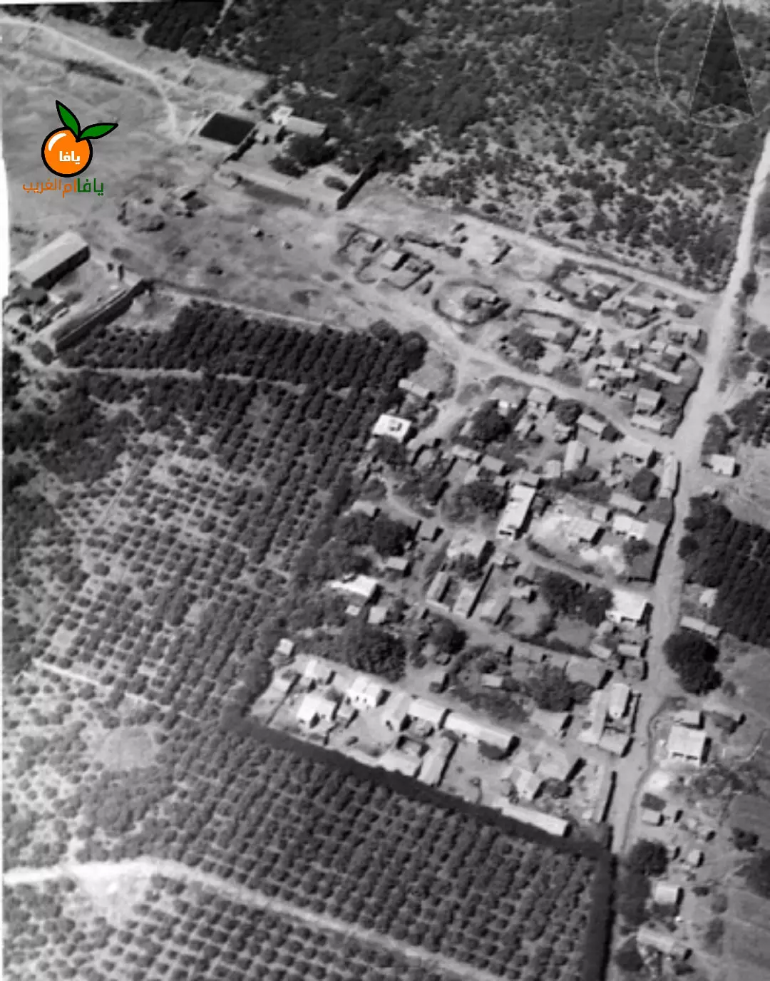
| Pre-Nakba Aerial View |
|||||||||||||||||||
|
|||||||||||||||||||
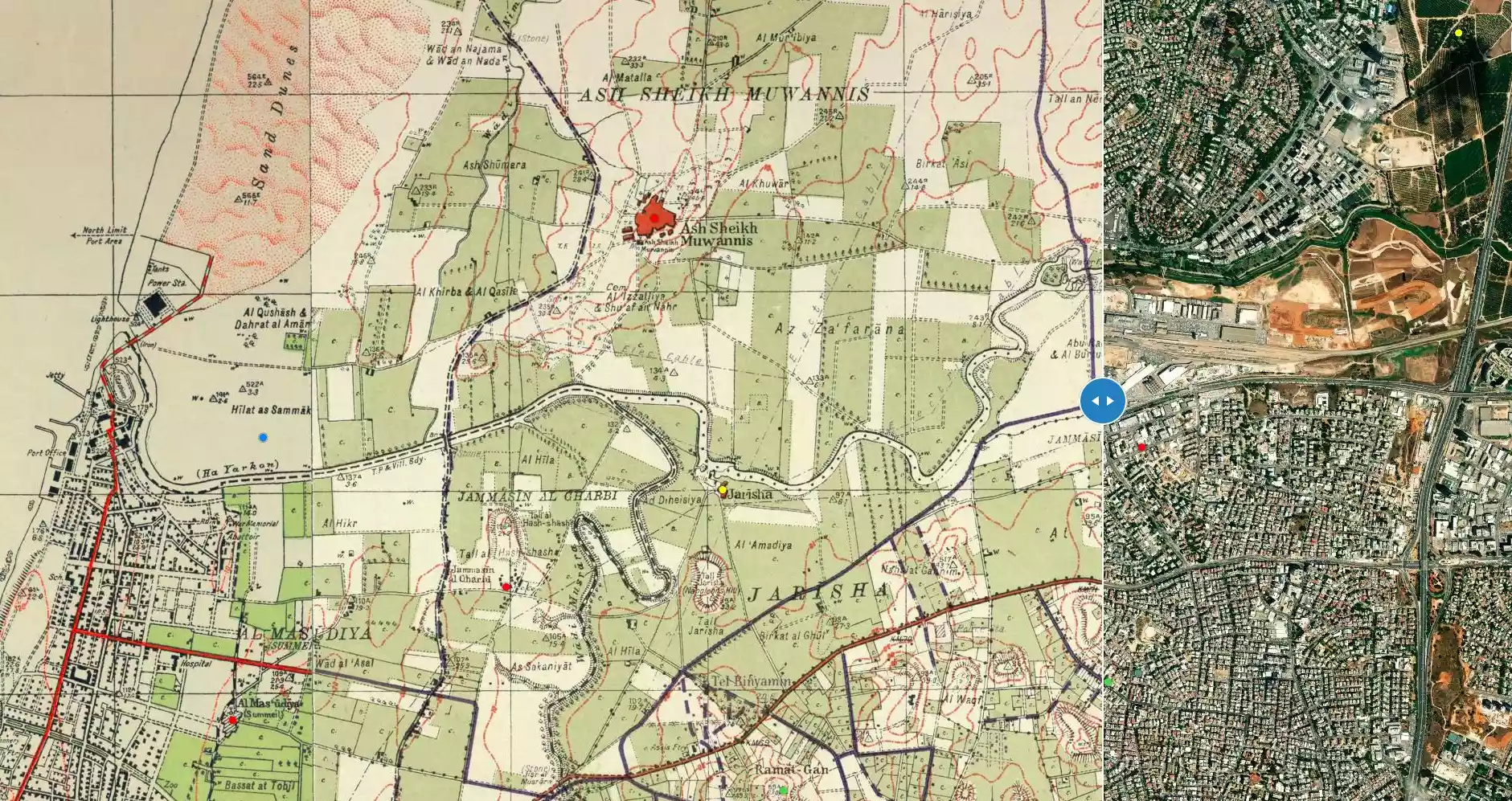
| Map Location | See location #10 on the map View from satellite |
||||||||||||||||||
| Exodus Cause | Fear of Jewish attack, or of being caught in the fighting | ||||||||||||||||||
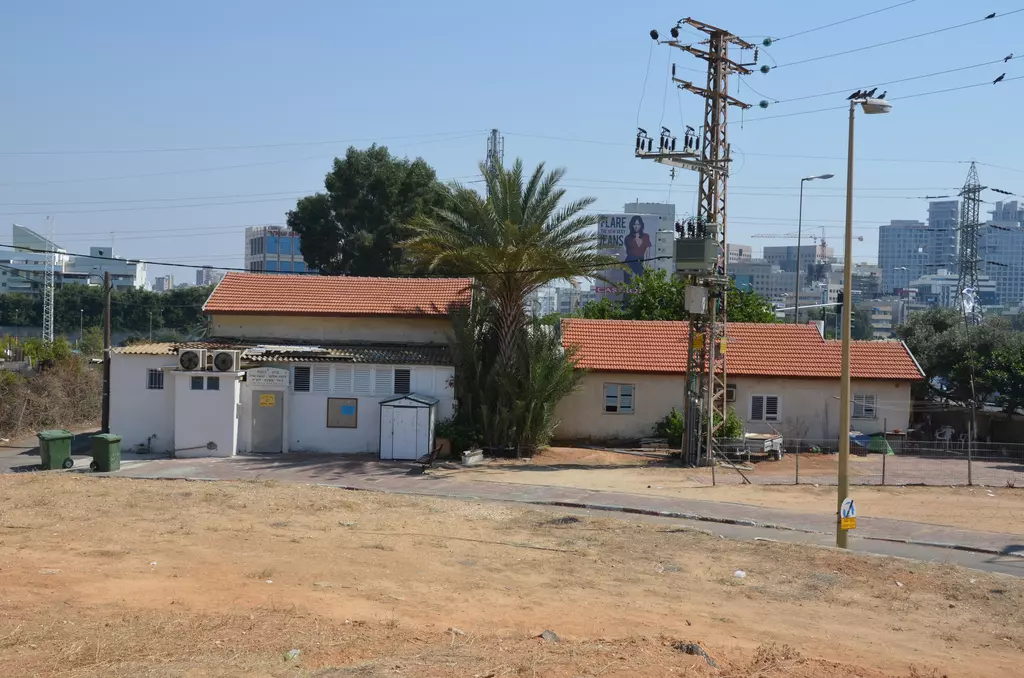
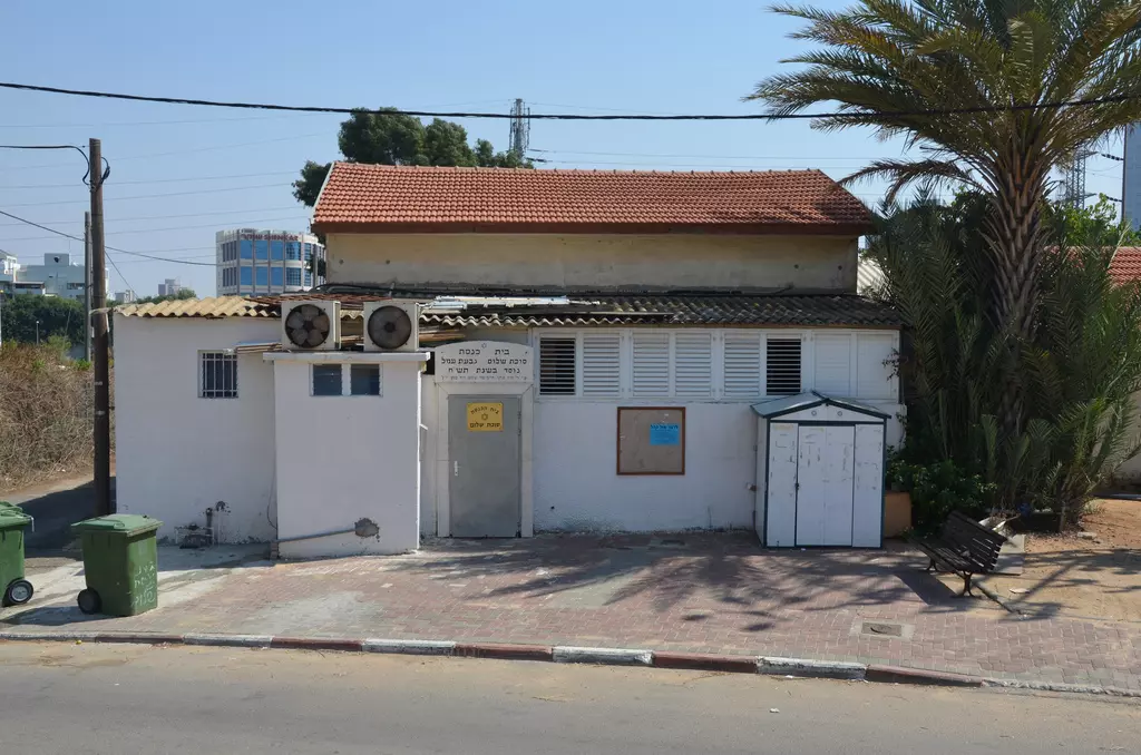
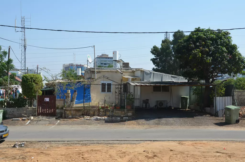
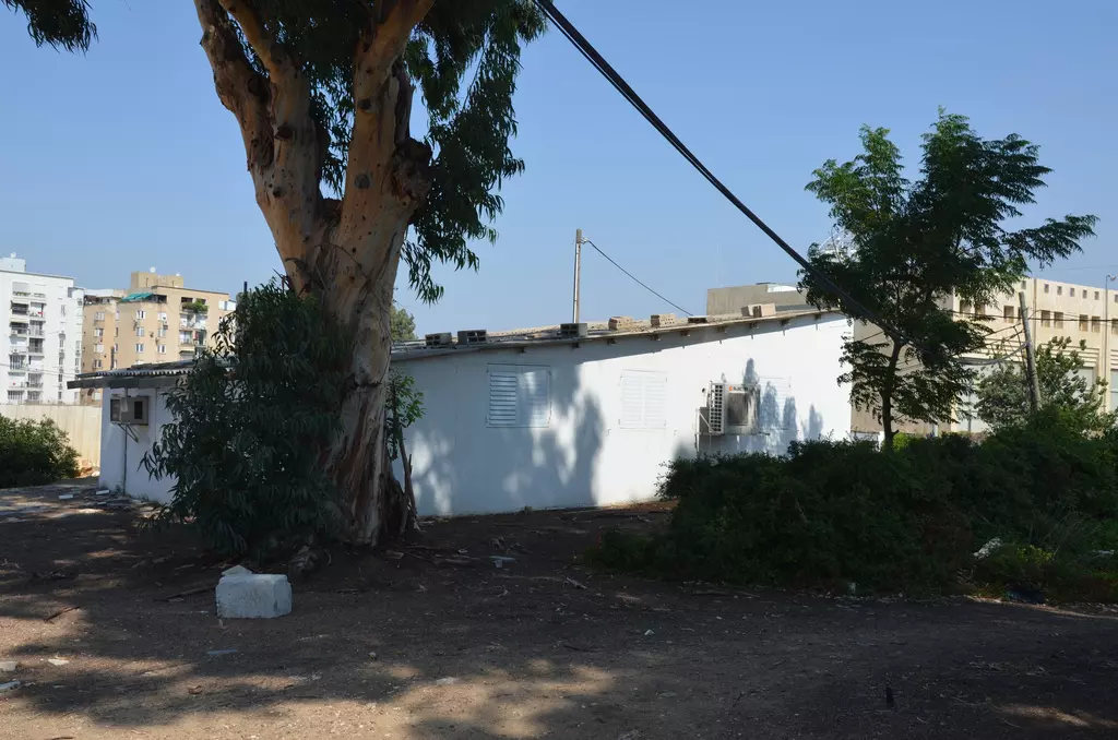
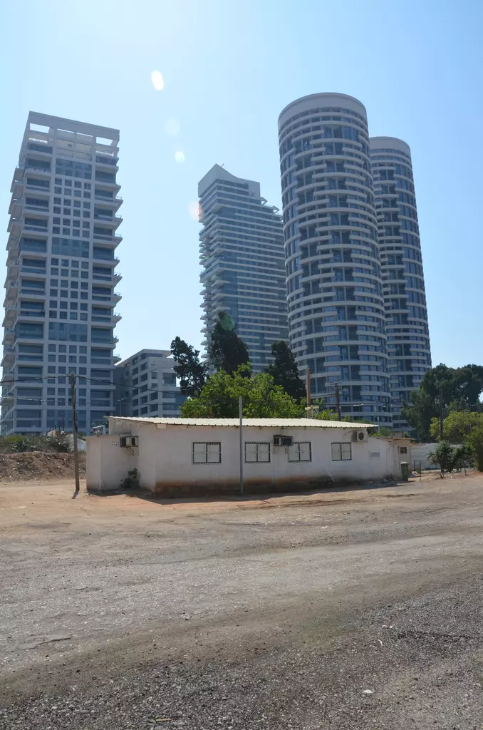
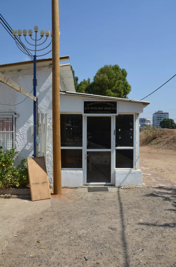
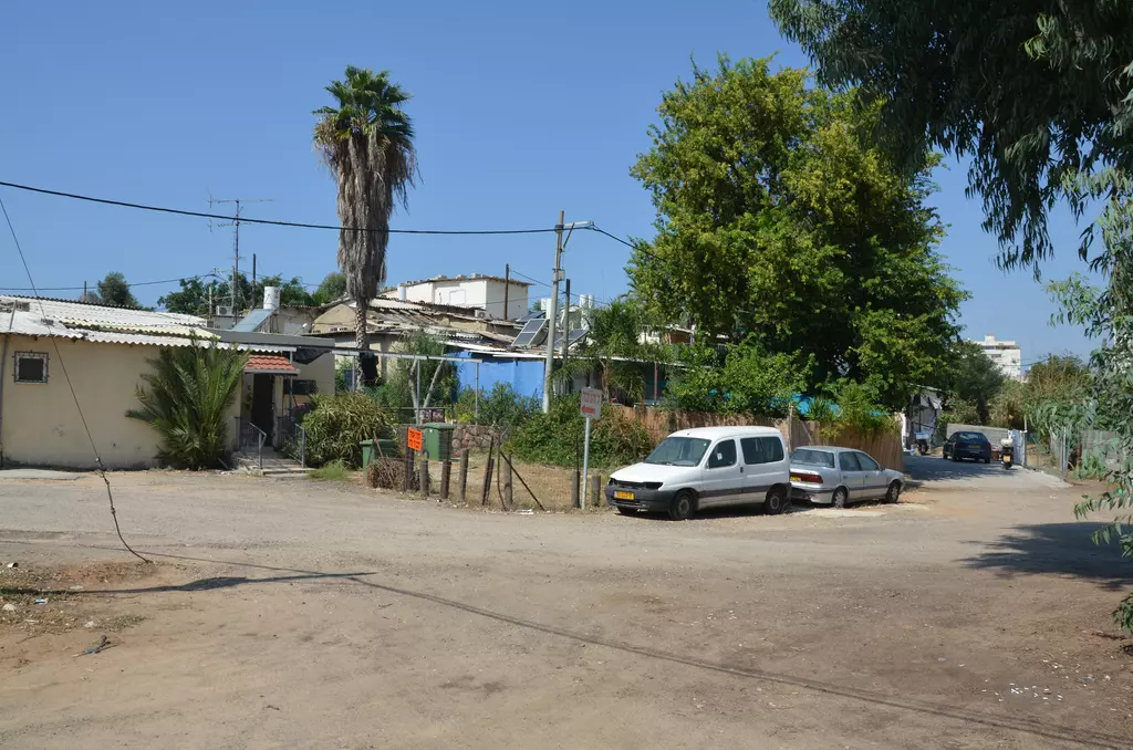
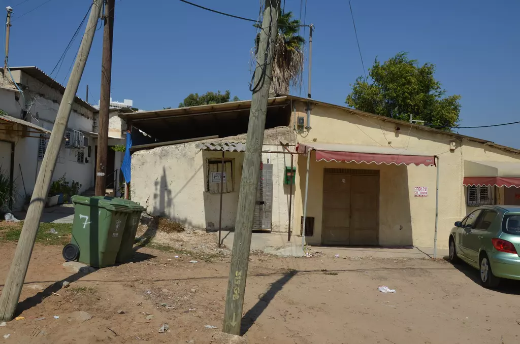
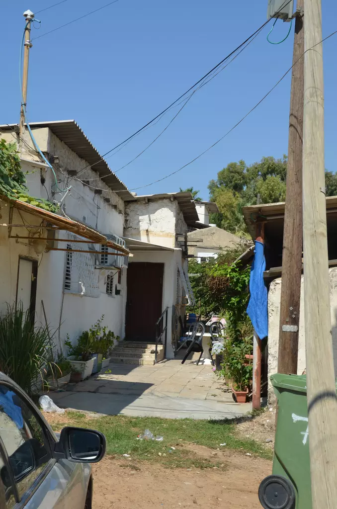
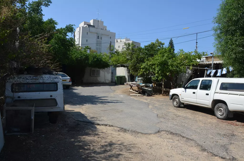
| Village Temains | al-Jammasin al-Gharbi was mostly destroyed with the exception of few houses currently being occupied by Jewish settlers. | ||||||||||||||||||
| Ethnically Cleansing | Either in December 1947 or January 1948 the leaders of al-Shaykh Muwannis, al-Mas'udiyya, al-Jammasin, and the mukhtars of 'Arab Abu Kishk and Ijlil met with Haganah representative in the house of Avraham Schapira in Petah Tikva and expressed desire for peace. Despite the commitment of these villages not harbor any Arab Liberation Armies or local Arab Militia, they were all completely ethnically cleansed. al-Jammasin al-Gharbi inhabitants were partially intimidated by the Haganah into fleeing their homes on January 7th 1948, and complete ethnic cleansing on March 17th, 1948. | ||||||||||||||||||
| Pre-Nakba Land Ownership |
**Town Lands' Demarcation Maps |
||||||||||||||||||
| Land Usage As of 1945 |
|
||||||||||||||||||
| Population |
|
||||||||||||||||||
| Near By Towns |
|||||||||||||||||||
|
|||||||||||||||||||
| Town's Name Through History | Jammasin in Arabic means Water Buffalo. The village may have been named after the water buffaloes that the villagers were famous in raising. | ||||||||||||||||||
| Schools | al-Jammasin al-Gharbi students used to attend school in the nearby village of al-Shaykh Muwannis. | ||||||||||||||||||
| Inhabitants Place of Origin | al-Jammasin's inhabitants were known to be descendants of nomads who had migrated to the area from the Jordan Valley. | ||||||||||||||||||
| Exculsive Jewish Colonies That Usurped Village Lands |
The Tel Aviv municipality | ||||||||||||||||||
| Featured Video | |||||||||||||||||||
Village Before NakbaThe village was situated 2.5 km from the seashore on the central coastal plain and was bordered by marshlands. The first part of the village name, al-Jammasin, meant 'buffalo breeders' in Arabic; the second part, al-Gharbi ('western'), distinguished it from its twin village in the east, al-Jammasin al-Sharqi. In the Ottoman tax registers for 1596 Jammasin is mentioned as a 'tribe' in the nahiya of Bani Sa'b (liwa' of Nablus); its members paid taxes on water buffalo. It is not certain that the 'tribe' had actually built the two villages that later bore the same name at that early date, since the area in which they were located was not characterized as an area of permanent settlement in the tax records. They were known to be descendants of nomads who had migrated from the Jordan Valley. By the eighteenth century the people of Jammasin, all of whom were Muslims, had settled in the area. A typical village abode was a khus (a conical or pyramidical hut made of tree logs and branches ), although some houses were built of adobe brick.In 1922, there were about 200 people living in the village, and by 1944, this figure had increased to over 1,000. The children attended school in the village of al-Shaykh Muwannis. The villagers earned their living primarily by raising buffalos, marketing their meat and milk in Jaffa, and using the beasts as draft animals. In addition to animal husbandry, they cultivated fruits, especially citrus. In 1944/45 a total of 202 dunums was devoted to citrus and bananas and 173 dunums were allocated to cereals; 151 dunums were irrigated or used for orchards. Some people from the village also worked in the outlying citrus groves, particularly the German-owned groves in Saruna. Village Occupation and Ethnic CleaningAI-Jammasin al-Gharbi was probably taken by Zionist troops sometime before the end of the British Mandate on 15 May 1948. By this time, Zionist forces were in control of the whole coastal area between Haifa and Tel Aviv (see Abu Kishk and al-Mas'udiyya, Jaffa sub-district).Zionists Colonies on Village LandsThere are no settlements on village lands, but development from Tel Aviv has taken over the site, which is now part of the Tel Aviv municipality.The Village Today Village TodayThe site is overgrown with weeds and grasses, interspersed with cypress, Christ's-thorn, and fig trees and castor-oil (ricinus) plants. A few somewhat dilapidated houses remain, some inhabited by Jews, others deserted. One inhabited house is a two-storey structure that looks like a conglomeration of unrelated rooms of varying size and shape. It has rectangular doors and windows, and the roofs of the rooms on the upper floors are both slanted and gabled. The whitewash on the exterior walls is peeling off. The high-rise apartment complexes of Tel Aviv loom in the background.SourceDr. Walid al-Khalidi, 1992: All That Remains. |
|||||||||||||||||||
| Related Maps | Town Lands' Demarcation Maps خرائط للقضاء توضح حدود القرى والاودية Town's map on MapQuest View from satellite Help us map this town at WikiMapia |
||||||||||||||||||
| Related Links | Wikipedia's Page Google Search Google For Images Google For Videos |
||||||||||||||||||
| More Information | في كتاب كي لا ننسى في كتاب بلادنا فلسطين المزيد من موقع هوية |
||||||||||||||||||
- Two houses in the eastern neighbourhood
Posted by Uri Zackhem 1 - A synagogue called a hut of peace. Est. 1948.
Posted by Uri Zackhem - A home
Posted by Uri Zackhem - A home
Posted by Uri Zackhem - A synagogue
Posted by Uri Zackhem - This synagogue is called mesopotamia (Al-Jazira - the Iraqi jazira that is)
Posted by Uri Zackhem - A view
Posted by Uri Zackhem - A home
Posted by Uri Zackhem - An alley
Posted by Uri Zackhem - An alley
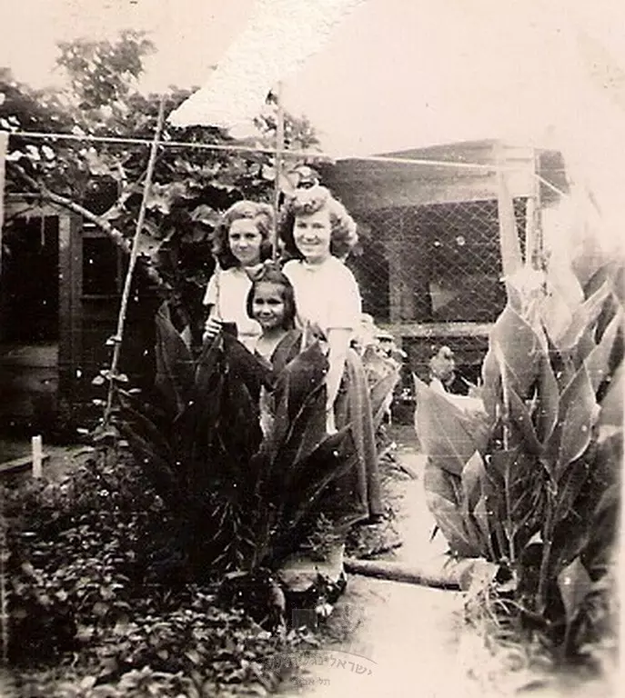
Posted by Uri Zackhem - صورة لمستوطنين من عائلة ريمبيك Rimberg و شوارتزمان Shwartzman بعد إحلالهم في قرية الجماسين الغربي بعد الاحتلال و بالتحديد يوم ٢٥ أبريل نيسان ١٩٤٨
Posted by أبو اليزن السعافين 1 - صورة جوية نادرة جدا لقرية الجمٌاسين الغربية قضاء مدينة يافا ...شاهدوا كثافة أشجار البرتقال اليافاوي حول القرية -- 1947
- معارك في الجماسين واخرى في تل الريش ودحر المجرمين
اليهود يتصيدون الامنين العرب من تل ابيب والمستعمرات المتصلة بيافا
المناضلون بتل الريش يشنون هجوما خاطفا منظما على مستعمرتي شحونات جرين وحولون -- 03-01-1948-- اﻷسماء في قسم التعليقات

1 - :
عرب الجماسين يطالبون باجلاء اليهود عن اراضيهم
ووضع قوات مسلحة للمحافظة على القرية -- 29-01-1948 -- المزيد في التعليقات

1
Want to browse more? 80,000 pictures were grouped in these gallaries:
| Display Name | Clan/Hamolah | Country of Residence |
| Yahya mohamed irsan Abu-Ayyash | Al jammasin | - |
| mhammed yussef musaimi | musaimi | - |
| جاسر أبوداود | - | - |
| mohammad abu dawood | abu dawood | - |
| وحيدالمسيمي | - | الاردن - عمان |
| طارق المسيمي | المسيمي | MA, USA |
| Khaled Abu Dawood | Abu Dawood | - |
| دارين | ابو حمدان | nablus, plastine |
| ScOrPiOnE | - | Gaza |
| zedana | - | - |
No links have been shared yet, be free to the first to share the first link.
 Fake Valor: Why Did Zionist Jews Hoist Nazis Flag on Their Ships in the 1930s?
What is new?
-
Facts About Oct. 7th Gaza Raid
-
Remined Us Please: Who Did Rape Whom? Was it Palestinians who raped Israelis? Or, was the other way around? You'll be the judge
-
When Prof. Edward Said was invited to debate Bibi Netanyahu in the 1980s, watch what happened!
-
Ezra Klein of the NY Times on the "Jewish Race".
-
Abusing Blood Libel!
-
How and why Israeli Jewry has become the most hated cult?
-
Did Israeli Soldiers Activate The Hannibal Direective On Oct. 7th? You Be The Judge
-
Zionist FAQ: Isn't it true that Palestinians don't want peace? Palestinians never accepted the two-state solution
- Facts about Haavara (Transfer) Agreement between Ben-Gurion & Hitler
-
Haavara FAQs: Why Did Zionist Jews Hoist Nazis' Flags on Their Ships in the 1930s?
- Haavara FAQs: When Chaim Weizmann met FDR in mid-1943, why was he silent about rescuing European Jewry?
-
Dear ChatGPT: How did Palestinians resist Napoleon's invasion of their country in 1799?
-
Dear ChatGPT: Gaza had a vibrant Jewish community in the mid-17th century. What happened to them?
-
Dear ChatGPT: Why did the Jewish Agency suppress news of the Holocaust during WWII?
-
Video Playlist: Jews share their DNA tests to end the conflict for good.
-
A Tale of Two Conflicts: Examining the Definition of Genocide
-
Prof. Abraham Polak And The Suppressed History of the Khazars and European Jewry
-
How Ronald Reagan would have framed the genocide in Gaza if he were still alive?
-
Haavara FAQs: Let us do the math: how many German Jews did The Haavara Agreement save?
-
Zionist FAQs: The Hebron Massacre of 1929, "clearly proves" that Palestinians are antisemitic, how could you deny it?
-
Zionist FAQs: Why Anti-Zionist Is Not Antisemitism?
-
Zionist FAQs: Isn't it true that the KGB created Palestinian Nationalism in the early 1960s?
- Zionist FAQs: Muslims are killing Muslims all the time; why are Israeli Jews being singled out in the media?
- Zionist FAQs: How is Israel an apartheid state when 20% of its citizens are Arabs who enjoy full rights?
-
Haavara FAQs: Why Did Dorothy Thompson Flip From A Zionist Advocate to A Silenced Dissenter?
-
Haavara FAQs: Analysis of Herzl's Uganda Scheme and how it could have saved millions of Jews.
-
Haavara FAQs: Why did Hayim Greenberg describe American Jewry as "morally bankrupt" in early 1943?
-
Haavara FAQs: What if the Evian Conference was a resounding success? What would have been the impact of saving European Jewry on Zionism?
- Haavara FAQs: What if the six million were saved, how that would have impacted the Zionist project?
-
Haavara FAQs: How did Zionist leaders react when Europe's Jews lingered in the DP camps after WWII ended?
-
Why does the American Jewish community repeat lies that David Ben-Gurion had debunked before he died?
-
Who has the power to rename the Tatar/Khazar Gene Marker to Jewish IV?
-
Zionist FAQs: Why won't Egypt, Syria, and Jordan take their people back? Jews are indigenous to Palestine, and Arabs immigrated after Jews developed the country. Arabs should leave.
-
Haavara FAQs: Did Hitler and the Nazis conflate between Judaism and Zionist? If that wasn't case, then why?
-
Haavara FAQs: Winston Churchill and antisemitism, a collection of articles written Churchill.
-
Haavara FAQs: Broken by country, how many Jews survived vs. killed during the Holocaust?
-
Haavara FAQs: Why did European Jews vote with their feet and to immigrated to the Americas, not Palestine, after WWII?
-
Watch this American Jewish Girl describing Israeli Jews' cognitive dissonance like no other in under two minutes
-
Haavara FAQs: When the Nazis went out of their way to hide the Holocaust, Israeli Jews did the exact opposite by broadcasting their genocide of Gazans. But why?
-
Haavara FAQs: How Zionist Jews went out of their to show their appreciation to Nazism and Fascism?
- Haavara FAQs: Why Zionist leaders were against bombing the death camps & the Railroads leading to them?
-
Haavara FAQs: Hitler's message to the British and American people: If Jews are such noble citizens and you care about them, how come you're not letting them in? I will gladly ship them to you at my expense, even on luxury liners!
-
A shortlist of Zionist and Israeli false flag operations in the name Jews.
-
The Most Moral Army
- The Land of Kapos (Israel): Where the brave are boycotted and Kapos walk free.
- Why did early Zionists often named their communal enterprises "colonial"?
- Zionist Relations with Nazi Germany by Faris Glubb
-
Two NY Times advertisements by Zionists in the early 1943 that exposes Zionists' treason at the height of the calamity
- Facts Not Lies about the Palestinian-Israeli Conflict.
- Site's pictures have been categorized
- Campgain Against Lice
- A Survey of Palestine, the official source about Palestine before Nakba produced by the British Mandate; over 1200 pages.
- Satellite View & Google Earth: Over 6,000 placemarks identifying all destroyed towns, W. Bank & Gaza Strip Towns, & refugee camps.
- PalestineRemembered.com and its Nakba Oral History Project were featured on al-Jazeera Satellite TV.
- Nakba Oral History Video Podcast:
 Over 700 Oral History interviews (including 3,500+ hours of recording) can be viewed online.
 - Palestine Village Statistics Project
- Gaza Jail Break
- النسخة العربية للموقع الان متوفرة
- Videos: Documenting the destroyed villages in video: Tracing all that remains since Nakba.
- Videos: Responding to Zionist Propaganda
- Interview: The ethnic cleansing of Palestine: George Galloway interviews Israeli Historian Ilan Pappe.
- For Palestinians, memory matters. It provides a blueprint for their future By George Bisharat.
- Zionist FAQ now available in Hebrew שאלות שציונים שואלים, עכשיו בעברית
- Video: The Stephen Walt and John Mearsheimer report on the influence of the Israel Lobby on U.S. Foreign Policy
- The Palestinian-Israeli conflict for beginners
