| PalestineRemembered | About Us | Oral History | العربية | |
| Pictures | Zionist FAQs | Haavara | Maps | |
| Search |
| Camps |
| Districts |
| Acre |
| Baysan |
| Beersheba |
| Bethlehem |
| Gaza |
| Haifa |
| Hebron |
| Jaffa |
| Jericho |
| Jerusalem |
| Jinin |
| Nablus |
| Nazareth |
| Ramallah |
| al-Ramla |
| Safad |
| Tiberias |
| Tulkarm |
| Donate |
| Contact |
| Profile |
| Videos |
Welcome To 'Ammuqa - عموقه (עמוקה)
|
District of Safad
Ethnically cleansed days ago |
العربية Google Earth |
 |
Gallery (21) |
- Statistics & Facts
-
Before & After

- Satellite View
- Articles 5
- Pictures 21
- Oral History 1
- Members 10
- All That Remains
- Wikipedia
- Videos 2
- Guest Book 1
- Links
| Statistic & Fact | Value | ||||||||||||||
| Occupation Date | May 24, 1948 | ||||||||||||||
| Distance From District | 5 (km) North East of Safad | ||||||||||||||
| Elevation | 450 (meters) | ||||||||||||||
| Before & After Nakba, Click Map For Details |
|||||||||||||||
|
|||||||||||||||
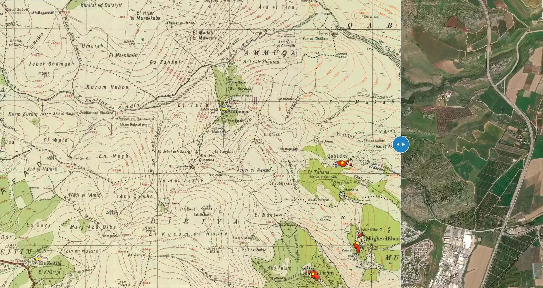
| Map Location | See location #54 on the map View from satellite |
||||||||||||||
| Military Operation | Operation Yiftach (commanded by the ethnic cleansing champion Yigal Allon) | ||||||||||||||
| Attacking Units | The Palmach's First Battalion | ||||||||||||||
| Exodus Cause | Military assault by Zionist troops | ||||||||||||||
| Village Temains | The village has been completely obliterated | ||||||||||||||
| Ethnically Cleansing | 'Ammuqa inhabitants were completely ethnically cleansed. | ||||||||||||||
| Pre-Nakba Land Ownership |
**Town Lands' Demarcation Maps |
||||||||||||||
| Land Usage As of 1945 |
|
||||||||||||||
| Population |
|
||||||||||||||
| Number of Houses |
|
||||||||||||||
| Near By Towns |
|||||||||||||||
|
|||||||||||||||
| Town's Name Through History | The Crusades referred to the village by 'Ammuqa | ||||||||||||||
| Water Supply | The village was locally known for its seven springs | ||||||||||||||
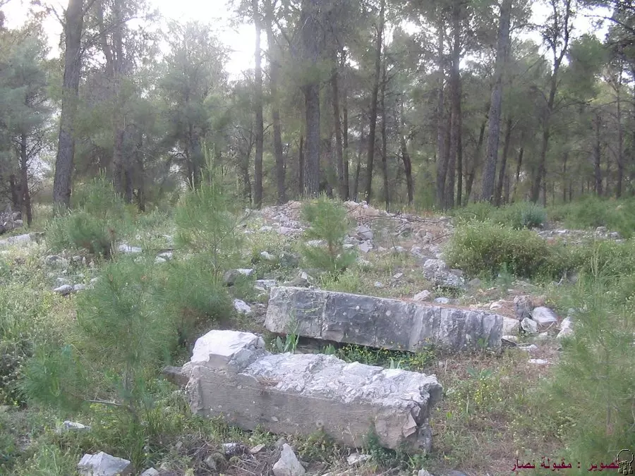
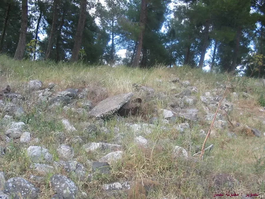
| Archeological Sites | The village contained stone tombs and two khirbas nearby, which contained fragments of columns and stone inscriptions | ||||||||||||||
| Exculsive Jewish Colonies That Usurped Village Lands |
'Ammuqa | ||||||||||||||
| Featured Video | |||||||||||||||
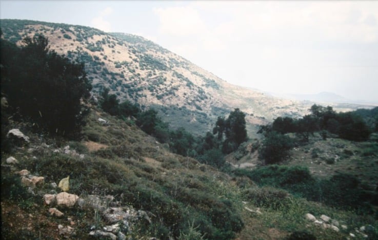
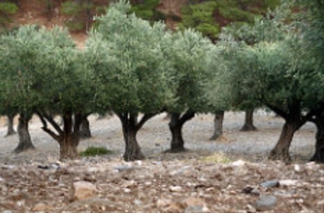
Village Before NakbaThe village was situated on the southern slopes of Mount Kan'an, and faced north and northeast. Its name may have been derived from the Syriac word 'ammiqa, which meant 'deep' or 'low in elevation.' The village was known as 'Ammuqa during the Crusader period. In 1596, 'Ammuqa was a village in the nahiya of Jira (liwa' of Safad) with a population of 391. It paid taxes on a number of crops, including wheat, barley, and olives, as well as on other types of produce and property, such as goats, beehives, and vineyards. In modern times, 'Ammuqa was small enough to be classified as a hamlet in the Mandate-era Palestine Index Gazetteer. Its population was entirely Muslim. The village was locally known for its seven springs. Its economy was based on agriculture; the villagers grew grain for the most part, although in the 1942/43 season 66 dunums were planted with olive trees. In 1944/45 a total of 1,164 dunums was allocated to cereals; 195 dunums were irrigated or used for orchards. Several ancient ruins were in the vicinity, including an archaeological site that contained stone tombs. There were also two khirbas nearby, which contained fragments of columns and stone inscriptions.Village Occupation and Ethnic Cleaning'Ammuqa fell on 24 May 1948 as a result of a Palmach attack that was part of Operation Yiftach (see Abil al-Qamh, Safad sub-district). The villagers evacuated 'Ammuqa as a result of the pressure of Jewish shelling, fear of being harmed if captured, and fear of being caught in the crossfire of the fighting armies.Zionists Colonies on Village LandsThe settlement of 'Ammuqa (199267), founded in 1980, is 1 km southeast of the village site, on village land.Village TodayNothing remains of the village but the rubble of houses; the site is overgrown with cactuses and eucalyptus, fig, and olive trees. Much of the land around the site is wooded, and some parts are cultivated by the settlement of 'Ammuqa.SourceDr. Walid al-Khalidi, 1992: All That Remains. |
|||||||||||||||
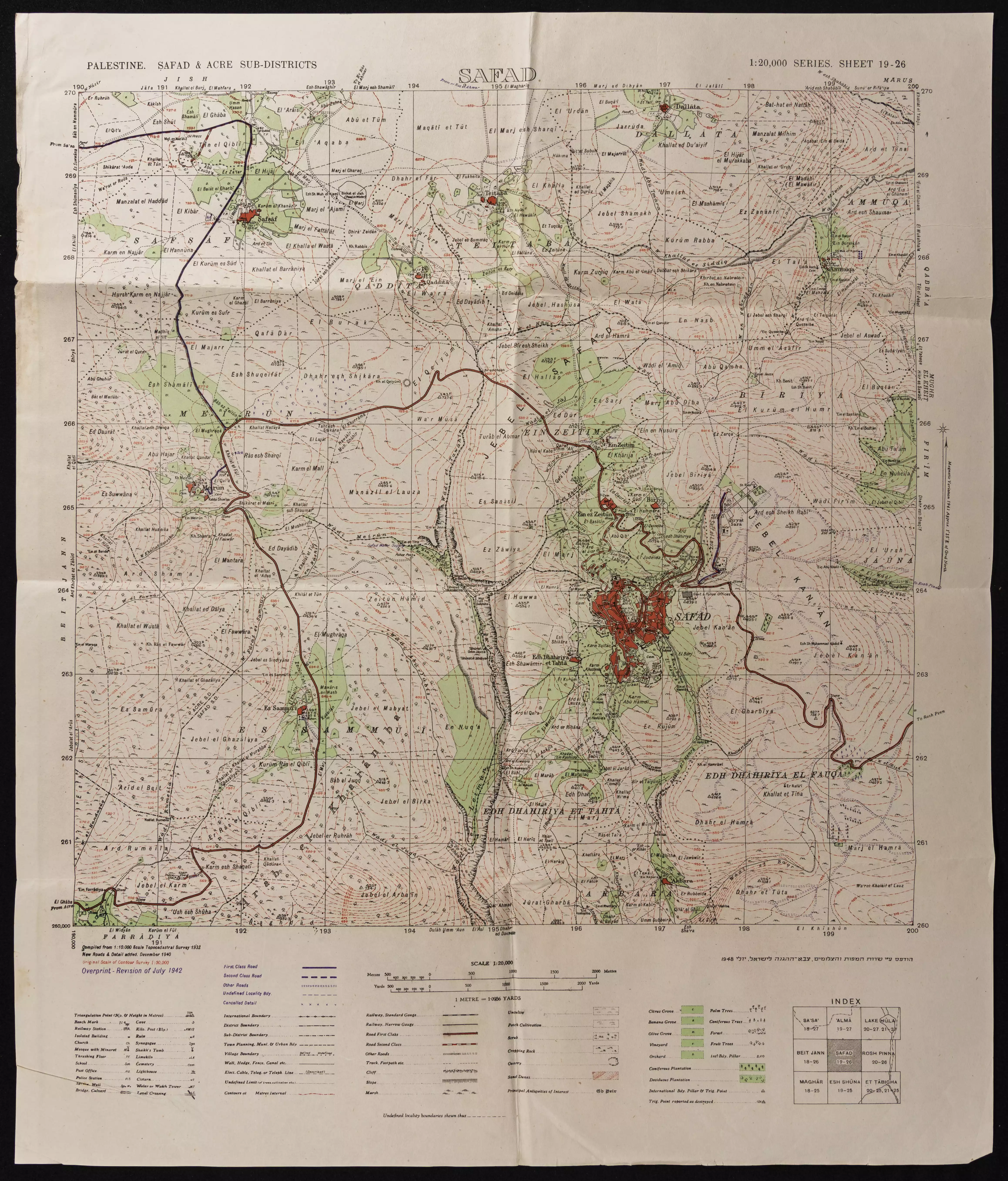
| Related Maps | Town Lands' Demarcation Maps خرائط للقضاء توضح حدود القرى والاودية Town's map on MapQuest View from satellite Help us map this town at WikiMapia |
||||||||||||||
| Related Links | Wikipedia's Page Google Search Google For Images Google For Videos |
||||||||||||||
| More Information | في كتاب كي لا ننسى في كتاب بلادنا فلسطين المزيد من موقع هوية |
||||||||||||||
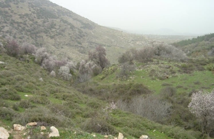
- View Of The Village Site In 1987
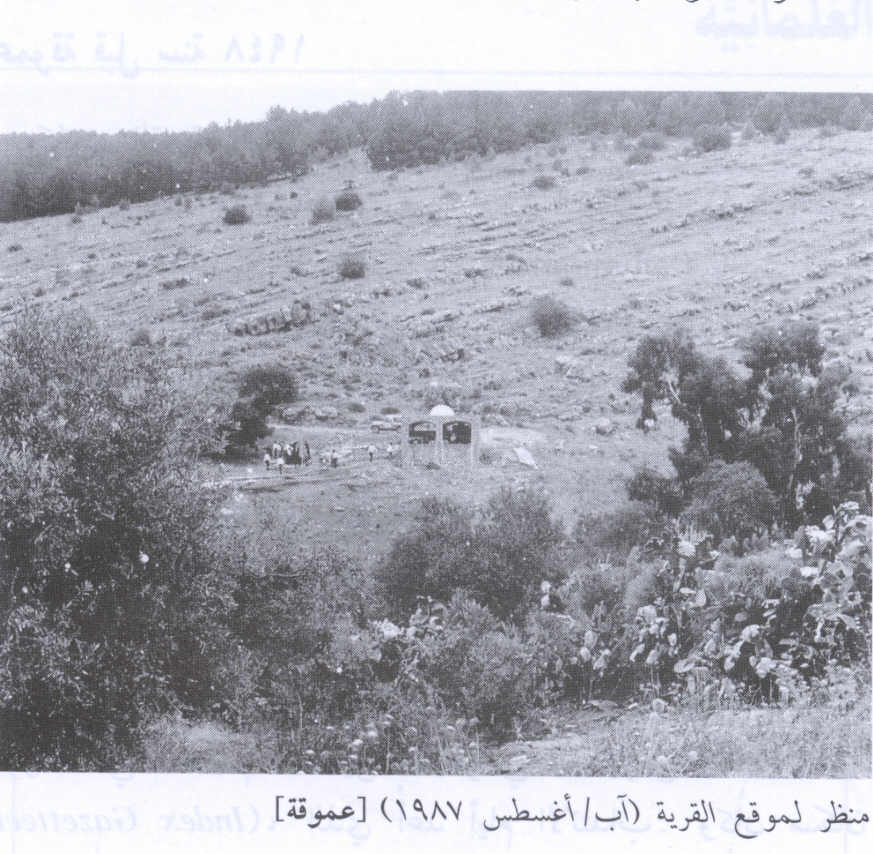
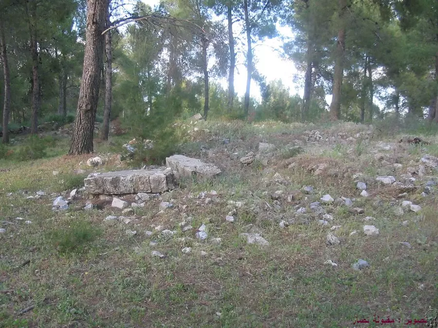
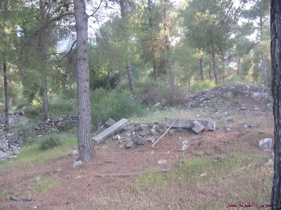
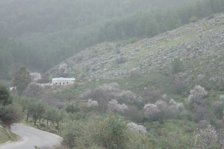
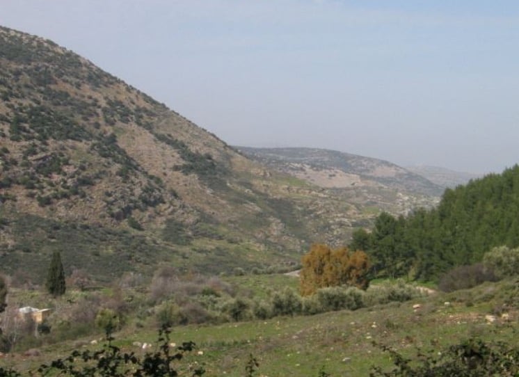
Scanned from "All That Remains" by Dr. Walid Khalidi - اثار بيوت هدمت في عموقه, موجوده في منطقة مرتفعة عن موقع القرية - 16.4.2005 تصوير : مقبولة نصار
Posted by Makbula Nassar - اثار بيوت هدمت في عموقه, موجوده في منطقة مرتفعة عن موقع القرية - 16.4.2005 تصوير : مقبولة نصار
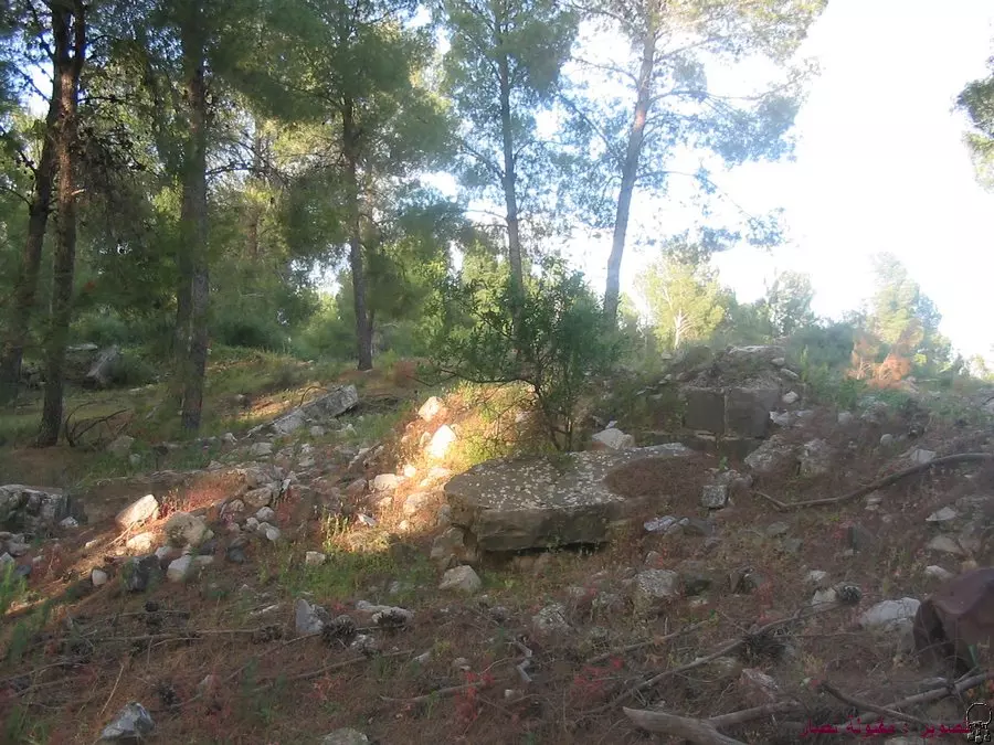
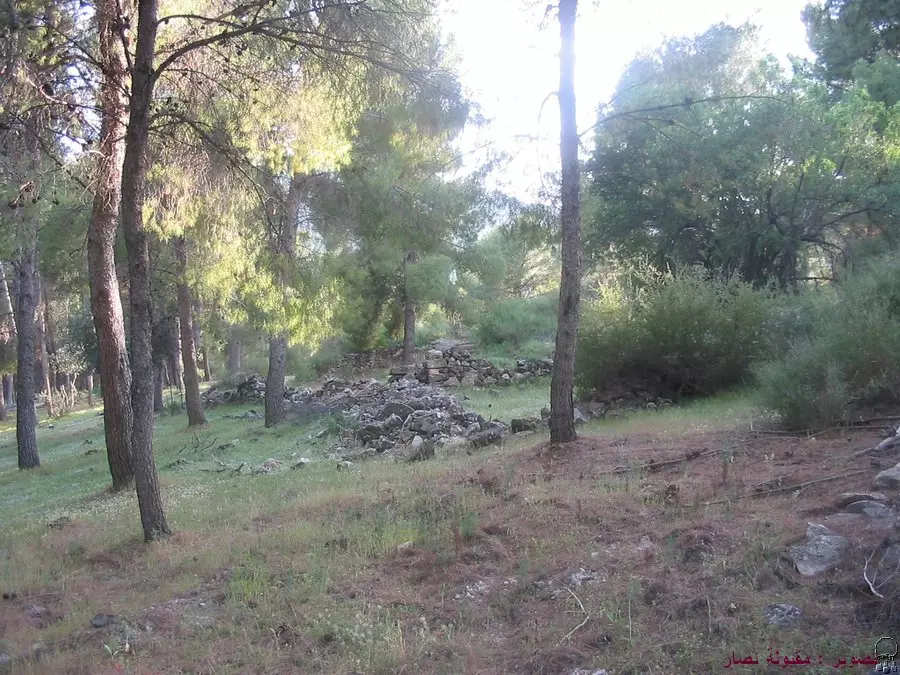
Posted by Makbula Nassar - اثار بيوت هدمت في عموقه, موجوده في منطقة مرتفعة عن موقع القرية - 16.4.2005 تصوير : مقبولة نصار
Posted by Makbula Nassar - اثار بيوت هدمت في عموقه, موجوده في منطقة مرتفعة عن موقع القرية - 16.4.2005 تصوير : مقبولة نصار
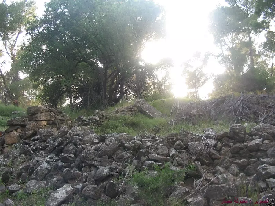
Posted by Makbula Nassar - اثار بيوت هدمت في عموقه, موجوده في منطقة مرتفعة عن موقع القرية - 16.4.2005 تصوير : مقبولة نصار
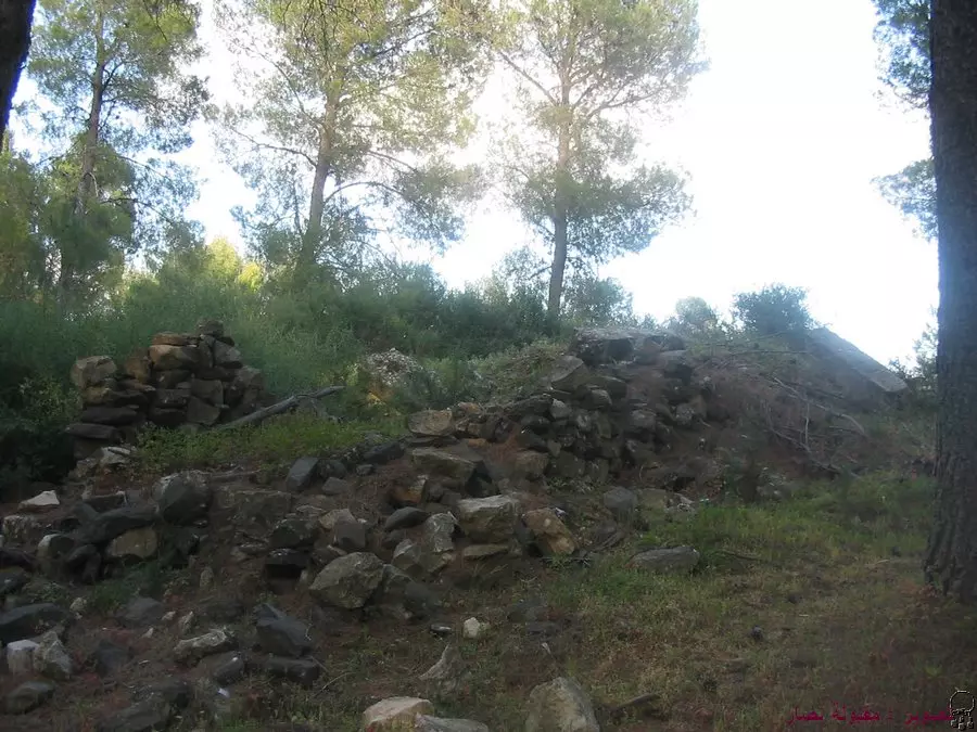
Posted by Makbula Nassar - اثار بيوت هدمت في عموقه, موجوده في منطقة مرتفعة عن موقع القرية - 16.4.2005 تصوير : مقبولة نصار
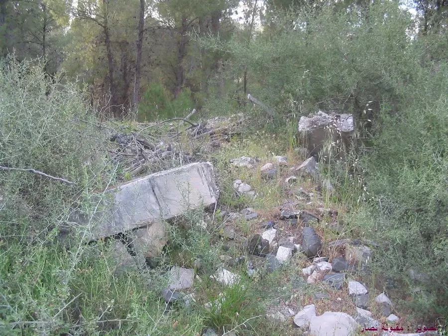
Posted by Makbula Nassar - اثار بيوت هدمت في عموقه, موجوده في منطقة مرتفعة عن موقع القرية - 16.4.2005 تصوير : مقبولة نصار
Posted by Makbula Nassar - اثار بيوت هدمت في عموقه, موجوده في منطقة مرتفعة عن موقع القرية - 16.4.2005 تصوير : مقبولة نصار
Posted by Makbula Nassar - اثار بيوت هدمت في عموقه, موجوده في منطقة مرتفعة عن موقع القرية - 16.4.2005 تصوير : مقبولة نصار
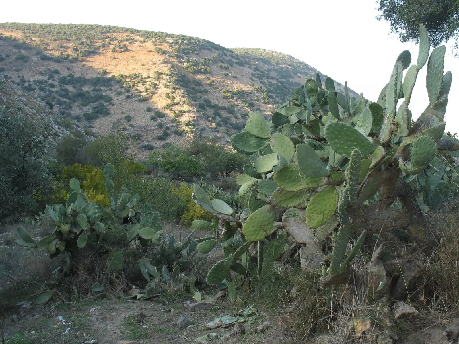
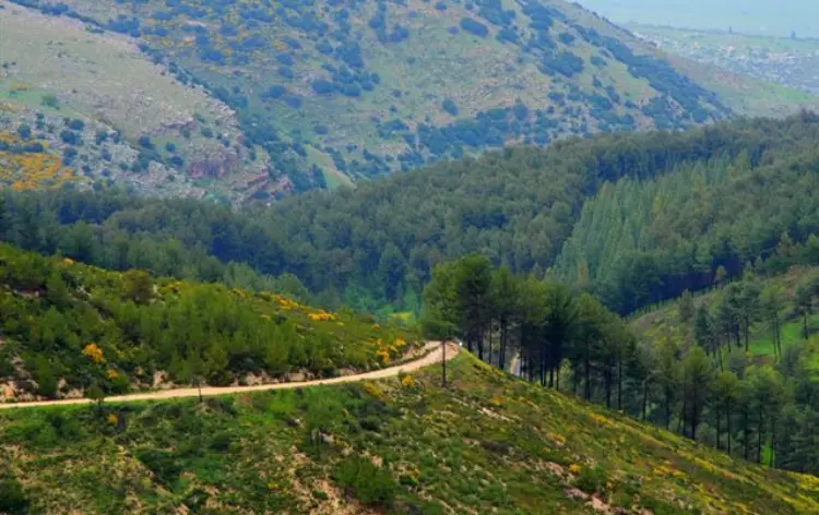
Posted by Makbula Nassar - Village lands and Cactus trees
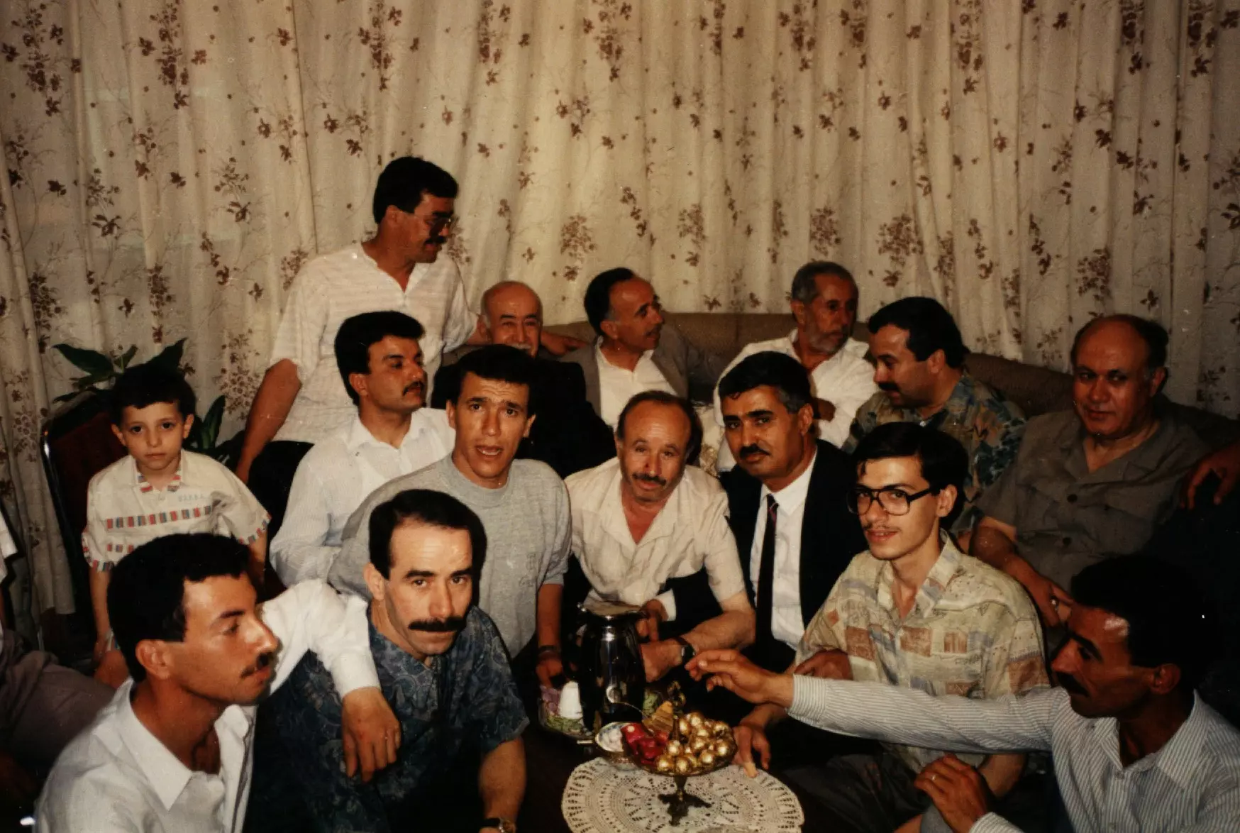
Posted by Noga Kadman - أفراد من سكان العموقة وبعض أقاربهم من بلدة ماروس
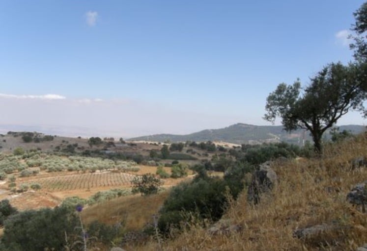
Posted by maher saleh 2 - منظر من قريه العموقه
Posted by abu raya - العموقه
Posted by abu raya - العموقه
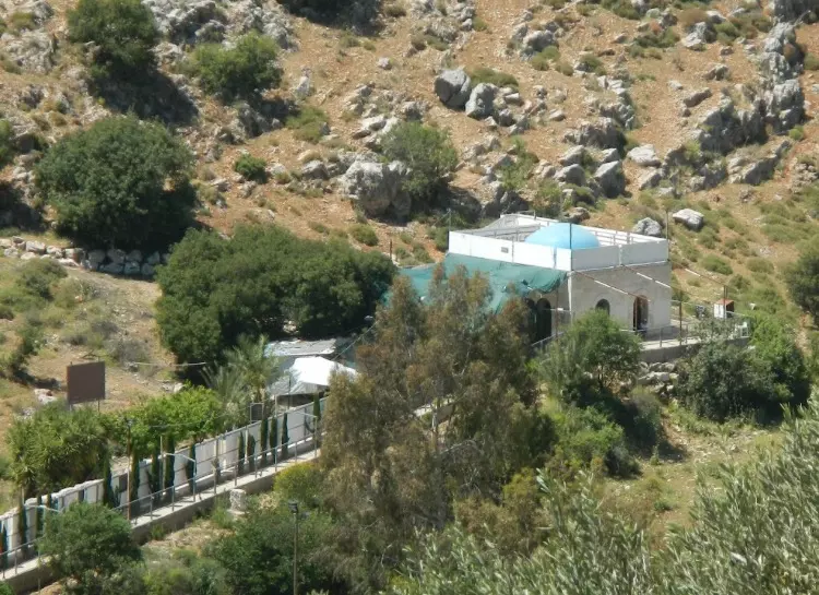
Posted by abu raya - العموقه
Posted by abu raya - العموقه
Posted by abu raya - العموقه
Posted by abu raya - العموقه
Posted by abu raya - زيتون العموقه
Posted by abu raya - خارطة تُظهِر الحدود والطرق بأنواعها والأماكن المقدسة والطبيعة الطوبغرافية من تلال وسهول ومنحدرات والتشكيلة الطبيعية للأرض وأنواع المزروعات. نُشرت الخريطة فترة الانتداب البريطاني، تم إضافة تعديلات عليها من قِبَل خدمة الخرائط والصور التابعة للقوات العسكرية الاسرائيلية فترة الأربعينيات.
Want to browse more? 80,000 pictures were grouped in these gallaries:
| Display Name | Clan/Hamolah | Country of Residence |
| maher saleh | - | - |
| wasim alsharif | alsharif | damascus , 00963 |
| Yousra Saleh | Ammoqa | Syria, Palestain |
| mouein husni abed al-rohman | - | lebanon, lebanon |
| MOUEIN HUSNI ABED ALROHMAN | - | LEBANON |
| MOUEIN HUSNI ABED ALROHMAN | - | - |
| ayman abdelrahman | - | labenon, labenon |
| Walid Abdel-Rahman | Abdel-Rahman | Danmark, Danmar |
| Khaled Abdel-Rahman | Abdel-Rahman | Danmark, Danmark |
| Tarek AbdelRahman | - | Beirut, Lebanon |
- الذاكرة مفتاح العودة-الحلقة 48- قرية عموقة Duration: 23 min 22 sec
- هوية - أحمد إبراهيم محمد عبد الرحمن - عموقة: فلسطين لا تباع لأنها أرض الأنبياء Duration: 7 min 57 sec
No links have been shared yet, be free to the first to share the first link.
 Fake Valor: Why Did Zionist Jews Hoist Nazis Flag on Their Ships in the 1930s?
What is new?
-
Facts About Oct. 7th Gaza Raid
-
Remined Us Please: Who Did Rape Whom? Was it Palestinians who raped Israelis? Or, was the other way around? You'll be the judge
-
When Prof. Edward Said was invited to debate Bibi Netanyahu in the 1980s, watch what happened!
-
Ezra Klein of the NY Times on the "Jewish Race".
-
Abusing Blood Libel!
-
How and why Israeli Jewry has become the most hated cult?
-
Did Israeli Soldiers Activate The Hannibal Direective On Oct. 7th? You Be The Judge
-
Zionist FAQ: Isn't it true that Palestinians don't want peace? Palestinians never accepted the two-state solution
- Facts about Haavara (Transfer) Agreement between Ben-Gurion & Hitler
-
Haavara FAQs: Why Did Zionist Jews Hoist Nazis' Flags on Their Ships in the 1930s?
- Haavara FAQs: When Chaim Weizmann met FDR in mid-1943, why was he silent about rescuing European Jewry?
-
Dear ChatGPT: How did Palestinians resist Napoleon's invasion of their country in 1799?
-
Dear ChatGPT: Gaza had a vibrant Jewish community in the mid-17th century. What happened to them?
-
Dear ChatGPT: Why did the Jewish Agency suppress news of the Holocaust during WWII?
-
Video Playlist: Jews share their DNA tests to end the conflict for good.
-
A Tale of Two Conflicts: Examining the Definition of Genocide
-
Prof. Abraham Polak And The Suppressed History of the Khazars and European Jewry
-
How Ronald Reagan would have framed the genocide in Gaza if he were still alive?
-
Haavara FAQs: Let us do the math: how many German Jews did The Haavara Agreement save?
-
Zionist FAQs: The Hebron Massacre of 1929, "clearly proves" that Palestinians are antisemitic, how could you deny it?
-
Zionist FAQs: Why Anti-Zionist Is Not Antisemitism?
-
Zionist FAQs: Isn't it true that the KGB created Palestinian Nationalism in the early 1960s?
- Zionist FAQs: Muslims are killing Muslims all the time; why are Israeli Jews being singled out in the media?
- Zionist FAQs: How is Israel an apartheid state when 20% of its citizens are Arabs who enjoy full rights?
-
Haavara FAQs: Why Did Dorothy Thompson Flip From A Zionist Advocate to A Silenced Dissenter?
-
Haavara FAQs: Analysis of Herzl's Uganda Scheme and how it could have saved millions of Jews.
-
Haavara FAQs: Why did Hayim Greenberg describe American Jewry as "morally bankrupt" in early 1943?
-
Haavara FAQs: What if the Evian Conference was a resounding success? What would have been the impact of saving European Jewry on Zionism?
- Haavara FAQs: What if the six million were saved, how that would have impacted the Zionist project?
-
Haavara FAQs: How did Zionist leaders react when Europe's Jews lingered in the DP camps after WWII ended?
-
Why does the American Jewish community repeat lies that David Ben-Gurion had debunked before he died?
-
Who has the power to rename the Tatar/Khazar Gene Marker to Jewish IV?
-
Zionist FAQs: Why won't Egypt, Syria, and Jordan take their people back? Jews are indigenous to Palestine, and Arabs immigrated after Jews developed the country. Arabs should leave.
-
Haavara FAQs: Did Hitler and the Nazis conflate between Judaism and Zionist? If that wasn't case, then why?
-
Haavara FAQs: Winston Churchill and antisemitism, a collection of articles written Churchill.
-
Haavara FAQs: Broken by country, how many Jews survived vs. killed during the Holocaust?
-
Haavara FAQs: Why did European Jews vote with their feet and to immigrated to the Americas, not Palestine, after WWII?
-
Watch this American Jewish Girl describing Israeli Jews' cognitive dissonance like no other in under two minutes
-
Haavara FAQs: When the Nazis went out of their way to hide the Holocaust, Israeli Jews did the exact opposite by broadcasting their genocide of Gazans. But why?
-
Haavara FAQs: How Zionist Jews went out of their to show their appreciation to Nazism and Fascism?
- Haavara FAQs: Why Zionist leaders were against bombing the death camps & the Railroads leading to them?
-
Haavara FAQs: Hitler's message to the British and American people: If Jews are such noble citizens and you care about them, how come you're not letting them in? I will gladly ship them to you at my expense, even on luxury liners!
-
A shortlist of Zionist and Israeli false flag operations in the name Jews.
-
The Most Moral Army
- The Land of Kapos (Israel): Where the brave are boycotted and Kapos walk free.
- Why did early Zionists often named their communal enterprises "colonial"?
- Zionist Relations with Nazi Germany by Faris Glubb
-
Two NY Times advertisements by Zionists in the early 1943 that exposes Zionists' treason at the height of the calamity
- Facts Not Lies about the Palestinian-Israeli Conflict.
- Site's pictures have been categorized
- Campgain Against Lice
- A Survey of Palestine, the official source about Palestine before Nakba produced by the British Mandate; over 1200 pages.
- Satellite View & Google Earth: Over 6,000 placemarks identifying all destroyed towns, W. Bank & Gaza Strip Towns, & refugee camps.
- PalestineRemembered.com and its Nakba Oral History Project were featured on al-Jazeera Satellite TV.
- Nakba Oral History Video Podcast:
 Over 700 Oral History interviews (including 3,500+ hours of recording) can be viewed online.
 - Palestine Village Statistics Project
- Gaza Jail Break
- النسخة العربية للموقع الان متوفرة
- Videos: Documenting the destroyed villages in video: Tracing all that remains since Nakba.
- Videos: Responding to Zionist Propaganda
- Interview: The ethnic cleansing of Palestine: George Galloway interviews Israeli Historian Ilan Pappe.
- For Palestinians, memory matters. It provides a blueprint for their future By George Bisharat.
- Zionist FAQ now available in Hebrew שאלות שציונים שואלים, עכשיו בעברית
- Video: The Stephen Walt and John Mearsheimer report on the influence of the Israel Lobby on U.S. Foreign Policy
- The Palestinian-Israeli conflict for beginners
