| PalestineRemembered | About Us | Oral History | العربية | |
| Pictures | Zionist FAQs | Haavara | Maps | |
| Search |
| Camps |
| Districts |
| Acre |
| Baysan |
| Beersheba |
| Bethlehem |
| Gaza |
| Haifa |
| Hebron |
| Jaffa |
| Jericho |
| Jerusalem |
| Jinin |
| Nablus |
| Nazareth |
| Ramallah |
| al-Ramla |
| Safad |
| Tiberias |
| Tulkarm |
| Donate |
| Contact |
| Profile |
| Videos |
Welcome To al-Hamma - الحمة (אל-חמה)
|
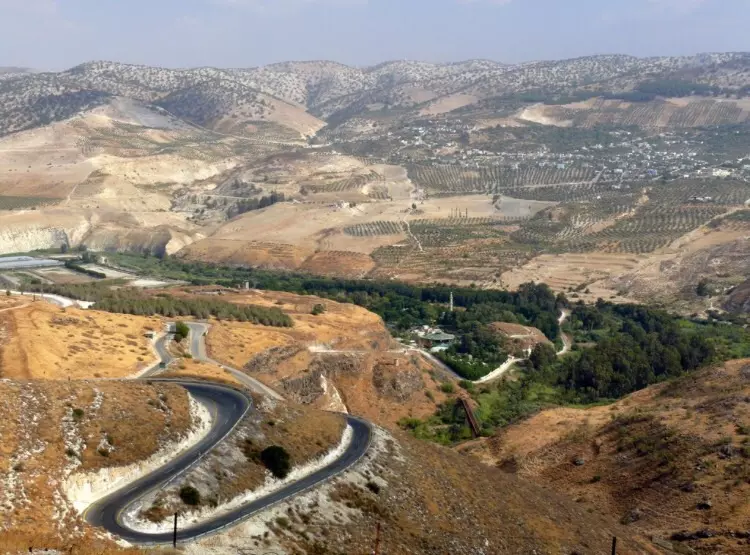
District of Tiberias
Ethnically cleansed days ago |
العربية Google Earth |
 |
Gallery (59) |
- Statistics & Facts
- Satellite View
- Articles 3
- Pictures 59
- Members
- All That Remains
- Wikipedia
- Videos 2
- Guest Book
- Links
| Statistic & Fact | Value | ||||||||||
| Occupation Date | July 20, 1949 | ||||||||||
| Distance From District | 12 (km) Southeast of Tiberias | ||||||||||
| Elevation | -150 (meters) | ||||||||||
| Map Location | See location #23 on the map View from satellite |
||||||||||
| Exodus Cause | Expulsion by Zionist troops | ||||||||||
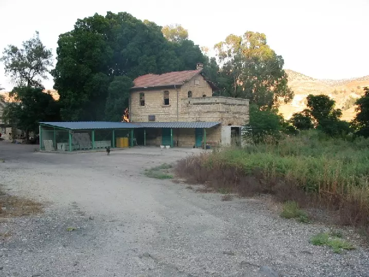
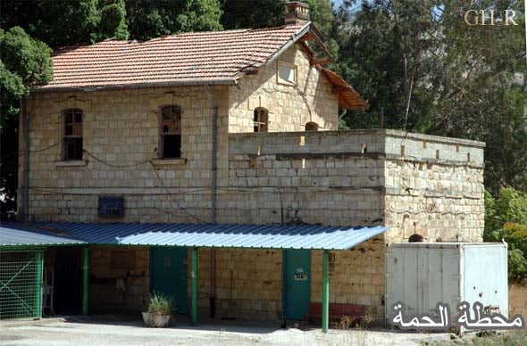
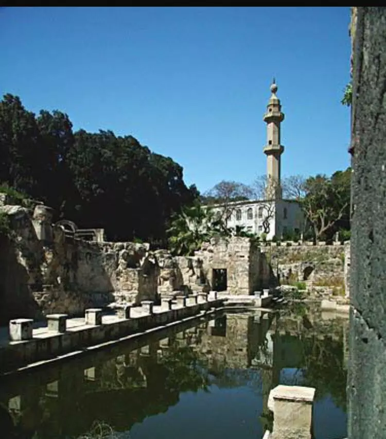
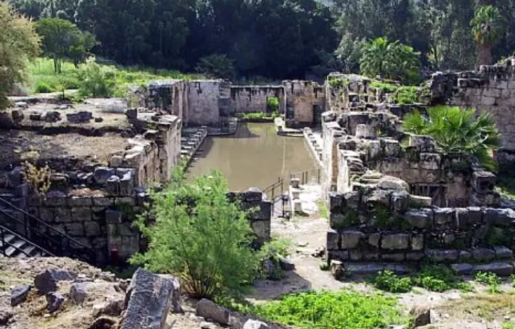
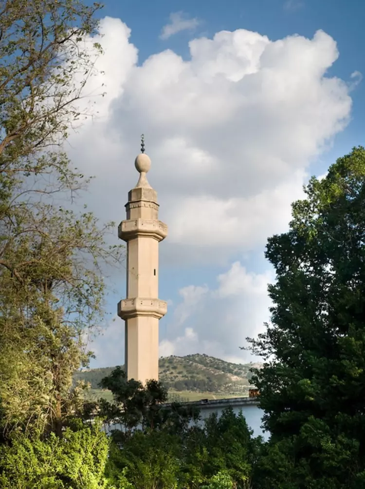
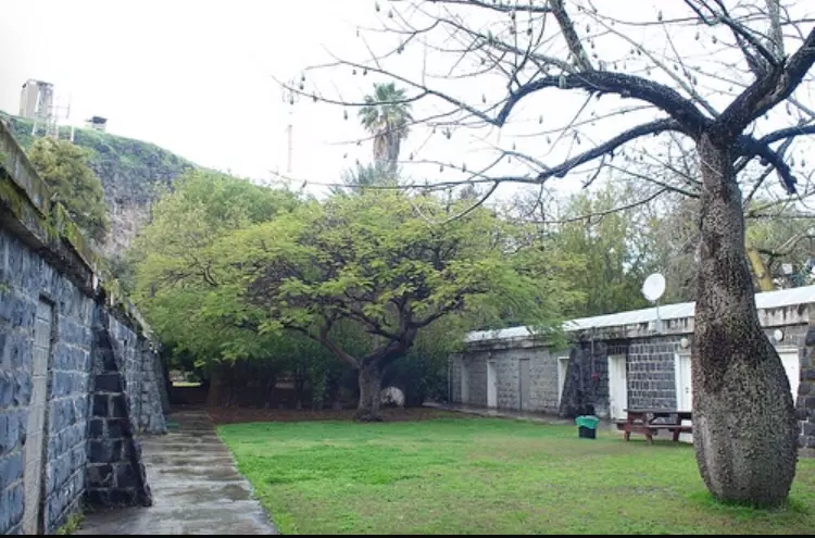
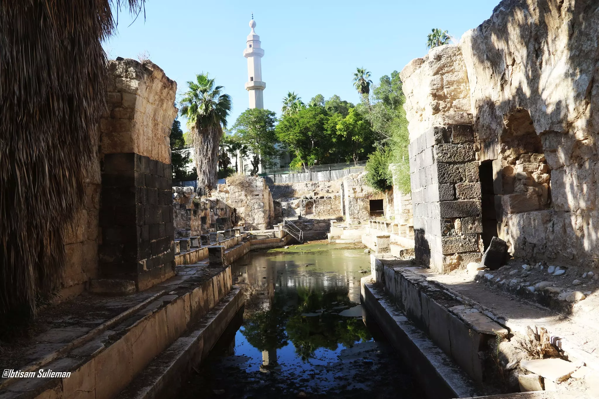
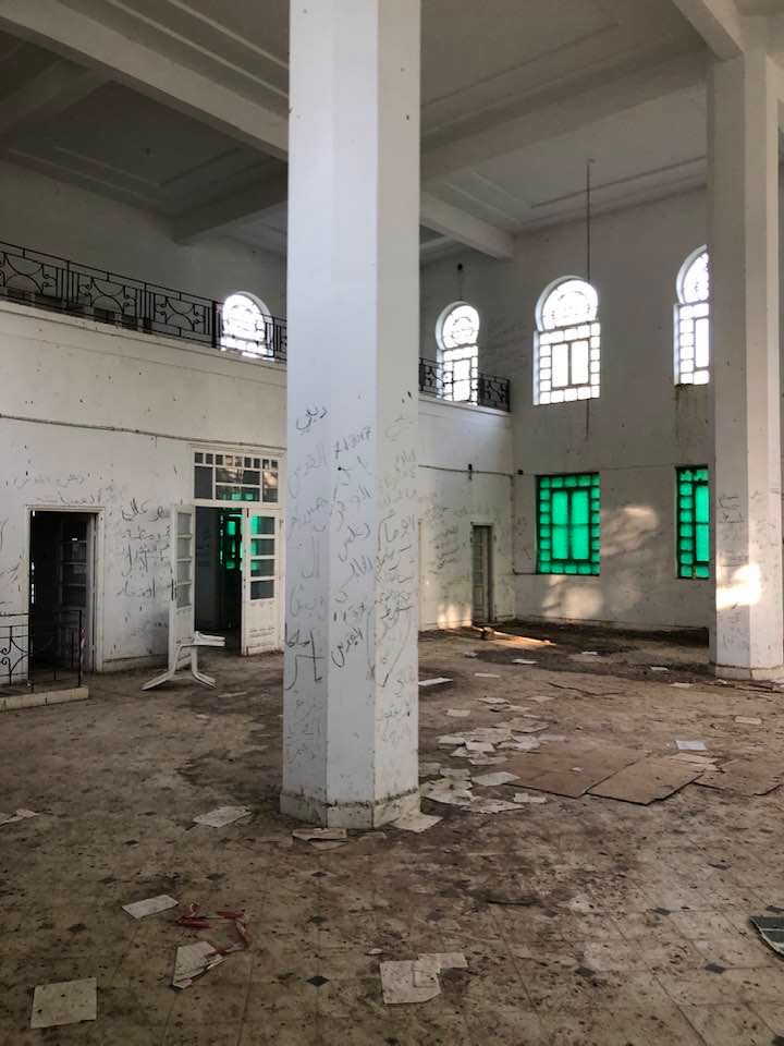
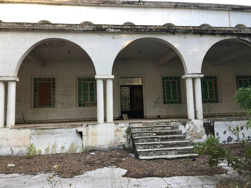
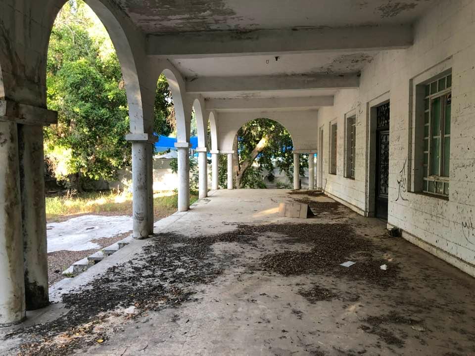
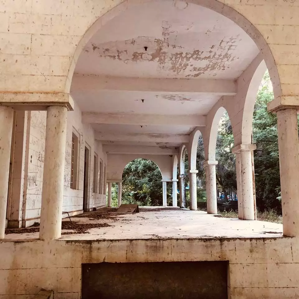
| Village Temains | al-Hamma has been converted into an Israeli tourist park, with parking facilities, swimming pools, and a small fishing pond. Some of the village structures have been spared destruction such as the train station and the village mosque, see Pictures section for details. | ||||||||||
| Ethnically Cleansing | al-Hamma's population were ethnically cleansed between 1949-1956. | ||||||||||
| Pre-Nakba Land Ownership |
**Town Lands' Demarcation Maps |
||||||||||
| Land Usage As of 1945 |
|
||||||||||
| Population |
|
||||||||||
| Number of Houses |
|
||||||||||
| Near By Towns |
|||||||||||
|
|||||||||||
| Town's Name Through History | The Old Testament's referred to al-Hamma by Ammath (or Emmath), during Romans period it was known by Emmatha. After the war, the village was known by al-Humma al-Suryah, sense it fell in the DMZ close to the Syrian borders. | ||||||||||
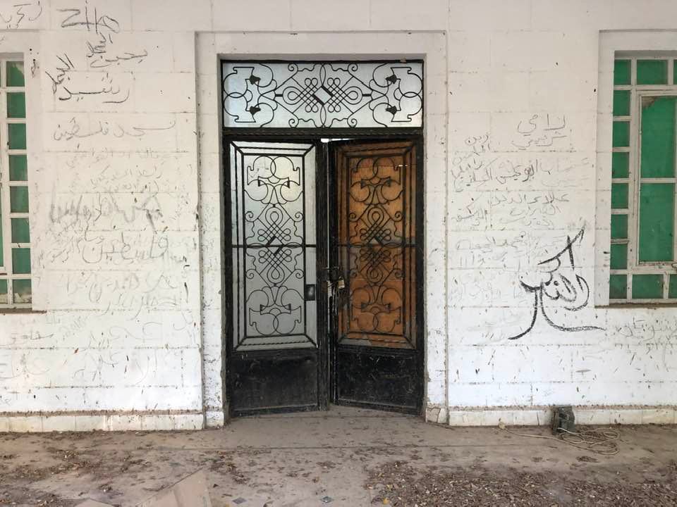
| Places of Warship | One mosque (still standing) | ||||||||||
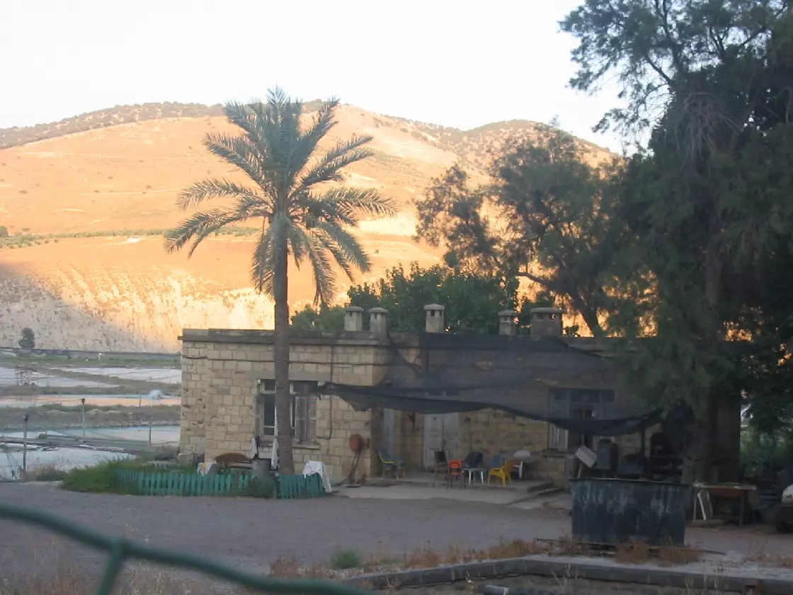
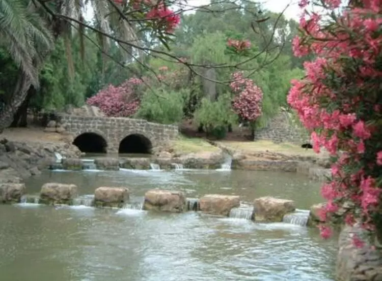
| Water Supply | al-hamma is super famous for its hot springs | ||||||||||
| Archeological Sites | The village contained an amphitheater, baths, a synagogue, burial grounds, the shafts and capitals of columns, and a shrine. | ||||||||||
| Exculsive Jewish Colonies That Usurped Village Lands |
No Israeli settlements on villageal-Hamma's lands. | ||||||||||
| Featured Video | |||||||||||
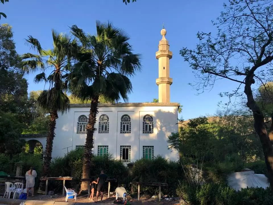
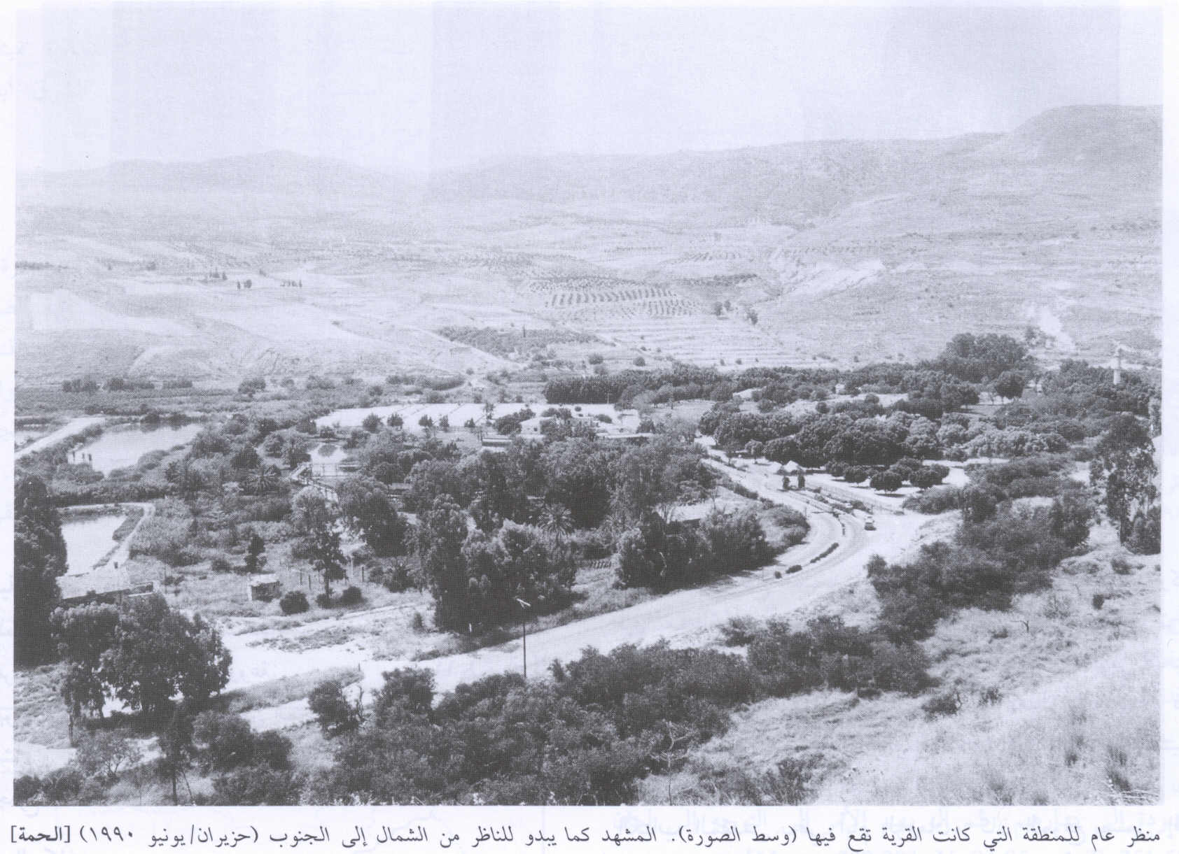
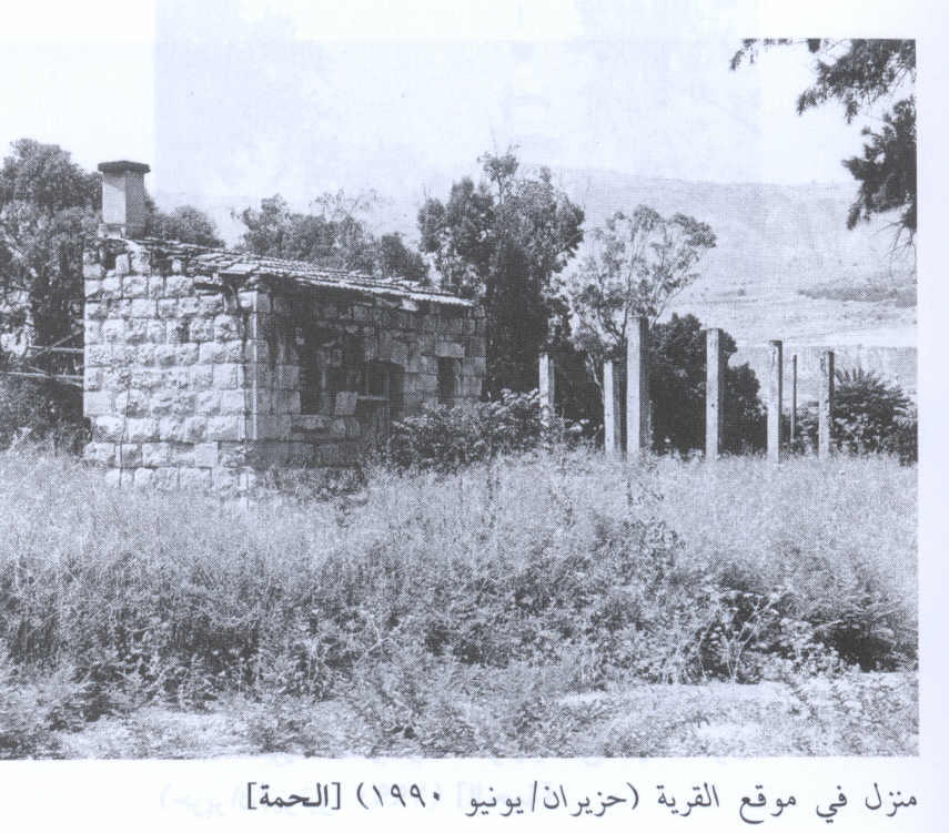
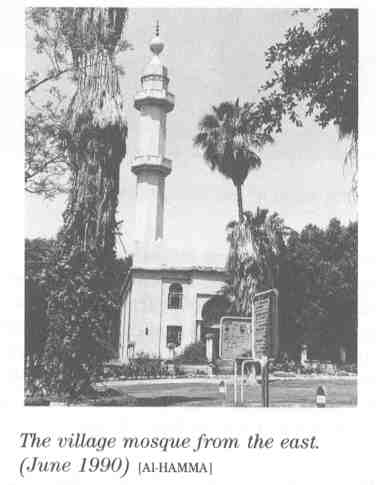
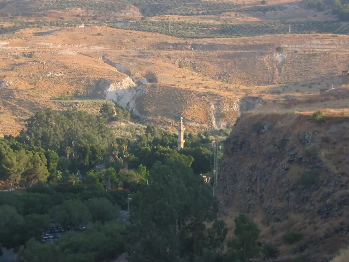
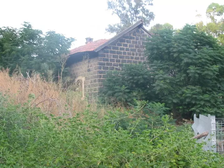
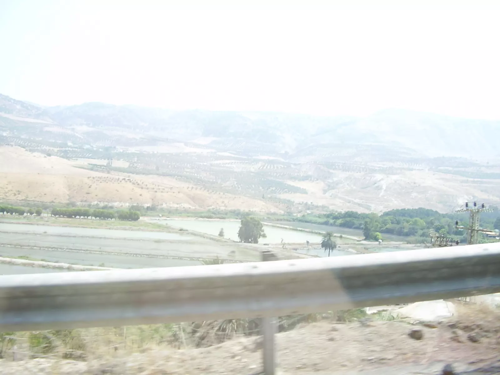
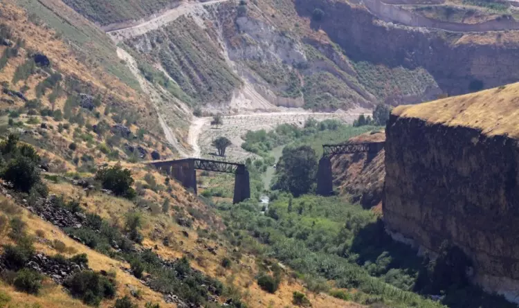
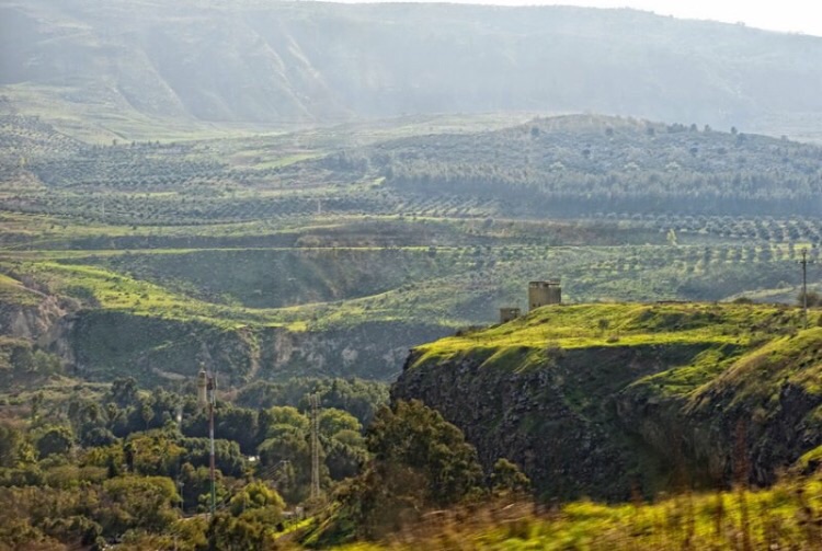
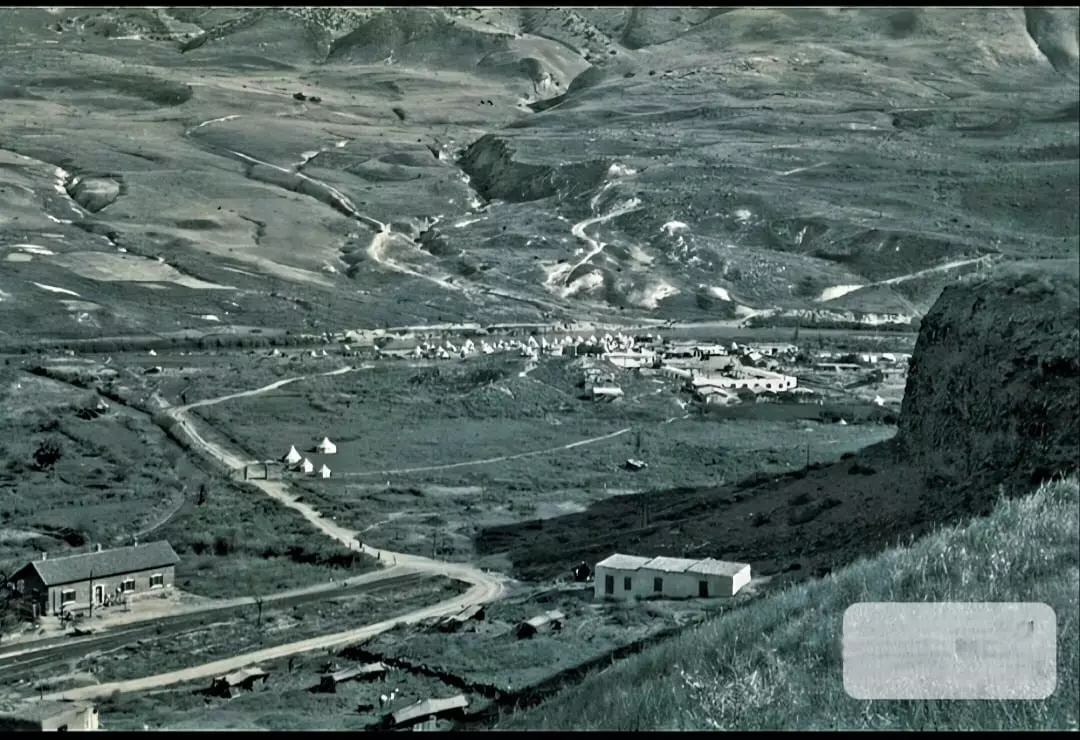
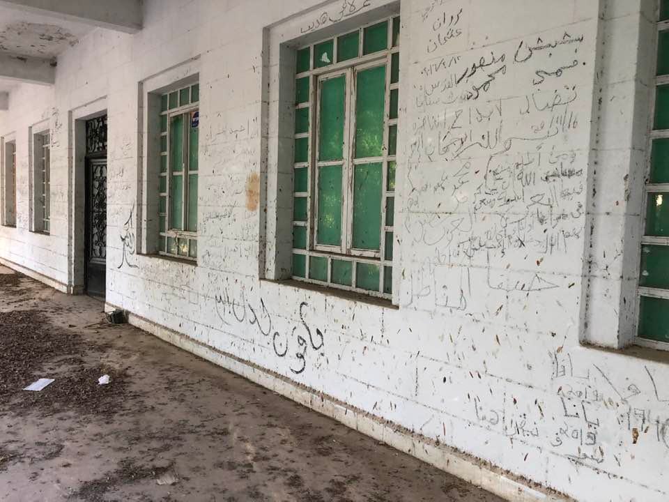
Village Before Nakbahe village was situated on a narrow strip of land in the Yarmuk Valley. Steep slopes rose to the north and south. It was one of the stations on the railway line that linked Haifa to the Hijaz railway through Samakh on the southern tip of Lake Tiberias. The area had attracted settlers since ancient times. Al-Hamma was established on the Hellenistic Ammathous, the Old Testament's Ammath (or Emmath). In the Roman period, the site was called Emmatha and belonged to the sub-disctrict of Gadara (Umm Qays), now located in Jordan. Al-Hamma was renovated in A.D. 663, during the reign of the Ummayyad caliph Mu'awiya, after it had been damaged by an earthquake. It was known for its hot springs, which were thought to have therapeutic qualities because of the high sulfur content of their water. Although the springs attracted many visitors in the days of the Greeks and Romans (as evidenced by modern excavation and by references to the springs in historical works), they were later abandoned and were visited only by Bedouin, who set up seasonal camps at the site. A Lebanese entrepreneur, Sulayman Nasif, was given a concession in 1936 (during the British Mandate) to exploit the springs. Afterwards, Palestinians and other Arabs flocked to the area for relaxation and therapy.The people of al-Hamma were predominantly Muslim, and the village had a large mosque with marble columns and a fountain in its front courtyard. Agriculture constituted the main source of livelihood for the villagers; a small portion of the village lands was planted with olive trees, and in 1944/45 a total of 1,105 dunums was irrigated or used for orchards. Archaeological remains in al-Hamma included an amphitheater, baths, a synagogue, burial grounds, the shafts and capitals of columns, and a shrine. Village Occupation and Ethnic CleaningAl-Hamma was not captured in combat but was seized well after the fighting had ended. At the end of the war, the village fell within the Demilitarized Zone on the Syrian border, and was protected under the provisions of the Syrian-Israeli armistice agreement (Article V) signed in July 1949. However, as Israeli historian Benny Morris writes, the Israeli authorities nevertheless decided to eject the inhabitants of the cluster of villages covered in the agreement, on grounds that they may have been helping the Syrians, stealing cattle, and trespassing. Over the next seven years (between 1949 and 1956), 'a combination of stick and carrot' was employed in order to drive them out, according to Morris. The methods used were 'police pressure and 'petty persecution,' and economic incentives.' Most of the area residents moved to Syria, but some were relocated to the village of Sha'b in Acre sub-disctrict.Zionists Colonies on Village LandsThere are no Israeli settlements on village land.Village TodayThe site has been converted into an Israeli tourist park, with parking facilities, swimming pools, and a small fishing pond. The deserted mosque still stands, and its minaret and marble columns are intact. Building foundations that were unearthed by an archaeological excavation can be seen south of the mosque. Five buildings east of the village site are built of black basalt. The railroad station still exists and the name of the village is inscribed on its entrance. There are three more deserted buildings next to the station, as well as the remains of destroyed houses (see photos section).SourceDr. Walid al-Khalidi, 1992: All That Remains. |
|||||||||||
| Related Maps | Town Lands' Demarcation Maps خرائط للقضاء توضح حدود القرى والاودية Town's map on MapQuest View from satellite Help us map this town at WikiMapia |
||||||||||
| Related Links | Wikipedia's Page Google Search Google For Images Google For Videos |
||||||||||
| More Information | في كتاب كي لا ننسى في كتاب بلادنا فلسطين المزيد من موقع هوية |
||||||||||
- General view of village area seen from north to south, 1990
Scanned from "All That Remains" by Dr. Walid Khalidi - A deserted village house, 1990
Scanned from "All That Remains" by Dr. Walid Khalidi - The village mosque from the east, 1990
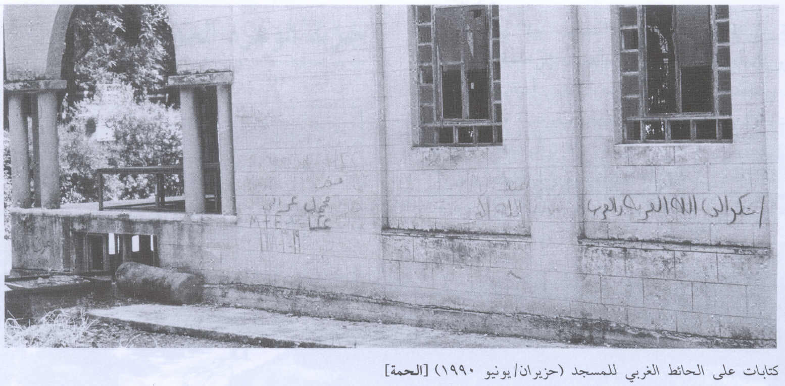
Scanned from "All That Remains" by Dr. Walid Khalidi - Read what is written in Arabic on the mosque wall! 1990
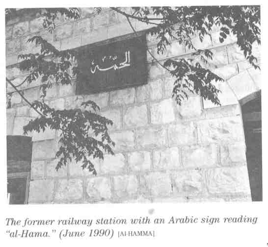
Scanned from "All That Remains" by Dr. Walid Khalidi 1 - The former railway station with the Arabic sign reading al-Huma, 1990
Scanned from "All That Remains" by Dr. Walid Khalidi - منظر لوقع القرية من الناحية الشرقية , تظهر مأذنة مسجد الحمة الذي لا يزال قائماً- 26/7/2003
Posted by Makbula Nassar - احد بيوت القرية - 26/7/2003
Posted by Makbula Nassar - احد بيوت القرية - 26/7/2003
Posted by Makbula Nassar - احد بيوت القرية - 26/7/2003
Posted by Makbula Nassar - منظر عام لموقع القرية من جهة الغرب - 26/7/2003

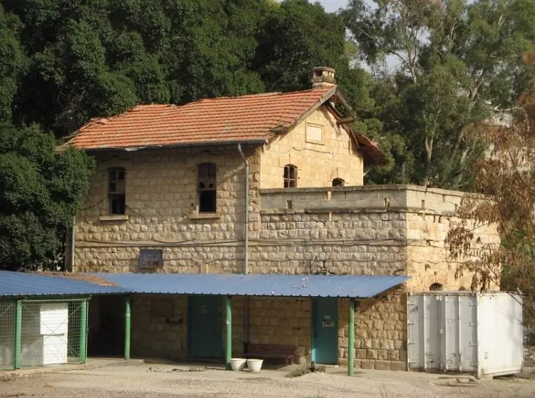
Posted by Makbula Nassar 1 - الحمة محطة القطار
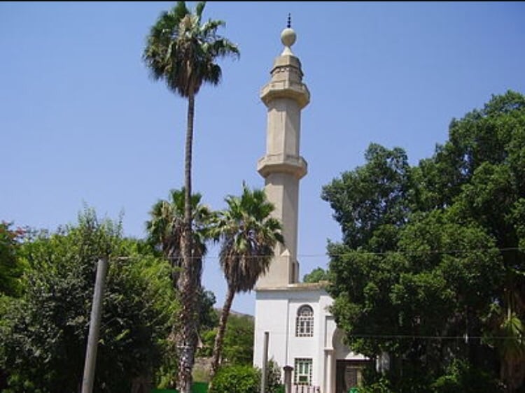
Posted by Ahmed Aboura - al hamma mosque

Posted by Abu Raya Muafaq - منظر عام
Posted by Abu Raya Muafaq - منظر عام

Posted by Abu Raya Muafaq - منظر عام للأراضي الزراعية
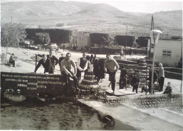
Posted by Abu Raya Muafaq - A trip to Al Himmah in the year 1965
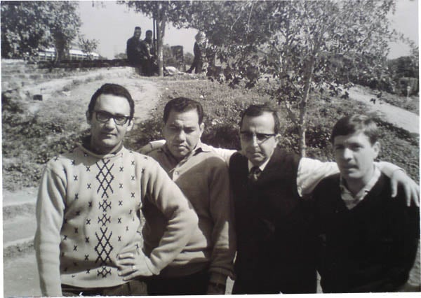
Posted by Salim El Far 1 - In the Himmeh gardens 1965
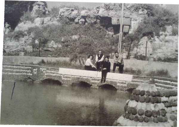
Posted by Salim El Far 1 - Besides a pool of mineral water (1965)
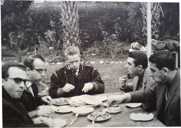
Posted by Salim El Far 1 - In one of al Himmah's restaurant (in 1965)
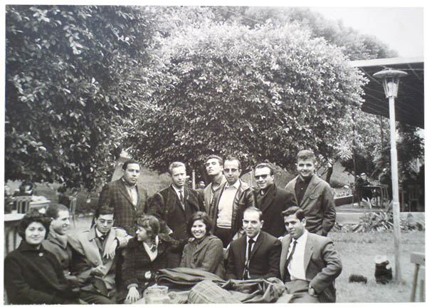
Posted by Salim El Far 1 - Picture taken before dinner in Himma's restaurant. You see here the Bank's employees making the trip from Damascus in 1965.
Posted by Salim El Far 1 - محطه قطار الحمه
Posted by abu raya - مسجد الحمه
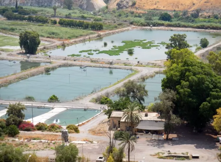
Posted by abu raya - المنتجع السياحي في قريه الحمه

Posted by abu raya - الاثار الرومانيه في الحمه
Posted by abu raya - منظر عام للحمه ومن الشرق الاراضي الاردنيه
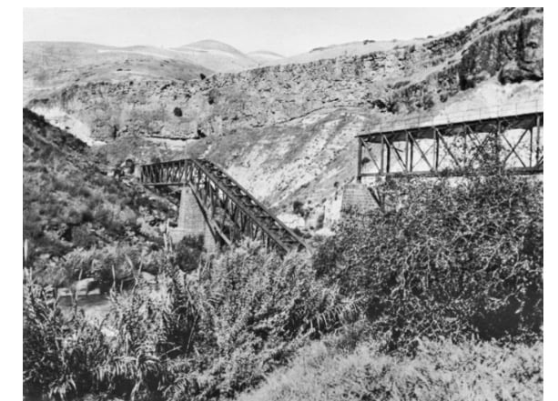
Posted by abu raya - جسر قطار الحجاز بالقرب من الحمه
Posted by abu raya - الاثار الرومانيه في الحمه
Posted by abu raya - مجرى مياه الحمه
Posted by abu raya - منظر عام للحمه

Posted by abu raya - مسجد الحمه
Posted by abu raya - الحمه
Posted by abu raya - منظر عام للحمه
Posted by abu raya - منظر عام لقريه الحمه

Posted by abu raya - منظر من شمال القريه وتظهر بيوتها الباقيه
Posted by abu raya - جسر لسكه الحديد بالقرب من قريه الحمه سنه 1918
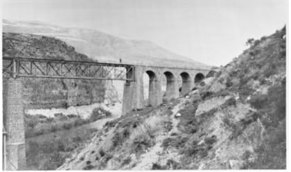
Posted by abu raya - جسر قطار سمخ الحمه سنه 1918
Posted by abu raya - قرية الحمة قضاء طبرية د1945
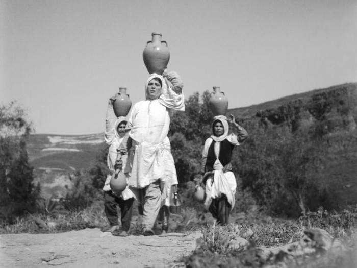
- صورة نادرة لقرية
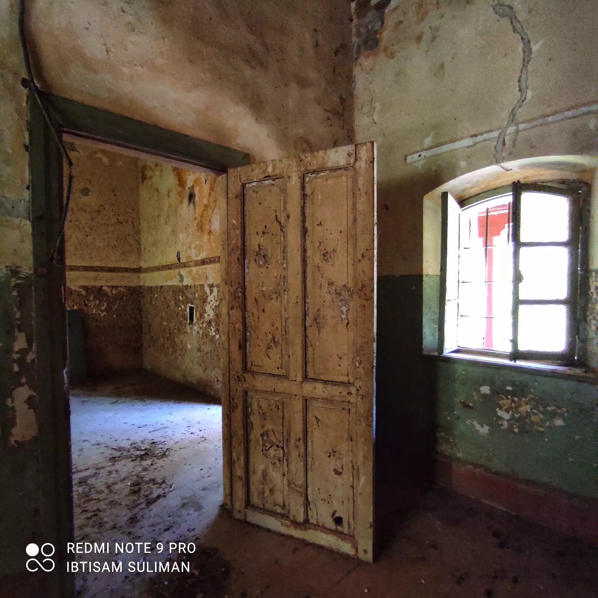
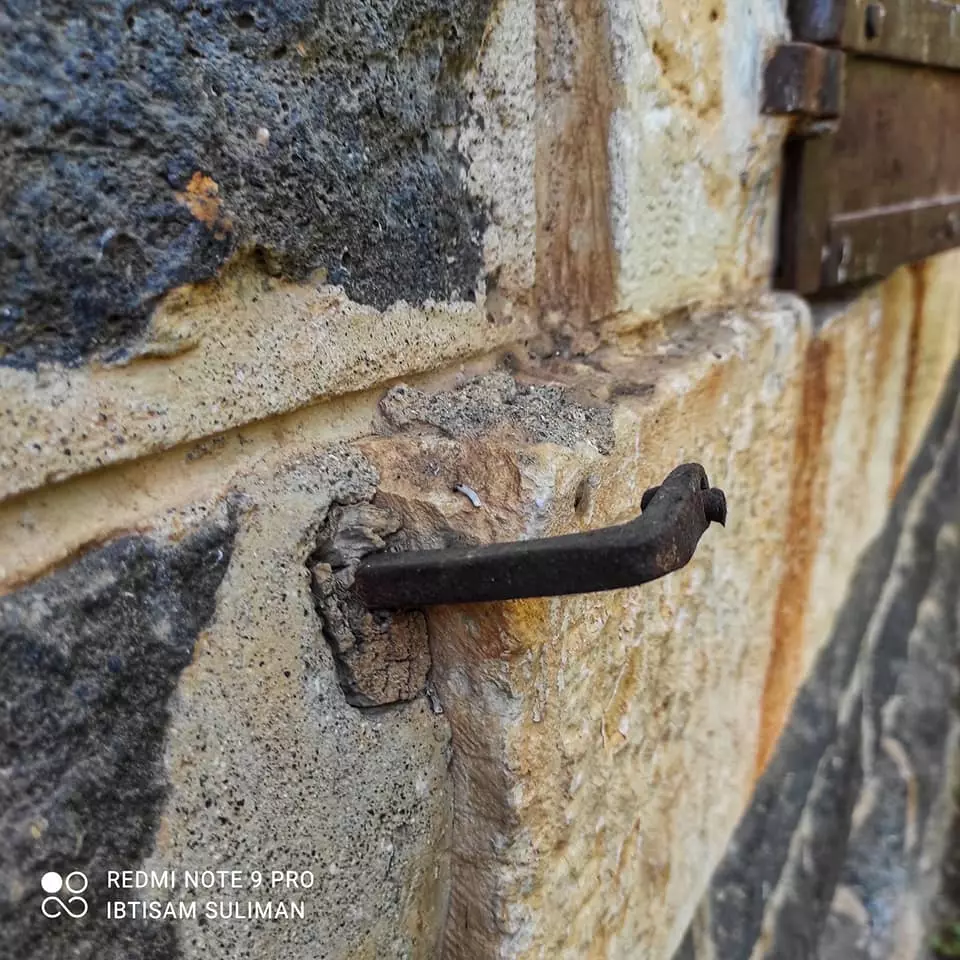
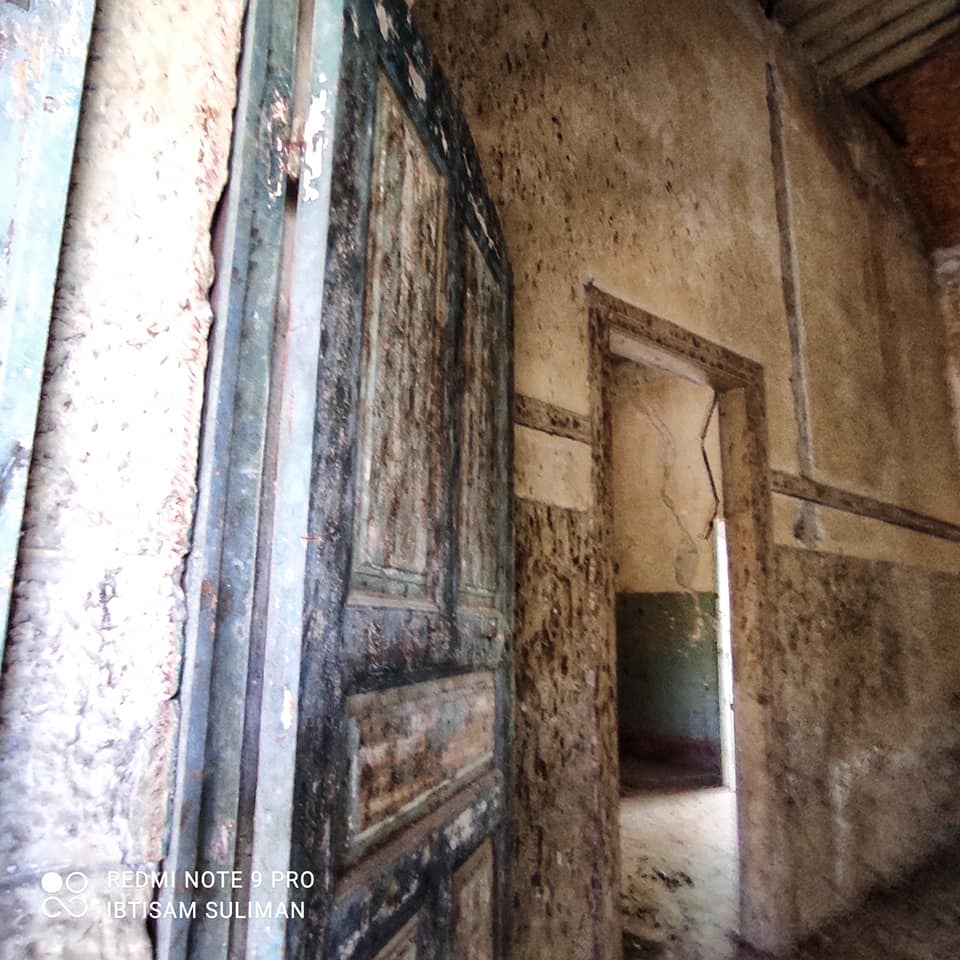
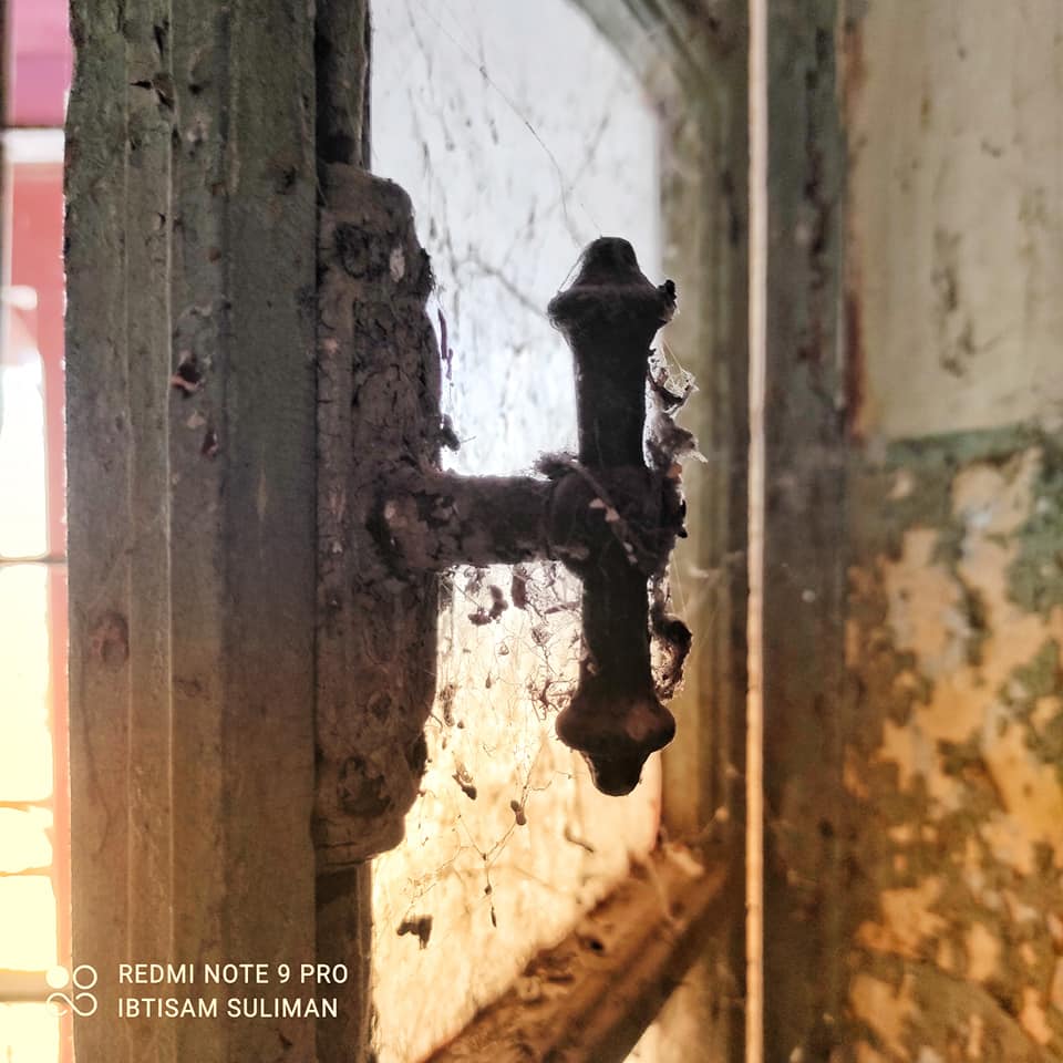
- من بيوتنا بقرية الحمة المهجرة--Ibtisam Sulieman
- من بيوتنا بقرية الحمة المهجرة--Ibtisam Sulieman #2

- من بيوتنا بقرية الحمة المهجرة--Ibtisam Sulieman #3
- من بيوتنا بقرية الحمة المهجرة--Ibtisam Sulieman #4
- من بيوتنا بقرية الحمة المهجرة--Ibtisam Sulieman #5
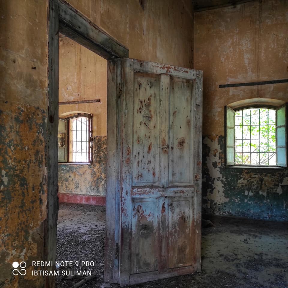
- من بيوتنا بقرية الحمة المهجرة--Ibtisam Sulieman #6
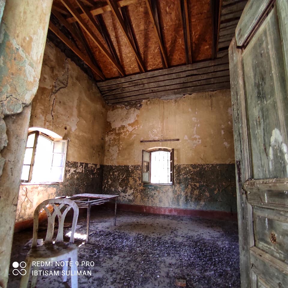
- من بيوتنا بقرية الحمة المهجرة--Ibtisam Sulieman #7
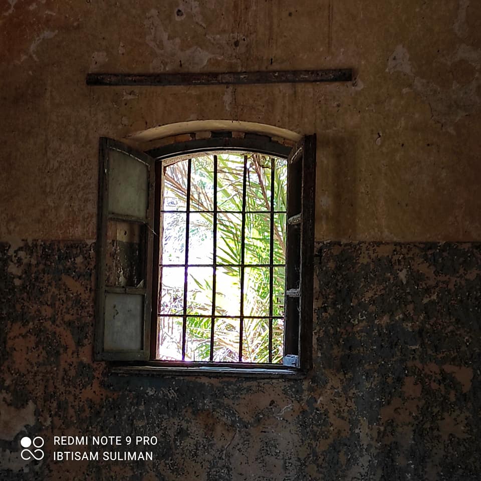
- من بيوتنا بقرية الحمة المهجرة--Ibtisam Sulieman #8
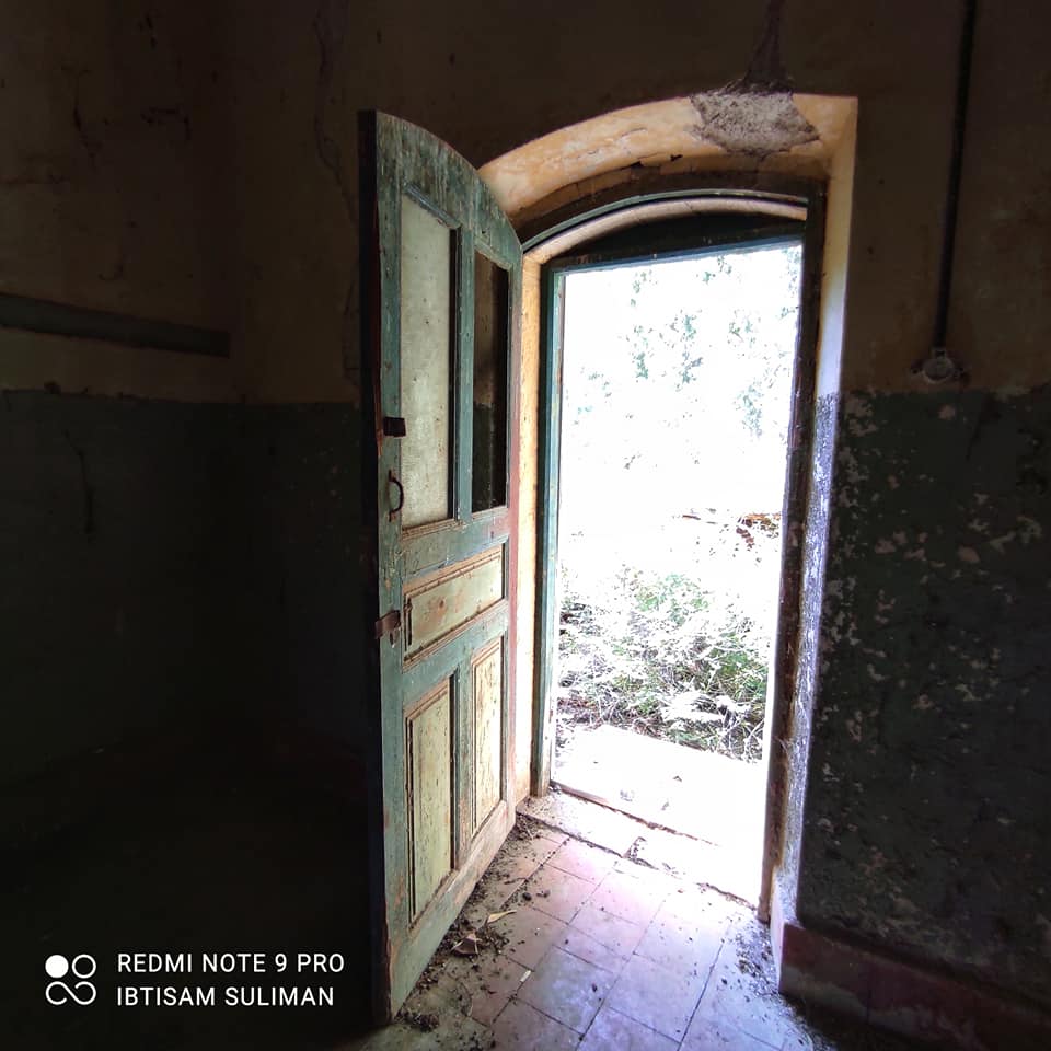
- من بيوتنا بقرية الحمة المهجرة--Ibtisam Sulieman #9
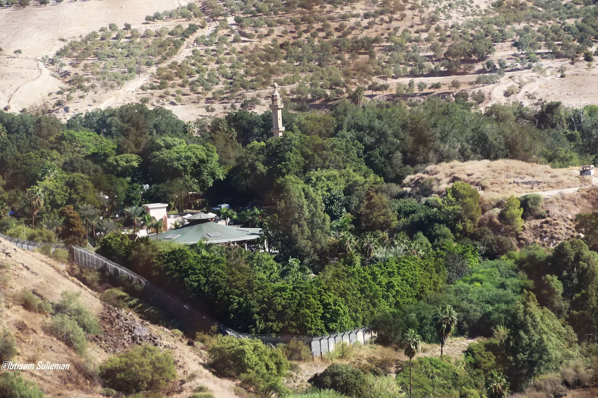
- General view of the village - 2021 - Ibtisam Sulieman
- جولة بين بيوت القرية القديمة--Ibtisam Sulieman
- جولة بين بيوت القرية القديمة--Ibtisam Sulieman #2
- جولة بين بيوت القرية القديمة--Ibtisam Sulieman #3
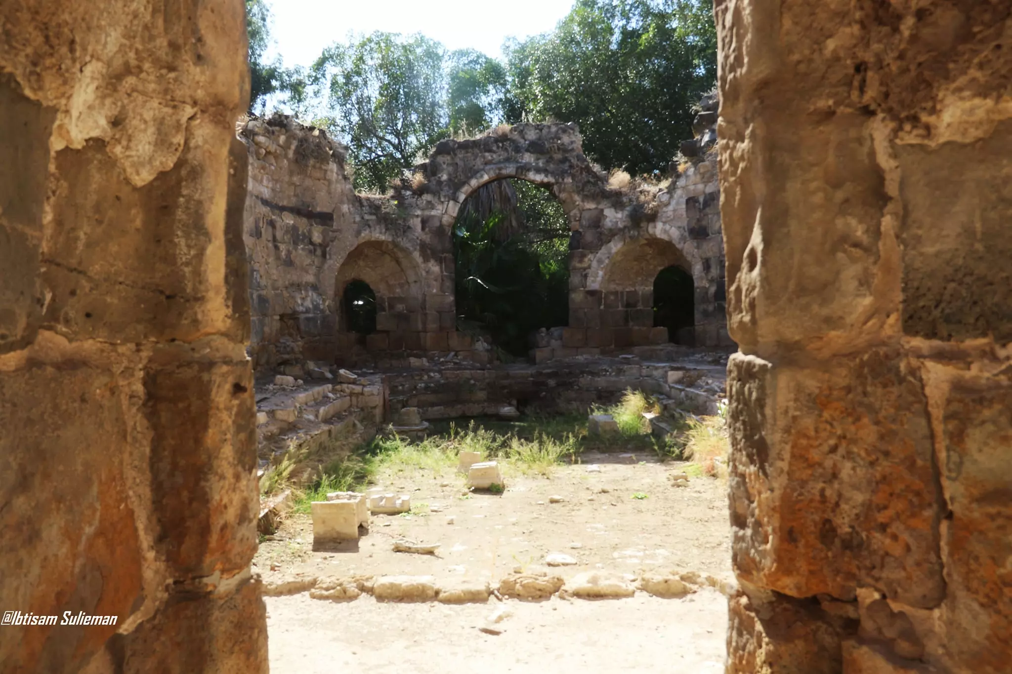
- مسجد الحمّة المهجرة

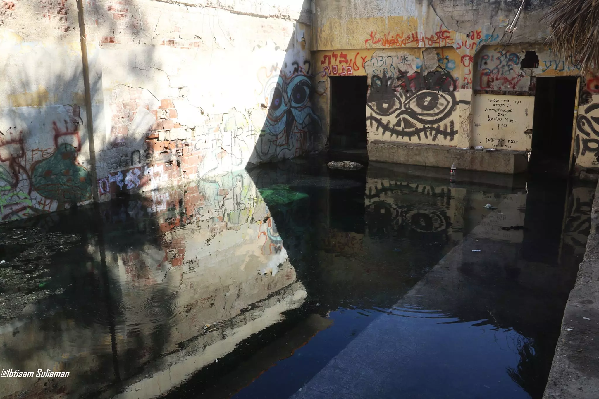
- The "civilized" obliterated our village except for the village mosque, May 7th, 2022
- The "civilized" obliterated our village except for the village mosque, May 7th, 2022 #2
- The "civilized" obliterated our village except for the village mosque, May 7th, 2022 #3
- The "civilized" obliterated our village except for the village mosque, May 7th, 2022 #4
- The "civilized" obliterated our village except for the village mosque, May 7th, 2022 #5
- The "civilized" obliterated our village except for the village mosque, May 7th, 2022 #6
- The "civilized" obliterated our village except for the village mosque, May 7th, 2022 #7
Want to browse more? 80,000 pictures were grouped in these gallaries:
| Display Name | Clan/Hamolah | Country of Residence |
No links have been shared yet, be free to the first to share the first link.
 Fake Valor: Why Did Zionist Jews Hoist Nazis Flag on Their Ships in the 1930s?
What is new?
-
Facts About Oct. 7th Gaza Raid

-
Remined Us Please: Who Did Rape Whom? Was it Palestinians who raped Israelis? Or, was the other way around? You'll be the judge
-
When Prof. Edward Said was invited to debate Bibi Netanyahu in the 1980s, watch what happened!
-
Ezra Klein of the NY Times on the "Jewish Race".
-
Abusing Blood Libel!
-
How and why Israeli Jewry has become the most hated cult?
-
Did Israeli Soldiers Activate The Hannibal Direective On Oct. 7th? You Be The Judge
-
Zionist FAQ: Isn't it true that Palestinians don't want peace? Palestinians never accepted the two-state solution
- Facts about Haavara (Transfer) Agreement between Ben-Gurion & Hitler
-
Haavara FAQs: Why Did Zionist Jews Hoist Nazis' Flags on Their Ships in the 1930s?
- Haavara FAQs: When Chaim Weizmann met FDR in mid-1943, why was he silent about rescuing European Jewry?
-
Dear ChatGPT: How did Palestinians resist Napoleon's invasion of their country in 1799?
-
Dear ChatGPT: Gaza had a vibrant Jewish community in the mid-17th century. What happened to them?
-
Dear ChatGPT: Why did the Jewish Agency suppress news of the Holocaust during WWII?
-
Video Playlist: Jews share their DNA tests to end the conflict for good.
-
A Tale of Two Conflicts: Examining the Definition of Genocide
-
Prof. Abraham Polak And The Suppressed History of the Khazars and European Jewry
-
How Ronald Reagan would have framed the genocide in Gaza if he were still alive?
-
Haavara FAQs: Let us do the math: how many German Jews did The Haavara Agreement save?
-
Zionist FAQs: The Hebron Massacre of 1929, "clearly proves" that Palestinians are antisemitic, how could you deny it?
-
Zionist FAQs: Why Anti-Zionist Is Not Antisemitism?
-
Zionist FAQs: Isn't it true that the KGB created Palestinian Nationalism in the early 1960s?
- Zionist FAQs: Muslims are killing Muslims all the time; why are Israeli Jews being singled out in the media?
- Zionist FAQs: How is Israel an apartheid state when 20% of its citizens are Arabs who enjoy full rights?
-
Haavara FAQs: Why Did Dorothy Thompson Flip From A Zionist Advocate to A Silenced Dissenter?
-
Haavara FAQs: Analysis of Herzl's Uganda Scheme and how it could have saved millions of Jews.
-
Haavara FAQs: Why did Hayim Greenberg describe American Jewry as "morally bankrupt" in early 1943?
-
Haavara FAQs: What if the Evian Conference was a resounding success? What would have been the impact of saving European Jewry on Zionism?
- Haavara FAQs: What if the six million were saved, how that would have impacted the Zionist project?
-
Haavara FAQs: How did Zionist leaders react when Europe's Jews lingered in the DP camps after WWII ended?
-
Why does the American Jewish community repeat lies that David Ben-Gurion had debunked before he died?
-
Who has the power to rename the Tatar/Khazar Gene Marker to Jewish IV?
-
Zionist FAQs: Why won't Egypt, Syria, and Jordan take their people back? Jews are indigenous to Palestine, and Arabs immigrated after Jews developed the country. Arabs should leave.
-
Haavara FAQs: Did Hitler and the Nazis conflate between Judaism and Zionist? If that wasn't case, then why?
-
Haavara FAQs: Winston Churchill and antisemitism, a collection of articles written Churchill.
-
Haavara FAQs: Broken by country, how many Jews survived vs. killed during the Holocaust?
-
Haavara FAQs: Why did European Jews vote with their feet and to immigrated to the Americas, not Palestine, after WWII?
-
Watch this American Jewish Girl describing Israeli Jews' cognitive dissonance like no other in under two minutes
-
Haavara FAQs: When the Nazis went out of their way to hide the Holocaust, Israeli Jews did the exact opposite by broadcasting their genocide of Gazans. But why?
-
Haavara FAQs: How Zionist Jews went out of their to show their appreciation to Nazism and Fascism?
- Haavara FAQs: Why Zionist leaders were against bombing the death camps & the Railroads leading to them?
-
Haavara FAQs: Hitler's message to the British and American people: If Jews are such noble citizens and you care about them, how come you're not letting them in? I will gladly ship them to you at my expense, even on luxury liners!
-
A shortlist of Zionist and Israeli false flag operations in the name Jews.
-
The Most Moral Army
- The Land of Kapos (Israel): Where the brave are boycotted and Kapos walk free.
- Why did early Zionists often named their communal enterprises "colonial"?
- Zionist Relations with Nazi Germany by Faris Glubb
-
Two NY Times advertisements by Zionists in the early 1943 that exposes Zionists' treason at the height of the calamity
- Facts Not Lies about the Palestinian-Israeli Conflict.
- Site's pictures have been categorized
- Campgain Against Lice
- A Survey of Palestine, the official source about Palestine before Nakba produced by the British Mandate; over 1200 pages.
- Satellite View & Google Earth: Over 6,000 placemarks identifying all destroyed towns, W. Bank & Gaza Strip Towns, & refugee camps.
- PalestineRemembered.com and its Nakba Oral History Project were featured on al-Jazeera Satellite TV.
- Nakba Oral History Video Podcast:
 Over 700 Oral History interviews (including 3,500+ hours of recording) can be viewed online.
 - Palestine Village Statistics Project
- Gaza Jail Break
- النسخة العربية للموقع الان متوفرة
- Videos: Documenting the destroyed villages in video: Tracing all that remains since Nakba.
- Videos: Responding to Zionist Propaganda
- Interview: The ethnic cleansing of Palestine: George Galloway interviews Israeli Historian Ilan Pappe.
- For Palestinians, memory matters. It provides a blueprint for their future By George Bisharat.
- Zionist FAQ now available in Hebrew שאלות שציונים שואלים, עכשיו בעברית
- Video: The Stephen Walt and John Mearsheimer report on the influence of the Israel Lobby on U.S. Foreign Policy
- The Palestinian-Israeli conflict for beginners
