| PalestineRemembered | About Us | Oral History | العربية | |
| Pictures | Zionist FAQs | Haavara | Maps | |
| Search |
| Camps |
| Districts |
| Acre |
| Baysan |
| Beersheba |
| Bethlehem |
| Gaza |
| Haifa |
| Hebron |
| Jaffa |
| Jericho |
| Jerusalem |
| Jinin |
| Nablus |
| Nazareth |
| Ramallah |
| al-Ramla |
| Safad |
| Tiberias |
| Tulkarm |
| Donate |
| Contact |
| Profile |
| Videos |
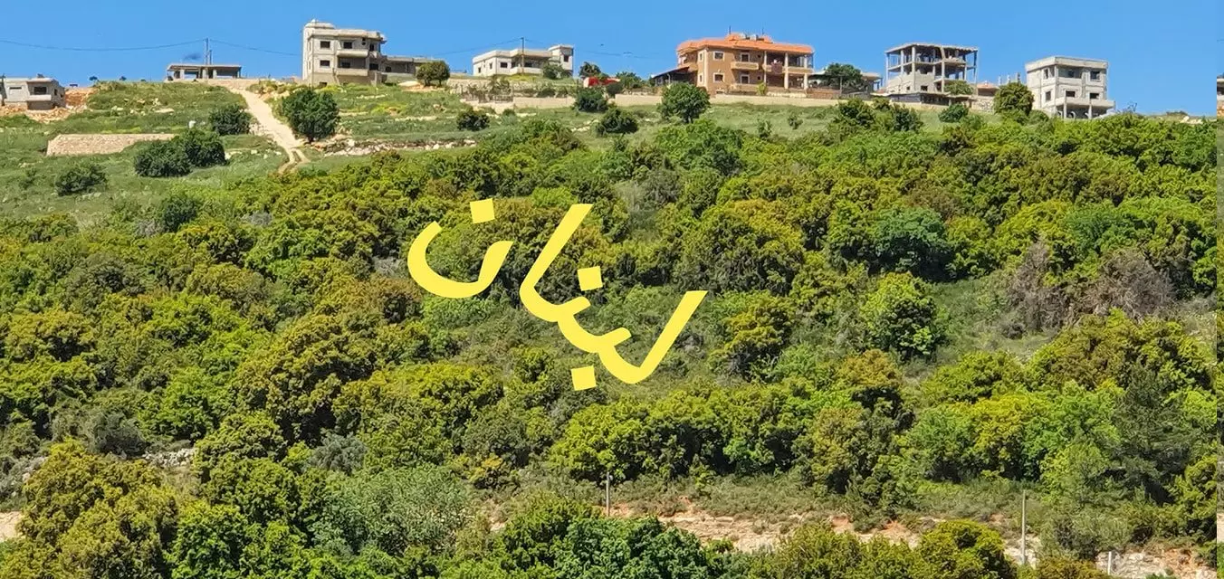
Welcome To Hunin - هونين (הונין)
|
District of Safad
Ethnically cleansed days ago |
العربية Google Earth |
 |
Gallery (112) |
- Statistics & Facts
-
Before & After

- Satellite View
- Articles 4
- Pictures 112
- Mayrters & Prisoners 1
- Oral History 3
- Members 5
- All That Remains
- Wikipedia
- Videos 2
- Guest Book 21
- Links 1
| Statistic & Fact | Value | |||||||||||||||||||||
| Occupation Date | May 3, 1948 | |||||||||||||||||||||
| Distance From District | 28.5 (km) North East of Safad | |||||||||||||||||||||
| Elevation | 650 (meters) | |||||||||||||||||||||
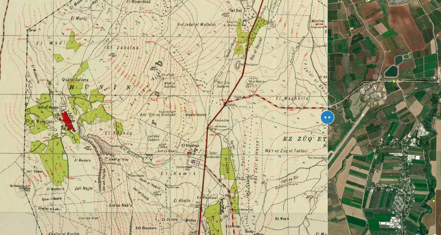
| Before & After Nakba, Click Map For Details |
||||||||||||||||||||||
|
||||||||||||||||||||||
| Map Location | See location #8 on the map View from satellite |
|||||||||||||||||||||
| Military Operation | Operation Yiftach (commanded by the ethnic cleansing champion Yigal Allon) | |||||||||||||||||||||
| Attacking Units | The Palmach's First Battalion | |||||||||||||||||||||
| Defenders | Local Palestinian militia | |||||||||||||||||||||
| Acts of Terror | Massacre occured by Zionist troops against the town's inhabitants. | |||||||||||||||||||||
| Exodus Cause | Fear of Jewish attack, or of being caught in the fighting | |||||||||||||||||||||
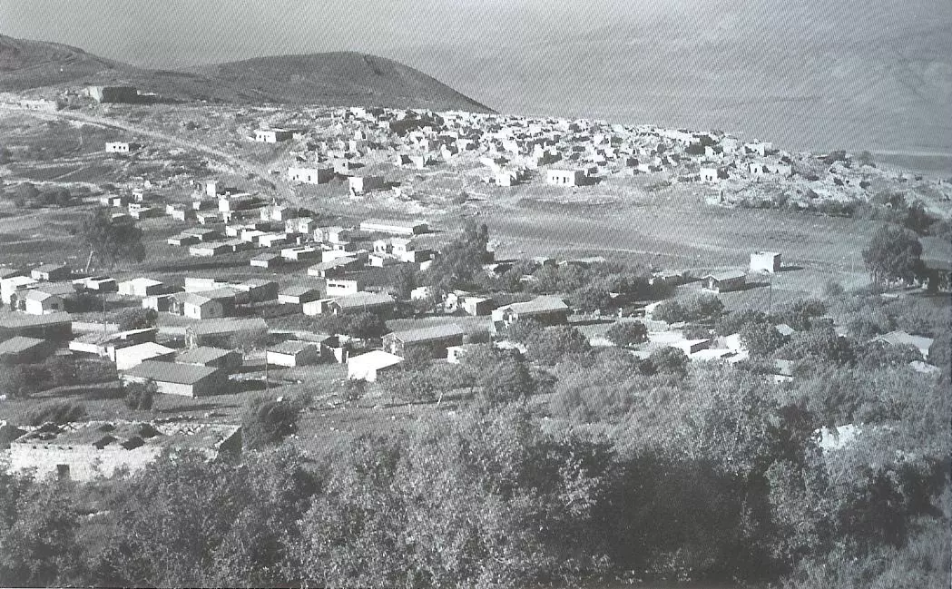
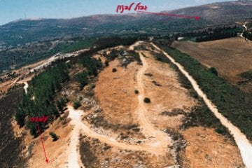
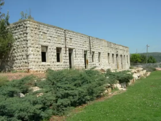
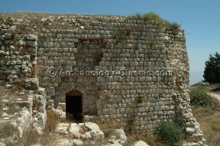
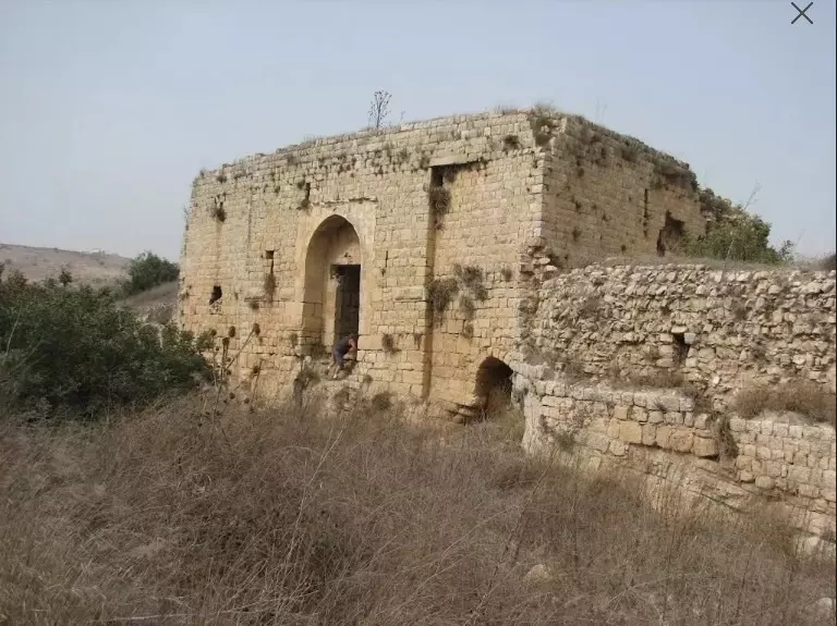
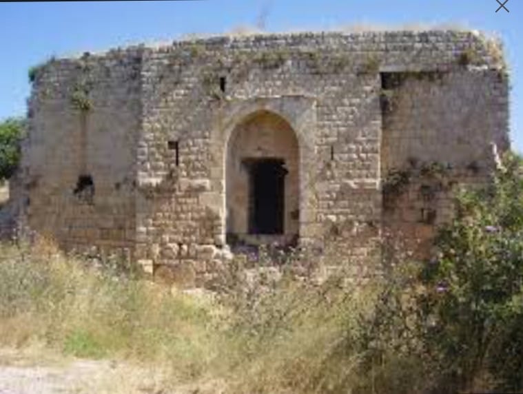
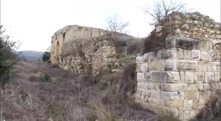
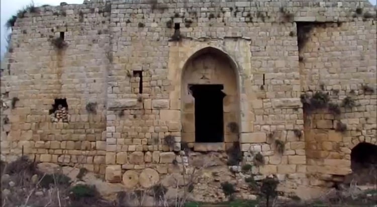
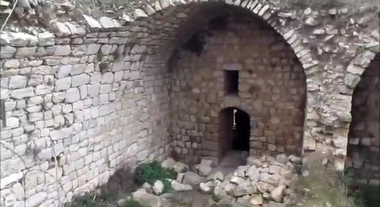
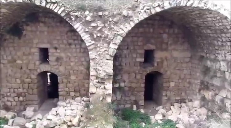
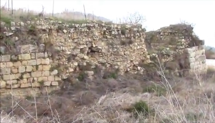
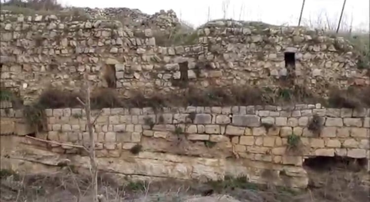
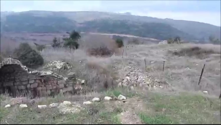
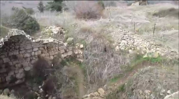
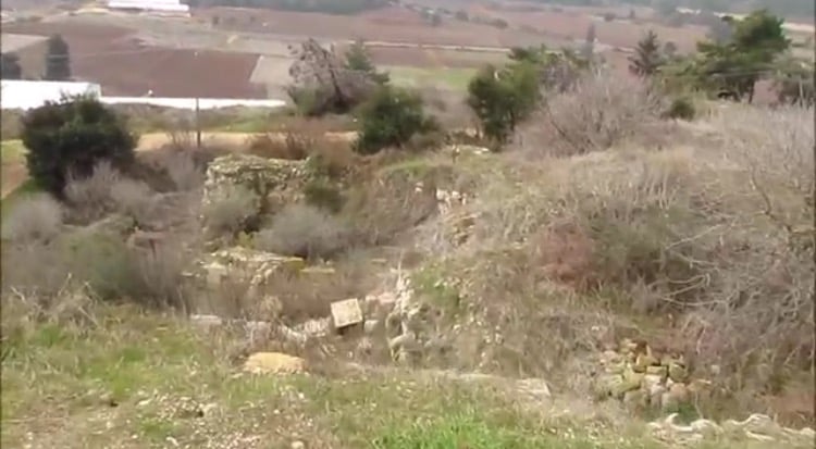
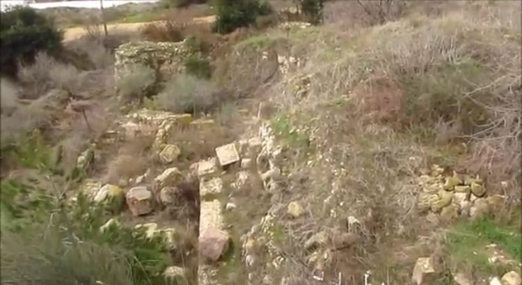
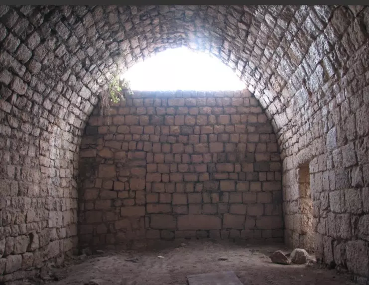
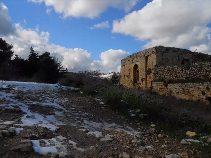
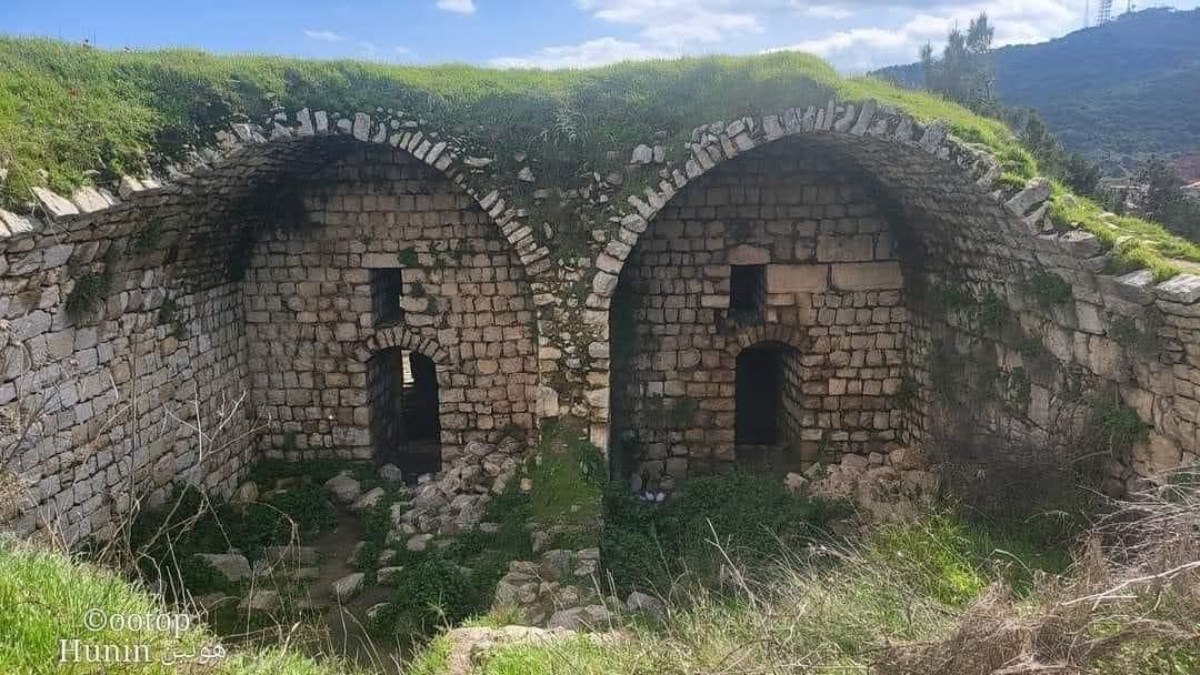
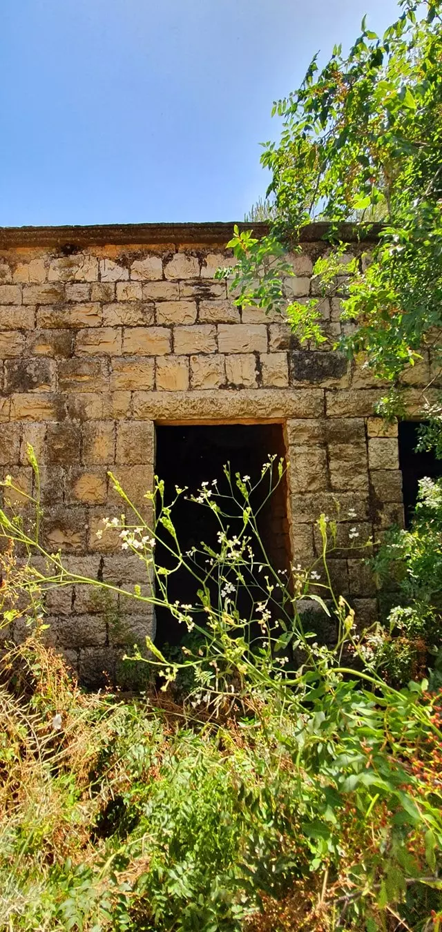
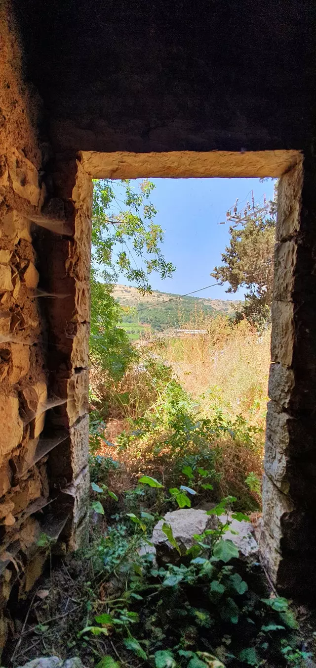
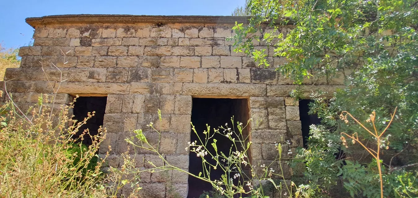
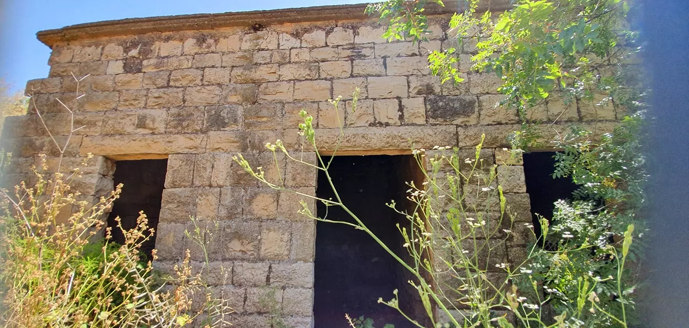
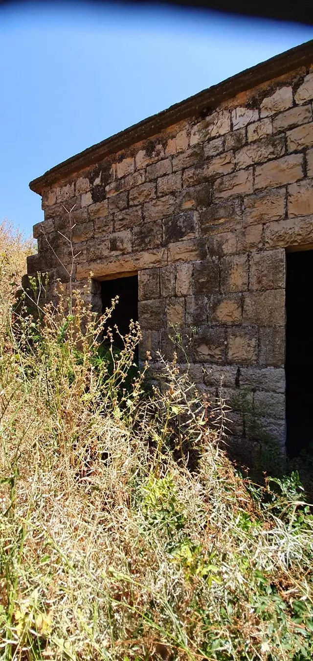
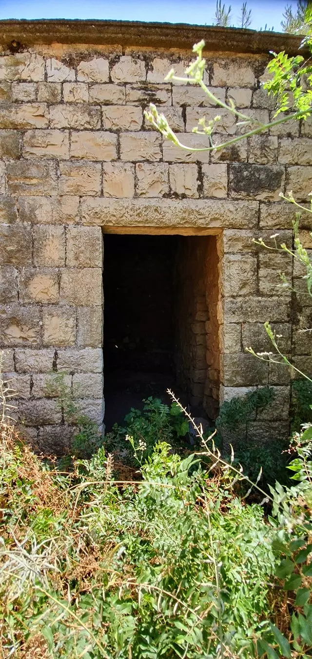
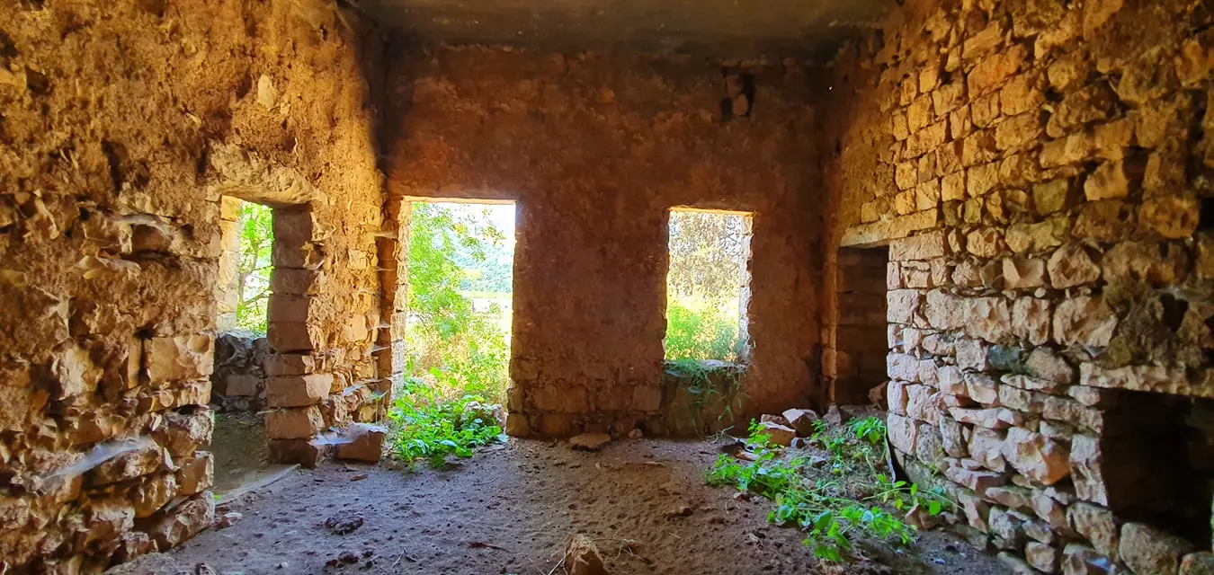
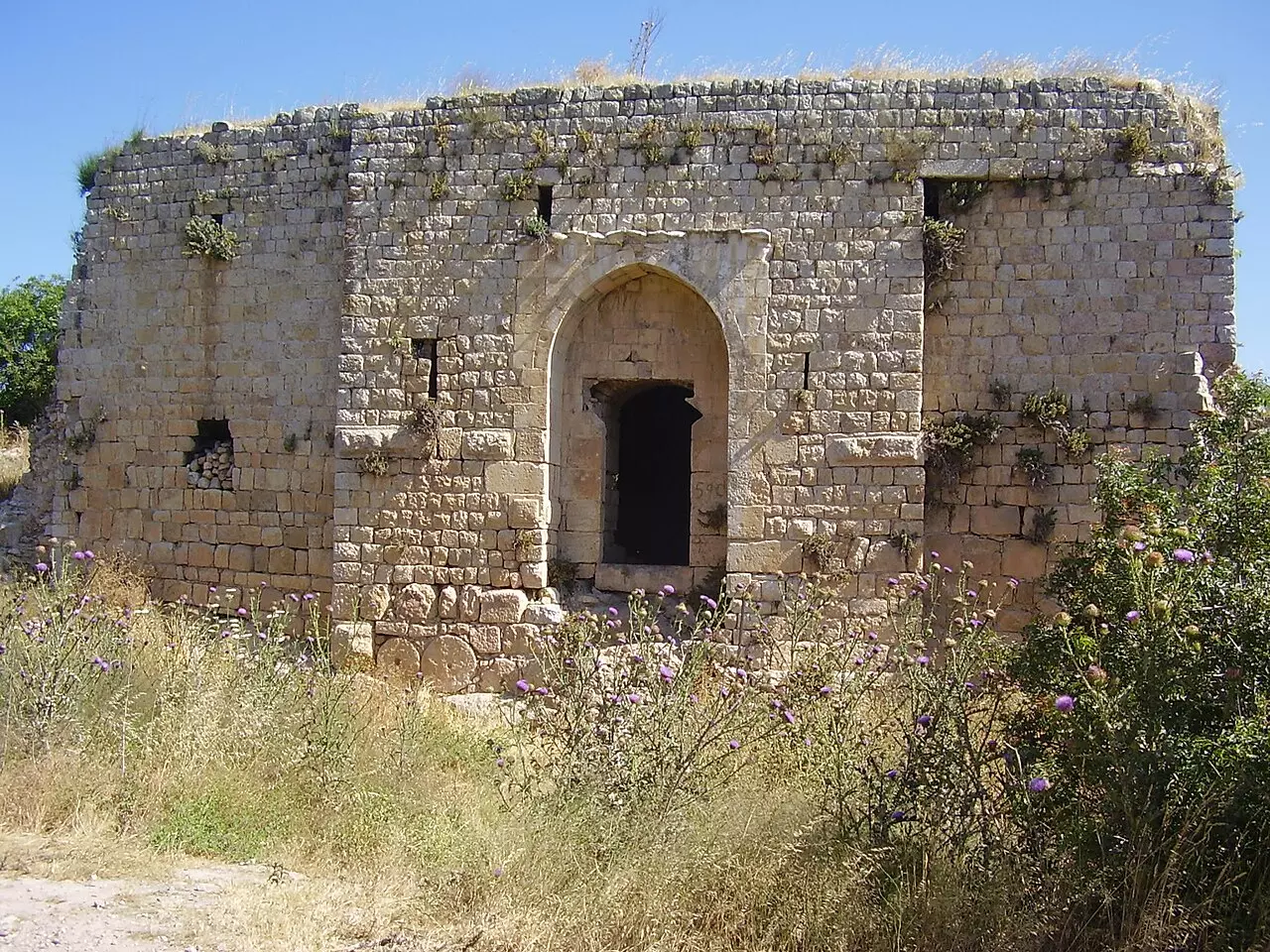
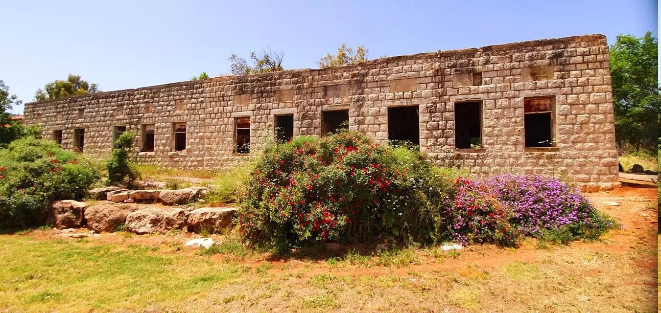
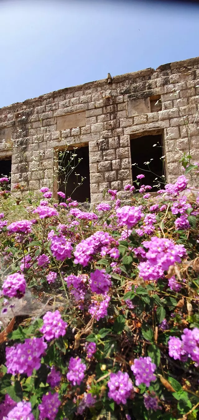
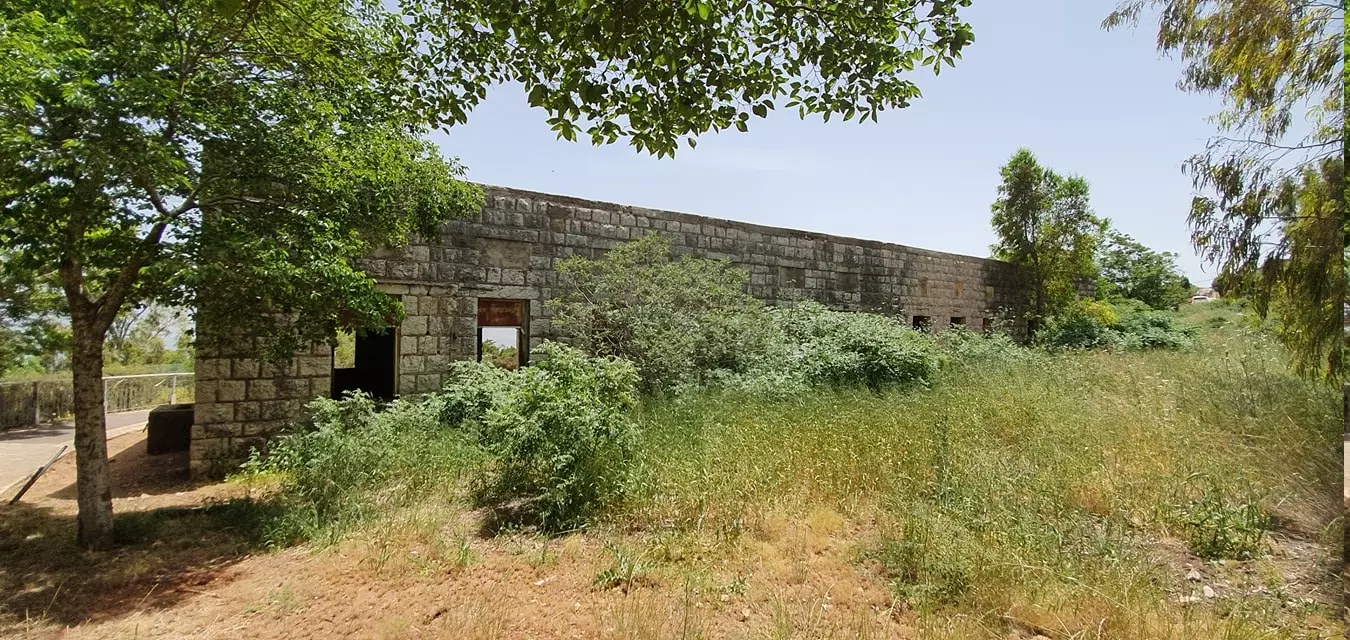
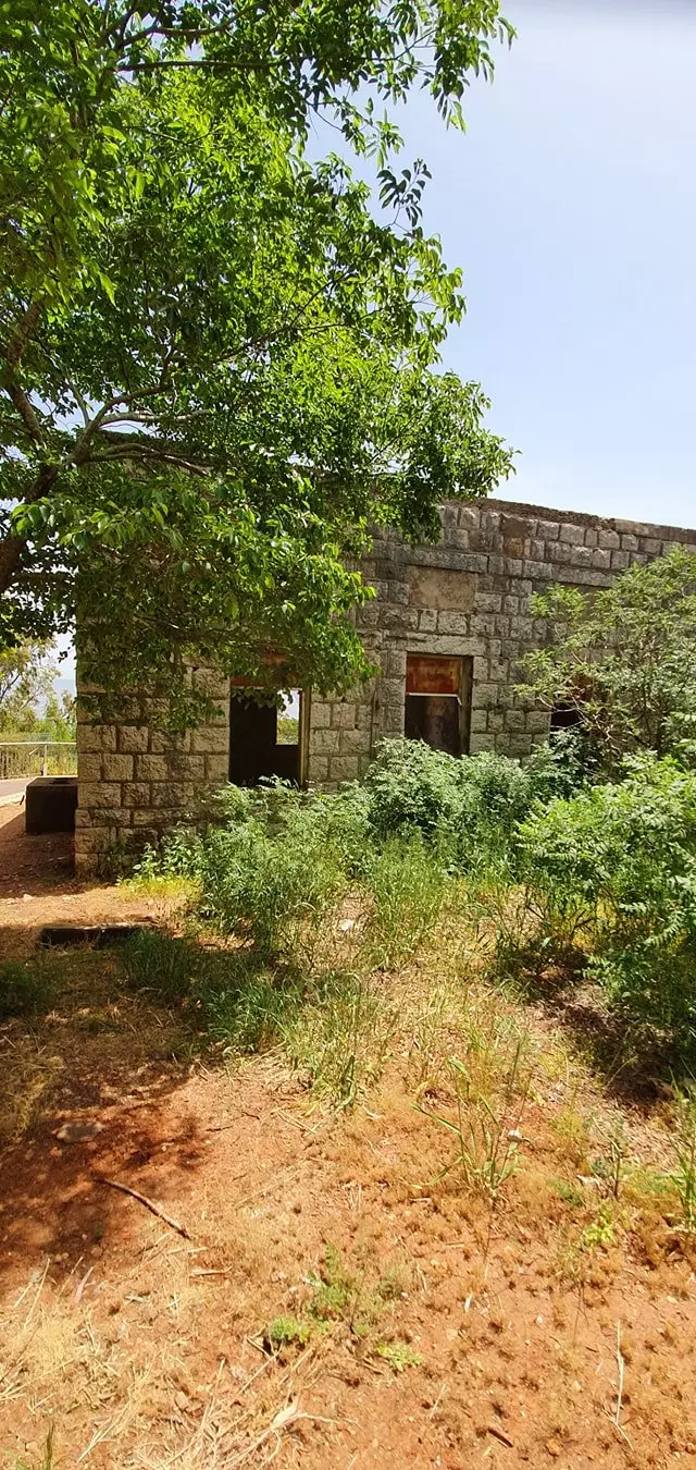
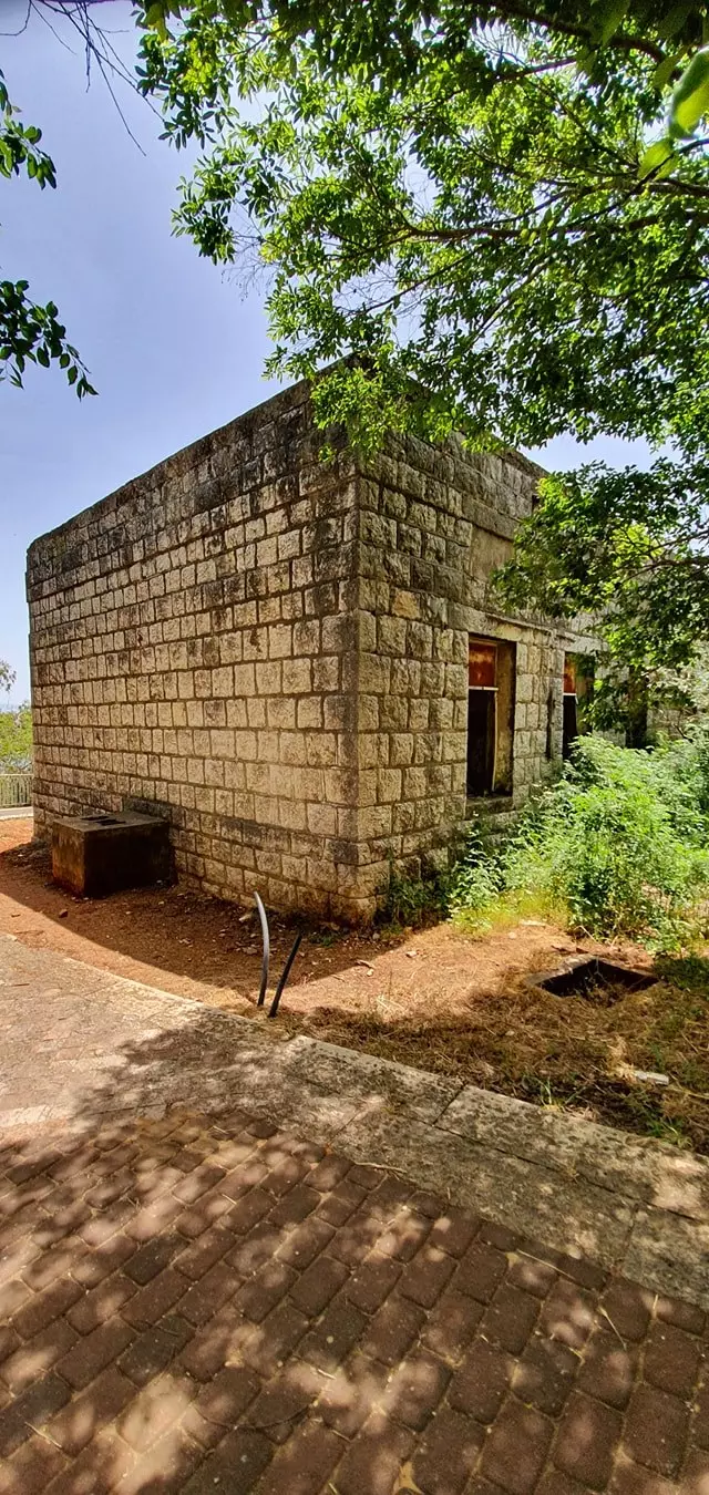
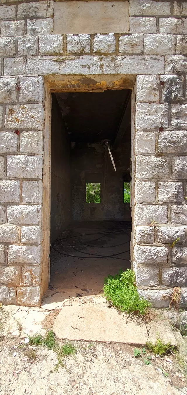
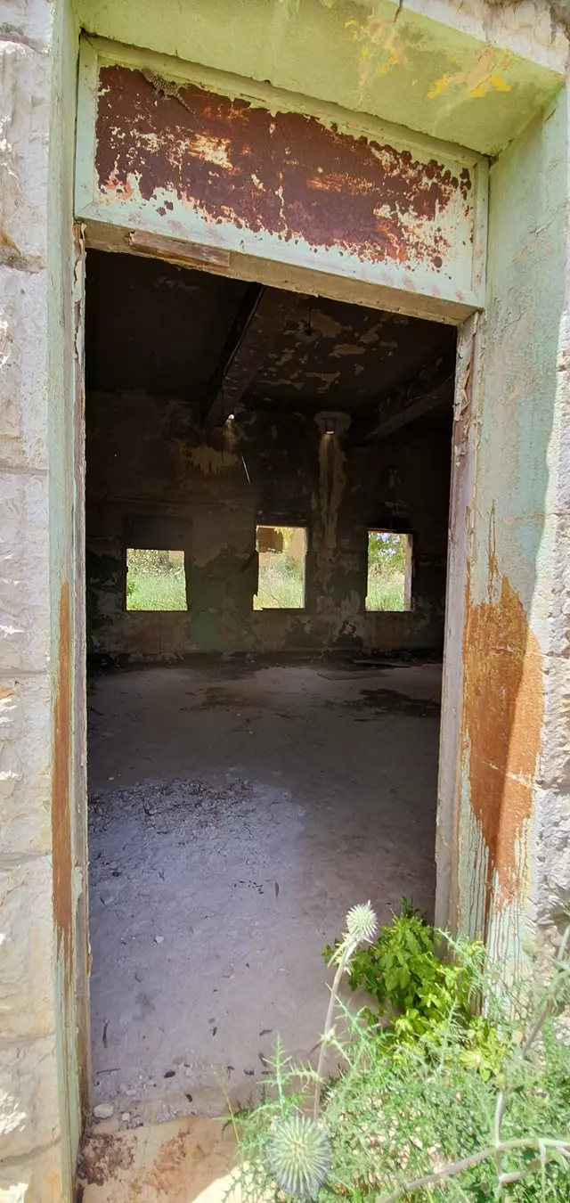
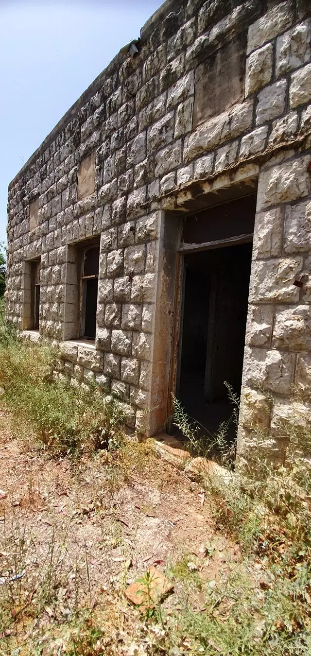
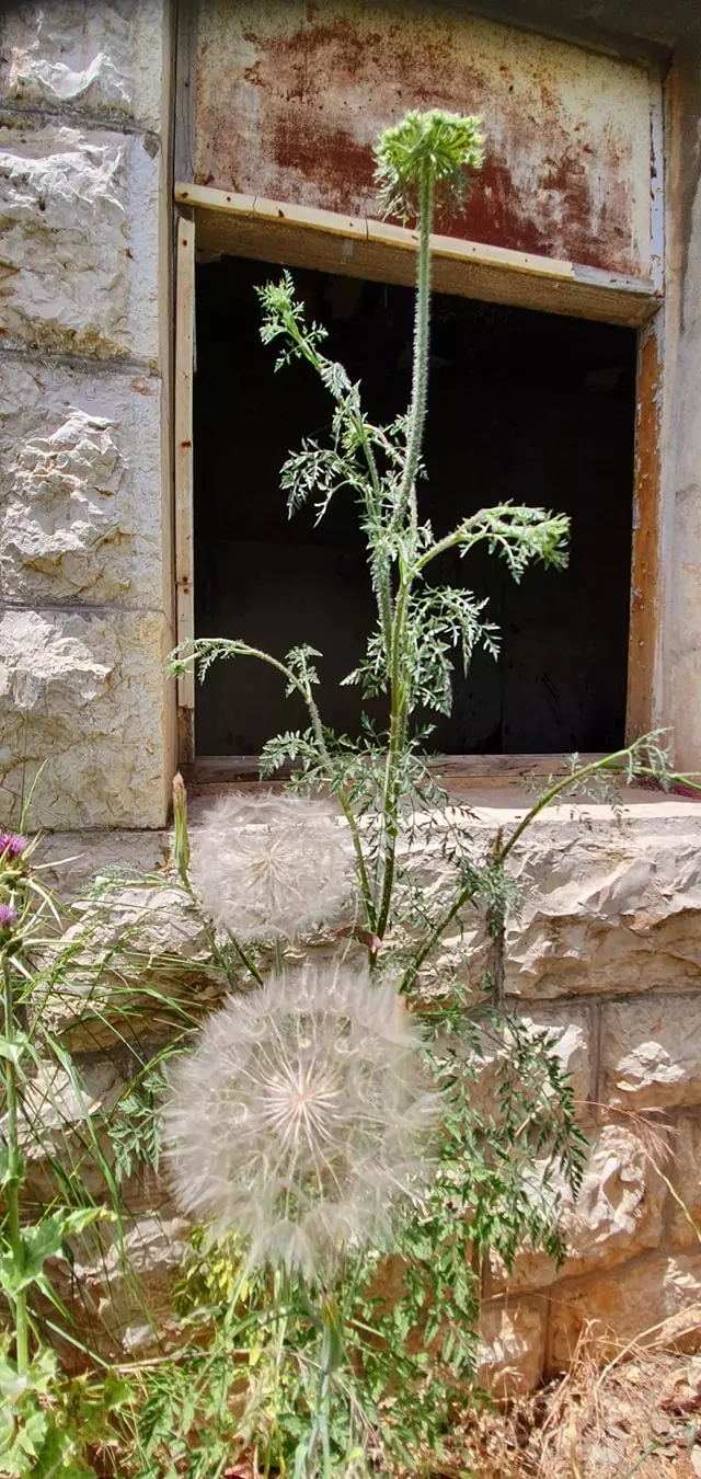
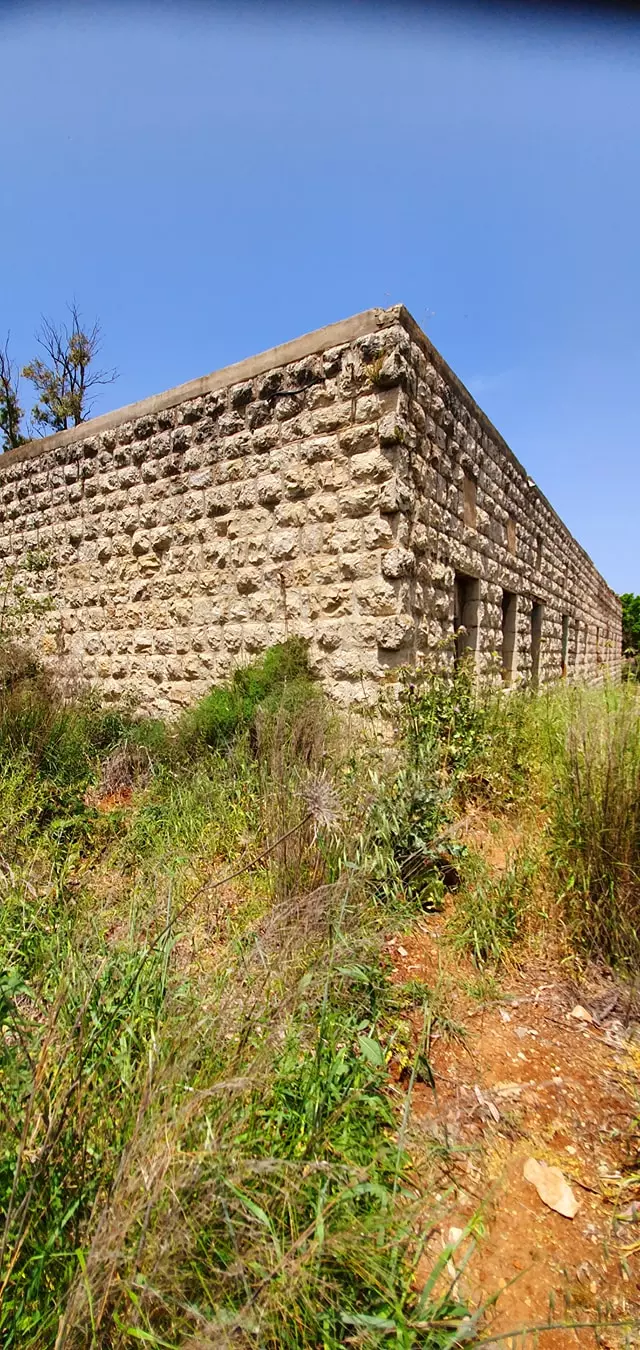
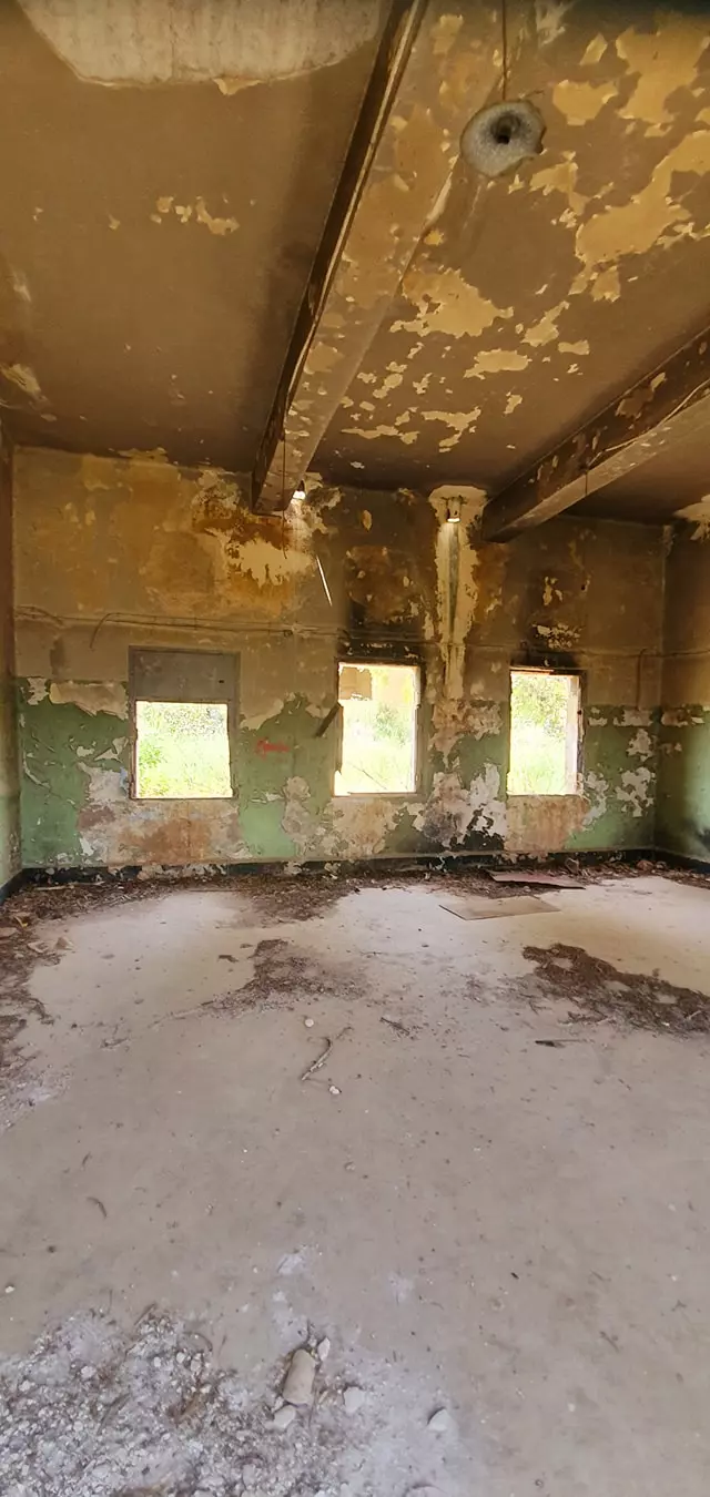
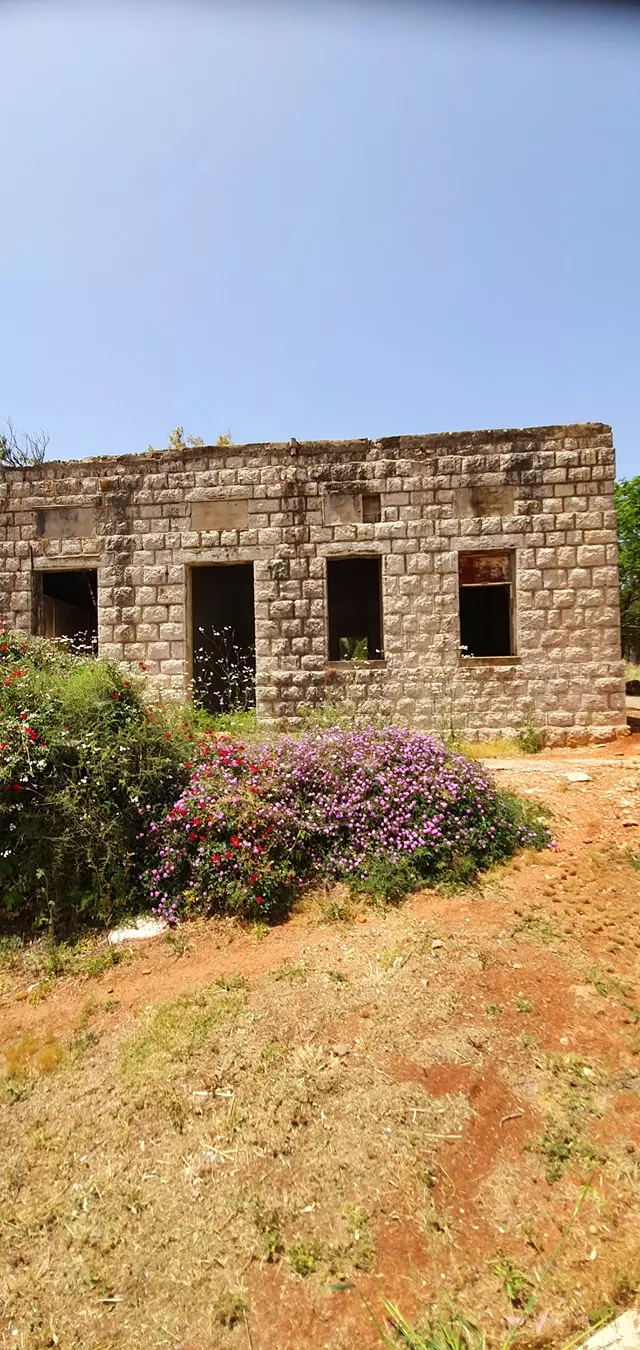
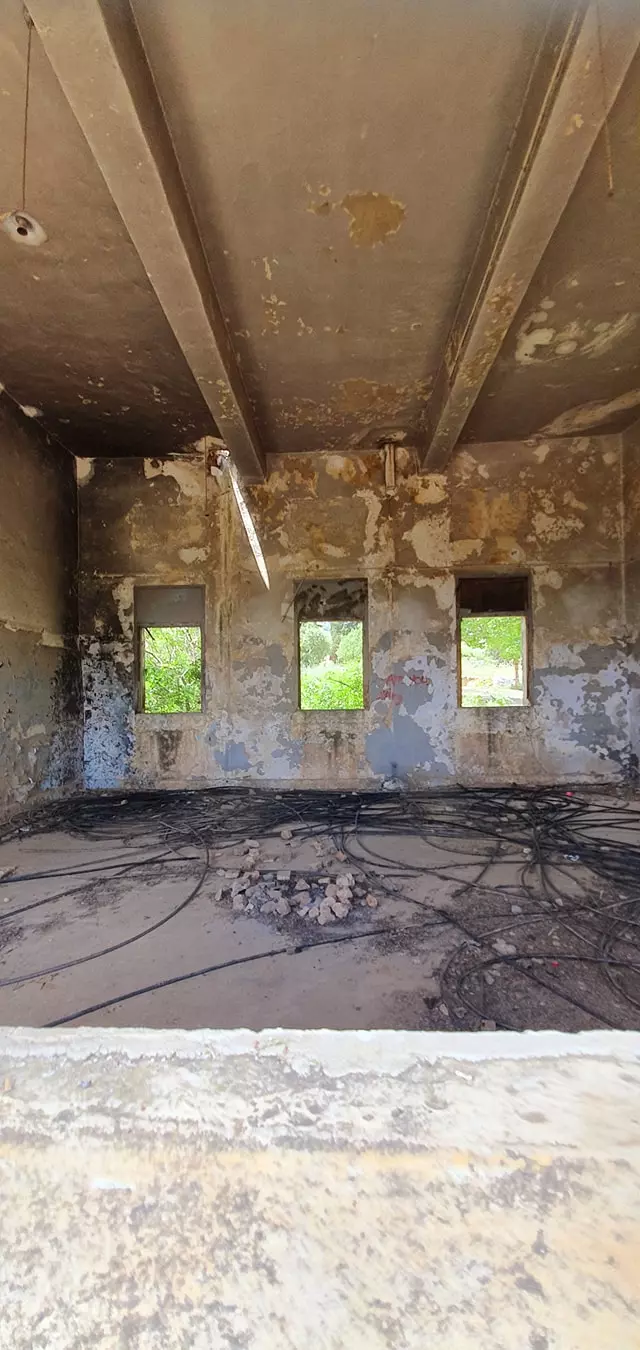
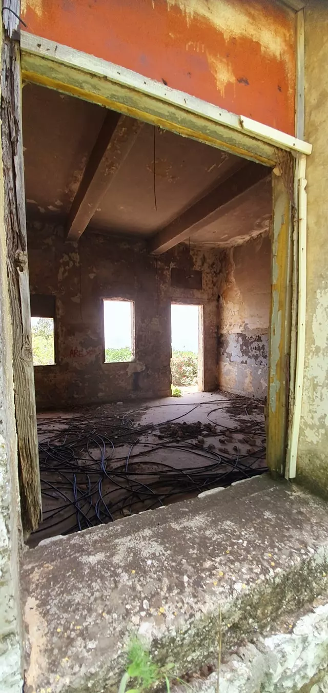
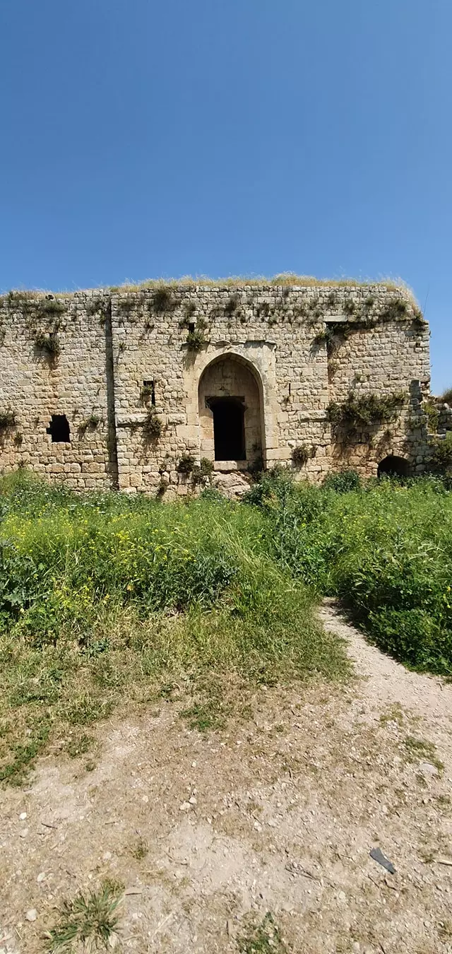
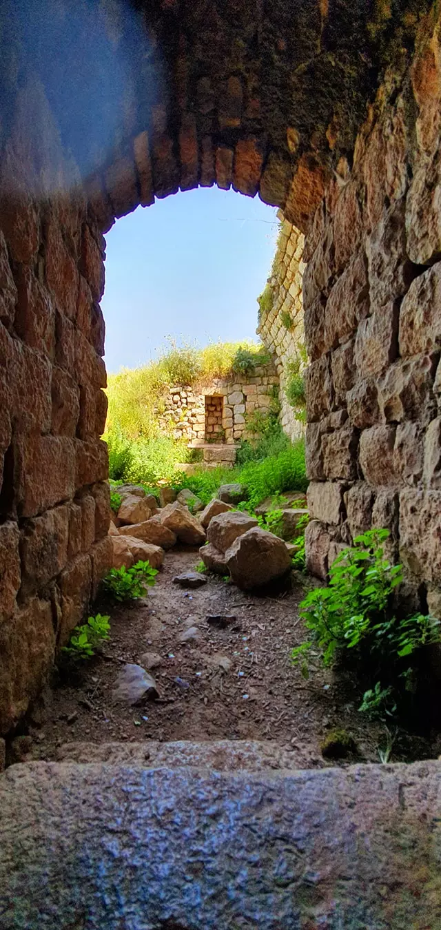
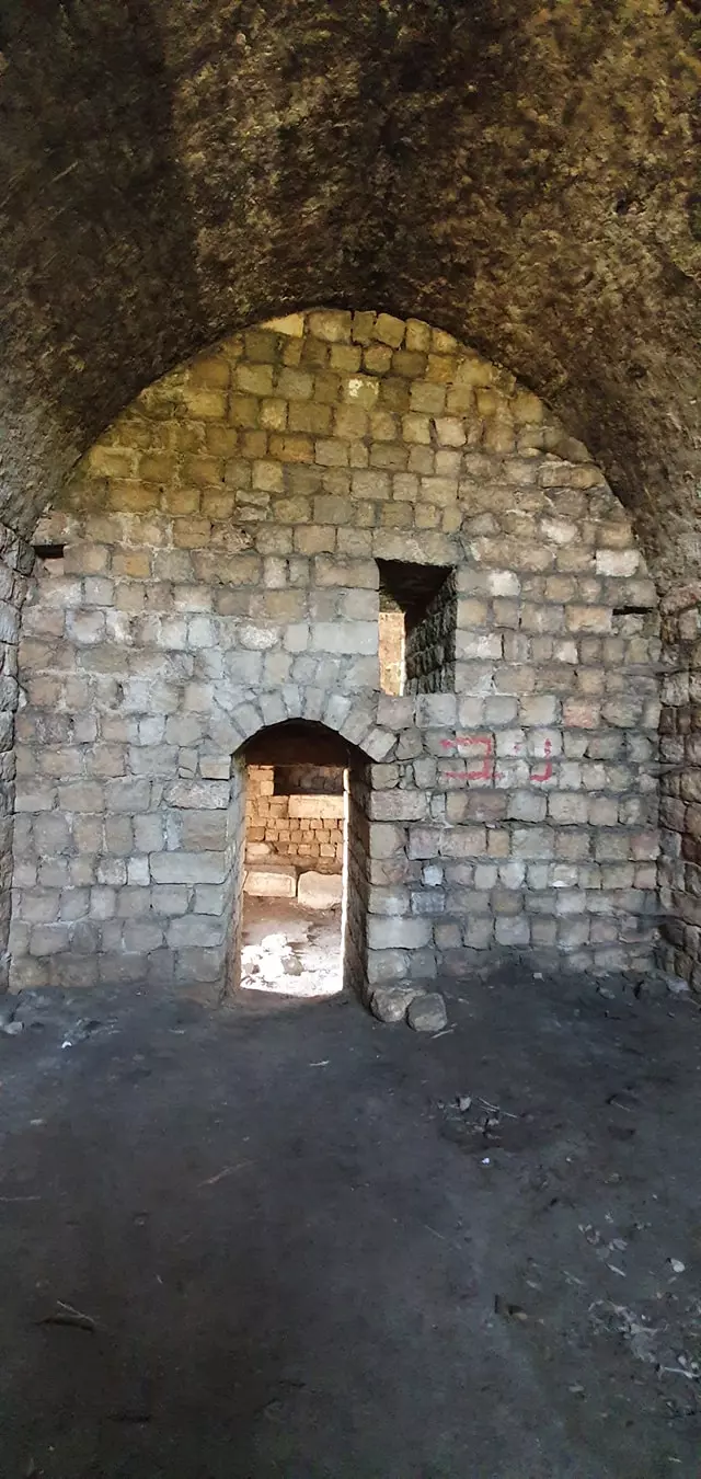
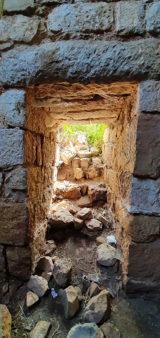
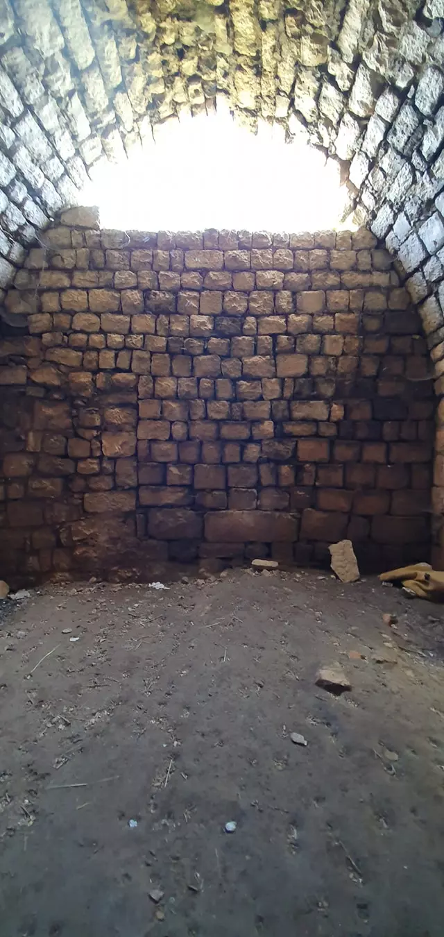
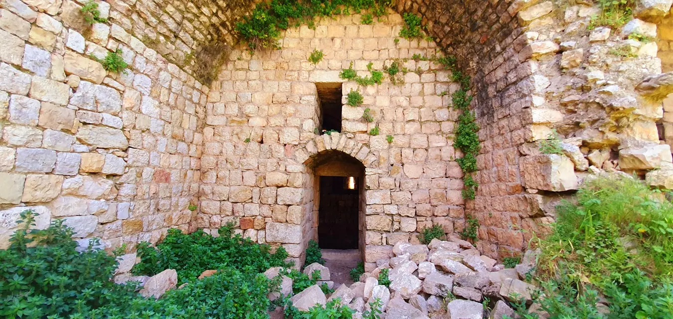
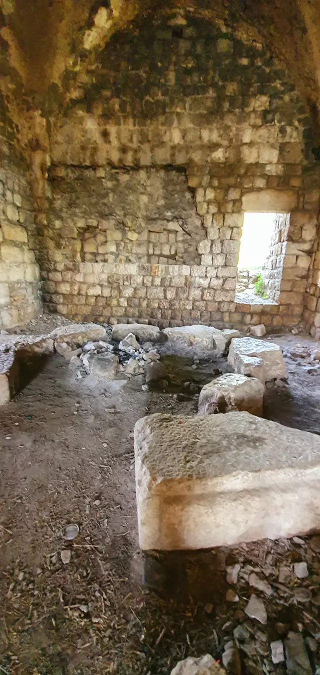
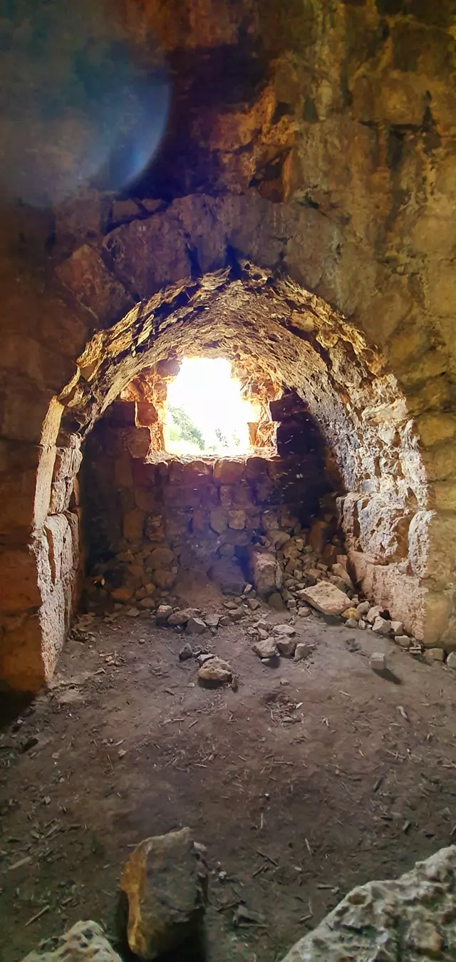
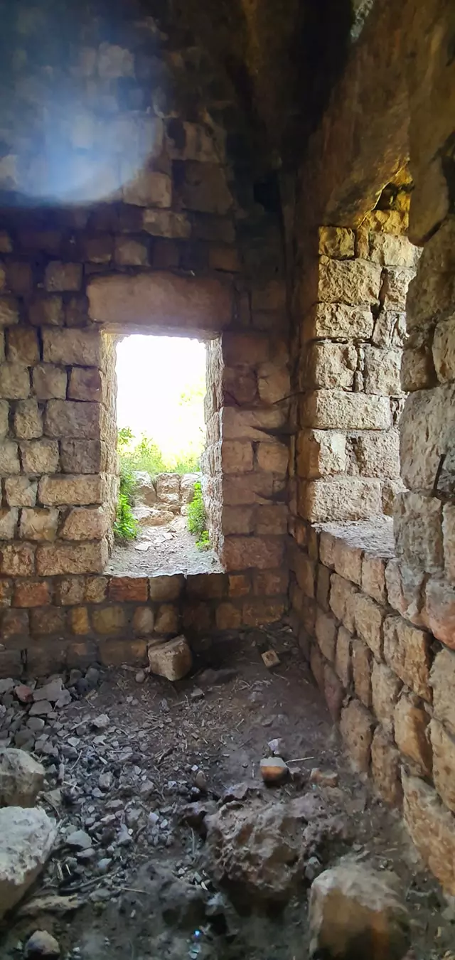
| Village Temains | The village has been mostly destroyed with the exception of the boys elementary school | |||||||||||||||||||||
| Ethnically Cleansing | Hunin inhabitants were completely ethnically cleansed. | |||||||||||||||||||||
| Pre-Nakba Land Ownership |
**Town Lands' Demarcation Maps |
|||||||||||||||||||||
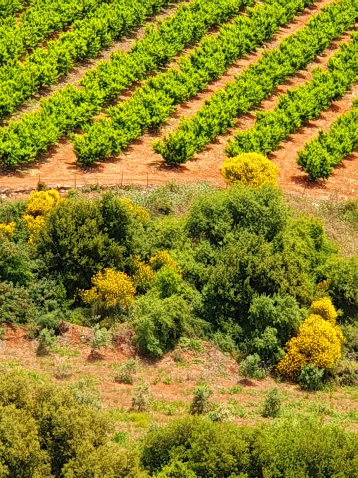
| Land Usage As of 1945 |
|
|||||||||||||||||||||
| Population |
|
|||||||||||||||||||||
| Near By Towns |
||||||||||||||||||||||
|
||||||||||||||||||||||
| Schools | One elementary school for boys (still standing, but it needs renovations guys) | |||||||||||||||||||||
| Places of Warship | One mosque | |||||||||||||||||||||
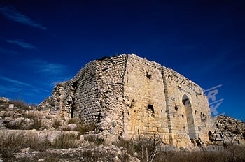
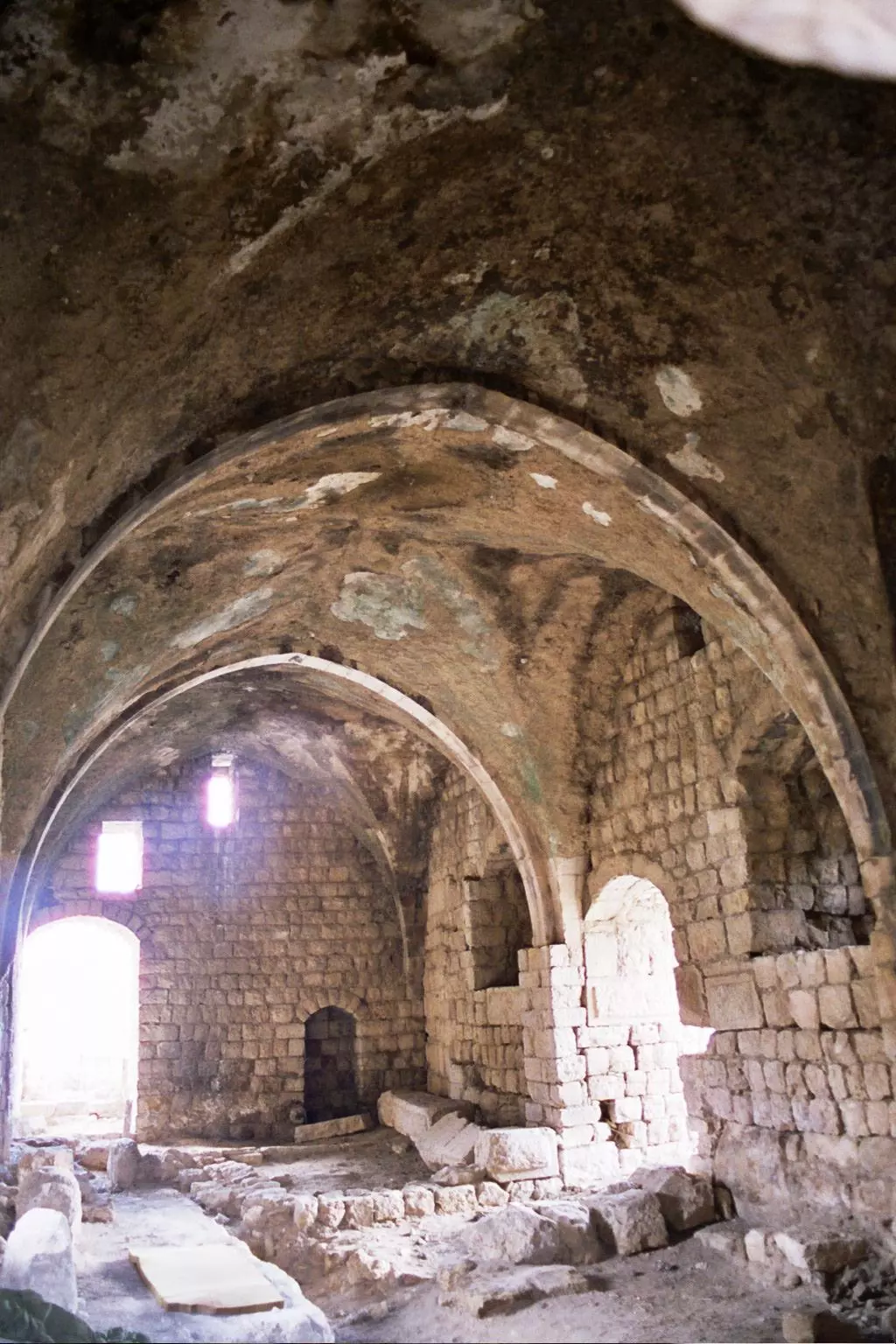
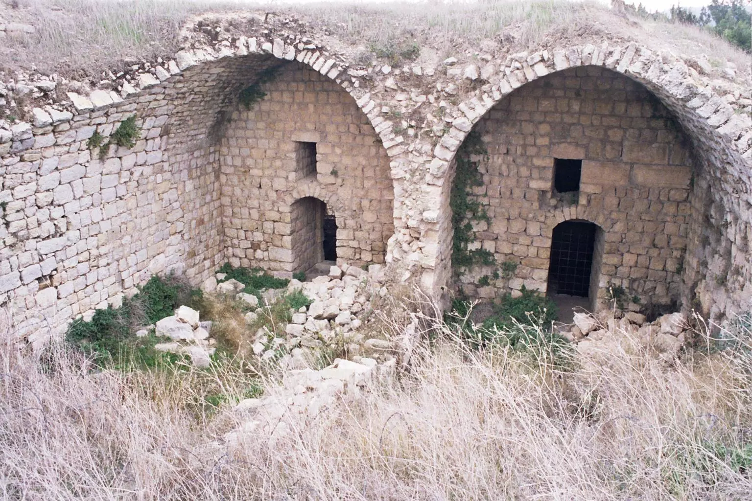
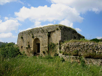
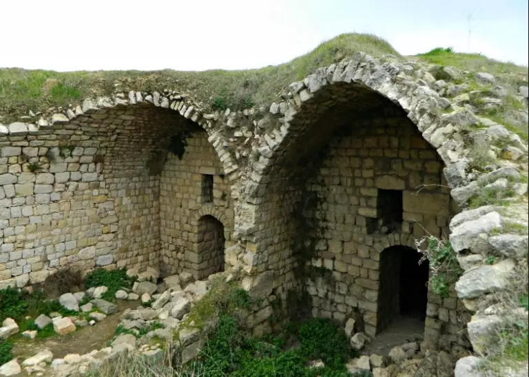
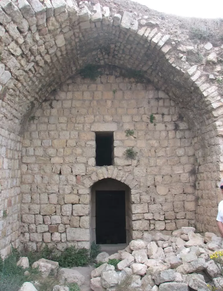
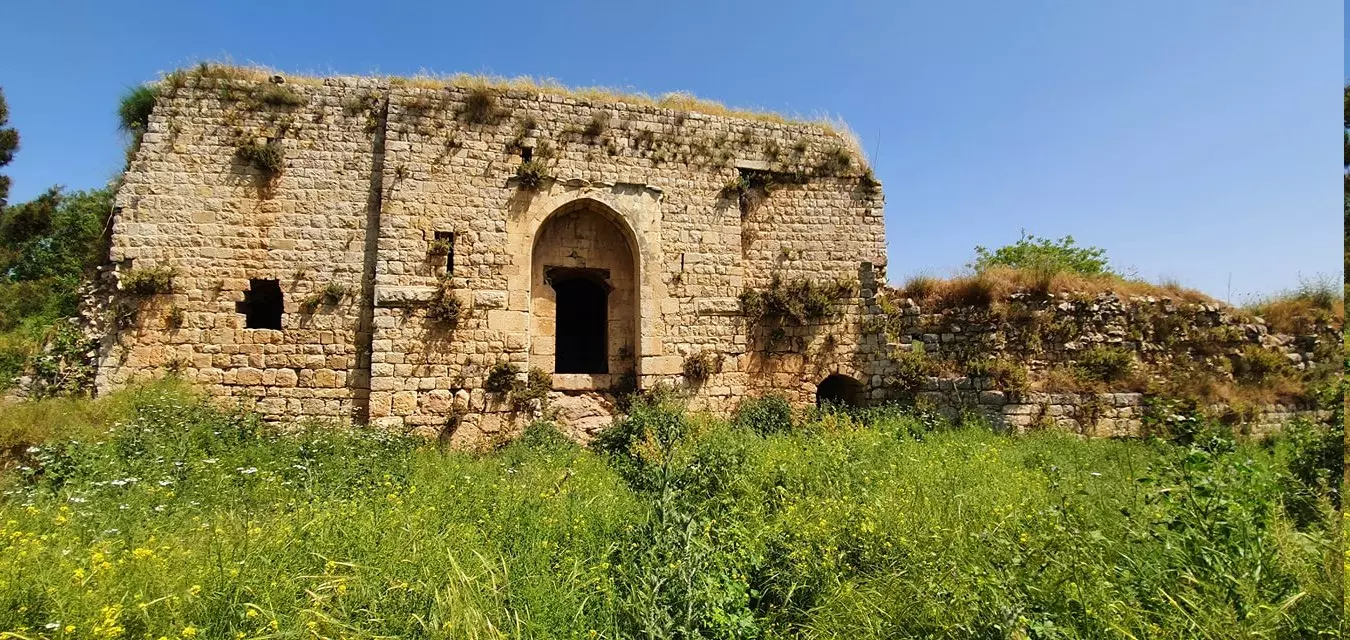
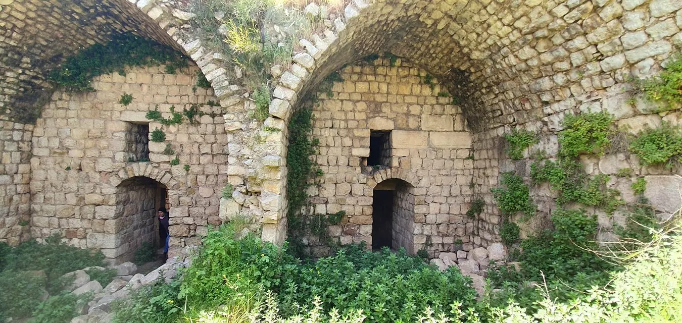
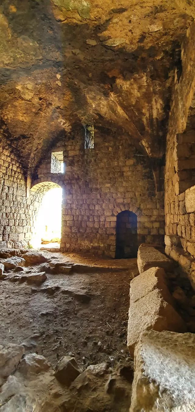
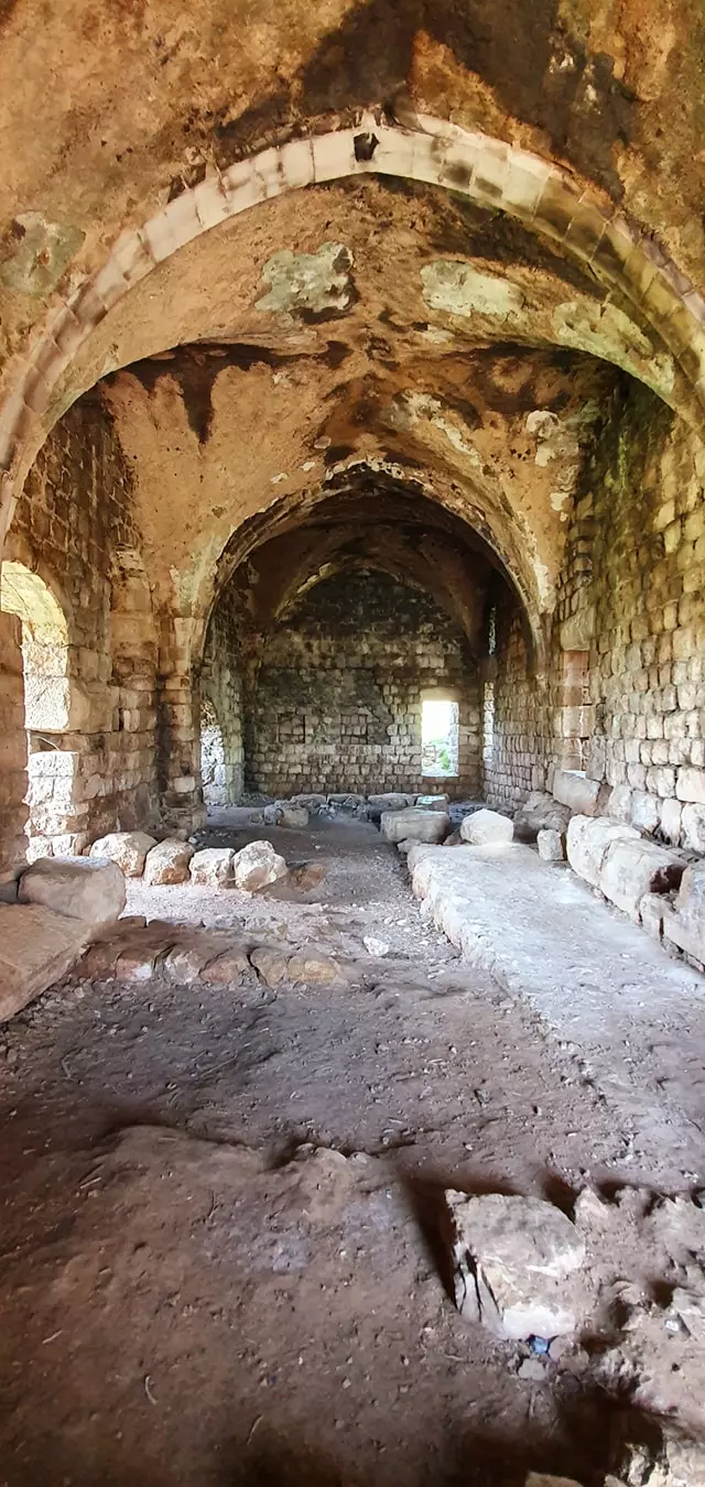
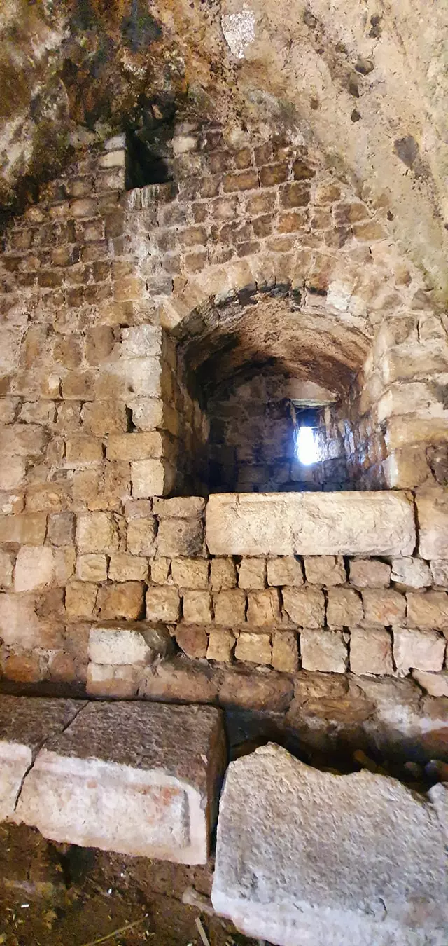
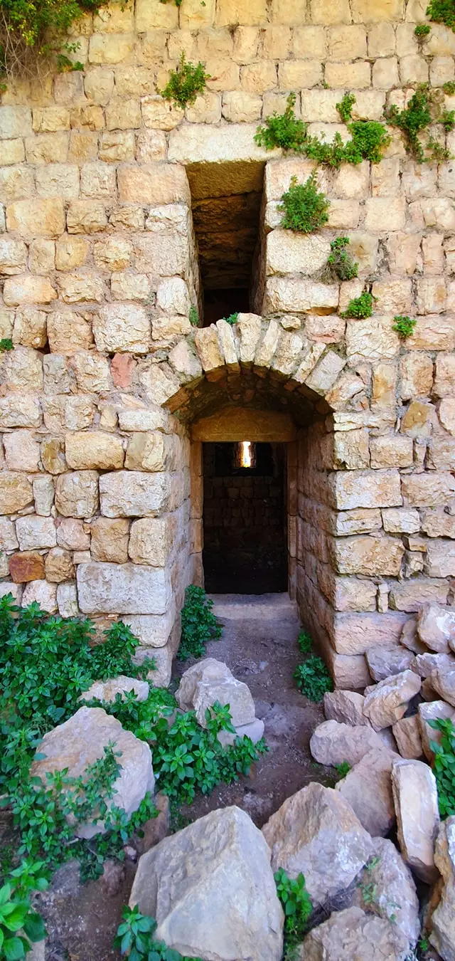
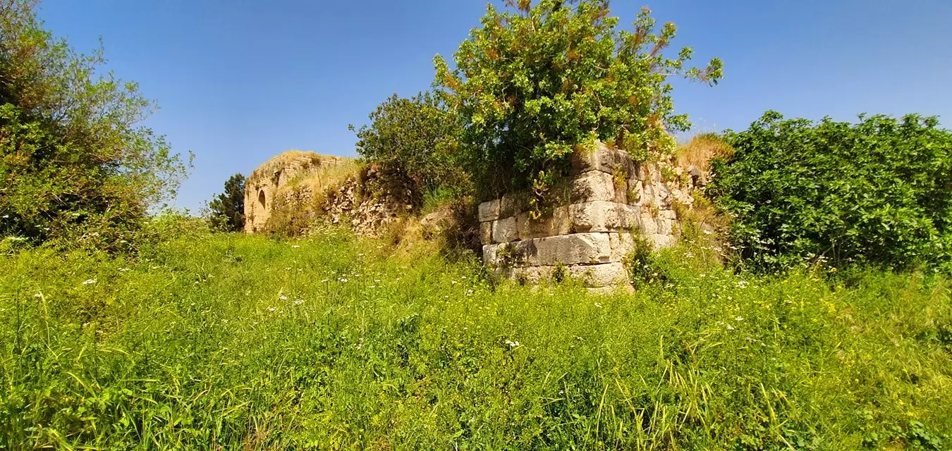
| Archeological Sites | The village contained a Crusaders castle called Chastel Neuf | |||||||||||||||||||||
| Exculsive Jewish Colonies That Usurped Village Lands |
Misgav 'Am and Margaliyyot (settled by Iraqi and Yamani Arab Jews) | |||||||||||||||||||||
| Featured Video | ||||||||||||||||||||||
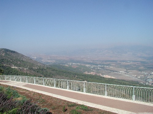
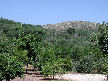
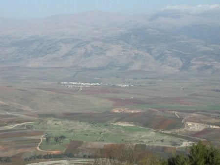
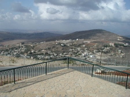
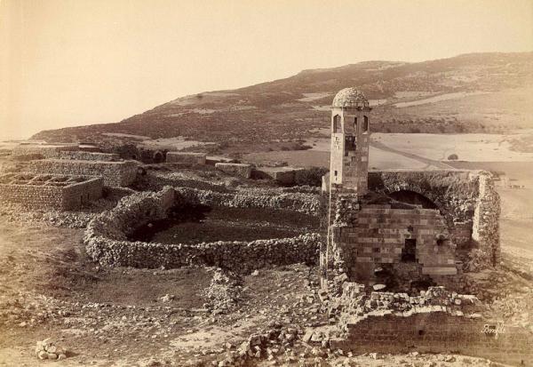
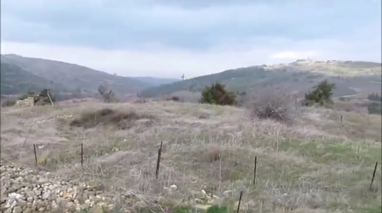
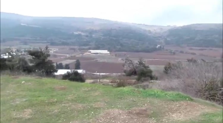
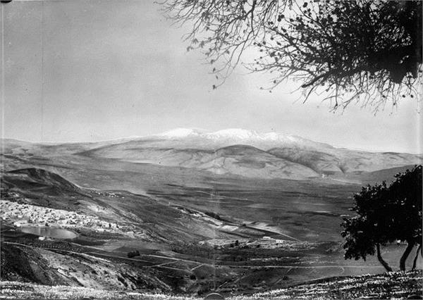
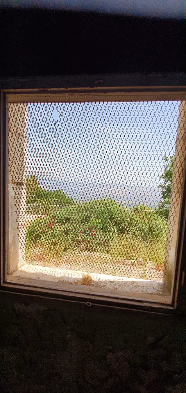
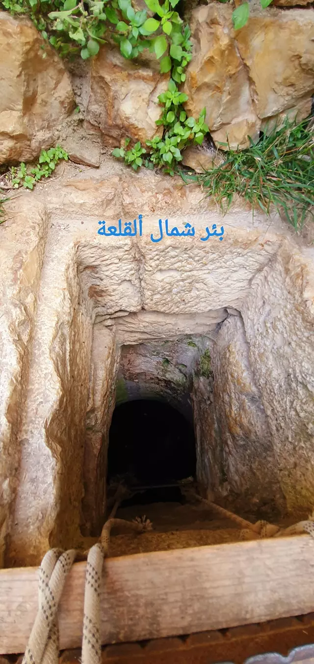
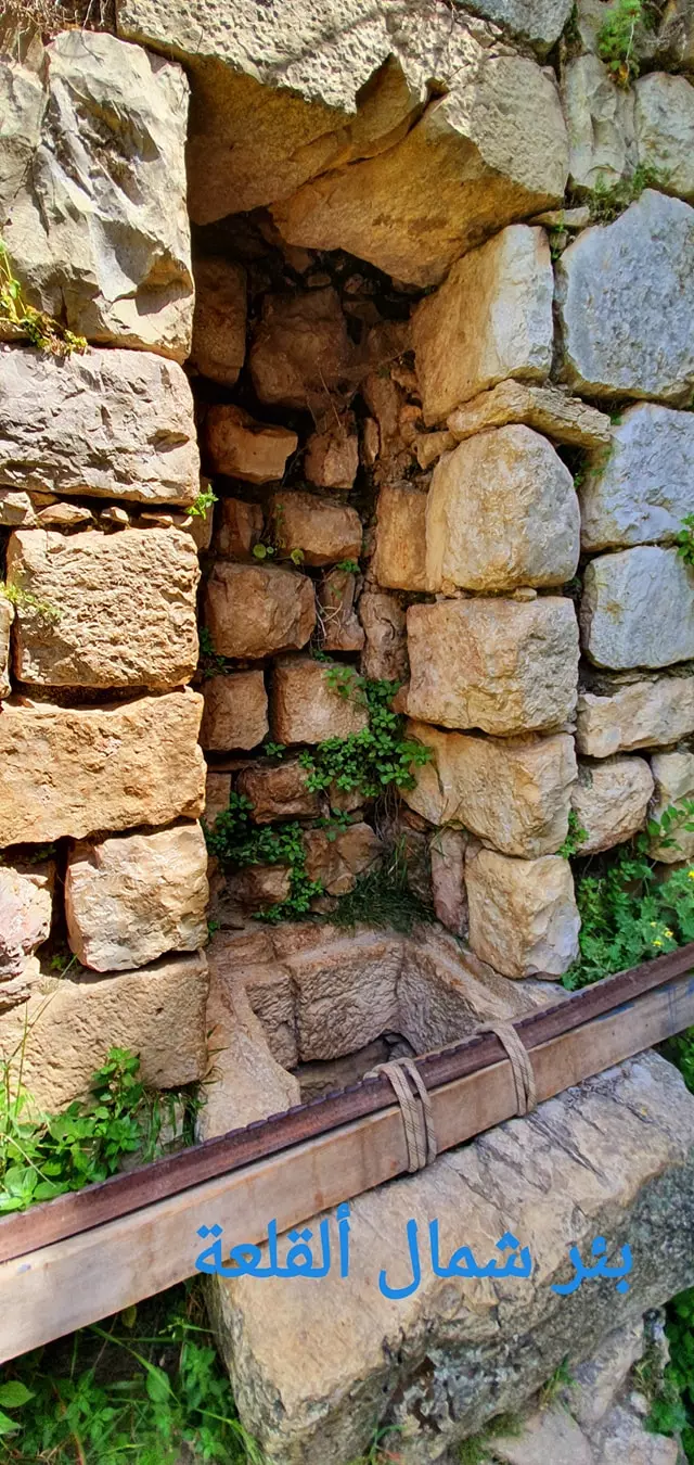
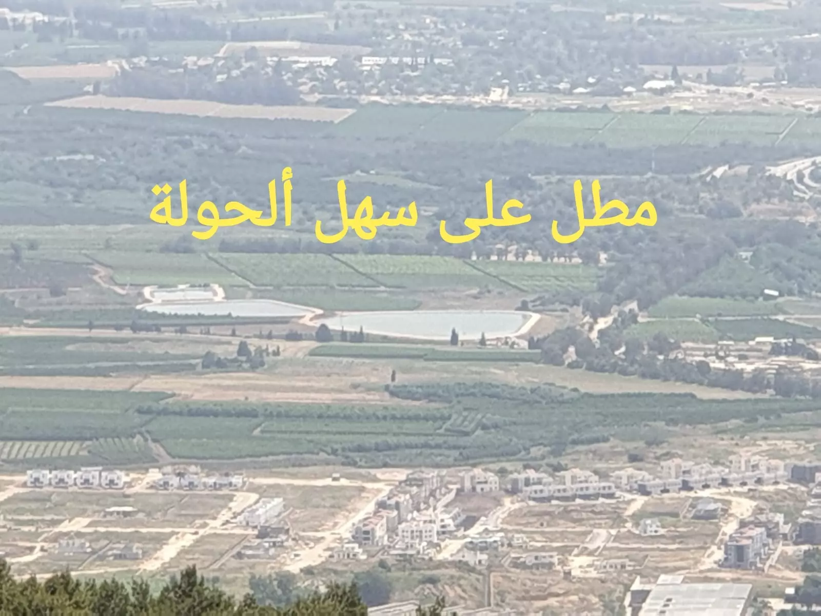
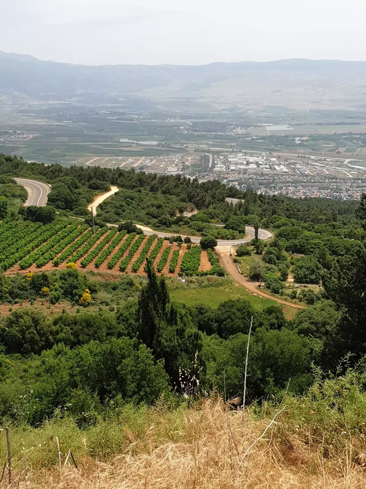
Village Before NakbaThe village was situated on Mount 'Amil on the edge of a slope that overlooked the northern section of the al-Hula Plain. Hunin was very close to the Lebanese border and was part of Lebanon until 1923, when the Lebanese-Palestinian border was delineated by Britain and France. It had two springs and a reservoir on the southwestern edge of the site. The Crusaders built the castle of Chastel Neuf at Hunin in 1179. The Arab traveler Ibn Jubayr, who passed through the area in about 1183, described it as a fortress which still belonged to the Franks. [[Cited in Le Strange 1965:418]] The defenders of the castle surrendered to Salah al-Din al-Ayyubi (Saladin) toward the end of 1187. However, the Crusaders reoccupied it in 1240, and were driven out for the last time by the Mamluk sultan Baybars in 1266. Yaqut al-Hamawi (d. 1228) mentioned Hunin as a village in the mountains of 'Amila (Mount 'Amil) overlooking al-Hula. [[Mu'jam, cited in D 6/ 2:231]] The site was also described by al-Dimashqi (d. 1327) as 'the castle of Hunin' which, he said, was an administrative center with villages under its jurisdiction. [[Nukhbat, cited in D 6/2:231]] .In the late nineteenth century, travelers described Hunin as a stone-built village joined to a ruined Crusaders' castle. The village, which stood on a low ridge, had about 100 (predominantly Muslim) residents. Although the hills surrounding the village were uncultivated, there was farmland in the valleys below it. [[SWP (1881) I:87]] Hunin had a mosque and an elementary school for boys. Agriculture was the mainstay of its economy; in the 1944/45 season, a total of 5,987 dunums was allocated to cereals, and 859 dunums were irrigated or used for orchards. Village Occupation and Ethnic CleaningLike almost all of the villages in the Galilee panhandle, Hunin was occupied in the course of Operation Yiftach (see Abil al-Qamh, Safad sub-district), which was implemented in April-May 1948. An Israeli military intelligence report later stated that Hunin was evacuated by its residents on 3 May. By that time, Zionist forces had not yet reached the village, and a Palmach report claimed that Arab forces ordered the villagers of Hunin to leave by 14 May. These reports are not consistent with the recollections of eyewitnesses interviewed twenty-five years later. People from the nearby village of al-Khalisa (2.5 km to the southeast) recalled that, on the morning that Safad fell (11 May), they decided to evacuate women and children to Hunin. When al-Khalisa was captured a few days later, its village militia also retreated temporarily to Hunin. Al-Khalisa's militia probably moved on to Lebanon a few days later, along with the people of Hunin itself.While discrepancies exist regarding the timing of this evacuation, there is broad agreement on the general picture. The commander of Operation Yiftach, Palmach chief Yigal Allon, wrote later: 'We regarded it as imperative to cleanse the interior of the Galilee and create Jewish territorial continuity in the whole of Upper Galilee.' This was achieved partly by direct attack and partly by using a campaign of psychological warfare. Zionists Colonies on Village LandsThe settlement of Misgav 'Am (201294) was established in 1945 on the northern part of the village lands. Jewish immigrants from Iraq and Yemen established the settlement of Margaliyyot (201291) on village land in 1951, just south of the village site.Village TodayThe cemetery, the elementary school, and the castle built by the Crusaders remain. The castle is a tourist attraction, and the school is used by Israelis as an agricultural warehouse. The lands in the vicinity are cultivated by the settlers.SourceDr. Walid al-Khalidi, 1992: All That Remains. |
||||||||||||||||||||||
| Related Maps | Town Lands' Demarcation Maps خرائط للقضاء توضح حدود القرى والاودية Town's map on MapQuest View from satellite Help us map this town at WikiMapia |
|||||||||||||||||||||
| Related Links | Wikipedia's Page Facebook Page Google Search Google For Images Google For Videos |
|||||||||||||||||||||
| More Information | في كتاب كي لا ننسى في كتاب بلادنا فلسطين المزيد من موقع هوية |
|||||||||||||||||||||
- Hunin 1949-1950 comment: Thanks to Tomer Gardi, a good Jewish friend for the photo
Posted by Sami Kleit 1 - Hunin Fortress
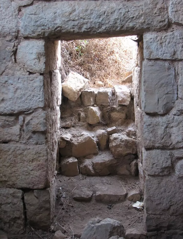
Posted by Mariam Mauzi 1 - Inside the Crusader Fortress
Posted by Sami Kleit - A walkway in present-day Hunin
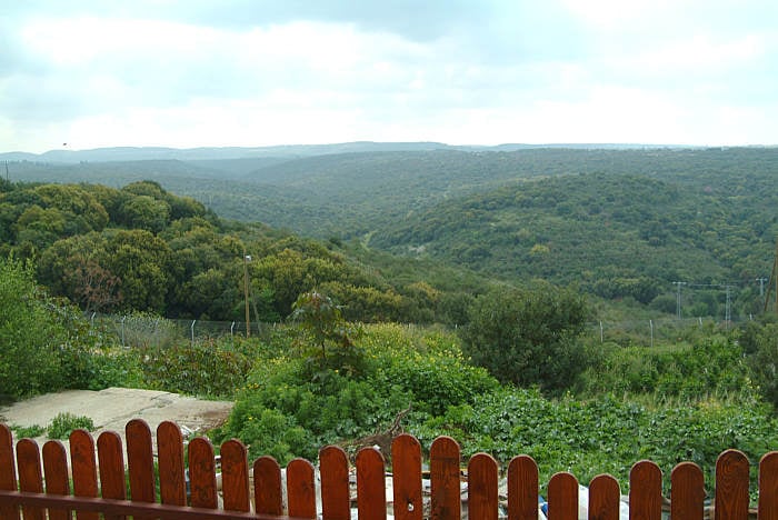
Posted by Sami Kleit - Orchards in present-day Hunin
Posted by Sami Kleit 1 - Crusader Fortress, Château/Chastel Neuf
Posted by Sami Kleit - Castle of hunin
Posted by Ibn Hunin 1 - Wadi hunin
Posted by Ibn Hunin 1 - Martyr Hussein Doqmaq

Posted by Sami Kleit 1 - Boys' Elementary School
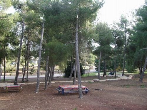
Posted by Sami Kleit 4 - A park in 'Misgav Am'
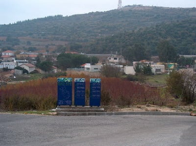
Posted by Sami Kleit 1 - General view
Posted by Sami Kleit - View of the Misgav Am-settlement
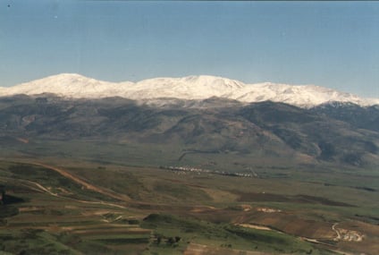
Posted by Sami Kleit - View of the lands with Mt Hermon in the back
Posted by Sami Kleit 1 - The fortress
Posted by Sami Kleit - View to the Lebanese border (the fence)
Posted by Sami Kleit 1 - Entrance
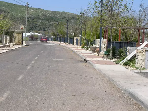
Posted by Sami Kleit - Road in modern day Hunin
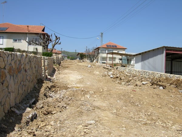
Posted by Sami Kleit - Site scheduled for reconstruction
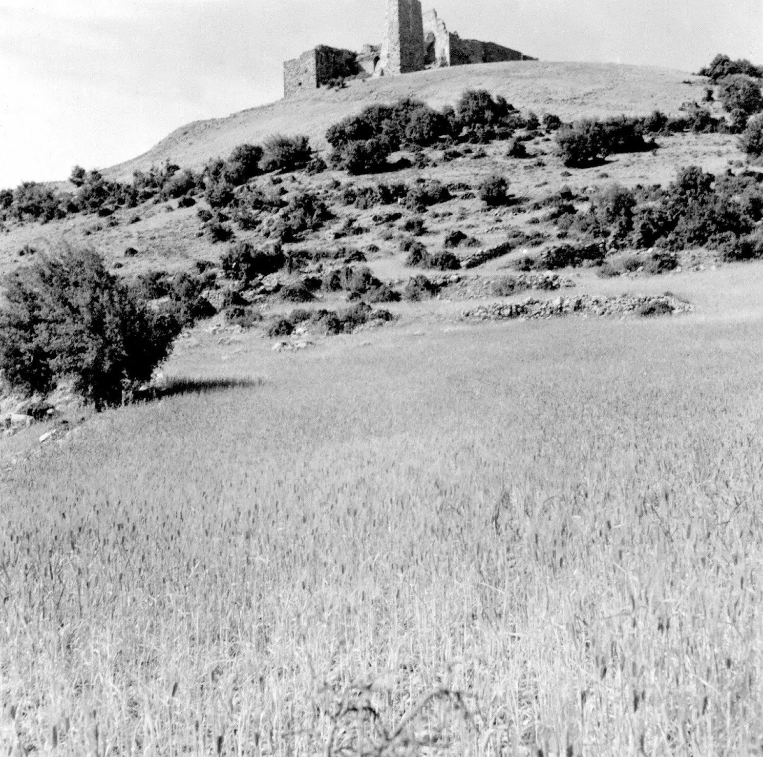
Posted by Sami Kleit - The fortress in 1970
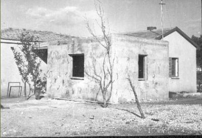
Posted by Sami Kleit 1 - A home in Hunin, 1971
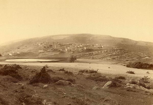
Posted by Sami Kleit - The village in 1890
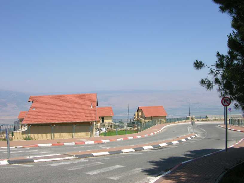
Posted by Sami Kleit - The settlement of Misgav Am
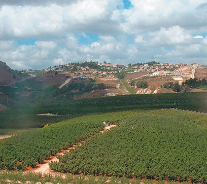
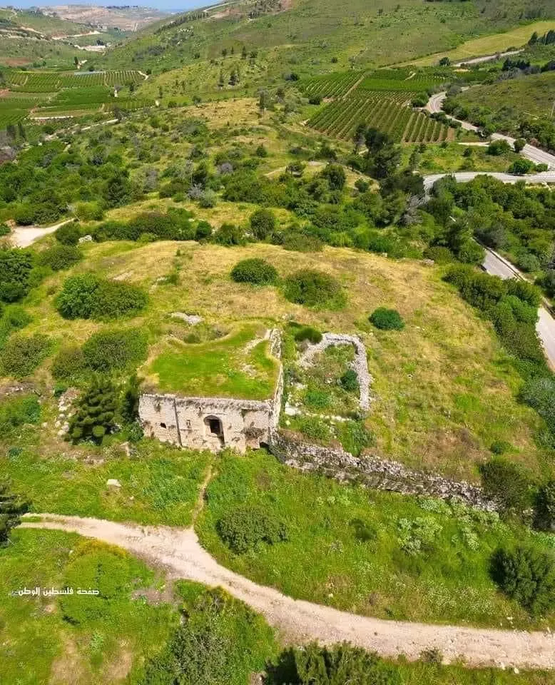
Posted by Sami Kleit - The village in 2007
Posted by Sami Kleit 3 - قلعه هونين
Posted by abu raya - القلعه
Posted by abu raya - القلعه من الداخل
Posted by abu raya - القلعه من الخلف
Posted by abu raya - قريه هونين
Posted by abu raya - قلعه قريه هونين
Posted by abu raya - قلعه هونين من الداخل
Posted by abu raya - قلعه هونين
Posted by abu raya - اثار بيوت هونين
Posted by abu raya - هونين
Posted by abu raya - موقع قريه هونين
Posted by abu raya - اثار ردم بيوت القريه
Posted by abu raya - موقع القريه
Posted by abu raya - موقع القريه واراضيها
Posted by abu raya - موقع القريه
Posted by abu raya - اثار ردم بيوت القريه
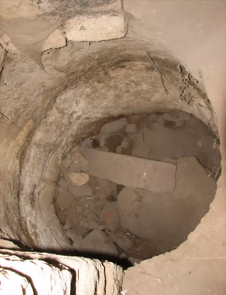
Posted by abu raya - ابار القريه
Posted by abu raya - القلعه
Posted by abu raya - قلعه هونين
Posted by abu raya - قلعه هونين
Posted by abu raya - بيوت هونين
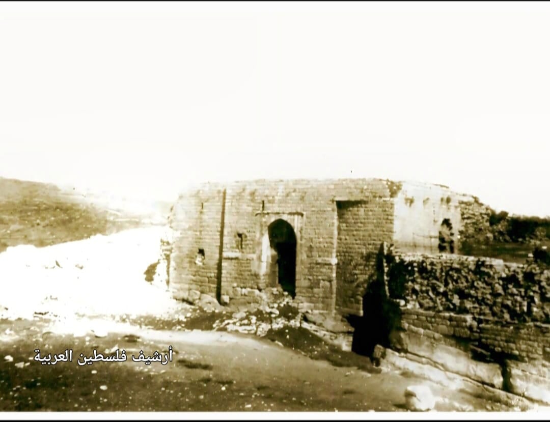
Posted by abu raya - قلعة هونين "الجليل الاعلى" سنة 1940
- قلعة قرية هونين قضاء صفد عام 1933..
- The "most civilized" who landed on us from Europe obliterated the village, except for a few remaining structures like this one. This is how the Jews will be great again. That is how they can feel safe: Jim Crow, plunder, ethnic cleansing, and genocide.
- The "most civilized" who landed on us from Europe obliterated the village, except for a few remaining structures like this one. This is how the Jews will be great again. That is how they can feel safe: Jim Crow, plunder, ethnic cleansing, and genocide. #2
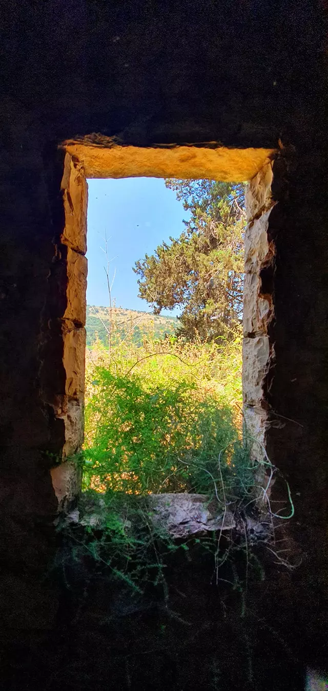
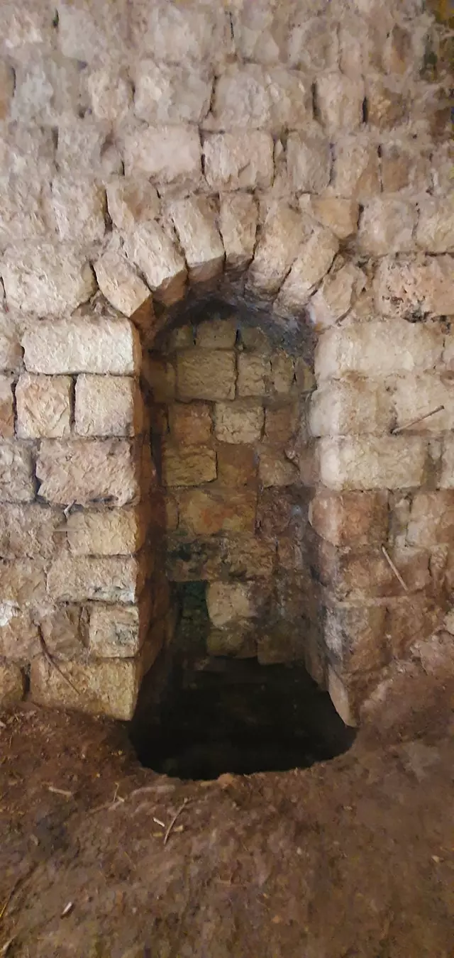
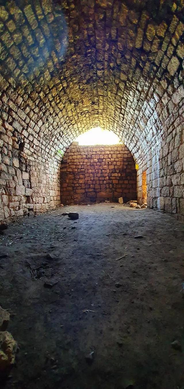
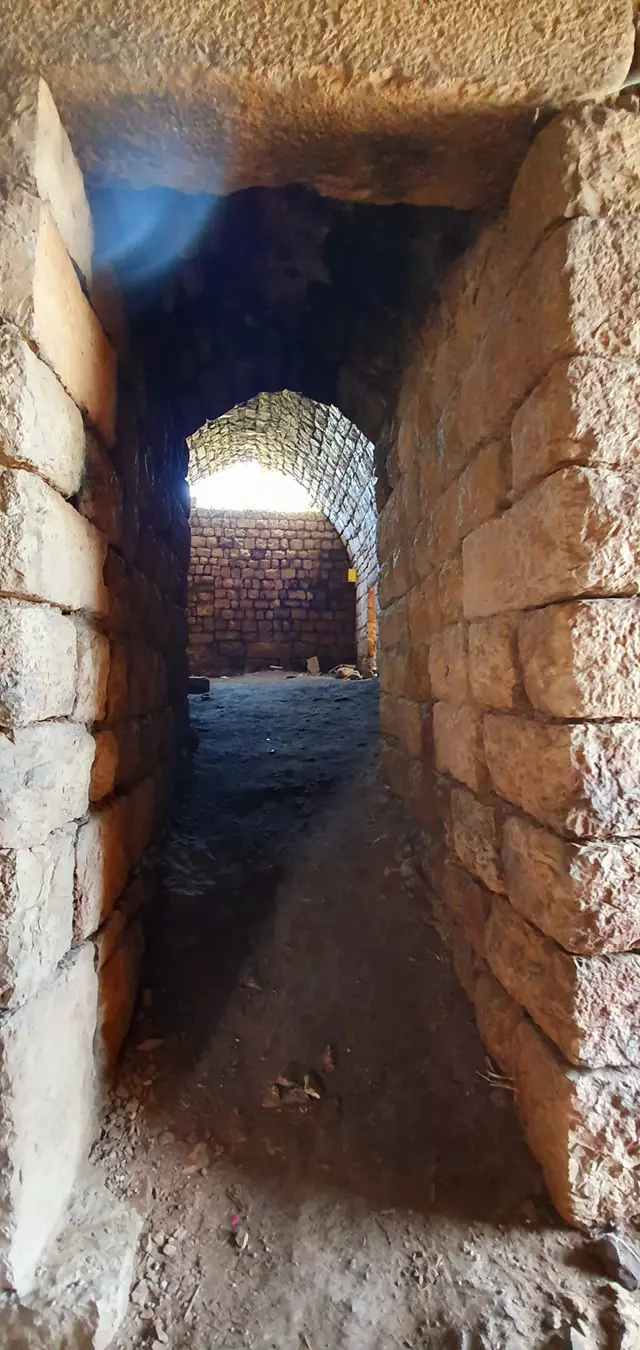
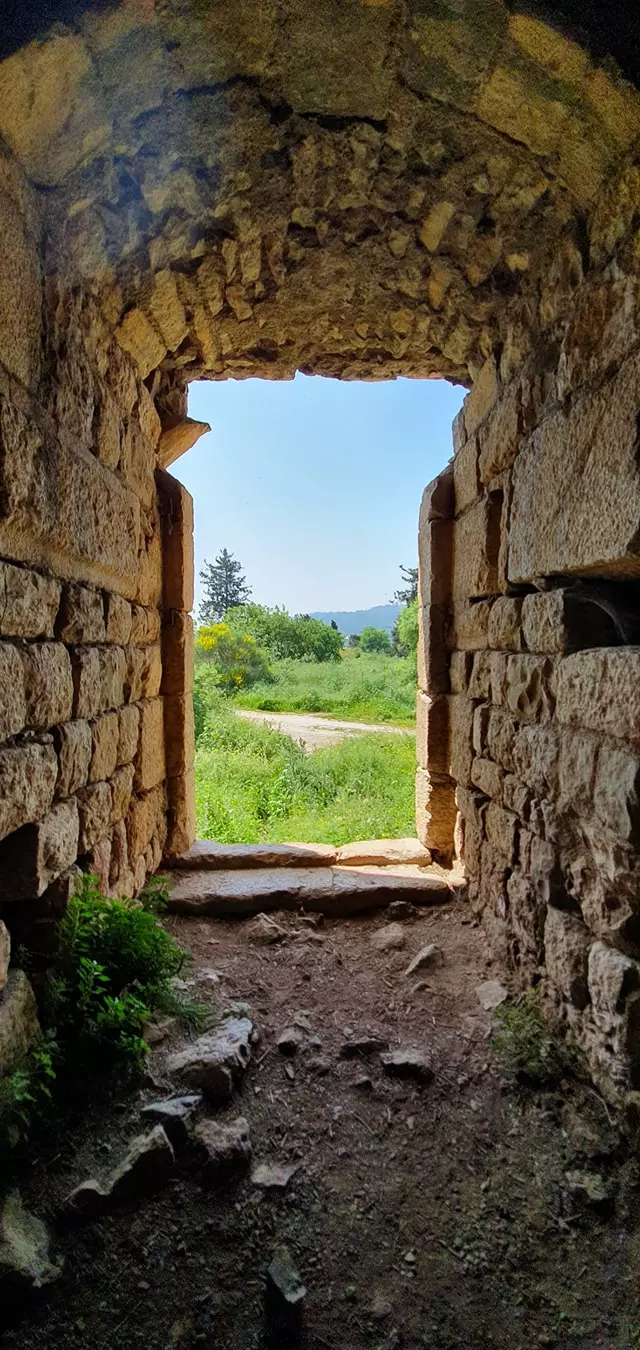
- جولة في احد البيوت المتبقة -- June 2021 -- Nabela Salem
- جولة في احد البيوت المتبقة -- June 2021 -- Nabela Salem #2
- جولة في احد البيوت المتبقة -- June 2021 -- Nabela Salem #3
- جولة في احد البيوت المتبقة -- June 2021 -- Nabela Salem #4
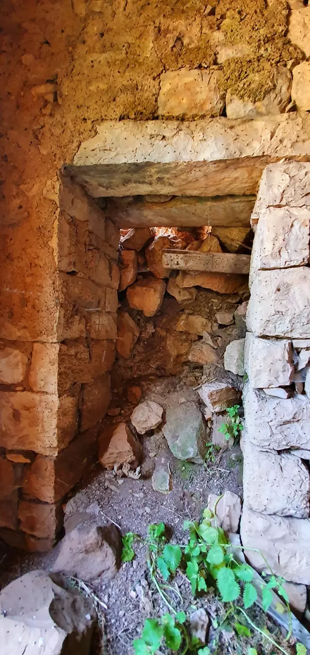
- جولة في احد البيوت المتبقة -- June 2021 -- Nabela Salem #5
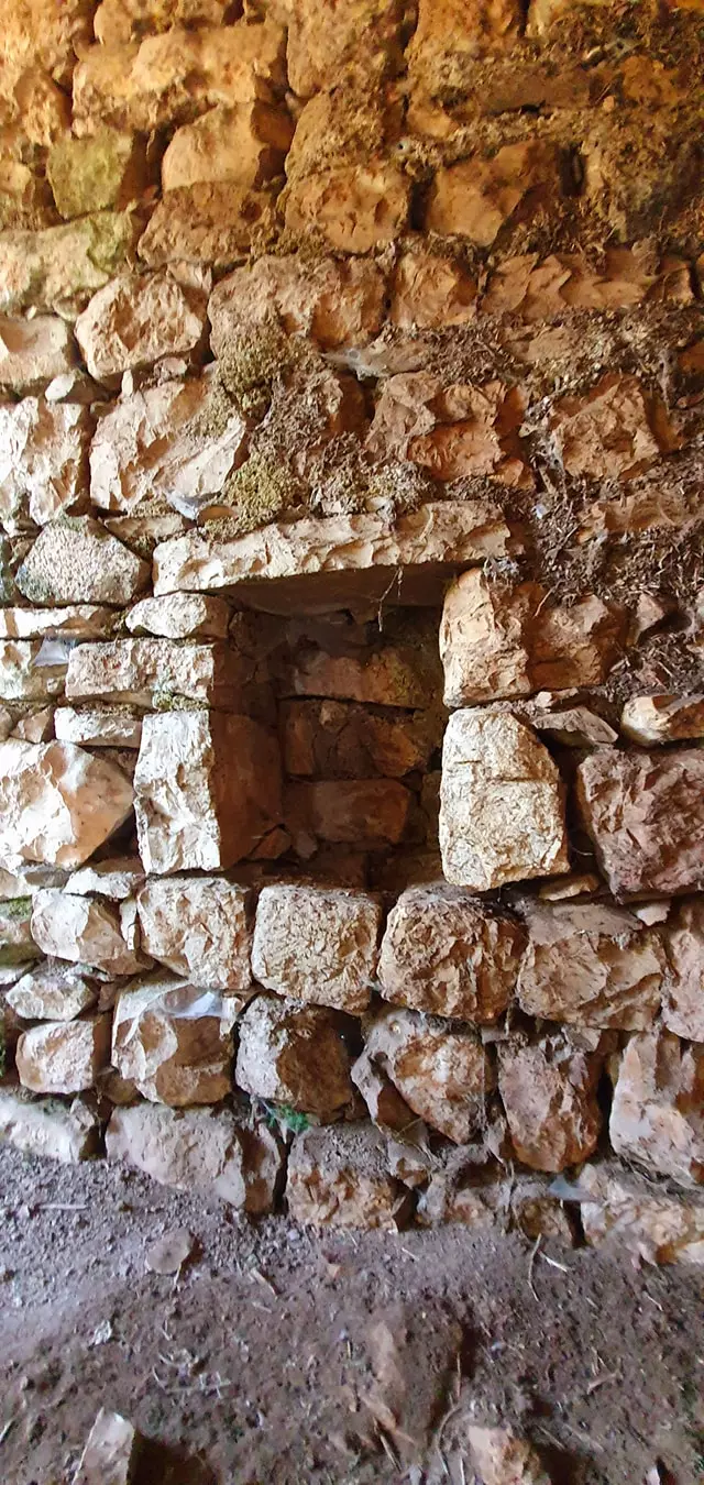
- جولة في احد البيوت المتبقة -- June 2021 -- Nabela Salem #6
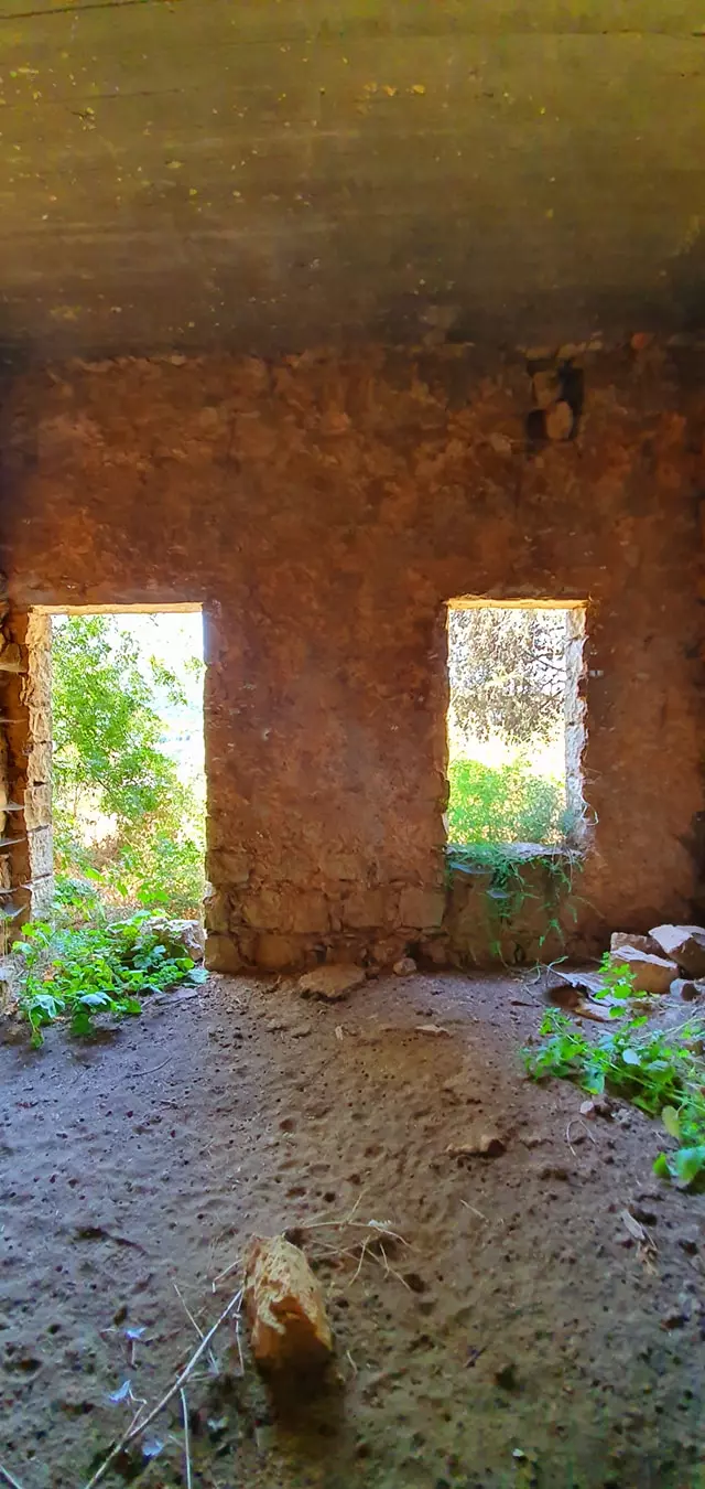
- جولة في احد البيوت المتبقة -- June 2021 -- Nabela Salem #7
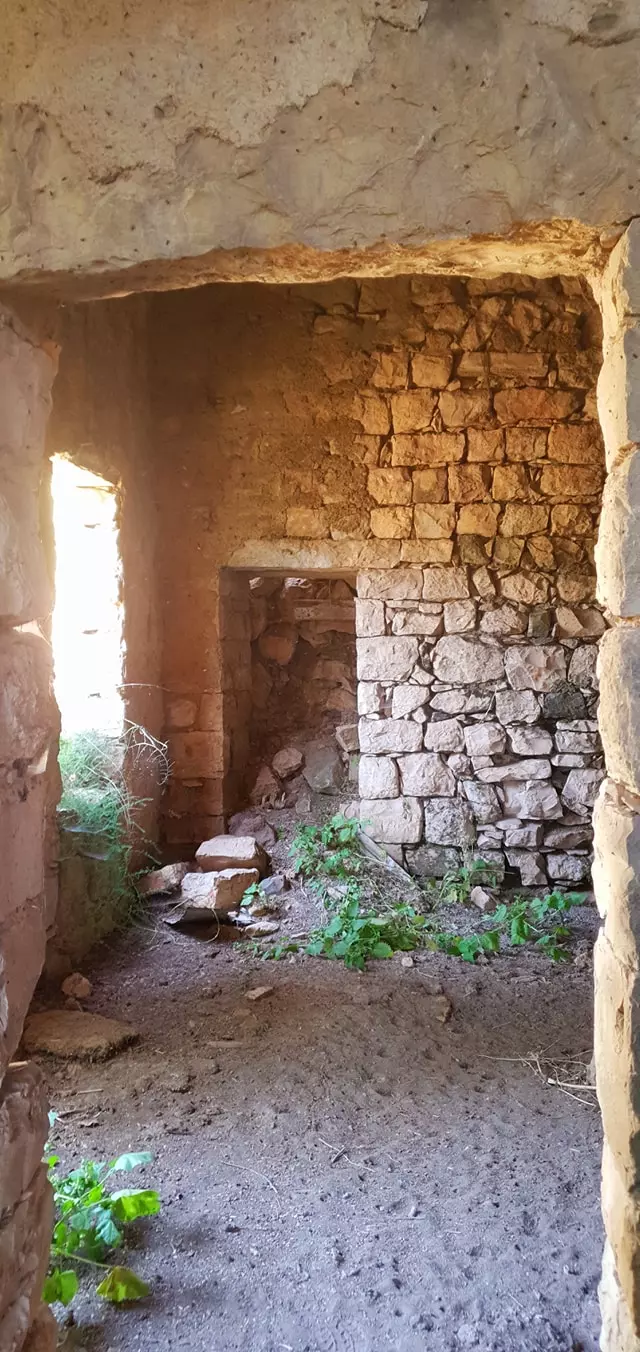
- جولة في احد البيوت المتبقة -- June 2021 -- Nabela Salem #8
- جولة في احد البيوت المتبقة -- June 2021 -- Nabela Salem #9
- جولة في احد البيوت المتبقة -- June 2021 -- Nabela Salem #10
- جولة في احد البيوت المتبقة -- June 2021 -- Nabela Salem #11
- جولة في احد البيوت المتبقة -- June 2021 -- Nabela Salem #12
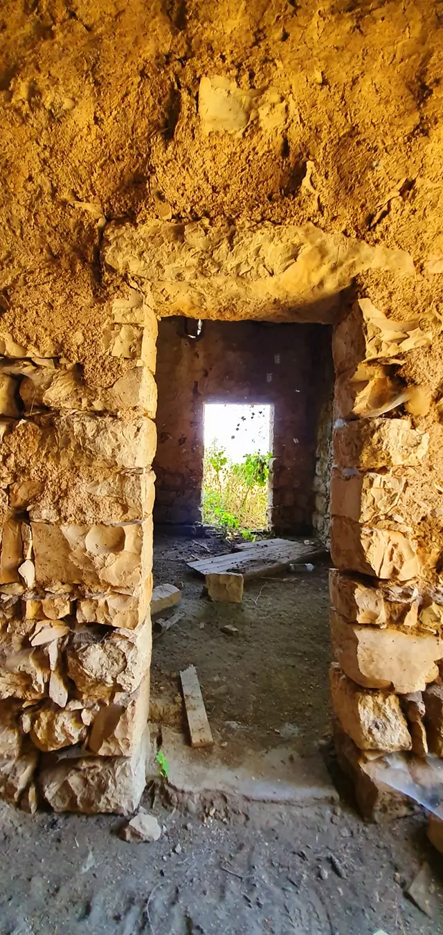
- جولة في احد البيوت المتبقة -- June 2021 -- Nabela Salem #13
- General view, 1937
- Gatehouse of the castle, built in the 18th century by Zahir al-Umar over Crusader ruins -- قلعة الظاهر العمر الزيداني
- Let us tour Hunin's school which was used by the Iraqi & Yemenite Jewish settlers of Margaliyyot until 1975 - مدرسة قرية هونين ألمهجرة قضاء صفد وحتى سنة 1975 تقريبا كان يتعلم فيها يهود مستوطنة مرجليوت -- May 2021 -- Nabela Salem
- Let us tour Hunin's school which was used by the Iraqi & Yemenite Jewish settlers of Margaliyyot until 1975 - مدرسة قرية هونين ألمهجرة قضاء صفد وحتى سنة 1975 تقريبا كان يتعلم فيها يهود مستوطنة مرجليوت -- May 2021 -- Nabela Salem #2
- Let us tour Hunin's school which was used by the Iraqi & Yemenite Jewish settlers of Margaliyyot until 1975 - مدرسة قرية هونين ألمهجرة قضاء صفد وحتى سنة 1975 تقريبا كان يتعلم فيها يهود مستوطنة مرجليوت -- May 2021 -- Nabela Salem #3
- Let us tour Hunin's school which was used by the Iraqi & Yemenite Jewish settlers of Margaliyyot until 1975 - مدرسة قرية هونين ألمهجرة قضاء صفد وحتى سنة 1975 تقريبا كان يتعلم فيها يهود مستوطنة مرجليوت -- May 2021 -- Nabela Salem #4
- Let us tour Hunin's school which was used by the Iraqi & Yemenite Jewish settlers of Margaliyyot until 1975 - مدرسة قرية هونين ألمهجرة قضاء صفد وحتى سنة 1975 تقريبا كان يتعلم فيها يهود مستوطنة مرجليوت -- May 2021 -- Nabela Salem #5
- Let us tour Hunin's school which was used by the Iraqi & Yemenite Jewish settlers of Margaliyyot until 1975 - مدرسة قرية هونين ألمهجرة قضاء صفد وحتى سنة 1975 تقريبا كان يتعلم فيها يهود مستوطنة مرجليوت -- May 2021 -- Nabela Salem #6
- Let us tour Hunin's school which was used by the Iraqi & Yemenite Jewish settlers of Margaliyyot until 1975 - مدرسة قرية هونين ألمهجرة قضاء صفد وحتى سنة 1975 تقريبا كان يتعلم فيها يهود مستوطنة مرجليوت -- May 2021 -- Nabela Salem #7
- Let us tour Hunin's school which was used by the Iraqi & Yemenite Jewish settlers of Margaliyyot until 1975 - مدرسة قرية هونين ألمهجرة قضاء صفد وحتى سنة 1975 تقريبا كان يتعلم فيها يهود مستوطنة مرجليوت -- May 2021 -- Nabela Salem #8
- Let us tour Hunin's school which was used by the Iraqi & Yemenite Jewish settlers of Margaliyyot until 1975 - مدرسة قرية هونين ألمهجرة قضاء صفد وحتى سنة 1975 تقريبا كان يتعلم فيها يهود مستوطنة مرجليوت -- May 2021 -- Nabela Salem #9
- Let us tour Hunin's school which was used by the Iraqi & Yemenite Jewish settlers of Margaliyyot until 1975 - مدرسة قرية هونين ألمهجرة قضاء صفد وحتى سنة 1975 تقريبا كان يتعلم فيها يهود مستوطنة مرجليوت -- May 2021 -- Nabela Salem #10
- Let us tour Hunin's school which was used by the Iraqi & Yemenite Jewish settlers of Margaliyyot until 1975 - مدرسة قرية هونين ألمهجرة قضاء صفد وحتى سنة 1975 تقريبا كان يتعلم فيها يهود مستوطنة مرجليوت -- May 2021 -- Nabela Salem #11
- Let us tour Hunin's school which was used by the Iraqi & Yemenite Jewish settlers of Margaliyyot until 1975 - مدرسة قرية هونين ألمهجرة قضاء صفد وحتى سنة 1975 تقريبا كان يتعلم فيها يهود مستوطنة مرجليوت -- May 2021 -- Nabela Salem #12
- Let us tour Hunin's school which was used by the Iraqi & Yemenite Jewish settlers of Margaliyyot until 1975 - مدرسة قرية هونين ألمهجرة قضاء صفد وحتى سنة 1975 تقريبا كان يتعلم فيها يهود مستوطنة مرجليوت -- May 2021 -- Nabela Salem #13
- Let us tour Hunin's school which was used by the Iraqi & Yemenite Jewish settlers of Margaliyyot until 1975 - مدرسة قرية هونين ألمهجرة قضاء صفد وحتى سنة 1975 تقريبا كان يتعلم فيها يهود مستوطنة مرجليوت -- May 2021 -- Nabela Salem #14
- Let us tour Hunin's school which was used by the Iraqi & Yemenite Jewish settlers of Margaliyyot until 1975 - مدرسة قرية هونين ألمهجرة قضاء صفد وحتى سنة 1975 تقريبا كان يتعلم فيها يهود مستوطنة مرجليوت -- May 2021 -- Nabela Salem #15
- Let us tour Hunin's school which was used by the Iraqi & Yemenite Jewish settlers of Margaliyyot until 1975 - مدرسة قرية هونين ألمهجرة قضاء صفد وحتى سنة 1975 تقريبا كان يتعلم فيها يهود مستوطنة مرجليوت -- May 2021 -- Nabela Salem #16
- Let us tour Thahir al-Omar al-Zidani's castle, April 2021 -- Nabela Salem -- جولة في قلعة الظاهر العمر الزيداني المطلة على سهل الحولة
- Let us tour Thahir al-Omar al-Zidani's castle, April 2021 -- Nabela Salem -- جولة في قلعة الظاهر العمر الزيداني المطلة على سهل الحولة #2
- Let us tour Thahir al-Omar al-Zidani's castle, April 2021 -- Nabela Salem -- جولة في قلعة الظاهر العمر الزيداني المطلة على سهل الحولة #3
- Let us tour Thahir al-Omar al-Zidani's castle, April 2021 -- Nabela Salem -- جولة في قلعة الظاهر العمر الزيداني المطلة على سهل الحولة #4
- Let us tour Thahir al-Omar al-Zidani's castle, April 2021 -- Nabela Salem -- جولة في قلعة الظاهر العمر الزيداني المطلة على سهل الحولة #5
- Let us tour Thahir al-Omar al-Zidani's castle, April 2021 -- Nabela Salem -- جولة في قلعة الظاهر العمر الزيداني المطلة على سهل الحولة #6
- Let us tour Thahir al-Omar al-Zidani's castle, April 2021 -- Nabela Salem -- جولة في قلعة الظاهر العمر الزيداني المطلة على سهل الحولة #7
- Let us tour Thahir al-Omar al-Zidani's castle, April 2021 -- Nabela Salem -- جولة في قلعة الظاهر العمر الزيداني المطلة على سهل الحولة #8
- Let us tour Thahir al-Omar al-Zidani's castle, April 2021 -- Nabela Salem -- جولة في قلعة الظاهر العمر الزيداني المطلة على سهل الحولة #9
- Let us tour Thahir al-Omar al-Zidani's castle, April 2021 -- Nabela Salem -- جولة في قلعة الظاهر العمر الزيداني المطلة على سهل الحولة #10
- Let us tour Thahir al-Omar al-Zidani's castle, April 2021 -- Nabela Salem -- جولة في قلعة الظاهر العمر الزيداني المطلة على سهل الحولة #11
- Let us tour Thahir al-Omar al-Zidani's castle, April 2021 -- Nabela Salem -- جولة في قلعة الظاهر العمر الزيداني المطلة على سهل الحولة #12
- Let us tour Thahir al-Omar al-Zidani's castle, April 2021 -- Nabela Salem -- جولة في قلعة الظاهر العمر الزيداني المطلة على سهل الحولة #13
- Let us tour Thahir al-Omar al-Zidani's castle, April 2021 -- Nabela Salem -- جولة في قلعة الظاهر العمر الزيداني المطلة على سهل الحولة #14
- Let us tour Thahir al-Omar al-Zidani's castle, April 2021 -- Nabela Salem -- جولة في قلعة الظاهر العمر الزيداني المطلة على سهل الحولة #15
- Let us tour Thahir al-Omar al-Zidani's castle, April 2021 -- Nabela Salem -- جولة في قلعة الظاهر العمر الزيداني المطلة على سهل الحولة #16
- Let us tour Thahir al-Omar al-Zidani's castle, April 2021 -- Nabela Salem -- جولة في قلعة الظاهر العمر الزيداني المطلة على سهل الحولة #17
- Let us tour Thahir al-Omar al-Zidani's castle, April 2021 -- Nabela Salem -- جولة في قلعة الظاهر العمر الزيداني المطلة على سهل الحولة #18
- Let us tour Thahir al-Omar al-Zidani's castle, April 2021 -- Nabela Salem -- جولة في قلعة الظاهر العمر الزيداني المطلة على سهل الحولة #19
- Let us tour Thahir al-Omar al-Zidani's castle, April 2021 -- Nabela Salem -- جولة في قلعة الظاهر العمر الزيداني المطلة على سهل الحولة #20
- Let us tour Thahir al-Omar al-Zidani's castle, April 2021 -- Nabela Salem -- جولة في قلعة الظاهر العمر الزيداني المطلة على سهل الحولة #21
- Let us tour Thahir al-Omar al-Zidani's castle, April 2021 -- Nabela Salem -- جولة في قلعة الظاهر العمر الزيداني المطلة على سهل الحولة #22
- Let us tour Thahir al-Omar al-Zidani's castle, April 2021 -- Nabela Salem -- جولة في قلعة الظاهر العمر الزيداني المطلة على سهل الحولة #23
- Let us tour Thahir al-Omar al-Zidani's castle, April 2021 -- Nabela Salem -- جولة في قلعة الظاهر العمر الزيداني المطلة على سهل الحولة #24
- Let us tour Thahir al-Omar al-Zidani's castle, April 2021 -- Nabela Salem -- جولة في قلعة الظاهر العمر الزيداني المطلة على سهل الحولة #25
- Let us tour Thahir al-Omar al-Zidani's castle, April 2021 -- Nabela Salem -- جولة في قلعة الظاهر العمر الزيداني المطلة على سهل الحولة #26
- Let us tour Thahir al-Omar al-Zidani's castle, April 2021 -- Nabela Salem -- جولة في قلعة الظاهر العمر الزيداني المطلة على سهل الحولة #27
- رسالة من المعلم رفاعي الرفاعي الى مفتش المعارف يطلب فيها تحويل راتبه الى بنك الأمة العربي في صفد
-تاريخ الوثيقة:
17/09/1947

- مجموعة رسائل بخصوص استلام راتب المعلم رفاعي الرفاعي الشهري
-تاريخ الوثيقة:
19/02/1948

- مجموعة من الوثائق التي تخص تعين عبد الله فرج --من الناصرة -- في مدرسة هونين -- من 1935 الى 1947-- أنقر الصورة لتكبيرها

- مجموعة من الوثائق التي تخص تعين واكد رشيد حدرج --من هونين -- في مدرسة هونين -- من 1935 الى 1948-- أنقر الصورة لتكبيرها

-
مجموعة من الوثائق التي تخص تعين رفاعي أحمد الرفاعي --من علما -- في مدرسة هونين -- من 1946 الى 1947-- أنقر الصورة لتكبيرها

Want to browse more? 80,000 pictures were grouped in these gallaries:
| Display Name | Clan/Hamolah | Country of Residence |
| abir klait | - | hounin |
| Ahmad Chahrour | Chahrour | Germany |
| ABURABIEH BERJAOUI | BERJAOUI | CARABOBO, VENEZUELA |
| Sami Kleit | Kleit | - |
| البطل ممحمد فالح | صباح | عوريف, عوريف |
- قرية وقلعة هونين المهجرة ومطل على الحدود اللبنانية الفلسطينية Duration: 6 min 53 sec
- مطل على سهل الحوله من قلعة هونين Duration: min 12 sec
 Fake Valor: Why Did Zionist Jews Hoist Nazis Flag on Their Ships in the 1930s?
What is new?
-
Facts About Oct. 7th Gaza Raid
-
Remined Us Please: Who Did Rape Whom? Was it Palestinians who raped Israelis? Or, was the other way around? You'll be the judge
-
When Prof. Edward Said was invited to debate Bibi Netanyahu in the 1980s, watch what happened!
-
Ezra Klein of the NY Times on the "Jewish Race".
-
Abusing Blood Libel!
-
How and why Israeli Jewry has become the most hated cult?
-
Did Israeli Soldiers Activate The Hannibal Direective On Oct. 7th? You Be The Judge
-
Zionist FAQ: Isn't it true that Palestinians don't want peace? Palestinians never accepted the two-state solution
- Facts about Haavara (Transfer) Agreement between Ben-Gurion & Hitler
-
Haavara FAQs: Why Did Zionist Jews Hoist Nazis' Flags on Their Ships in the 1930s?
- Haavara FAQs: When Chaim Weizmann met FDR in mid-1943, why was he silent about rescuing European Jewry?
-
Dear ChatGPT: How did Palestinians resist Napoleon's invasion of their country in 1799?
-
Dear ChatGPT: Gaza had a vibrant Jewish community in the mid-17th century. What happened to them?
-
Dear ChatGPT: Why did the Jewish Agency suppress news of the Holocaust during WWII?
-
Video Playlist: Jews share their DNA tests to end the conflict for good.
-
A Tale of Two Conflicts: Examining the Definition of Genocide
-
Prof. Abraham Polak And The Suppressed History of the Khazars and European Jewry
-
How Ronald Reagan would have framed the genocide in Gaza if he were still alive?
-
Haavara FAQs: Let us do the math: how many German Jews did The Haavara Agreement save?
-
Zionist FAQs: The Hebron Massacre of 1929, "clearly proves" that Palestinians are antisemitic, how could you deny it?
-
Zionist FAQs: Why Anti-Zionist Is Not Antisemitism?
-
Zionist FAQs: Isn't it true that the KGB created Palestinian Nationalism in the early 1960s?
- Zionist FAQs: Muslims are killing Muslims all the time; why are Israeli Jews being singled out in the media?
- Zionist FAQs: How is Israel an apartheid state when 20% of its citizens are Arabs who enjoy full rights?
-
Haavara FAQs: Why Did Dorothy Thompson Flip From A Zionist Advocate to A Silenced Dissenter?
-
Haavara FAQs: Analysis of Herzl's Uganda Scheme and how it could have saved millions of Jews.
-
Haavara FAQs: Why did Hayim Greenberg describe American Jewry as "morally bankrupt" in early 1943?
-
Haavara FAQs: What if the Evian Conference was a resounding success? What would have been the impact of saving European Jewry on Zionism?
- Haavara FAQs: What if the six million were saved, how that would have impacted the Zionist project?
-
Haavara FAQs: How did Zionist leaders react when Europe's Jews lingered in the DP camps after WWII ended?
-
Why does the American Jewish community repeat lies that David Ben-Gurion had debunked before he died?
-
Who has the power to rename the Tatar/Khazar Gene Marker to Jewish IV?
-
Zionist FAQs: Why won't Egypt, Syria, and Jordan take their people back? Jews are indigenous to Palestine, and Arabs immigrated after Jews developed the country. Arabs should leave.
-
Haavara FAQs: Did Hitler and the Nazis conflate between Judaism and Zionist? If that wasn't case, then why?
-
Haavara FAQs: Winston Churchill and antisemitism, a collection of articles written Churchill.
-
Haavara FAQs: Broken by country, how many Jews survived vs. killed during the Holocaust?
-
Haavara FAQs: Why did European Jews vote with their feet and to immigrated to the Americas, not Palestine, after WWII?
-
Watch this American Jewish Girl describing Israeli Jews' cognitive dissonance like no other in under two minutes
-
Haavara FAQs: When the Nazis went out of their way to hide the Holocaust, Israeli Jews did the exact opposite by broadcasting their genocide of Gazans. But why?
-
Haavara FAQs: How Zionist Jews went out of their to show their appreciation to Nazism and Fascism?
- Haavara FAQs: Why Zionist leaders were against bombing the death camps & the Railroads leading to them?
-
Haavara FAQs: Hitler's message to the British and American people: If Jews are such noble citizens and you care about them, how come you're not letting them in? I will gladly ship them to you at my expense, even on luxury liners!
-
A shortlist of Zionist and Israeli false flag operations in the name Jews.
-
The Most Moral Army
- The Land of Kapos (Israel): Where the brave are boycotted and Kapos walk free.
- Why did early Zionists often named their communal enterprises "colonial"?
- Zionist Relations with Nazi Germany by Faris Glubb
-
Two NY Times advertisements by Zionists in the early 1943 that exposes Zionists' treason at the height of the calamity
- Facts Not Lies about the Palestinian-Israeli Conflict.
- Site's pictures have been categorized
- Campgain Against Lice
- A Survey of Palestine, the official source about Palestine before Nakba produced by the British Mandate; over 1200 pages.
- Satellite View & Google Earth: Over 6,000 placemarks identifying all destroyed towns, W. Bank & Gaza Strip Towns, & refugee camps.
- PalestineRemembered.com and its Nakba Oral History Project were featured on al-Jazeera Satellite TV.
- Nakba Oral History Video Podcast:
 Over 700 Oral History interviews (including 3,500+ hours of recording) can be viewed online.
 - Palestine Village Statistics Project
- Gaza Jail Break
- النسخة العربية للموقع الان متوفرة
- Videos: Documenting the destroyed villages in video: Tracing all that remains since Nakba.
- Videos: Responding to Zionist Propaganda
- Interview: The ethnic cleansing of Palestine: George Galloway interviews Israeli Historian Ilan Pappe.
- For Palestinians, memory matters. It provides a blueprint for their future By George Bisharat.
- Zionist FAQ now available in Hebrew שאלות שציונים שואלים, עכשיו בעברית
- Video: The Stephen Walt and John Mearsheimer report on the influence of the Israel Lobby on U.S. Foreign Policy
- The Palestinian-Israeli conflict for beginners
