| PalestineRemembered | About Us | Oral History | العربية | |
| Pictures | Zionist FAQs | Haavara | Maps | |
| Search |
| Camps |
| Districts |
| Acre |
| Baysan |
| Beersheba |
| Bethlehem |
| Gaza |
| Haifa |
| Hebron |
| Jaffa |
| Jericho |
| Jerusalem |
| Jinin |
| Nablus |
| Nazareth |
| Ramallah |
| al-Ramla |
| Safad |
| Tiberias |
| Tulkarm |
| Donate |
| Contact |
| Profile |
| Videos |
Welcome To al-Qubayba - القبيبة (אל-קביבה)
|
District of al-Ramla
Ethnically cleansed days ago |
العربية Google Earth |
 |
Gallery (98) |
- Statistics & Facts
-
Before & After

- Satellite View
- Articles 17
- Pictures 98
- Aerial Views 1
- Oral History 3
- Members 11
- Families
- All That Remains
- Town's Map
- Wikipedia
- Videos 8
- Guest Book 18
- Links 2
| Statistic & Fact | Value | |||||||||||||||||||||
| Occupation Date | May 27, 1948 | |||||||||||||||||||||
| Distance From District | 10.5 (km) Southeast of al-Ramla | |||||||||||||||||||||
| Elevation | 25 (meters) | |||||||||||||||||||||
| Before & After Nakba, Click Map For Details |
||||||||||||||||||||||
|
||||||||||||||||||||||
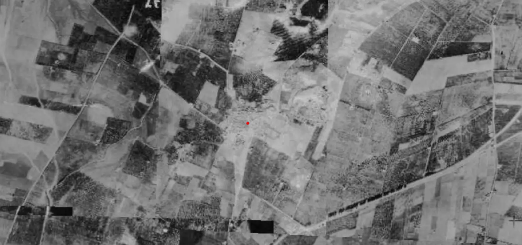
| Pre-Nakba Aerial View |
||||||||||||||||||||||
|
||||||||||||||||||||||
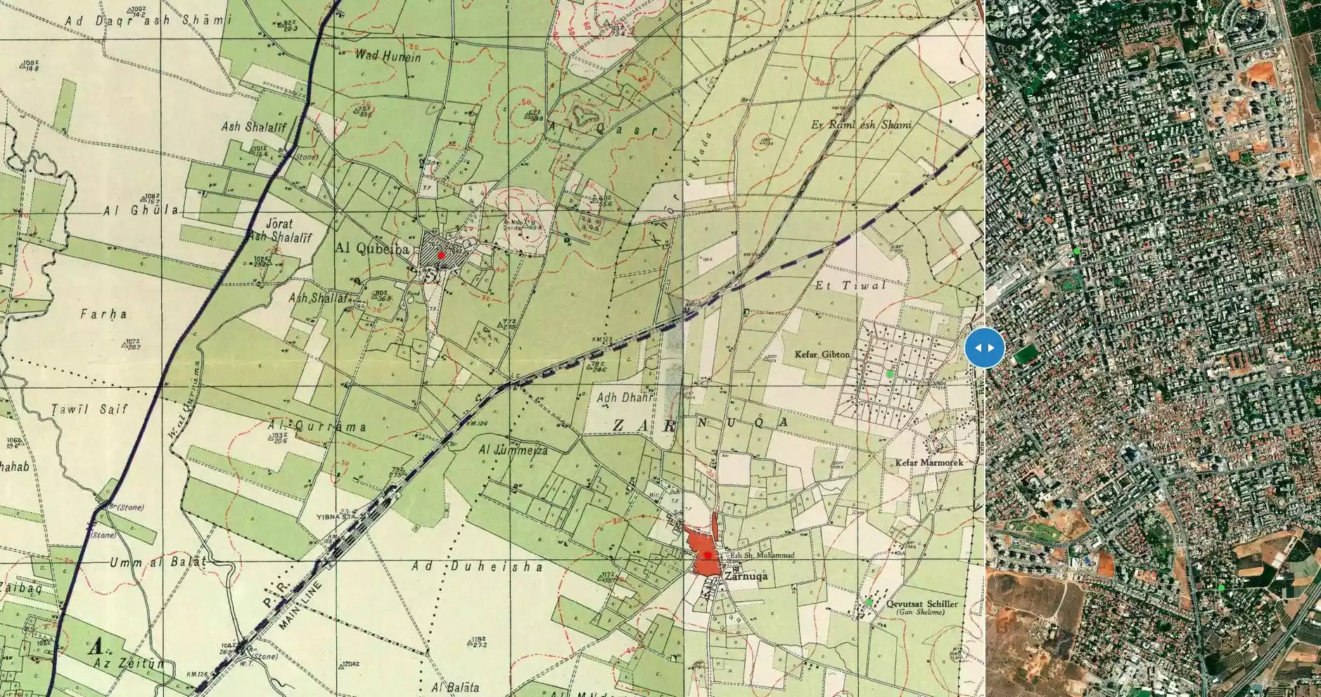
| Map Location | See location #24 on the map View from satellite |
|||||||||||||||||||||
| Military Operation | Second stage of operation Barak | |||||||||||||||||||||
| Attacking Units | Giva'ti brigade | |||||||||||||||||||||
| Exodus Cause | Expulsion by Zionist troops | |||||||||||||||||||||
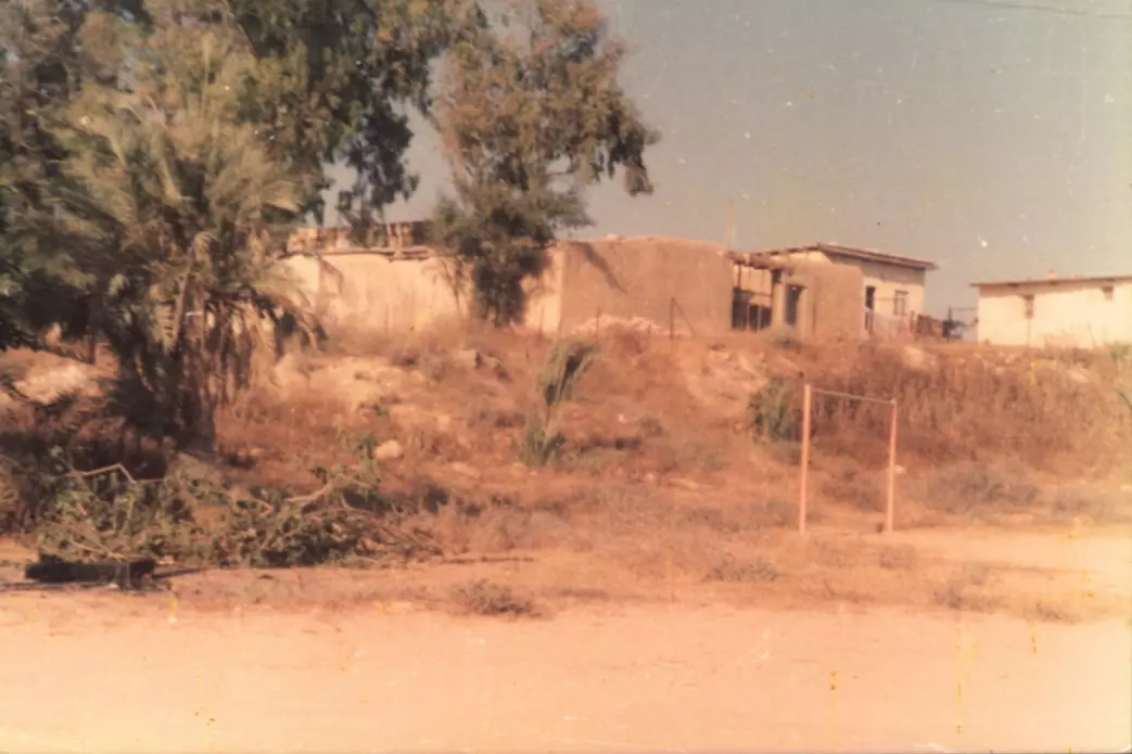
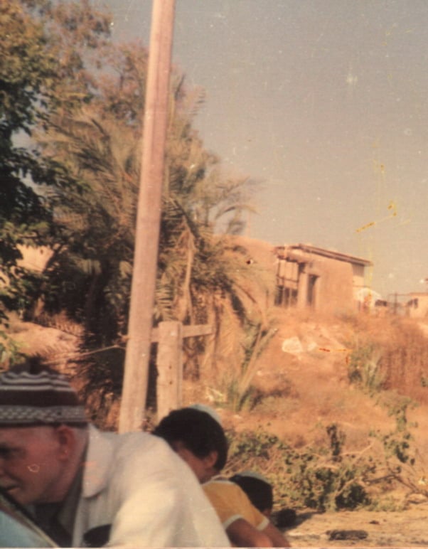
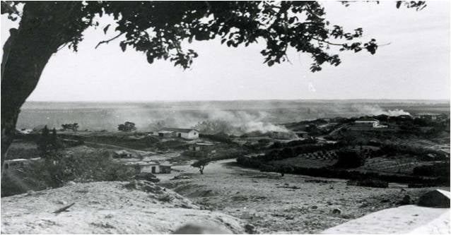
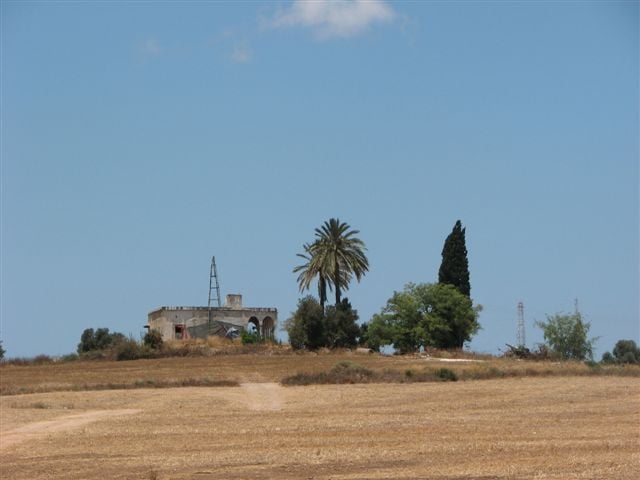
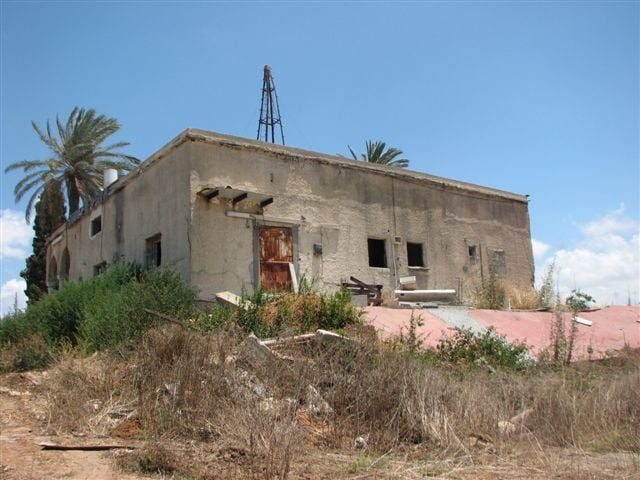
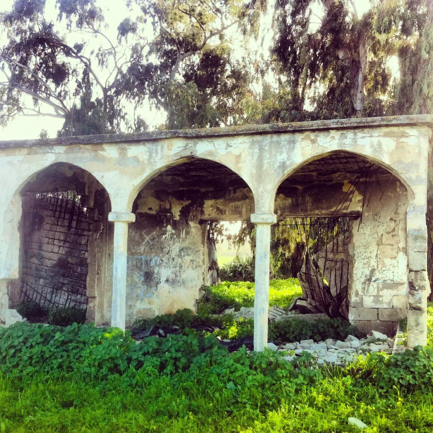
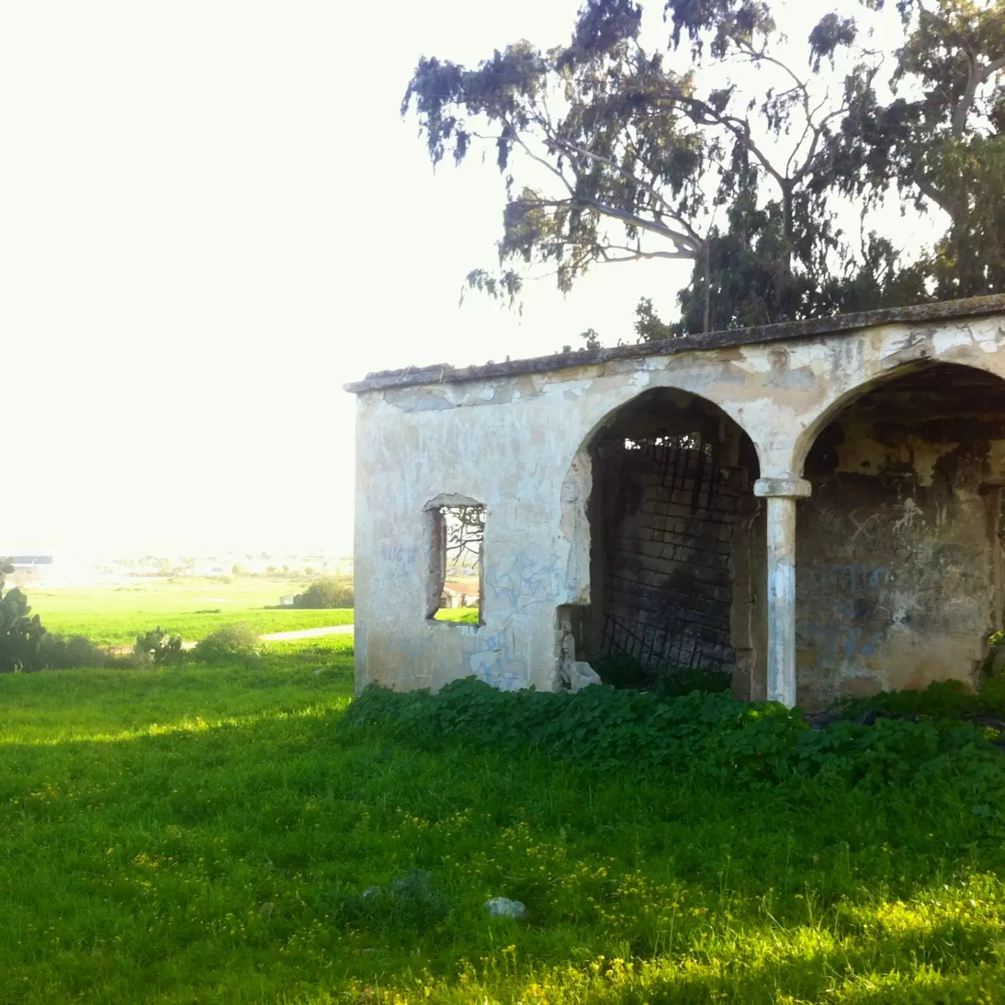
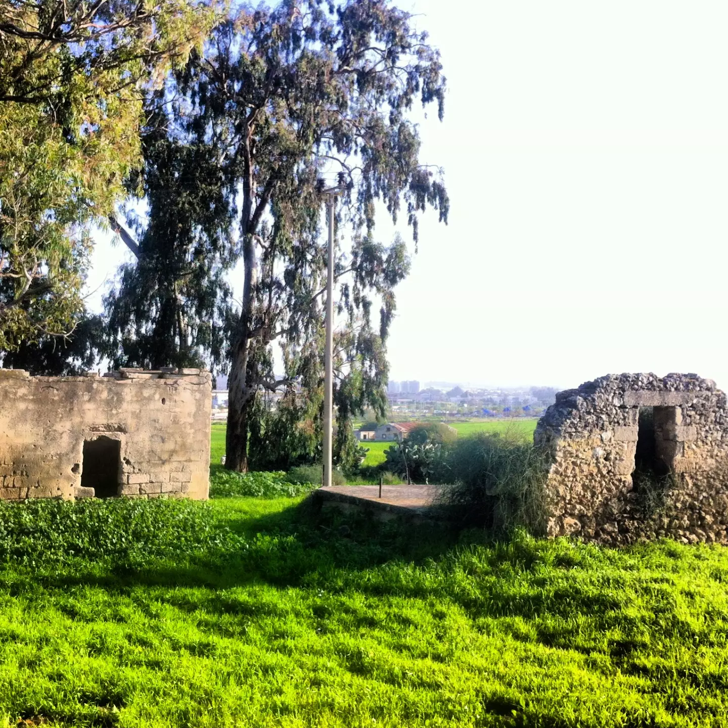
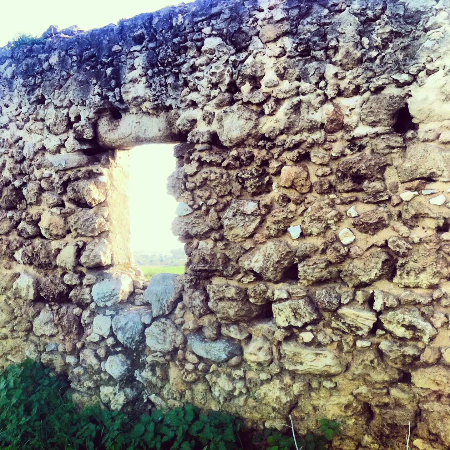
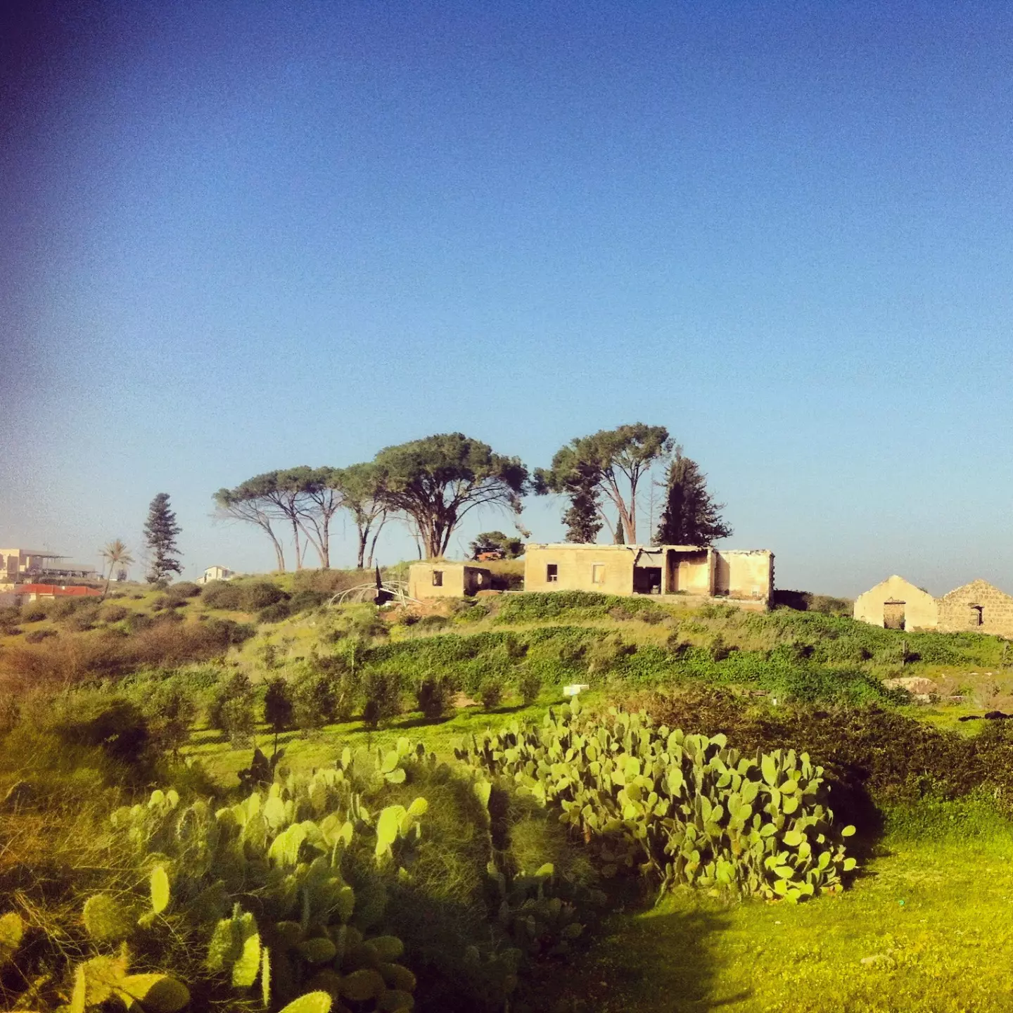
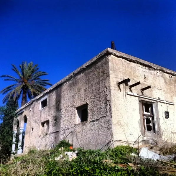
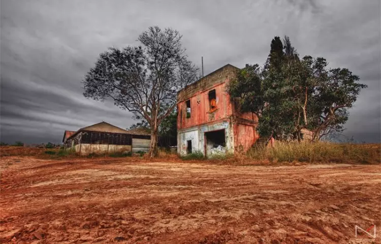
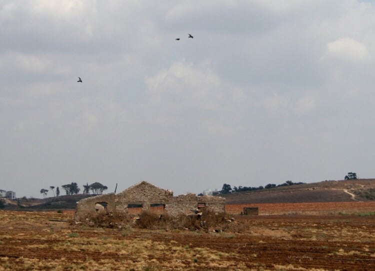
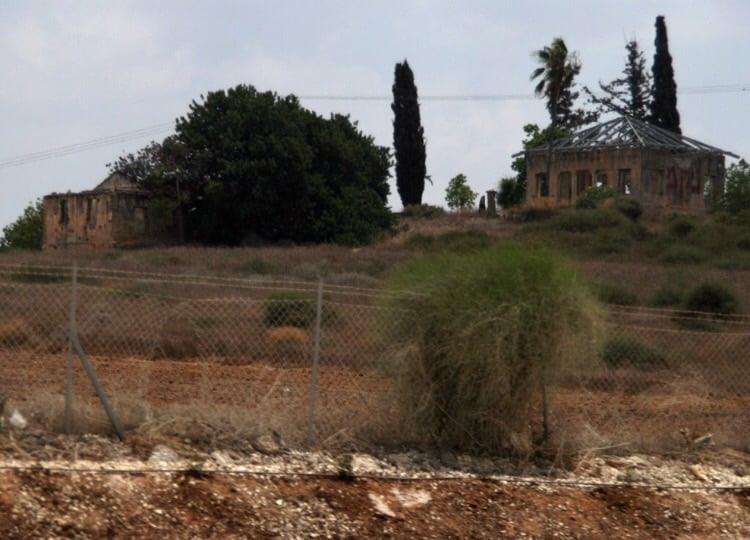
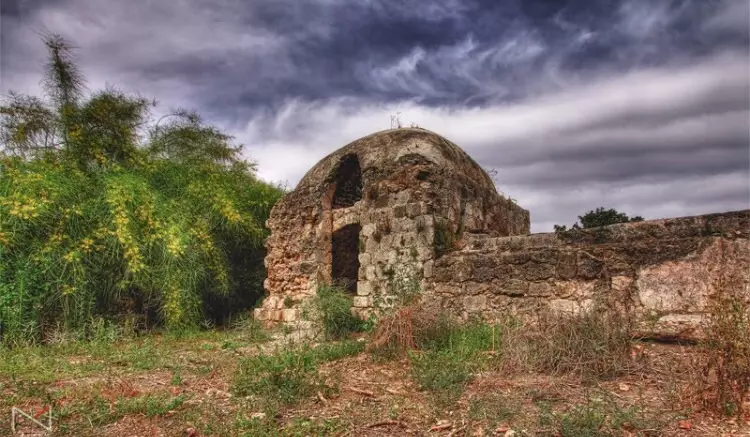
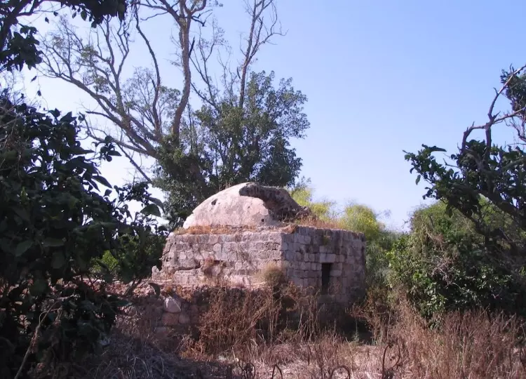
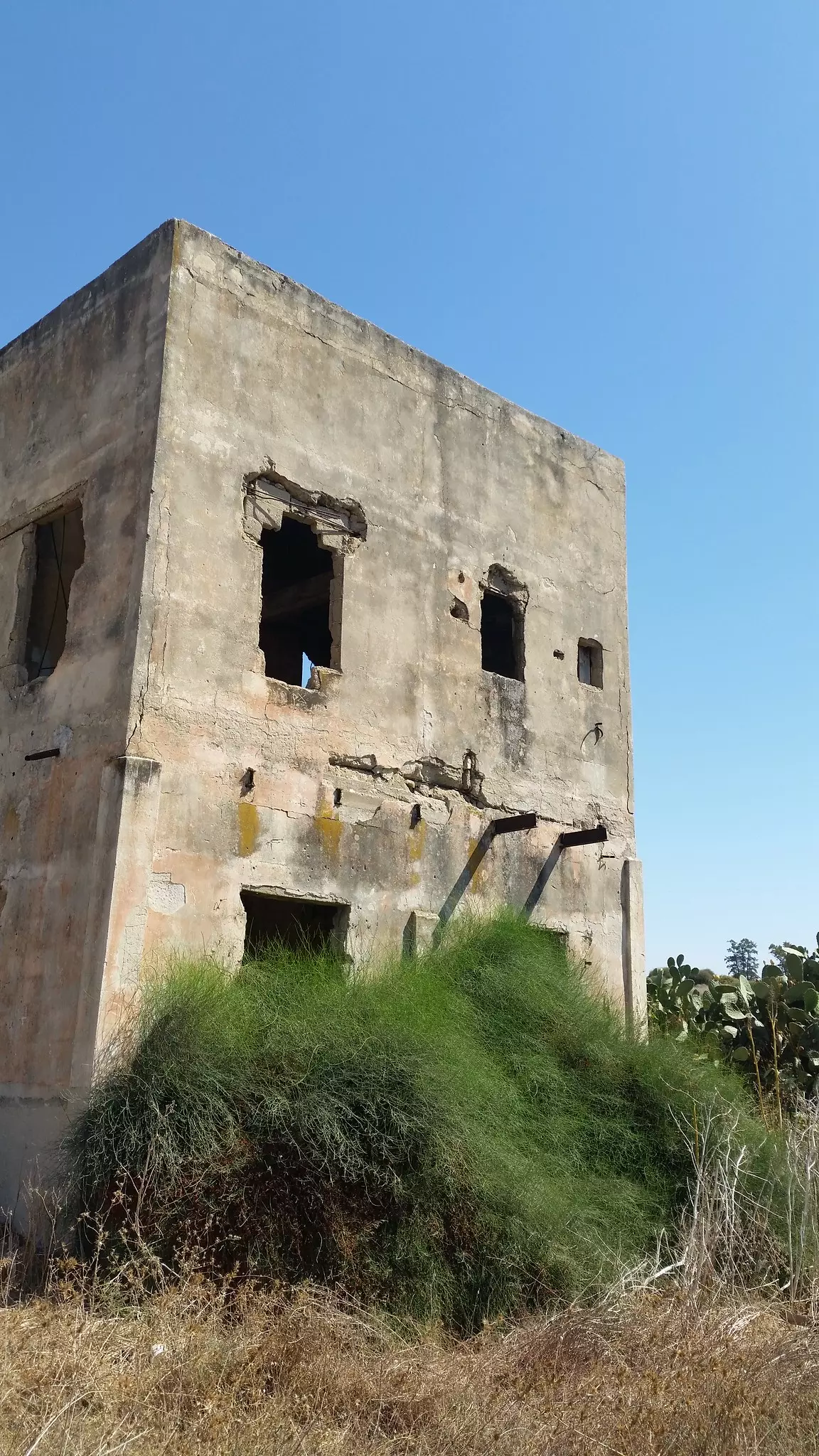
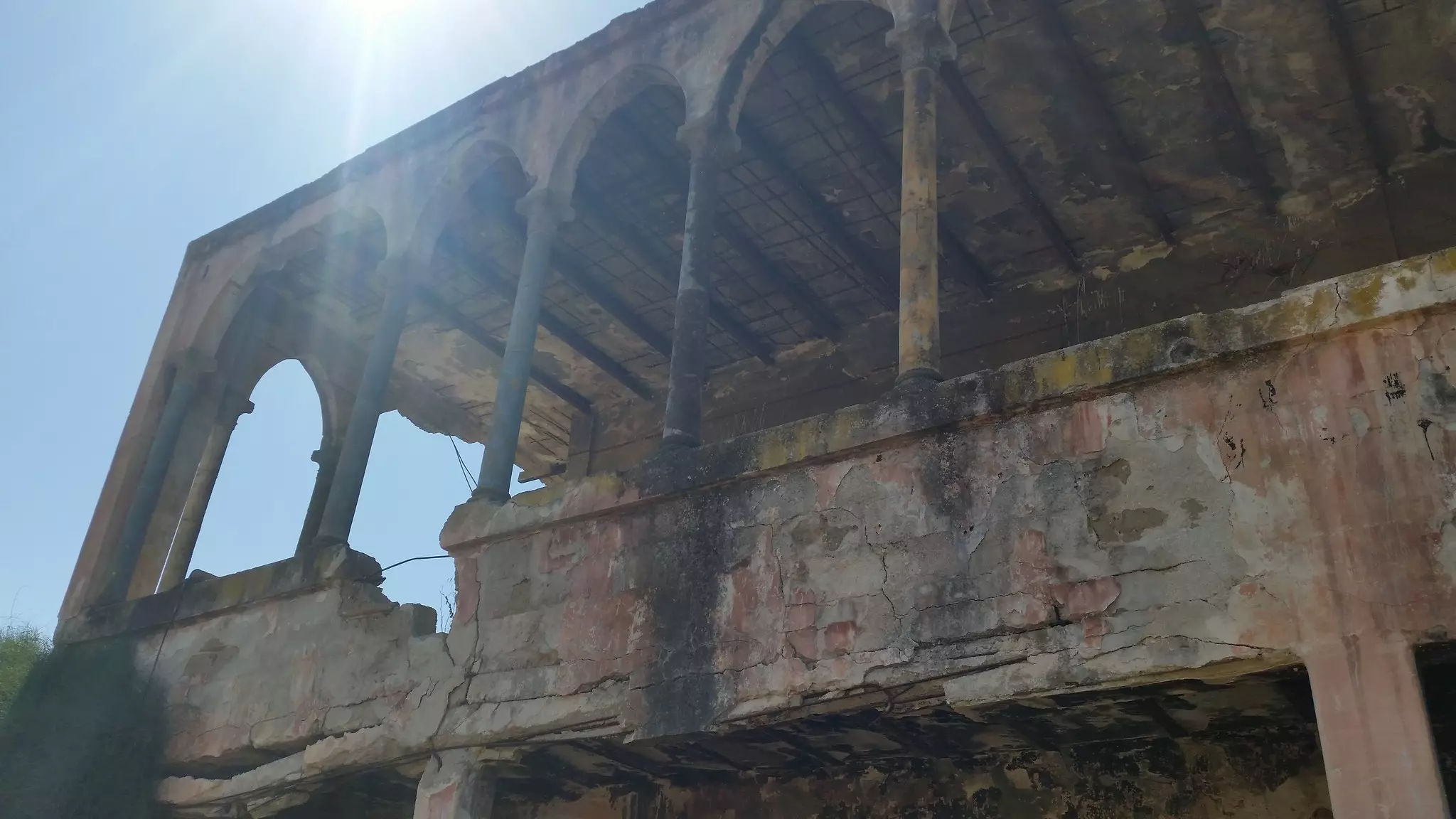
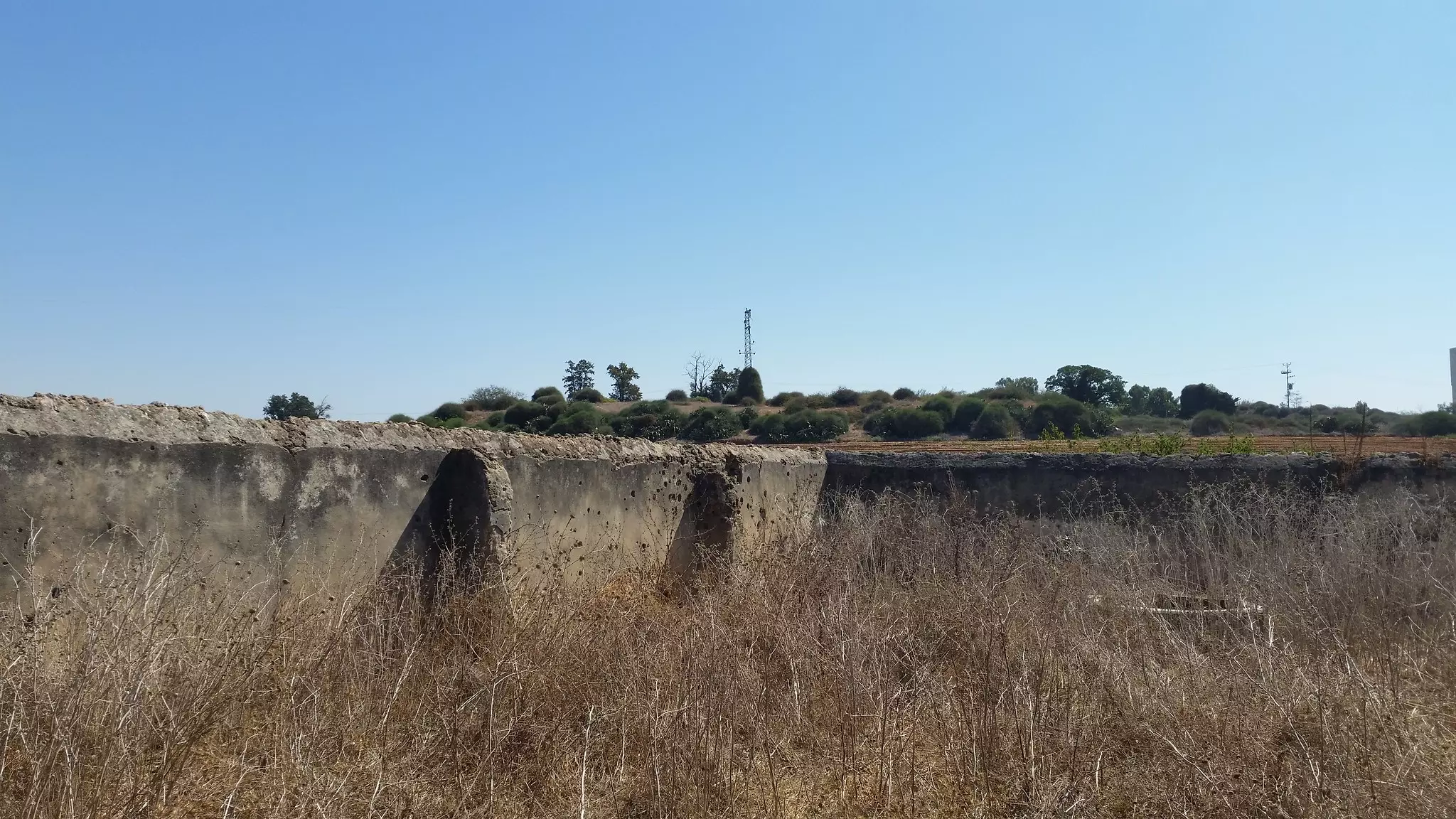
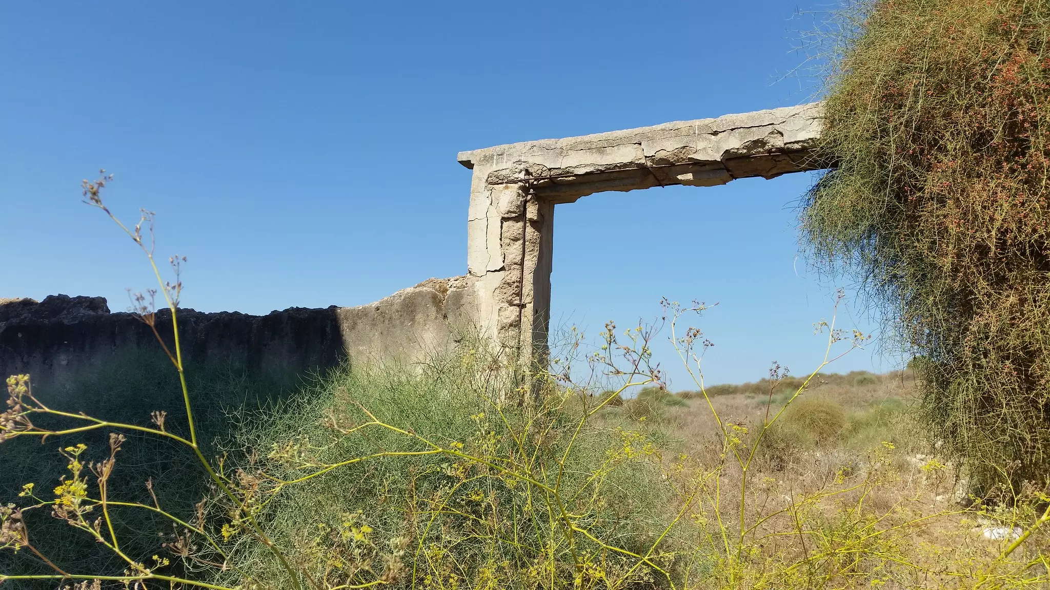
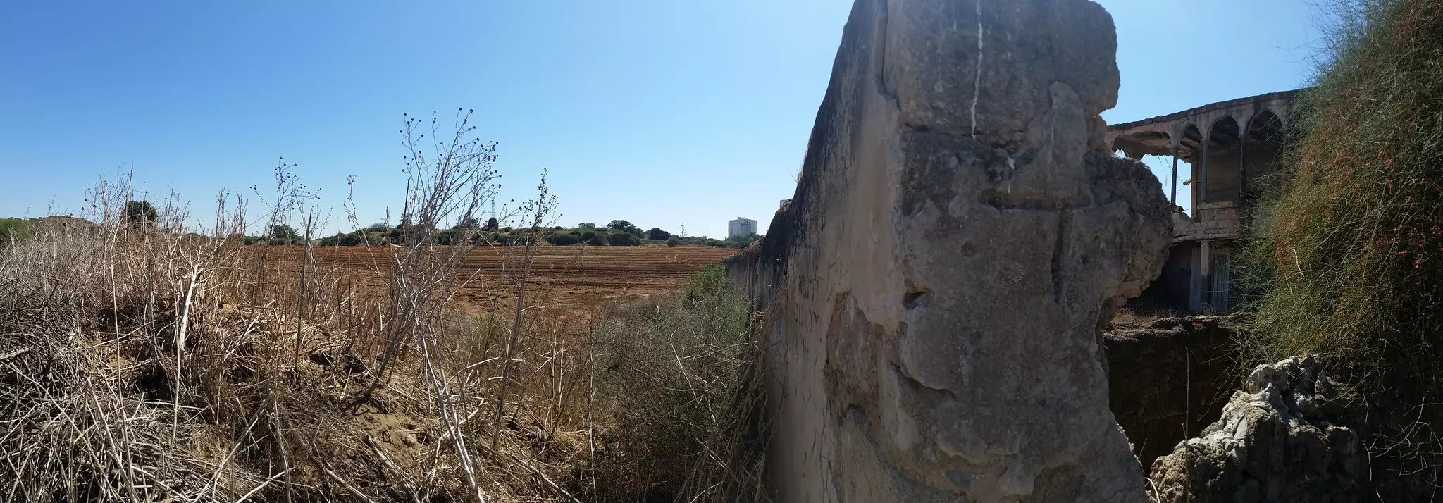
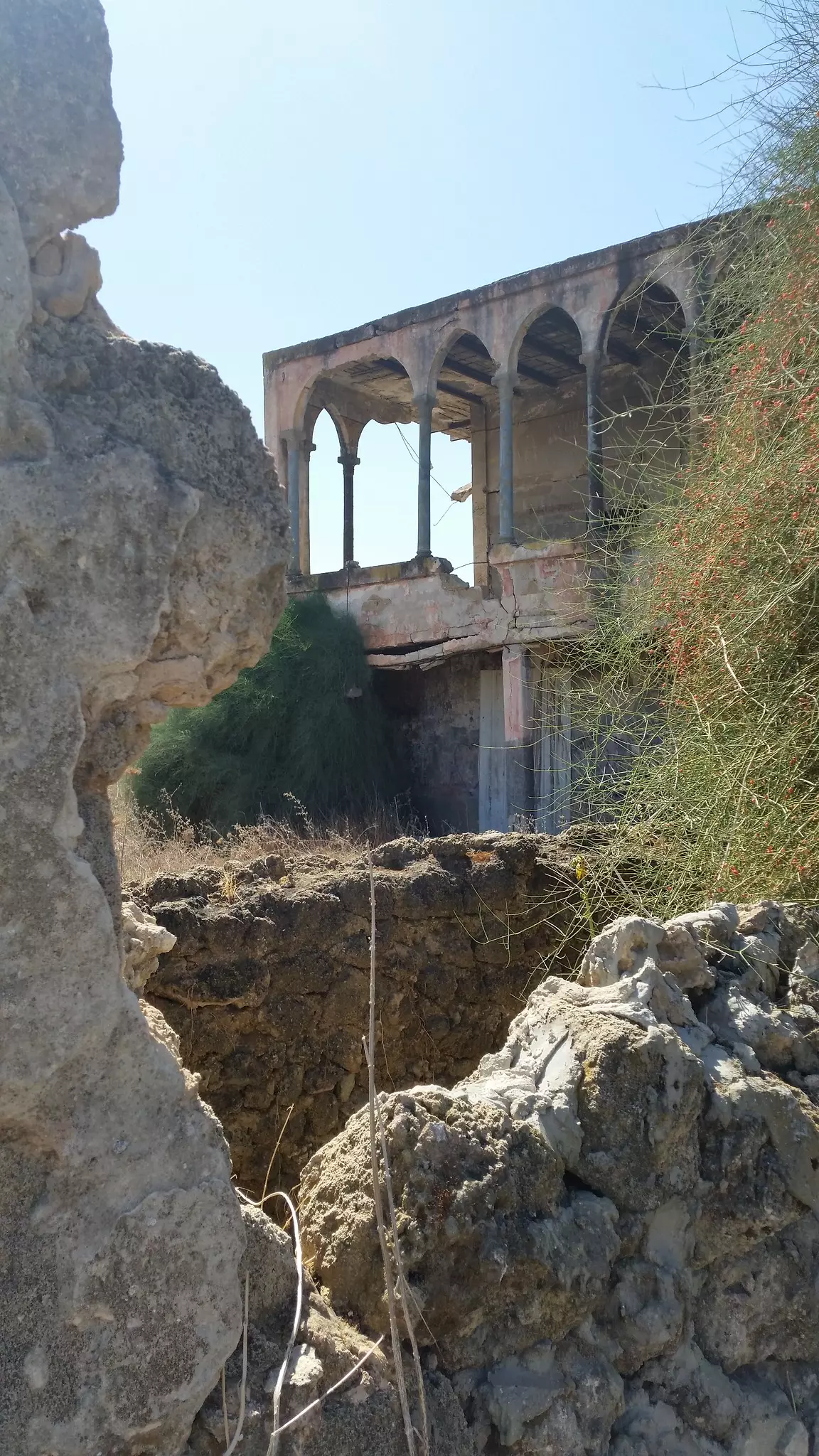
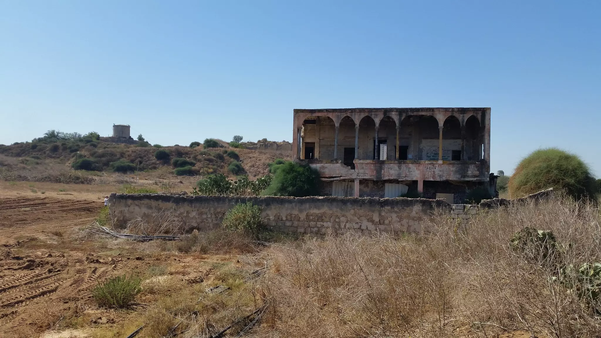
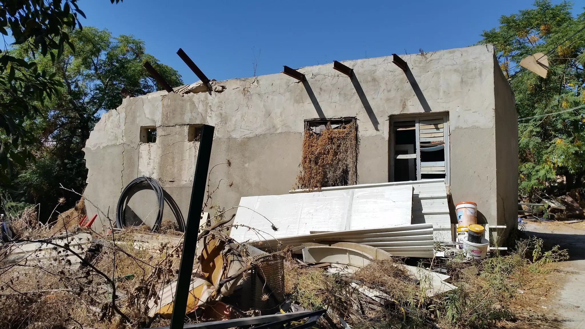
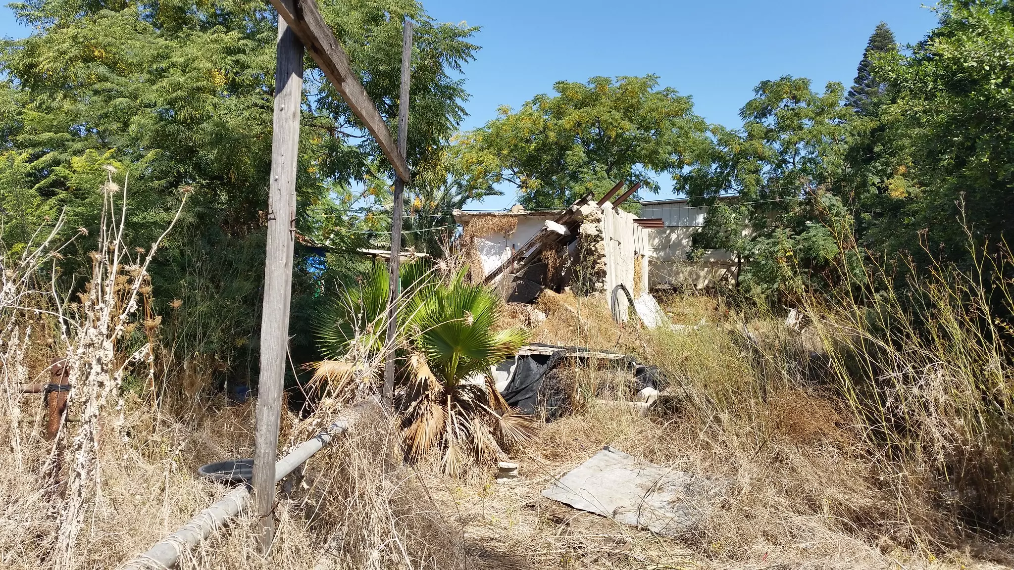
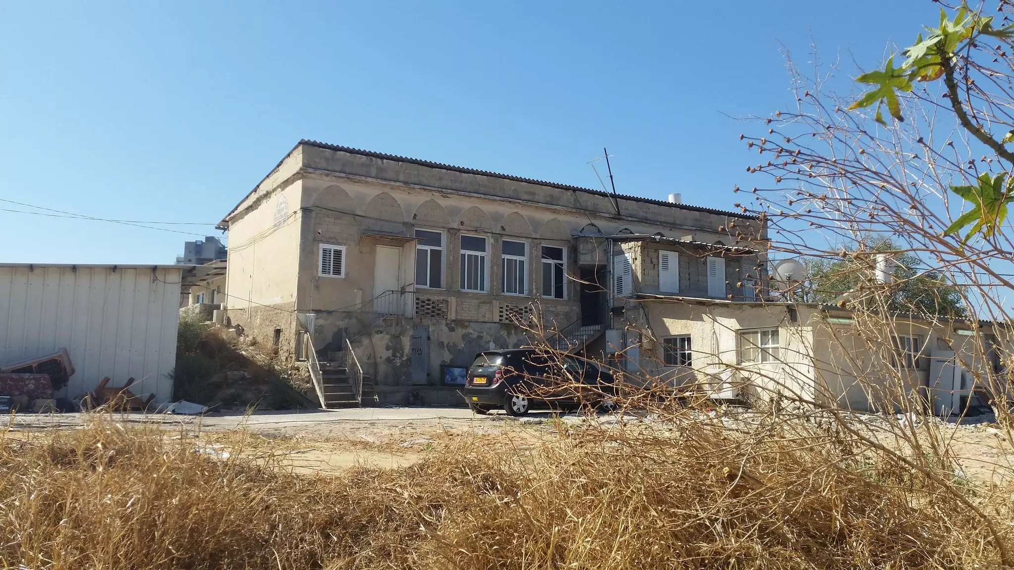
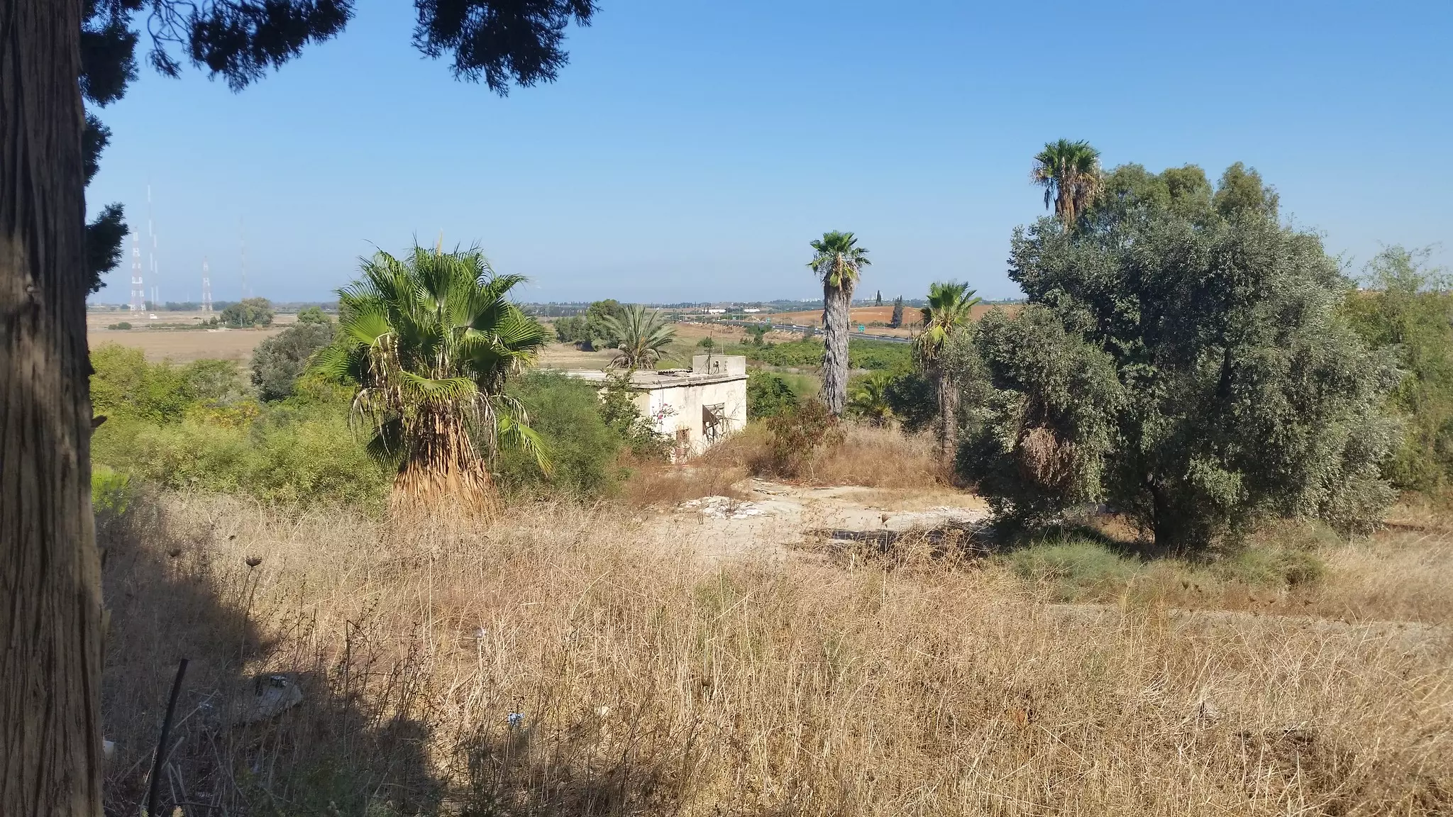
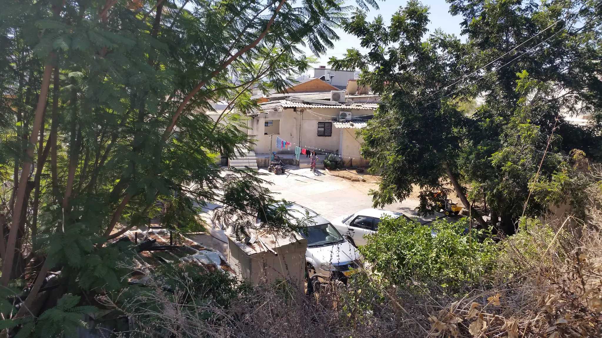
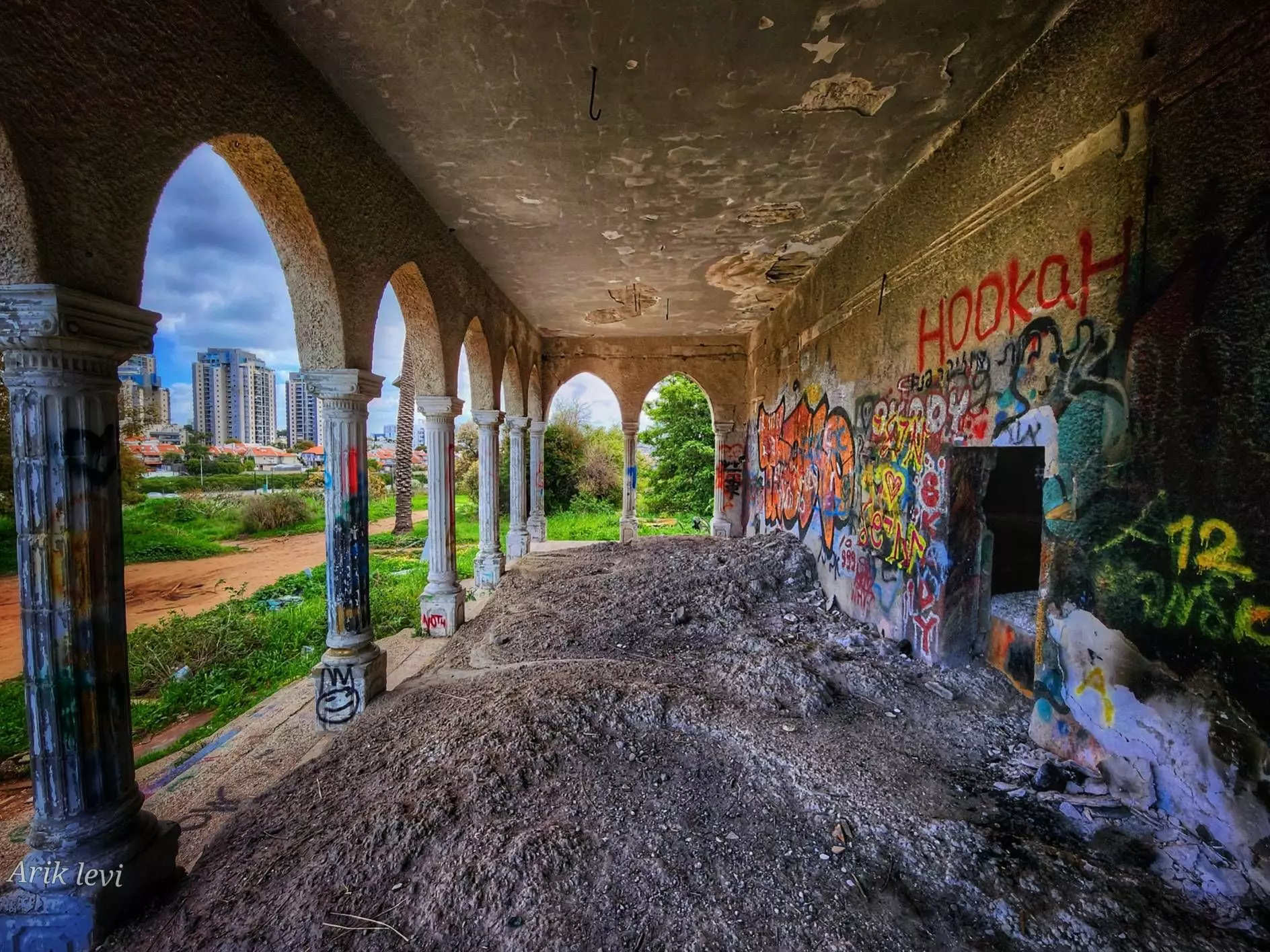
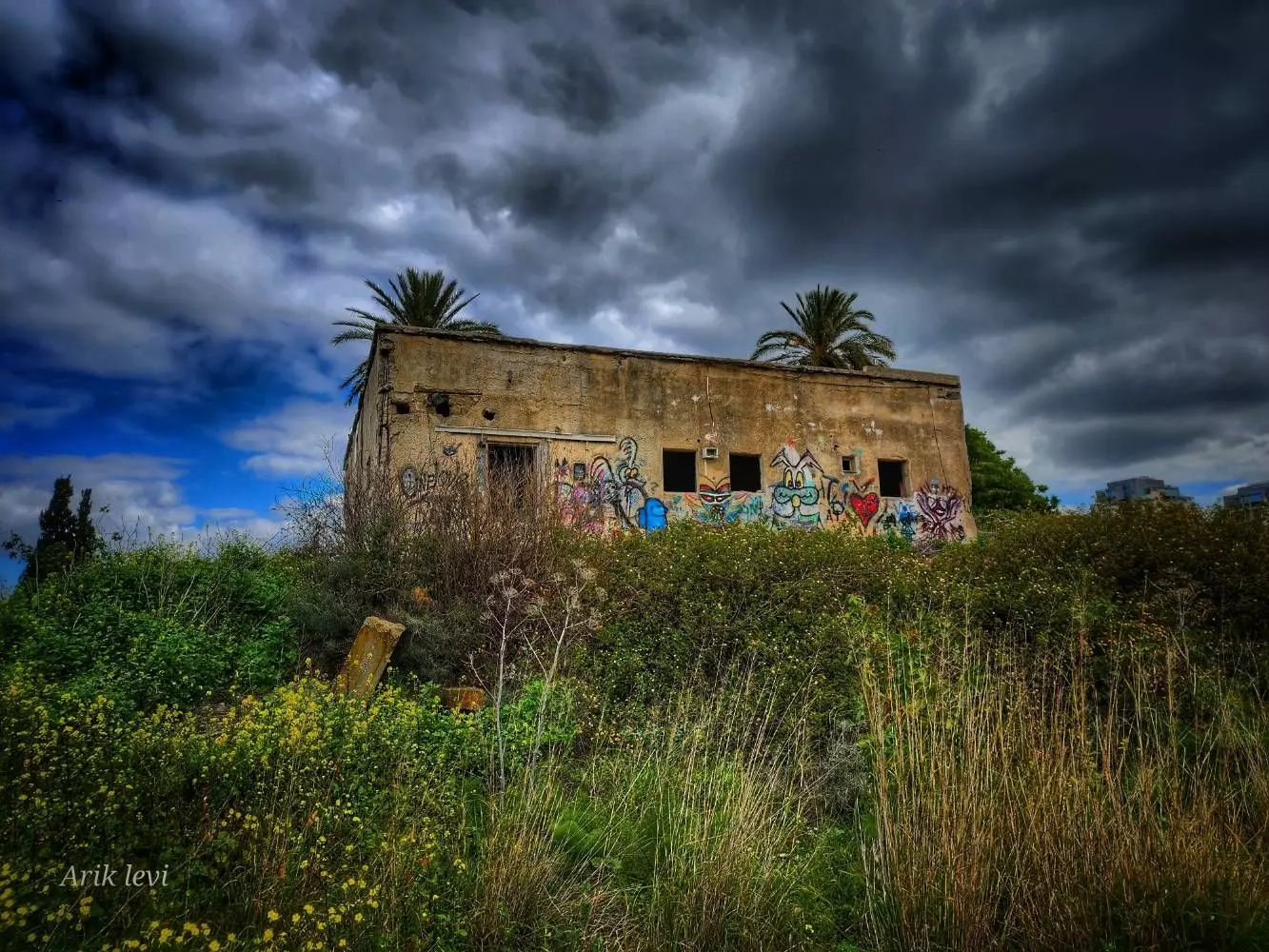
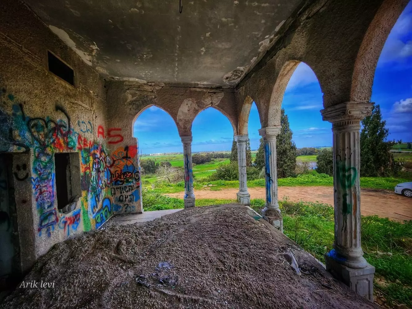
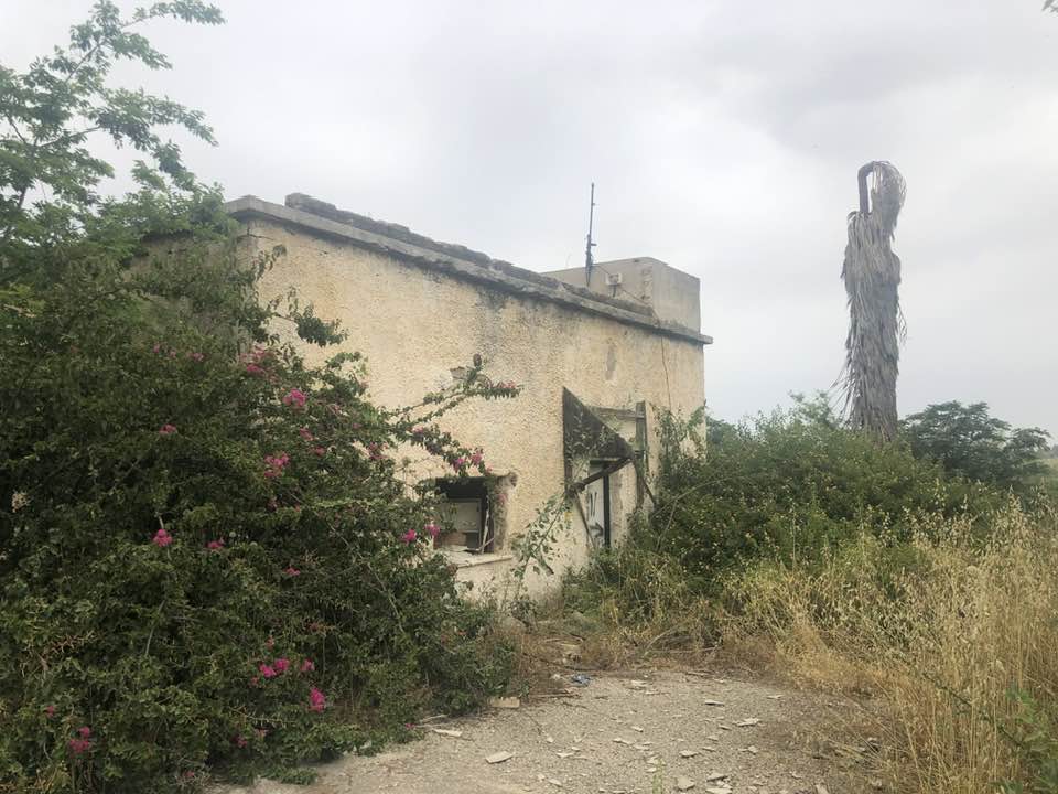
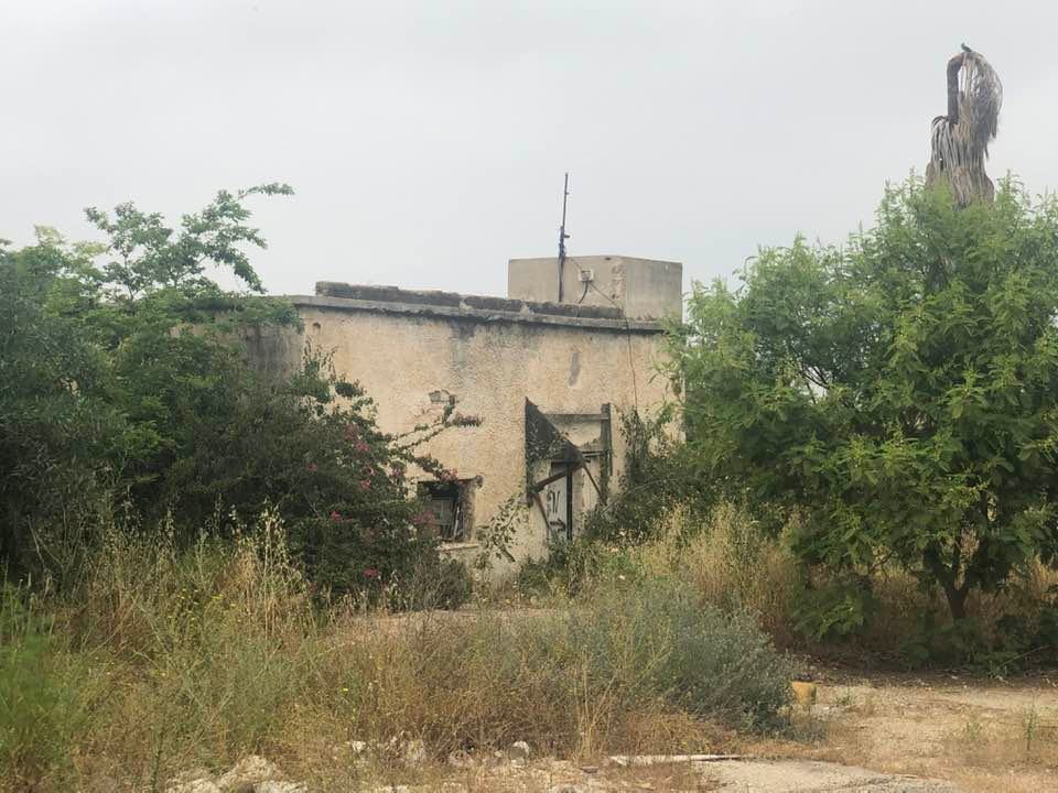
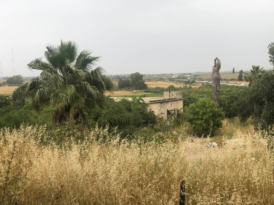
| Village Temains | During the 1st half of June 1948, al-Qubayba was mostly destroyed with the exception of few houses. Currently, those houses are occupied by Israeli Jewish settlers. | |||||||||||||||||||||
| Ethnically Cleansing | On the 29th of August 1948, al-Qubayba was completely ethnically cleansed. | |||||||||||||||||||||
| Pre-Nakba Land Ownership |
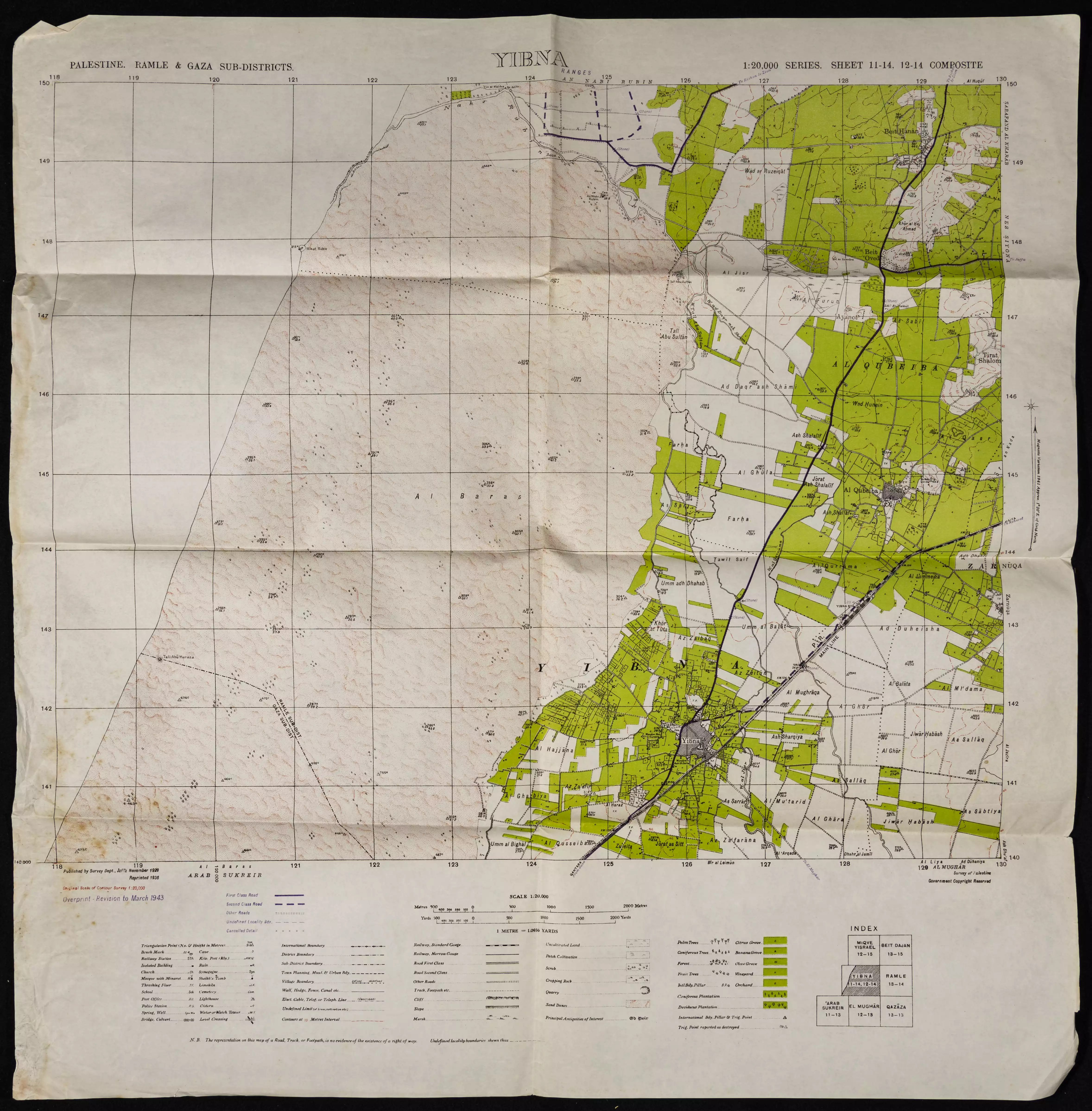
**Town Lands' Demarcation Maps |
|||||||||||||||||||||
| Land Usage As of 1945 |
|
|||||||||||||||||||||
| Population |
|
|||||||||||||||||||||
| Number of Houses |
|
|||||||||||||||||||||
| Near By Towns |
||||||||||||||||||||||
|
||||||||||||||||||||||
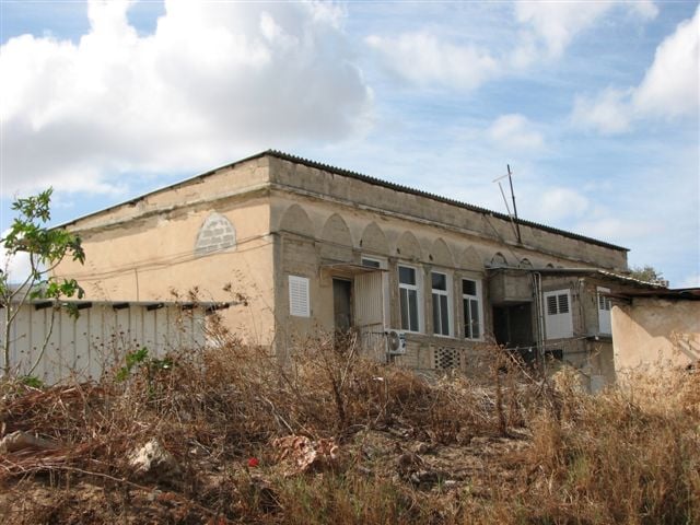
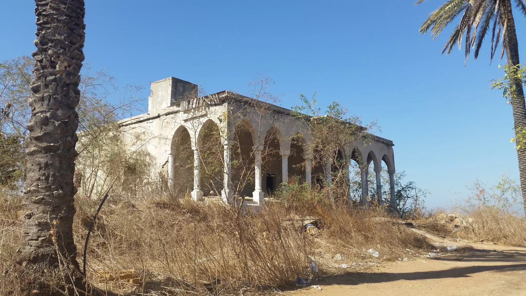
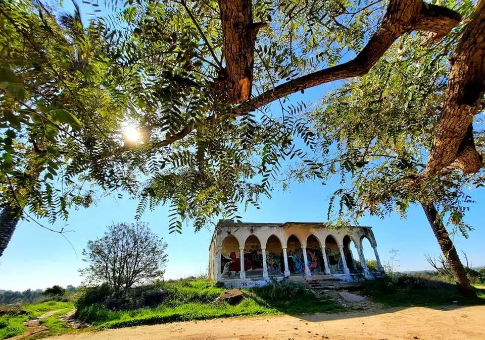
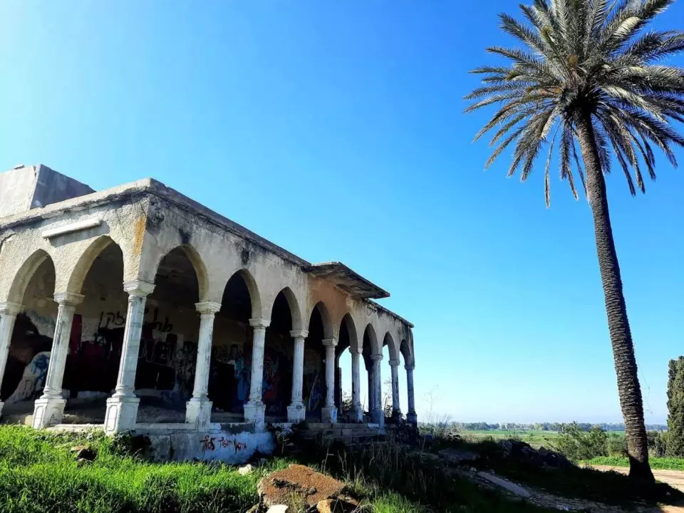
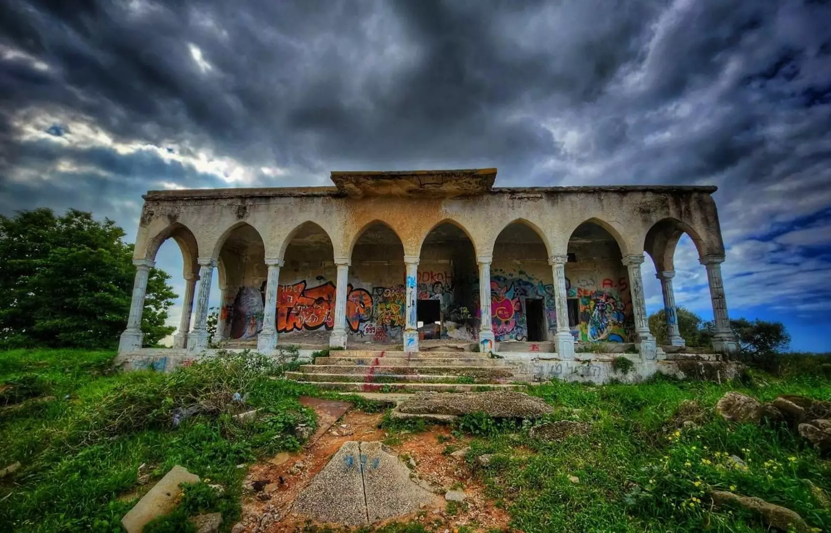
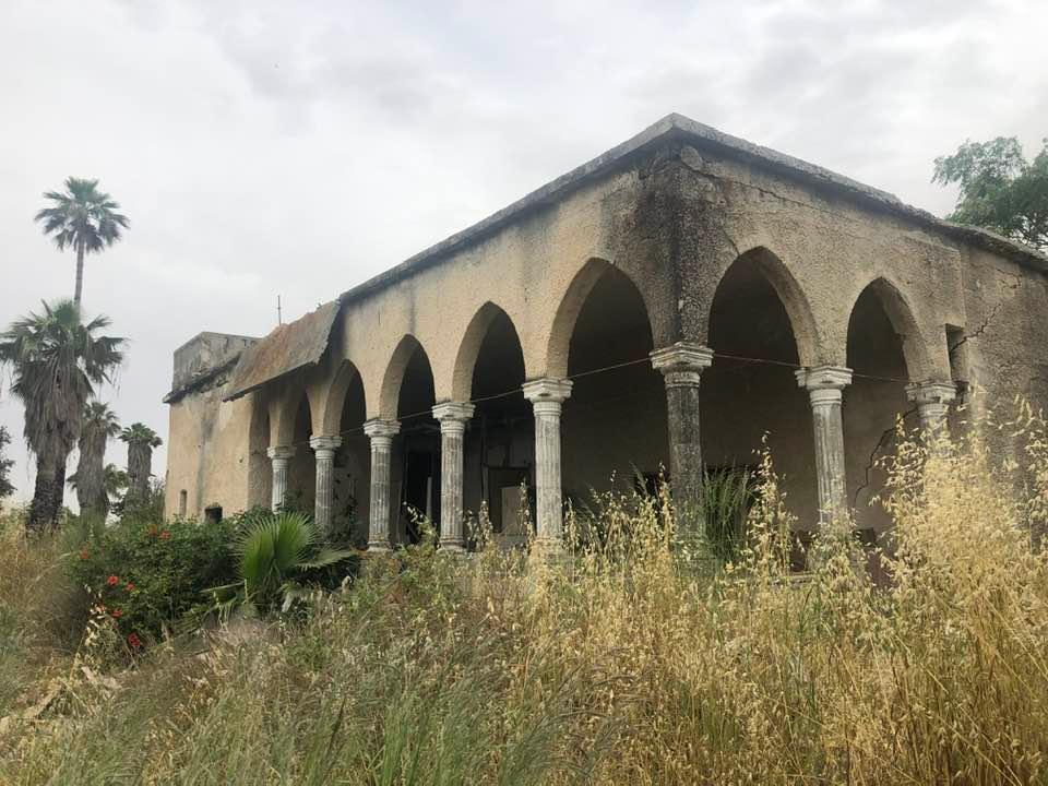
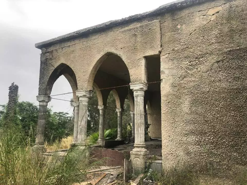
| Schools | An elementary school for boys which was founded in 1929, and in 1945 it had an enrollment of 344 students. The school is still standing, but it's in a bad shape and in need of serious renovation guys! | |||||||||||||||||||||
| Places of Warship | One mosque | |||||||||||||||||||||
| Nearby Wadies & Rivers | Rubin River (or Wadi al-Sarar) borders village lands. | |||||||||||||||||||||
| Water Supply | Fresh water was drawn from artesian wells and Rubin River waters was used for irrigation. | |||||||||||||||||||||
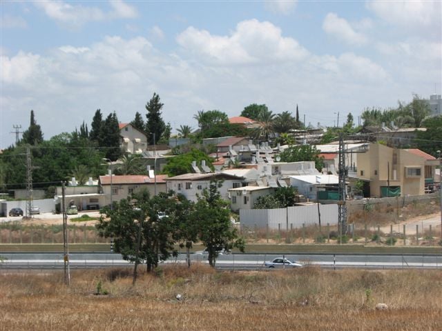
| Exculsive Jewish Colonies Who Usurped Village Lands |
Kefar Gevirol and Ge'alya | |||||||||||||||||||||
| Featured Video | ||||||||||||||||||||||
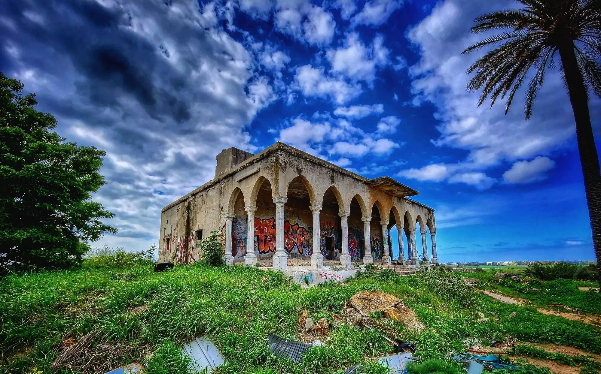
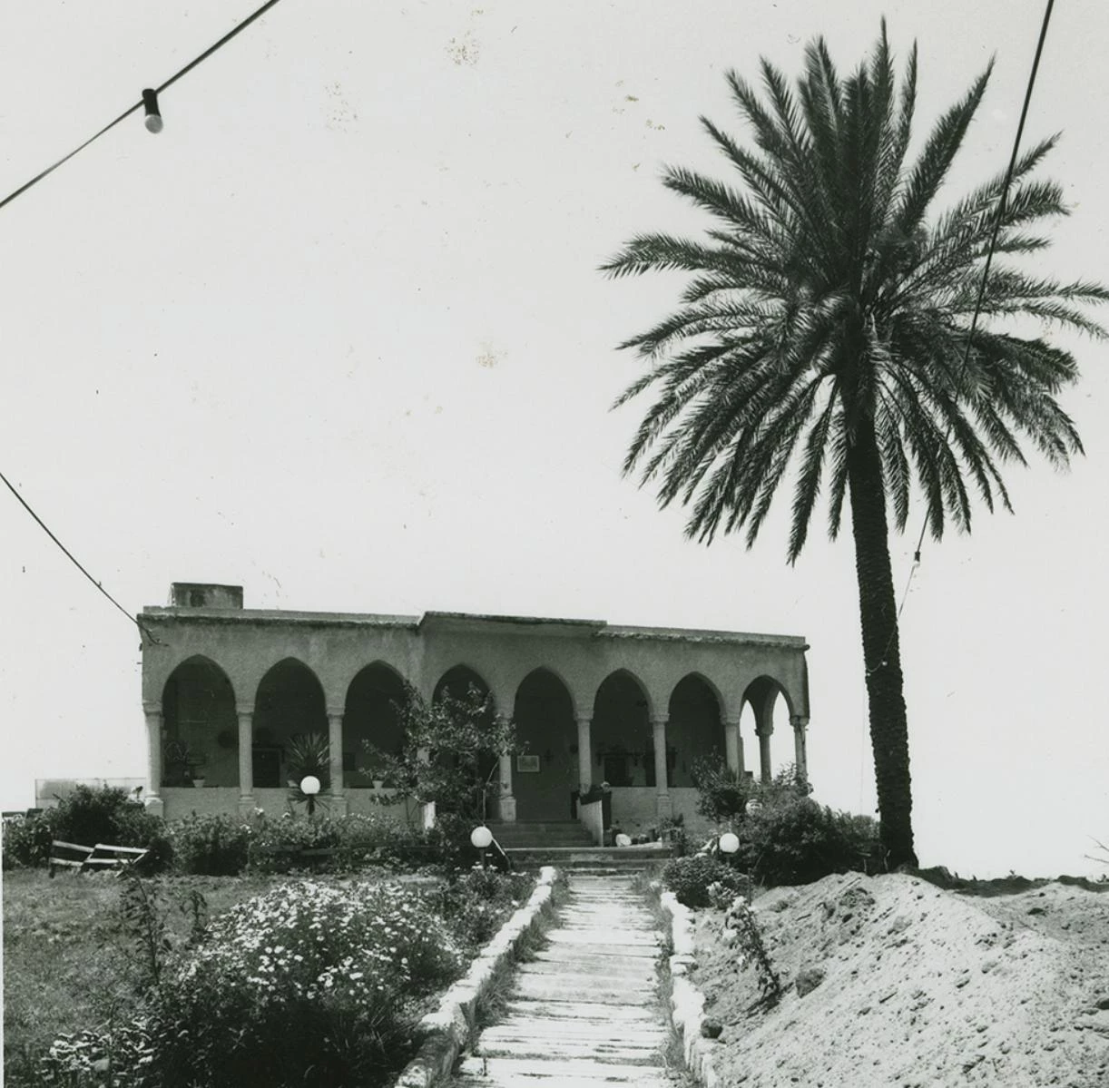
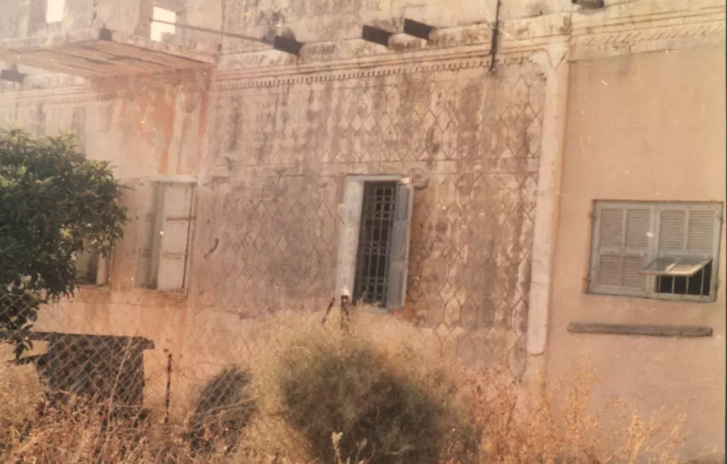
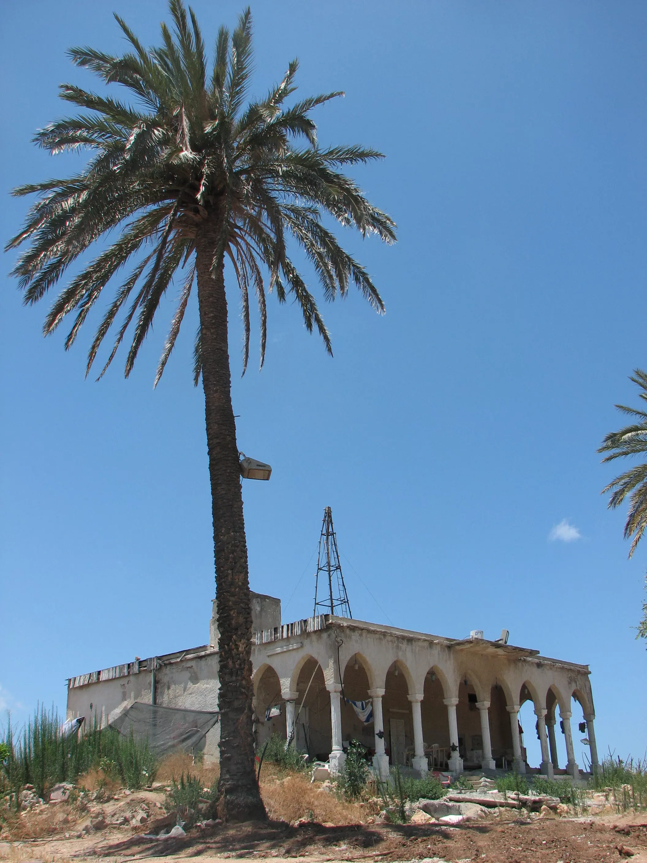
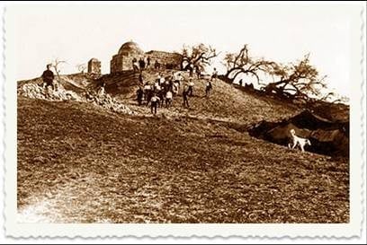
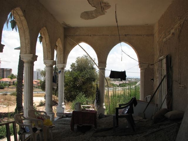
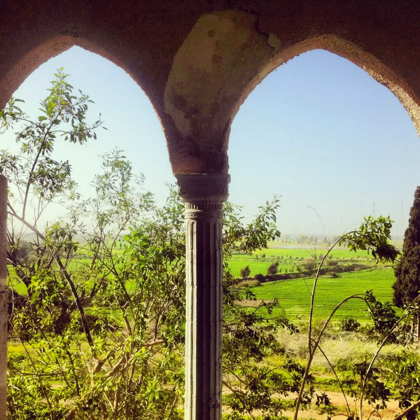
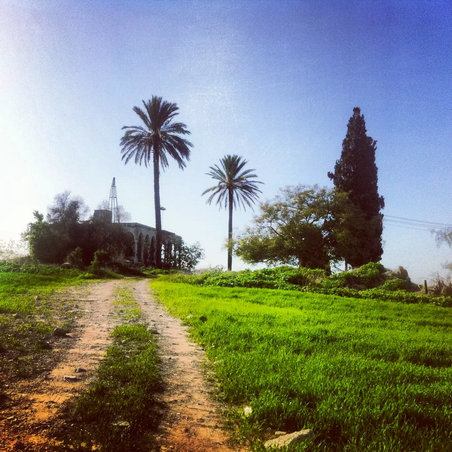
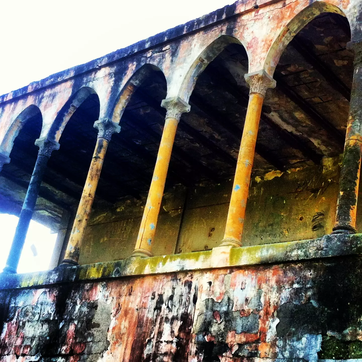
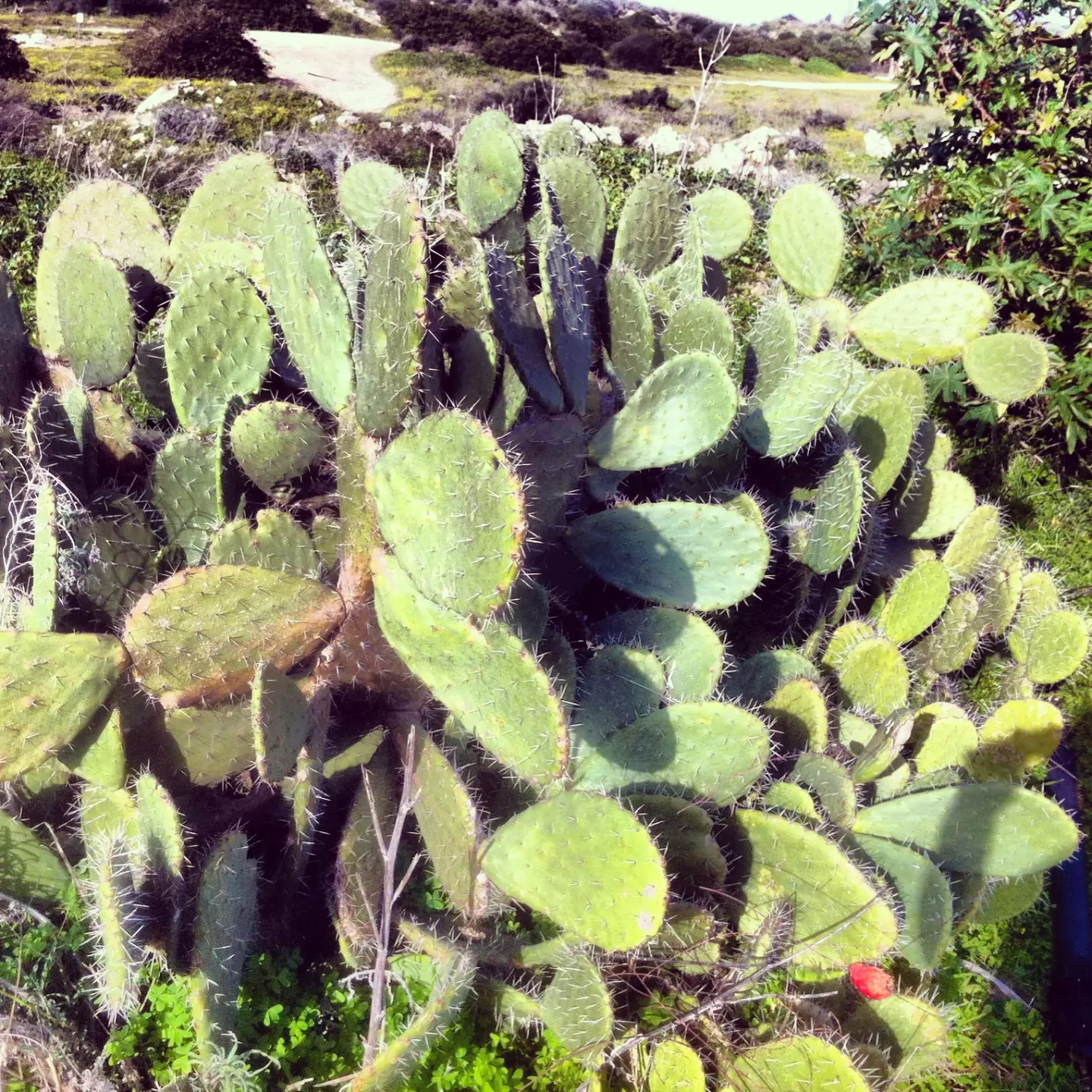
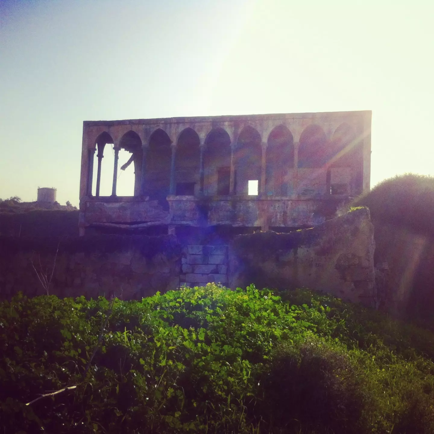
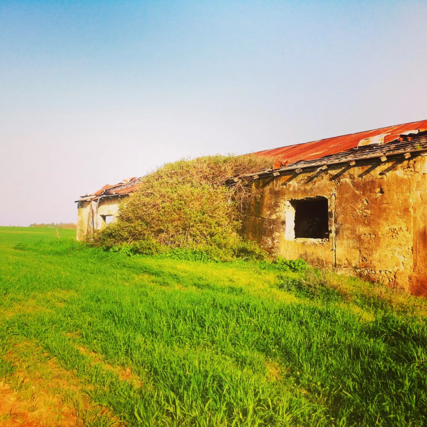
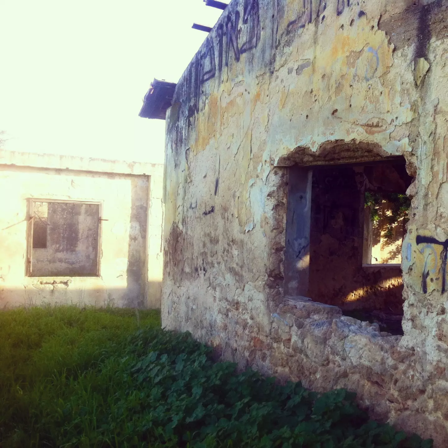
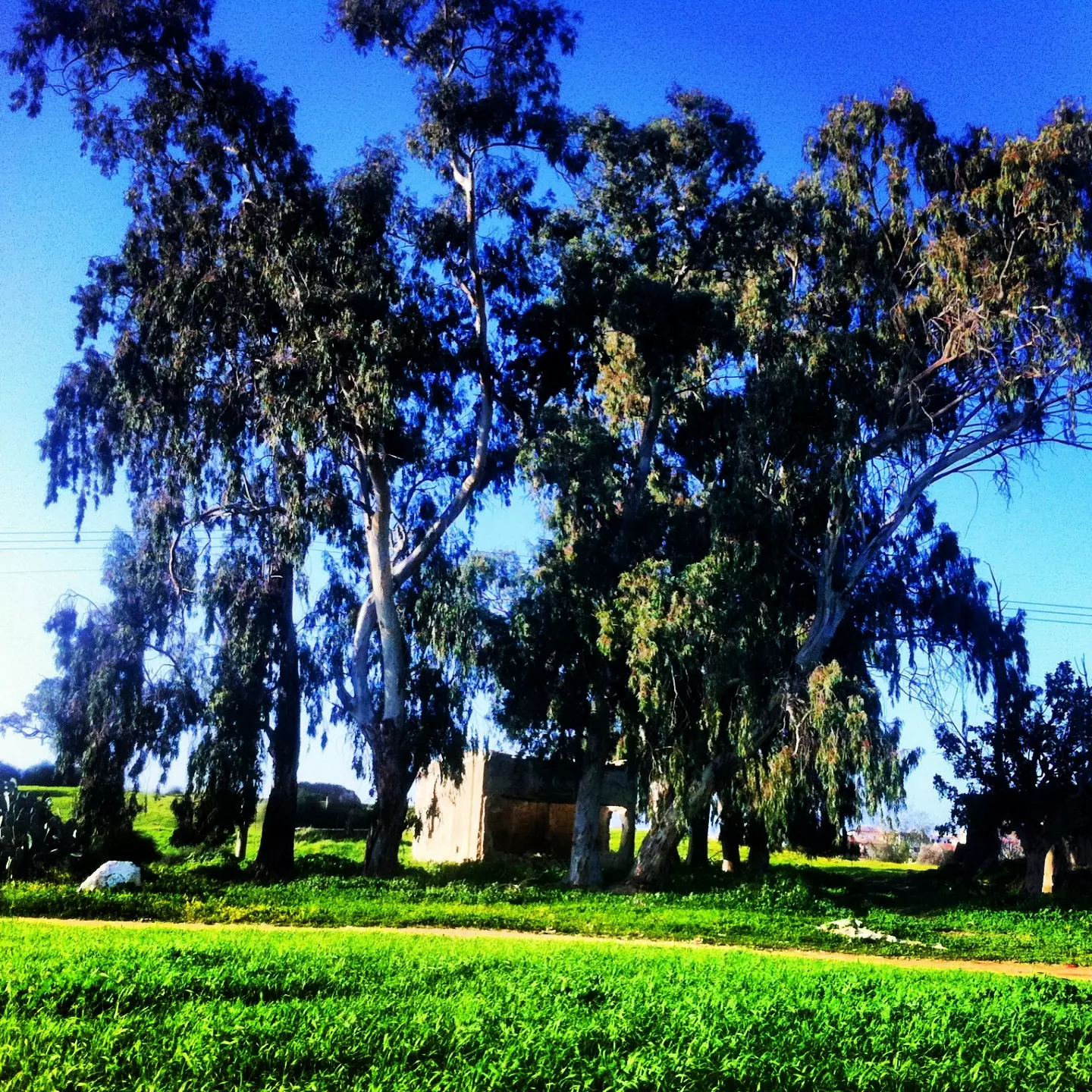
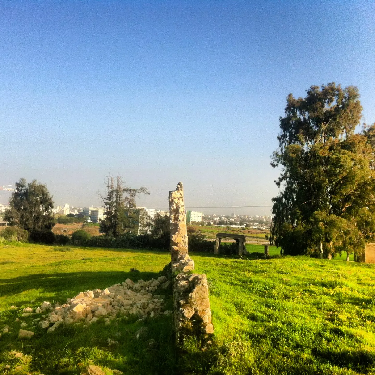
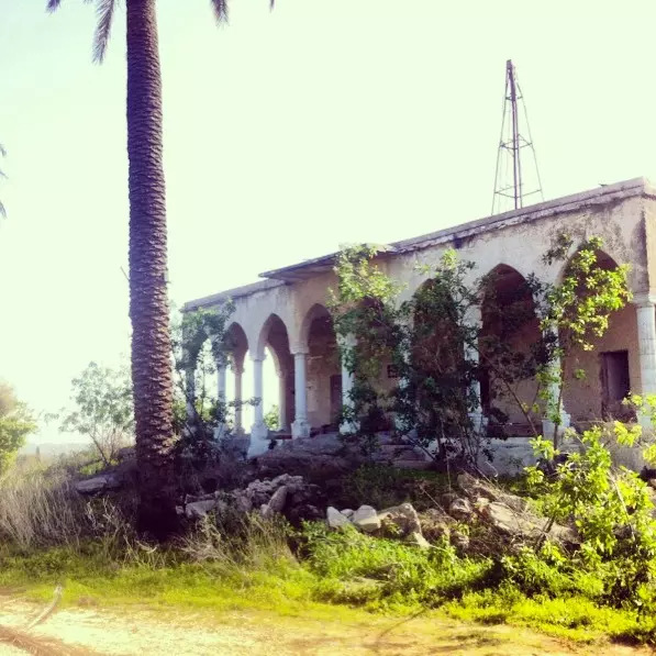
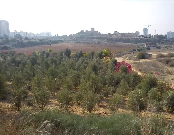
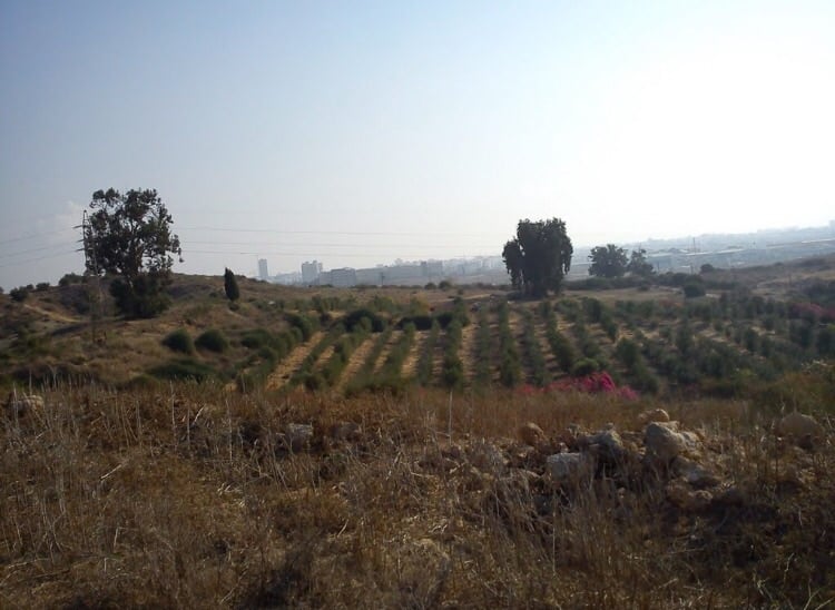
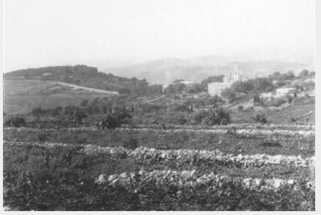
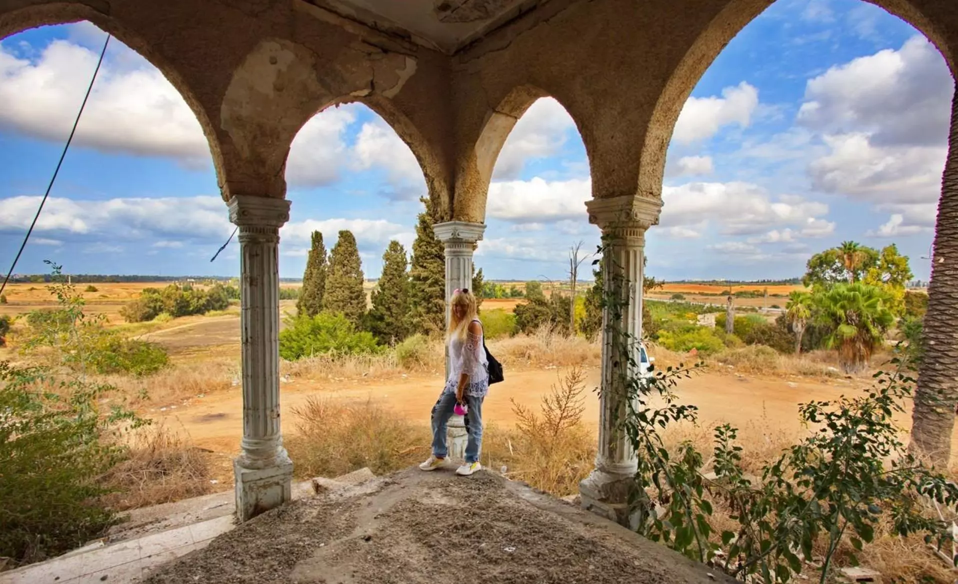
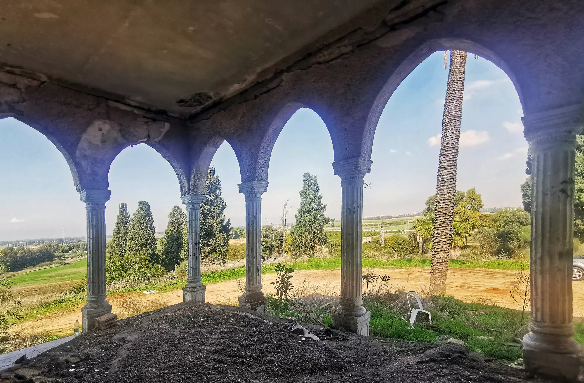
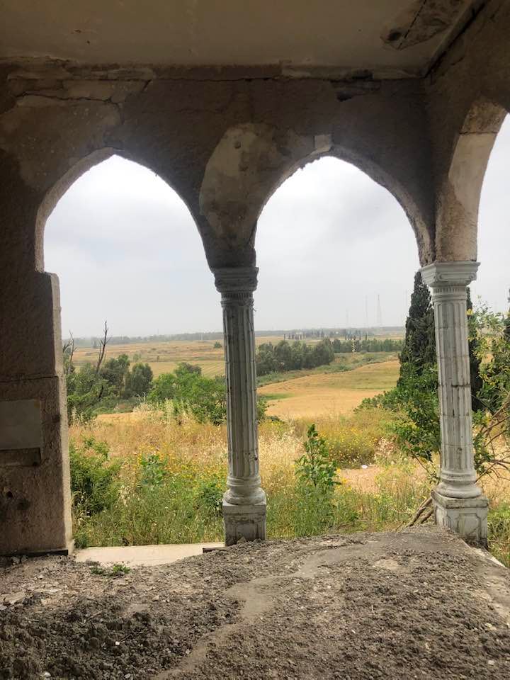
Village Before NakbaThe village stood on an alluvial elevation on the coastal plain, connected via a spur to the coastal highway to the west that linked it to Gaza, Ramla, and other urban centers. In the late nineteenth century, al-Qubayba was described as a village built of adobe bricks and situated on high ground. Gardens enclosed by cactus hedges were cultivated nearby. During the Mandate the houses were made of either adobe brick or stone and were clustered close to one another; new houses built on the eve of the war were spaced farther apart. AI-Qubayba had a modest marketplace, a mosque, and an elementary school. The school, established in 1929, had an annex of twelve dunums where students were taught basic agronomy; about 344 students were enrolled in the school in 1945-46. The population was entirely Muslim. By 1945, about nine hundred nomads were settled near the village. Agriculture was the main occupation of the villagers, who cultivated fruits, especially citrus, vegetables, and grain.In 1944/45 a total of 4,639 dunums was devoted to citrus and bananas and 2,972 dunums were allocated to cereals; 1,143 dunums were irrigated or used for orchards. Irrigation water was drawn from artesian wells and from the Rubin River. Village Occupation and Ethnic CleaningThe Associated Press quoted an Israeli military headquarters announcement stating that al-Qubayba was occupied on 19 May, but Israeli historian Benny Morris claims that it was occupied around a week later, on 27 May, by the Giv'ati Brigade during Operation Barak (see al-Batani al-Gharbi, Gaza sub-disctrict). The brigade was commanded by Shim'on Avidan, who 'wanted only empty villages,' according to Morris. At the same time that al-Qubayba was occupied by the Israeli army, the Irgun Zvai Leumi was engaged in an attempt to storm Ramla, about 10 km to the northeast. The village had been occupied along with Zarnuqa in a four-hour battle, according to the New York Times.Morris indicates that the deliberate destruction of al-Qubayba became something of an issue during Israeli cabinet meetings in June 1948. The level of devastation at the village must have been particularly high, for on 20 June, Minority Affairs Minister Bechor Shitrit specifically raised the case at a cabinet meeting. Part of the opposition to the destruction of this and other villages was based on financial concerns, to which Shitrit was alerted by Yitzchaq Gvirtz, director of the Absentee Property Department in the Office of the Custodian of Abandoned Property (part of the Finance Ministry). In a letter to Shitrit, Gvirtz stated that he was 'ready to accept the premise that we do not want the return of the Arabs to these villages,' and then proceeded to outline the financial concerns. He raised questions about wanton destruction that left no room for the salvage of doors, frames, tiles, and other useful building materials. At the time, Israeli Prime Minister Ben-Gurion agreed to investigate this matter, but the results of the investigation are not given. Zionists Colonies on Village LandsZionists established the settlement Ge'alya (127143) on the village site in 1948. Kefar Gevirol (128144) was also built on the site-probably at the same time-as a rural housing lot. Kefar ha-Nagid (126143), built in 1949, is near the site, on land that belonged to the neighboring village of Yibna.Village TodayThe walls and rubble of collapsed houses intermingle with the buildings of the Israeli settlements that have been established on the site. A former pool is used as a garbage dump. Some houses remain. One house, occupied by Jewish residents, is of modest size and is made of masonry; the beams that support its flat roof protrude slightly from the masonry of the exterior walls. Another village house is now used as a restaurant. Part of the school, a long building with a rectangular door and windows, still stands. Cactus hedges and sycamore and palm trees grow on the southern edge of the site.SourceDr. Walid al-Khalidi, 1992: All That Remains. |
||||||||||||||||||||||
| Related Maps | Town Lands' Demarcation Maps خرائط للقضاء توضح حدود القرى والاودية Town's map on MapQuest View from satellite Help us map this town at WikiMapia |
|||||||||||||||||||||
| Related Links | Wikipedia's Page Facebook Page Featured Article Google Search Google For Images Google For Videos |
|||||||||||||||||||||
| More Information | مخطط البلد في كتاب كي لا ننسى في كتاب بلادنا فلسطين المزيد من موقع هوية |
|||||||||||||||||||||
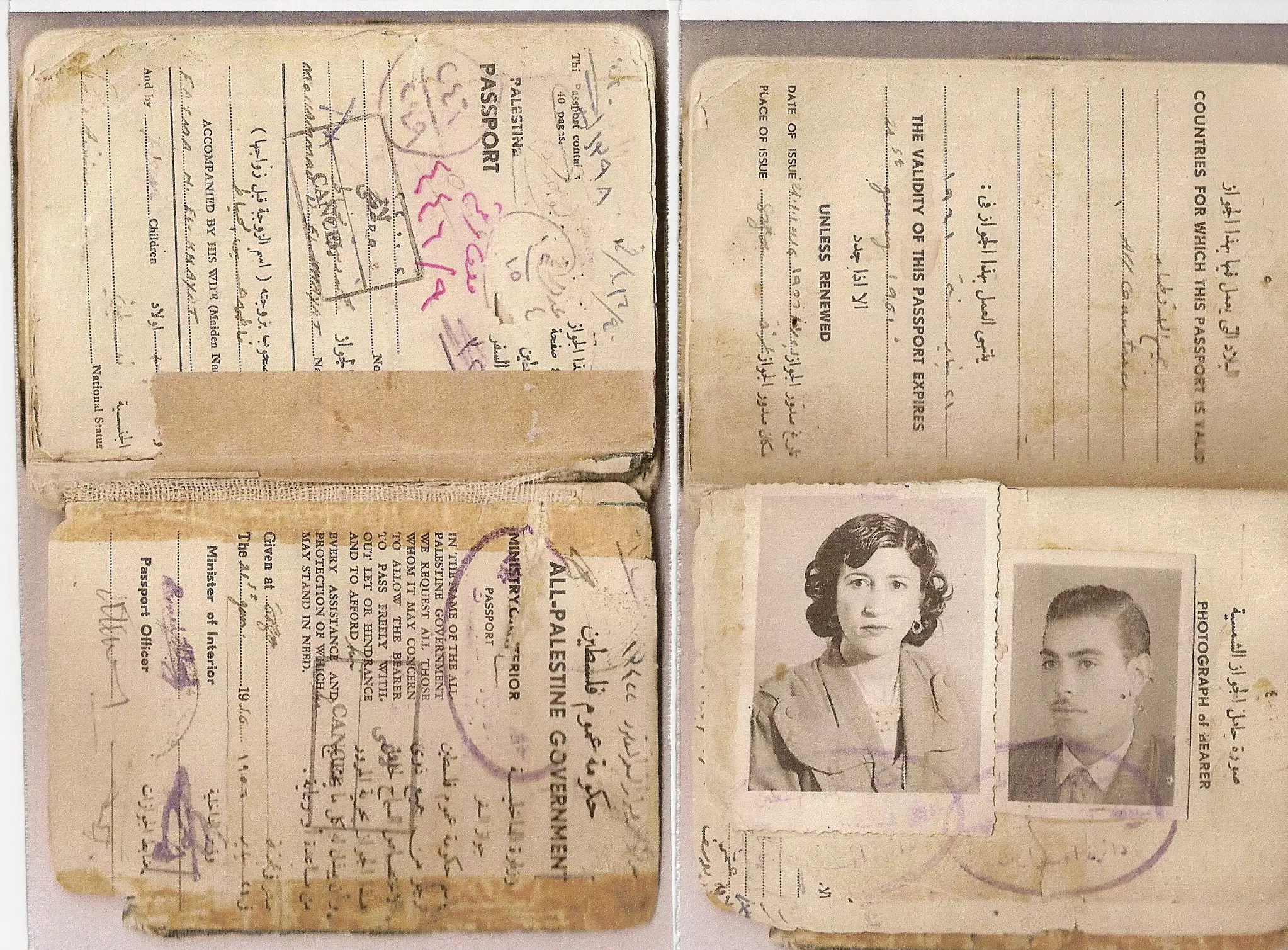
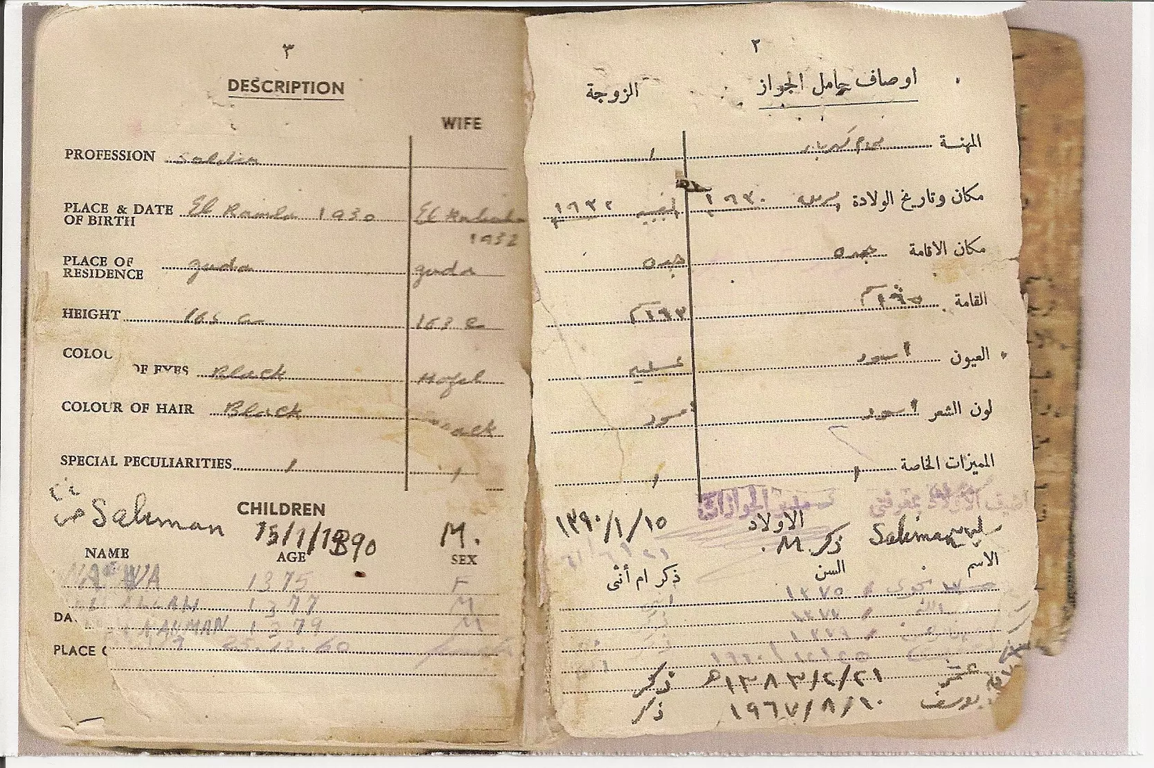
- My family history:link to Qubeiba
- Book about al-Qubayba
- السعوديه
- أسماء العائلات التي كانت تسكن القبيبة حتى نكبة 1948
- نبذة تاريخية عن قرية القبيبة (قضاء الرملة) من كتاب (كي لا ننسى)
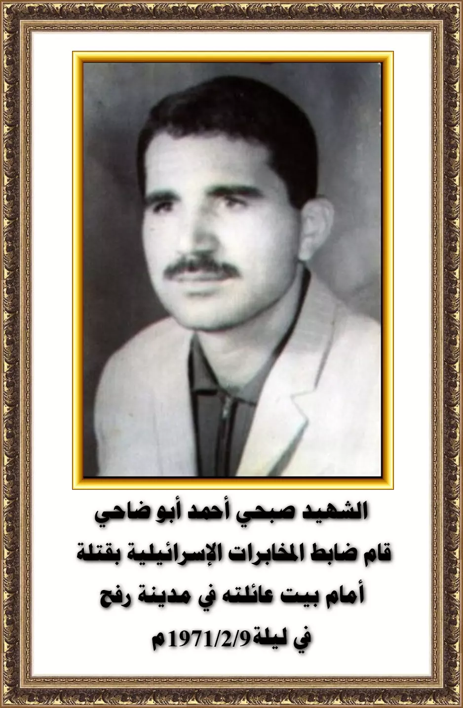
- الشهيد / صبحي أحمد أبو ضاحي
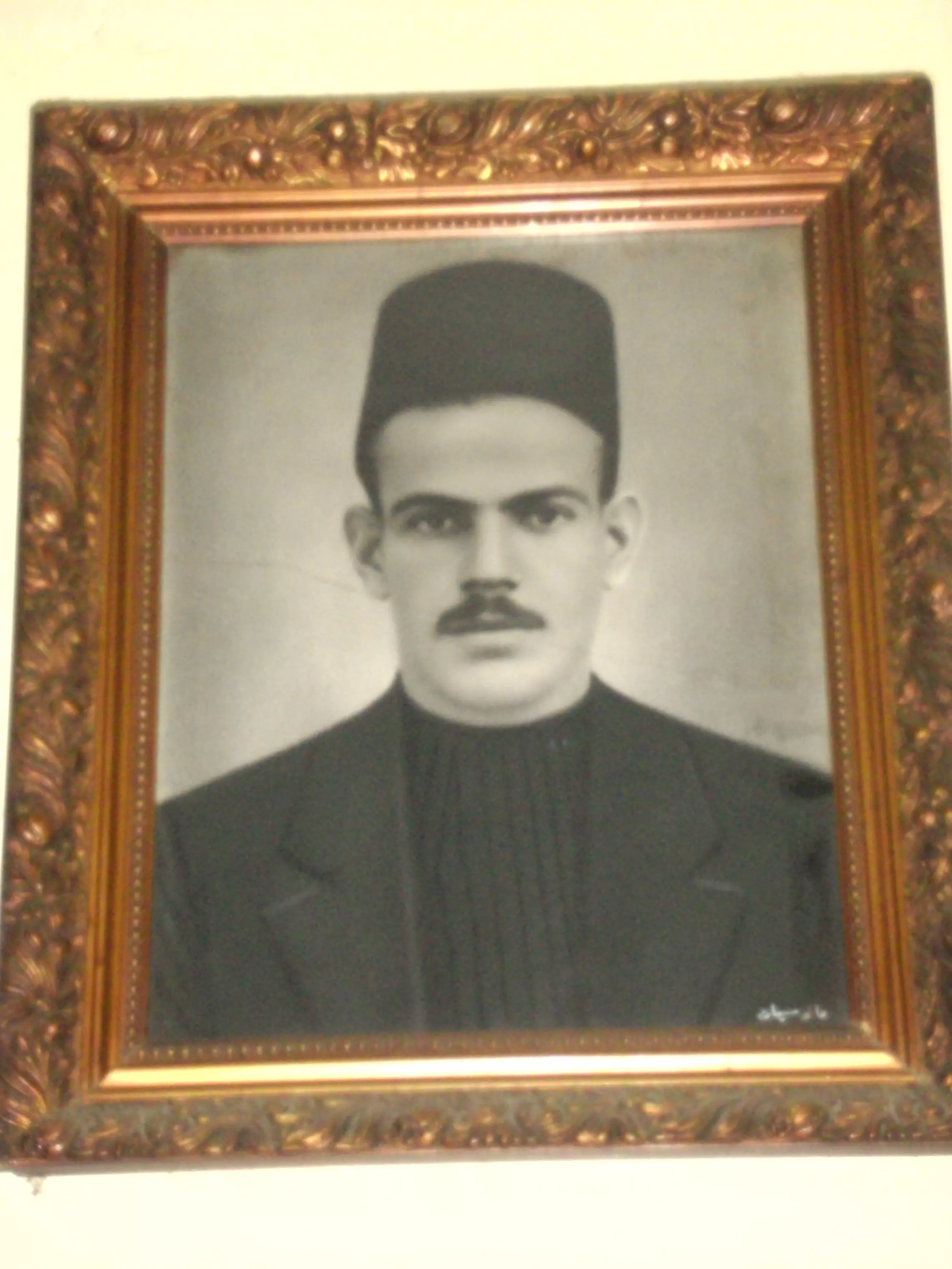
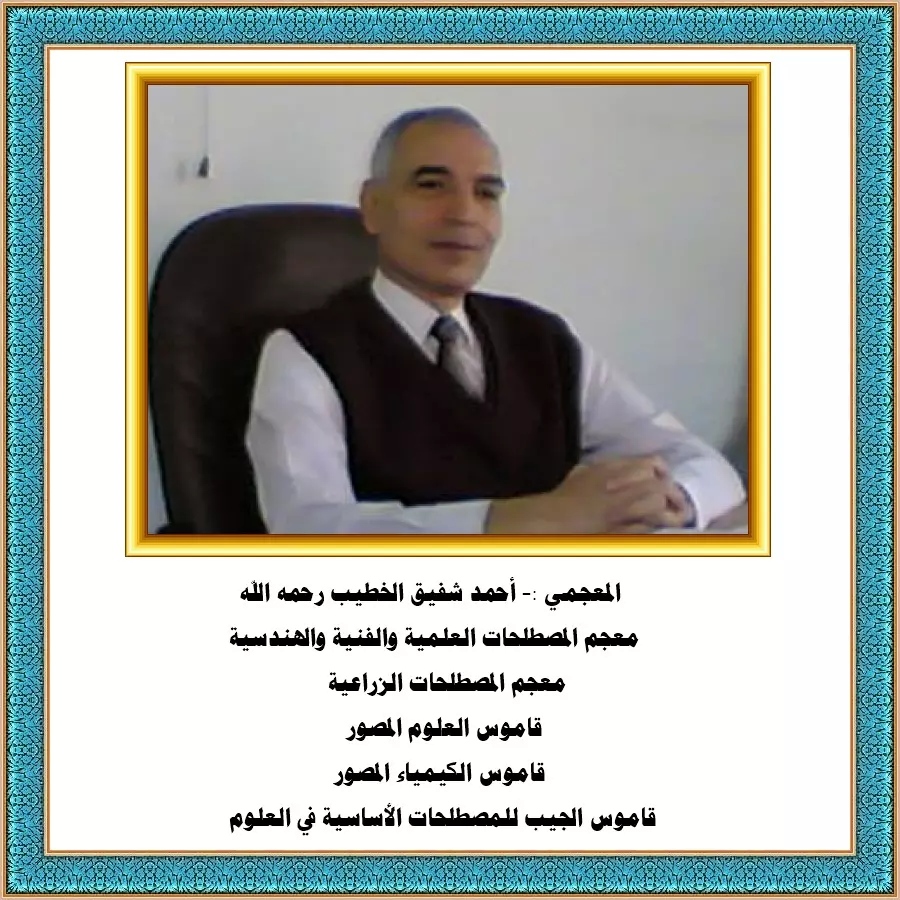
- من أعلام القبيبة :- المعجمي الأستاذ أحمد شفيق الخطيب
- من أعلام القبيبة :- د. حسين أبو النجا
- من أعلام القبيبة :- أ. أحمد الدبش
- من أعلام القبيبة :- الفنان التشكيلي والشاعر محمد شكري المزين
- من أعلام القبيبة :- محمد الضيف المصري... القائد القسّامي
- من أعلام القبيبة :- الفنان د.عبد الرحمن المزين
- شهداء قرية القبيبة قضاء الرملة
- التعريف بقرية القبيبة قضاء الرملة
- من أعلام القبيبة :- العقيد - رأفت شاهين محمد شاهين
- القبيبة في الموسوعة الفلسطينية
- اصل شاهين القبيبة عشيرة ال شاهين الخالدي المخزومي
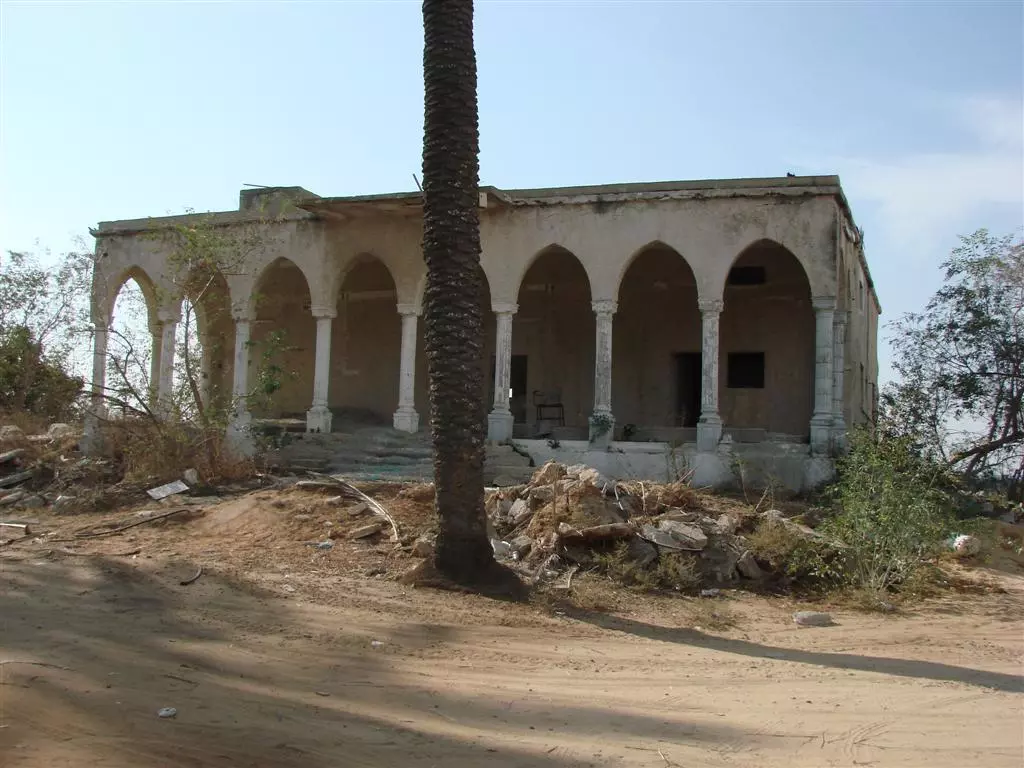
- إحدى بيوت القرية المغتصبة التي حُولت لمطعم إسرائيلي
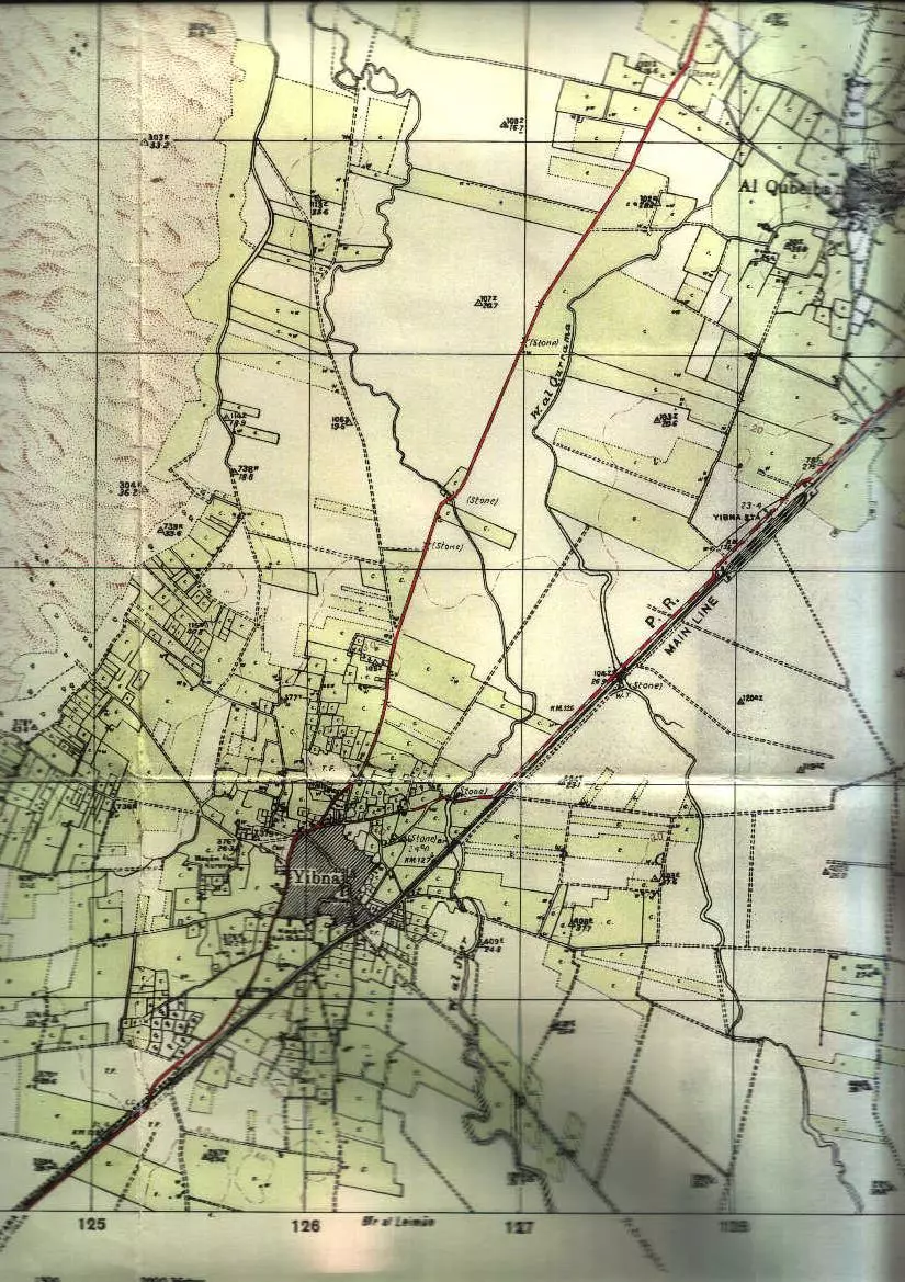
Scanned from "All That Remains" by Dr. Walid Khalidi 48 - The Official Map of The Agriculture & Built Up Areas In & Around Yibna & al-Qubayba Before Destruction As Of 1941. Very Rare Map!
Posted by Prince, Peaceful Israeli 2 - محمد ديب الخياط من مواليد القبيبه - محافظة الرمله
Posted by ابو بندر 2 - محمد ديب الخياط من مواليد القبيبه - محافظة الرمله - 2
Posted by ابو بندر - Al basha Refeat Shahin
Posted by Refeat Shahin 2 - Al sayed Abdul kader Shahin

Posted by Refeat Shahin 2 - El-Shikh Shafiq Al-khatib House
Posted by Haider Al-khatib 1 - Alqubiba country-sides and houses (1982 Visit)
Posted by Haider Al-khatib - Alqubayba country-sides and houses (1982 Visit)
Posted by Haider Al-khatib 1 - المختار نعيم شاهين
Posted by المختار نعيم شاهين 13 - al-Qubayba, 6q2010
Posted by said 1 - al-Qubayba 11-2010
Posted by said - قرية القبيبة - صورة للاحتلال القرية 1948
Posted by صفافي أصيل - قرية القبيبة - صورة للقرية عام 1940
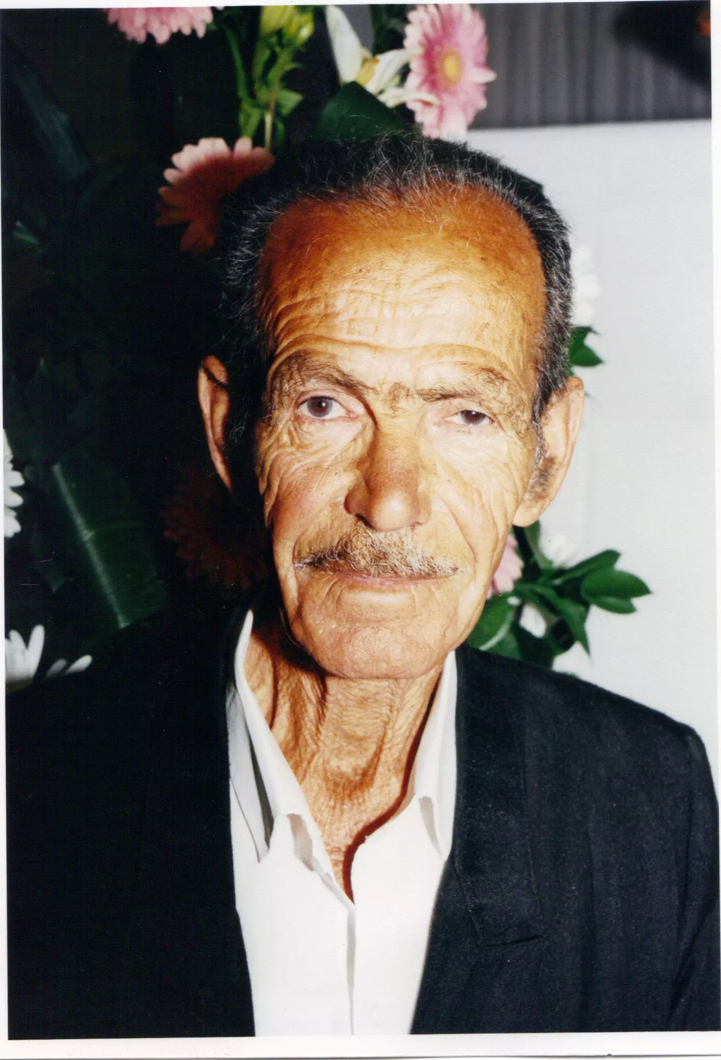
Posted by صفافي أصيل - المرحوم الوالد احمد رفعت شاهين من القبيبة
Posted by khawla shahin 2 - منظر عام من منزل موسى شاهين
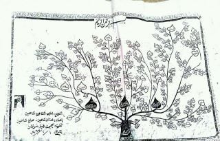
Posted by شاهين - شجرة العائلة
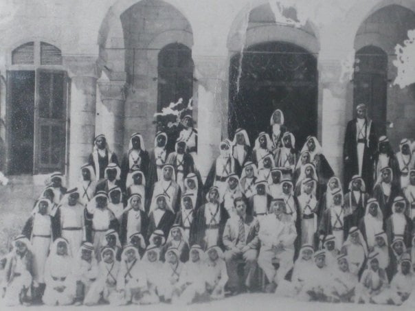
Posted by شاهين - مدرسة للطلاب بالقبيبة التقطت عام 1920
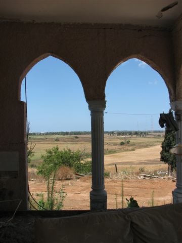
Posted by شاهين 1 - منزل موسى شاهين بمنتصف القرية
Posted by شاهين - من داخل المنزل
Posted by شاهين - المنزل من الخلف
Posted by شاهين - مستوطنات امام منزل موسى شاهين
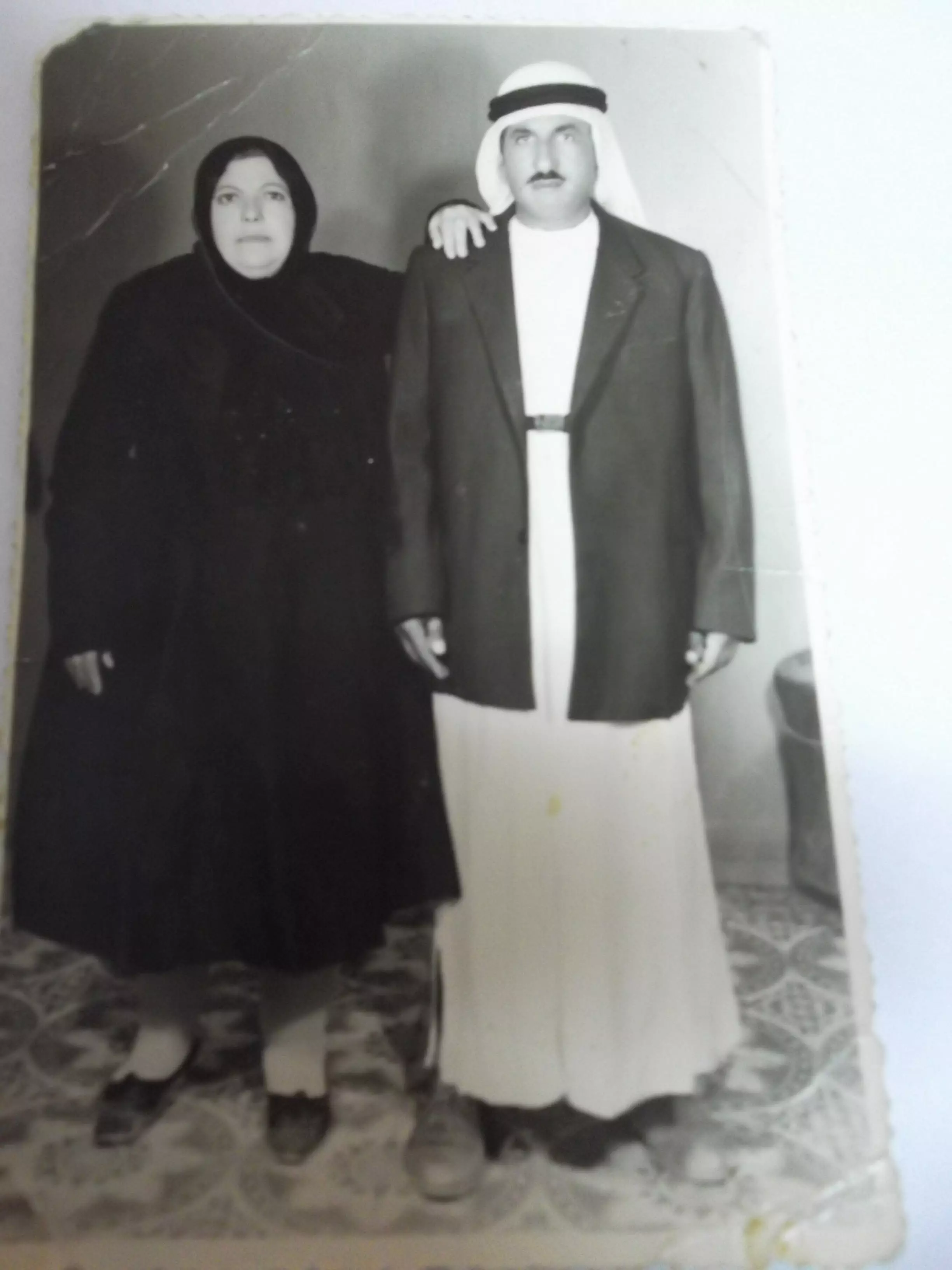
Posted by شاهين - ابو جمال وام جمال شاهين
Posted by azzehikmat - قرية القبيبة الفلسطينية (قضاء الرملة) المحتلة عام 1948
Posted by Maher Shahin - قرية القبيبة الفلسطينية (قضاء الرملة) المحتلة عام 1948
Posted by Maher Shahin - قرية القبيبة الفلسطينية (قضاء الرملة) المحتلة عام 1948
Posted by Maher Shahin - قرية القبيبة الفلسطينية (قضاء الرملة) المحتلة عام 1948
Posted by Maher Shahin - قرية القبيبة الفلسطينية (قضاء الرملة) المحتلة عام 1948
Posted by Maher Shahin - قرية القبيبة الفلسطينية (قضاء الرملة) المحتلة عام 1948
Posted by Maher Shahin - قرية القبيبة الفلسطينية (قضاء الرملة) المحتلة عام 1948
Posted by Maher Shahin - قرية القبيبة الفلسطينية (قضاء الرملة) المحتلة عام 1948
Posted by Maher Shahin - قرية القبيبة الفلسطينية (قضاء الرملة) المحتلة عام 1948
Posted by Maher Shahin - قرية القبيبة الفلسطينية (قضاء الرملة) المحتلة عام 1948
Posted by Maher Shahin - قرية القبيبة الفلسطينية (قضاء الرملة) المحتلة عام 1948
Posted by Maher Shahin - قرية القبيبة الفلسطينية (قضاء الرملة) المحتلة عام 1948
Posted by Maher Shahin - قرية القبيبة الفلسطينية (قضاء الرملة) المحتلة عام 1948
Posted by Maher Shahin - قرية القبيبة الفلسطينية (قضاء الرملة) المحتلة عام 1948
Posted by Maher Shahin - قرية القبيبة الفلسطينية (قضاء الرملة) المحتلة عام 1948
Posted by Maher Shahin - قرية القبيبة الفلسطينية (قضاء الرملة) المحتلة عام 1948
Posted by Maher Shahin - قرية القبيبة الفلسطينية (قضاء الرملة) المحتلة عام 1948
Posted by Maher Shahin 2 - قرية القبيبة الفلسطينية (قضاء الرملة) المحتلة عام 1948
Posted by Maher Shahin - قرية القبيبة الفلسطينية (قضاء الرملة) المحتلة عام 1948
Posted by Maher Shahin - قرية القبيبة الفلسطينية (قضاء الرملة) المحتلة عام 1948
Posted by Maher Shahin - اراضي قريه القبيبه
Posted by abu raya - القبيبه
Posted by abu raya - المتبقي من بيوت القريه
Posted by abu raya - بيوت القريه
Posted by abu raya - بيوت القريه
Posted by abu raya - قريه القبيبه
Posted by abu raya - قريه القبيبه
Posted by abu raya - قريه القبيبه يوم احتلالها سنه 1948
Posted by abu raya - قريه القبيبه قبل النكبه
Posted by abu raya - القبيبه قبل النكبه
Posted by abu raya - صوره من قريه القبيبه قبل النكبه
Posted by abu raya - القبيبه قبل النكبه
Posted by abu raya - القبيبه قبل النكبه
Posted by abu raya - الشهيد صبحي أحمد أبو ضاحي
Posted by مصطفى محمد البلبيسي - المعجمي :- أحمد شفيق الخطيب رحمه الله
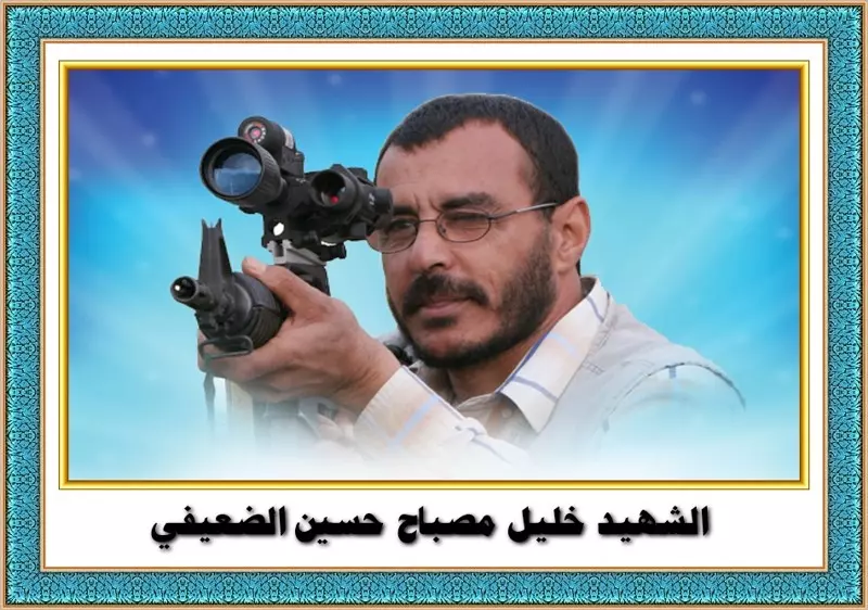
Posted by مصطفى محمد البلبيسي - الشهيد خليل مصباح حسين الضعيفي
Posted by مصطفى محمد البلبيسي - الشهيد عمر عرفات شفيق الخطيب

Posted by مصطفى محمد البلبيسي - Pre-Nakba Aerial view of the village / صورة من الجو للقرية اخذت قبل النكبة
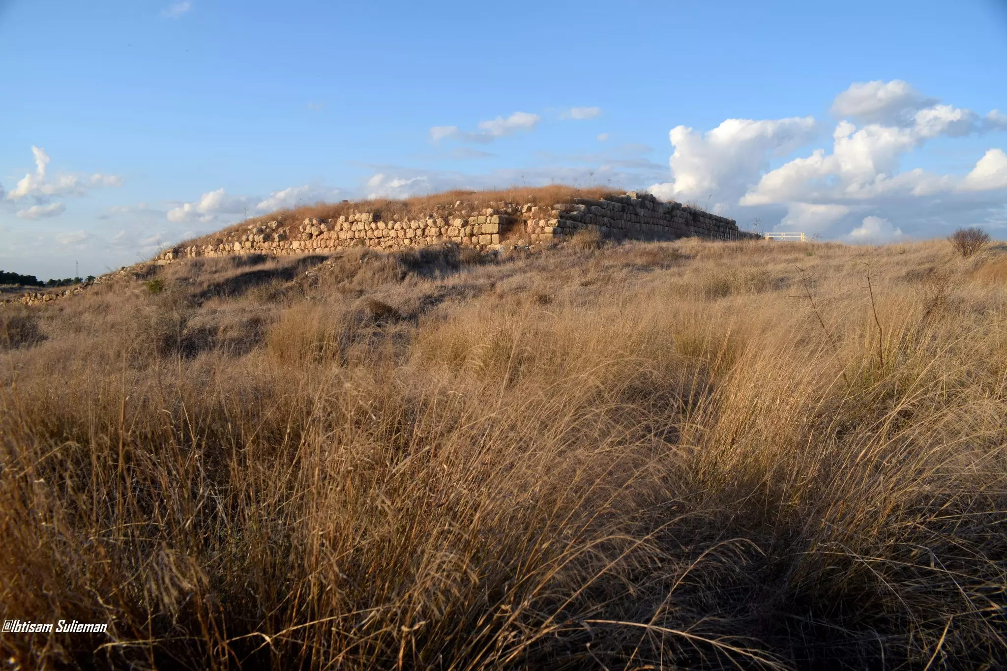
- تل الدوير او مدينة لخيش الكنعانية--Ibtisam Sulieman

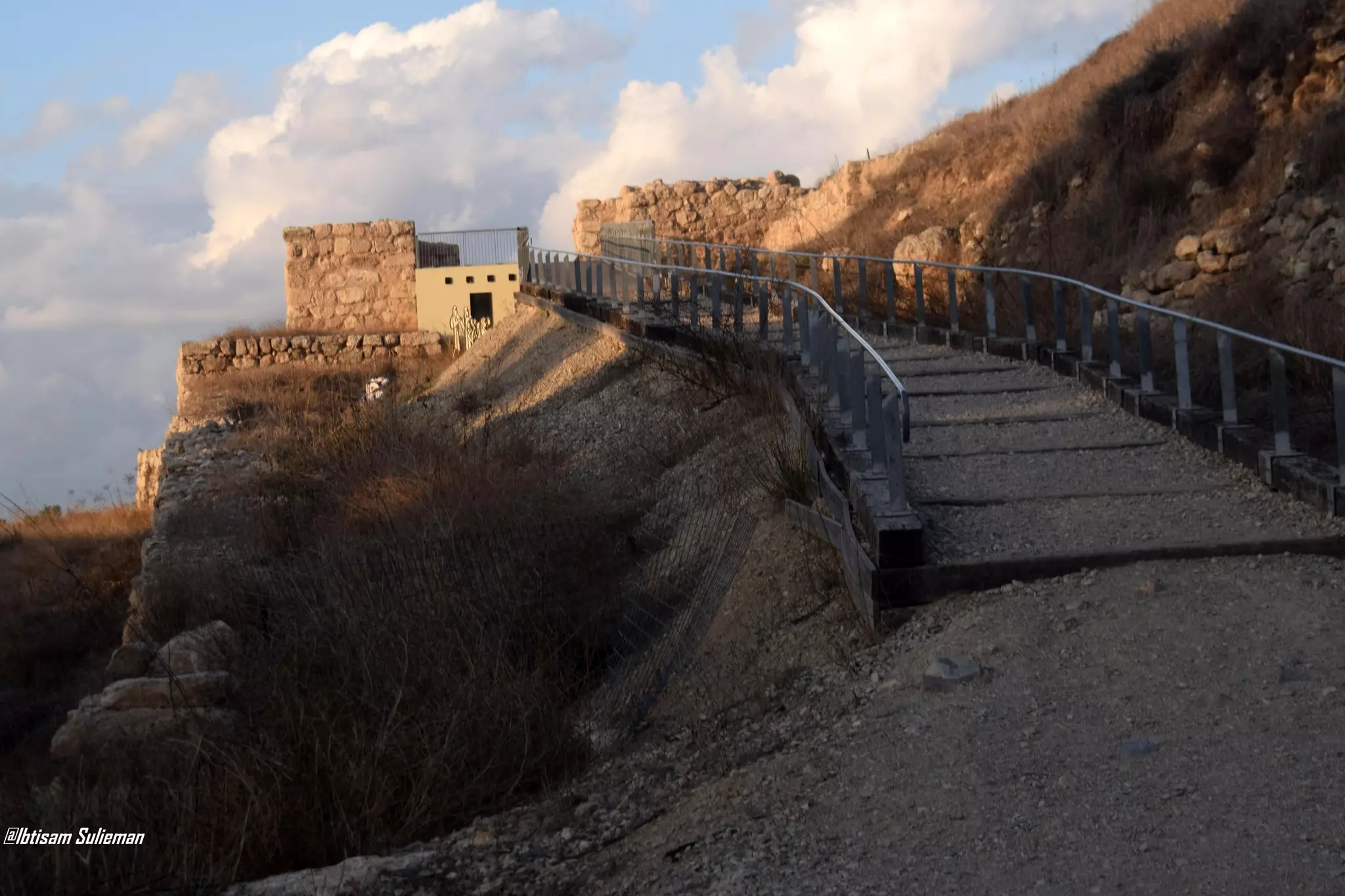
- تل الدوير او مدينة لخيش الكنعانية--Ibtisam Sulieman #2
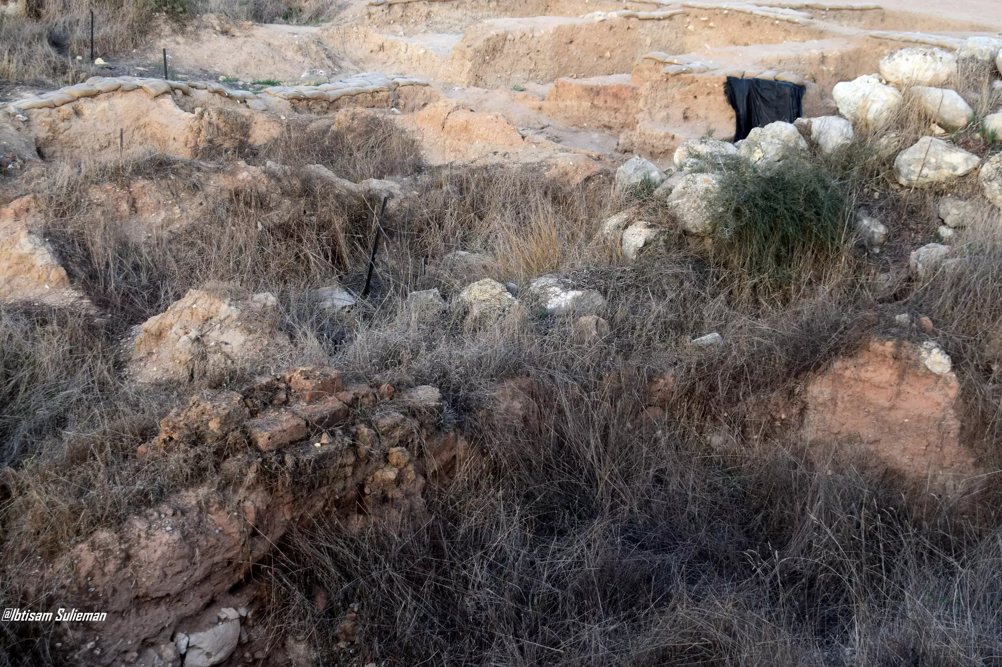
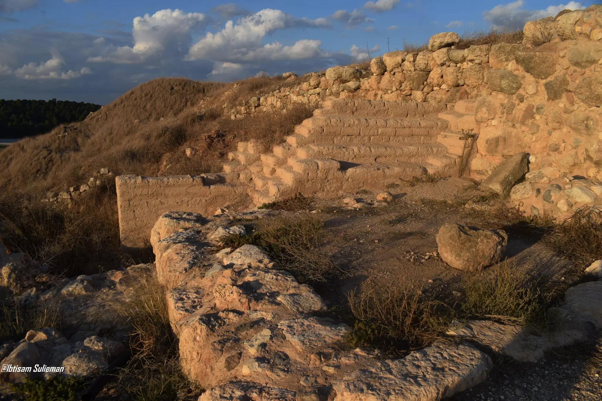
- تل الدوير او مدينة لخيش الكنعانية--Ibtisam Sulieman #3
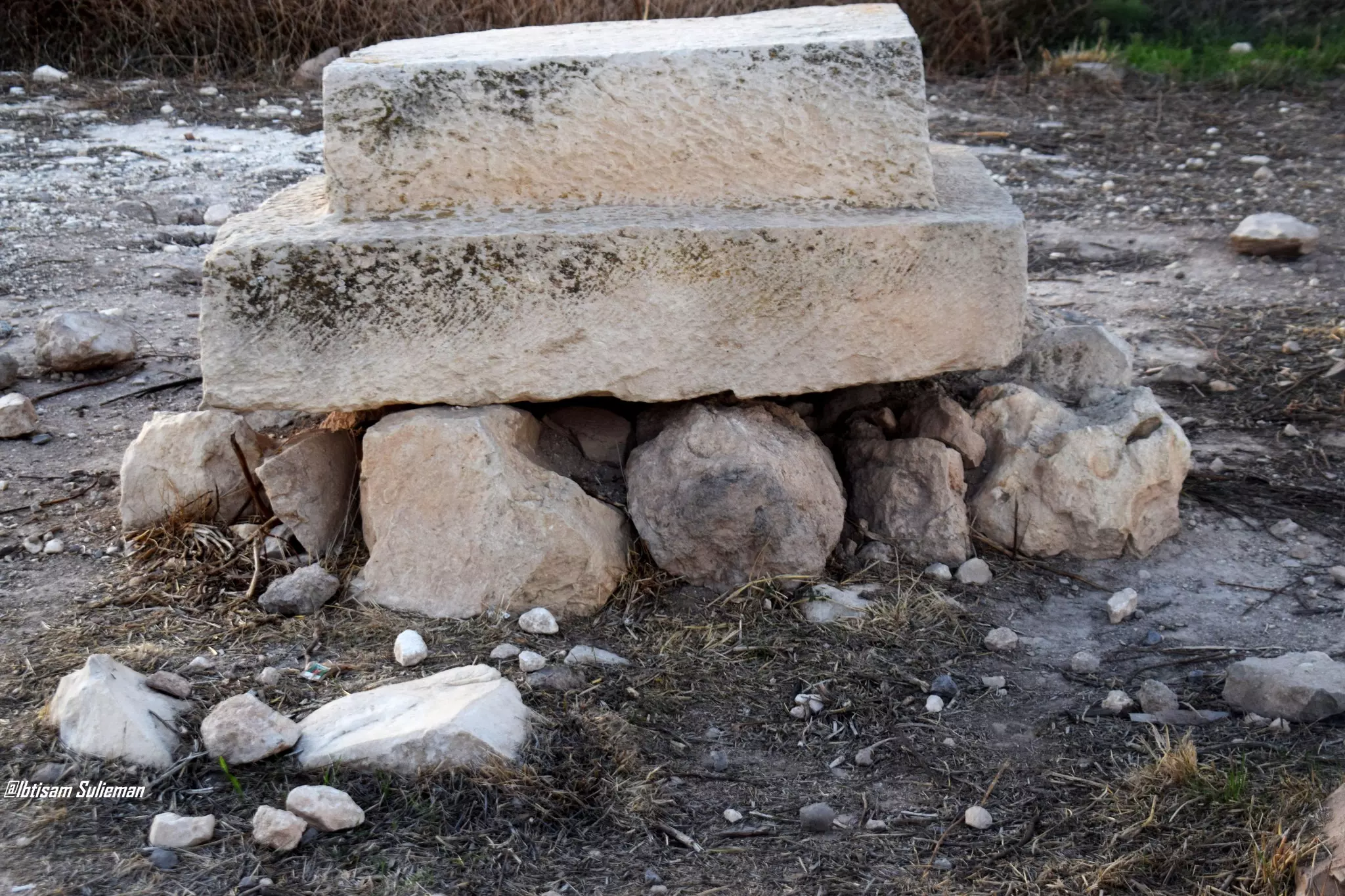
- تل الدوير او مدينة لخيش الكنعانية--Ibtisam Sulieman #4
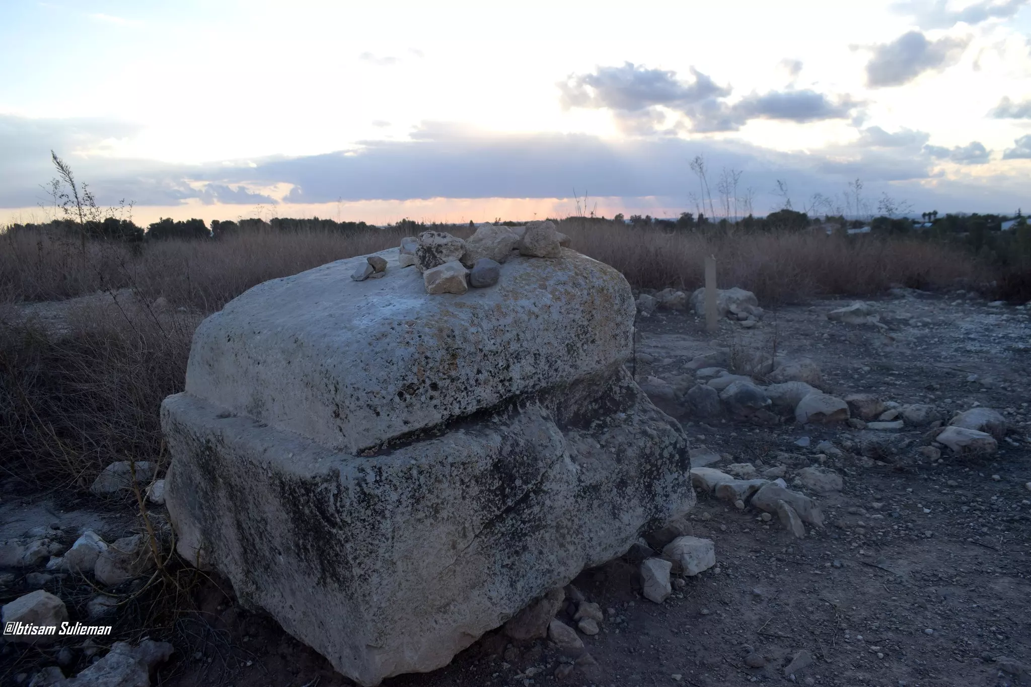
- تل الدوير او مدينة لخيش الكنعانية--Ibtisam Sulieman #5
- تل الدوير او مدينة لخيش الكنعانية--Ibtisam Sulieman #6
- تل الدوير او مدينة لخيش الكنعانية--Ibtisam Sulieman #7
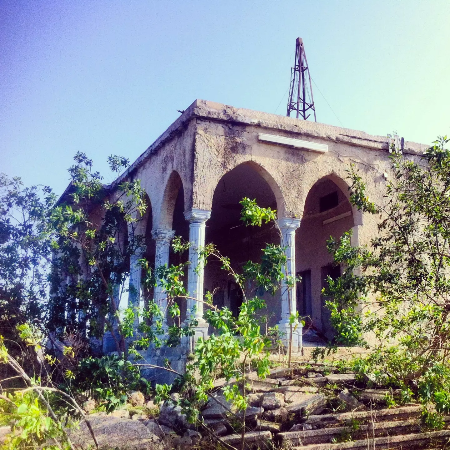
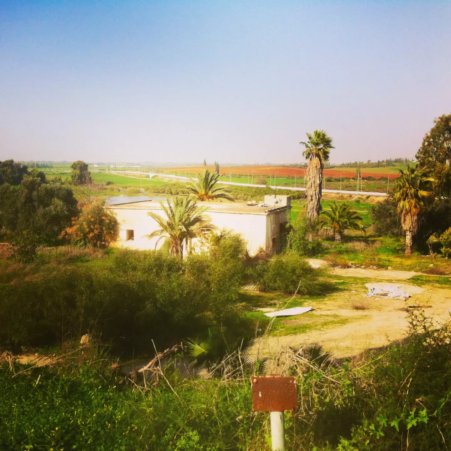
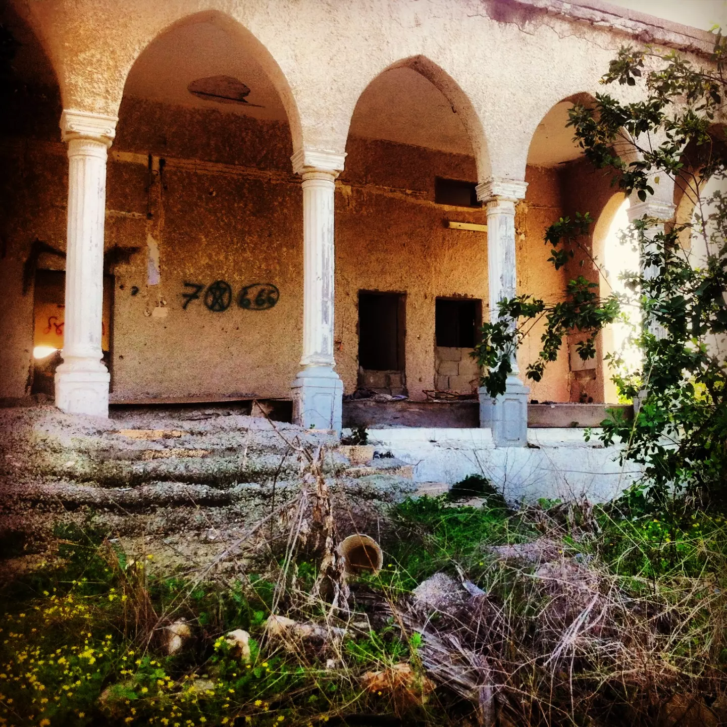
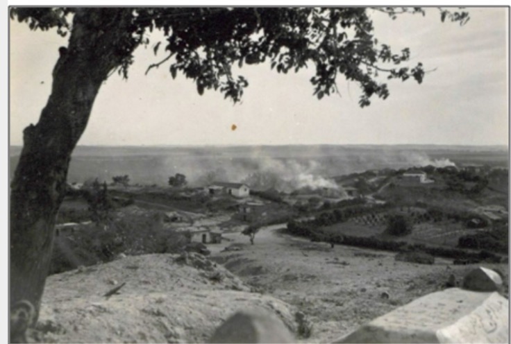
- That is how the "civilized" erased and replaced us: al-Qubayba was completely obliterated except for a few remaining structures, as you see -- القبيبة باتت أثر بعد عين. من هنا مر الهمجّ
- That is how the "civilized" erased and replaced us: al-Qubayba was completely obliterated except for a few remaining structures, as you see -- القبيبة باتت أثر بعد عين. من هنا مر الهمجّ #2
- That is how the "civilized" erased and replaced us: al-Qubayba was completely obliterated except for a few remaining structures, as you see -- القبيبة باتت أثر بعد عين. من هنا مر الهمجّ #3
- That is how the "civilized" erased and replaced us: al-Qubayba was completely obliterated except for a few remaining structures, as you see -- القبيبة باتت أثر بعد عين. من هنا مر الهمجّ #4
- That is how the "civilized" erased and replaced us: al-Qubayba was completely obliterated except for a few remaining structures, as you see -- القبيبة باتت أثر بعد عين. من هنا مر الهمجّ #5
- That is how the "civilized" erased and replaced us: al-Qubayba was completely obliterated except for a few remaining structures, as you see -- القبيبة باتت أثر بعد عين. من هنا مر الهمجّ #6
- That is how the "civilized" erased and replaced us: al-Qubayba was completely obliterated except for a few remaining structures, as you see -- القبيبة باتت أثر بعد عين. من هنا مر الهمجّ #7
- That is how the "civilized" erased and replaced us: al-Qubayba was completely obliterated except for a few remaining structures, as you see -- القبيبة باتت أثر بعد عين. من هنا مر الهمجّ #8
- That is how the "civilized" erased and replaced us: al-Qubayba was completely obliterated except for a few remaining structures, as you see -- القبيبة باتت أثر بعد عين. من هنا مر الهمجّ #9
- That is how the "civilized" erased and replaced us: al-Qubayba was completely obliterated except for a few remaining structures, as you see -- القبيبة باتت أثر بعد عين. من هنا مر الهمجّ #10
- That is how the "civilized" erased and replaced us: al-Qubayba was completely obliterated except for a few remaining structures, as you see -- القبيبة باتت أثر بعد عين. من هنا مر الهمجّ #11
- That is how the "civilized" erased and replaced us: al-Qubayba was completely obliterated except for a few remaining structures, as you see -- القبيبة باتت أثر بعد عين. من هنا مر الهمجّ #12
- That is how the "civilized" erased and replaced us: al-Qubayba was completely obliterated except for a few remaining structures, as you see -- القبيبة باتت أثر بعد عين. من هنا مر الهمجّ #13
- That is how the "civilized" erased and replaced us: al-Qubayba was completely obliterated except for a few remaining structures, as you see -- القبيبة باتت أثر بعد عين. من هنا مر الهمجّ #14
- That is how the "civilized" erased and replaced us: al-Qubayba was completely obliterated except for a few remaining structures, as you see -- القبيبة باتت أثر بعد عين. من هنا مر الهمجّ
- That is how the "civilized" erased and replaced us: al-Qubayba was completely obliterated except for a few remaining structures, as you see -- القبيبة باتت أثر بعد عين. من هنا مر الهمجّ #2
- That is how the "civilized" erased and replaced us: al-Qubayba was completely obliterated except for a few remaining structures, as you see -- القبيبة باتت أثر بعد عين. من هنا مر الهمجّ #3
- That is how the "civilized" erased and replaced us: al-Qubayba was completely obliterated except for a few remaining structures, as you see -- القبيبة باتت أثر بعد عين. من هنا مر الهمجّ #4
- That is how the "civilized" erased and replaced us: al-Qubayba was completely obliterated except for a few remaining structures, as you see -- القبيبة باتت أثر بعد عين. من هنا مر الهمجّ #5
- That is how the "civilized" erased and replaced us: al-Qubayba was completely obliterated except for a few remaining structures, as you see -- القبيبة باتت أثر بعد عين. من هنا مر الهمجّ #6
- That is how the "civilized" erased and replaced us: al-Qubayba was completely obliterated except for a few remaining structures, as you see -- القبيبة باتت أثر بعد عين. من هنا مر الهمجّ #7
- That is how the "civilized" erased and replaced us: al-Qubayba was completely obliterated except for a few remaining structures, as you see -- القبيبة باتت أثر بعد عين. من هنا مر الهمجّ #8
- That is how the "civilized" erased and replaced us: al-Qubyba was completely obliterated except for a few remaining structures, as you see -- القبيبة باتت أثر بعد عين بإستثناء بعض المباني. من هنا مر الهمجّ
- That is how the "civilized" erased and replaced us: al-Qubyba was completely obliterated except for a few remaining structures, as you see -- القبيبة باتت أثر بعد عين بإستثناء بعض المباني. من هنا مر الهمجّ #2
- That is how the "civilized" erased and replaced us: al-Qubyba was completely obliterated except for a few remaining structures, as you see -- القبيبة باتت أثر بعد عين بإستثناء بعض المباني. من هنا مر الهمجّ #3
- That is how the "civilized" erased and replaced us: al-Qubyba was completely obliterated except for a few remaining structures, as you see -- القبيبة باتت أثر بعد عين بإستثناء بعض المباني. من هنا مر الهمجّ #4
- That is how the "civilized" erased and replaced us: al-Qubyba was completely obliterated except for a few remaining structures, as you see -- القبيبة باتت أثر بعد عين بإستثناء بعض المباني. من هنا مر الهمجّ #5
- That is how the "civilized" erased and replaced us: al-Qubyba was completely obliterated except for a few remaining structures, as you see -- القبيبة باتت أثر بعد عين بإستثناء بعض المباني. من هنا مر الهمجّ #6
- That is how the "civilized" erased and replaced us: al-Qubyba was completely obliterated except for a few remaining structures, as you see -- القبيبة باتت أثر بعد عين بإستثناء بعض المباني. من هنا مر الهمجّ #7
- خارطة تُظهِر الحدود والطرق بأنواعها والأماكن المقدسة والطبيعة الطوبغرافية من تلال وسهول ومنحدرات والتشكيلة الطبيعية للأرض وأنواع المزروعات. نُشرت الخريطة فترة الانتداب البريطاني، تم إضافة تعديلات عليها من قِبَل خدمة الخرائط والصور التابعة للقوات العسكرية الاسرائيلية فترة الأربعينيات.
Want to browse more? 80,000 pictures were grouped in these gallaries:
| Display Name | Clan/Hamolah | Country of Residence |
| يزن عمر محمد الخياط | الخياط | Kuala Lumpur, Malaysia |
| Maher Shahin | شاهين | Palestine |
| محمد رفيق | الدواوسه | عمان |
| وليد شاهين | شاهين | السعوديه, السعوديه |
| محمد رستم | - | - |
| ادهم | جاب الله | - |
| مصطفى محمد البلبيسي | البلبيسي | قطاع عزة, فلسطين |
| AYMAN SHABANA | شبانة | Vasternorrlands, Sweden |
| تامر محمود | - | رفح |
| بشار شاهين | شاهين | - |
| قبيبة شاهين | شاهين | فلسطين, غزة |
- Home of Musa Shaheen-بيت موسى شاهين في القبيبة
- قرية القبيبة الفلسطينية المحتلة عام 1948 (1)
- قرية القبيبة الفلسطينية المحتلة عام 1948 (2)
- قرية القبيبة الفلسطينية المحتلة عام 1948 (3)
- قرية القبيبة الفلسطينية المحتلة عام 1948 (4)
- Return to Qubeibe 01/10/2016
- قبيبة شاهين (قضاء الرملة) ... قرية البيارات والقصور متعددة الأقواس Duration: 2 min 33 sec
- مقبرة ووقف مقام النبي قندة (قبيبة شاهين قضاء الرملة) ومضارب عرب السوطرية التي انتشرت منه الى قرى ابو فضل وديران وتل البطيخ. Duration: min 59 sec
 Fake Valor: Why Did Zionist Jews Hoist Nazis Flag on Their Ships in the 1930s?
What is new?
-
Facts About Oct. 7th Gaza Raid
-
Remined Us Please: Who Did Rape Whom? Was it Palestinians who raped Israelis? Or, was the other way around? You'll be the judge
-
When Prof. Edward Said was invited to debate Bibi Netanyahu in the 1980s, watch what happened!
-
Ezra Klein of the NY Times on the "Jewish Race".
-
Abusing Blood Libel!
-
How and why Israeli Jewry has become the most hated cult?
-
Did Israeli Soldiers Activate The Hannibal Direective On Oct. 7th? You Be The Judge
-
Zionist FAQ: Isn't it true that Palestinians don't want peace? Palestinians never accepted the two-state solution
- Facts about Haavara (Transfer) Agreement between Ben-Gurion & Hitler
-
Haavara FAQs: Why Did Zionist Jews Hoist Nazis' Flags on Their Ships in the 1930s?
- Haavara FAQs: When Chaim Weizmann met FDR in mid-1943, why was he silent about rescuing European Jewry?
-
Dear ChatGPT: How did Palestinians resist Napoleon's invasion of their country in 1799?
-
Dear ChatGPT: Gaza had a vibrant Jewish community in the mid-17th century. What happened to them?
-
Dear ChatGPT: Why did the Jewish Agency suppress news of the Holocaust during WWII?
-
Video Playlist: Jews share their DNA tests to end the conflict for good.
-
A Tale of Two Conflicts: Examining the Definition of Genocide
-
Prof. Abraham Polak And The Suppressed History of the Khazars and European Jewry
-
How Ronald Reagan would have framed the genocide in Gaza if he were still alive?
-
Haavara FAQs: Let us do the math: how many German Jews did The Haavara Agreement save?
-
Zionist FAQs: The Hebron Massacre of 1929, "clearly proves" that Palestinians are antisemitic, how could you deny it?
-
Zionist FAQs: Why Anti-Zionist Is Not Antisemitism?
-
Zionist FAQs: Isn't it true that the KGB created Palestinian Nationalism in the early 1960s?
- Zionist FAQs: Muslims are killing Muslims all the time; why are Israeli Jews being singled out in the media?
- Zionist FAQs: How is Israel an apartheid state when 20% of its citizens are Arabs who enjoy full rights?
-
Haavara FAQs: Why Did Dorothy Thompson Flip From A Zionist Advocate to A Silenced Dissenter?
-
Haavara FAQs: Analysis of Herzl's Uganda Scheme and how it could have saved millions of Jews.
-
Haavara FAQs: Why did Hayim Greenberg describe American Jewry as "morally bankrupt" in early 1943?
-
Haavara FAQs: What if the Evian Conference was a resounding success? What would have been the impact of saving European Jewry on Zionism?
- Haavara FAQs: What if the six million were saved, how that would have impacted the Zionist project?
-
Haavara FAQs: How did Zionist leaders react when Europe's Jews lingered in the DP camps after WWII ended?
-
Why does the American Jewish community repeat lies that David Ben-Gurion had debunked before he died?
-
Who has the power to rename the Tatar/Khazar Gene Marker to Jewish IV?
-
Zionist FAQs: Why won't Egypt, Syria, and Jordan take their people back? Jews are indigenous to Palestine, and Arabs immigrated after Jews developed the country. Arabs should leave.
-
Haavara FAQs: Did Hitler and the Nazis conflate between Judaism and Zionist? If that wasn't case, then why?
-
Haavara FAQs: Winston Churchill and antisemitism, a collection of articles written Churchill.
-
Haavara FAQs: Broken by country, how many Jews survived vs. killed during the Holocaust?
-
Haavara FAQs: Why did European Jews vote with their feet and to immigrated to the Americas, not Palestine, after WWII?
-
Watch this American Jewish Girl describing Israeli Jews' cognitive dissonance like no other in under two minutes
-
Haavara FAQs: When the Nazis went out of their way to hide the Holocaust, Israeli Jews did the exact opposite by broadcasting their genocide of Gazans. But why?
-
Haavara FAQs: How Zionist Jews went out of their to show their appreciation to Nazism and Fascism?
- Haavara FAQs: Why Zionist leaders were against bombing the death camps & the Railroads leading to them?
-
Haavara FAQs: Hitler's message to the British and American people: If Jews are such noble citizens and you care about them, how come you're not letting them in? I will gladly ship them to you at my expense, even on luxury liners!
-
A shortlist of Zionist and Israeli false flag operations in the name Jews.
-
The Most Moral Army
- The Land of Kapos (Israel): Where the brave are boycotted and Kapos walk free.
- Why did early Zionists often named their communal enterprises "colonial"?
- Zionist Relations with Nazi Germany by Faris Glubb
-
Two NY Times advertisements by Zionists in the early 1943 that exposes Zionists' treason at the height of the calamity
- Facts Not Lies about the Palestinian-Israeli Conflict.
- Site's pictures have been categorized
- Campgain Against Lice
- A Survey of Palestine, the official source about Palestine before Nakba produced by the British Mandate; over 1200 pages.
- Satellite View & Google Earth: Over 6,000 placemarks identifying all destroyed towns, W. Bank & Gaza Strip Towns, & refugee camps.
- PalestineRemembered.com and its Nakba Oral History Project were featured on al-Jazeera Satellite TV.
- Nakba Oral History Video Podcast:
 Over 700 Oral History interviews (including 3,500+ hours of recording) can be viewed online.
 - Palestine Village Statistics Project
- Gaza Jail Break
- النسخة العربية للموقع الان متوفرة
- Videos: Documenting the destroyed villages in video: Tracing all that remains since Nakba.
- Videos: Responding to Zionist Propaganda
- Interview: The ethnic cleansing of Palestine: George Galloway interviews Israeli Historian Ilan Pappe.
- For Palestinians, memory matters. It provides a blueprint for their future By George Bisharat.
- Zionist FAQ now available in Hebrew שאלות שציונים שואלים, עכשיו בעברית
- Video: The Stephen Walt and John Mearsheimer report on the influence of the Israel Lobby on U.S. Foreign Policy
- The Palestinian-Israeli conflict for beginners
