| PalestineRemembered | About Us | Oral History | العربية | |
| Pictures | Zionist FAQs | Haavara | Maps | |
| Search |
| Camps |
| Districts |
| Acre |
| Baysan |
| Beersheba |
| Bethlehem |
| Gaza |
| Haifa |
| Hebron |
| Jaffa |
| Jericho |
| Jerusalem |
| Jinin |
| Nablus |
| Nazareth |
| Ramallah |
| al-Ramla |
| Safad |
| Tiberias |
| Tulkarm |
| Donate |
| Contact |
| Profile |
| Videos |
Welcome To Khirbat al-Simya - خربة السيمياء (السمية) (ח'ירבת א-סימיא)
|
District of Hebron
Occupied days ago |
العربية Google Earth |
 |
Gallery (56) |
- Statistics & Facts
-
Before & After

- Satellite View
- Articles 7
- Pictures 56
- Members 1
- Town's Map
- Wikipedia
- Videos
- Guest Book 2
- Links 3
| Statistic & Fact | Value | |||||||||
| Distance From District | 15 km southwest of Hebron | |||||||||
| Elevation | 460 meters | |||||||||
| Before & After Nakba, Click Map For Details |
||||||||||
|
||||||||||
| Population |
|
|||||||||
| Near By Towns |
||||||||||
|
|
||||||||||
| Related Maps | Town Lands' Demarcation Maps خرائط للقضاء توضح حدود القرى والاودية View from satellite Town's map on MapQuest Help us map this town at WikiMapia |
|||||||||
| Related Links | Detailed Map Detailed Map Wikipedia's Page Facebook Page Google Search Google For Images Google For Videos مخطط البلد في كتاب بلادنا فلسطين |
|||||||||
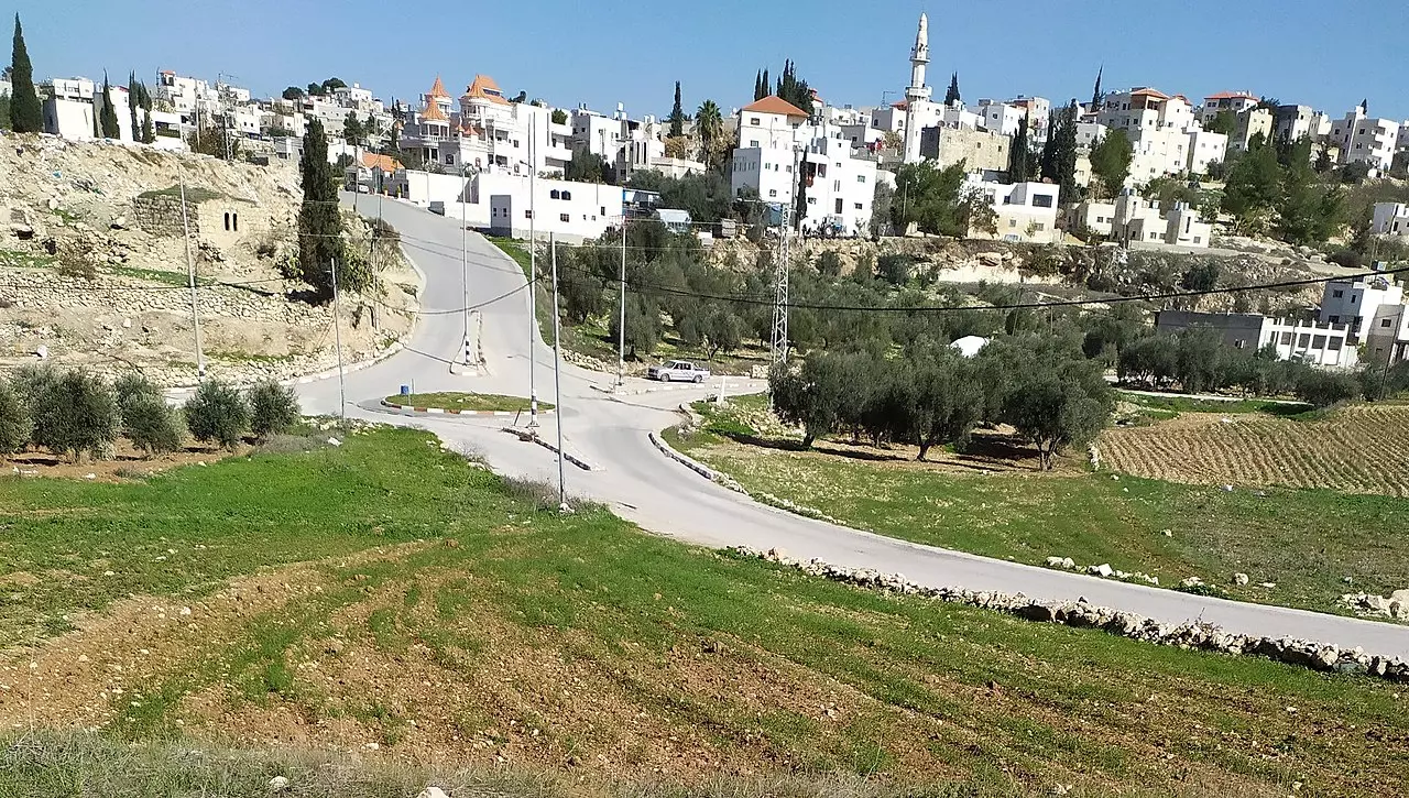
- صورة قرية السيميا غرب دورا في محافظة الخليل
Posted by محمد الشراونة 2 - بيارة السيميا في قرية السيميا غرب دورا في محافظة الخليل
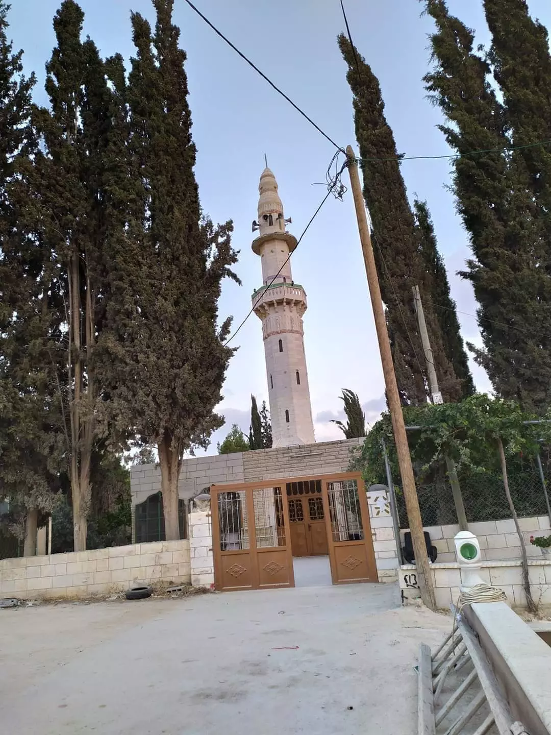
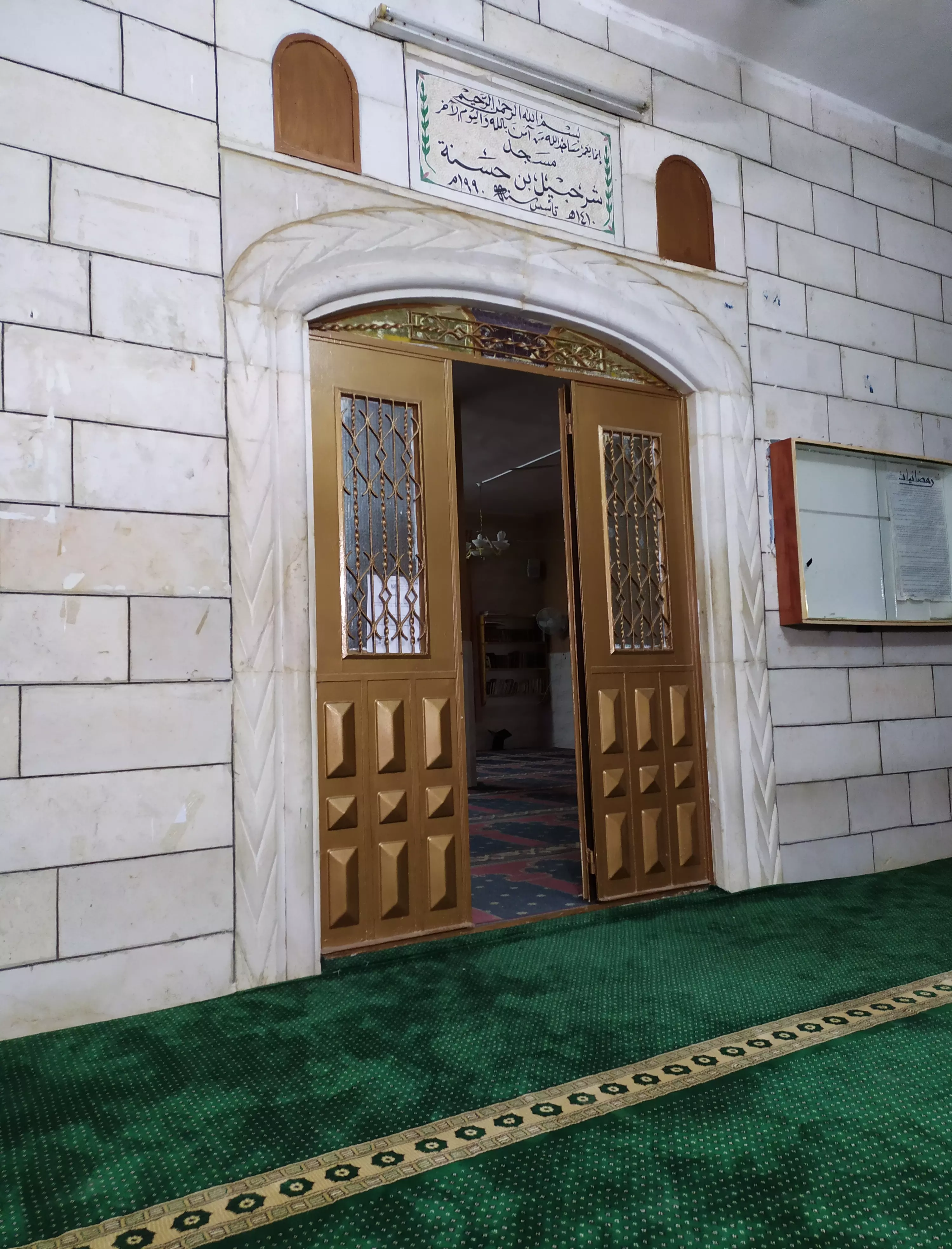
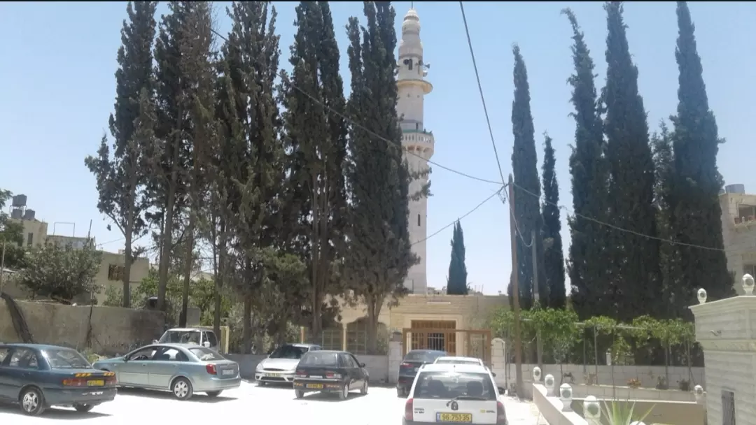
Posted by محمد الشراونة - مسجد الصحابي الجليل شرحبيل بن حسنة في قرية السيميا غرب دورا
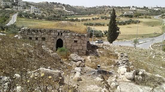
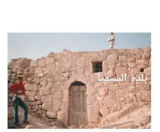
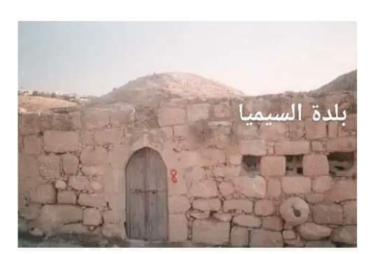
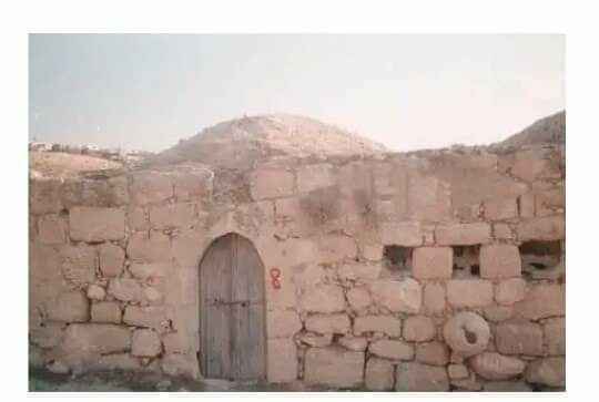
Posted by محمد الشراونة - آخر ما تبقى من البلدة القديمة في السيميا غرب دورا عقد قديم من عقود الحاج يوسف حريبي الشراونة
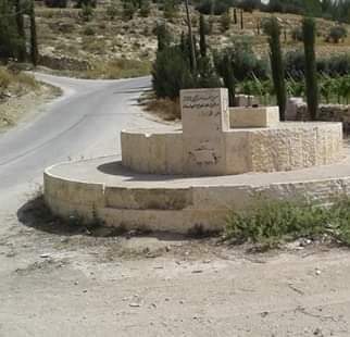
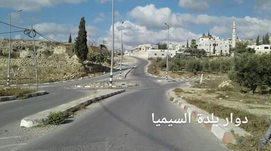
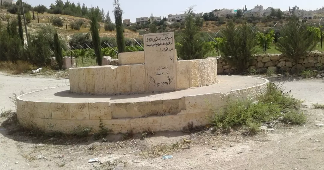
Posted by محمد الشراونة - دوار السيميا في قرية السيميا غرب دورا
Posted by محمد الشراونة - دوار السيميا في قرية السيميا غرب دورا #2
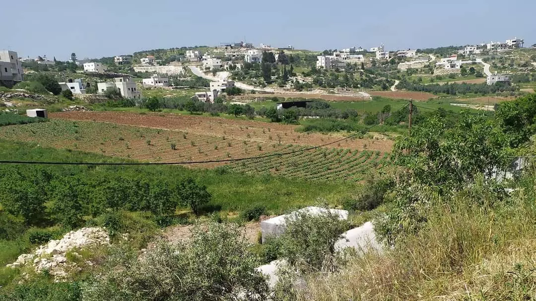
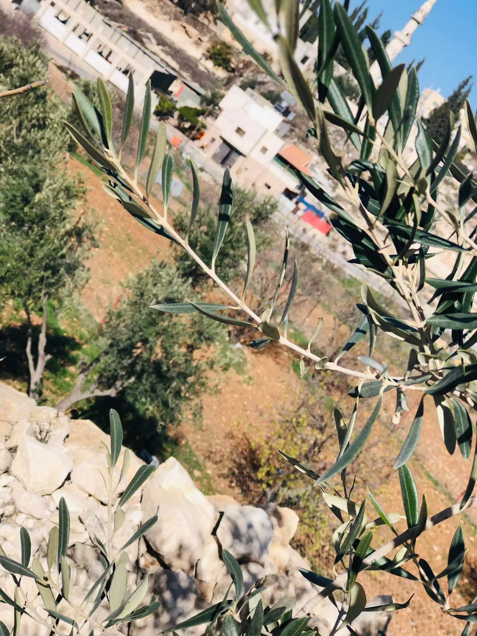
Posted by محمد الشراونة - من سهول قرية السيميا غرب دورا في الربيع
Posted by محمد الشراونة - المرحوم الحاج يوسف حريبي صلاح حرب الشراونة أحد رجال السيميا وأحد كبار شيوخ ووجهاء دورا وجبل الخليل ديوان عشيرة الشراونة في السيميا صور من مساكن البلدة القديمة في السيميا
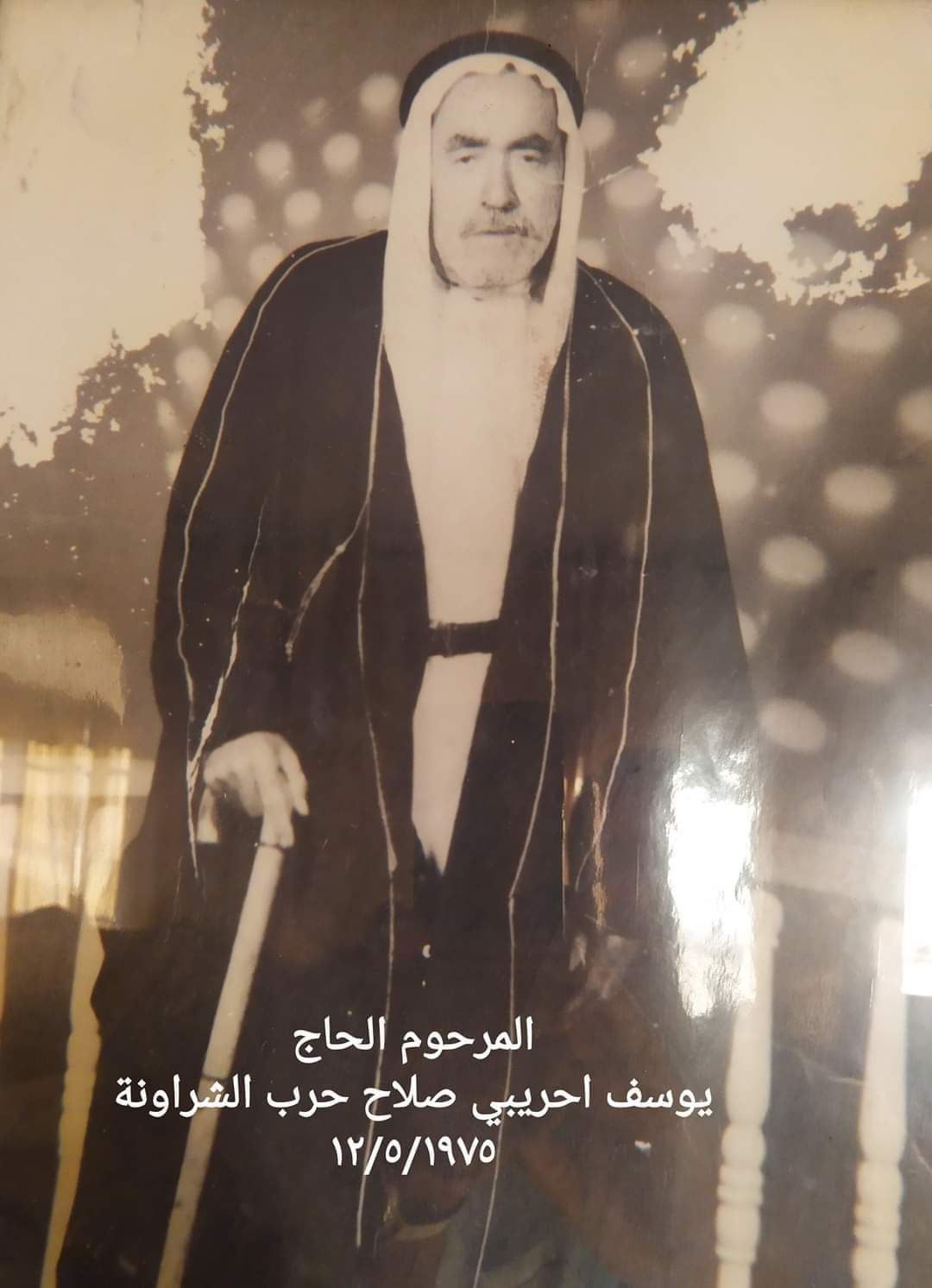
Posted by محمد الشراونة - المرحوم الحاج يوسف حريبي صلاح حرب الشراونة أحد رجال السيميا وأحد كبار شيوخ ووجهاء دورا وجبل الخليل ديوان عشيرة الشراونة في السيميا صور من مساكن البلدة القديمة في السيميا #2
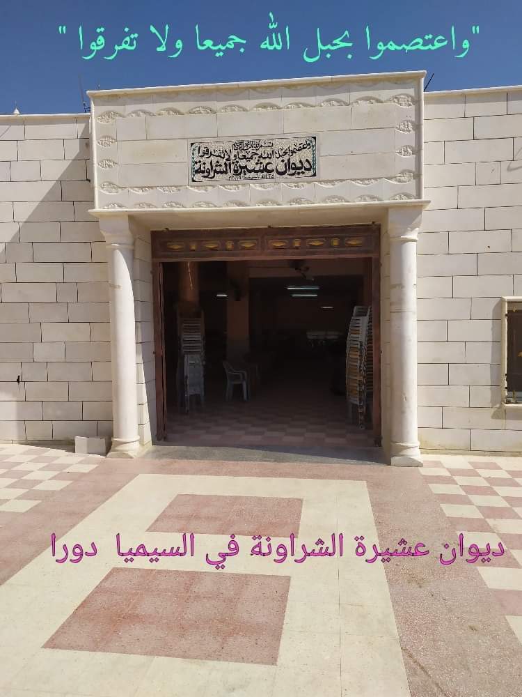
Posted by محمد الشراونة - المرحوم الحاج يوسف حريبي صلاح حرب الشراونة أحد رجال السيميا وأحد كبار شيوخ ووجهاء دورا وجبل الخليل ديوان عشيرة الشراونة في السيميا صور من مساكن البلدة القديمة في السيميا #3
Posted by محمد الشراونة - المرحوم الحاج يوسف حريبي صلاح حرب الشراونة أحد رجال السيميا وأحد كبار شيوخ ووجهاء دورا وجبل الخليل ديوان عشيرة الشراونة في السيميا صور من مساكن البلدة القديمة في السيميا #4
Posted by محمد الشراونة - المرحوم الحاج يوسف حريبي صلاح حرب الشراونة أحد رجال السيميا وأحد كبار شيوخ ووجهاء دورا وجبل الخليل ديوان عشيرة الشراونة في السيميا صور من مساكن البلدة القديمة في السيميا #5
Posted by محمد الشراونة - المرحوم الحاج يوسف حريبي صلاح حرب الشراونة أحد رجال السيميا وأحد كبار شيوخ ووجهاء دورا وجبل الخليل ديوان عشيرة الشراونة في السيميا صور من مساكن البلدة القديمة في السيميا #6
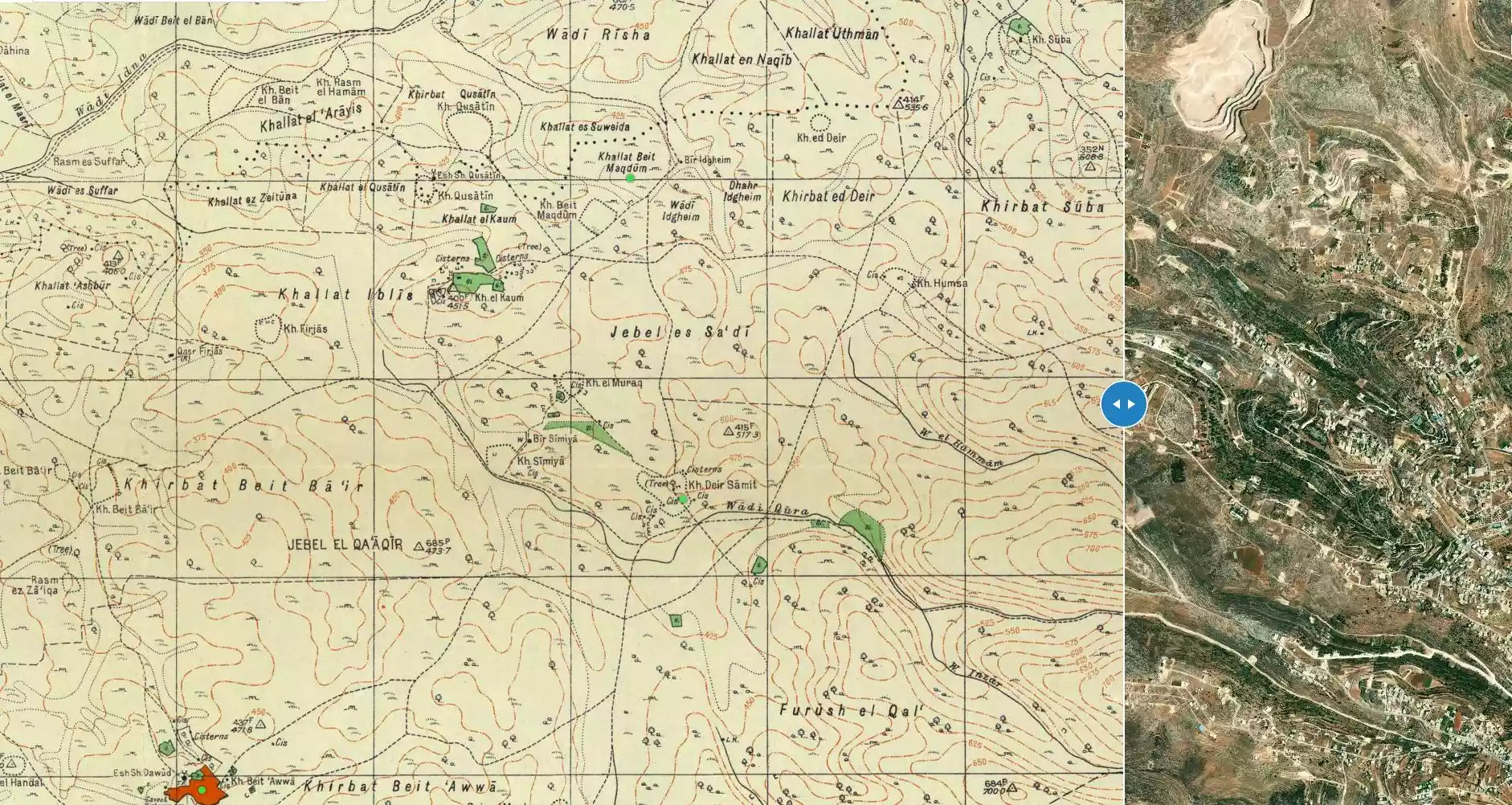
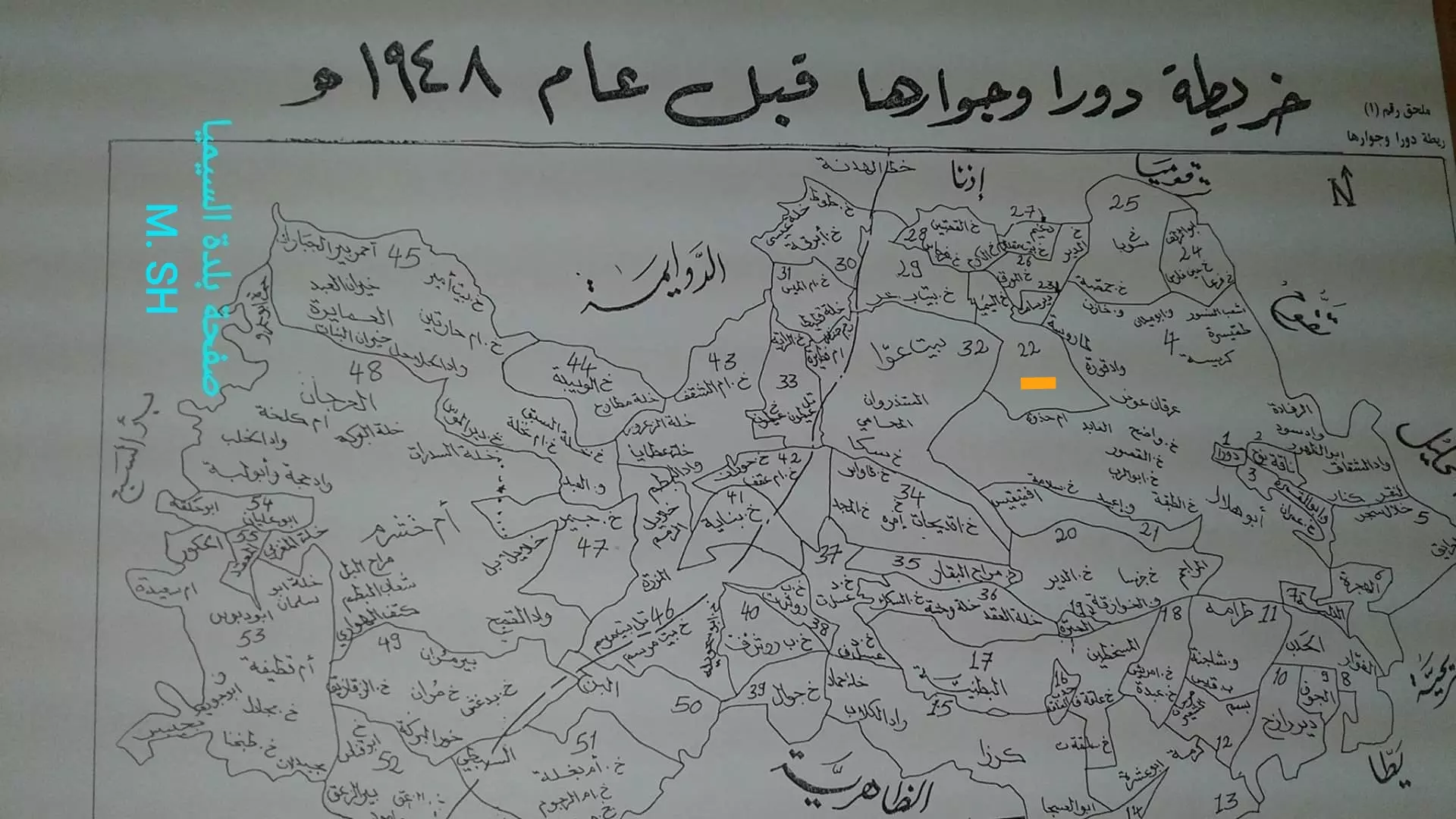
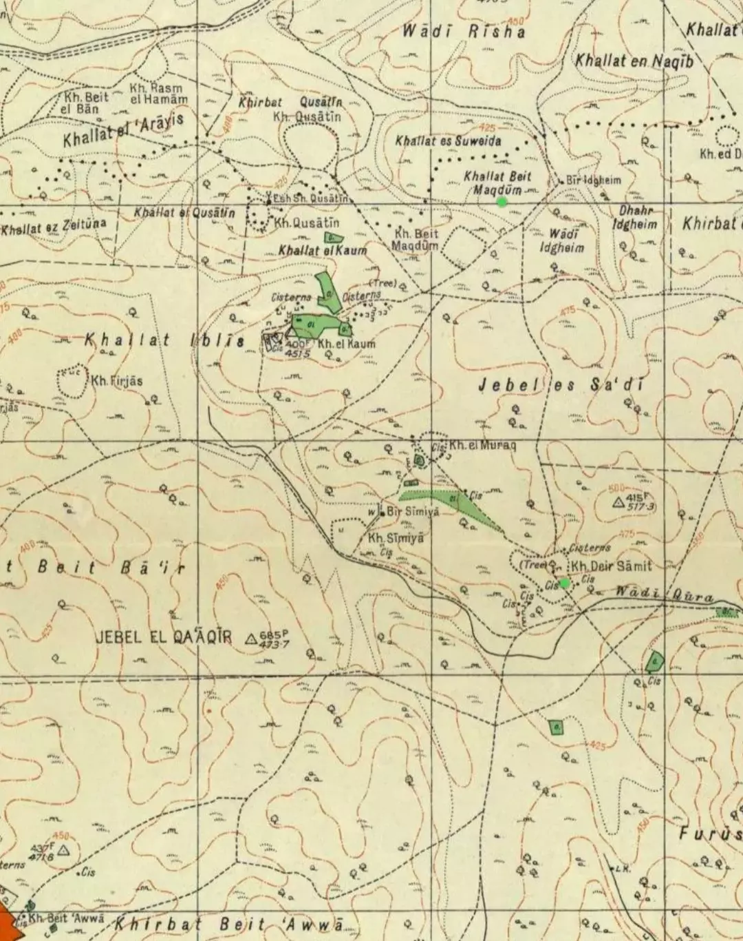
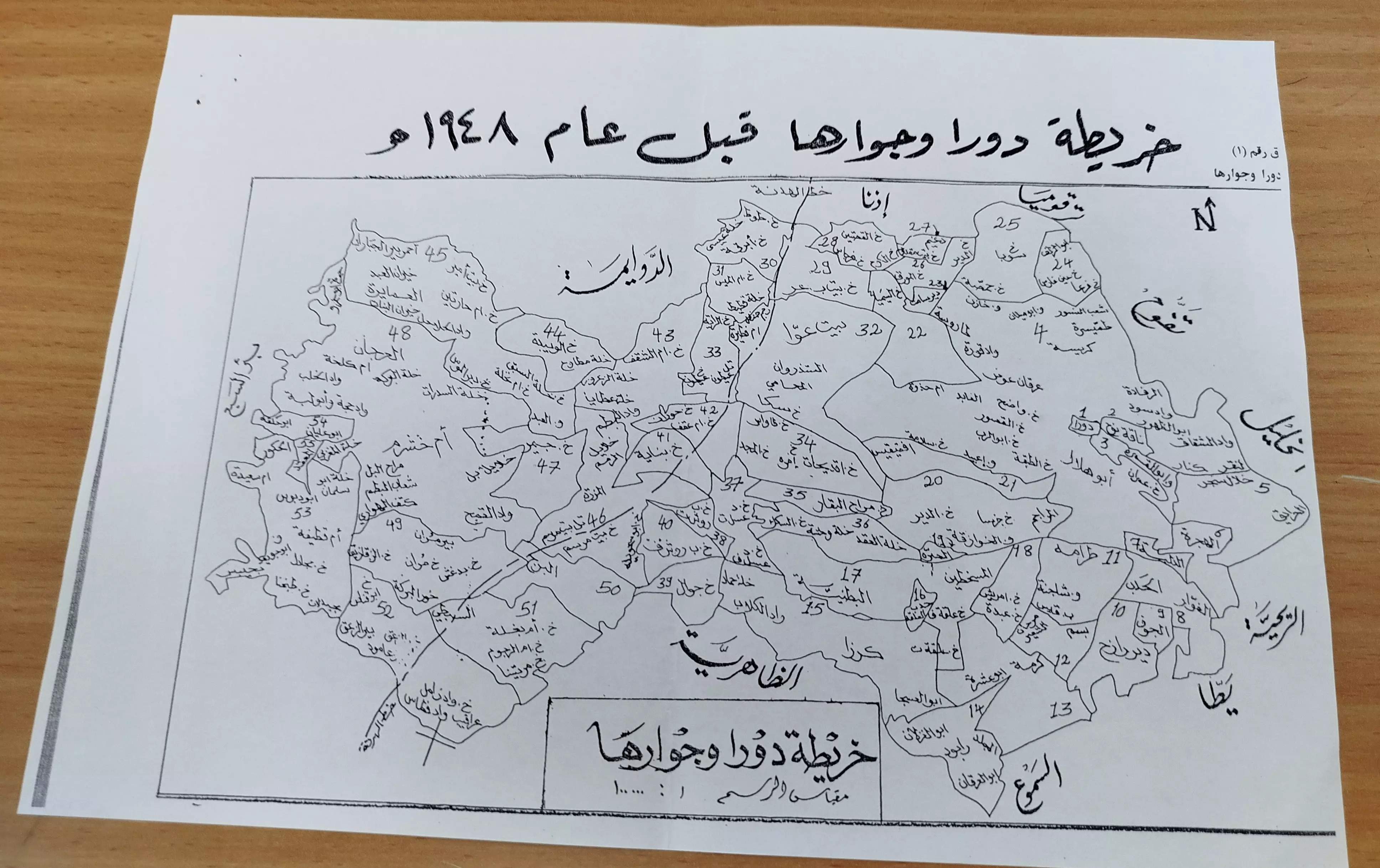
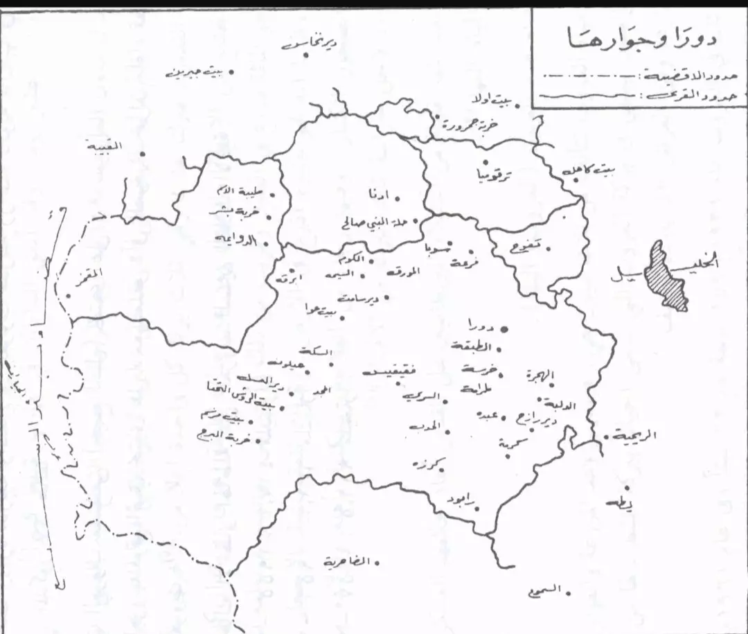
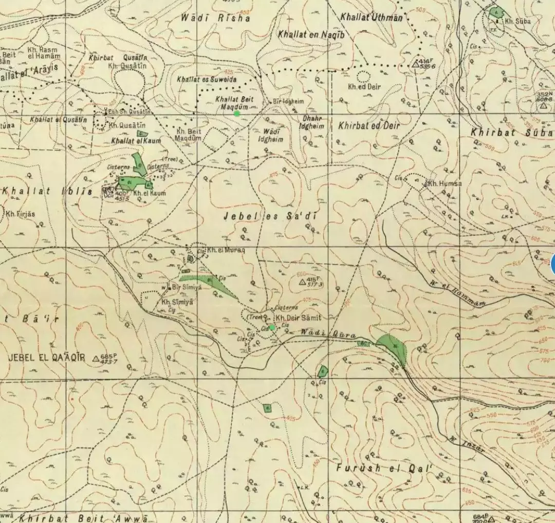
Posted by محمد الشراونة - خارطة دورا وقراها قبل عام 1948 خربة السيميا تقع ضمن الحوض الطبيعي رقم 22 السيميا دورا M. SH
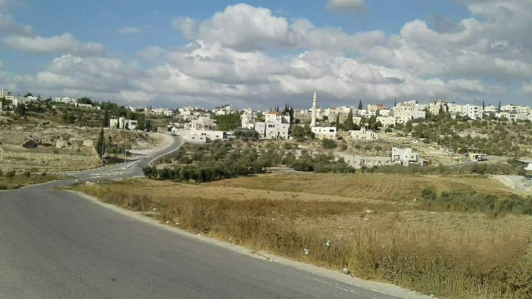
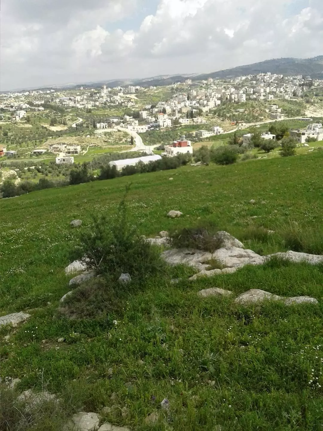
Posted by محمد الشراونة - إطلالة على السيميا من جبل خلة الفول موقع السيميا دورا
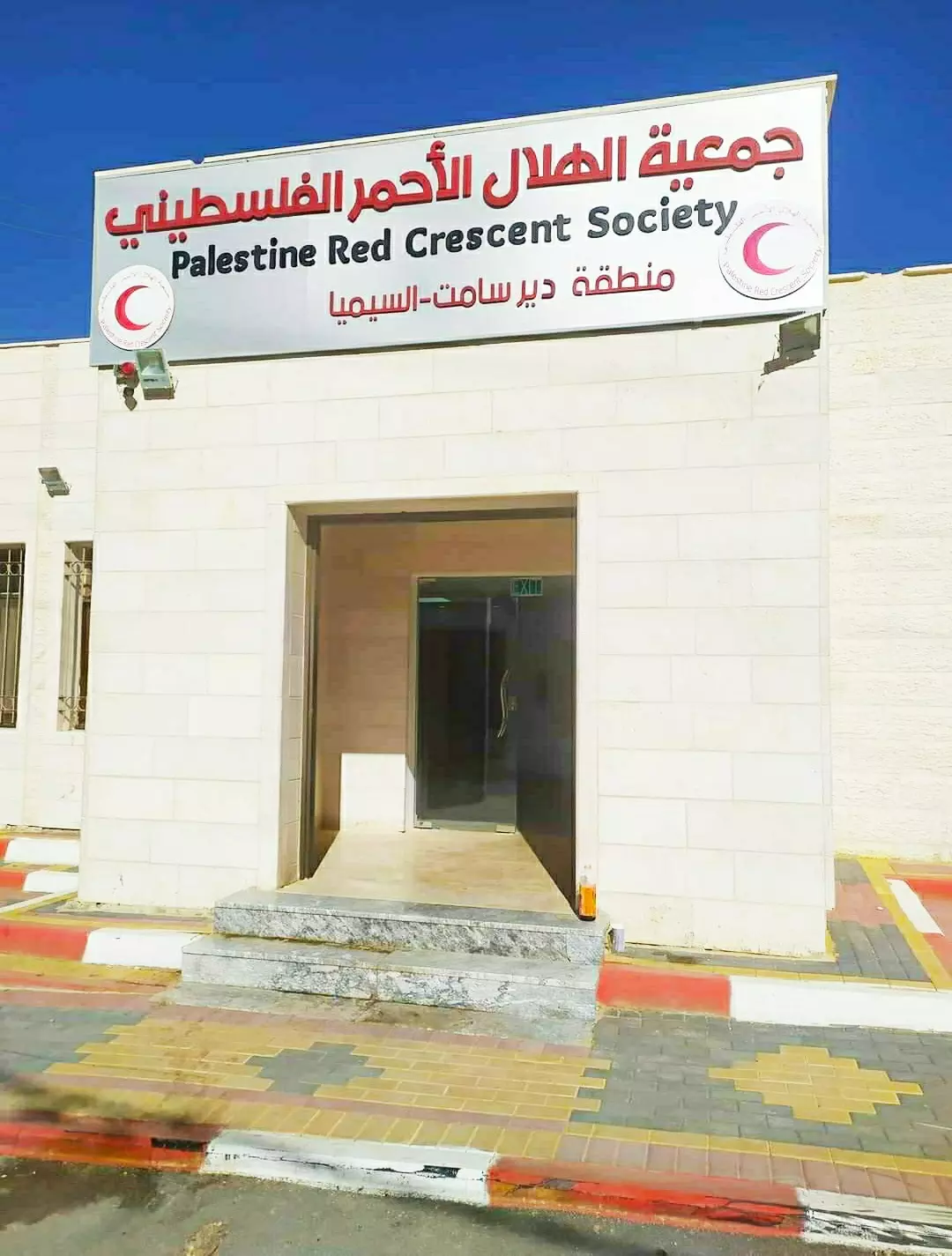
Posted by محمد الشراونة - مركز طوارئ السيميا التابع ل جمعية الهلال الأحمر الفلسطيني والذي يخدم منطقة ديرسامت والسيميا وقرى دورا الغربية - والواقع في قرية السيميا
Posted by محمد الشراونة - خارطة تظهر خربة السيميا في دورا قبل النكبة
Posted by محمد الشراونة - صورة مباني عقود المرحوم الحاج يوسف حريبي صلاح حرب الشراونة في خربة السيميا في دورا
Posted by محمد الشراونة - جولة في قرية السيميا من قرى مدينة دورا الخليل
- جولة في قرية السيميا من قرى مدينة دورا الخليل #2
- جولة في قرية السيميا من قرى مدينة دورا الخليل #3
- جولة في قرية السيميا من قرى مدينة دورا الخليل #4
- جولة في قرية السيميا من قرى مدينة دورا الخليل #5
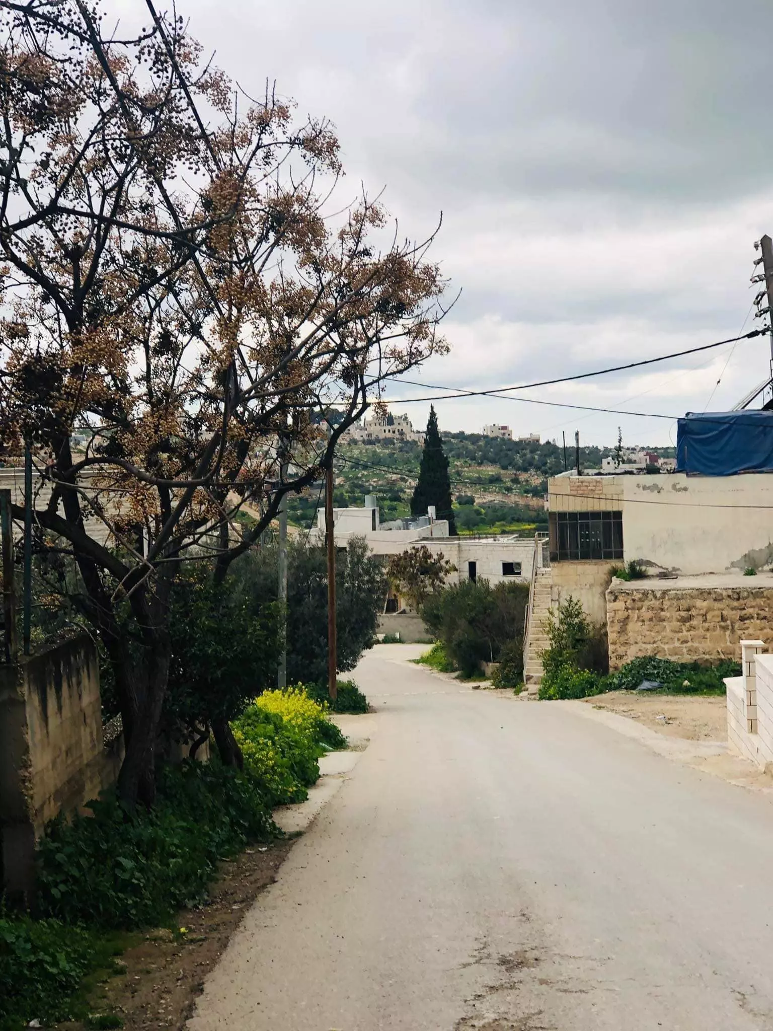
- جولة في قرية السيميا من قرى مدينة دورا الخليل #6
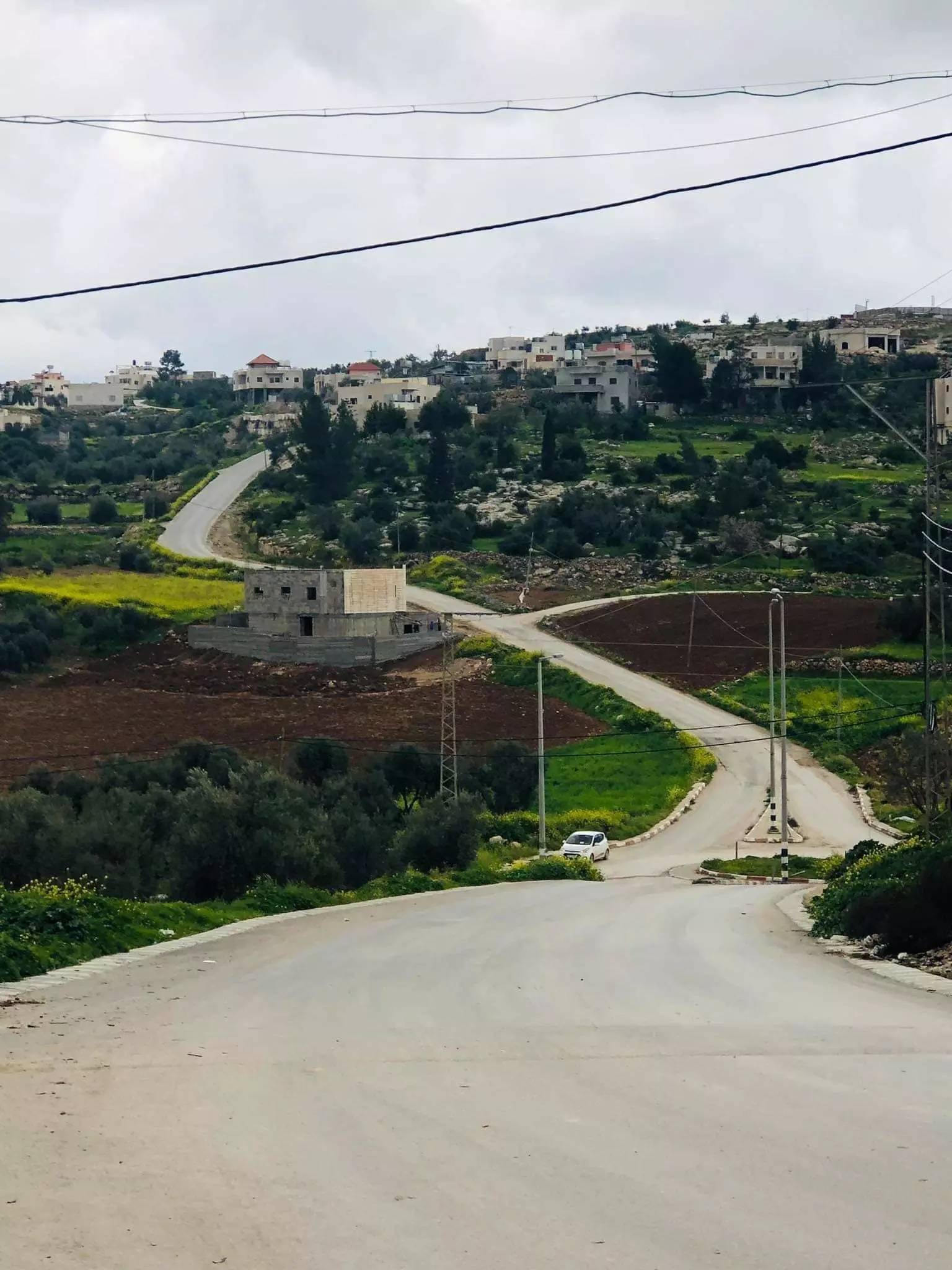
- جولة في قرية السيميا من قرى مدينة دورا الخليل #7

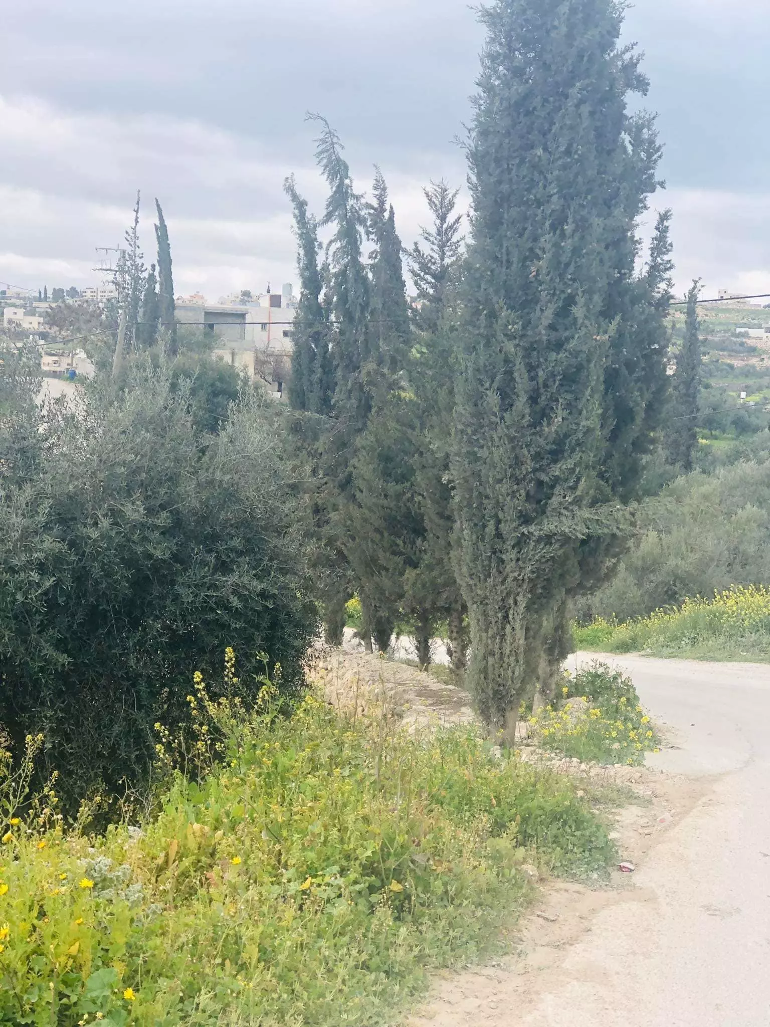
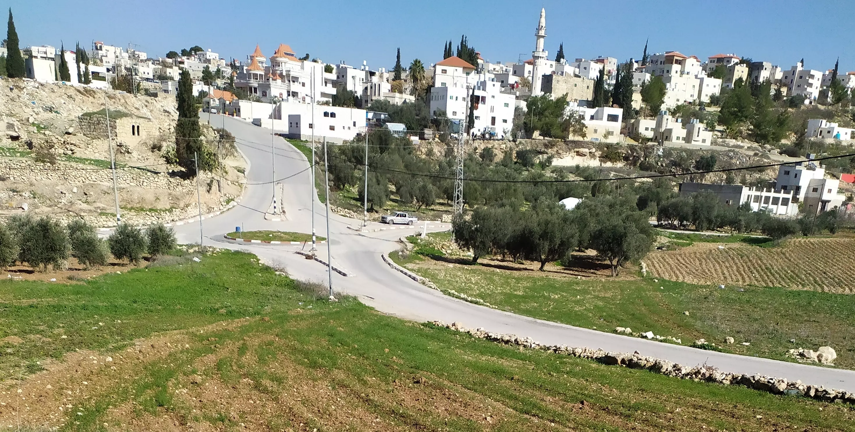
- السيميا، منطقة دوار السيميا ، خربة سيميا
قرية السيمياء: غرب مدينة دورا بمحافظة الخليل جنوب الضفة الغربية
Posted by محمد الشراونة - خارطة دورا وقراها قبل عام 1948
قرى وخرب مدينة دورا بمحافظة الخليل، الأحواض الطبيعية والحدود
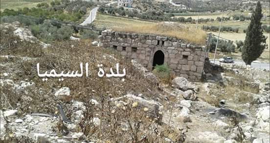
Posted by محمد الشراونة 1 - مسجد السيميا أو مسجد الصحابي الجليل شرحبيل بن حسنة
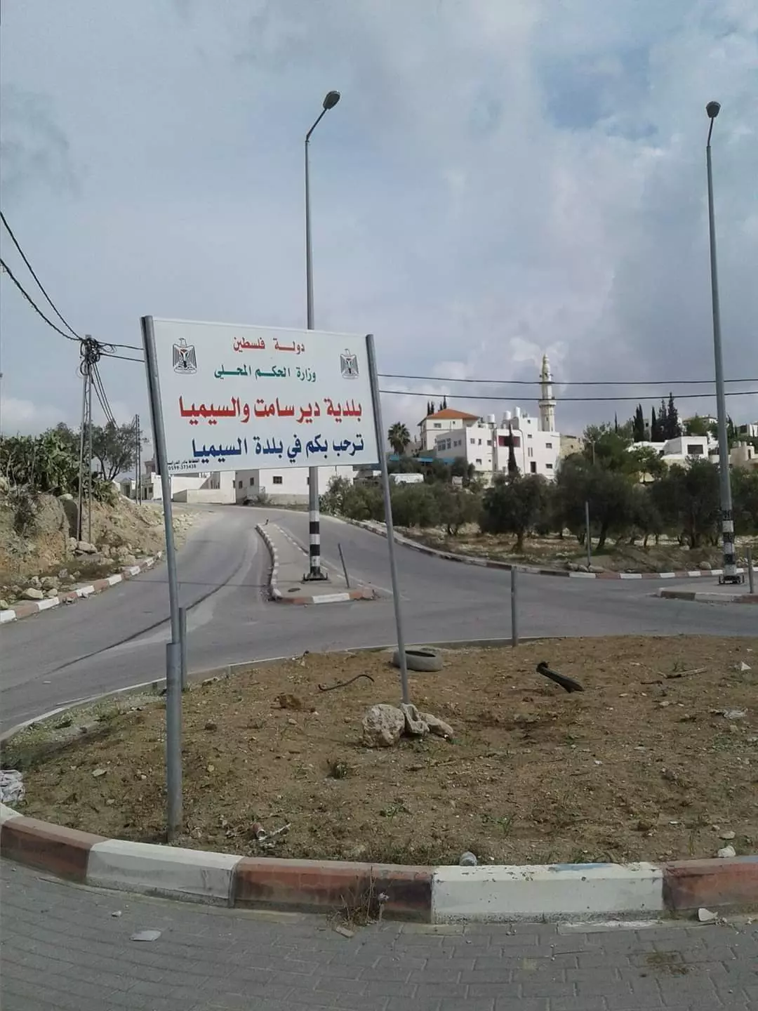
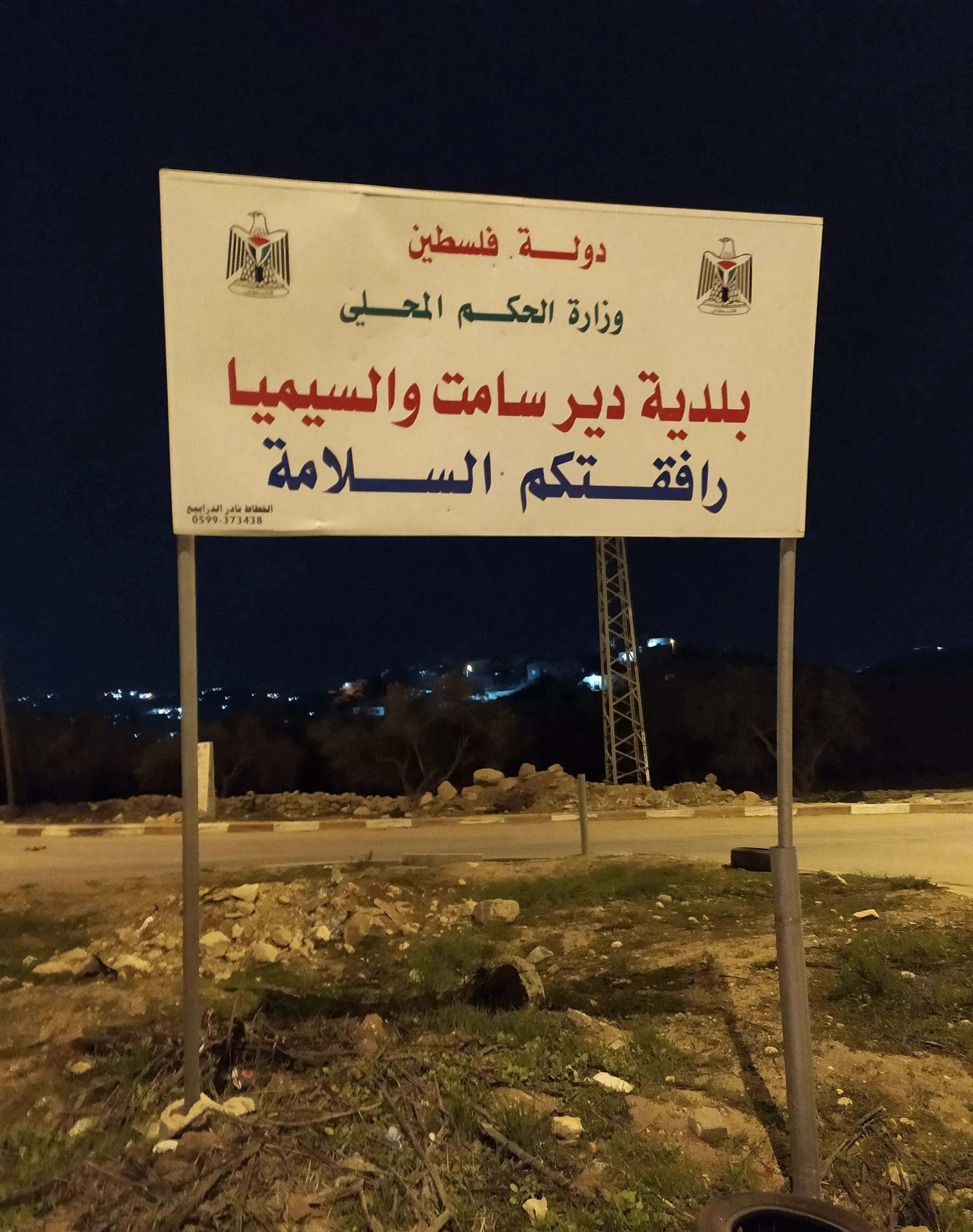
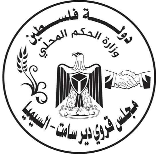
Posted by محمد الشراونة - بلدية ديرسامت والسيميا
إشارة ترحيب
Posted by محمد الشراونة - مراكز طوارئ السيميا أو مركز صحي السيميا، عيادة السيميا، قيد الإنشاء
Posted by محمد الشراونة - خارطة دورا وجوارها قضاء الخليل
Posted by محمد الشراونة - خارطة فلسطين عام 1880م، خربة سيميا، Khirbat es Simieh
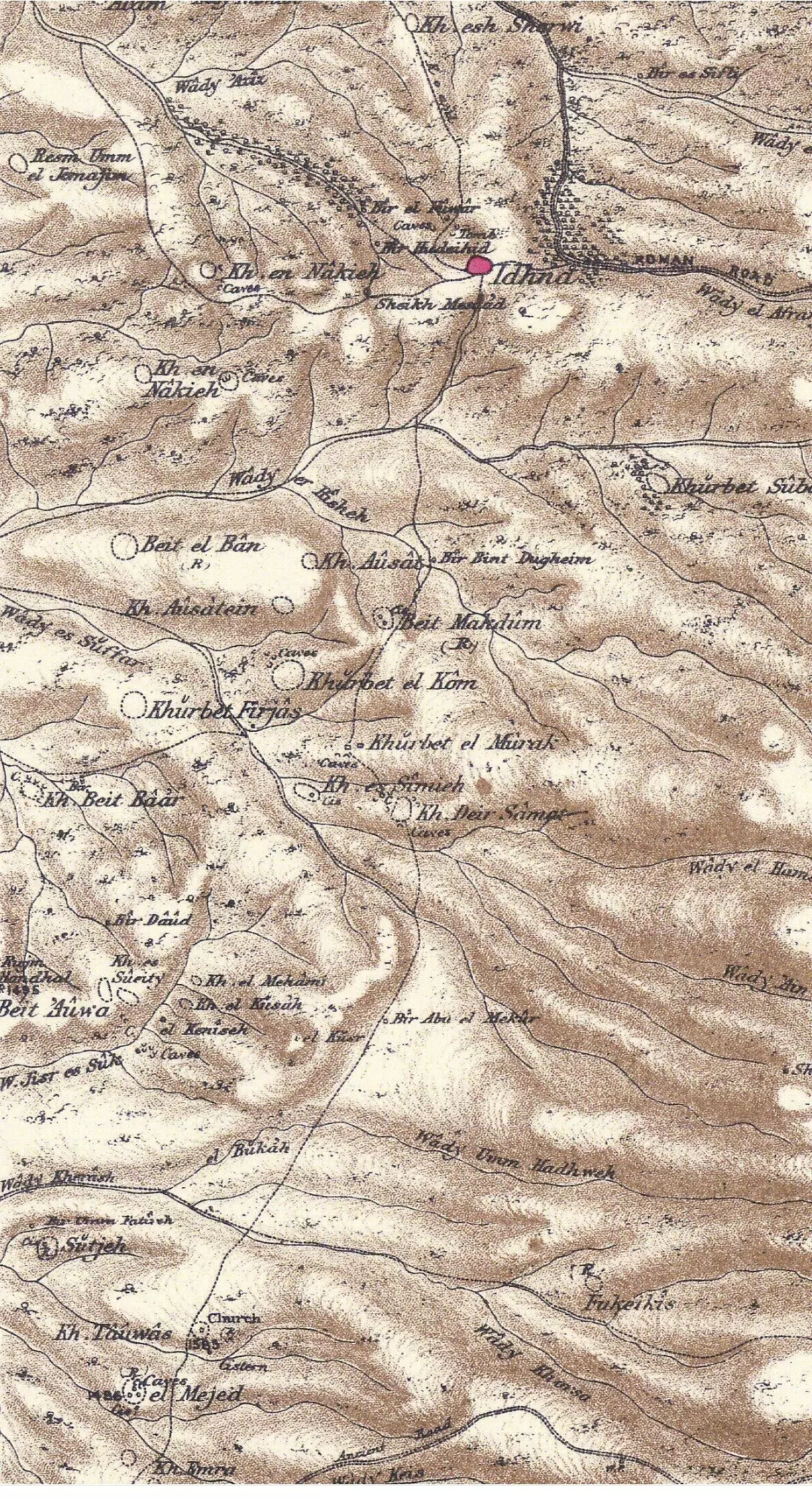
Posted by محمد الشراونة - خارطة خربة سيميا عام 1881م ...خربة سيميا
إحدى خرب وقرى مدينة دورا في محافظة الخليل جنوب الضفة الغربية.
حدودها من الشرق دير سامت ومن الغرب الكوم ومن الشمال المورق ومن الجنوب بيت عوا، عدد سكانها في عام 1961م (196) نسمة، وبلغ عدد سكانها عام 1997م هو (1225) نسمة، وتشترك مع ديرسامت في مجلس قروي منذ عام 1978م، رفع إلى مجلس بلدي عام 2018، رسمياً بلدية ديرسامت والسيمياء .
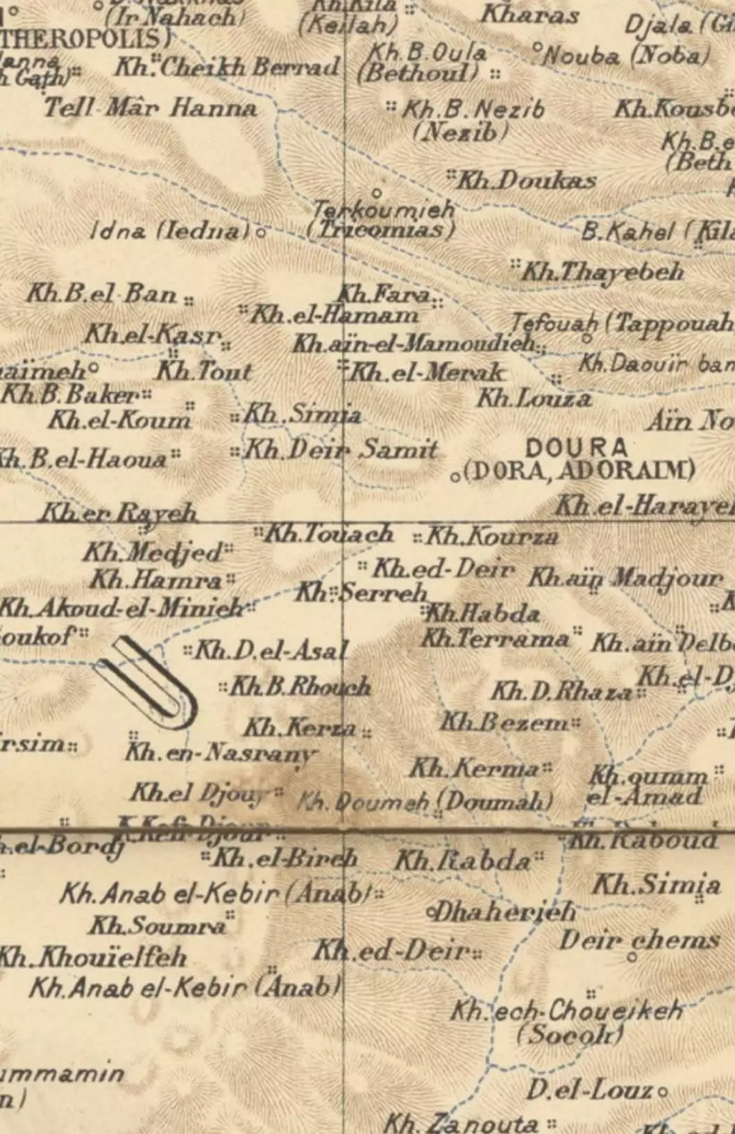
(فيكتور جويرين: Victor Guérin: خربة سيميا ص 344، KHIRBET SiMIA)
المصدر: خارطة فلسطين فيكتور غيرن 1881م
Carte de la Palestine, Par Victor Guérin, Gravé par R. Hausermann
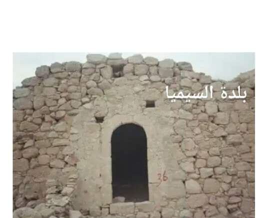
Posted by محمد الشراونة 1 - دوار السيميا - البلدة القديمة في السيميا
- Kh. Sumya' Map during the pre-Nakba period
Posted by محمد الشراونة - مسجد السيميا
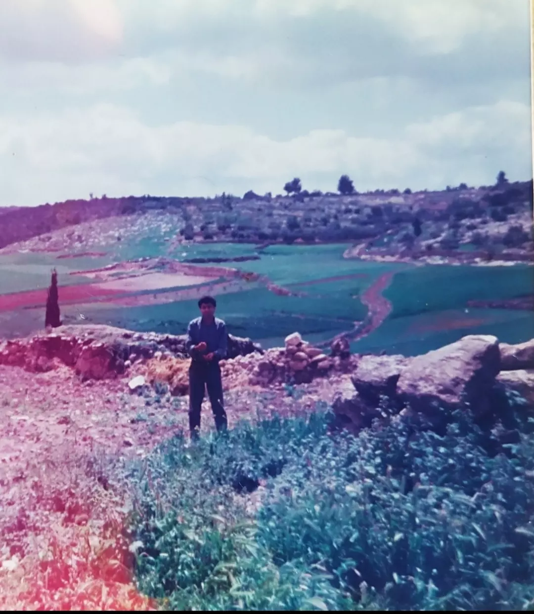
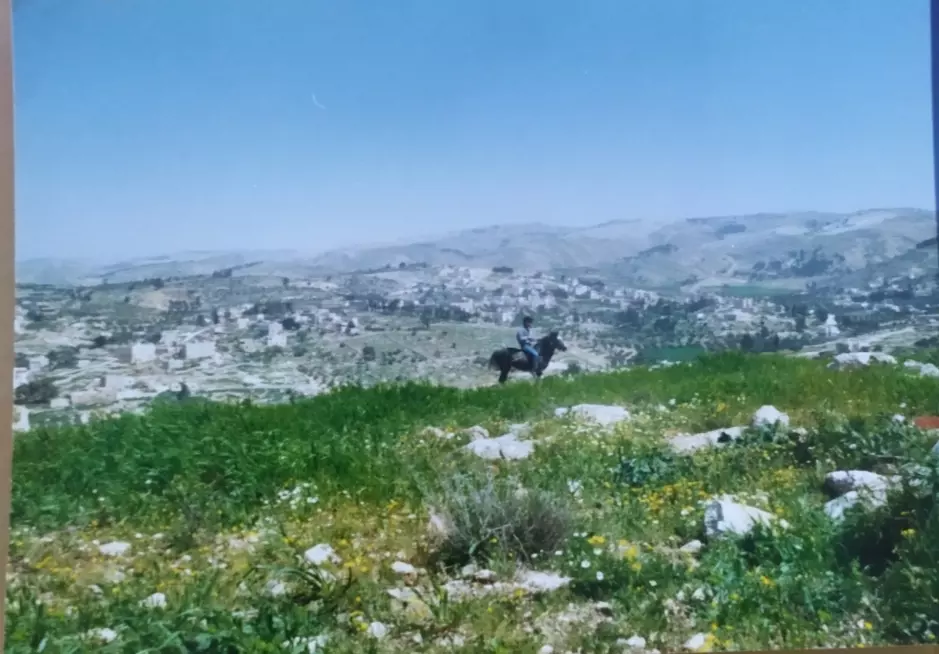
Posted by محمد الشراونة - إطلالة على سهلة السيميا في ربيع عام 1987م
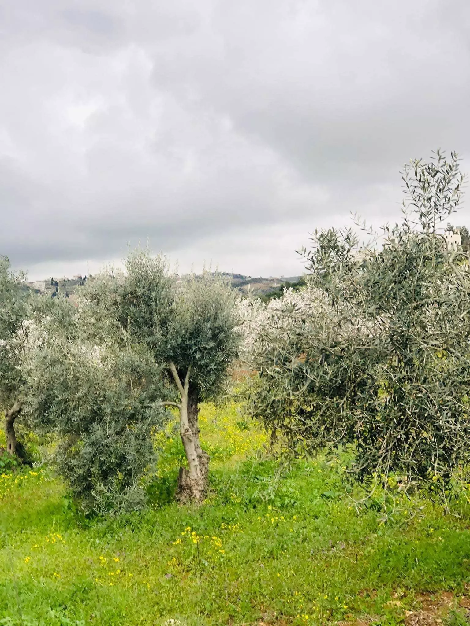
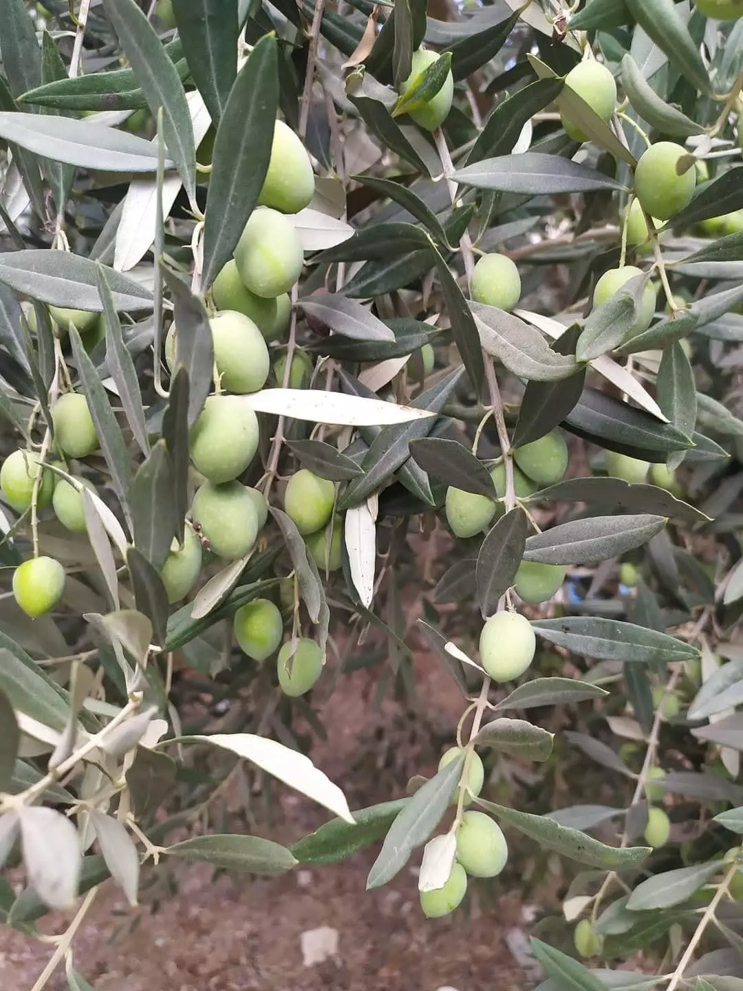
Posted by محمد الشراونة - زيتون أخضر صنف نبالي بلدي أو رومي
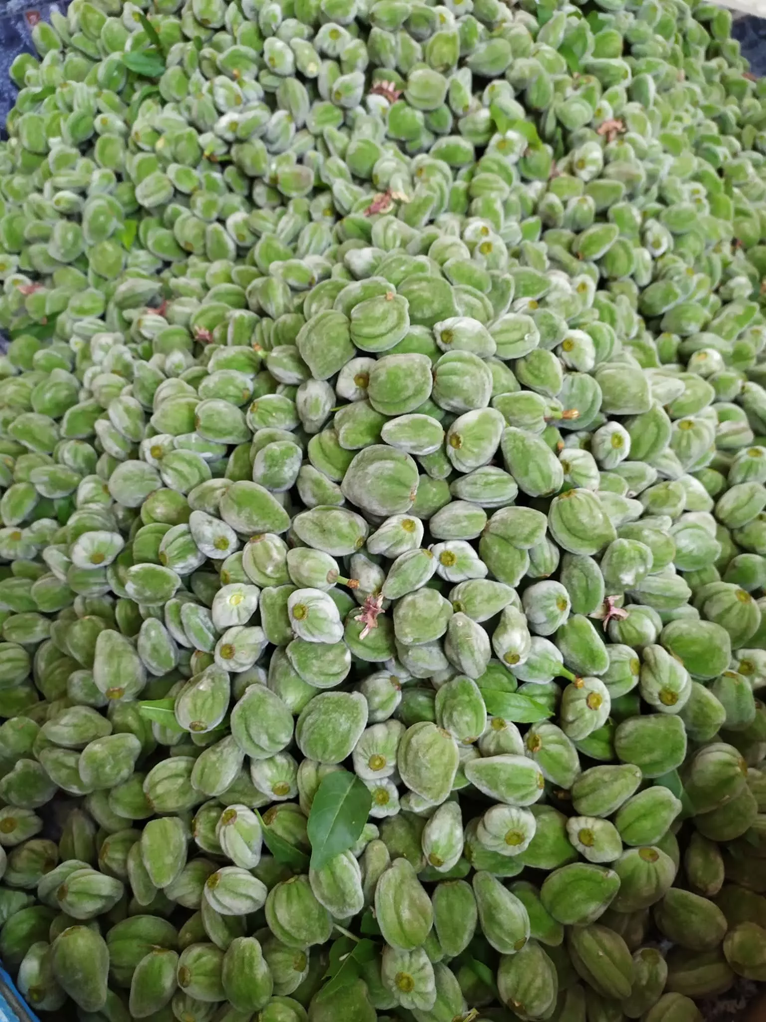
Posted by محمد الشراونة - لوز أخضر صنف مخمل
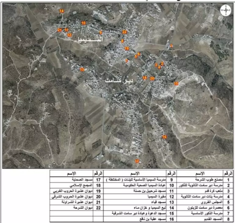
Posted by محمد الشراونة - مخطط قرية السيمياء ودير سامت
رفع المجلس القروي المشترك إلى مجلس بلدي عام 2018
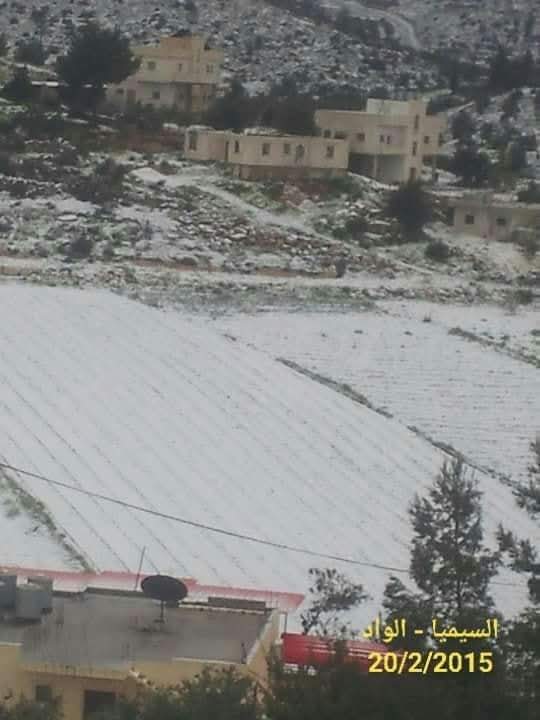
Posted by محمد الشراونة - واد السيميا عام 2015
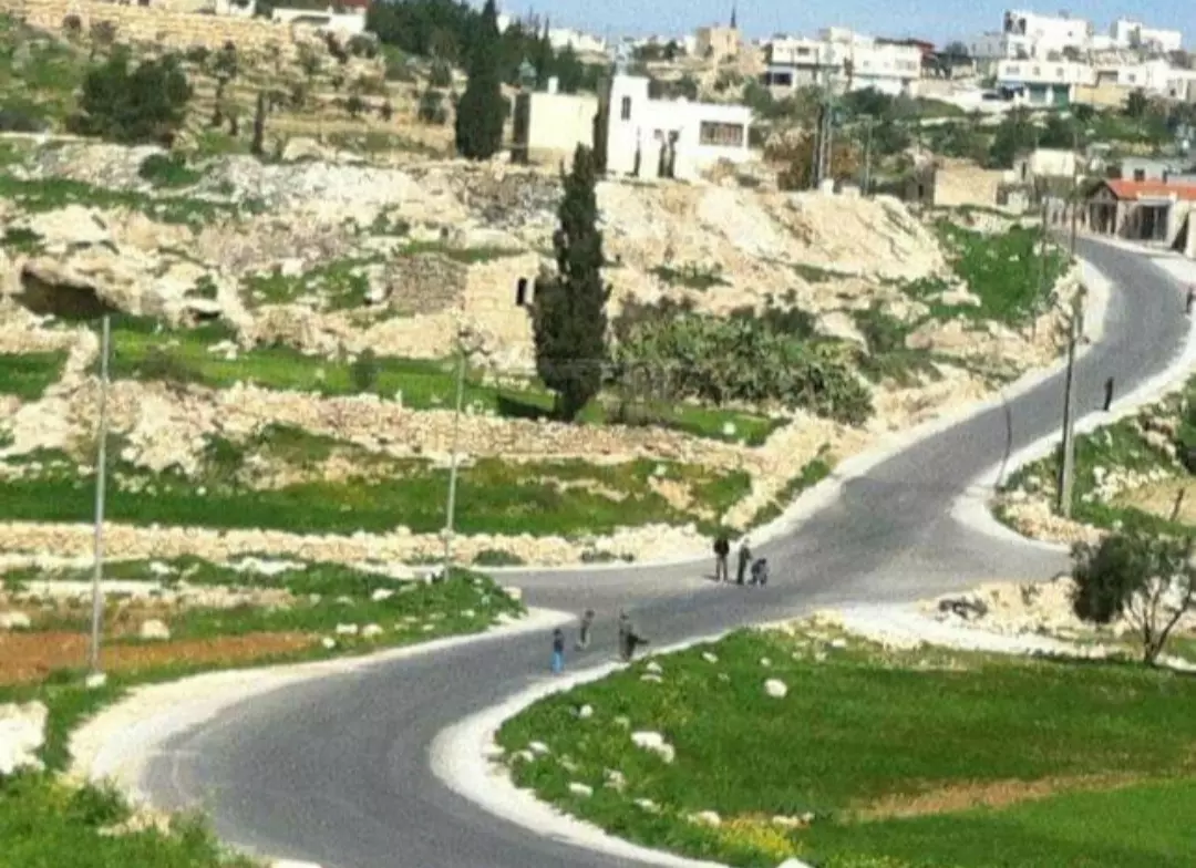
Posted by محمد الشراونة - منطقة البلدة القديمة والدوار في السيميا أو السيمياء
Posted by محمد الشراونة - شعب الزنقعي والسهلة في السيميا في ربيع عام 1987م
Posted by محمد الشراونة - بيارة السيميا أو بئر نبع السيمياء، أحد الآبار التاريخية في مدينة دورا
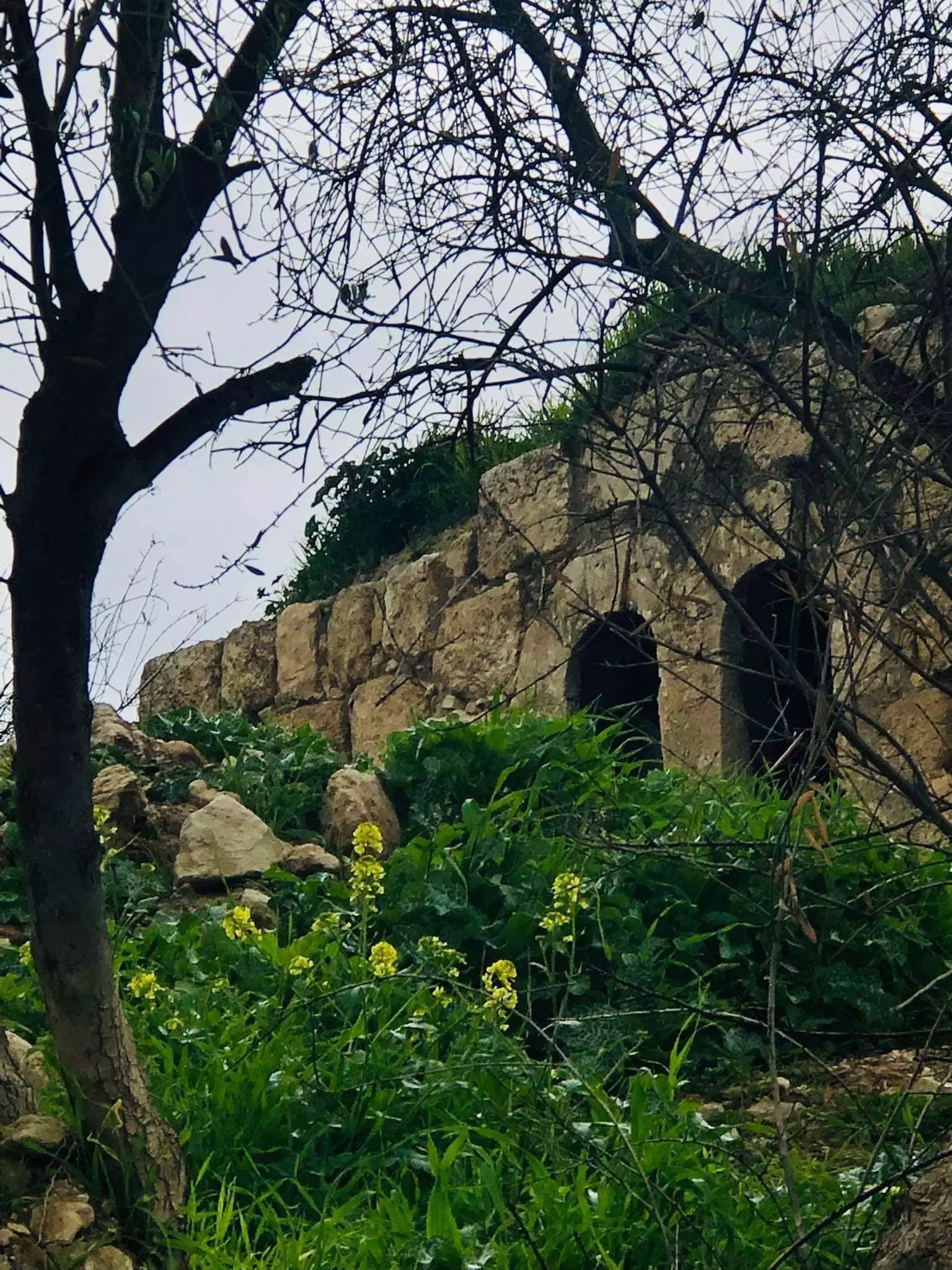
Posted by محمد الشراونة - إطلالة من منطقة الرجوم في البلدة القديمة في السيميا عام 1985م
Posted by محمد الشراونة - إطلالة من منطقة خلة الفول على خربة سيميا أو السيمياء عام 1985م، ويظهر ديوان عشيرة الشراونة القديم والمعروف جامع الشجرة، والذي كان يضم عقود تاريخية قديمة تتوسطها شجرة معمرة ضخمة عمرها مئات السنين.
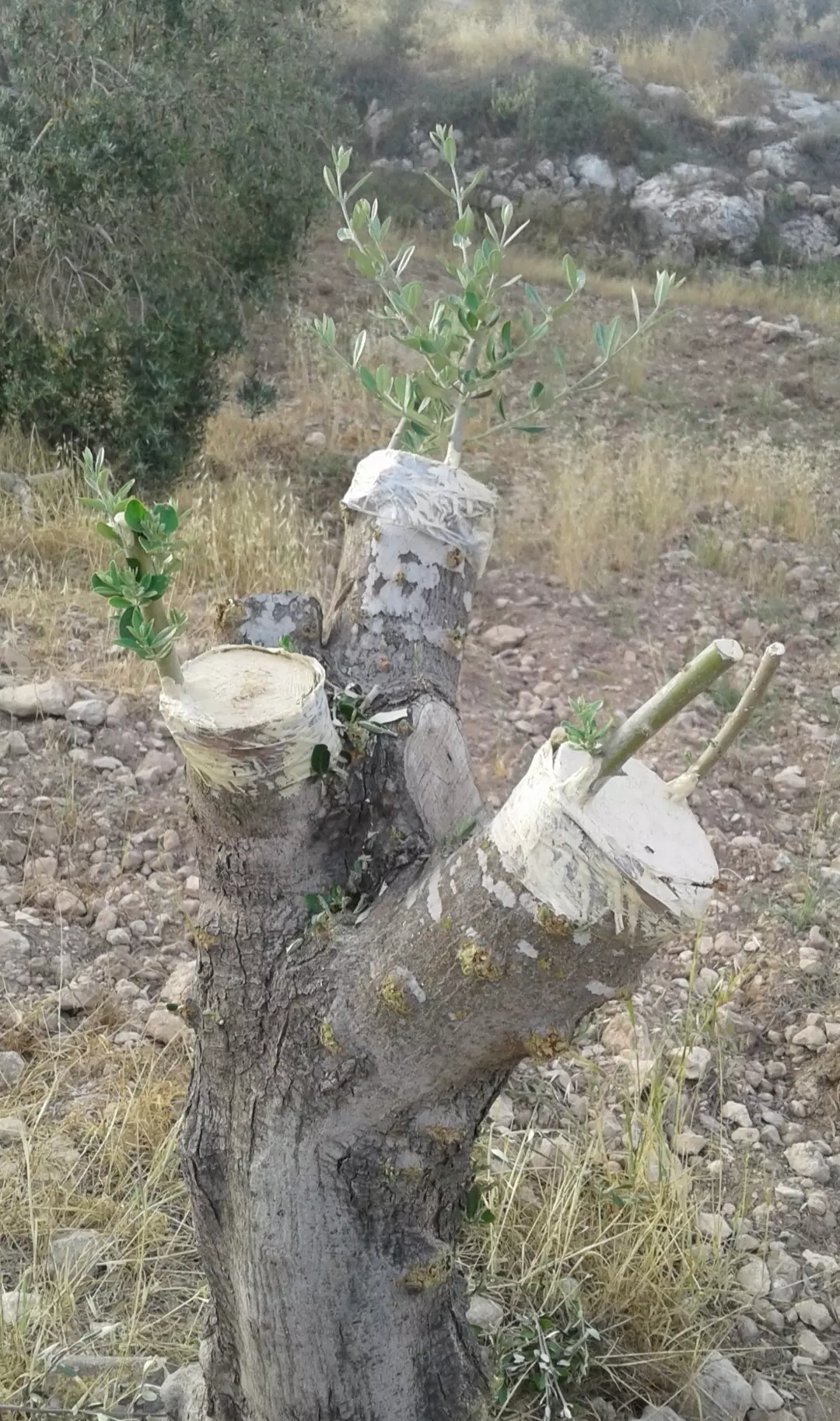
Posted by محمد الشراونة - تطعيم أشجار الزيتون الكبيرة بالقلم بأصناف جيدة
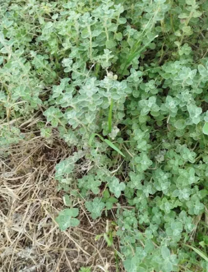
Posted by محمد الشراونة - نبات زعتر فلسطيني جبلي
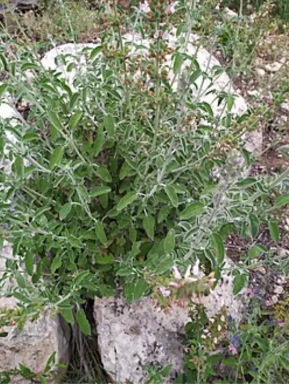
Posted by محمد الشراونة - نبات مريمية أو مرمية جبلية
Posted by محمد الشراونة - موسم قطف الزيتون
Posted by محمد الشراونة - فلسطيني أنا
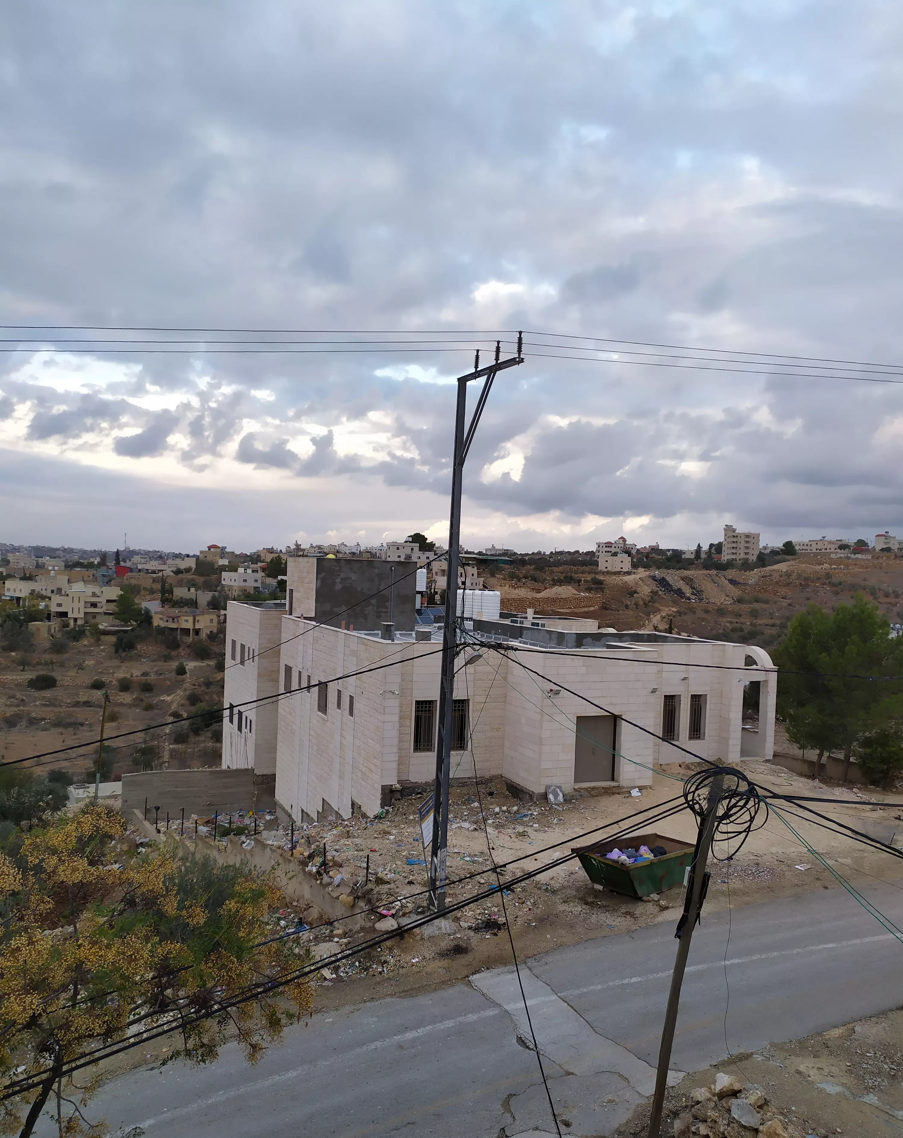
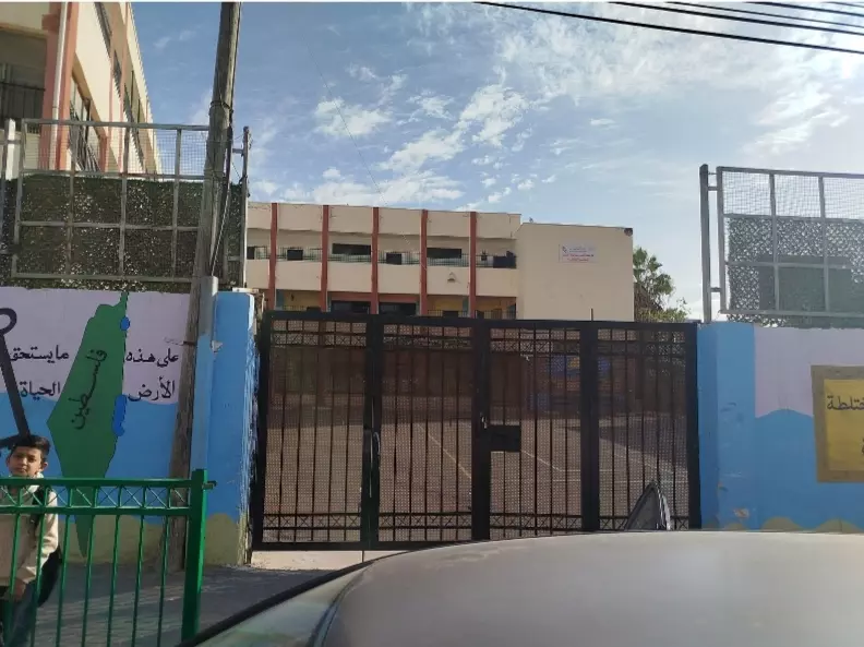
Posted by محمد الشراونة - مدرسة دير سامت السيميا الأساسية المختلطة، تقع في قرية السيميا غرب مدينة دورا بمحافظة الخليل
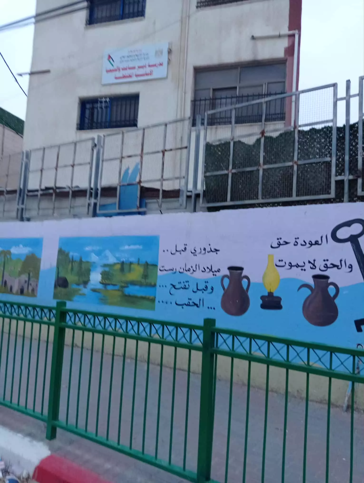
Posted by محمد الشراونة - مدرسة دير سامت السيميا الأساسية المختلطة، تقع في قرية السيميا غرب مدينة دورا بمحافظة الخليل #2
Posted by محمد الشراونة - مجلس قروي دير سامت - السيميا، مجلس مشترك تأسس سنة 1978م، رسمياً 1982م.
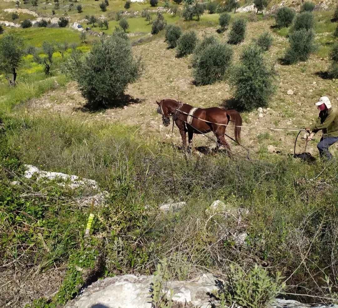
Posted by محمد الشراونة - حراثة حقول الزيتون
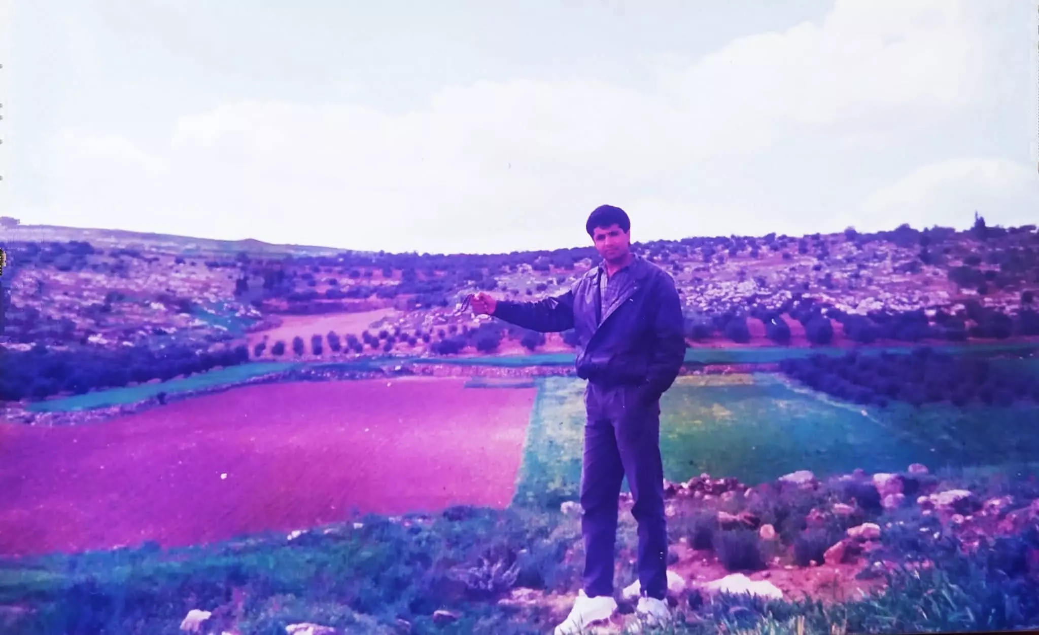
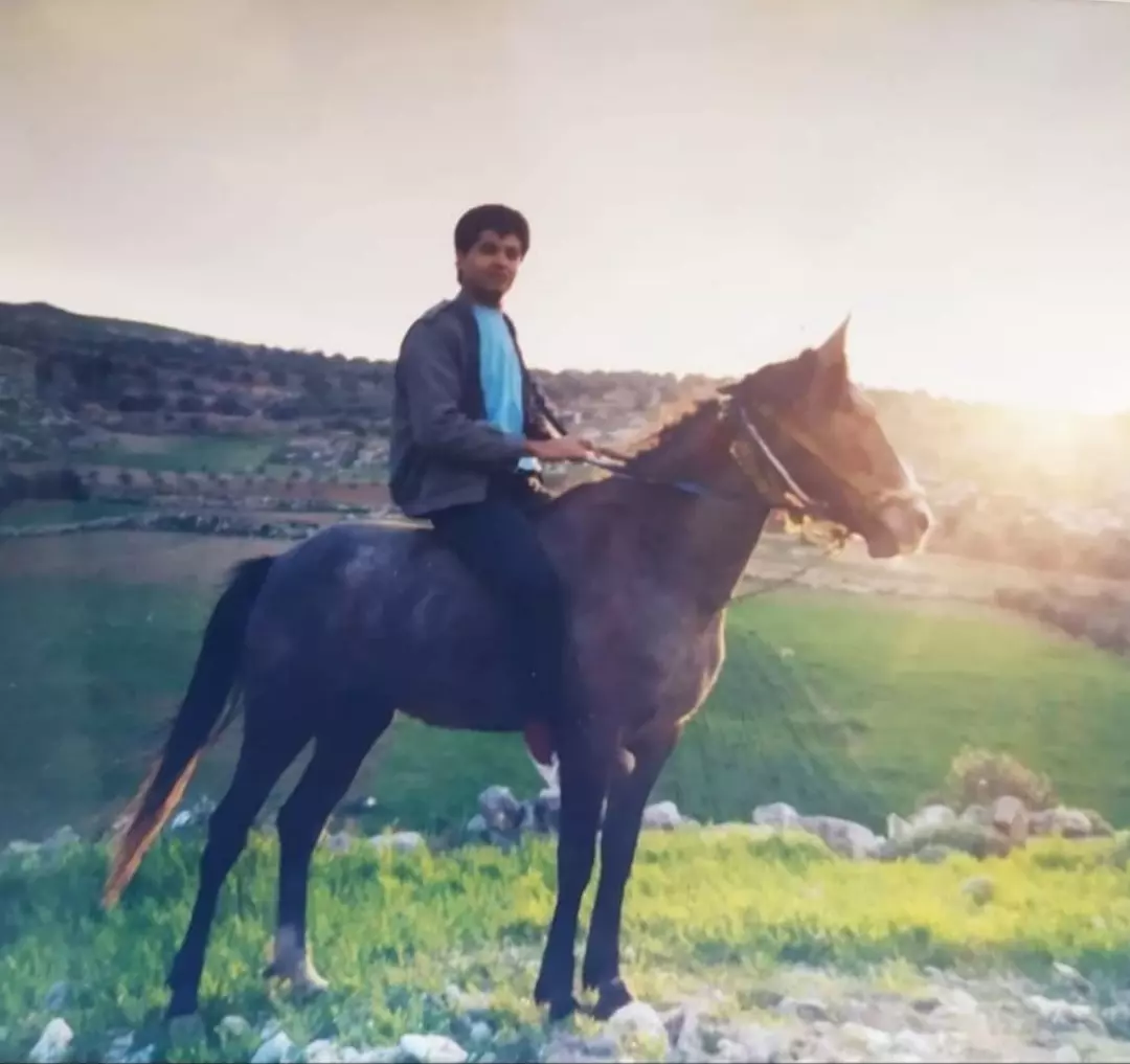
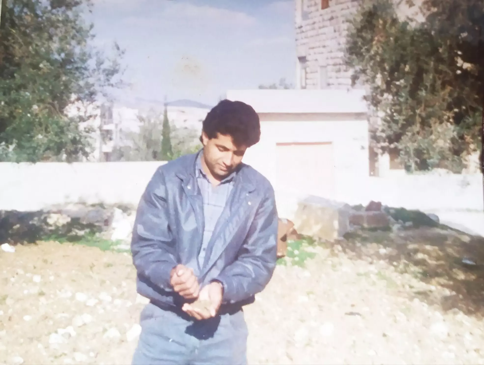
Posted by محمد الشراونة - السيميا 1987م، عاشق التراب
Posted by محمد الشراونة
Want to browse more? 80,000 pictures were grouped in these gallaries:
| Display Name | Clan/Hamolah | Country of Residence |
| محمد الشراونة | - | Palestine |
 Fake Valor: Why Did Zionist Jews Hoist Nazis Flag on Their Ships in the 1930s?
What is new?
-
Facts About Oct. 7th Gaza Raid
-
Remined Us Please:: Who Did Rape Who? Palestinians Raped Israelis? Or, was the other way around?
-
When Prof. Edward Said was invited to debate Bibi Netanyahu in the 1980s, watch what happened!
-
Ezra Klein of the NY Times on the "Jewish Race".
-
Abusing Blood Libel!
-
Zionist FAQ: Isn't it true that Palestinians don't want peace? Palestinians never accepted the two-state solution
- Facts about Haavara (Transfer) Agreement between Ben-Gurion & Hitler
-
Haavara FAQs: Why Did Zionist Jews Hoist Nazis' Flags on Their Ships in the 1930s?
-
Dear ChatGPT: Why did the Jewish Agency suppress news of the Holocaust during WWII?
-
Video Playlist: Jews share their DNA tests to end the conflict for good.
-
A Tale of Two Conflicts: Examining the Definition of Genocide
-
Prof. Abraham Polak And The Suppressed History of the Khazars and European Jewry
-
How Ronald Reagan would have framed the genocide in Gaza if he were still alive?
-
Haavara FAQs: Let us do the math: how many German Jews did The Haavara Agreement save?
-
Zionist FAQs: The Hebron Massacre of 1929, "clearly proves" that Palestinians are antisemitic, how could you deny it?
-
Zionist FAQs: Why Anti-Zionist Is Not Antisemitism?
-
Zionist FAQs: Isn't it true that the KGB create Palestinian Nationalism in the early 1960s?
- Zionist FAQs: Muslims are killing Muslims all the time; why are Israeli Jews being singled out in the media?
- Zionist FAQs: How is Israel an apartheid state when 20% of its citizens are Arabs who enjoy full rights?
-
Haavara FAQs: Analysis of Herzl's Uganda Scheme and how it could have saved millions of Jews.
-
Haavara FAQs: Why did Hayim Greenberg describe American Jewry as "morally bankrupt" in early 1943?
-
Haavara FAQs: What if the Evian Conference was a resounding success? What would have been the impact of saving European Jewry on Zionism?
- Haavara FAQs: What if the six million were saved, how that would have impacted the Zionist project?
-
Haavara FAQs: How did Zionist leaders react when Europe's Jews lingered in the DP camps after WWII ended?
-
Why does the American Jewish community repeat lies that David Ben-Gurion had debunked before he died?
-
Who has the power to rename the Tatar/Khazar Gene Marker to Jewish IV?
-
Zionist FAQs: Why won't Egypt, Syria, and Jordan take their people back? Jews are indigenous to Palestine, and Arabs immigrated after Jews developed the country. Arabs should leave.
-
Haavara FAQs: Did Hitler and the Nazis conflate between Judaism and Zionist? If that wasn't case, then why?
-
Haavara FAQs: Winston Churchill and antisemitism, a collection of articles written Churchill.
-
Haavara FAQs: Broken by country, how many Jews survived vs. killed during the Holocaust?
-
Haavara FAQs: Why did European Jews vote with their feet and to immigrated to the Americas, not Palestine, after WWII?
-
Watch this American Jewish Girl describing Israeli Jews' cognitive dissonance like no other in under two minutes
-
Haavara FAQs: When the Nazis went out of their way to hide the Holocaust, Israeli Jews did the exact opposite by broadcasting their genocide of Gazans. But why?
-
Haavara FAQs: How Zionist Jews went out of their to show their appreciation to Nazism and Fascism?
- Haavara FAQs: Why Zionist leaders were against bombing the death camps & the Railroads leading to them?
-
Haavara FAQs: Hitler's message to the British and American people: If Jews are such noble citizens and you care about them, how come you're not letting them in? I will gladly ship them to you at my expense, even on luxury liners!
-
A shortlist of Zionist and Israeli false flag operations in the name Jews.
-
The Most Moral Army
- The Land of Kapos (Israel): Where the brave are boycotted and Kapos walk free.
- Why did early Zionists often named their communal enterprises "colonial"?
- Zionist Relations with Nazi Germany by Faris Glubb
-
Two NY Times advertisements by Zionists in the early 1943 that exposes Zionists' treason at the height of the calamity
- Facts Not Lies about the Palestinian-Israeli Conflict.
- Site's pictures have been categorized
- Campgain Against Lice
- A Survey of Palestine, the official source about Palestine before Nakba produced by the British Mandate; over 1200 pages.
- Satellite View & Google Earth: Over 6,000 placemarks identifying all destroyed towns, W. Bank & Gaza Strip Towns, & refugee camps.
- PalestineRemembered.com and its Nakba Oral History Project were featured on al-Jazeera Satellite TV.
- Nakba Oral History Video Podcast:
 Over 700 Oral History interviews (including 3,500+ hours of recording) can be viewed online.
 - Palestine Village Statistics Project
- Gaza Jail Break
- النسخة العربية للموقع الان متوفرة
- Videos: Documenting the destroyed villages in video: Tracing all that remains since Nakba.
- Videos: Responding to Zionist Propaganda
- Interview: The ethnic cleansing of Palestine: George Galloway interviews Israeli Historian Ilan Pappe.
- For Palestinians, memory matters. It provides a blueprint for their future By George Bisharat.
- Zionist FAQ now available in Hebrew שאלות שציונים שואלים, עכשיו בעברית
- Video: The Stephen Walt and John Mearsheimer report on the influence of the Israel Lobby on U.S. Foreign Policy
- The Palestinian-Israeli conflict for beginners
