| PalestineRemembered | About Us | Oral History | العربية | |
| Pictures | Zionist FAQs | Haavara | Maps | |
| Search |
| Camps |
| Districts |
| Acre |
| Baysan |
| Beersheba |
| Bethlehem |
| Gaza |
| Haifa |
| Hebron |
| Jaffa |
| Jericho |
| Jerusalem |
| Jinin |
| Nablus |
| Nazareth |
| Ramallah |
| al-Ramla |
| Safad |
| Tiberias |
| Tulkarm |
| Donate |
| Contact |
| Profile |
| Videos |
|
Prev |
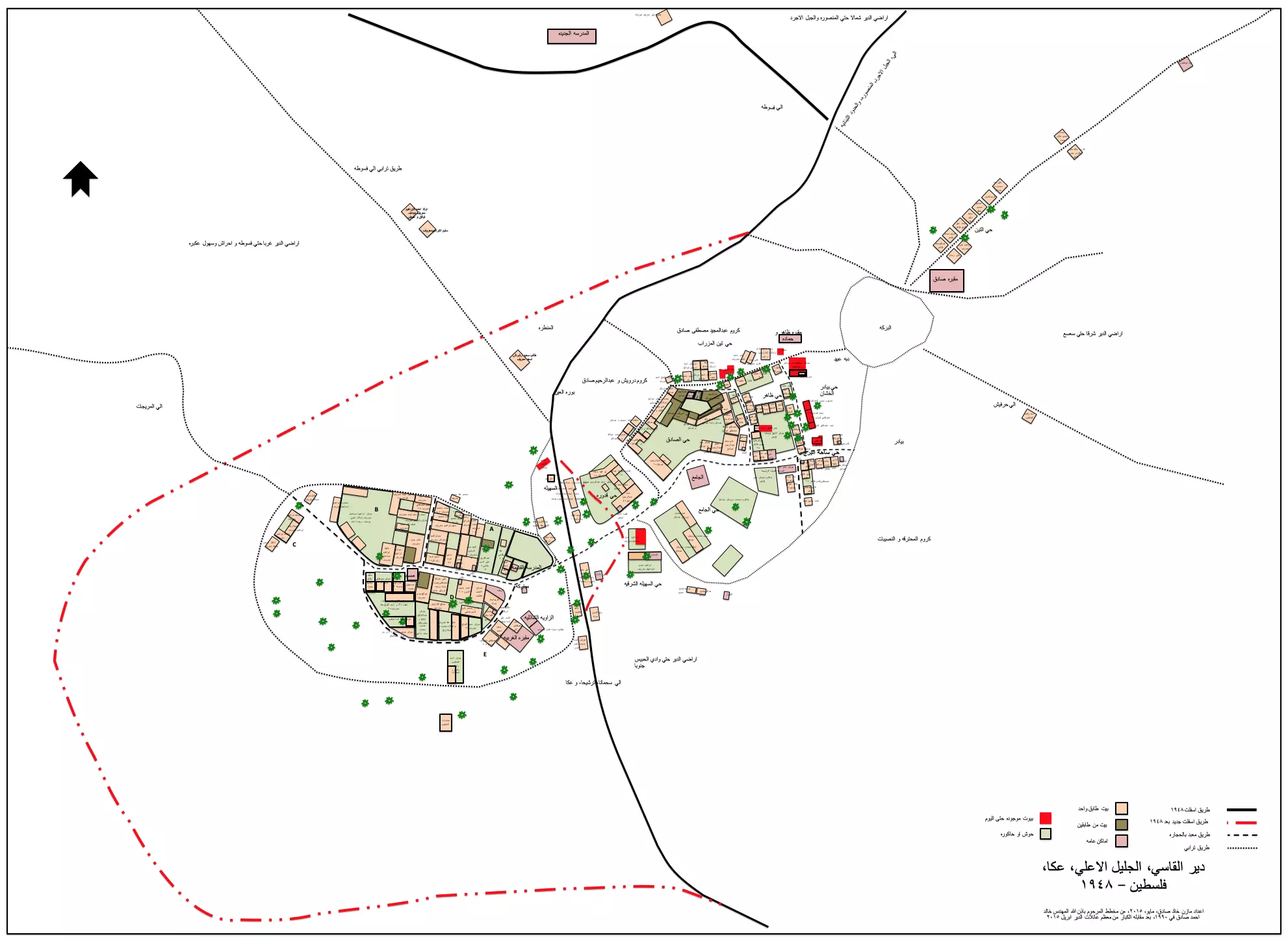
Dayr al-Qasi - دير القاسي: Map of Dayr il Qasi with its homes pre 1948 and another map superimposed on a current satellite image of the village region- Map started and drafted by the late Khalid Ahmad Sadiq and continued by his son the late Mazin Khalid Sadiq2 comments |
Next
العربية |
| Posted by Dalia Mazin Khalid Sadiq On September 17, 2019 |
||
| Upload | Prev 47 48 49 50 51 Next | Satellite |


Post Your Comment
*It should be NOTED that your email address won't be shared, and all communications between members will be routed via the website's mail server.
ابو السوس - صلاح منصور