| Prev | Next |  |
| Prev | Next |
| PalestineRemembered | About Us | Oral History | العربية | |
| Pictures | Zionist FAQs | Haavara | Maps | |
| Search |
| Camps |
| Districts |
| Acre |
| Baysan |
| Beersheba |
| Bethlehem |
| Gaza |
| Haifa |
| Hebron |
| Jaffa |
| Jericho |
| Jerusalem |
| Jinin |
| Nablus |
| Nazareth |
| Ramallah |
| al-Ramla |
| Safad |
| Tiberias |
| Tulkarm |
| Donate |
| Contact |
| Profile |
| Videos |
British Mandate: A Survey of Palestine: Volume I - Page 406 |
Disclaimer
The above documents, article, interviews, movies, podcasts, or stories reflects solely the research and opinions of its authors. PalestineRemembered.com makes its best effort to validate its contents.


Post Your Comment
*It should be NOTED that your email address won't be shared, and all communications between members will be routed via the website's mail server.
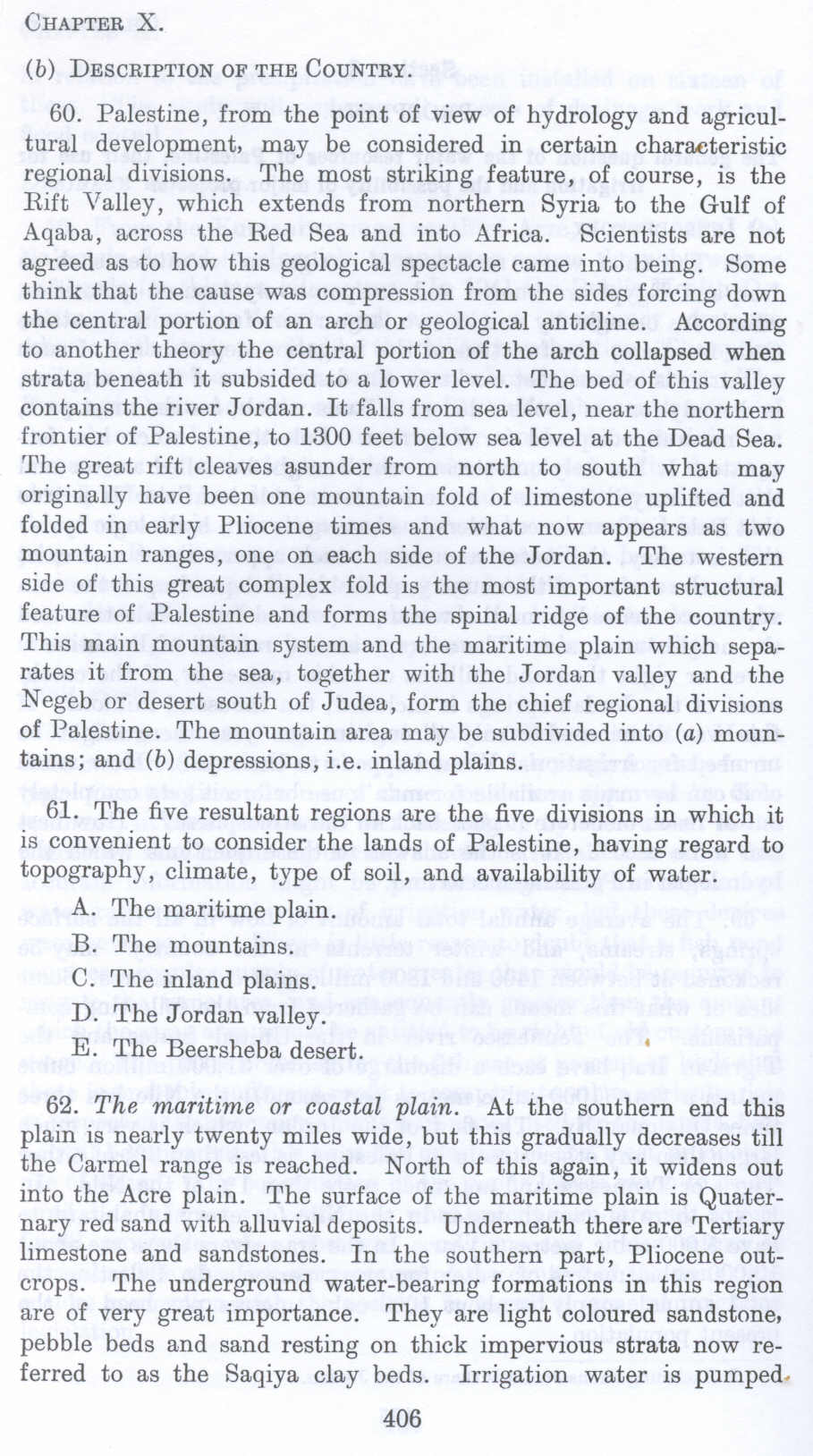
(b) DESCRIPTION OF THE Country.
60. Palestine, from the point of view of hydrology and agricultural development, may be considered in certain characteristic regional divisions. The most striking feature, of course, is the Rift Valley, which extends from northern Syria to the Gulf of Aqaba, across the Red Sea and into Africa. Scientists are not agreed as to how this geological spectacle came into being. Some think that the cause was compression from the sides forcing down the central portion of an arch or geological anticline. According to another theory the central portion of the arch collapsed when strata beneath it subsided to a lower level. The bed of this valley contains the river Jordan. It falls from sea level, near the northern frontier of Palestine, to 1300 feet below sea level at the Dead Sea. The great rift cleaves asunder from north to south what may originally have been one mountain fold of limestone uplifted and folded in early Pliocene times and what now appears as two mountain ranges, one on each side of the Jordan. The western side of this great complex fold is the most important structural feature of Palestine and forms the spinal ridge of the country. This main mountain system and the maritime plain which separates it from the sea, together with the Jordan valley and the Negeb or desert south of Judea, form the chief regional divisions of Palestine. The mountain area may be subdivided into (a) mountains; and (b) depressions, i.e. inland plains.
61. The five resultant regions are the five divisions in which it is convenient to consider the lands of Palestine, having regard to topography, climate, type of soil, and availability of water.
A. The maritime plain.
B. The mountains.
C. The inland plains.
D. The Jordan valley.
E. The Beersheba desert.
62. The maritime or coastal plain. At the southern end this plain is nearly twenty miles wide, but this gradually decrease" till the Carmel range is reached. North of this again, it widens out into the Acre plain. The surface of the maritime plain is Quaternary red sand with alluvial deposits. Underneath there are Tertiary limestone and sandstones. In the southern part, Pliocene outcrops. The underground water-bearing formations in this region are of very great importance. They are light coloured sandstone, pebble beds and sand resting on thick impervious strata now referred to as the Saqiya clay beds. Irrigation water is pumped-
Page 406