| PalestineRemembered | About Us | Oral History | العربية | |
| Pictures | Zionist FAQs | Haavara | Maps | |
| Search |
| Camps |
| Districts |
| Acre |
| Baysan |
| Beersheba |
| Bethlehem |
| Gaza |
| Haifa |
| Hebron |
| Jaffa |
| Jericho |
| Jerusalem |
| Jinin |
| Nablus |
| Nazareth |
| Ramallah |
| al-Ramla |
| Safad |
| Tiberias |
| Tulkarm |
| Donate |
| Contact |
| Profile |
| Videos |
Welcome To Farwana - فرونه (פרונה)
|
District of Baysan
Ethnically cleansed days ago |
العربية Google Earth |
 |
Gallery (8) |
- Statistics & Facts
-
Before & After

- Satellite View
- Articles 2
- Pictures 8
- Oral History 1
- Members
- All That Remains
- Wikipedia
- Videos
- Guest Book 2
- Links
| Statistic & Fact | Value | ||||||||||||||
| Occupation Date | May 11, 1948 | ||||||||||||||
| Distance From District | 4.5 (km) South of Baysan | ||||||||||||||
| Elevation | -125 (meters) | ||||||||||||||
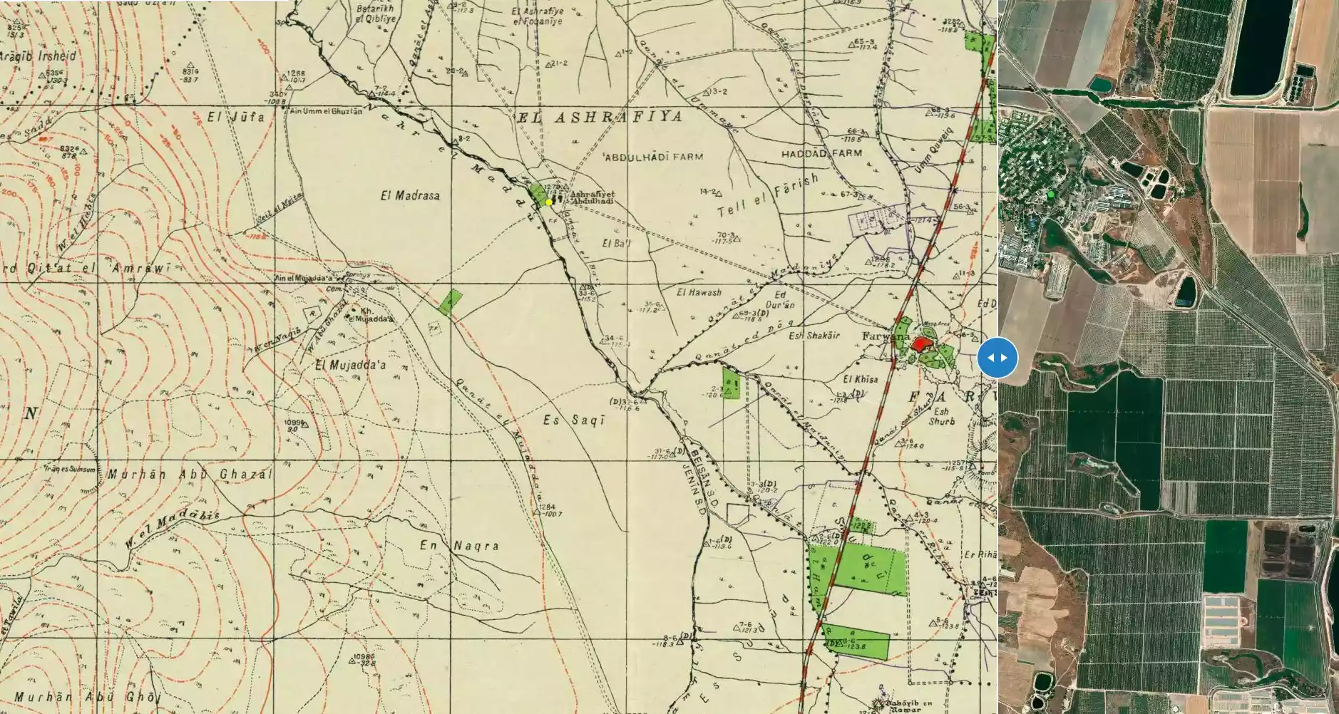
| Before & After Nakba, Click Map For Details |
|||||||||||||||
|
|||||||||||||||
| Map Location | See location #23 on the map View from satellite |
||||||||||||||
| Military Operation | Gidion Operation | ||||||||||||||
| Attacking Units | Golani Brigade | ||||||||||||||
| Exodus Cause | Military assault by Zionist troops | ||||||||||||||
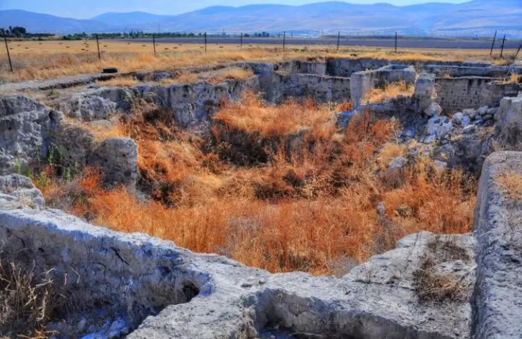
| Village Temains | On May 12th, 1948, Farwana was completely destroyed, and only house walls and rubble left behind. | ||||||||||||||
| Ethnically Cleansing | Upon occupation, both Farwana and al-Ashrafiyya inhabitants fled towards Jordan. | ||||||||||||||
| Pre-Nakba Land Ownership |
**Town Lands' Demarcation Maps |
||||||||||||||
| Land Usage As of 1945 |
|
||||||||||||||
| Population |
|
||||||||||||||
| Number of Houses |
|
||||||||||||||
| Near By Towns |
|||||||||||||||
|
|
|||||||||||||||
| Town's Name Through History | Farwana was sometimes identified with city of Rehob during Egyptian rule over Palestine in the 2nd millenium B.C. | ||||||||||||||
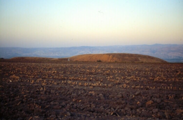
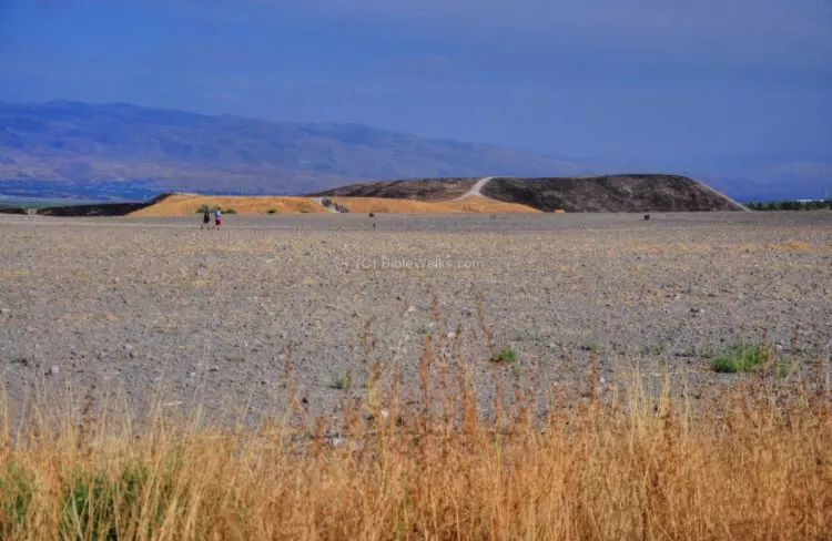
| Archeological Sites | The village contains Tall al-Sarim (the ruins of an anceint city), also the remains of a third century A.D. synagogue. | ||||||||||||||
| Exculsive Jewish Colonies Who Usurped Village Lands |
Rechov, Chawwat Eden, and 'En ha-Natziv. | ||||||||||||||
| Featured Video | |||||||||||||||
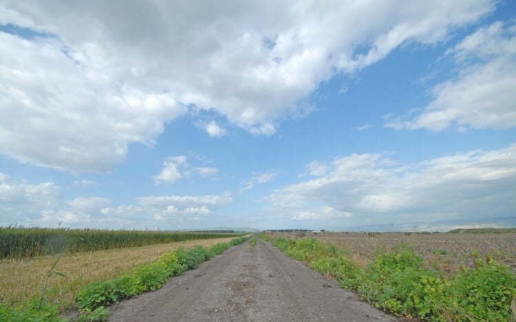
Village Before NakbaThe village stood on flat ground in the Baysan Valley, on the highway between Baysan and Jericho. Farwana may have been derived from an Arabic phrase, farana al-khubzu farnan or 'the bread was thoroughly baked [in the oven],' due to the hot climate of the Jordan Valley. The village houses, built of adobe brick, were crowded together, separated only by narrow alleys. The village was surrounded by agricultural lands, where a number of springs flowed and eventually fed Wadi al-Maddu'. In 1944/45 a total of 3,847 dunums was allotted to cereals; 42 dunums were irrigated or used for orchards. About 300 m southeast of the village was Tall al-Sarim, a large tell containing the ruins of a city that was bifurcated into upper and lower parts. This city is sometimes identified with Rehob, a center of Egyptian rule over Palestine in the second millenium B.C. Excavations some 200 m south of this tell uncovered tombs dating to the late third and early second millennium B.C. The ruins of a third century A.D. synagogue were discovered northeast of the village site in 1969.Village Occupation and Ethnic CleaningFarwana was targeted for attack in mid-February 1948, as a nearby battle raged around the Jewish settlement of Tirat Tzvi. The Palestinian daily Filastin reported on 19 February that Zionist forces attempted to encircle the village from the north and east, but were driven back by Farwana's defenders. According to the newspaper account, the attackers blew up three empty houses before withdrawing.Israeli historian Benny Morris writes that on the night of 10-11 May 1948, units of the Golani Brigade attacked and captured the village, along with neighboring al-Ashrafiyya. Both were located on the outskirts of Baysan and were occupied in preparation for the final assault on the sub-disctrict capital, on 12 May. The village was probably one of eight villages in the Baysan area reported by the Associated Press as captured on 13 May. Morris reports that the inhabitants fled across the Jordan River 'as the troops approached,' adding that sappers from the Haganah lost no time in blowing up the village houses and completely destroying the village. Zionists Colonies on Village LandsThe settlement of Rechov was founded in 1951 to the north of the village site on village lands. The model farm of Chawwat Eden is to the west, on village lands. The settlement of 'En ha-Natziv was established in 1946 just to the northeast of the village site, on lands belonging to the town of Baysan. Sde Terumot was also established in 1951 west of the village site, on land belonging to al-Samiriyya.Village TodayThe only remains of the village are the ruined walls and floors of houses. The site is overgrown with wild vegetation and contains an archaeological dig. The lands around it are cultivated by Israelis.SourceDr. Walid al-Khalidi, 1992: All That Remains. |
|||||||||||||||
| Related Maps | Town Lands' Demarcation Maps خرائط للقضاء توضح حدود القرى والاودية Town's map on MapQuest View from satellite Help us map this town at WikiMapia |
||||||||||||||
| Related Links | Wikipedia's Page Google Search Google For Images Google For Videos |
||||||||||||||
| More Information | في كتاب كي لا ننسى في كتاب بلادنا فلسطين المزيد من موقع هوية |
||||||||||||||
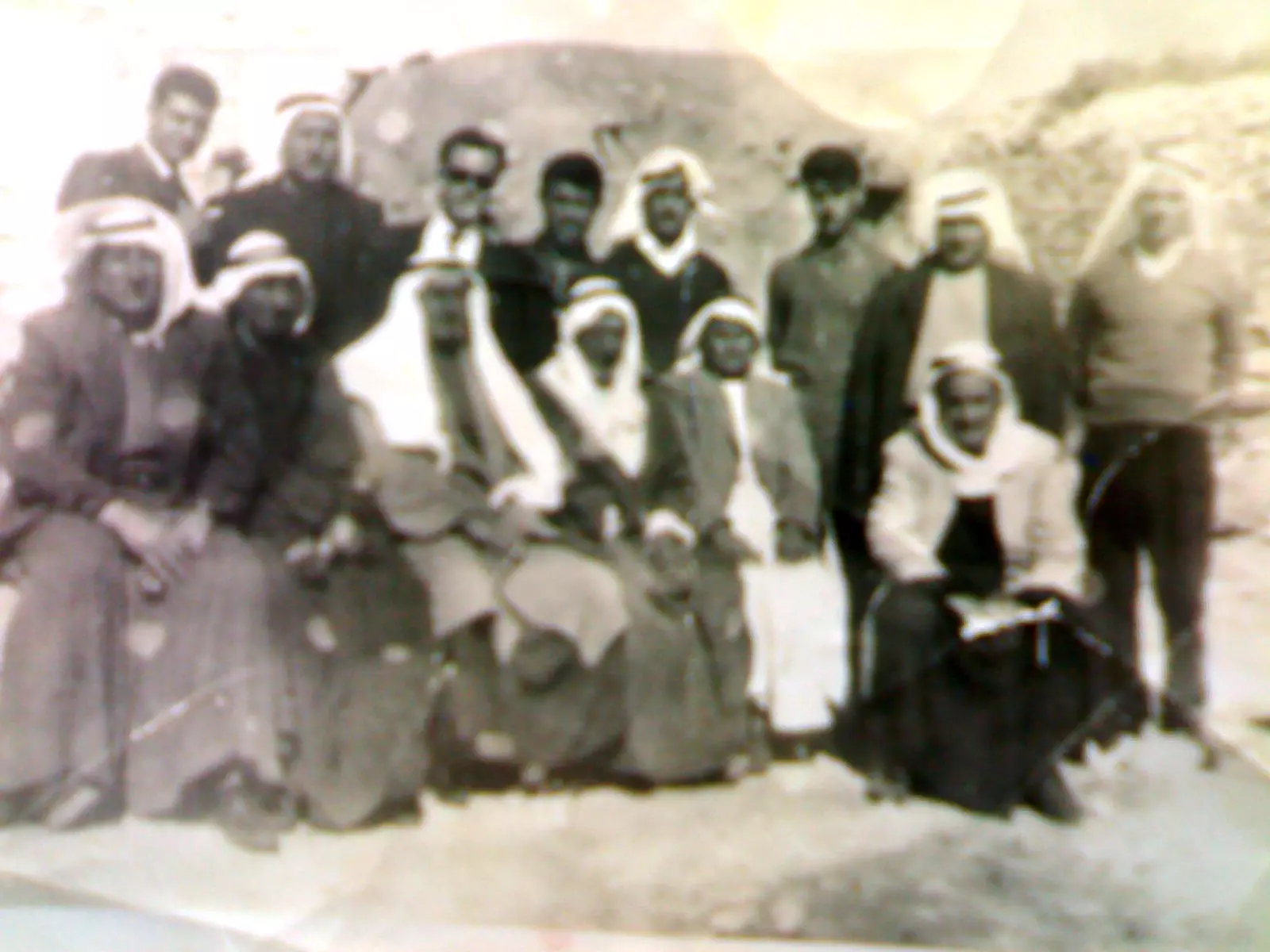
- من أهل فرونة-عن يمينك الجلوس 1- محمود احمد الحاج 2- مصطفى ابراهيم الحاج 4- أحمد عبد الغافر الحاج 5- علي محمود الحاج الوقوف 1- مصطفى صادق الحاج 4- موسى علي الحاج 5- علي أحمد الحاج 6- محمد صادق الحاج 8- أحمد عبد الله الحاج
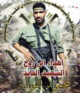
Posted by waleed alhaj 2 - الشهيد محمد طوالبة
Posted by نيوتن - تل الصارم الاثري القريب من القريه
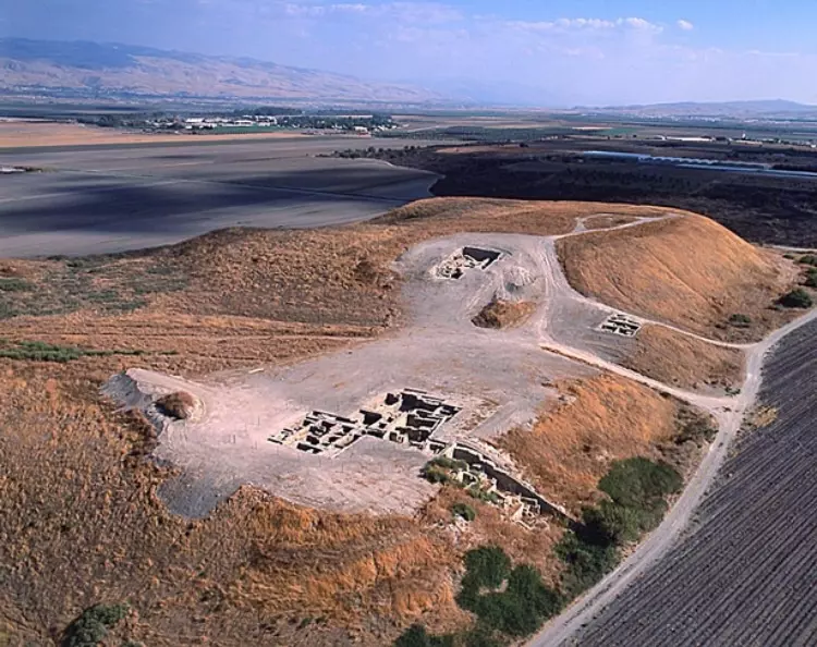
Posted by abu raya - الاثار القديمه في تل الصارم شرق القريه
Posted by abu raya - اراضي القريه وتل الصارم
Posted by abu raya - موقع القريه واراضيها
Posted by abu raya - اراضي القريه
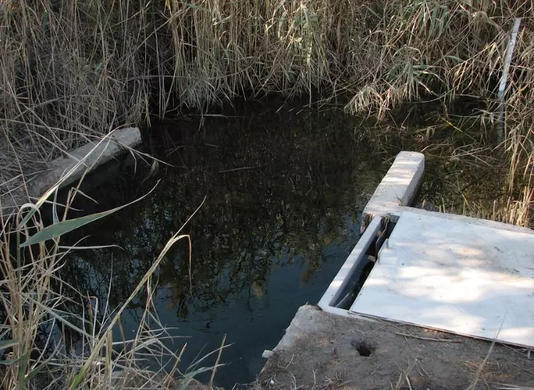
Posted by abu raya - من عيون القريه شمال موقعها
Posted by abu raya
Want to browse more? 80,000 pictures were grouped in these gallaries:
| Display Name | Clan/Hamolah | Country of Residence |
No links have been shared yet, be free to the first to share the first link.
 Fake Valor: Why Did Zionist Jews Hoist Nazis Flag on Their Ships in the 1930s?
What is new?
-
Facts About Oct. 7th Gaza Raid
-
Remined Us Please:: Who Did Rape Who? Palestinians Raped Israelis? Or, was the other way around?
-
When Prof. Edward Said was invited to debate Bibi Netanyahu in the 1980s, watch what happened!
-
Abusing Blood Libel!
-
Zionist FAQ: Isn't it true that Palestinians don't want peace? Palestinians never accepted the two-state solution
- Facts about Haavara (Transfer) Agreement between Ben-Gurion & Hitler
-
Haavara FAQs: Why Did Zionist Jews Hoist Nazis' Flags on Their Ships in the 1930s?
-
Dear ChatGPT: Why did the Jewish Agency suppress news of the Holocaust during WWII?
-
Video Playlist: Jews share their DNA tests to end the conflict for good.
-
A Tale of Two Conflicts: Examining the Definition of Genocide
-
Prof. Abraham Polak And The Suppressed History of the Khazars and European Jewry
-
How Ronald Reagan would have framed the genocide in Gaza if he were still alive?
-
Haavara FAQs: Let us do the math: how many German Jews did The Haavara Agreement save?
-
Zionist FAQs: The Hebron Massacre of 1929, "clearly proves" that Palestinians are antisemitic, how could you deny it?
-
Zionist FAQs: Why Anti-Zionist Is Not Antisemitism?
-
Zionist FAQs: Isn't it true that the KGB create Palestinian Nationalism in the early 1960s?
- Zionist FAQs: Muslims are killing Muslims all the time; why are Israeli Jews being singled out in the media?
- Zionist FAQs: How is Israel an apartheid state when 20% of its citizens are Arabs who enjoy full rights?
-
Haavara FAQs: Analysis of Herzl's Uganda Scheme and how it could have saved millions of Jews.
-
Haavara FAQs: Why did Hayim Greenberg describe American Jewry as "morally bankrupt" in early 1943?
-
Haavara FAQs: What if the Evian Conference was a resounding success? What would have been the impact of saving European Jewry on Zionism?
- Haavara FAQs: What if the six million were saved, how that would have impacted the Zionist project?
-
Haavara FAQs: How did Zionist leaders react when Europe's Jews lingered in the DP camps after WWII ended?
-
Why does the American Jewish community repeat lies that David Ben-Gurion had debunked before he died?
-
Who has the power to rename the Tatar/Khazar Gene Marker to Jewish IV?
-
Zionist FAQs: Why won't Egypt, Syria, and Jordan take their people back? Jews are indigenous to Palestine, and Arabs immigrated after Jews developed the country. Arabs should leave.
-
Haavara FAQs: Did Hitler and the Nazis conflate between Judaism and Zionist? If that wasn't case, then why?
-
Haavara FAQs: Winston Churchill and antisemitism, a collection of articles written Churchill.
-
Haavara FAQs: Broken by country, how many Jews survived vs. killed during the Holocaust?
-
Haavara FAQs: Why did European Jews vote with their feet and to immigrated to the Americas, not Palestine, after WWII?
-
Watch this American Jewish Girl describing Israeli Jews' cognitive dissonance like no other in under two minutes
-
Haavara FAQs: When the Nazis went out of their way to hide the Holocaust, Israeli Jews did the exact opposite by broadcasting their genocide of Gazans. But why?
-
Haavara FAQs: How Zionist Jews went out of their to show their appreciation to Nazism and Fascism?
- Haavara FAQs: Why Zionist leaders were against bombing the death camps & the Railroads leading to them?
-
Haavara FAQs: Hitler's message to the British and American people: If Jews are such noble citizens and you care about them, how come you're not letting them in? I will gladly ship them to you at my expense, even on luxury liners!
-
A shortlist of Zionist and Israeli false flag operations in the name Jews.
-
The Most Moral Army
- The Land of Kapos (Israel): Where the brave are boycotted and Kapos walk free.
- Why did early Zionists often named their communal enterprises "colonial"?
- Zionist Relations with Nazi Germany by Faris Glubb
-
Two NY Times advertisements by Zionists in the early 1943 that exposes Zionists' treason at the height of the calamity
- Facts Not Lies about the Palestinian-Israeli Conflict.
- Site's pictures have been categorized
- Campgain Against Lice
- A Survey of Palestine, the official source about Palestine before Nakba produced by the British Mandate; over 1200 pages.
- Satellite View & Google Earth: Over 6,000 placemarks identifying all destroyed towns, W. Bank & Gaza Strip Towns, & refugee camps.
- PalestineRemembered.com and its Nakba Oral History Project were featured on al-Jazeera Satellite TV.
- Nakba Oral History Video Podcast:
 Over 700 Oral History interviews (including 3,500+ hours of recording) can be viewed online.
 - Palestine Village Statistics Project
- Gaza Jail Break
- النسخة العربية للموقع الان متوفرة
- Videos: Documenting the destroyed villages in video: Tracing all that remains since Nakba.
- Videos: Responding to Zionist Propaganda
- Interview: The ethnic cleansing of Palestine: George Galloway interviews Israeli Historian Ilan Pappe.
- For Palestinians, memory matters. It provides a blueprint for their future By George Bisharat.
- Zionist FAQ now available in Hebrew שאלות שציונים שואלים, עכשיו בעברית
- Video: The Stephen Walt and John Mearsheimer report on the influence of the Israel Lobby on U.S. Foreign Policy
- The Palestinian-Israeli conflict for beginners
