| PalestineRemembered | About Us | Oral History | العربية | |
| Pictures | Zionist FAQs | Haavara | Maps | |
| Search |
| Camps |
| Districts |
| Acre |
| Baysan |
| Beersheba |
| Bethlehem |
| Gaza |
| Haifa |
| Hebron |
| Jaffa |
| Jericho |
| Jerusalem |
| Jinin |
| Nablus |
| Nazareth |
| Ramallah |
| al-Ramla |
| Safad |
| Tiberias |
| Tulkarm |
| Donate |
| Contact |
| Profile |
| Videos |
Welcome To al-Taqa, Khirbat - خربة الطاقة (ח'ירבת א-טאקה)
|
District of Baysan
Ethnically cleansed days ago |
العربية Google Earth |
 |
Gallery (16) |
- Statistics & Facts
-
Before & After

- Satellite View
- Articles 2
- Pictures 16
- Members
- All That Remains
- Videos
- Guest Book
- Links
| Statistic & Fact | Value |
| Occupation Date | May 15, 1948 |
| Distance From District | 14 (km) North of Baysan |
| Elevation | -200 (meters) |
| Before & After Nakba, Click Map For Details |
|
|
|
| Map Location | See location #3 on the map View from satellite |
| Military Operation | Operation Gideon |
| Attacking Units | Golani Brigade |
| Defenders | Iraqi Army |
| Village Temains | Khirbat al-Taqa was completely obliterated. |
| Ethnically Cleansing | al-Taqa, Khirbat inhabitants were completely ethnically cleansed. |
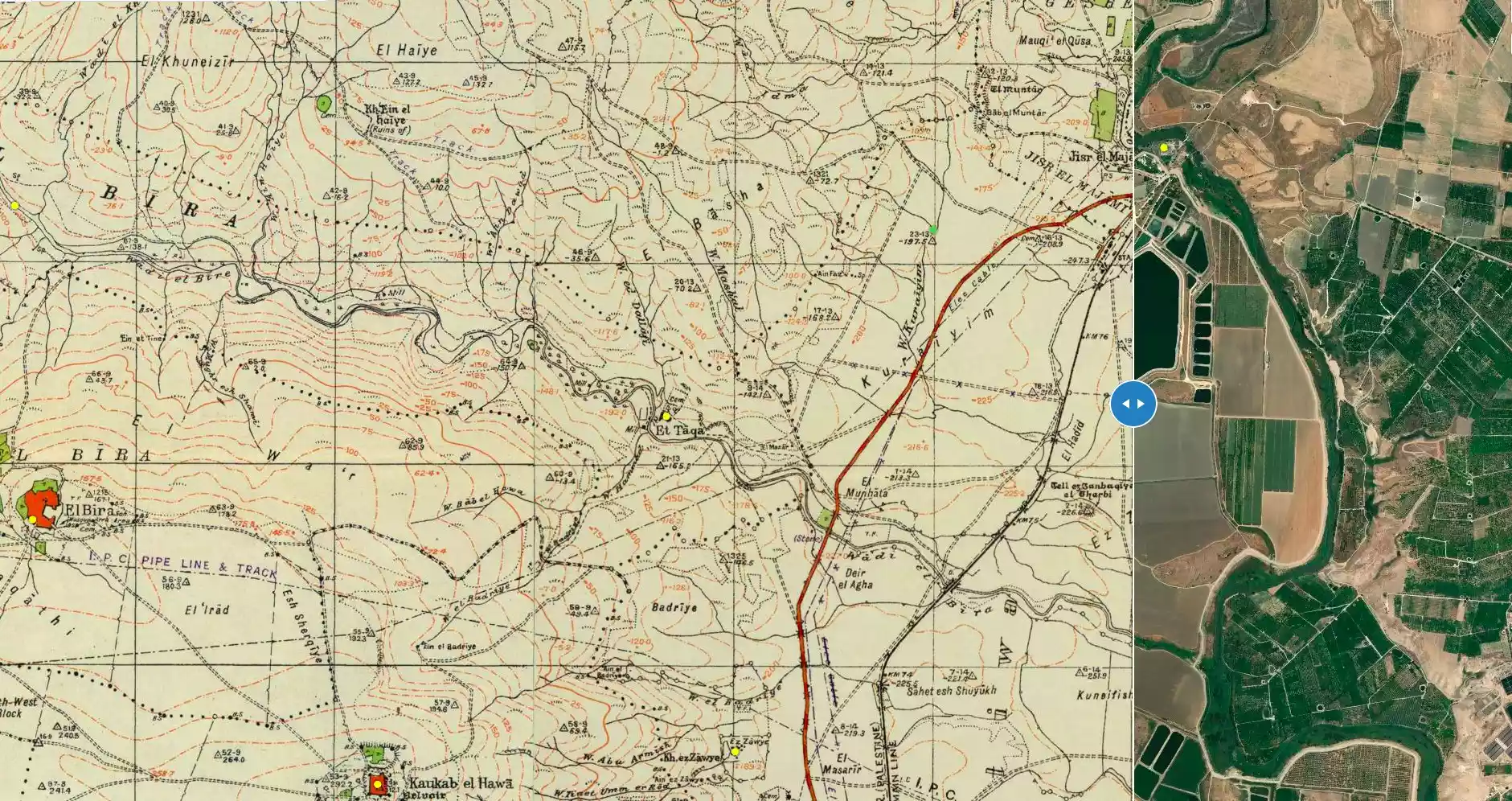
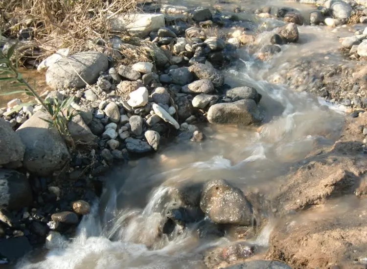
| Nearby Wadies & Rivers | The village is situated nearby Wadi al-Bira. |
| Archeological Sites | The village had several water-mills, which were powered by running water from wadi al-Bira. |
| Exculsive Jewish Colonies Who Usurped Village Lands |
Gesher |
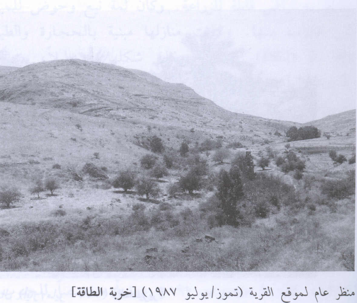
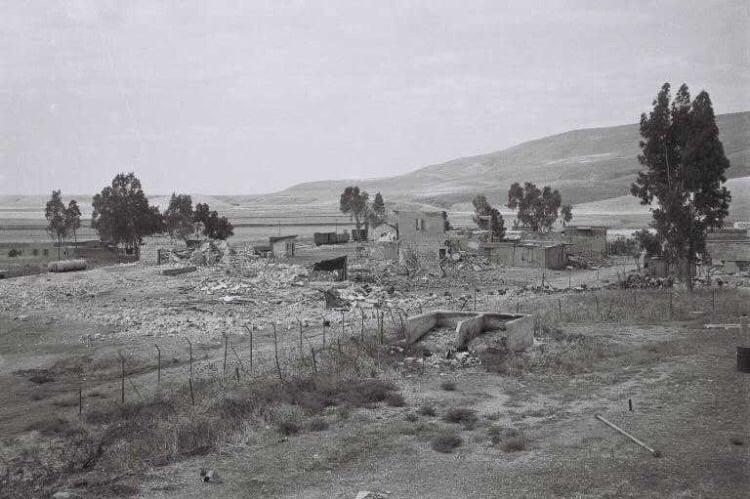
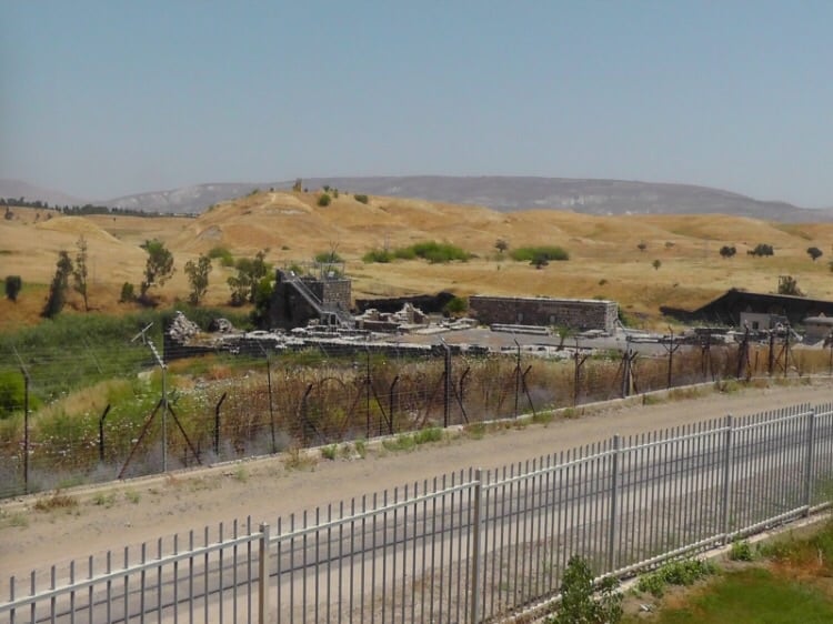
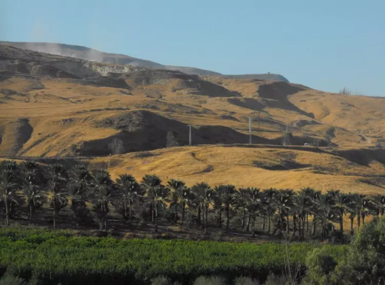
Village Before NakbaThe village, which was classified as a hamlet in the Palestine Index Gazetteer, stood on the north bank of Wadi al-Bira, near where the wadi issued from the hills and descended toward the Jordan Valley, some 3 km southeast. An abandoned mill, once powered by water from the wadi, lay in ruins on the south bank of the wadi, opposite the village. The cemetery for Khirbat al-Taqa lay upslope from the site, to the north. The village was hidden by hills on the north and south sides. It was only 500 m from a highway that led north to Jisr al-Majami', a major ford and bridge across the Jordan River. The same highway led to Baysan in the south.Village Occupation and Ethnic CleaningThe village probably fell within the scope of Operation Gideon. That operation succeeded in occupying and emptying the town of Baysan and most villages in its sub-disctrict by 15 May. After that date, Iraqi forces crossed the Jordan River in the vicinity of al-Taqa, in an attempt to restore the area to Arab hands. The History of the War of Independence relates that in the days after 15 May, Iraqi forces besieged the nearby Jewish settlement of Gesher and regained some positions on the western bank of the Jordan (perhaps including al-Taqa). However, the Iraqi attempt ultimately failed, due to heavy bombardment from Israeli artillery batteries positioned at Kawkab al-Hawa.Zionists Colonies on Village LandsThere are no Israeli settlements on village land. However, the nearby settlement of Gesher was established in 1939, northeast of the village site.Village TodayThe site is overgrown with cactuses and palm and eucalyptus trees no trace of any houses remains. Part of the adjacent land has been fenced in and is used by Israelis as a cow pasture.SourceDr. Walid al-Khalidi, 1992: All That Remains. |
|
| Related Maps | Town Lands' Demarcation Maps خرائط للقضاء توضح حدود القرى والاودية Town's map on MapQuest View from satellite Help us map this town at WikiMapia |
| More Information | في كتاب كي لا ننسى |
- Village General View in 1987
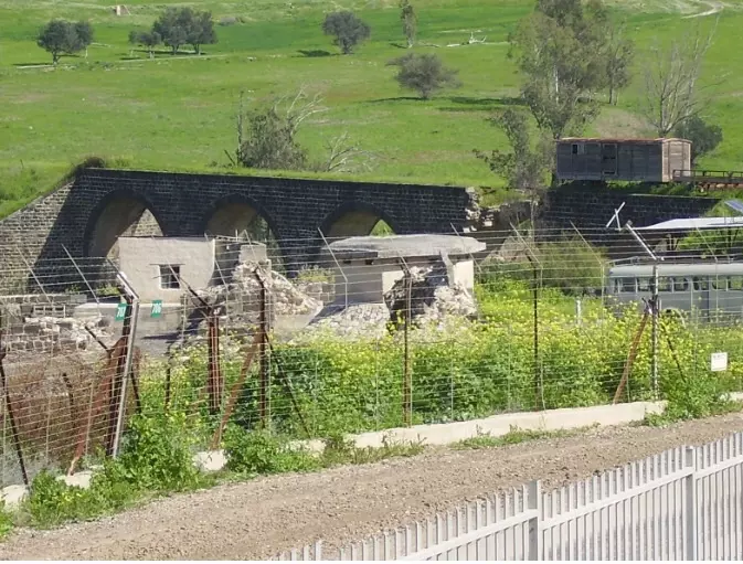
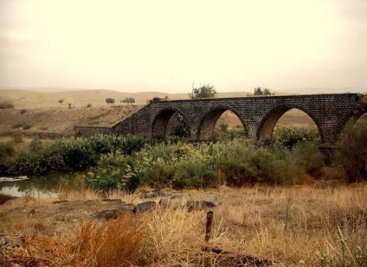
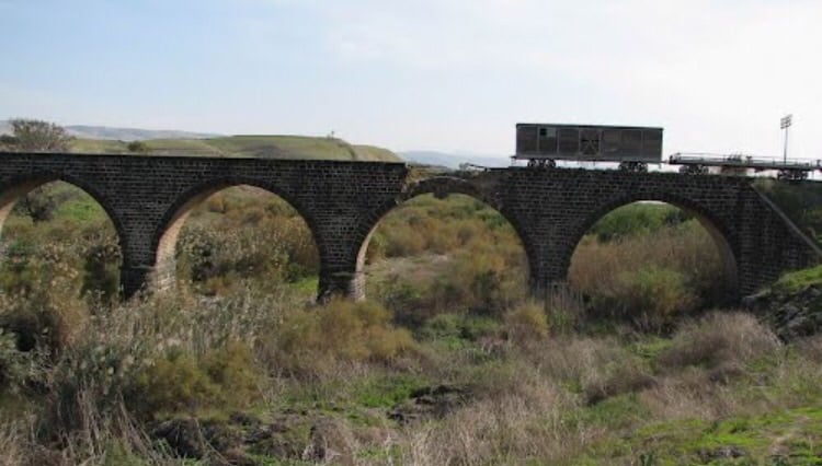
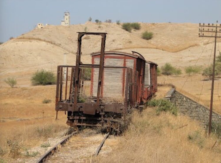
Scanned from "All That Remains" by Dr. Walid Khalidi - جسر القطار القديم بالقرب من القريه
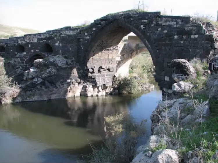
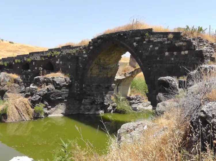
Posted by abu raya - الجسر القديم بالقرب من القريه
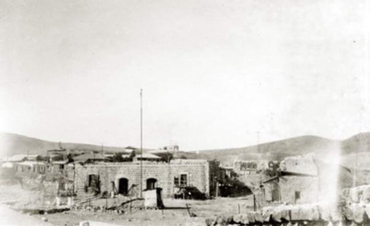
Posted by abu raya - صوره قديمه لمستوطنه جيشر سنه 1948 بعد تدميره بايدي القوات السوريه
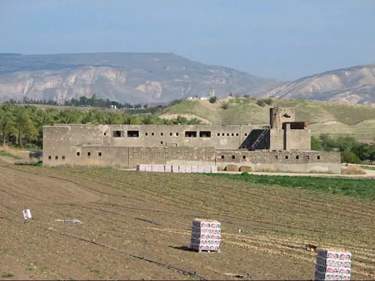
Posted by abu raya - موقع قريب من القريه
Posted by abu raya - اراضي القريه
Posted by abu raya - جسر القطار القديم القريب من القريه
Posted by abu raya - من اراضي القريه
Posted by abu raya - الجسر القديم ووادي البيره
Posted by abu raya - صوره قديمه من القريه
Posted by abu raya - الجسر ووادي البيره بالقرب من القريه
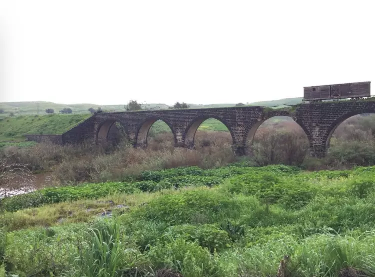
Posted by abu raya - الجسر والقطار القديم
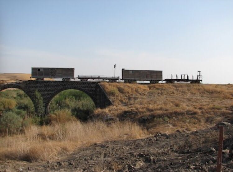
Posted by abu raya - منظر للجسر بالقرب من القريه
Posted by abu raya - صوره للقطار القديم بالقرب من القريه
Posted by abu raya - موقع القريه
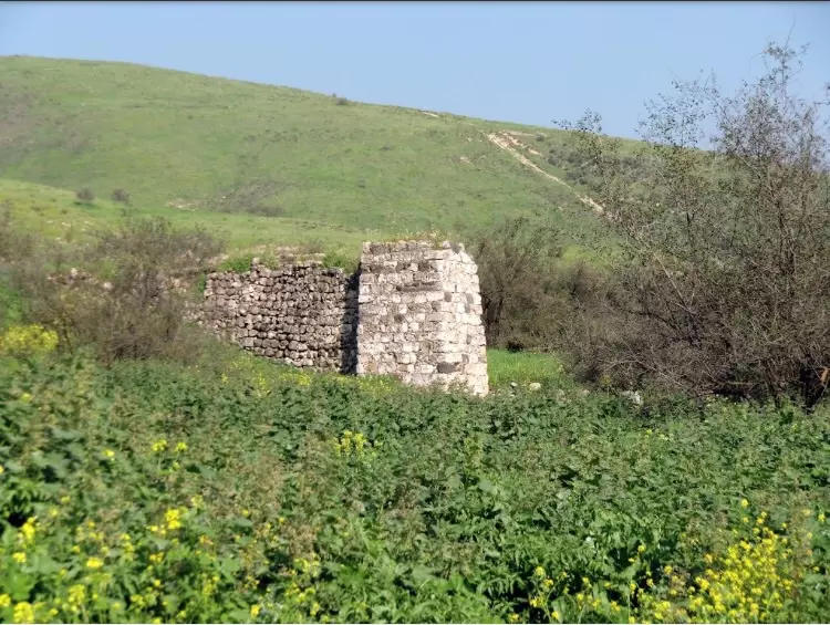
Posted by abu raya - عيون القريه
Posted by abu raya
Want to browse more? 80,000 pictures were grouped in these gallaries:
| Display Name | Clan/Hamolah | Country of Residence |
No links have been shared yet, be free to the first to share the first link.
 Fake Valor: Why Did Zionist Jews Hoist Nazis Flag on Their Ships in the 1930s?
What is new?
-
Facts About Oct. 7th Gaza Raid
-
Remined Us Please:: Who Did Rape Who? Palestinians Raped Israelis? Or, was the other way around?
-
When Prof. Edward Said was invited to debate Bibi Netanyahu in the 1980s, watch what happened!
-
Ezra Klein of the NY Times on the "Jewish Race".
-
Abusing Blood Libel!
-
Zionist FAQ: Isn't it true that Palestinians don't want peace? Palestinians never accepted the two-state solution
- Facts about Haavara (Transfer) Agreement between Ben-Gurion & Hitler
-
Haavara FAQs: Why Did Zionist Jews Hoist Nazis' Flags on Their Ships in the 1930s?
-
Dear ChatGPT: Why did the Jewish Agency suppress news of the Holocaust during WWII?
-
Video Playlist: Jews share their DNA tests to end the conflict for good.
-
A Tale of Two Conflicts: Examining the Definition of Genocide
-
Prof. Abraham Polak And The Suppressed History of the Khazars and European Jewry
-
How Ronald Reagan would have framed the genocide in Gaza if he were still alive?
-
Haavara FAQs: Let us do the math: how many German Jews did The Haavara Agreement save?
-
Zionist FAQs: The Hebron Massacre of 1929, "clearly proves" that Palestinians are antisemitic, how could you deny it?
-
Zionist FAQs: Why Anti-Zionist Is Not Antisemitism?
-
Zionist FAQs: Isn't it true that the KGB create Palestinian Nationalism in the early 1960s?
- Zionist FAQs: Muslims are killing Muslims all the time; why are Israeli Jews being singled out in the media?
- Zionist FAQs: How is Israel an apartheid state when 20% of its citizens are Arabs who enjoy full rights?
-
Haavara FAQs: Analysis of Herzl's Uganda Scheme and how it could have saved millions of Jews.
-
Haavara FAQs: Why did Hayim Greenberg describe American Jewry as "morally bankrupt" in early 1943?
-
Haavara FAQs: What if the Evian Conference was a resounding success? What would have been the impact of saving European Jewry on Zionism?
- Haavara FAQs: What if the six million were saved, how that would have impacted the Zionist project?
-
Haavara FAQs: How did Zionist leaders react when Europe's Jews lingered in the DP camps after WWII ended?
-
Why does the American Jewish community repeat lies that David Ben-Gurion had debunked before he died?
-
Who has the power to rename the Tatar/Khazar Gene Marker to Jewish IV?
-
Zionist FAQs: Why won't Egypt, Syria, and Jordan take their people back? Jews are indigenous to Palestine, and Arabs immigrated after Jews developed the country. Arabs should leave.
-
Haavara FAQs: Did Hitler and the Nazis conflate between Judaism and Zionist? If that wasn't case, then why?
-
Haavara FAQs: Winston Churchill and antisemitism, a collection of articles written Churchill.
-
Haavara FAQs: Broken by country, how many Jews survived vs. killed during the Holocaust?
-
Haavara FAQs: Why did European Jews vote with their feet and to immigrated to the Americas, not Palestine, after WWII?
-
Watch this American Jewish Girl describing Israeli Jews' cognitive dissonance like no other in under two minutes
-
Haavara FAQs: When the Nazis went out of their way to hide the Holocaust, Israeli Jews did the exact opposite by broadcasting their genocide of Gazans. But why?
-
Haavara FAQs: How Zionist Jews went out of their to show their appreciation to Nazism and Fascism?
- Haavara FAQs: Why Zionist leaders were against bombing the death camps & the Railroads leading to them?
-
Haavara FAQs: Hitler's message to the British and American people: If Jews are such noble citizens and you care about them, how come you're not letting them in? I will gladly ship them to you at my expense, even on luxury liners!
-
A shortlist of Zionist and Israeli false flag operations in the name Jews.
-
The Most Moral Army
- The Land of Kapos (Israel): Where the brave are boycotted and Kapos walk free.
- Why did early Zionists often named their communal enterprises "colonial"?
- Zionist Relations with Nazi Germany by Faris Glubb
-
Two NY Times advertisements by Zionists in the early 1943 that exposes Zionists' treason at the height of the calamity
- Facts Not Lies about the Palestinian-Israeli Conflict.
- Site's pictures have been categorized
- Campgain Against Lice
- A Survey of Palestine, the official source about Palestine before Nakba produced by the British Mandate; over 1200 pages.
- Satellite View & Google Earth: Over 6,000 placemarks identifying all destroyed towns, W. Bank & Gaza Strip Towns, & refugee camps.
- PalestineRemembered.com and its Nakba Oral History Project were featured on al-Jazeera Satellite TV.
- Nakba Oral History Video Podcast:
 Over 700 Oral History interviews (including 3,500+ hours of recording) can be viewed online.
 - Palestine Village Statistics Project
- Gaza Jail Break
- النسخة العربية للموقع الان متوفرة
- Videos: Documenting the destroyed villages in video: Tracing all that remains since Nakba.
- Videos: Responding to Zionist Propaganda
- Interview: The ethnic cleansing of Palestine: George Galloway interviews Israeli Historian Ilan Pappe.
- For Palestinians, memory matters. It provides a blueprint for their future By George Bisharat.
- Zionist FAQ now available in Hebrew שאלות שציונים שואלים, עכשיו בעברית
- Video: The Stephen Walt and John Mearsheimer report on the influence of the Israel Lobby on U.S. Foreign Policy
- The Palestinian-Israeli conflict for beginners
