| PalestineRemembered | About Us | Oral History | العربية | |
| Pictures | Zionist FAQs | Haavara | Maps | |
| Search |
| Camps |
| Districts |
| Acre |
| Baysan |
| Beersheba |
| Bethlehem |
| Gaza |
| Haifa |
| Hebron |
| Jaffa |
| Jericho |
| Jerusalem |
| Jinin |
| Nablus |
| Nazareth |
| Ramallah |
| al-Ramla |
| Safad |
| Tiberias |
| Tulkarm |
| Donate |
| Contact |
| Profile |
| Videos |
Welcome To al-Jammama - الجمامه
|
District of Beersheba
Ethnically cleansed days ago |
العربية Google Earth |
 |
Gallery (16) |
- Statistics & Facts
-
Before & After

- Satellite View
- Articles 1
- Pictures 16
- Members 8
- All That Remains
- Wikipedia
- Videos
- Guest Book 3
- Links
| Statistic & Fact | Value | |||||||||
| Occupation Date | May 22nd, 1948 | |||||||||
| Distance From District | 30 (km) West of Beersheba | |||||||||
| Elevation | 150 (meters) | |||||||||
| Before & After Nakba, Click Map For Details |
||||||||||
|
||||||||||
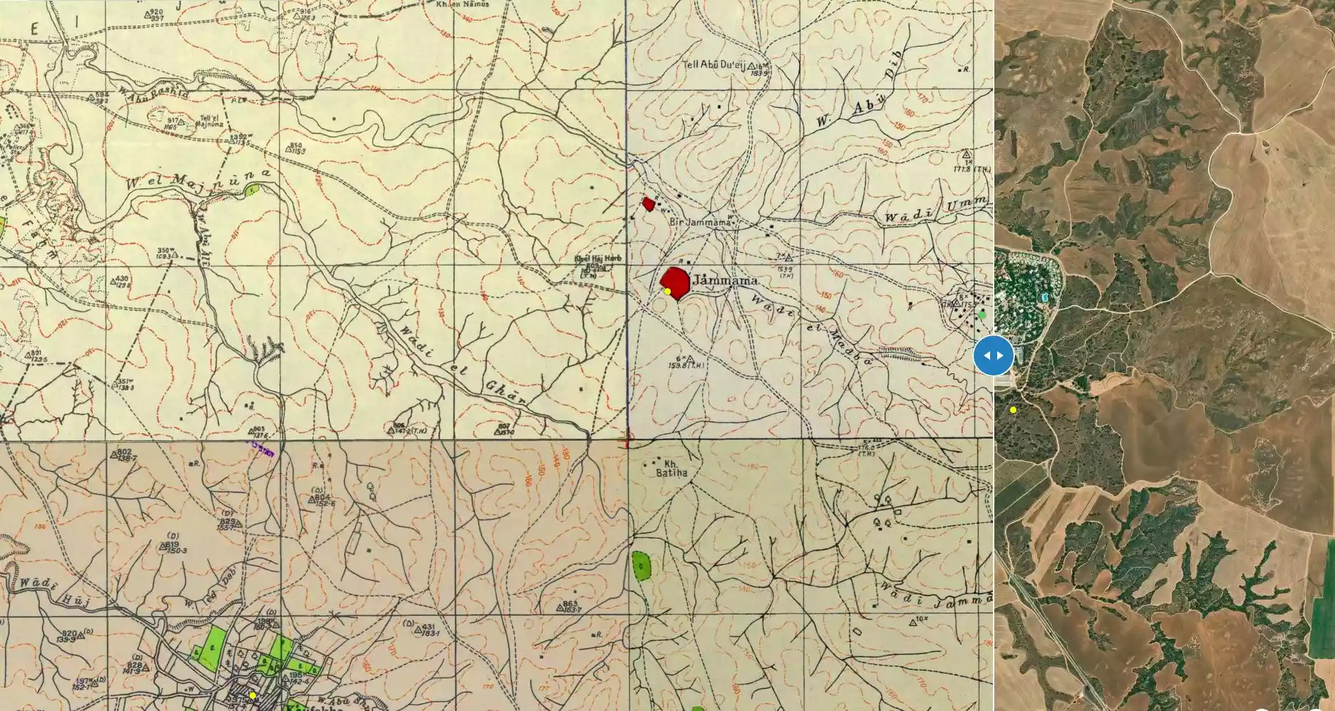
| Map Location | See location #2 on the map View from satellite |
|||||||||
| Military Operation | Operation Barak (lightening) | |||||||||
| Attacking Units | Negev and possibly Giv'ati Brigades | |||||||||
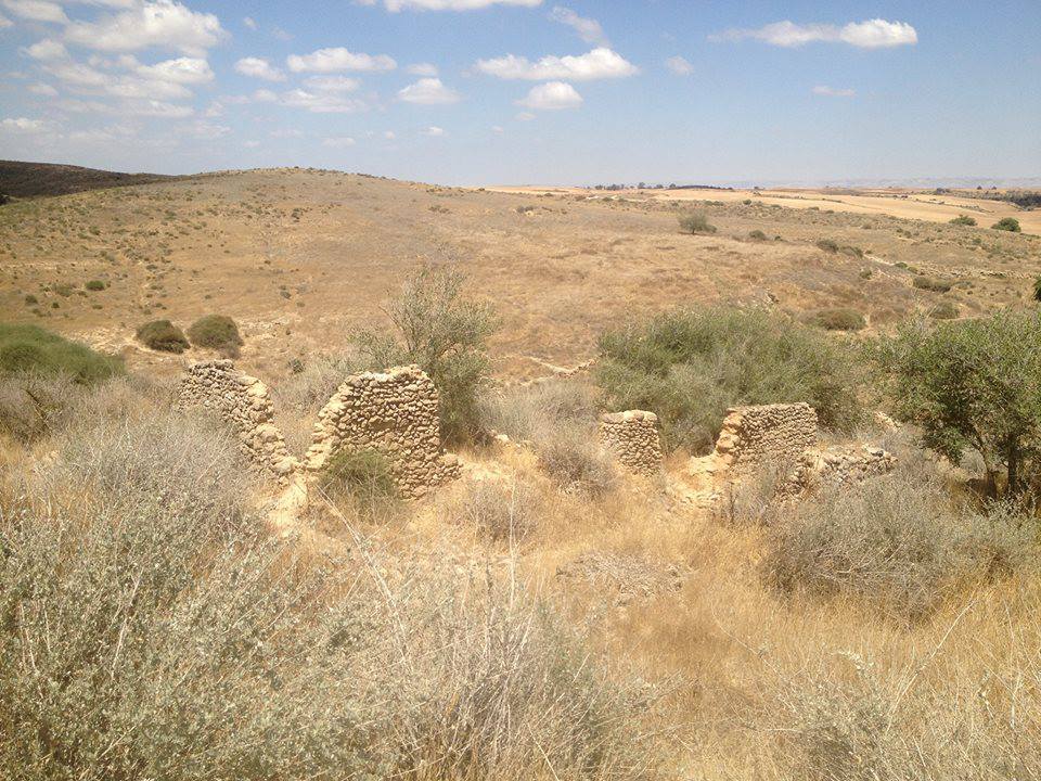
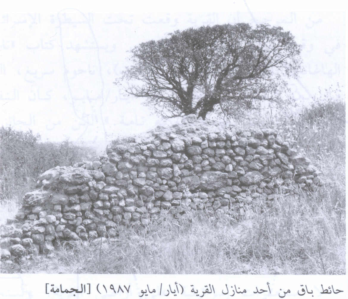
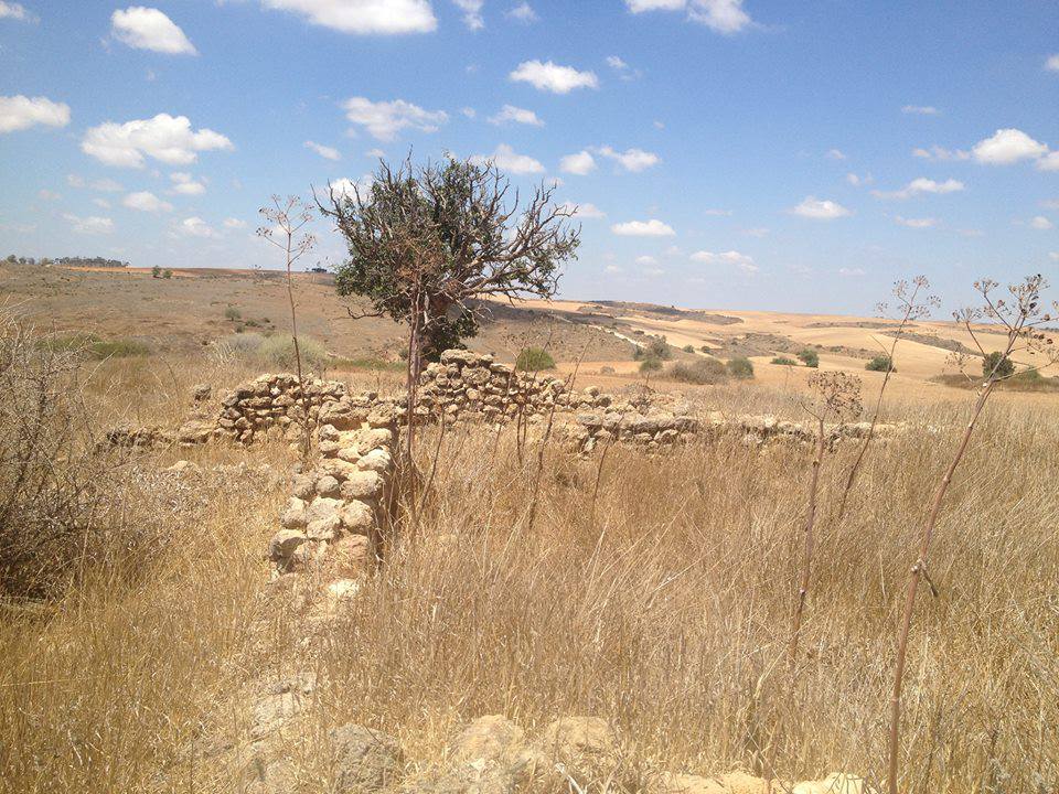
| Village Temains | al-Jammama was completely destroyed, and only house walls and rubble left behind. | |||||||||
| Ethnically Cleansing | al-Jammama inhabitants were completely ethnically cleansed. | |||||||||
| Number of Houses | In (1944): 120 buildings | |||||||||
| Near By Towns |
||||||||||
|
||||||||||
| Schools | al-Jammama had an elementary school for boys which was founded in 1944. | |||||||||
| Archeological Sites | The village contained cisterns, an olive press, mosaic floors, tombs, the crown of a stone column, stone tools from the Middle Paleolithic period. | |||||||||
| Exculsive Jewish Colonies Who Usurped Village Lands |
Ruchama | |||||||||
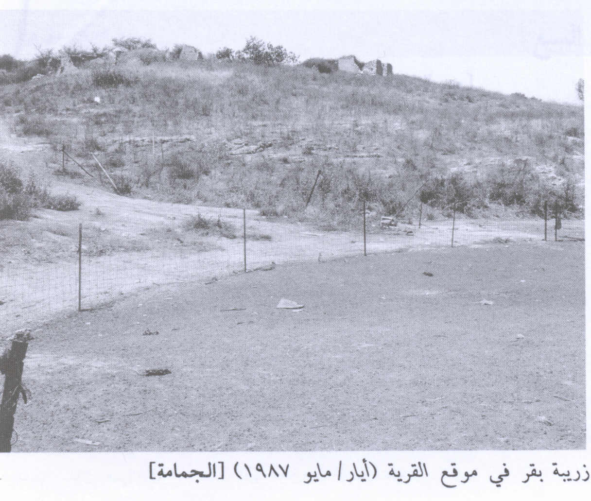
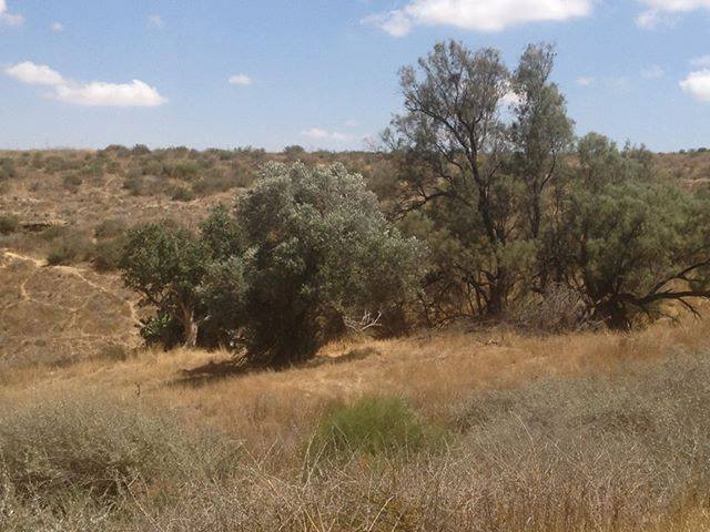
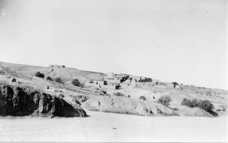
Village Before NakbaThe village was located on rolling terrain in the northern Negev, on the bank of Wadi al-Mudabba'. It was linked via a secondary road to the village of Burayr, to the northwest, which was itself on a highway that led to Gaza and ran parallel to the coastal highway. Because a network of similar roads linked it to other villages as well as to the Bir al-Sabi'-Gaza highway, to the southwest, al-Jammama was considered a gateway to southern Palestine. At the end of World War I, on 8 November 1917, the British overcame an Ottoman force in al-Jammama, which resulted in a British occupation of the village.According to information given to the staff of the Galilee Center for Social Research by members of the Arab al-Atawina Bedouin tribe, who lived in the village before 1948, al-Jammama contained about 120 buildings called bakiyas; these buildings were made of stone and mud and were roofed with mud and wood. They were located on Khirbat al-Jammama and in the surrounding area; those on the site were clustered together, separated in the center by a few shops. Many of the bakiyas served as houses for the villagers, but some that were no longer in good repair were used for grain storage and as animal shelters. If the figure of 120 bakiyas is correct, it would suggest that either the figure of 1 house given in the 1931 census was a substantial undercount or that settlement had proceeded at a rapid pace after the census. Al-Jammama's economy was agricultural, based mainly on wheat, barley, and vegetables. The inhabitants also engaged in animal husbandry, taking advantage of the plentiful rangeland around them. Wells next to the site provided water for animals, as well as for the irrigation of small plots of vegetables. An elementary school was established in al-Jammama in 1944. The village was an archaeological site which contained cisterns, an olive press, mosaic floors, tombs, the crown of a stone column, and other fragments of columns. A number of stone tools dating from the Middle Paleolithic have also been found in the vicinity. Village Occupation and Ethnic CleaningAll that is known is that the village was occupied and depopulated as a result of a military assault on 22 May 1948, according to historian Benny Morris. This implies that it was captured by the Israeli army's Negev Brigade, moving northwards during Operation Barak, in coordination with the Giv'ati Brigade.Zionists Colonies on Village LandsThe agricultural settlement of Ruchama was established in 1944 on village lands.Village TodayA few walls remain on the slopes of hills, surrounded by shrubs and thorns. Cactuses and gum trees grow on the site. The site is used for animal grazing; it also has a stable for horses. The surrounding lands are used for agriculture. Bedouin still camp near the site occasionally to take advantage of nearby pasture.SourceDr. Walid al-Khalidi, 1992: All That Remains. |
||||||||||
| Related Maps | Town Lands' Demarcation Maps خرائط للقضاء توضح حدود القرى والاودية Town's map on MapQuest View from satellite Help us map this town at WikiMapia |
|||||||||
| Related Links | Wikipedia's Page Google Search Google For Images Google For Videos |
|||||||||
| More Information | في كتاب كي لا ننسى المزيد من موقع هوية |
|||||||||
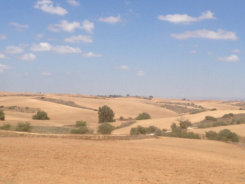
- Village Site In 1990
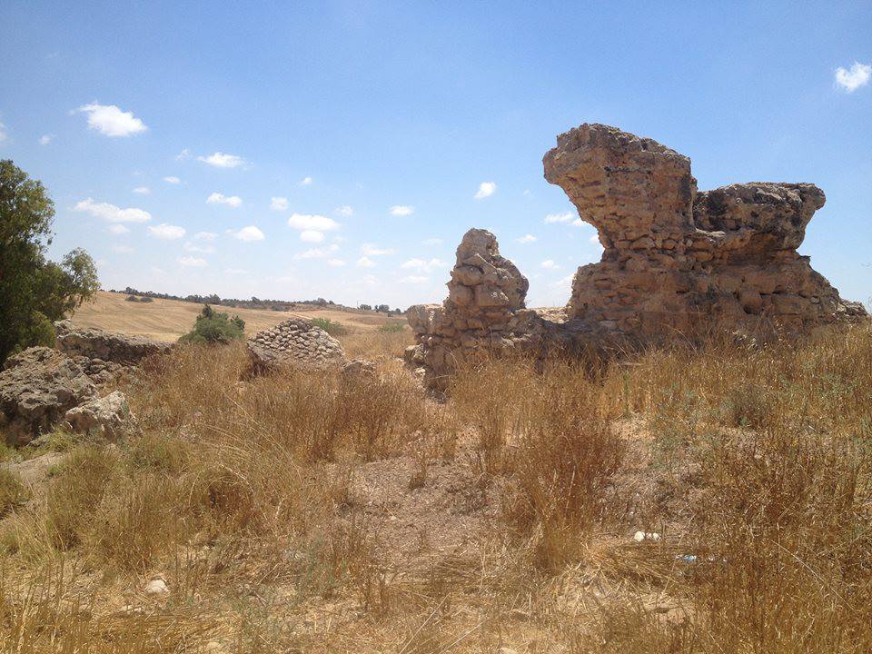
Scanned from "All That Remains" by Dr. Walid Khalidi - Ruined Village House, 1987
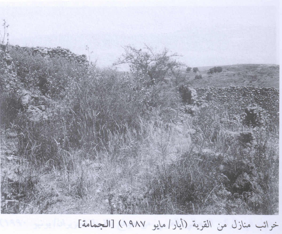
Scanned from "All That Remains" by Dr. Walid Khalidi 2 - A remaining wall from a village building, 1987
Scanned from "All That Remains" by Dr. Walid Khalidi - طريق مغتصبة روحاما المقامة على الارض الطاهرة لبلدتي الاصلية الجمامه
Posted by زيد العطاونه العطاونه 3 - صورة في اراضي مغتصبة روحاما _ المقامة على بلدة الجمامة -العطاونه
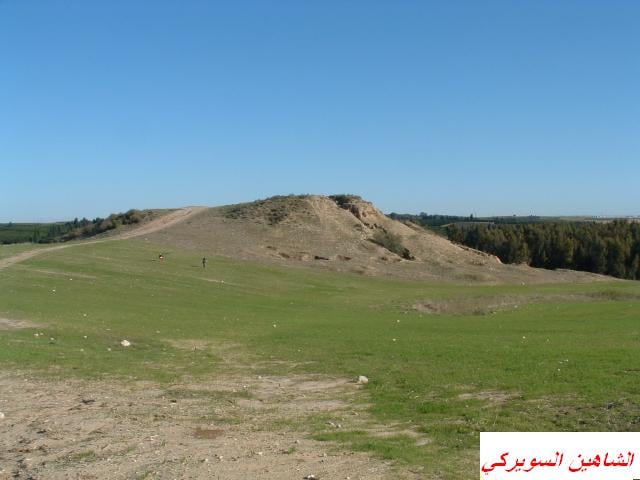
Posted by زيد العطاونه العطاونه 5 - تل الحسي
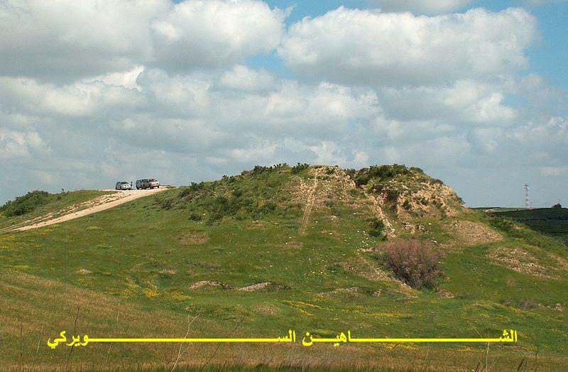
Posted by الشاهين 7 - صورة منقولة: منطقة قرية روخاما Jammamh الجمامة المقامة على اراضيها المغتصبة الظاهرة في الصورة
Posted by زيد العطاونه العطاونه 1 - تل الحسي - السواركه
Posted by سعد - صوره حديثه سنه 2013...منظر عام لقريه الجمامه المهجره
Posted by محمد ابو عويلى - صوره حديثه سنه 2013...منظر عام لقريه الجمامه ...ما تبقى من بيوت القريه المهجره
Posted by محمد ابو عويلى - صوره حديثه سنه 2013...منظر عام لقريه الجمامه ...ما تبقى من بيوت القريه المهجره
Posted by محمد ابو عويلى - صوره حديثه سنه 2013...منظر عام لقريه الجمامه ...ما تبقى من بيوت القريه المهجره
Posted by محمد ابو عويلى - صوره حديثه سنه 2013...منظر عام لقريه الجمامه ...ما تبقى من بيوت القريه المهجره
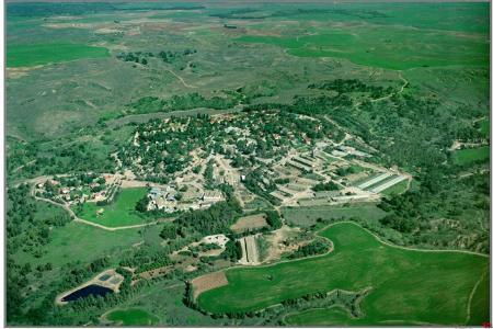
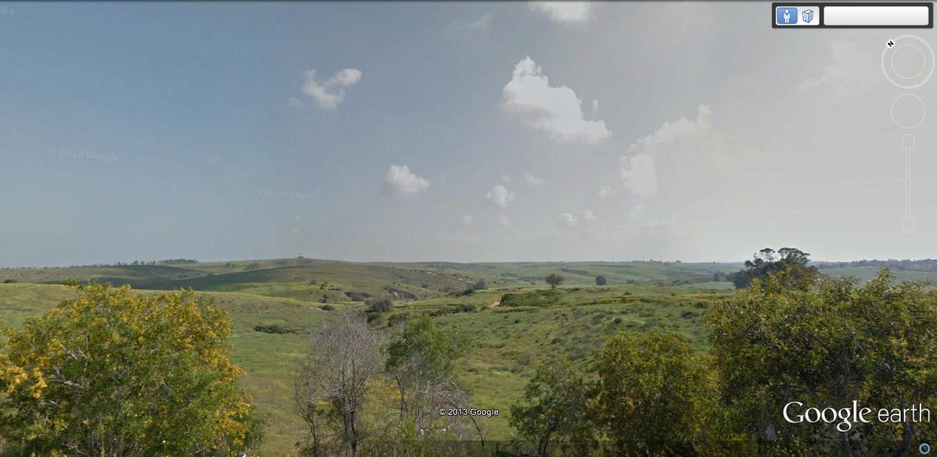
Posted by محمد ابو عويلى 5 - منظر عام يبين موقع قريه الجمامه المهجره و اراضيها...صوره من جوجل ايرث
Posted by محمد ابو عويلى - منظر عام قبل النكبة
- خارطة تُظهِر الحدود والطرق بأنواعها والأماكن المقدسة والطبيعة الطوبغرافية من تلال وسهول ومنحدرات والتشكيلة الطبيعية للأرض وأنواع المزروعات. نُشرت الخريطة فترة الانتداب البريطاني، تم إضافة تعديلات عليها من قِبَل خدمة الخرائط والصور التابعة للقوات العسكرية الاسرائيلية فترة الأربعينيات.

Want to browse more? 80,000 pictures were grouped in these gallaries:
| Display Name | Clan/Hamolah | Country of Residence |
| أبو يمان الحنجوري | الحناجرة | عمان, الاردن |
| انس العطاونة | العطاونة | مخيم حطين - الرصيفة, الاردن |
| محمد العطاونة | العطاونة | غزة |
| زيد العطاونه العطاونه | العطاونه | ابو ظبي |
| naser1232 | - | - |
| ليلـــــــــى (==>laila<==) | - | بئر السبع . |
| qods atawneh | ntoush | - |
| Abdul Aziz Abu Holy | Hanagrah | United Arab Emirates, United Arab Emirates |
No links have been shared yet, be free to the first to share the first link.
 Fake Valor: Why Did Zionist Jews Hoist Nazis Flag on Their Ships in the 1930s?
What is new?
-
Facts About Oct. 7th Gaza Raid
-
Remined Us Please:: Who Did Rape Who? Palestinians Raped Israelis? Or, was the other way around?
-
When Prof. Edward Said was invited to debate Bibi Netanyahu in the 1980s, watch what happened!
-
Ezra Klein of the NY Times on the "Jewish Race".
-
Abusing Blood Libel!
-
Did Israeli Soldiers Activate The Hanniba Direective On Oct. 7th? You Be The Judge
-
Zionist FAQ: Isn't it true that Palestinians don't want peace? Palestinians never accepted the two-state solution
- Facts about Haavara (Transfer) Agreement between Ben-Gurion & Hitler
-
Haavara FAQs: Why Did Zionist Jews Hoist Nazis' Flags on Their Ships in the 1930s?
- Haavara FAQs: When Chaim Weizmann met FDR in mid-1943, why was he silent about rescuing European Jewry?
-
Dear ChatGPT: How did Palestinians resist Napoleon's invasion of their country in 1799?
-
Dear ChatGPT: Gaza had a vibrant Jewish community in the mid-17th century. What happened to them?
-
Dear ChatGPT: Why did the Jewish Agency suppress news of the Holocaust during WWII?
-
Video Playlist: Jews share their DNA tests to end the conflict for good.
-
A Tale of Two Conflicts: Examining the Definition of Genocide
-
Prof. Abraham Polak And The Suppressed History of the Khazars and European Jewry
-
How Ronald Reagan would have framed the genocide in Gaza if he were still alive?
-
Haavara FAQs: Let us do the math: how many German Jews did The Haavara Agreement save?
-
Zionist FAQs: The Hebron Massacre of 1929, "clearly proves" that Palestinians are antisemitic, how could you deny it?
-
Zionist FAQs: Why Anti-Zionist Is Not Antisemitism?
-
Zionist FAQs: Isn't it true that the KGB created Palestinian Nationalism in the early 1960s?
- Zionist FAQs: Muslims are killing Muslims all the time; why are Israeli Jews being singled out in the media?
- Zionist FAQs: How is Israel an apartheid state when 20% of its citizens are Arabs who enjoy full rights?
-
Haavara FAQs: Why Did Dorothy Thompson Flip From A Zionist Advocate to A Silenced Dissenter?
-
Haavara FAQs: Analysis of Herzl's Uganda Scheme and how it could have saved millions of Jews.
-
Haavara FAQs: Why did Hayim Greenberg describe American Jewry as "morally bankrupt" in early 1943?
-
Haavara FAQs: What if the Evian Conference was a resounding success? What would have been the impact of saving European Jewry on Zionism?
- Haavara FAQs: What if the six million were saved, how that would have impacted the Zionist project?
-
Haavara FAQs: How did Zionist leaders react when Europe's Jews lingered in the DP camps after WWII ended?
-
Why does the American Jewish community repeat lies that David Ben-Gurion had debunked before he died?
-
Who has the power to rename the Tatar/Khazar Gene Marker to Jewish IV?
-
Zionist FAQs: Why won't Egypt, Syria, and Jordan take their people back? Jews are indigenous to Palestine, and Arabs immigrated after Jews developed the country. Arabs should leave.
-
Haavara FAQs: Did Hitler and the Nazis conflate between Judaism and Zionist? If that wasn't case, then why?
-
Haavara FAQs: Winston Churchill and antisemitism, a collection of articles written Churchill.
-
Haavara FAQs: Broken by country, how many Jews survived vs. killed during the Holocaust?
-
Haavara FAQs: Why did European Jews vote with their feet and to immigrated to the Americas, not Palestine, after WWII?
-
Watch this American Jewish Girl describing Israeli Jews' cognitive dissonance like no other in under two minutes
-
Haavara FAQs: When the Nazis went out of their way to hide the Holocaust, Israeli Jews did the exact opposite by broadcasting their genocide of Gazans. But why?
-
Haavara FAQs: How Zionist Jews went out of their to show their appreciation to Nazism and Fascism?
- Haavara FAQs: Why Zionist leaders were against bombing the death camps & the Railroads leading to them?
-
Haavara FAQs: Hitler's message to the British and American people: If Jews are such noble citizens and you care about them, how come you're not letting them in? I will gladly ship them to you at my expense, even on luxury liners!
-
A shortlist of Zionist and Israeli false flag operations in the name Jews.
-
The Most Moral Army
- The Land of Kapos (Israel): Where the brave are boycotted and Kapos walk free.
- Why did early Zionists often named their communal enterprises "colonial"?
- Zionist Relations with Nazi Germany by Faris Glubb
-
Two NY Times advertisements by Zionists in the early 1943 that exposes Zionists' treason at the height of the calamity
- Facts Not Lies about the Palestinian-Israeli Conflict.
- Site's pictures have been categorized
- Campgain Against Lice
- A Survey of Palestine, the official source about Palestine before Nakba produced by the British Mandate; over 1200 pages.
- Satellite View & Google Earth: Over 6,000 placemarks identifying all destroyed towns, W. Bank & Gaza Strip Towns, & refugee camps.
- PalestineRemembered.com and its Nakba Oral History Project were featured on al-Jazeera Satellite TV.
- Nakba Oral History Video Podcast:
 Over 700 Oral History interviews (including 3,500+ hours of recording) can be viewed online.
 - Palestine Village Statistics Project
- Gaza Jail Break
- النسخة العربية للموقع الان متوفرة
- Videos: Documenting the destroyed villages in video: Tracing all that remains since Nakba.
- Videos: Responding to Zionist Propaganda
- Interview: The ethnic cleansing of Palestine: George Galloway interviews Israeli Historian Ilan Pappe.
- For Palestinians, memory matters. It provides a blueprint for their future By George Bisharat.
- Zionist FAQ now available in Hebrew שאלות שציונים שואלים, עכשיו בעברית
- Video: The Stephen Walt and John Mearsheimer report on the influence of the Israel Lobby on U.S. Foreign Policy
- The Palestinian-Israeli conflict for beginners
