| PalestineRemembered | About Us | Oral History | العربية | |
| Pictures | Zionist FAQs | Haavara | Maps | |
| Search |
| Camps |
| Districts |
| Acre |
| Baysan |
| Beersheba |
| Bethlehem |
| Gaza |
| Haifa |
| Hebron |
| Jaffa |
| Jericho |
| Jerusalem |
| Jinin |
| Nablus |
| Nazareth |
| Ramallah |
| al-Ramla |
| Safad |
| Tiberias |
| Tulkarm |
| Donate |
| Contact |
| Profile |
| Videos |
|
Prev |
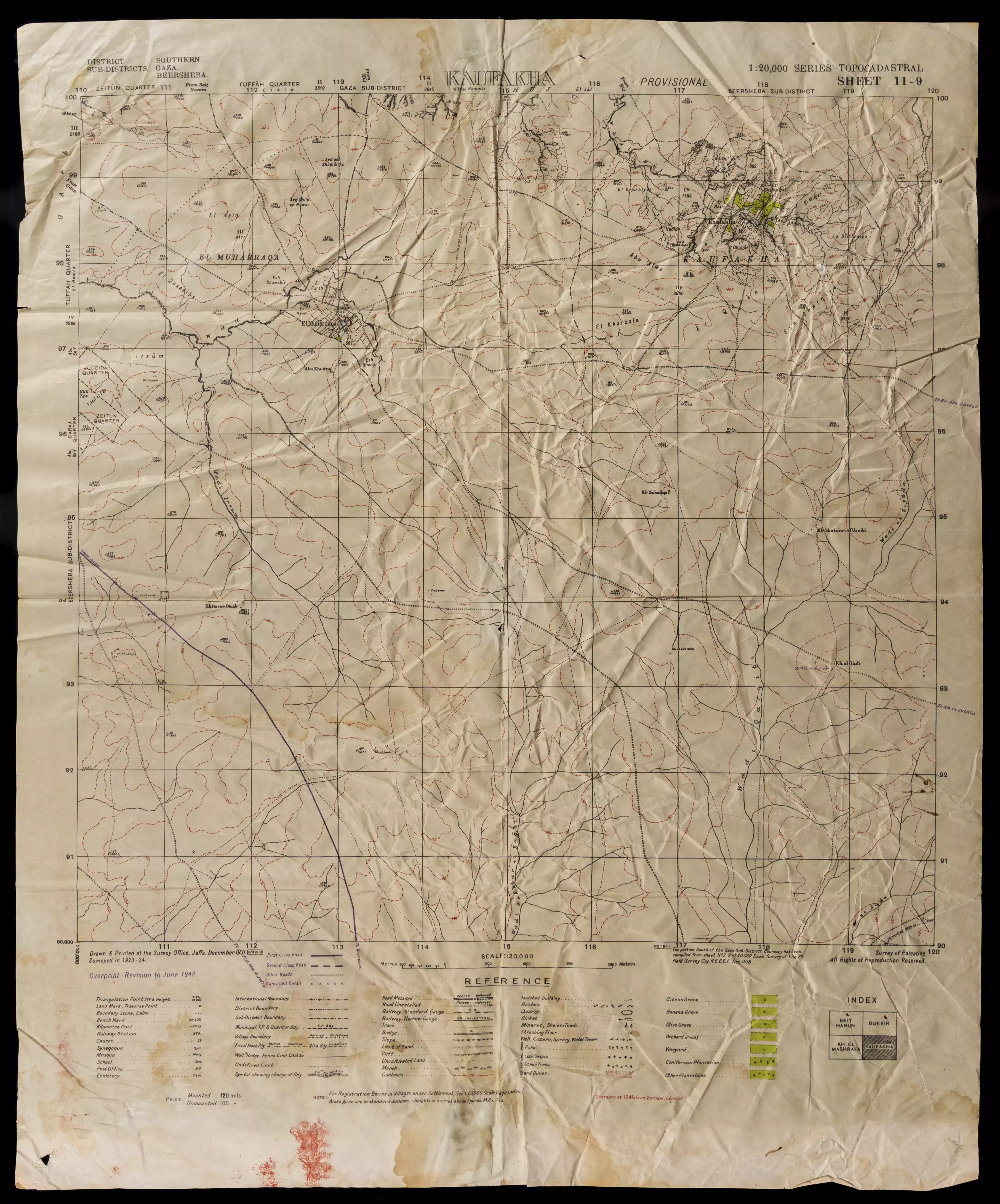
Kawfakha - كوفخة: A map showing borders, roads, sacred places, topographical nature of hills, plains, slopes, natural landscape, and planting types. The map was published during the British Mandate, and was modified by the Maps and Images Service of the Israeli Military Forces in the 1940s.0 comment |
Next Town
العربية |
| On September 28, 2025 |
||
| Upload | Prev 18 19 20 | Satellite |


Post Your Comment
*It should be NOTED that your email address won't be shared, and all communications between members will be routed via the website's mail server.