PalestineRemembered About Us Oral History العربية
Menu Pictures Zionist FAQs Haavara Maps
PalestineRemembered.com Satellite View Search Donate Contact Us Looting 101 العربية
About Us Zionist FAQs Conflict 101 Pictures Maps Oral History Haavara Facts Not Lies Zionism 101 Zionist Quotes
Prev

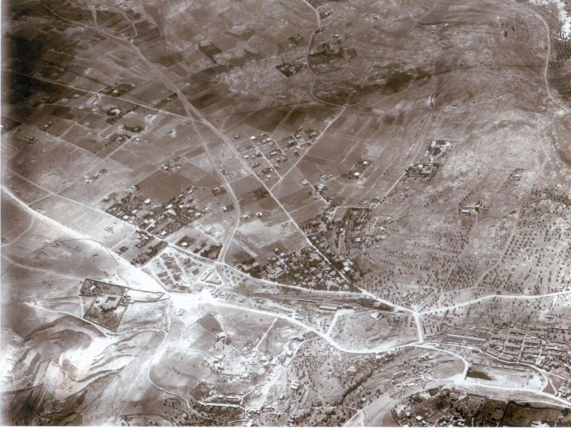
Jerusalem - القدس الشريف: Jerusalem's southern suburbs in 1918, right hand side point north

  3 comments
      Next

العربية

Picture for Jerusalem City: Jerusalem's southern suburbs in 1918, right hand side point north. Browse 70k pictures documenting Palestinian history & culture before Nakba

 Shared On December 19, 2006
 
Upload A Picture Prev     738   739   740   741    Next Satellite View
 

Post Your Comment

Shimon: There is a big difference between land owned, and one taken by act of war and aggression. Many Palestinian families from Jerusalem have the deeds (TABO) for their land and homes in Baka and other places in Jerusalem, but they have no right to live in them under the Israeli law.
This is a view to the west. on the foreground, darker, are the slopes of mt zion. Just beneath it (at the right end of the picture) is the sultan's pool. Above the pool is the jewish neighborhood of Mishkenot Sha'ananim, or Yemin Moshe, built by moses montefiore in the 1860s. The street that runs to the right end of the picture, over the Mishkenot shananim, is the current king david street. At the left end of king david street is the begining of emek refaim street (to the west) and beit lehem road (to the east).at the crossing is the railway station. under it is the beginning of the arab abu tor neighborhood (today a mixed arab-jewish neighborhood). The green triangle between emek refaim and beit lehem road is the german colony, inhabited by germans until wwII. Left of it is the begining of the arab neighborhood of baka, built mainly during the mandate and now owned by jews. very good pic, thanks for posting.
Shimon from israel
The view is generally to the west. The large compound of the St. Claire Convent is at the lower left. Coming in from the west, roughly paralleling Emeq Refaim Street is the rail line, turning north and terminating at the old train station. At the lower right, note the dark patch of water standing at the lower the Sultan's Pool, and the cluster of many structures (dwellings?) in the Hinnom Valley, below (to the left) of the bridge, which of course are no longer there.
 
Fake Valor: Why Did Zionist Jews Hoist Nazis Flag on Their Ships in the 1930s?

What is new?