| PalestineRemembered | About Us | Oral History | العربية | |
| Pictures | Zionist FAQs | Haavara | Maps | |
| Search |
| Camps |
| Districts |
| Acre |
| Baysan |
| Beersheba |
| Bethlehem |
| Gaza |
| Haifa |
| Hebron |
| Jaffa |
| Jericho |
| Jerusalem |
| Jinin |
| Nablus |
| Nazareth |
| Ramallah |
| al-Ramla |
| Safad |
| Tiberias |
| Tulkarm |
| Donate |
| Contact |
| Profile |
| Videos |


Post Your Comment
*It should be NOTED that your email address won't be shared, and all communications between members will be routed via the website's mail server.
---
(لنزاهة المعلومة، فقد تم اقتباس هذه الصورة من مقال "دراسة مسحيّة لـ بيتار، آخر معقل لـ بار كوخبا" بقلم د. ديڤد أُسِشكن)
---
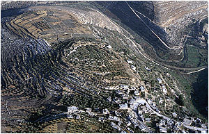
(For the integrity of information, this photo was quoted from the article “Sounding in Betar, Bar Cochba’s Last Stronghold” written by Prof. David Ussishkin)