| PalestineRemembered | About Us | Oral History | العربية | |
| Pictures | Zionist FAQs | Haavara | Maps | |
| Search |
| Camps |
| Districts |
| Acre |
| Baysan |
| Beersheba |
| Bethlehem |
| Gaza |
| Haifa |
| Hebron |
| Jaffa |
| Jericho |
| Jerusalem |
| Jinin |
| Nablus |
| Nazareth |
| Ramallah |
| al-Ramla |
| Safad |
| Tiberias |
| Tulkarm |
| Donate |
| Contact |
| Profile |
| Videos |
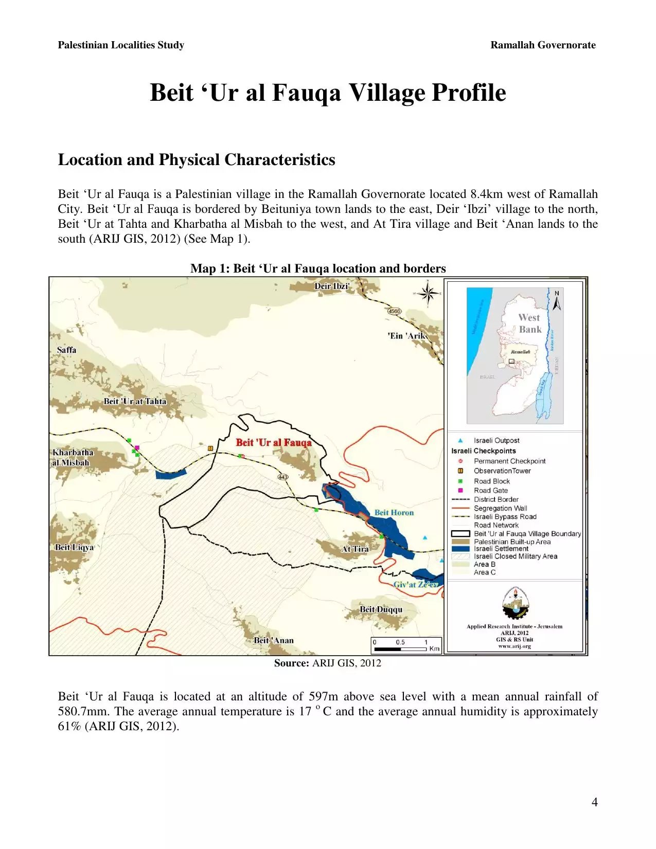
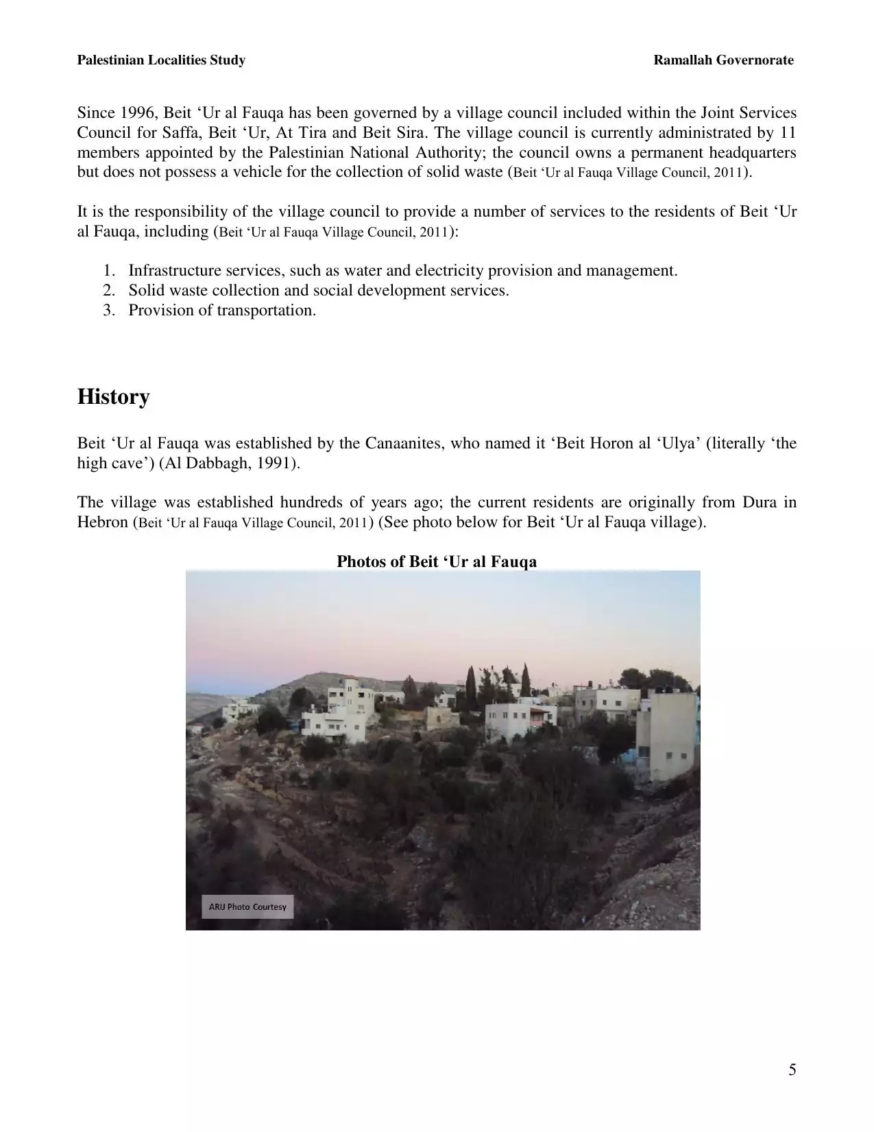
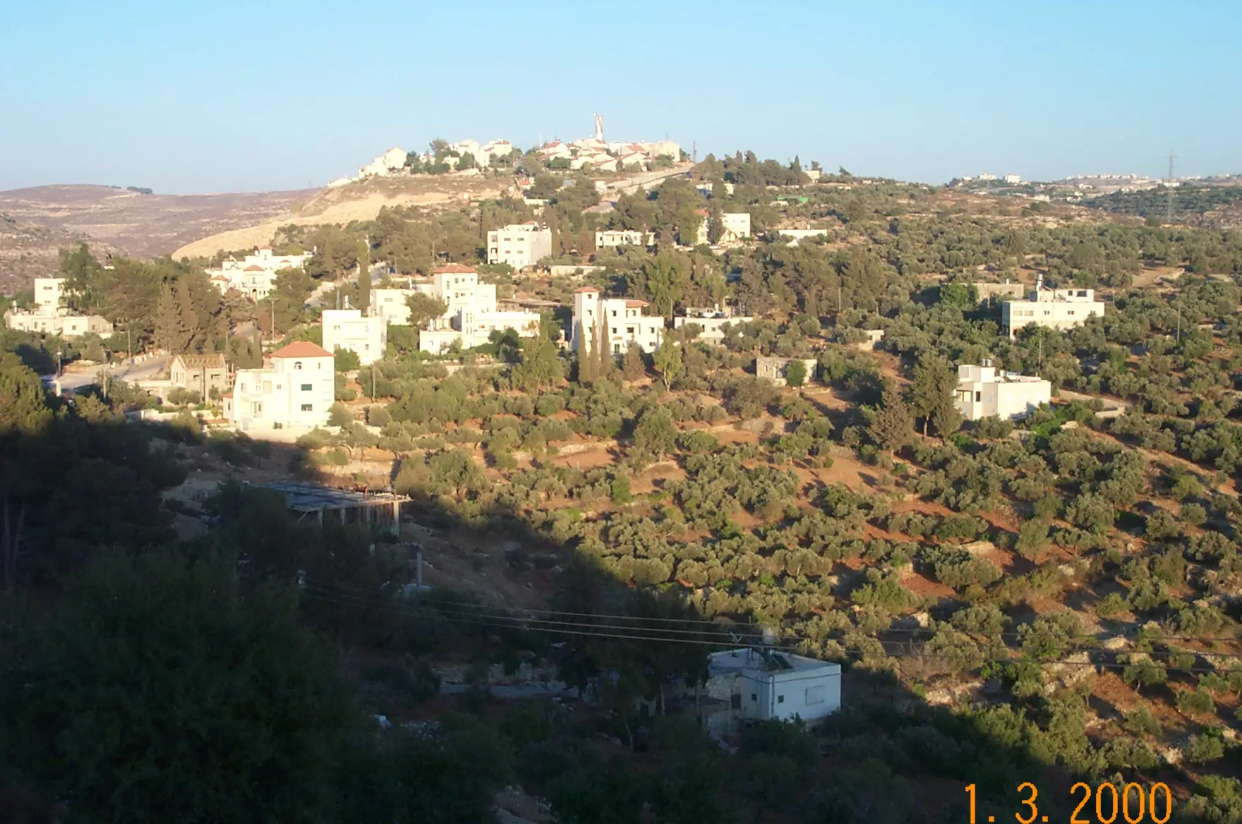
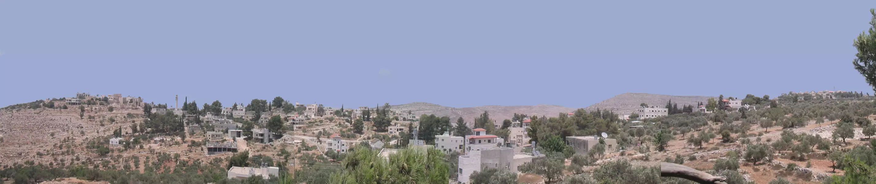
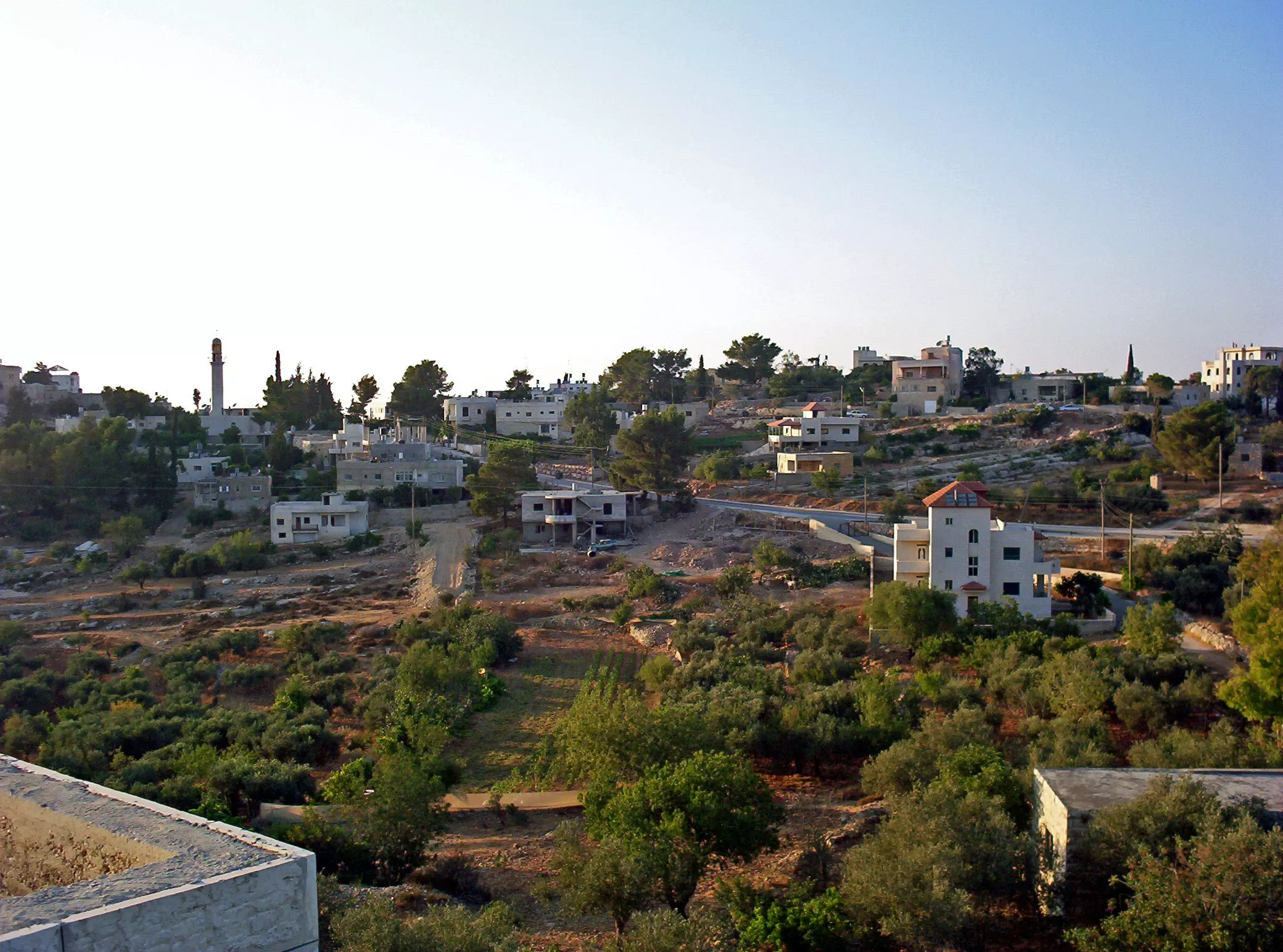
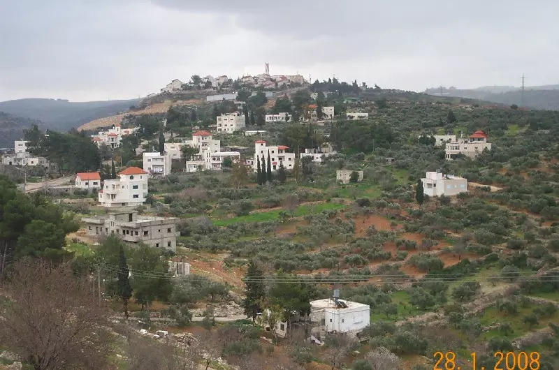
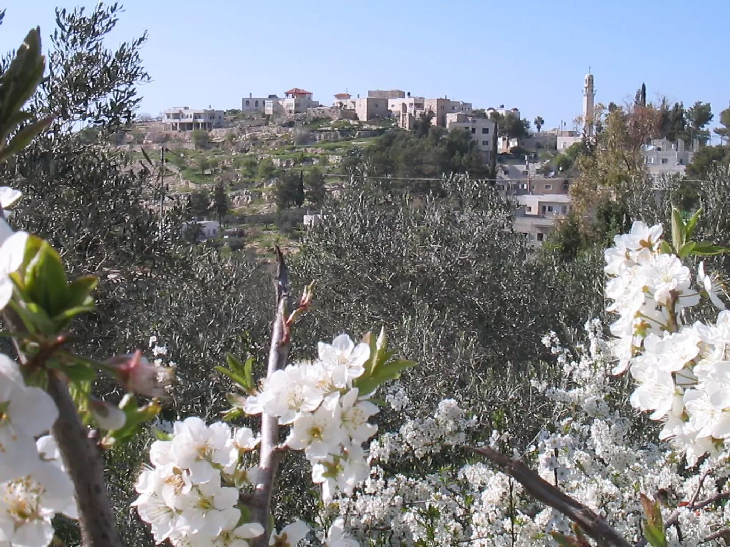
Welcome To Bayt 'Ur al-Fauqa - بيت عور الفوقا (בית עור אל-פוקא)
|
District of Ramallah
Occupied days ago |
العربية Google Earth |
 |
Gallery (110) |
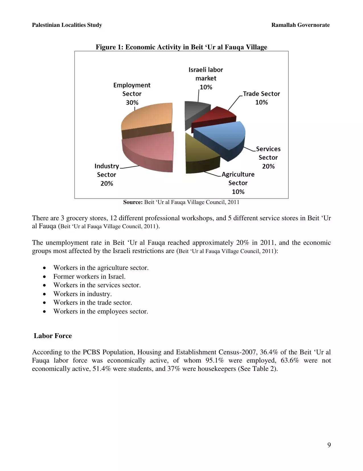
- Statistics & Facts
-
Before & After

- Satellite View
- Articles 2
- Pictures 110
- Aerial Views 1
- Members 3
- Families
- Wikipedia
- ARIJ Guide
- Videos 1
- Guest Book 8
- Links 1
| Statistic & Fact | Value | ||||||||||||||||||
| Distance From District | 14 km west of Ramallah | ||||||||||||||||||
| Elevation | 600 meters | ||||||||||||||||||
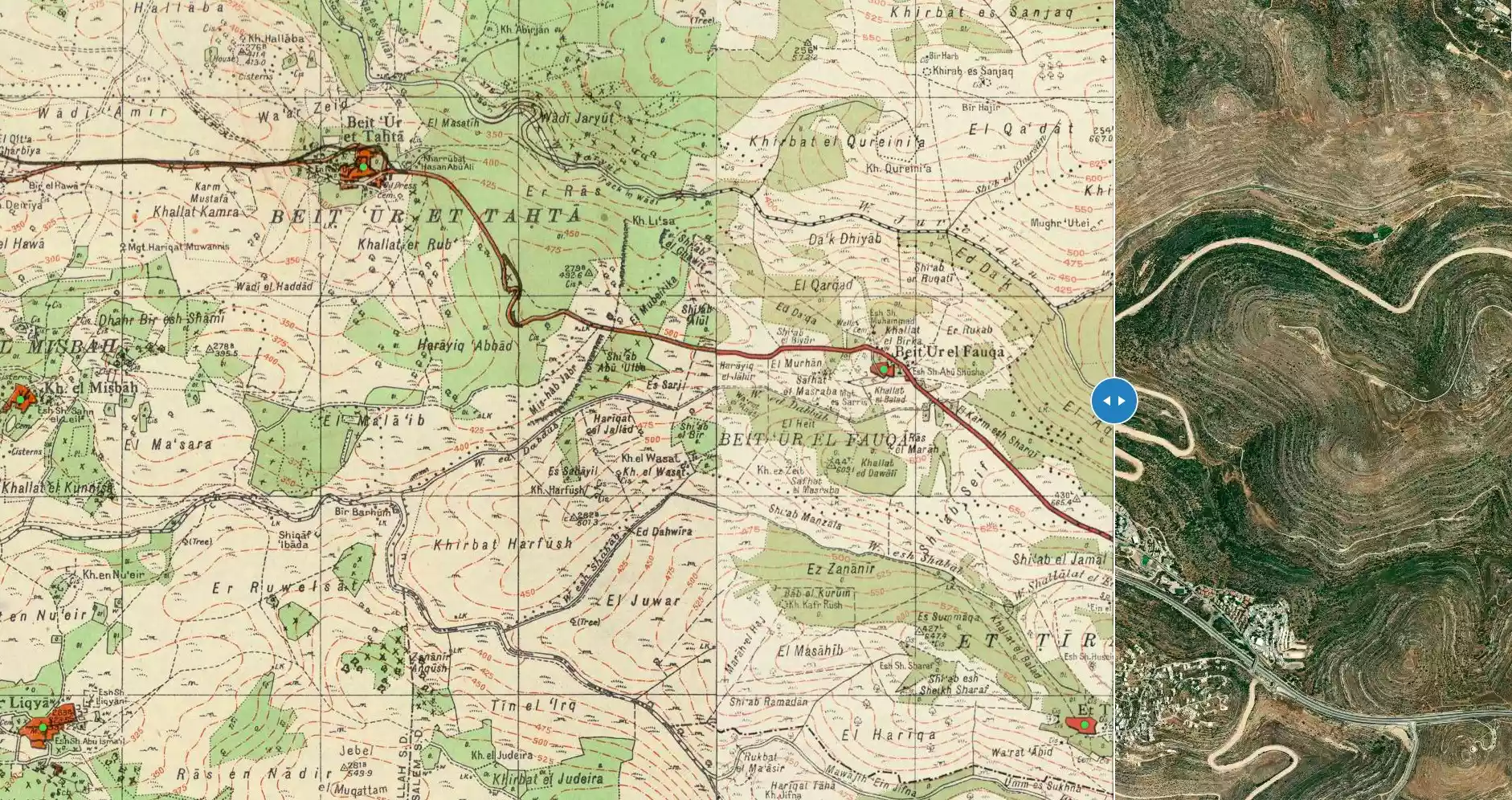
| Before & After Nakba, Click Map For Details |
|||||||||||||||||||
|
|||||||||||||||||||
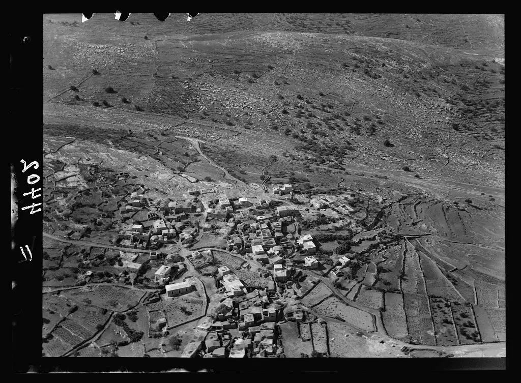
| Pre-Nakba Aerial View |
|||||||||||||||||||
|
|||||||||||||||||||
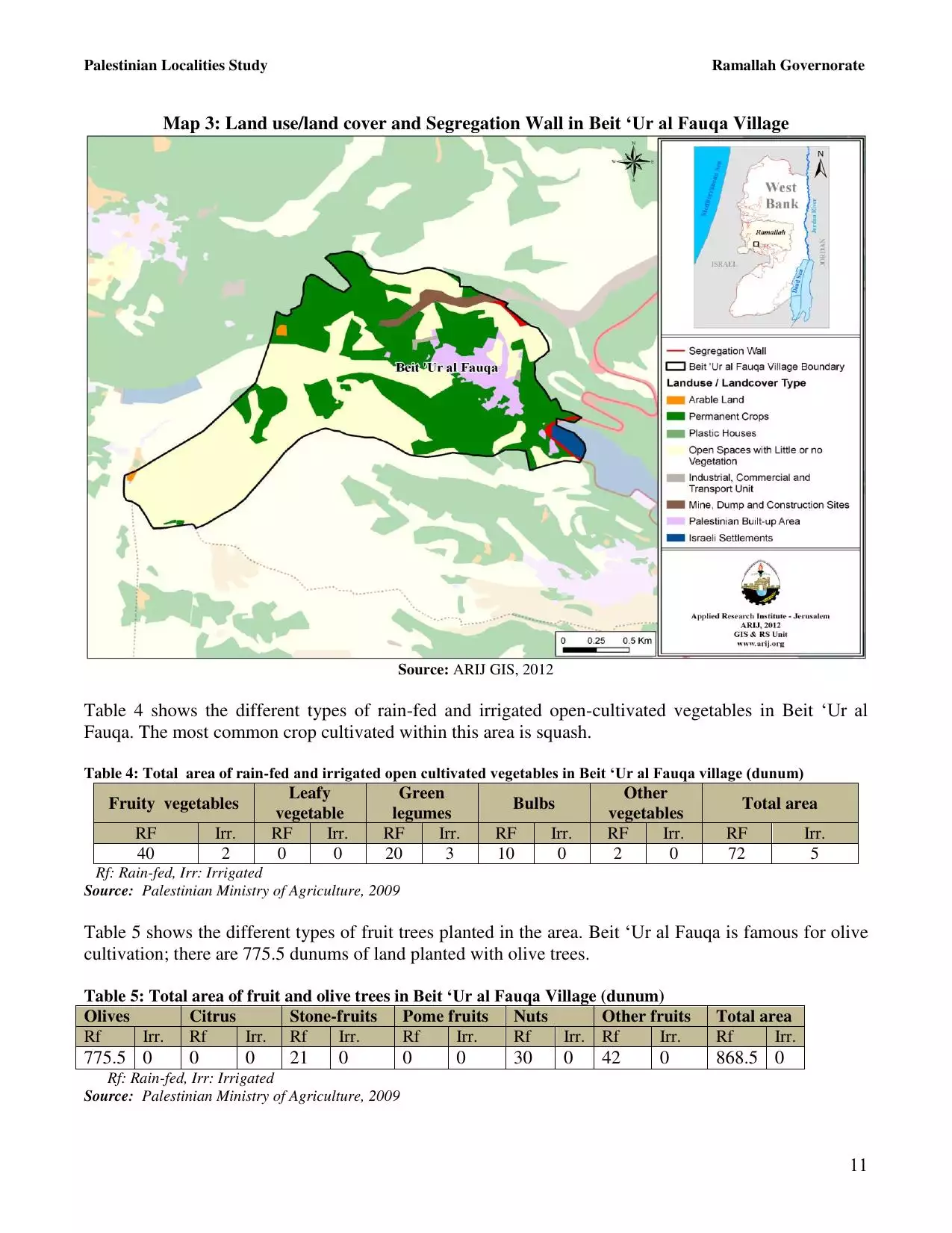
| Land Ownership |
**Town Lands' Demarcation Maps |
||||||||||||||||||
| Land Usage As of 1945 |
|
||||||||||||||||||
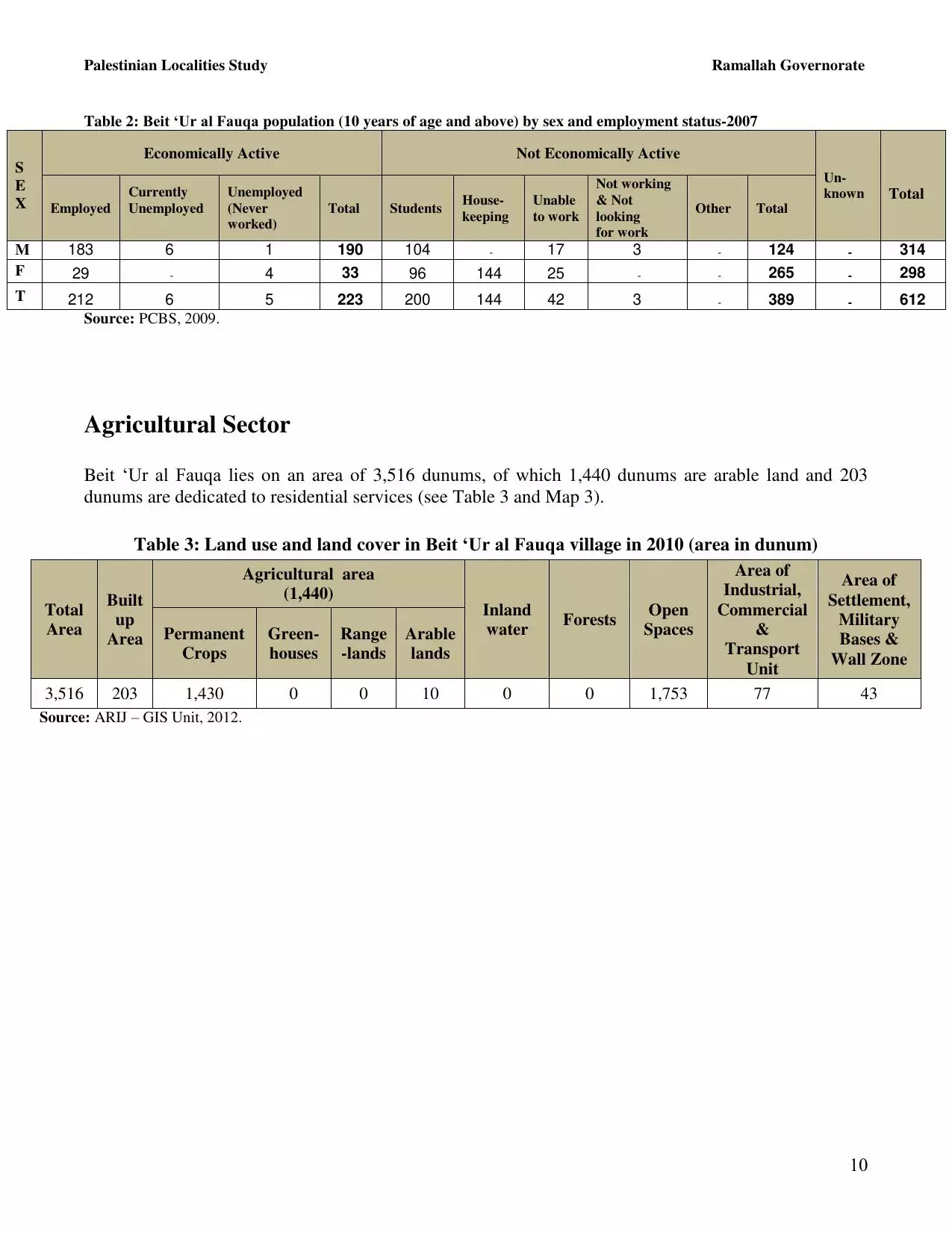
| Population |
|
||||||||||||||||||
| Near By Towns |
|||||||||||||||||||
|
|
|||||||||||||||||||
| ARIJ Guide | |||||||||||||||||||
|
Click here to browse online. |
|||||||||||||||||||
| Related Maps | Town Lands' Demarcation Maps خرائط للقضاء توضح حدود القرى والاودية View from satellite Town's map on MapQuest Help us map this town at WikiMapia |
||||||||||||||||||
| Related Links | Wikipedia's Page Facebook Page ARIJ Guide Google Search Google For Images Google For Videos في كتاب بلادنا فلسطين دليل أريج المزيد من موقع هوية |
||||||||||||||||||

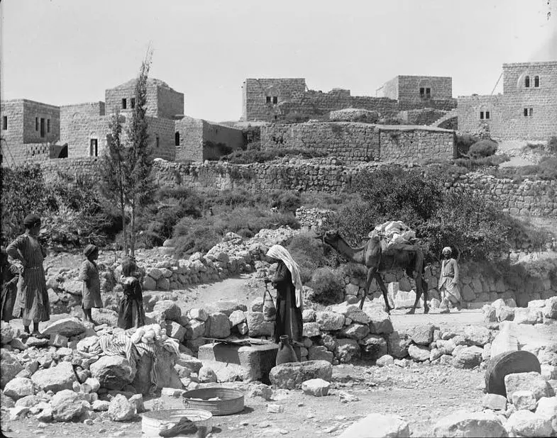
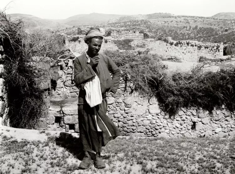
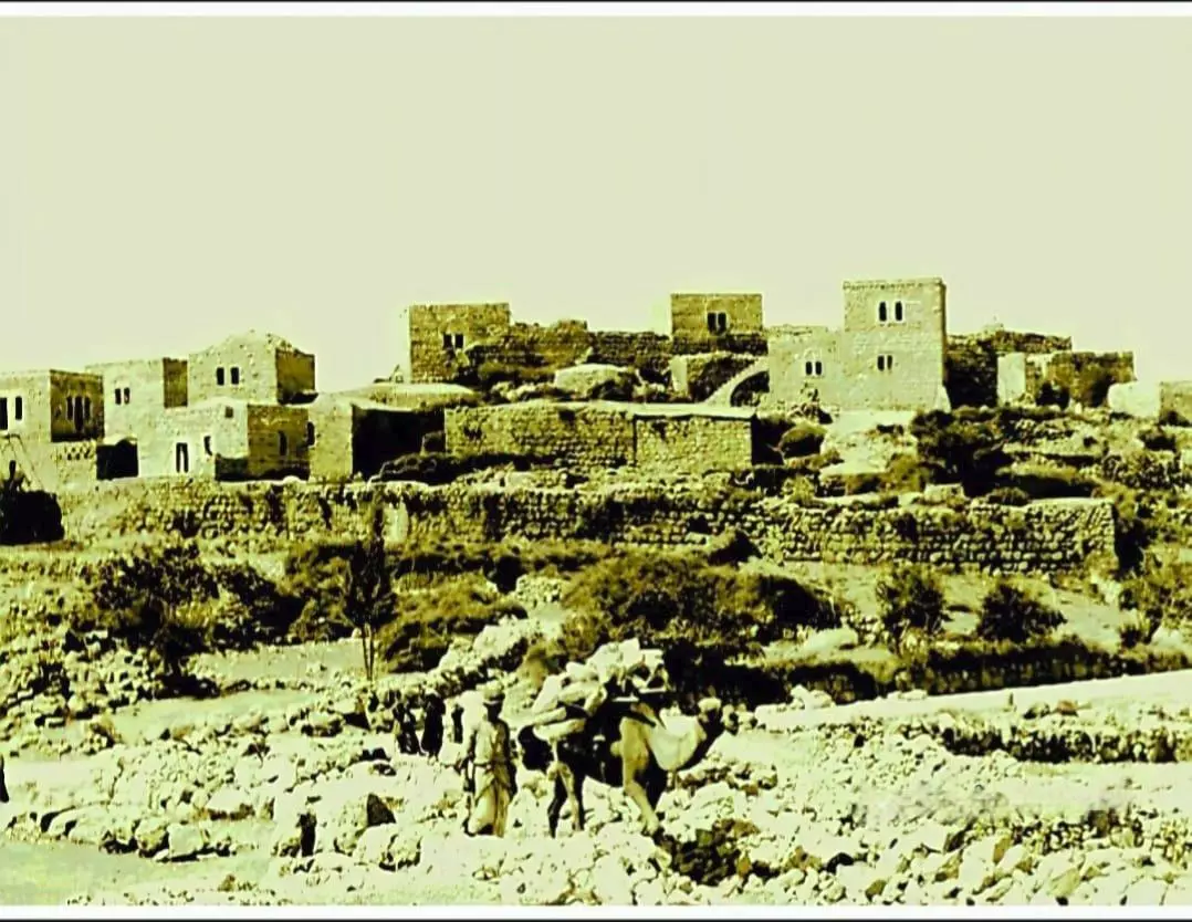
- صورة لقرية بيت عور الفوقا عام 1920
Posted by ابو عايش - منظر عام، اُنقر الصورة لتكبيرها. - تصوير أبو غزالي
Posted by Emad Abo gazali 2 - منظر عام عريض للقريه من أبو غزالي. اُنقر الصورة لتكبيرها.
Posted by Emad Abo gazali 2 - منظر عام، اُنقر الصورة لتكبيرها.
Posted by Fayez Fayez 3 - منظر عام، اُنقر الصورة لتكبيرها.
Posted by Fayez Fayez 2 - منظر عام، اُنقر الصورة لتكبيرها.
Posted by Fayez Fayez 2 - حاره كوبرا - تصوير أبو غزالي
Posted by Emad Abo gazali 2 - حاره كوبرا - تصوير أبو غزالي
Posted by Emad Abo gazali - الحارة الشرقية، اُنقر الصورة لتكبيرها - تصوير أبو غزالي
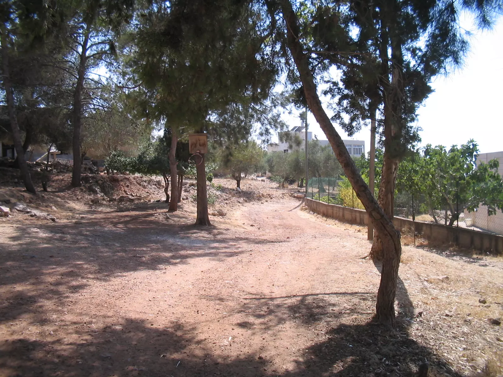
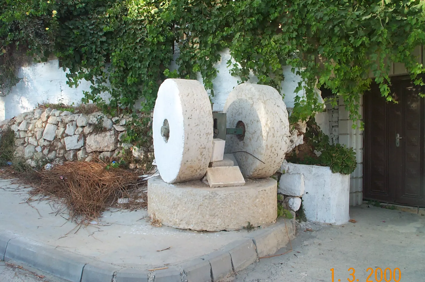
Posted by Emad Abo gazali - منظر طاحونه في وسط القريه
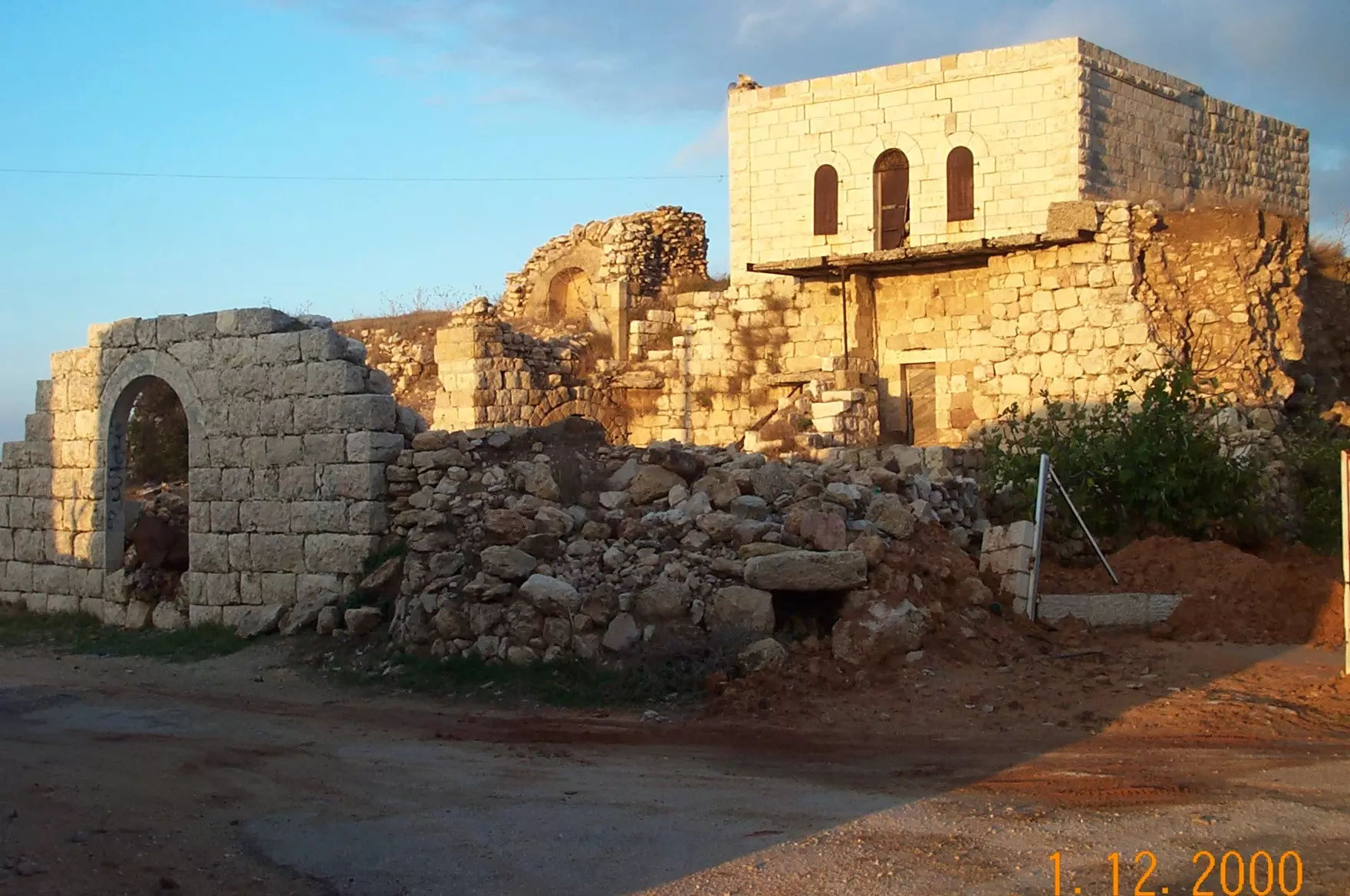
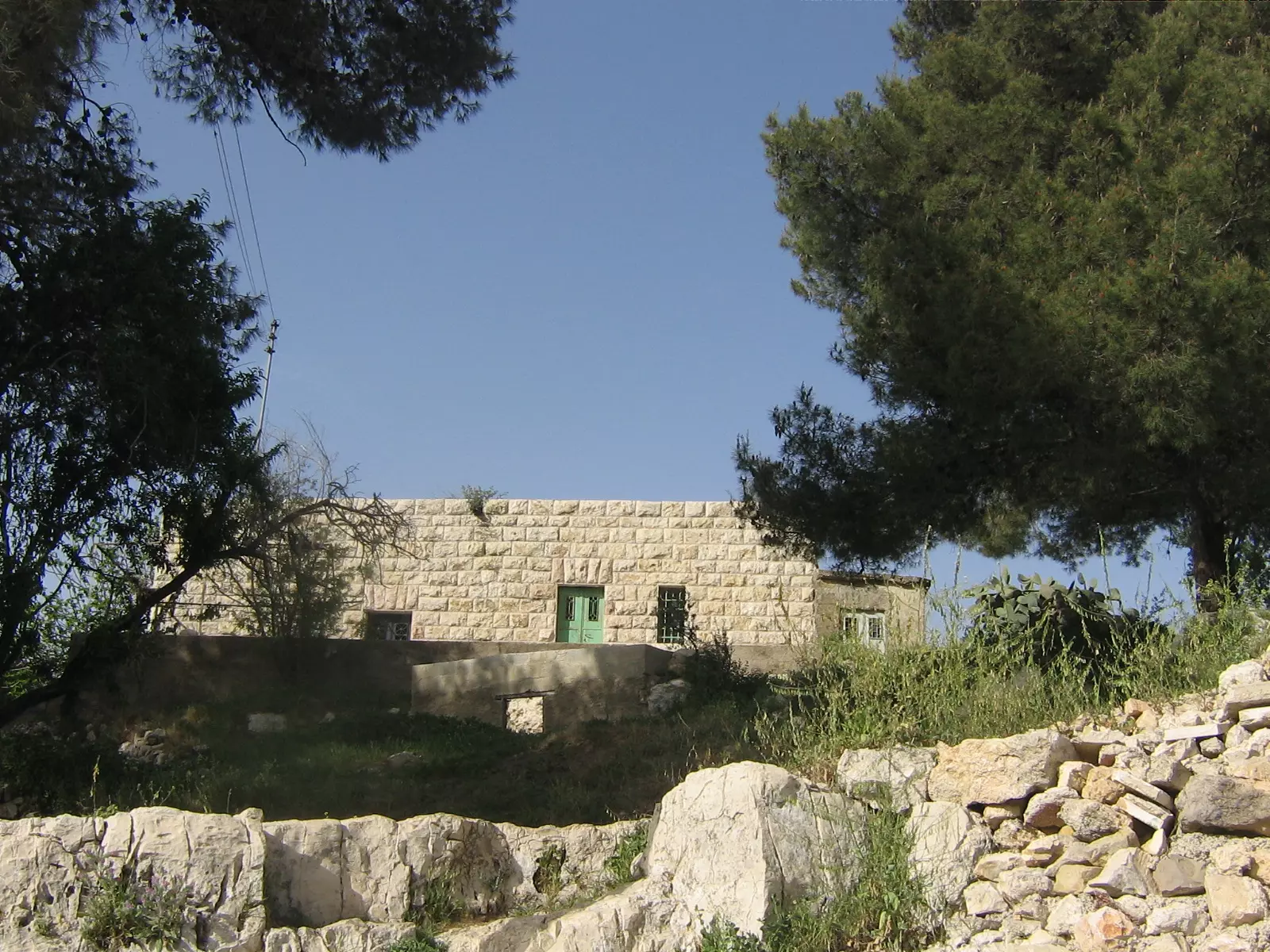
Posted by Emad Abo gazali 1 - البلده القديه في القريه - أبو غزالي
Posted by Emad Abo gazali 1 - صوره في فصل الشتاء - تصوير أبو غزالي
Posted by Emad Abo gazali 7 - صورة للقريه في فصل الشتاء - أبو غزالي

Posted by Emad Abo gazali 1 - صوره للبلده القديمه - أبو غزالي
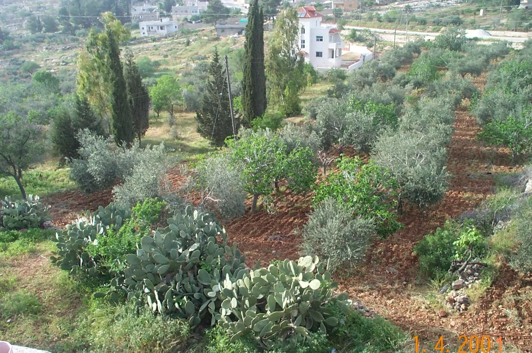
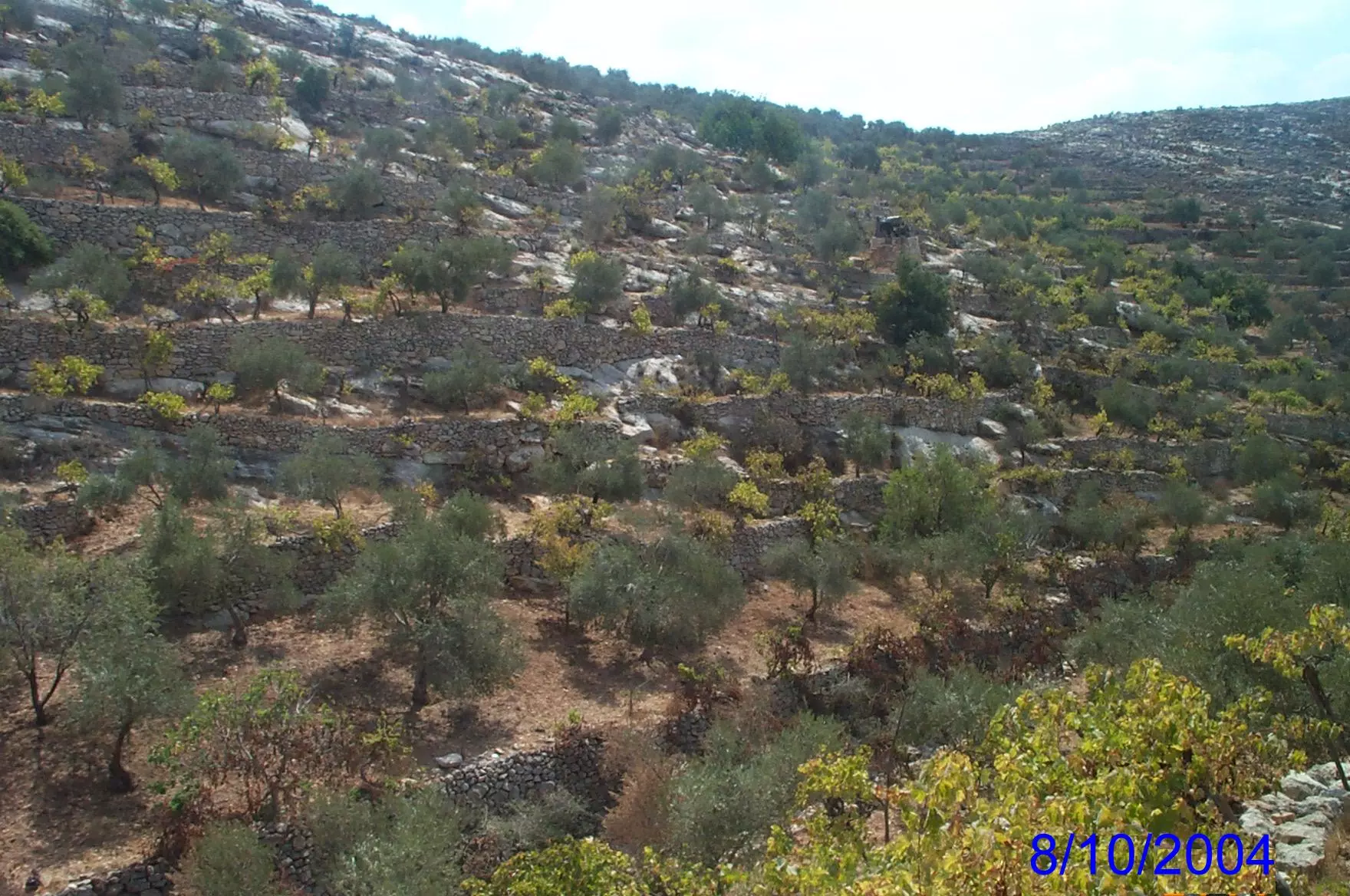
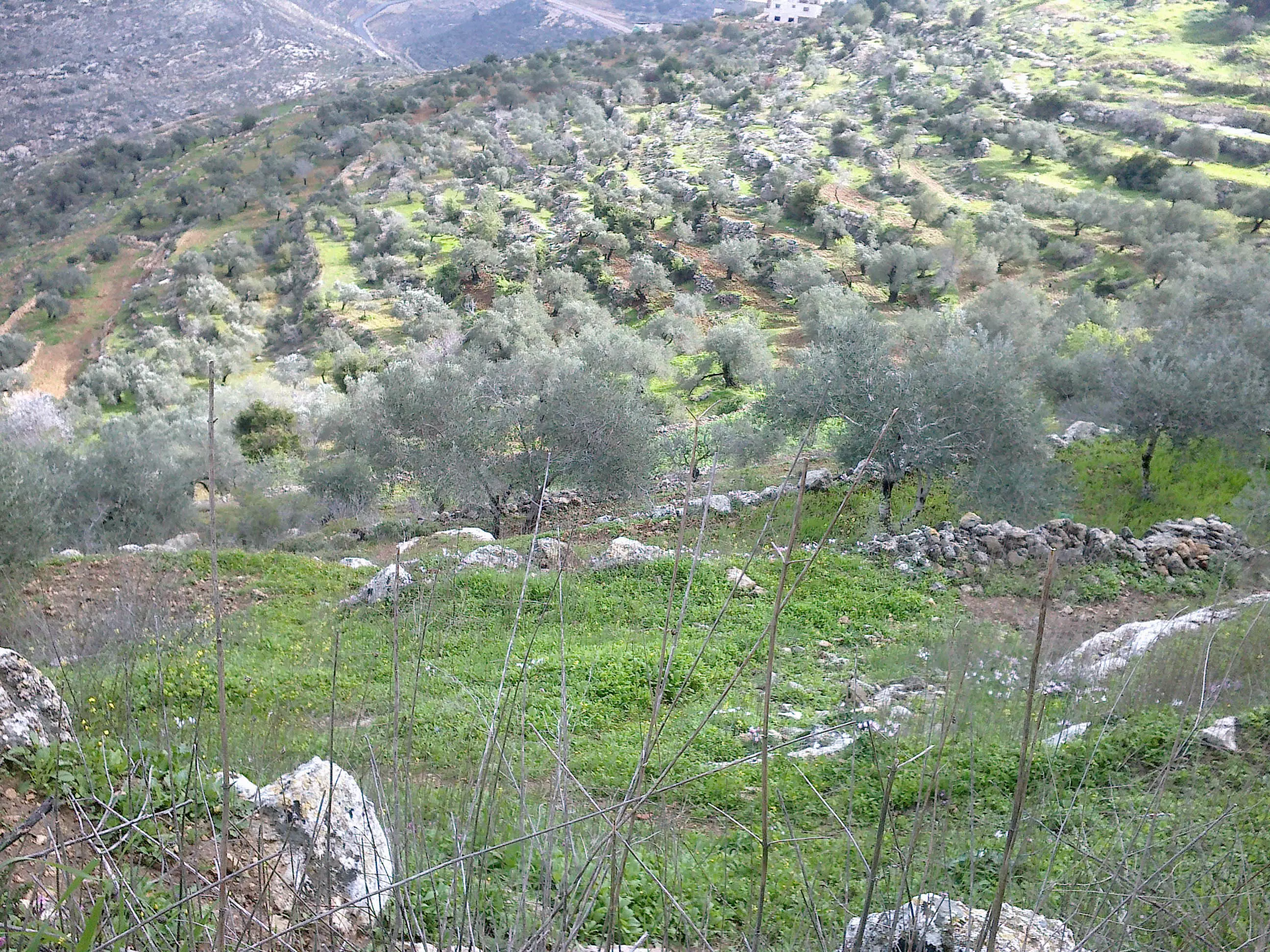
Posted by Emad Abo gazali - أحد الحقول المزروعه بالتين و الزيتون في القريه - أبو غزالي
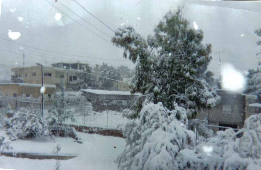
Posted by Emad Abo gazali - صوره لمقطع من القريه في الثلج
Posted by Emad Abo gazali 2 - صوره لأحد حقول العنب و الزيتون في القريه - أبو غزالي
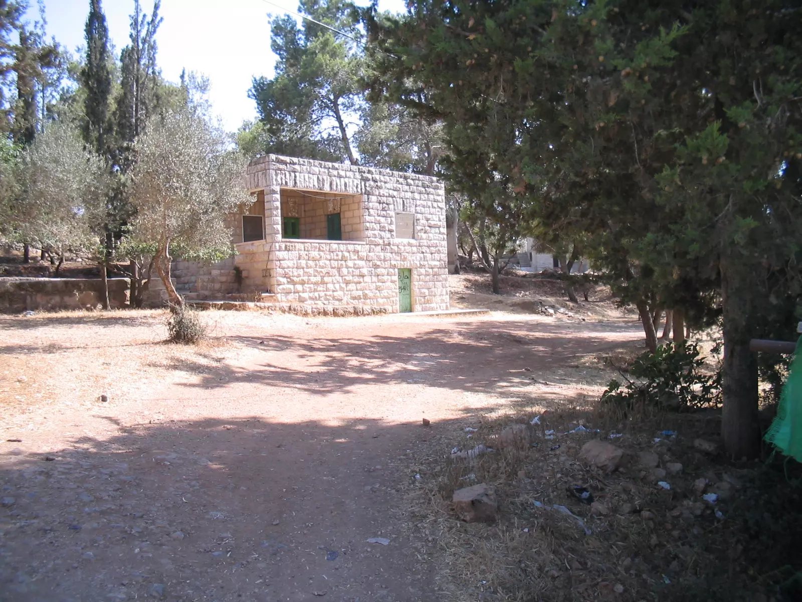
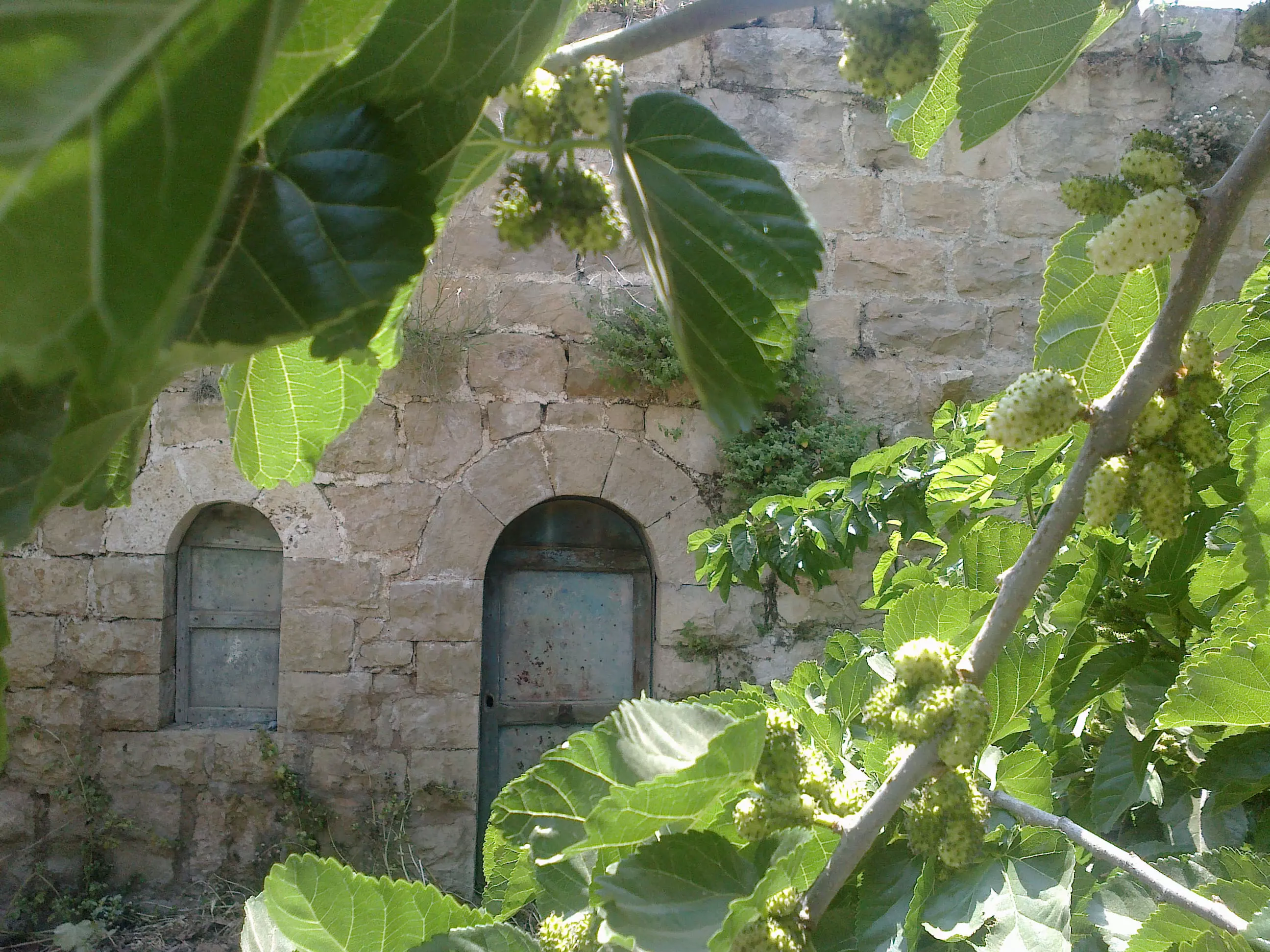
Posted by Emad Abo gazali 2 - Our Old Home - بيت قديم في وسط القريه - تصوير أبو غزالي
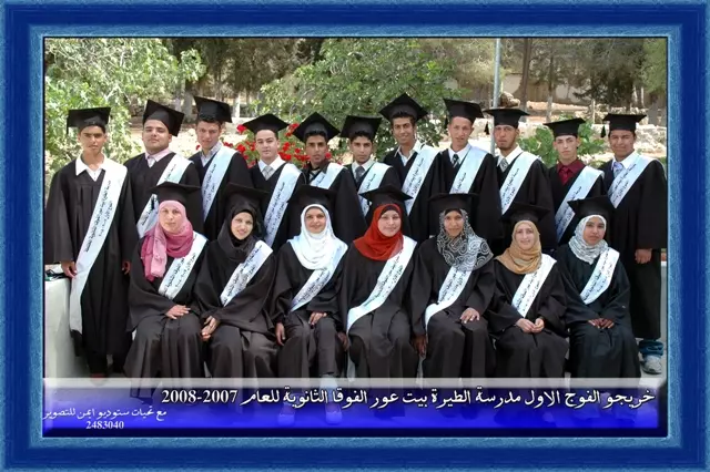
Posted by Emad Abo gazali 4 - خريجو الفوج الاول مدرسة بيت عور الفوقا والطيرة للعام 2007-2008
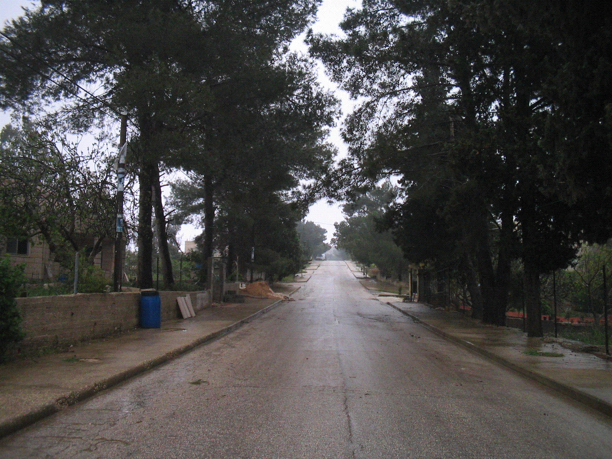
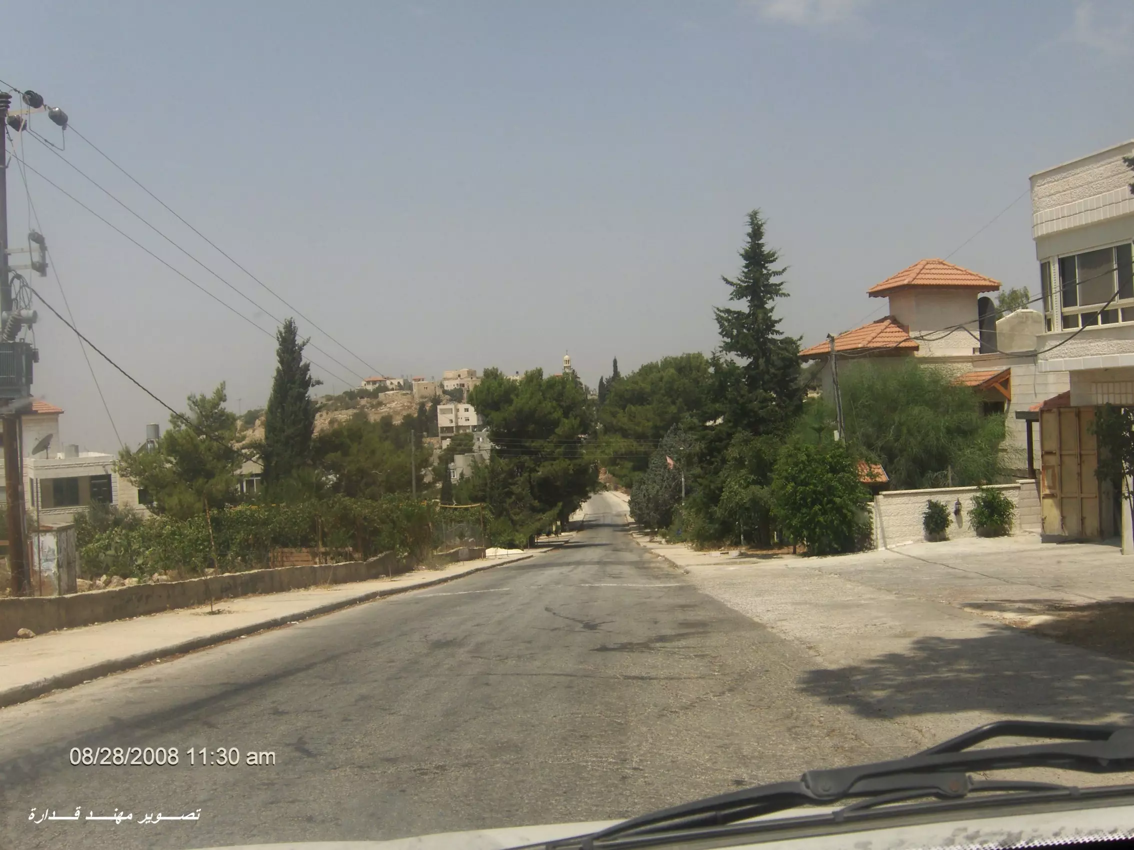
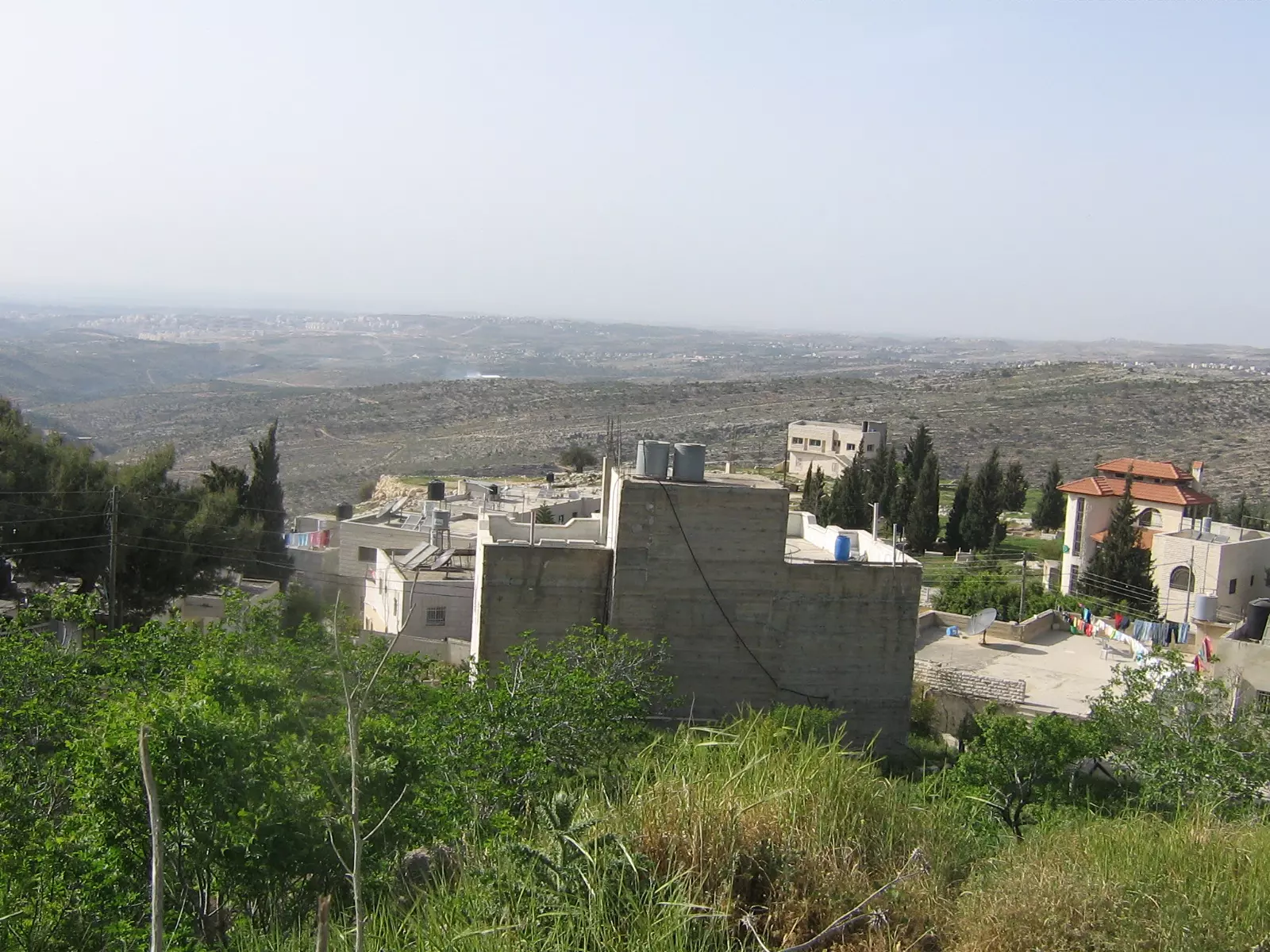
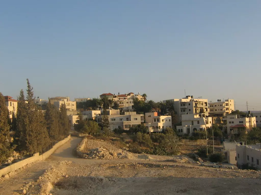
Posted by ستوديو ايمن للتصوير 7 - شارع البلدة الرئيس بعدسة مهند قدارة
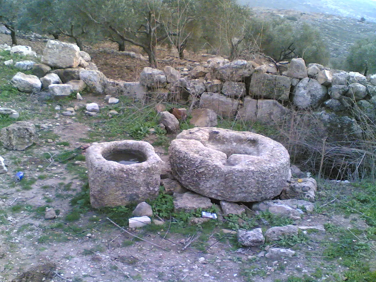
Posted by مهند قداره 1 - بئر ماء - القرينعه
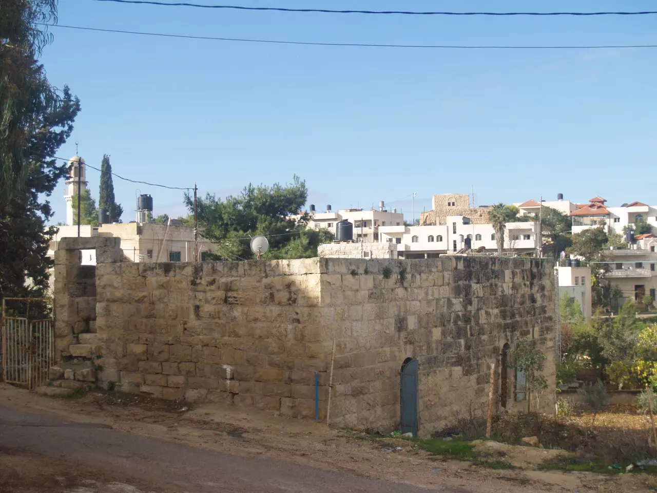
Posted by Emad Abo gazali 1 - صوره الجدار شرق القريه
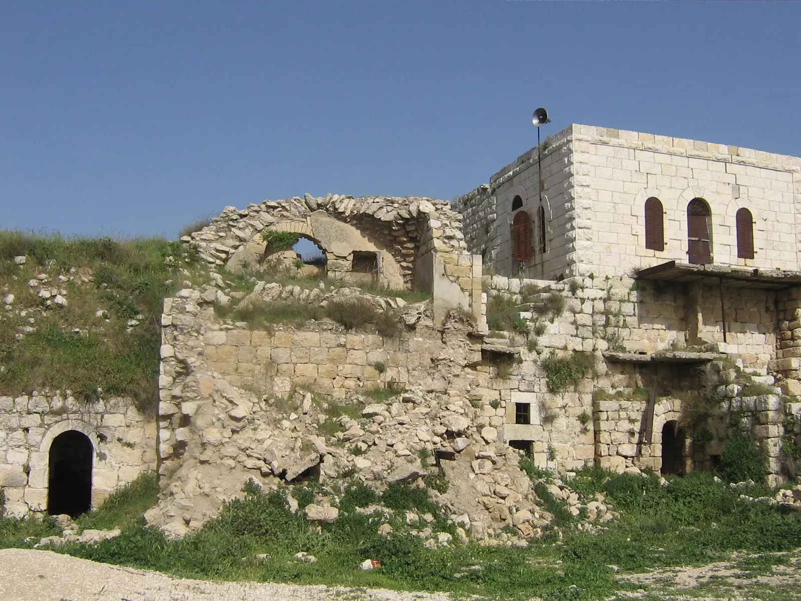
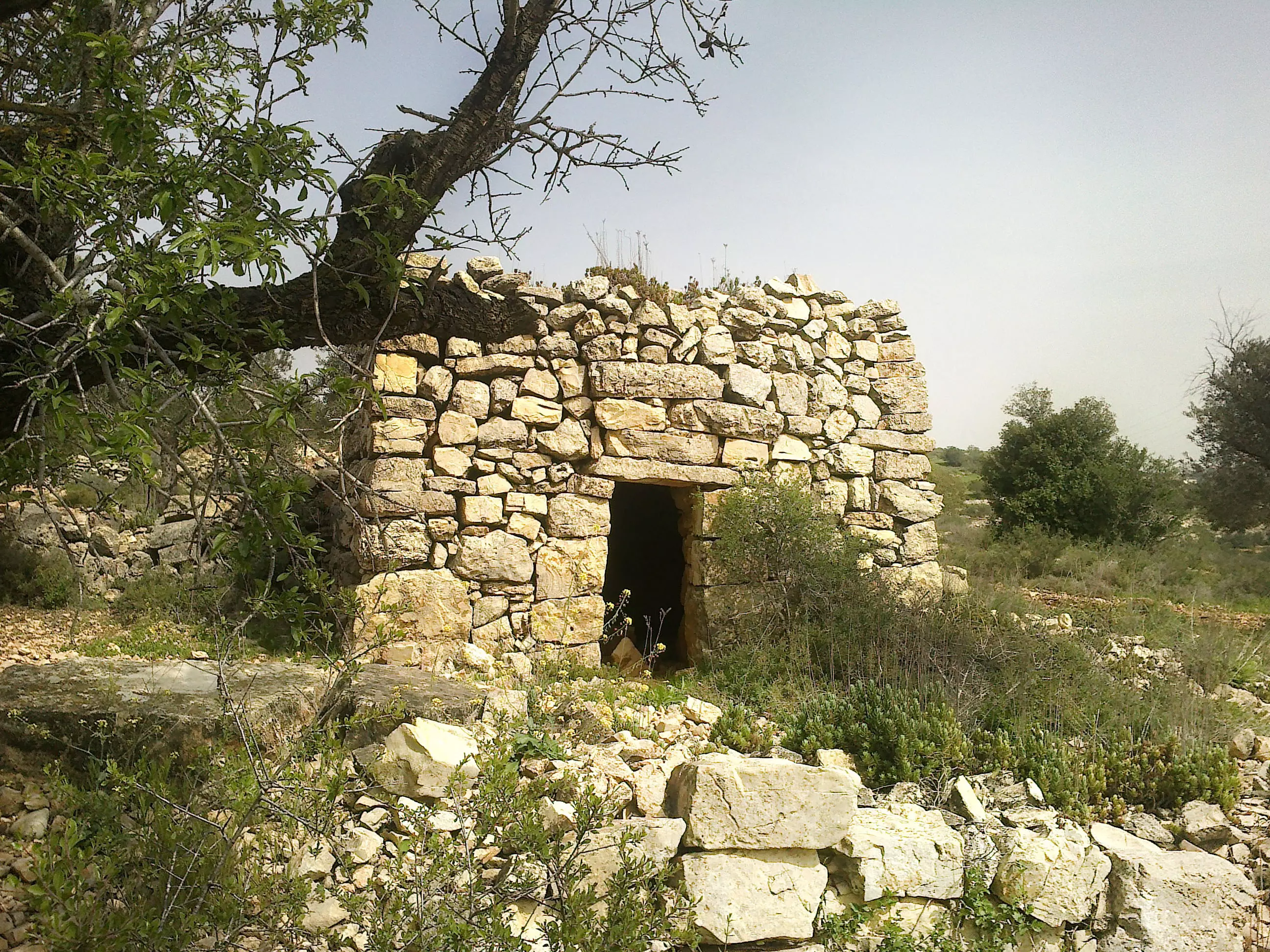
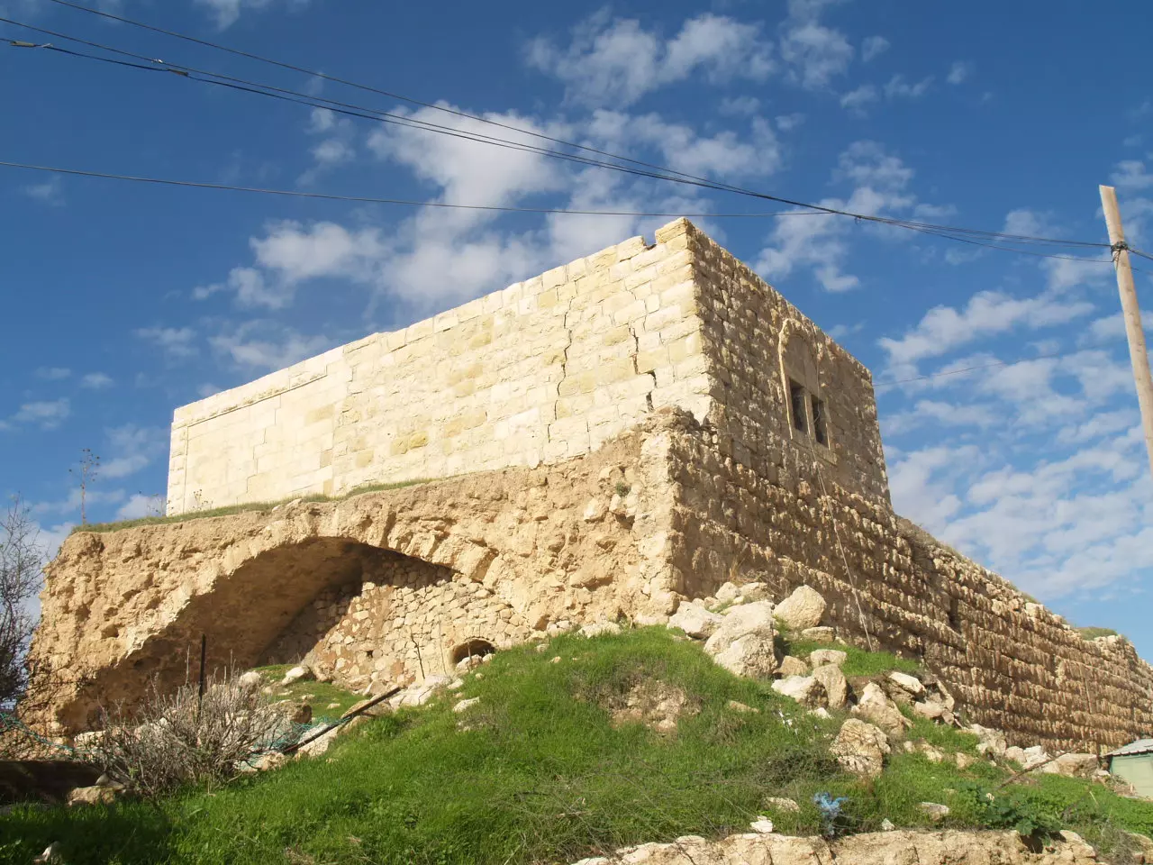
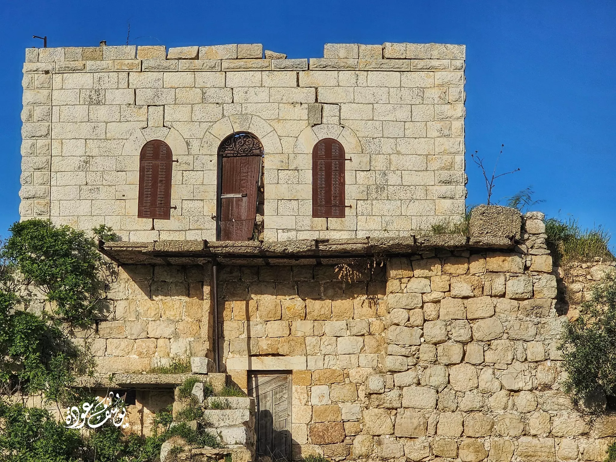
Posted by Emad Abo gazali 2 - البرج - من الجهة الغربيه
Posted by Emad Abo gazali 1 - صوره من الجهة الغربيه بناء على طلب ابراهيم نصر و قريبا سنضع المزيد
Posted by Emad Abo gazali 2 - الحارة الغربية - بعدسة عماد أبو غزالي
Posted by Emad Abo gazali 2 - صورة للجدار شرق القرية - تصوير أبو غزالي
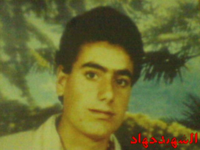
Posted by Emad Abo gazali 1 - شهيد من شهداء قرية بيت لقيا استشهد بتاريخ 2/4/1988
Posted by مرعي عاصي 1 - صوره للحارة الشرق قبليه
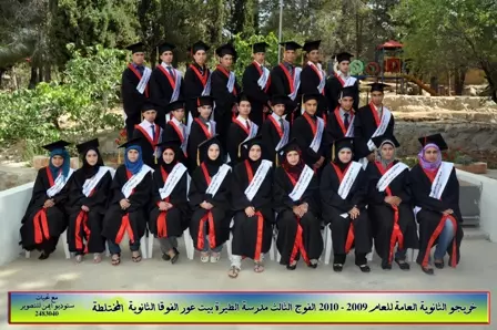
Posted by Emad Abo gazali - حفل تكريم الثانوية العامة للعام 2009-2010 مدرسة الطيرة بيت عور الفوقا الثانوية المختلطة
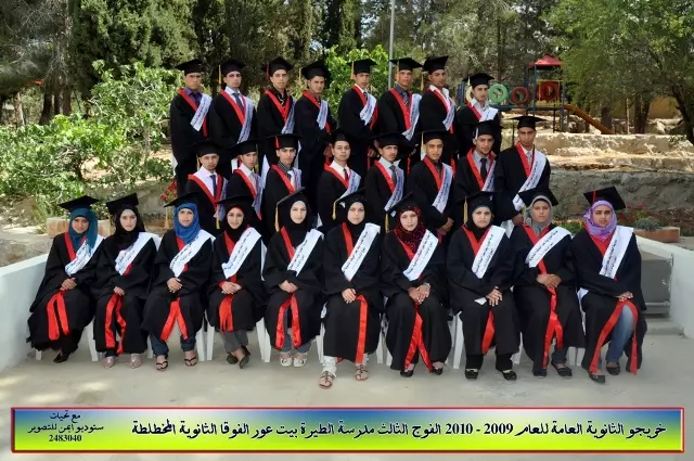
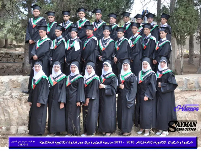
Posted by ستوديو ايمن للتصوير - حفل تكريم الثانوية العامة مدرسة الطيرة بيت عور الفوقا 2009-2010
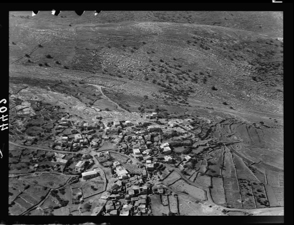
Posted by ستوديو ايمن للتصوير 2 - صورة جوية للقرية 1931 , اهداء من عاصم عليان الصفافي
Posted by عاصم ابو عمر 1 - خريجوا وخريجات الثانوية العامة للعام 2010 - 2011 مدرسة الطيرة بيت عور الفوقا الثانوية المختلطة
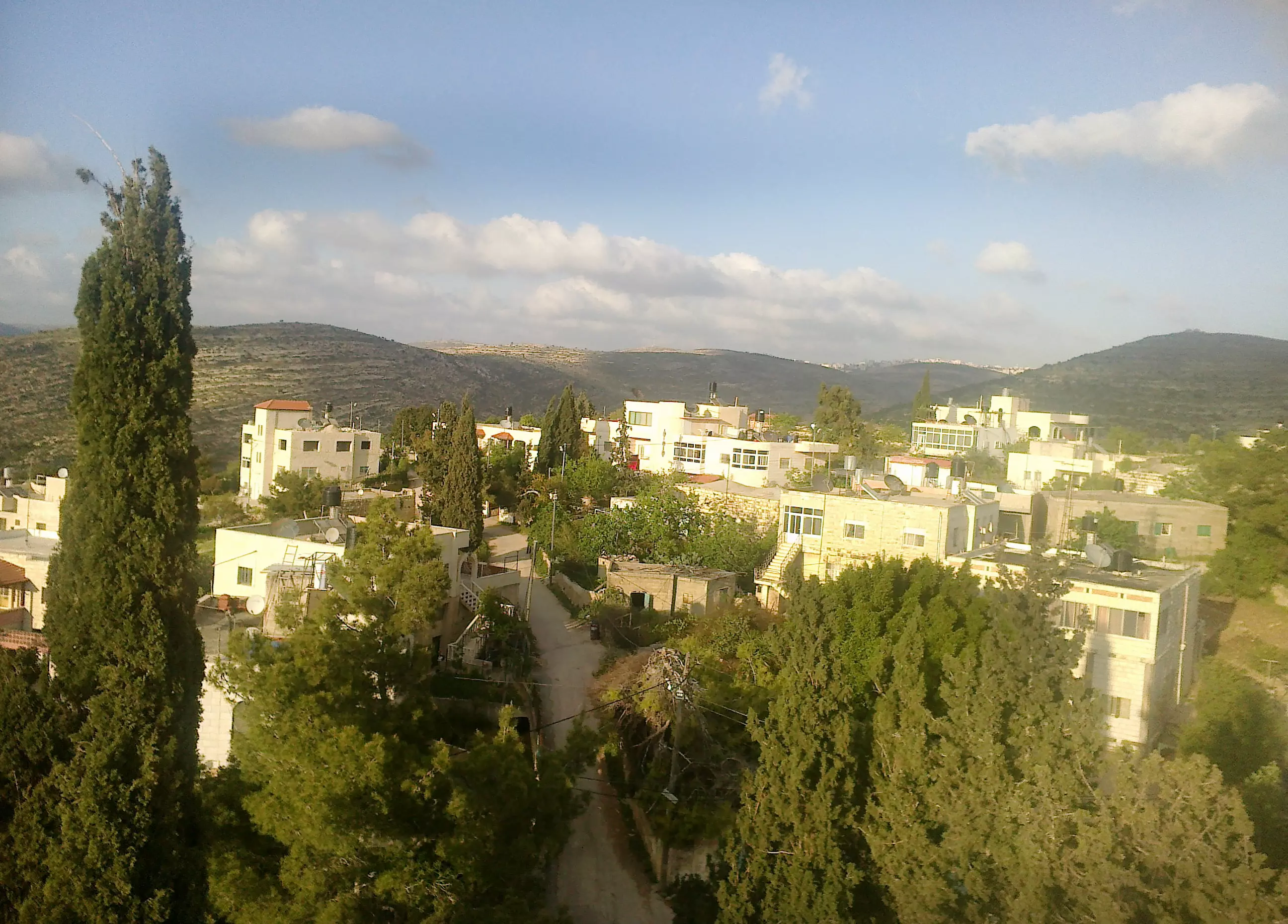
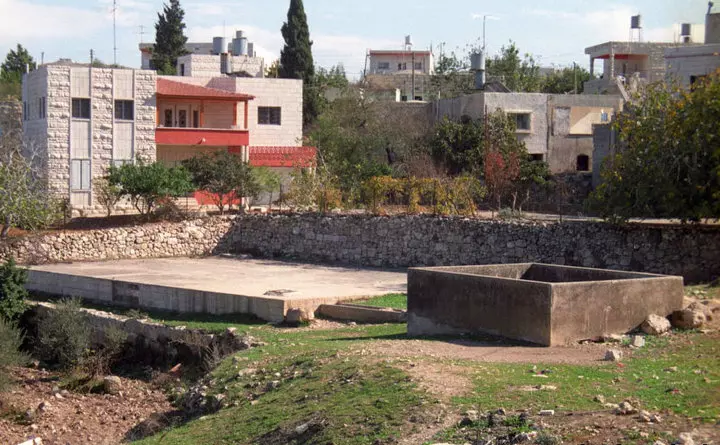
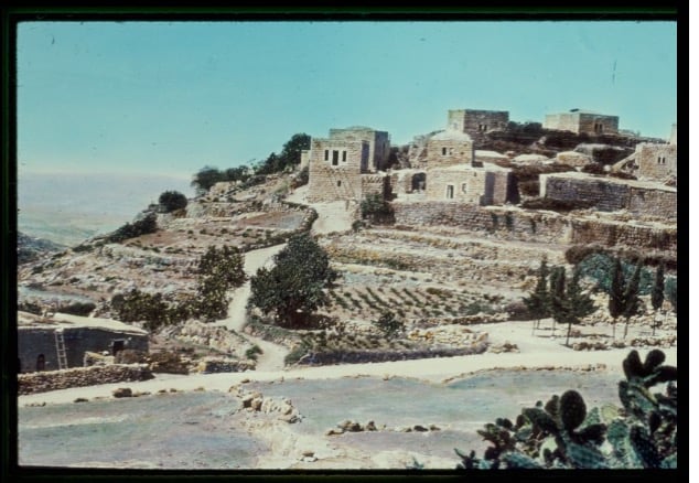
Posted by ستوديو ايمن للتصوير 5 - البلدة القديمة في القرية
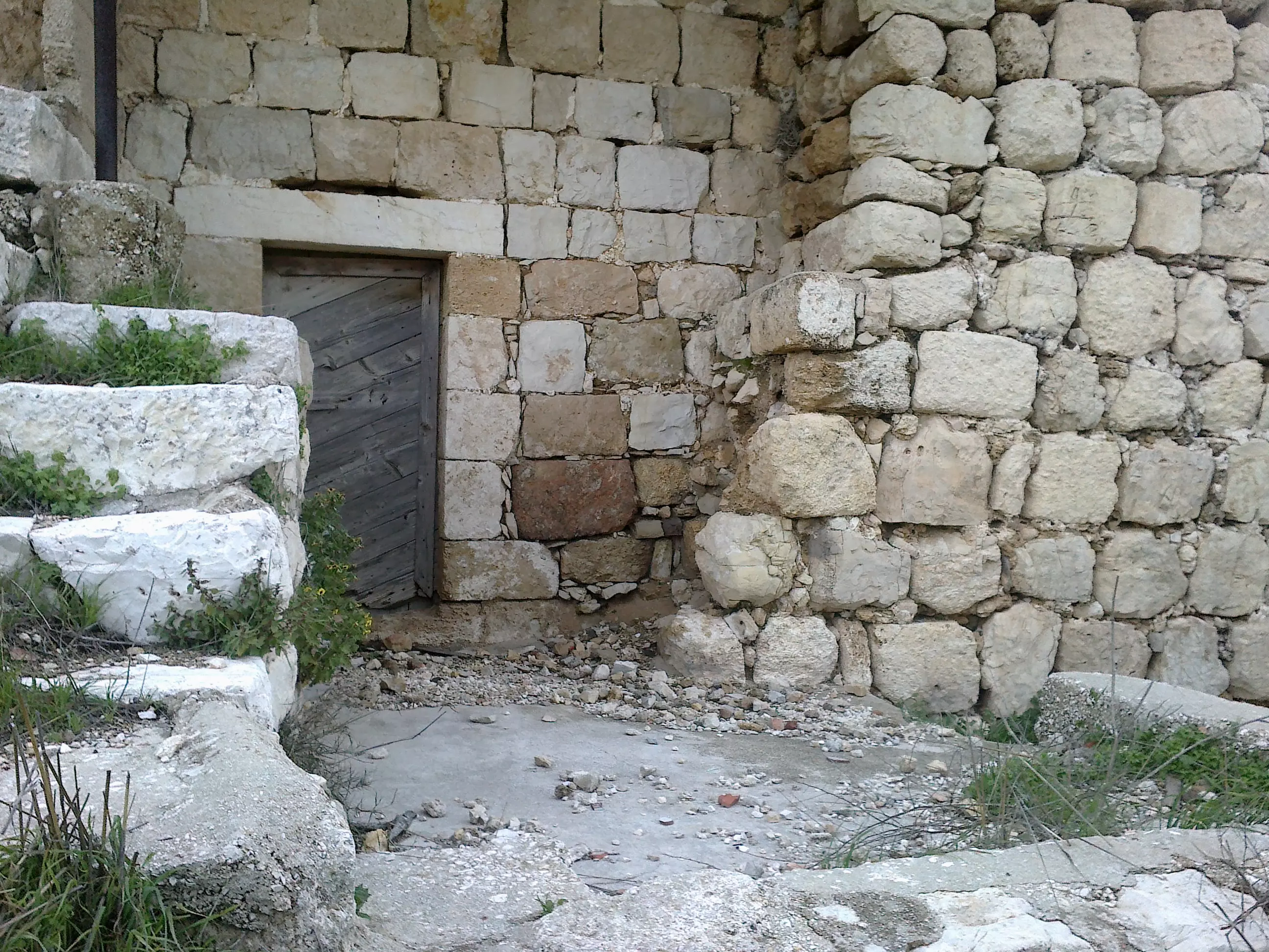
Posted by ابو عايش - البلدة القديمه بيت عور الفوقا-ابو عايش
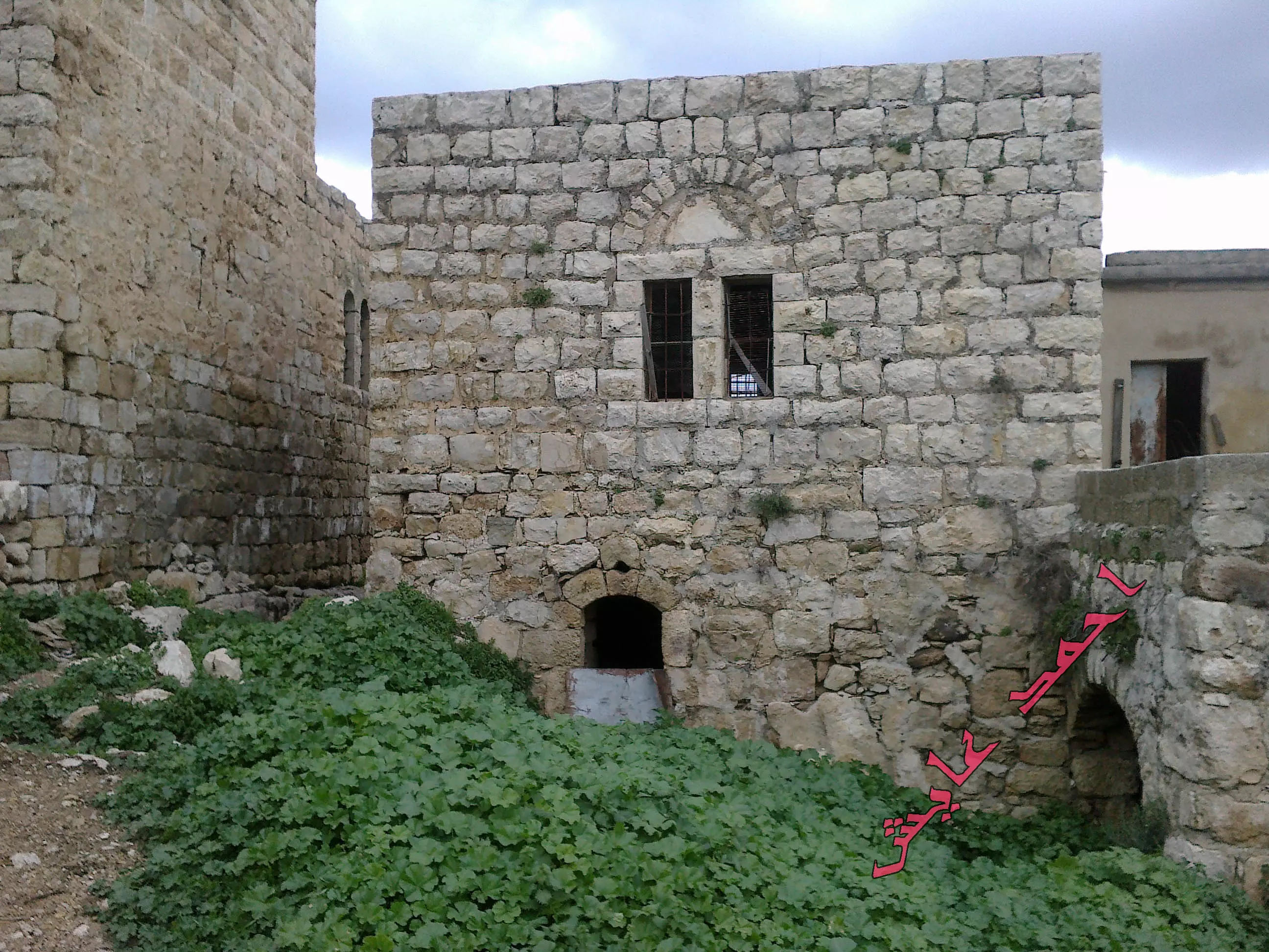
Posted by ابو عايش - بيت عور الفوقا -بعدسة محمد عايش البرج -ابو عايش
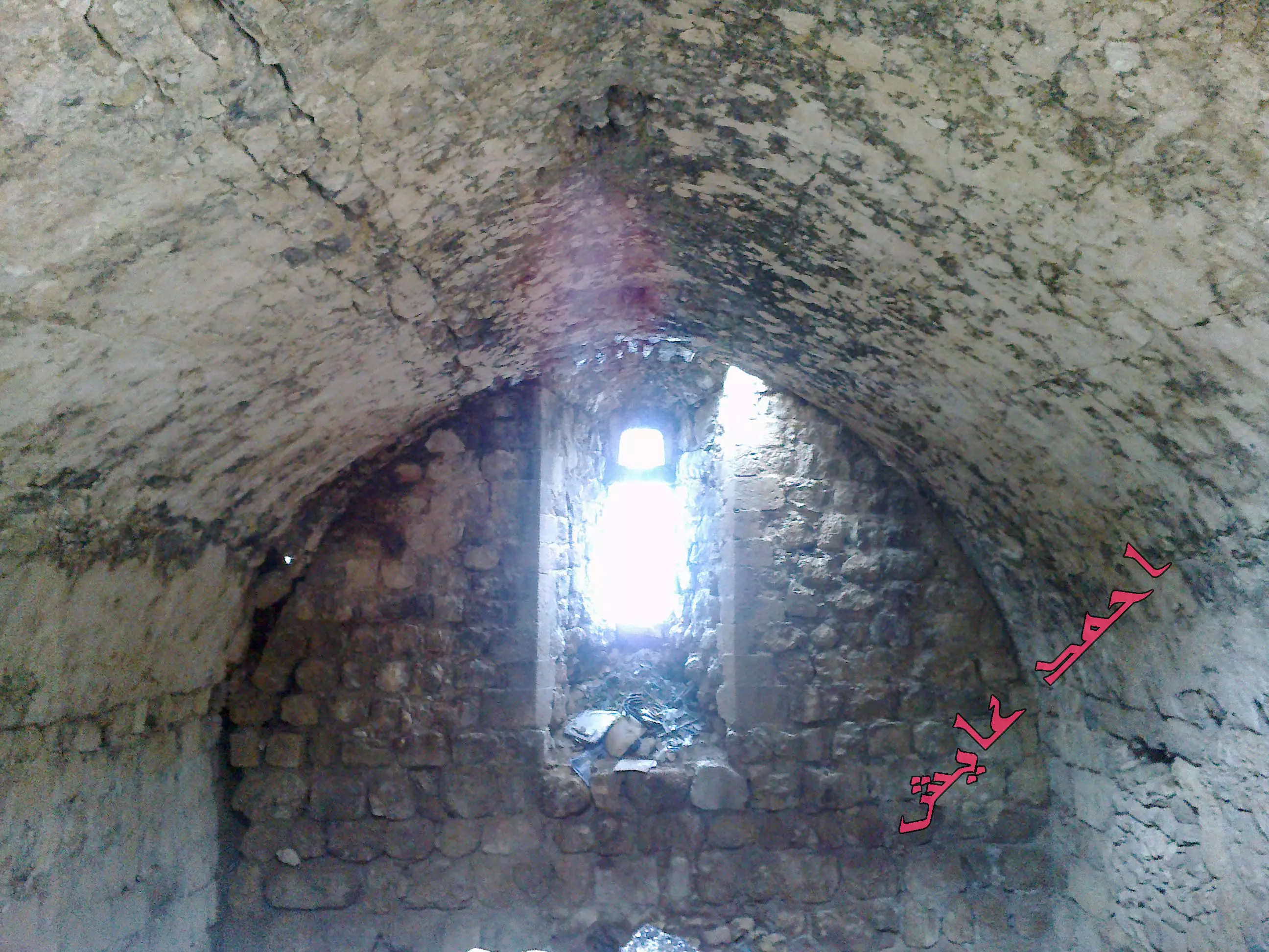
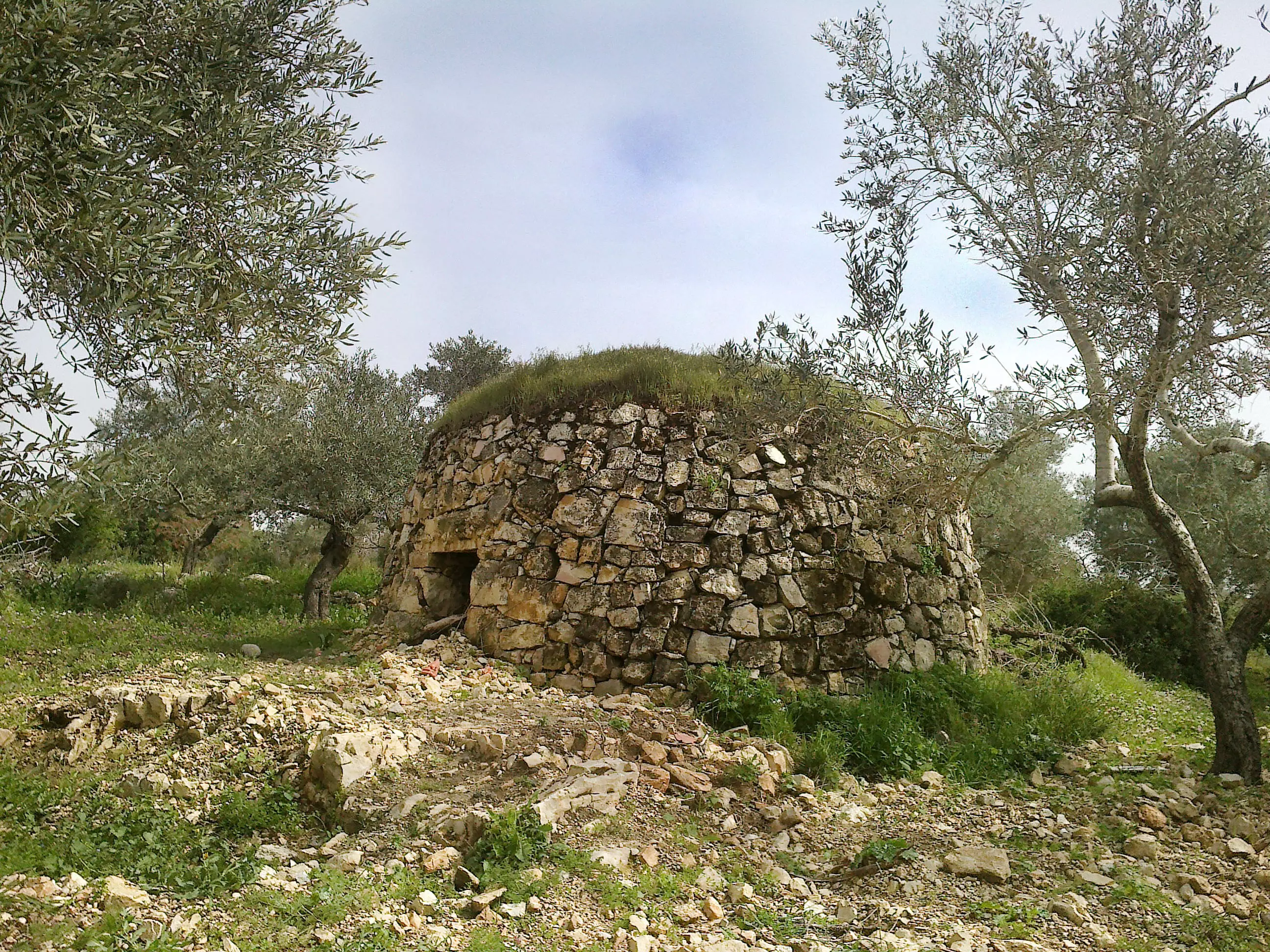
Posted by ابو عايش - صورة بعدسة احمد عايش -صورة داخل البرج البلده القديمه
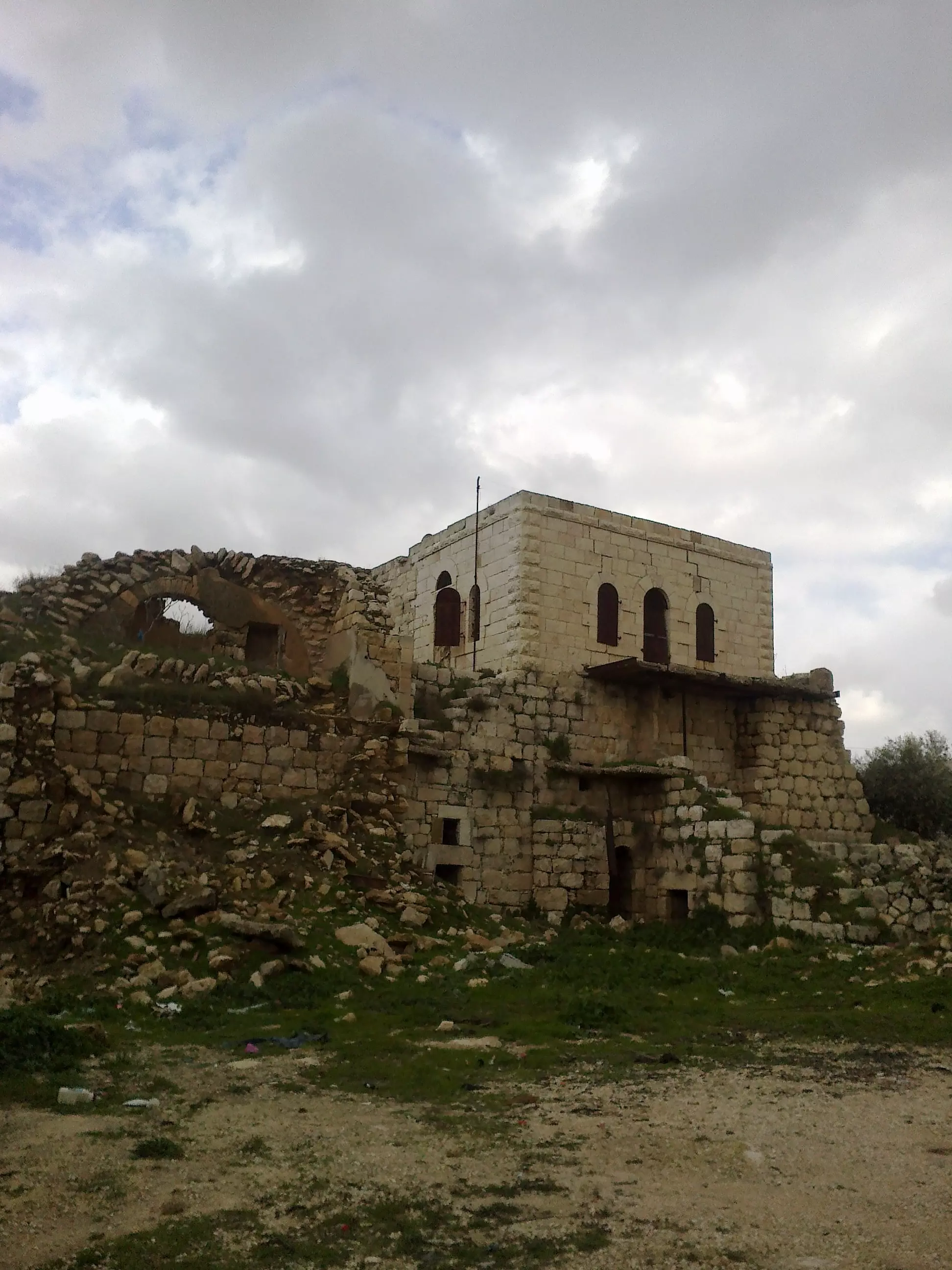
Posted by ابو عايش - صورة من الجهة الجنوبية للبلدة -بعدسة احمد عايش
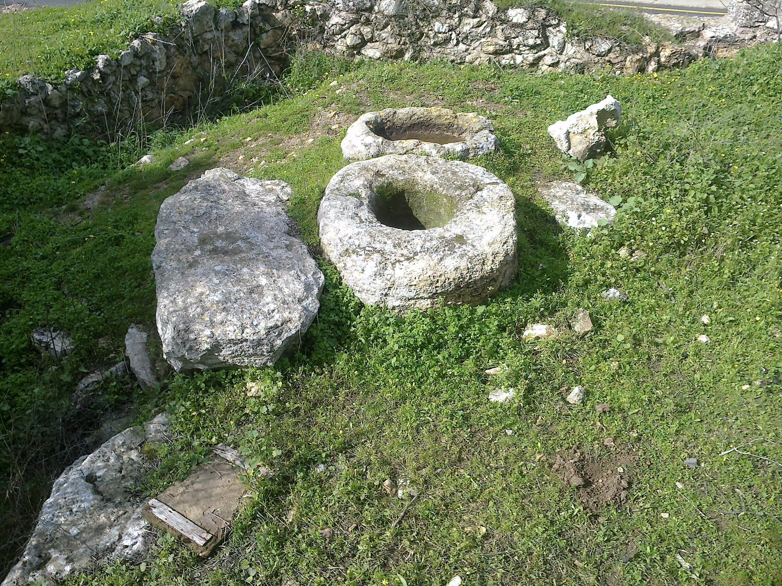
Posted by ابو عايش - صورة بئر قديم من الجهه الغربيه للبلدة-المرحان - بعدسة احمد عايش
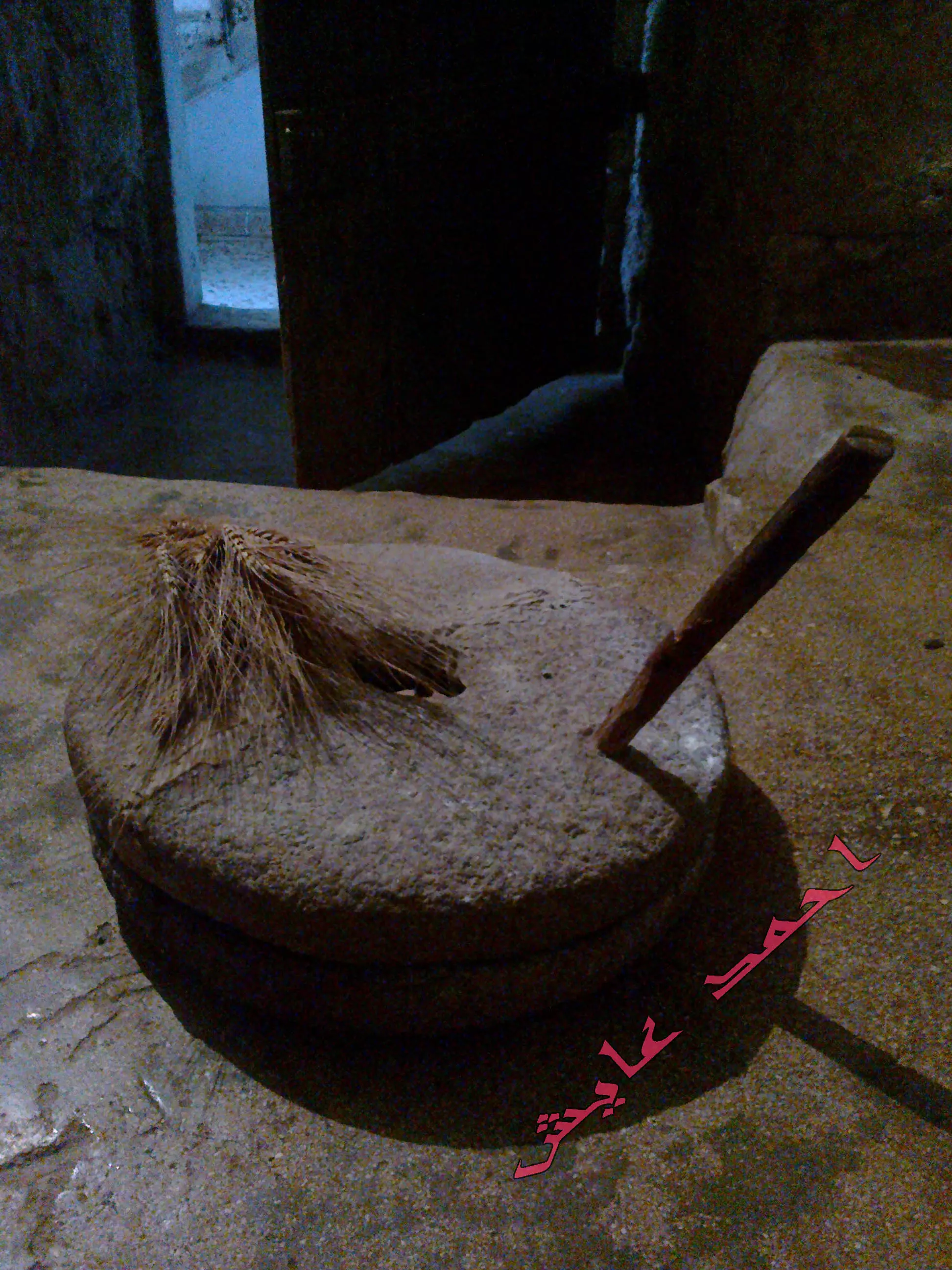
Posted by ابو عايش - صورة طاحونه من قرية بيت عور الفوقا عمرها200عام-بعدسة احمد عايش
Posted by ابو عايش - صورة من الجهة الشرقيه لشارع البلدة المؤدي لمدينة رام الله -بعدسة احمد عايش

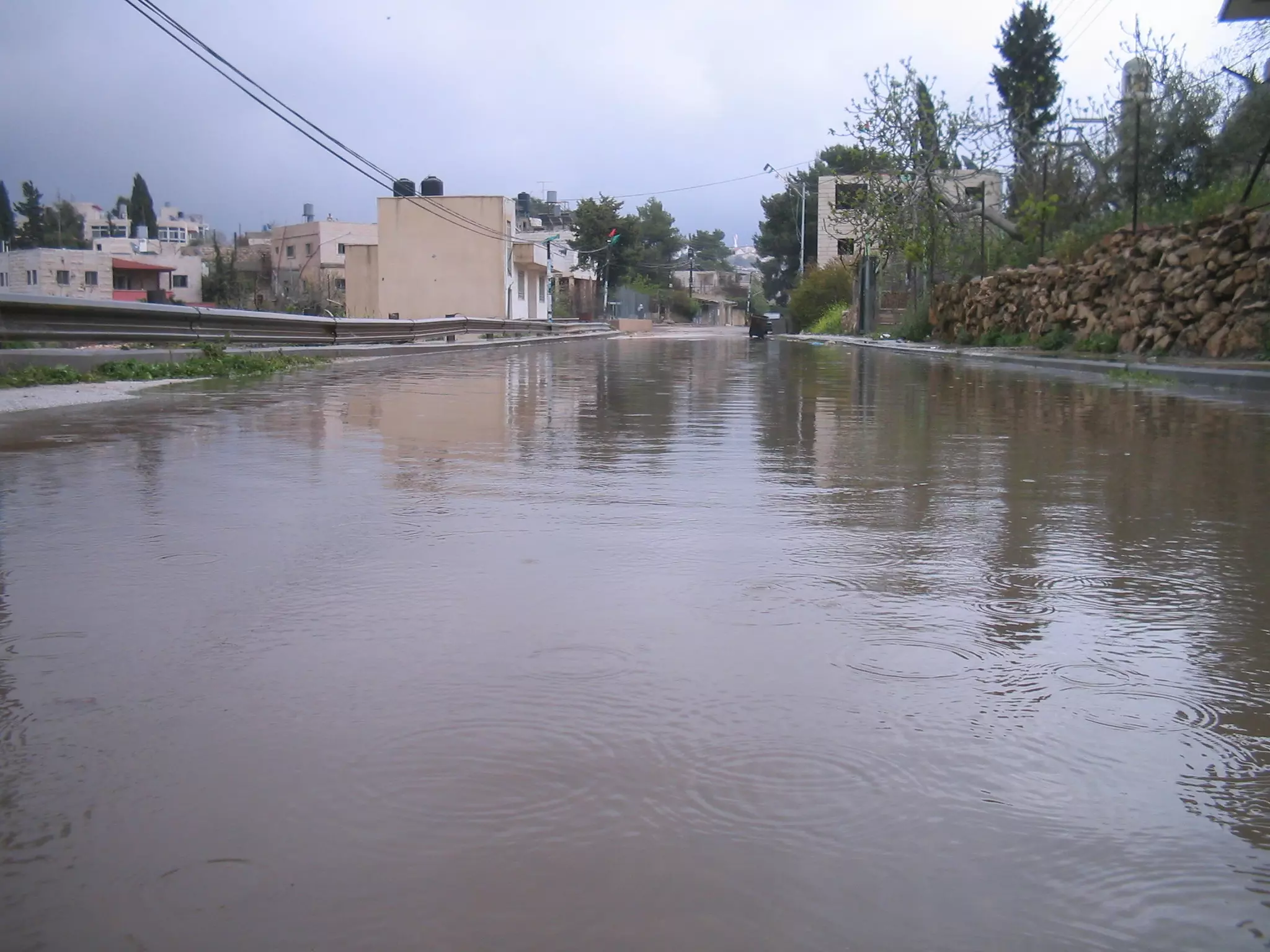
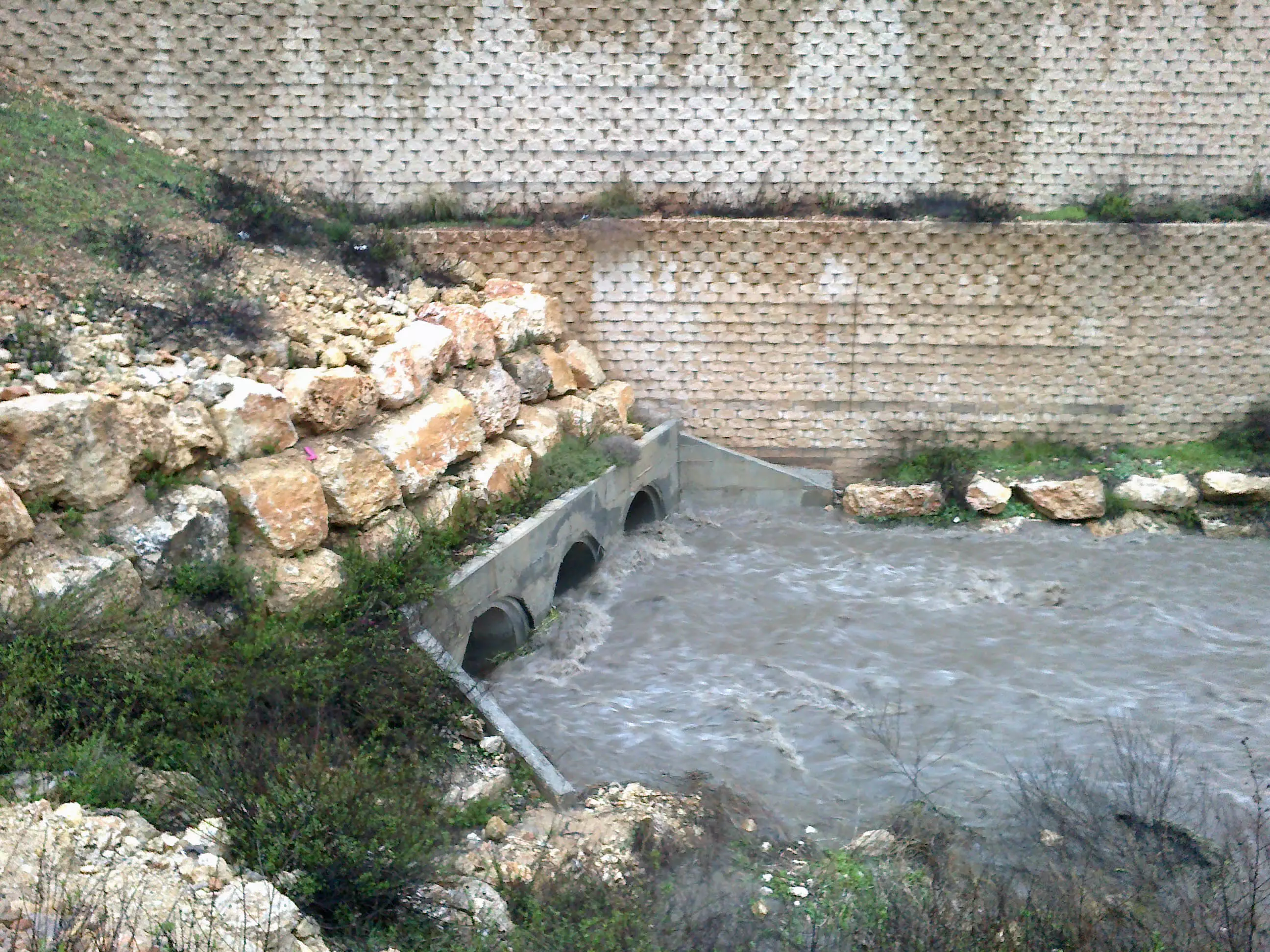
Posted by ابو عايش - صورة من الجهة الجنوبيه للبلده في الاجواء الماطرة ولتجمع مياة الشتاء في وادي البلدة -بعدسة احمد عايش
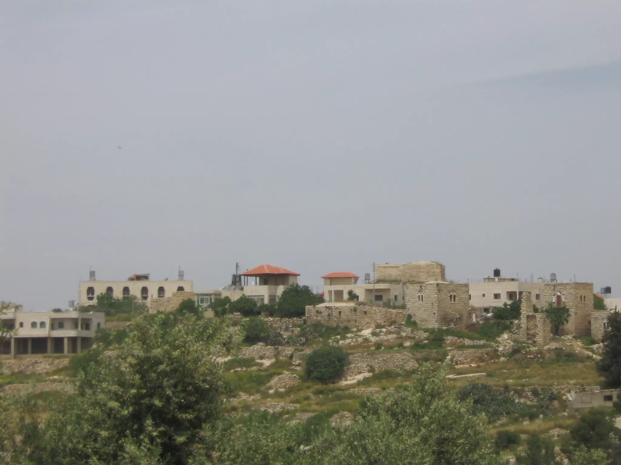
Posted by ابو عايش - صورة للبلدة من الجهه الشرقيه لبيت عور الفوقا-احمد عايش
Posted by ابو عايش - صورة لوسط البلد بعدسة احمد عايش
Posted by ابو عايش - صورة من الجهة الجنوبية للبلدة --بعدسة احمد عايش
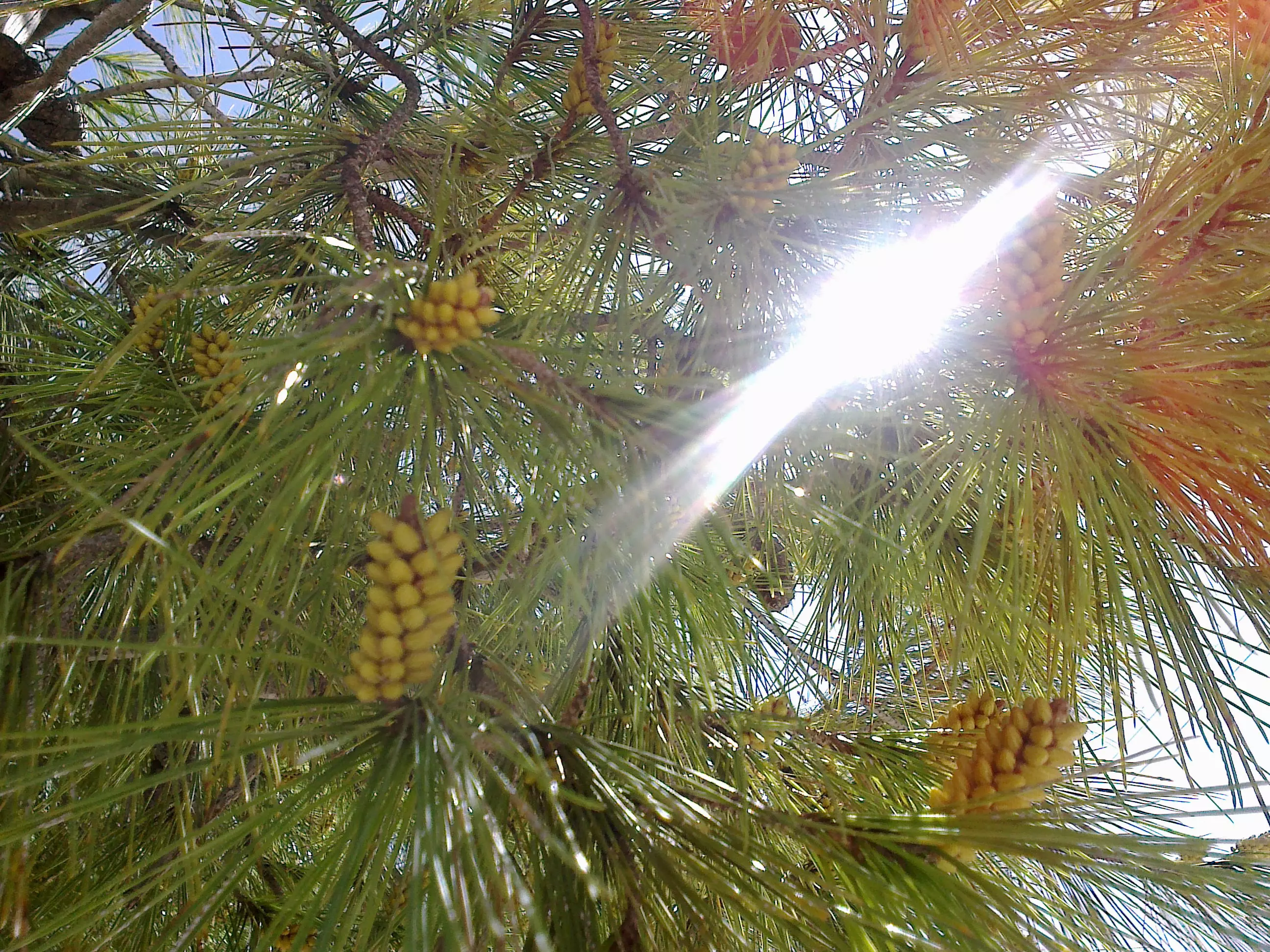
Posted by ابو عايش - صورة لشجرة الصنوبر العملاقه في بلدة بيت عور الفوقا -بعدسة احمد عايش
Posted by ابو عايش - صور ة من الحارة الشرقيه - كرنة الحمص -بعدسة احمد عايش
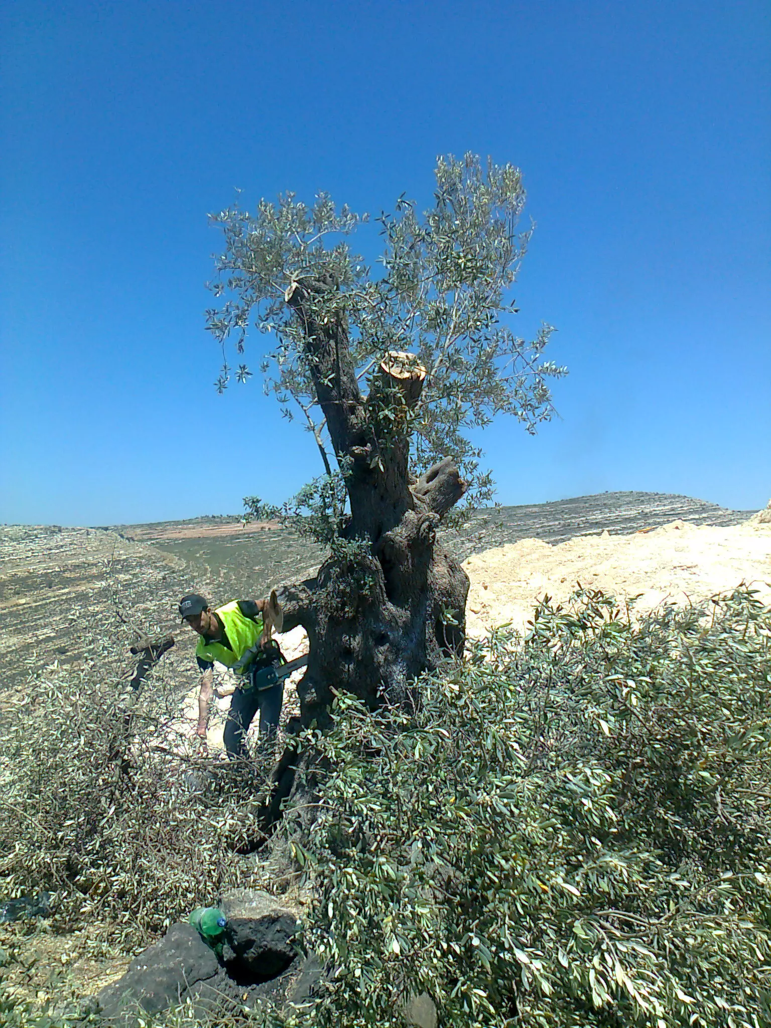
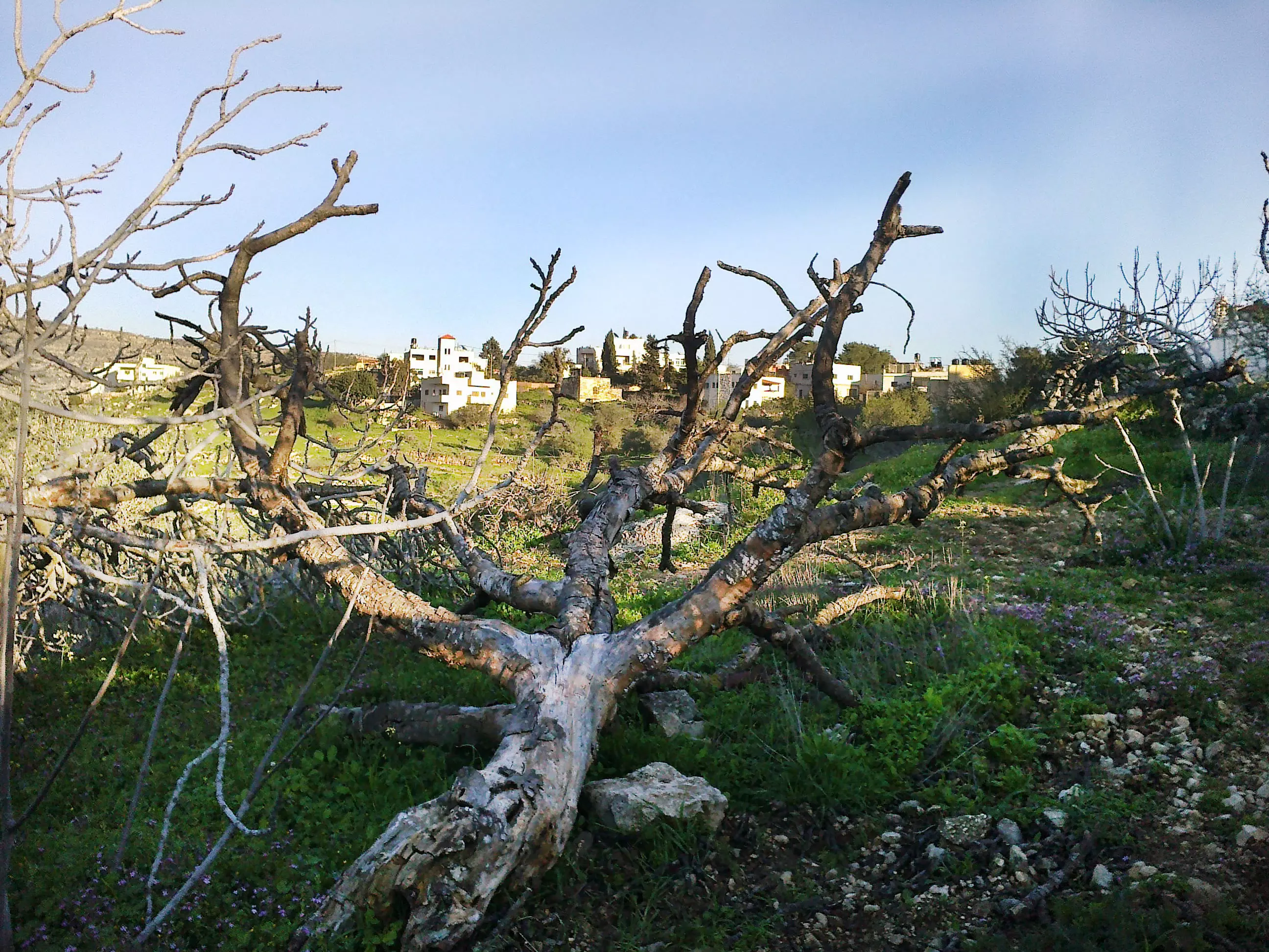
Posted by ابو عايش - صورة لشجرة زيتون معمرة عمرها ما يقارب 2000عام -تم اقتلاعها من الايدي الغادر الصهيونية-بيت عور الفوقا -بعدسة احمد عايش
Posted by ابو عايش - صورة للبلدة من الجهه الشرقيه لبيت عور الفوقا-بعدسة-احمد عايش
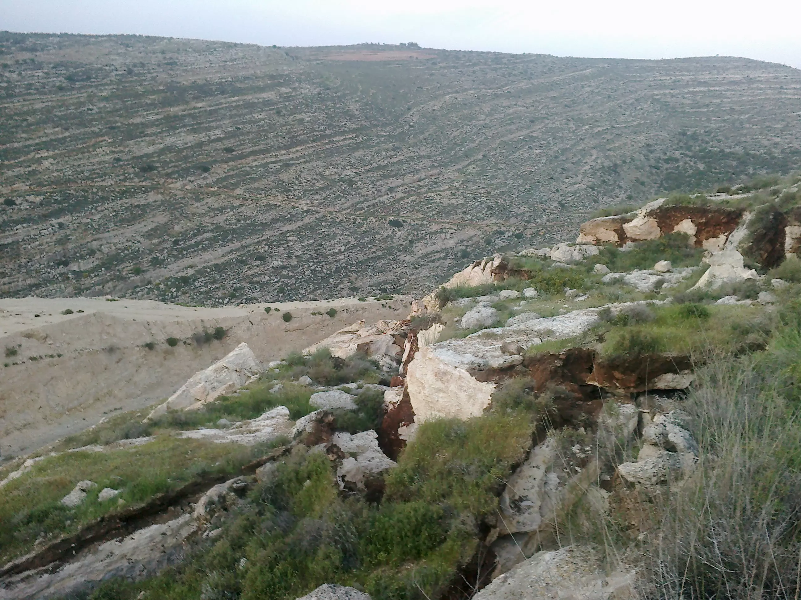
Posted by ابو عايش - صور للانهيارت على الشارع المؤدي لمدينة رام الله بيت عور الفوقا-بعدسة احمد عايش
Posted by ابو عايش - صورة لبيت قديم في وسط البلدة-بعدسة احمد عايش
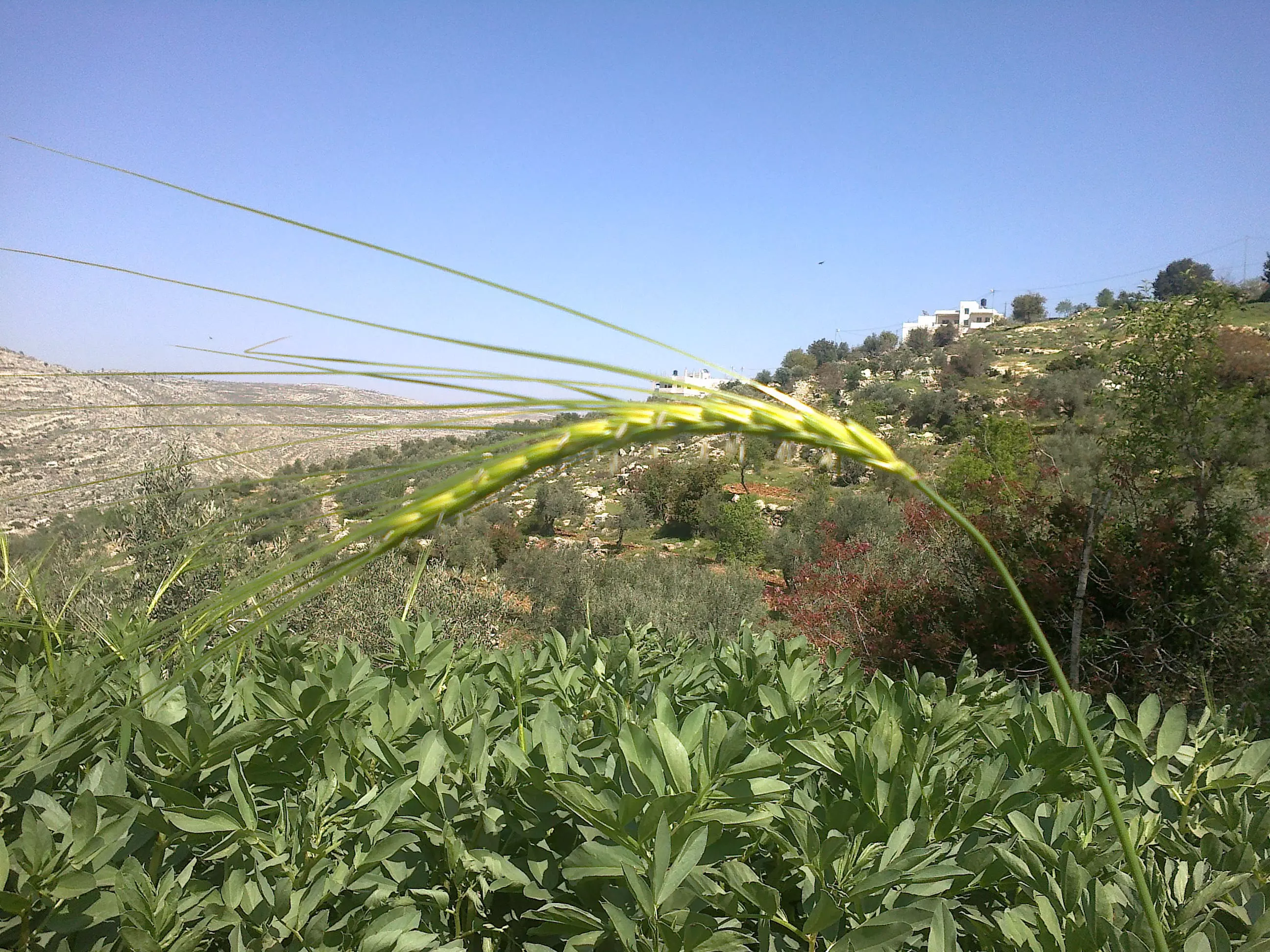
Posted by ابو عايش - صورة سنبلة قمح في بلدة بيت عور الفوقا -بعدسة محمد عايش
Posted by ابو عايش - صورة من قلب بيت عور الفوقا -بعدسة احمد عايش
Posted by ابو عايش - صورة للبلدة من الجهه الشرقيه لبيت عور الفوقا-بعدسة-احمد عايش
Posted by ابو عايش - صورة منطار قديم في البلدة -راس المراح -بعدسة احمد عايش
Posted by ابو عايش - صورة لطابون في القرية -الحارة الشرقيه -بعدسة احمد عايش
Posted by ابو عايش - صورة للحارة الشمالية لقرية بيت عور الفوقا-بعدسة محمد عايش
Posted by ابو عايش 1 - صورة من الجهة الشمالية من بلدة- بعدسة احمد عايش
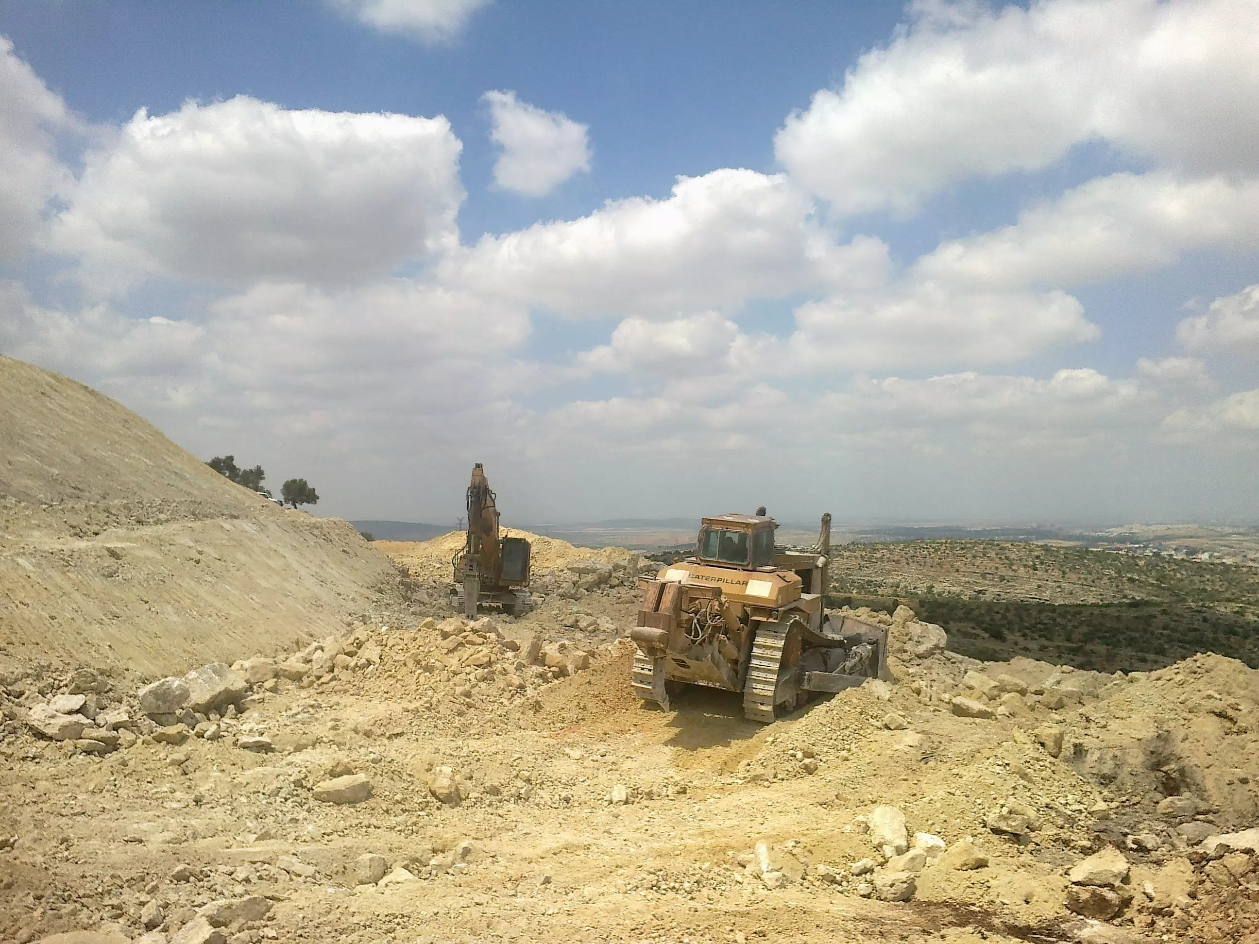
Posted by ابو عايش - صورة لاليات عسكرية اسرائيلية-تفحر الطريق لحق الملكية - بعدسة محمد عايش
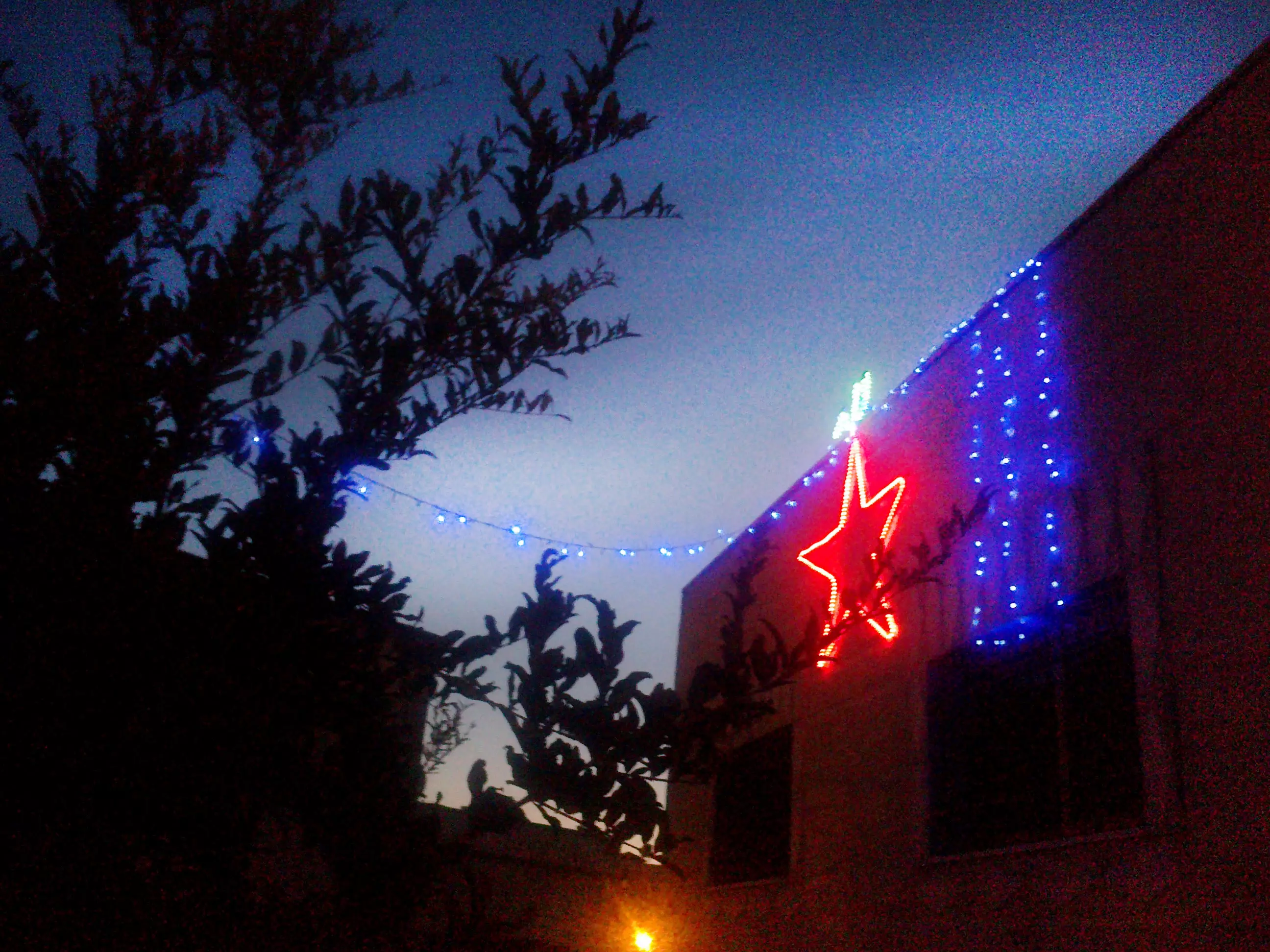
Posted by ابو عايش - الاجواء الرمضانية في قرية بيت عور الفوقا -بعدسة احمد عايش
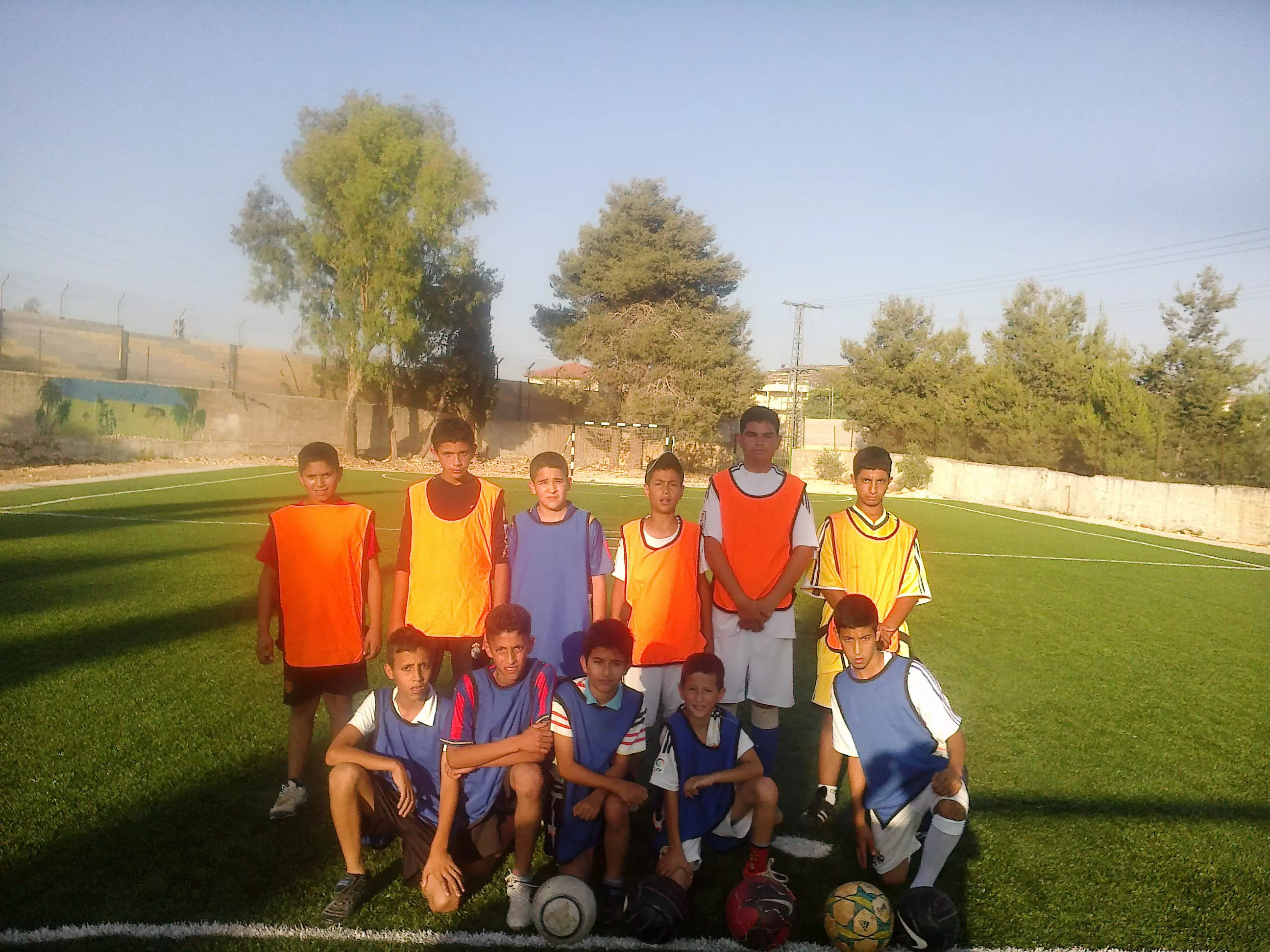
Posted by ابو عايش - صورة لنادي اشبال بيت عور الفوقا -بكميرة احمد عايش
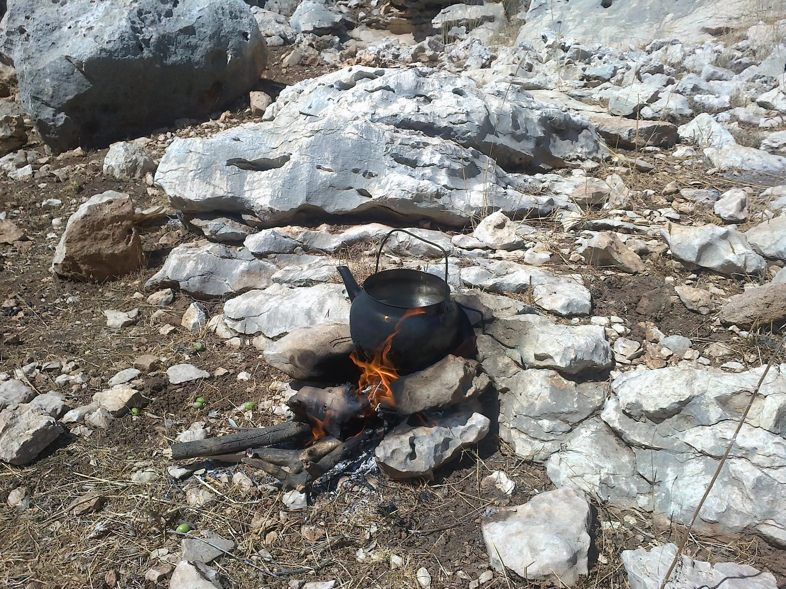
Posted by ابو عايش 1 - صورة لابريق شاي في موسم قطف الزيتون -بيت عور الفوقا -بعدسة احمد عايش
Posted by ابو عايش 1 - صورة من وسط البلد -بعدسة محمد عايش

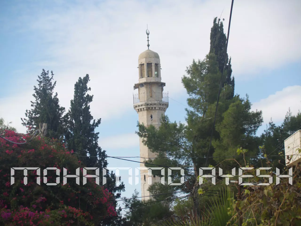
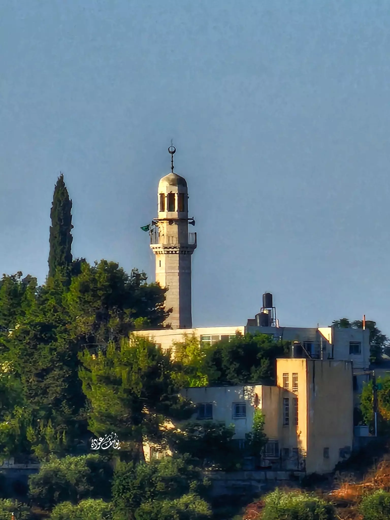
Posted by ابو عايش - صورة لمسجد بيت عور الفوقا -بعدسة محمد عايش
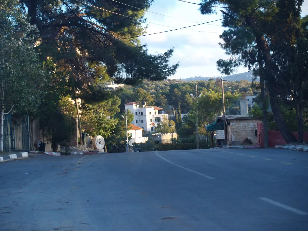
Posted by ابو عايش - صورة من وسط البلد -بعدسة محمد عايش
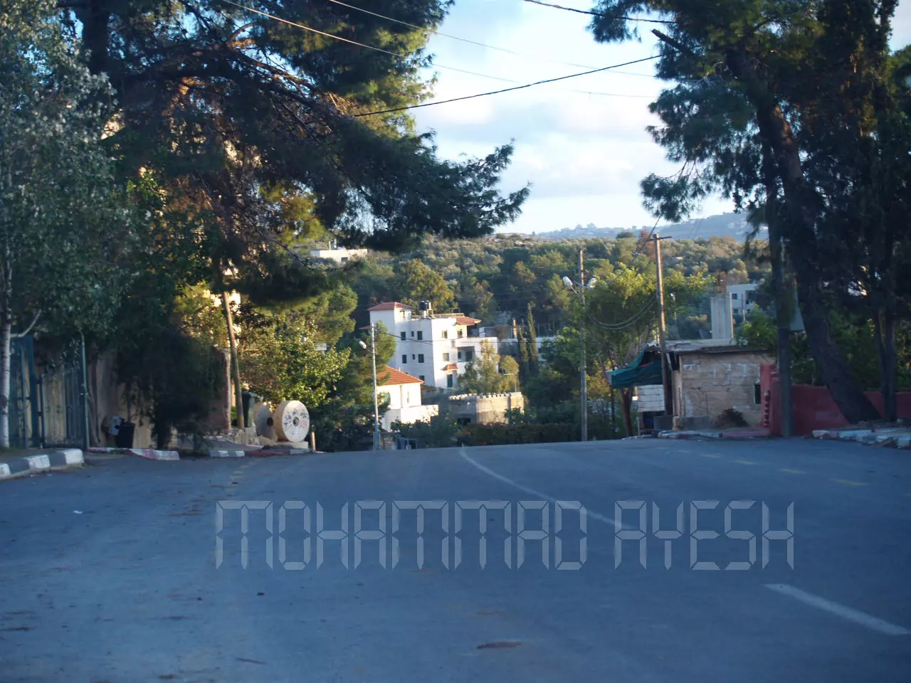
Posted by ابو عايش - صورة من وسط البلد -بعدسة محمد عايش
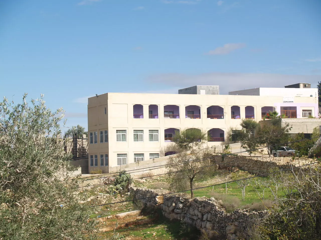
Posted by ابو عايش - صورة لمدرسة بيت عور الفوقا -بعدسة محمد عايش
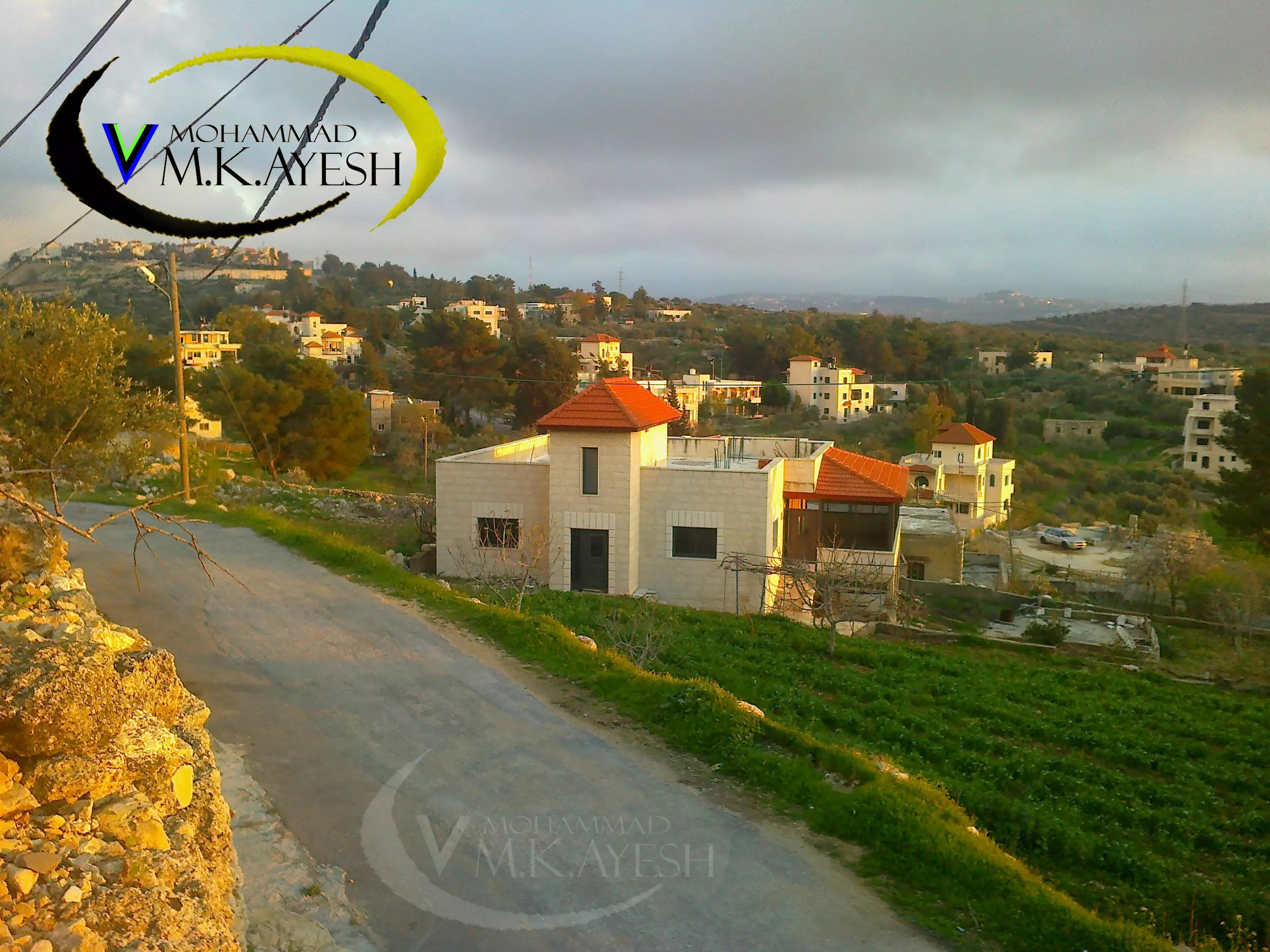
Posted by ابو عايش - صور لقرية بيت عور الفوقا -بعدسة محمد عايش
Posted by ابو عايش - صورة لمدرسة بيت عور الفوقا -بعدسة محمد عايش

Posted by ابو عايش - صولرة للبرج - بعدسة محمد عايش
Posted by ابو عايش - صور لحارة النجوم -بيت عور الفوقا
Posted by ابو عايش - صورة لشجرة الوز -بعدسة احمد عايش
Posted by ابو عايش - صورة للبلد - البركة - بيت عور الفوقا 1998
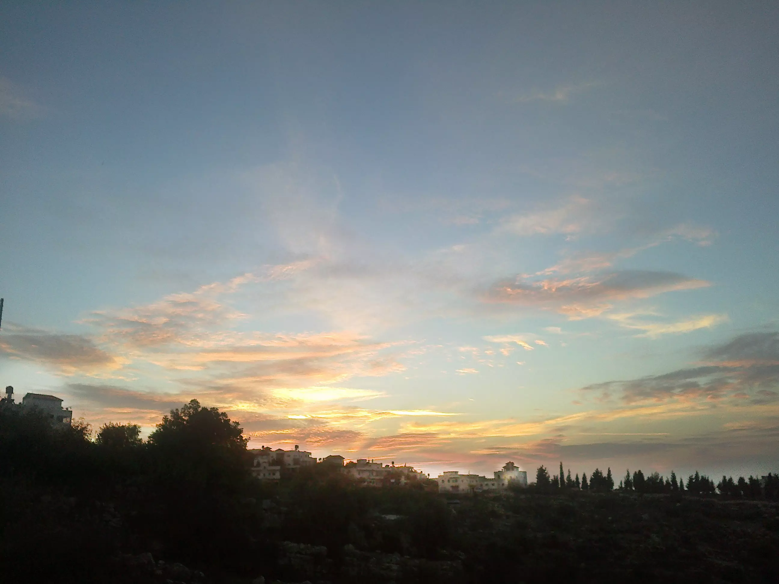
Posted by ابو عايش - صورة لشفق الاحمر يخيم على قرية بيت عور الفوقا- بعدسة احمد عايش
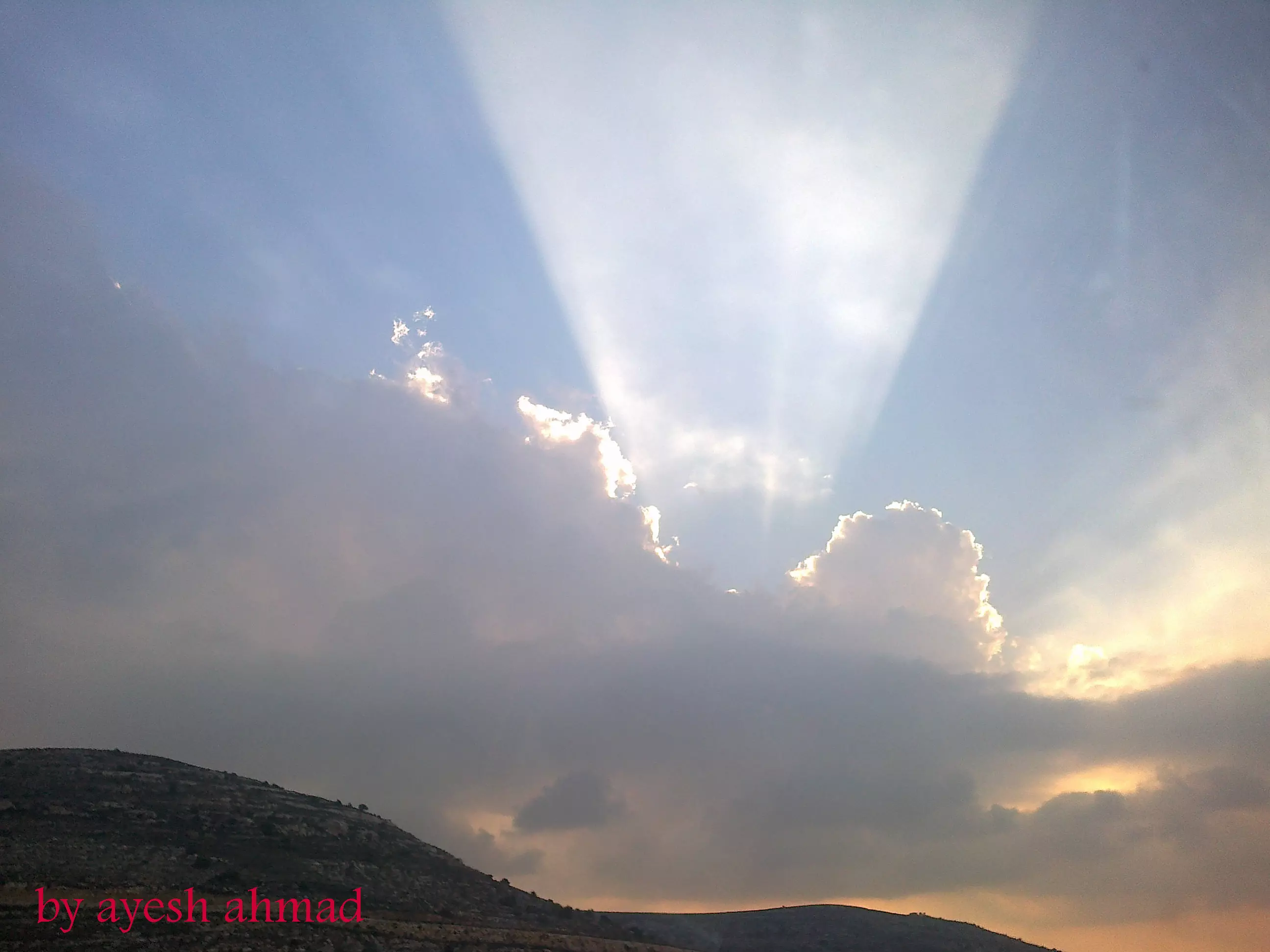
Posted by ابو عايش 2 - صورة من قلب بيت عور الفوقا -يخرج من خلف الغيوم شعاع الشمس- بعدسة احمد عايش
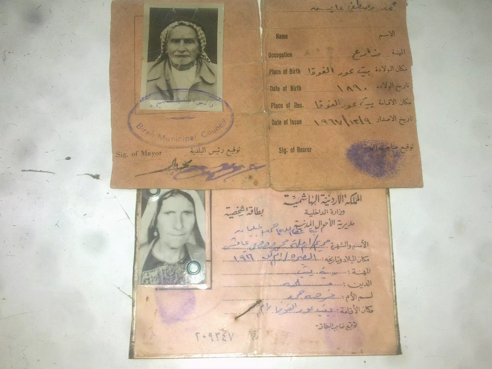
Posted by ابو عايش - صورة هوية قديمة لمواطن من بيت عور الفوقا - السيد محمد مصطفى عايش و زوجته-بعدسة عيسى الحاج
Posted by ابو عايش - صورة وردة نرجس برية في قرية بيت عور الفوقا بعدسة محمد عايش

Posted by ابو عايش - صور للبلدة من الجهة الجنوبية - بعدسة -محمد عايش
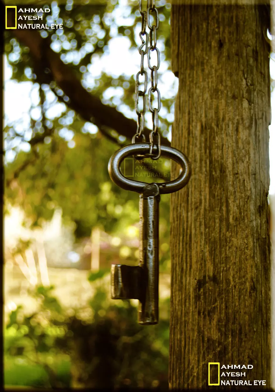
Posted by ابو عايش - صورة لمفتاح قديم يعود الى احد بيوت التي تم تهجير سكنها قصرا على ايادي العصابات الصهيونية هذا الفتاح من احد سكان بيت عور الفوقا.*\ بعدسة احمد عايش
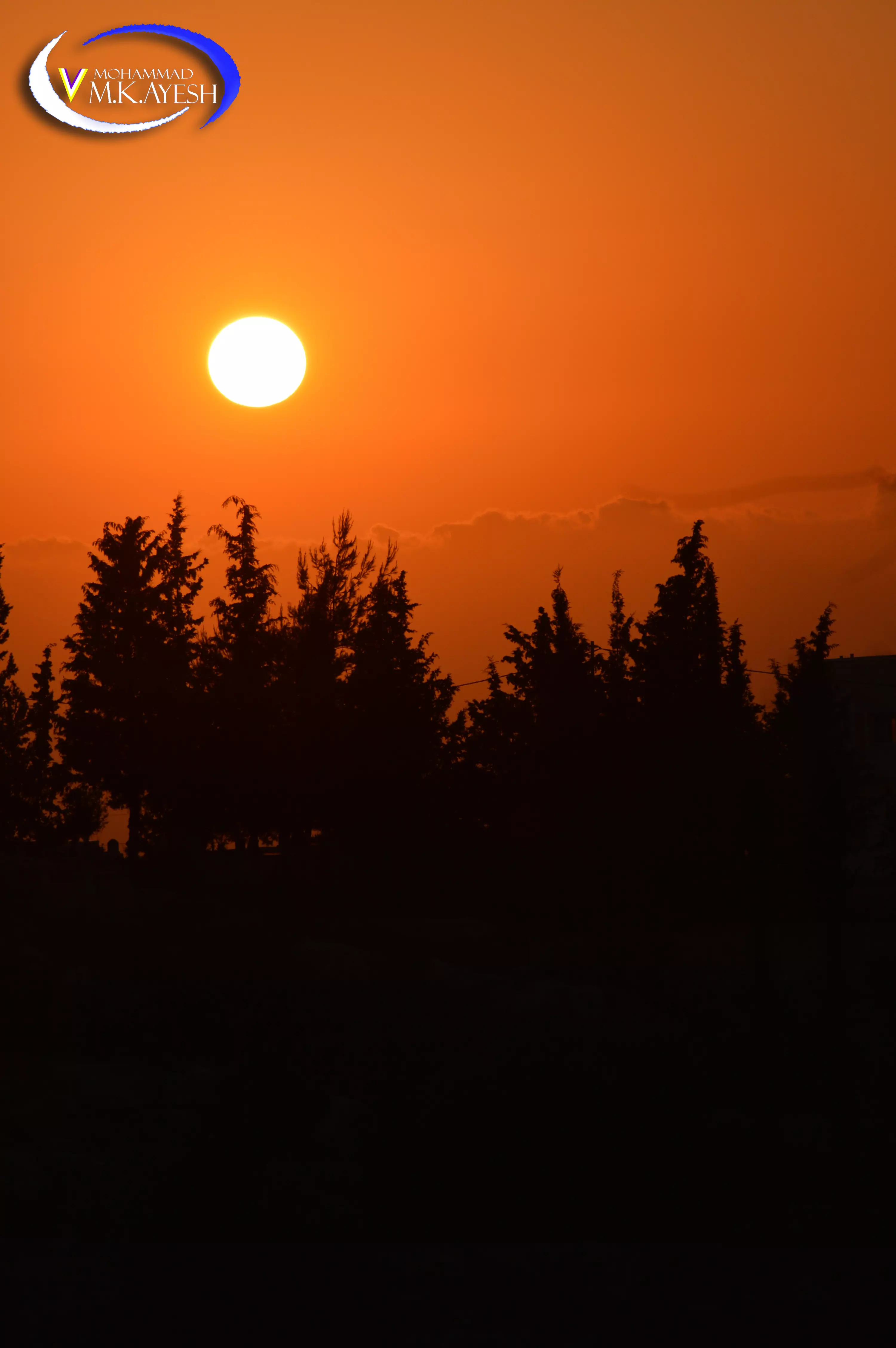
Posted by ابو عايش - صورة لغروب الشمس في قرية بيت عور الفوقا المطلة على سطح البحر - بعد سة محمد عايش
Posted by ابو عايش 1 - ادخلو ا على موقعنا على جروب شو ما بدك من بيت عور الفوقا -https://www.facebook.com/groups/mohammad2013/
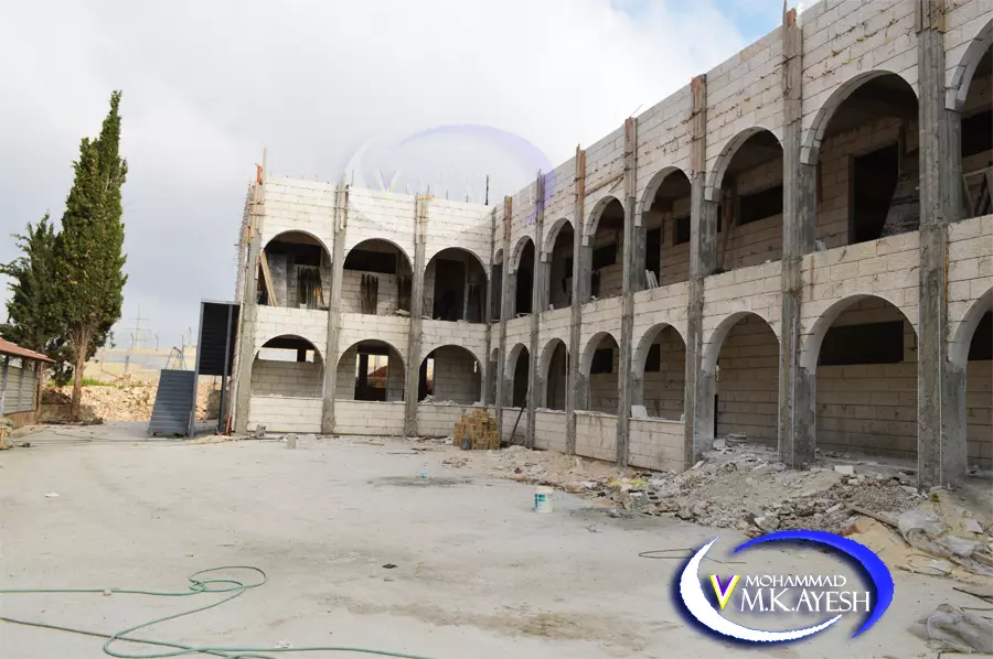
Posted by ابو عايش 1 - مدرسة الطيرة بيت عور الفوقا المختلطة قيد البناء 2013
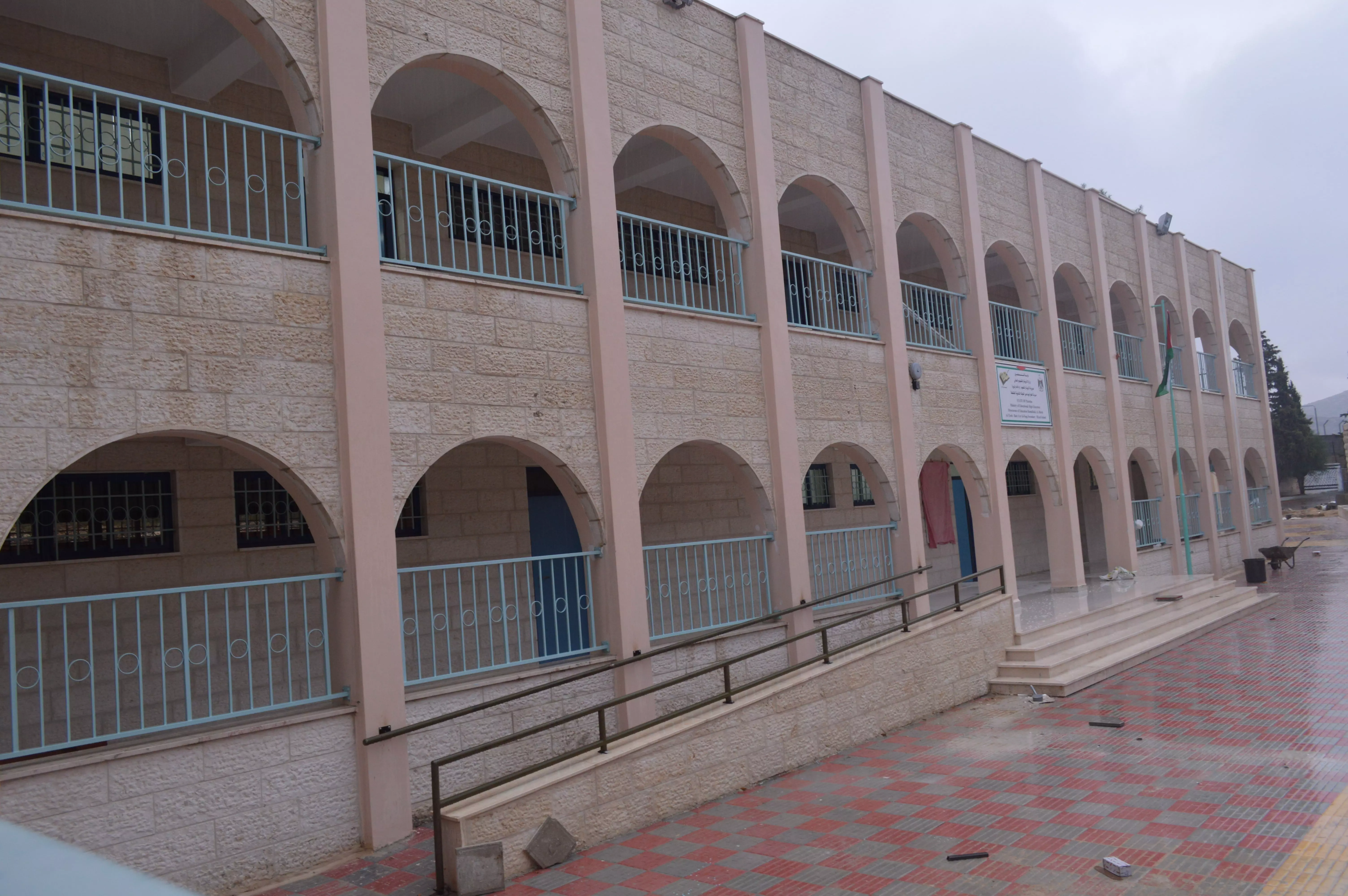
Posted by ابو عايش - مدرسة الطيرة بيت عور الفوقا المختلطة بعدسة محمد عايش
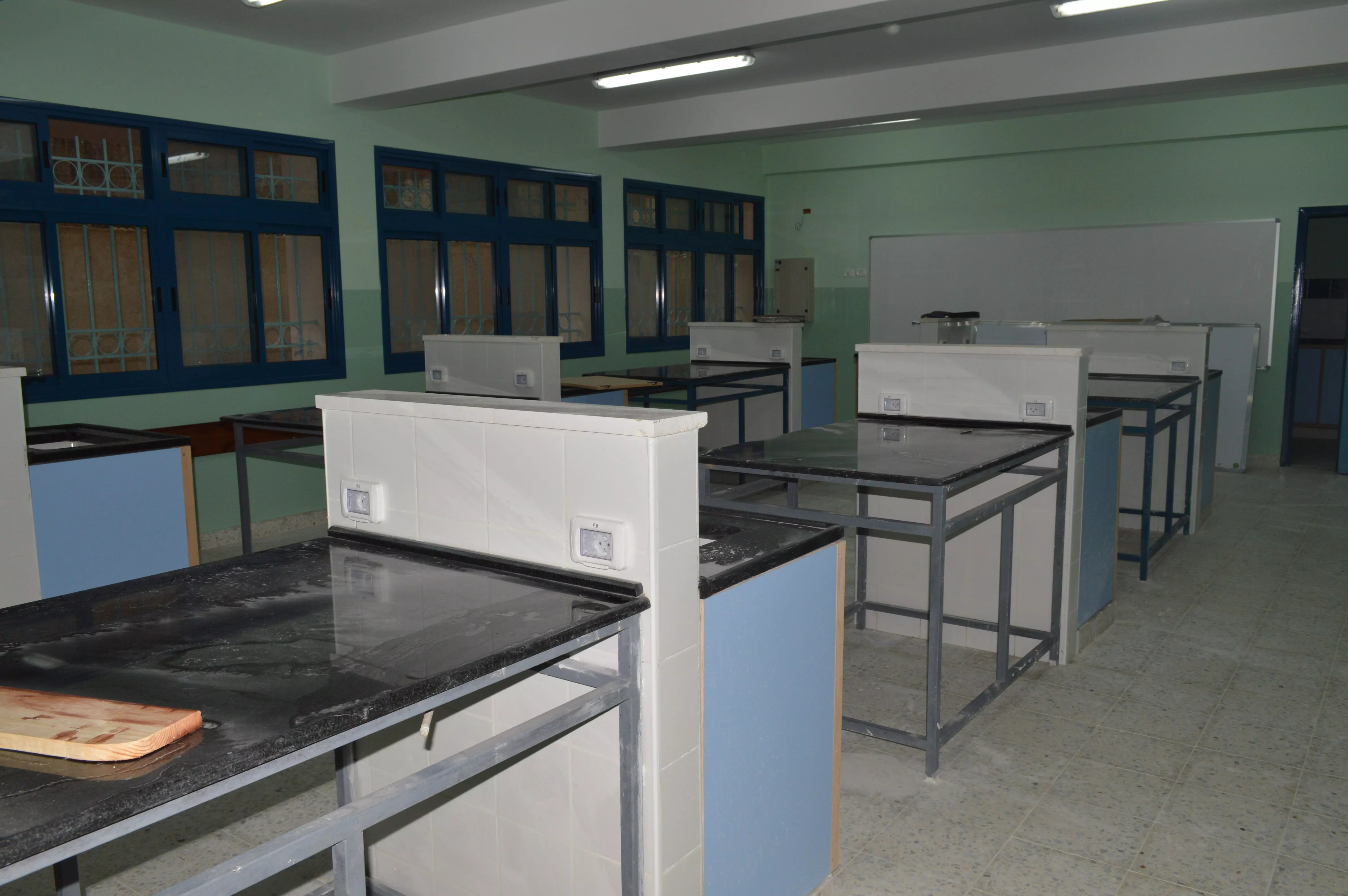
Posted by ابو عايش - المختبر في مدرسة الطيرة بيت عور الفوقا المختلطة - بعدسة بيت عور الفوقا
Posted by ابو عايش 1 - الساحل الغربي من قرية بيت عور الفوقا- بعدسة محمد عايش
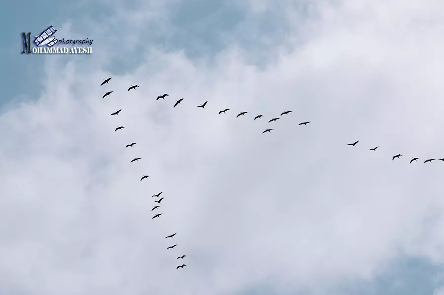
Posted by ابو عايش - الطيور المهاجرة في سماء بيت عور الفوقا - بعدسة محمد عايش
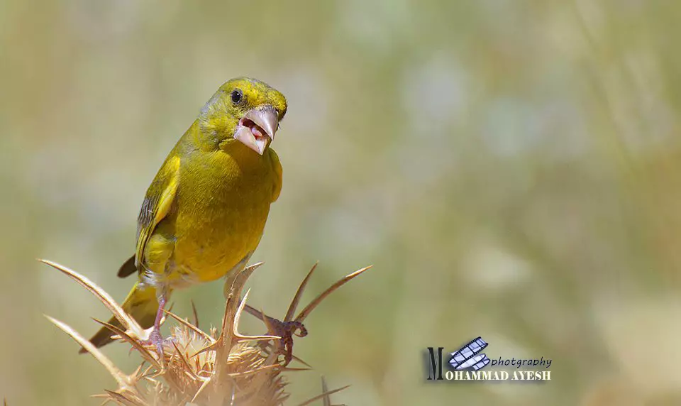
Posted by ابو عايش 2 - العصفور الاصفر من قلب بيت عور الفوقا -المقبرة - بعدسة محمد عايش
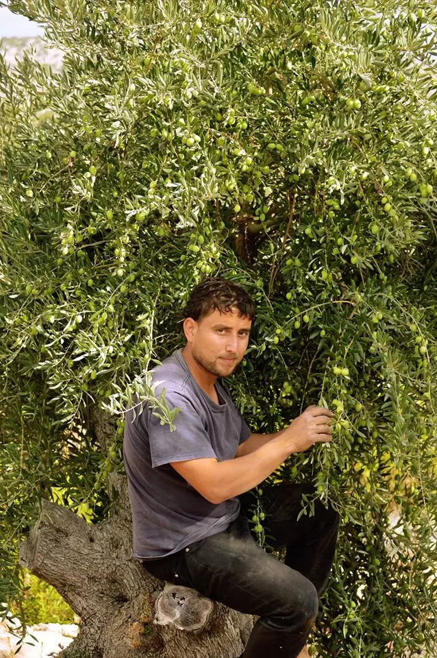
Posted by ابو عايش - موسم قطف الزيتون - بيت عور الفوقا - بعدسة ابو عايش
Posted by ابو عايش - صوره قديمه من بيت عور الفوقا
Posted by abu raya - منظر عام لقريه بيت عور الفوقا سنه 1932
Posted by abu raya - صوره قديمه من الجو لقريه بيت عور الفوقا
Posted by abu raya - صوره قديمه من القريه
Posted by abu raya - صوره من وسط البلد
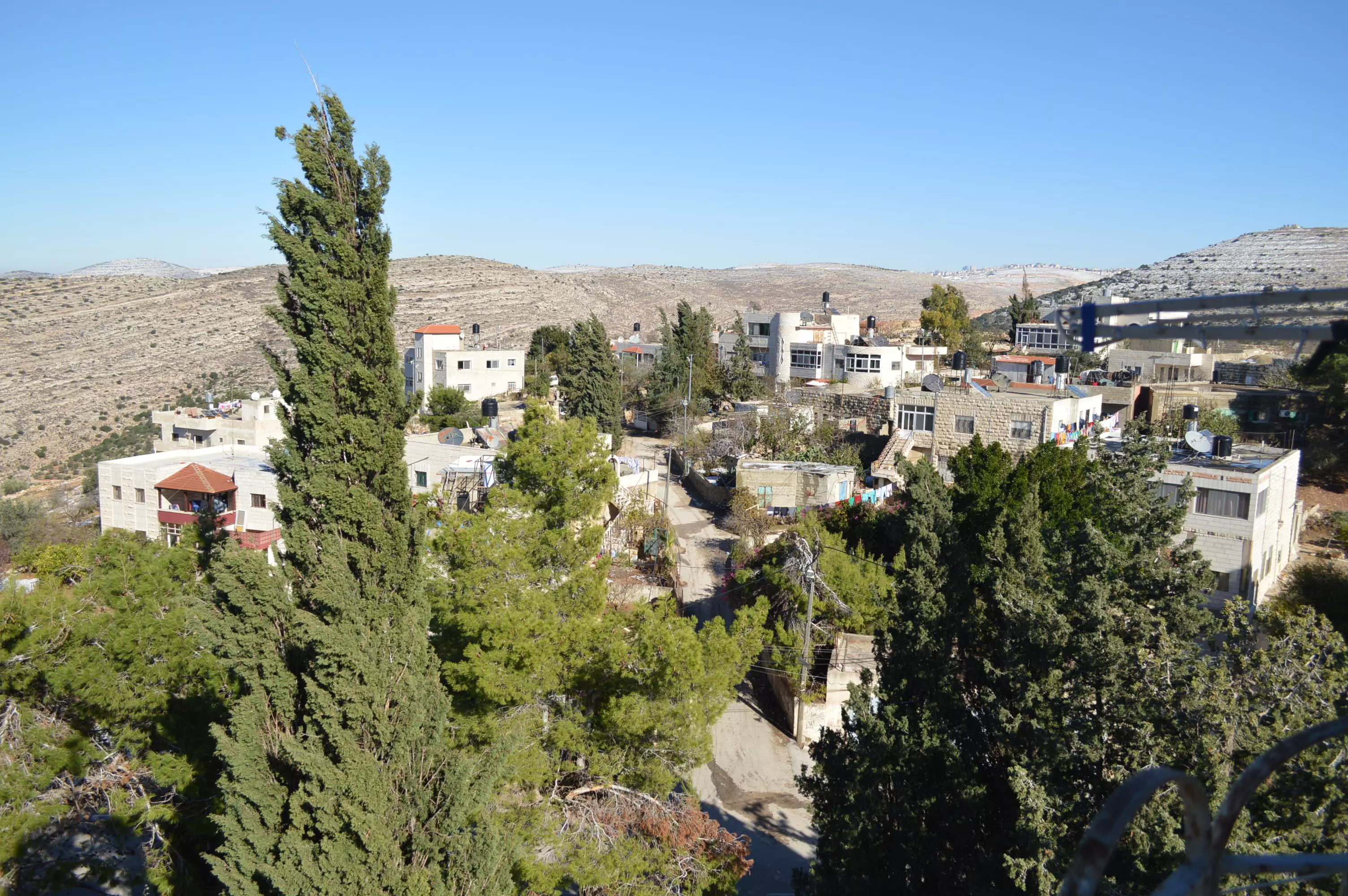
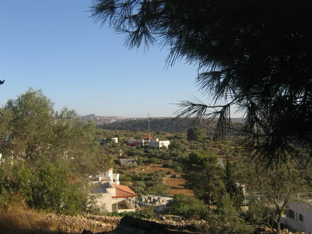
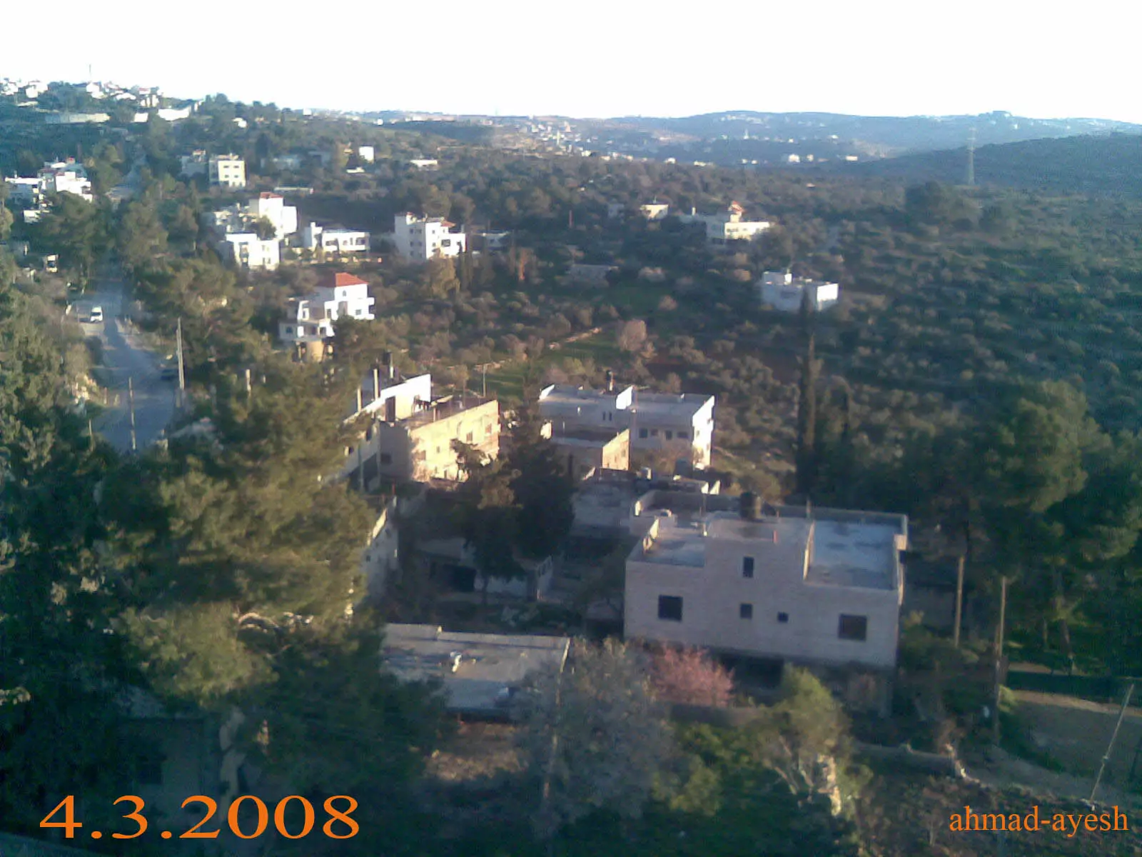
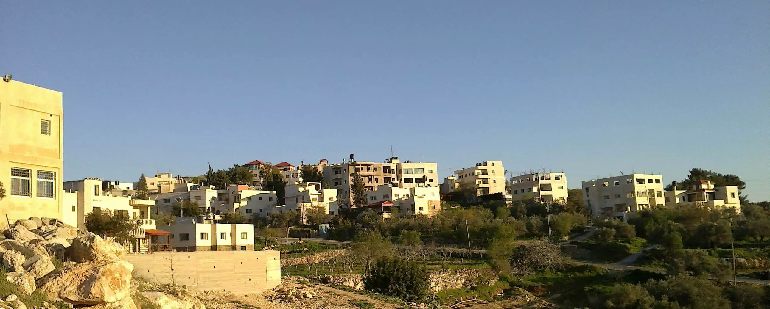
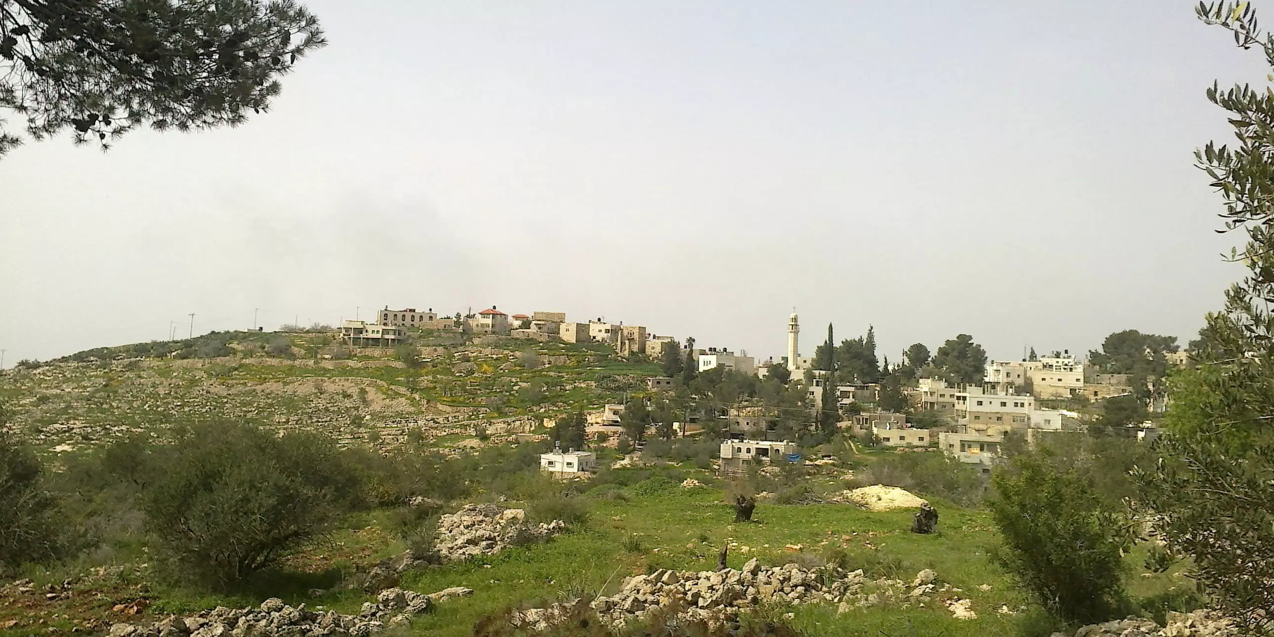
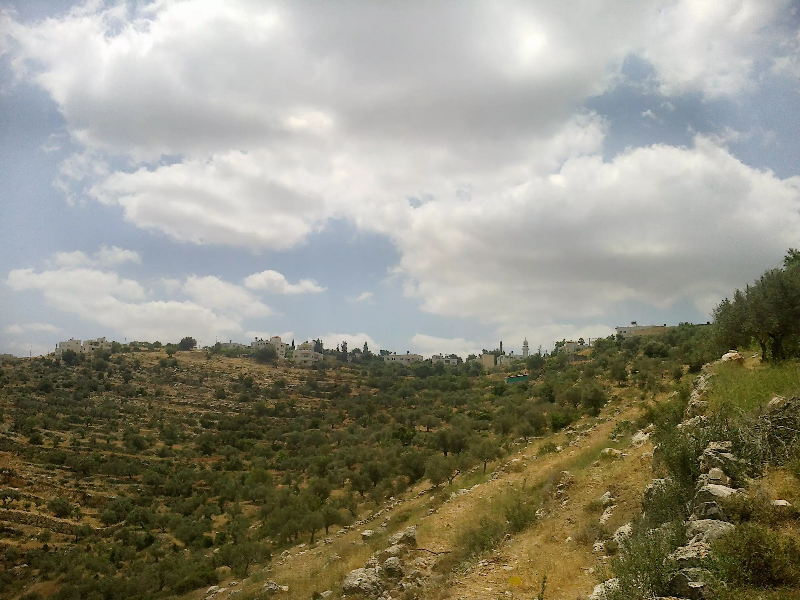
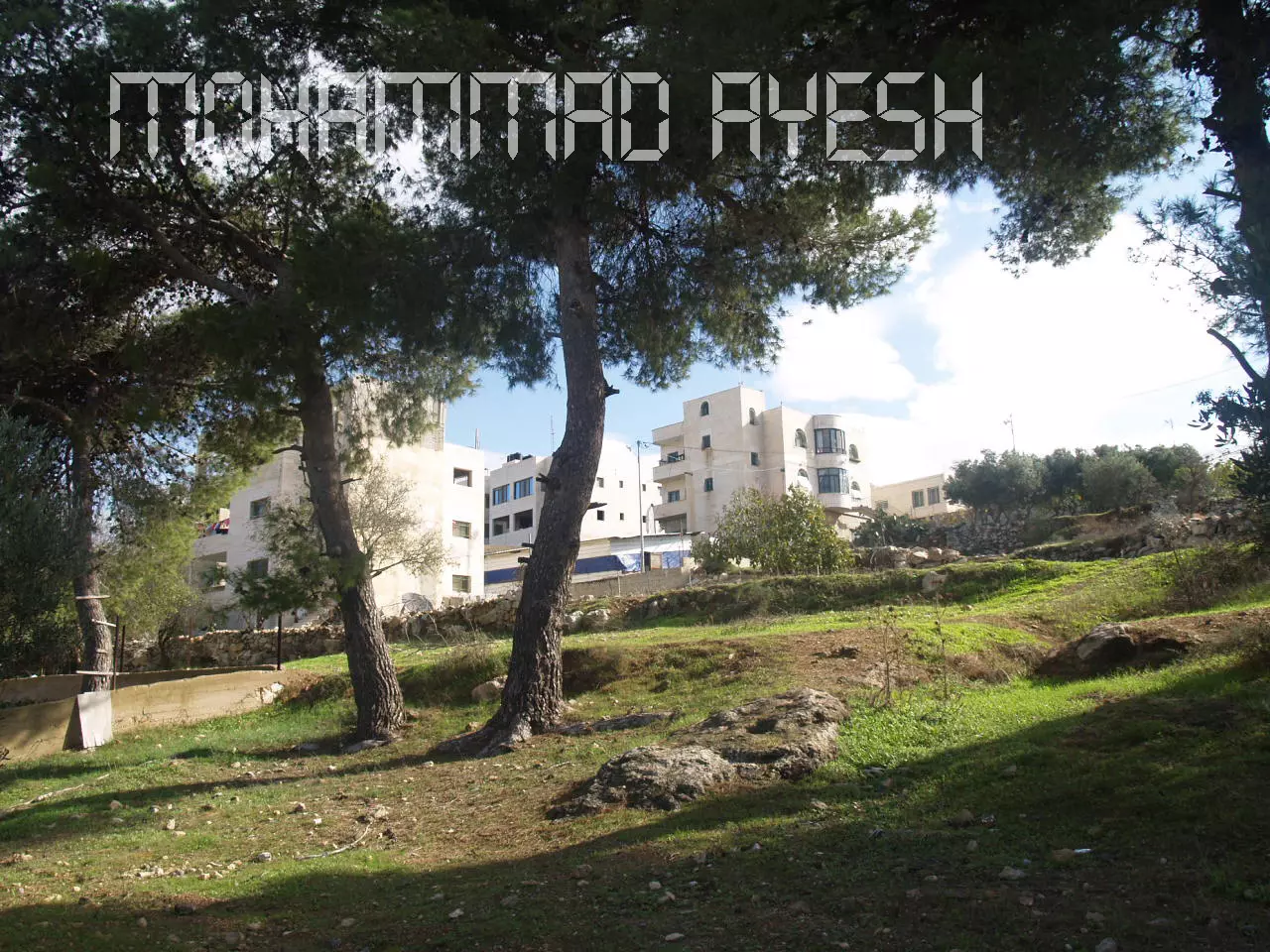
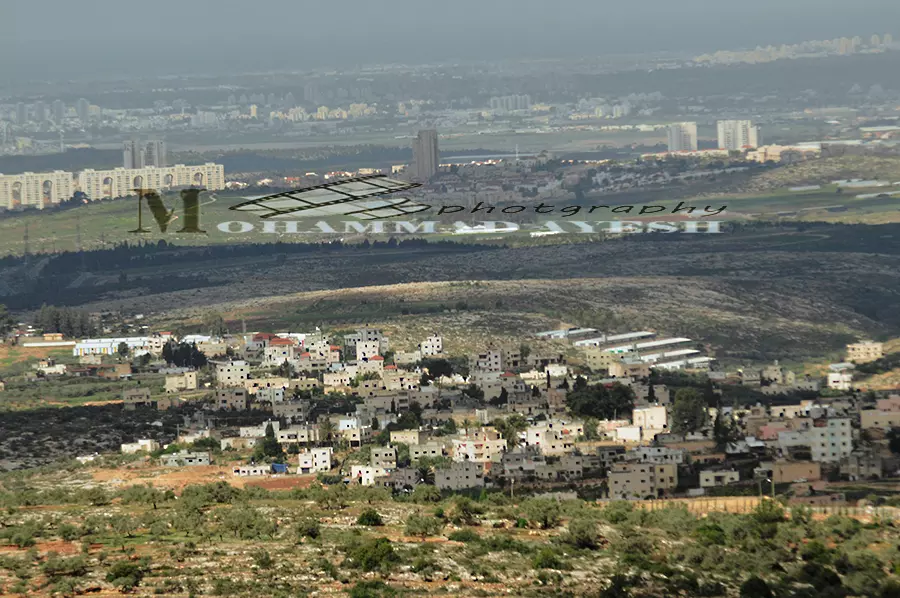
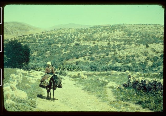
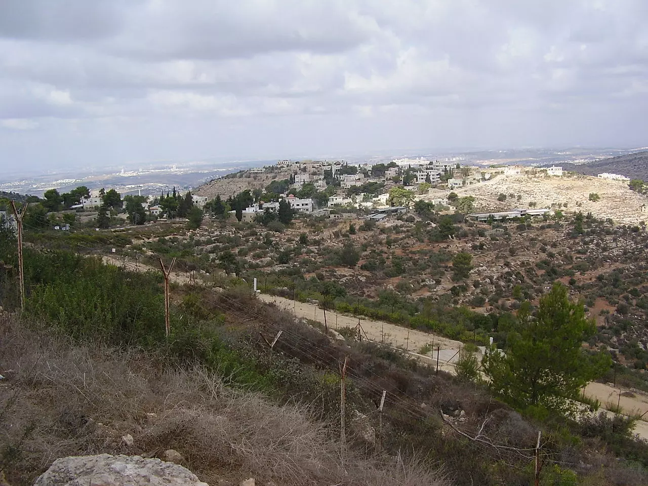
Posted by ابو عايش - منظر عام
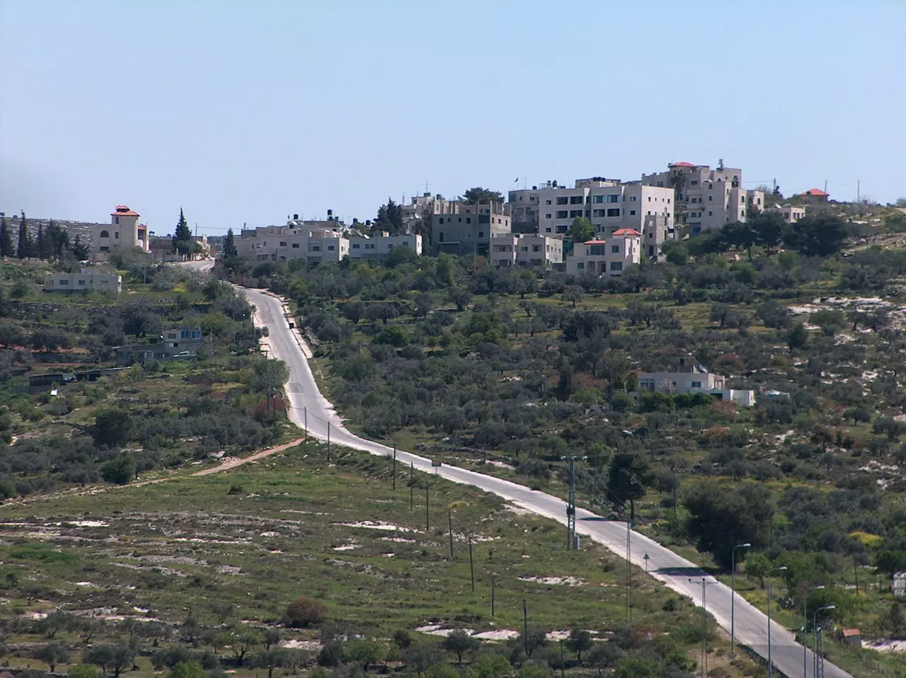
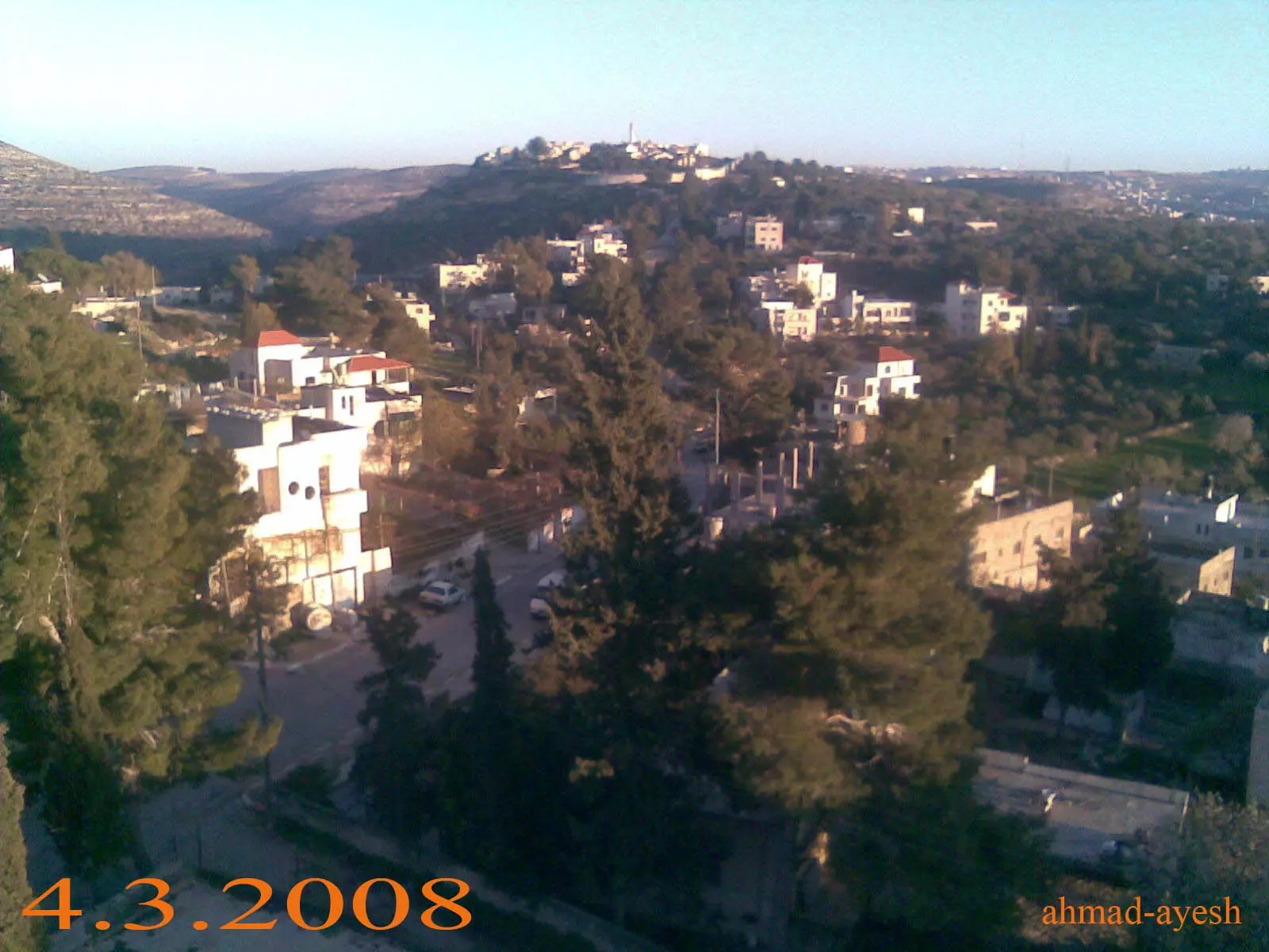
- منظر عام #2
- صورة نادرة وساحرة لبيت عور الفوقا قضاء رام الله بين عام 1934-1939..
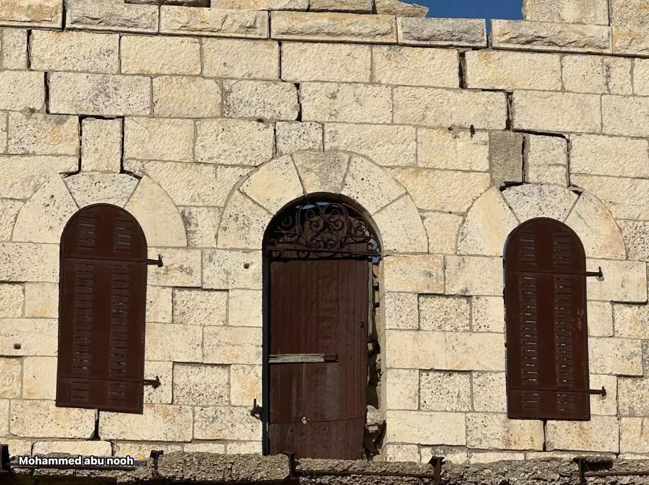
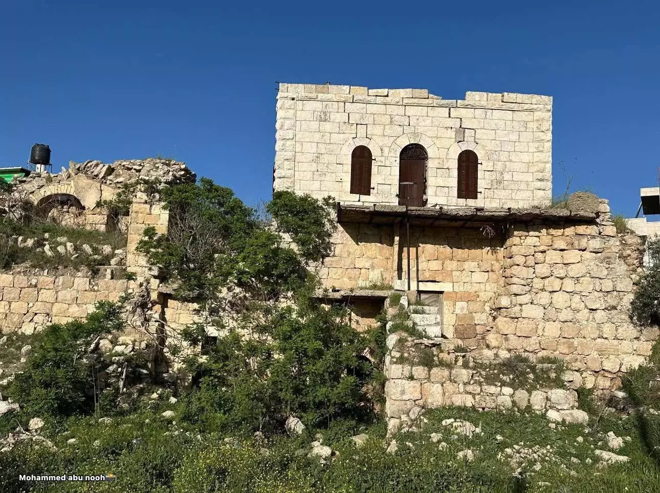
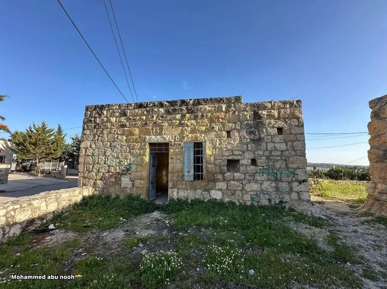
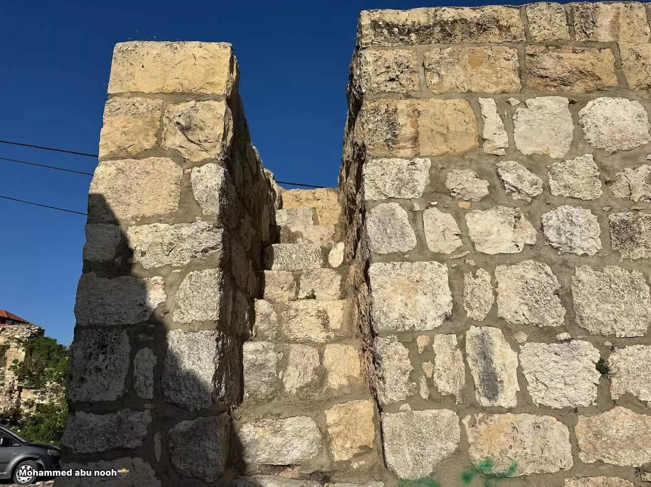
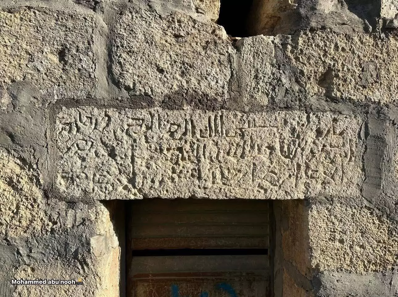
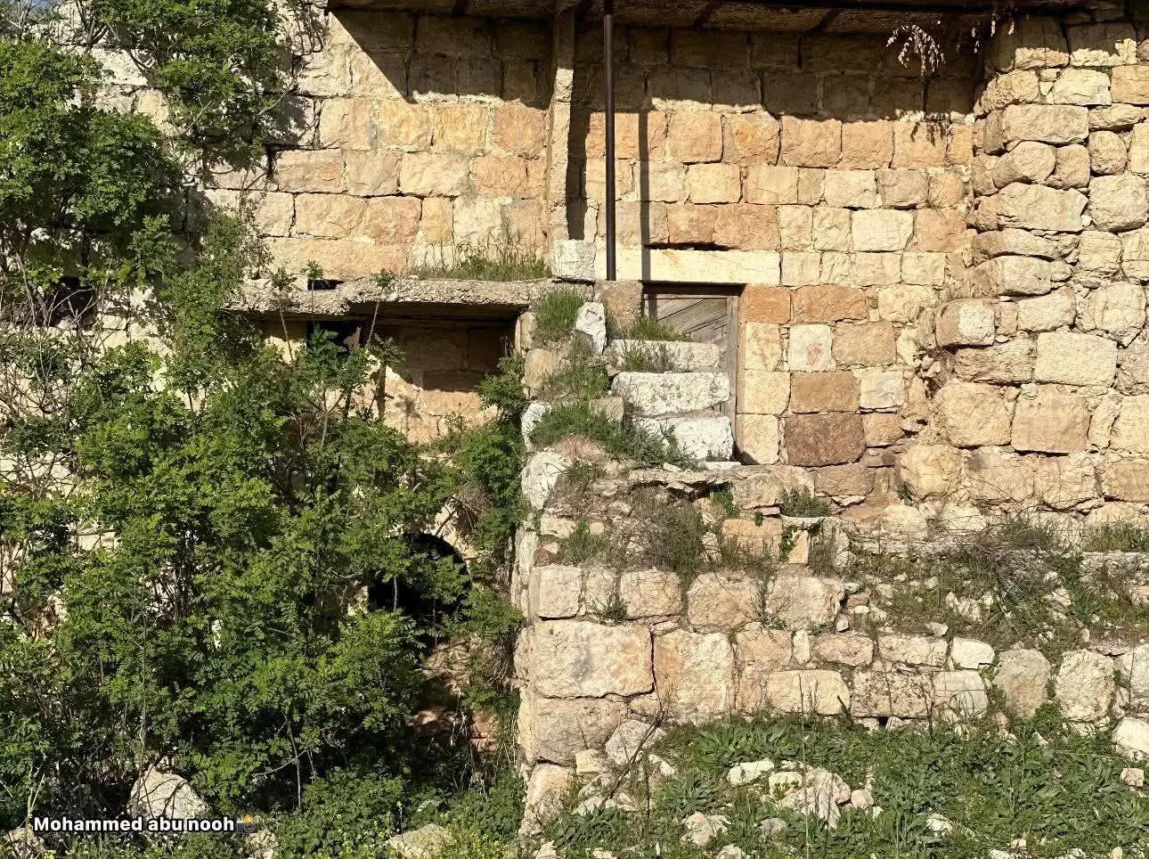
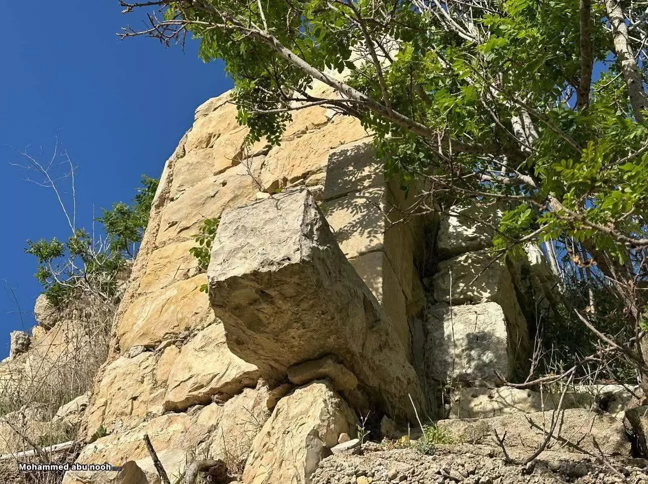
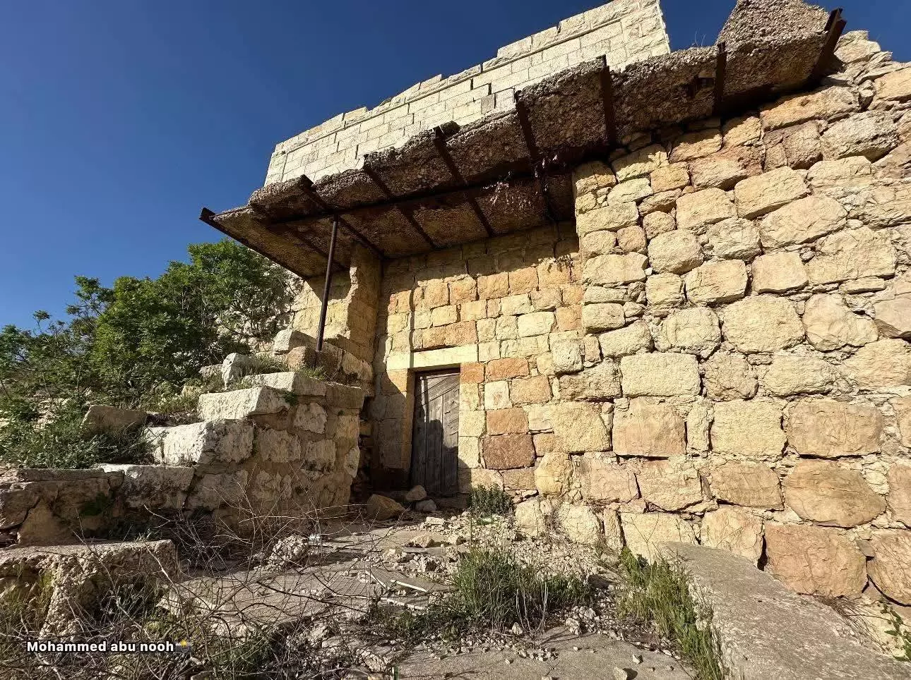
- صور للبلدة القديمة ببلدة بيت عور الفوقا بعدسة: محمد ابو نوح
- صور للبلدة القديمة ببلدة بيت عور الفوقا بعدسة: محمد ابو نوح #2
- صور للبلدة القديمة ببلدة بيت عور الفوقا بعدسة: محمد ابو نوح #3
- صور للبلدة القديمة ببلدة بيت عور الفوقا بعدسة: محمد ابو نوح #4

- صور للبلدة القديمة ببلدة بيت عور الفوقا بعدسة: محمد ابو نوح #5
- صور للبلدة القديمة ببلدة بيت عور الفوقا بعدسة: محمد ابو نوح #6
- صور للبلدة القديمة ببلدة بيت عور الفوقا بعدسة: محمد ابو نوح #7
- صور للبلدة القديمة ببلدة بيت عور الفوقا بعدسة: محمد ابو نوح #8
- صور للبلدة القديمة ببلدة بيت عور الفوقا بعدسة: محمد ابو نوح #9
- جولة رائعة بين بيوت القرية القديمة -- Yousif Odeh
- جولة رائعة بين بيوت القرية القديمة -- Yousif Odeh #2

- جولة رائعة بين بيوت القرية القديمة -- Yousif Odeh #3
- جولة رائعة بين بيوت القرية القديمة -- Yousif Odeh #4

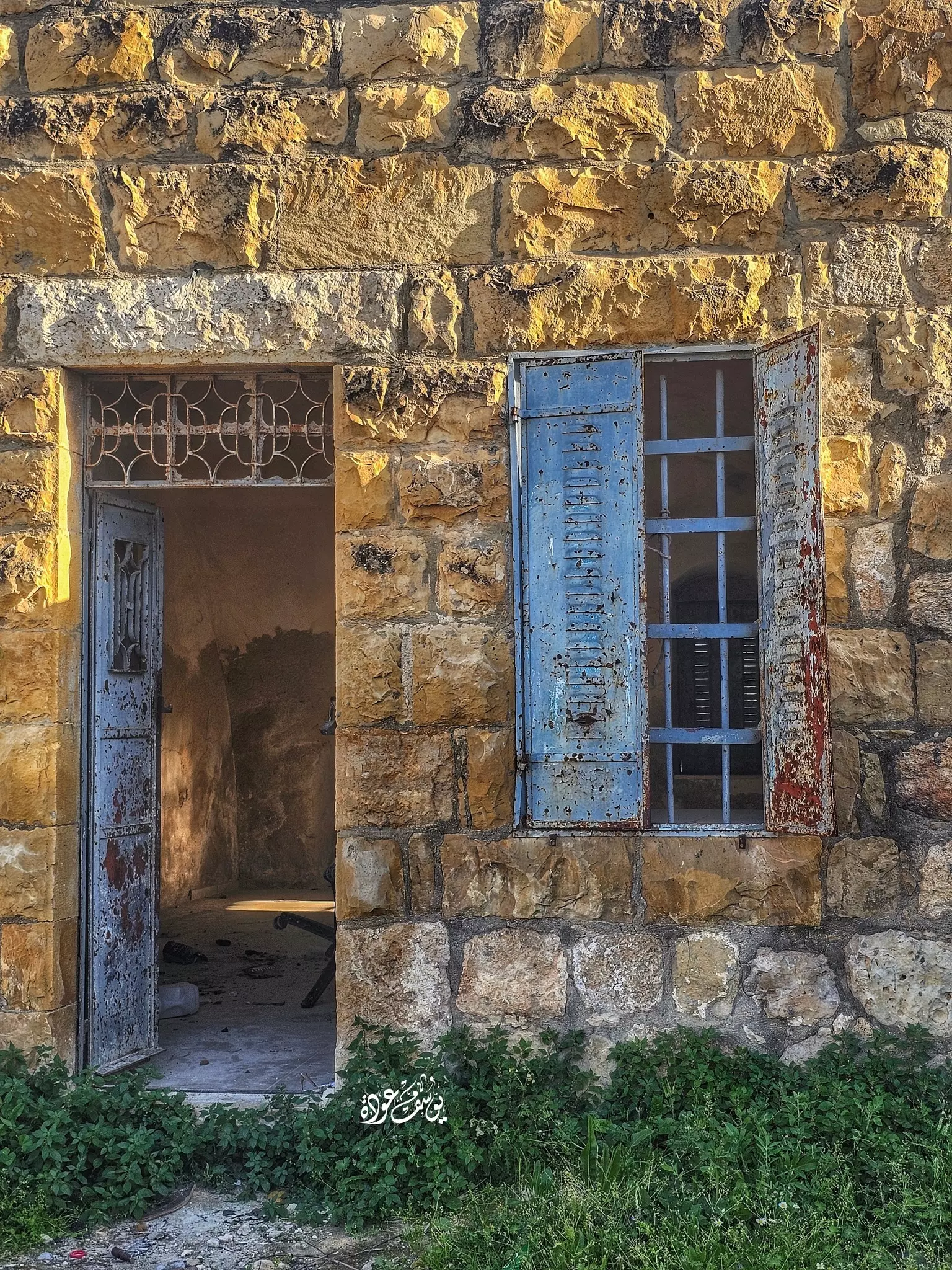
- منظر عام -- يوسف عودة
- منظر عام -- يوسف عودة #2

Want to browse more? 80,000 pictures were grouped in these gallaries:
| Display Name | Clan/Hamolah | Country of Residence |
| دموع الورد | - | رام اللة, بيت عورالفوقا |
| ابو عايش | - | رام الله , بيت عور الفوقا |
| محمود فضل نعمان الشيخ | نعمان | فلسطين, بدو |
 Fake Valor: Why Did Zionist Jews Hoist Nazis Flag on Their Ships in the 1930s?
What is new?
-
Facts About Oct. 7th Gaza Raid
-
Remined Us Please:: Who Did Rape Who? Palestinians Raped Israelis? Or, was the other way around?
-
When Prof. Edward Said was invited to debate Bibi Netanyahu in the 1980s, watch what happened!
-
Abusing Blood Libel!
-
Zionist FAQ: Isn't it true that Palestinians don't want peace? Palestinians never accepted the two-state solution
- Facts about Haavara (Transfer) Agreement between Ben-Gurion & Hitler
-
Haavara FAQs: Why Did Zionist Jews Hoist Nazis' Flags on Their Ships in the 1930s?
-
Dear ChatGPT: Why did the Jewish Agency suppress news of the Holocaust during WWII?
-
Video Playlist: Jews share their DNA tests to end the conflict for good.
-
A Tale of Two Conflicts: Examining the Definition of Genocide
-
Prof. Abraham Polak And The Suppressed History of the Khazars and European Jewry
-
How Ronald Reagan would have framed the genocide in Gaza if he were still alive?
-
Haavara FAQs: Let us do the math: how many German Jews did The Haavara Agreement save?
-
Zionist FAQs: The Hebron Massacre of 1929, "clearly proves" that Palestinians are antisemitic, how could you deny it?
-
Zionist FAQs: Why Anti-Zionist Is Not Antisemitism?
-
Zionist FAQs: Isn't it true that the KGB create Palestinian Nationalism in the early 1960s?
- Zionist FAQs: Muslims are killing Muslims all the time; why are Israeli Jews being singled out in the media?
- Zionist FAQs: How is Israel an apartheid state when 20% of its citizens are Arabs who enjoy full rights?
-
Haavara FAQs: Analysis of Herzl's Uganda Scheme and how it could have saved millions of Jews.
-
Haavara FAQs: Why did Hayim Greenberg describe American Jewry as "morally bankrupt" in early 1943?
-
Haavara FAQs: What if the Evian Conference was a resounding success? What would have been the impact of saving European Jewry on Zionism?
- Haavara FAQs: What if the six million were saved, how that would have impacted the Zionist project?
-
Haavara FAQs: How did Zionist leaders react when Europe's Jews lingered in the DP camps after WWII ended?
-
Why does the American Jewish community repeat lies that David Ben-Gurion had debunked before he died?
-
Who has the power to rename the Tatar/Khazar Gene Marker to Jewish IV?
-
Zionist FAQs: Why won't Egypt, Syria, and Jordan take their people back? Jews are indigenous to Palestine, and Arabs immigrated after Jews developed the country. Arabs should leave.
-
Haavara FAQs: Did Hitler and the Nazis conflate between Judaism and Zionist? If that wasn't case, then why?
-
Haavara FAQs: Winston Churchill and antisemitism, a collection of articles written Churchill.
-
Haavara FAQs: Broken by country, how many Jews survived vs. killed during the Holocaust?
-
Haavara FAQs: Why did European Jews vote with their feet and to immigrated to the Americas, not Palestine, after WWII?
-
Watch this American Jewish Girl describing Israeli Jews' cognitive dissonance like no other in under two minutes
-
Haavara FAQs: When the Nazis went out of their way to hide the Holocaust, Israeli Jews did the exact opposite by broadcasting their genocide of Gazans. But why?
-
Haavara FAQs: How Zionist Jews went out of their to show their appreciation to Nazism and Fascism?
- Haavara FAQs: Why Zionist leaders were against bombing the death camps & the Railroads leading to them?
-
Haavara FAQs: Hitler's message to the British and American people: If Jews are such noble citizens and you care about them, how come you're not letting them in? I will gladly ship them to you at my expense, even on luxury liners!
-
A shortlist of Zionist and Israeli false flag operations in the name Jews.
-
The Most Moral Army
- The Land of Kapos (Israel): Where the brave are boycotted and Kapos walk free.
- Why did early Zionists often named their communal enterprises "colonial"?
- Zionist Relations with Nazi Germany by Faris Glubb
-
Two NY Times advertisements by Zionists in the early 1943 that exposes Zionists' treason at the height of the calamity
- Facts Not Lies about the Palestinian-Israeli Conflict.
- Site's pictures have been categorized
- Campgain Against Lice
- A Survey of Palestine, the official source about Palestine before Nakba produced by the British Mandate; over 1200 pages.
- Satellite View & Google Earth: Over 6,000 placemarks identifying all destroyed towns, W. Bank & Gaza Strip Towns, & refugee camps.
- PalestineRemembered.com and its Nakba Oral History Project were featured on al-Jazeera Satellite TV.
- Nakba Oral History Video Podcast:
 Over 700 Oral History interviews (including 3,500+ hours of recording) can be viewed online.
 - Palestine Village Statistics Project
- Gaza Jail Break
- النسخة العربية للموقع الان متوفرة
- Videos: Documenting the destroyed villages in video: Tracing all that remains since Nakba.
- Videos: Responding to Zionist Propaganda
- Interview: The ethnic cleansing of Palestine: George Galloway interviews Israeli Historian Ilan Pappe.
- For Palestinians, memory matters. It provides a blueprint for their future By George Bisharat.
- Zionist FAQ now available in Hebrew שאלות שציונים שואלים, עכשיו בעברית
- Video: The Stephen Walt and John Mearsheimer report on the influence of the Israel Lobby on U.S. Foreign Policy
- The Palestinian-Israeli conflict for beginners
