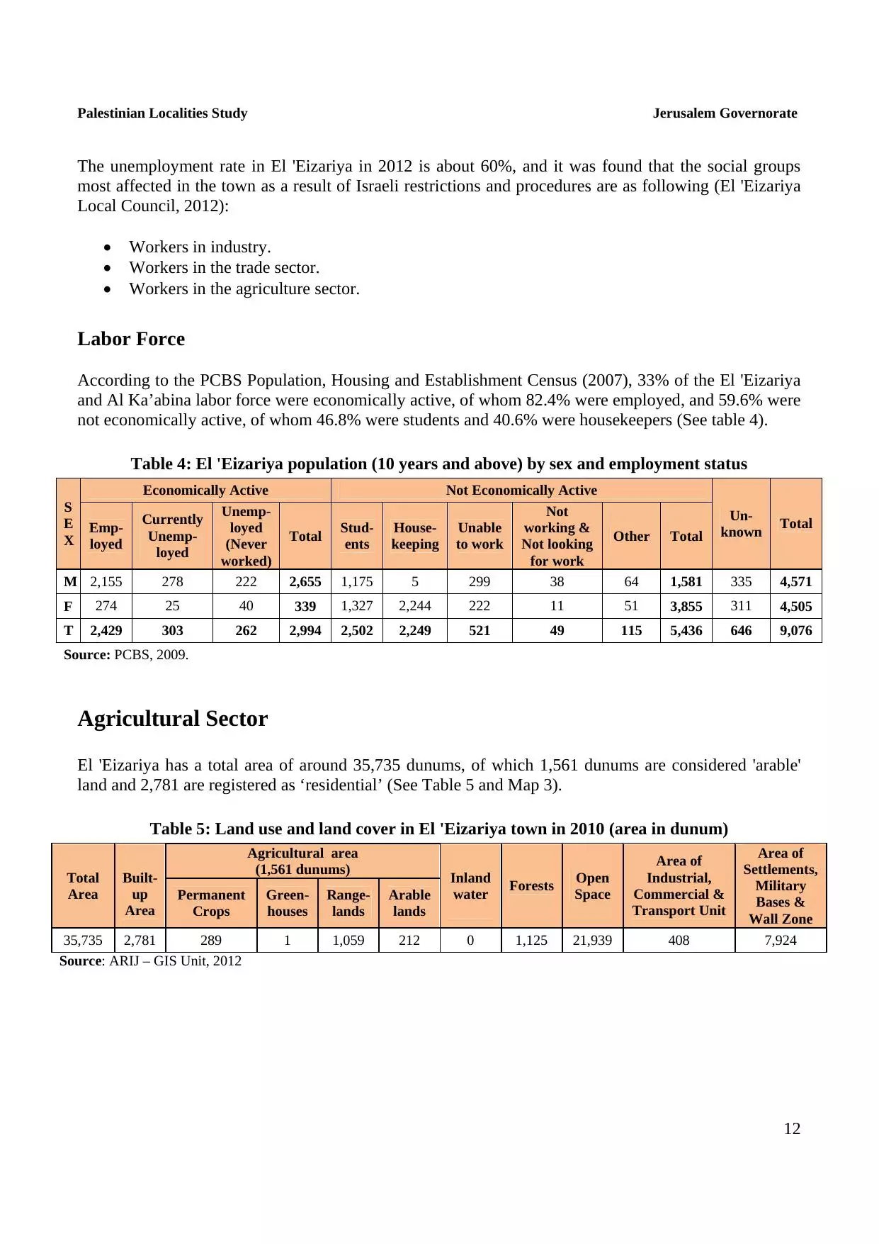
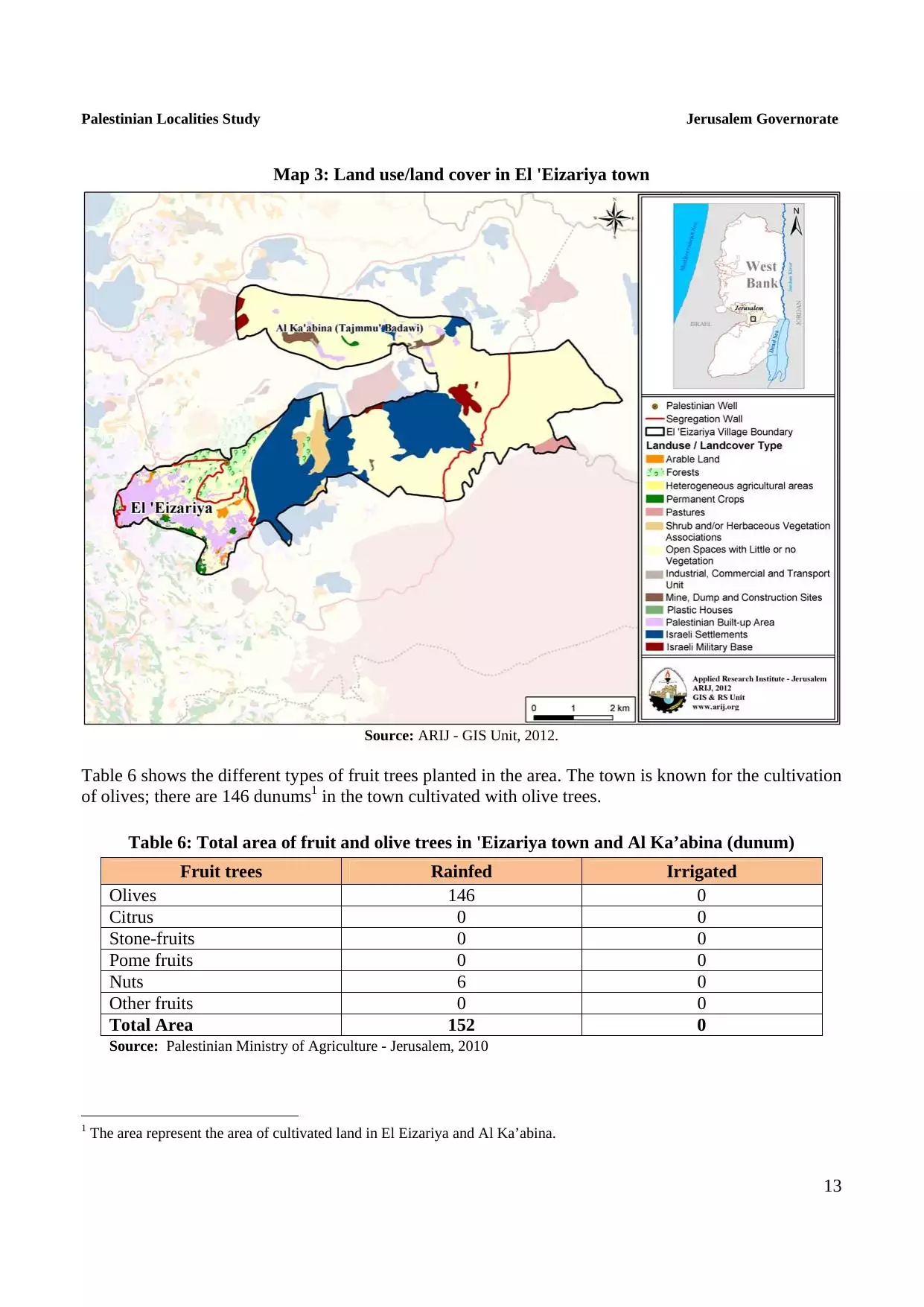
| PalestineRemembered | About Us | Oral History | العربية | |
| Pictures | Zionist FAQs | Haavara | Maps | |
| Search |
| Camps |
| Districts |
| Acre |
| Baysan |
| Beersheba |
| Bethlehem |
| Gaza |
| Haifa |
| Hebron |
| Jaffa |
| Jericho |
| Jerusalem |
| Jinin |
| Nablus |
| Nazareth |
| Ramallah |
| al-Ramla |
| Safad |
| Tiberias |
| Tulkarm |
| Donate |
| Contact |
| Profile |
| Videos |
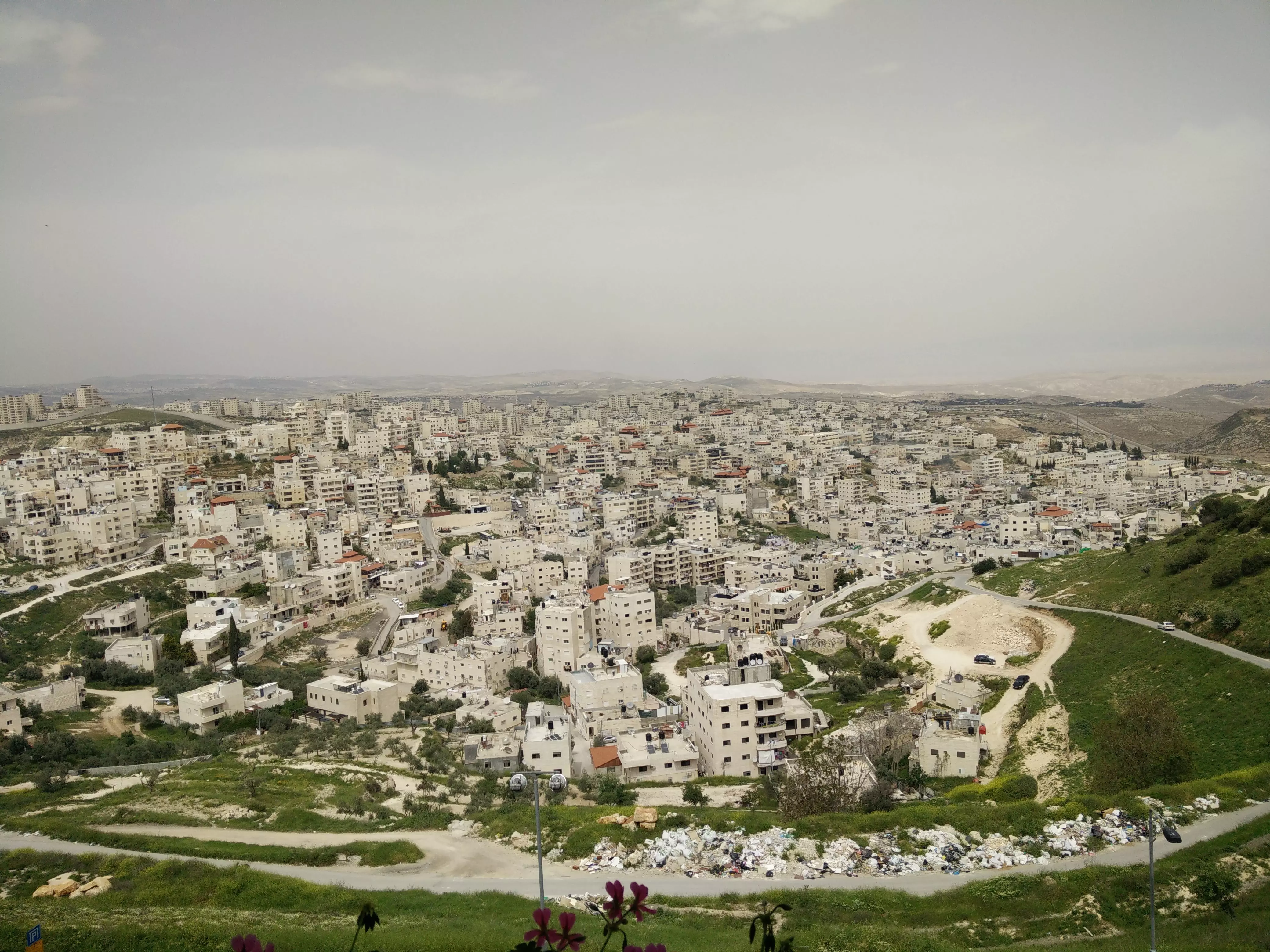
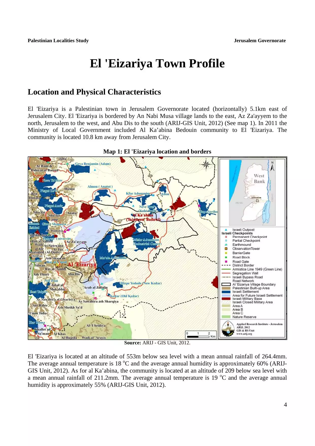
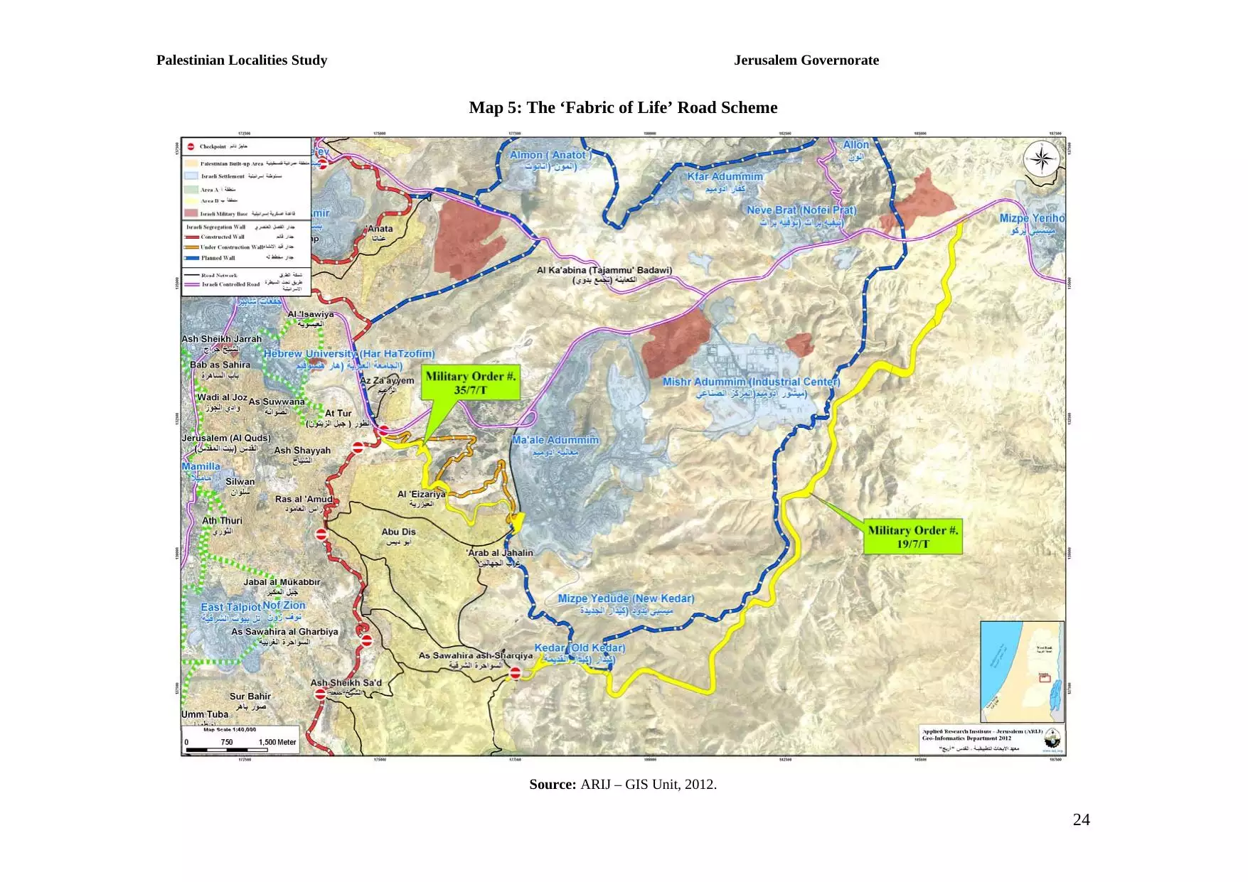
Welcome To Bethany - العيزريه (בית עניה)
|
District of Jerusalem
Occupied days ago |
العربية Google Earth |
 |
Gallery (68) |
- Statistics & Facts
-
Before & After

- Satellite View
- Articles 1
- Pictures 68
- Aerial Views 1
- Members 7
- Families
- Wikipedia
- ARIJ Guide
- Videos
- Guest Book 5
- Links
| Statistic & Fact | Value | ||||||||||||||
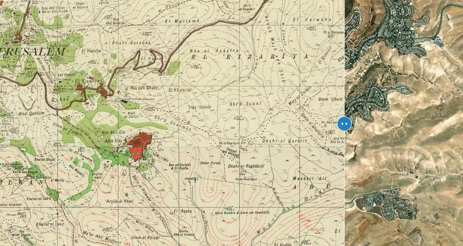
| Before & After Nakba, Click Map For Details |
|||||||||||||||
|
|||||||||||||||
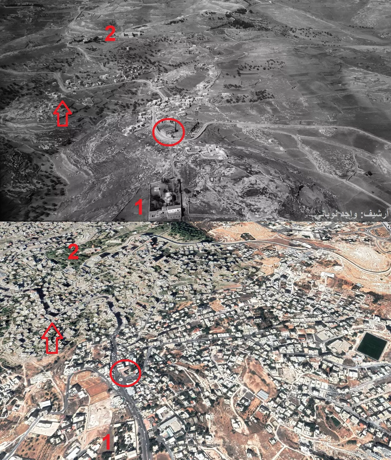
| Pre-Nakba Aerial View |
|||||||||||||||
|
|||||||||||||||
| Land Ownership |
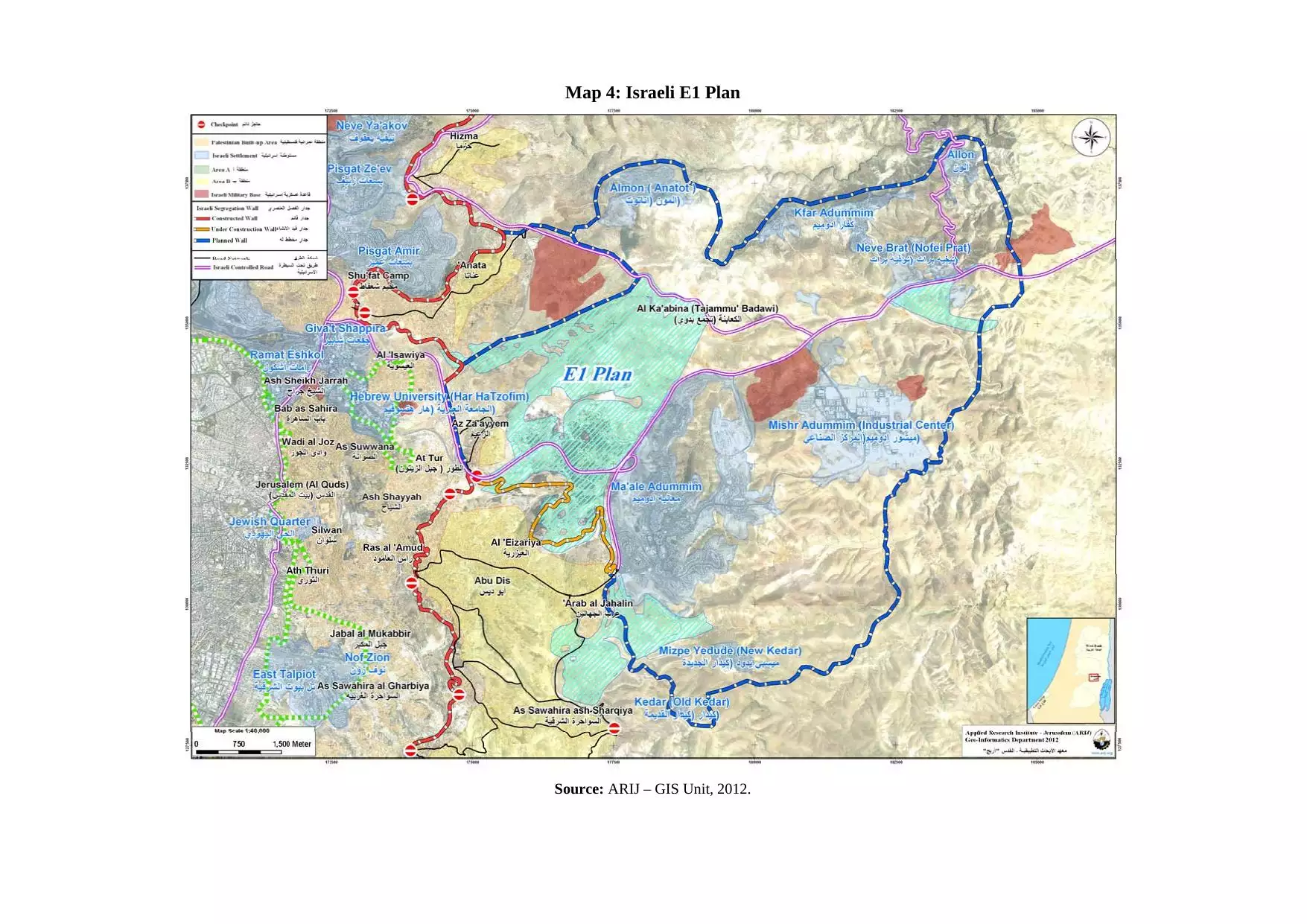
**Town Lands' Demarcation Maps |
||||||||||||||
| Land Usage As of 1945 |
|
||||||||||||||
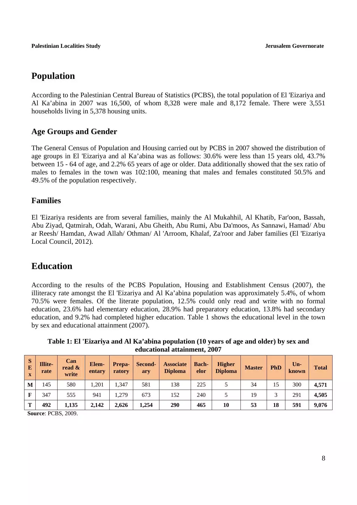
| Population |
|
||||||||||||||
| Near By Towns |
|||||||||||||||
|
|||||||||||||||
| Featured Video | |||||||||||||||
| ARIJ Guide | |||||||||||||||
|
Click here to browse online. |
|||||||||||||||
| Related Maps | Town Lands' Demarcation Maps خرائط للقضاء توضح حدود القرى والاودية View from satellite Town's map on MapQuest Help us map this town at WikiMapia |
||||||||||||||
| Related Links | Wikipedia's Page ARIJ Guide Google Search Google For Images Google For Videos في كتاب بلادنا فلسطين دليل أريج المزيد من موقع هوية |
||||||||||||||
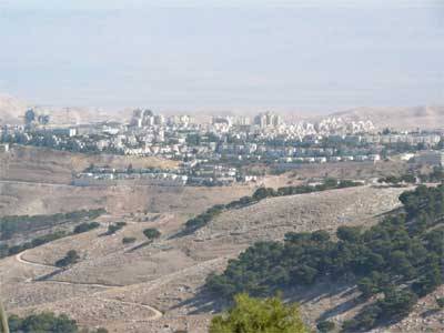
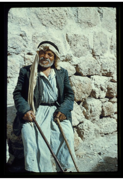
- Undated Picture for Bethany
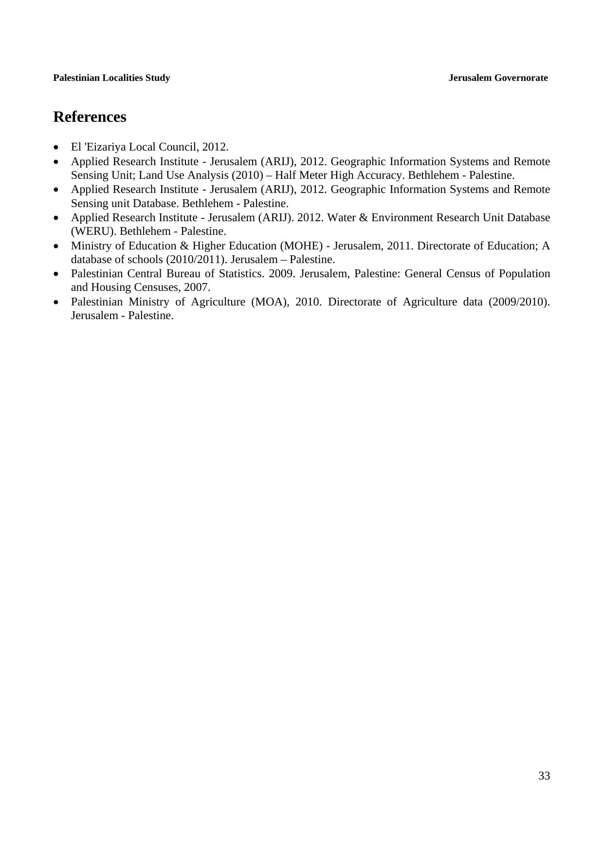
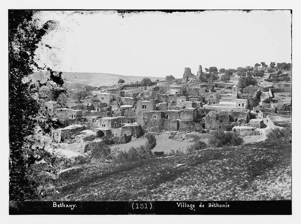
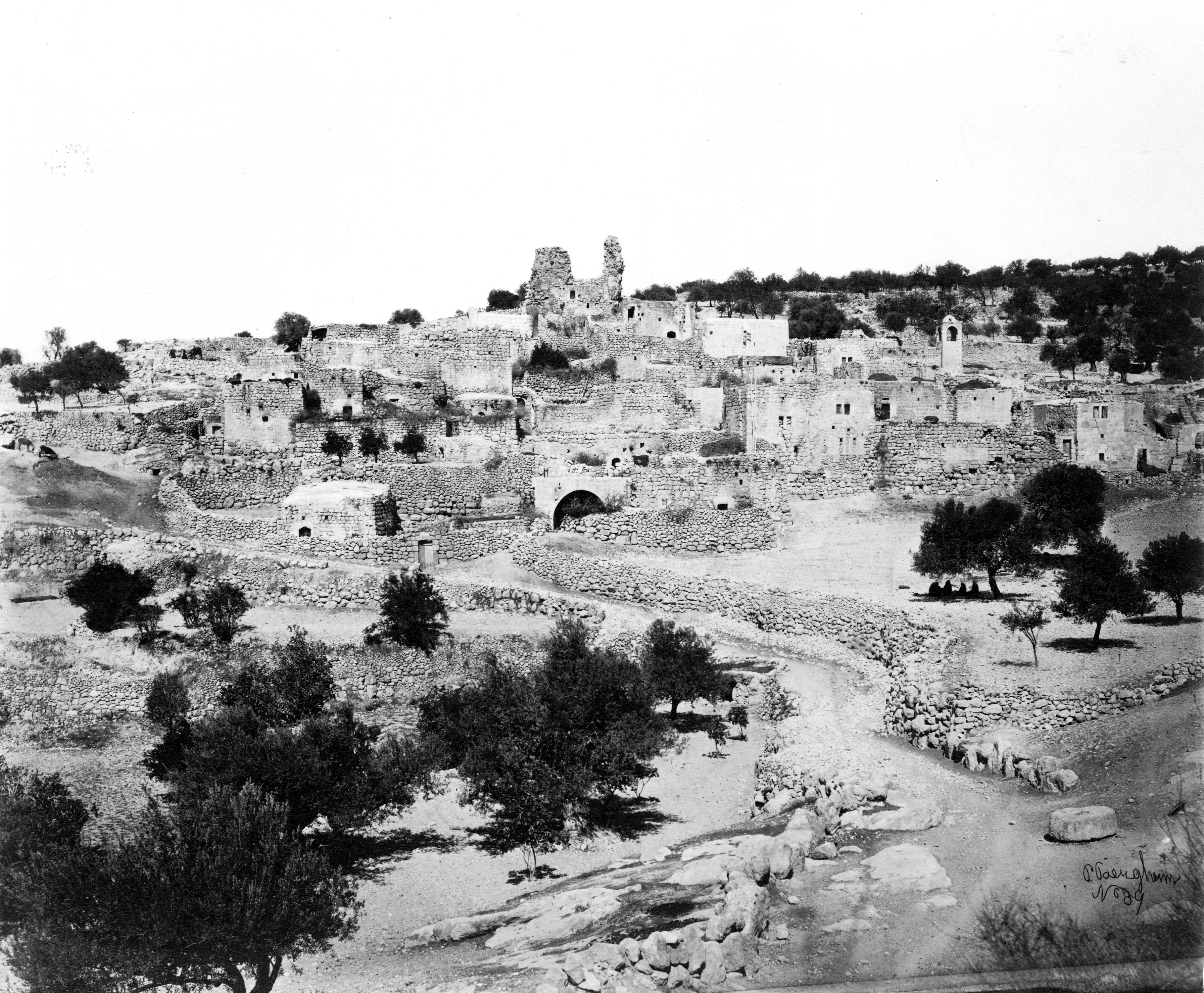
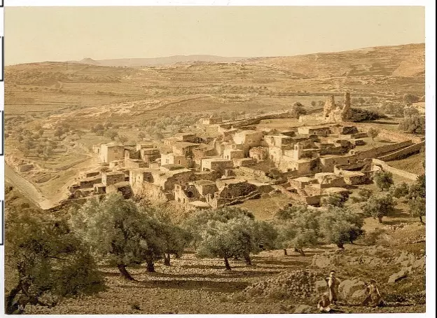
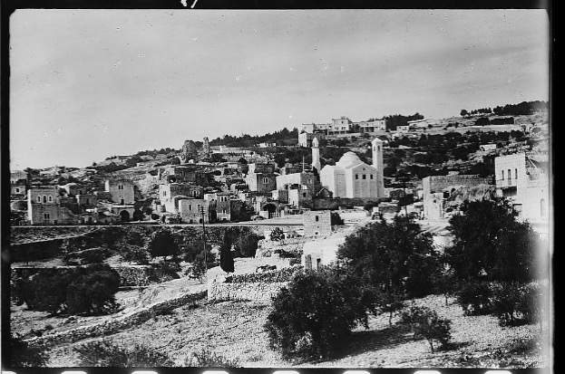
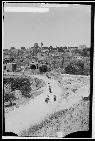
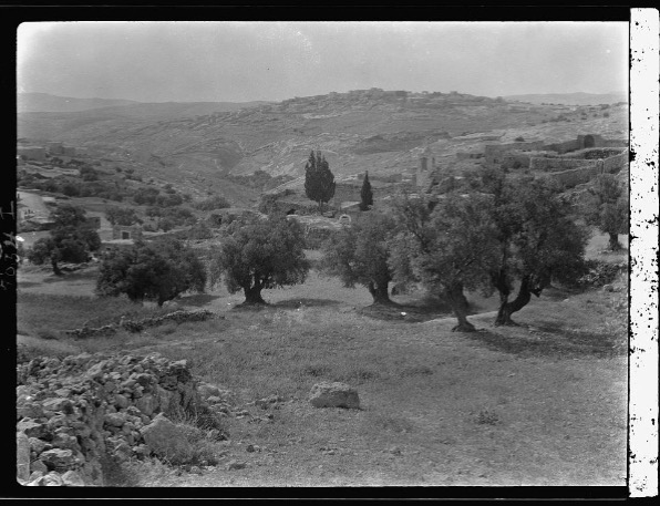
1 - The village of Bethany (1890)
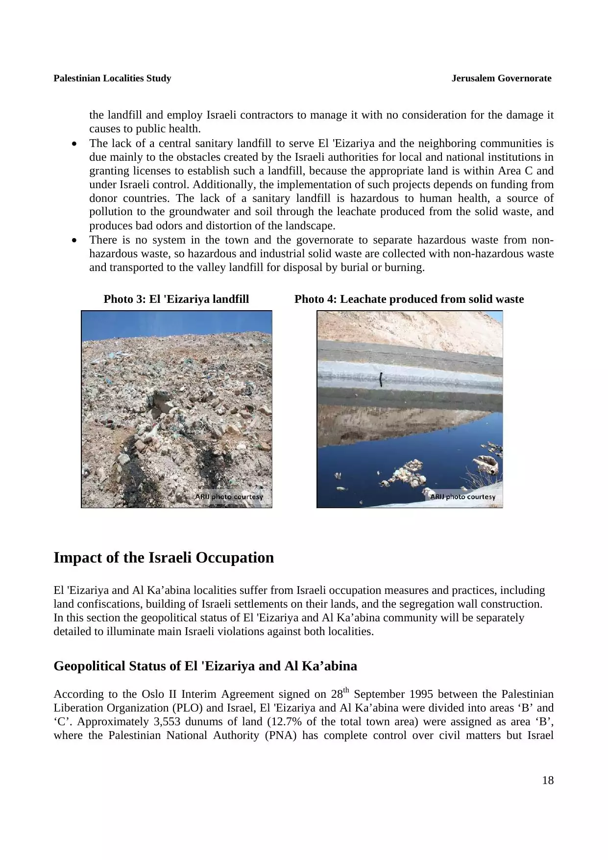
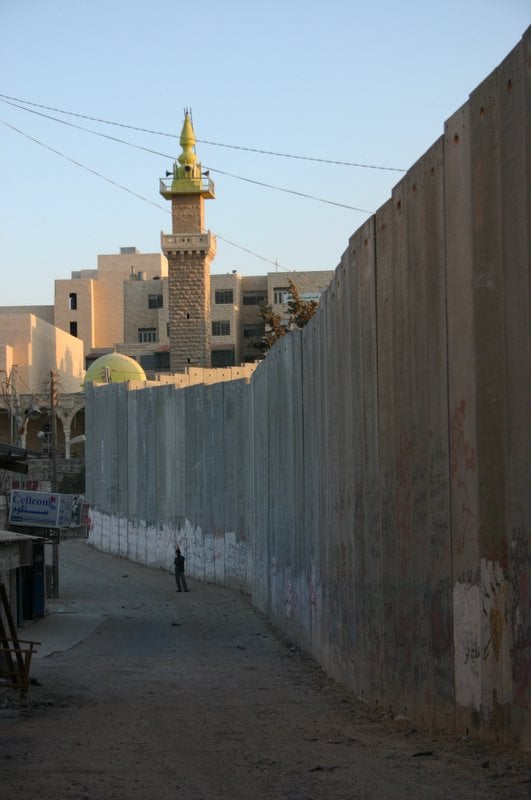
6 - The Apartheid Wall at al-Kabseh Intersection leading to Abu Dis, Bethany, and al-Shayyah
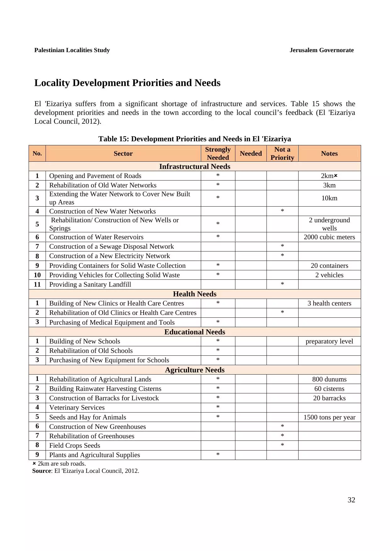
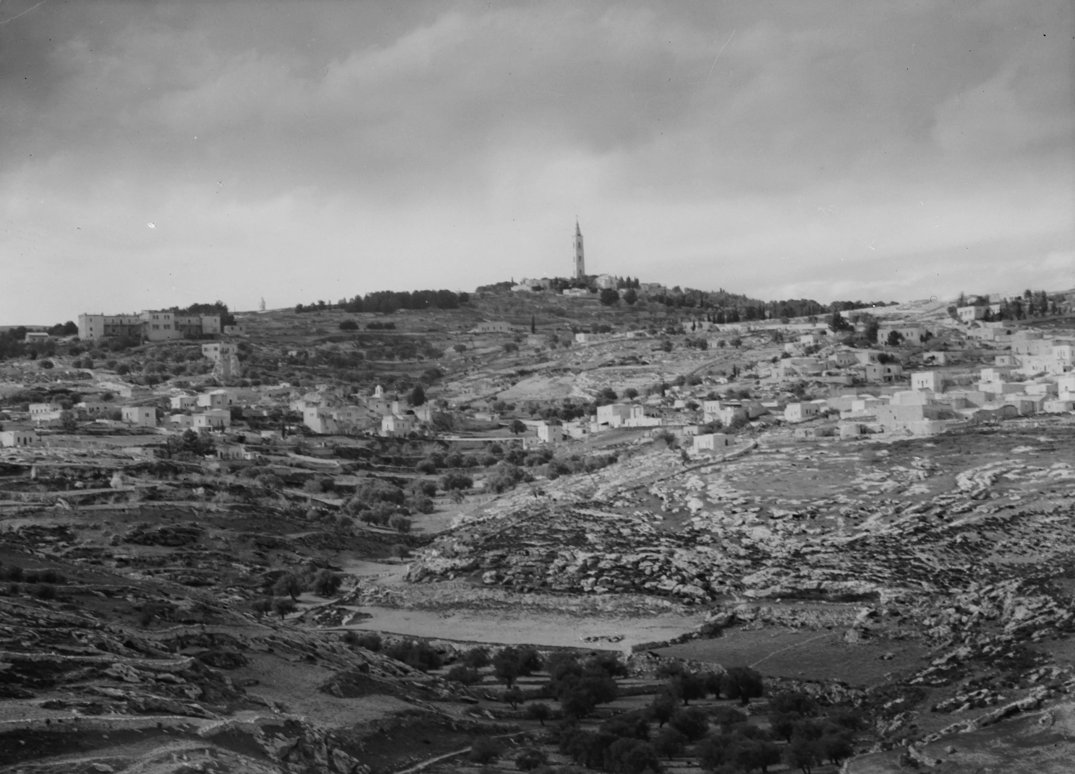
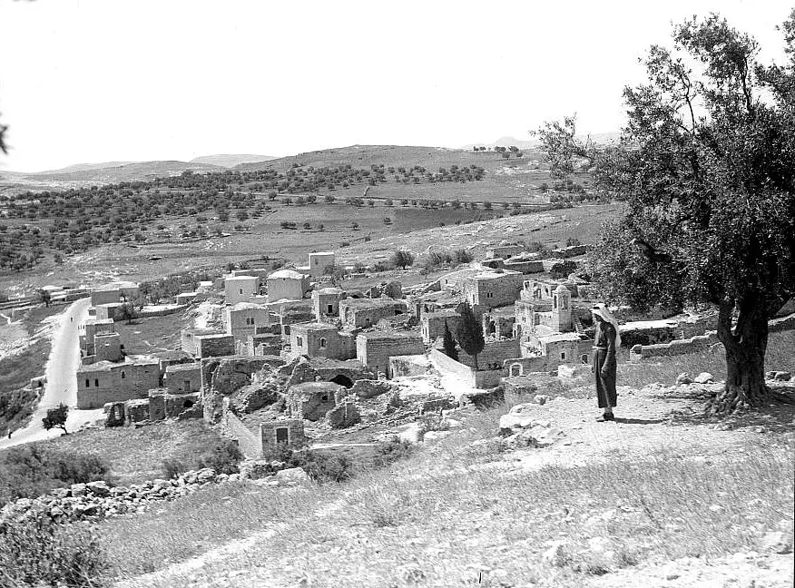
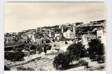
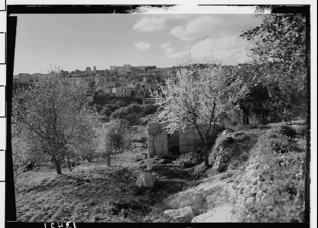
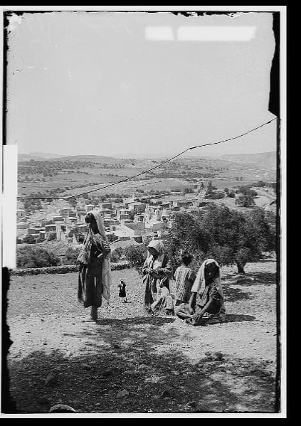
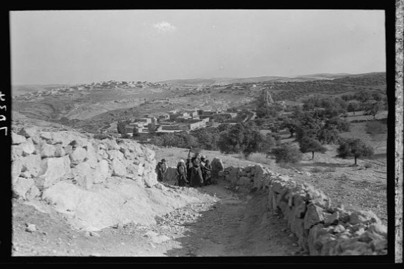
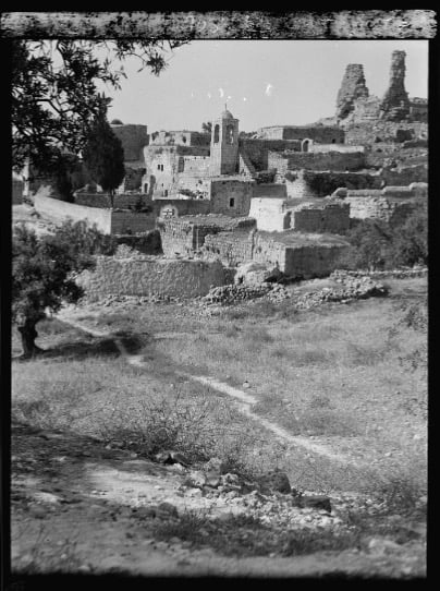
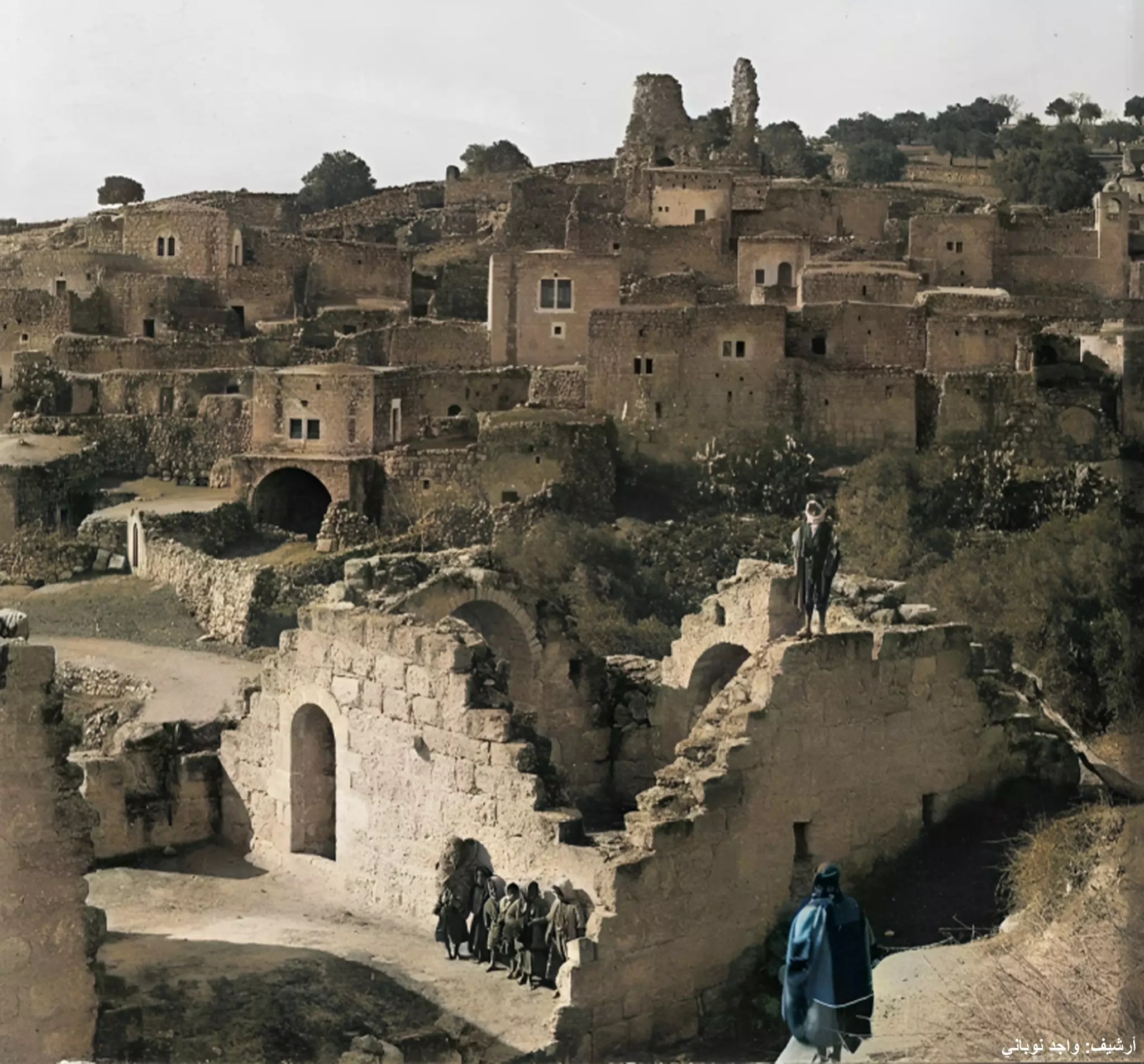
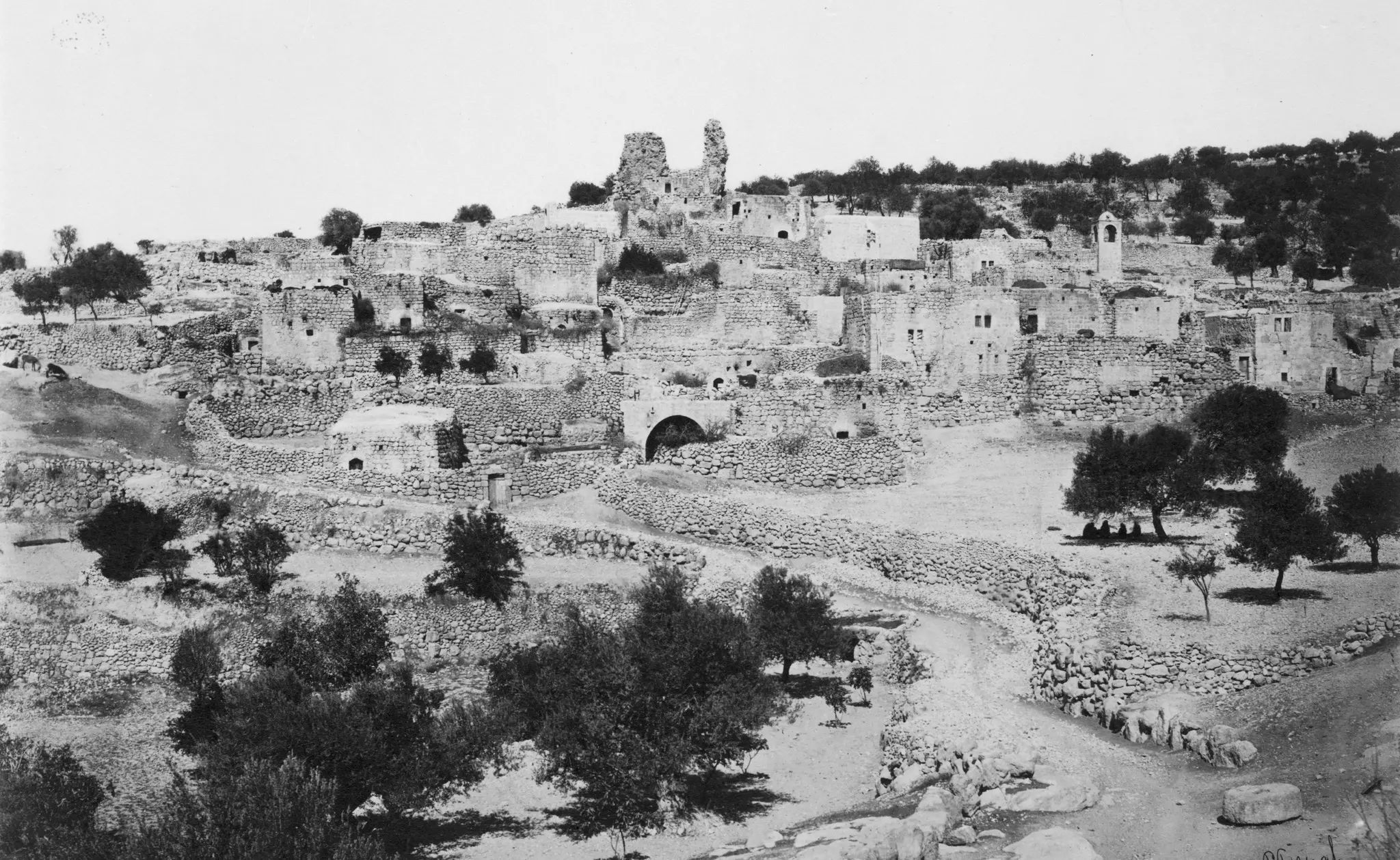
3 - General view before 1914, Matson Collection.
3 - منظر في القرية
Posted by ahmad sulieman muhamad ali alkhatib 3 - منظر عام
Posted by ahmad sulieman muhamad ali alkhatib 1 - منظر عام
Posted by الرقم الصعب اسلميه 2 - طلاب البرلمان الطلابي في صورة بمدرسة ذكور مسقط الثانوية
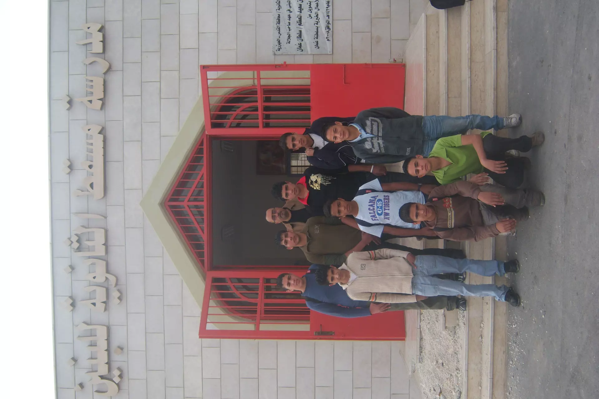
Posted by ابو كرم - انتخابات البرلملن الطلابي في مدرسة مسقط الثانوية للعام 2008/2009

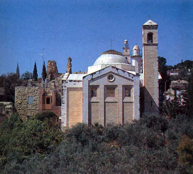
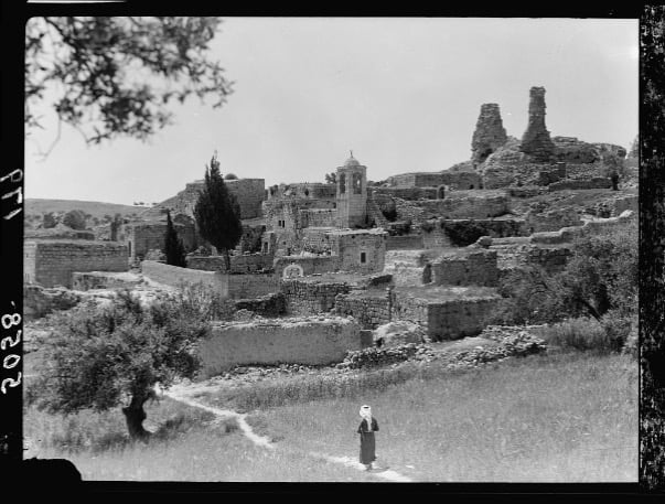
Posted by ابو كرم - The Church of Saint Lazarus in Bethany (Al-Izariyh or Al-Eizariya)
Posted by farah al jundi 1 - مغارة العازر في العيزرية
Posted by farah al jundi - منظر لاراضي العيزريه من الجهة الشرقية والمطلع على مستوطنة معالي ادوميم
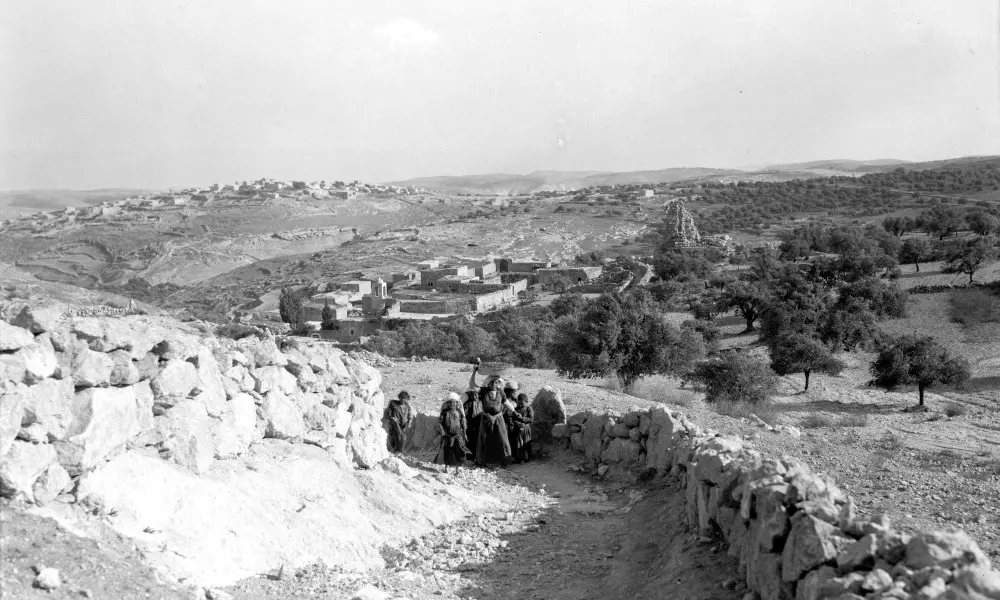
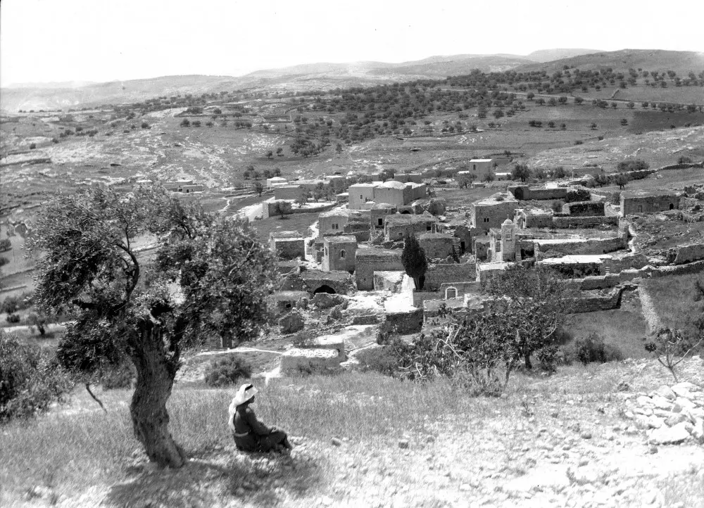
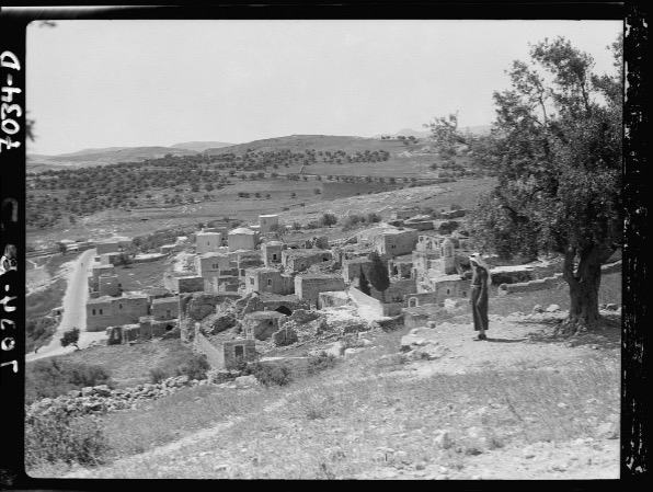
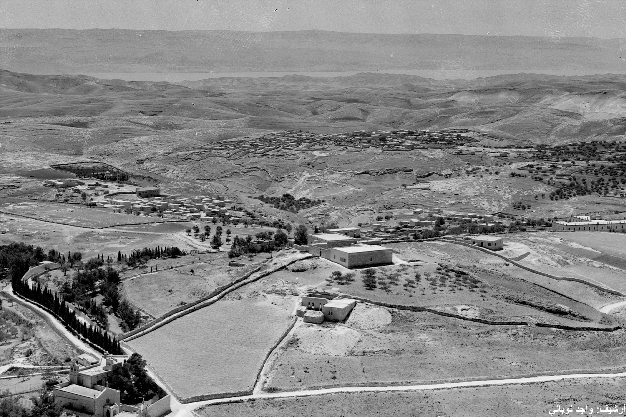
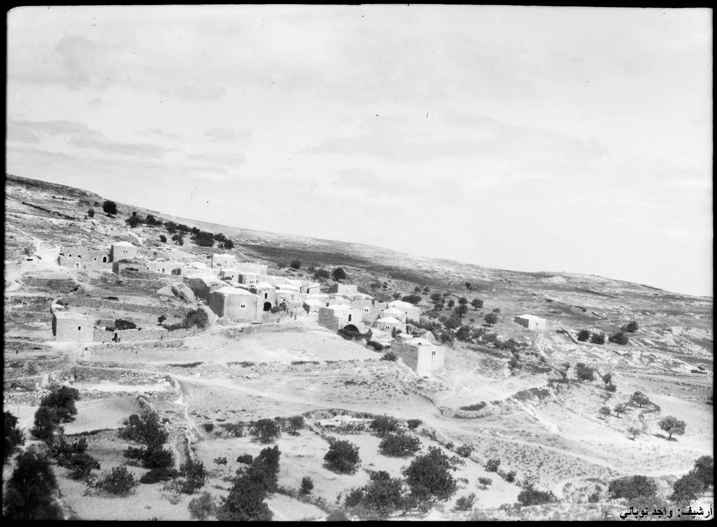
Posted by farah al jundi - منظر عام سنة 1940
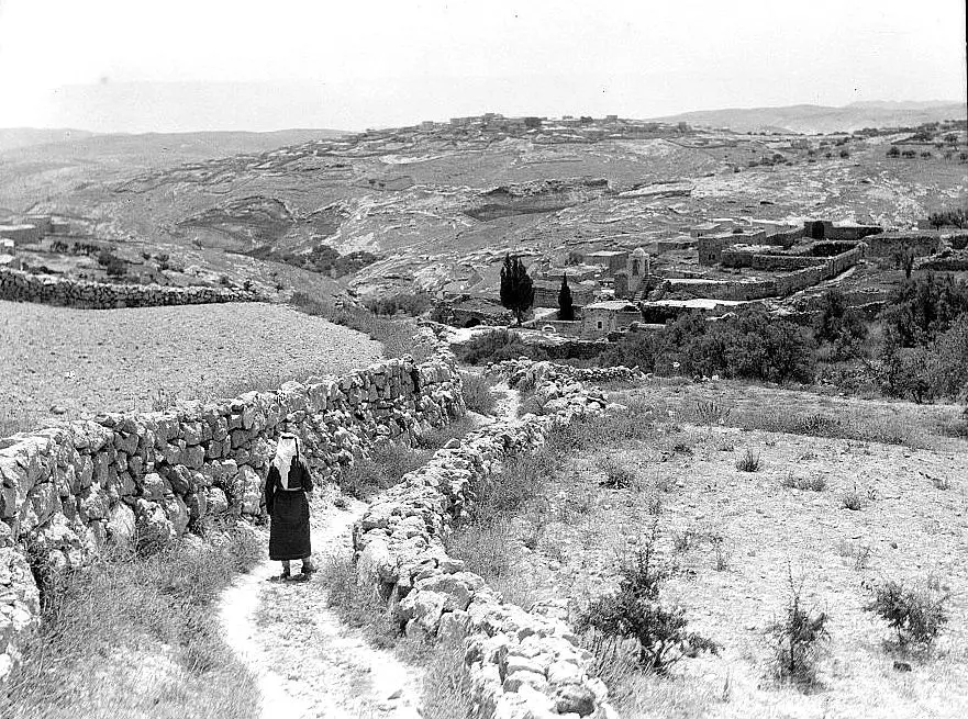
- العيزريه.....Bethany...... Octobber, 1934.....
Posted by Umar Abu El-Bararri - العيزريه.....Bethany...... Octobber, 1934.....
Posted by Umar Abu El-Bararri - العيزريه.....Bethany...... Octobber, 1934.....
Posted by Umar Abu El-Bararri - العيزريه.....Bethany...... Octobber, 1934.....
Posted by Umar Abu El-Bararri - العيزريه.....Bethany...... 1860-1880...
Posted by Umar Abu El-Bararri - العيزريه.....Bethany...... Octobber, between 1934 - 1939.....
Posted by Umar Abu El-Bararri - العيزريه سنه 1940
Posted by abu raya - العزيريه قبل النكبه
Posted by abu raya - العزيريه قبل النكبه
Posted by abu raya - العزيريه قبل النكبه
Posted by abu raya - العزيريه قبل النكبه
Posted by abu raya - العزيريه قبل النكبه
Posted by abu raya - العزيريه قبل النكبه
Posted by abu raya - العزيريه قبل النكبه
Posted by abu raya - العزيريه قبل النكبه
Posted by abu raya - العزيريه قبل النكبه
Posted by abu raya - العزيريه قبل النكبه
Posted by abu raya - العزيريه سنه 1934
Posted by abu raya - العزيريه سنه 1934
Posted by abu raya - العزيريه قبل النكبه
Posted by abu raya - العزيريه قبل النكبه
Posted by abu raya - العزيريه قبل النكبه
Posted by abu raya - العزيريه قبل النكبه
Posted by abu raya - صوره قديمه من قريه العزيريه
Posted by abu raya - صوره قديمه لقريه العيزريه
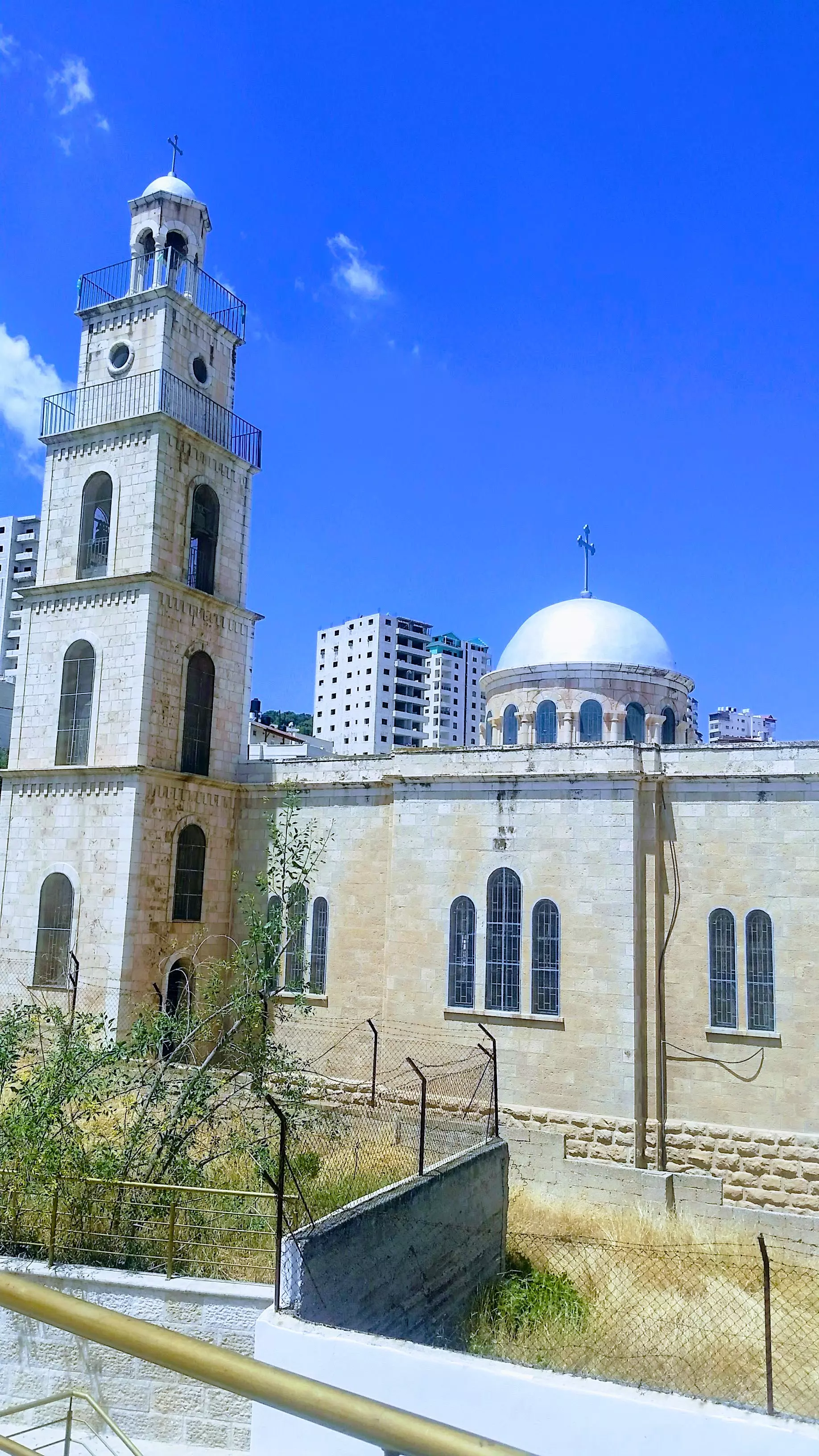
Posted by abu raya - كنيسة الروم الارثوذكس في العيزرية - تصوير سهيل مخول يوم 15.04.2018
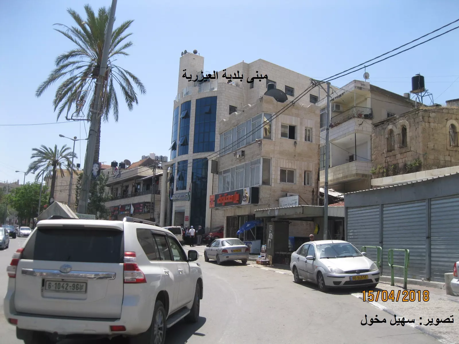
Posted by سهيل مخول - مبنى بلدية العيزرية بعدسة :سهيل مخول
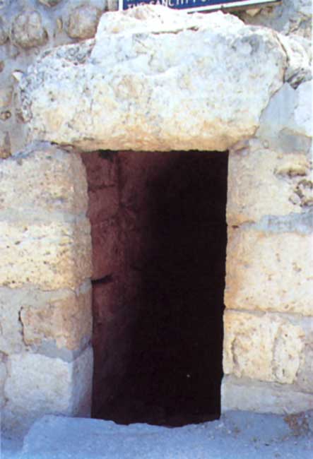
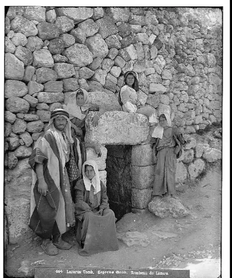
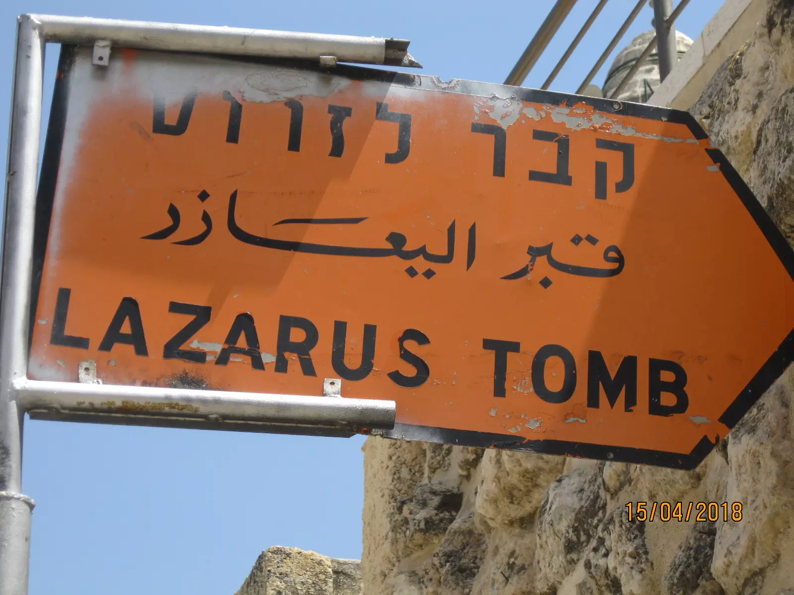
Posted by سهيل مخول - قبر العزار في العزارية- بعدسة سهيل مخول
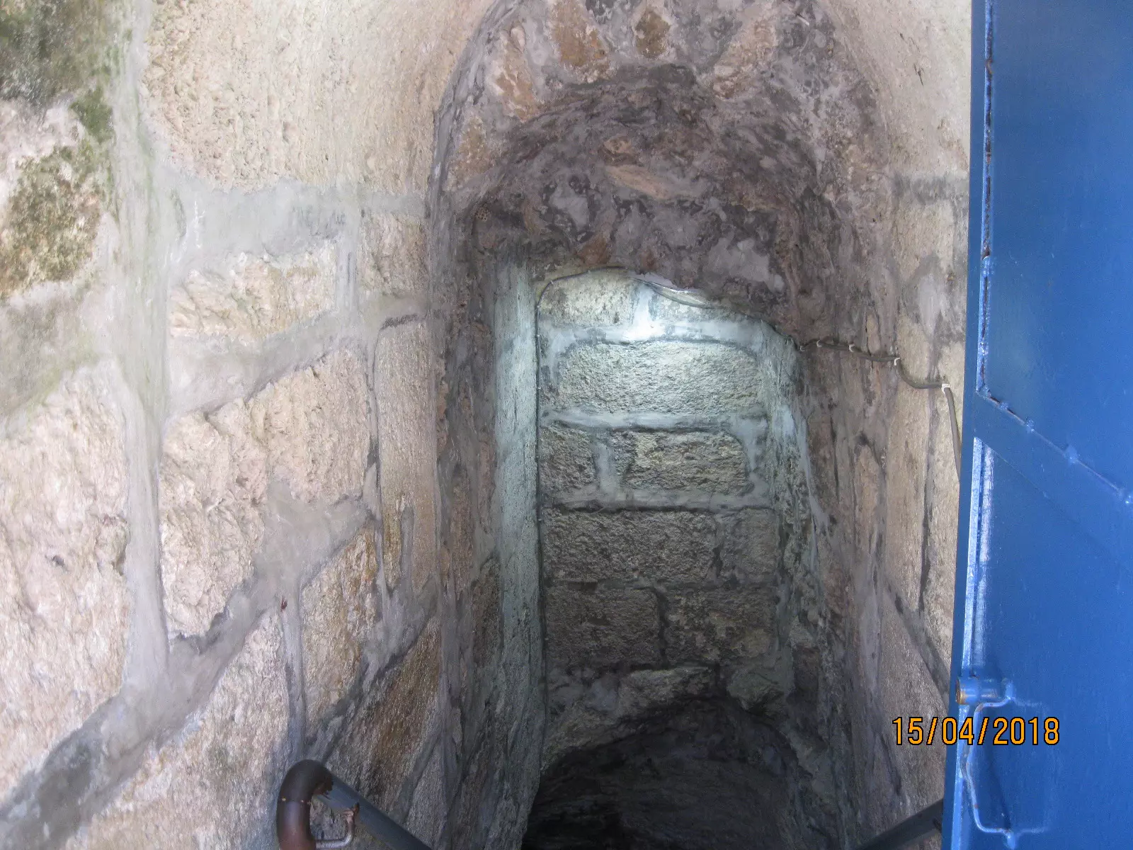
Posted by سهيل مخول - داخل قبر العزار . بعدسة سهيل مخول
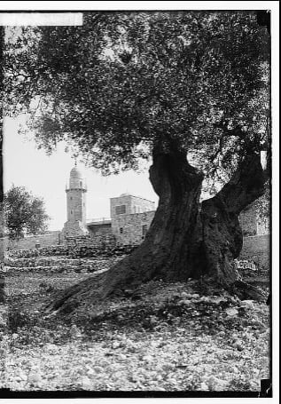
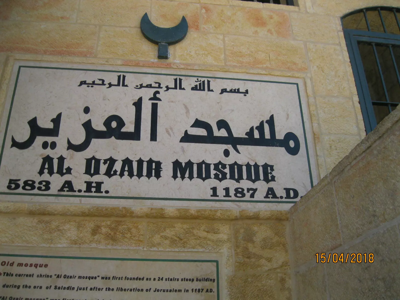
Posted by سهيل مخول - مسجد العزير - بعدسة سهيل مخول
Posted by سهيل مخول - كنيسة اللاتين في العزير - تصوير سهيل مخول
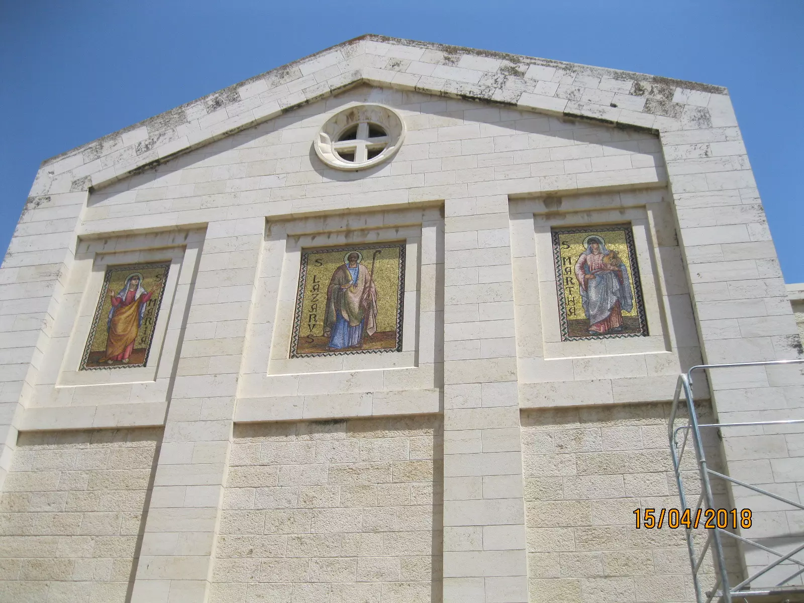
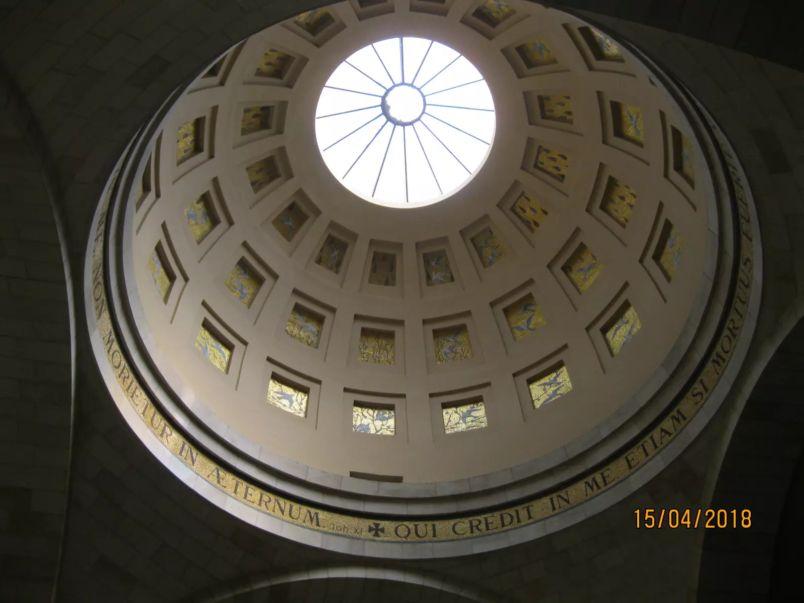
Posted by سهيل مخول - قبة كنيسة الاتين في العيزرية - بعدسة سهيل مخول
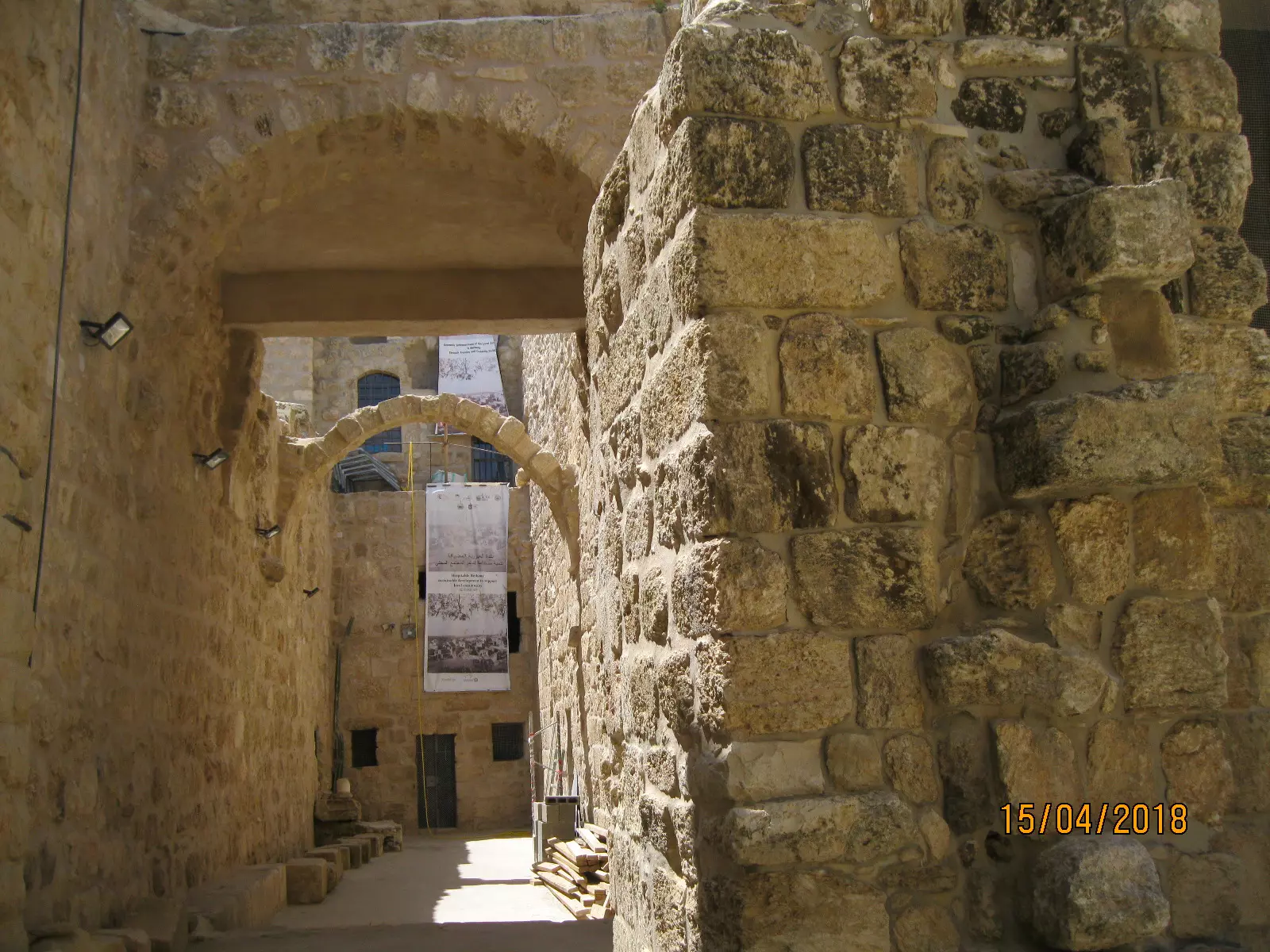
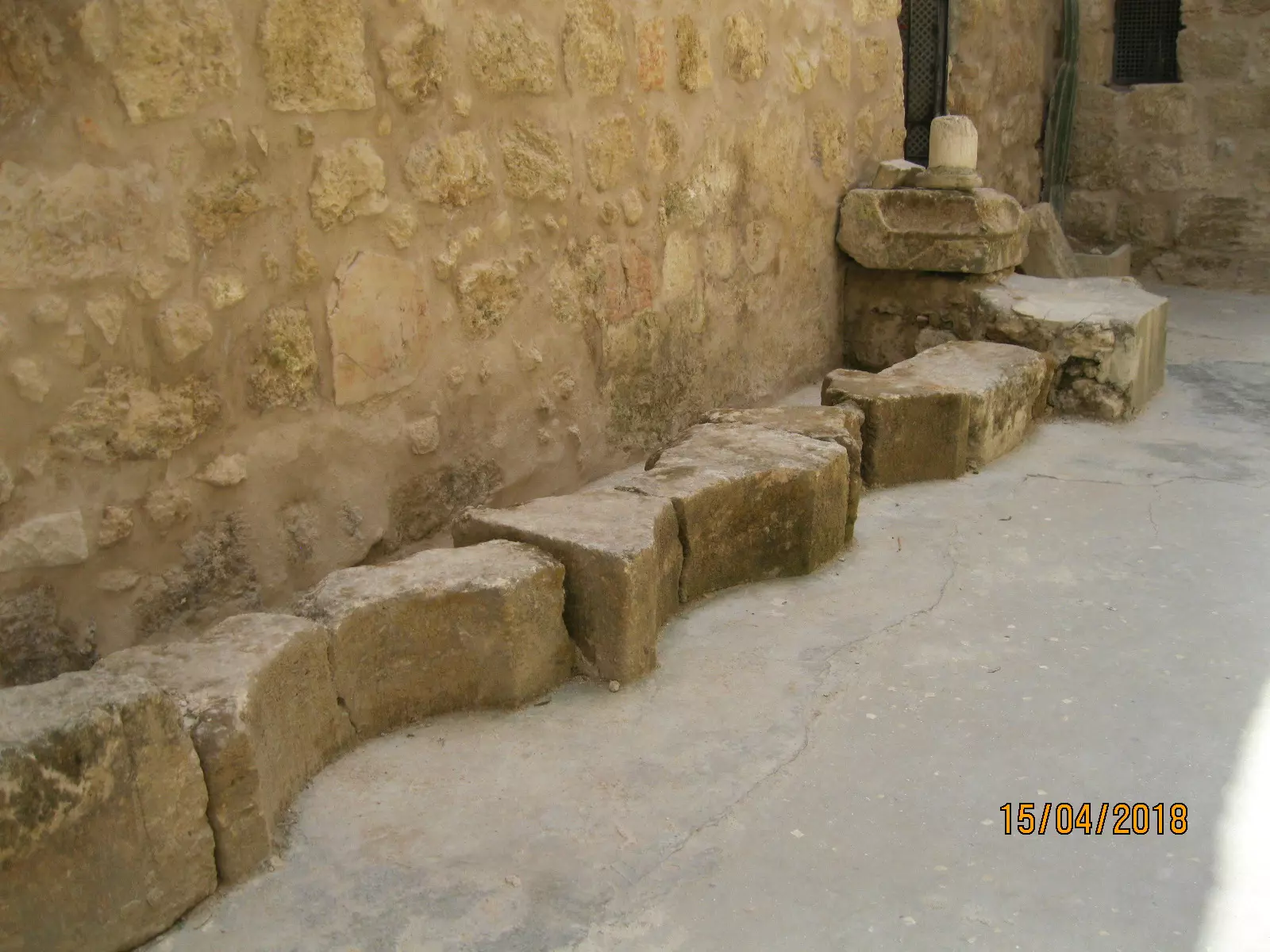
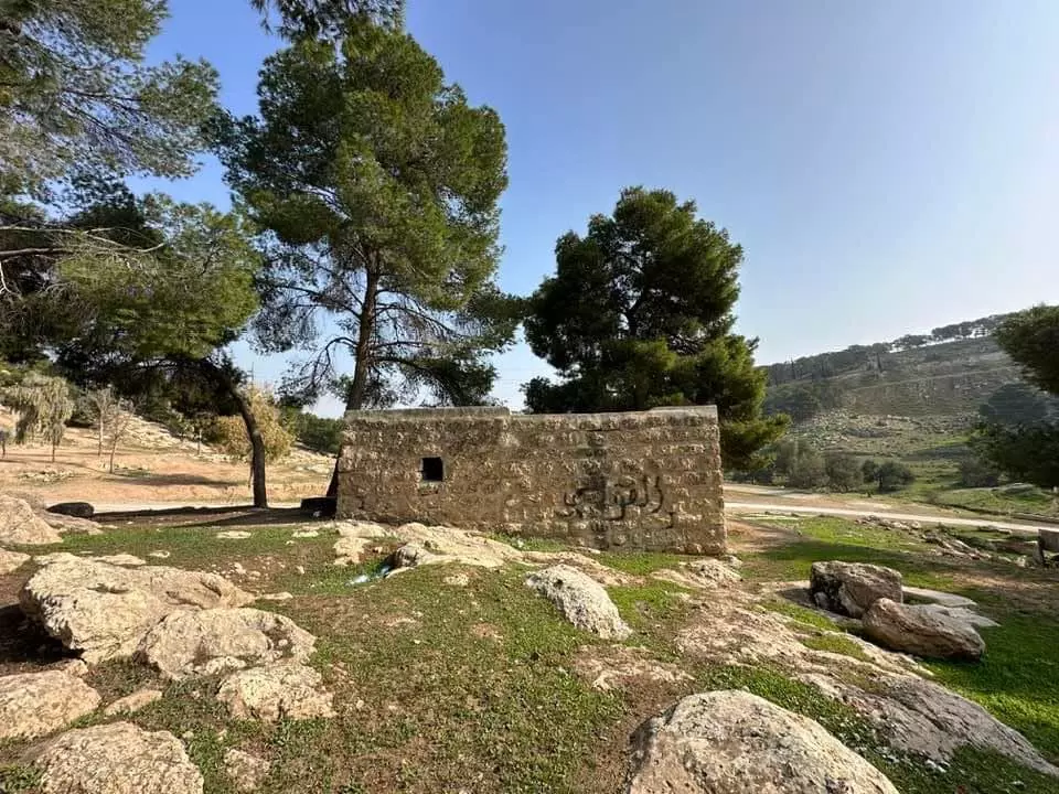
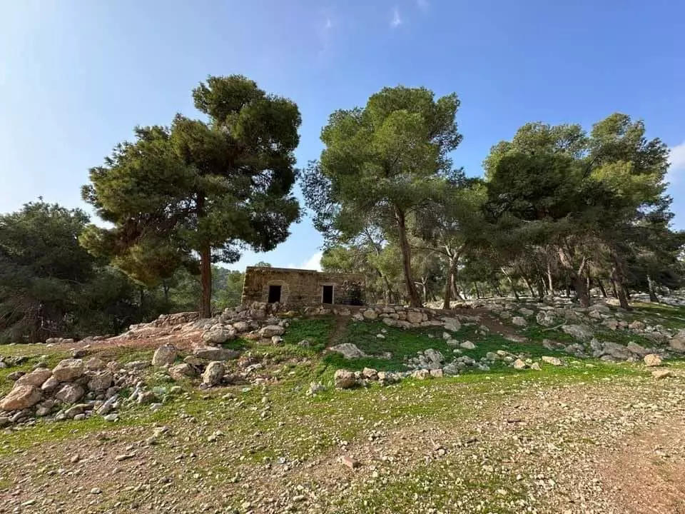
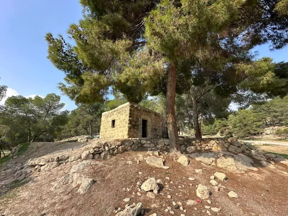
Posted by سهيل مخول - أثار قديمة في محيط كنيسة الانين - بعدسة: سهيل مخول
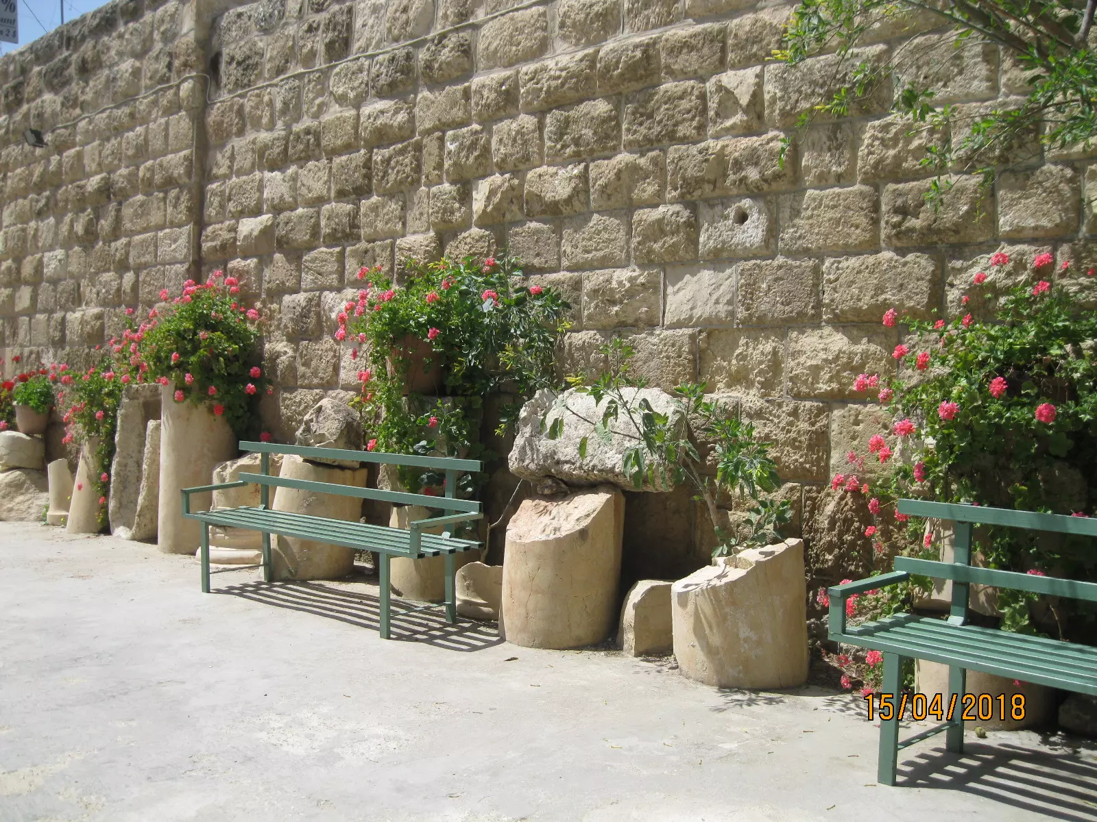
Posted by سهيل مخول - أثار قديمة في محيط كنيسة الانين - بعدسة: سهيل مخول
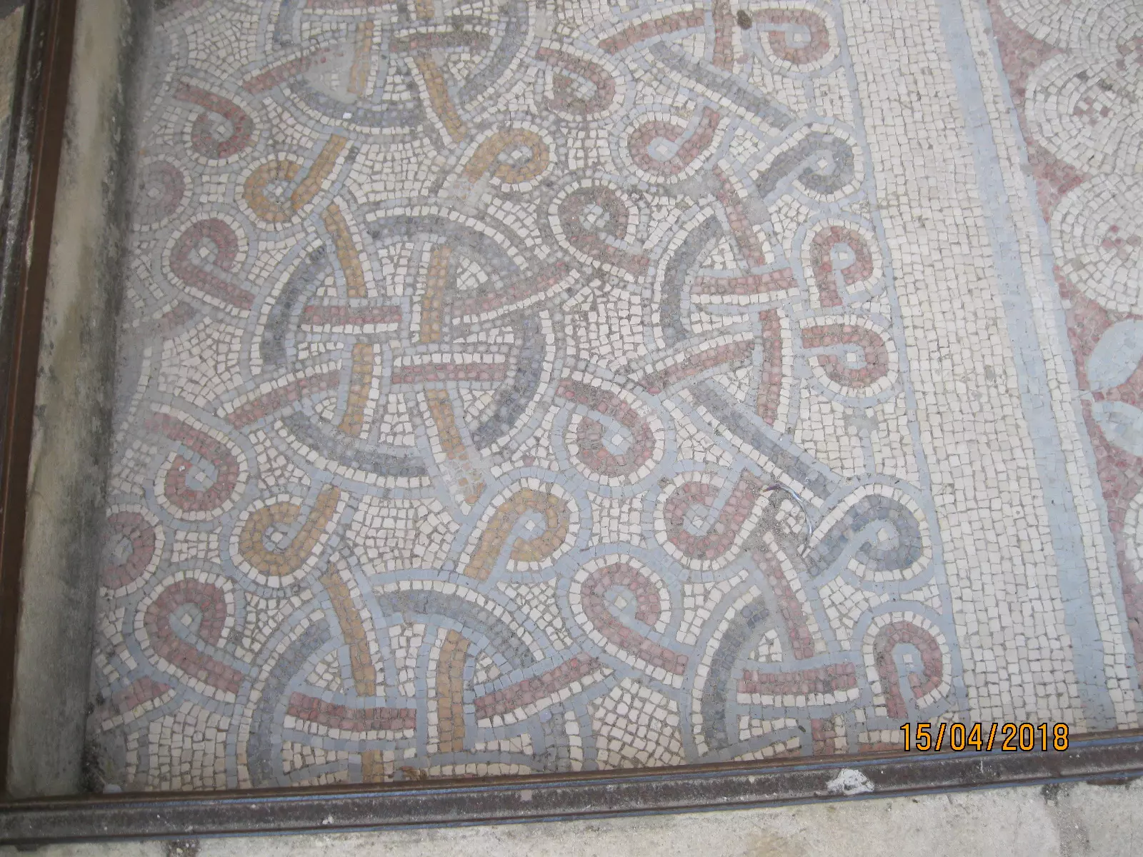
Posted by سهيل مخول - أثار قديمة في محيط كنيسة الانين - بعدسة: سهيل مخول
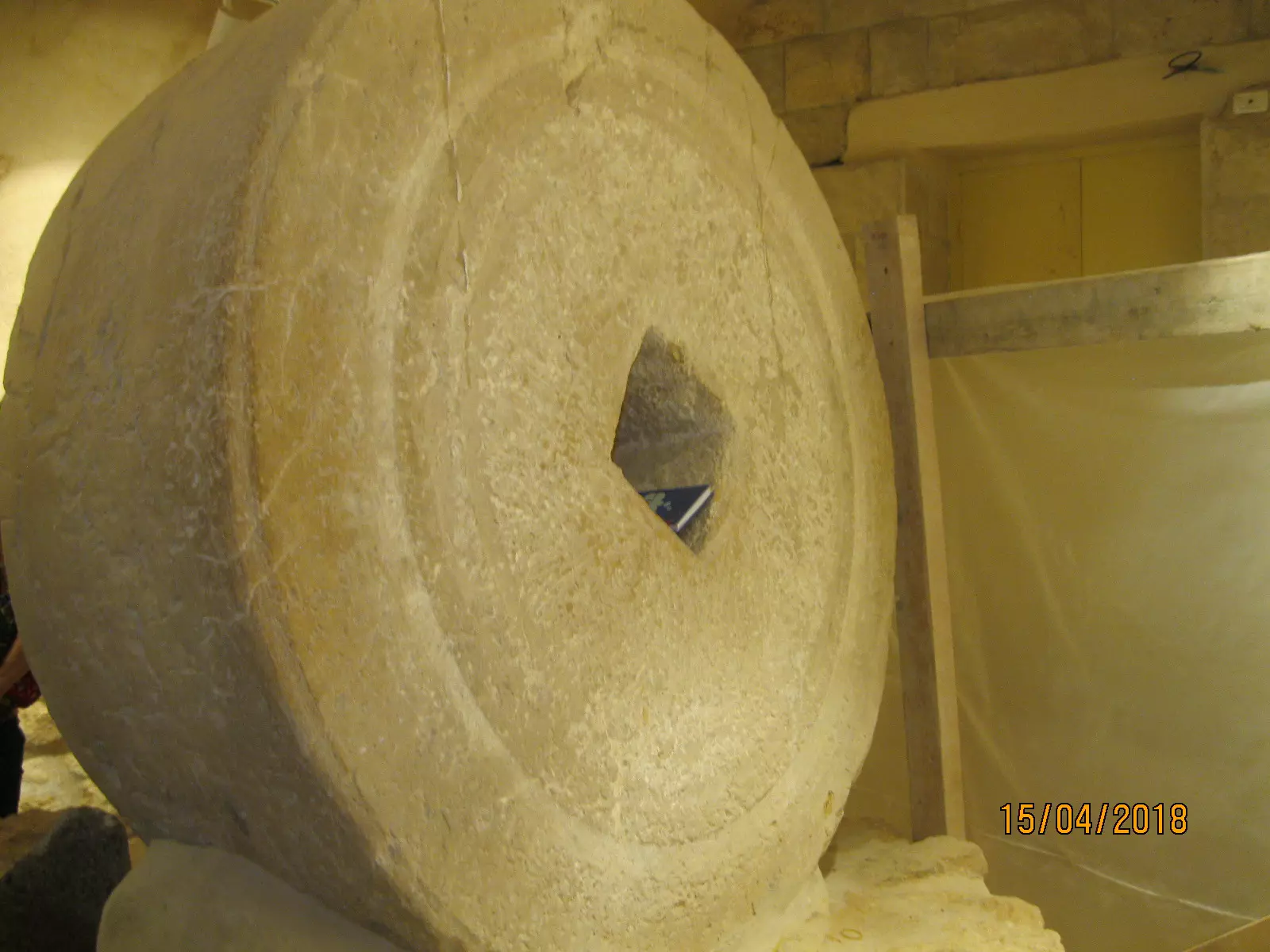
Posted by سهيل مخول - أثار قديمة في محيط كنيسة الانين - بعدسة: سهيل مخول
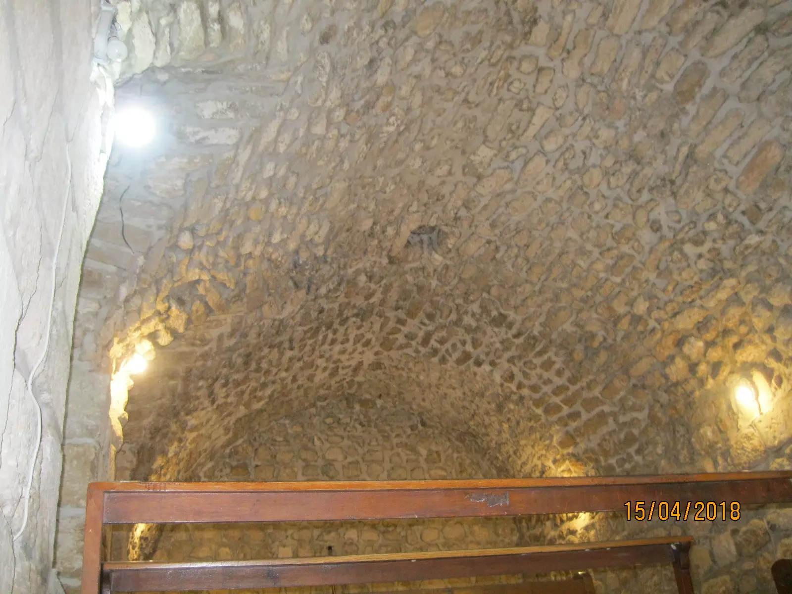
Posted by سهيل مخول - أثار قديمة في محيط كنيسة الانين - بعدسة: سهيل مخول
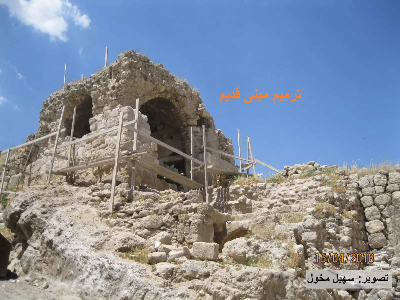
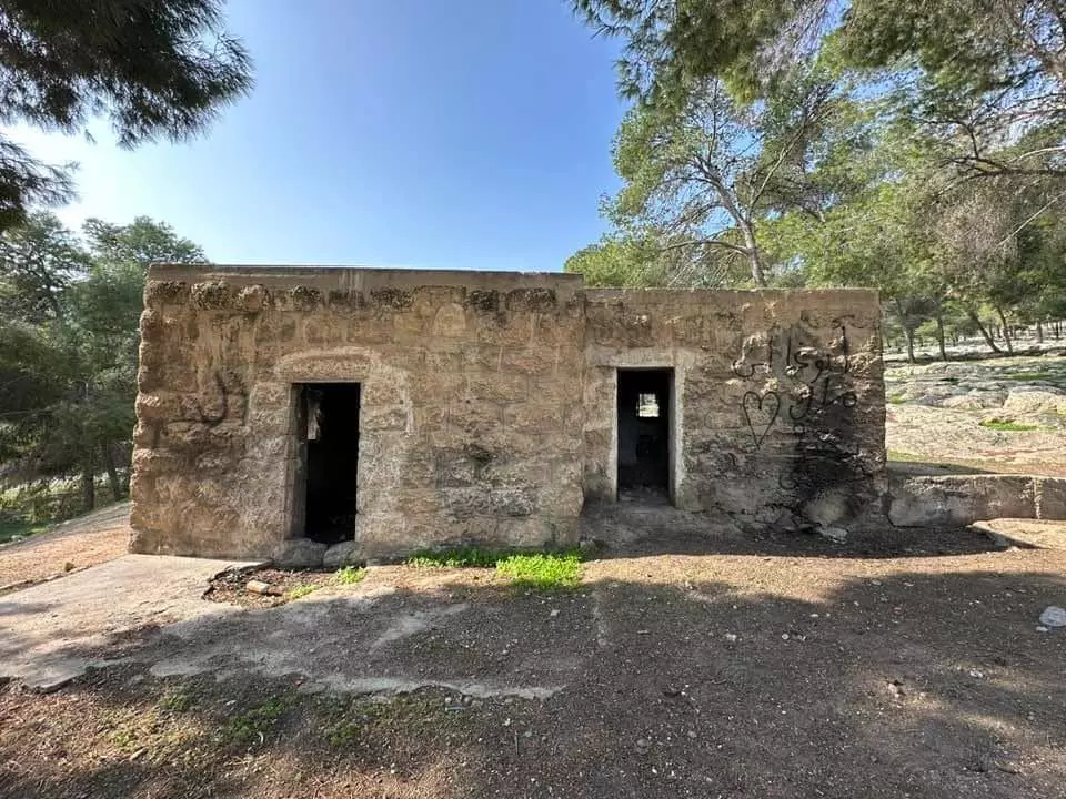
Posted by سهيل مخول - ترميم مبنى قديم في العيزرية - بعدسة: سهيل مخول
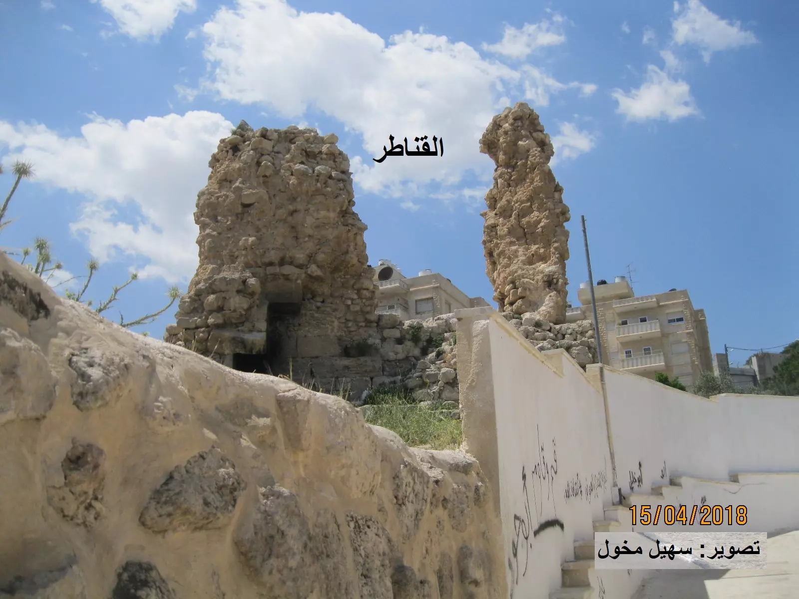
Posted by سهيل مخول - القناطر في العيزرية - بعدسة : سهيل مخول
Posted by سهيل مخول - أثار قديمة في محيط كنيسة الانين - بعدسة: سهيل مخول
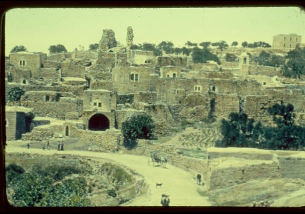
Posted by سهيل مخول - صورة رائعة للعيزرية غضون الحرب العالمية الثانية -- General View of Bethany during WWII, 1940-1944
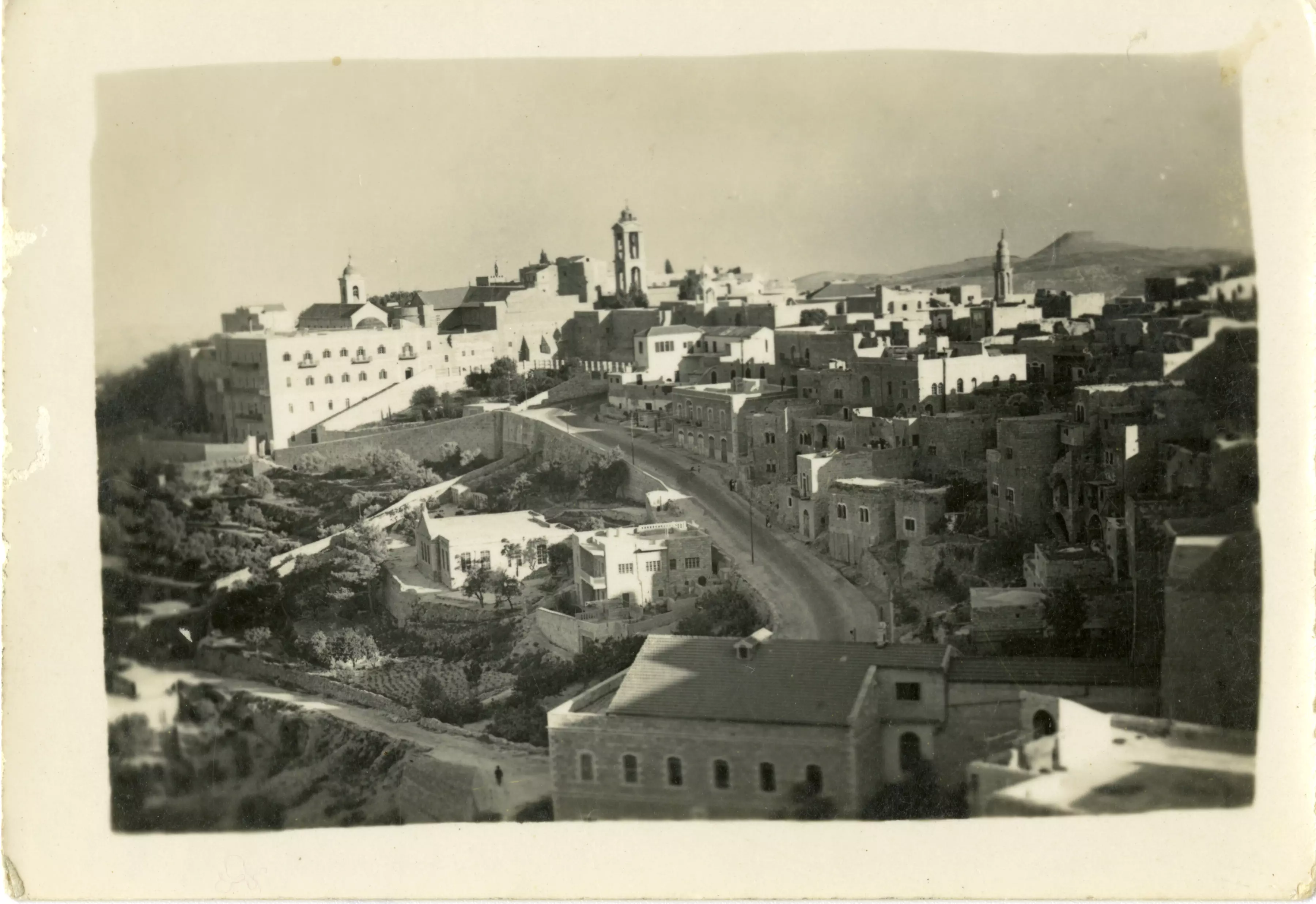
- صورة رائعة للعيزرية غضون الحرب العالمية الثانية -- General View of Bethany during WWII, 1940-1944, #2
- مشهد في العيزرية قبل مئة عام
- العيزرية - أبوديس - البحر الميت شرق فلسطين - جبال الأردن بعد البحر.
للمصور فرانك شولتن قبل 100 عام
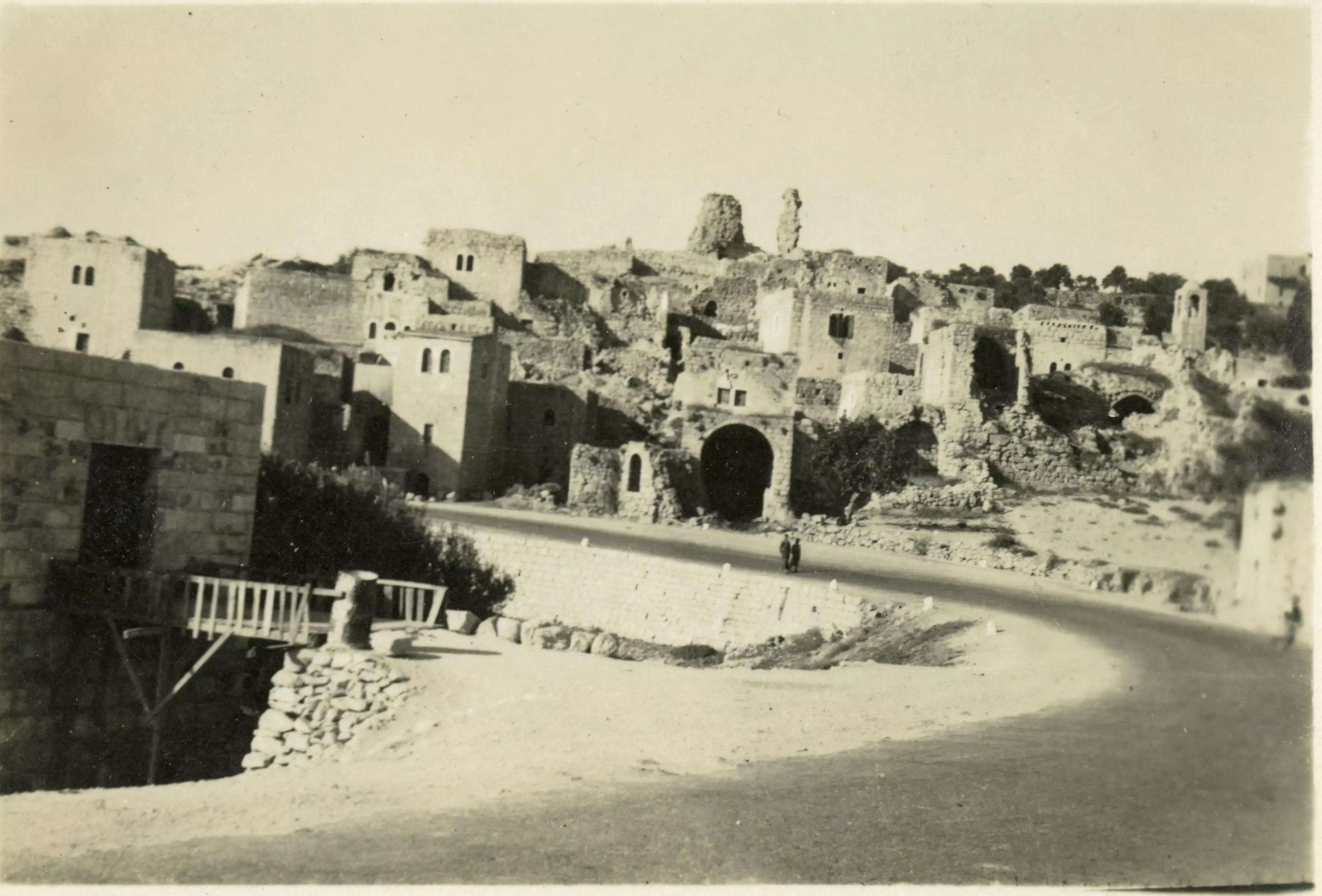
- العيزرية - الفرق بين الصورتين 92 سنة
رقم واحد كنيسة للروم الأرثوذكس. رقم 2 لا أستطيع تذكره لكنه يتبع لطائفة مسيحية على ما أعتقد. وما في الدائرة نسيت ما كان يمثله. سيتم التعديل بعد أن يوضح لنا أصدقاء المعلومات.. بالنسبة للسهم يشير لنفس الطريق-- واجد النوباني
- العيسوية كما كانت قبل 100 عام
- العيزرية "بيت عنيا" 1860م
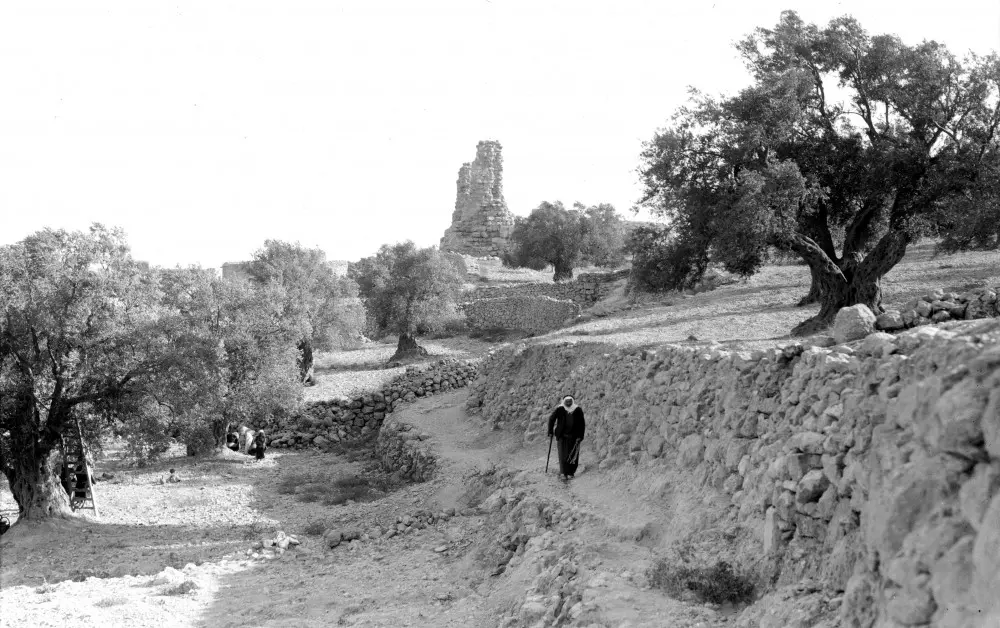
- زيارة لوادي الحوض ببلدة العيزرية -- إياد جابر
- زيارة لوادي الحوض ببلدة العيزرية -- إياد جابر #2
- زيارة لوادي الحوض ببلدة العيزرية -- إياد جابر #3
- زيارة لوادي الحوض ببلدة العيزرية -- إياد جابر #4
- زيارة لوادي الحوض ببلدة العيزرية -- إياد جابر #5
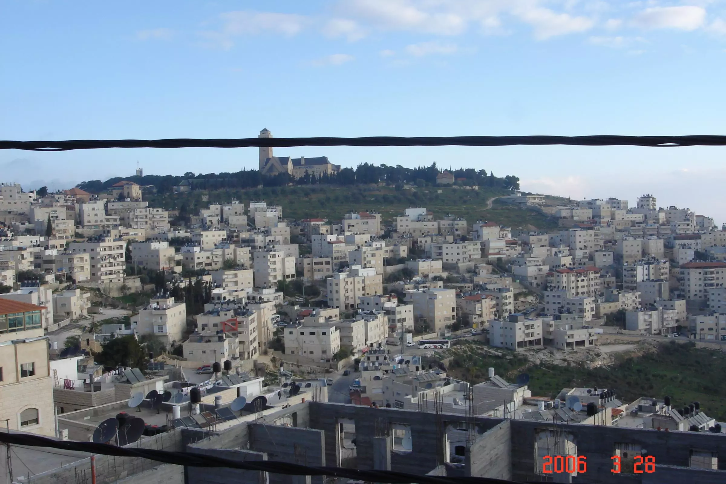
- منظر عام رائع للبلدة من الجامعة العبرية
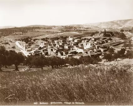
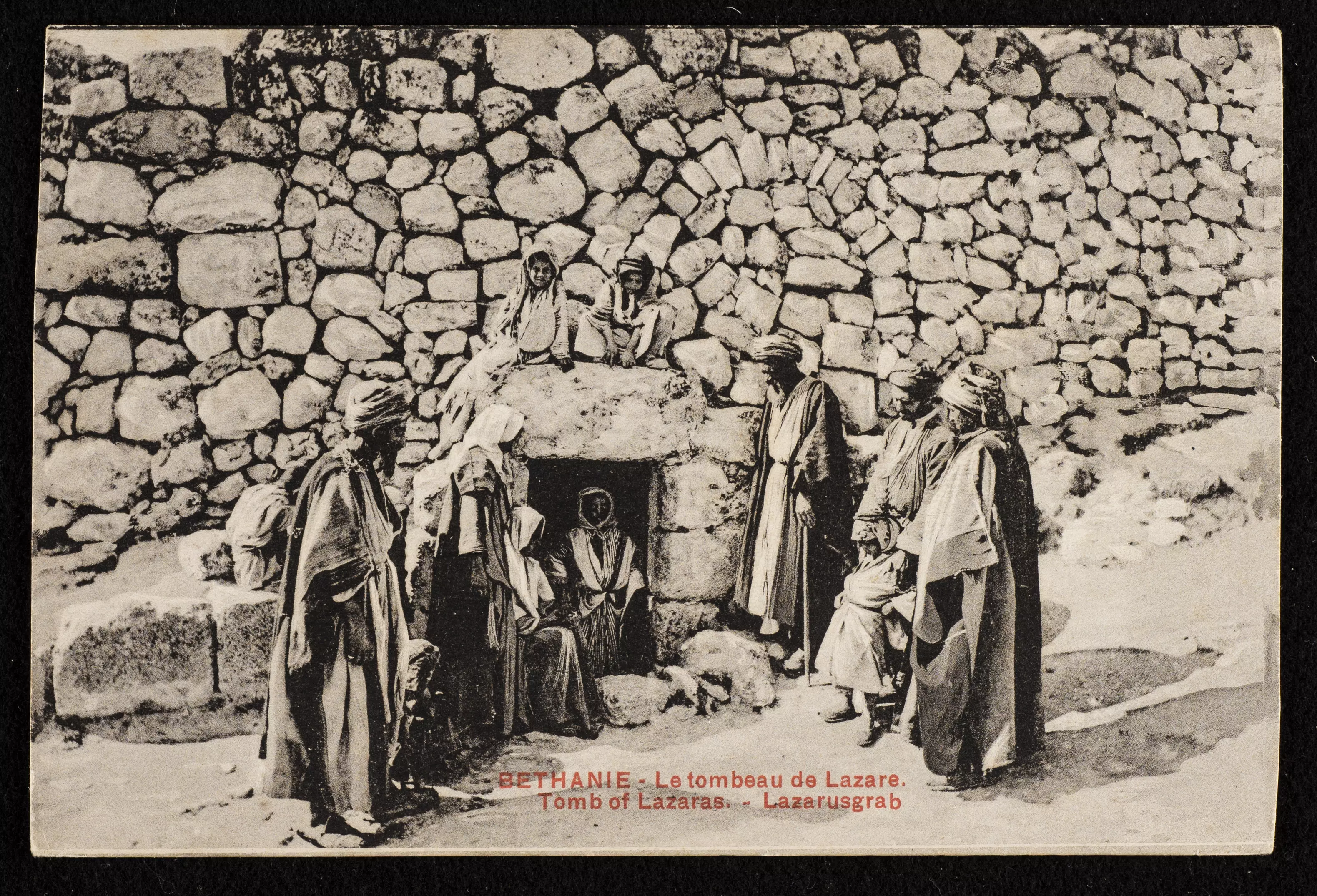
- A postcard for the village dated before WWI
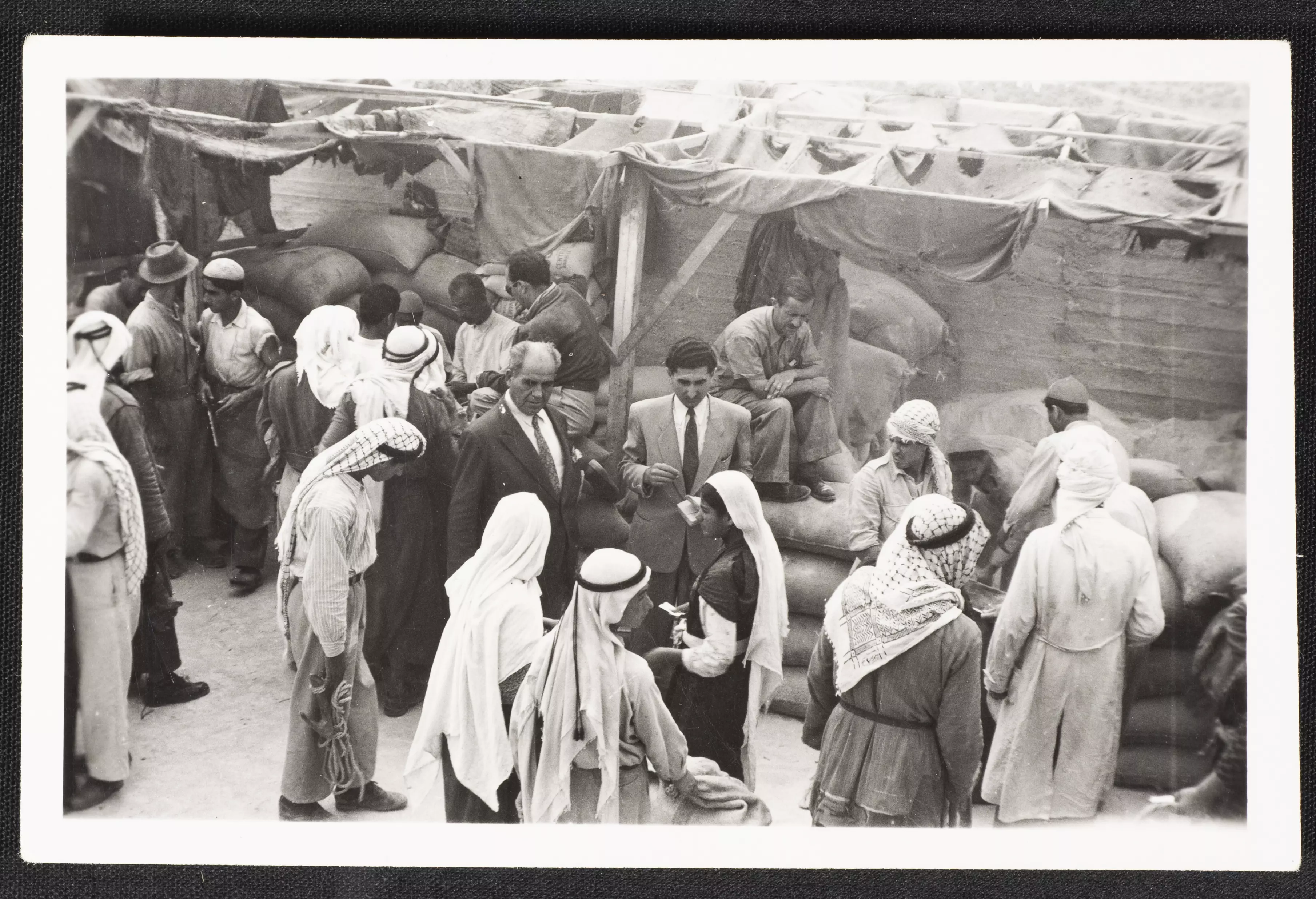
- Palestinian Refugees Receiving Assistance in al-Eizariya, 29 September 1949
Want to browse more? 80,000 pictures were grouped in these gallaries:
| Display Name | Clan/Hamolah | Country of Residence |
| مطر | werny | القدس, فلسطين |
| عامر | - | - |
| abu khalaf | - | - |
| maz | jabr | luanda |
| MOHAMMAD QATMERAH | QATMERAH | PALESTINE, PALESTINE |
| AYMAN | AL MUKAHAL | JERUSALEM |
| ahmad sulieman muhamad ali alkhatib | alkhatib abualsheikh | north carolina, united states |
No links have been shared yet, be free to the first to share the first link.
 Fake Valor: Why Did Zionist Jews Hoist Nazis Flag on Their Ships in the 1930s?
What is new?
-
Facts About Oct. 7th Gaza Raid
-
Remined Us Please:: Who Did Rape Who? Palestinians Raped Israelis? Or, was the other way around?
-
When Prof. Edward Said was invited to debate Bibi Netanyahu in the 1980s, watch what happened!
-
Ezra Klein of the NY Times on the "Jewish Race".
-
Abusing Blood Libel!
-
Zionist FAQ: Isn't it true that Palestinians don't want peace? Palestinians never accepted the two-state solution
- Facts about Haavara (Transfer) Agreement between Ben-Gurion & Hitler
-
Haavara FAQs: Why Did Zionist Jews Hoist Nazis' Flags on Their Ships in the 1930s?
-
Dear ChatGPT: How did Palestinians resist Napoleon's invasion of their country in 1799?
-
Dear ChatGPT: Gaza had a vibrant Jewish community in the mid-17th century. What happened to them?
-
Dear ChatGPT: Why did the Jewish Agency suppress news of the Holocaust during WWII?
-
Video Playlist: Jews share their DNA tests to end the conflict for good.
-
A Tale of Two Conflicts: Examining the Definition of Genocide
-
Prof. Abraham Polak And The Suppressed History of the Khazars and European Jewry
-
How Ronald Reagan would have framed the genocide in Gaza if he were still alive?
-
Haavara FAQs: Let us do the math: how many German Jews did The Haavara Agreement save?
-
Zionist FAQs: The Hebron Massacre of 1929, "clearly proves" that Palestinians are antisemitic, how could you deny it?
-
Zionist FAQs: Why Anti-Zionist Is Not Antisemitism?
-
Zionist FAQs: Isn't it true that the KGB create Palestinian Nationalism in the early 1960s?
- Zionist FAQs: Muslims are killing Muslims all the time; why are Israeli Jews being singled out in the media?
- Zionist FAQs: How is Israel an apartheid state when 20% of its citizens are Arabs who enjoy full rights?
-
Haavara FAQs: Analysis of Herzl's Uganda Scheme and how it could have saved millions of Jews.
-
Haavara FAQs: Why did Hayim Greenberg describe American Jewry as "morally bankrupt" in early 1943?
-
Haavara FAQs: What if the Evian Conference was a resounding success? What would have been the impact of saving European Jewry on Zionism?
- Haavara FAQs: What if the six million were saved, how that would have impacted the Zionist project?
-
Haavara FAQs: How did Zionist leaders react when Europe's Jews lingered in the DP camps after WWII ended?
-
Why does the American Jewish community repeat lies that David Ben-Gurion had debunked before he died?
-
Who has the power to rename the Tatar/Khazar Gene Marker to Jewish IV?
-
Zionist FAQs: Why won't Egypt, Syria, and Jordan take their people back? Jews are indigenous to Palestine, and Arabs immigrated after Jews developed the country. Arabs should leave.
-
Haavara FAQs: Did Hitler and the Nazis conflate between Judaism and Zionist? If that wasn't case, then why?
-
Haavara FAQs: Winston Churchill and antisemitism, a collection of articles written Churchill.
-
Haavara FAQs: Broken by country, how many Jews survived vs. killed during the Holocaust?
-
Haavara FAQs: Why did European Jews vote with their feet and to immigrated to the Americas, not Palestine, after WWII?
-
Watch this American Jewish Girl describing Israeli Jews' cognitive dissonance like no other in under two minutes
-
Haavara FAQs: When the Nazis went out of their way to hide the Holocaust, Israeli Jews did the exact opposite by broadcasting their genocide of Gazans. But why?
-
Haavara FAQs: How Zionist Jews went out of their to show their appreciation to Nazism and Fascism?
- Haavara FAQs: Why Zionist leaders were against bombing the death camps & the Railroads leading to them?
-
Haavara FAQs: Hitler's message to the British and American people: If Jews are such noble citizens and you care about them, how come you're not letting them in? I will gladly ship them to you at my expense, even on luxury liners!
-
A shortlist of Zionist and Israeli false flag operations in the name Jews.
-
The Most Moral Army
- The Land of Kapos (Israel): Where the brave are boycotted and Kapos walk free.
- Why did early Zionists often named their communal enterprises "colonial"?
- Zionist Relations with Nazi Germany by Faris Glubb
-
Two NY Times advertisements by Zionists in the early 1943 that exposes Zionists' treason at the height of the calamity
- Facts Not Lies about the Palestinian-Israeli Conflict.
- Site's pictures have been categorized
- Campgain Against Lice
- A Survey of Palestine, the official source about Palestine before Nakba produced by the British Mandate; over 1200 pages.
- Satellite View & Google Earth: Over 6,000 placemarks identifying all destroyed towns, W. Bank & Gaza Strip Towns, & refugee camps.
- PalestineRemembered.com and its Nakba Oral History Project were featured on al-Jazeera Satellite TV.
- Nakba Oral History Video Podcast:
 Over 700 Oral History interviews (including 3,500+ hours of recording) can be viewed online.
 - Palestine Village Statistics Project
- Gaza Jail Break
- النسخة العربية للموقع الان متوفرة
- Videos: Documenting the destroyed villages in video: Tracing all that remains since Nakba.
- Videos: Responding to Zionist Propaganda
- Interview: The ethnic cleansing of Palestine: George Galloway interviews Israeli Historian Ilan Pappe.
- For Palestinians, memory matters. It provides a blueprint for their future By George Bisharat.
- Zionist FAQ now available in Hebrew שאלות שציונים שואלים, עכשיו בעברית
- Video: The Stephen Walt and John Mearsheimer report on the influence of the Israel Lobby on U.S. Foreign Policy
- The Palestinian-Israeli conflict for beginners
