| PalestineRemembered | About Us | Oral History | العربية | |
| Pictures | Zionist FAQs | Haavara | Maps | |
| Search |
| Camps |
| Districts |
| Acre |
| Baysan |
| Beersheba |
| Bethlehem |
| Gaza |
| Haifa |
| Hebron |
| Jaffa |
| Jericho |
| Jerusalem |
| Jinin |
| Nablus |
| Nazareth |
| Ramallah |
| al-Ramla |
| Safad |
| Tiberias |
| Tulkarm |
| Donate |
| Contact |
| Profile |
| Videos |
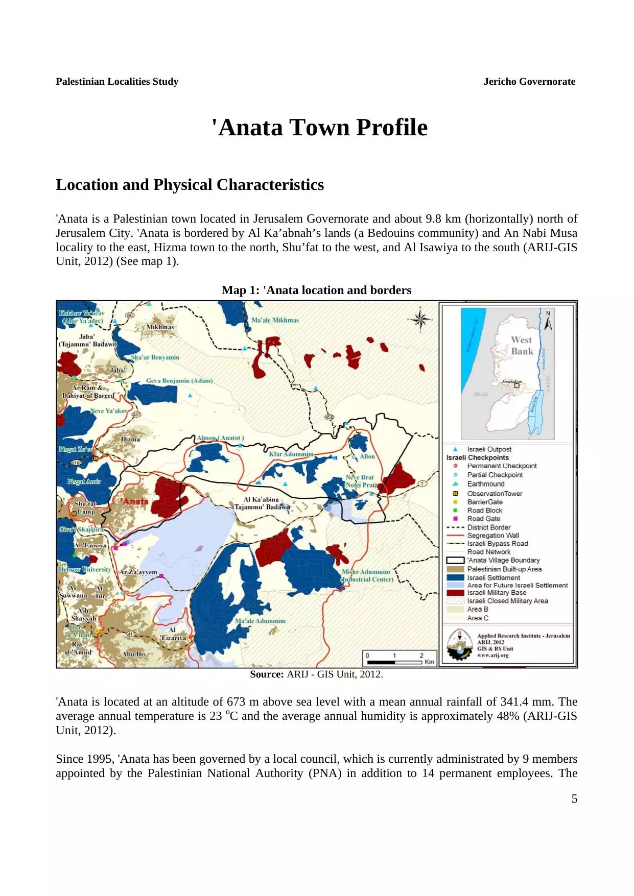
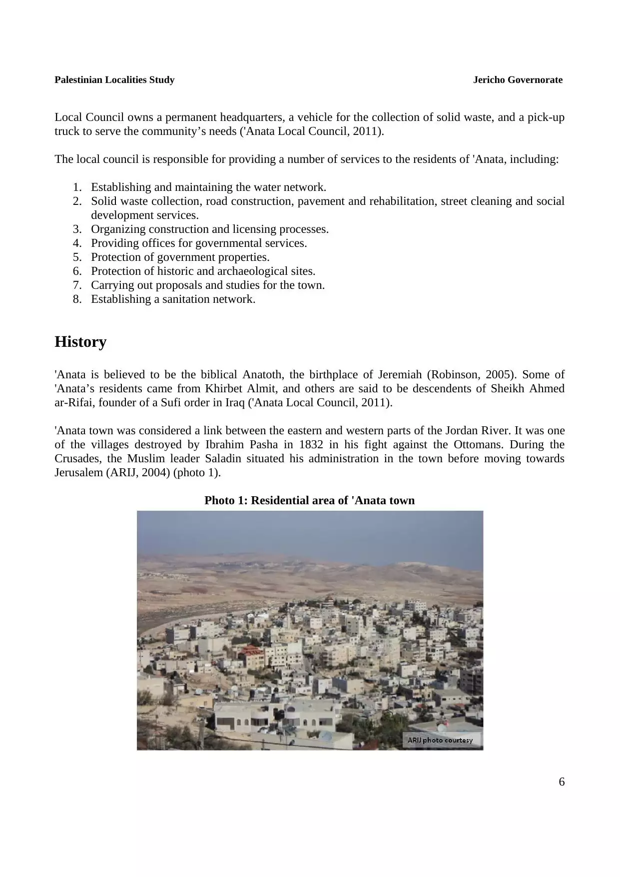
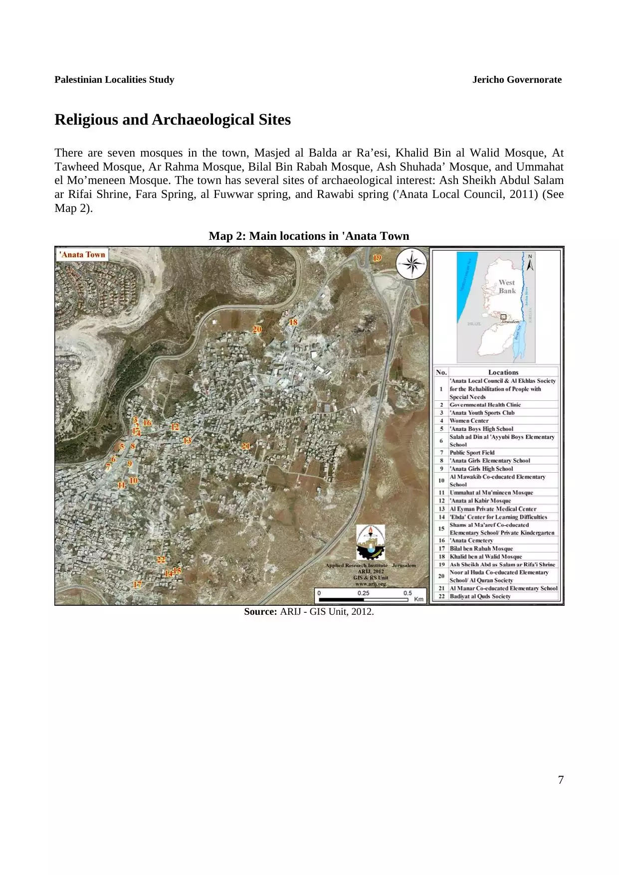
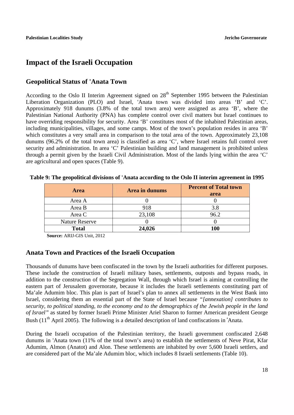
Welcome To 'Anata - عناتا (ענאתא)
|
District of Jerusalem
Occupied days ago |
العربية Google Earth |
 |
Gallery (51) |
- Statistics & Facts
-
Before & After

- Satellite View
- Articles 6
- Pictures 51
- Aerial Views 1
- Members 15
- Families
- Wikipedia
- ARIJ Guide
- Videos 5
- Guest Book 16
- Links
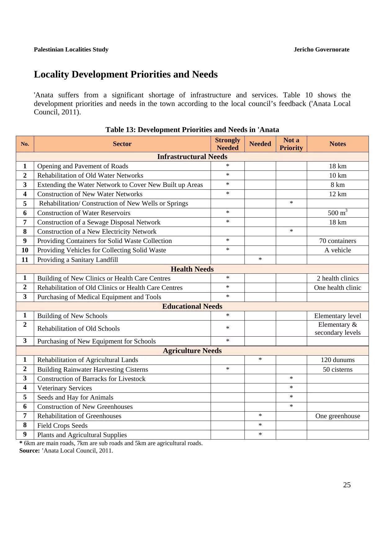
| Statistic & Fact | Value | ||||||||||||||||||
| Distance From District | 4 km northeast of Jerusalem | ||||||||||||||||||
| Elevation | 681 meters | ||||||||||||||||||
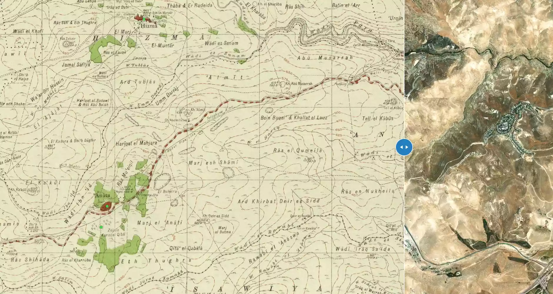
| Before & After Nakba, Click Map For Details |
|||||||||||||||||||
|
|||||||||||||||||||
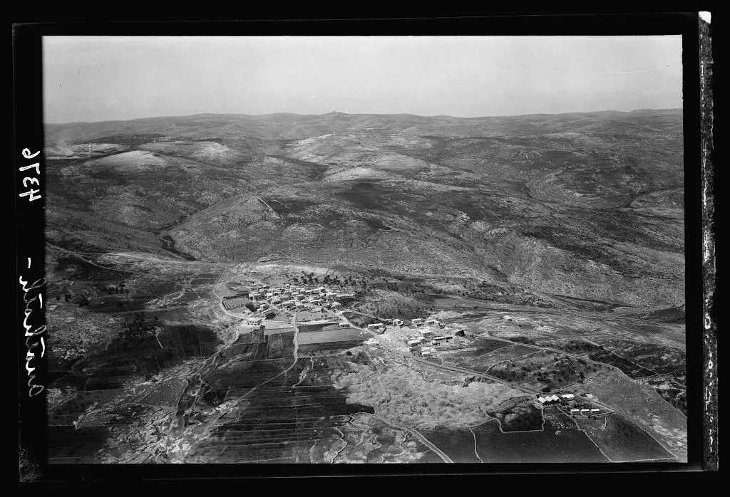
| Pre-Nakba Aerial View |
|||||||||||||||||||
|
|||||||||||||||||||
| Land Ownership |
**Town Lands' Demarcation Maps |
||||||||||||||||||
| Land Usage As of 1945 |
|
||||||||||||||||||
| Population |
|
||||||||||||||||||
| Near By Towns |
|||||||||||||||||||
|
|||||||||||||||||||
| Featured Video | |||||||||||||||||||
| ARIJ Guide | |||||||||||||||||||
3.
4. 
5. 
6. 
7. 
8. 
9. 
10. 
11. 
12. 
13. 
14. 
15. 
16. 
17. 
18. 
19. 
20. 
21. 
22. 
23. 
24. 
25. 
Click here to browse online. |
|||||||||||||||||||
| Related Maps | Town Lands' Demarcation Maps خرائط للقضاء توضح حدود القرى والاودية View from satellite Town's map on MapQuest Help us map this town at WikiMapia |
||||||||||||||||||
| Related Links | Wikipedia's Page Facebook Page ARIJ Guide Google Search Google For Images Google For Videos في كتاب بلادنا فلسطين دليل أريج المزيد من موقع هوية |
||||||||||||||||||
- أبناء عبد الحميد بن علي بن ابراهيم بن سليمان بن عبد السلام الرفاعي العناتي
- عناتا بلد الرفاعيين والناس الطيبيين والماء والهواء وحجارة بيت المقدس
- الإمارات العربية المتحدة - أبوظبي
- مصادر أكيدة عن عناتا وصلتها بالرفاعيين قبل وبعد الاسلام
- عناتا القدس.بقلم موسى احمد صالح ابراهيم
- السيد الجليل والإمام الزاهد أحمد الرفاعي
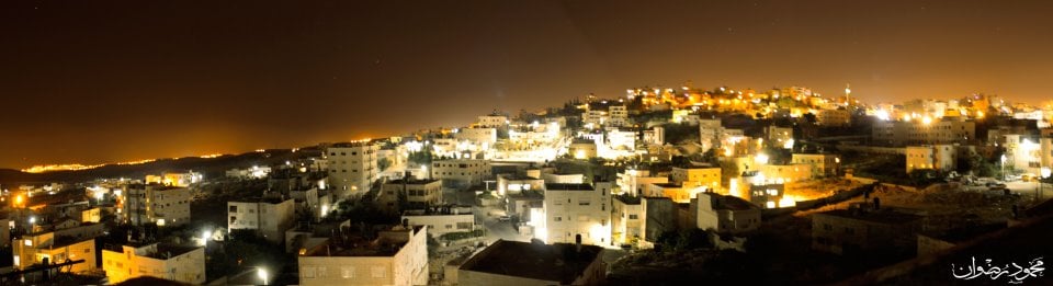
- صورة بانورامية لبلدة عناتا ليلاً-عدسة محمود رضوان
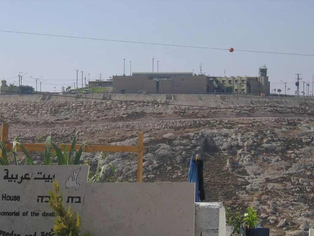
Posted by محمود رضوان - An Israeli prison/concentration camp for Palestinians. If you know the name of this prison, please provide in the comments section below.
2 - General view #2
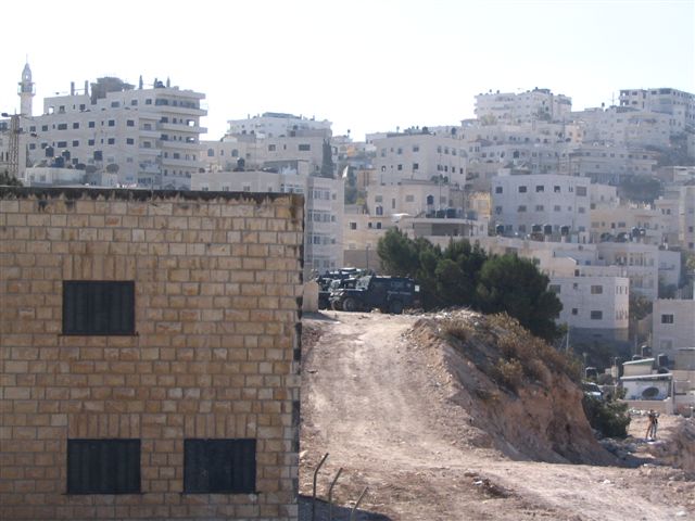
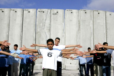
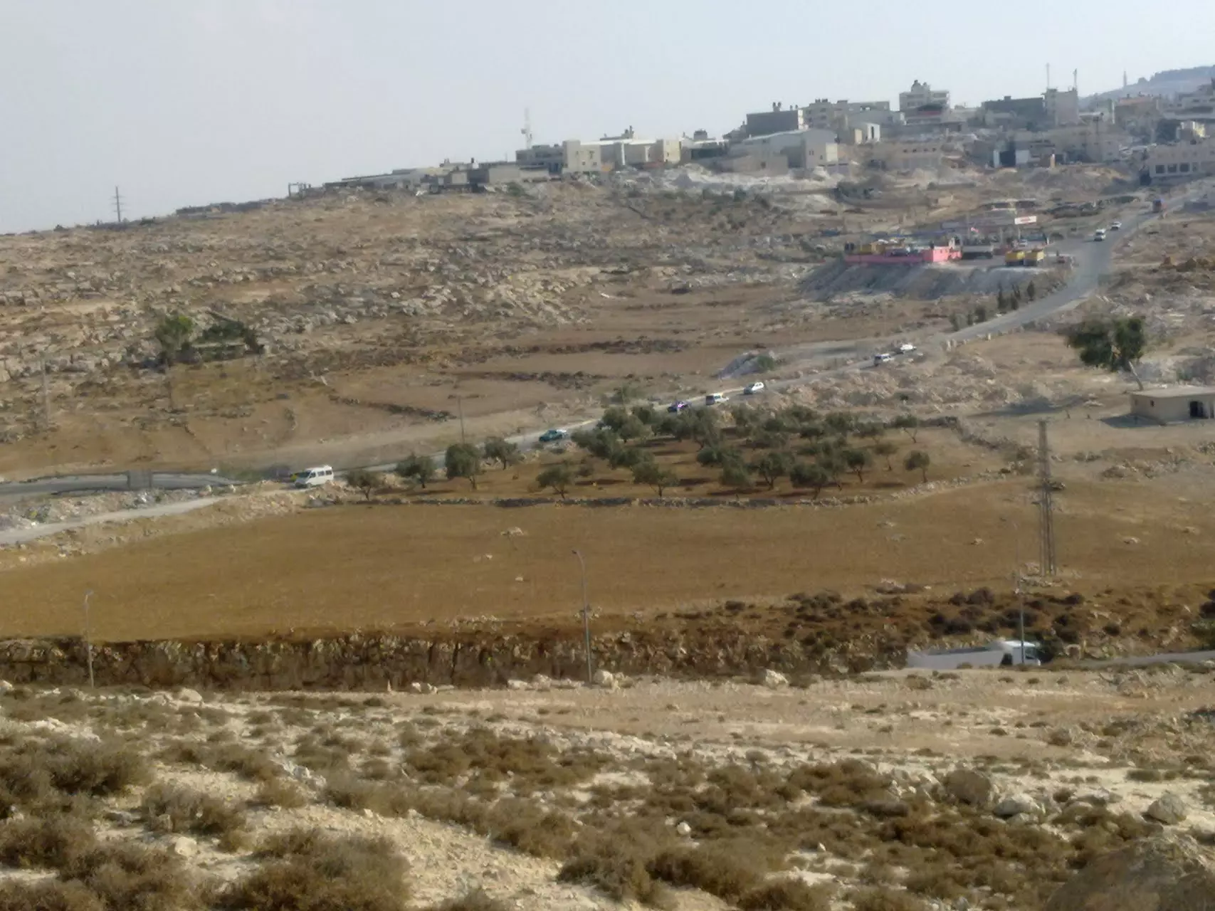
12 - General view #3 in the path of the Apartheid Wall
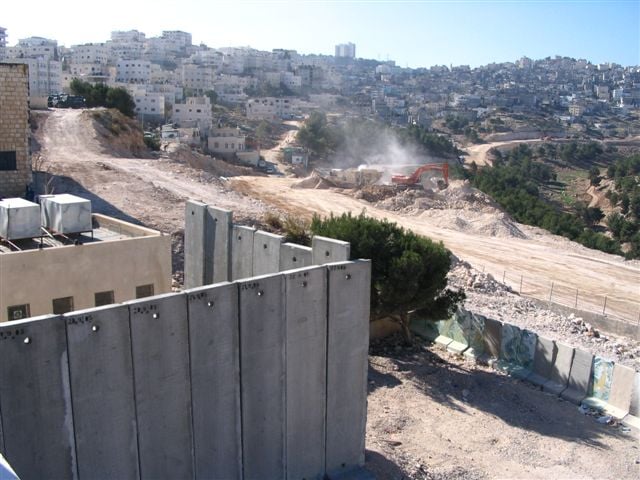
1 - General view #4 behind the Apartheid Wall
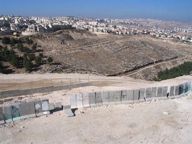
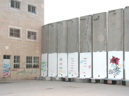
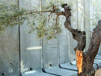
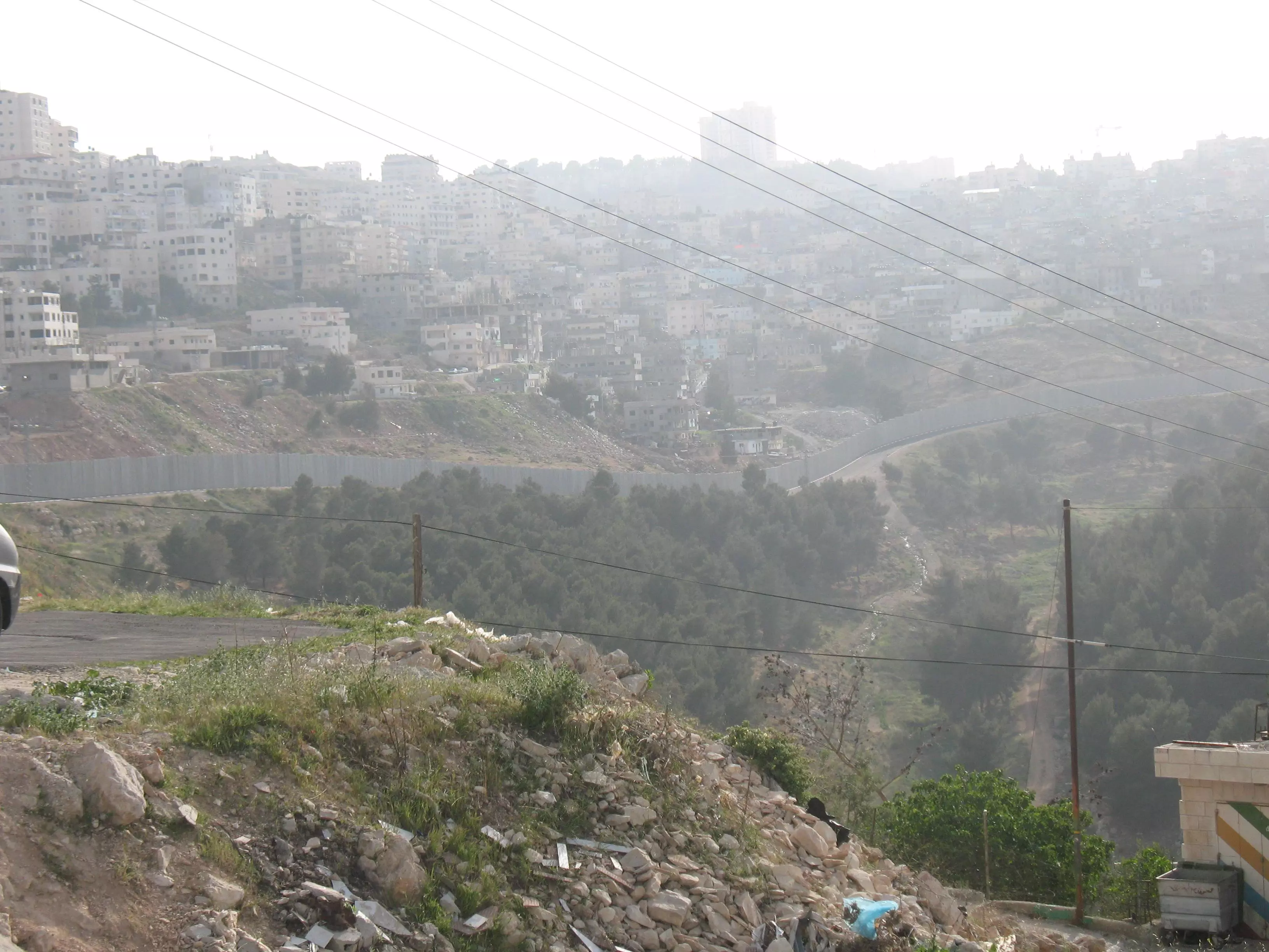
2 - The Apartheid Wall #1
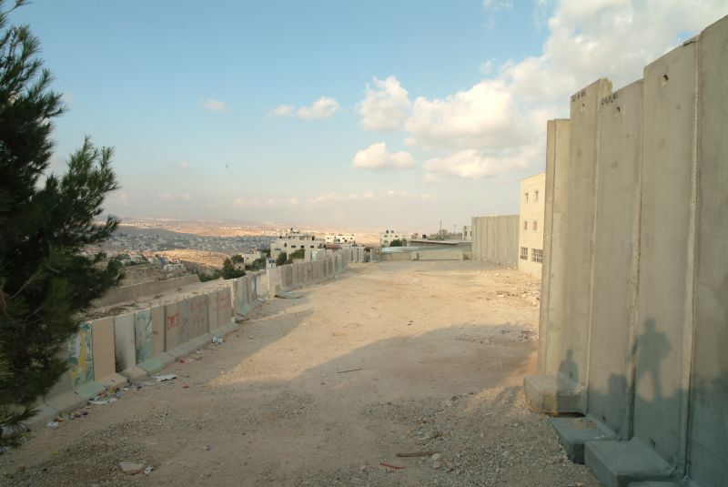
4 - The Apartheid Wall surrounds a building #2
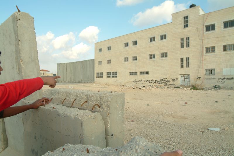
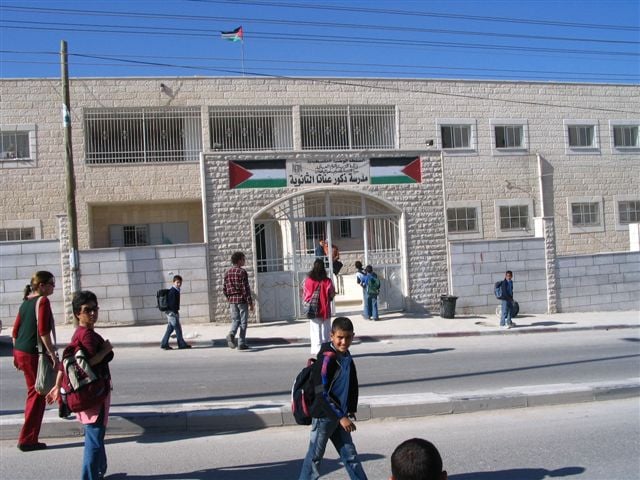
2 - The Boys School
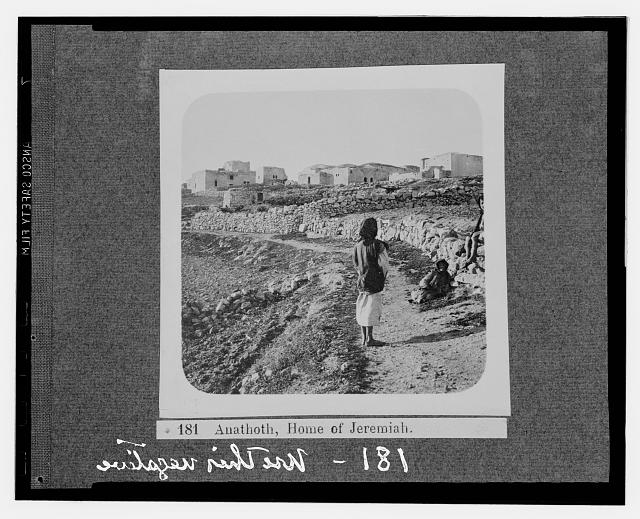
11 - صورة قديمة Jerammiah house?
Posted by ابو عمر 1 - next to the apratheid wall
Posted by معروف الرفاعي 1 - apratheid wall
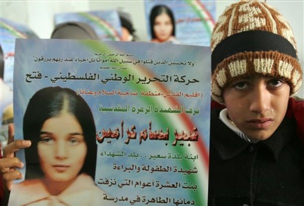
Posted by معروف الرفاعي 1 - شهيدة عناتا
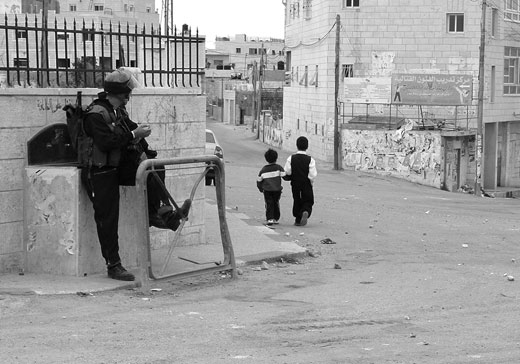
Posted by معروف الرفاعي 1 - الجنود الاسرائيليين في عناتا
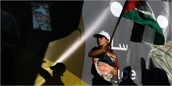
Posted by معروف الرفاعي 5 - احتفال بمناسبة ذكرى النكبة
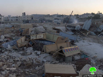
Posted by معروف الرفاعي - هدم البيوت في عناتا

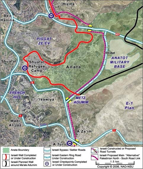
Posted by معروف الرفاعي 1 - خارطة عناتا
Posted by معروف الرفاعي - عناتا
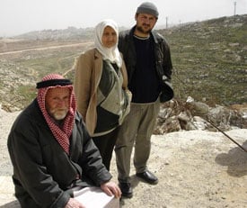
Posted by معروف الرفاعي - احدى عائلات البلدة بعد تدمير منزلها من قبل قوات الاحتلال
Posted by معروف الرفاعي - منظر لجدار الفصل العنصري البغيض
Posted by معروف الرفاعي - anata in the past
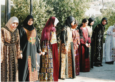
Posted by معروف الرفاعي - فلكلور عناتا
Posted by mohammad Elayyan - عناتا
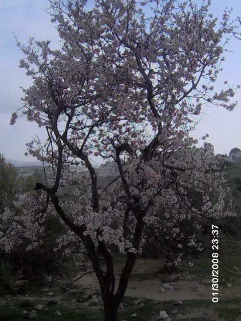
Posted by mohammad Elayyan - لوز عناتا
Posted by mohammad Elayyan - عناتا
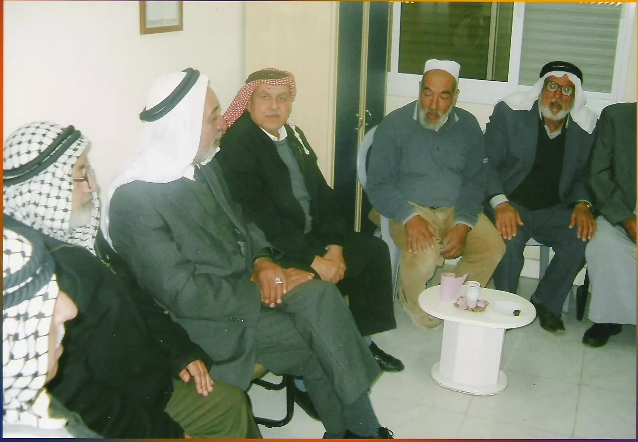
Posted by mohammad Elayyan 1 - من كبار عناتا
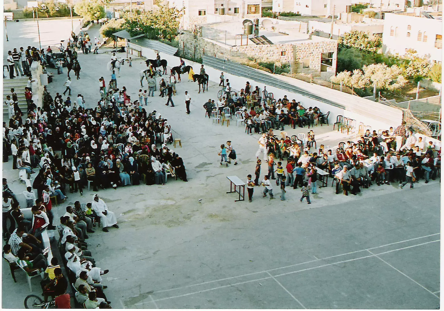
Posted by mohammad Elayyan - احتفالات عناتا
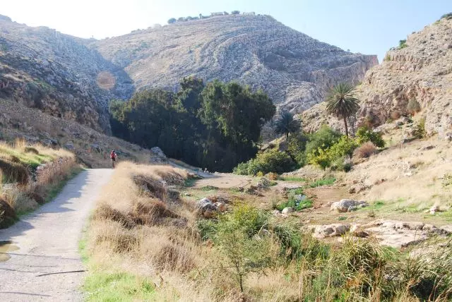
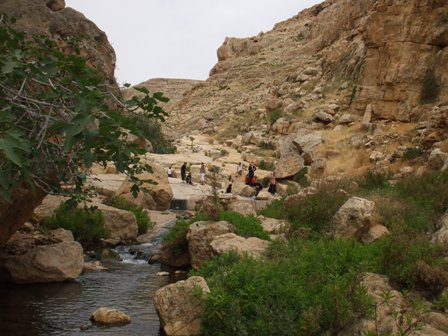
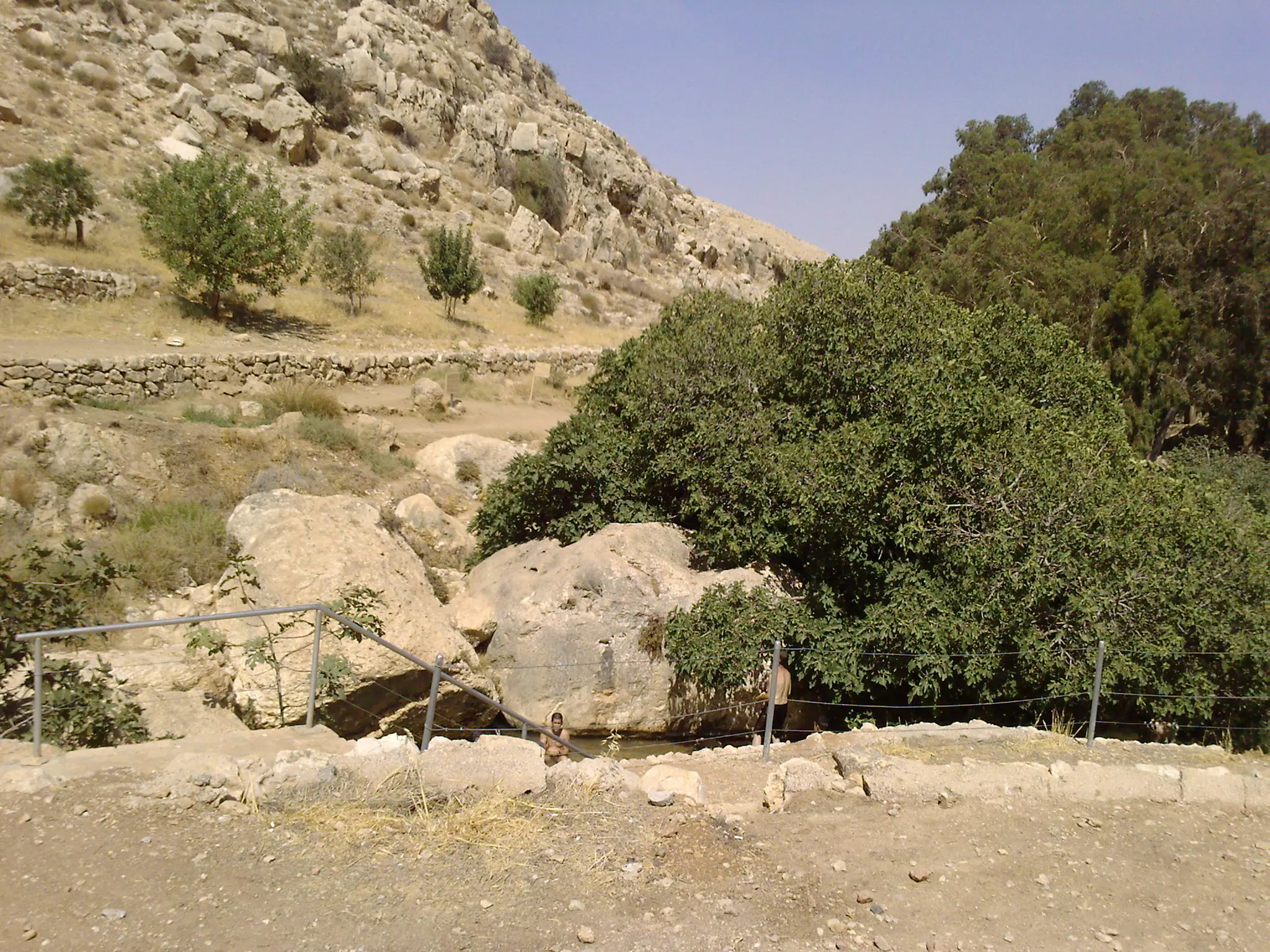
Posted by mohammad Elayyan - عين فارة / عناتا
Posted by mohammad Elayyan 2 - طريق عين فارة / عناتا
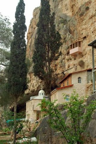
Posted by mohammad Elayyan 3 - دير عين فارة / عناتا
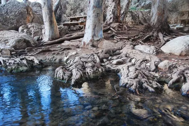
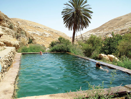
Posted by mohammad Elayyan 2 - بركة عين فارة / عناتا
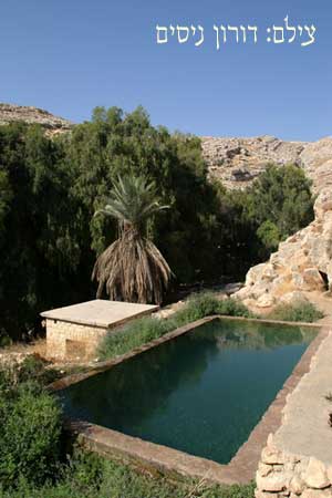
Posted by mohammad Elayyan 2 - بركة عين فارة / عناتا
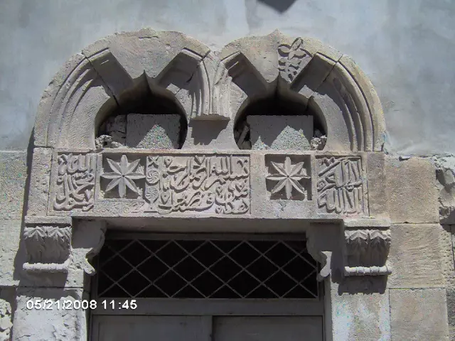
Posted by mohammad Elayyan - ضريح الشيخ عبد السلام الرفاعي ( ابو عناتا)
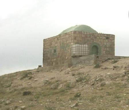
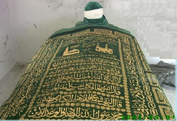
Posted by mohammad Elayyan 2 - ضريح الشيخ عبد السلام الرفاعي ( ابو عناتا) من الداخل
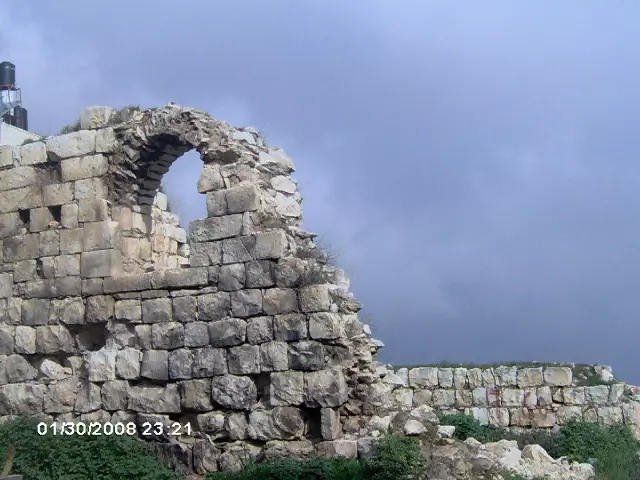
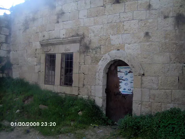
Posted by mohammad Elayyan 1 - احد منازل عناتا القديمة
Posted by mohammad Elayyan 3 - عين فارة
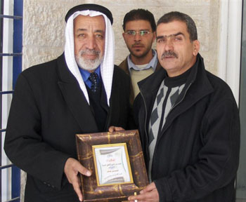
Posted by mohammad Elayyan 1 - رئيس نادي عناتا المقدسي يكرم رئيس مجلس محلي عناتا السابق
Posted by mohammad Elayyan 7 - فن النقش على الحجر
Posted by مركز عناتا الثقافي - ضريح شيخ الطريقة الرفاعية محمد عبد الباقي الرفاعي من مواليد القرن التاسع عشر
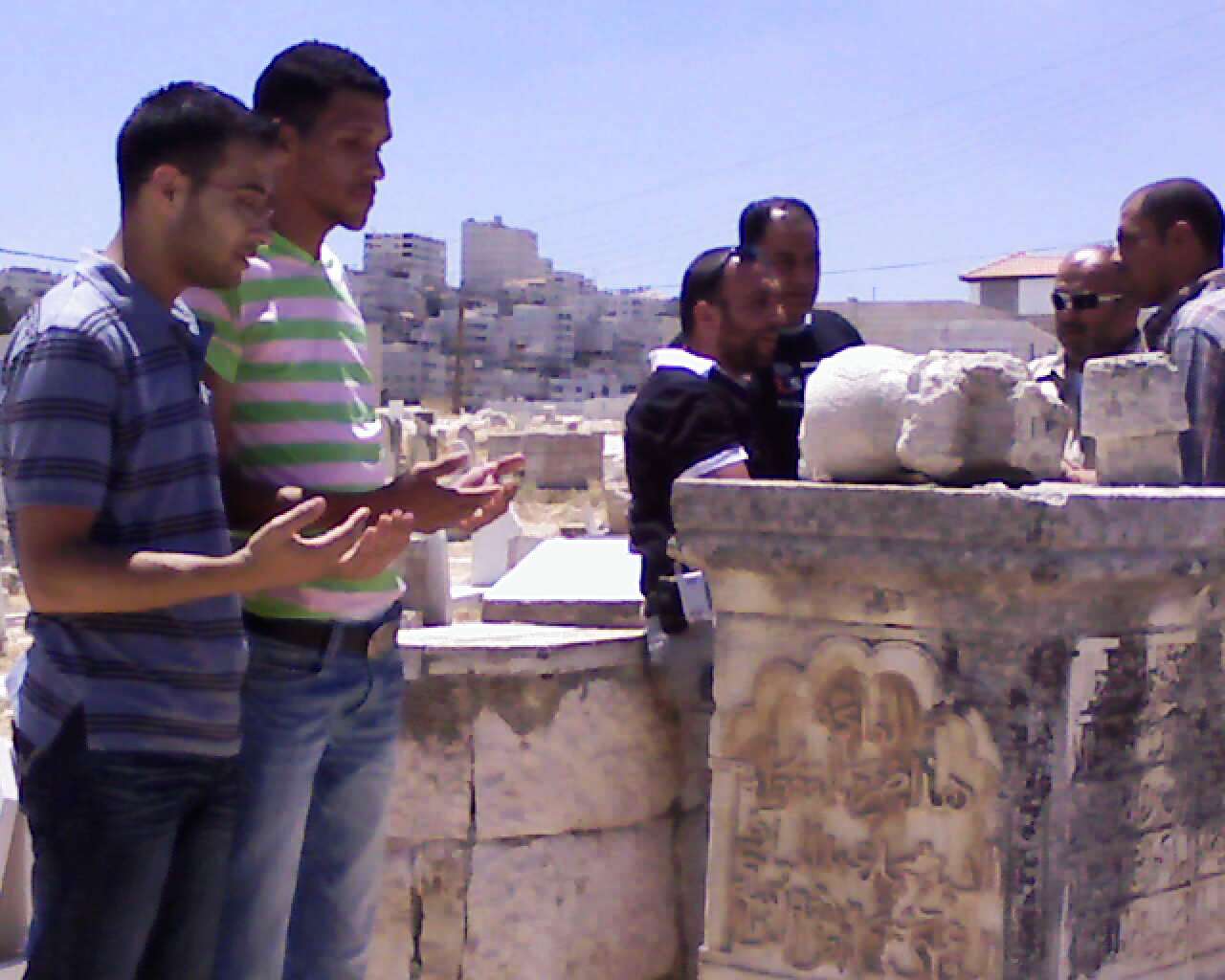
Posted by mohammad Elayyan - شباب عناتا يزورون قبر الشيخ محمد عبد الباقي الرفاعي
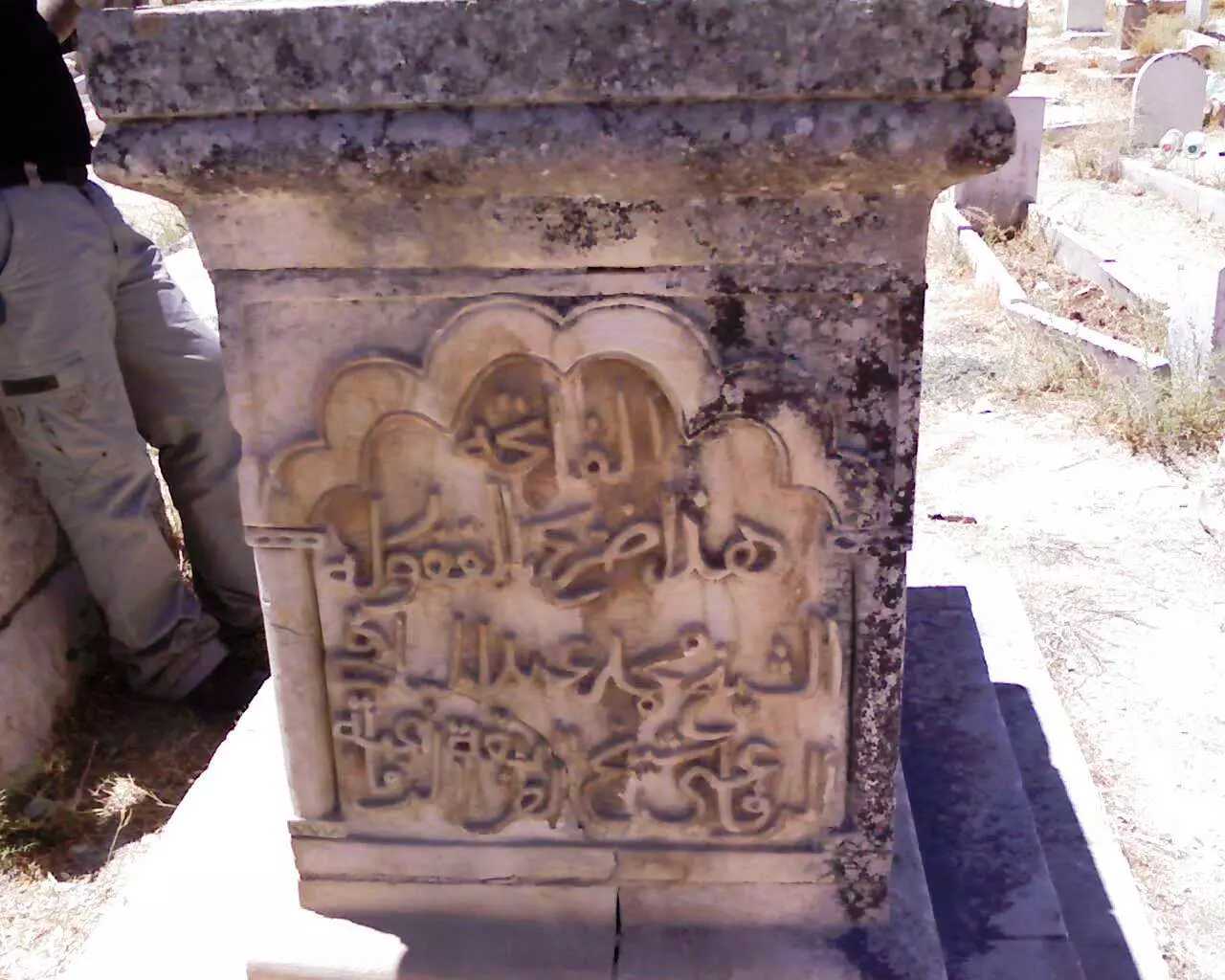
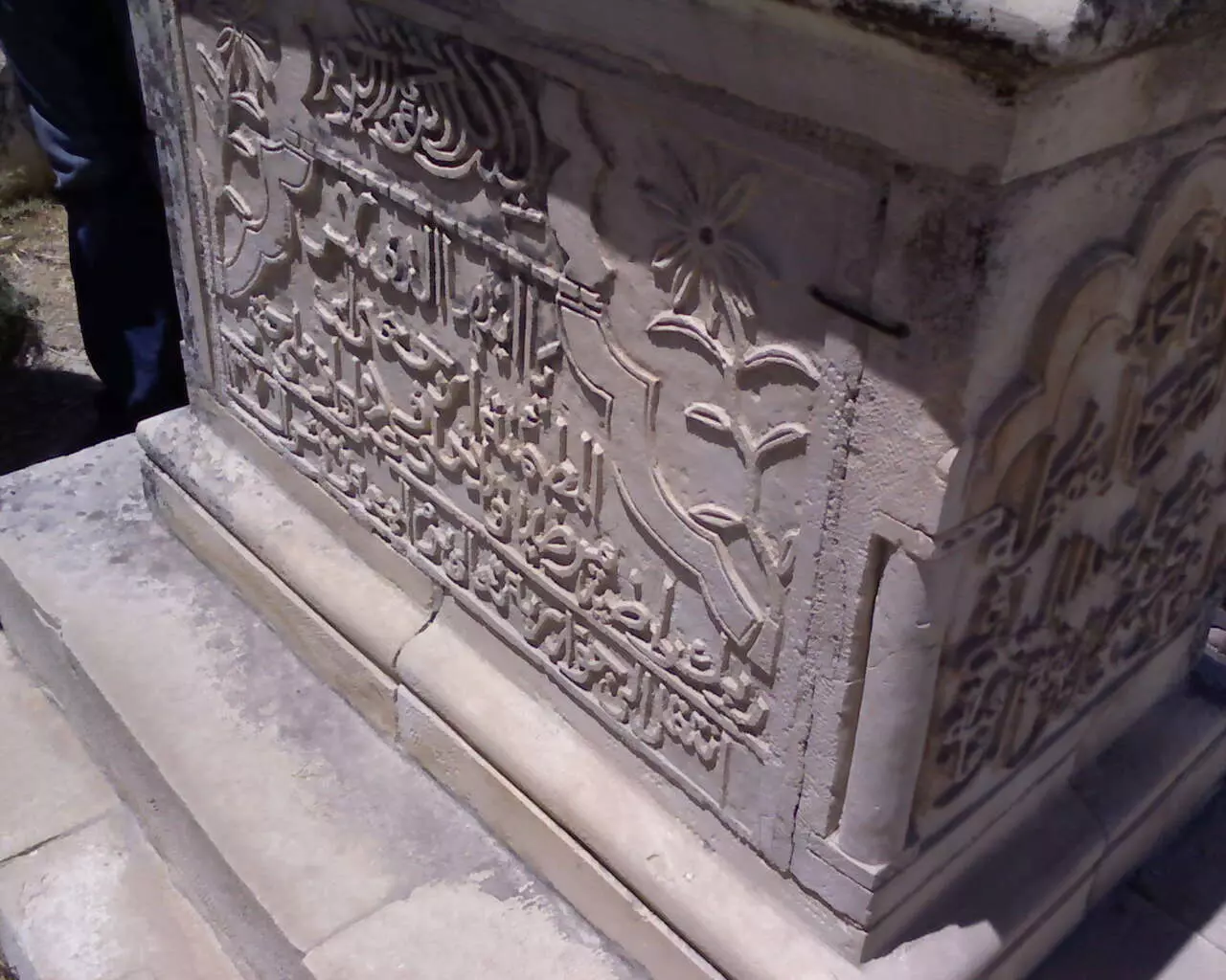
Posted by mohammad Elayyan 1 - قبر الشيخ محمد عبد الباقي الرفاعي ويظهر عليه فن النقش على الحجر
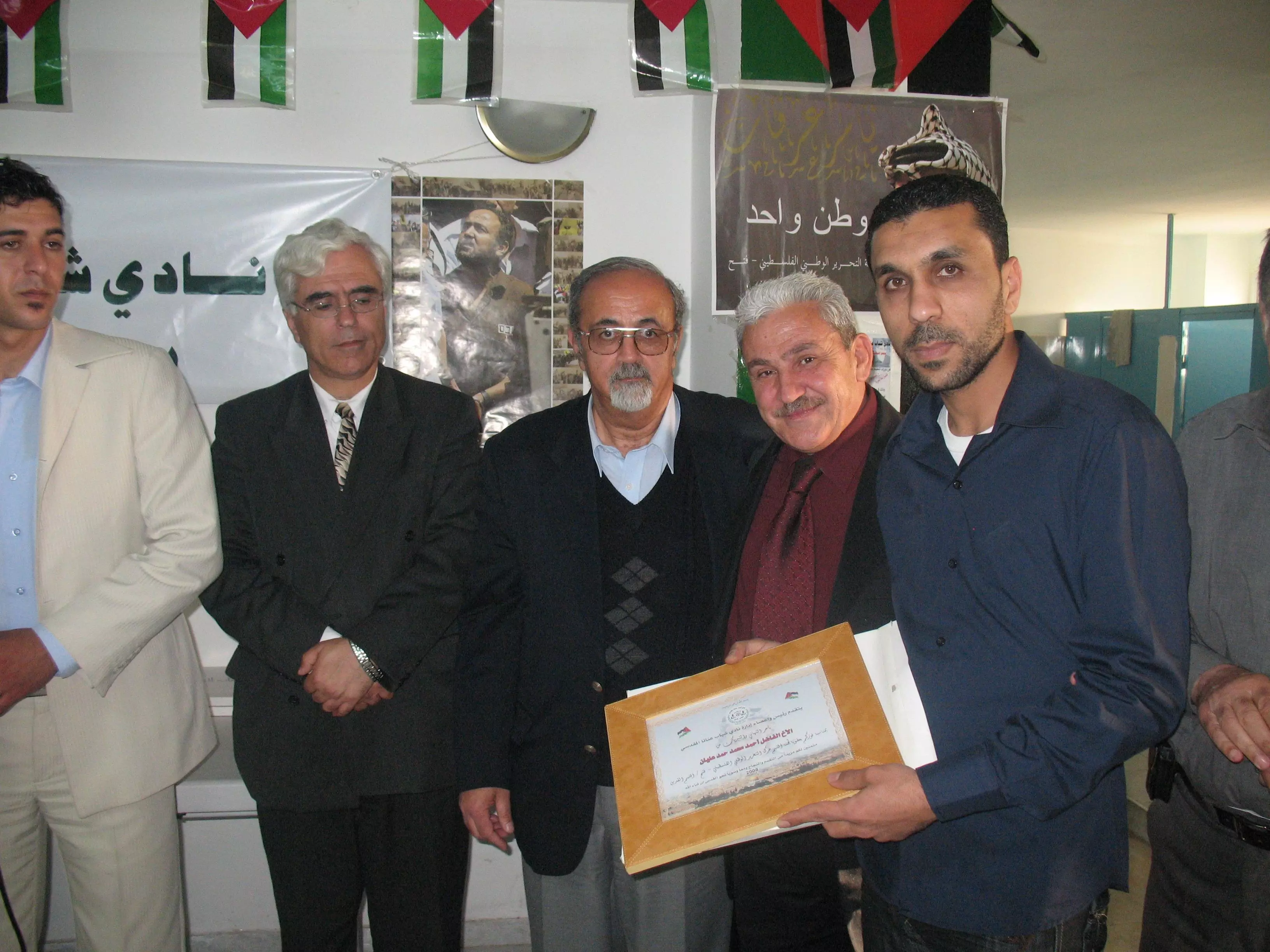
Posted by mohammad Elayyan 2 - تكريم احمد عليان
Posted by HaMaD Elayyan 5 - جدار الفصل العنصري
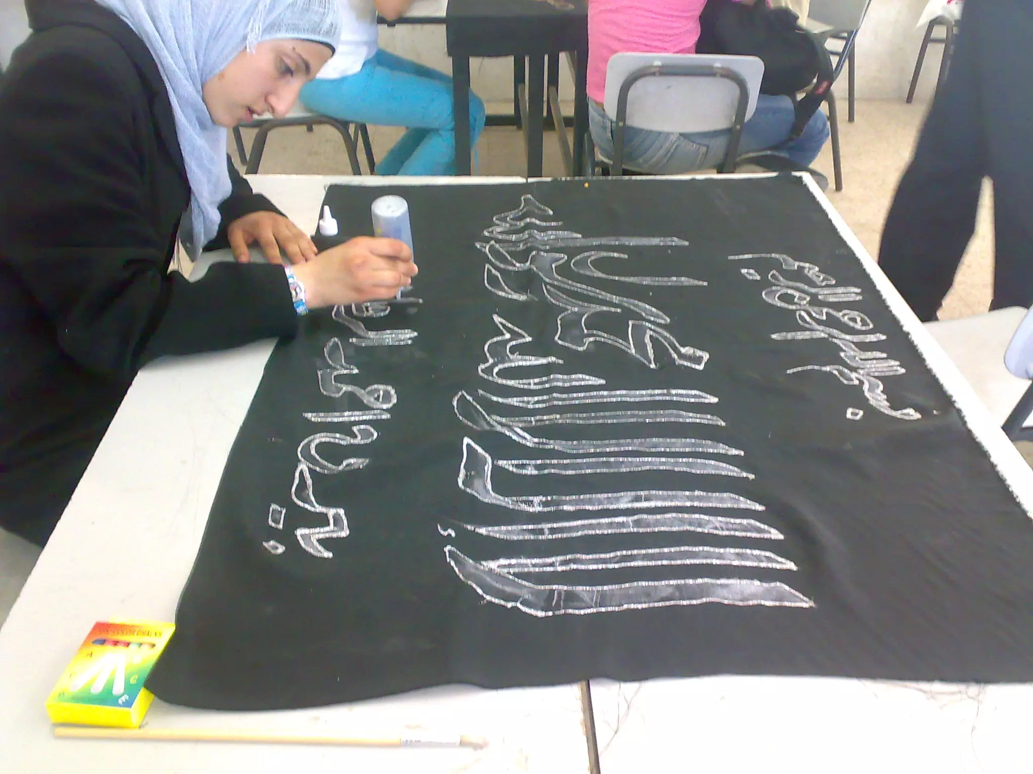
Posted by HaMaD Elayyan - صناعة بيارق النبي موسى
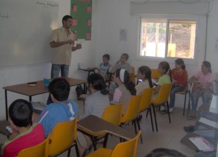
Posted by مركز عناتا الثقافي - تدريب كمبيوتر ضمن فعاليات مخيم الوفاء للقدس الصيفي

Posted by مركز عناتا الثقافي 1 - برنامج التعليم المساند
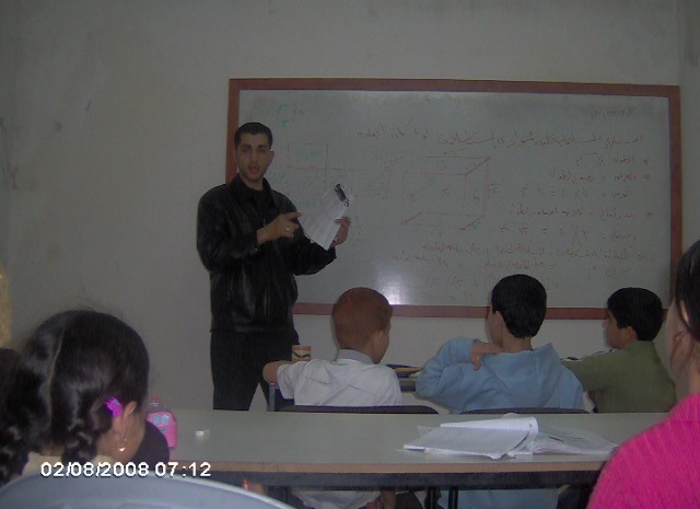
Posted by مركز عناتا الثقافي - تعليم مساند
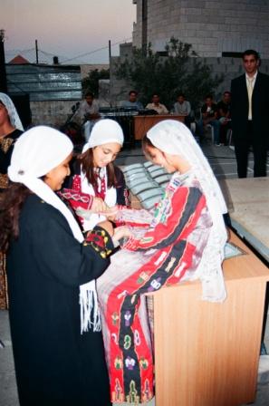
Posted by مركز عناتا الثقافي - العرس الفلسطيني ضمن فعاليات مهرجان الوفاء للقدس 2007
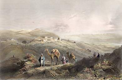
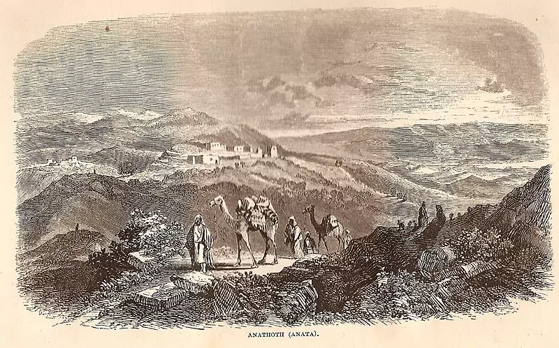
Posted by مركز عناتا الثقافي - عناتا عام 1859
Posted by زكريا عليان 1 - عين فارا
Posted by OTHMAN SHEHA - صورة جوية للقرية 1931 , اهداء من عاصم عليان الصفافي
Posted by عاصم ابو عمر - anata
Posted by ch3ban
Want to browse more? 80,000 pictures were grouped in these gallaries:
| Display Name | Clan/Hamolah | Country of Residence |
| سامر يحيى عبدالرحمن يوسف اسماعيل الرفاعي | الرفاعي | Amman, Jordan |
| محمود رضوان | - | - |
| محمود سلامة الرفاعي | الرفاعي | القدس |
| - | الرفاعي | -, الكويت |
| Muhannad Shiha | - | - |
| ابورامي اليمني | ابراهيم | القدس , عناتا |
| mohammad Elayyan | elayyan | anata - jerusalem |
| معروف الرفاعي | الرفاعي | الفجيرة, الامارات |
| خضر الرفاعي | الرفاعي | أبوظبي, الإمارات |
| ابو همام | - | القدس, عناتا |
| MODAR KHALID | الرفاعي | - |
| sameera سميرة refa3ee الرفاعي | - | - |
| منال الرفاعي | الرفاعي | الزرقاء, الاردن |
| زكريا الرفاعي | الرفاعي | الرياض, السعودية |
| فاطمة الرفاعي | عليان | الزرقاء, الاردن |
- Demolishing houses in occupied Anata, Palestine Duration: 10 min 57 sec
- More house destruction, Israeli style Duration: 3 min 20 sec
- تساقط الثلوج على قرية عناتا - القدس
- قضية هدم المباني التاريخية في عناتا
- عناتا - قضاء القدس - جولة في شوارع عناتا قضاء القدس Duration: 11 min 38 sec
No links have been shared yet, be free to the first to share the first link.
 Fake Valor: Why Did Zionist Jews Hoist Nazis Flag on Their Ships in the 1930s?
What is new?
-
Facts About Oct. 7th Gaza Raid
-
Remined Us Please:: Who Did Rape Who? Palestinians Raped Israelis? Or, was the other way around?
-
When Prof. Edward Said was invited to debate Bibi Netanyahu in the 1980s, watch what happened!
-
Ezra Klein of the NY Times on the "Jewish Race".
-
Abusing Blood Libel!
-
Did Israeli Soldiers Activate The Hanniba Direective On Oct. 7th? You Be The Judge
-
Zionist FAQ: Isn't it true that Palestinians don't want peace? Palestinians never accepted the two-state solution
- Facts about Haavara (Transfer) Agreement between Ben-Gurion & Hitler
-
Haavara FAQs: Why Did Zionist Jews Hoist Nazis' Flags on Their Ships in the 1930s?
- Haavara FAQs: When Chaim Weizmann met FDR in mid-1943, why was he silent about rescuing European Jewry?
-
Dear ChatGPT: How did Palestinians resist Napoleon's invasion of their country in 1799?
-
Dear ChatGPT: Gaza had a vibrant Jewish community in the mid-17th century. What happened to them?
-
Dear ChatGPT: Why did the Jewish Agency suppress news of the Holocaust during WWII?
-
Video Playlist: Jews share their DNA tests to end the conflict for good.
-
A Tale of Two Conflicts: Examining the Definition of Genocide
-
Prof. Abraham Polak And The Suppressed History of the Khazars and European Jewry
-
How Ronald Reagan would have framed the genocide in Gaza if he were still alive?
-
Haavara FAQs: Let us do the math: how many German Jews did The Haavara Agreement save?
-
Zionist FAQs: The Hebron Massacre of 1929, "clearly proves" that Palestinians are antisemitic, how could you deny it?
-
Zionist FAQs: Why Anti-Zionist Is Not Antisemitism?
-
Zionist FAQs: Isn't it true that the KGB created Palestinian Nationalism in the early 1960s?
- Zionist FAQs: Muslims are killing Muslims all the time; why are Israeli Jews being singled out in the media?
- Zionist FAQs: How is Israel an apartheid state when 20% of its citizens are Arabs who enjoy full rights?
-
Haavara FAQs: Why Did Dorothy Thompson Flip From A Zionist Advocate to A Silenced Dissenter?
-
Haavara FAQs: Analysis of Herzl's Uganda Scheme and how it could have saved millions of Jews.
-
Haavara FAQs: Why did Hayim Greenberg describe American Jewry as "morally bankrupt" in early 1943?
-
Haavara FAQs: What if the Evian Conference was a resounding success? What would have been the impact of saving European Jewry on Zionism?
- Haavara FAQs: What if the six million were saved, how that would have impacted the Zionist project?
-
Haavara FAQs: How did Zionist leaders react when Europe's Jews lingered in the DP camps after WWII ended?
-
Why does the American Jewish community repeat lies that David Ben-Gurion had debunked before he died?
-
Who has the power to rename the Tatar/Khazar Gene Marker to Jewish IV?
-
Zionist FAQs: Why won't Egypt, Syria, and Jordan take their people back? Jews are indigenous to Palestine, and Arabs immigrated after Jews developed the country. Arabs should leave.
-
Haavara FAQs: Did Hitler and the Nazis conflate between Judaism and Zionist? If that wasn't case, then why?
-
Haavara FAQs: Winston Churchill and antisemitism, a collection of articles written Churchill.
-
Haavara FAQs: Broken by country, how many Jews survived vs. killed during the Holocaust?
-
Haavara FAQs: Why did European Jews vote with their feet and to immigrated to the Americas, not Palestine, after WWII?
-
Watch this American Jewish Girl describing Israeli Jews' cognitive dissonance like no other in under two minutes
-
Haavara FAQs: When the Nazis went out of their way to hide the Holocaust, Israeli Jews did the exact opposite by broadcasting their genocide of Gazans. But why?
-
Haavara FAQs: How Zionist Jews went out of their to show their appreciation to Nazism and Fascism?
- Haavara FAQs: Why Zionist leaders were against bombing the death camps & the Railroads leading to them?
-
Haavara FAQs: Hitler's message to the British and American people: If Jews are such noble citizens and you care about them, how come you're not letting them in? I will gladly ship them to you at my expense, even on luxury liners!
-
A shortlist of Zionist and Israeli false flag operations in the name Jews.
-
The Most Moral Army
- The Land of Kapos (Israel): Where the brave are boycotted and Kapos walk free.
- Why did early Zionists often named their communal enterprises "colonial"?
- Zionist Relations with Nazi Germany by Faris Glubb
-
Two NY Times advertisements by Zionists in the early 1943 that exposes Zionists' treason at the height of the calamity
- Facts Not Lies about the Palestinian-Israeli Conflict.
- Site's pictures have been categorized
- Campgain Against Lice
- A Survey of Palestine, the official source about Palestine before Nakba produced by the British Mandate; over 1200 pages.
- Satellite View & Google Earth: Over 6,000 placemarks identifying all destroyed towns, W. Bank & Gaza Strip Towns, & refugee camps.
- PalestineRemembered.com and its Nakba Oral History Project were featured on al-Jazeera Satellite TV.
- Nakba Oral History Video Podcast:
 Over 700 Oral History interviews (including 3,500+ hours of recording) can be viewed online.
 - Palestine Village Statistics Project
- Gaza Jail Break
- النسخة العربية للموقع الان متوفرة
- Videos: Documenting the destroyed villages in video: Tracing all that remains since Nakba.
- Videos: Responding to Zionist Propaganda
- Interview: The ethnic cleansing of Palestine: George Galloway interviews Israeli Historian Ilan Pappe.
- For Palestinians, memory matters. It provides a blueprint for their future By George Bisharat.
- Zionist FAQ now available in Hebrew שאלות שציונים שואלים, עכשיו בעברית
- Video: The Stephen Walt and John Mearsheimer report on the influence of the Israel Lobby on U.S. Foreign Policy
- The Palestinian-Israeli conflict for beginners
