| PalestineRemembered | About Us | Oral History | العربية | |
| Pictures | Zionist FAQs | Haavara | Maps | |
| Search |
| Camps |
| Districts |
| Acre |
| Baysan |
| Beersheba |
| Bethlehem |
| Gaza |
| Haifa |
| Hebron |
| Jaffa |
| Jericho |
| Jerusalem |
| Jinin |
| Nablus |
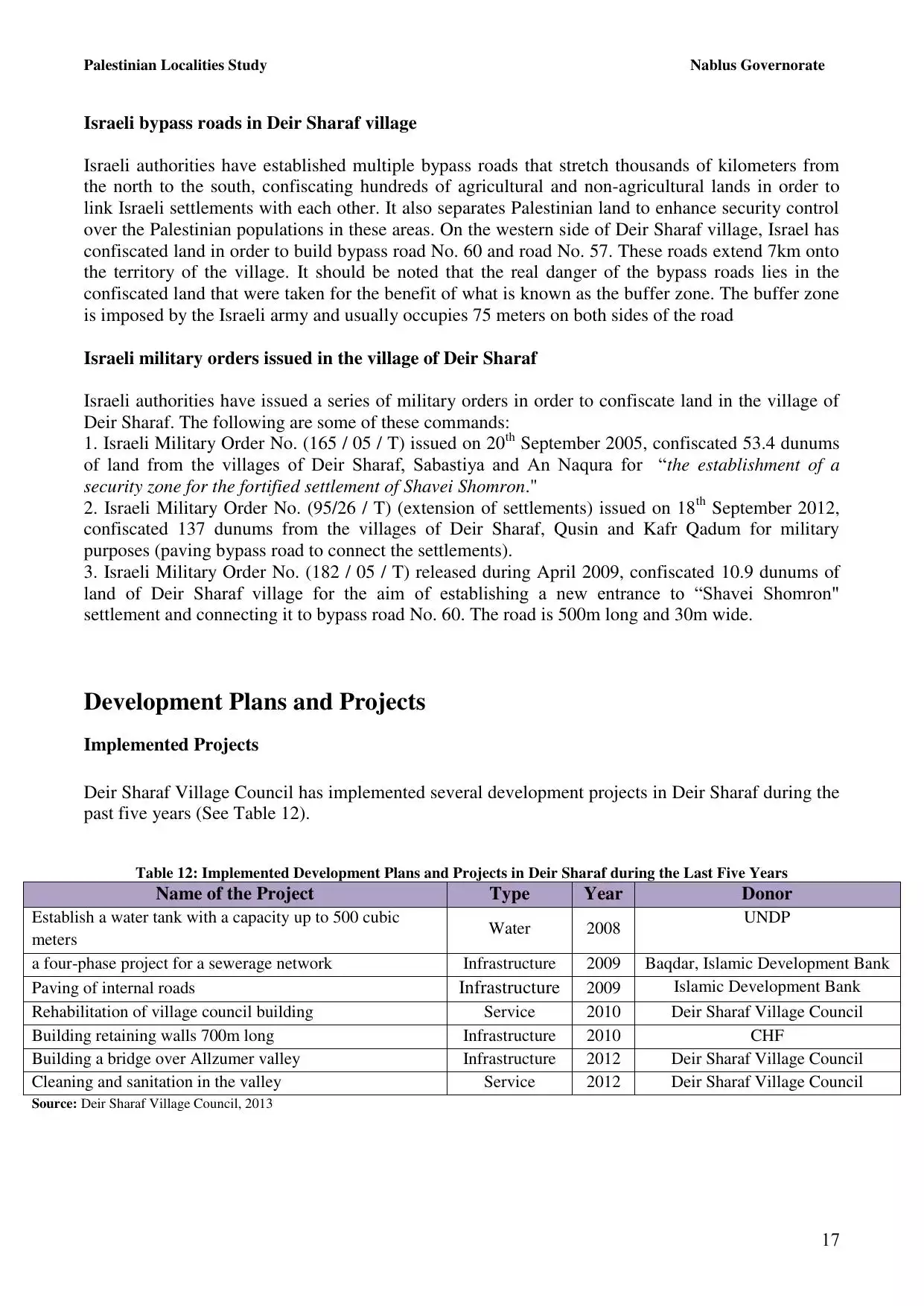
| Nazareth |
| Ramallah |
| al-Ramla |
| Safad |
| Tiberias |
| Tulkarm |
| Donate |
| Contact |
| Profile |
| Videos |
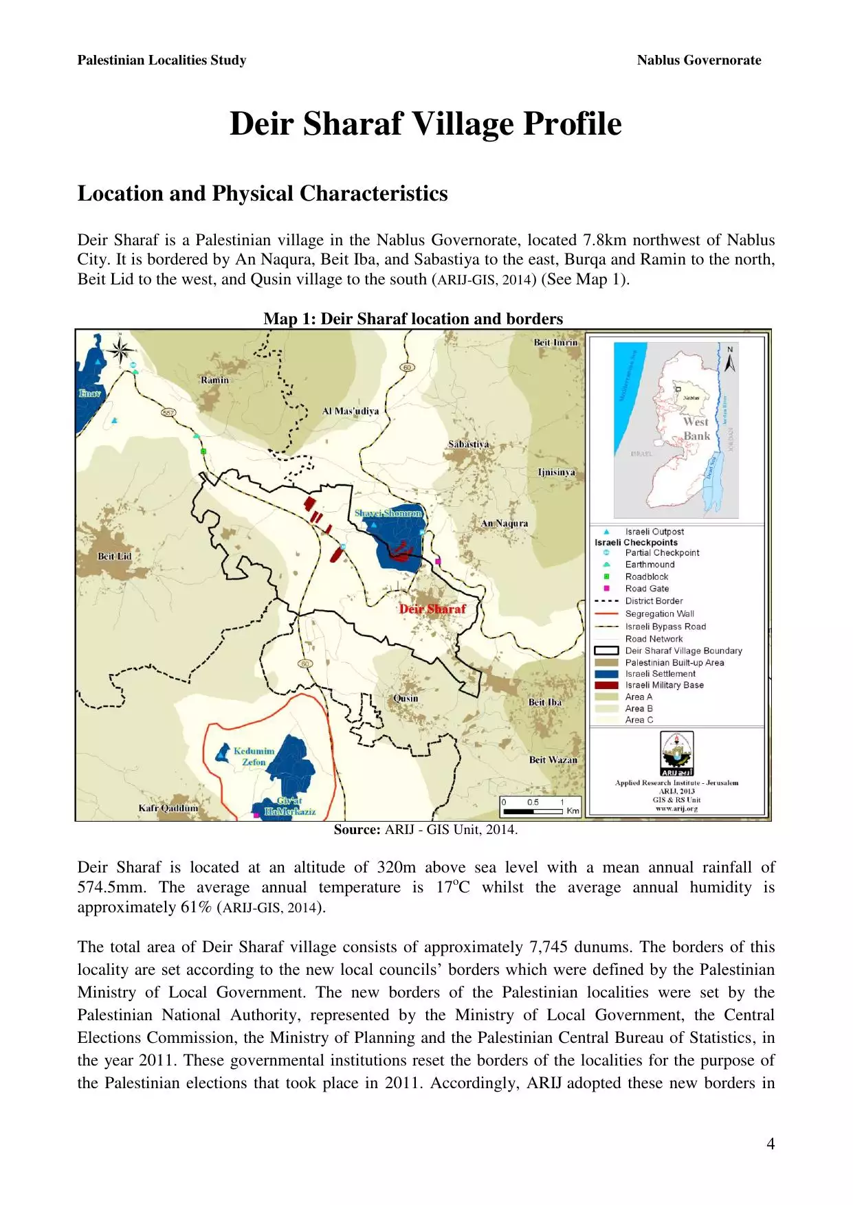
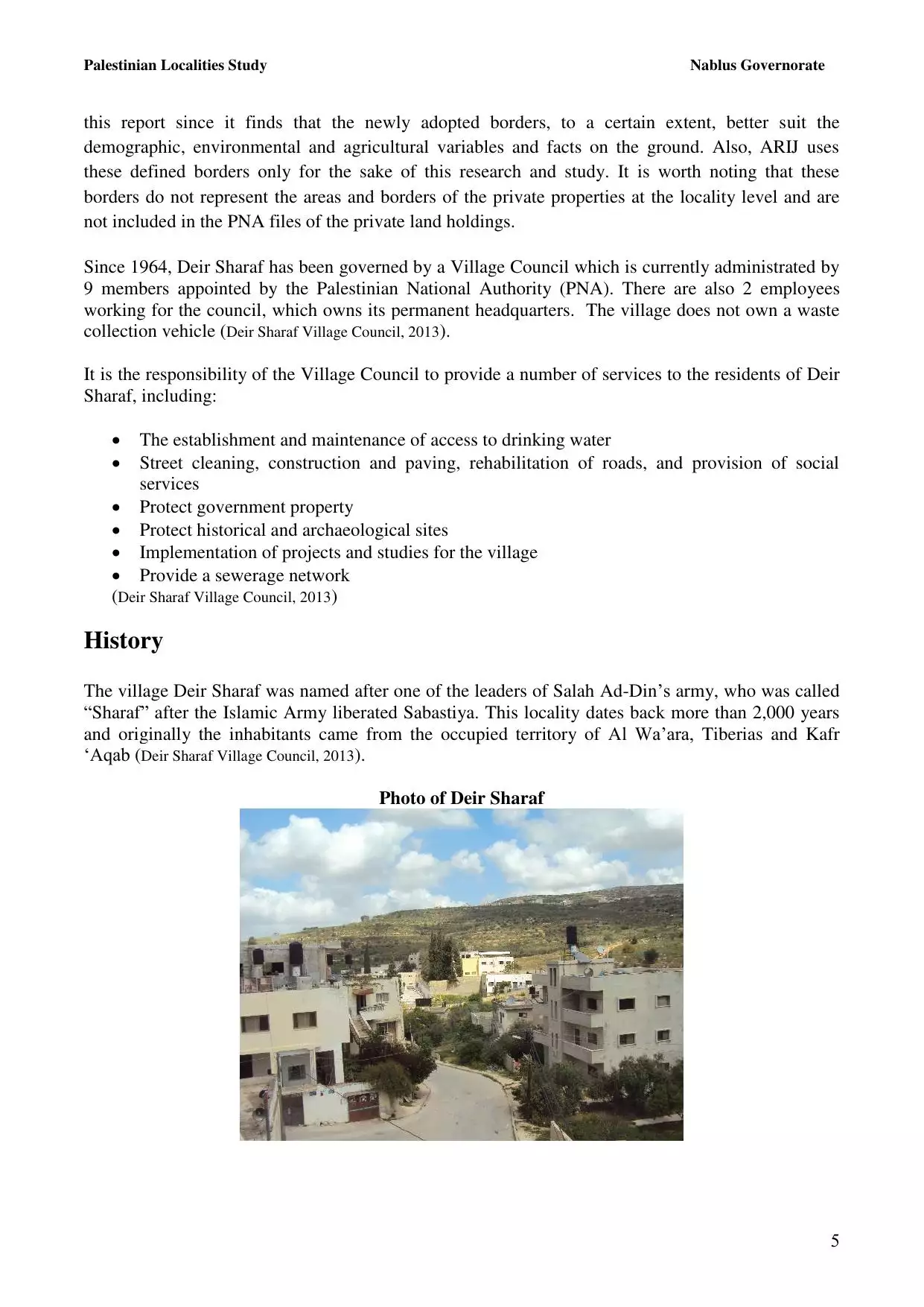
Welcome To Dayr Sharaf - دير شرف (דיר שרף)
|
District of Nablus
Occupied days ago |
العربية Google Earth |
 |
Gallery (52) |
- Statistics & Facts
-
Before & After

- Satellite View
- Articles 4
- Pictures 52
- Mayrters & Prisoners 1
- Members 18
- Families
- Wikipedia
- ARIJ Guide
- Videos 1
- Guest Book 3
- Links
| Statistic & Fact | Value | ||||||||||||||||||||||
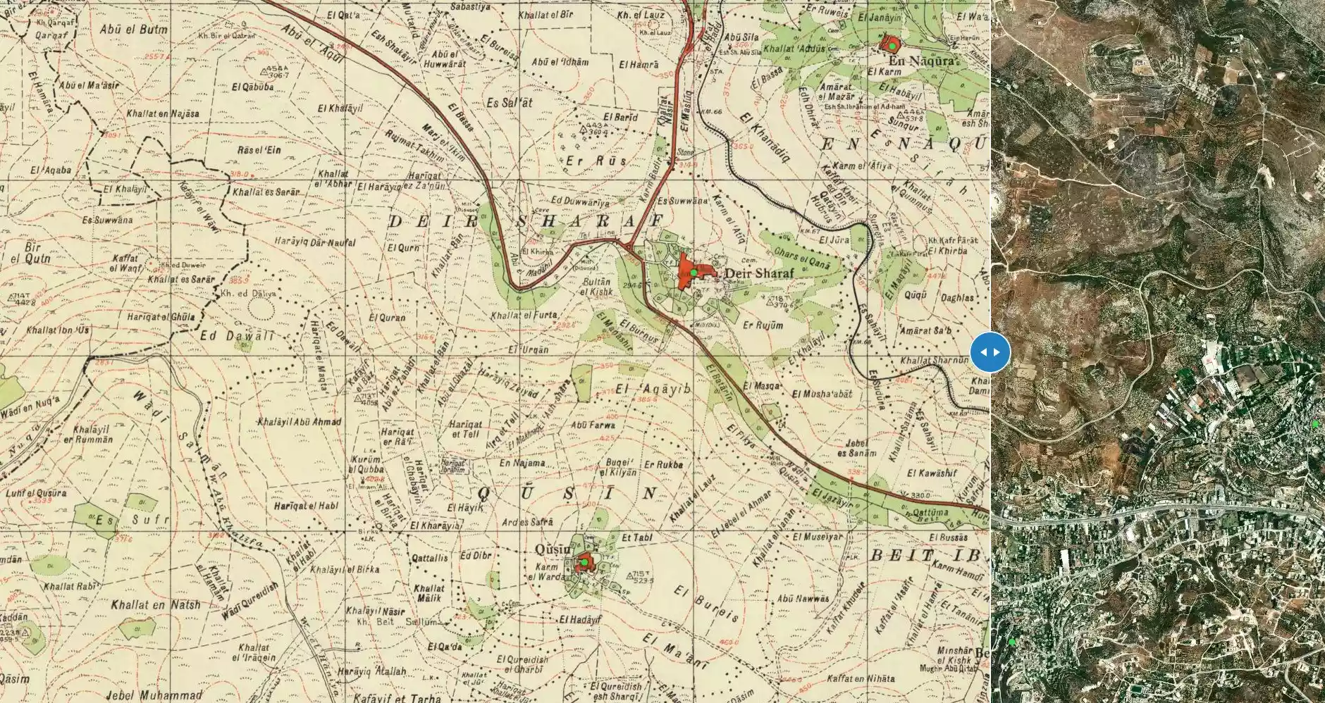
| Distance From District | 9 km northwest of Nablus | ||||||||||||||||||||||
| Before & After Nakba, Click Map For Details |
|||||||||||||||||||||||
|
|||||||||||||||||||||||
| Land Ownership |
**Town Lands' Demarcation Maps |
||||||||||||||||||||||
| Land Usage As of 1945 |
|
||||||||||||||||||||||
| Population |
|
||||||||||||||||||||||
| Near By Towns |
|||||||||||||||||||||||
|
|||||||||||||||||||||||
| Featured Video | |||||||||||||||||||||||
| ARIJ Guide | |||||||||||||||||||||||
3.
4. 
5. 
6. 
7. 
8. 
9. 
10. 
11. 
12. 
13. 
14. 
15. 
16. 
17. 
18. 
19. 
20. 
Click here to browse online. |
|||||||||||||||||||||||
| Related Maps | Town Lands' Demarcation Maps خرائط للقضاء توضح حدود القرى والاودية View from satellite Town's map on MapQuest Help us map this town at WikiMapia |
||||||||||||||||||||||
| Related Links | Wikipedia's Page Facebook Page ARIJ Guide Google Search Google For Images Google For Videos في كتاب بلادنا فلسطين دليل أريج المزيد من موقع هوية |
||||||||||||||||||||||
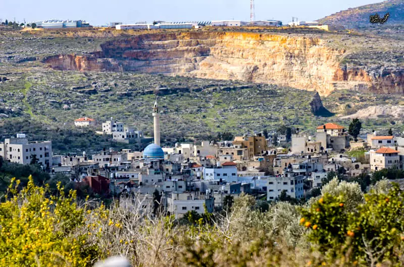
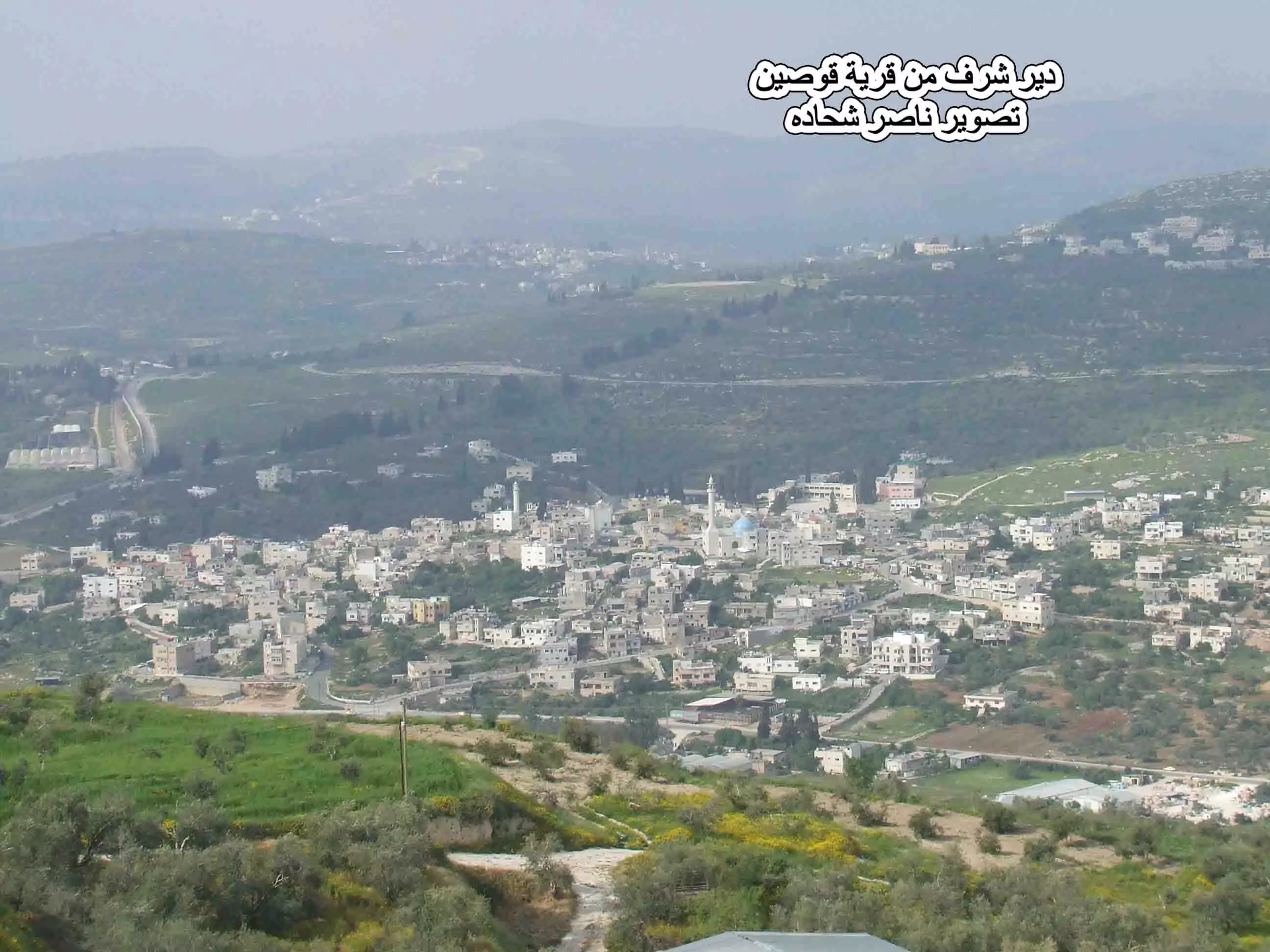
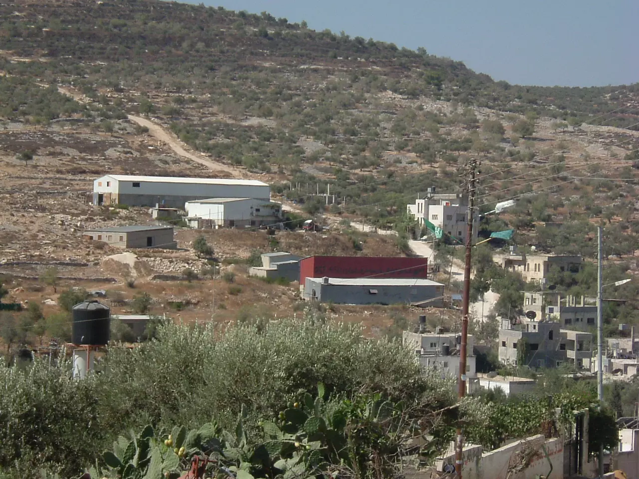
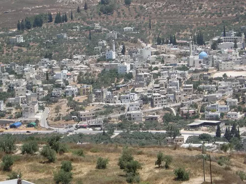
- منظر عام لدير شرف من قرية قوصين تصوير ناصر العوريفي
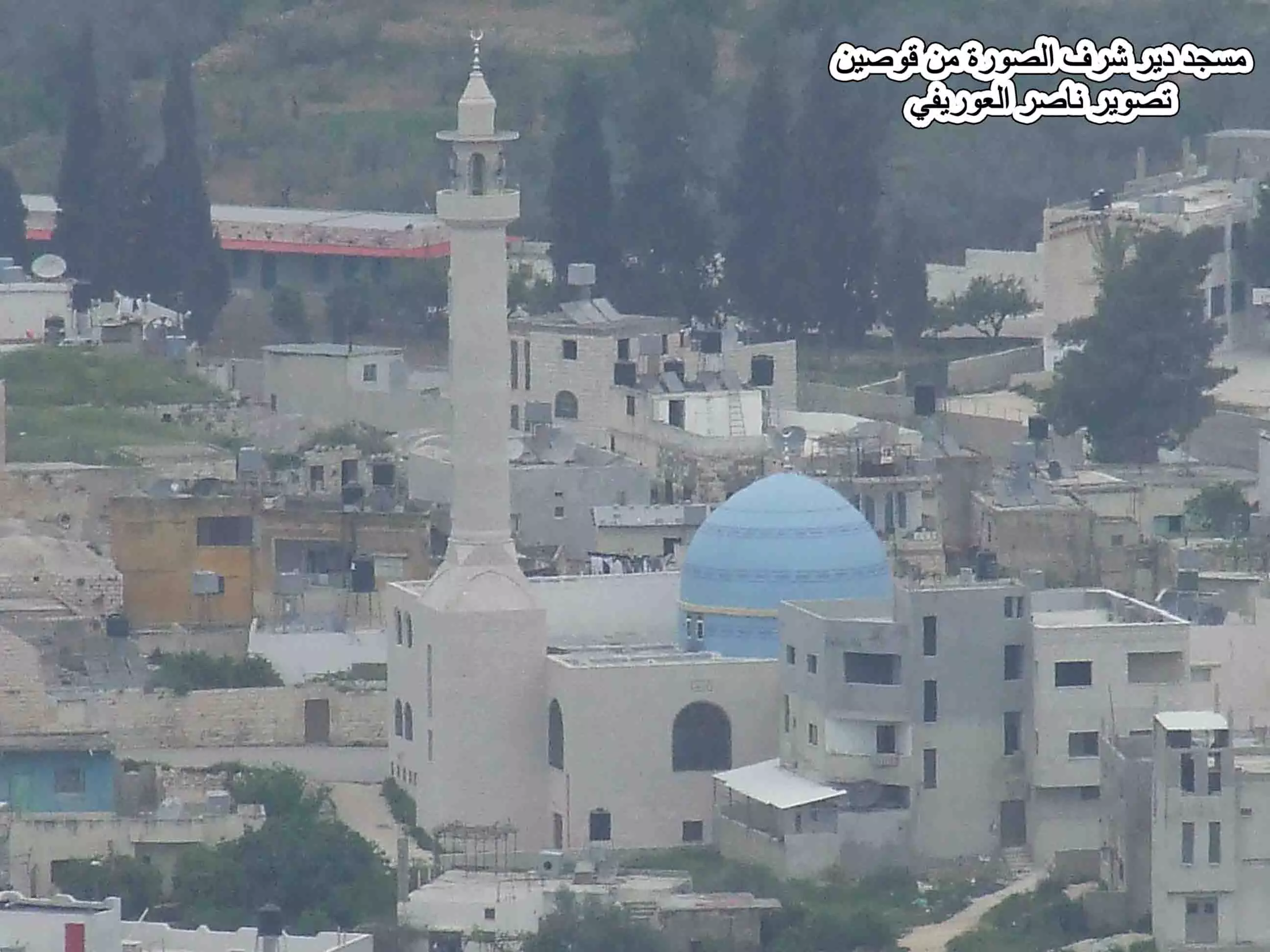
Posted by naser abed 20 - مسجد ديرشرف من قرية قوصين تصوير ناصر العوريفي
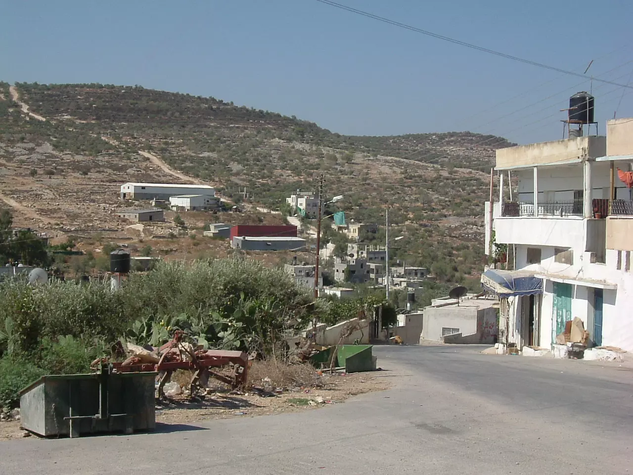
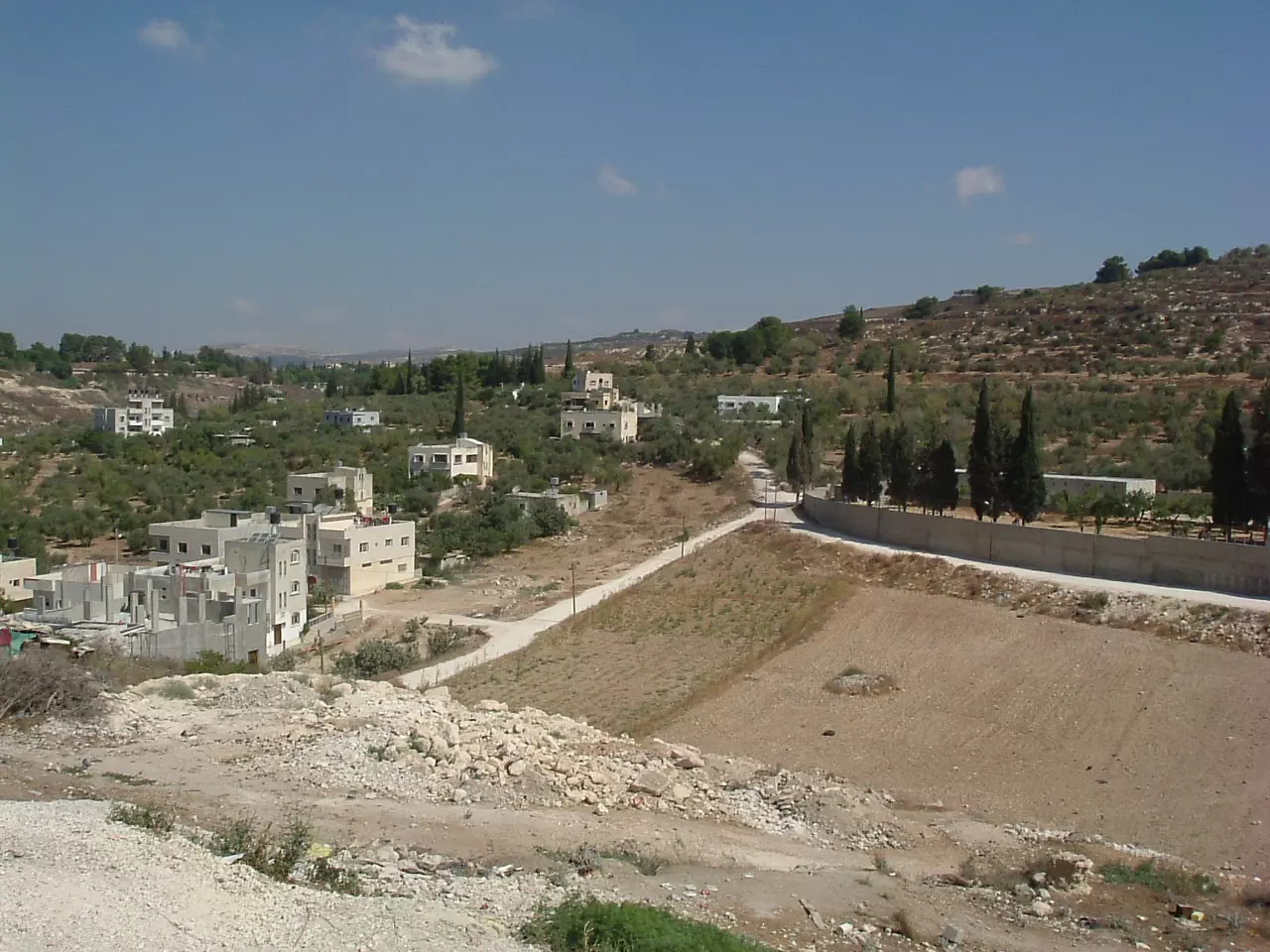
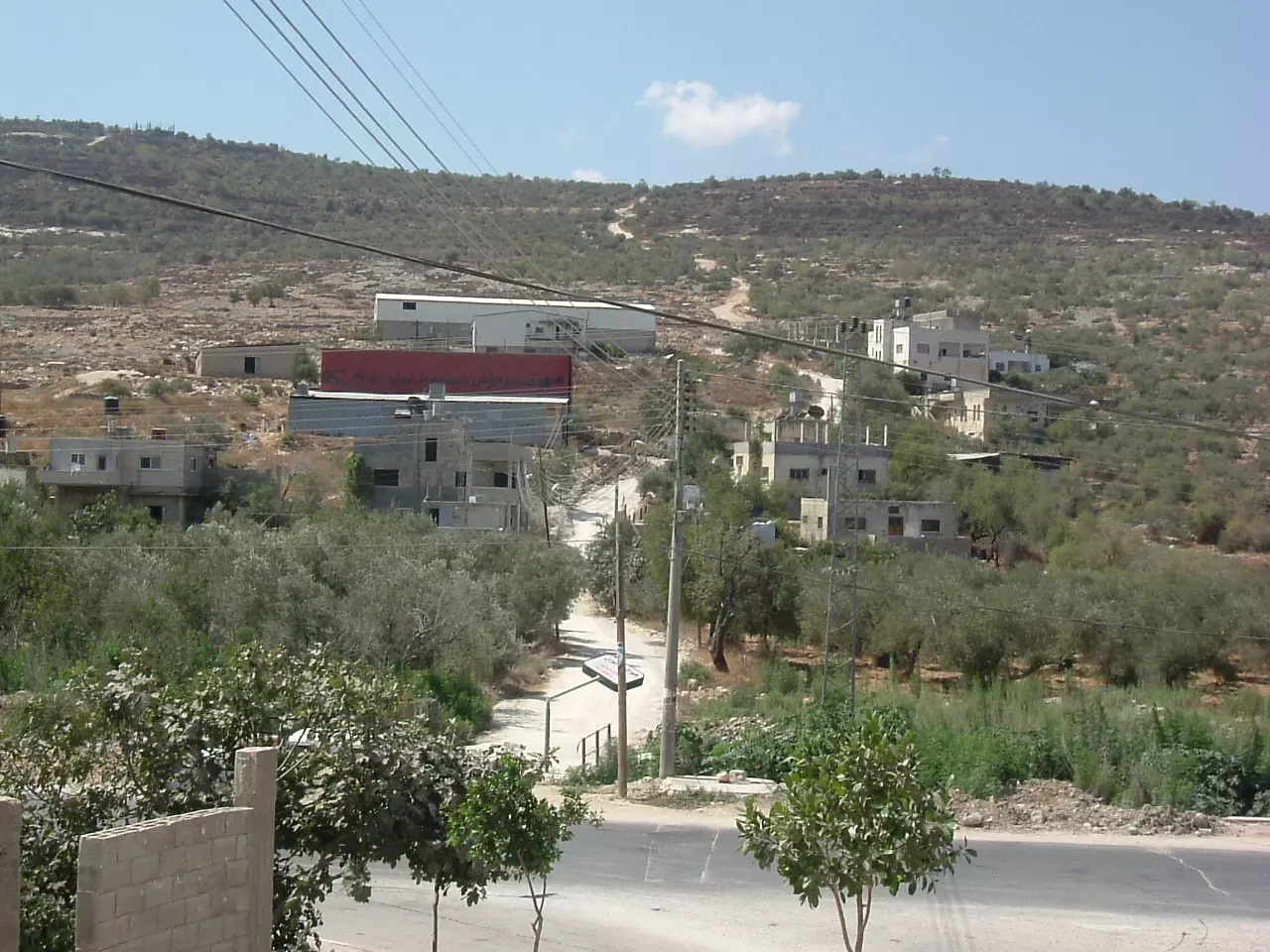
Posted by naser abed 2 - ديرشرف و يظهر المثلث و الشارع المتجه غربا الى طولكرم و الشارع المتجه شمالا الى جنين و تظهر في الصورة ارض الروس و بيوت الحارة التحتا و قطان الواويات و بيوت الحارة التحتا ارض الوعرة و كسارة ابو شوشة ومن بعيد تظهر جبال بيت ليد
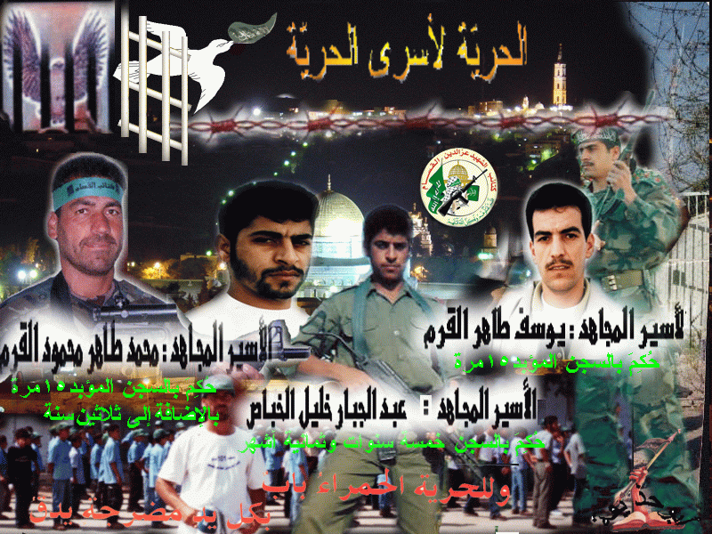
Posted by ابو صفط - الاسرى الاحرار
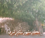
Posted by معاوية 3 - مكانمشهور
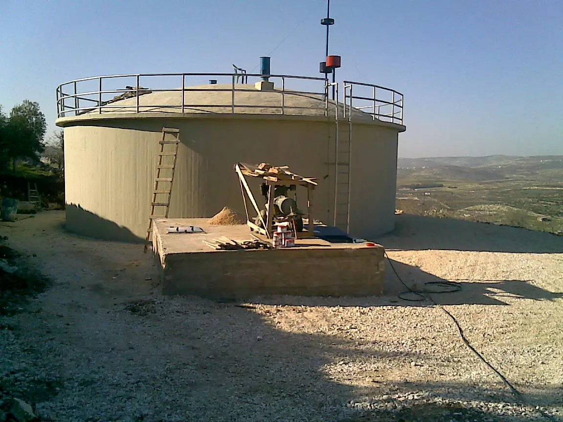
Posted by احمد ابوالقرم - حاووز ديرشرف
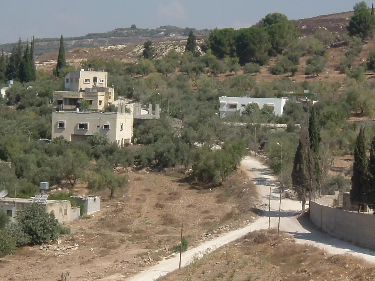
Posted by شرفي 1 - منظر عام من طريق نابلس طولكرم الرئيسي
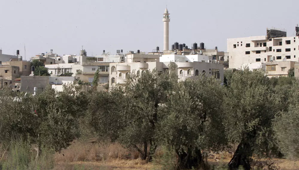
Posted by saher kaddarah 3 - منظر عام من طريق نابلس طولكرم الرئيسي
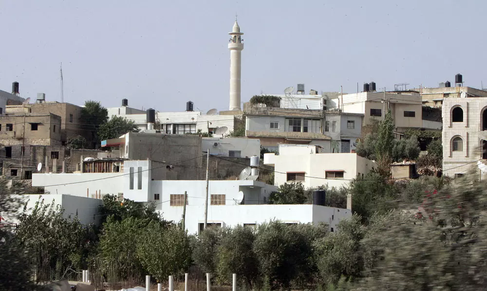
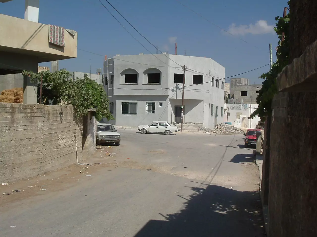
Posted by saher kaddarah 3 - ديرشرف
Posted by ابو صفط 3 - ديرشرف
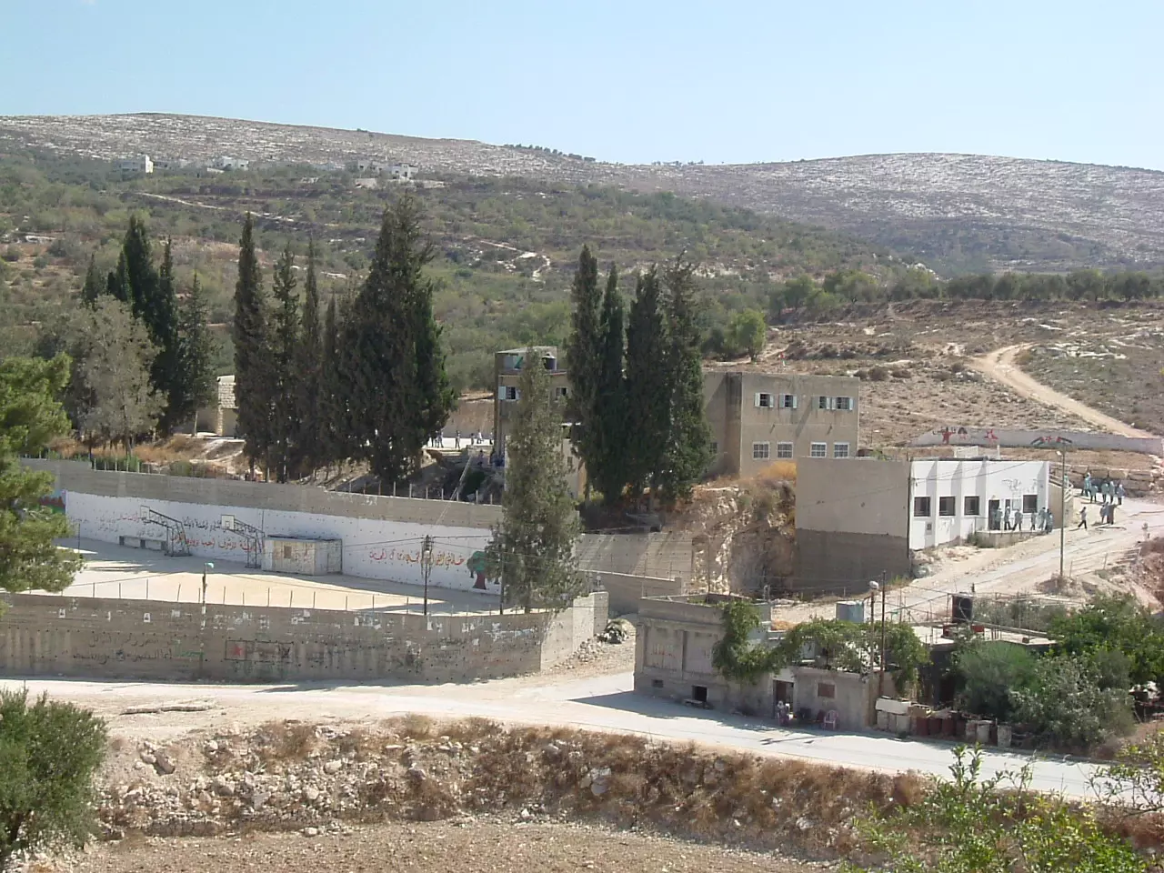
Posted by ابو صفط 1 - صورة مدرسة ديرشرف للبنات و يظهر في الصورة ملعب مدرسة البنين و يظهر مقر النادي و جزء من مقبرة القرية
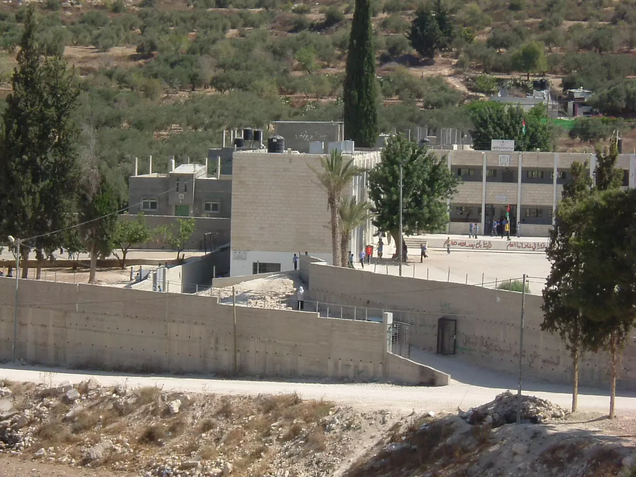
Posted by ابو صفط 1 - مدرسة ديرشرف الثانوية المختلطة
Posted by ابو صفط 2 - ارض خل الزيد وارض الصوانة
Posted by ابو صفط 3 - ارض الصوانة وتظهر في الصورة دار غازي فارس يعقوب و دار بشير ابو شامية و دار بهجت حسن يوسف
Posted by ابو صفط - مقر المجلس القروي و مقر الجمعية النسوية
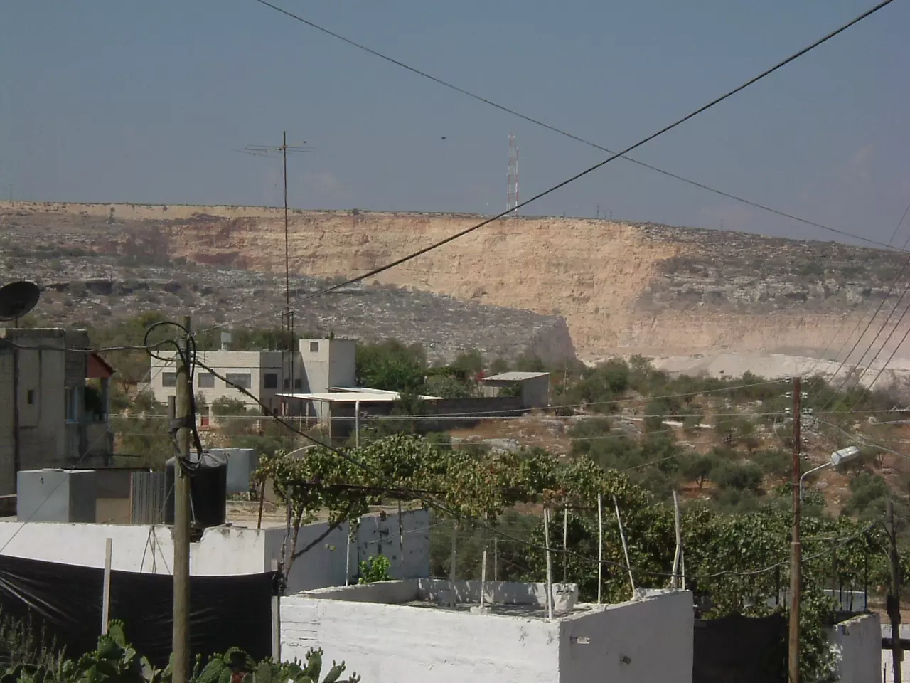
Posted by ابو صفط - دار نضال عطاري و خلفها كسارة ابو شوشة
Posted by ابو صفط - ديرشرف/ منطقة العقايب و يظهر في الصورة من اعلى الى اسفل دار مصطفى ابراهيم مرعي و دار رياض عبدالحافظو دار حسين ابو صفط و دار رسمي( احمد و ايمن و محمود و محمد) و دار مصطفى الأحمد اما المخازن الكبيرة فهي منجرة لدار هواش و منجرة لدار المصري
Posted by ابو صفط 1 - تظهر في الصورة طريق قوصين / العقايب و تظهر قرية قوصين اعلى الجبل و الصورة مأخوذة من فوق مئذنة المسجد القديم 000 تصوير السيد باسل ابو صفط
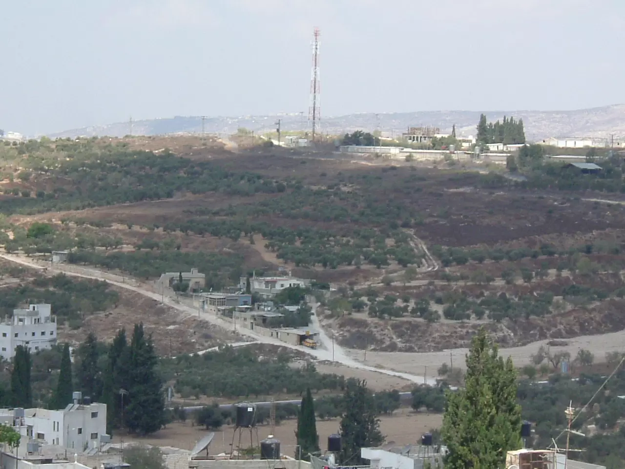
Posted by ابو صفط 2 - يظهر في الصورة الشارع المتجه الى مدينة جنين و تظهر حديقة ابو صالح وارضكرم بادر حيث منزل محمود سليمان نوفل و ارض قطان الواويات وبعض بيوت الحارة التحتا
Posted by ابو صفط 1 - مسجد خالد بن الوليد(المسجد الجديد ) و ظهر من بعيد جزء من قرية بيت وزن و مصنع الألمنيوم
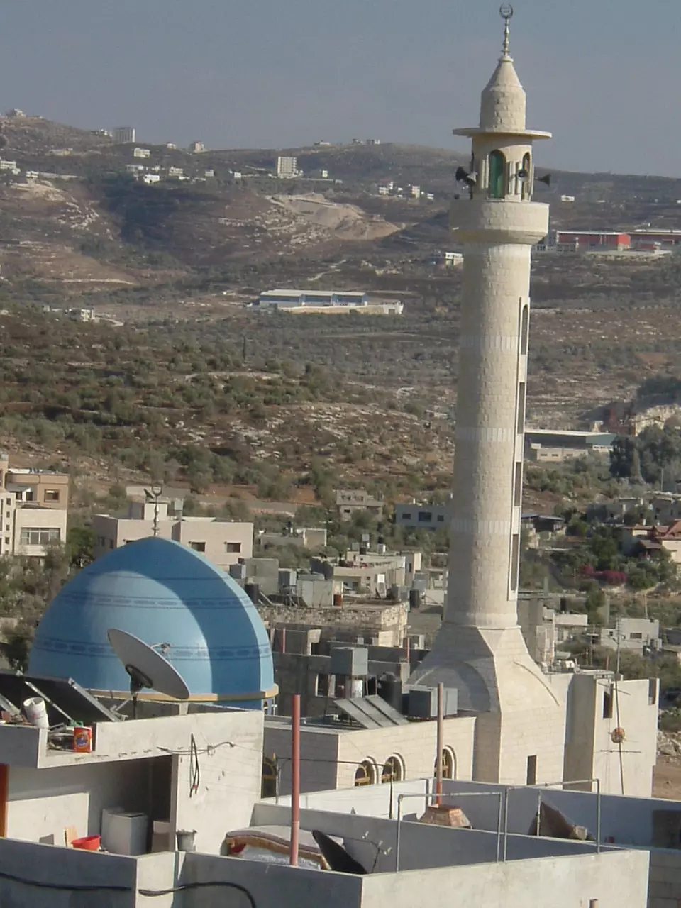
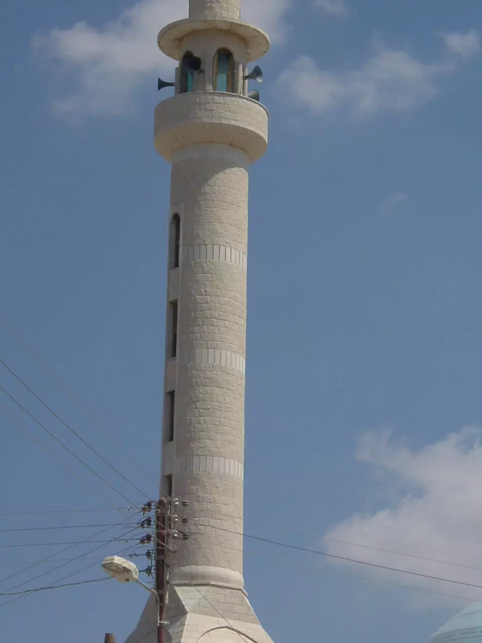
Posted by ابو صفط 2 - مئذنة مسجد خالد بن الوليد (الجديد)
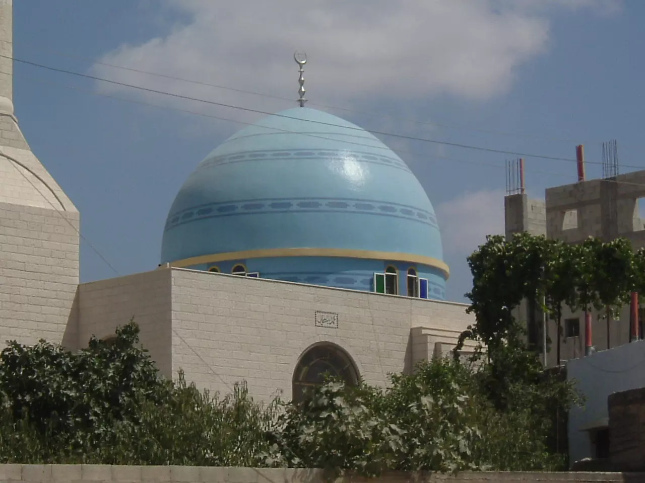
Posted by ابو صفط 1 - مسجد القرية الجديد ( خالد بن الوليد )
Posted by ابو صفط 1 - الشارع في الحارة التحتا و المتجه من الشمال الى الجنوب وفي الصورة يظهر بيت ابو عمر الواوي و مقابله تظهر شجرة التوتة التي كانت منتدى الحارة التحتا حيث اجتماعات الختيارية و يظهر بيت الحاج احمد عبد الغني القديم و يظهر منزل توفيق طاهر عارف
Posted by ابو صفط - تظهر في الصورة مستوطنة شافي شومرون و ارض الروس ومن بعيد تظهر جبال قرية بلعا و تظهر منازل عبد القادر حمد و منزل عبد الجبار عبد القادر خضر و منزل زياد سليم رشيد
Posted by ابو صفط - اقيمت هذه الأستراحة و المطعم و سوبر ماركت مكان البناء القديم لمخفر شرطة ديرشرف الذي كان زمن الحكم الاردني السابق

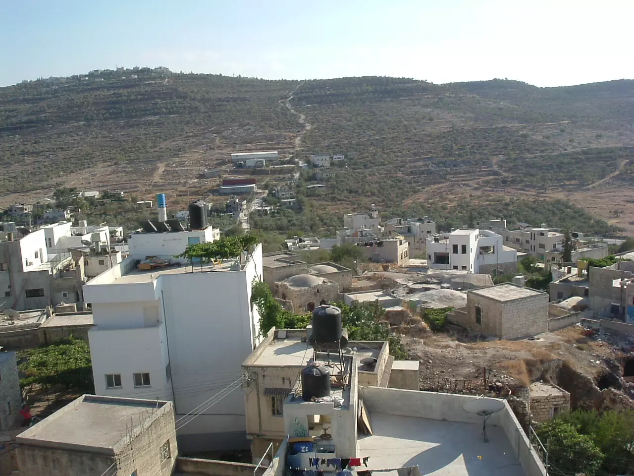
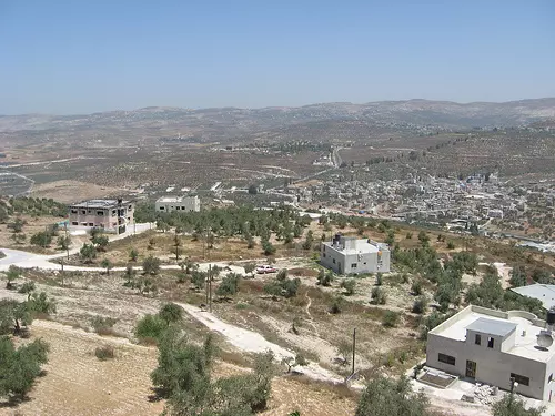
Posted by ابو صفط - View of Deir Sharaf from Qusin (Summer 2009)
Posted by Zohair alqusiny - View of Deir Sharaf from Qusin ( 2009)
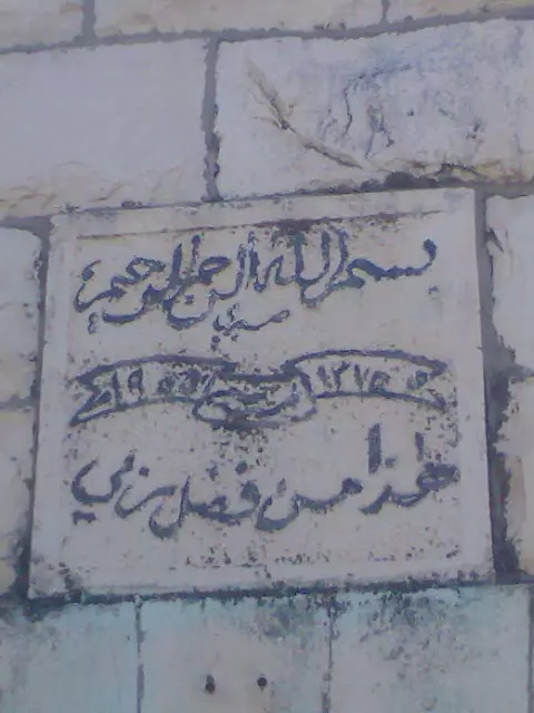
Posted by Zohair alqusiny 1 - فن الخط على البيوت القديمة في دير شرف
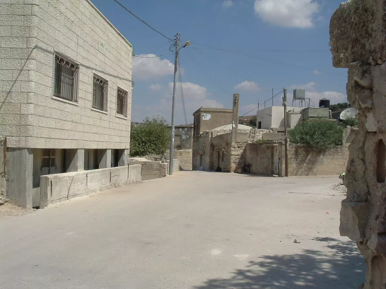
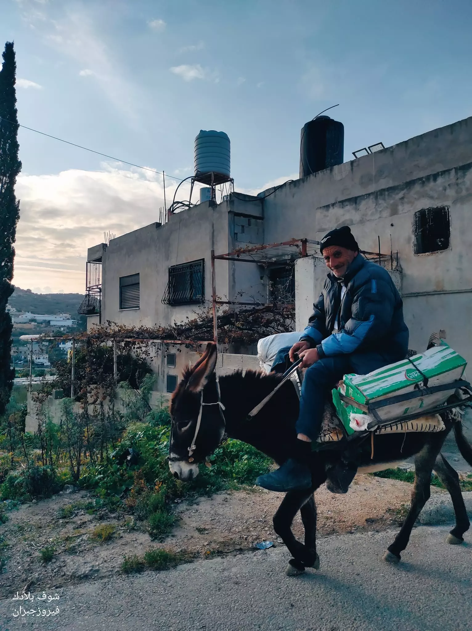
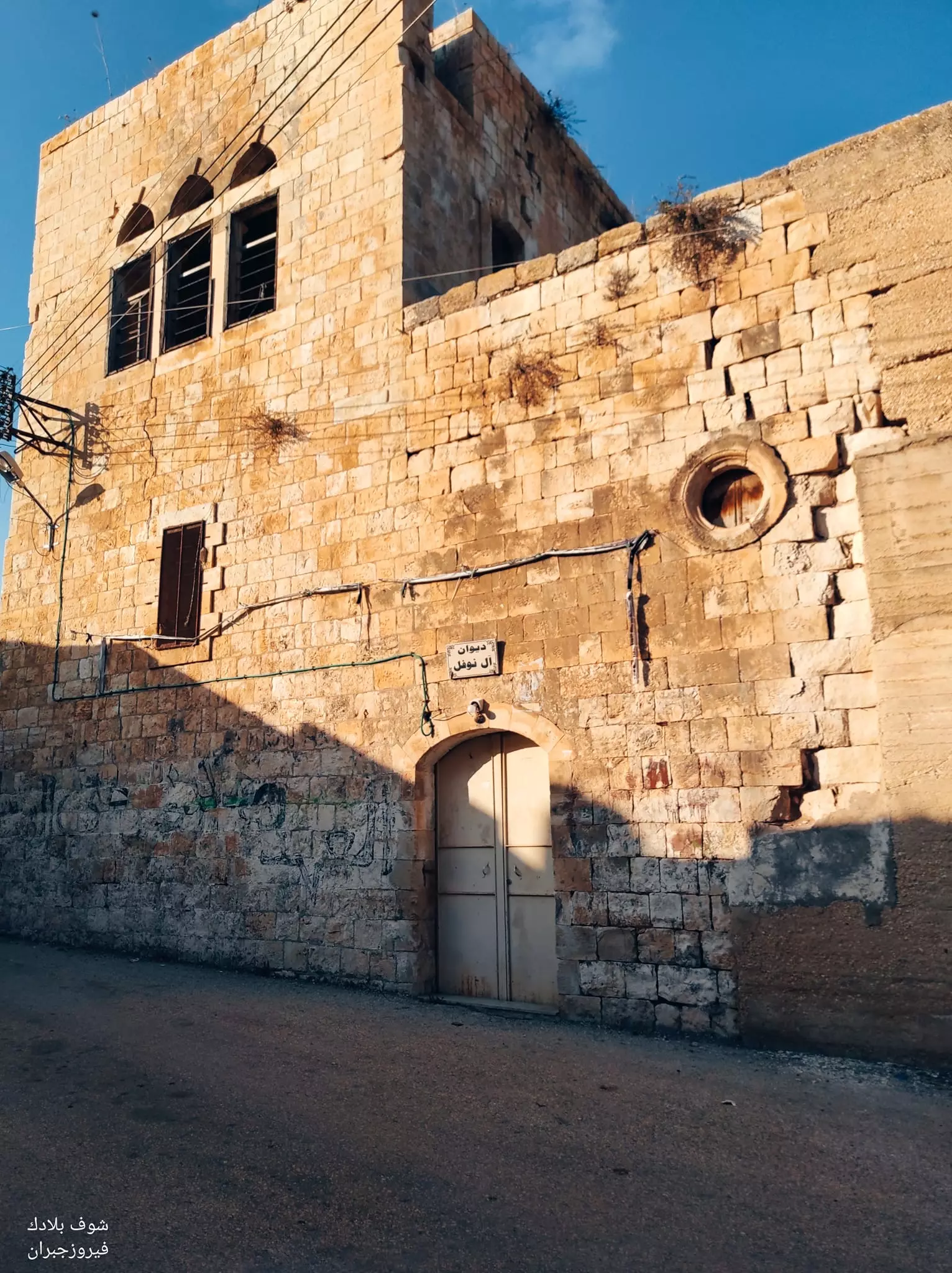
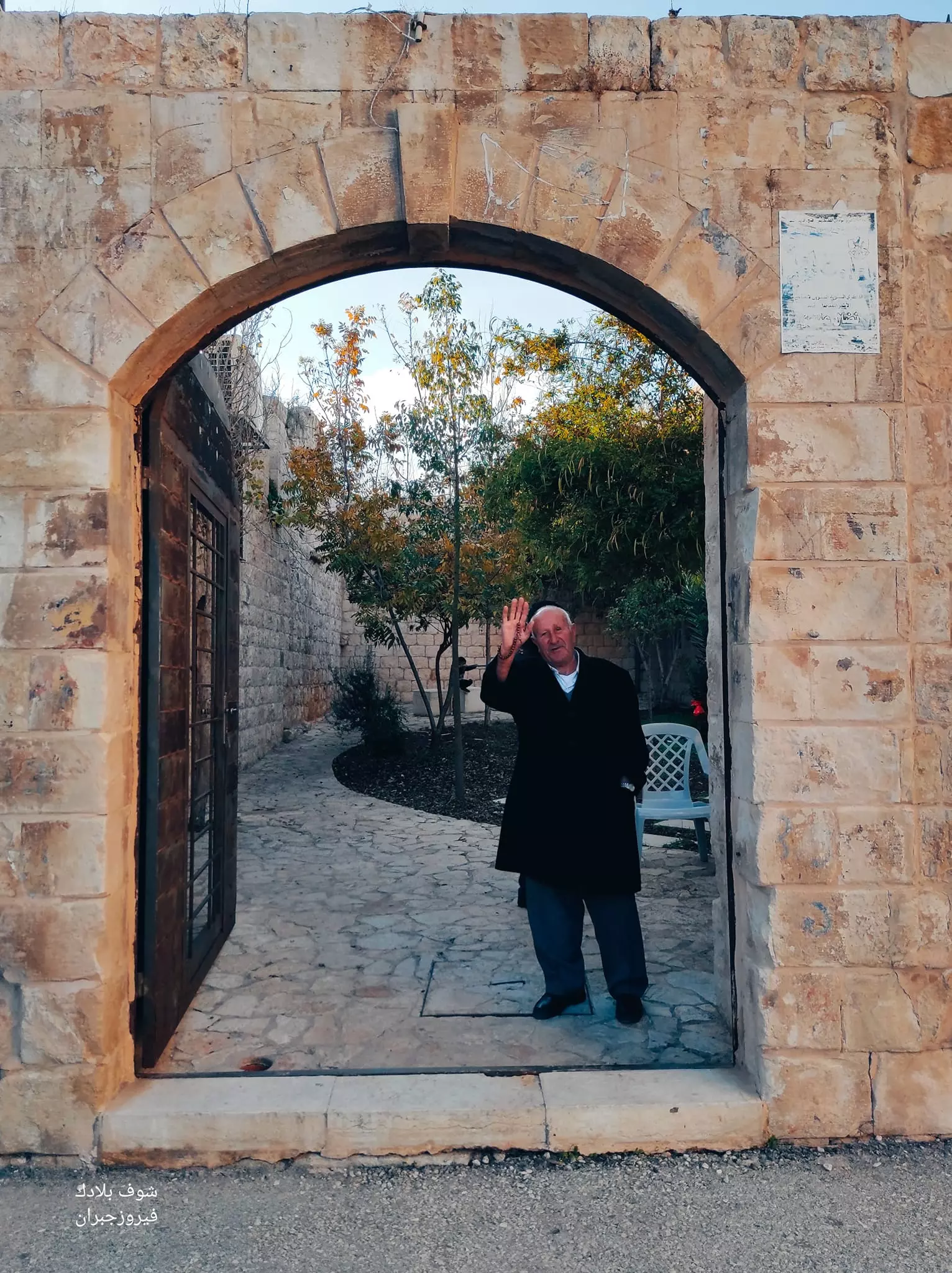
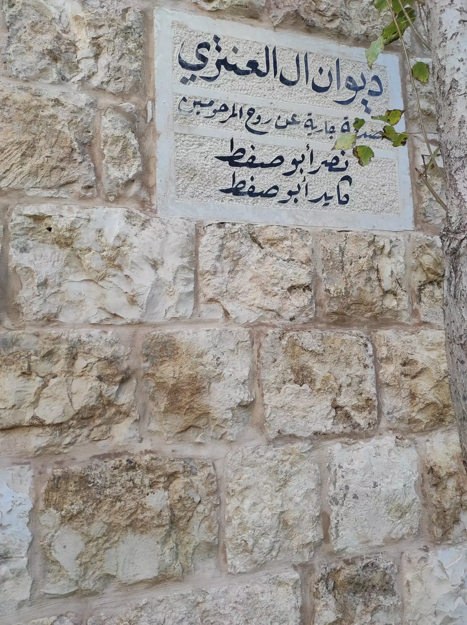
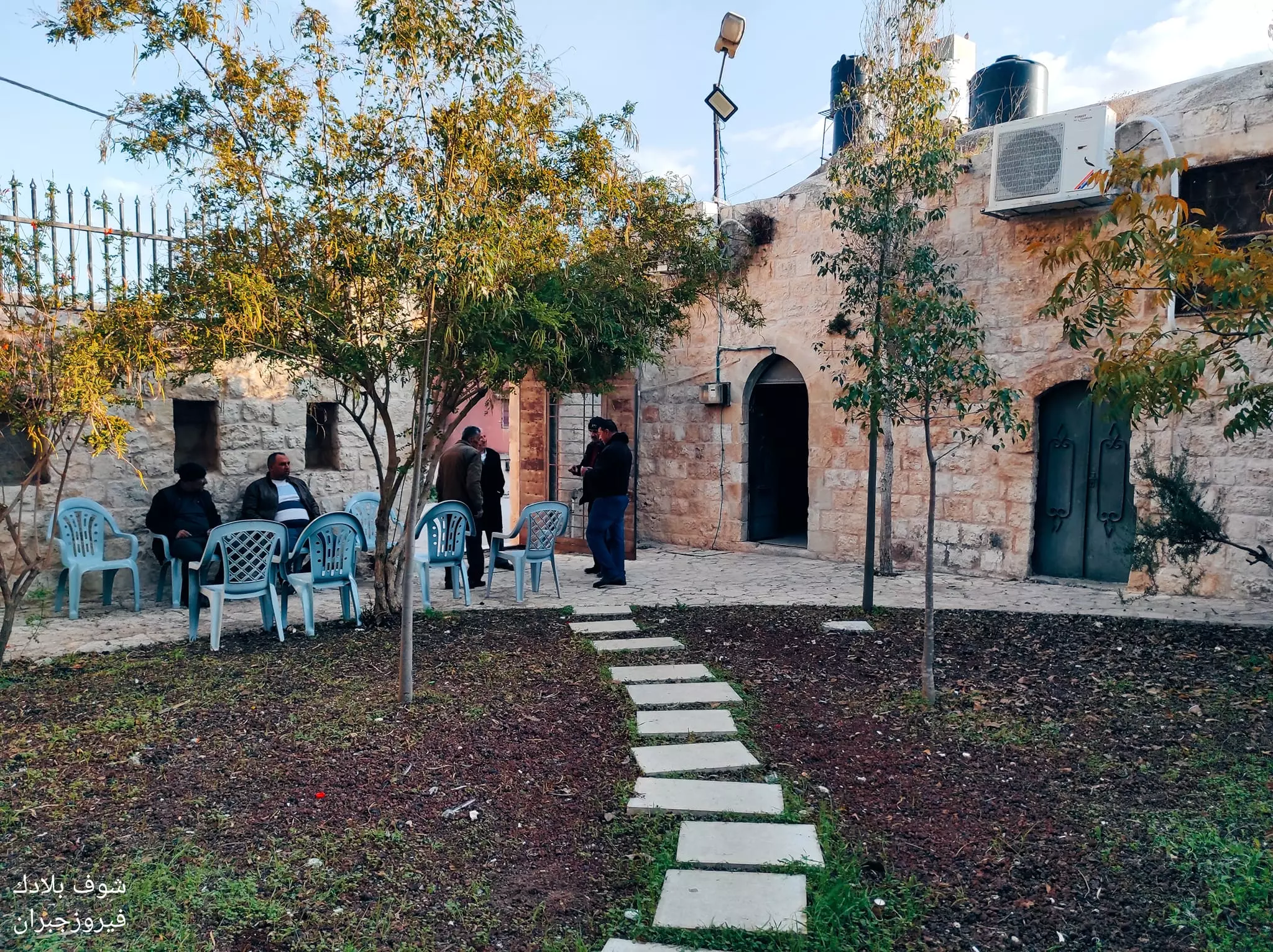
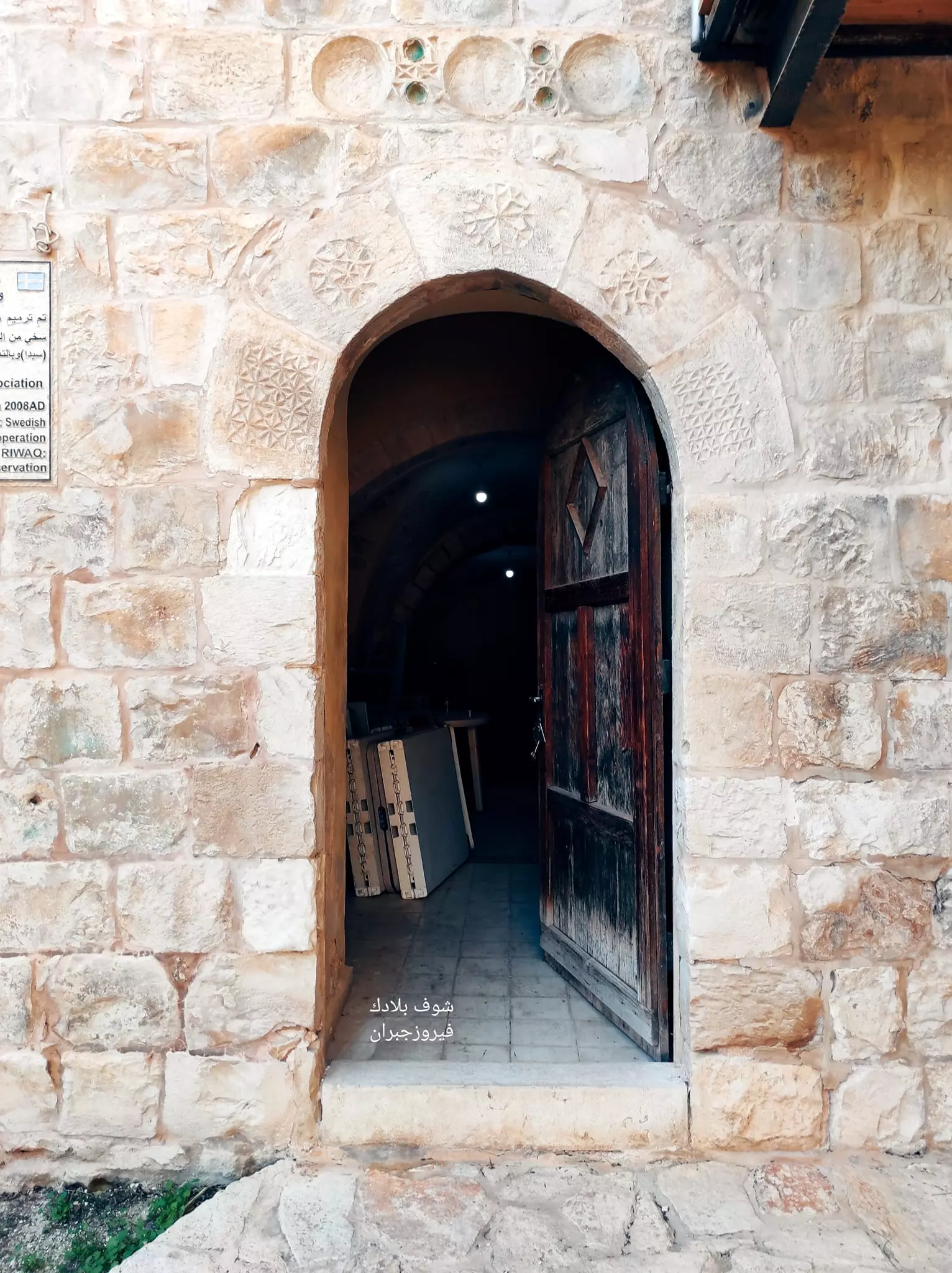
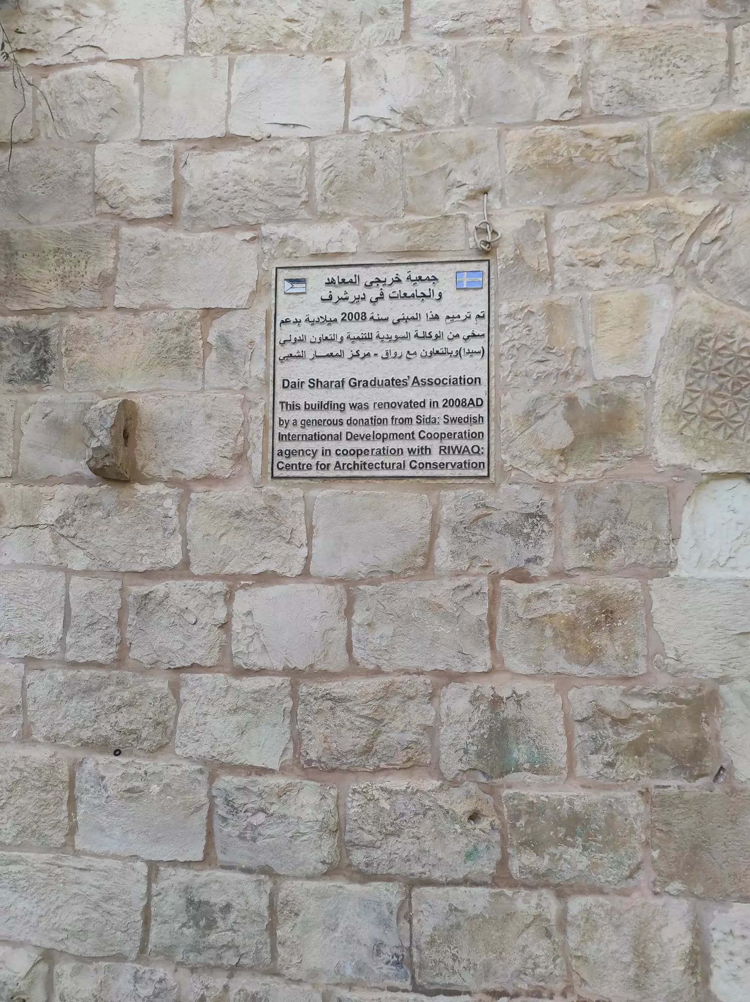
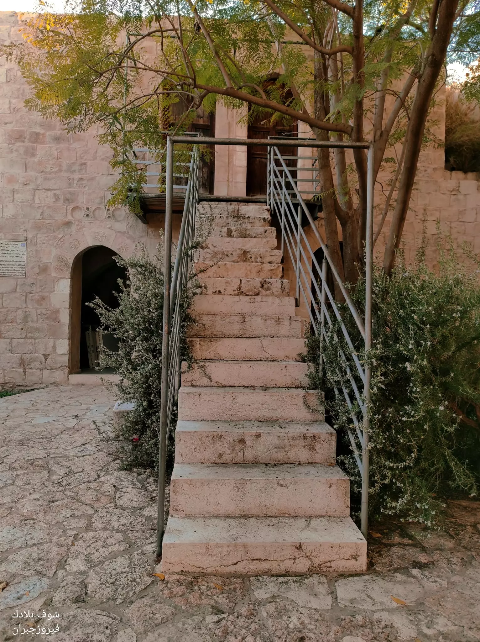
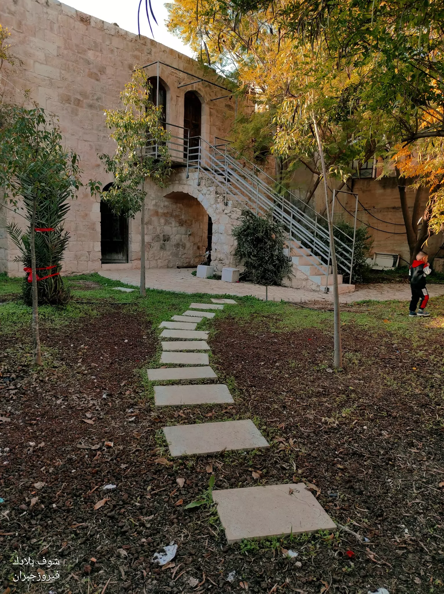
Posted by ابو صفط 3 - جولة رائعة بين بيوت القرية القديمة -- Fairouz Jubran -- March 2022
- جولة رائعة بين بيوت القرية القديمة -- Fairouz Jubran -- March 2022 #2
- جولة رائعة بين بيوت القرية القديمة -- Fairouz Jubran -- March 2022 #3

- جولة رائعة بين بيوت القرية القديمة -- Fairouz Jubran -- March 2022 #4
- جولة رائعة بين بيوت القرية القديمة -- Fairouz Jubran -- March 2022 #5
- جولة رائعة بين بيوت القرية القديمة -- Fairouz Jubran -- March 2022 #6
- جولة رائعة بين بيوت القرية القديمة -- Fairouz Jubran -- March 2022 #7
- جولة رائعة بين بيوت القرية القديمة -- Fairouz Jubran -- March 2022 #8
- جولة رائعة بين بيوت القرية القديمة -- Fairouz Jubran -- March 2022 #9
- جولة رائعة بين بيوت القرية القديمة -- Fairouz Jubran -- March 2022 #10
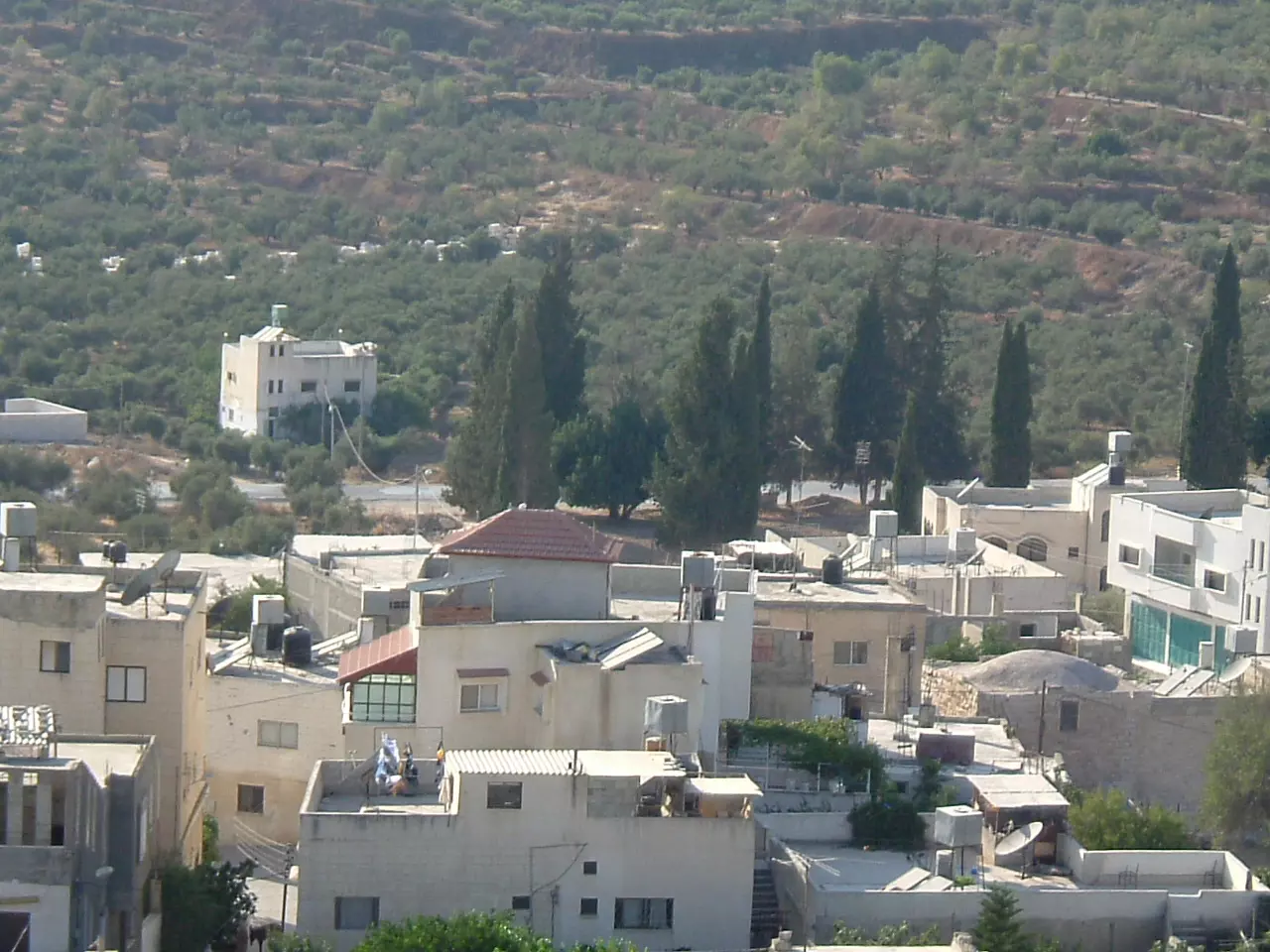
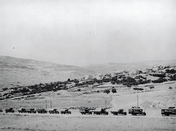
- منظر عام -- 1920
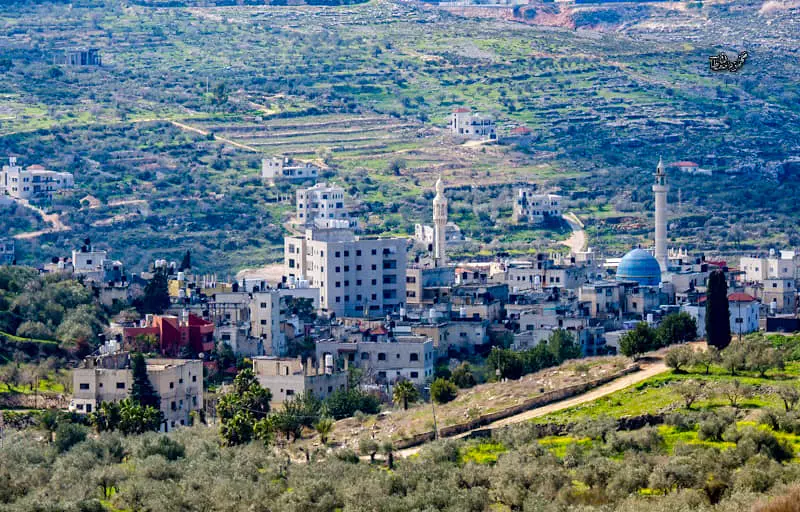
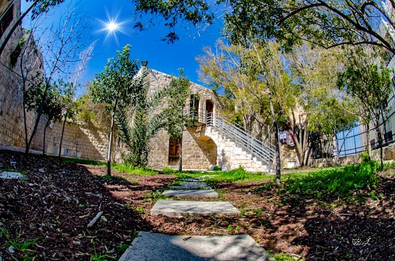
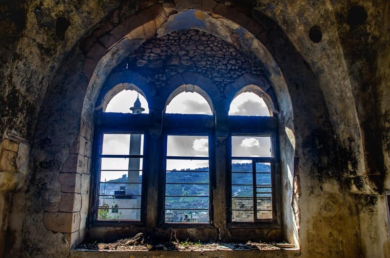
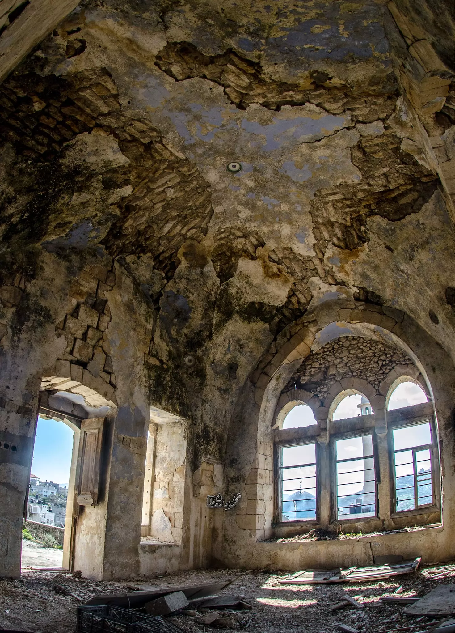
- منظر عام -- July 2024 -- Mahmoud Moutan
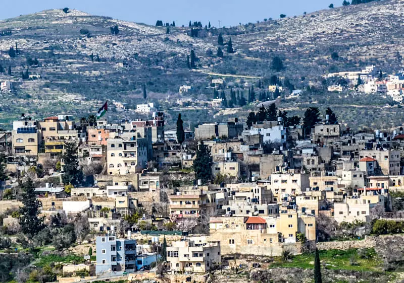
- منظر عام -- July 2024 -- Mahmoud Moutan #2
- منظر عام -- July 2024 -- Mahmoud Moutan #3
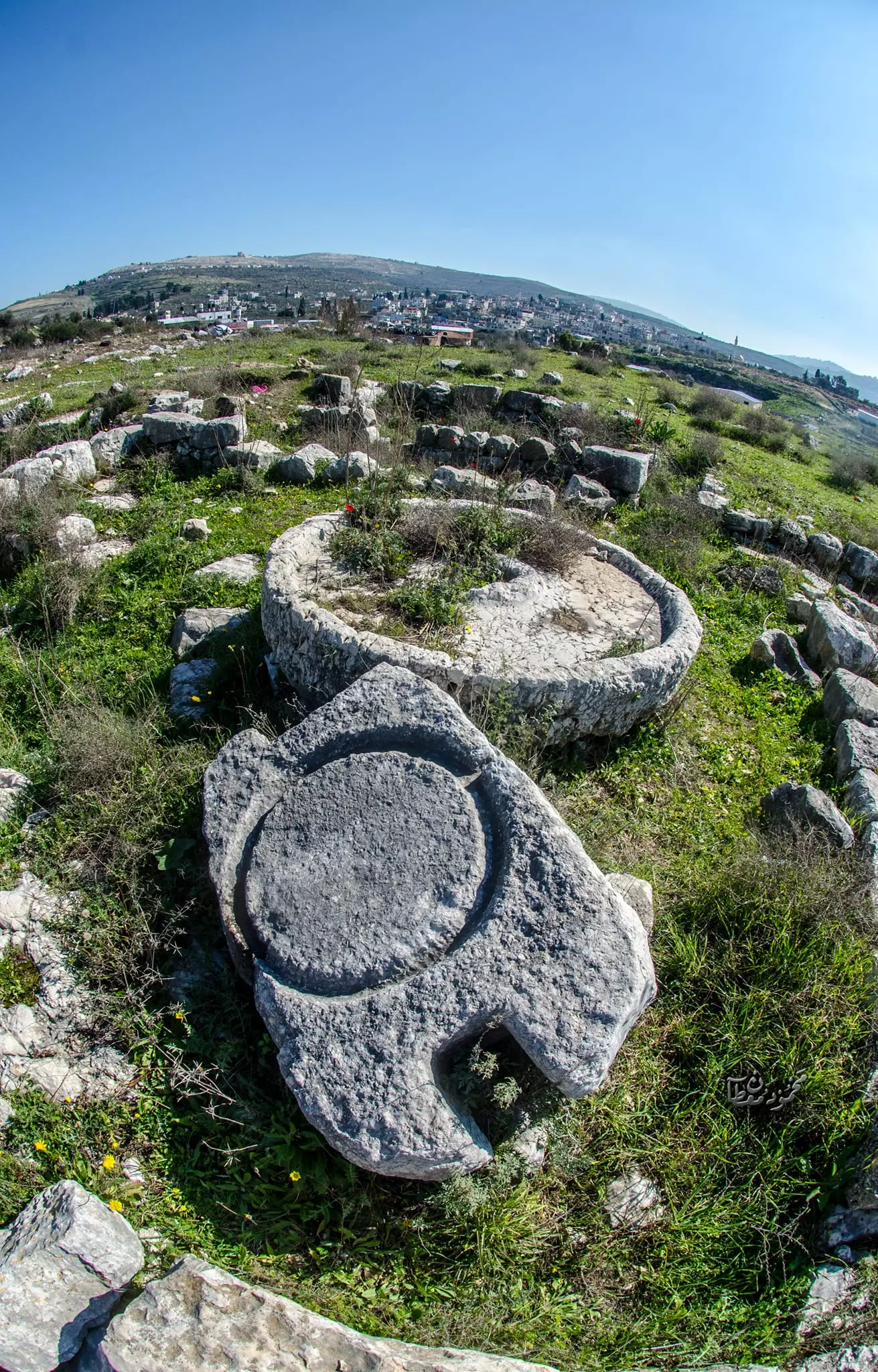
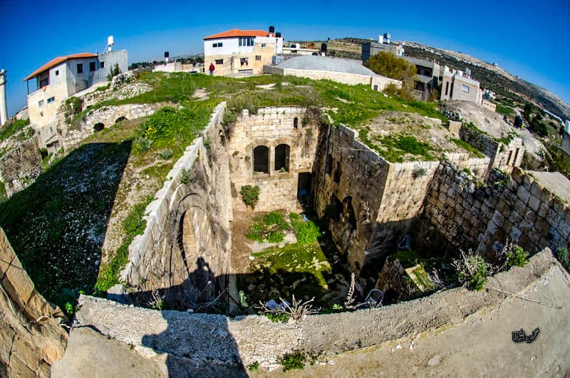
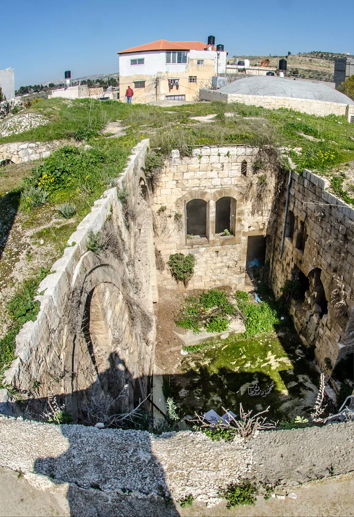
- خربة-- July 2024 -- Mahmoud Moutan
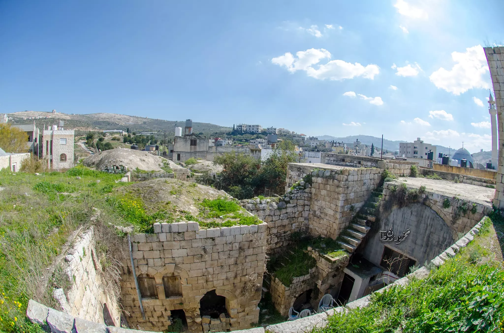
- جولة بين بيوت البلدة القديمة -- Mahmoud Moutan
- جولة بين بيوت البلدة القديمة -- Mahmoud Moutan #2
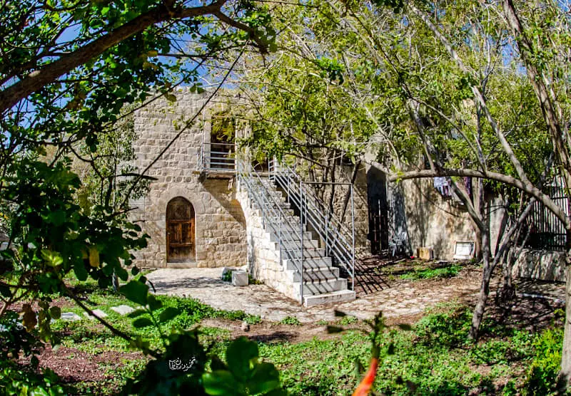
- جولة بين بيوت البلدة القديمة -- Mahmoud Moutan #3
- جولة بين بيوت البلدة القديمة -- Mahmoud Moutan #4
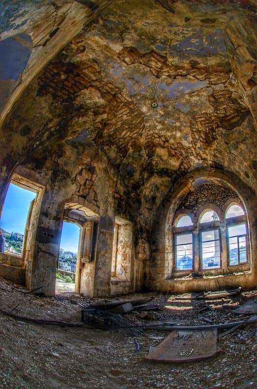
- جولة بين بيوت البلدة القديمة -- Mahmoud Moutan #5
- جولة بين بيوت البلدة القديمة -- Mahmoud Moutan #6
- جولة بين بيوت البلدة القديمة -- Mahmoud Moutan #7
- جولة بين بيوت البلدة القديمة -- Mahmoud Moutan #8
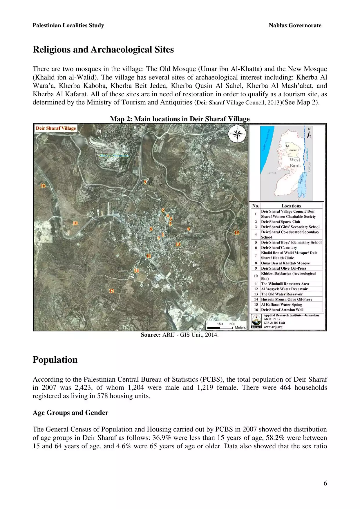
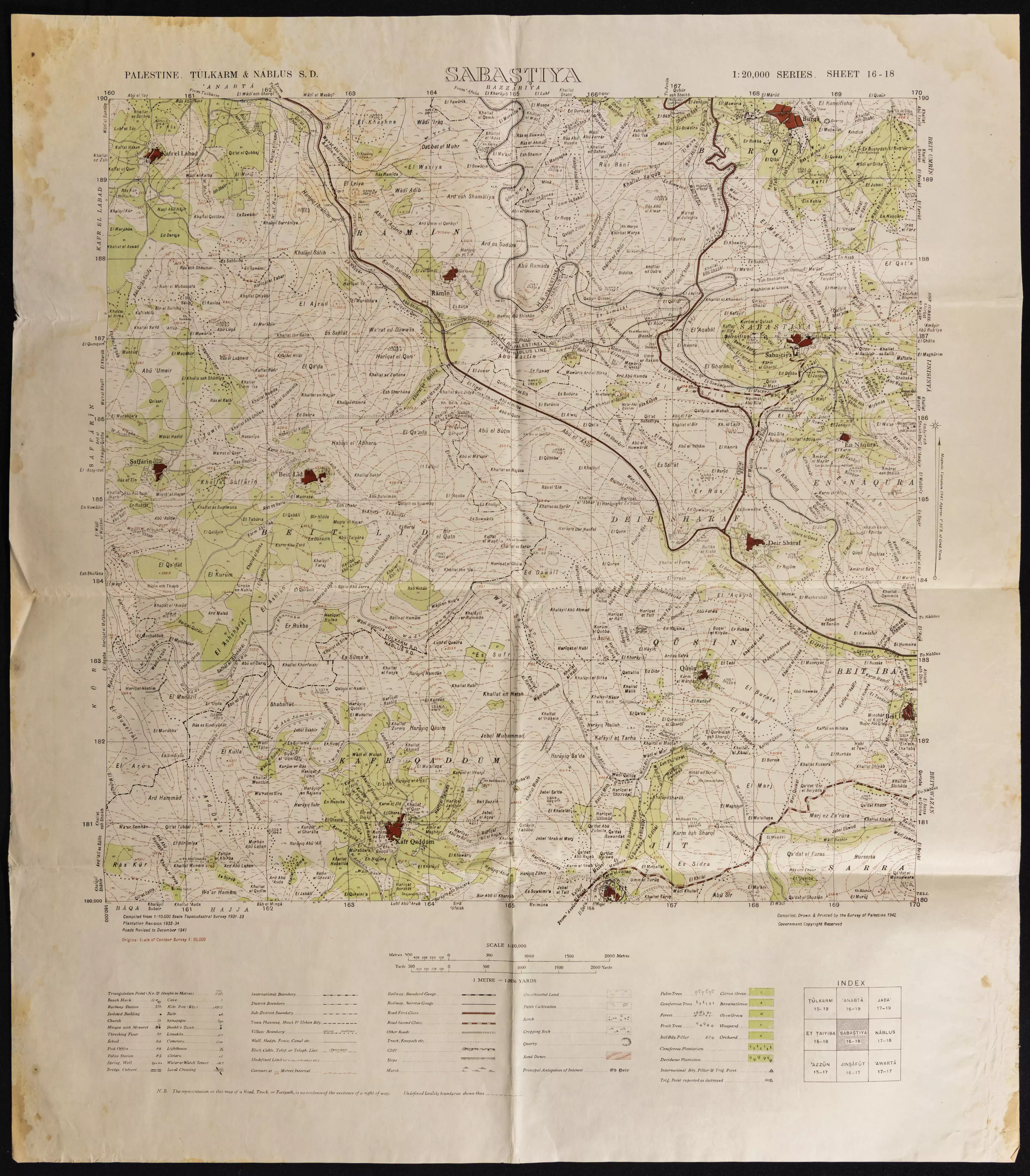
- خارطة تُظهِر الحدود والطرق بأنواعها والأماكن المقدسة والطبيعة الطوبغرافية من تلال وسهول ومنحدرات والتشكيلة الطبيعية للأرض وأنواع المزروعات. نُشرت الخريطة فترة الانتداب البريطاني، تم إضافة تعديلات عليها من قِبَل خدمة الخرائط والصور التابعة للقوات العسكرية الاسرائيلية فترة الأربعينيات.
Want to browse more? 80,000 pictures were grouped in these gallaries:
| Display Name | Clan/Hamolah | Country of Residence |
| Batool Faruq | - | Palestine |
| Basem Al Masoud | - | - |
| هلال أسلامك | العنتري | عمان, الاردن |
| raed nofal | - | - |
| نشات العنتري | العنتري | حكما, الاردن ـ اربد |
| محمد وجيه نوفل | - | amman |
| ابوالوليد | فقهاء | نابلس, ديرشرف |
| بسام أبو سفط | العنتري | - |
| Ihab Antary | - | Riyadh, KSA |
| SNIPER | MAREE | ZARQA, JORDAN |
| أبو إبراهيم الفقيه | الفقهاء | riyadh, Saudi Arabia |
| tariq | antari | nablus |
| ابو القرم | العنتري | - |
| che | antari | west bank, 00972 |
| احمد ابوالقرم | العنتري | - |
| خالص فريد العنتري | العنتري | vaxjo, sweden |
| Prince | Al Antari | Riyadh |
| مجهول | - | - |
- جولة في شوارع - دير شرف - قضاء نابلس - لي وطن - النسخة الأصلية Duration: 4 min 51 sec
No links have been shared yet, be free to the first to share the first link.
 Fake Valor: Why Did Zionist Jews Hoist Nazis Flag on Their Ships in the 1930s?
What is new?
-
Facts About Oct. 7th Gaza Raid
-
Remined Us Please:: Who Did Rape Who? Palestinians Raped Israelis? Or, was the other way around?
-
When Prof. Edward Said was invited to debate Bibi Netanyahu in the 1980s, watch what happened!
-
Ezra Klein of the NY Times on the "Jewish Race".
-
Abusing Blood Libel!
-
Did Israeli Soldiers Activate The Hanniba Direective On Oct. 7th? You Be The Judge
-
Zionist FAQ: Isn't it true that Palestinians don't want peace? Palestinians never accepted the two-state solution
- Facts about Haavara (Transfer) Agreement between Ben-Gurion & Hitler
-
Haavara FAQs: Why Did Zionist Jews Hoist Nazis' Flags on Their Ships in the 1930s?
- Haavara FAQs: When Chaim Weizmann met FDR in mid-1943, why was he silent about rescuing European Jewry?
-
Dear ChatGPT: How did Palestinians resist Napoleon's invasion of their country in 1799?
-
Dear ChatGPT: Gaza had a vibrant Jewish community in the mid-17th century. What happened to them?
-
Dear ChatGPT: Why did the Jewish Agency suppress news of the Holocaust during WWII?
-
Video Playlist: Jews share their DNA tests to end the conflict for good.
-
A Tale of Two Conflicts: Examining the Definition of Genocide
-
Prof. Abraham Polak And The Suppressed History of the Khazars and European Jewry
-
How Ronald Reagan would have framed the genocide in Gaza if he were still alive?
-
Haavara FAQs: Let us do the math: how many German Jews did The Haavara Agreement save?
-
Zionist FAQs: The Hebron Massacre of 1929, "clearly proves" that Palestinians are antisemitic, how could you deny it?
-
Zionist FAQs: Why Anti-Zionist Is Not Antisemitism?
-
Zionist FAQs: Isn't it true that the KGB created Palestinian Nationalism in the early 1960s?
- Zionist FAQs: Muslims are killing Muslims all the time; why are Israeli Jews being singled out in the media?
- Zionist FAQs: How is Israel an apartheid state when 20% of its citizens are Arabs who enjoy full rights?
-
Haavara FAQs: Why Did Dorothy Thompson Flip From A Zionist Advocate to A Silenced Dissenter?
-
Haavara FAQs: Analysis of Herzl's Uganda Scheme and how it could have saved millions of Jews.
-
Haavara FAQs: Why did Hayim Greenberg describe American Jewry as "morally bankrupt" in early 1943?
-
Haavara FAQs: What if the Evian Conference was a resounding success? What would have been the impact of saving European Jewry on Zionism?
- Haavara FAQs: What if the six million were saved, how that would have impacted the Zionist project?
-
Haavara FAQs: How did Zionist leaders react when Europe's Jews lingered in the DP camps after WWII ended?
-
Why does the American Jewish community repeat lies that David Ben-Gurion had debunked before he died?
-
Who has the power to rename the Tatar/Khazar Gene Marker to Jewish IV?
-
Zionist FAQs: Why won't Egypt, Syria, and Jordan take their people back? Jews are indigenous to Palestine, and Arabs immigrated after Jews developed the country. Arabs should leave.
-
Haavara FAQs: Did Hitler and the Nazis conflate between Judaism and Zionist? If that wasn't case, then why?
-
Haavara FAQs: Winston Churchill and antisemitism, a collection of articles written Churchill.
-
Haavara FAQs: Broken by country, how many Jews survived vs. killed during the Holocaust?
-
Haavara FAQs: Why did European Jews vote with their feet and to immigrated to the Americas, not Palestine, after WWII?
-
Watch this American Jewish Girl describing Israeli Jews' cognitive dissonance like no other in under two minutes
-
Haavara FAQs: When the Nazis went out of their way to hide the Holocaust, Israeli Jews did the exact opposite by broadcasting their genocide of Gazans. But why?
-
Haavara FAQs: How Zionist Jews went out of their to show their appreciation to Nazism and Fascism?
- Haavara FAQs: Why Zionist leaders were against bombing the death camps & the Railroads leading to them?
-
Haavara FAQs: Hitler's message to the British and American people: If Jews are such noble citizens and you care about them, how come you're not letting them in? I will gladly ship them to you at my expense, even on luxury liners!
-
A shortlist of Zionist and Israeli false flag operations in the name Jews.
-
The Most Moral Army
- The Land of Kapos (Israel): Where the brave are boycotted and Kapos walk free.
- Why did early Zionists often named their communal enterprises "colonial"?
- Zionist Relations with Nazi Germany by Faris Glubb
-
Two NY Times advertisements by Zionists in the early 1943 that exposes Zionists' treason at the height of the calamity
- Facts Not Lies about the Palestinian-Israeli Conflict.
- Site's pictures have been categorized
- Campgain Against Lice
- A Survey of Palestine, the official source about Palestine before Nakba produced by the British Mandate; over 1200 pages.
- Satellite View & Google Earth: Over 6,000 placemarks identifying all destroyed towns, W. Bank & Gaza Strip Towns, & refugee camps.
- PalestineRemembered.com and its Nakba Oral History Project were featured on al-Jazeera Satellite TV.
- Nakba Oral History Video Podcast:
 Over 700 Oral History interviews (including 3,500+ hours of recording) can be viewed online.
 - Palestine Village Statistics Project
- Gaza Jail Break
- النسخة العربية للموقع الان متوفرة
- Videos: Documenting the destroyed villages in video: Tracing all that remains since Nakba.
- Videos: Responding to Zionist Propaganda
- Interview: The ethnic cleansing of Palestine: George Galloway interviews Israeli Historian Ilan Pappe.
- For Palestinians, memory matters. It provides a blueprint for their future By George Bisharat.
- Zionist FAQ now available in Hebrew שאלות שציונים שואלים, עכשיו בעברית
- Video: The Stephen Walt and John Mearsheimer report on the influence of the Israel Lobby on U.S. Foreign Policy
- The Palestinian-Israeli conflict for beginners
