| PalestineRemembered | About Us | Oral History | العربية | |
| Pictures | Zionist FAQs | Haavara | Maps | |
| Search |
| Camps |
| Districts |
| Acre |
| Baysan |
| Beersheba |
| Bethlehem |
| Gaza |
| Haifa |
| Hebron |
| Jaffa |
| Jericho |
| Jerusalem |
| Jinin |
| Nablus |
| Nazareth |
| Ramallah |
| al-Ramla |
| Safad |
| Tiberias |
| Tulkarm |
| Donate |
| Contact |
| Profile |
| Videos |
Dayr al-Sudan - دير السودان: Before & After Nakba SlideShow |
العربية |
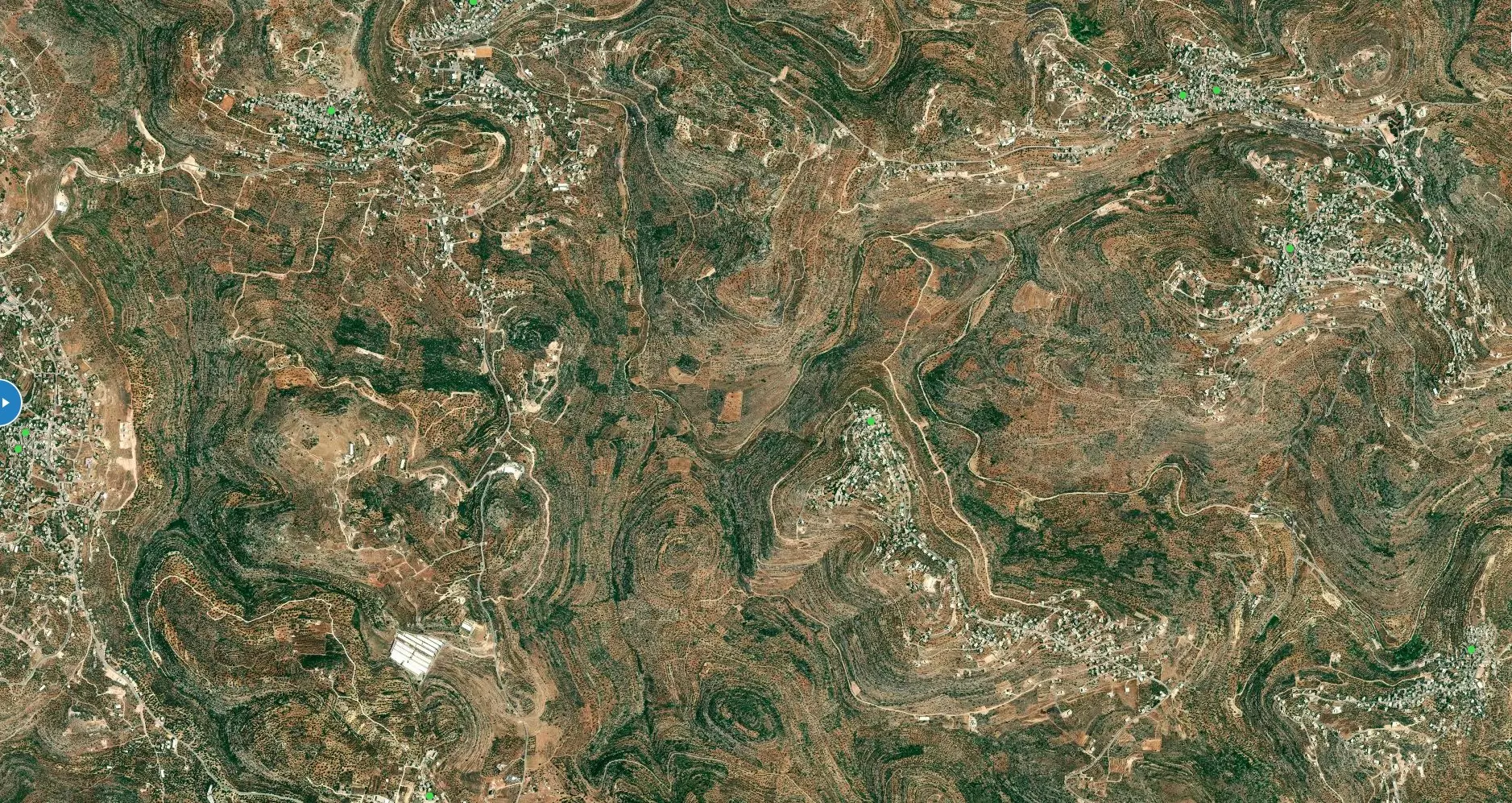
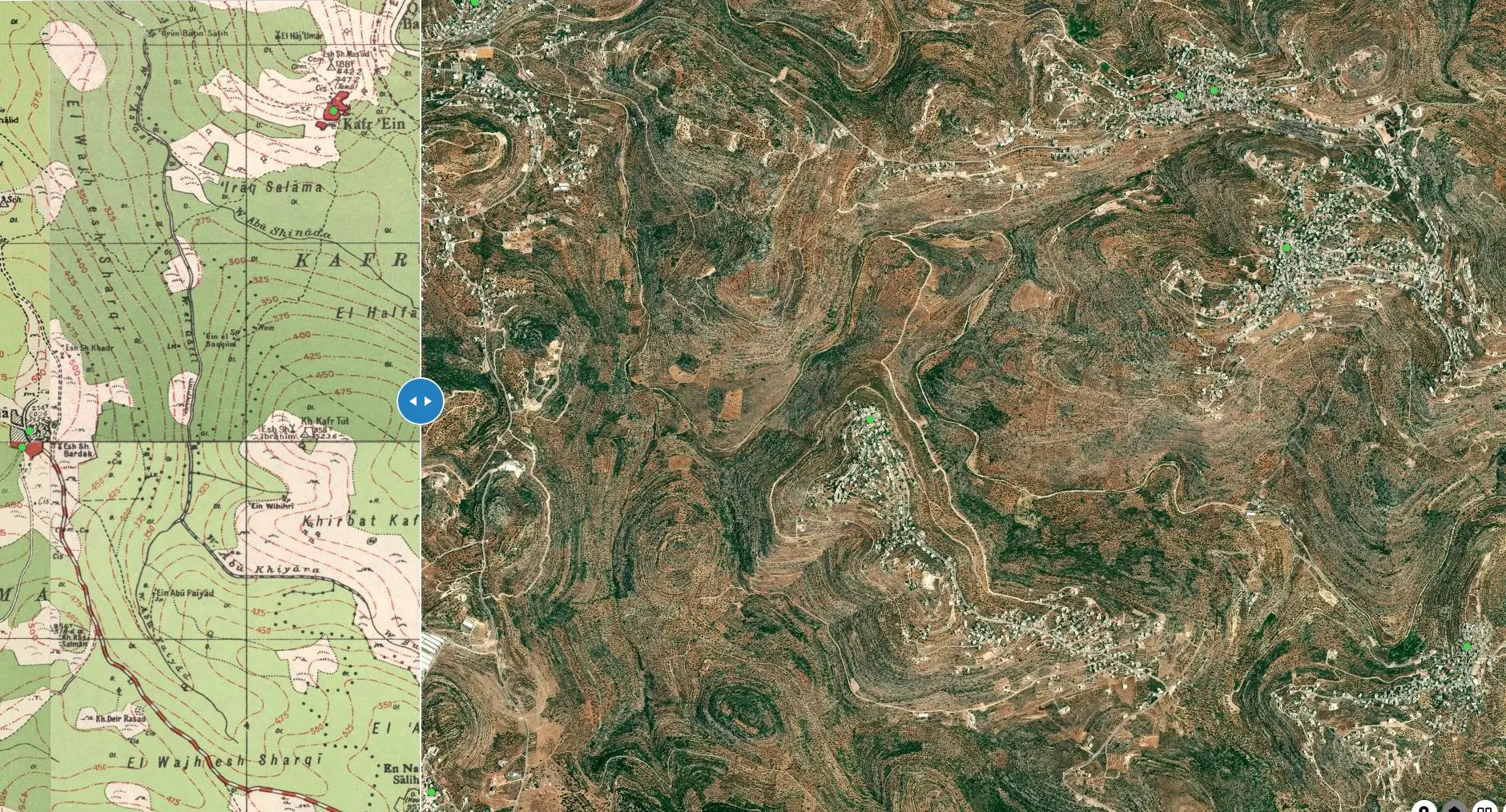
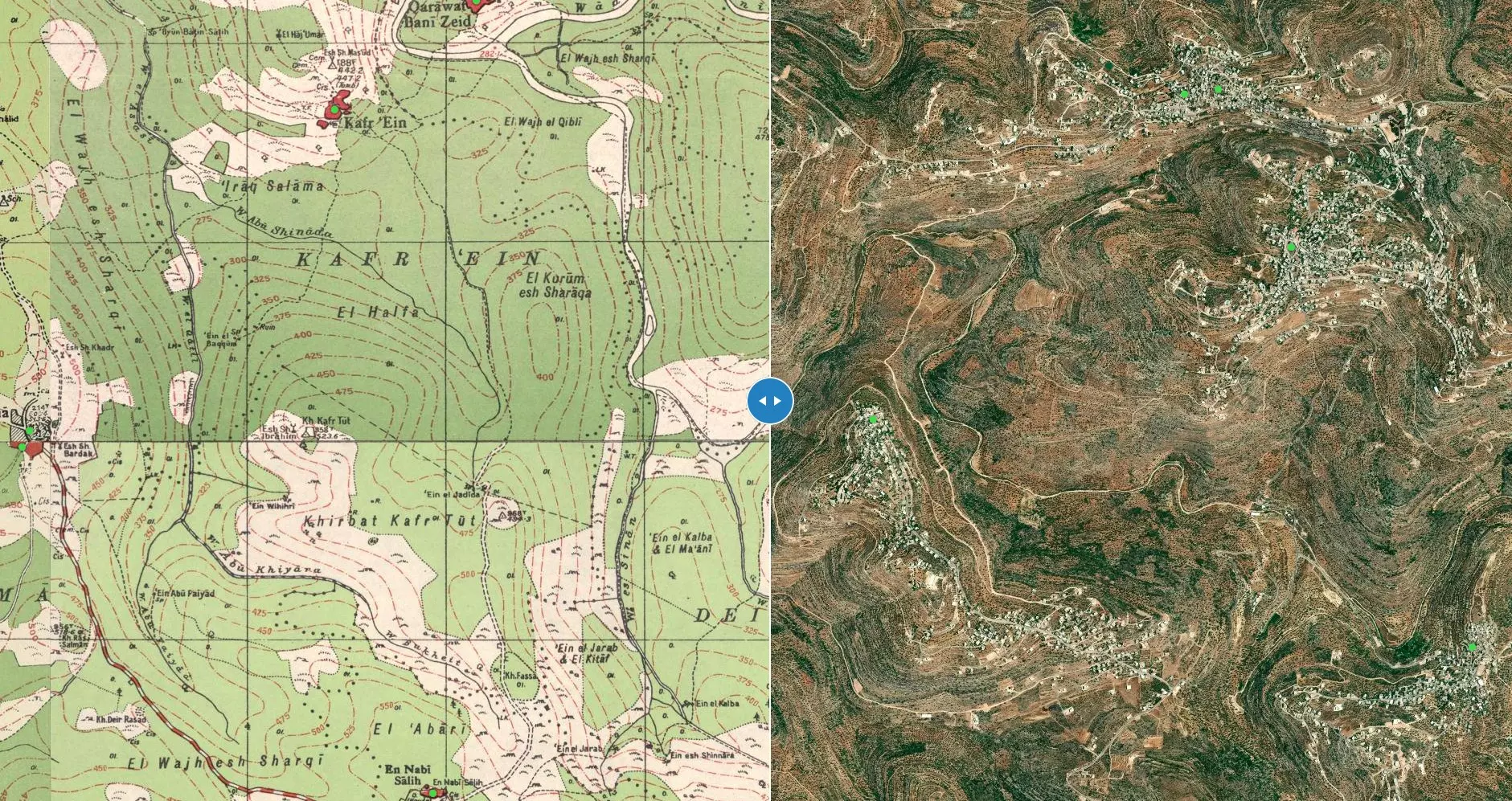
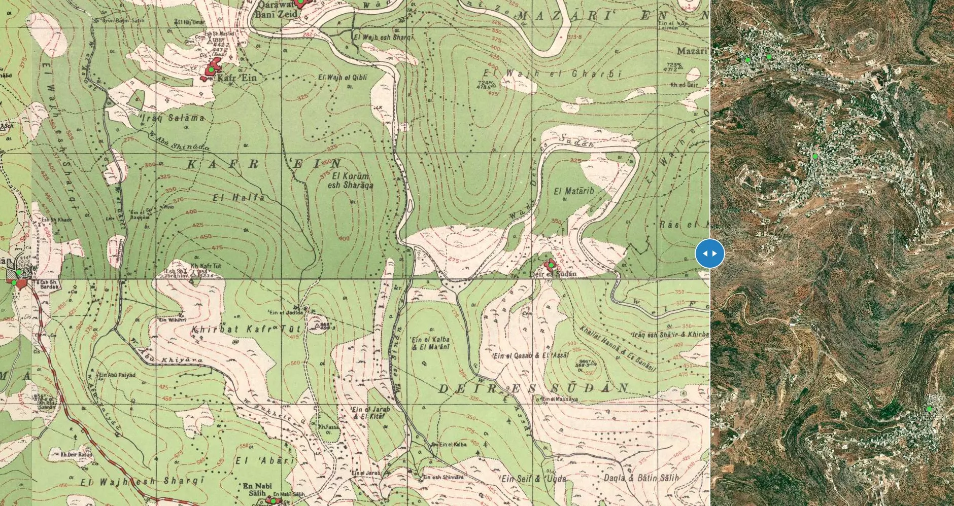
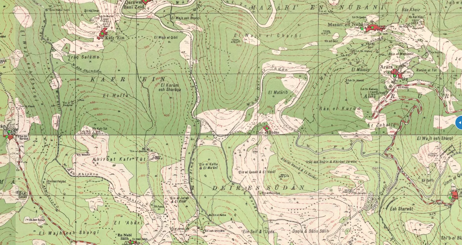
| Help us identify lands' names (khillat) with there directions from the center, click map to enlarge. | Google Earth |
For interactive maps with zoom in & out capabilities, visit Palestine Open Maps. Once there enable Split View from the lower right hand corner. Here are also detailed maps showing villages' demarcation lines (marked with the dotted black lines in the above pre-Nakba map).
It should be noted that the above detailed pre-Nakba map was based on British Mandate's A Survey of Palestine & Village Statistics; both have been made available online.
Be free to browse near by towns:


Post Your Comment
*It should be NOTED that your email address won't be shared, and all communications between members will be routed via the website's mail server.