| PalestineRemembered | About Us | Oral History | العربية | |
| Pictures | Zionist FAQs | Haavara | Maps | |
| Search |
| Camps |
| Districts |
| Acre |
| Baysan |
| Beersheba |
| Bethlehem |
| Gaza |
| Haifa |
| Hebron |
| Jaffa |
| Jericho |
| Jerusalem |
| Jinin |
| Nablus |
| Nazareth |
| Ramallah |
| al-Ramla |
| Safad |
| Tiberias |
| Tulkarm |
| Donate |
| Contact |
| Profile |
| Videos |
|
Prev |
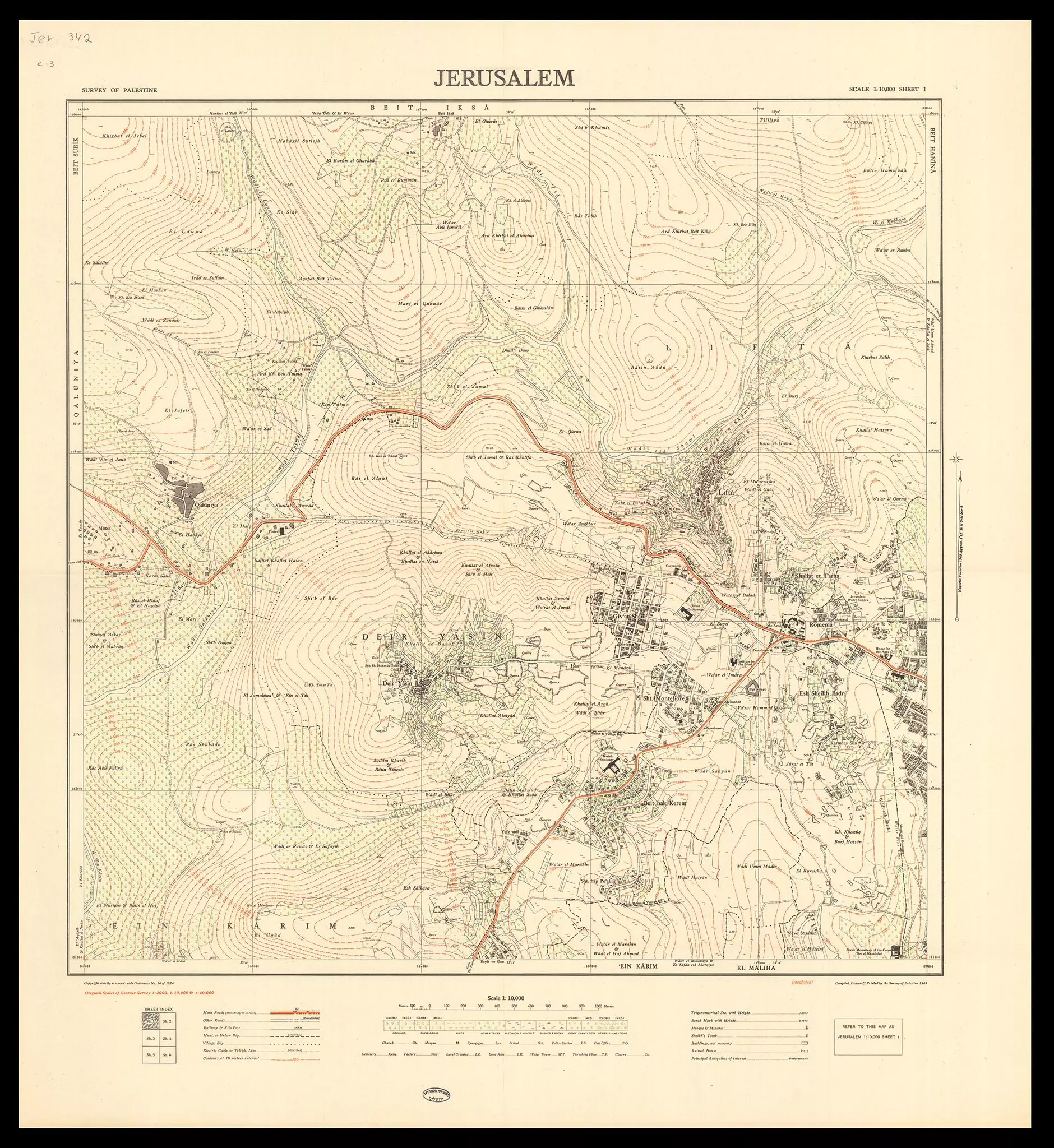
Jerusalem - القدس الشريف: A detailed map of Jerusalem's Western suburbs as if was before Nakba of 1948 showing Lift, Qalunya, Deir Yassin and Sheik Badr. More about Sheikh badr in the comment section below the picture take from Assaf, MD on X0 comment |
Next
العربية |
| On February 14, 2025 |
||
| Upload | Prev 1735 1736 1737 1738 1739 Next | Satellite |


Post Your Comment
*It should be NOTED that your email address won't be shared, and all communications between members will be routed via the website's mail server.