| PalestineRemembered | About Us | Oral History | العربية | |
| Pictures | Zionist FAQs | Haavara | Maps | |
| Search |
| Camps |
| Districts |
| Acre |
| Baysan |
| Beersheba |
| Bethlehem |
| Gaza |
| Haifa |
| Hebron |
| Jaffa |
| Jericho |
| Jerusalem |
| Jinin |
| Nablus |
| Nazareth |
| Ramallah |
| al-Ramla |
| Safad |
| Tiberias |
| Tulkarm |
| Donate |
| Contact |
| Profile |
| Videos |


Post Your Comment
*It should be NOTED that your email address won't be shared, and all communications between members will be routed via the website's mail server.
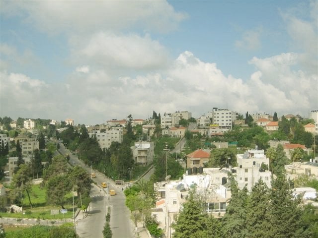
Lower-right and backwards = Al-Muntazah and Al-Baladiyeh
Lower-left and leftwards = Ein Munjid and up-hill towards Al-masyoon.
Backwards from road = Up-hill towards Maidan Al-Mughtaribeen.
Left fork of road = Towards the industrial Zone (Al-Mantiqa Al-Sina3iyeh) and Betunia beyond that.
Right fork of road = Round Old Ramallah and right towards Batn El-Hawa.