| PalestineRemembered | About Us | Oral History | العربية | |
| Pictures | Zionist FAQs | Haavara | Maps | |
| Search |
| Camps |
| Districts |
| Acre |
| Baysan |
| Beersheba |
| Bethlehem |
| Gaza |
| Haifa |
| Hebron |
| Jaffa |
| Jericho |
| Jerusalem |
| Jinin |
| Nablus |
| Nazareth |
| Ramallah |
| al-Ramla |
| Safad |
| Tiberias |
| Tulkarm |
| Donate |
| Contact |
| Profile |
| Videos |
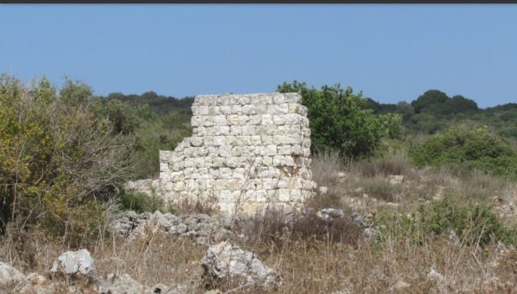
Welcome To Qumbaza, Khirbat - خربة قمبازة (ח'ירבת קומבאזה)
|
District of Haifa
Ethnically cleansed days ago |
العربية Google Earth |
 |
Gallery (8) |
- Statistics & Facts
-
Before & After

- Satellite View
- Articles 1
- Pictures 8
- Members
- All That Remains
- Wikipedia
- Videos 1
- Guest Book
- Links
| Statistic & Fact | Value | |||||||||
| Occupation Date | May 15, 1948 | |||||||||
| Distance From District | 21.5 (km) South of Haifa | |||||||||
| Elevation | 200 (meters) | |||||||||
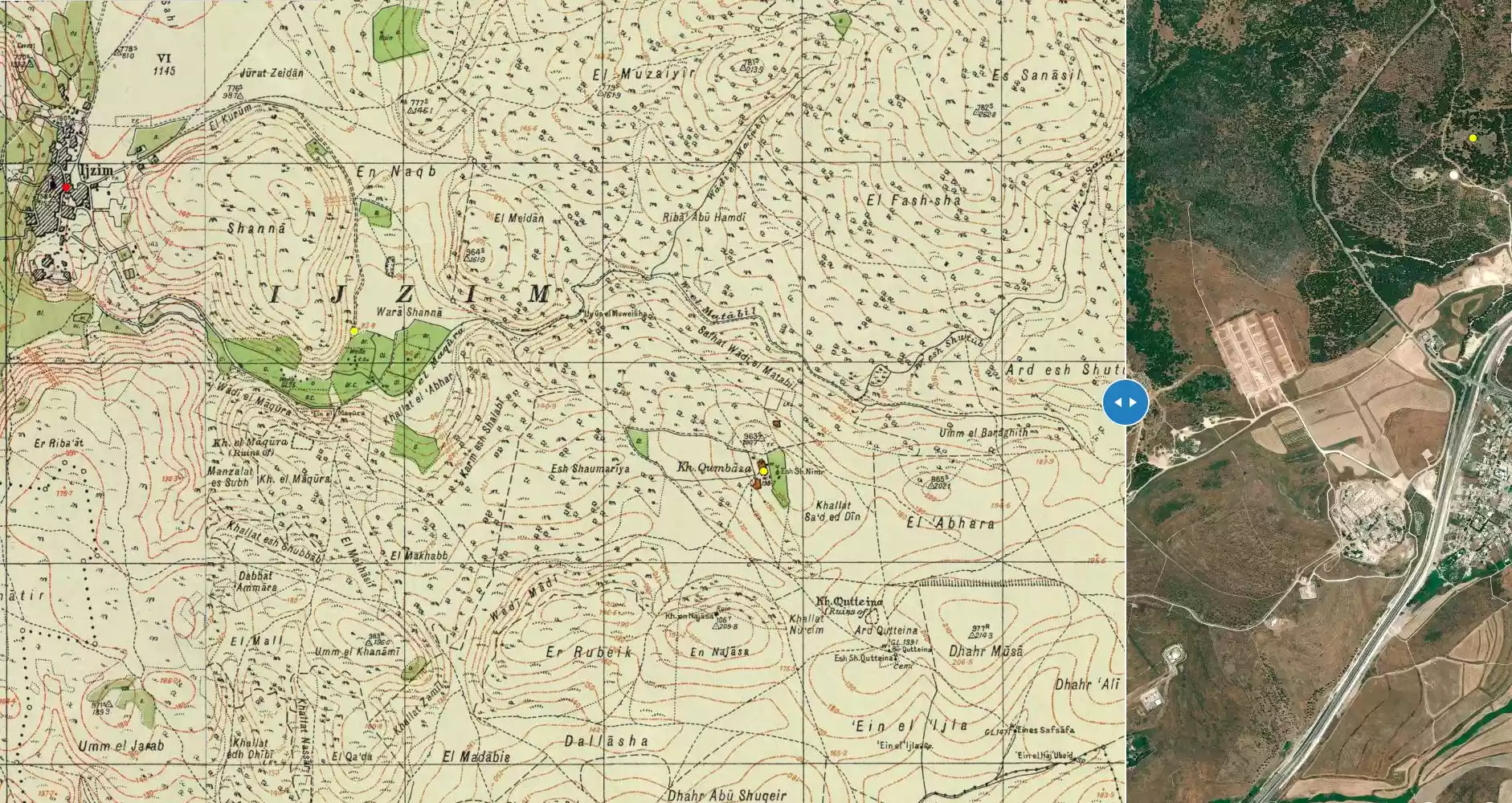
| Before & After Nakba, Click Map For Details |
||||||||||
|
||||||||||
| Map Location | See location #22 on the map View from satellite |
|||||||||
| Military Operation | Coastal Clearing | |||||||||
| Attacking Units | Golani Brigade | |||||||||
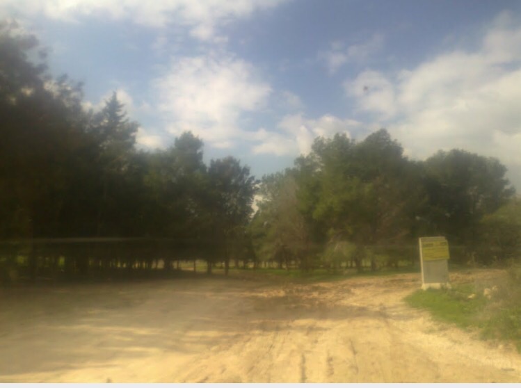
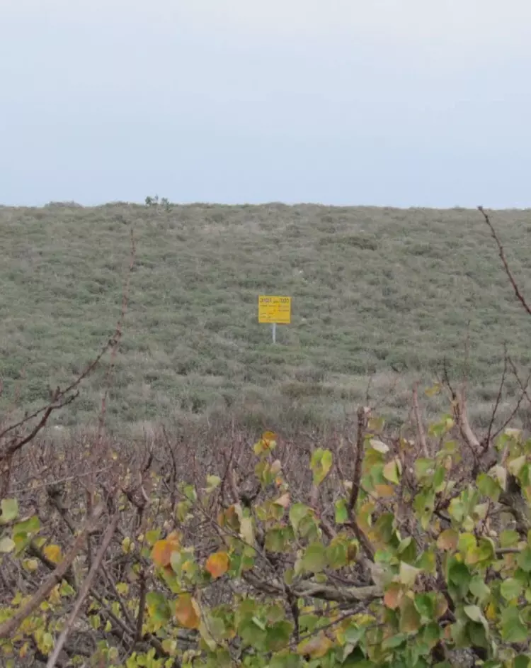
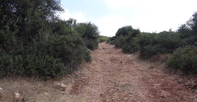
| Village Temains | The village has been completely obliterated | |||||||||
| Ethnically Cleansing | Qumbaza, Khirbat inhabitants were completely ethnically cleansed. | |||||||||
| Population |
|
|||||||||
| Number of Houses | (1931): 442 (includes ljzim, Khirbat al-Manara, al-Mazar, Shaykh al-Burayk, al-Washahiyya) | |||||||||
| Near By Towns |
||||||||||
|
|
||||||||||
| Town's Name Through History | Canaanites referred to the village by Kartah. | |||||||||
| Shrines / Maqams | A maqam for al-Shaykh Quttayna | |||||||||
| Nearby Wadies & Rivers | Khirbat Qumbaza was situated 3 km away from Wadi al-Mileh | |||||||||
| Archeological Sites | Khirbat Quttayna has been identified by some scholars as the Canaanite Kartah | |||||||||
| Exculsive Jewish Colonies Who Usurped Village Lands |
Some of village lands are being used by the Israeli army as military training ground and the rest are occupied by the settlement of Kerem Maharal. | |||||||||
| Featured Video | ||||||||||
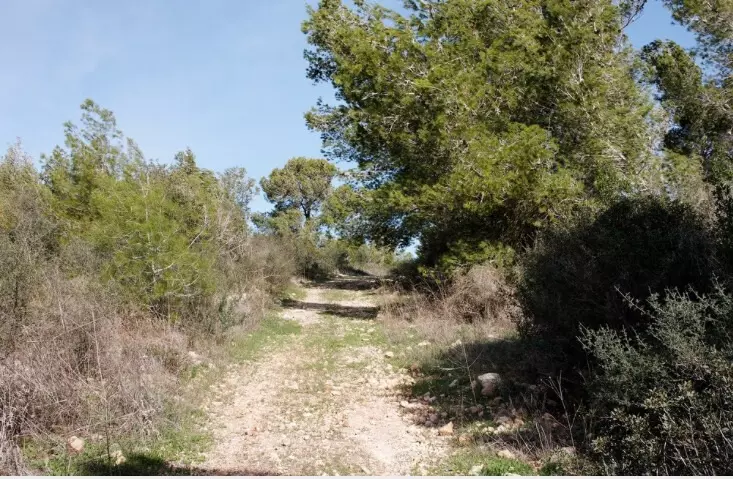
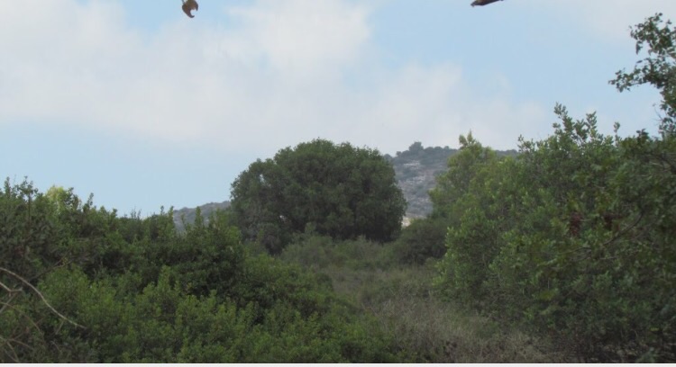
Village Before NakbaThe village was located in the midst of rolling hills that descended to the coastal plain, 7 km to the west. A secondary road connected the village to the Wadi Milh highway, 3 km away, which linked the coastal plain to the northern end of Marj ibn Amir. In the late nineteenth century, Khirbat Qumbaza was described as 'a small hamlet on high ground.' One km to the southeast lay the maqam of Shaykh Quttayna, above which was Khirbat Quttayna, where the remains of earlier structures have been discovered. Khirbat Quttayna has been identified by some scholars as the Canaanite Kartah (Joshua 21:34).Village Occupation and Ethnic CleaningThe village may have been occupied in May 1948, according to Israeli historian Benny Morris. Support for this speculation comes from the fact that nearby Umm al-Zinat was captured on 15 May by units of the Golani Brigade. Moreover, the New York Times quoted Haganah sources on 15 May as saying that Jewish forces had taken several villages on the slopes of Mount Carmel and near Afula. This occurred in the wake of the occupation of Haifa Haganah units were ordered to strike at villages in the city's hinterland in order to 'clear' the area of its inhabitants and establish an alternative route for Haganah military convoys going to the south, since the local Palestinian population blocked the coastal road south of Haifa. Khirbat Qumbaza, located in the vicinity of the inland supply route, was probably targeted for capture at that time.Zionists Colonies on Village LandsSome of the village lands are part of a military training area. The settlement of Kerem Maharal, built in 1949, is also close to the village site.Village TodayThe entire area is reserved for military training and is inaccessible to the public.SourceDr. Walid al-Khalidi, 1992: All That Remains. |
||||||||||
| Related Maps | Town Lands' Demarcation Maps خرائط للقضاء توضح حدود القرى والاودية Town's map on MapQuest View from satellite Help us map this town at WikiMapia |
|||||||||
| Related Links | Wikipedia's Page Facebook Page Google Search Google For Images Google For Videos |
|||||||||
| More Information | في كتاب كي لا ننسى في كتاب بلادنا فلسطين المزيد من موقع هوية |
|||||||||
Want to browse more? 80,000 pictures were grouped in these gallaries:
| Display Name | Clan/Hamolah | Country of Residence |
No links have been shared yet, be free to the first to share the first link.
 Fake Valor: Why Did Zionist Jews Hoist Nazis Flag on Their Ships in the 1930s?
What is new?
-
Facts About Oct. 7th Gaza Raid
-
Remined Us Please:: Who Did Rape Who? Palestinians Raped Israelis? Or, was the other way around?
-
When Prof. Edward Said was invited to debate Bibi Netanyahu in the 1980s, watch what happened!
-
Ezra Klein of the NY Times on the "Jewish Race".
-
Abusing Blood Libel!
-
Zionist FAQ: Isn't it true that Palestinians don't want peace? Palestinians never accepted the two-state solution
- Facts about Haavara (Transfer) Agreement between Ben-Gurion & Hitler
-
Haavara FAQs: Why Did Zionist Jews Hoist Nazis' Flags on Their Ships in the 1930s?
-
Dear ChatGPT: Why did the Jewish Agency suppress news of the Holocaust during WWII?
-
Video Playlist: Jews share their DNA tests to end the conflict for good.
-
A Tale of Two Conflicts: Examining the Definition of Genocide
-
Prof. Abraham Polak And The Suppressed History of the Khazars and European Jewry
-
How Ronald Reagan would have framed the genocide in Gaza if he were still alive?
-
Haavara FAQs: Let us do the math: how many German Jews did The Haavara Agreement save?
-
Zionist FAQs: The Hebron Massacre of 1929, "clearly proves" that Palestinians are antisemitic, how could you deny it?
-
Zionist FAQs: Why Anti-Zionist Is Not Antisemitism?
-
Zionist FAQs: Isn't it true that the KGB create Palestinian Nationalism in the early 1960s?
- Zionist FAQs: Muslims are killing Muslims all the time; why are Israeli Jews being singled out in the media?
- Zionist FAQs: How is Israel an apartheid state when 20% of its citizens are Arabs who enjoy full rights?
-
Haavara FAQs: Analysis of Herzl's Uganda Scheme and how it could have saved millions of Jews.
-
Haavara FAQs: Why did Hayim Greenberg describe American Jewry as "morally bankrupt" in early 1943?
-
Haavara FAQs: What if the Evian Conference was a resounding success? What would have been the impact of saving European Jewry on Zionism?
- Haavara FAQs: What if the six million were saved, how that would have impacted the Zionist project?
-
Haavara FAQs: How did Zionist leaders react when Europe's Jews lingered in the DP camps after WWII ended?
-
Why does the American Jewish community repeat lies that David Ben-Gurion had debunked before he died?
-
Who has the power to rename the Tatar/Khazar Gene Marker to Jewish IV?
-
Zionist FAQs: Why won't Egypt, Syria, and Jordan take their people back? Jews are indigenous to Palestine, and Arabs immigrated after Jews developed the country. Arabs should leave.
-
Haavara FAQs: Did Hitler and the Nazis conflate between Judaism and Zionist? If that wasn't case, then why?
-
Haavara FAQs: Winston Churchill and antisemitism, a collection of articles written Churchill.
-
Haavara FAQs: Broken by country, how many Jews survived vs. killed during the Holocaust?
-
Haavara FAQs: Why did European Jews vote with their feet and to immigrated to the Americas, not Palestine, after WWII?
-
Watch this American Jewish Girl describing Israeli Jews' cognitive dissonance like no other in under two minutes
-
Haavara FAQs: When the Nazis went out of their way to hide the Holocaust, Israeli Jews did the exact opposite by broadcasting their genocide of Gazans. But why?
-
Haavara FAQs: How Zionist Jews went out of their to show their appreciation to Nazism and Fascism?
- Haavara FAQs: Why Zionist leaders were against bombing the death camps & the Railroads leading to them?
-
Haavara FAQs: Hitler's message to the British and American people: If Jews are such noble citizens and you care about them, how come you're not letting them in? I will gladly ship them to you at my expense, even on luxury liners!
-
A shortlist of Zionist and Israeli false flag operations in the name Jews.
-
The Most Moral Army
- The Land of Kapos (Israel): Where the brave are boycotted and Kapos walk free.
- Why did early Zionists often named their communal enterprises "colonial"?
- Zionist Relations with Nazi Germany by Faris Glubb
-
Two NY Times advertisements by Zionists in the early 1943 that exposes Zionists' treason at the height of the calamity
- Facts Not Lies about the Palestinian-Israeli Conflict.
- Site's pictures have been categorized
- Campgain Against Lice
- A Survey of Palestine, the official source about Palestine before Nakba produced by the British Mandate; over 1200 pages.
- Satellite View & Google Earth: Over 6,000 placemarks identifying all destroyed towns, W. Bank & Gaza Strip Towns, & refugee camps.
- PalestineRemembered.com and its Nakba Oral History Project were featured on al-Jazeera Satellite TV.
- Nakba Oral History Video Podcast:
 Over 700 Oral History interviews (including 3,500+ hours of recording) can be viewed online.
 - Palestine Village Statistics Project
- Gaza Jail Break
- النسخة العربية للموقع الان متوفرة
- Videos: Documenting the destroyed villages in video: Tracing all that remains since Nakba.
- Videos: Responding to Zionist Propaganda
- Interview: The ethnic cleansing of Palestine: George Galloway interviews Israeli Historian Ilan Pappe.
- For Palestinians, memory matters. It provides a blueprint for their future By George Bisharat.
- Zionist FAQ now available in Hebrew שאלות שציונים שואלים, עכשיו בעברית
- Video: The Stephen Walt and John Mearsheimer report on the influence of the Israel Lobby on U.S. Foreign Policy
- The Palestinian-Israeli conflict for beginners
