| PalestineRemembered | About Us | Oral History | العربية | |
| Pictures | Zionist FAQs | Haavara | Maps | |
| Search |
| Camps |
| Districts |
| Acre |
| Baysan |
| Beersheba |
| Bethlehem |
| Gaza |
| Haifa |
| Hebron |
| Jaffa |
| Jericho |
| Jerusalem |
| Jinin |
| Nablus |
| Nazareth |
| Ramallah |
| al-Ramla |
| Safad |
| Tiberias |
| Tulkarm |
| Donate |
| Contact |
| Profile |
| Videos |
Welcome To al-Ghubayya al-Fawqa - الغبية الفوقا (אל-ע'וביה אל-פוקא)
|
District of Haifa
Ethnically cleansed days ago |
العربية Google Earth |
 |
Gallery (7) |
- Statistics & Facts
-
Before & After

- Satellite View
- Articles 2
- Pictures 7
- Oral History 2
- Members 7
- All That Remains
- Wikipedia
- Videos
- Guest Book 2
- Links 1
| Statistic & Fact | Value | ||||||||||
| Occupation Date | April 8, 1948 | ||||||||||
| Distance From District | 28 (km) South East of Haifa | ||||||||||
| Elevation | 200 (meters) | ||||||||||
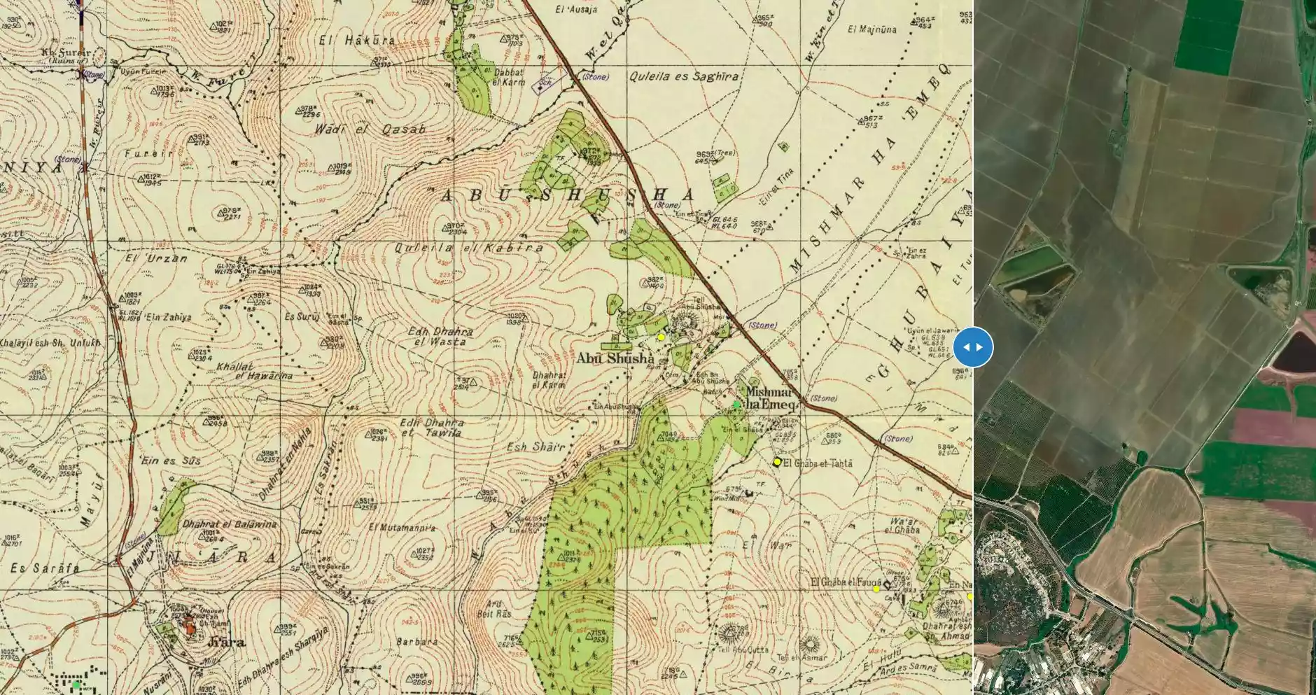
| Before & After Nakba, Click Map For Details |
|||||||||||
|
|||||||||||
| Map Location | See location #32 on the map View from satellite |
||||||||||
| Military Operation | Mishmar ha-'Emeq Battle | ||||||||||
| Attacking Units | Some units drawn from the Palmach (strike force), and from the Carmeli and Alexandroni Brigades. | ||||||||||
| Defenders | Local militia & Arab Liberation Army | ||||||||||
| Exodus Cause | Military assault by Zionist troops | ||||||||||
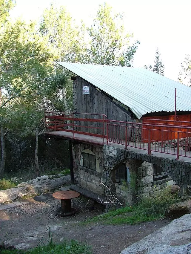
| Village Temains | The village has been completely obliterated, and only house rubble left behind. | ||||||||||
| Ethnically Cleansing | al-Ghubayya al-Fawqa inhabitants were completely ethnically cleansed. | ||||||||||
| Pre-Nakba Land Ownership |
**Town Lands' Demarcation Maps |
||||||||||
| Land Usage As of 1945 |
|
||||||||||
| Population |
|
||||||||||
| Number of Houses | In (1931): 38 (including al-Ghubayya al-Tahta) | ||||||||||
| Schools | al-Ghubayya al-Fawqa shared an elementary school (founded by the Ottomans in 1888) with the nearby villages of al-Ghubayya-al-Tahta and al-Naghnaghiyya. The school was later on closed during the British Mandate period. | ||||||||||
| Places of Warship | One Mosque | ||||||||||
| Shrines / Maqams | A shrine for a Muslim sage known by al-Shaykh Ahmad. | ||||||||||
| Archeological Sites | An unexcavated archaeological site, Tel al-Asmar, lay some 300m southwest of the village borders. | ||||||||||
| Exculsive Jewish Colonies Who Usurped Village Lands |
Mishmar ha-'Emeq | ||||||||||
| Featured Video | |||||||||||
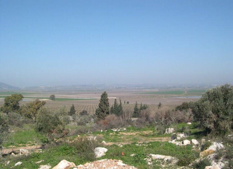
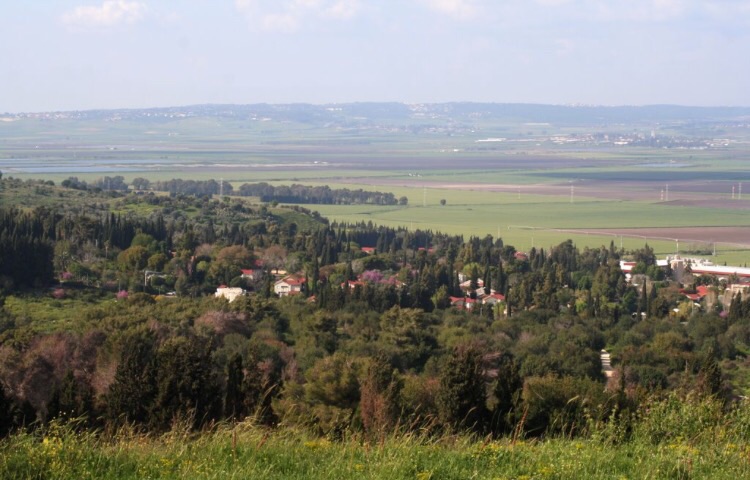
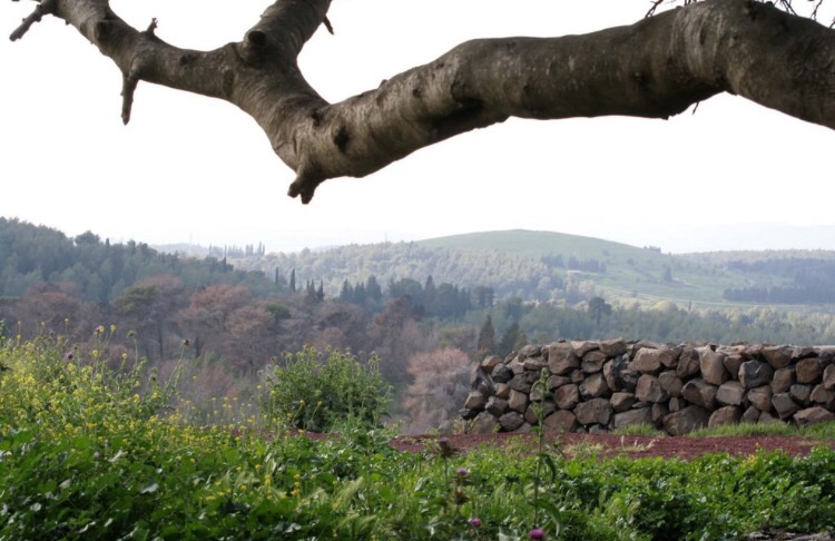
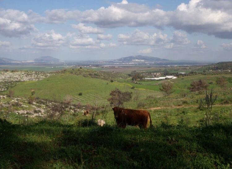
Village Before NakbaThe village was one of a group of three villages known collectively as al-Ghubayyat (the 'little forests'), located on the eastern slopes of the bilad al-rawha' (the 'fragrant country'; see Daliyat al-Rawha', Haifa sub-district); the other two villages were al-Ghubayya al-Tahta and al-Naghnaghiyya. It was located on a hill and extended down the slopes that paralleled the Haifa-Jenin highway, which ran immediately northeast of the village. The second part of its name meant 'upper' in Arabic; this served to distinguish it from its 'lower' counterpart, al-Ghubayya al-Tahta. In 1596, al-Ghubayya al-Fawqa was a village in the nahiya of Shafa (liwa' of Lajjun) with a population of 215. It paid taxes on a number of crops, including wheat and barley, as well as on other types of produce, such as goats, beehives, and water buffalos.Al-Ghubayya al-Fawqa's population was Muslim. Its houses were made of cement and mud and were dispersed across the slopes. The three villages shared an elementary school that was built about 1888, during Ottoman rule; it was closed under the Mandate, at which time the village was classified as a hamlet by the Palestine Index Gazetteer. Al-Ghubayya al-Fawqa had a mosque and a shrine for a Muslim sage, al-Shaykh Ahmad. Its cemetery was located on a hill in the upper part of the village. The three villages had access to a number of water sources including wadis, springs, and the al-Muqatta' River. The economies of these three villages were based on animal husbandry and agriculture, with grain being the chief crop. In 1944/45 a total of 10,883 dunums of the lands of the three villages was allotted to cereals; 209 dunums were irrigated or used for orchards. An unexcavated archaeological site, Tall al-Asmar, lay some 300 m southwest of the village. Village Occupation and Ethnic CleaningOne of the first villages to be captured by the Haganah following the battle of Mishrnar ha-Emeq, al-Ghubayya al-Fawqa changed hands several times in the first half of April 1948. Along with its sister village, al-Ghubayya al-Tahta, the village was occupied by Haganah units drawn from the Palmach, as well as the Carmeli and Alexandroni Brigades. They first entered the villages on 8-9 April, during 'fierce fighting'; 'there was house-to-house fighting in the village throughout the night,' according to Arab Liberation Army (ALA) commander Fawzi al-Qawuqji. The following day, Qawuqji relates, the fighting developed into a pitched battle and the Zionist forces were driven out. These dates are confirmed by the Palestinian newspaper Filastin, which reported that the 10 April battle was 'long' and 'violent' and was waged inside the village itself. For the next few days, Haganah control of these villages was precarious, according to the History of the Haganah. While they managed to retain a presence in them during the night, they were forced to withdraw under ALA bombardment during the day. But this did not prevent these units from destroying the village 'piecemeal,' as Israeli historian Benny Morris puts it, over the following few days. Palestinian historian Aref al-Aref states that some time before the battle, the people of al-Ghubayya al-Fawqa had been joined by those of al-Ghubayya al-Tahta, whose village had been destroyed. The influx of people from the neighboring village doubled the population of al-Ghubayya al-Fawqa, bringing the number of its inhabitants to 1,400. It is not clear what became of them when the battle erupted. The Haganah stated that by 13 April, ALA forces had withdrawn from the entire area, but the ALA reported that it recovered the al-Ghubayyat villages briefly on 14 April.A decision was taken by the Haganah and Ben-Gurion to expel the Arab inhabitants of the area and raze the villages near Mishrnar ha-Emeq to permanently remove the 'threat to the Yishuv.' Al-Ghubayya al-Fawqa was blown up by the Haganah and Palmach, with the help of local Jewish settlers, within the next week. Zionists Colonies on Village LandsThe site is overgrown with cactuses and fig, almond, and carob trees. The debris of the houses is visible among the vegetation. One can also see a big heap of stones where the mosque once stood. The cemetery is covered with thorny plants and weeds. The surrounding lands are used by Israeli farmers for various purposes, such as pasturing cattle and growing cotton.Village TodayThe settlement of Mishrnar ha-Emeq, established in 1926, is not on village land; however, it now uses some of the village lands as pasture.The Village Today SourceDr. Walid al-Khalidi, 1992: All That Remains. |
|||||||||||
| Related Maps | Town Lands' Demarcation Maps خرائط للقضاء توضح حدود القرى والاودية Town's map on MapQuest View from satellite Help us map this town at WikiMapia |
||||||||||
| Related Links | Wikipedia's Page Google Search Google For Images Google For Videos |
||||||||||
| More Information | في كتاب كي لا ننسى في كتاب بلادنا فلسطين في كتاب النكبة والفردوس المفقود المزيد من موقع هوية |
||||||||||
- شجرة الخروب وسط القرية وأسفلها مغارة كبيرة
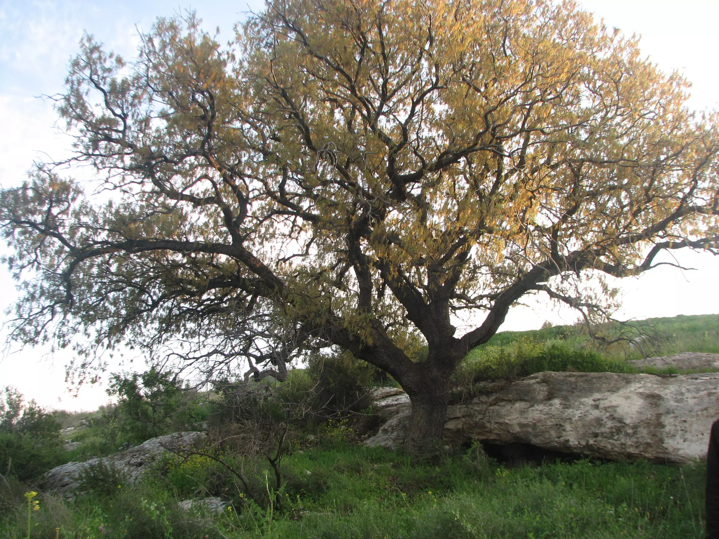
Posted by دارين طاطور - D:\481CANON\dareen\IMG_7601.jpg
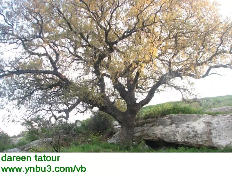
Posted by دارين طاطور - الغبية التحتا او الفوقا ...ومسنعمرت مشمار هغيمك
Posted by فتحي ابو رضا \ العايدي - الغبيه الفوقا . موقع القريه
Posted by abu raya - الغبيه الفوقا
Posted by abu raya - الغبيه الفوقا
Posted by abu raya - الغبيه الفوقا
Posted by abu raya
Want to browse more? 80,000 pictures were grouped in these gallaries:
| Display Name | Clan/Hamolah | Country of Residence |
| Hussein Nabahani | Nabahani | CA, USA |
| أحمد أبوزينة | أبوزينة | Palestine |
| ابو جواد | النغنغية | - |
| ابو طويله | السعدي | فلسطين, فلسطين |
| Mohammad Nabhani | Nabhani | Irbid, Jordan |
| jafar nabhani | - | - |
| Arab Al Turkman | Arab Al Turkman | - |
 Fake Valor: Why Did Zionist Jews Hoist Nazis Flag on Their Ships in the 1930s?
What is new?
-
Facts About Oct. 7th Gaza Raid
-
Remined Us Please:: Who Did Rape Who? Palestinians Raped Israelis? Or, was the other way around?
-
When Prof. Edward Said was invited to debate Bibi Netanyahu in the 1980s, watch what happened!
-
Abusing Blood Libel!
-
Zionist FAQ: Isn't it true that Palestinians don't want peace? Palestinians never accepted the two-state solution
- Facts about Haavara (Transfer) Agreement between Ben-Gurion & Hitler
-
Haavara FAQs: Why Did Zionist Jews Hoist Nazis' Flags on Their Ships in the 1930s?
-
Dear ChatGPT: Why did the Jewish Agency suppress news of the Holocaust during WWII?
-
Video Playlist: Jews share their DNA tests to end the conflict for good.
-
How Ronald Reagan would have framed the genocide in Gaza if he was still alive?
-
Haavara FAQs: Let us do the math: how many German Jews did The Haavara Agreement save?
-
Zionist FAQs: The Hebron Massacre of 1929, "clearly proves" that Palestinians are antisemitic, how could you deny it?
-
Zionist FAQs: Why Anti-Zionist Is Not Antisemitism?
-
Zionist FAQs: Isn't it true that the KGB create Palestinian Nationalism in the early 1960s?
- Zionist FAQs: Muslims are killing Muslims all the time; why are Israeli Jews being singled out in the media?
- Zionist FAQs: How is Israel an apartheid state when 20% of its citizens are Arabs who enjoy full rights?
-
Haavara FAQs: Analysis of Herzl's Uganda Scheme and how it could have saved millions of Jews.
-
Haavara FAQs: Why did Hayim Greenberg describe American Jewry as "morally bankrupt" in early 1943?
-
Haavara FAQs: What if the Evian Conference was a resounding success? What would have been the impact of saving European Jewry on Zionism?
- Haavara FAQs: What if the six million were saved, how that would have impacted the Zionist project?
-
Haavara FAQs: How did Zionist leaders react when Europe's Jews lingered in the DP camps after WWII ended?
-
Why does the American Jewish community repeat lies that David Ben-Gurion had debunked before he died?
-
Who has the power to rename the Tatar/Khazar Gene Marker to Jewish IV?
-
Zionist FAQs: Why won't Egypt, Syria, and Jordan take their people back? Jews are indigenous to Palestine, and Arabs immigrated after Jews developed the country. Arabs should leave.
-
Haavara FAQs: Did Hitler and the Nazis conflate between Judaism and Zionist? If that wasn't case, then why?
-
Haavara FAQs: Winston Churchill and antisemitism, a collection of articles written Churchill.
-
Haavara FAQs: Broken by country, how many Jews survived vs. killed during the Holocaust?
-
Haavara FAQs: Why did European Jews vote with their feet and to immigrated to the Americas, not Palestine, after WWII?
-
Watch this American Jewish Girl describing Israeli Jews' cognitive dissonance like no other in under two minutes
-
Haavara FAQs: When the Nazis went out of their way to hide the Holocaust, Israeli Jews did the exact opposite by broadcasting their genocide of Gazans. But why?
-
Haavara FAQs: How Zionist Jews went out of their to show their appreciation to Nazism and Fascism?
- Haavara FAQs: Why Zionist leaders were against bombing the death camps & the Railroads leading to them?
-
Haavara FAQs: Hitler's message to the British and American people: If Jews are such noble citizens and you care about them, how come you're not letting them in? I will gladly ship them to you at my expense, even on luxury liners!
-
A shortlist of Zionist and Israeli false flag operations in the name Jews.
-
The Most Moral Army
- The Land of Kapos (Israel): Where the brave are boycotted and Kapos walk free.
- Why did early Zionists often named their communal enterprises "colonial"?
- Zionist Relations with Nazi Germany by Faris Glubb
-
Two NY Times advertisements by Zionists in the early 1943 that exposes Zionists' treason at the height of the calamity
- Facts Not Lies about the Palestinian-Israeli Conflict.
- Site's pictures have been categorized
- Campgain Against Lice
- A Survey of Palestine, the official source about Palestine before Nakba produced by the British Mandate; over 1200 pages.
- Satellite View & Google Earth: Over 6,000 placemarks identifying all destroyed towns, W. Bank & Gaza Strip Towns, & refugee camps.
- PalestineRemembered.com and its Nakba Oral History Project were featured on al-Jazeera Satellite TV.
- Nakba Oral History Video Podcast:
 Over 700 Oral History interviews (including 3,500+ hours of recording) can be viewed online.
 - Palestine Village Statistics Project
- Gaza Jail Break
- النسخة العربية للموقع الان متوفرة
- Videos: Documenting the destroyed villages in video: Tracing all that remains since Nakba.
- Videos: Responding to Zionist Propaganda
- Interview: The ethnic cleansing of Palestine: George Galloway interviews Israeli Historian Ilan Pappe.
- For Palestinians, memory matters. It provides a blueprint for their future By George Bisharat.
- Zionist FAQ now available in Hebrew שאלות שציונים שואלים, עכשיו בעברית
- Video: The Stephen Walt and John Mearsheimer report on the influence of the Israel Lobby on U.S. Foreign Policy
- The Palestinian-Israeli conflict for beginners
