| PalestineRemembered | About Us | Oral History | العربية | |
| Pictures | Zionist FAQs | Haavara | Maps | |
| Search |
| Camps |
| Districts |
| Acre |
| Baysan |
| Beersheba |
| Bethlehem |
| Gaza |
| Haifa |
| Hebron |
| Jaffa |
| Jericho |
| Jerusalem |
| Jinin |
| Nablus |
| Nazareth |
| Ramallah |
| al-Ramla |
| Safad |
| Tiberias |
| Tulkarm |
| Donate |
| Contact |
| Profile |
| Videos |
Welcome To al-Shuna, Khirbat - خربة الشونة (א-סינדיאנה)
|
District of Haifa
Ethnically cleansed days ago |
العربية Google Earth |
 |
Gallery (42) |
- Statistics & Facts
-
Before & After

- Satellite View
- Articles 1
- Pictures 42
- Members
- All That Remains
- Wikipedia
- Videos
- Guest Book
- Links 1
| Statistic & Fact | Value | ||||
| Occupation Date | March 15, 1948 | ||||
| Distance From District | 32.5 (km) South of Haifa | ||||
| Elevation | 25 (meters) | ||||
| Before & After Nakba, Click Map For Details |
|||||
|
|||||
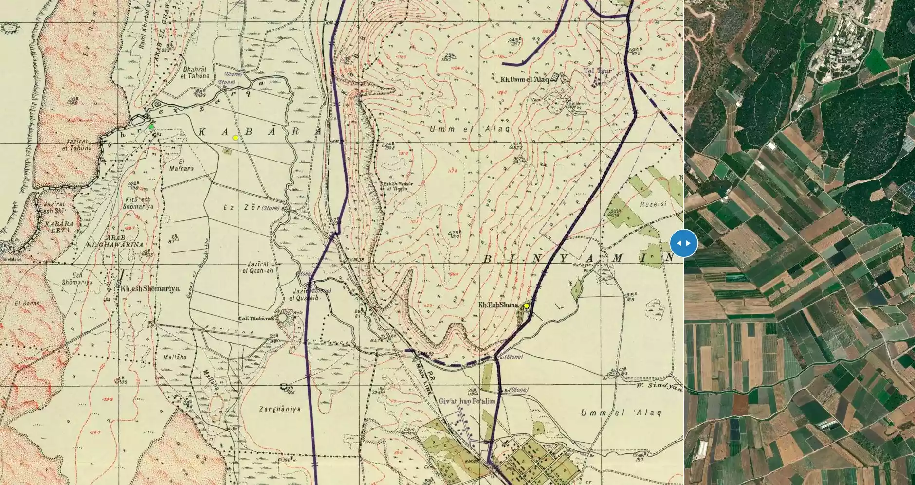
| Map Location | See location #42 on the map View from satellite |
||||
| Attacking Units | Possibly Haganah and lrgun forces | ||||
| Exodus Cause | Expulsion by Zionist troops | ||||
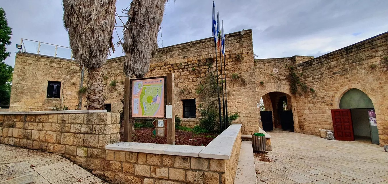
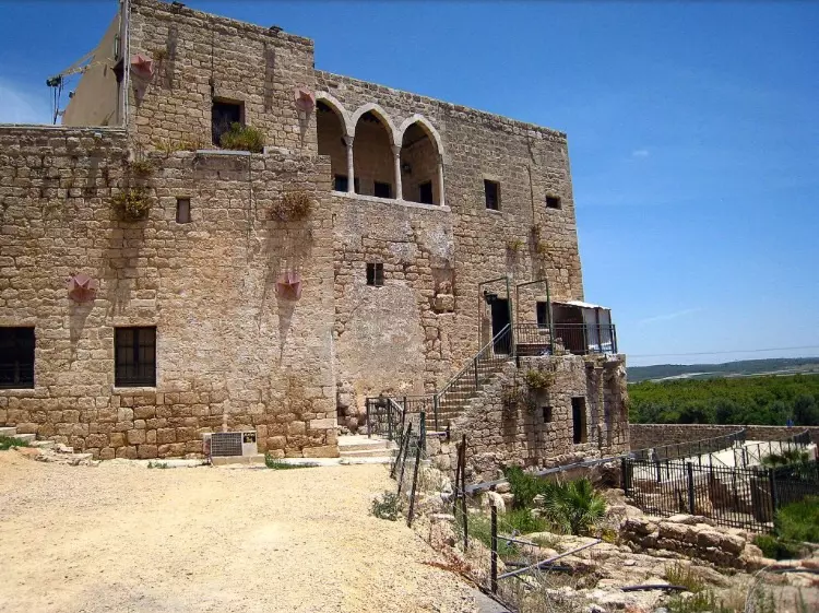
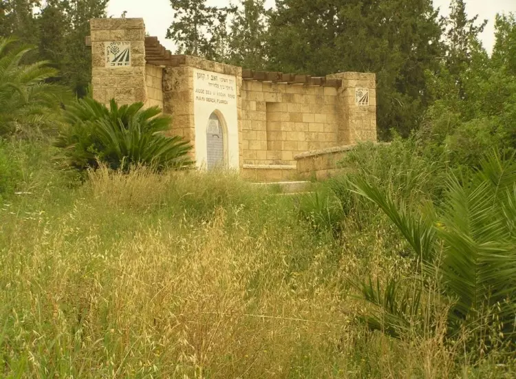
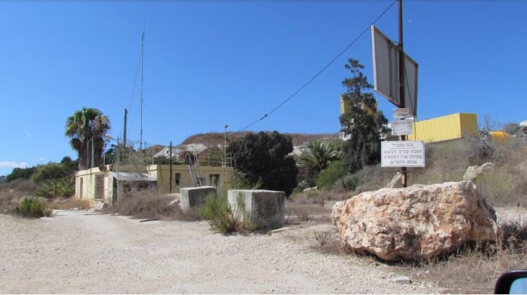
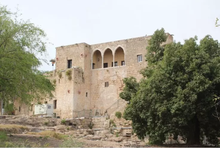
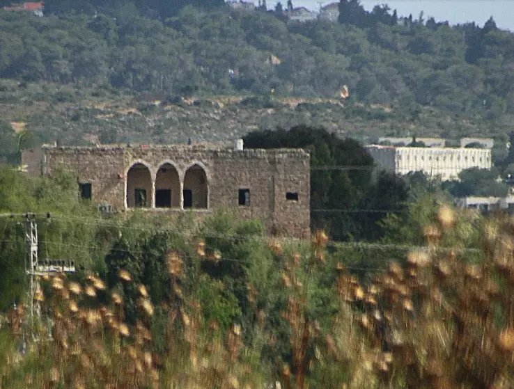
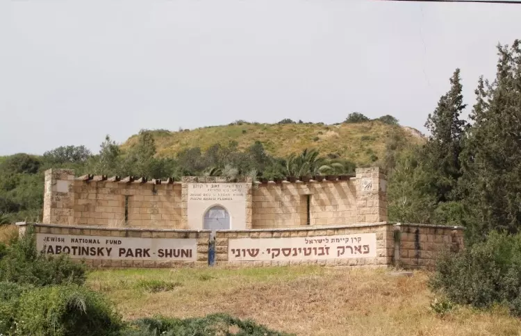
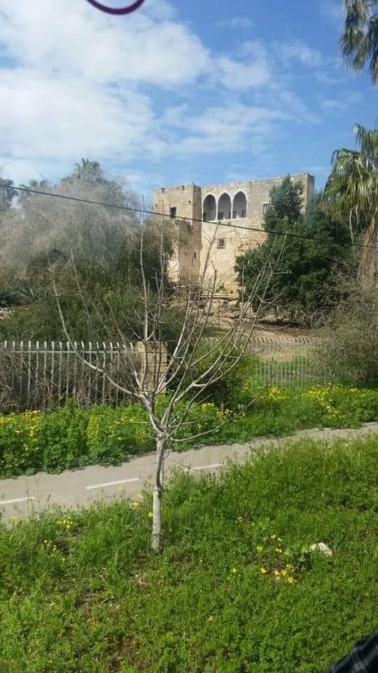
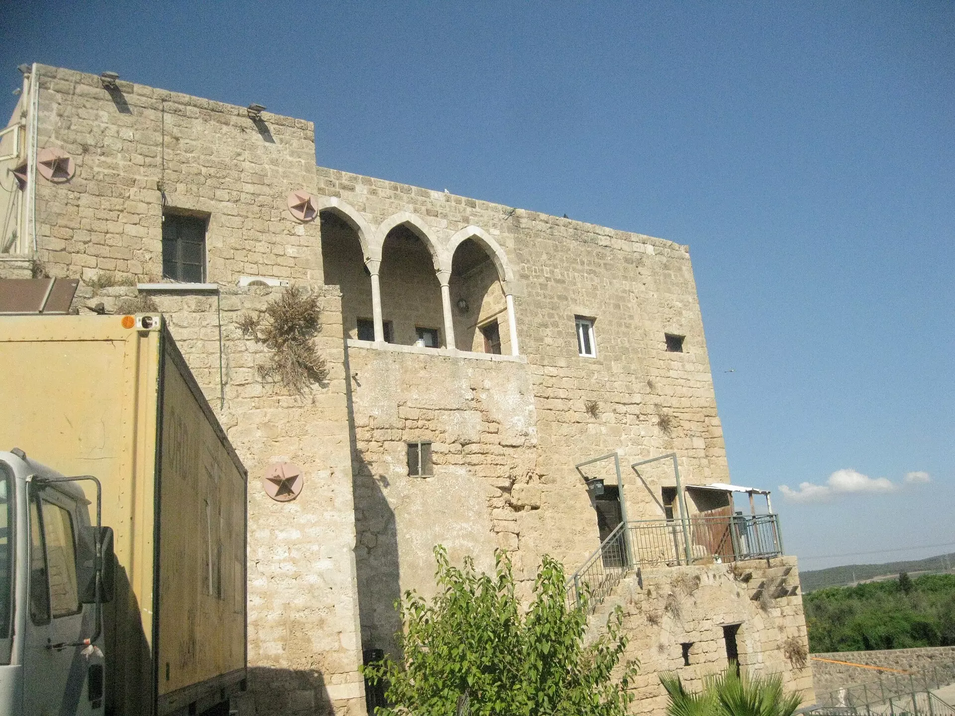
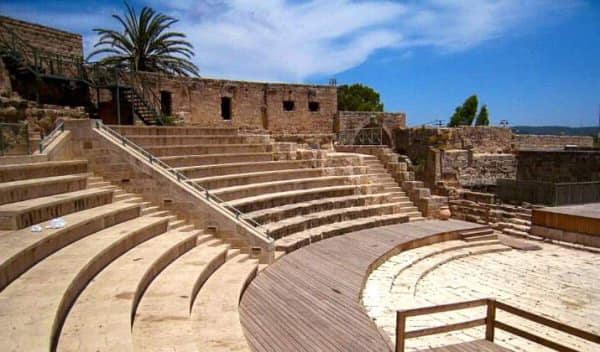
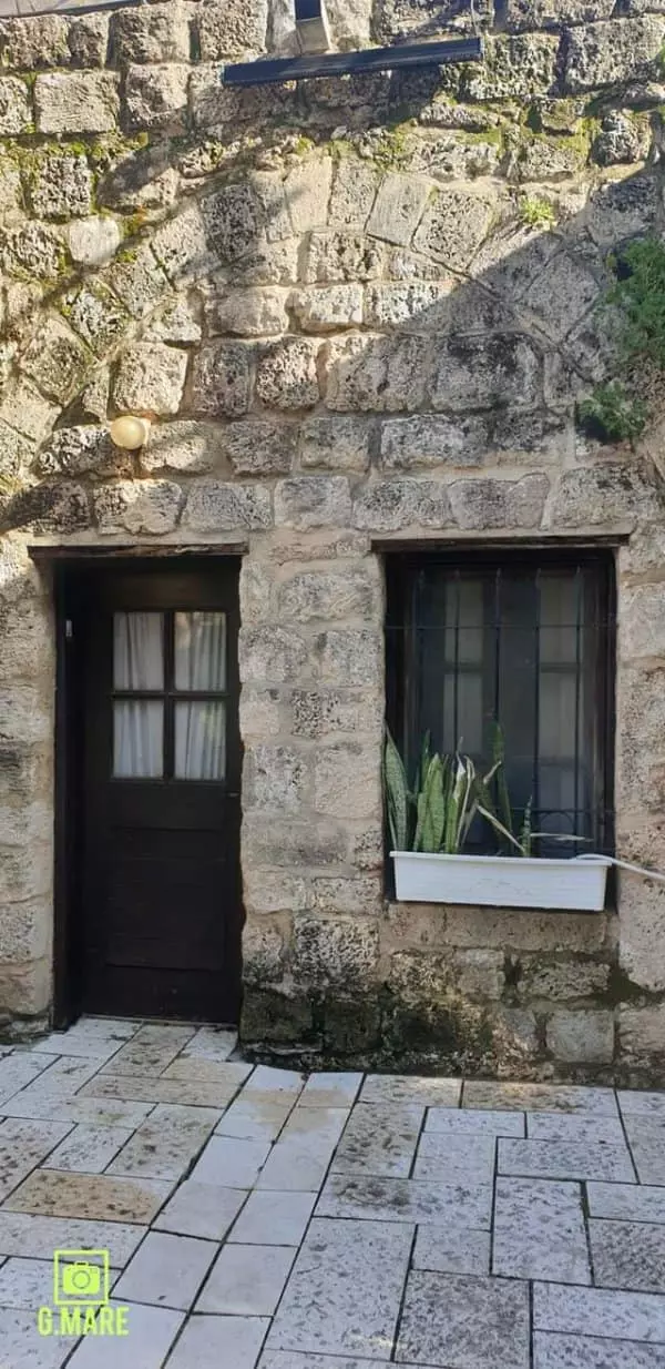
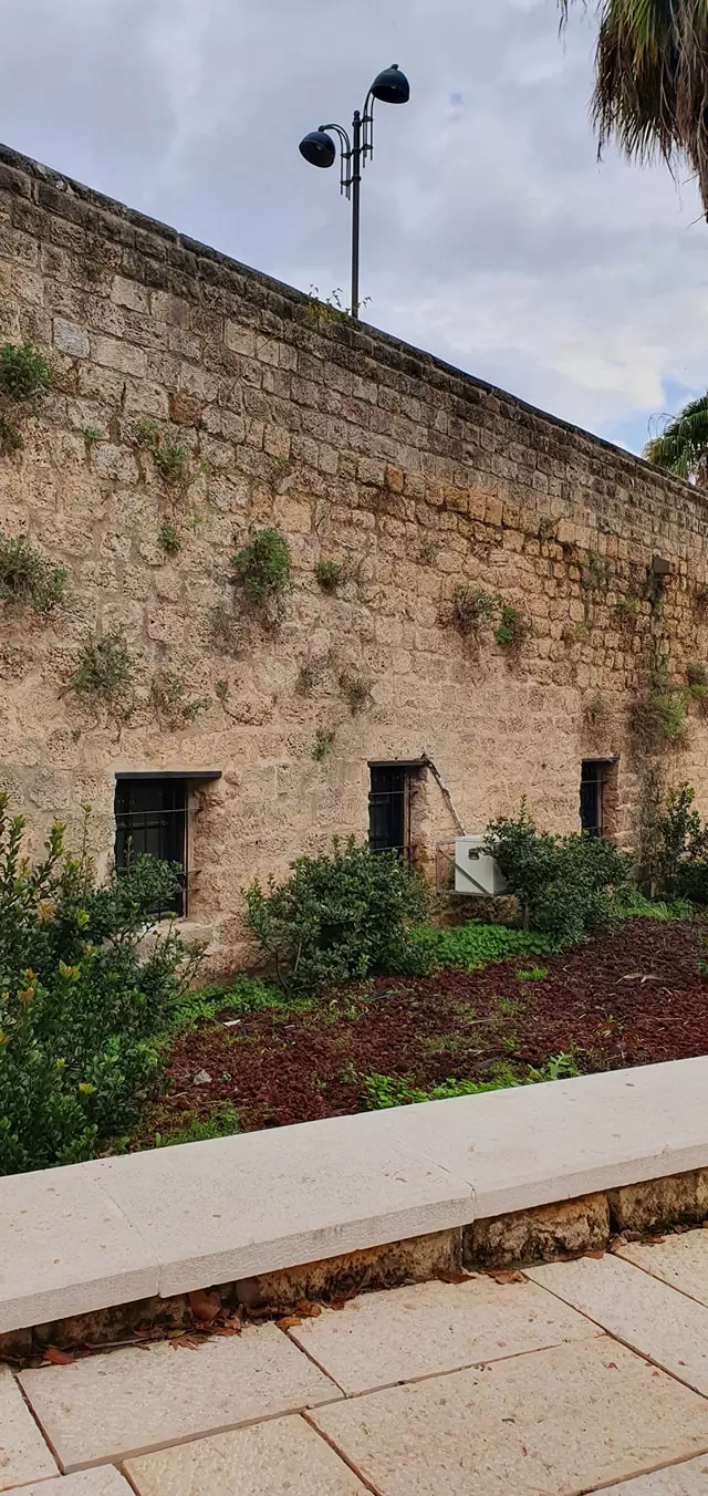
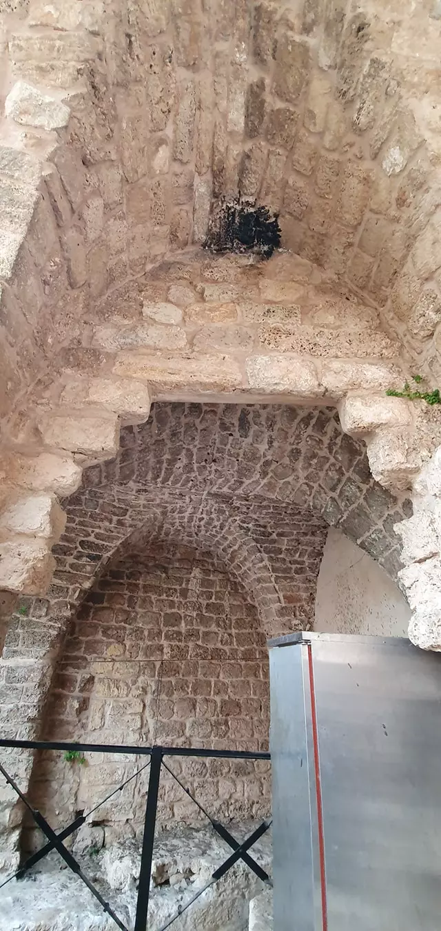
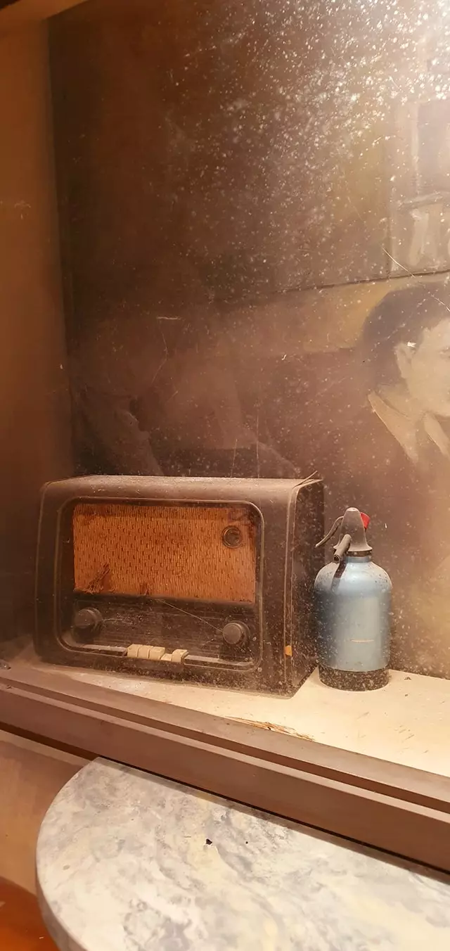
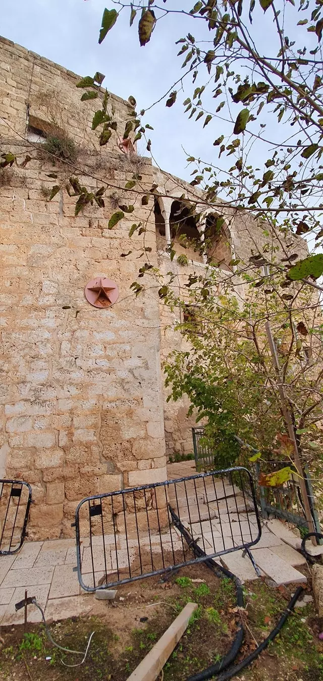
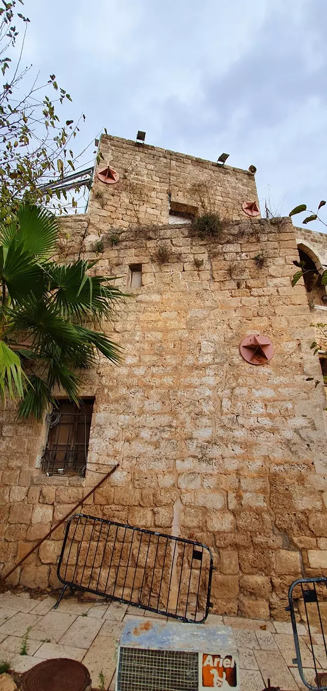
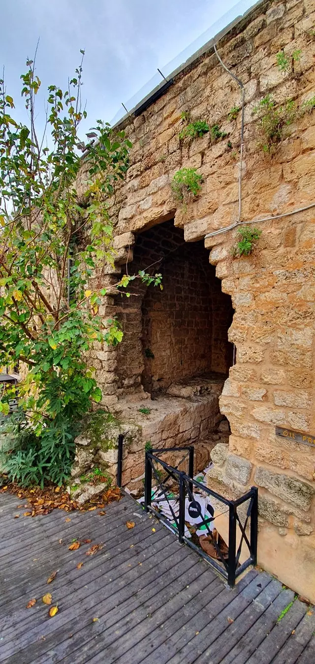
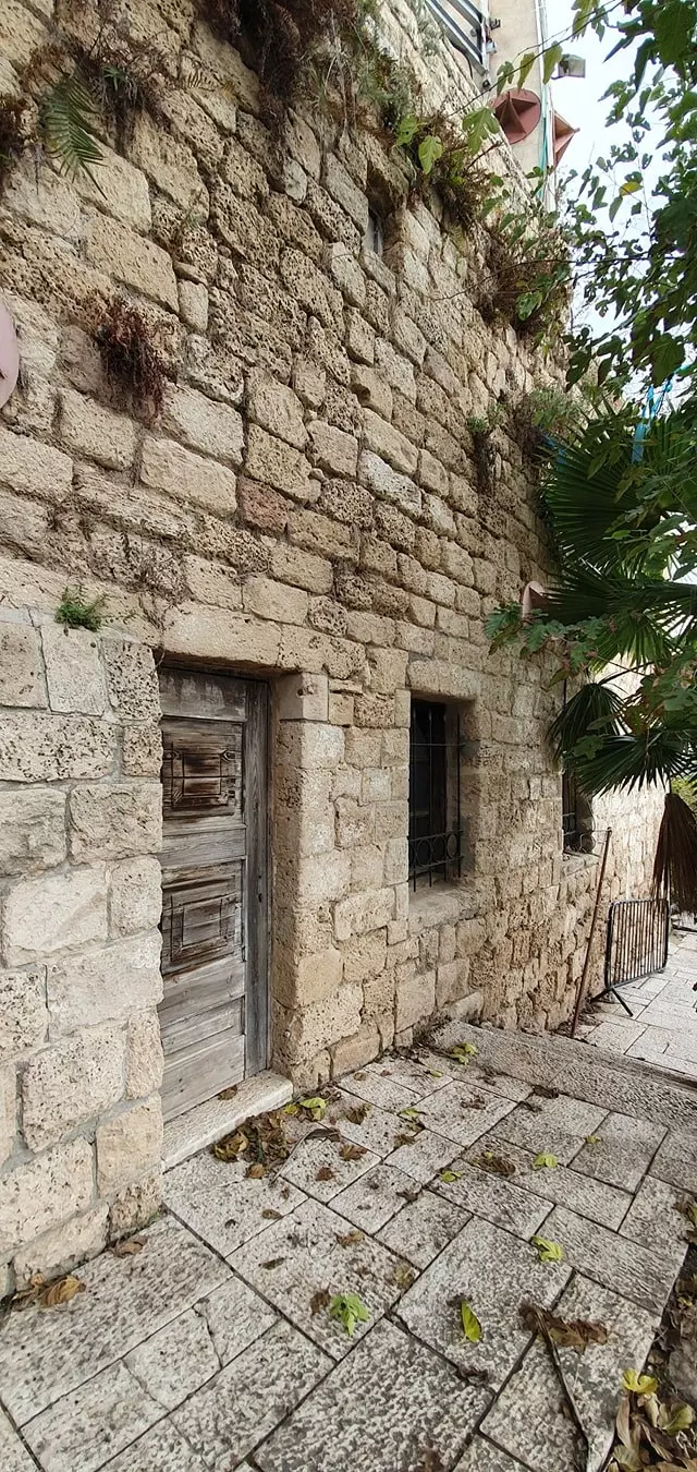
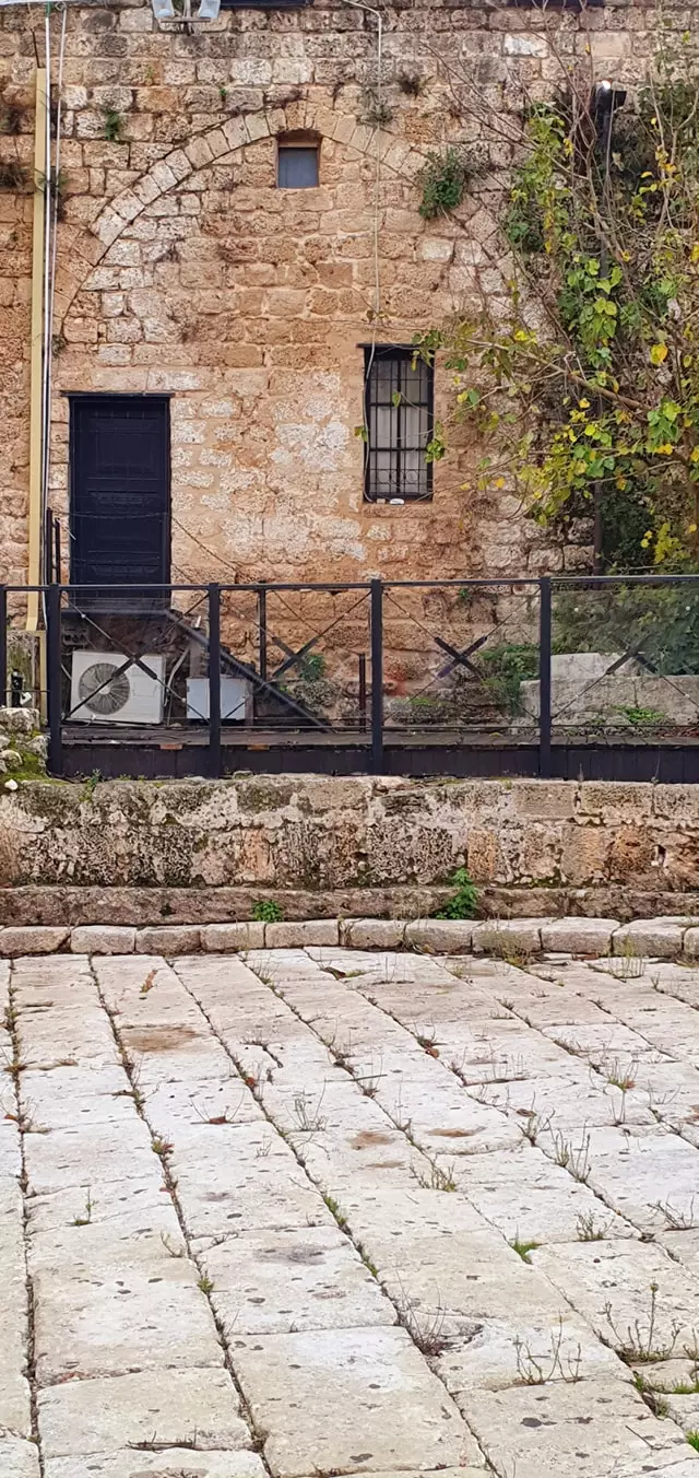
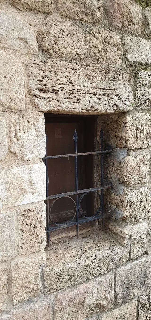
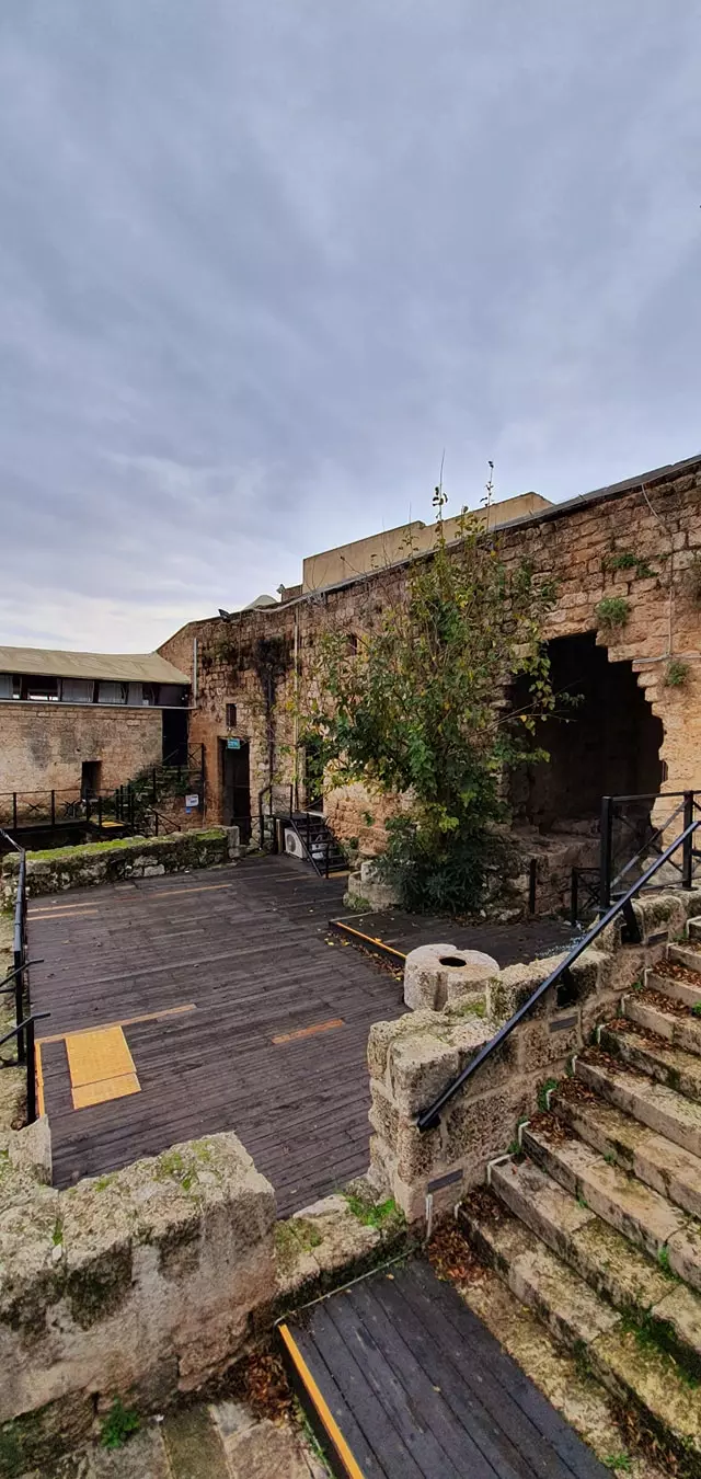
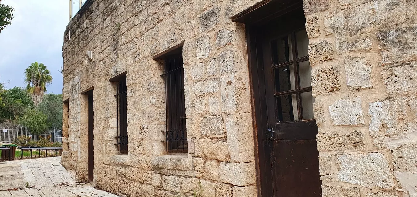
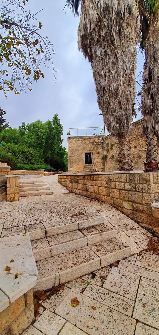
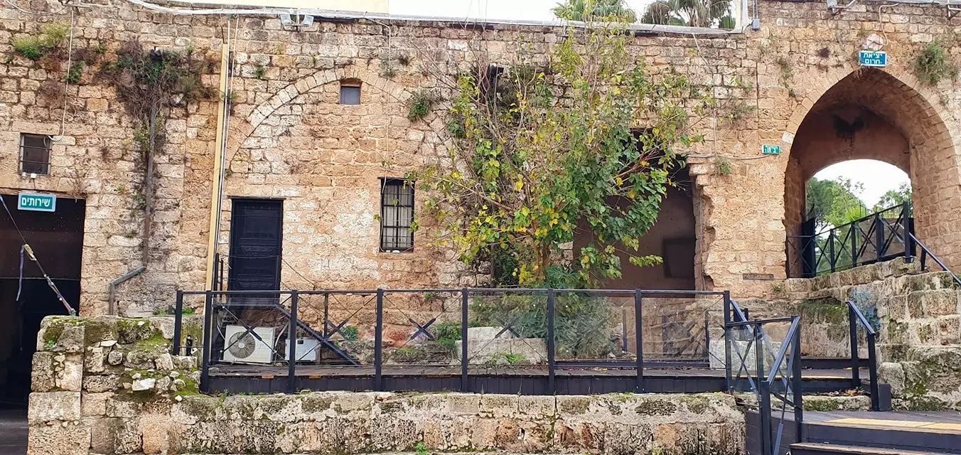
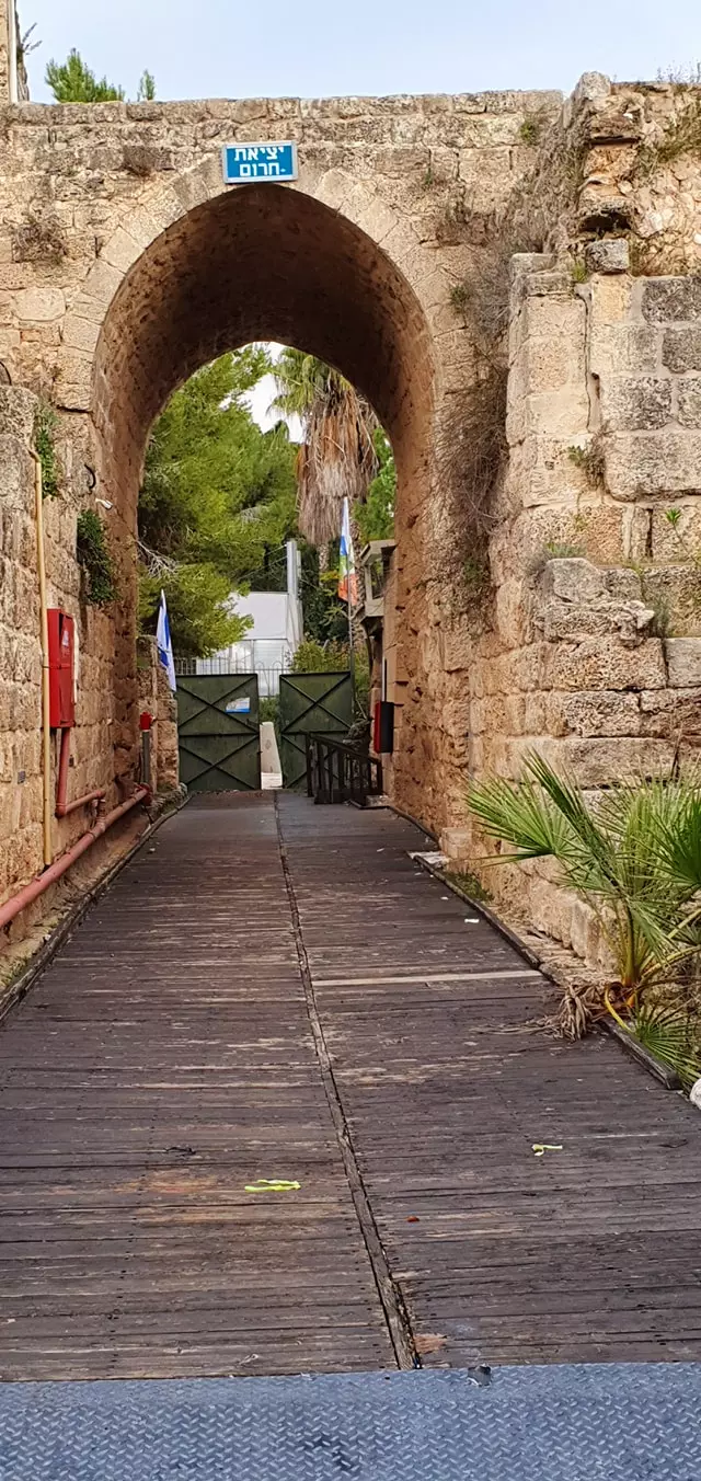
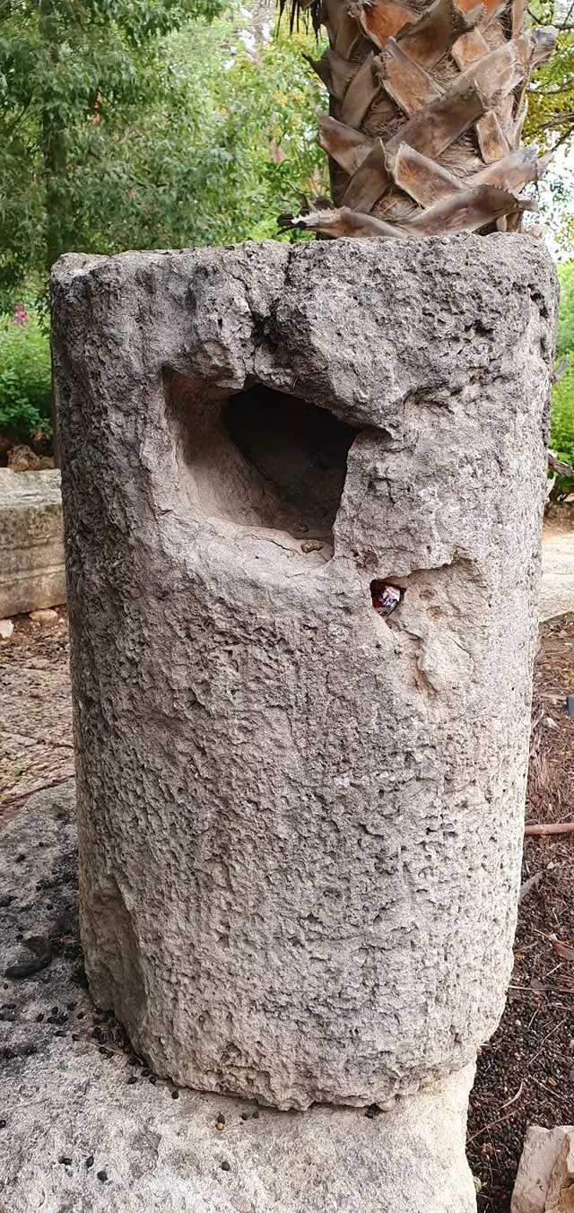
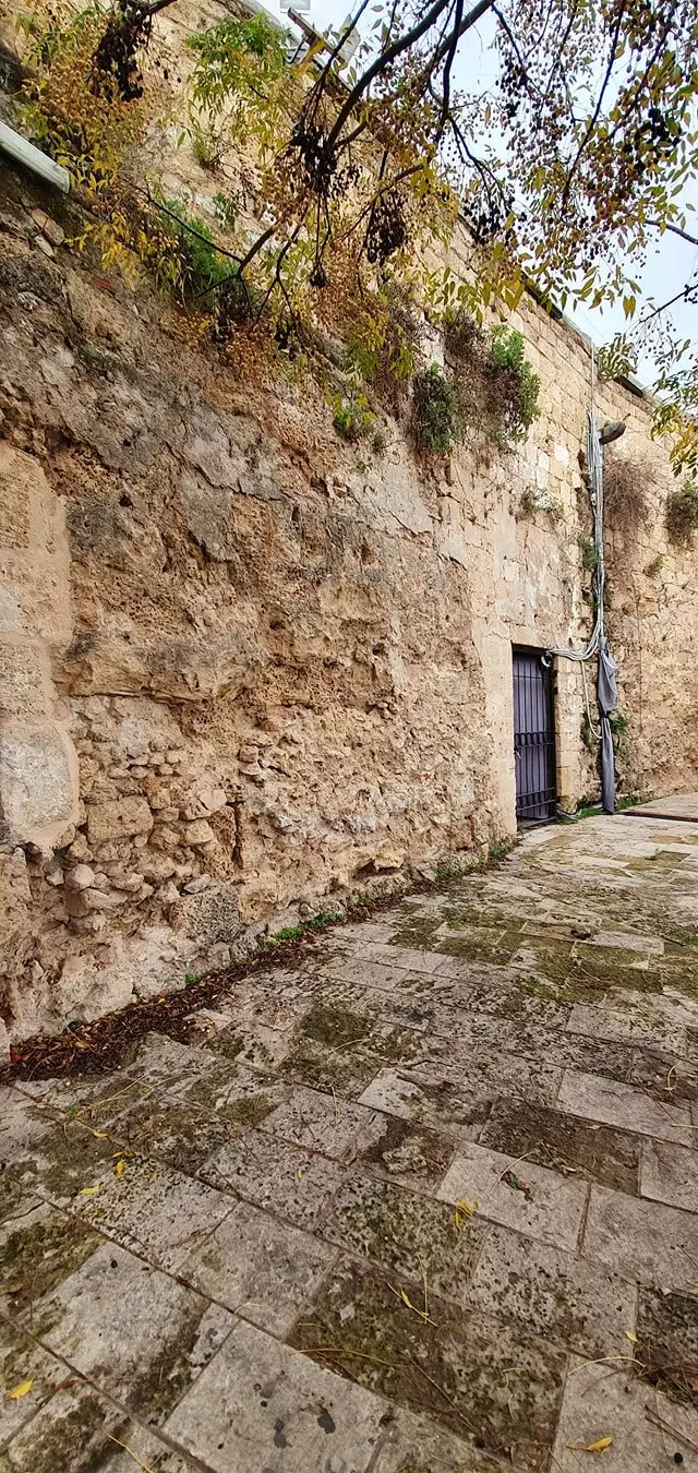
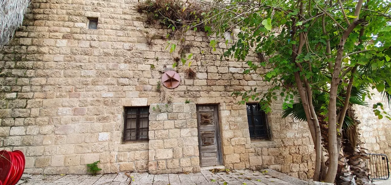
| Village Temains | The village has been mostly destroyed with the exception of few houses which have been renovated and turned into tourist facilities. | ||||
| Ethnically Cleansing | Village inhabitants were completely ethnically cleansed. | ||||
| Population |
|
||||
| Number of Houses | In (1931): 191 (includes the settlement of Zikhron Ya'aqov, under which the village is counted, and other localities) | ||||
| Town's Name Through History | Khirbat al-Shuna inhabitiants changed its name from just al-Shuna to Khirbat al-Shuna to differentiate it from the nearby Zionist settlement Binyamina, which used to be called al-Shuna al-Yahudiyya (The Jewish al-Shuna ). | ||||
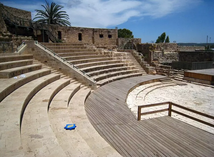
| Archeological Sites | Khirbat al-Shuna contained khirbat Tel Mubarak (a small archaeological site). | ||||
| Exculsive Jewish Colonies Who Usurped Village Lands |
Binyamina and Nachalat Jabotinsky | ||||
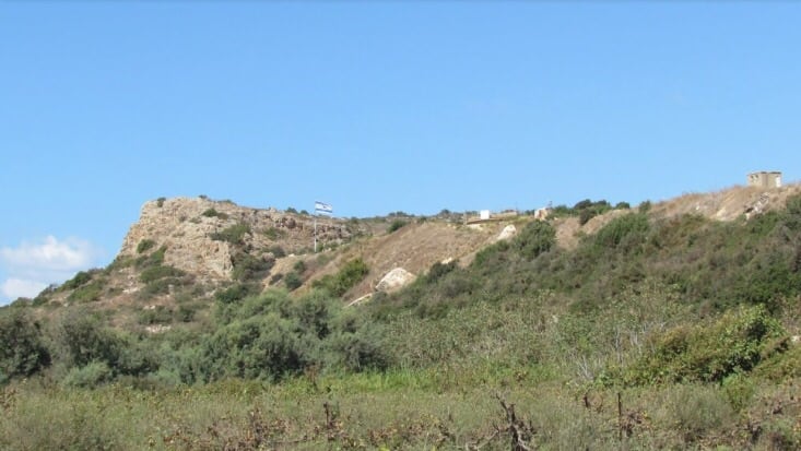
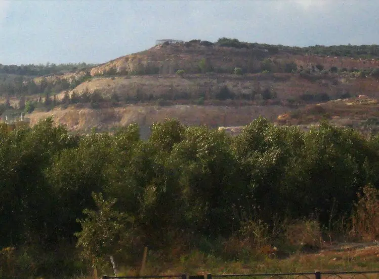
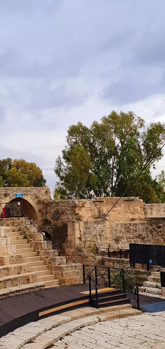
Village Before NakbaKhirbat al-Shuna was located at the southwestern foot of the Carmel Mountains, very near the coastal highway. The Haifa-Tel-Aviv railway passed along the western edge of the village. Its original name was al-Shuna. By the mid-1920s it had been engulfed by the Zionist settlement of Binyamina, founded in 1922 and originally known as 'Jewish al-Shuna' (al-Shuna al-yahudiyya). The Palestinian village was thereafter referred to as Khirbat al-Shuna. The village was classified as a hamlet in the Palestine Index Gazetteer. West of the village lay Tall Mubarak, a small archaeological site excavated by the Hebrew University in 1973-76. The fourteen strata of ruins were dated from the early second millenium B.C. through the Roman, Byzantine, and Crusader periods, that is, as late as the thirteenth century A.D. The top of this mound had been the cemetery for the nearby Palestinian village of Jisr al-Zarqa.Village Occupation and Ethnic CleaningLocated on a stretch of the coast regarded by Zionist leaders as the core of the future Jewish state, the village would have been vulnerable to 'clearing' operations undertaken in the first weeks of the war. In mid-March, April, and the first half of May 1948, Haganah and Irgun forces organized a series of strikes designed to expel all Palestinian villagers from the coastal area between Tel Aviv and the Jewish settlement of Zikhron Ya'aqov, south of Haifa. This area was considered by the Haganah command to be 'the core of the emergent Jewish state,' according to Israeli historian Benny Morris. The raids usually targeted one or two villages at a time, and often also succeeded in scaring neighboring communities into flight.Al-'Abbasiyya (Jaffa sub-district) was the first village to be occupied by the Irgun during the implementation of this general Haganah plan. The village fell on 4 May and was held by Irgun forces for a total of five weeks, according to the History of the Haganah. By mid-May, the Haganah had fulfilled its aim of 'clearing' most Arab inhabitants from this part of the coastal plain. Zionists Colonies on Village LandsThere are no Israeli settlements on village land. The settlement of Binyamina, built in 1922 south of the site, has expanded so that some of its buildings are close to the original boundaries of the village land. It was combined with Nachalat Jabotinsky (named after Vladimir Jabotinsky, the founder of Revisionist Zionism) in 1946.Village TodayThe site is fenced in, and the few standing houses have been renovated and turned into tourist facilities. There are tall palm and eucalyptus trees and cactuses grow around the houses.SourceDr. Walid al-Khalidi, 1992: All That Remains. |
|||||
| Related Maps | Town Lands' Demarcation Maps خرائط للقضاء توضح حدود القرى والاودية Town's map on MapQuest View from satellite Help us map this town at WikiMapia |
||||
| Related Links | Wikipedia's Page Google Search Google For Images Google For Videos |
||||
| More Information | في كتاب كي لا ننسى في كتاب بلادنا فلسطين المزيد من موقع هوية |
||||
- General View Of Village Remains In 1990
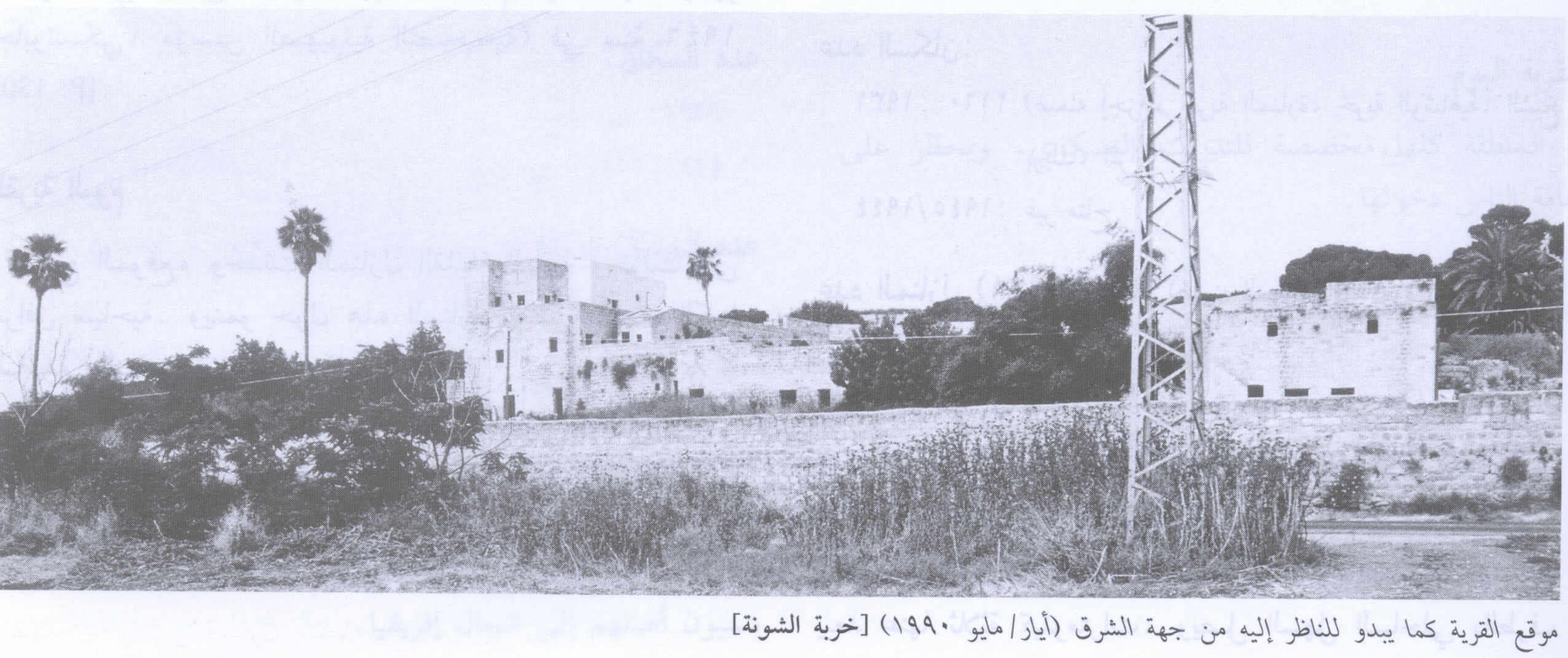
Scanned from "All That Remains" by Dr. Walid Khalidi - بيوت قريه خربه الشونه
Posted by abu raya - بقايا بيوت القريه يستغلها المستعمرون كمنتزه سياحي
Posted by abu raya - موقع وبيوت القريه
Posted by abu raya - من جانب موقع القريه
Posted by abu raya - من طرق القريه
Posted by abu raya - بيوت القريه
Posted by abu raya - بيوت القريه يسكنها المستعمرون
Posted by abu raya - الثار القديمه في القريه
Posted by abu raya - اراضي القريه
Posted by abu raya - موقع من غرب القريه
Posted by abu raya - موقع القريه يستغله المستعمرون كمنتزه سياحي
Posted by abu raya - موقع القريه تم تحويله لمنتزه سياحي
Posted by abu raya - بيوت ومدرج القريه
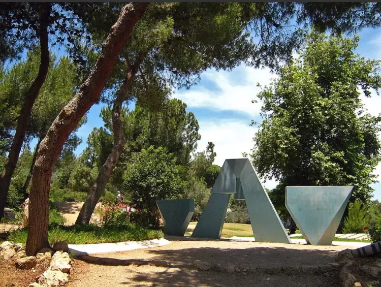
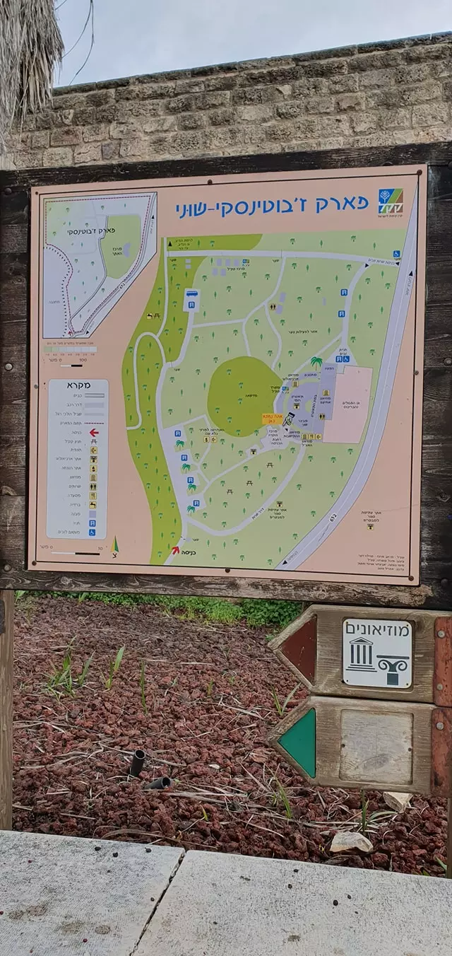
Posted by abu raya - قصر سليم الخوري في الشونة (بنيامينا ) يعرف اليوم باسم " بارك جابوتنسكي " وذلك بعد أن كان صاحبه قد باعه للمؤسسات الصهيونية -- المزيد عنها بقسم التعليقات --داود مصطفى كبها
1 - قصر سليم الخوري في الشونة (بنيامينا ) يعرف اليوم باسم " بارك جابوتنسكي" وذلك بعد أن كان صاحبه قد باعه للمؤسسات الصهيونية هو وعشرات آلاف الدونمات في منطقة الشونة وقيساريا والخضيرة ومنطقة غرب الروحة ووادي الشقاق
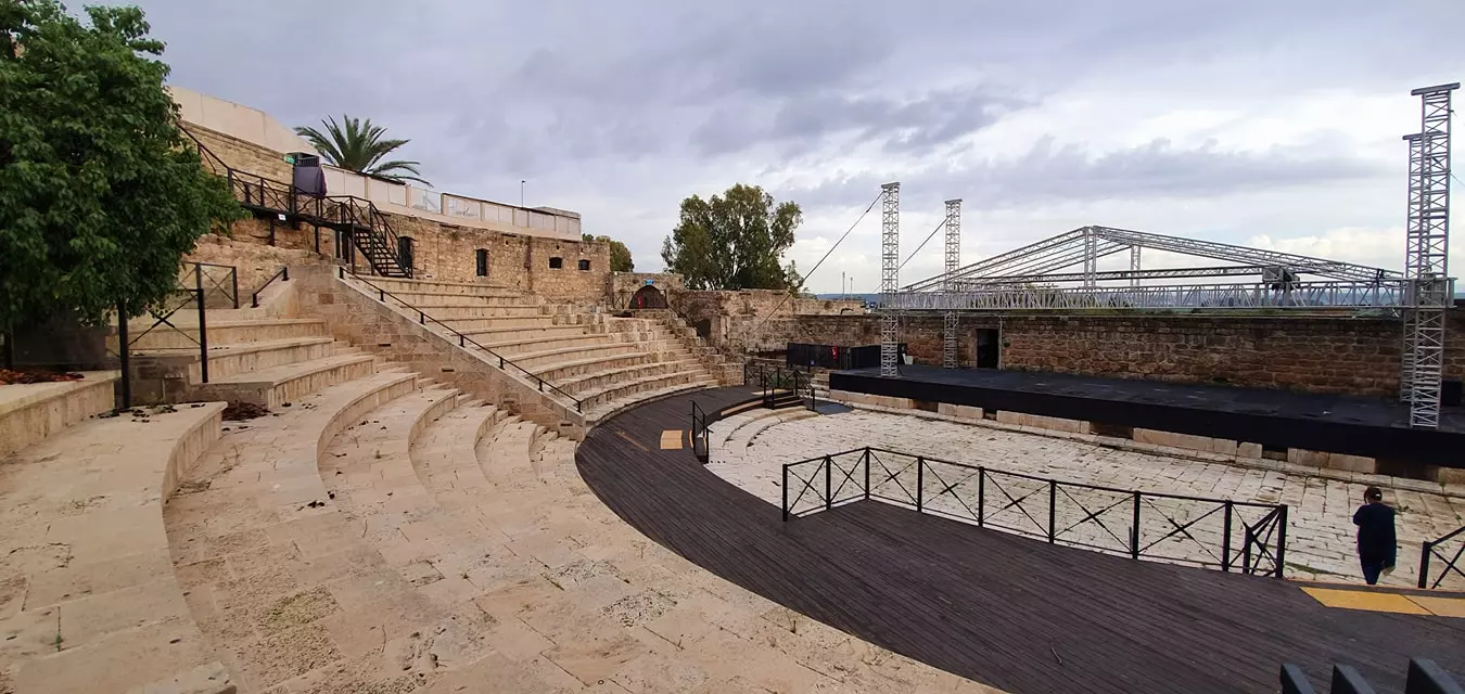
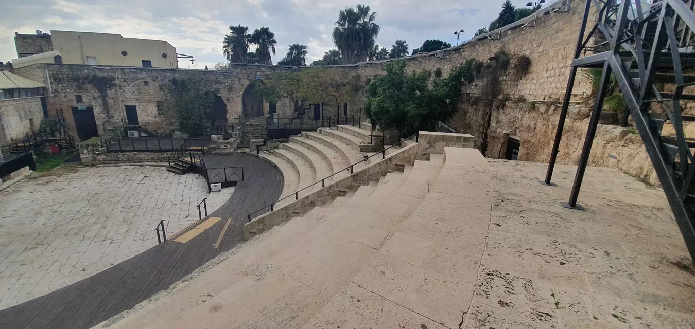
- The Roman amphitheatre
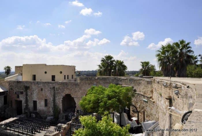
- The Roman amphitheatre #2
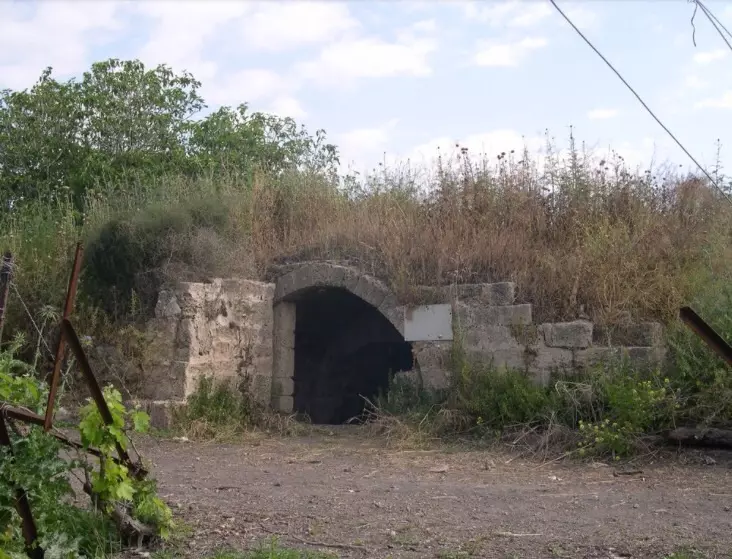
- One of the few remaining structures
- جولة في قصر سليم الخوري متنزه جابوتنسكي الشونه مخازن المونه في بنيامينا المدرج المسرح وألبركه والخان -- Dec. 2020 - Nabela Salem
- جولة في قصر سليم الخوري متنزه جابوتنسكي الشونه مخازن المونه في بنيامينا المدرج المسرح وألبركه والخان -- Dec. 2020 - Nabela Salem #2
- جولة في قصر سليم الخوري متنزه جابوتنسكي الشونه مخازن المونه في بنيامينا المدرج المسرح وألبركه والخان -- Dec. 2020 - Nabela Salem #3
- جولة في قصر سليم الخوري متنزه جابوتنسكي الشونه مخازن المونه في بنيامينا المدرج المسرح وألبركه والخان -- Dec. 2020 - Nabela Salem #4
- جولة في قصر سليم الخوري متنزه جابوتنسكي الشونه مخازن المونه في بنيامينا المدرج المسرح وألبركه والخان -- Dec. 2020 - Nabela Salem #5
- جولة في قصر سليم الخوري متنزه جابوتنسكي الشونه مخازن المونه في بنيامينا المدرج المسرح وألبركه والخان -- Dec. 2020 - Nabela Salem #6
- جولة في قصر سليم الخوري متنزه جابوتنسكي الشونه مخازن المونه في بنيامينا المدرج المسرح وألبركه والخان -- Dec. 2020 - Nabela Salem #7
- جولة في قصر سليم الخوري متنزه جابوتنسكي الشونه مخازن المونه في بنيامينا المدرج المسرح وألبركه والخان -- Dec. 2020 - Nabela Salem #8
- جولة في قصر سليم الخوري متنزه جابوتنسكي الشونه مخازن المونه في بنيامينا المدرج المسرح وألبركه والخان -- Dec. 2020 - Nabela Salem #9
- جولة في قصر سليم الخوري متنزه جابوتنسكي الشونه مخازن المونه في بنيامينا المدرج المسرح وألبركه والخان -- Dec. 2020 - Nabela Salem #10
- جولة في قصر سليم الخوري متنزه جابوتنسكي الشونه مخازن المونه في بنيامينا المدرج المسرح وألبركه والخان -- Dec. 2020 - Nabela Salem #11
- جولة في قصر سليم الخوري متنزه جابوتنسكي الشونه مخازن المونه في بنيامينا المدرج المسرح وألبركه والخان -- Dec. 2020 - Nabela Salem #12
- جولة في قصر سليم الخوري متنزه جابوتنسكي الشونه مخازن المونه في بنيامينا المدرج المسرح وألبركه والخان -- Dec. 2020 - Nabela Salem #13
- جولة في قصر سليم الخوري متنزه جابوتنسكي الشونه مخازن المونه في بنيامينا المدرج المسرح وألبركه والخان -- Dec. 2020 - Nabela Salem #14
- جولة في قصر سليم الخوري متنزه جابوتنسكي الشونه مخازن المونه في بنيامينا المدرج المسرح وألبركه والخان -- Dec. 2020 - Nabela Salem #15
- جولة في قصر سليم الخوري متنزه جابوتنسكي الشونه مخازن المونه في بنيامينا المدرج المسرح وألبركه والخان -- Dec. 2020 - Nabela Salem #16
- جولة في قصر سليم الخوري متنزه جابوتنسكي الشونه مخازن المونه في بنيامينا المدرج المسرح وألبركه والخان -- Dec. 2020 - Nabela Salem #17
- جولة في قصر سليم الخوري متنزه جابوتنسكي الشونه مخازن المونه في بنيامينا المدرج المسرح وألبركه والخان -- Dec. 2020 - Nabela Salem #18
- جولة في قصر سليم الخوري متنزه جابوتنسكي الشونه مخازن المونه في بنيامينا المدرج المسرح وألبركه والخان -- Dec. 2020 - Nabela Salem #19
- جولة في قصر سليم الخوري متنزه جابوتنسكي الشونه مخازن المونه في بنيامينا المدرج المسرح وألبركه والخان -- Dec. 2020 - Nabela Salem #20
- جولة في قصر سليم الخوري متنزه جابوتنسكي الشونه مخازن المونه في بنيامينا المدرج المسرح وألبركه والخان -- Dec. 2020 - Nabela Salem #21
- جولة في قصر سليم الخوري متنزه جابوتنسكي الشونه مخازن المونه في بنيامينا المدرج المسرح وألبركه والخان -- Dec. 2020 - Nabela Salem #22
- جولة في قصر سليم الخوري متنزه جابوتنسكي الشونه مخازن المونه في بنيامينا المدرج المسرح وألبركه والخان -- Dec. 2020 - Nabela Salem #23
Want to browse more? 80,000 pictures were grouped in these gallaries:
| Display Name | Clan/Hamolah | Country of Residence |
 Fake Valor: Why Did Zionist Jews Hoist Nazis Flag on Their Ships in the 1930s?
What is new?
-
Facts About Oct. 7th Gaza Raid
-
Remined Us Please:: Who Did Rape Who? Palestinians Raped Israelis? Or, was the other way around?
-
When Prof. Edward Said was invited to debate Bibi Netanyahu in the 1980s, watch what happened!
-
Ezra Klein of the NY Times on the "Jewish Race".
-
Abusing Blood Libel!
-
Did Israeli Soldiers Activate The Hanniba Direective On Oct. 7th? You Be The Judge
-
Zionist FAQ: Isn't it true that Palestinians don't want peace? Palestinians never accepted the two-state solution
- Facts about Haavara (Transfer) Agreement between Ben-Gurion & Hitler
-
Haavara FAQs: Why Did Zionist Jews Hoist Nazis' Flags on Their Ships in the 1930s?
- Haavara FAQs: When Chaim Weizmann met FDR in mid-1943, why was he silent about rescuing European Jewry?
-
Dear ChatGPT: How did Palestinians resist Napoleon's invasion of their country in 1799?
-
Dear ChatGPT: Gaza had a vibrant Jewish community in the mid-17th century. What happened to them?
-
Dear ChatGPT: Why did the Jewish Agency suppress news of the Holocaust during WWII?
-
Video Playlist: Jews share their DNA tests to end the conflict for good.
-
A Tale of Two Conflicts: Examining the Definition of Genocide
-
Prof. Abraham Polak And The Suppressed History of the Khazars and European Jewry
-
How Ronald Reagan would have framed the genocide in Gaza if he were still alive?
-
Haavara FAQs: Let us do the math: how many German Jews did The Haavara Agreement save?
-
Zionist FAQs: The Hebron Massacre of 1929, "clearly proves" that Palestinians are antisemitic, how could you deny it?
-
Zionist FAQs: Why Anti-Zionist Is Not Antisemitism?
-
Zionist FAQs: Isn't it true that the KGB created Palestinian Nationalism in the early 1960s?
- Zionist FAQs: Muslims are killing Muslims all the time; why are Israeli Jews being singled out in the media?
- Zionist FAQs: How is Israel an apartheid state when 20% of its citizens are Arabs who enjoy full rights?
-
Haavara FAQs: Why Did Dorothy Thompson Flip From A Zionist Advocate to A Silenced Dissenter?
-
Haavara FAQs: Analysis of Herzl's Uganda Scheme and how it could have saved millions of Jews.
-
Haavara FAQs: Why did Hayim Greenberg describe American Jewry as "morally bankrupt" in early 1943?
-
Haavara FAQs: What if the Evian Conference was a resounding success? What would have been the impact of saving European Jewry on Zionism?
- Haavara FAQs: What if the six million were saved, how that would have impacted the Zionist project?
-
Haavara FAQs: How did Zionist leaders react when Europe's Jews lingered in the DP camps after WWII ended?
-
Why does the American Jewish community repeat lies that David Ben-Gurion had debunked before he died?
-
Who has the power to rename the Tatar/Khazar Gene Marker to Jewish IV?
-
Zionist FAQs: Why won't Egypt, Syria, and Jordan take their people back? Jews are indigenous to Palestine, and Arabs immigrated after Jews developed the country. Arabs should leave.
-
Haavara FAQs: Did Hitler and the Nazis conflate between Judaism and Zionist? If that wasn't case, then why?
-
Haavara FAQs: Winston Churchill and antisemitism, a collection of articles written Churchill.
-
Haavara FAQs: Broken by country, how many Jews survived vs. killed during the Holocaust?
-
Haavara FAQs: Why did European Jews vote with their feet and to immigrated to the Americas, not Palestine, after WWII?
-
Watch this American Jewish Girl describing Israeli Jews' cognitive dissonance like no other in under two minutes
-
Haavara FAQs: When the Nazis went out of their way to hide the Holocaust, Israeli Jews did the exact opposite by broadcasting their genocide of Gazans. But why?
-
Haavara FAQs: How Zionist Jews went out of their to show their appreciation to Nazism and Fascism?
- Haavara FAQs: Why Zionist leaders were against bombing the death camps & the Railroads leading to them?
-
Haavara FAQs: Hitler's message to the British and American people: If Jews are such noble citizens and you care about them, how come you're not letting them in? I will gladly ship them to you at my expense, even on luxury liners!
-
A shortlist of Zionist and Israeli false flag operations in the name Jews.
-
The Most Moral Army
- The Land of Kapos (Israel): Where the brave are boycotted and Kapos walk free.
- Why did early Zionists often named their communal enterprises "colonial"?
- Zionist Relations with Nazi Germany by Faris Glubb
-
Two NY Times advertisements by Zionists in the early 1943 that exposes Zionists' treason at the height of the calamity
- Facts Not Lies about the Palestinian-Israeli Conflict.
- Site's pictures have been categorized
- Campgain Against Lice
- A Survey of Palestine, the official source about Palestine before Nakba produced by the British Mandate; over 1200 pages.
- Satellite View & Google Earth: Over 6,000 placemarks identifying all destroyed towns, W. Bank & Gaza Strip Towns, & refugee camps.
- PalestineRemembered.com and its Nakba Oral History Project were featured on al-Jazeera Satellite TV.
- Nakba Oral History Video Podcast:
 Over 700 Oral History interviews (including 3,500+ hours of recording) can be viewed online.
 - Palestine Village Statistics Project
- Gaza Jail Break
- النسخة العربية للموقع الان متوفرة
- Videos: Documenting the destroyed villages in video: Tracing all that remains since Nakba.
- Videos: Responding to Zionist Propaganda
- Interview: The ethnic cleansing of Palestine: George Galloway interviews Israeli Historian Ilan Pappe.
- For Palestinians, memory matters. It provides a blueprint for their future By George Bisharat.
- Zionist FAQ now available in Hebrew שאלות שציונים שואלים, עכשיו בעברית
- Video: The Stephen Walt and John Mearsheimer report on the influence of the Israel Lobby on U.S. Foreign Policy
- The Palestinian-Israeli conflict for beginners
