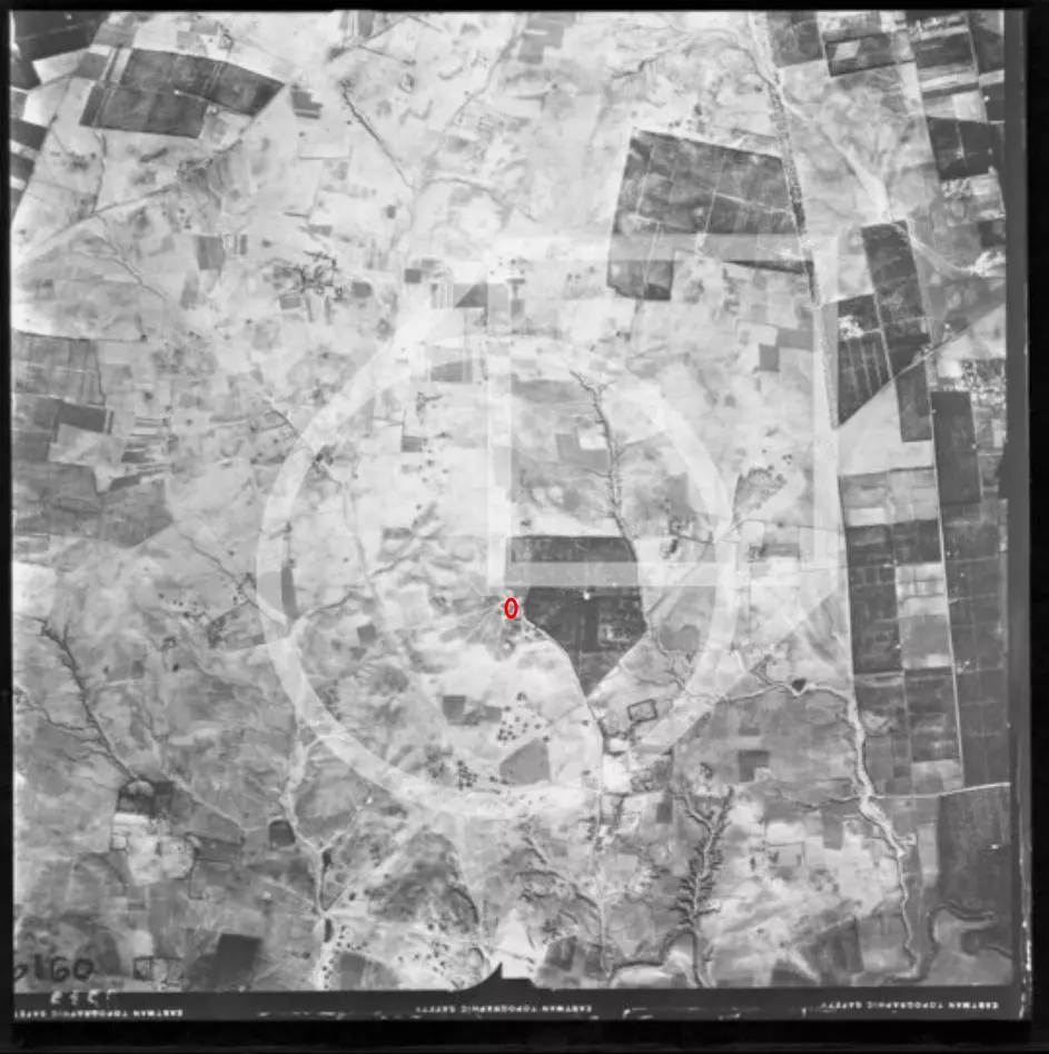
Your observation is completely accurate. In the 1945
Village Statistics,
Arab Abu Kishk (عرب أبو كشك) was recorded with an official population of
1,900 people (and owned around 18,470 dunams of land). Yet, looking at the aerial photograph, you do not see a dense, tightly packed stone village like those found in the hills of Ramallah, Nablus, or Hebron.
Instead, the photograph shows vast, meticulously partitioned agricultural fields and citrus groves with only a few scattered structures.
Here is why that was the case, what they lived in, and why the land looks the way it does:
1. They Were a Sedentarizing Bedouin Community ('Arab)
The people of Abu Kishk were not mountain fellahin (peasants) who traditionally built multi-story, defensible stone houses packed shoulder-to-shoulder on rocky ridges.
They were an Arab tribal community (Bedouin) that had migrated to the coastal plain around the al-Auja (Yarkon) River basin in the 18th/19th century and underwent a transition to settled agriculture. Because of this tribal heritage:
2. Were They Living in Tents?
Yes, partially--alongside other lightweight, low-profile structures.
Because they lived on the fertile, stone-poor coastal plain and maintained semi-pastoral traditions, their dwellings consisted of:
3. The Land: Intensive, High-Yield Agriculture
While the dwellings are low-profile, the land tells the true demographic story:
Summary
You are not looking at an "empty" land or an abandoned outpost. You are looking at a classic coastal plain agro-pastoral landscape: 2,000 people living in dispersed, light-footprint housing (tents, reed huts, and mud-brick farmsteads) directly woven into thousands of dunams of intensively farmed orchards and grain fields.
 We asked: Wait, but the Jews told us they bloomed the Negev!
Google's Gemini answered: The popular slogan that early settlers "made the desert bloom" became one of the most successful fundraising and political narratives of the 20th century, but examining the historical records, British Mandate surveys, and satellite imagery reveals a reality split into two major facts: the indigenous Bedouin were already cultivating vast areas of the Negev before 1948, and the vast majority of the Negev remains an uncultivated, arid desert today.
1. The Pre-1948 Reality: Indigenous Bedouin Cultivation
The narrative often presumes that the Negev (the Beersheba sub-district) was an empty, untouched moonscape waiting for modern agricultural techniques. In reality, the region sustained an estimated 65,000 to 90,000 Palestinian Bedouins across dozens of tribal confederations (including the Tarabin, Tayaha, and 'Azazma):
2. How the Modern "Blooming" Was Actually Achieved
Where agriculture does exist today in the northern and western margins of the Negev, it was not the result of natural transformation or local hydrology. It was built through heavy, state-funded industrial engineering:
3. Open a Satellite Map: The Desert is Still a Desert
The Negev covers roughly 12,000 square kilometers--comprising roughly 55% to 60% of the entire land area between the Jordan River and the Mediterranean Sea:
4. Afforestation as Political Demarcation
Much of the visible "greening" promoted to international donors consists of planted pine and cypress forests managed by the Jewish National Fund (JNF), such as the Yatir Forest along the southern Hebron hills:
The phrase "making the desert bloom" served as a powerful metaphor to project modernity and justify the displacement of the indigenous population. In physical terms, it took massive water diversions from the north to green a thin northern fringe, displaced the Bedouin farmers who were already harvesting hundreds of thousands of dunams of grain, and left the vast majority of the Negev exactly as nature formed it.
 Menu



 Over 700 Oral History interviews (including 3,500+ hours of recording) can be viewed online.
Post Your Comment
*It should be NOTED that your email address won't be shared, and all communications between members will be routed via the website's mail server.