| PalestineRemembered | About Us | Oral History | العربية | |
| Pictures | Zionist FAQs | Haavara | Maps | |
| Search |
| Camps |
| Districts |
| Acre |
| Baysan |
| Beersheba |
| Bethlehem |
| Gaza |
| Haifa |
| Hebron |
| Jaffa |
| Jericho |
| Jerusalem |
| Jinin |
| Nablus |
| Nazareth |
| Ramallah |
| al-Ramla |
| Safad |
| Tiberias |
| Tulkarm |
| Donate |
| Contact |
| Profile |
| Videos |
Welcome To al-Mujaydil - المجيدل (אל-מג'ידל)
|
District of Nazareth
Ethnically cleansed days ago |
العربية Google Earth |
 |
Gallery (22) |
- Statistics & Facts
-
Before & After

- Satellite View
- Articles 2
- Pictures 22
- Aerial Views 1
- Oral History 3
- Members 10
- Families
- All That Remains
- Wikipedia
- Videos 3
- Guest Book 15
- Links
| Statistic & Fact | Value | |||||||||||||||||||||
| Occupation Date | July 15, 1948 | |||||||||||||||||||||
| Distance From District | 6 (km) South West of Nazareth | |||||||||||||||||||||
| Elevation | 230 (meters) | |||||||||||||||||||||
| Before & After Nakba, Click Map For Details |
||||||||||||||||||||||
|
||||||||||||||||||||||
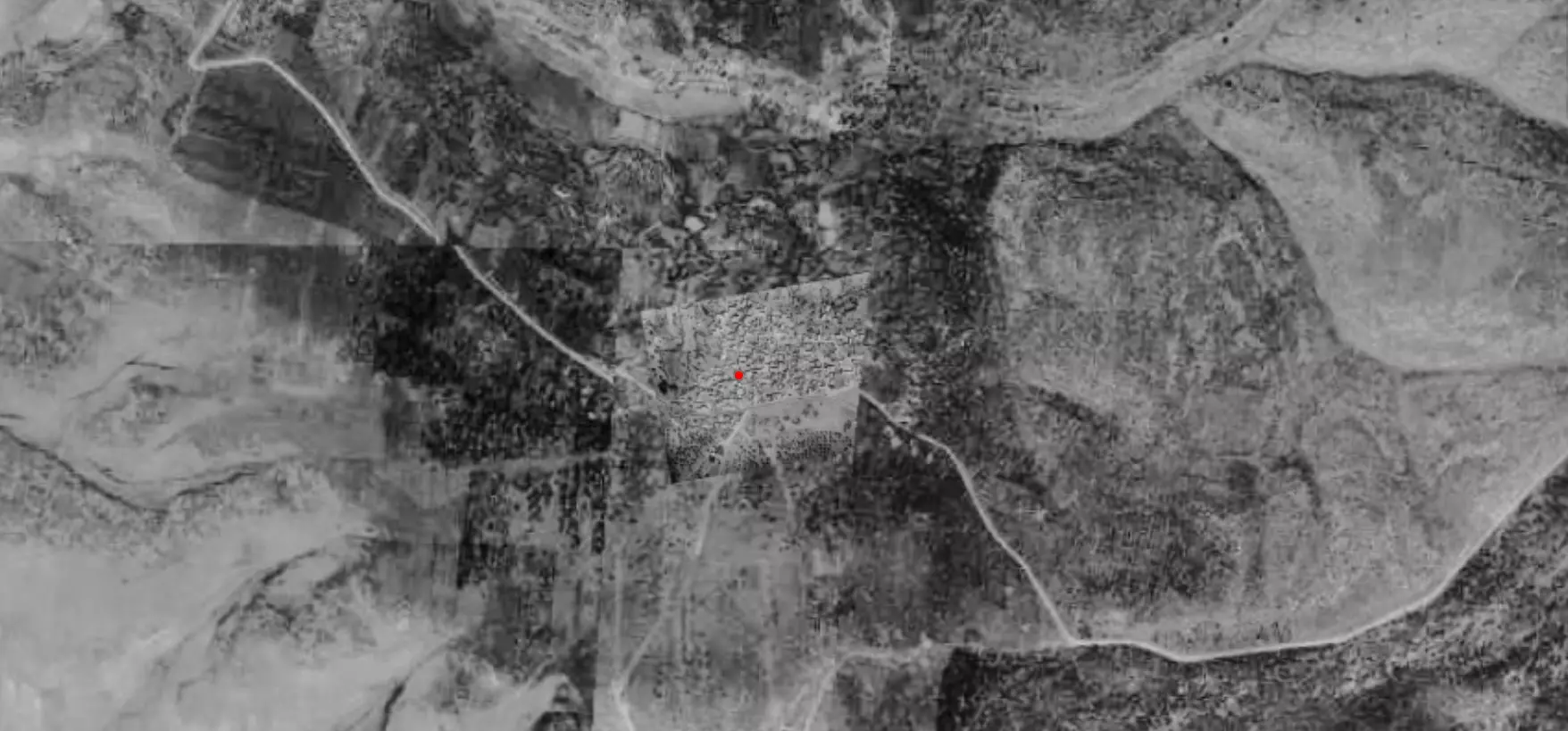
| Pre-Nakba Aerial View |
||||||||||||||||||||||
|
||||||||||||||||||||||
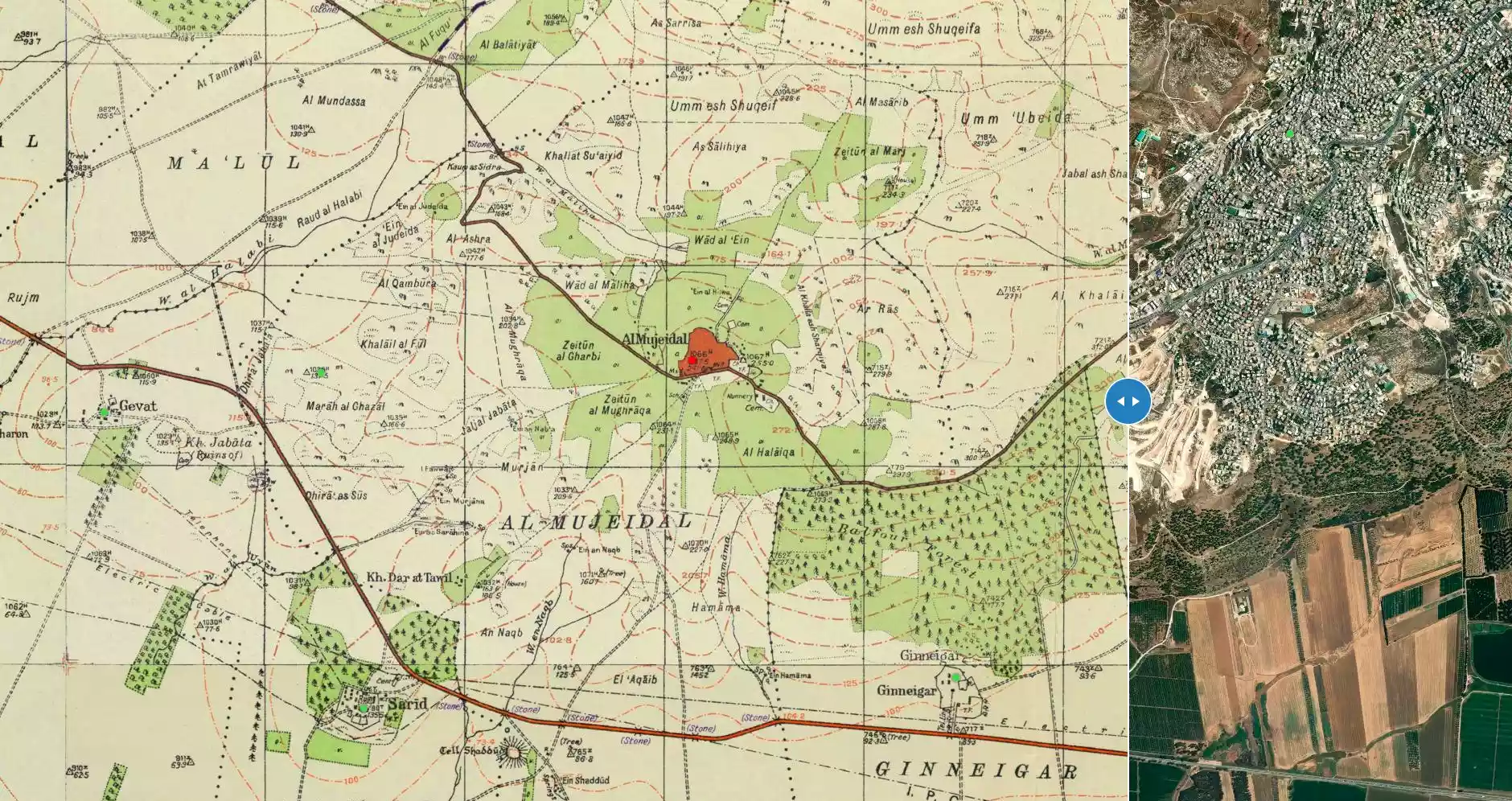
| Map Location | See location #3 on the map View from satellite |
|||||||||||||||||||||
| Attacking Units | Golani Brigade | |||||||||||||||||||||
| Refugees' Migration Routes | About 1,200 refugees from al-Mujaydil had reportedly reached Nazareth by the end of July, 1948. | |||||||||||||||||||||
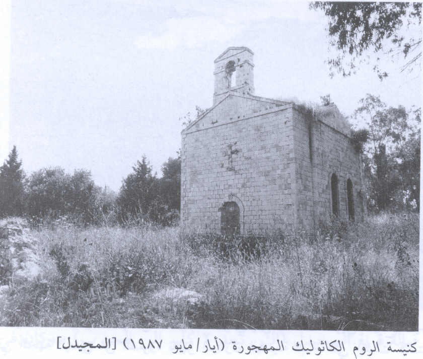
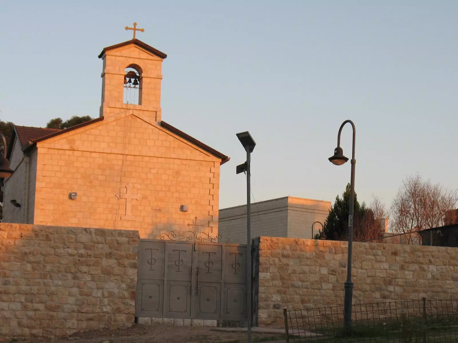
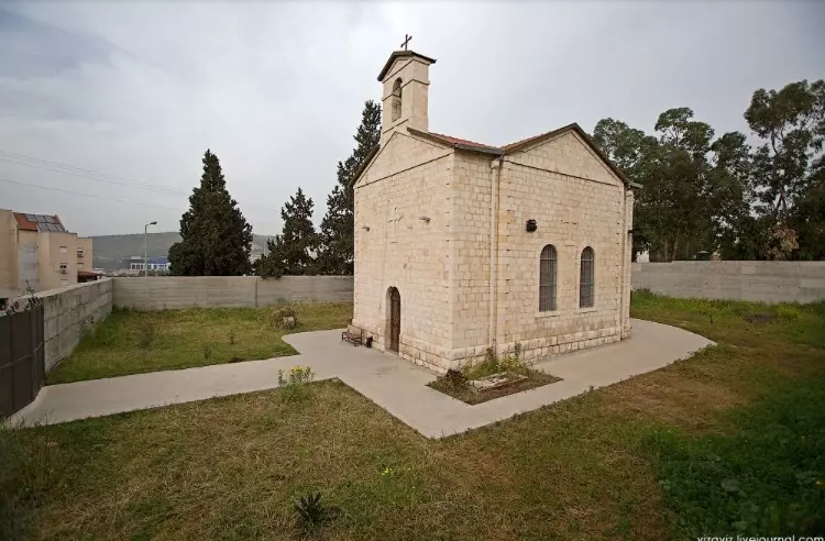
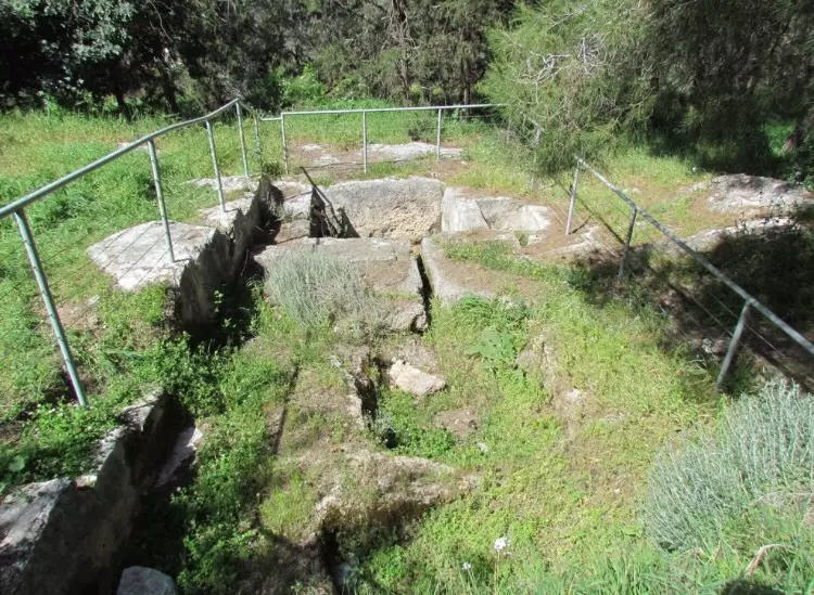
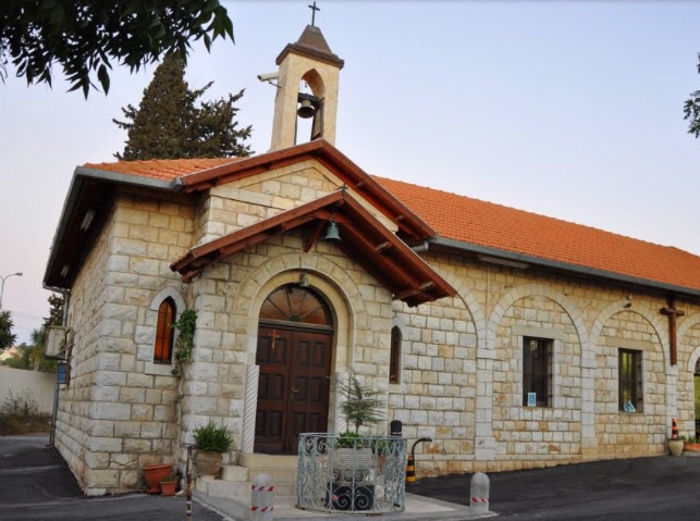
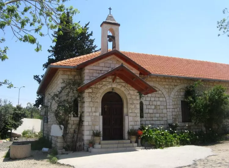
| Village Temains | al-Mujaydil was mostly destroyed with the exception of the monastery and a partially destroyed church. | |||||||||||||||||||||
| Ethnically Cleansing | al-Mujaydil inhabitants were completely ethnically cleansed. | |||||||||||||||||||||
| Pre-Nakba Land Ownership |
**Town Lands' Demarcation Maps |
|||||||||||||||||||||
| Land Usage As of 1945 |
|
|||||||||||||||||||||
| Population |
|
|||||||||||||||||||||
| Number of Houses | In (1931): 293 (includes 'Arab al-Khurayfat) | |||||||||||||||||||||
| Near By Towns |
||||||||||||||||||||||
|
||||||||||||||||||||||
| Schools | There were two elementary schools in al-Mujaydil, one for boys and the other for girls. | |||||||||||||||||||||
| Local Council | al-Mujaydil had a local council that administered its local affairs. | |||||||||||||||||||||
| Places of Warship | The village had a Roman Catholic church and a monastery. | |||||||||||||||||||||
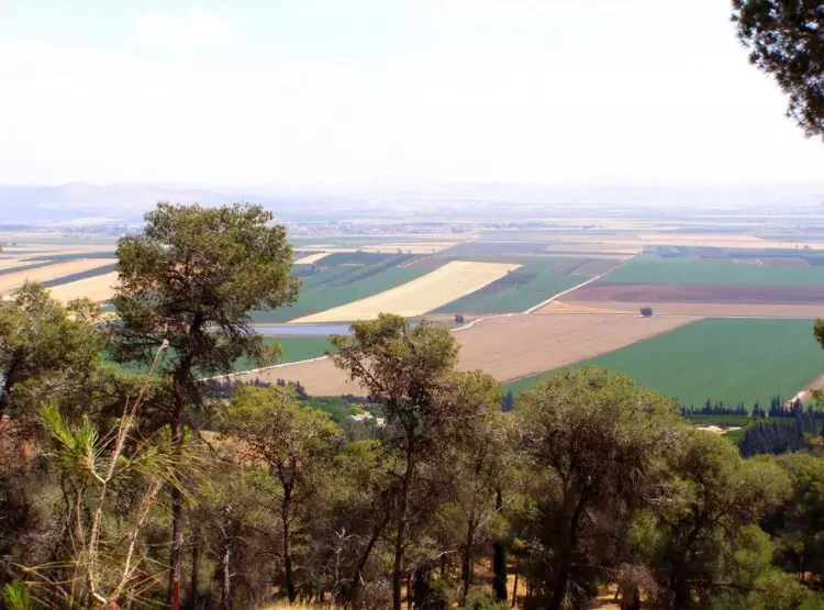
| Nearby Wadies & Rivers | The village is situated on the southern slopes of Wadi al-Mujaydil. | |||||||||||||||||||||
| Water Supply | Several springs flowed in the vicinity of the Wadi al-Mujaydil.. | |||||||||||||||||||||
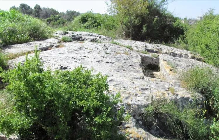
| Archeological Sites | Traces of a Roman road were found close to the village. | |||||||||||||||||||||
| Exculsive Jewish Colonies Who Usurped Village Lands |
Migdal ha-'Emeq (founded by Iranian Jews in in 1952) and Yifat. | |||||||||||||||||||||
| Featured Video | ||||||||||||||||||||||
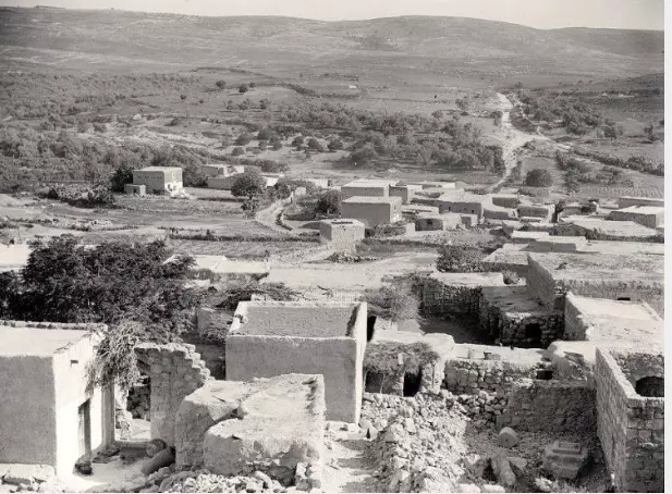
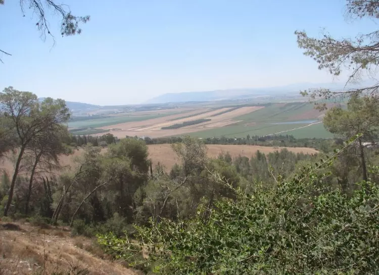
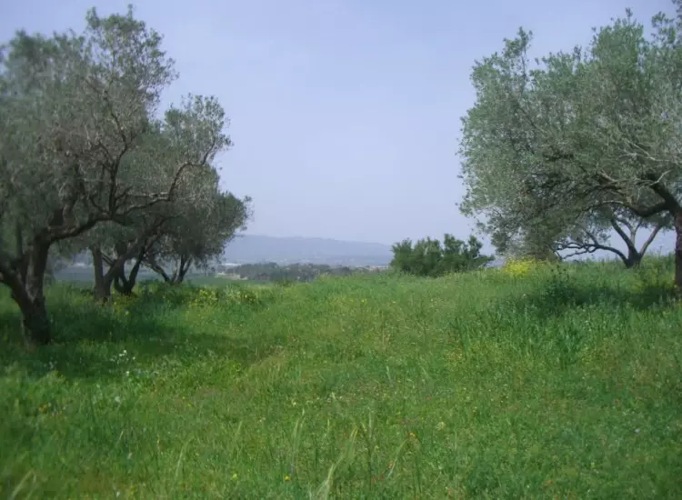
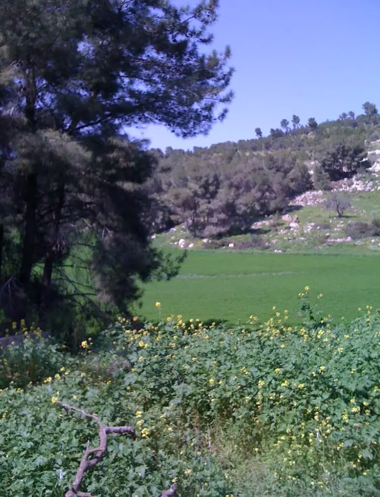
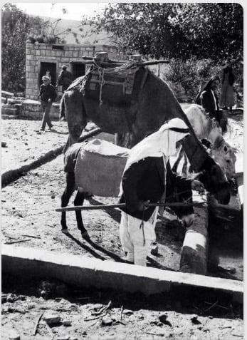
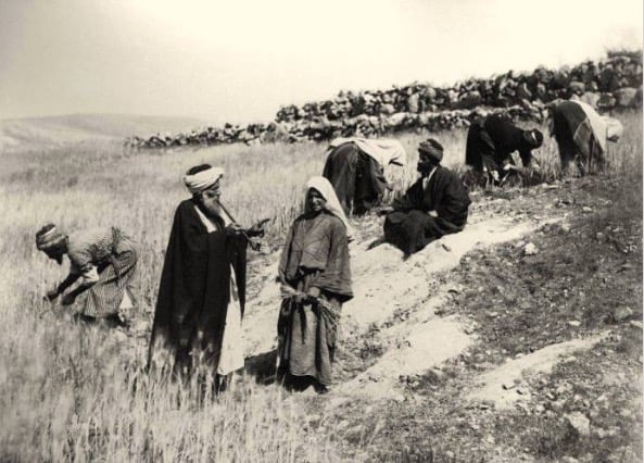
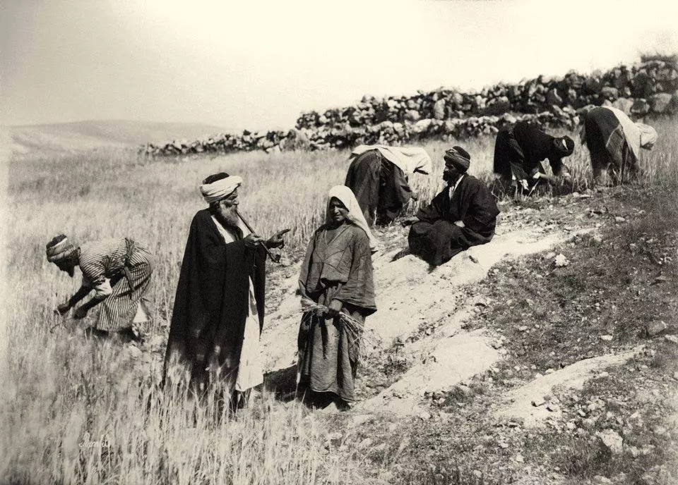
Village Before NakbaThe village stood on the gently-sloping, southern slopes of Wadi al-Mujaydil, on the Nazareth–Haifa highway. In 1596, al-Mujaydil was in the nahiya of Tabariyya (liwa' of Safad) with a population of twenty-two. It paid taxes on wheat, barley, fruit trees, goats, and beehives. In the late nineteenth century al-Mujaydil was described as a 'flourishing' village built of stone and mud. It was on the northern side of a small plateau, and olive groves were cultivated to the east and south. The number of its residents was estimated at 800 (in 1859); they cultivated 100 faddans (1 faddan = 100–250 dunums). Several springs flowed in the vicinity of the village, mainly in the southwest. Al-Mujaydil had a triangular outline; its houses were clustered closely together, and were made of stone and mud, stone and cement, or concrete. In 1945 it was the third largest village in the sub-disctrict in terms of population; it had 1,640 Muslims and 260 Christian inhabitants. There were two elementary schools in al-Mujaydil, one for boys and one for girls. The village also had a Roman Catholic church and a monastery, and a local council that administered its affairs.A Survey of Palestine estimates the council's expenditures at 36 Palestinian pounds (P£) in 1929 but offers no figures for subsequent years. The Palestine Gazette shows that these expenditures amounted to P£80 in 1937 and then fell to P£34 in 1942, although the revenues continued to grow. Agriculture was the backbone of the economy; the most important crop was grain. In 1944/45 a total of 14,982 dunums was allotted to cereals; 1,685 dunums were irrigated or used for orchards, the bulk of which (1,600 dunums) was planted with olive trees. AI-Mujaydil was the second largest olive producer in the sub-district and had two mechanical olive presses in operation. Traces of a Roman road were found close to the village, which may indicate that the region was opened to intensive settlement as early as Roman times. Village Occupation and Ethnic CleaningLike neighboring Ma'lul, al-Mujaydil was occupied by a unit of the Golani Brigade, according to the History of the Haganah. That occurred on 14 or 15 July 1948, during the second stage of Operation Dekel (see 'Amqa, Acre sub-district), as the Israeli army closed in on Nazareth. The attack on this village misled the defenders of Nazareth into believing that the city would be attacked from the south. The History of the Haganah states: 'It seems that the Arabs of Nazareth were confident of their ability to repulse any attack from that direction [i.e. the south],' but it goes on to describe how the assault on Nazareth proceeded from the northwest, by Israeli units concentrated in the previously occupied town of Shafa 'Amr.AI-Mujaydil was one of the villages in Lower Galilee that was completely emptied of its inhabitants and then razed to the ground. About 1,200 refugees from al-Mujaydil had reportedly reached Nazareth by the end of July 1948, but it is not clear whether they remained there. Zionists Colonies on Village LandsJewish immigrants from Iran established the settlement of Migdal ha-'Emeq (172231) in 1952 on village land, less than 1 km southwest of the village site. The older settlement of Yif'at (171231), established in 1926 on what were traditionally village lands, is 2 km west of the site.Village TodayMost of the site is covered with a pine forest that serves as an Israeli park. The monastery and parts of the (destroyed) church are the only remaining buildings on the site; monks still live in the monastery (see photos section). Remnants of destroyed houses and the walls of a cemetery are visible. Cactuses and pomegranate, olive, and fig trees grow around the site, which is dotted with wells.SourceDr. Walid al-Khalidi, 1992: All That Remains. |
||||||||||||||||||||||
| Related Maps | Town Lands' Demarcation Maps خرائط للقضاء توضح حدود القرى والاودية Town's map on MapQuest View from satellite Help us map this town at WikiMapia |
|||||||||||||||||||||
| Related Links | Wikipedia's Page Google Search Google For Images Google For Videos |
|||||||||||||||||||||
| More Information | في كتاب كي لا ننسى في كتاب بلادنا فلسطين المزيد من موقع هوية |
|||||||||||||||||||||
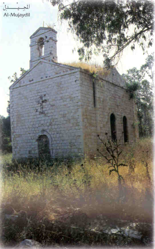
- The deserted Roman Catholic church, 1987
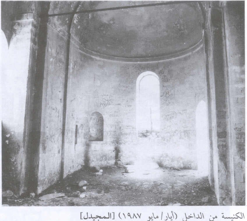
Scanned from "All That Remains" by Dr. Walid Khalidi - The interior of the Roman Catholic Church, 1987
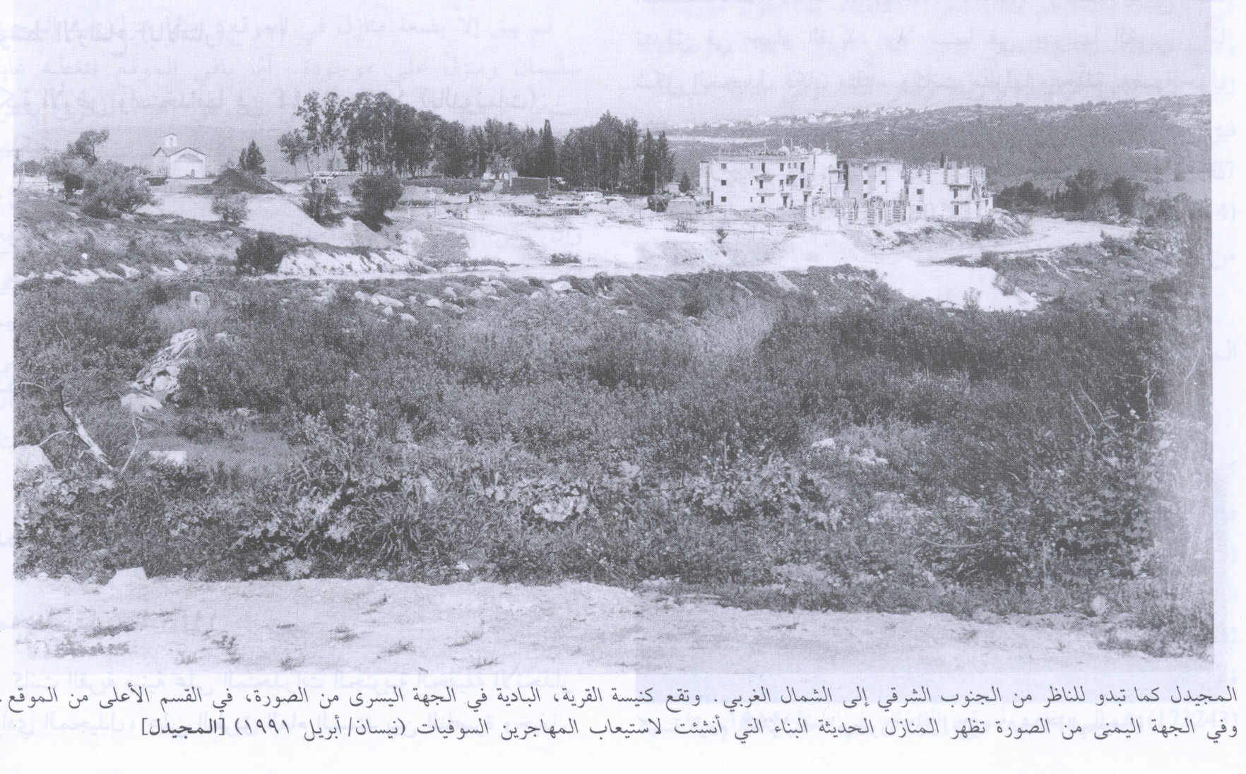
Scanned from "All That Remains" by Dr. Walid Khalidi - View of the village from the southeast looking northwest, 1991
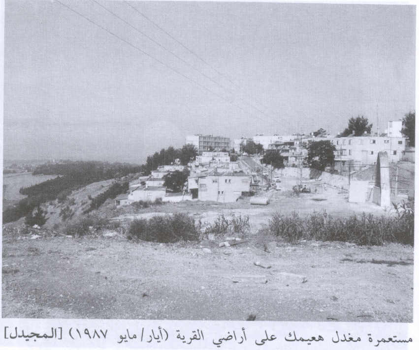
Scanned from "All That Remains" by Dr. Walid Khalidi - The settlement of Migdal ha-'Emeq on village lands, 1987
Scanned from "All That Remains" by Dr. Walid Khalidi 1 - al-Mujeidil's church
- The villages Church, still being used and often newly weds refugees celebrate their wedding here.
Posted by Noga Kadman - كنيسه المجيدل
Posted by abu raya - اثار المجيدل القديمه
Posted by abu raya - اثار المجيدل القديمه
Posted by abu raya - اثار المجيدل القديمه
Posted by abu raya - كنيسه المجيدل
Posted by abu raya - كنيسه المجيدل
Posted by abu raya - سهل قريه المجيدل
Posted by abu raya - اراضي المجيدل
Posted by abu raya - زيتون المجيدل
Posted by abu raya - الطبيعه في المجيدل
Posted by abu raya - المجيدل قبل النكبه
Posted by abu raya - قريه المجيدل قبل النكبه
Posted by abu raya - المجيدل قبل النكبه
Posted by abu raya - المجيدل قبل النكبه
Posted by abu raya - من قرية المجيدل المهجرة قضاء الناصرة سنة 1915
- Pre-Nakba Aerial view of the village / صورة من الجو للقرية اخذت قبل النكبة
Want to browse more? 80,000 pictures were grouped in these gallaries:
| Display Name | Clan/Hamolah | Country of Residence |
| ايمن محمد جبر احمد يوسف قويدر | ال سيف | عمان |
| رياض نصار | نصار | - |
| محمد غازي | - | Damascus, syria |
| لمية سلام | - | دمشق, سوريا |
| ebn el medjedel | - | algeria |
| الكرمل | - | - |
| سميه قويدر | ال سيف | - |
| ابو عبيد | عبيد | الناصرة |
| جمال صالح | الشناشري | - |
| hussam | - | ankara, Turkey |
- Return to Mjeidel
- وقفة على اطلال المجيدل(الجزء الاول)-- بعدسة جواد واكد Duration: 19 min 10 sec
- الذاكرة مفتاح العودة-الحلقة 55- المجيدل Duration: 23 min 22 sec
No links have been shared yet, be free to the first to share the first link.
 Fake Valor: Why Did Zionist Jews Hoist Nazis Flag on Their Ships in the 1930s?
What is new?
-
Facts About Oct. 7th Gaza Raid
-
Remined Us Please:: Who Did Rape Who? Palestinians Raped Israelis? Or, was the other way around?
-
When Prof. Edward Said was invited to debate Bibi Netanyahu in the 1980s, watch what happened!
-
Abusing Blood Libel!
-
Zionist FAQ: Isn't it true that Palestinians don't want peace? Palestinians never accepted the two-state solution
- Facts about Haavara (Transfer) Agreement between Ben-Gurion & Hitler
-
Haavara FAQs: Why Did Zionist Jews Hoist Nazis' Flags on Their Ships in the 1930s?
-
Dear ChatGPT: Why did the Jewish Agency suppress news of the Holocaust during WWII?
-
Video Playlist: Jews share their DNA tests to end the conflict for good.
-
A Tale of Two Conflicts: Examining the Definition of Genocide
-
Prof. Abraham Polak And The Suppressed History of the Khazars and European Jewry
-
How Ronald Reagan would have framed the genocide in Gaza if he were still alive?
-
Haavara FAQs: Let us do the math: how many German Jews did The Haavara Agreement save?
-
Zionist FAQs: The Hebron Massacre of 1929, "clearly proves" that Palestinians are antisemitic, how could you deny it?
-
Zionist FAQs: Why Anti-Zionist Is Not Antisemitism?
-
Zionist FAQs: Isn't it true that the KGB create Palestinian Nationalism in the early 1960s?
- Zionist FAQs: Muslims are killing Muslims all the time; why are Israeli Jews being singled out in the media?
- Zionist FAQs: How is Israel an apartheid state when 20% of its citizens are Arabs who enjoy full rights?
-
Haavara FAQs: Analysis of Herzl's Uganda Scheme and how it could have saved millions of Jews.
-
Haavara FAQs: Why did Hayim Greenberg describe American Jewry as "morally bankrupt" in early 1943?
-
Haavara FAQs: What if the Evian Conference was a resounding success? What would have been the impact of saving European Jewry on Zionism?
- Haavara FAQs: What if the six million were saved, how that would have impacted the Zionist project?
-
Haavara FAQs: How did Zionist leaders react when Europe's Jews lingered in the DP camps after WWII ended?
-
Why does the American Jewish community repeat lies that David Ben-Gurion had debunked before he died?
-
Who has the power to rename the Tatar/Khazar Gene Marker to Jewish IV?
-
Zionist FAQs: Why won't Egypt, Syria, and Jordan take their people back? Jews are indigenous to Palestine, and Arabs immigrated after Jews developed the country. Arabs should leave.
-
Haavara FAQs: Did Hitler and the Nazis conflate between Judaism and Zionist? If that wasn't case, then why?
-
Haavara FAQs: Winston Churchill and antisemitism, a collection of articles written Churchill.
-
Haavara FAQs: Broken by country, how many Jews survived vs. killed during the Holocaust?
-
Haavara FAQs: Why did European Jews vote with their feet and to immigrated to the Americas, not Palestine, after WWII?
-
Watch this American Jewish Girl describing Israeli Jews' cognitive dissonance like no other in under two minutes
-
Haavara FAQs: When the Nazis went out of their way to hide the Holocaust, Israeli Jews did the exact opposite by broadcasting their genocide of Gazans. But why?
-
Haavara FAQs: How Zionist Jews went out of their to show their appreciation to Nazism and Fascism?
- Haavara FAQs: Why Zionist leaders were against bombing the death camps & the Railroads leading to them?
-
Haavara FAQs: Hitler's message to the British and American people: If Jews are such noble citizens and you care about them, how come you're not letting them in? I will gladly ship them to you at my expense, even on luxury liners!
-
A shortlist of Zionist and Israeli false flag operations in the name Jews.
-
The Most Moral Army
- The Land of Kapos (Israel): Where the brave are boycotted and Kapos walk free.
- Why did early Zionists often named their communal enterprises "colonial"?
- Zionist Relations with Nazi Germany by Faris Glubb
-
Two NY Times advertisements by Zionists in the early 1943 that exposes Zionists' treason at the height of the calamity
- Facts Not Lies about the Palestinian-Israeli Conflict.
- Site's pictures have been categorized
- Campgain Against Lice
- A Survey of Palestine, the official source about Palestine before Nakba produced by the British Mandate; over 1200 pages.
- Satellite View & Google Earth: Over 6,000 placemarks identifying all destroyed towns, W. Bank & Gaza Strip Towns, & refugee camps.
- PalestineRemembered.com and its Nakba Oral History Project were featured on al-Jazeera Satellite TV.
- Nakba Oral History Video Podcast:
 Over 700 Oral History interviews (including 3,500+ hours of recording) can be viewed online.
 - Palestine Village Statistics Project
- Gaza Jail Break
- النسخة العربية للموقع الان متوفرة
- Videos: Documenting the destroyed villages in video: Tracing all that remains since Nakba.
- Videos: Responding to Zionist Propaganda
- Interview: The ethnic cleansing of Palestine: George Galloway interviews Israeli Historian Ilan Pappe.
- For Palestinians, memory matters. It provides a blueprint for their future By George Bisharat.
- Zionist FAQ now available in Hebrew שאלות שציונים שואלים, עכשיו בעברית
- Video: The Stephen Walt and John Mearsheimer report on the influence of the Israel Lobby on U.S. Foreign Policy
- The Palestinian-Israeli conflict for beginners
