| PalestineRemembered | About Us | Oral History | العربية | |
| Pictures | Zionist FAQs | Haavara | Maps | |
| Search |
| Camps |
| Districts |
| Acre |
| Baysan |
| Beersheba |
| Bethlehem |
| Gaza |
| Haifa |
| Hebron |
| Jaffa |
| Jericho |
| Jerusalem |
| Jinin |
| Nablus |
| Nazareth |
| Ramallah |
| al-Ramla |
| Safad |
| Tiberias |
| Tulkarm |
| Donate |
| Contact |
| Profile |
| Videos |
Welcome To Khan al-Duwayr - خان الدوير (ח'אן א-דויר)
|
District of Safad
Ethnically cleansed days ago |
العربية Google Earth |
 |
Gallery (11) |
- Statistics & Facts
-
Before & After

- Satellite View
- Articles 1
- Pictures 11
- Members
- All That Remains
- Wikipedia
- Videos
- Guest Book
- Links
| Statistic & Fact | Value | ||||||||||||
| Occupation Date | May 30, 1948 | ||||||||||||
| Distance From District | 35 (km) North East of Safad | ||||||||||||
| Elevation | 200 (meters) | ||||||||||||
| Before & After Nakba, Click Map For Details |
|||||||||||||
|
|||||||||||||
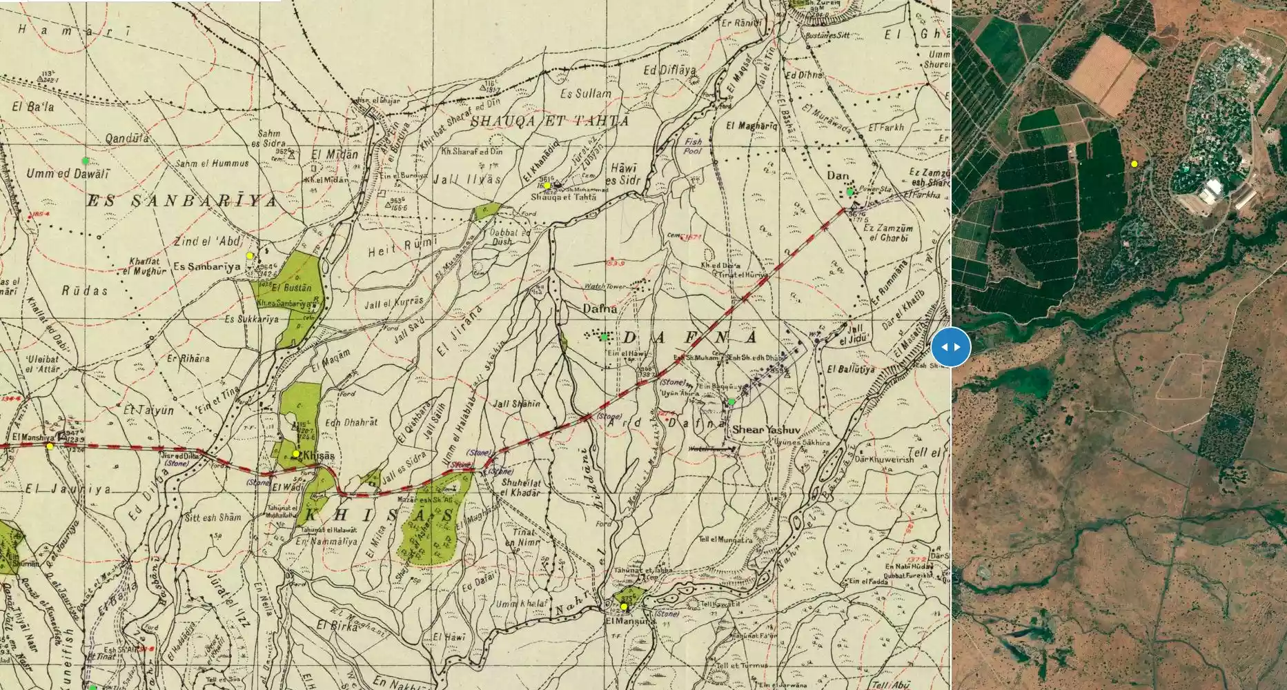
| Map Location | See location #4 on the map View from satellite |
||||||||||||
| Military Operation | Operation Yiftach (commanded by the ethnic cleansing champion Yigal Allon) | ||||||||||||
| Attacking Units | The Palmach's First Battalion | ||||||||||||
| Exodus Cause | Military assault by Zionist troops | ||||||||||||
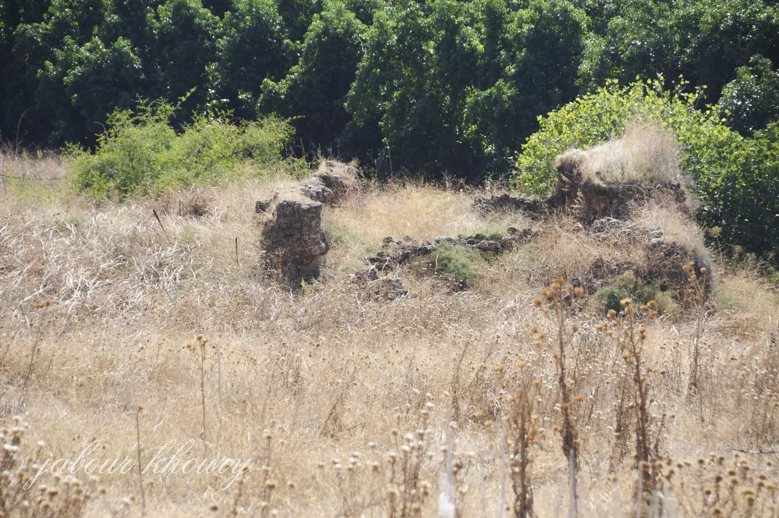
| Village Temains | The village has been completely destroyed. | ||||||||||||
| Ethnically Cleansing | Khan al-Duwayr inhabitants were completely ethnically cleansed. | ||||||||||||
| Pre-Nakba Land Ownership |
|
||||||||||||
| Population |
|
||||||||||||
| Number of Houses |
|
||||||||||||
| Archeological Sites | The village had khirbat Tall al-Qadi lay about 1 km to the northwest of the village. | ||||||||||||
| Exculsive Jewish Colonies Who Usurped Village Lands |
Dafna and Dan are close by village lands | ||||||||||||
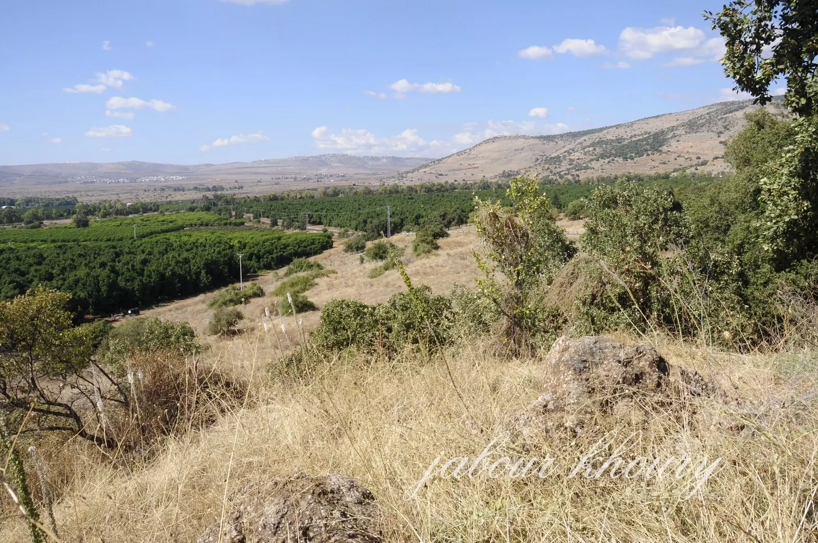
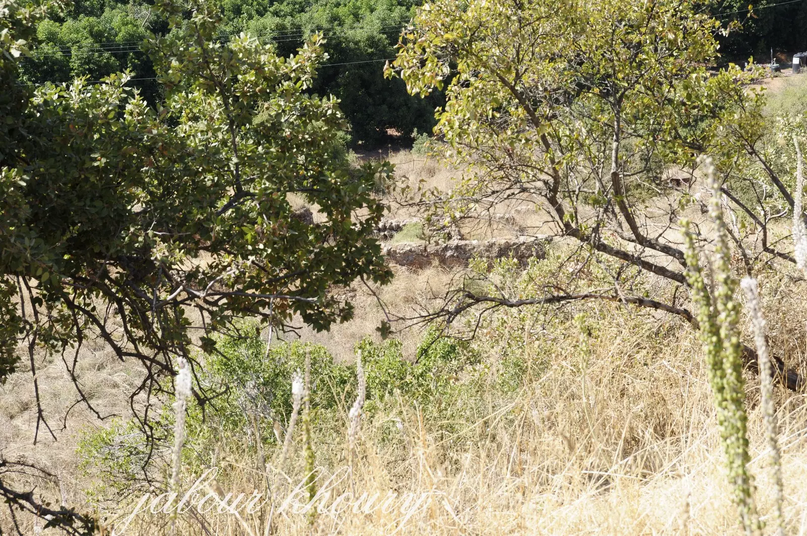
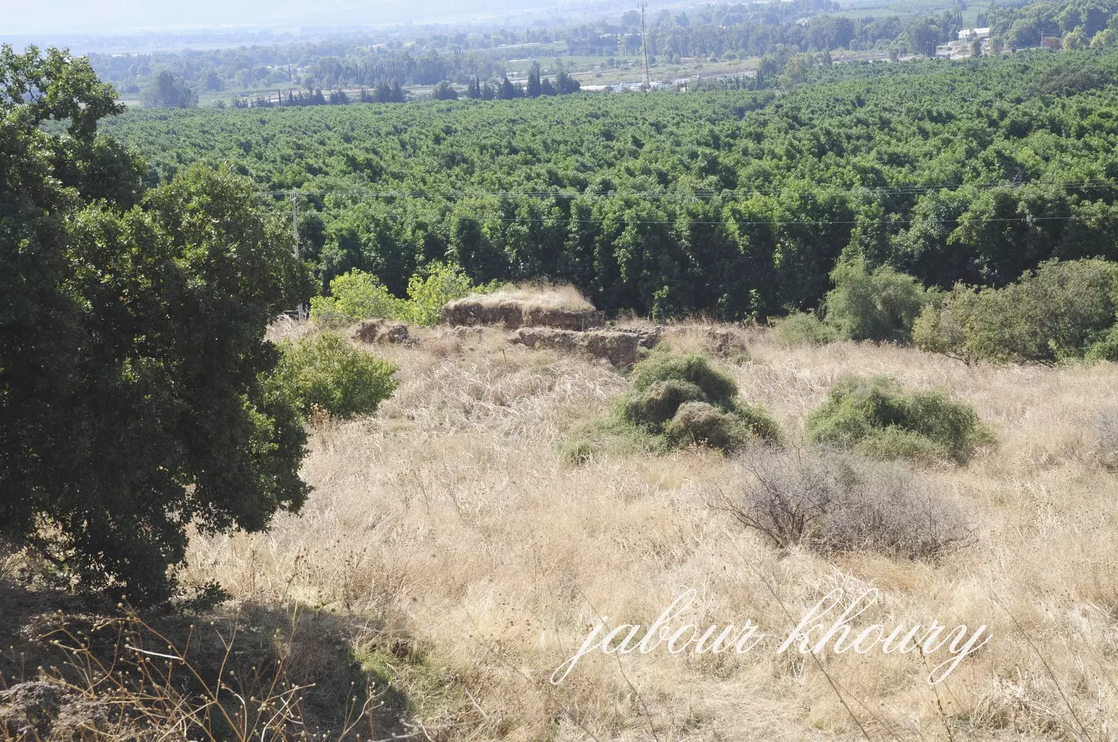
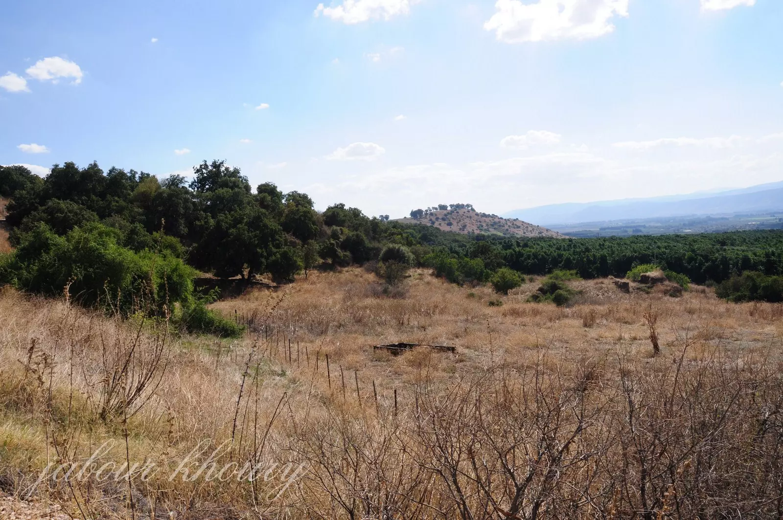
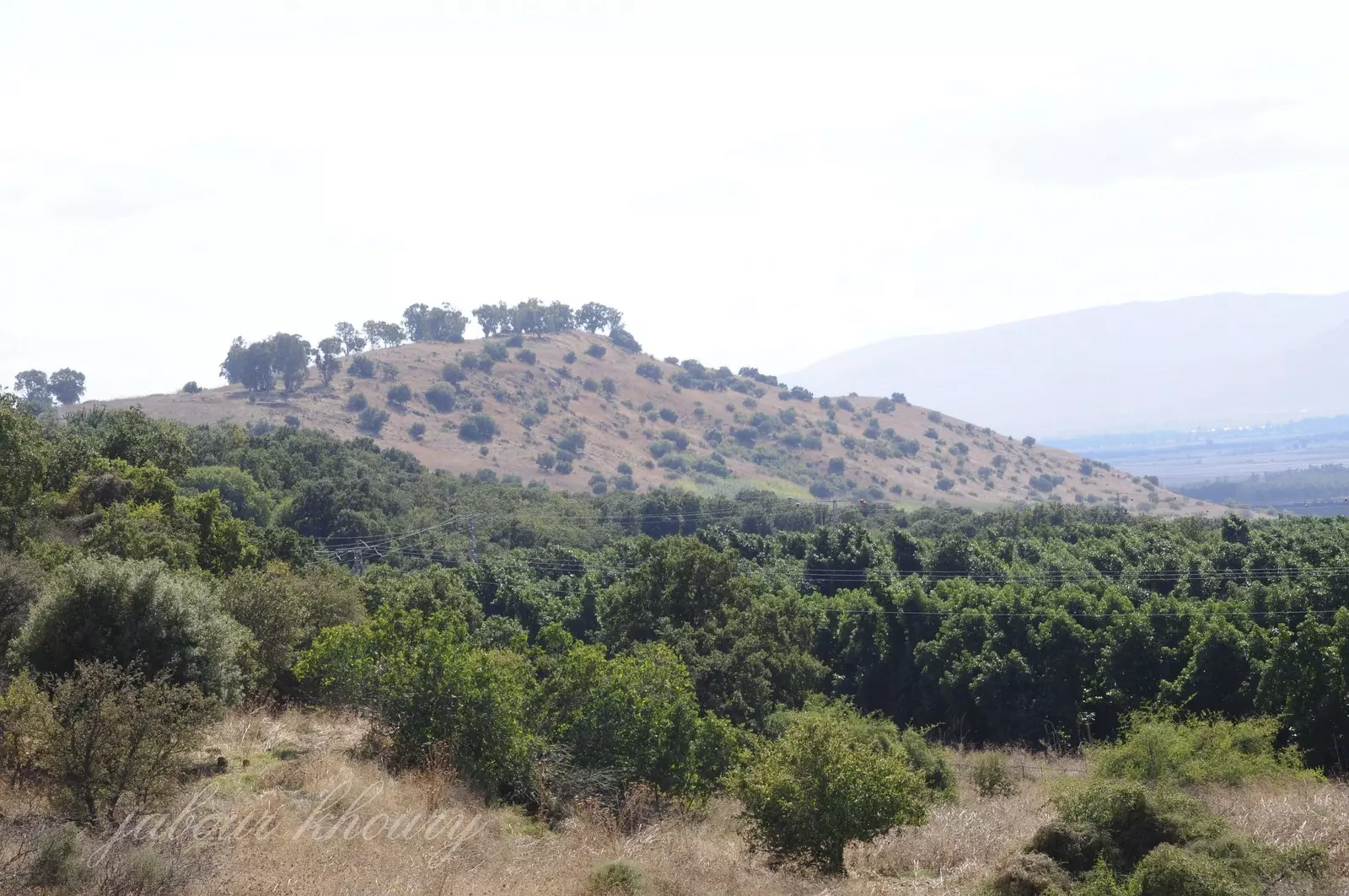
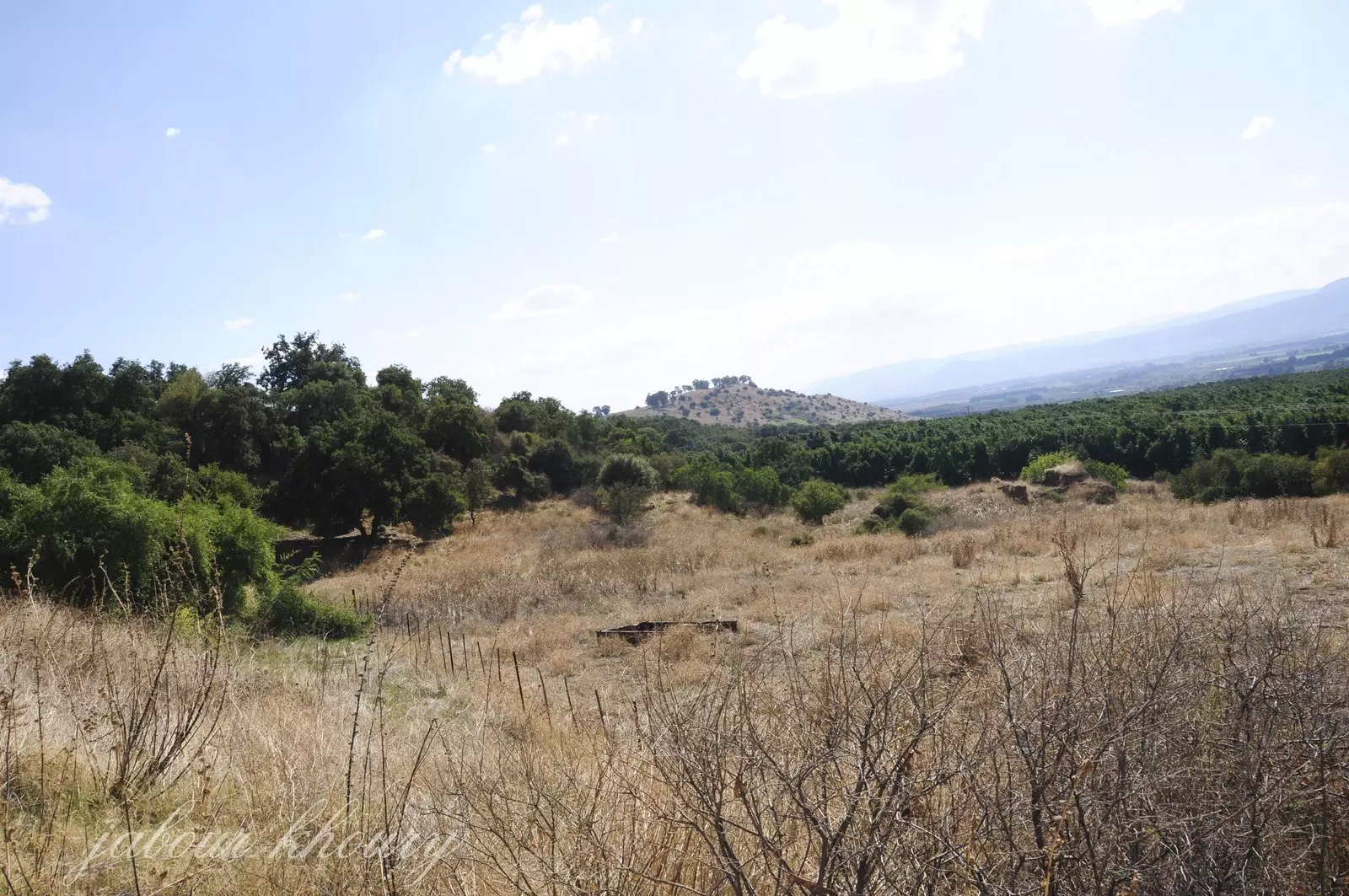
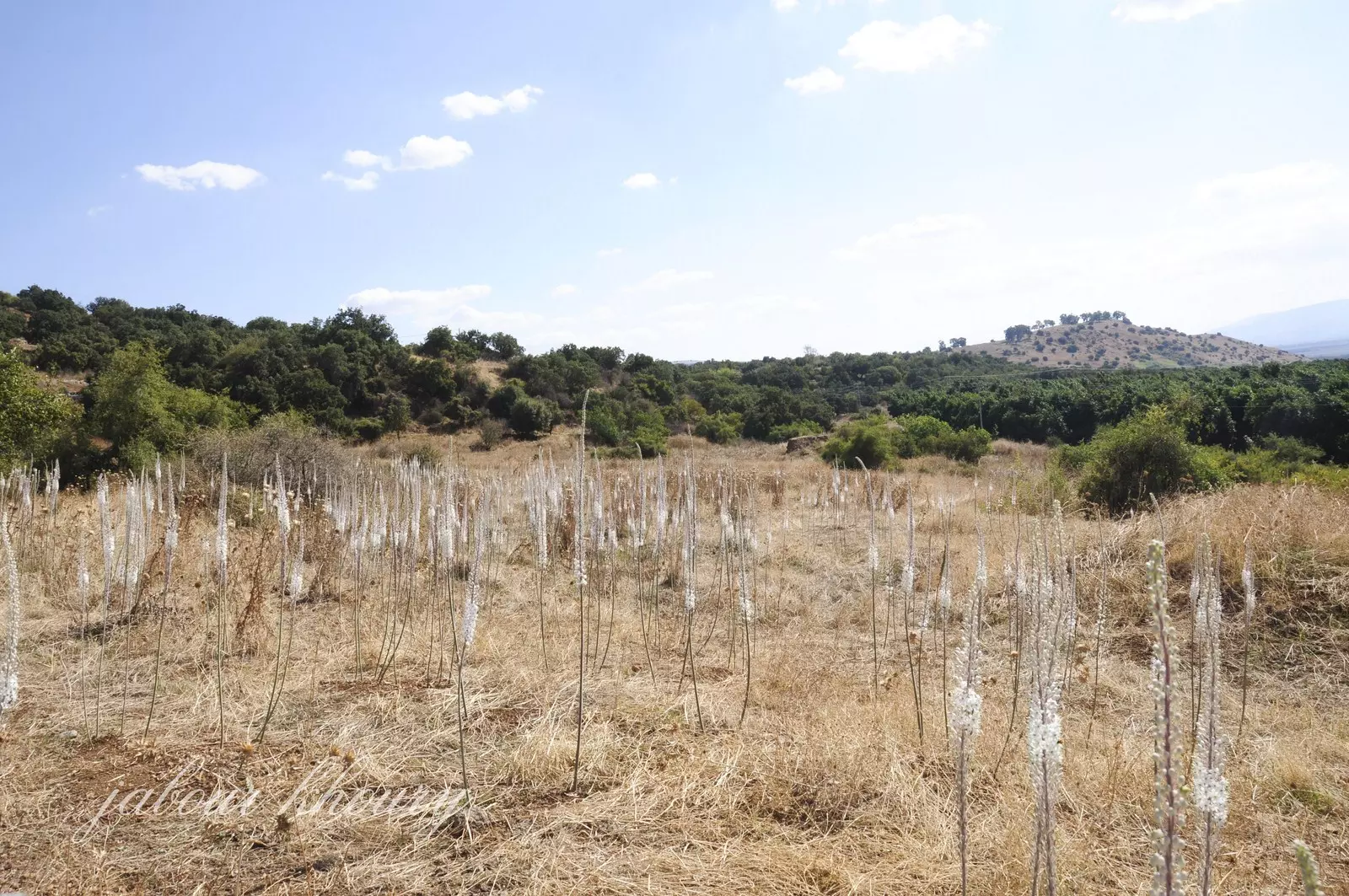
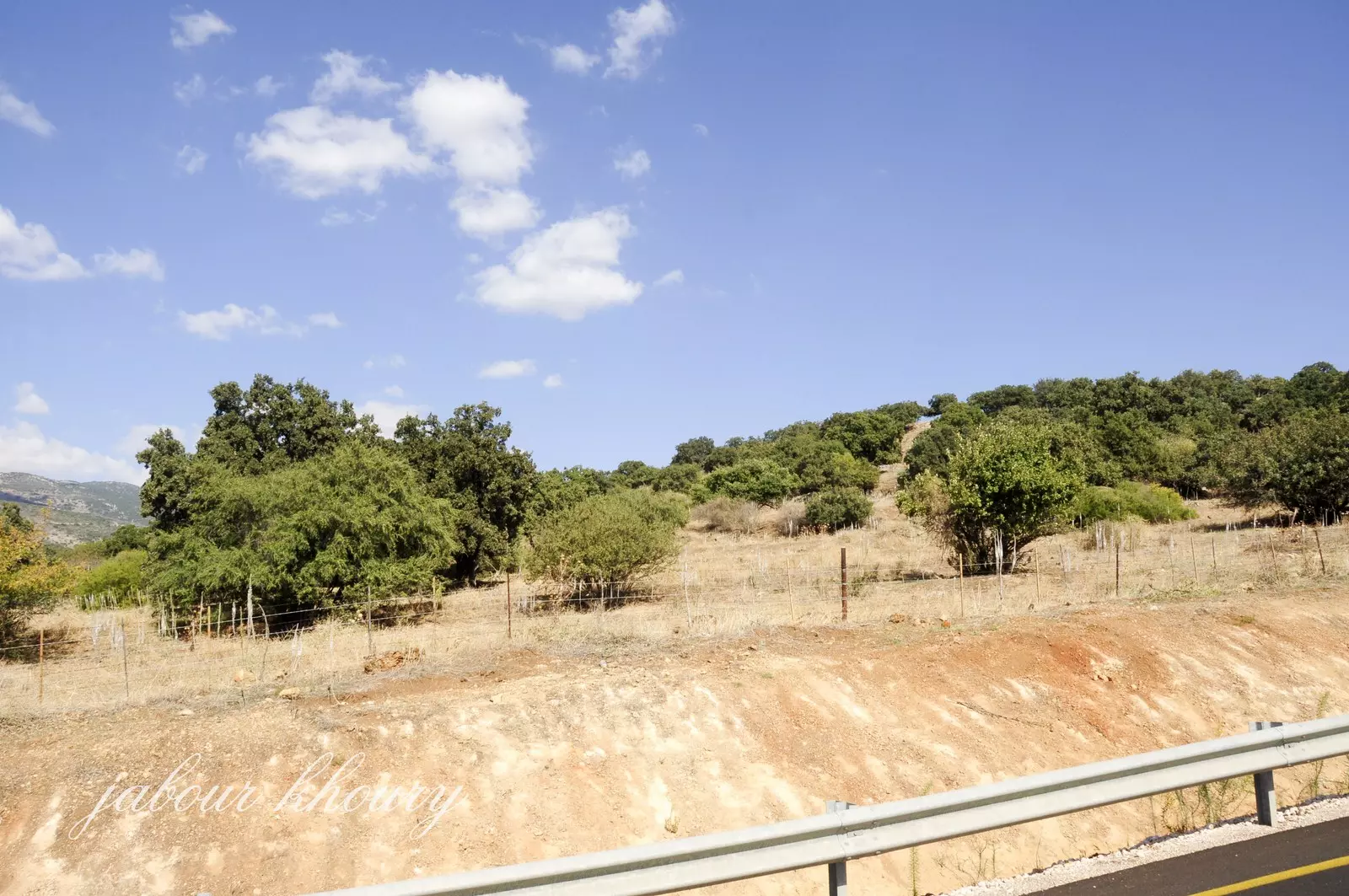
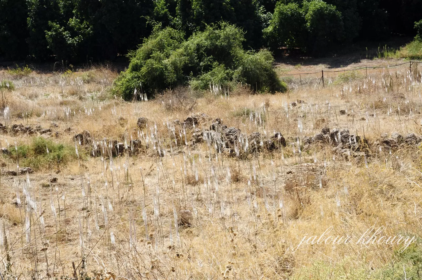
Village Before NakbaThe village was located on the northeast margin of the al-Hula Plain and overlooked it towards the south. A secondary road passed immediately to the northwest of it and linked Khan al-Duwayr to the town of Banyas in Syria, to a number of villages (including al-Khalisa), and to a highway that led to Safad. It had always been an important stop for the commercial caravans journeying between Syria, Palestine, and Lebanon. An archaeological site known as Tall aI-Qadi lay about 1 km to the northwest. This may have been the biblical Laish, referred to in the Old Testament (Judges 18:29) as a walled town conquered by the tribe of Dan in the twelfth century B.C.In the late nineteenth century, Khan al-Duwayr consisted merely of two stone houses in which twenty people lived. Situated on the slope of a hill, the dwellings were surrounded by olive trees and cultivated land. During the Mandate it was classified as a hamlet in the Palestine Index Gazetteer. Its houses were made of black basalt and mud. In 1944/45 a total of 96 dunums was allocated to cereals; 2,067 dunums were irrigated or used for orchards. Village Occupation and Ethnic CleaningLocated in the northern tip of the Galilee panhandle, Khan al-Duwayr may not have been entered by Zionist forces until the end of Operation Yiftach (see Abil al-Qamh, Safad sub-district) in late May 1948. But it is more likely that the village came under attack well before then, as the Haganah pushed to control the northern border before the end of the British Mandate on 15 May. Furthermore, the village was accessible from the Jewish settlement of Dafna, which was one of the launching pads for forays into Syria undertaken by Zionist forces during this period. Thus, it may have been targeted in the early stages of Yiftach, in the second half of April.Zionists Colonies on Village LandsThere are no Israeli settlements on village land. However, the settlements of Dafna (210292) and Dan (211293), both established in 1939, are close to the village site; the former is about 3 km southwest of it, while the latter is 2 km to the west.Village TodayThe site is deserted, overgrown with grass. Only the ruins of a khan (caravansary) are visible. The surrounding land is either cultivated by Israelis, or used as forest or pasture.SourceDr. Walid al-Khalidi, 1992: All That Remains. |
|||||||||||||
| Related Maps | Town Lands' Demarcation Maps خرائط للقضاء توضح حدود القرى والاودية Town's map on MapQuest View from satellite Help us map this town at WikiMapia |
||||||||||||
| Related Links | Wikipedia's Page Google Search Google For Images Google For Videos |
||||||||||||
| More Information | في كتاب كي لا ننسى في كتاب بلادنا فلسطين المزيد من موقع هوية |
||||||||||||
- Ruins of village Khan, 1987
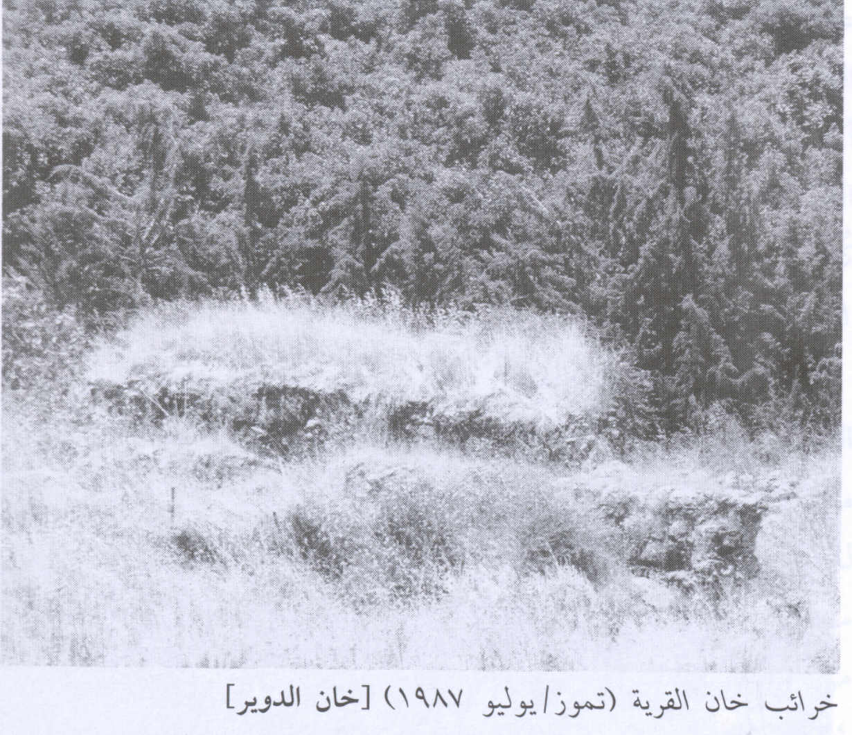
Scanned from "All That Remains" by Dr. Walid Khalidi - موقع القريه نظره من الجهه الشرقيه
Posted by Jabour Khoury - بقايا الخان المغطاه بالاعشاب والاشجار
Posted by Jabour Khoury - بقايا الخان
Posted by Jabour Khoury - موقع القريه ويظهر بقايا الخان وقريه خربه العزيزات على التل في خلفيه الصوره
Posted by Jabour Khoury - خربه العزيزات كما تظهر من اراضي القريه
Posted by Jabour Khoury - اراضي القريه المغطاه بالاعشاب
Posted by Jabour Khoury - بقايا الخان
Posted by Jabour Khoury 1 - اراضي القريه
Posted by Jabour Khoury - شمال القريه
Posted by Jabour Khoury - اثار ردم البيوت بين الاشجار
Posted by Jabour Khoury
Want to browse more? 80,000 pictures were grouped in these gallaries:
| Display Name | Clan/Hamolah | Country of Residence |
No links have been shared yet, be free to the first to share the first link.
 Fake Valor: Why Did Zionist Jews Hoist Nazis Flag on Their Ships in the 1930s?
What is new?
-
Facts About Oct. 7th Gaza Raid
-
Remined Us Please:: Who Did Rape Who? Palestinians Raped Israelis? Or, was the other way around?
-
When Prof. Edward Said was invited to debate Bibi Netanyahu in the 1980s, watch what happened!
-
Ezra Klein of the NY Times on the "Jewish Race".
-
Abusing Blood Libel!
-
Zionist FAQ: Isn't it true that Palestinians don't want peace? Palestinians never accepted the two-state solution
- Facts about Haavara (Transfer) Agreement between Ben-Gurion & Hitler
-
Haavara FAQs: Why Did Zionist Jews Hoist Nazis' Flags on Their Ships in the 1930s?
-
Dear ChatGPT: Why did the Jewish Agency suppress news of the Holocaust during WWII?
-
Video Playlist: Jews share their DNA tests to end the conflict for good.
-
A Tale of Two Conflicts: Examining the Definition of Genocide
-
Prof. Abraham Polak And The Suppressed History of the Khazars and European Jewry
-
How Ronald Reagan would have framed the genocide in Gaza if he were still alive?
-
Haavara FAQs: Let us do the math: how many German Jews did The Haavara Agreement save?
-
Zionist FAQs: The Hebron Massacre of 1929, "clearly proves" that Palestinians are antisemitic, how could you deny it?
-
Zionist FAQs: Why Anti-Zionist Is Not Antisemitism?
-
Zionist FAQs: Isn't it true that the KGB create Palestinian Nationalism in the early 1960s?
- Zionist FAQs: Muslims are killing Muslims all the time; why are Israeli Jews being singled out in the media?
- Zionist FAQs: How is Israel an apartheid state when 20% of its citizens are Arabs who enjoy full rights?
-
Haavara FAQs: Analysis of Herzl's Uganda Scheme and how it could have saved millions of Jews.
-
Haavara FAQs: Why did Hayim Greenberg describe American Jewry as "morally bankrupt" in early 1943?
-
Haavara FAQs: What if the Evian Conference was a resounding success? What would have been the impact of saving European Jewry on Zionism?
- Haavara FAQs: What if the six million were saved, how that would have impacted the Zionist project?
-
Haavara FAQs: How did Zionist leaders react when Europe's Jews lingered in the DP camps after WWII ended?
-
Why does the American Jewish community repeat lies that David Ben-Gurion had debunked before he died?
-
Who has the power to rename the Tatar/Khazar Gene Marker to Jewish IV?
-
Zionist FAQs: Why won't Egypt, Syria, and Jordan take their people back? Jews are indigenous to Palestine, and Arabs immigrated after Jews developed the country. Arabs should leave.
-
Haavara FAQs: Did Hitler and the Nazis conflate between Judaism and Zionist? If that wasn't case, then why?
-
Haavara FAQs: Winston Churchill and antisemitism, a collection of articles written Churchill.
-
Haavara FAQs: Broken by country, how many Jews survived vs. killed during the Holocaust?
-
Haavara FAQs: Why did European Jews vote with their feet and to immigrated to the Americas, not Palestine, after WWII?
-
Watch this American Jewish Girl describing Israeli Jews' cognitive dissonance like no other in under two minutes
-
Haavara FAQs: When the Nazis went out of their way to hide the Holocaust, Israeli Jews did the exact opposite by broadcasting their genocide of Gazans. But why?
-
Haavara FAQs: How Zionist Jews went out of their to show their appreciation to Nazism and Fascism?
- Haavara FAQs: Why Zionist leaders were against bombing the death camps & the Railroads leading to them?
-
Haavara FAQs: Hitler's message to the British and American people: If Jews are such noble citizens and you care about them, how come you're not letting them in? I will gladly ship them to you at my expense, even on luxury liners!
-
A shortlist of Zionist and Israeli false flag operations in the name Jews.
-
The Most Moral Army
- The Land of Kapos (Israel): Where the brave are boycotted and Kapos walk free.
- Why did early Zionists often named their communal enterprises "colonial"?
- Zionist Relations with Nazi Germany by Faris Glubb
-
Two NY Times advertisements by Zionists in the early 1943 that exposes Zionists' treason at the height of the calamity
- Facts Not Lies about the Palestinian-Israeli Conflict.
- Site's pictures have been categorized
- Campgain Against Lice
- A Survey of Palestine, the official source about Palestine before Nakba produced by the British Mandate; over 1200 pages.
- Satellite View & Google Earth: Over 6,000 placemarks identifying all destroyed towns, W. Bank & Gaza Strip Towns, & refugee camps.
- PalestineRemembered.com and its Nakba Oral History Project were featured on al-Jazeera Satellite TV.
- Nakba Oral History Video Podcast:
 Over 700 Oral History interviews (including 3,500+ hours of recording) can be viewed online.
 - Palestine Village Statistics Project
- Gaza Jail Break
- النسخة العربية للموقع الان متوفرة
- Videos: Documenting the destroyed villages in video: Tracing all that remains since Nakba.
- Videos: Responding to Zionist Propaganda
- Interview: The ethnic cleansing of Palestine: George Galloway interviews Israeli Historian Ilan Pappe.
- For Palestinians, memory matters. It provides a blueprint for their future By George Bisharat.
- Zionist FAQ now available in Hebrew שאלות שציונים שואלים, עכשיו בעברית
- Video: The Stephen Walt and John Mearsheimer report on the influence of the Israel Lobby on U.S. Foreign Policy
- The Palestinian-Israeli conflict for beginners
