| PalestineRemembered | About Us | Oral History | العربية | |
| Pictures | Zionist FAQs | Haavara | Maps | |
| Search |
| Camps |
| Districts |
| Acre |
| Baysan |
| Beersheba |
| Bethlehem |
| Gaza |
| Haifa |
| Hebron |
| Jaffa |
| Jericho |
| Jerusalem |
| Jinin |
| Nablus |
| Nazareth |
| Ramallah |
| al-Ramla |
| Safad |
| Tiberias |
| Tulkarm |
| Donate |
| Contact |
| Profile |
| Videos |
Welcome To Nasir al-Din - نصر الدين (ח'ירבת נאצר א-דין)
|
District of Tiberias
Ethnically cleansed days ago |
العربية Google Earth |
 |
Gallery (25) |
- Statistics & Facts
-
Before & After

- Satellite View
- Articles 1
- Pictures 25
- Oral History 1
- Members
- All That Remains
- Wikipedia
- Videos 2
- Guest Book
- Links
| Statistic & Fact | Value | ||||||||||||
| Occupation Date | April 12, 1948 | ||||||||||||
| Distance From District | 3 (km) Southwest of Tiberias | ||||||||||||
| Elevation | 75 (meters) | ||||||||||||
| Before & After Nakba, Click Map For Details |
|||||||||||||
|
|||||||||||||
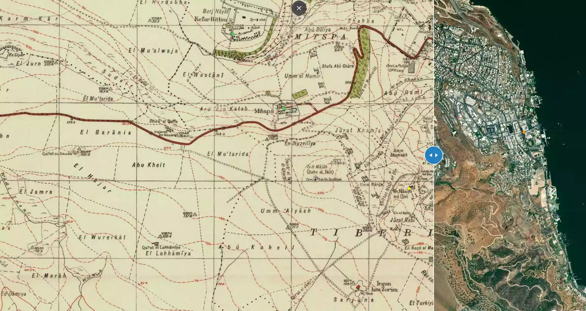
| Map Location | See location #12 on the map View from satellite |
||||||||||||
| Attacking Units | Golani Brigade | ||||||||||||
| Acts of Terror | Massacre occured by Zionist troops against the town's inhabitants. | ||||||||||||
| Refugees' Migration Routes | Nasir al-Din refugees fled to Tiberias city and Lubya who were evacuated by the British troops. | ||||||||||||
| Exodus Cause | Military assault by Zionist troops | ||||||||||||
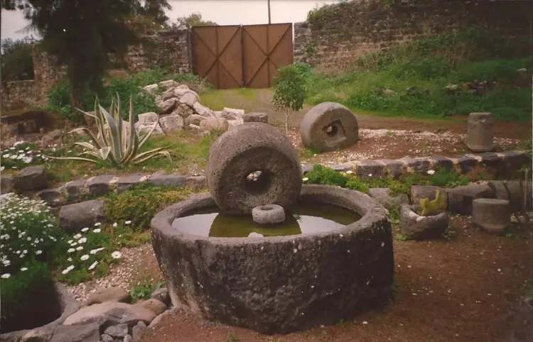
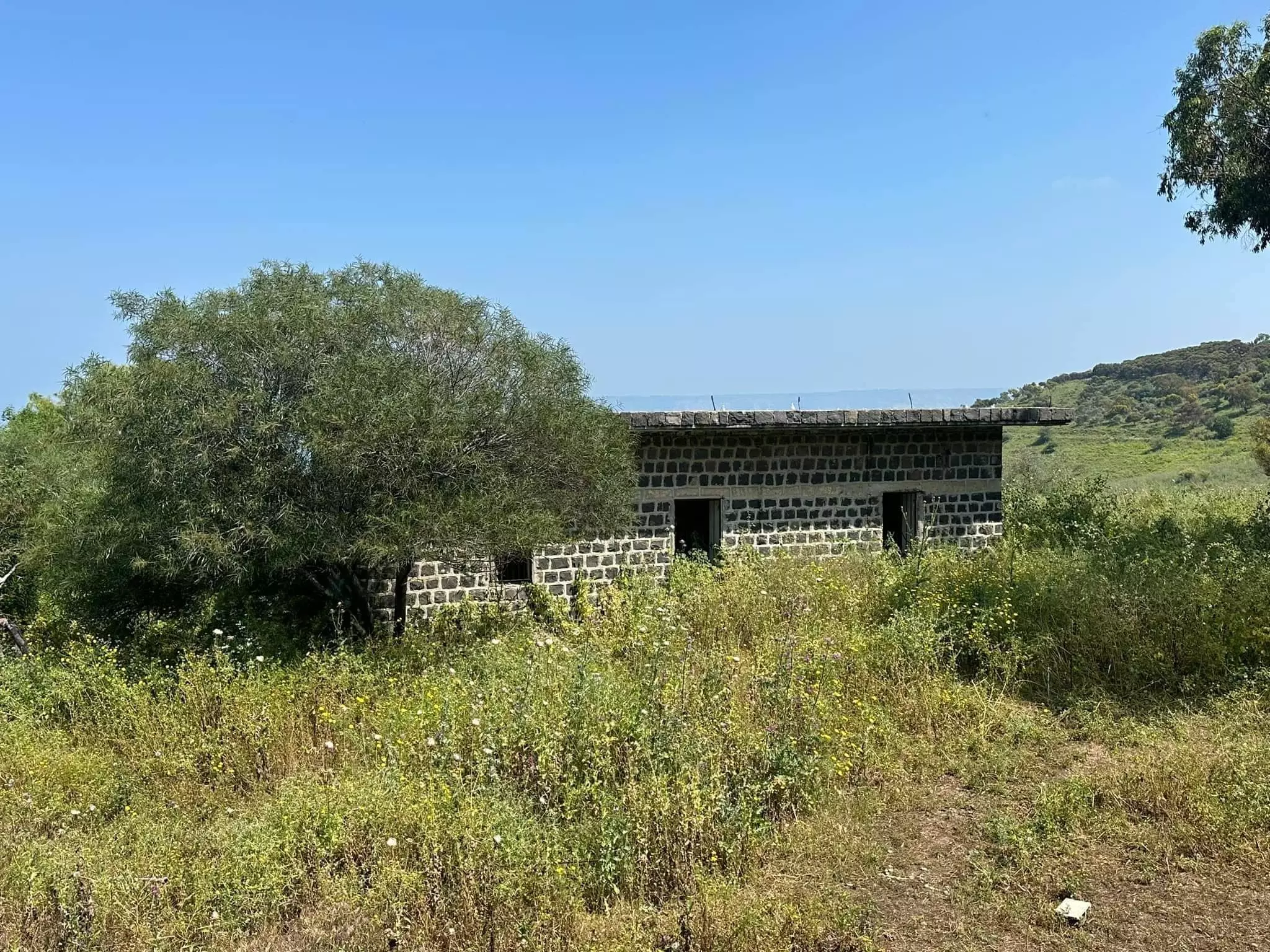
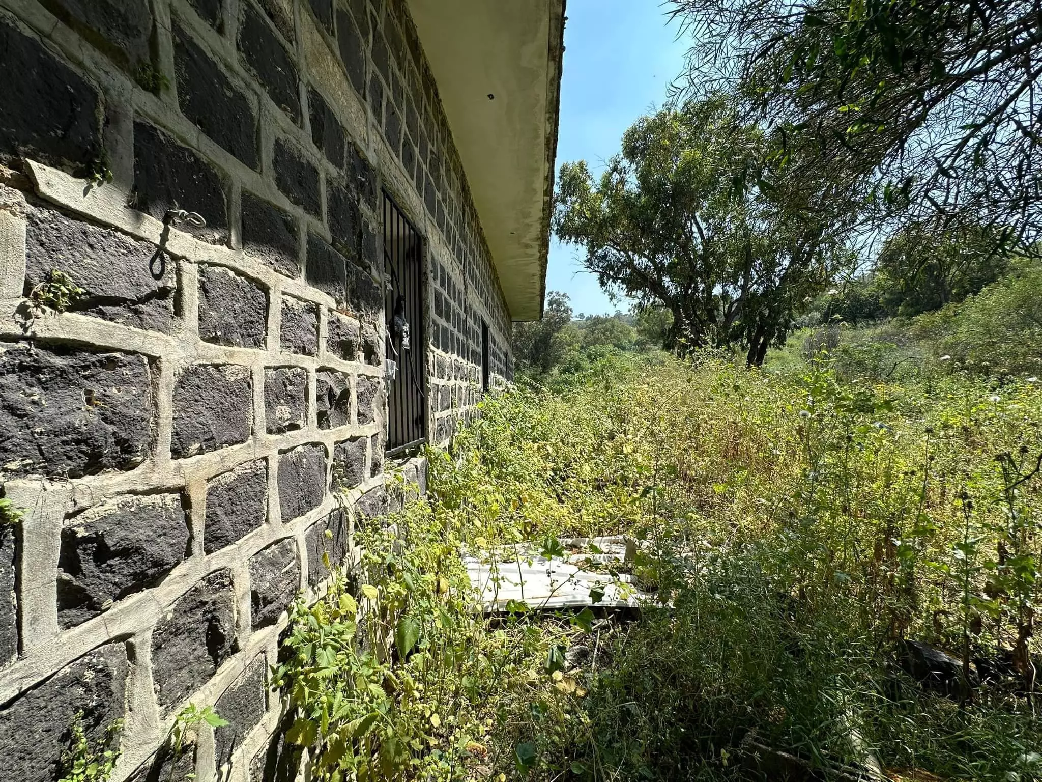
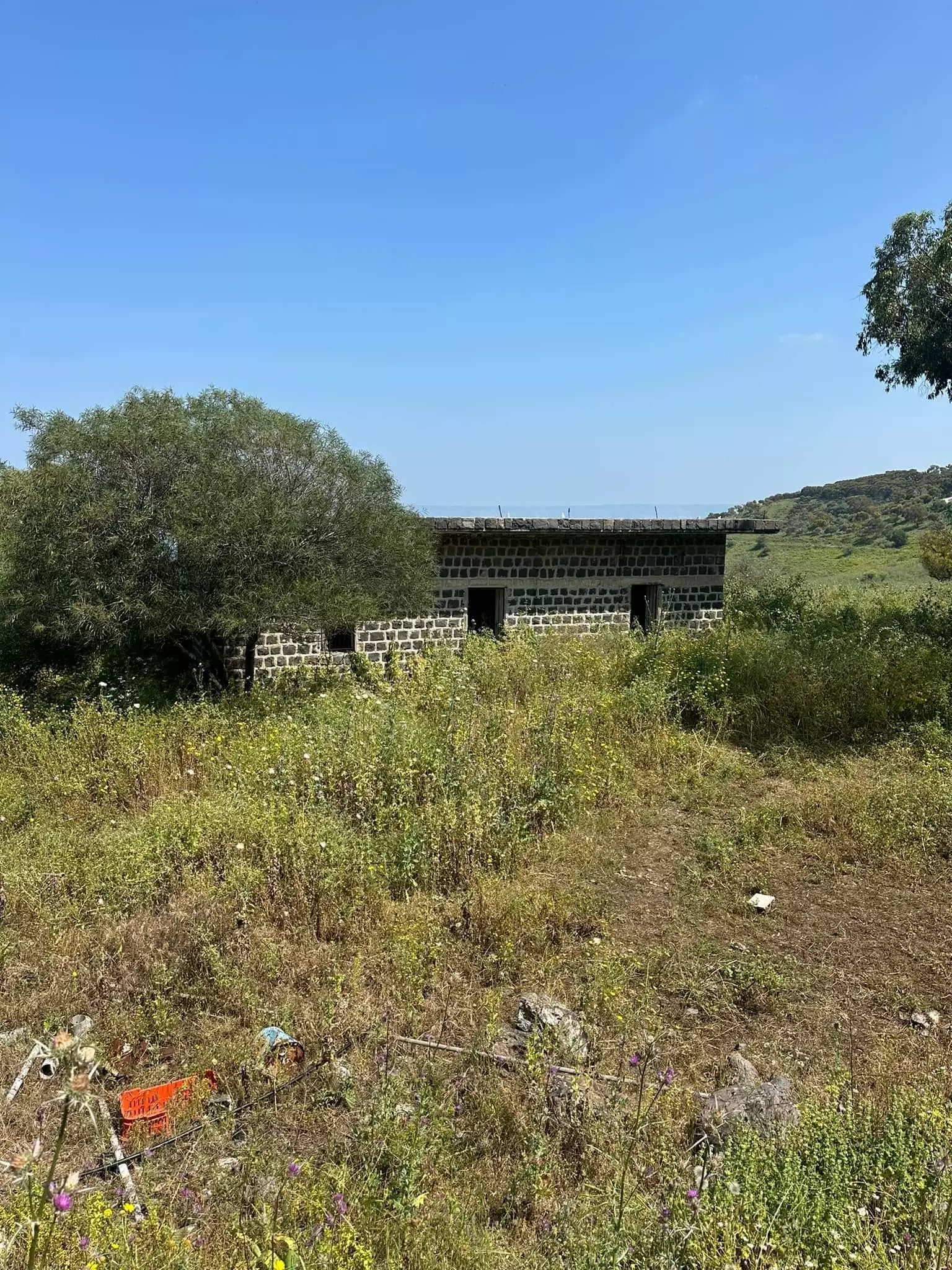
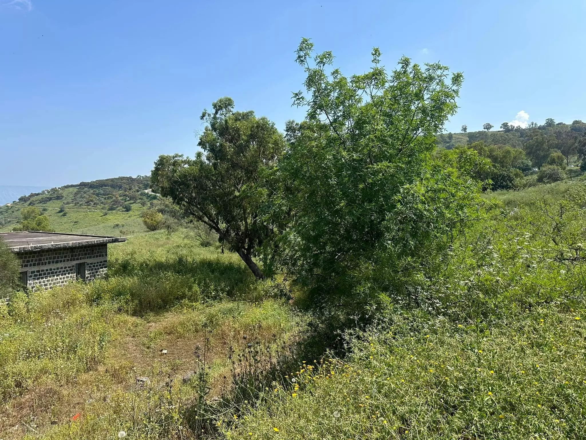
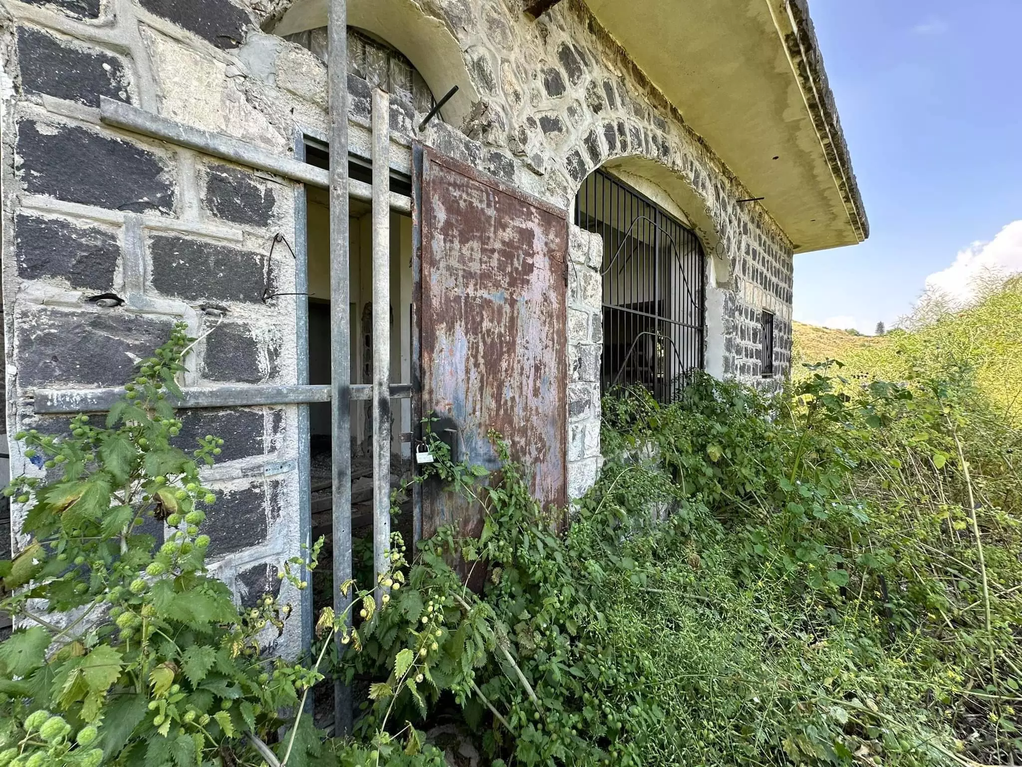
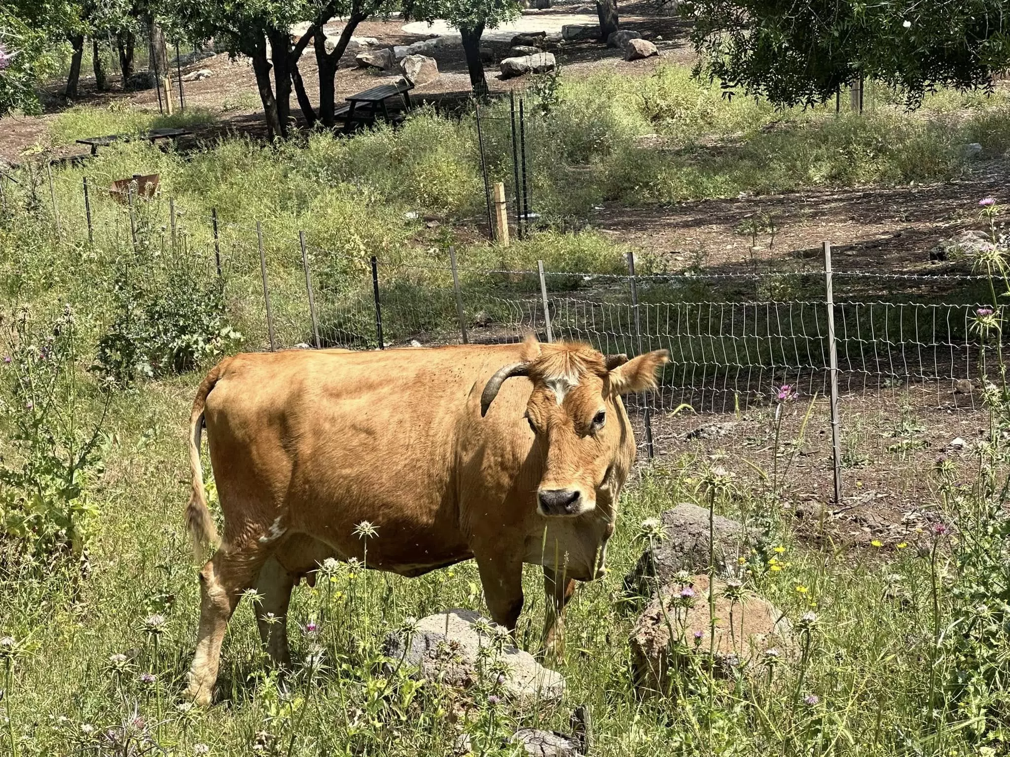
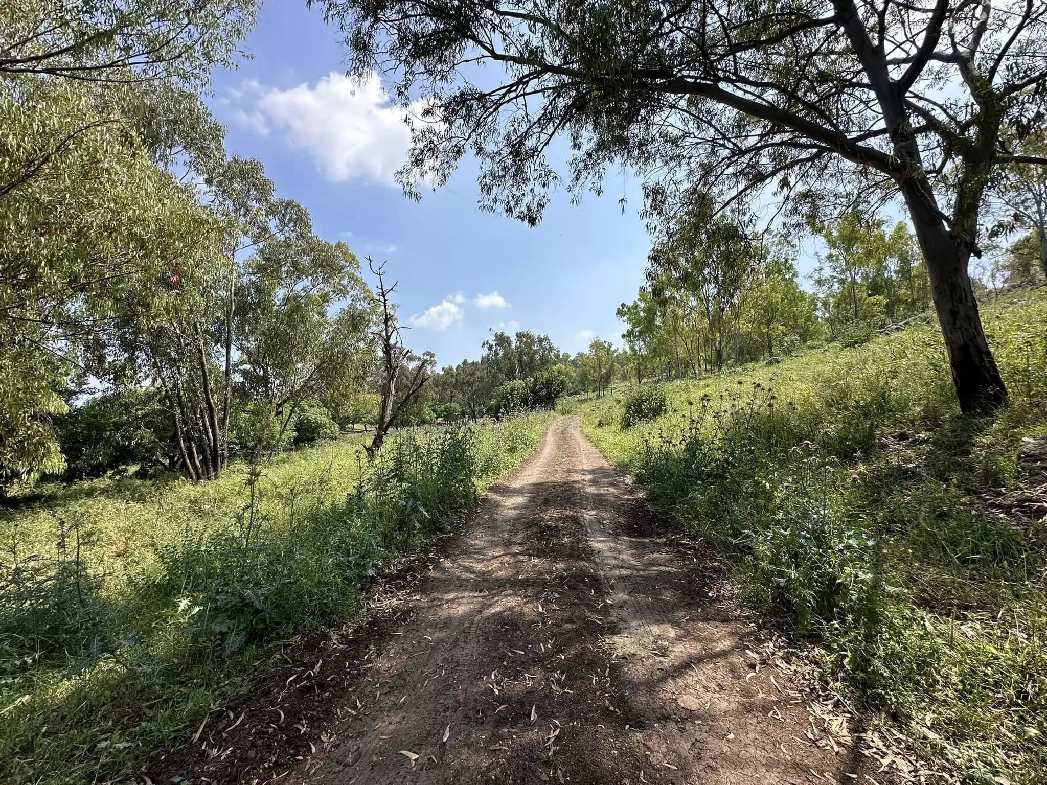
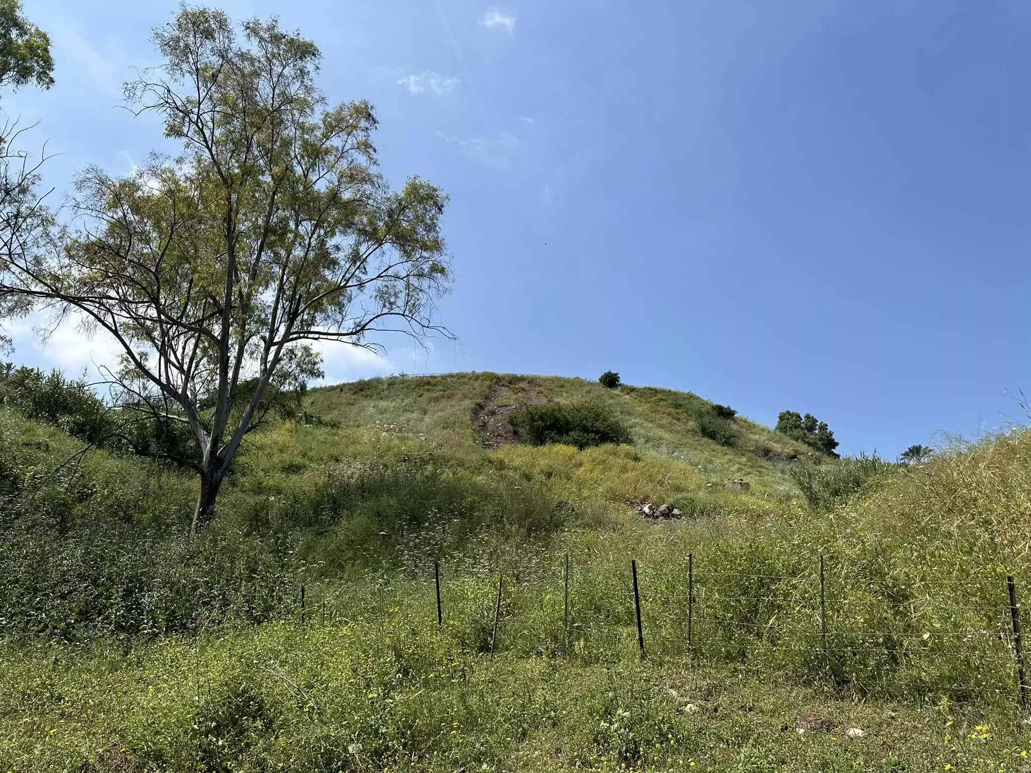
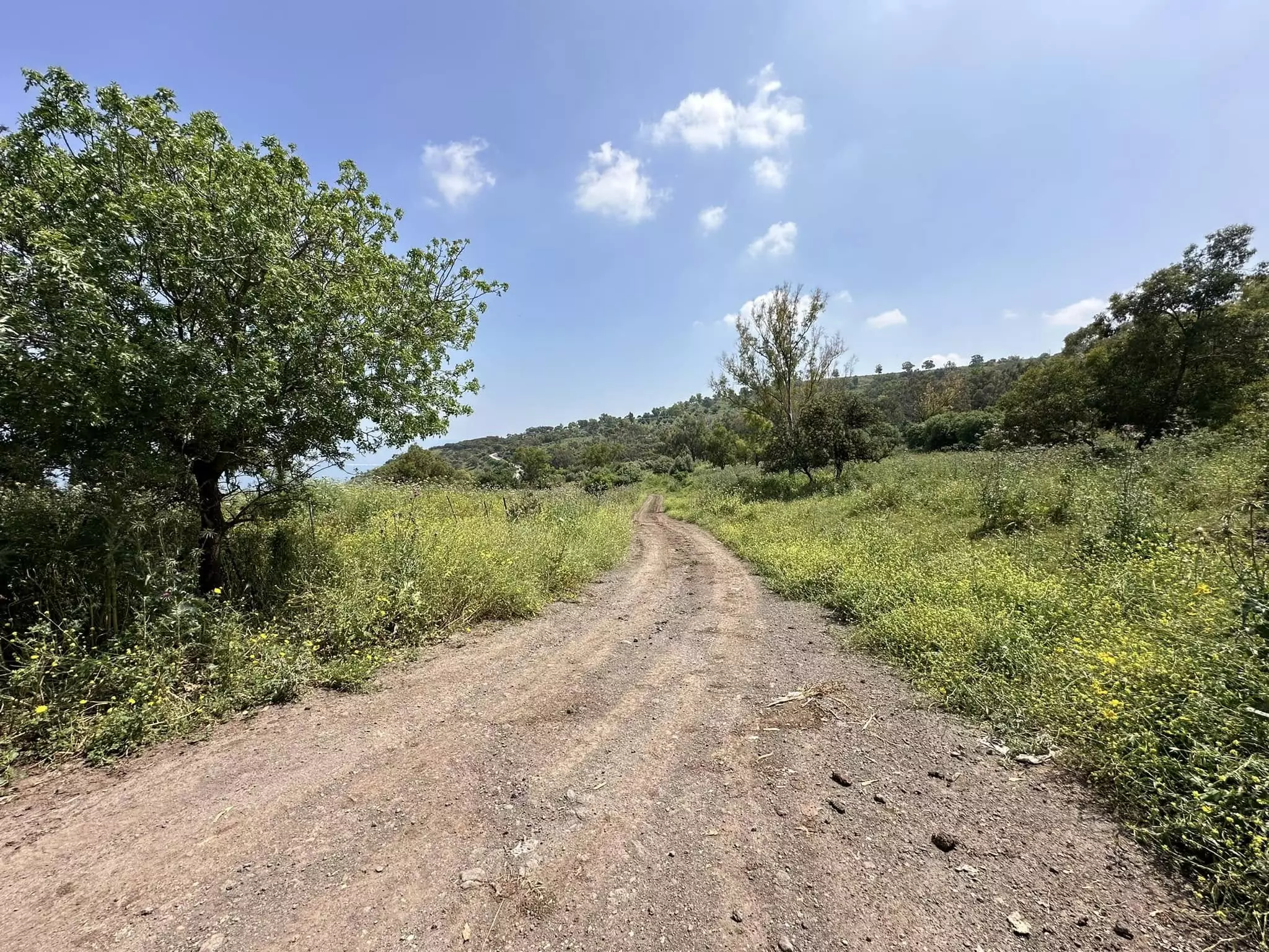
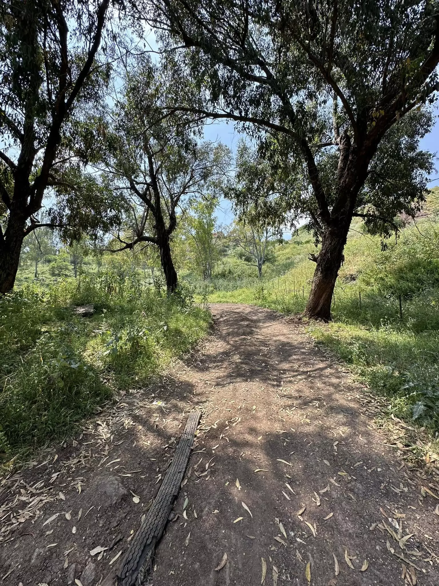
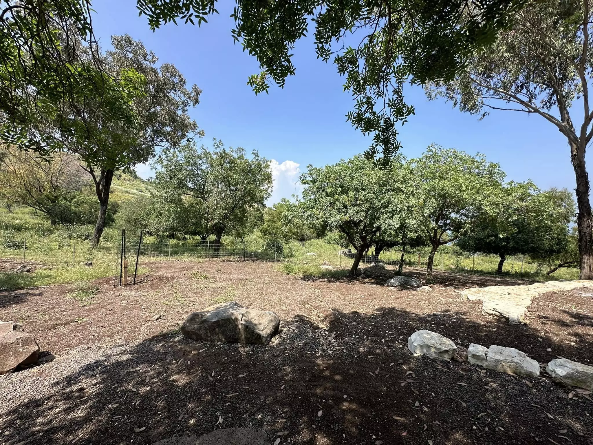
| Village Temains | Nasir al-Din was completely obliterated soon after occupation. | ||||||||||||
| Ethnically Cleansing | Nasir al-Din inhabitants were completely ethnically cleansed. | ||||||||||||
| Pre-Nakba Land Ownership |
**Town Lands' Demarcation Maps |
||||||||||||
| Population |
|
||||||||||||
| Number of Houses |
|
||||||||||||
| Town's Name Through History | The village was named after Nasir al-Din who was killed while battleing the Crusades. | ||||||||||||
| Shrines / Maqams | Nasir al-Din contains two shrines: the 1st is for Nasir al-Din, and the 2nd is for al-Shaykh al-Qaddumi, both died while fighting the Crusades. | ||||||||||||
| Exculsive Jewish Colonies Who Usurped Village Lands |
A section of the Israeli City of Tiberias is on the village site. | ||||||||||||
| Featured Video | |||||||||||||
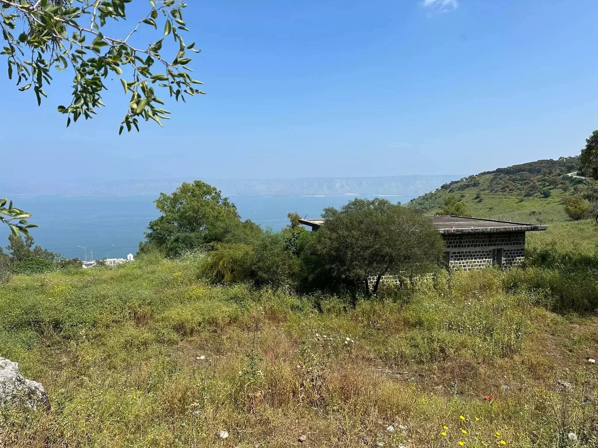
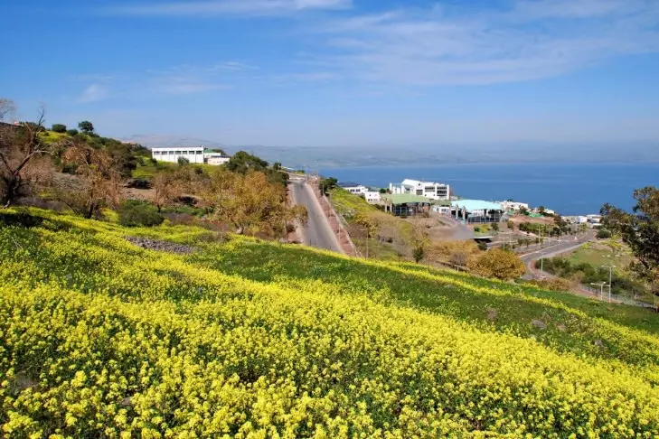
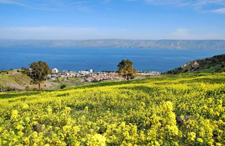
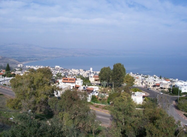
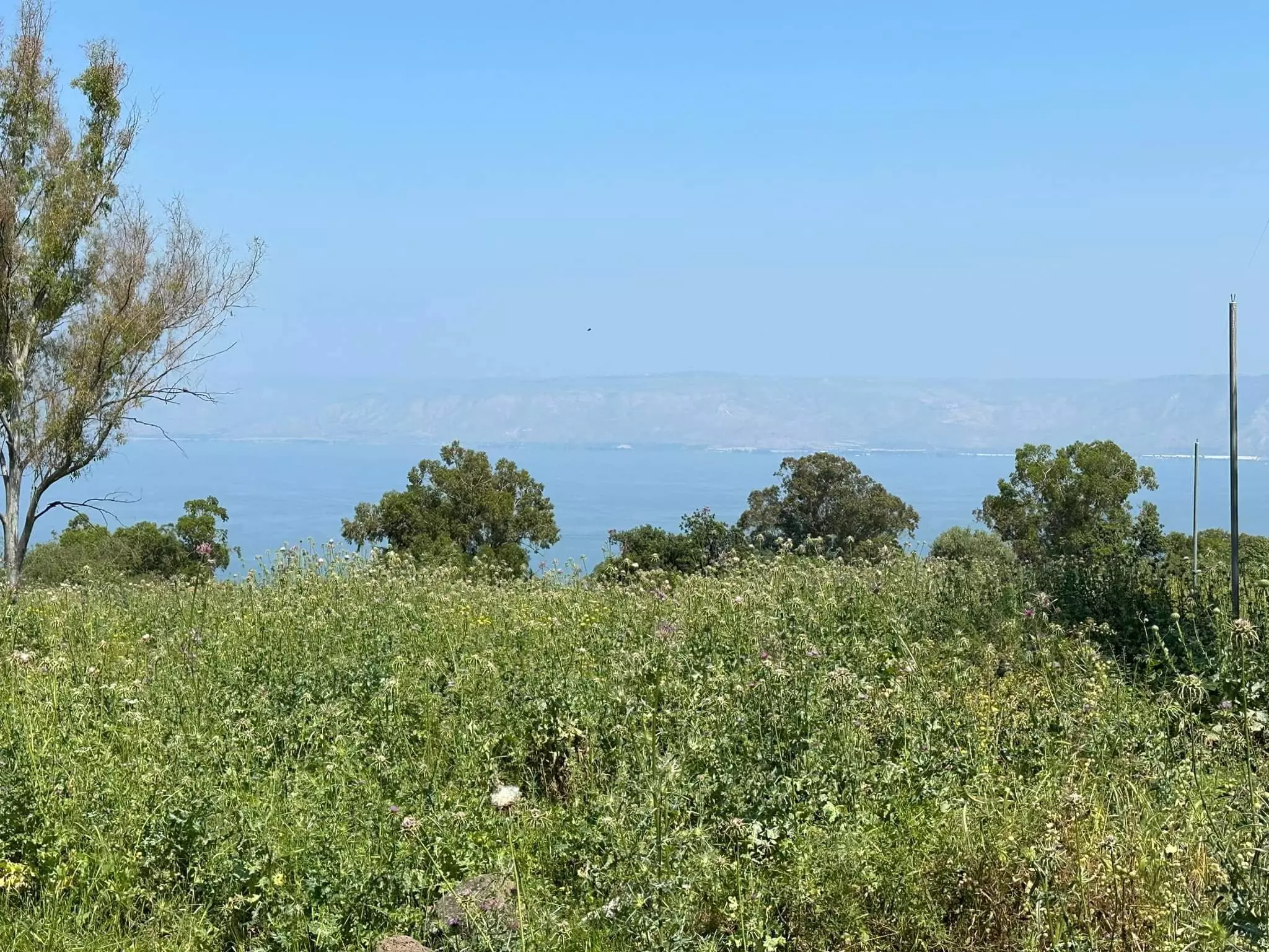
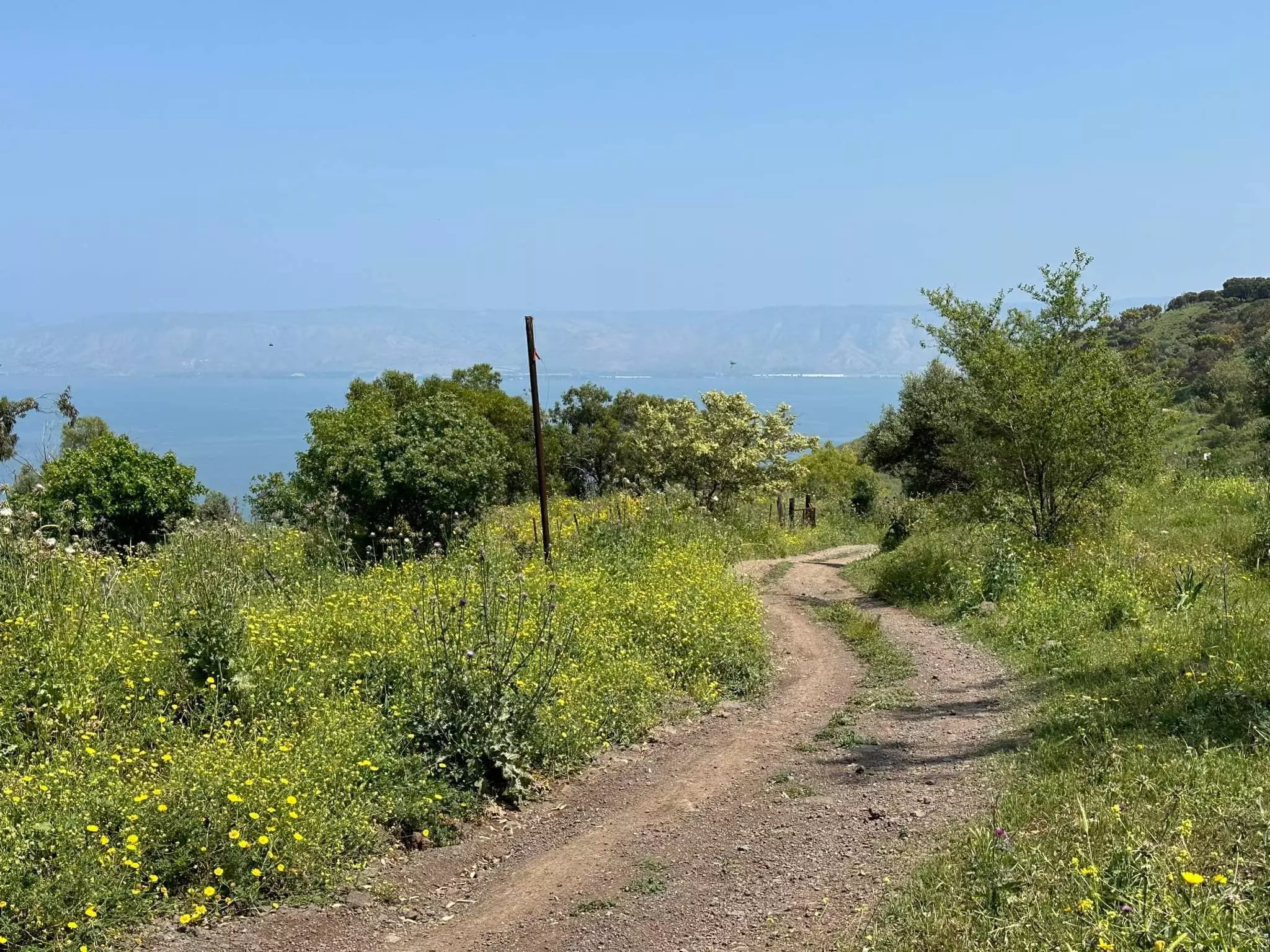
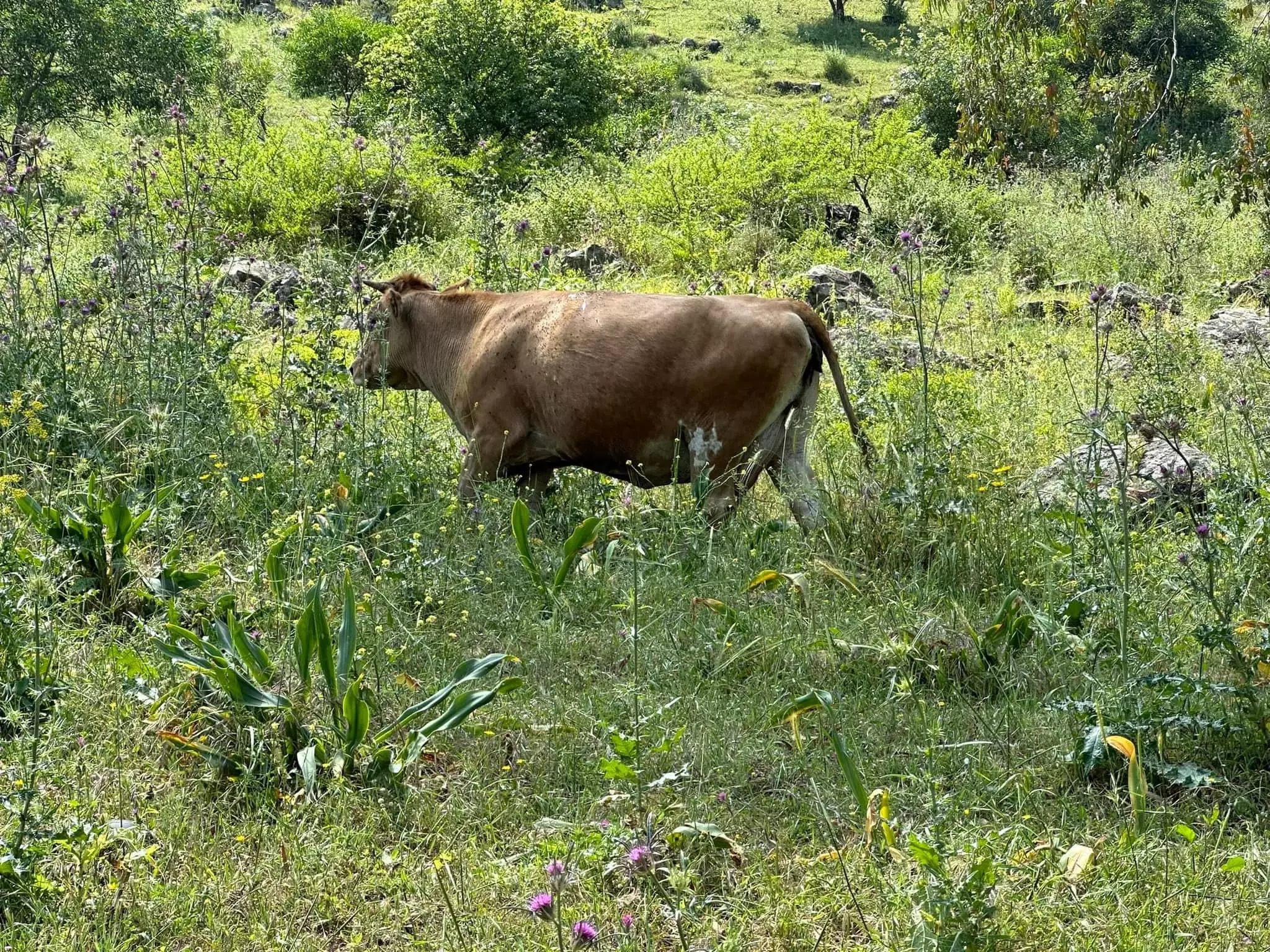
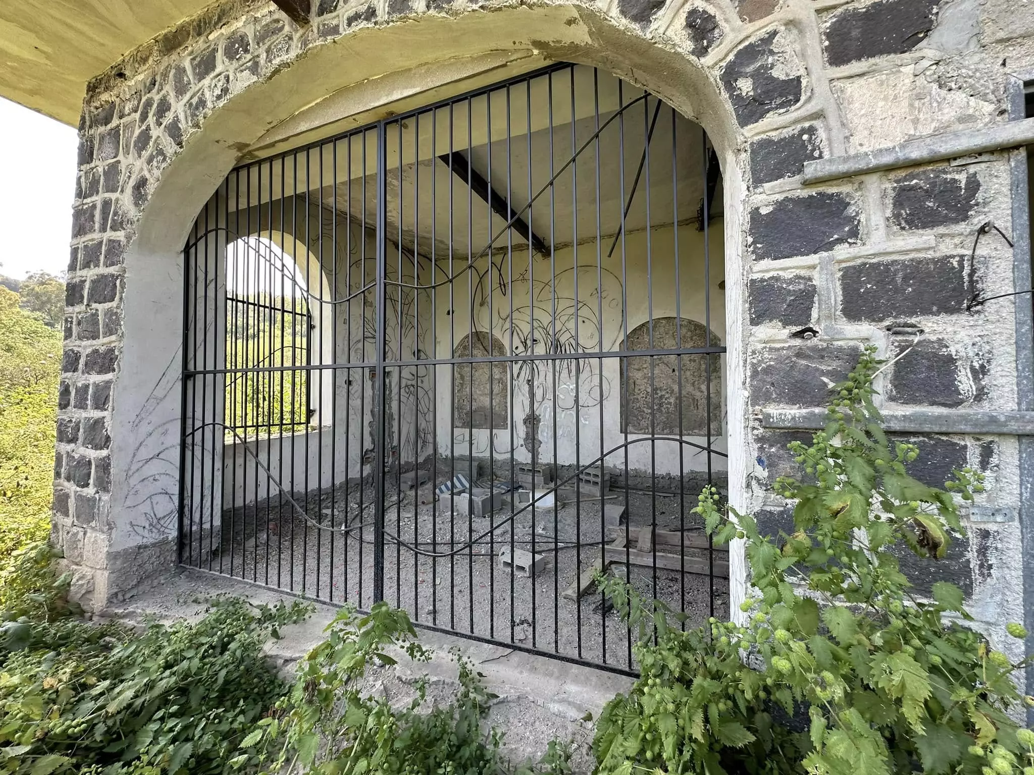
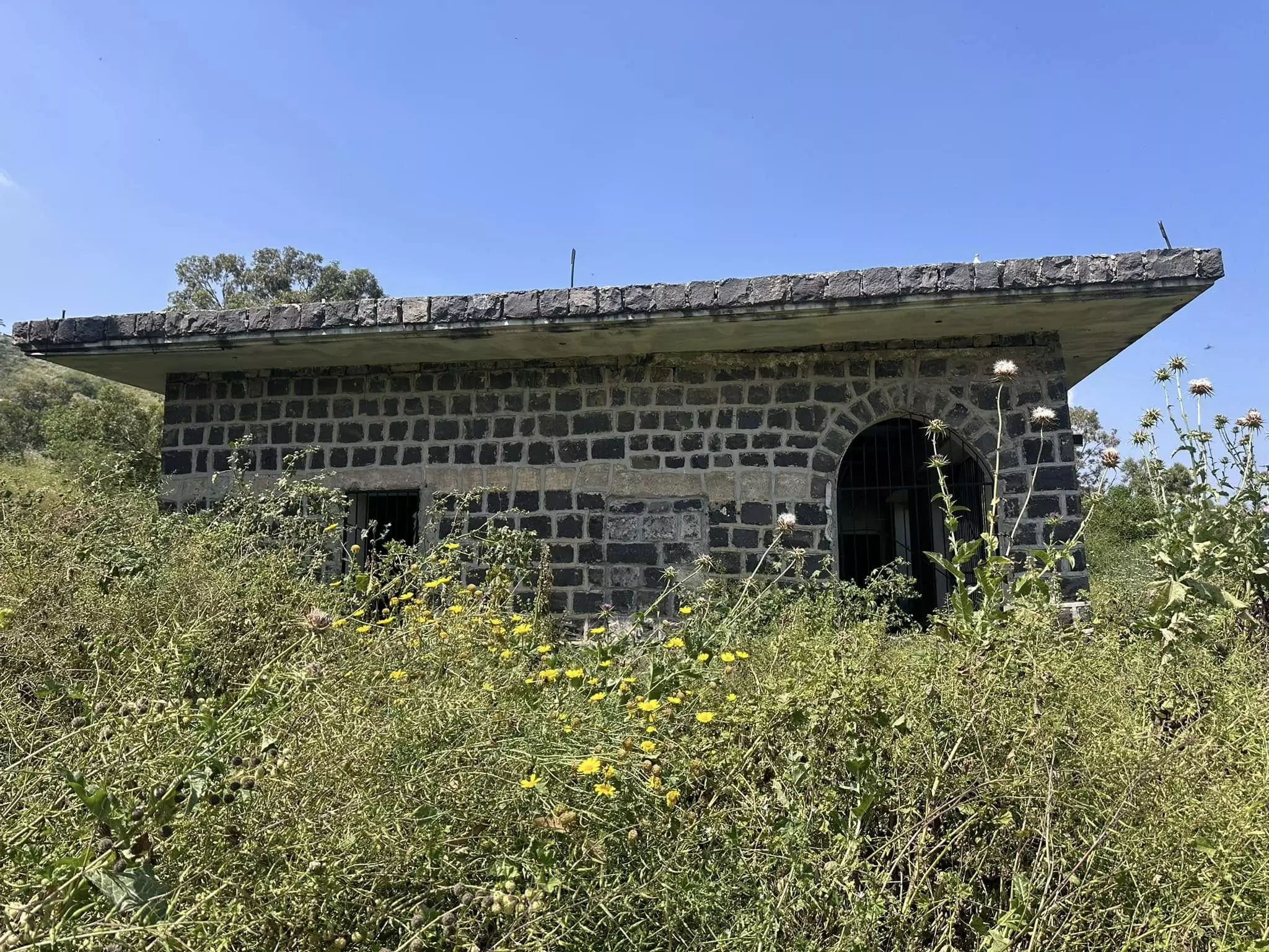
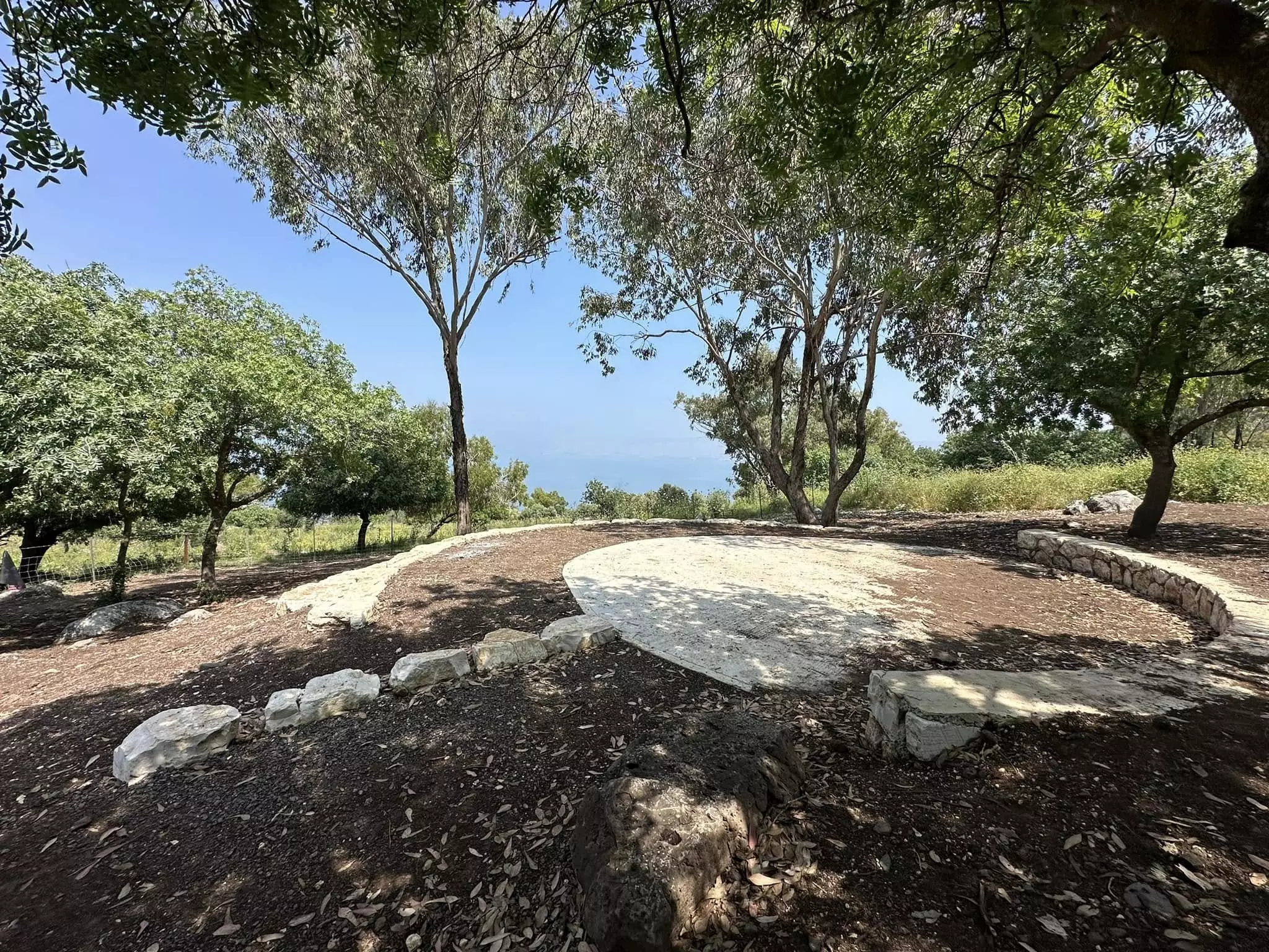
Village Before NakbaThe village was located on the crest of a slope that overlooked, and descended toward, Lake Tiberias and the city of Tiberias. A number of springs were found to the east, southeast, and south. A secondary road linked it to a highway in the northwest that led to Tiberias. The village was named after a Nasir al-Din, whose shrine was built north of the village site and who, according to legend, was killed in a battle against the Crusaders and buried on the site. In addition to the shrine for Nasir al-Din, the village had another shrine on Tall Ma'un, 1 km to the west, for one Shaykh al-Qaddumi who also was said to have been killed by Crusaders. The village had no particular plan; however, its houses were generally scattered in a north-south direction. The people of Nasir al-Din were Muslims. They worked mainly in agriculture and livestock breeding. In 1944/45 a total of 4,172 dunums of the land of the villages of al-Manara and Nasir al-Din was allocated to cereals.Village Occupation and Ethnic CleaningBefore occupying a city, the Haganah often captured one of the nearby villages to make an example of it, inciting fear among the city's residents and creating an outflow of refugees. This tactic was employed in the capture of Tiberias; Nasir al-Din was the village that was singled out for a show of strength. On 11 or 12 April 1948, two platoons of the Golani Brigade that were based in the Jewish quarter of Tiberias moved on the village. Israeli historian Benny Morris writes that 'Some non-combatants were apparently killed and some houses destroyed. Most of the population fled to Lubiya or to Tiberias, from where British troops evacuated them to Lubiya.'More explicit accounts of the early April attack are given by two Palestinian sources. Palestinian historian Nafez Nazzal quotes eyewitnesses who state that all of the village's houses were destroyed, some inhabitants (including women and children) were killed, and the rest were expelled. He cites the names of seven villagers killed in the struggle. Palestinian historian 'Arif al-'Arif states that ten people were killed and the houses of the village were burned. An official British communique quoted in the Palestinian daily Filastin states that eight men, one woman, and an unspecified number of children were killed during the onslaught. Filastin confirms that stone houses were blown up and mud houses were burned by the attackers. The arrival of the terrorized refugees undetermined morale in Tiberias. The occupation of the village also effectively isolated Tiberias from the large nearby village of Lubya, thus tightening the noose around the town. [[F:13/4/48, 14/4/48; M:71; N:29; R:205; S:1569]] Morris claims that some people remained in the village even after its fall, but that they were made to leave by 23 April. The circumstances of their expulsion are unclear. Zionists Colonies on Village LandsA section of the city of Tiberias is on the village site.Village TodayThere is no visible sign of the former village. Residential buildings that belong to the city of Tiberias have been erected on parts of the village site and land. Portions of the village land have not been developed and are used as grazing areas by Israelis.SourceDr. Walid al-Khalidi, 1992: All That Remains. |
|||||||||||||
| Related Maps | Town Lands' Demarcation Maps خرائط للقضاء توضح حدود القرى والاودية Town's map on MapQuest View from satellite Help us map this town at WikiMapia |
||||||||||||
| Related Links | Wikipedia's Page Google Search Google For Images Google For Videos |
||||||||||||
| More Information | في كتاب كي لا ننسى في كتاب بلادنا فلسطين |
||||||||||||
- موقع القريه
Posted by abu raya - موقع القريه
Posted by abu raya - موقع القريه مغطى بالاعشاب
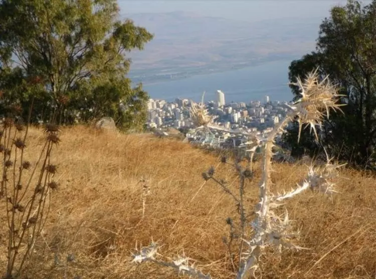
Posted by abu raya - نظره من موقع القريه باتجاه طبريا
Posted by abu raya - المتبقي من القريه
Posted by abu raya - موقع القريه
Posted by abu raya - الطبيعه في القريه
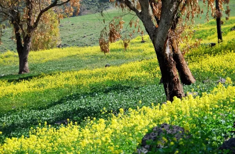
Posted by abu raya - That is how the "civilized" erased and replaced us: Nasir al-Din was completely obliterated except for a house, as you see. The colonizers mostly use the land for pasture -- نصر الدين باتت أثر بعد عين. من هنا مر الهمجّ
- That is how the "civilized" erased and replaced us: Nasir al-Din was completely obliterated except for a house, as you see. The colonizers mostly use the land for pasture -- نصر الدين باتت أثر بعد عين. من هنا مر الهمجّ #2
- That is how the "civilized" erased and replaced us: Nasir al-Din was completely obliterated except for a house, as you see. The colonizers mostly use the land for pasture -- نصر الدين باتت أثر بعد عين. من هنا مر الهمجّ #3
- That is how the "civilized" erased and replaced us: Nasir al-Din was completely obliterated except for a house, as you see. The colonizers mostly use the land for pasture -- نصر الدين باتت أثر بعد عين. من هنا مر الهمجّ #4
- That is how the "civilized" erased and replaced us: Nasir al-Din was completely obliterated except for a house, as you see. The colonizers mostly use the land for pasture -- نصر الدين باتت أثر بعد عين. من هنا مر الهمجّ #5
- That is how the "civilized" erased and replaced us: Nasir al-Din was completely obliterated except for a house, as you see. The colonizers mostly use the land for pasture -- نصر الدين باتت أثر بعد عين. من هنا مر الهمجّ #6
- That is how the "civilized" erased and replaced us: Nasir al-Din was completely obliterated except for a house, as you see. The colonizers mostly use the land for pasture -- نصر الدين باتت أثر بعد عين. من هنا مر الهمجّ #7
- That is how the "civilized" erased and replaced us: Nasir al-Din was completely obliterated except for a house, as you see. The colonizers mostly use the land for pasture -- نصر الدين باتت أثر بعد عين. من هنا مر الهمجّ #8
- That is how the "civilized" erased and replaced us: Nasir al-Din was completely obliterated except for a house, as you see. The colonizers mostly use the land for pasture -- نصر الدين باتت أثر بعد عين. من هنا مر الهمجّ #9
- That is how the "civilized" erased and replaced us: Nasir al-Din was completely obliterated except for a house, as you see. The colonizers mostly use the land for pasture -- نصر الدين باتت أثر بعد عين. من هنا مر الهمجّ
- That is how the "civilized" erased and replaced us: Nasir al-Din was completely obliterated except for a house, as you see. The colonizers mostly use the land for pasture -- نصر الدين باتت أثر بعد عين. من هنا مر الهمجّ #2
- That is how the "civilized" erased and replaced us: Nasir al-Din was completely obliterated except for a house, as you see. The colonizers mostly use the land for pasture -- نصر الدين باتت أثر بعد عين. من هنا مر الهمجّ #3
- That is how the "civilized" erased and replaced us: Nasir al-Din was completely obliterated except for a house, as you see. The colonizers mostly use the land for pasture -- نصر الدين باتت أثر بعد عين. من هنا مر الهمجّ #4
- That is how the "civilized" erased and replaced us: Nasir al-Din was completely obliterated except for a house, as you see. The colonizers mostly use the land for pasture -- نصر الدين باتت أثر بعد عين. من هنا مر الهمجّ #5
- That is how the "civilized" erased and replaced us: Nasir al-Din was completely obliterated except for a house, as you see. The colonizers mostly use the land for pasture -- نصر الدين باتت أثر بعد عين. من هنا مر الهمجّ #6
- That is how the "civilized" erased and replaced us: Nasir al-Din was completely obliterated except for a house, as you see. The colonizers mostly use the land for pasture -- نصر الدين باتت أثر بعد عين. من هنا مر الهمجّ #7
- That is how the "civilized" erased and replaced us: Nasir al-Din was completely obliterated except for a house, as you see. The colonizers mostly use the land for pasture -- نصر الدين باتت أثر بعد عين. من هنا مر الهمجّ #8
- That is how the "civilized" erased and replaced us: Nasir al-Din was completely obliterated except for a house, as you see. The colonizers mostly use the land for pasture -- نصر الدين باتت أثر بعد عين. من هنا مر الهمجّ #9
Want to browse more? 80,000 pictures were grouped in these gallaries:
| Display Name | Clan/Hamolah | Country of Residence |
- قرية ناصر الدين جنوب غرب طبريا Duration: 3 min 15 sec
- الذاكرة مفتاح العودة--الحلقة 64- قرية ناصر الدين Duration: 23 min 22 sec
No links have been shared yet, be free to the first to share the first link.
 Fake Valor: Why Did Zionist Jews Hoist Nazis Flag on Their Ships in the 1930s?
What is new?
-
Facts About Oct. 7th Gaza Raid
-
Remined Us Please:: Who Did Rape Who? Palestinians Raped Israelis? Or, was the other way around?
-
When Prof. Edward Said was invited to debate Bibi Netanyahu in the 1980s, watch what happened!
-
Ezra Klein of the NY Times on the "Jewish Race".
-
Abusing Blood Libel!
-
Zionist FAQ: Isn't it true that Palestinians don't want peace? Palestinians never accepted the two-state solution
- Facts about Haavara (Transfer) Agreement between Ben-Gurion & Hitler
-
Haavara FAQs: Why Did Zionist Jews Hoist Nazis' Flags on Their Ships in the 1930s?
-
Dear ChatGPT: Why did the Jewish Agency suppress news of the Holocaust during WWII?
-
Video Playlist: Jews share their DNA tests to end the conflict for good.
-
A Tale of Two Conflicts: Examining the Definition of Genocide
-
Prof. Abraham Polak And The Suppressed History of the Khazars and European Jewry
-
How Ronald Reagan would have framed the genocide in Gaza if he were still alive?
-
Haavara FAQs: Let us do the math: how many German Jews did The Haavara Agreement save?
-
Zionist FAQs: The Hebron Massacre of 1929, "clearly proves" that Palestinians are antisemitic, how could you deny it?
-
Zionist FAQs: Why Anti-Zionist Is Not Antisemitism?
-
Zionist FAQs: Isn't it true that the KGB create Palestinian Nationalism in the early 1960s?
- Zionist FAQs: Muslims are killing Muslims all the time; why are Israeli Jews being singled out in the media?
- Zionist FAQs: How is Israel an apartheid state when 20% of its citizens are Arabs who enjoy full rights?
-
Haavara FAQs: Analysis of Herzl's Uganda Scheme and how it could have saved millions of Jews.
-
Haavara FAQs: Why did Hayim Greenberg describe American Jewry as "morally bankrupt" in early 1943?
-
Haavara FAQs: What if the Evian Conference was a resounding success? What would have been the impact of saving European Jewry on Zionism?
- Haavara FAQs: What if the six million were saved, how that would have impacted the Zionist project?
-
Haavara FAQs: How did Zionist leaders react when Europe's Jews lingered in the DP camps after WWII ended?
-
Why does the American Jewish community repeat lies that David Ben-Gurion had debunked before he died?
-
Who has the power to rename the Tatar/Khazar Gene Marker to Jewish IV?
-
Zionist FAQs: Why won't Egypt, Syria, and Jordan take their people back? Jews are indigenous to Palestine, and Arabs immigrated after Jews developed the country. Arabs should leave.
-
Haavara FAQs: Did Hitler and the Nazis conflate between Judaism and Zionist? If that wasn't case, then why?
-
Haavara FAQs: Winston Churchill and antisemitism, a collection of articles written Churchill.
-
Haavara FAQs: Broken by country, how many Jews survived vs. killed during the Holocaust?
-
Haavara FAQs: Why did European Jews vote with their feet and to immigrated to the Americas, not Palestine, after WWII?
-
Watch this American Jewish Girl describing Israeli Jews' cognitive dissonance like no other in under two minutes
-
Haavara FAQs: When the Nazis went out of their way to hide the Holocaust, Israeli Jews did the exact opposite by broadcasting their genocide of Gazans. But why?
-
Haavara FAQs: How Zionist Jews went out of their to show their appreciation to Nazism and Fascism?
- Haavara FAQs: Why Zionist leaders were against bombing the death camps & the Railroads leading to them?
-
Haavara FAQs: Hitler's message to the British and American people: If Jews are such noble citizens and you care about them, how come you're not letting them in? I will gladly ship them to you at my expense, even on luxury liners!
-
A shortlist of Zionist and Israeli false flag operations in the name Jews.
-
The Most Moral Army
- The Land of Kapos (Israel): Where the brave are boycotted and Kapos walk free.
- Why did early Zionists often named their communal enterprises "colonial"?
- Zionist Relations with Nazi Germany by Faris Glubb
-
Two NY Times advertisements by Zionists in the early 1943 that exposes Zionists' treason at the height of the calamity
- Facts Not Lies about the Palestinian-Israeli Conflict.
- Site's pictures have been categorized
- Campgain Against Lice
- A Survey of Palestine, the official source about Palestine before Nakba produced by the British Mandate; over 1200 pages.
- Satellite View & Google Earth: Over 6,000 placemarks identifying all destroyed towns, W. Bank & Gaza Strip Towns, & refugee camps.
- PalestineRemembered.com and its Nakba Oral History Project were featured on al-Jazeera Satellite TV.
- Nakba Oral History Video Podcast:
 Over 700 Oral History interviews (including 3,500+ hours of recording) can be viewed online.
 - Palestine Village Statistics Project
- Gaza Jail Break
- النسخة العربية للموقع الان متوفرة
- Videos: Documenting the destroyed villages in video: Tracing all that remains since Nakba.
- Videos: Responding to Zionist Propaganda
- Interview: The ethnic cleansing of Palestine: George Galloway interviews Israeli Historian Ilan Pappe.
- For Palestinians, memory matters. It provides a blueprint for their future By George Bisharat.
- Zionist FAQ now available in Hebrew שאלות שציונים שואלים, עכשיו בעברית
- Video: The Stephen Walt and John Mearsheimer report on the influence of the Israel Lobby on U.S. Foreign Policy
- The Palestinian-Israeli conflict for beginners
