| PalestineRemembered | About Us | Oral History | العربية | |
| Pictures | Zionist FAQs | Haavara | Maps | |
| Search |
| Camps |
| Districts |
| Acre |
| Baysan |
| Beersheba |
| Bethlehem |
| Gaza |
| Haifa |
| Hebron |
| Jaffa |
| Jericho |
| Jerusalem |
| Jinin |
| Nablus |
| Nazareth |
| Ramallah |
| al-Ramla |
| Safad |
| Tiberias |
| Tulkarm |
| Donate |
| Contact |
| Profile |
| Videos |
|
Prev |
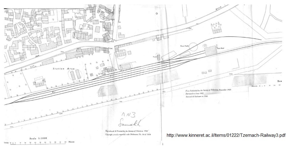
Samakh - سمخ: The area of the train as mapped by the Mandatory Ma pping & Surveying Department in 1945: the station building and the wooden huts close to it are in the centre of the complex, with the goods warehouse on the right. On the right – the water tower, with the tur ntable and locomotive shed on its right (مخطط محطة القطار 1945).0 comment |
Next
العربية |
| Posted by نايف مصطفى الترعاني On March 23, 2017 |
||
| Upload | Prev 97 98 99 100 101 Next | Satellite |


Post Your Comment
*It should be NOTED that your email address won't be shared, and all communications between members will be routed via the website's mail server.