| PalestineRemembered | About Us | Oral History | العربية | |
| Pictures | Zionist FAQs | Haavara | Maps | |
| Search |
| Camps |
| Districts |
| Acre |
| Baysan |
| Beersheba |
| Bethlehem |
| Gaza |
| Haifa |
| Hebron |
| Jaffa |
| Jericho |
| Jerusalem |
| Jinin |
| Nablus |
| Nazareth |
| Ramallah |
| al-Ramla |
| Safad |
| Tiberias |
| Tulkarm |
| Donate |
| Contact |
| Profile |
| Videos |
Welcome To al-Wa'ra al-Sawda', Khirbat - خربة الوعرة السوداء (ח ירבת אל-וערה א-סודא)
|
District of Tiberias
Ethnically cleansed days ago |
العربية Google Earth |
 |
Gallery (91) |
- Statistics & Facts
-
Before & After

- Satellite View
- Articles 3
- Pictures 91
- Oral History 3
- Members 10
- All That Remains
- Wikipedia
- Videos 3
- Guest Book 2
- Links
| Statistic & Fact | Value | ||||||||||
| Occupation Date | April 18, 1948 | ||||||||||
| Distance From District | 7.5 (km) Northeast of Tiberias | ||||||||||
| Elevation | 25 (meters) | ||||||||||
| Before & After Nakba, Click Map For Details |
|||||||||||
|
|||||||||||
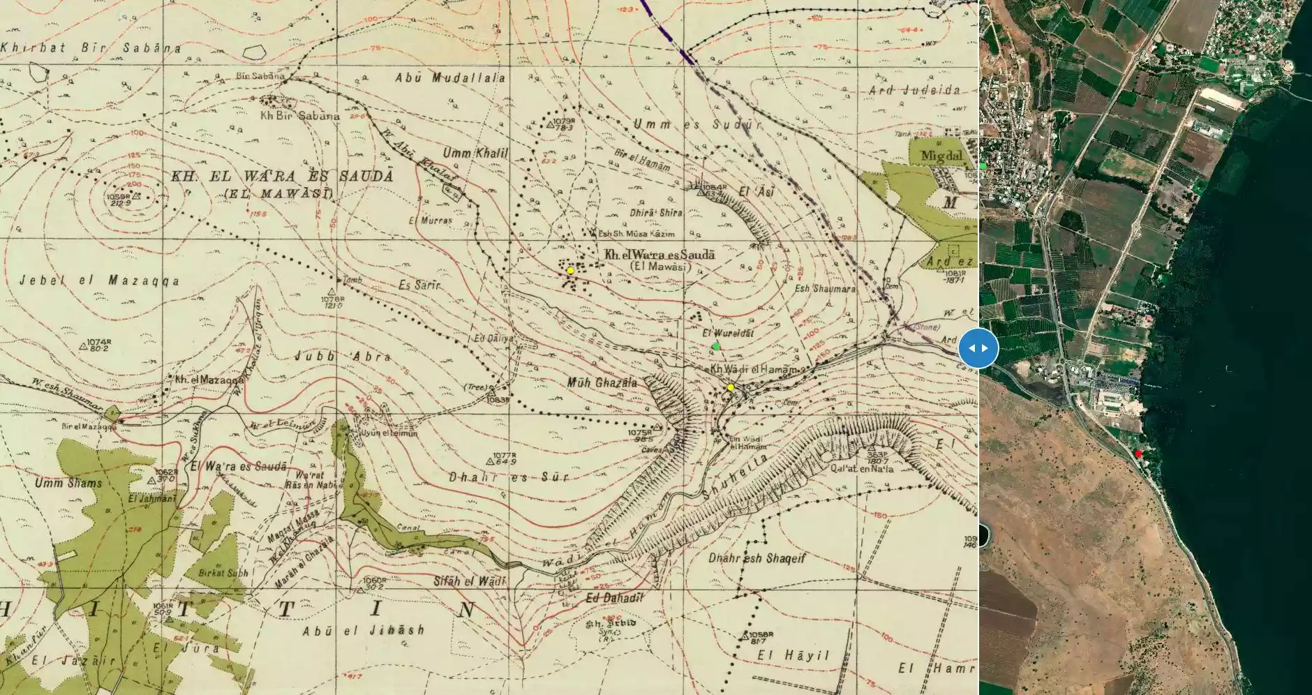
| Map Location | See location #6 on the map View from satellite |
||||||||||
| Military Operation | Possibly Operation Dekal | ||||||||||
| Acts of Terror | Little unknown massacre committed while the village was being occupied. Fifteen plus villagers were rounded up and shot dead. Some villagers who survived the massacre, lived to talk about it in Syria. Further details about this little massacre are missing, so please be free to share any information you may know about it. | ||||||||||
| Refugees' Migration Routes | Some of 'Arab al-Mawasi escaped to Syria and some stayed behind in the inner Galilee. | ||||||||||
| Exodus Cause | Expulsion by Zionist troops | ||||||||||
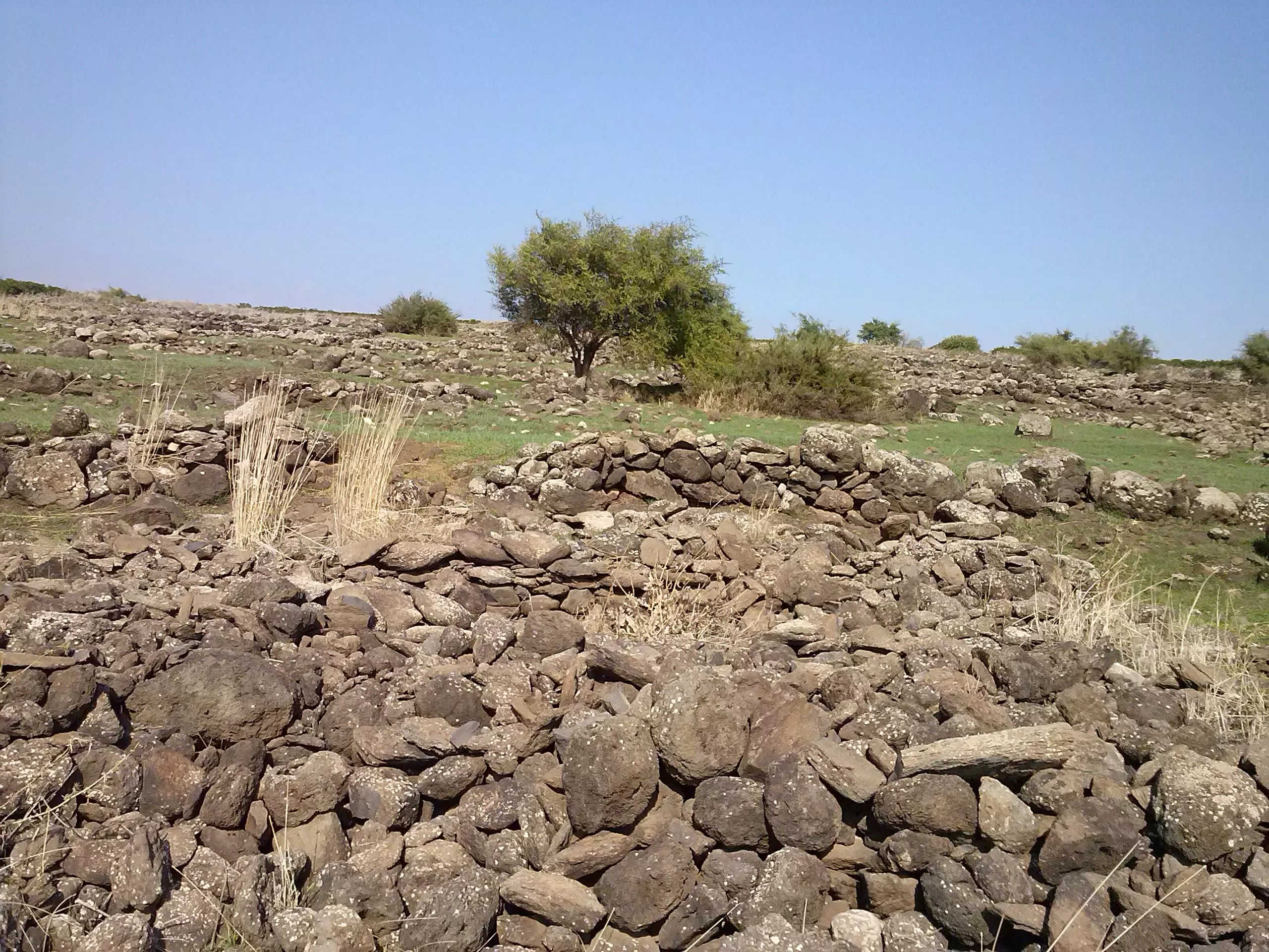
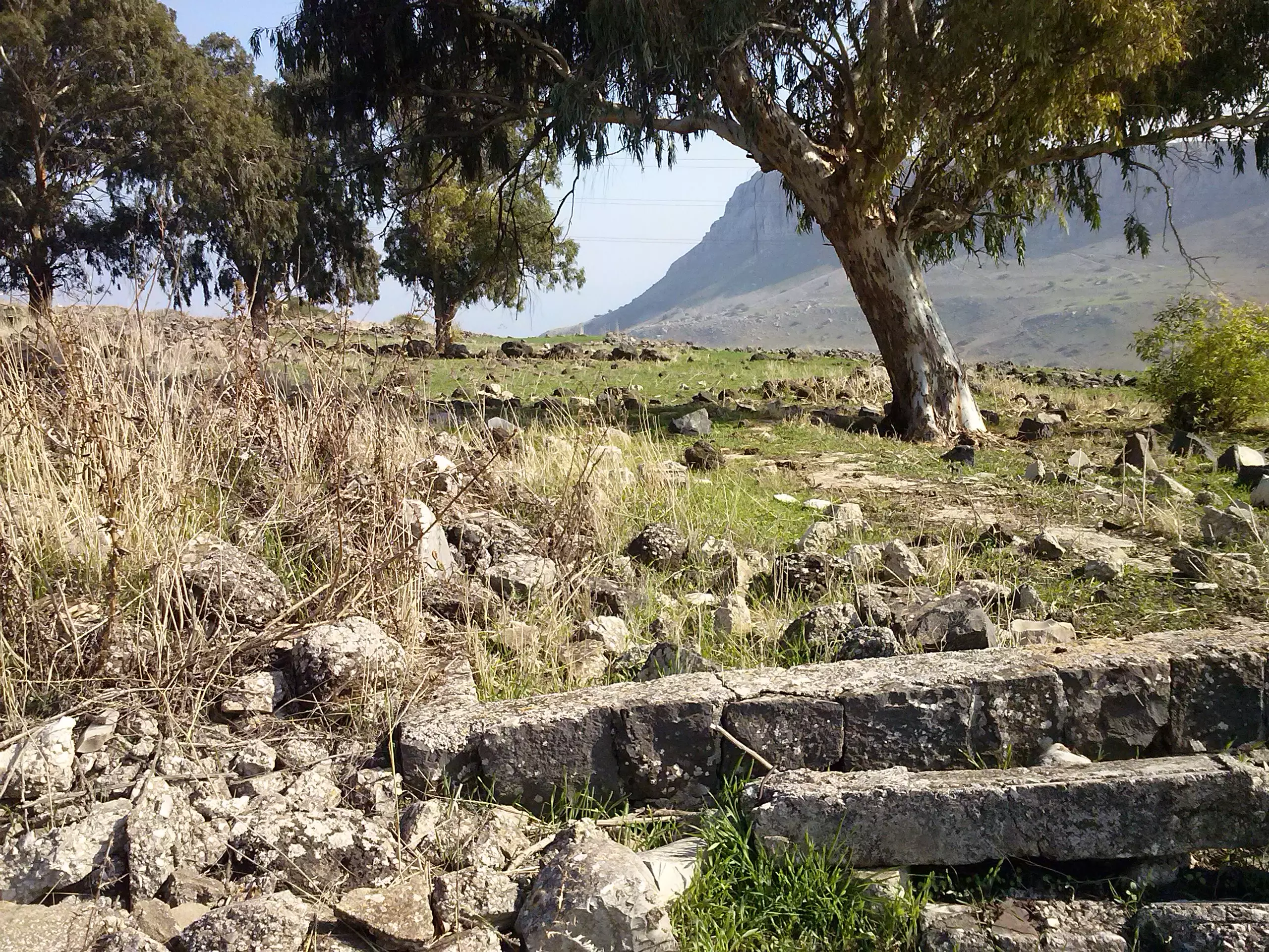
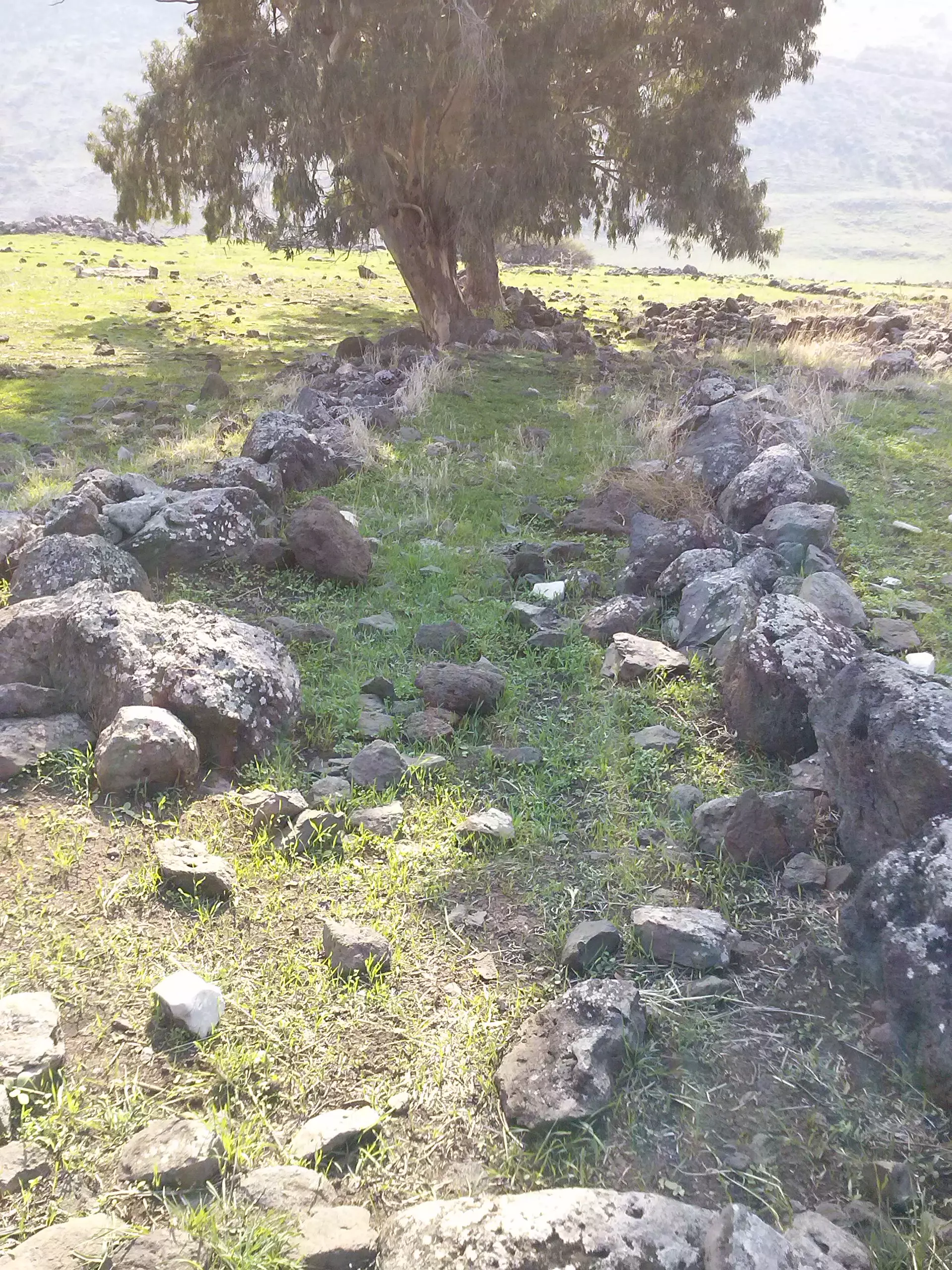
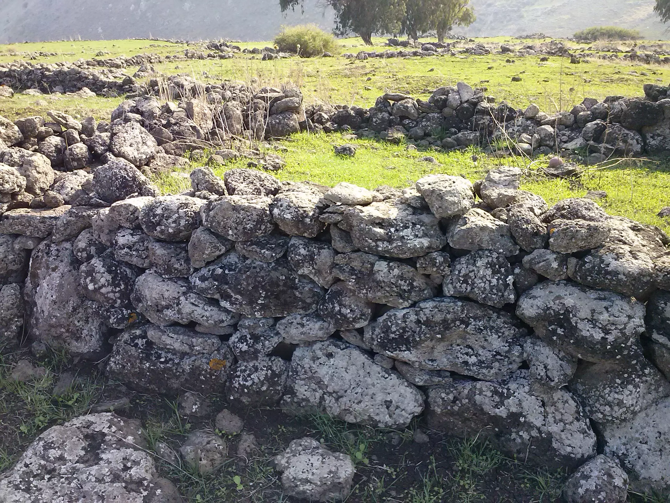
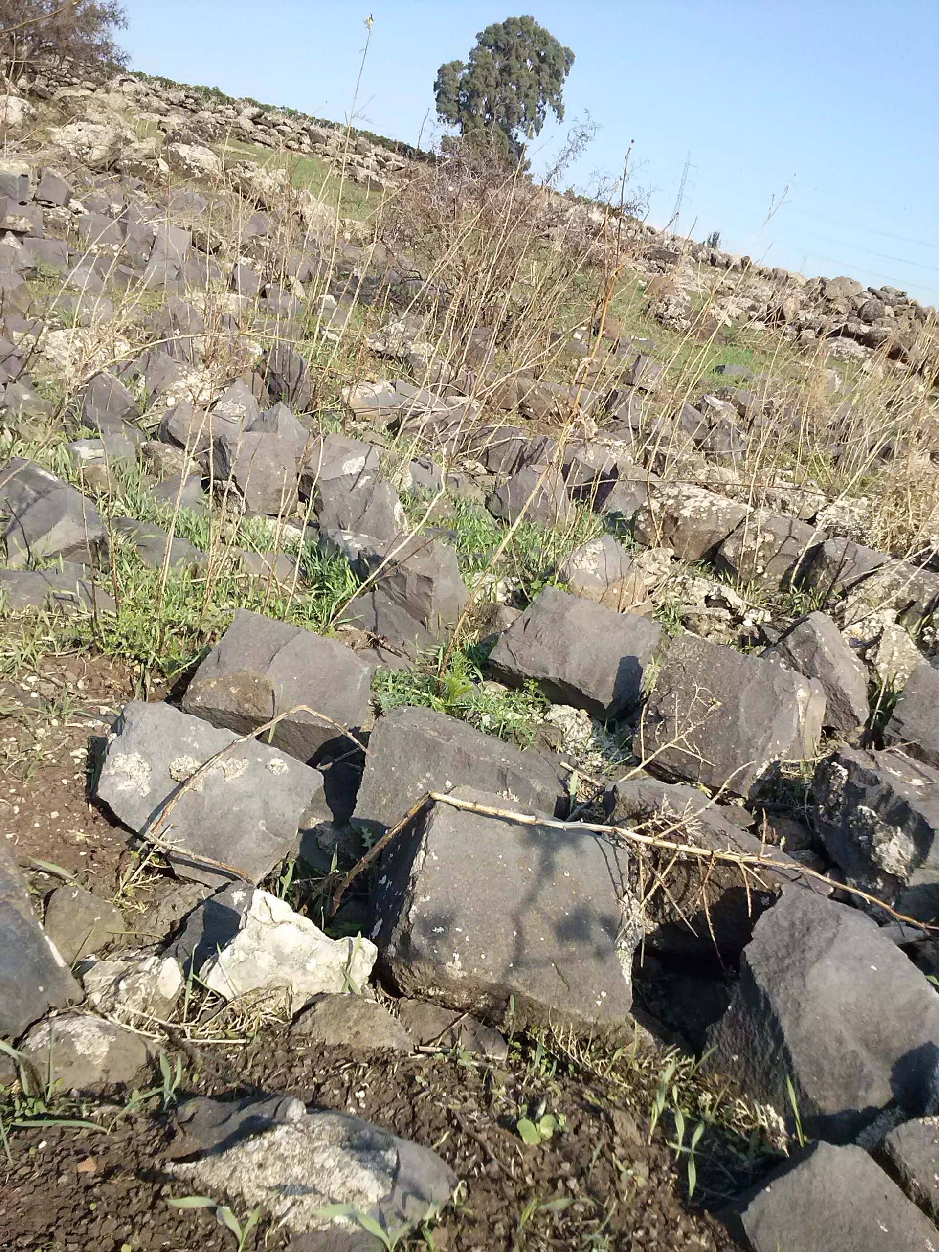
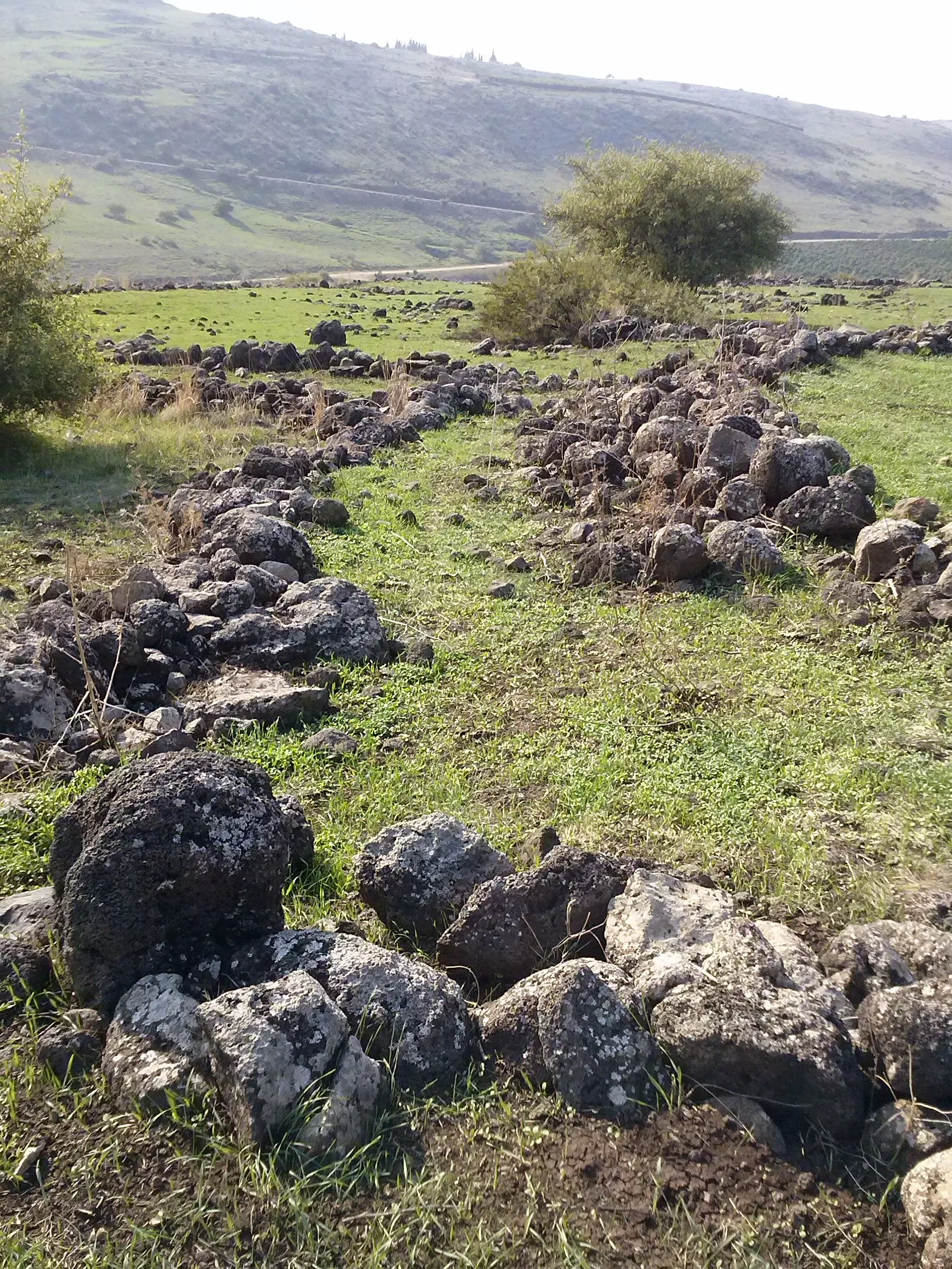
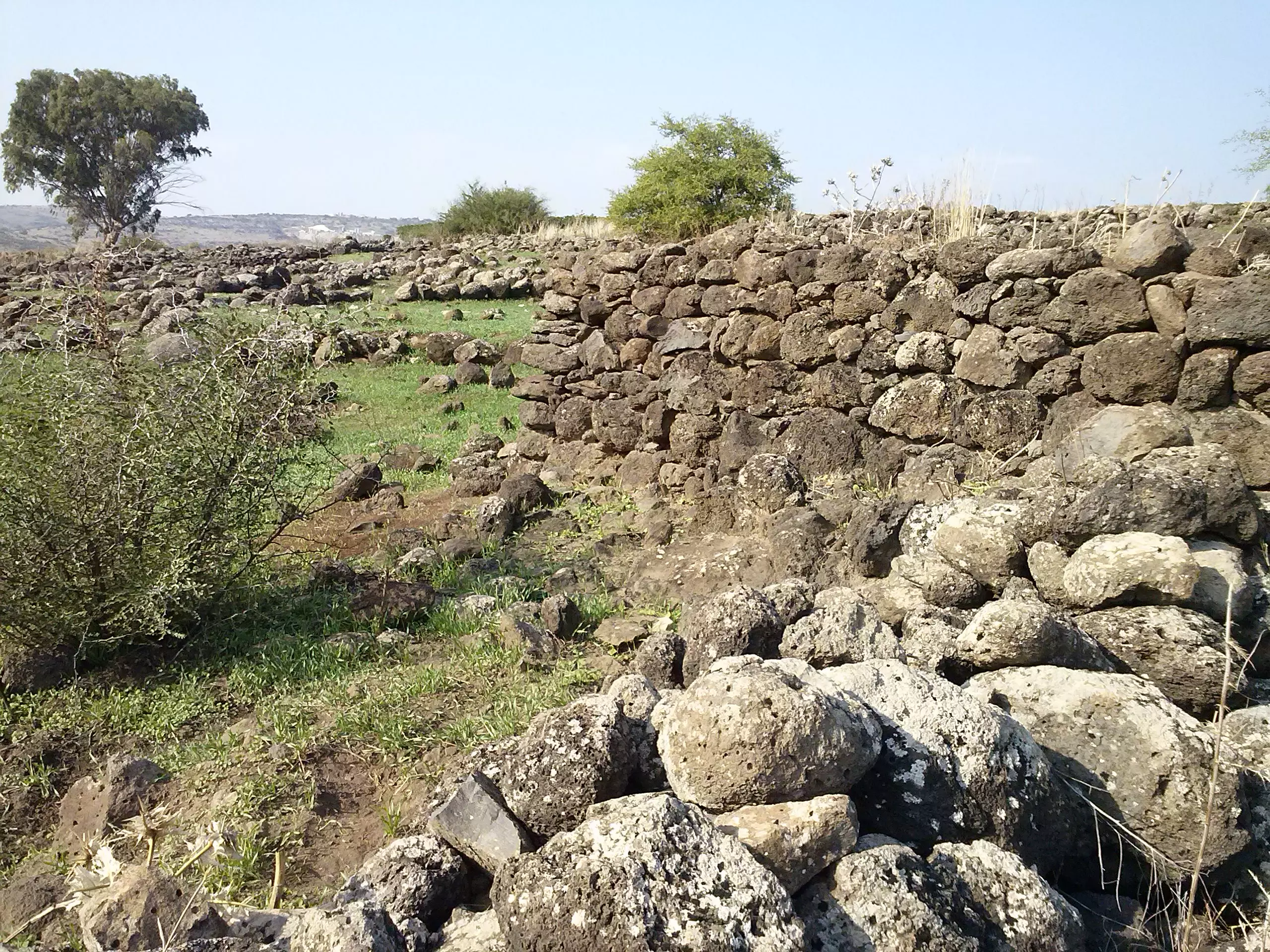
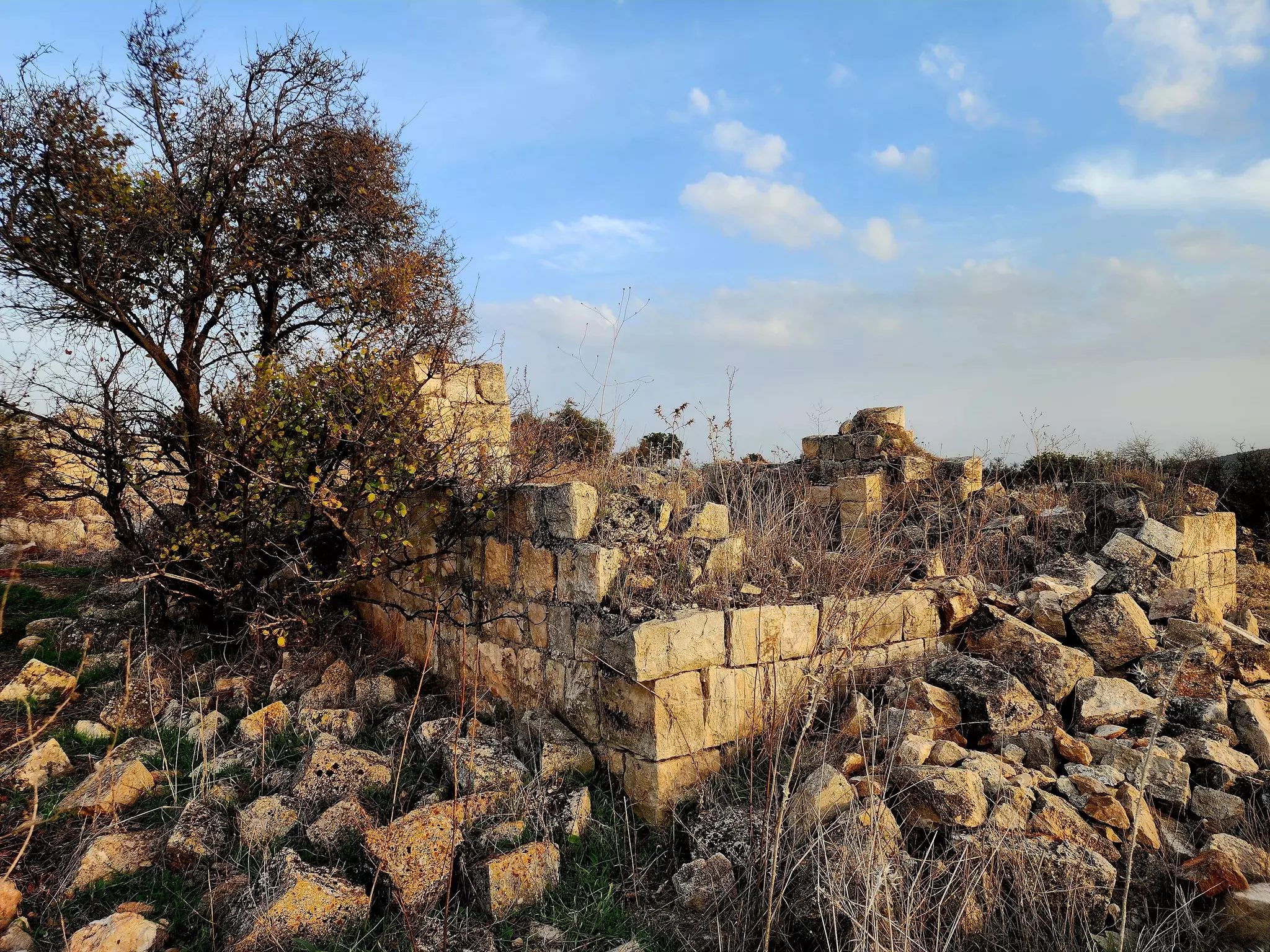
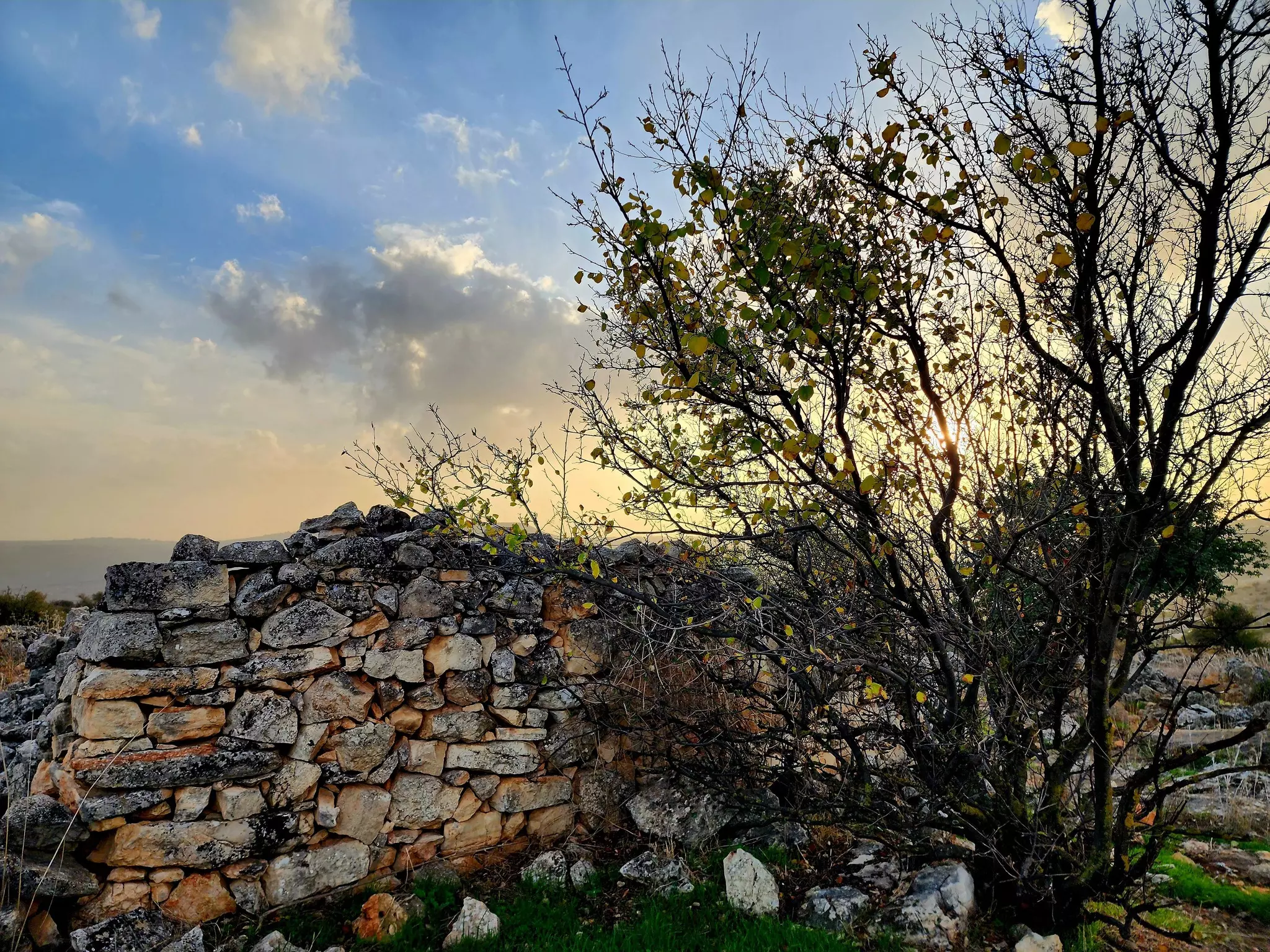
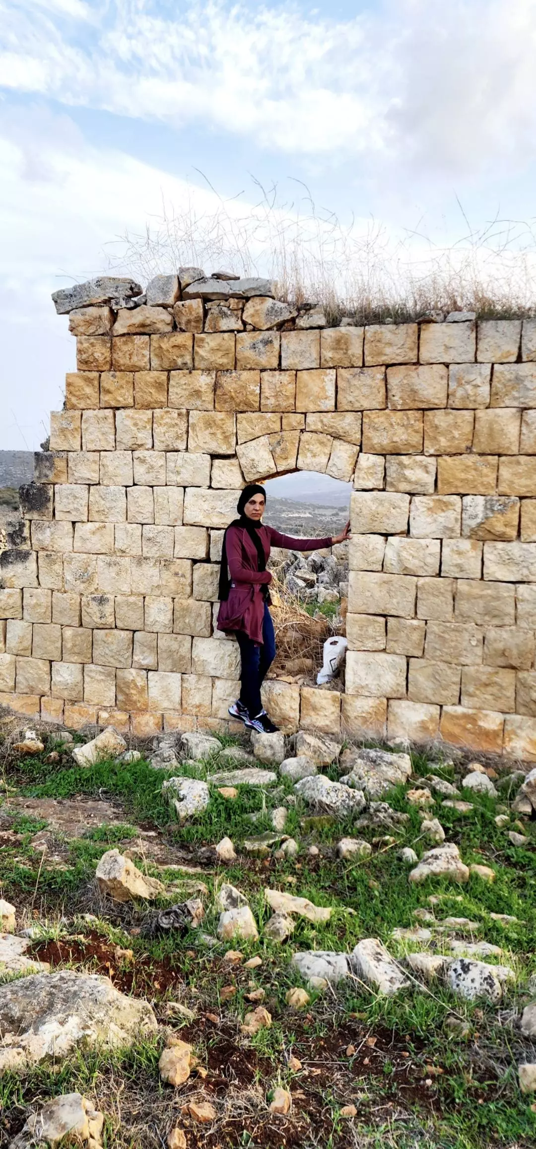
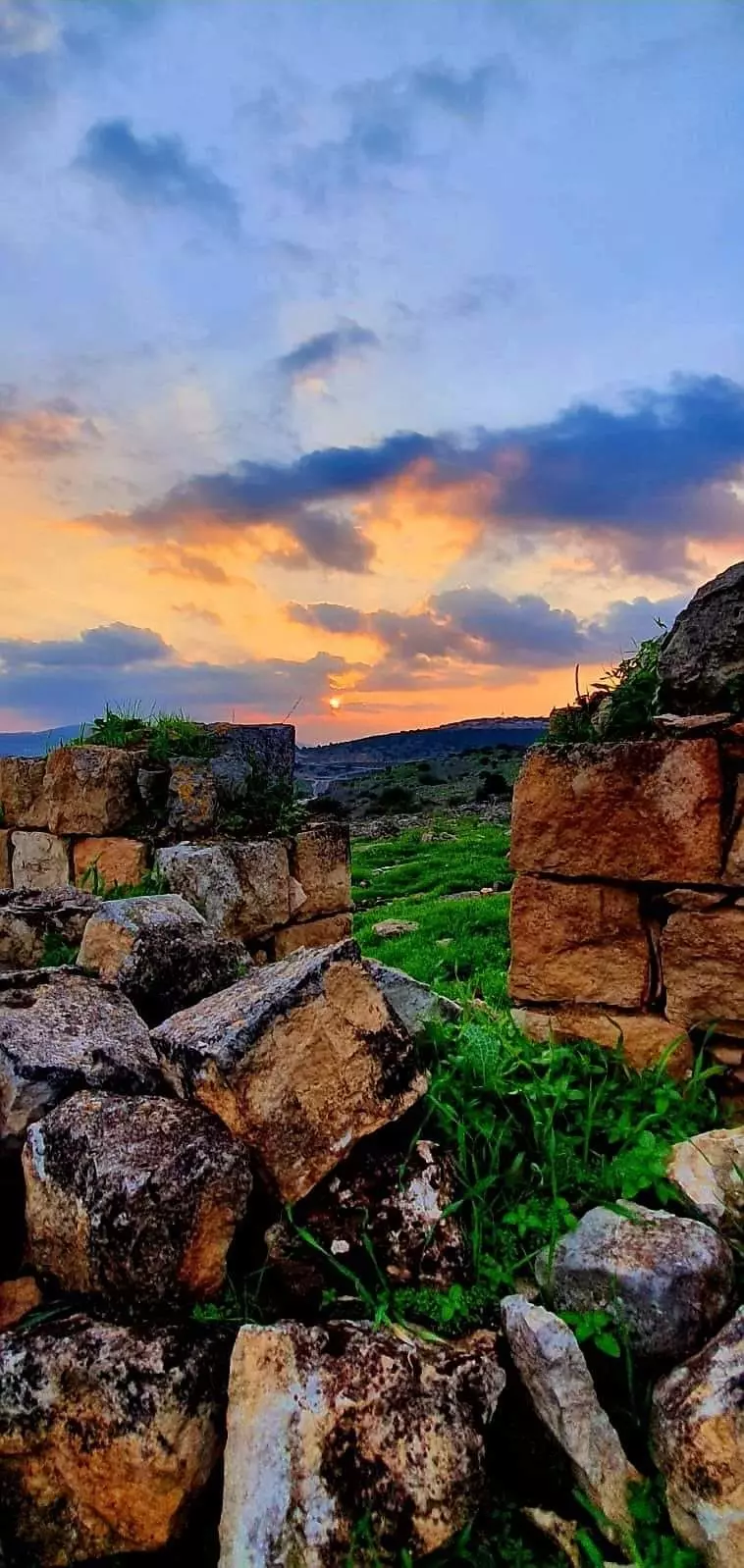
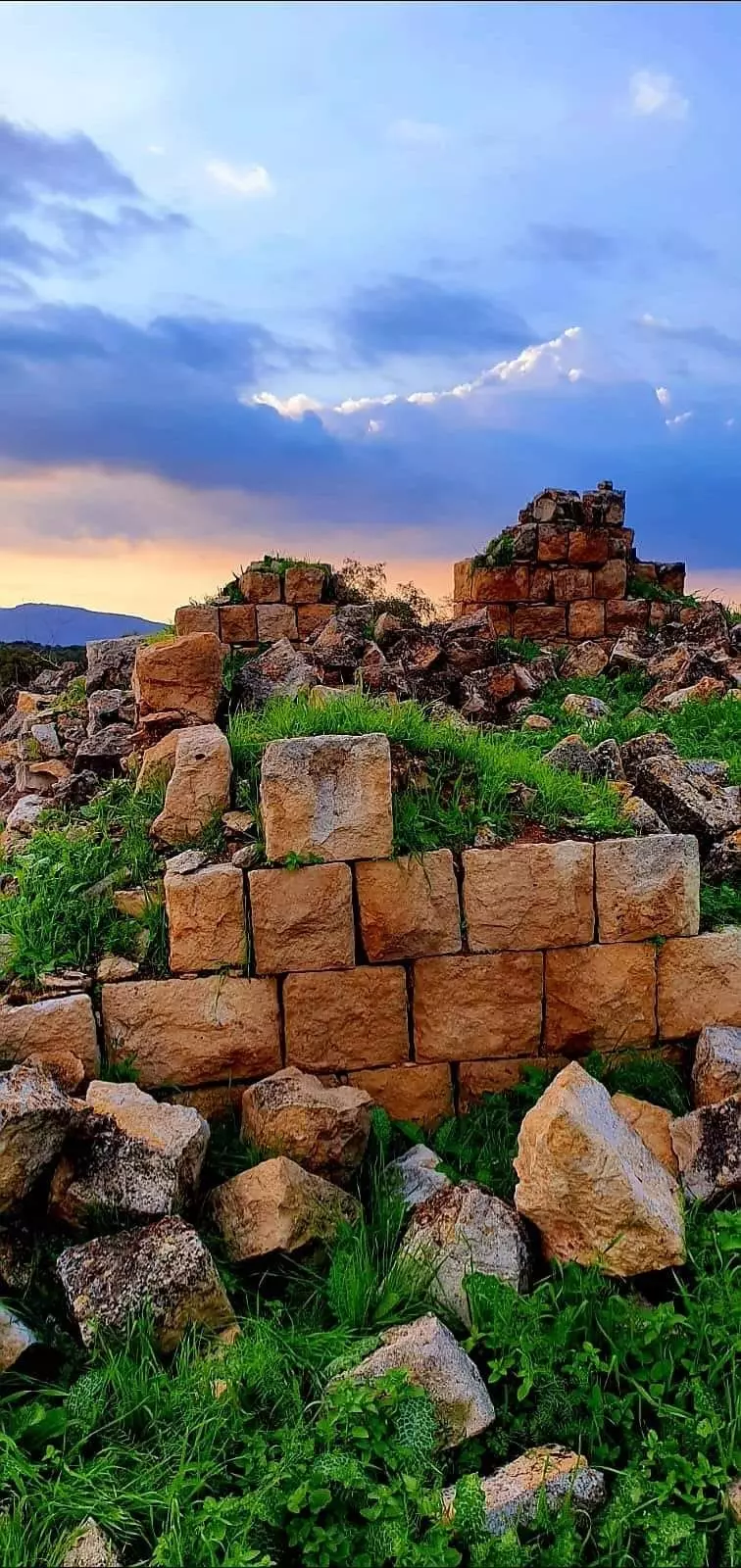
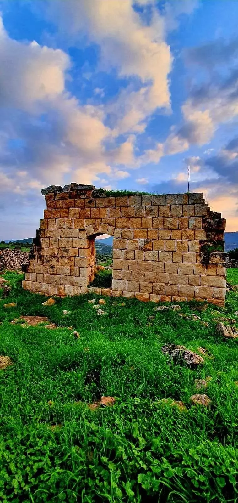
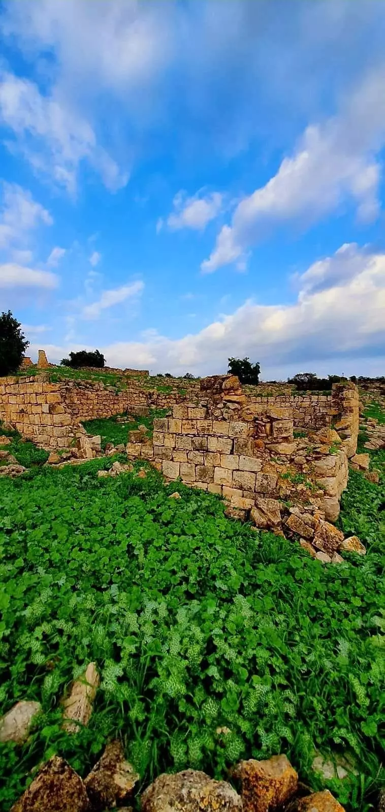
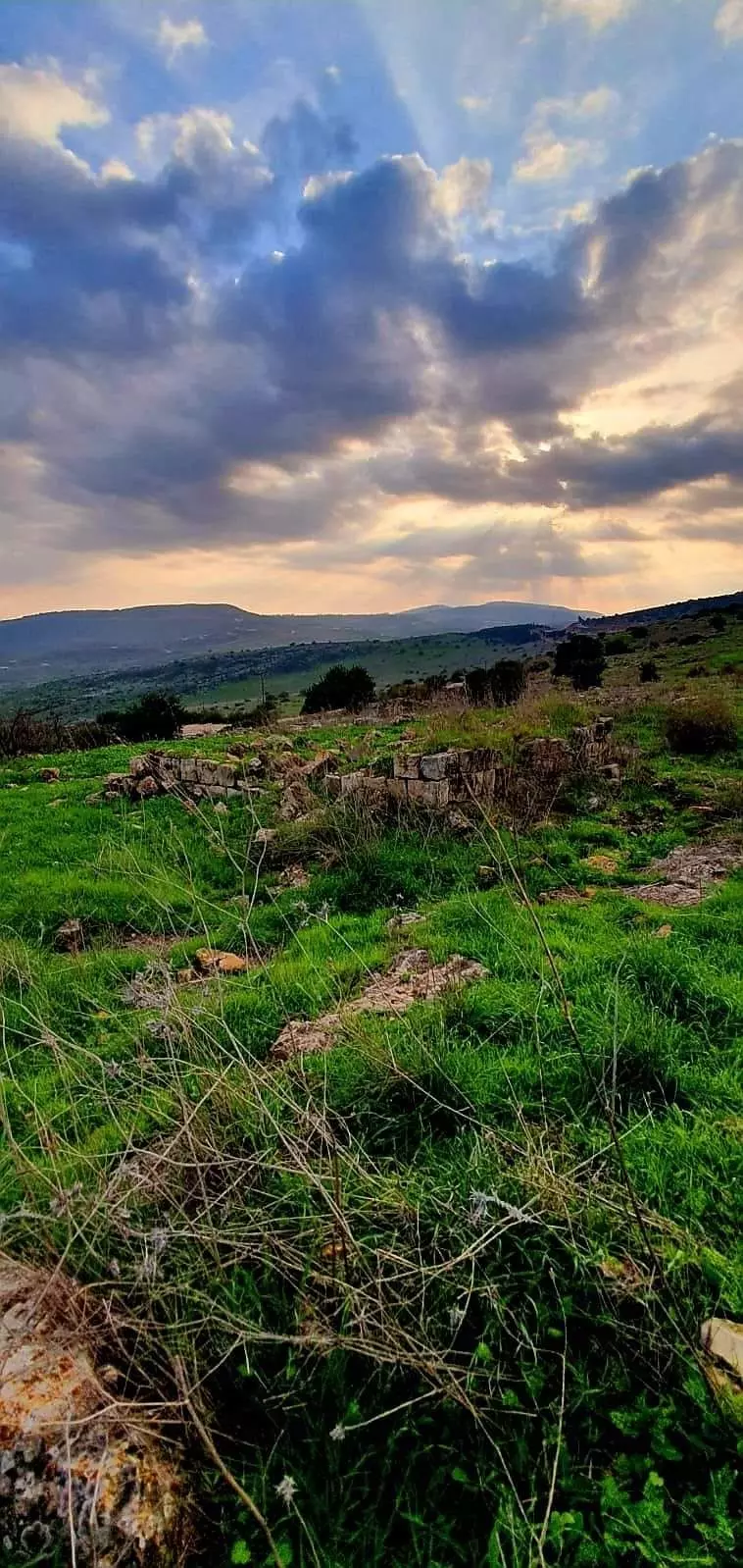
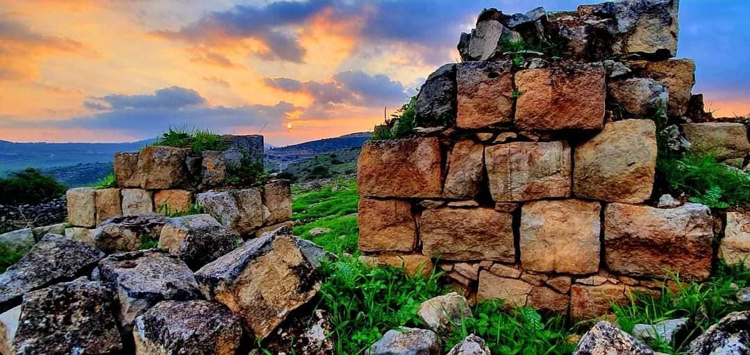
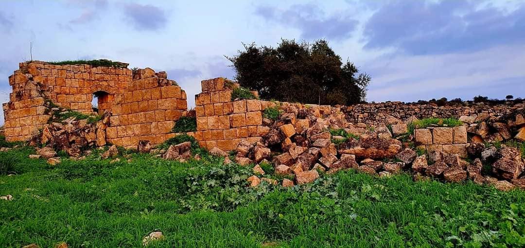
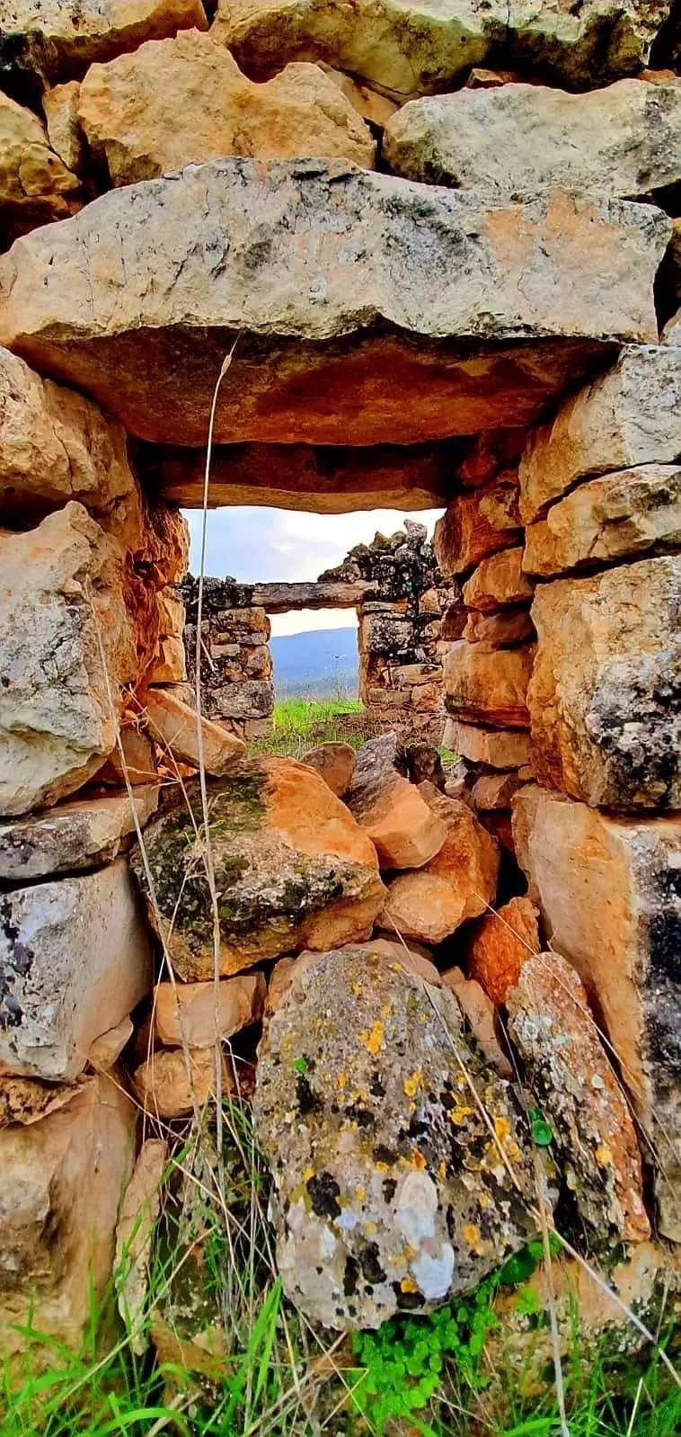
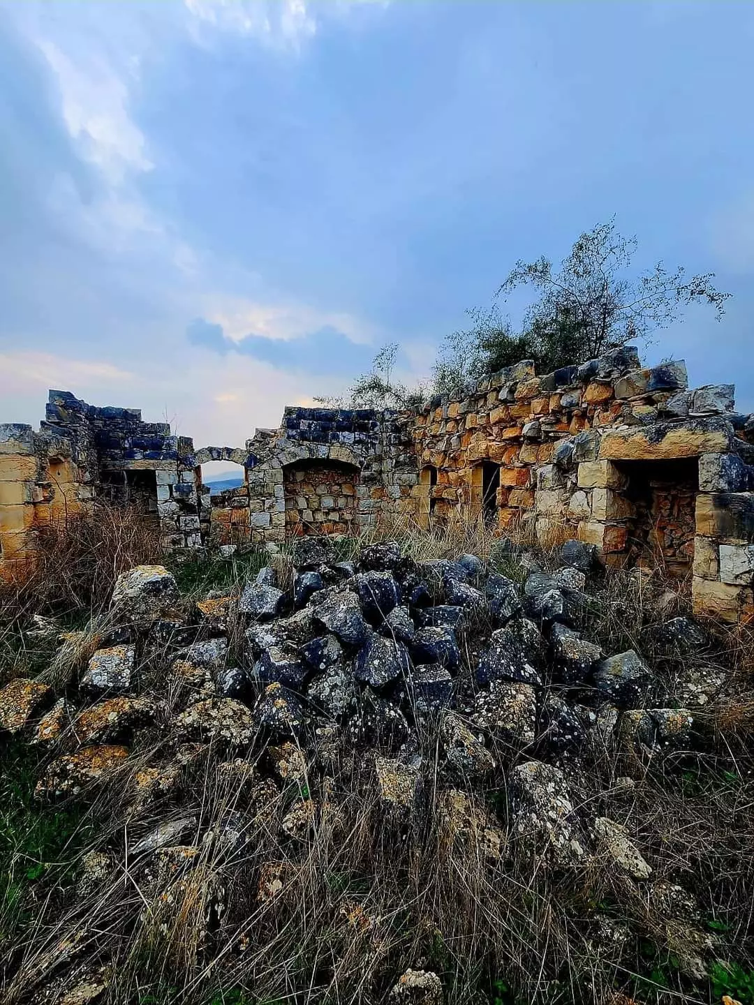
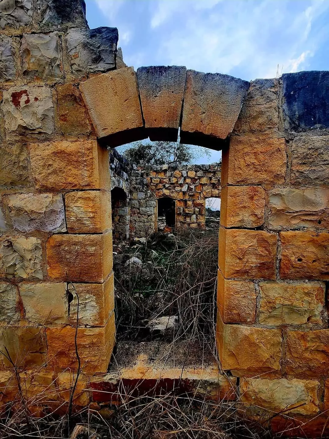
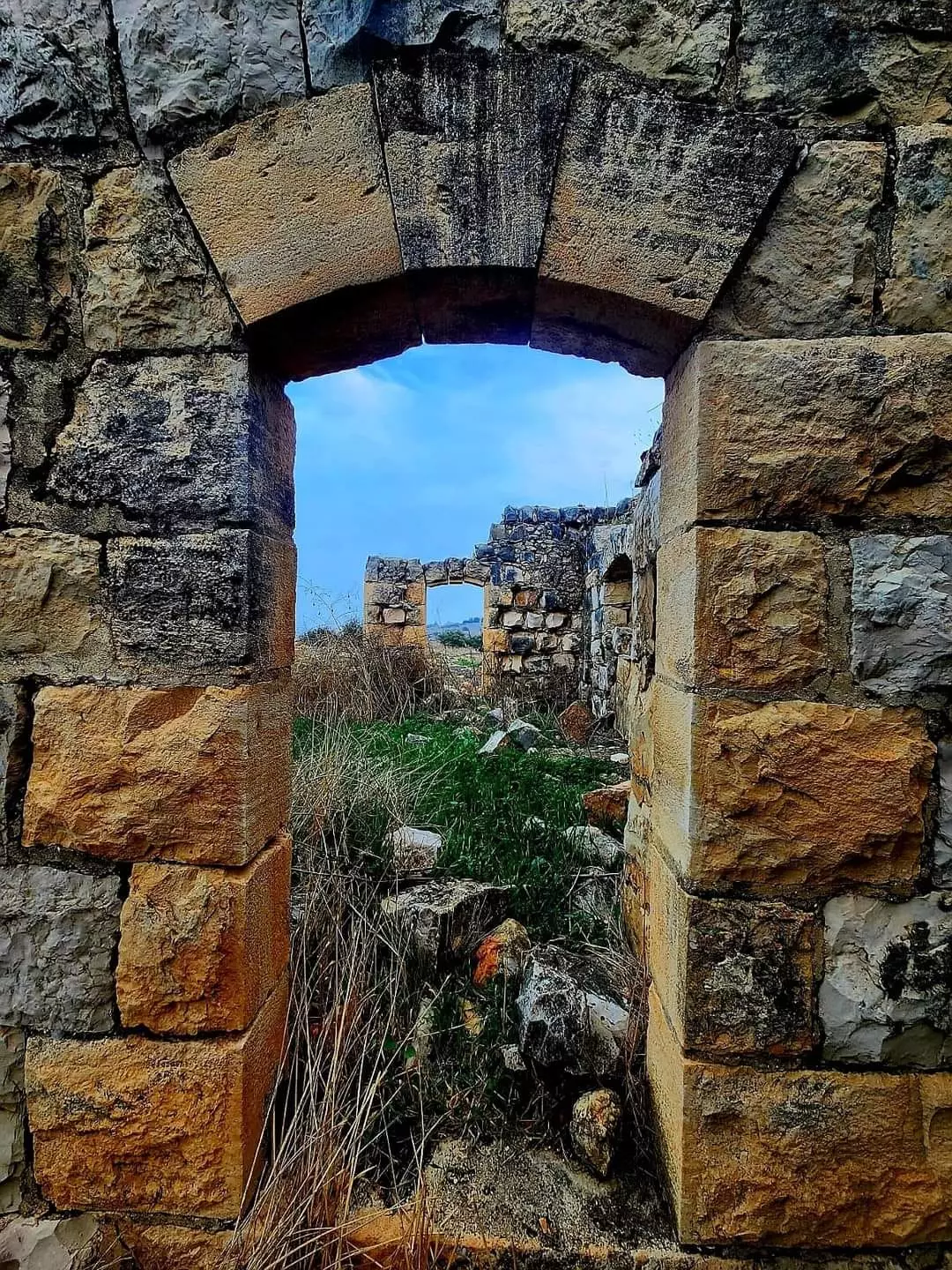
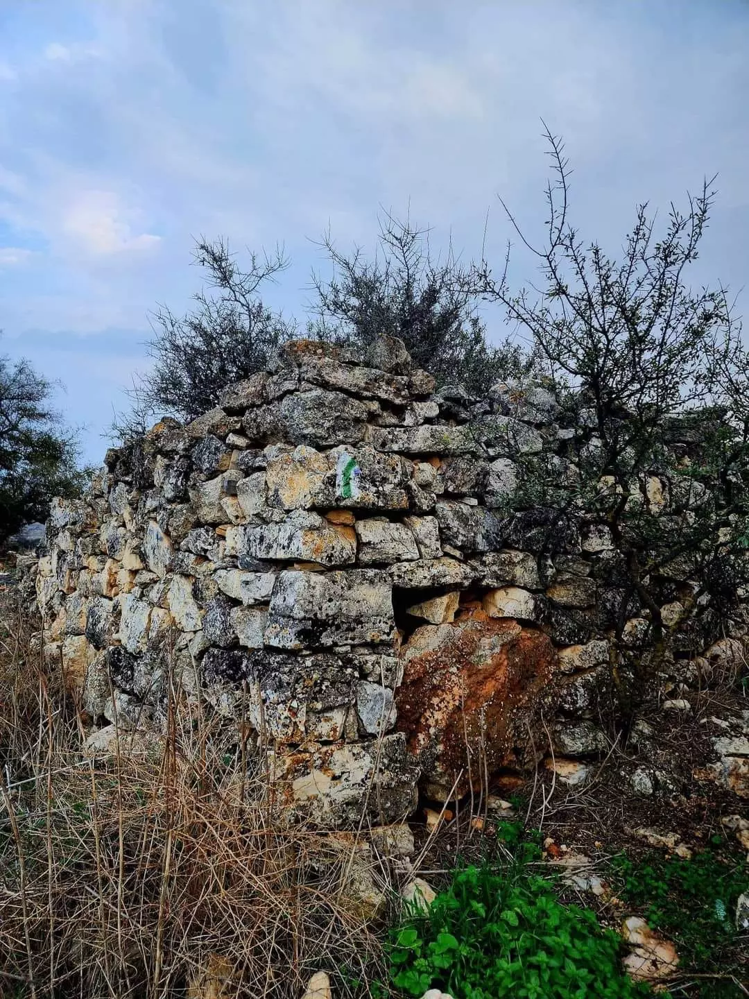
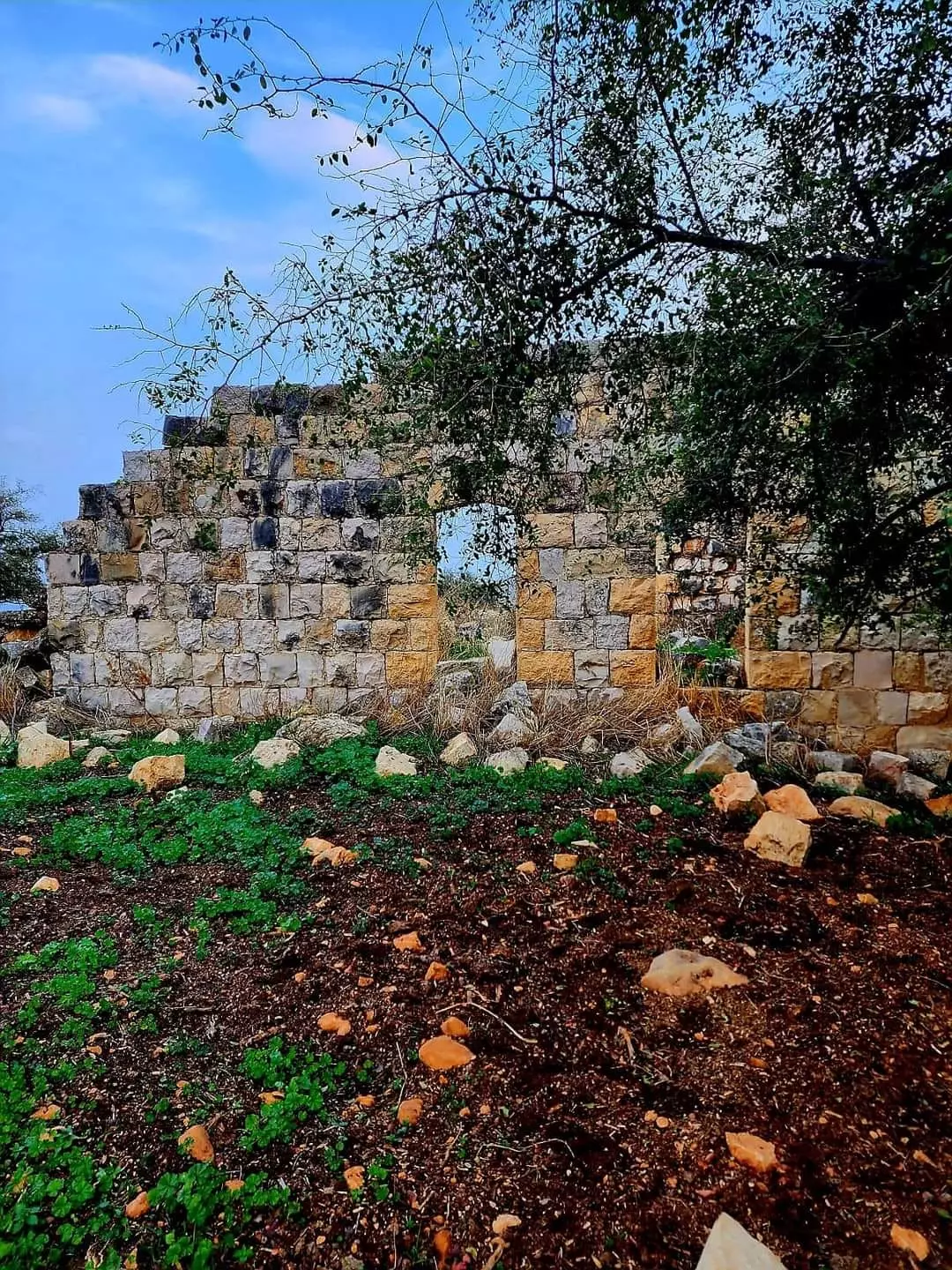
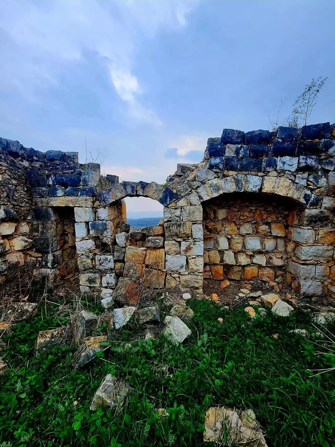
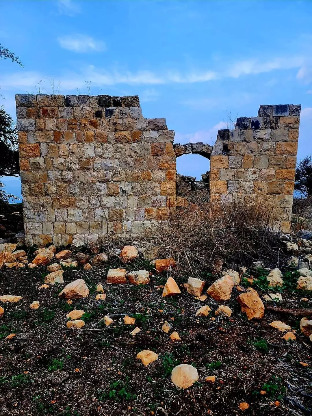
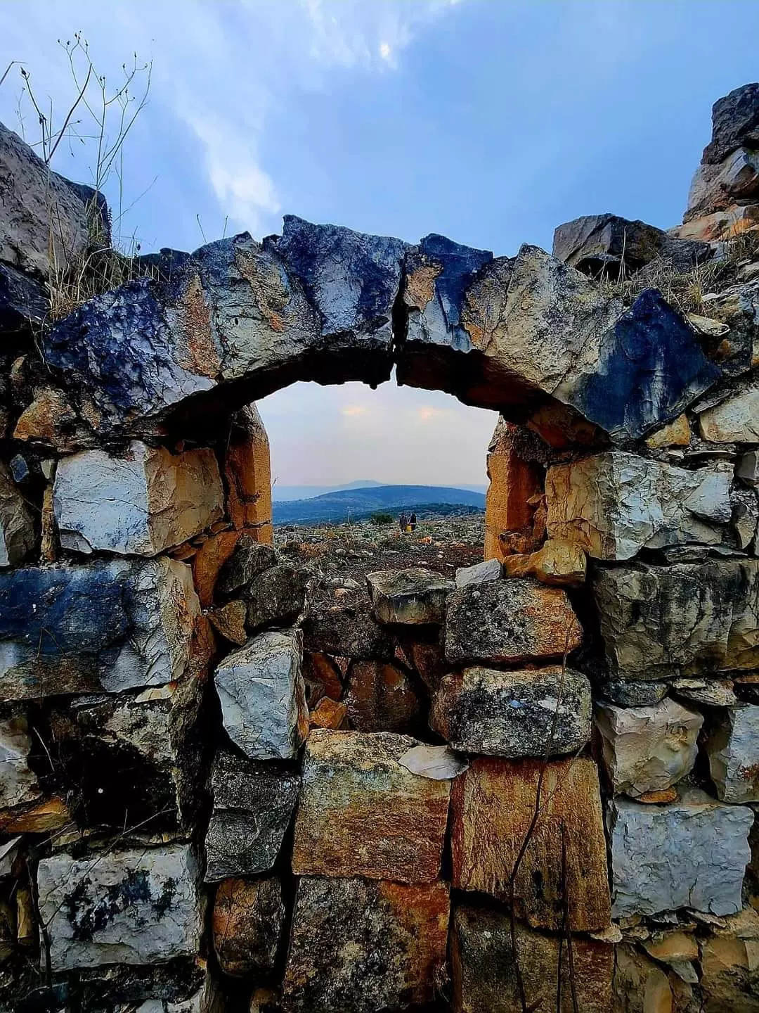
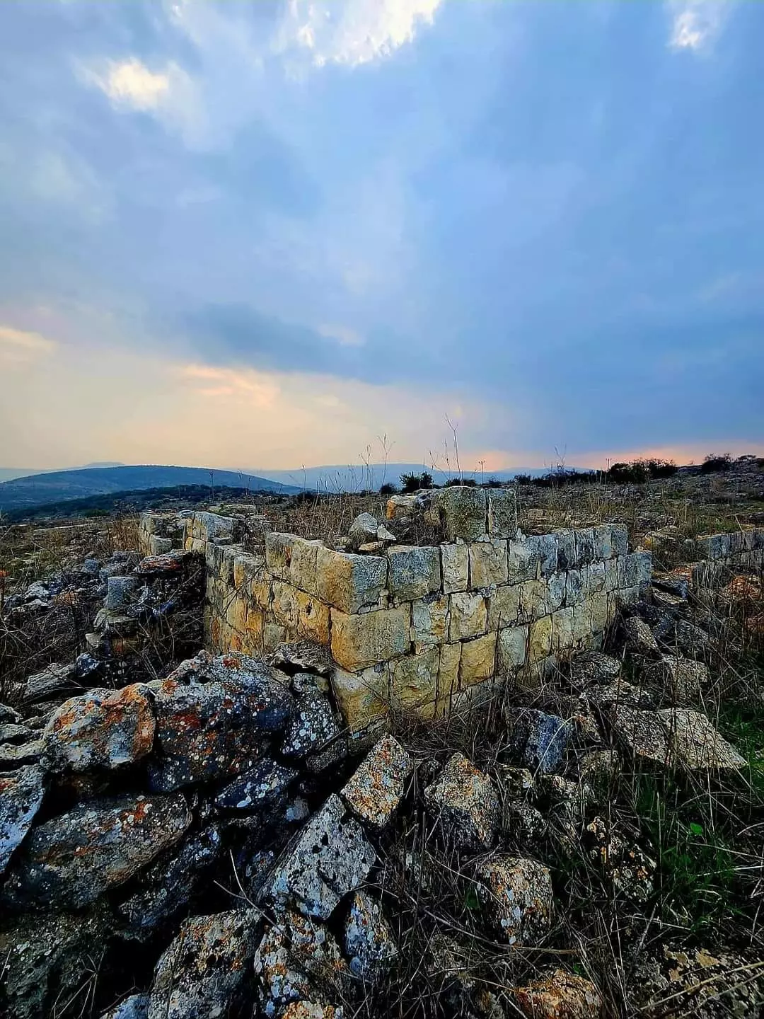
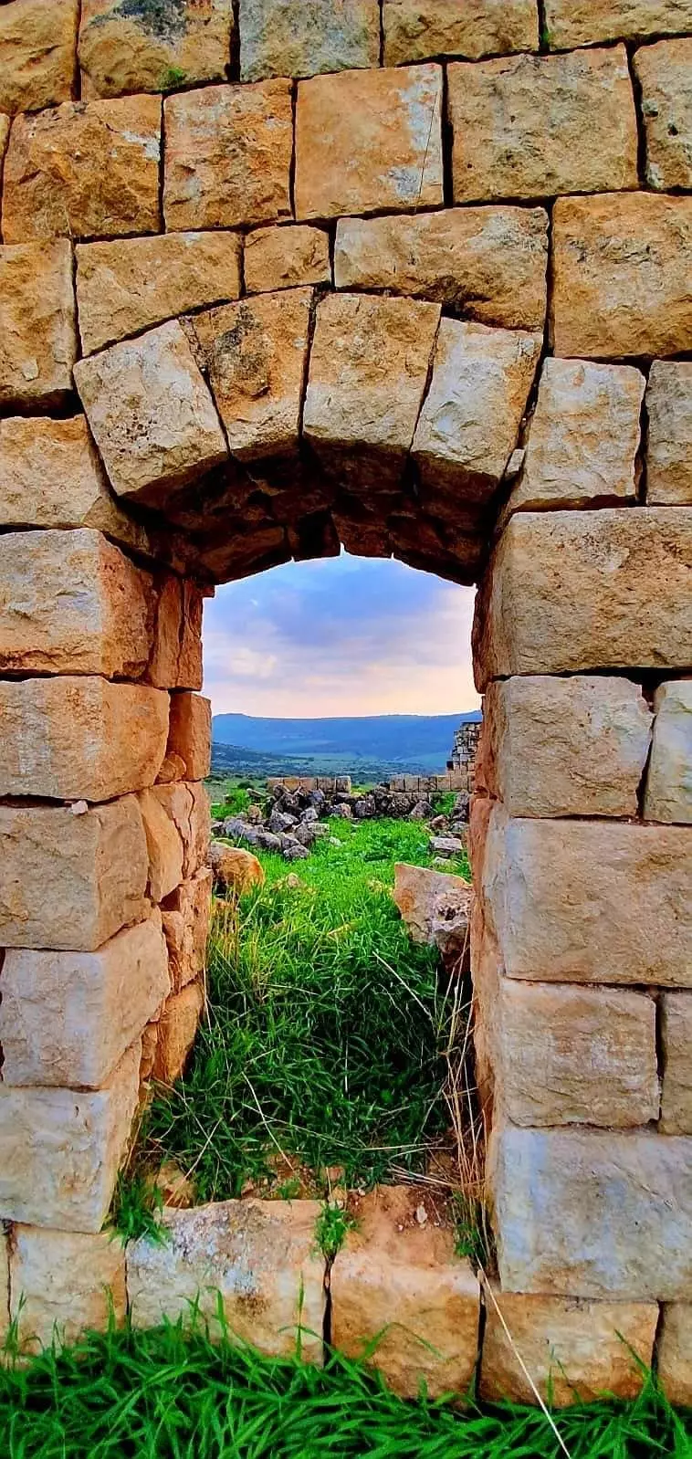
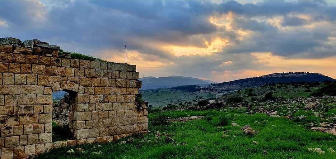
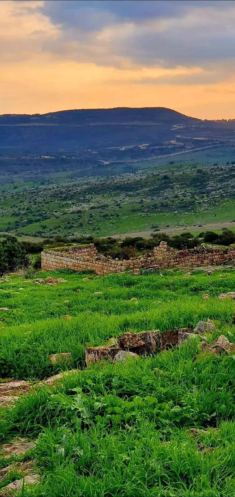
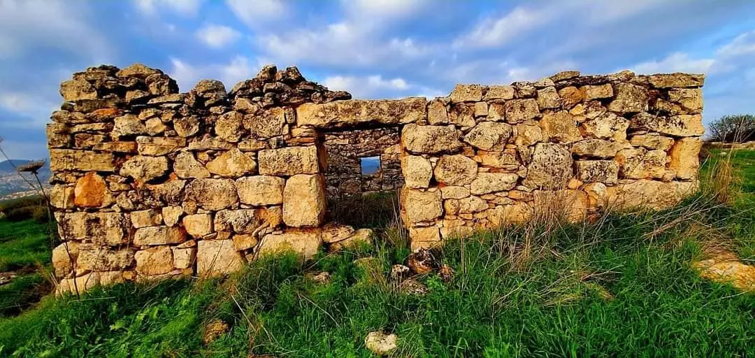
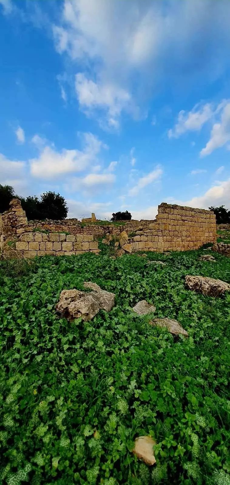
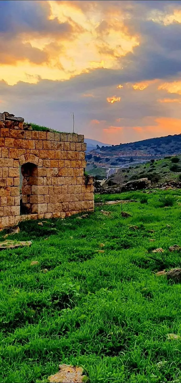
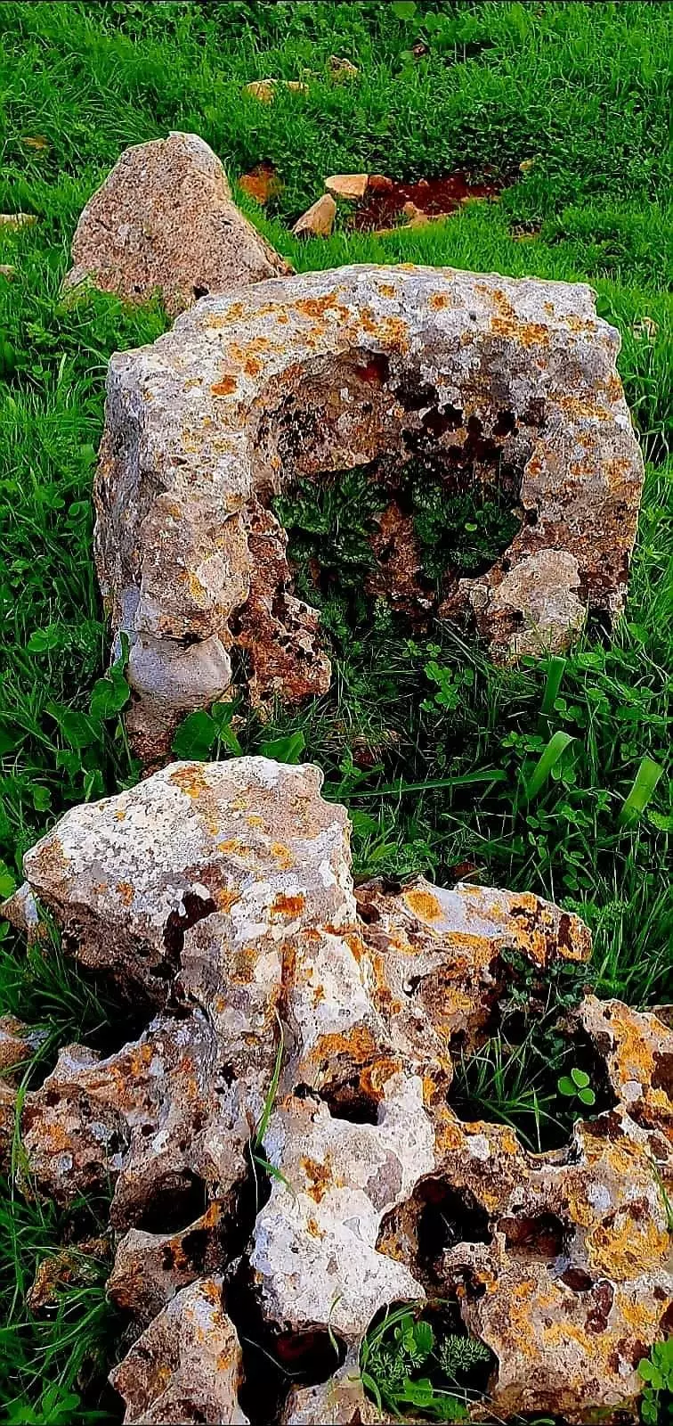
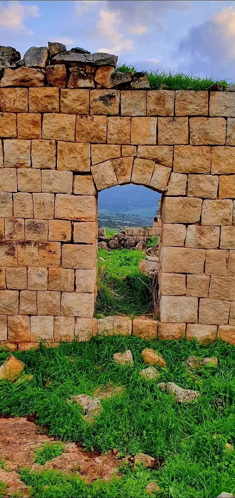
| Village Temains | The village was completely obliterated | ||||||||||
| Ethnically Cleansing | al-Wa'ra al-Sawda', Khirbat inhabitants were completely ethnically cleansed. | ||||||||||
| Clans | The villagers belonged mainly to the 'Arab al-Mawasi clan, but some families were of the 'Arab Wuhayb | ||||||||||
| Pre-Nakba Land Ownership |
**Town Lands' Demarcation Maps |
||||||||||
| Land Usage As of 1945 |
|
||||||||||
| Population |
|
||||||||||
| Number of Houses | In (1931): 190 (161 'Arab al-Mawasi, 29 Arab al-Wuhayb) | ||||||||||
| Shrines / Maqams | Two shrines: the 1st was for al-Shaykh 'Umar and 2nd was for al-Shaykh Musa al-Qadhim. | ||||||||||
| Exculsive Jewish Colonies Who Usurped Village Lands |
Ravid and Arbel | ||||||||||
| Featured Video | |||||||||||
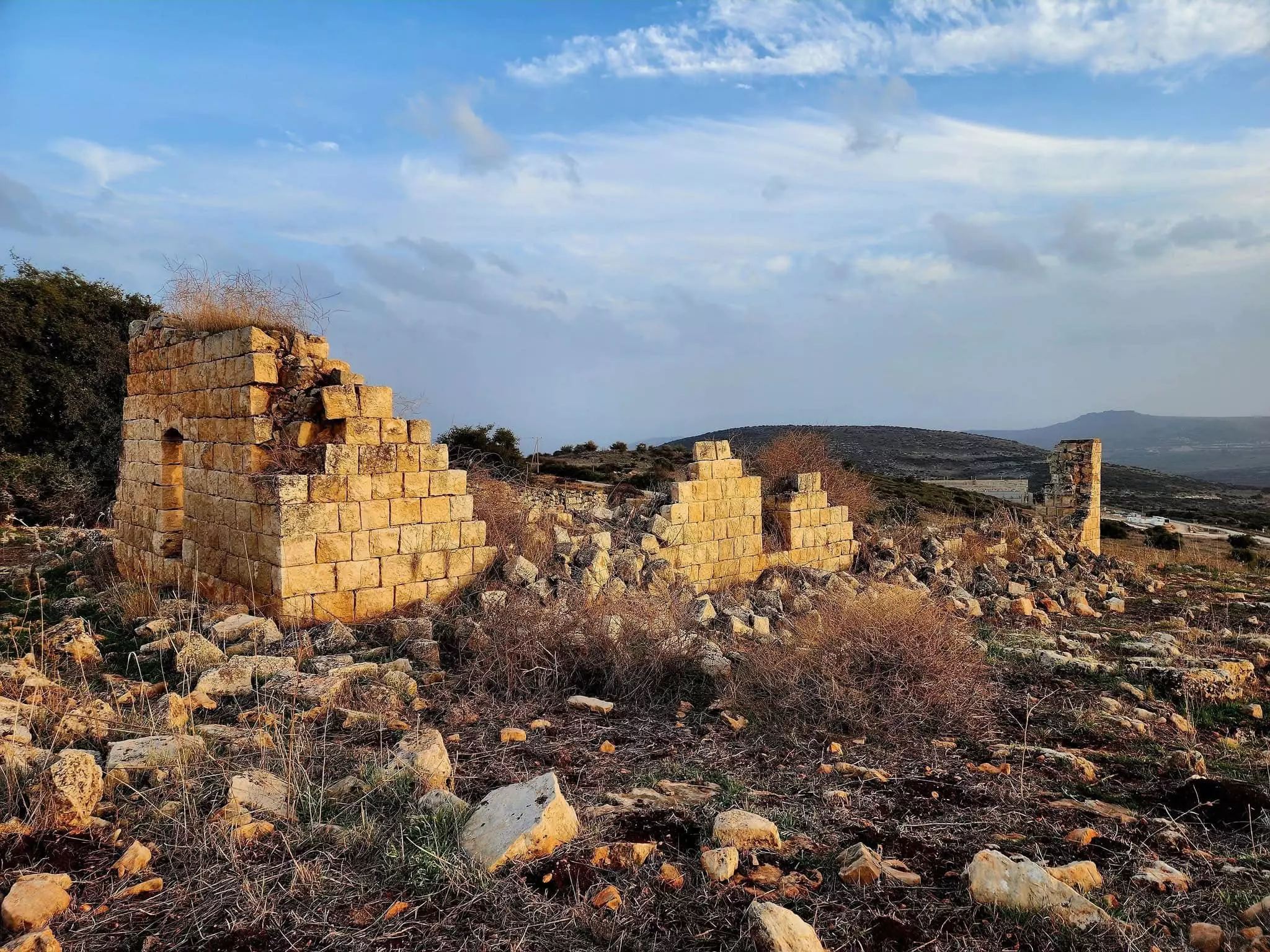
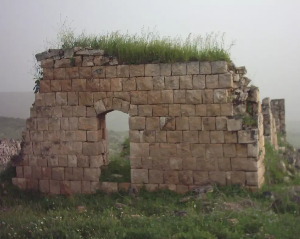
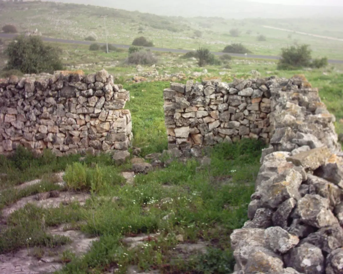
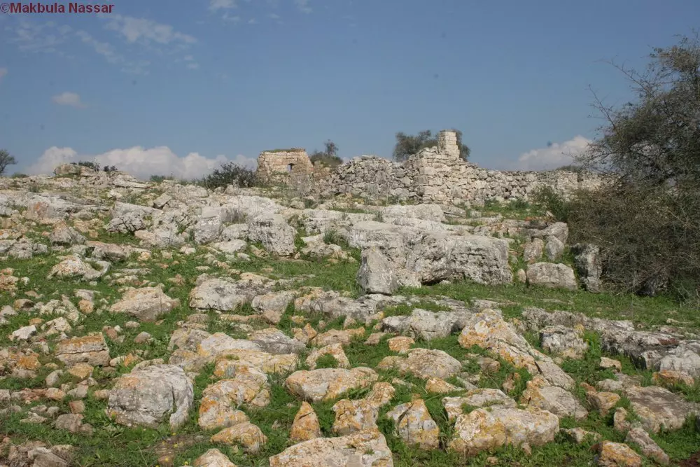
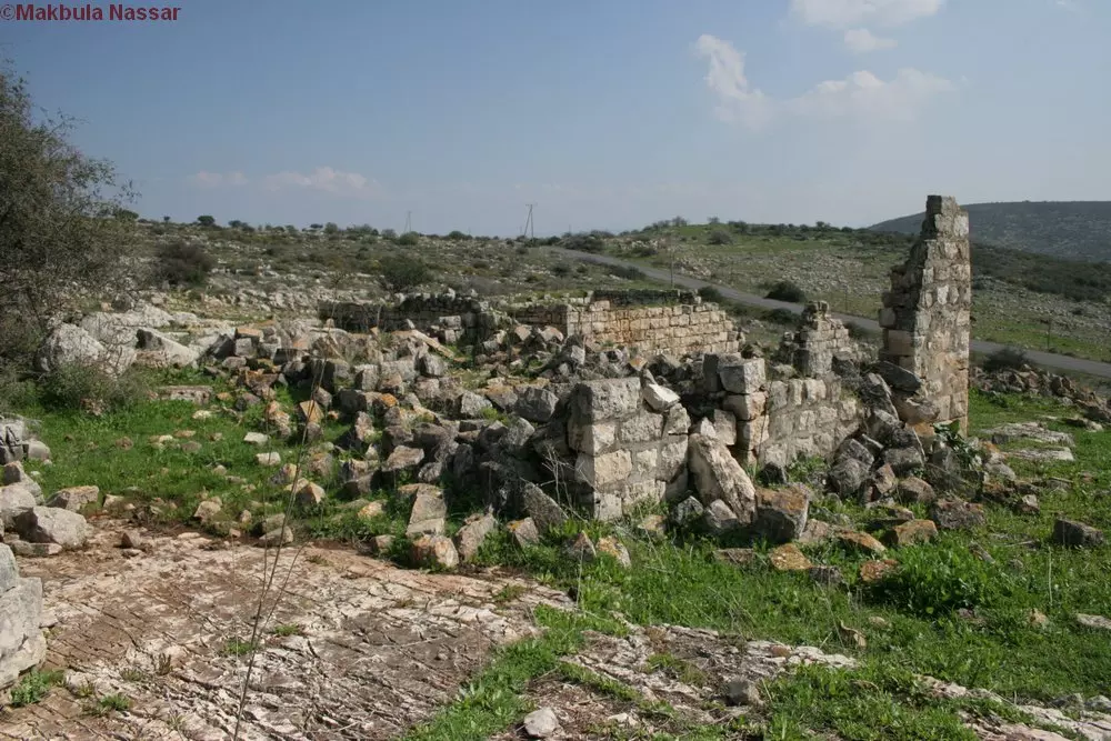
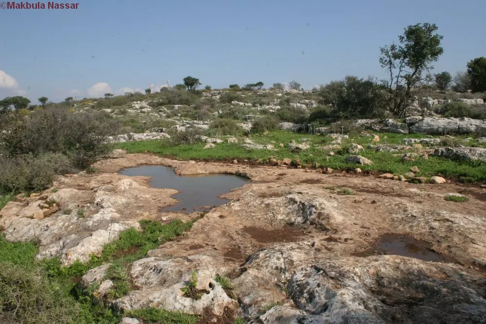
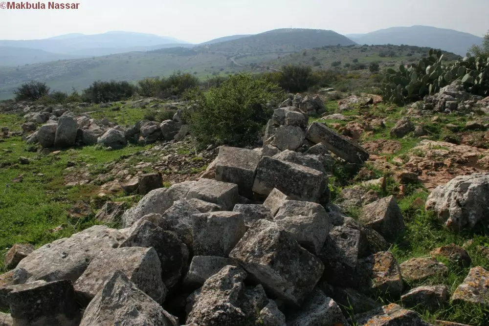
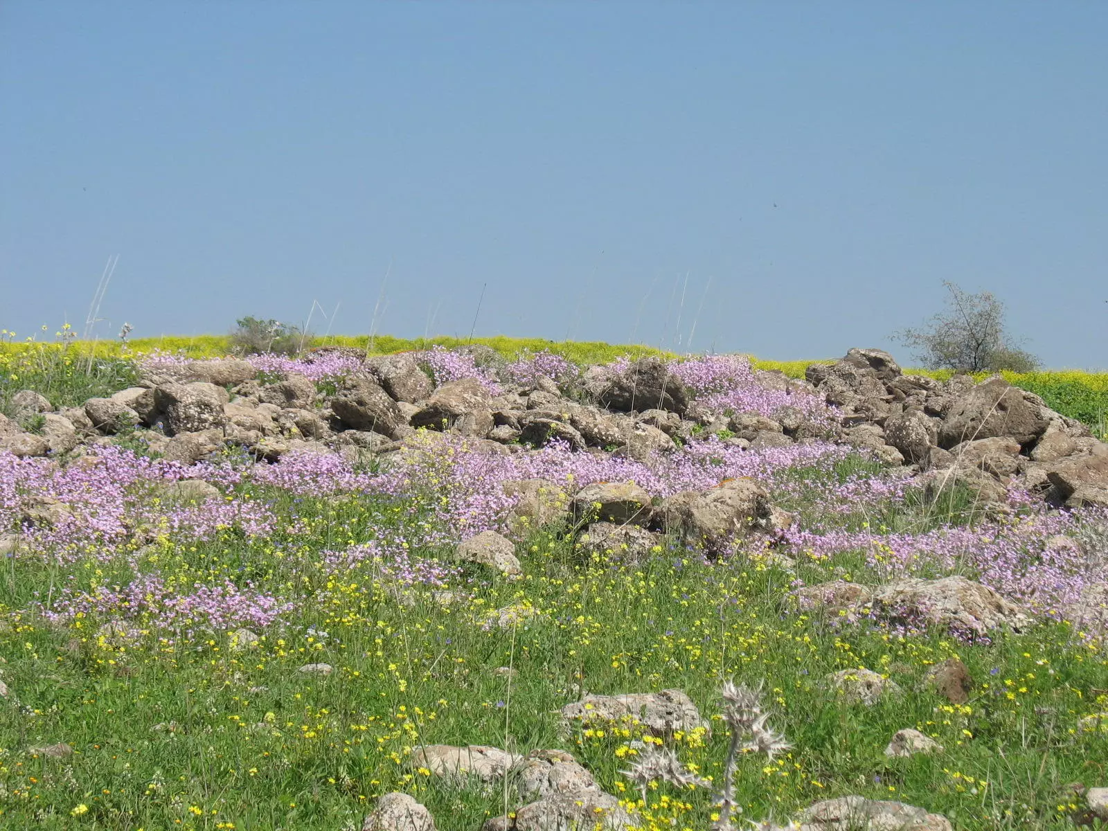
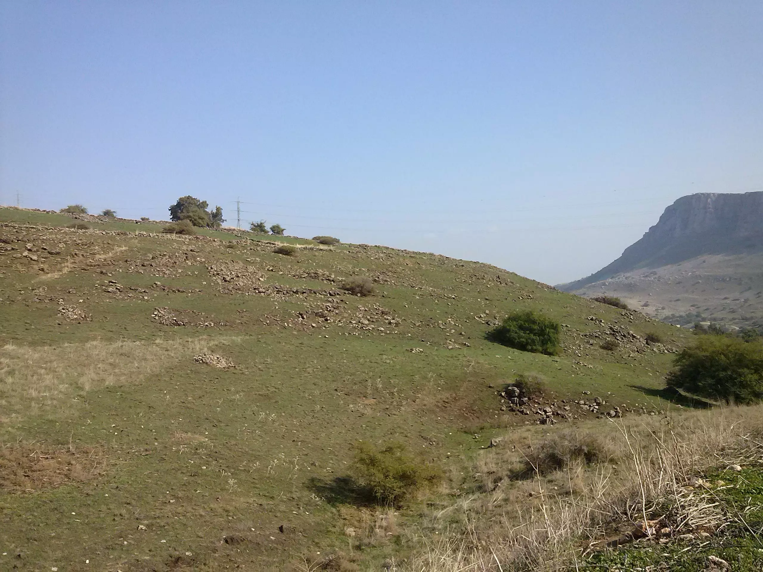
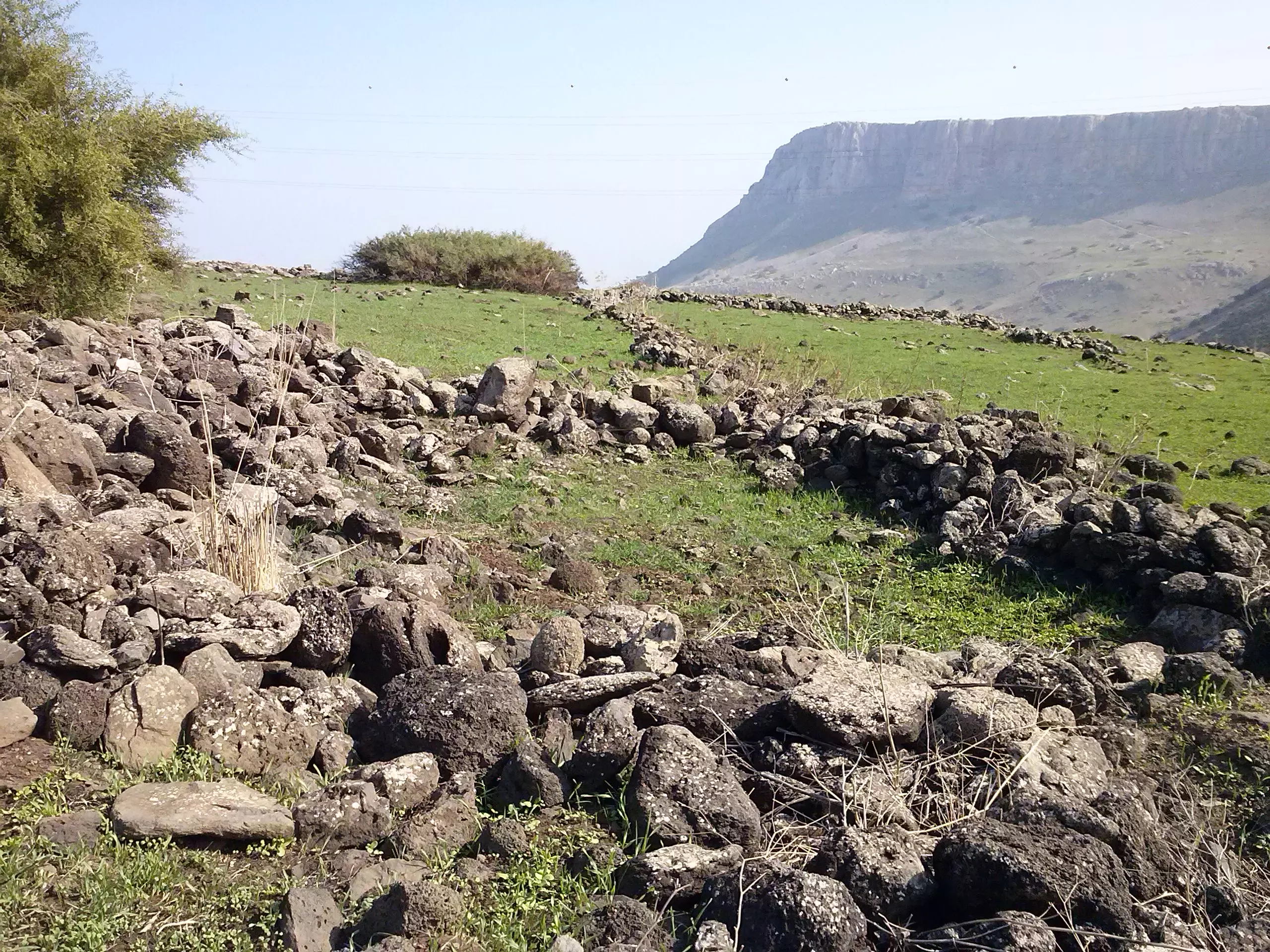
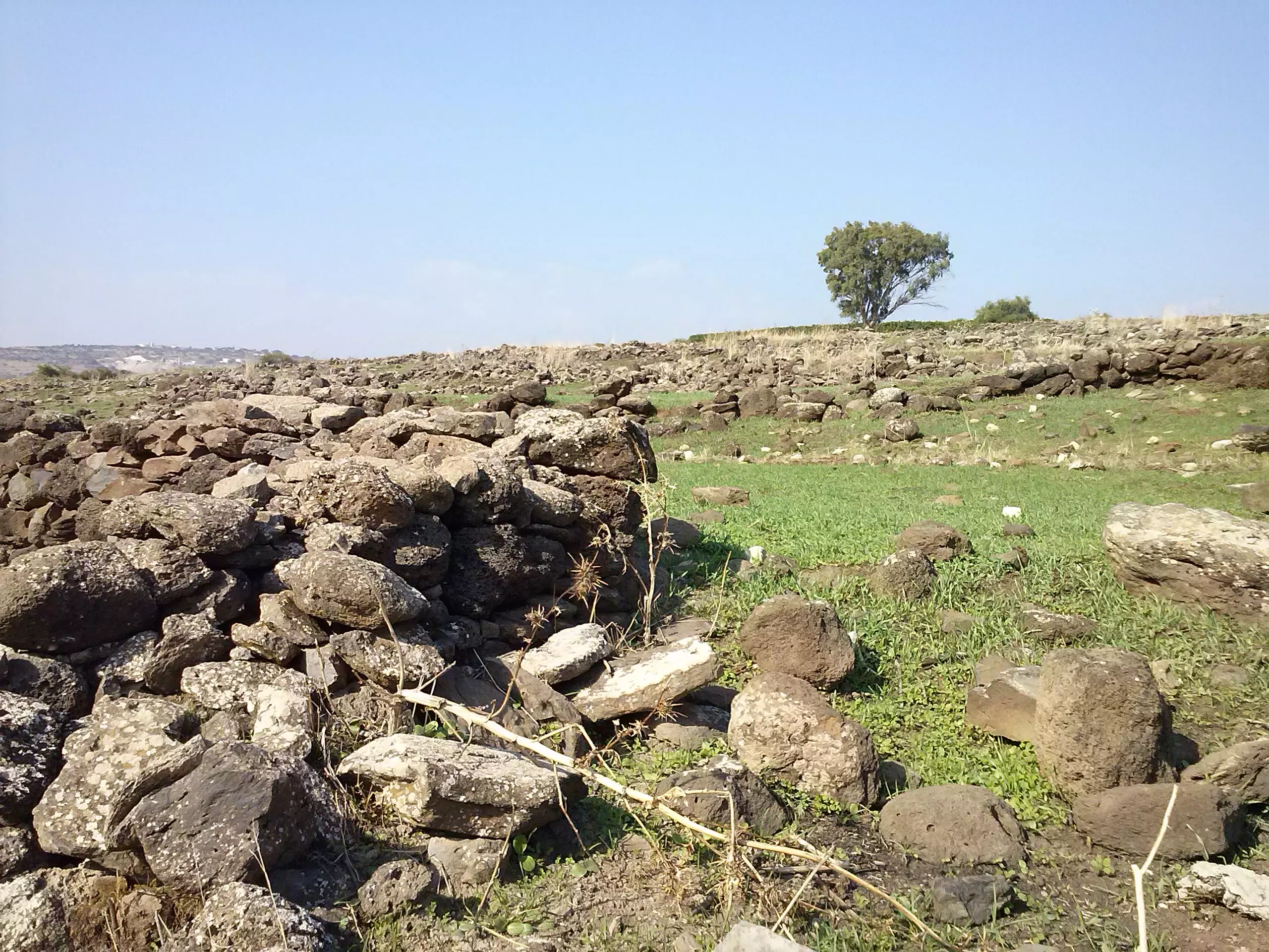
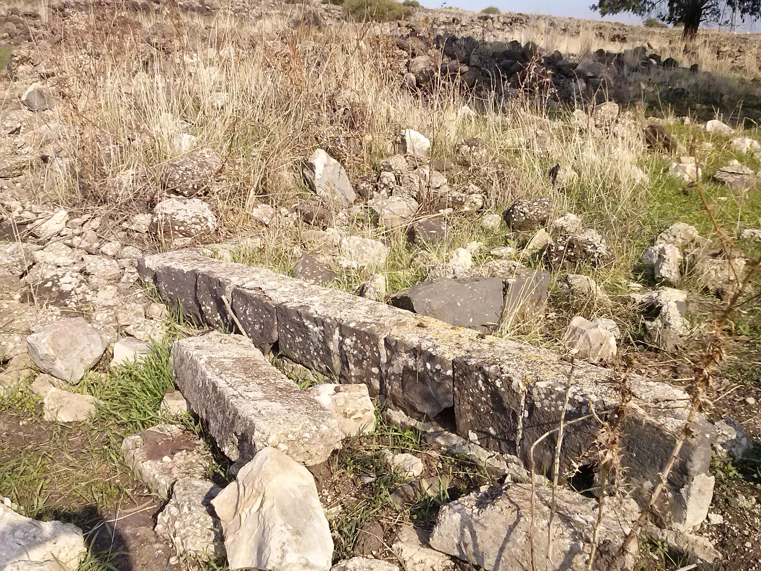
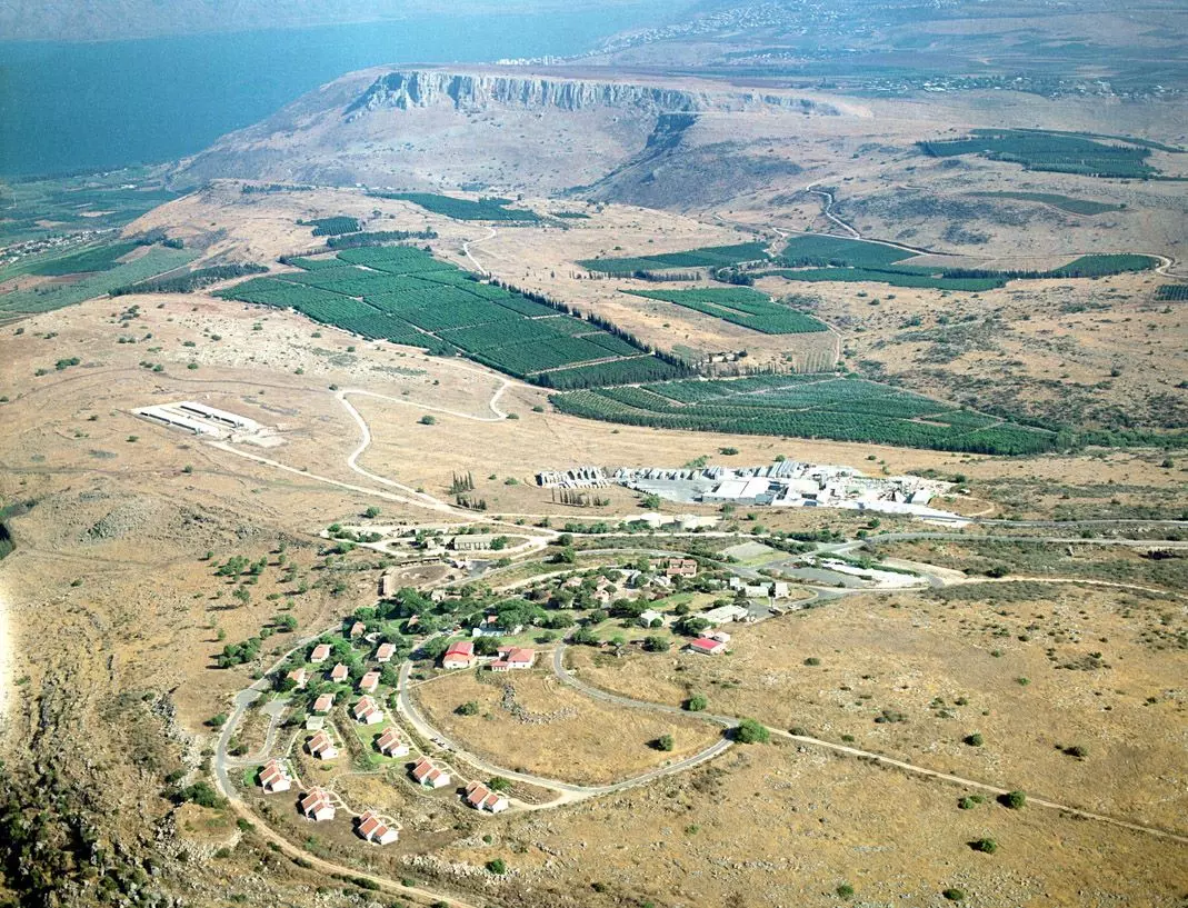
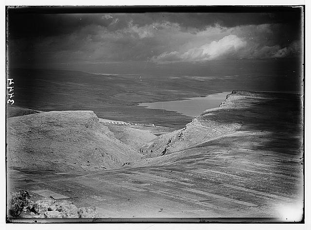
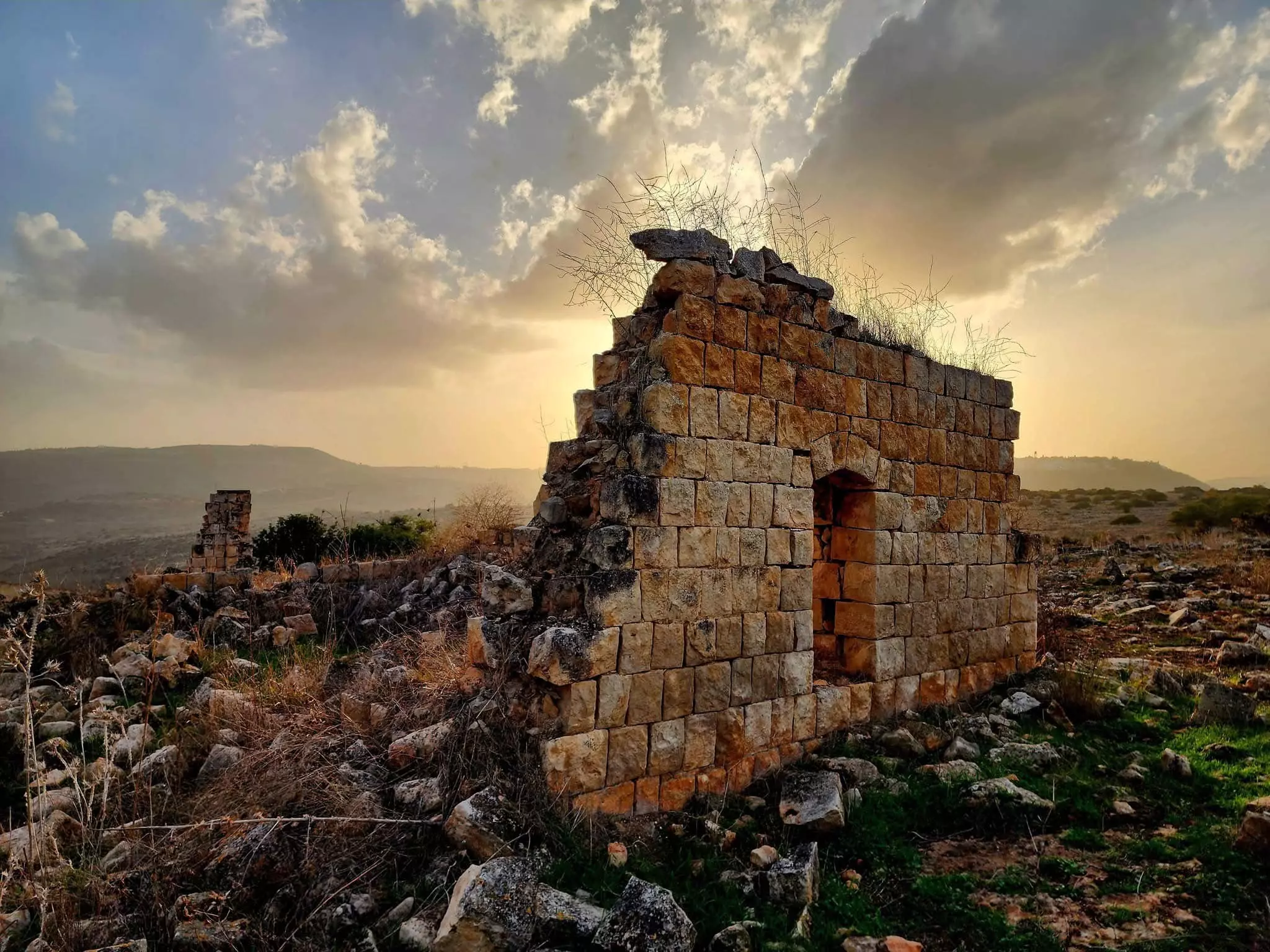
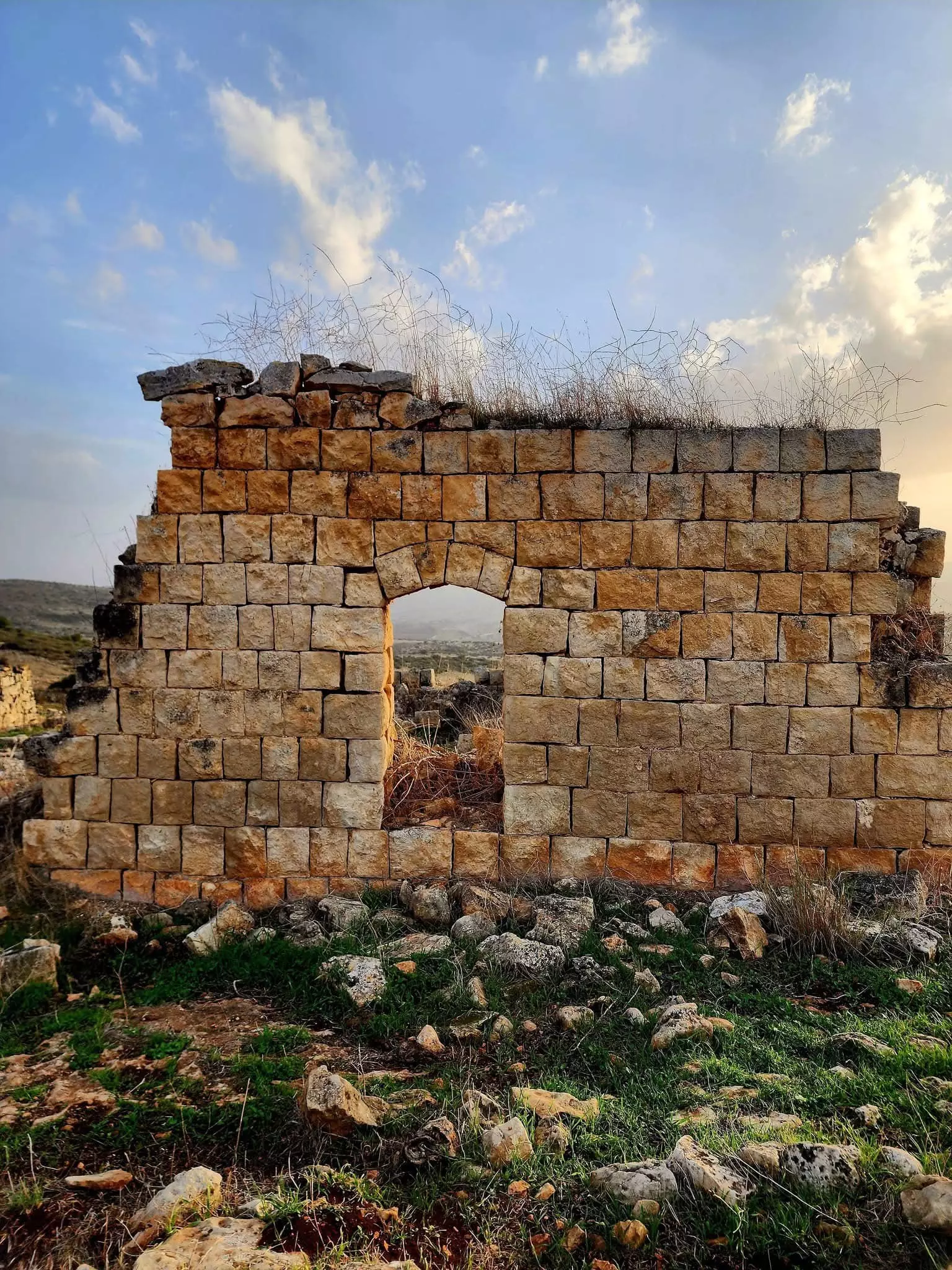
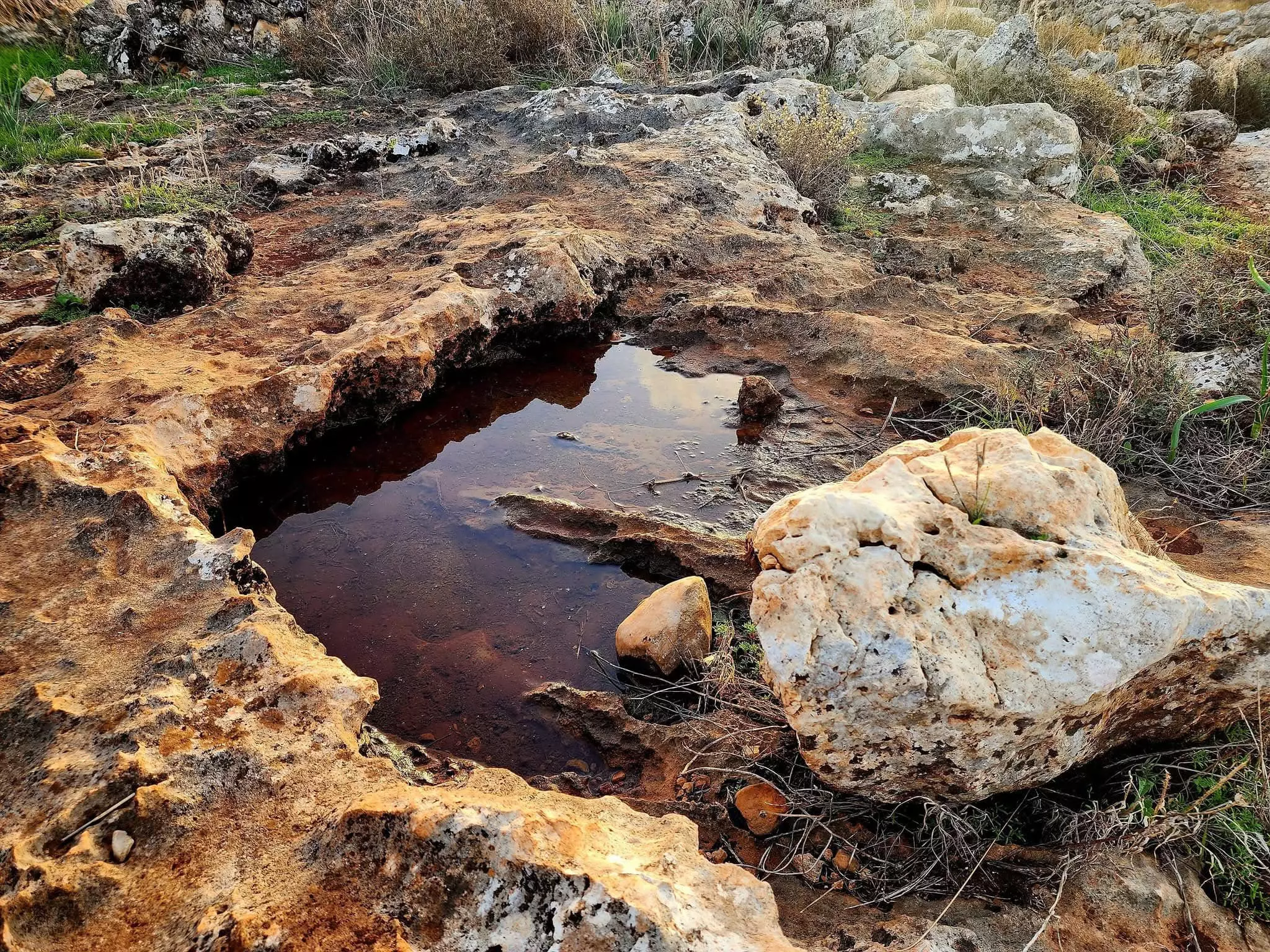
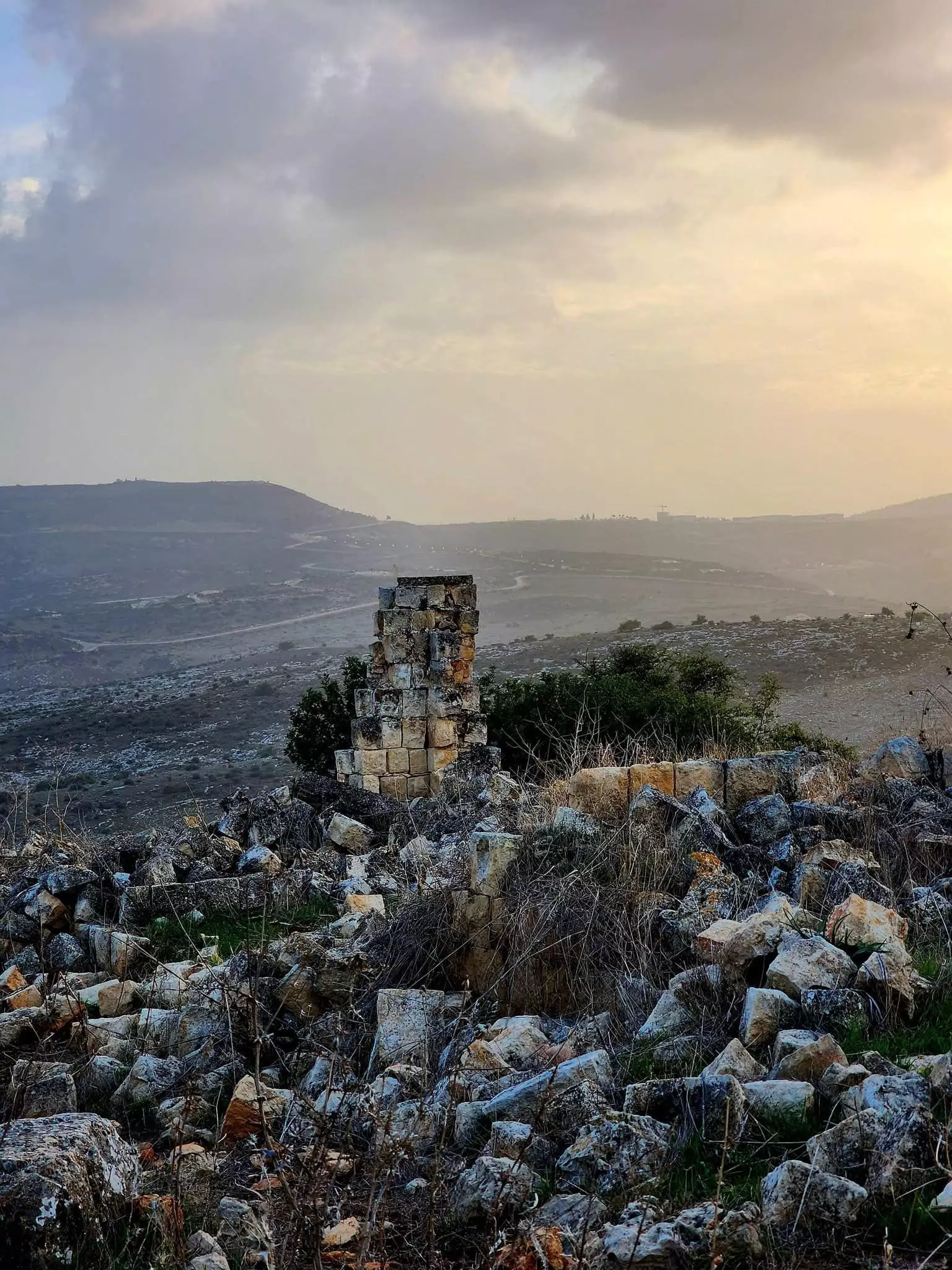
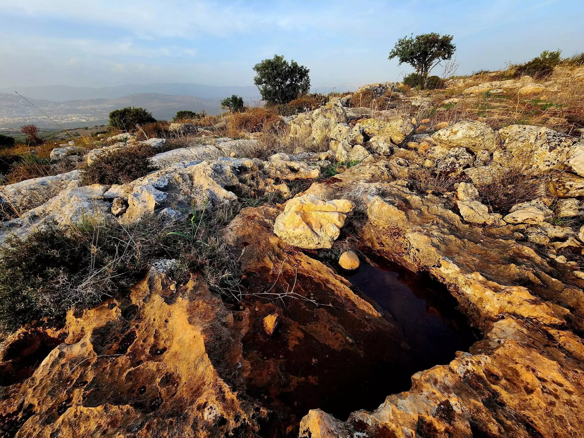
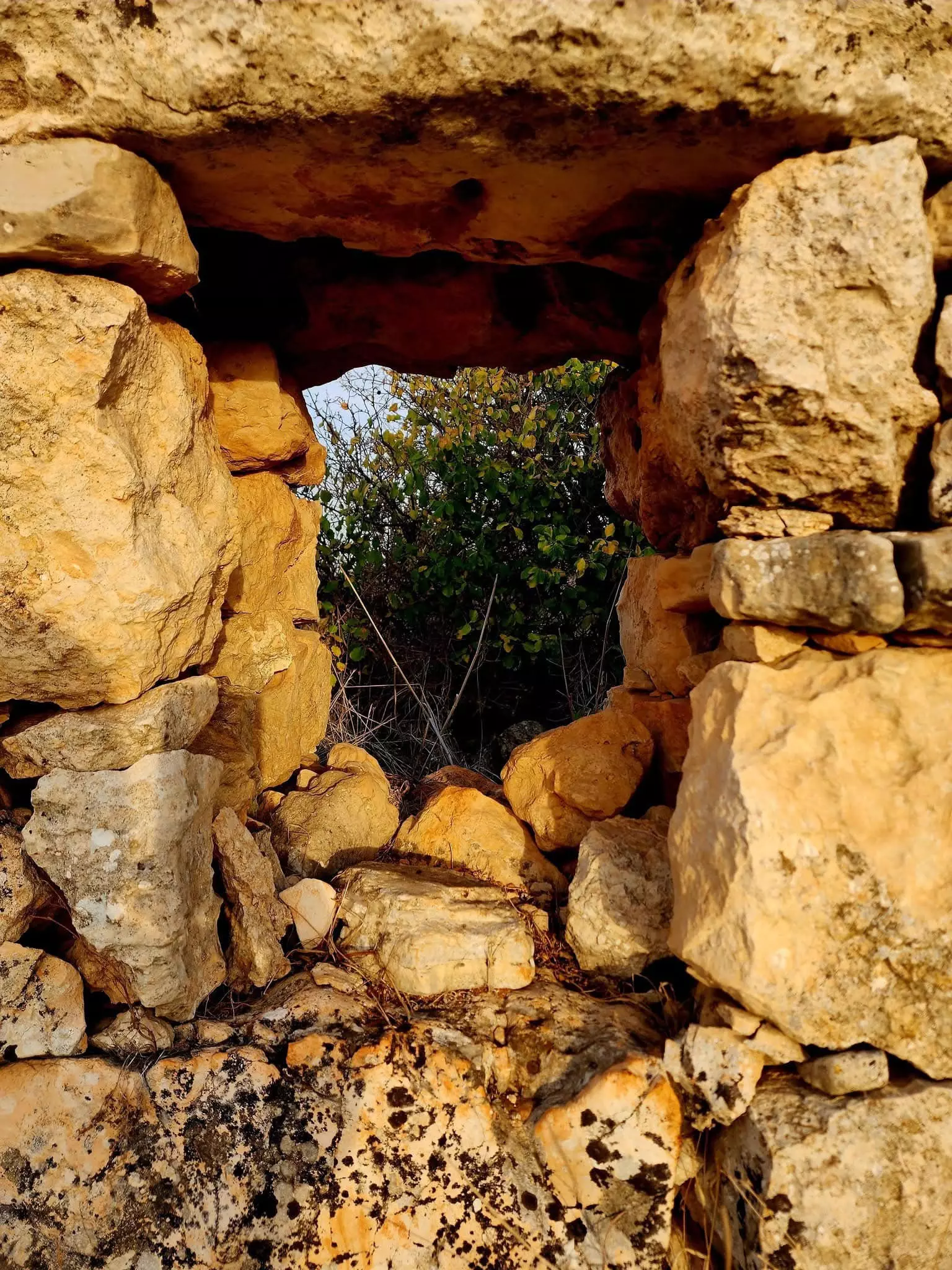
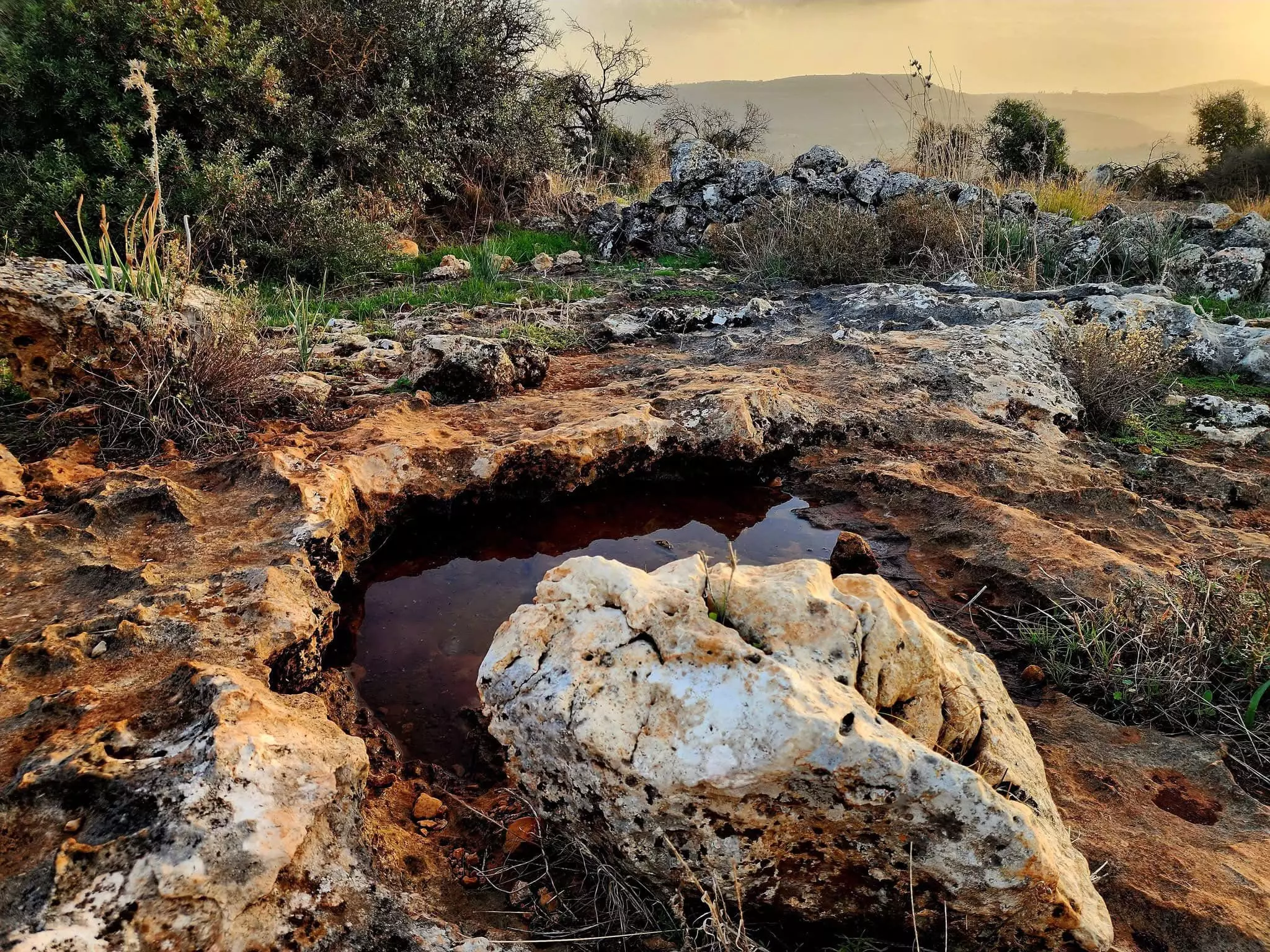
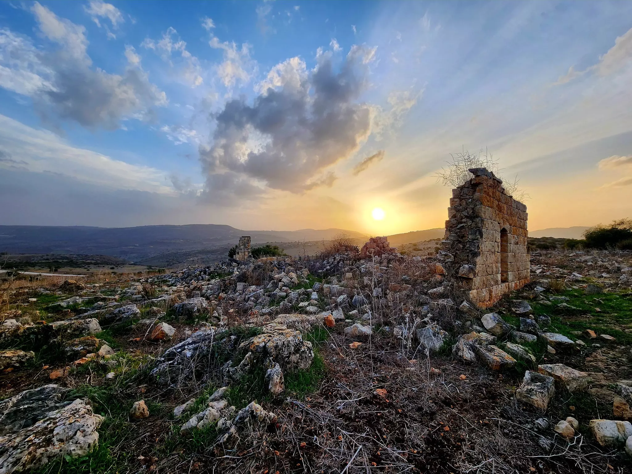
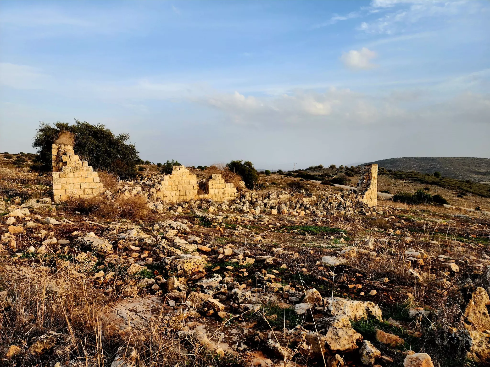
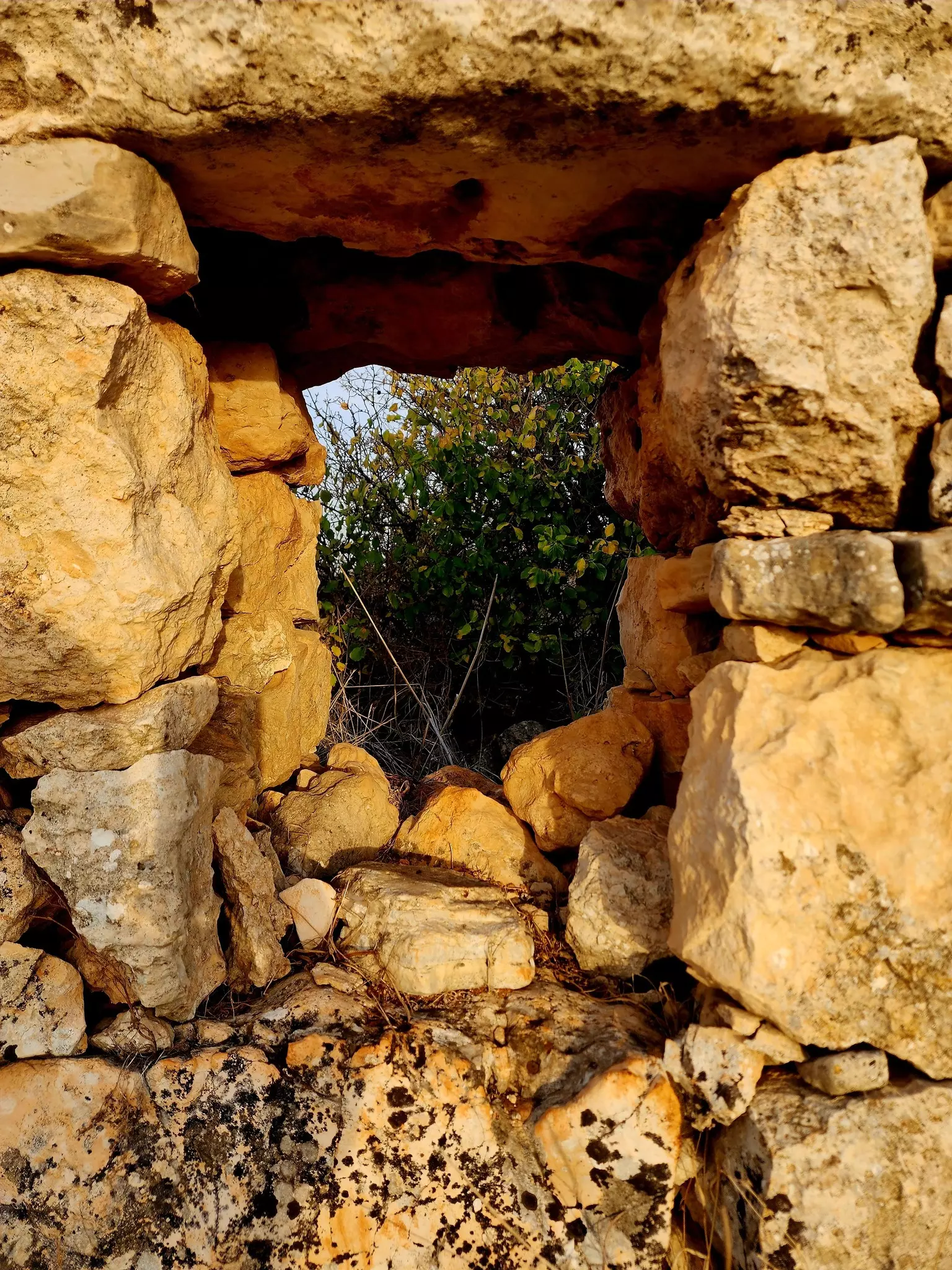
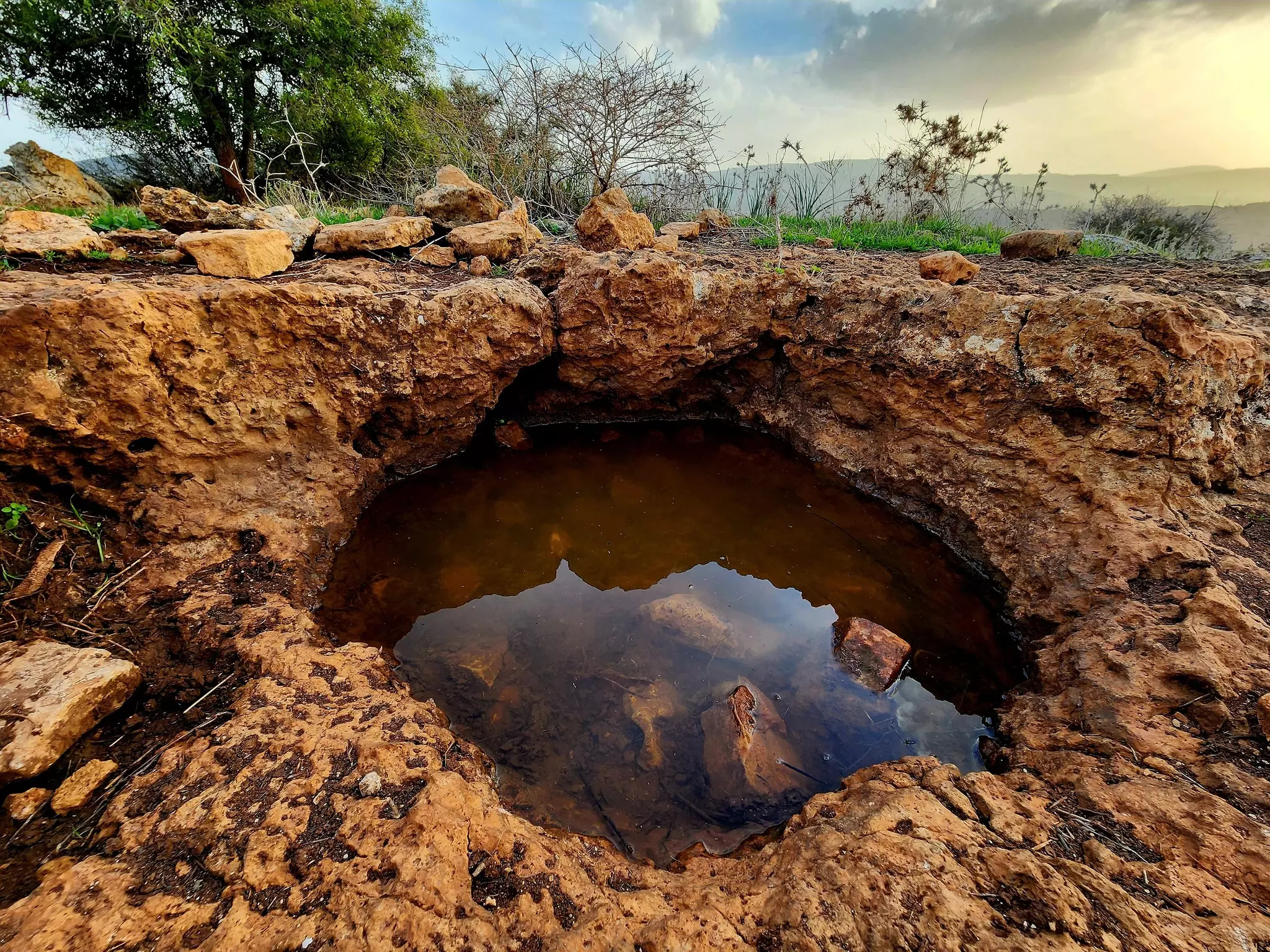
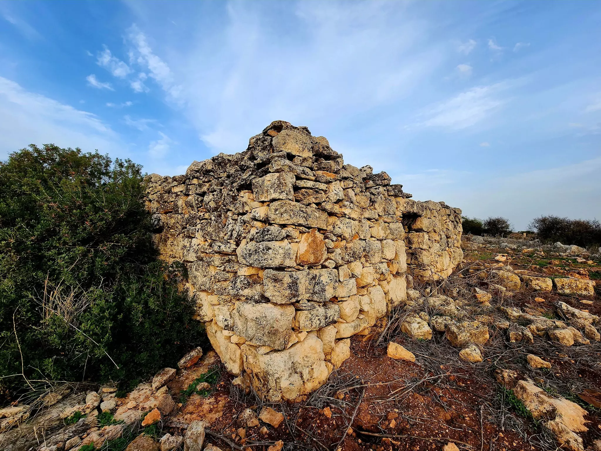
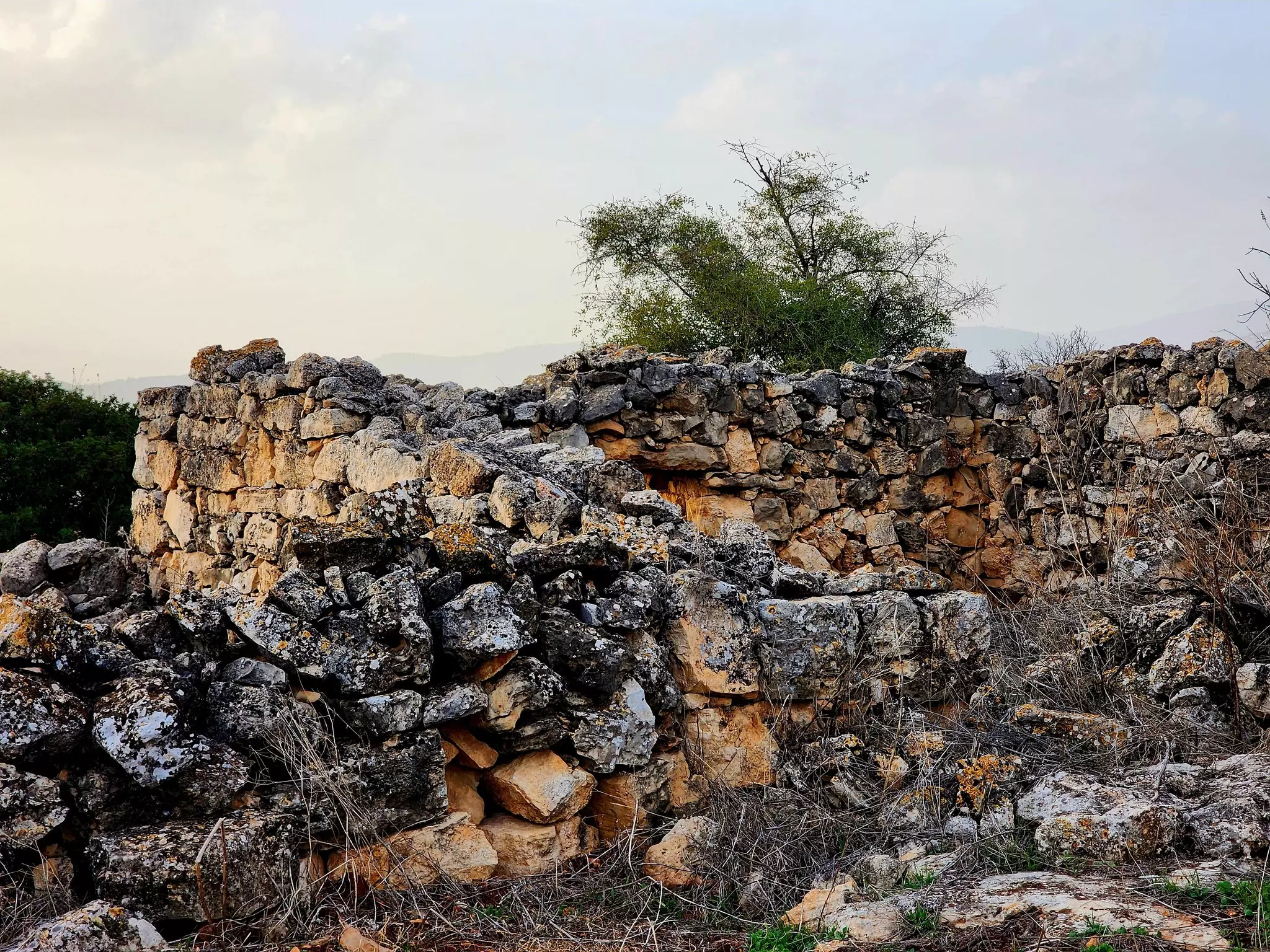
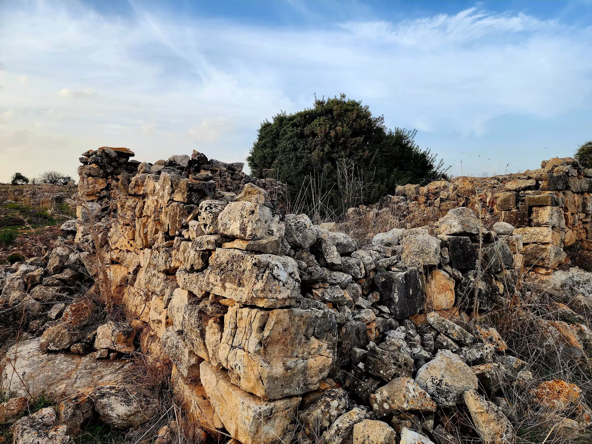
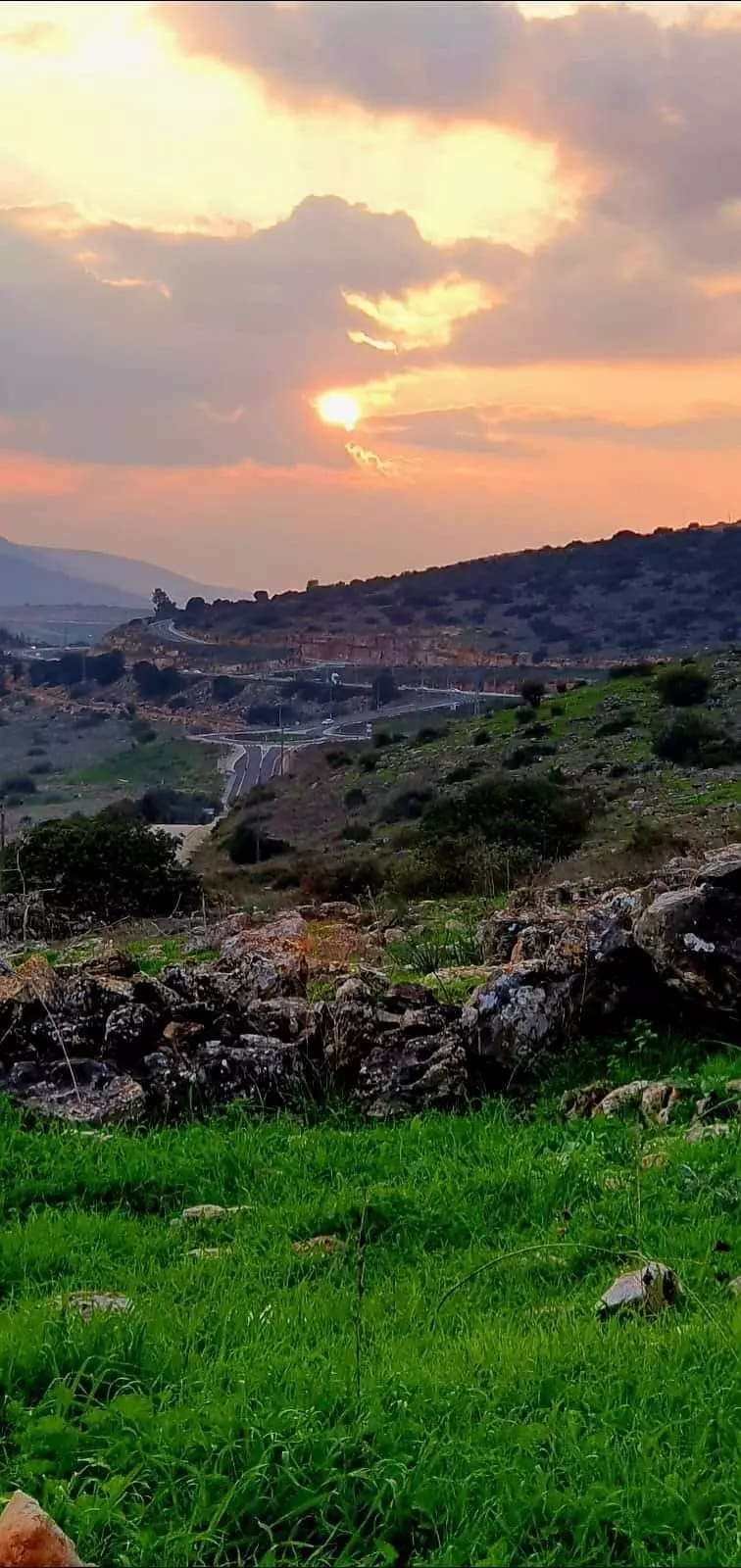
Village Before NakbaThe village stood on a small plateau of volcanic rock, overlooking Wadi al-Hamam and Lake Tiberias. Classified by the Palestine Index Gazetteer as a hamlet, it was linked by a secondary road to a highway that ran along the lake shore to Tiberias. A dirt road linked it to the village of Hittin in the southwest. The village houses were grouped in an irregular pattern around the intersection of these two roads. The villagers belonged mainly to the 'Arab al-Mawasi clan, but some families were of the 'Arab Wuhayb. Their stone houses were surrounded by the tents of the Bedouin who had not constructed permanent housing. All of the villagers were Muslim. Two shrines that were dedicated to local shaykhs-'Umar and Musa al-Qadhim-were located in a khirba on the northern outskirts of the village. Villagers performed religious ceremonies at the latter shrine. Agriculture was the mainstay of the village economy; olive trees were planted in the northern parts of the land, and grain was grown in the bed of Wadi al-Hamam. In 1944/45 a total of 2,027 dunums was allotted to cereals. There were a few archaeological sites near the village, including two khirbas that contained building foundations, stone cairns, cisterns, a cave, a well, and a trough hewn in rock.Village Occupation and Ethnic CleaningNo accounts of the occupation of this village have been published. Judging from its location, two scenarios are possible. The first is that it was captured in the wake of the fall of Tiberias on 18 April 1948. After occupying the city, Haganah forces struck at a few of the villages in the area to consolidate their hold on Tiberias and drive out the inhabitants of its hinterland. Khirbat al-Wa'ra al-Sawda' may have been one of these villages. The second possibility is that it was captured in the course of Operation Dekel (see 'Amqa, Acre sub-disctrict), as the forces that had occupied Nazareth advanced eastwards in the direction of Tiberias. If so, it probably came under occupation in mid-July, along with nearby Hittin, shortly before the second truce of the war. [[see M:70-73, 203]]There is an oral report of a massacre of 'Arab al-Mawasi villagers that took place in late October or early November 1948, following the second truce of the war. According to villagers, Jewish soldiers rounded up 15 men, took them to the nearby village of Eilabun, and shot them. Two men survived, but pretended to be dead, as the soldiers had retreated only a short distance. After some minutes wait, the soldiers returned and shot each of the bodies again, this time in the head. Fourteen villagers died and were buried in a nearby cave. The only survivor escaped to Syria, along with other 'Arab al-Mawasi. Some others joined tribes in the inner Galilee. Zionists Colonies on Village LandsThe settlement of Ravid (193250) is 3 km west of the village site but is not on village lands. Arbel (196246), built in 1949, is about 2 km southeast of the site on the village lands of Hittin.Village TodayNo traces of the houses remain. Stone terraces provide the only indication of a former village on the site. The site and the lands around it are used largely as grazing areas, although some of the lands are cultivated by Israelis.SourceDr. Walid al-Khalidi, 1992: All That Remains. |
|||||||||||
| Related Maps | Town Lands' Demarcation Maps خرائط للقضاء توضح حدود القرى والاودية Town's map on MapQuest View from satellite Help us map this town at WikiMapia |
||||||||||
| Related Links | Wikipedia's Page Google Search Google For Images Google For Videos |
||||||||||
| More Information | في كتاب كي لا ننسى في كتاب بلادنا فلسطين المزيد من موقع هوية |
||||||||||
- احد الخرب غربي طبريا - خربة العزونية - سكنتها عائلة العيسات شرقي قرية عيلبون 2003
Posted by Makbula Nassar 3 - احد الخرب غربي طبريا - خربة العزونية - سكنتها عائلة العيسات شرقي قرية عيلبون 2003
Posted by Makbula Nassar - احد الخرب غربي طبريا - خربة العزونية - سكنتها عائلة العيسات شرقي قرية عيلبون 2003
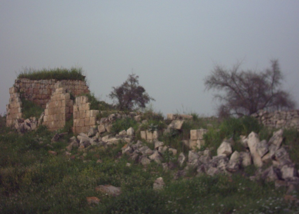
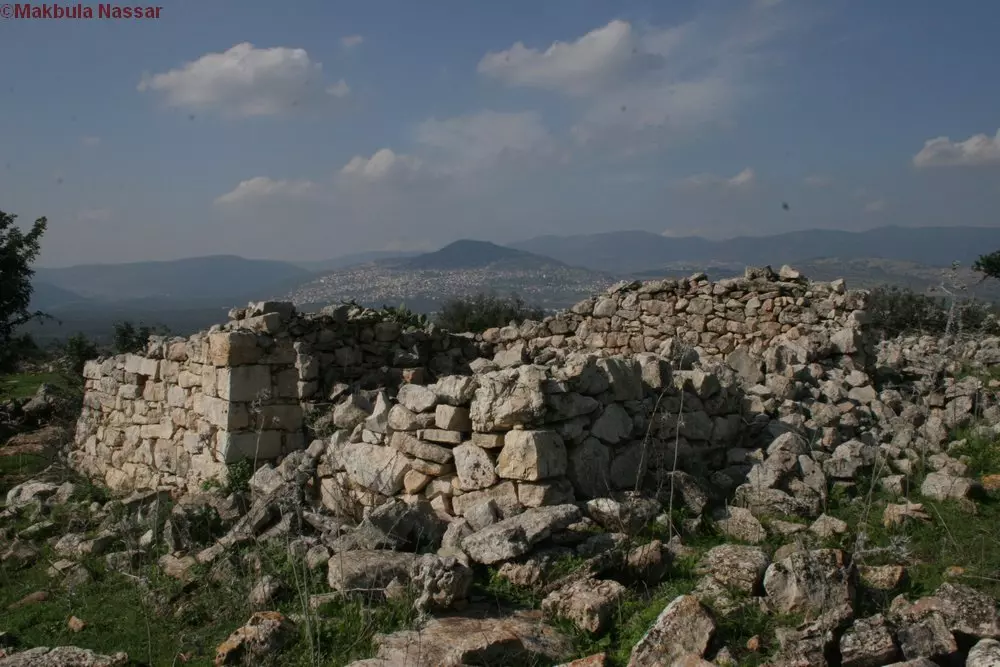
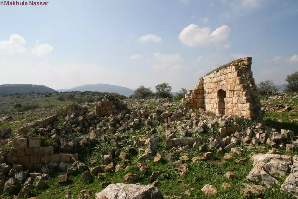
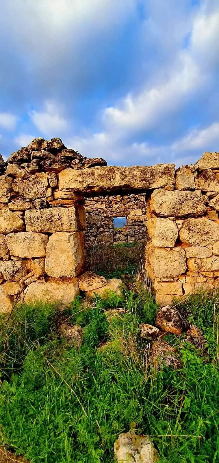
Posted by Makbula Nassar - اثار باقية في القرية17/2/07- تصوير: مقبولة نصار
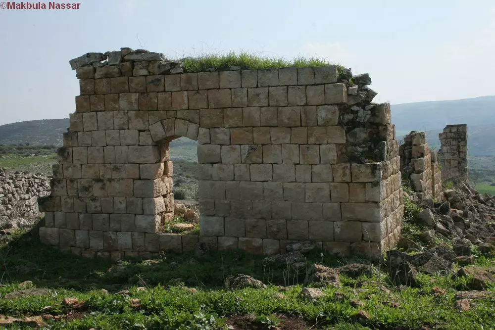
Posted by Makbula Nassar - اثار باقية في القرية17/2/07- تصوير: مقبولة نصار
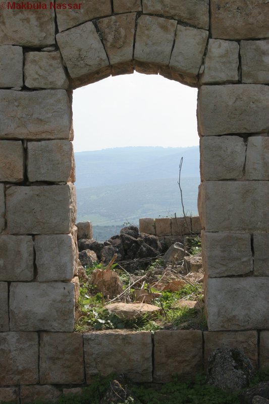
Posted by Makbula Nassar - اثار باقية في القرية17/2/07- تصوير: مقبولة نصار
Posted by Makbula Nassar - اثار باقية في القرية17/2/07- تصوير: مقبولة نصار
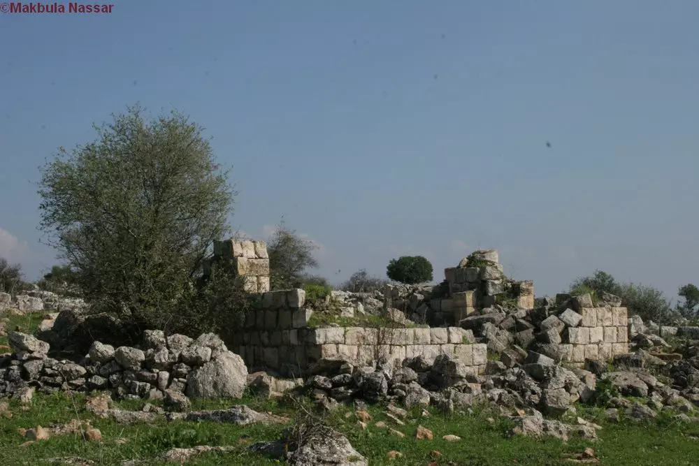
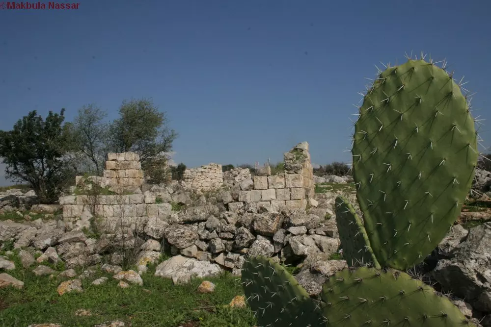
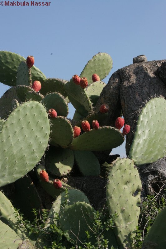
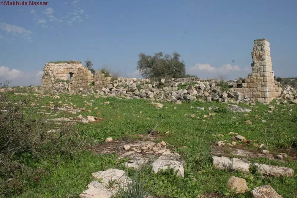
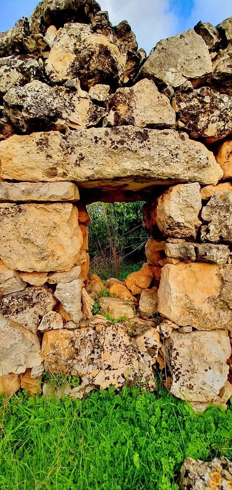
Posted by Makbula Nassar 3 - الصبار واثار القرية 17/2/07- تصوير: مقبولة نصار
Posted by Makbula Nassar 1 - اثار باقية في القرية 17/2/07- تصوير: مقبولة نصار
Posted by Makbula Nassar - الصبارالى جانب البيوت17/2/07- تصوير: مقبولة نصار
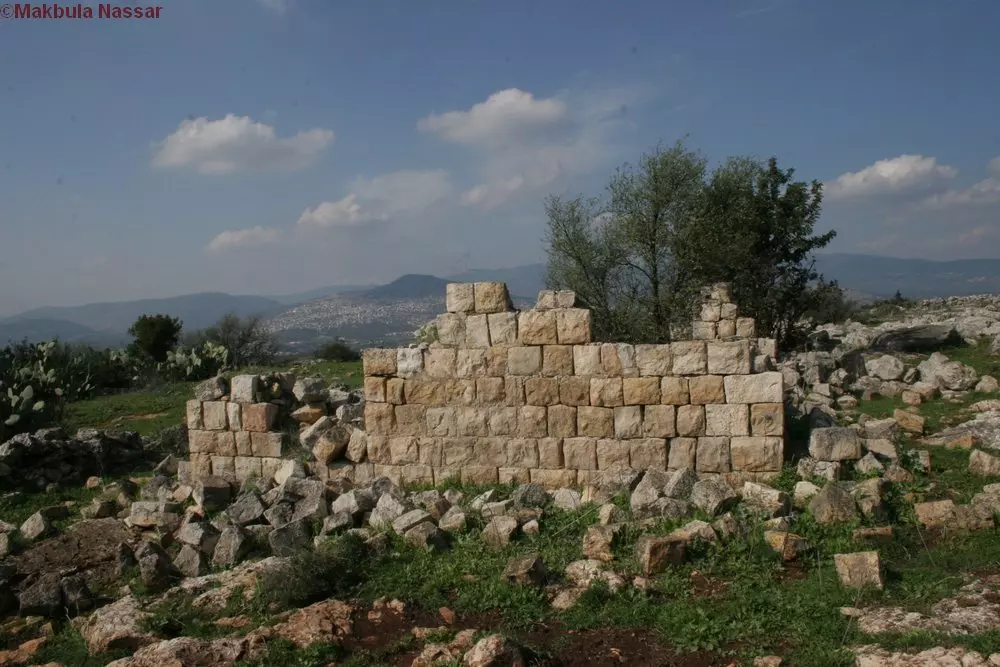
Posted by Makbula Nassar - اثار باقية في القرية 17/2/07- تصوير: مقبولة نصار
Posted by Makbula Nassar - اثار باقية في القرية17/2/07- تصوير: مقبولة نصار
Posted by Makbula Nassar - اثار باقية في القرية 17/2/07- تصوير: مقبولة نصار
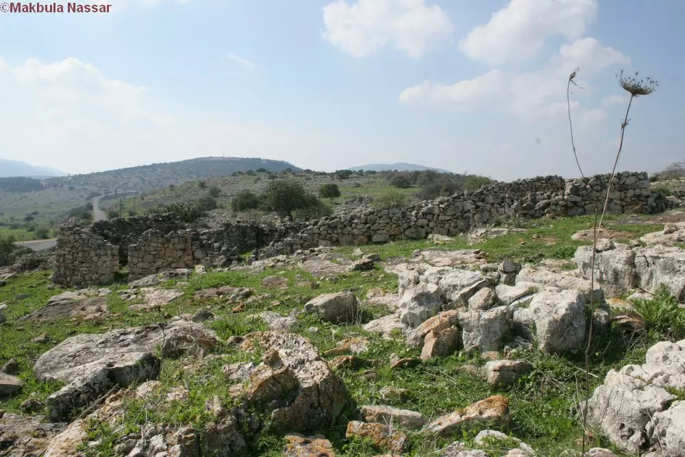
Posted by Makbula Nassar - اثار باقية في القرية17/2/07- تصوير: مقبولة نصار
Posted by Makbula Nassar - اثار باقية في القرية 17/2/07- تصوير: مقبولة نصار
Posted by Makbula Nassar - اثار باقية في القرية17/2/07- تصوير: مقبولة نصار
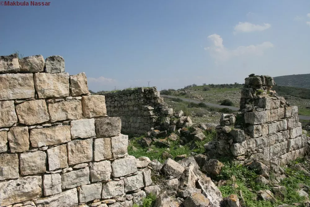
Posted by Makbula Nassar - منظر من القرية/2/07- تصوير: مقبولة نصار
Posted by Makbula Nassar - احجار البيوت المهدومة 17/2/07 تصوير:مقبولة نصار
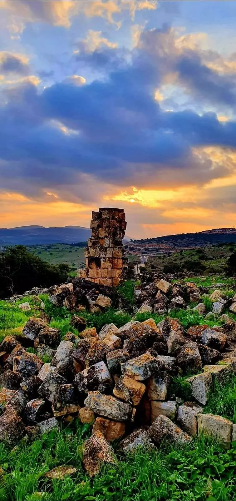
Posted by Makbula Nassar - Ruins of the destroyed Palestinian village
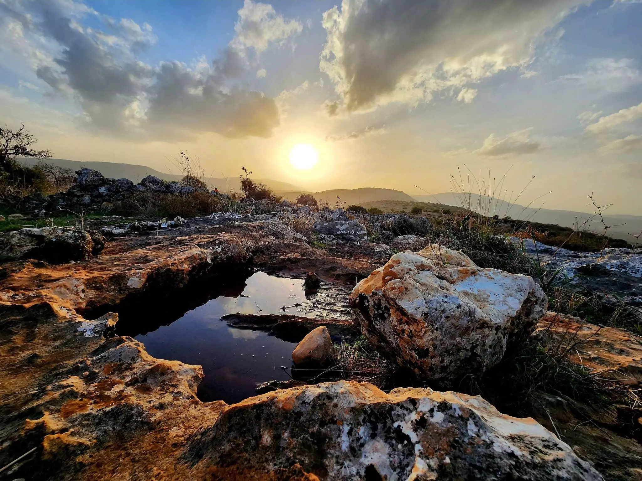
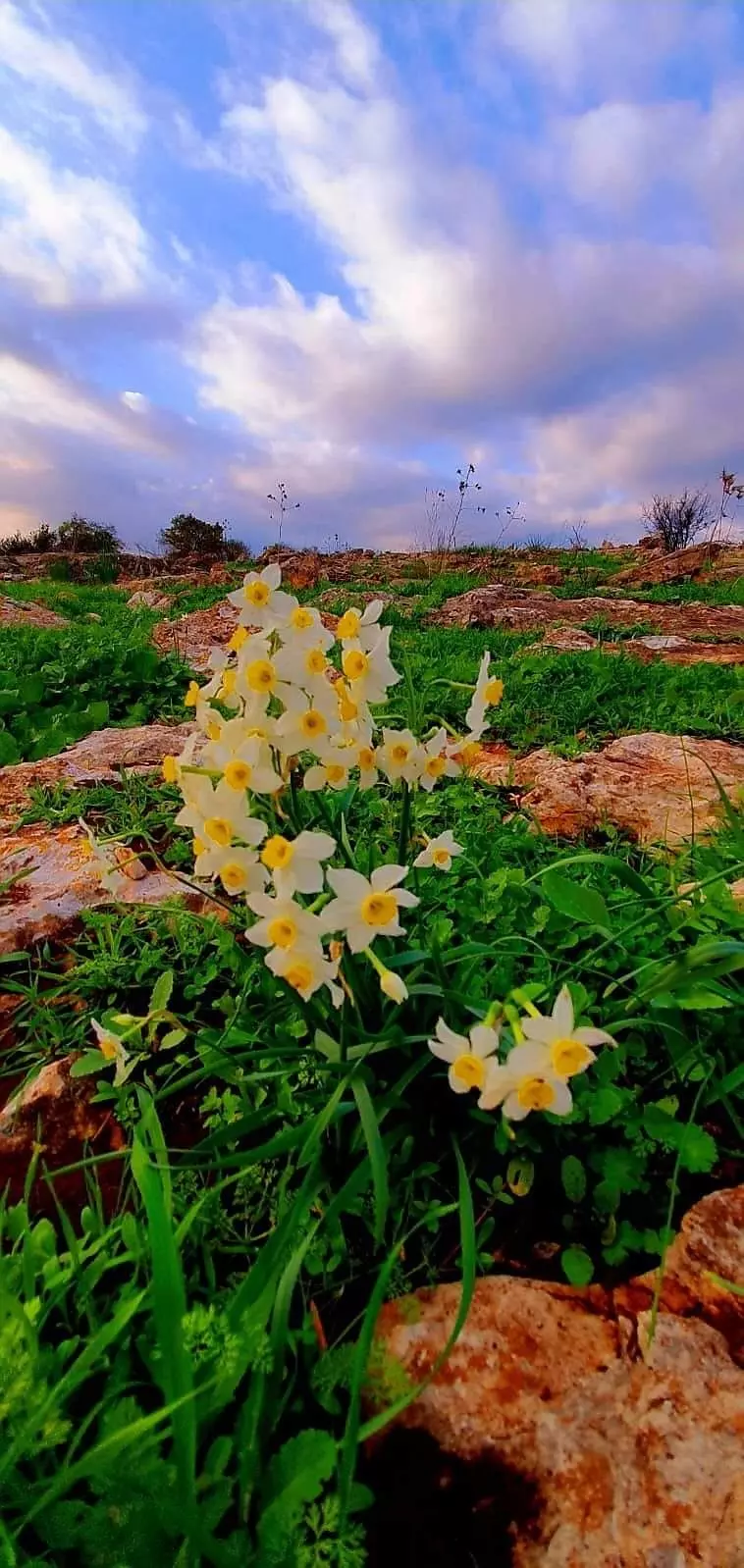
Posted by Noga Kadman 1 - Location of the village خربة الوعرة السودا - موقع القرية ومضارب المواسي بالقرب من وادي الحمام - تصوير رامز عيد 11/2012
Posted by Ramez - Al-Wa'ra al-Sawda 11/2012 خربة الوعرة السودا - موقع القرية ومضارب المواسي بالقرب من وادي الحمام - تصوير رامز عيد
Posted by Ramez 2 - خربة الوعرة السودا - موقع القرية ومضارب المواسي بالقرب من وادي الحمام - تصوير رامز عيد 11/2012
Posted by Ramez - خربة الوعرة السودا - موقع القرية ومضارب المواسي بالقرب من وادي الحمام - تصوير رامز عيد 11/2012
Posted by Ramez - المدخل الشرقي للقرية - وتظهر بقايا بيت (من الاسمنت) تم هدمه وتفجيره. تصوير رامز عيد 11/2012
Posted by Ramez - طريق المدخل الشرقي للقرية . تصوير رامز عيد 11/2012
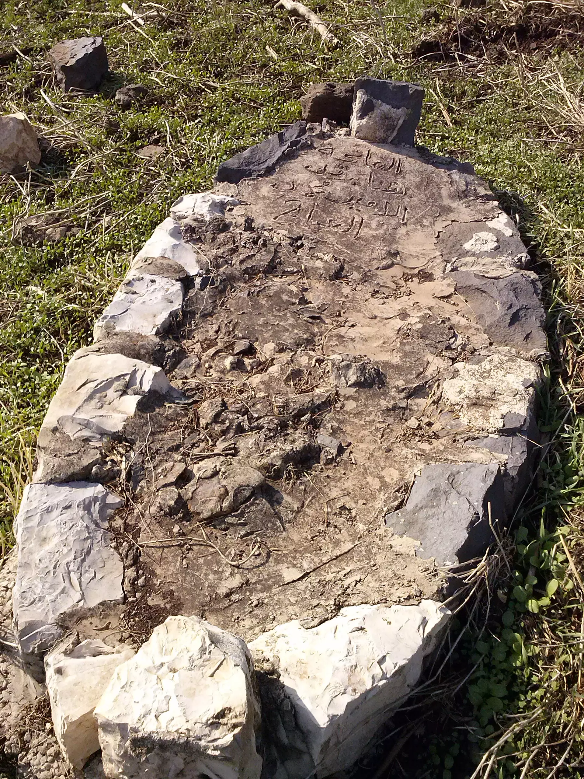
Posted by Ramez - احد القبور في الناحية الشرقية للقرية/المضارب. تصوير رامز عيد 11/2012 al-Wa'ra al-Sawda'
Posted by Ramez - احد البيوت في وسط القرية/المضارب. تصوير رامز عيد 11/2012
Posted by Ramez - بقايا بيت مهدوم بني من الحجارة والاسمنت في وسط القرية. تصويؤ ؤامز عيد 11/2012
Posted by Ramez - بعض من طرق القرية/المضارب. تصوير رامز عيد 11/2012
Posted by Ramez - حائط قاوم الهدم... تصوير رامز عيد 11/2012
Posted by Ramez - احد البيوت القليلة التي بنيت من الاسمنت - يقع في الجهة الشرقية للقرية. تصوير رامز عيد 11/2012
Posted by Ramez - منظر عام
- قلعة الوعرة السوداء
- عرب المواسي \ الوهرة السوداعام 1920-1933
Posted by فتحي ابو رضا \ العايدي - جولة بين انقاض البيوت المدمرة وحواكير القرية المهجرة -- نبيلة سالم .
- جولة بين انقاض البيوت المدمرة وحواكير القرية المهجرة -- نبيلة سالم . #2
- جولة بين انقاض البيوت المدمرة وحواكير القرية المهجرة -- نبيلة سالم . #3
- جولة بين انقاض البيوت المدمرة وحواكير القرية المهجرة -- نبيلة سالم . #4
- جولة بين انقاض البيوت المدمرة وحواكير القرية المهجرة -- نبيلة سالم . #5
- جولة بين انقاض البيوت المدمرة وحواكير القرية المهجرة -- نبيلة سالم . #6
- جولة بين انقاض البيوت المدمرة وحواكير القرية المهجرة -- نبيلة سالم . #7
- جولة بين انقاض البيوت المدمرة وحواكير القرية المهجرة -- نبيلة سالم . #8
- جولة بين انقاض البيوت المدمرة وحواكير القرية المهجرة -- نبيلة سالم . #9
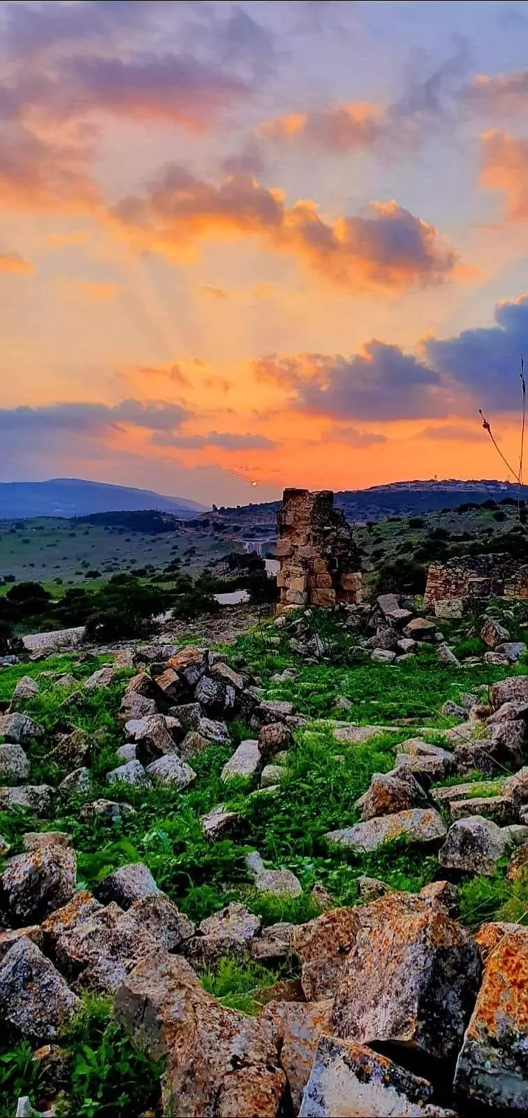
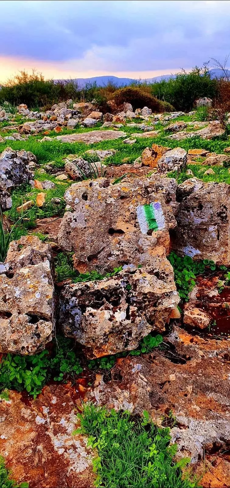
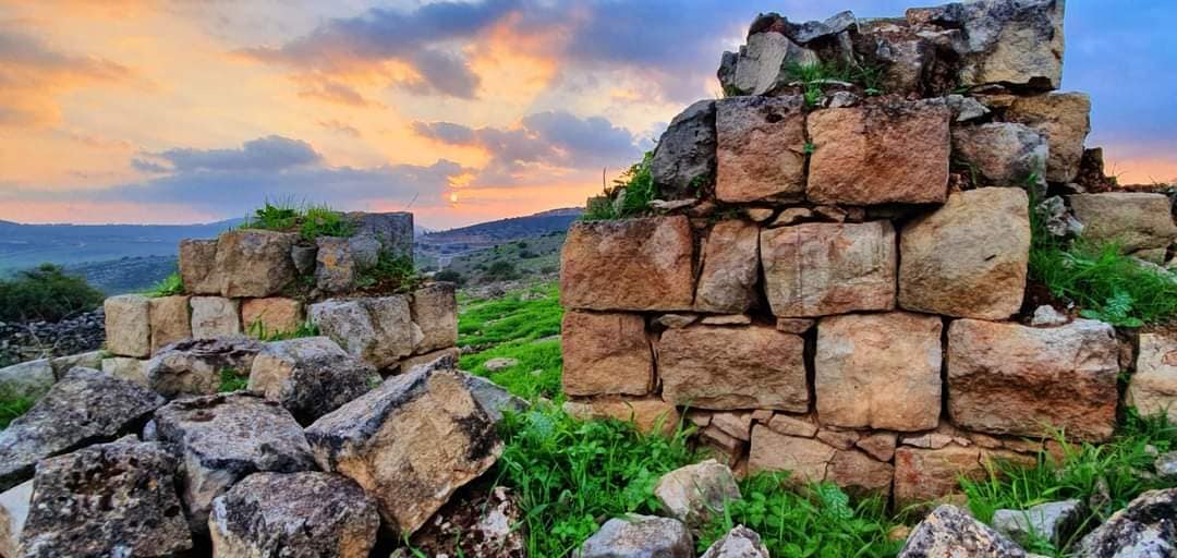
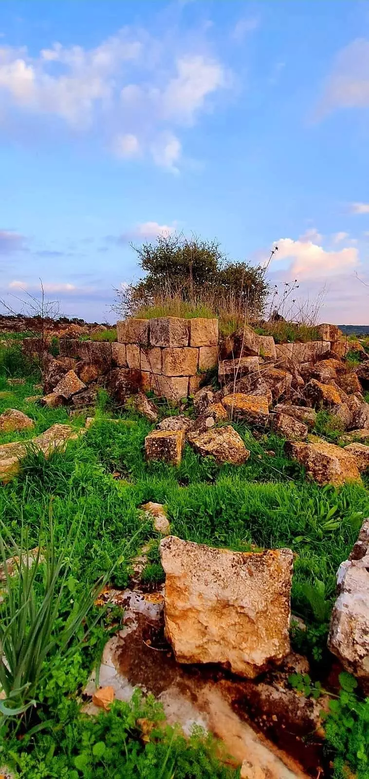
- Let us see how the most "liberal and civilized" of world Jewry has obliterated our village. How else will the Jews be great and safe again? -- القرية دمرت بالكامل.. من هنا مر الهمج
- Let us see how the most "liberal and civilized" of world Jewry has obliterated our village. How else will the Jews be great and safe again? -- القرية دمرت بالكامل.. من هنا مر الهمج
#2
- Let us see how the most "liberal and civilized" of world Jewry has obliterated our village. How else will the Jews be great and safe again? -- القرية دمرت بالكامل.. من هنا مر الهمج
#3
- Let us see how the most "liberal and civilized" of world Jewry has obliterated our village. How else will the Jews be great and safe again? -- القرية دمرت بالكامل.. من هنا مر الهمج
#4
- Let us see how the most "liberal and civilized" of world Jewry has obliterated our village. How else will the Jews be great and safe again? -- القرية دمرت بالكامل.. من هنا مر الهمج
#5
- Let us see how the most "liberal and civilized" of world Jewry has obliterated our village. How else will the Jews be great and safe again? -- القرية دمرت بالكامل.. من هنا مر الهمج
#6
- Let us see how the most "liberal and civilized" of world Jewry has obliterated our village. How else will the Jews be great and safe again? -- القرية دمرت بالكامل.. من هنا مر الهمج
#7
- Let us see how the most "liberal and civilized" of world Jewry has obliterated our village. How else will the Jews be great and safe again? -- القرية دمرت بالكامل.. من هنا مر الهمج
#8
- Let us see how the most "liberal and civilized" of world Jewry has obliterated our village. How else will the Jews be great and safe again? -- القرية دمرت بالكامل.. من هنا مر الهمج
#9

- Let us see how the most "liberal and civilized" of world Jewry has obliterated our village. How else will the Jews be great and safe again? -- القرية دمرت بالكامل.. من هنا مر الهمج
#10
- Let us see how the most "liberal and civilized" of world Jewry has obliterated our village. How else will the Jews be great and safe again? -- القرية دمرت بالكامل.. من هنا مر الهمج
#11
- Let us see how the most "liberal and civilized" of world Jewry has obliterated our village. How else will the Jews be great and safe again? -- القرية دمرت بالكامل.. من هنا مر الهمج
#12
- Let us see how the most "liberal and civilized" of world Jewry has obliterated our village. How else will the Jews be great and safe again? -- القرية دمرت بالكامل.. من هنا مر الهمج -Jan, 2024
- Let us see how the most "liberal and civilized" of world Jewry has obliterated our village. How else will the Jews be great and safe again? -- القرية دمرت بالكامل.. من هنا مر الهمج -Jan, 2024 #2
- Let us see how the most "liberal and civilized" of world Jewry has obliterated our village. How else will the Jews be great and safe again? -- القرية دمرت بالكامل.. من هنا مر الهمج -Jan, 2024 #3
- Let us see how the most "liberal and civilized" of world Jewry has obliterated our village. How else will the Jews be great and safe again? -- القرية دمرت بالكامل.. من هنا مر الهمج -Jan, 2024 #4
- Let us see how the most "liberal and civilized" of world Jewry has obliterated our village. How else will the Jews be great and safe again? -- القرية دمرت بالكامل.. من هنا مر الهمج -Jan, 2024 #5
- Let us see how the most "liberal and civilized" of world Jewry has obliterated our village. How else will the Jews be great and safe again? -- القرية دمرت بالكامل.. من هنا مر الهمج -Jan, 2024 #6
- Let us see how the most "liberal and civilized" of world Jewry has obliterated our village. How else will the Jews be great and safe again? -- القرية دمرت بالكامل.. من هنا مر الهمج -Jan, 2024 #7
- Let us see how the most "liberal and civilized" of world Jewry has obliterated our village. How else will the Jews be great and safe again? -- القرية دمرت بالكامل.. من هنا مر الهمج -Jan, 2024 #8
- Let us see how the most "liberal and civilized" of world Jewry has obliterated our village. How else will the Jews be great and safe again? -- القرية دمرت بالكامل.. من هنا مر الهمج -Jan, 2024 #9
- Let us see how the most "liberal and civilized" of world Jewry has obliterated our village. How else will the Jews be great and safe again? -- القرية دمرت بالكامل.. من هنا مر الهمج -Jan, 2024 #10
- Let us see how the most "liberal and civilized" of world Jewry has obliterated our village. How else will the Jews be great and safe again? -- القرية دمرت بالكامل.. من هنا مر الهمج -Jan, 2024 #11
- Let us see how the most "liberal and civilized" of world Jewry has obliterated our village. How else will the Jews be great and safe again? -- القرية دمرت بالكامل.. من هنا مر الهمج -Jan, 2024 #12
- Let us see how the most "liberal and civilized" of world Jewry has obliterated our village. How else will the Jews be great and safe again? -- القرية دمرت بالكامل.. من هنا مر الهمج -Jan, 2024 #13
- Let us see how the most "liberal and civilized" of world Jewry has obliterated our village. How else will the Jews be great and safe again? -- القرية دمرت بالكامل.. من هنا مر الهمج -Jan, 2024 #14
- Let us see how the most "liberal and civilized" of world Jewry has obliterated our village. How else will the Jews be great and safe again? -- القرية دمرت بالكامل.. من هنا مر الهمج -Jan, 2024 #15
- Let us see how the most "liberal and civilized" of world Jewry has obliterated our village. How else will the Jews be great and safe again? -- القرية دمرت بالكامل.. من هنا مر الهمج -Jan, 2024 #16
- Let us see how the most "liberal and civilized" of world Jewry has obliterated our village. How else will the Jews be great and safe again? -- القرية دمرت بالكامل.. من هنا مر الهمج -Jan, 2024 #17
- Let us see how the most "liberal and civilized" of world Jewry has obliterated our village. How else will the Jews be great and safe again? -- القرية دمرت بالكامل.. من هنا مر الهمج -Jan, 2024 #18
- Let us see how the most "liberal and civilized" of world Jewry has obliterated our village. How else will the Jews be great and safe again? -- القرية دمرت بالكامل.. من هنا مر الهمج -Jan, 2024 #19
- Let us see how the most "liberal and civilized" of world Jewry has obliterated our village. How else will the Jews be great and safe again? -- القرية دمرت بالكامل.. من هنا مر الهمج -Jan, 2024 #20
- Let us see how the most "liberal and civilized" of world Jewry has obliterated our village. How else will the Jews be great and safe again? -- القرية دمرت بالكامل.. من هنا مر الهمج -Jan, 2024 #21
- Let us see how the most "liberal and civilized" of world Jewry has obliterated our village. How else will the Jews be great and safe again? -- القرية دمرت بالكامل.. من هنا مر الهمج -Jan, 2024 #22
- Let us see how the most "liberal and civilized" of world Jewry has obliterated our village. How else will the Jews be great and safe again? -- القرية دمرت بالكامل.. من هنا مر الهمج -Jan, 2024 #23
- Let us see how the most "liberal and civilized" of world Jewry has obliterated our village. How else will the Jews be great and safe again? -- القرية دمرت بالكامل.. من هنا مر الهمج -Jan, 2024 #24
- Let us see how the most "liberal and civilized" of world Jewry has obliterated our village. How else will the Jews be great and safe again? -- القرية دمرت بالكامل.. من هنا مر الهمج -Jan, 2024 #25
- Let us see how the most "liberal and civilized" of world Jewry has obliterated our village. How else will the Jews be great and safe again? -- القرية دمرت بالكامل.. من هنا مر الهمج -Jan, 2024 #26
- Let us see how the most "liberal and civilized" of world Jewry has obliterated our village. How else will the Jews be great and safe again? -- القرية دمرت بالكامل.. من هنا مر الهمج -Jan, 2024 #27
- Let us see how the most "liberal and civilized" of world Jewry has obliterated our village. How else will the Jews be great and safe again? -- القرية دمرت بالكامل.. من هنا مر الهمج -Jan, 2024 #28
- Let us see how the most "liberal and civilized" of world Jewry has obliterated our village. How else will the Jews be great and safe again? -- القرية دمرت بالكامل.. من هنا مر الهمج -Jan, 2024 #29
- Let us see how the most "liberal and civilized" of world Jewry has obliterated our village. How else will the Jews be great and safe again? -- القرية دمرت بالكامل.. من هنا مر الهمج -Jan, 2024 #30
- Let us see how the most "liberal and civilized" of world Jewry has obliterated our village. How else will the Jews be great and safe again? -- القرية دمرت بالكامل.. من هنا مر الهمج -Jan, 2024 #31
- Let us see how the most "liberal and civilized" of world Jewry has obliterated our village. How else will the Jews be great and safe again? -- القرية دمرت بالكامل.. من هنا مر الهمج -Jan, 2024 #32
- Let us see how the most "liberal and civilized" of world Jewry has obliterated our village. How else will the Jews be great and safe again? -- القرية دمرت بالكامل.. من هنا مر الهمج -Jan, 2024 #33
- Let us see how the most "liberal and civilized" of world Jewry has obliterated our village. How else will the Jews be great and safe again? -- القرية دمرت بالكامل.. من هنا مر الهمج -Jan, 2024 #34
- Let us see how the most "liberal and civilized" of world Jewry has obliterated our village. How else will the Jews be great and safe again? -- القرية دمرت بالكامل.. من هنا مر الهمج -Jan, 2024 #35
- Let us see how the most "liberal and civilized" of world Jewry has obliterated our village. How else will the Jews be great and safe again? -- القرية دمرت بالكامل.. من هنا مر الهمج -Jan, 2024 #36
Want to browse more? 80,000 pictures were grouped in these gallaries:
| Display Name | Clan/Hamolah | Country of Residence |
| منير صالح جبر | المواسى | HEERHUGOWAARD, Nederland |
| قصي عوض | عرب المواسى | - |
| الامير ناجي العويمر | المواسي | - |
| قتيبة عوض | عرب المواسى | - |
| mohd kasem | almesawe | syria, syria |
| ابو محمد المواسي | - | - |
| أبو مرعي | المواسى | دمشق, سوريا |
| خليلية | خليلية | جبع |
| fadi abbas | - | - |
| Assad Elabbasa | almawasi | - |
- الذاكرة مفتاح العودة-الحلقة 44- قرية وعرة السودا Duration: 23 min 22 sec
- مقطع من برنامج حق يأبى النسيان للجزيرة Duration: min 50 sec
- سلسلة حكاية قرية من فلسطين| خِربةُ الوعرةِ السوداء (17) موسوعة القرى الفلسطينية Duration: 4 min 55 sec
No links have been shared yet, be free to the first to share the first link.
 Fake Valor: Why Did Zionist Jews Hoist Nazis Flag on Their Ships in the 1930s?
What is new?
-
Facts About Oct. 7th Gaza Raid
-
Remined Us Please:: Who Did Rape Who? Palestinians Raped Israelis? Or, was the other way around?
-
When Prof. Edward Said was invited to debate Bibi Netanyahu in the 1980s, watch what happened!
-
Ezra Klein of the NY Times on the "Jewish Race".
-
Abusing Blood Libel!
-
Zionist FAQ: Isn't it true that Palestinians don't want peace? Palestinians never accepted the two-state solution
- Facts about Haavara (Transfer) Agreement between Ben-Gurion & Hitler
-
Haavara FAQs: Why Did Zionist Jews Hoist Nazis' Flags on Their Ships in the 1930s?
-
Dear ChatGPT: Why did the Jewish Agency suppress news of the Holocaust during WWII?
-
Video Playlist: Jews share their DNA tests to end the conflict for good.
-
A Tale of Two Conflicts: Examining the Definition of Genocide
-
Prof. Abraham Polak And The Suppressed History of the Khazars and European Jewry
-
How Ronald Reagan would have framed the genocide in Gaza if he were still alive?
-
Haavara FAQs: Let us do the math: how many German Jews did The Haavara Agreement save?
-
Zionist FAQs: The Hebron Massacre of 1929, "clearly proves" that Palestinians are antisemitic, how could you deny it?
-
Zionist FAQs: Why Anti-Zionist Is Not Antisemitism?
-
Zionist FAQs: Isn't it true that the KGB create Palestinian Nationalism in the early 1960s?
- Zionist FAQs: Muslims are killing Muslims all the time; why are Israeli Jews being singled out in the media?
- Zionist FAQs: How is Israel an apartheid state when 20% of its citizens are Arabs who enjoy full rights?
-
Haavara FAQs: Analysis of Herzl's Uganda Scheme and how it could have saved millions of Jews.
-
Haavara FAQs: Why did Hayim Greenberg describe American Jewry as "morally bankrupt" in early 1943?
-
Haavara FAQs: What if the Evian Conference was a resounding success? What would have been the impact of saving European Jewry on Zionism?
- Haavara FAQs: What if the six million were saved, how that would have impacted the Zionist project?
-
Haavara FAQs: How did Zionist leaders react when Europe's Jews lingered in the DP camps after WWII ended?
-
Why does the American Jewish community repeat lies that David Ben-Gurion had debunked before he died?
-
Who has the power to rename the Tatar/Khazar Gene Marker to Jewish IV?
-
Zionist FAQs: Why won't Egypt, Syria, and Jordan take their people back? Jews are indigenous to Palestine, and Arabs immigrated after Jews developed the country. Arabs should leave.
-
Haavara FAQs: Did Hitler and the Nazis conflate between Judaism and Zionist? If that wasn't case, then why?
-
Haavara FAQs: Winston Churchill and antisemitism, a collection of articles written Churchill.
-
Haavara FAQs: Broken by country, how many Jews survived vs. killed during the Holocaust?
-
Haavara FAQs: Why did European Jews vote with their feet and to immigrated to the Americas, not Palestine, after WWII?
-
Watch this American Jewish Girl describing Israeli Jews' cognitive dissonance like no other in under two minutes
-
Haavara FAQs: When the Nazis went out of their way to hide the Holocaust, Israeli Jews did the exact opposite by broadcasting their genocide of Gazans. But why?
-
Haavara FAQs: How Zionist Jews went out of their to show their appreciation to Nazism and Fascism?
- Haavara FAQs: Why Zionist leaders were against bombing the death camps & the Railroads leading to them?
-
Haavara FAQs: Hitler's message to the British and American people: If Jews are such noble citizens and you care about them, how come you're not letting them in? I will gladly ship them to you at my expense, even on luxury liners!
-
A shortlist of Zionist and Israeli false flag operations in the name Jews.
-
The Most Moral Army
- The Land of Kapos (Israel): Where the brave are boycotted and Kapos walk free.
- Why did early Zionists often named their communal enterprises "colonial"?
- Zionist Relations with Nazi Germany by Faris Glubb
-
Two NY Times advertisements by Zionists in the early 1943 that exposes Zionists' treason at the height of the calamity
- Facts Not Lies about the Palestinian-Israeli Conflict.
- Site's pictures have been categorized
- Campgain Against Lice
- A Survey of Palestine, the official source about Palestine before Nakba produced by the British Mandate; over 1200 pages.
- Satellite View & Google Earth: Over 6,000 placemarks identifying all destroyed towns, W. Bank & Gaza Strip Towns, & refugee camps.
- PalestineRemembered.com and its Nakba Oral History Project were featured on al-Jazeera Satellite TV.
- Nakba Oral History Video Podcast:
 Over 700 Oral History interviews (including 3,500+ hours of recording) can be viewed online.
 - Palestine Village Statistics Project
- Gaza Jail Break
- النسخة العربية للموقع الان متوفرة
- Videos: Documenting the destroyed villages in video: Tracing all that remains since Nakba.
- Videos: Responding to Zionist Propaganda
- Interview: The ethnic cleansing of Palestine: George Galloway interviews Israeli Historian Ilan Pappe.
- For Palestinians, memory matters. It provides a blueprint for their future By George Bisharat.
- Zionist FAQ now available in Hebrew שאלות שציונים שואלים, עכשיו בעברית
- Video: The Stephen Walt and John Mearsheimer report on the influence of the Israel Lobby on U.S. Foreign Policy
- The Palestinian-Israeli conflict for beginners
