| PalestineRemembered | About Us | Oral History | العربية | |
| Pictures | Zionist FAQs | Haavara | Maps | |
| Search |
| Camps |
| Districts |
| Acre |
| Baysan |
| Beersheba |
| Bethlehem |
| Gaza |
| Haifa |
| Hebron |
| Jaffa |
| Jericho |
| Jerusalem |
| Jinin |
| Nablus |
| Nazareth |
| Ramallah |
| al-Ramla |
| Safad |
| Tiberias |
| Tulkarm |
| Donate |
| Contact |
| Profile |
| Videos |
Welcome To Bayt Shanna - بيت شنة
|
District of al-Ramla
Ethnically cleansed days ago |
العربية Google Earth |
 |
Gallery (23) |
- Statistics & Facts
-
Before & After

- Satellite View
- Articles 1
- Pictures 23
- Members
- All That Remains
- Wikipedia
- Videos
- Guest Book 2
- Links
| Statistic & Fact | Value | ||||||||||||
| Occupation Date | July 15, 1948 | ||||||||||||
| Distance From District | 11.5 (km) Southeast of al-Ramla | ||||||||||||
| Elevation | 240 (meters) | ||||||||||||
| Before & After Nakba, Click Map For Details |
|||||||||||||
|
|||||||||||||
| Map Location | See location #30 on the map View from satellite |
||||||||||||
| Military Operation | Second stage of Operation Dani | ||||||||||||
| Exodus Cause | Military assault by Zionist troops | ||||||||||||
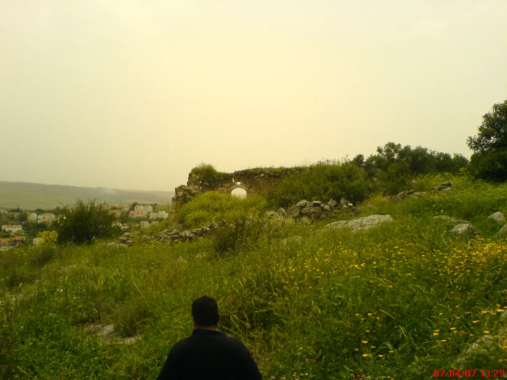
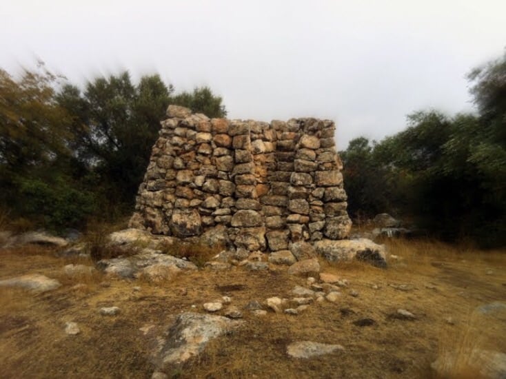
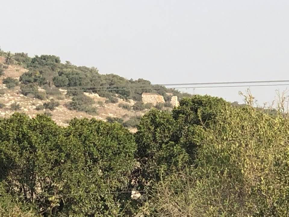
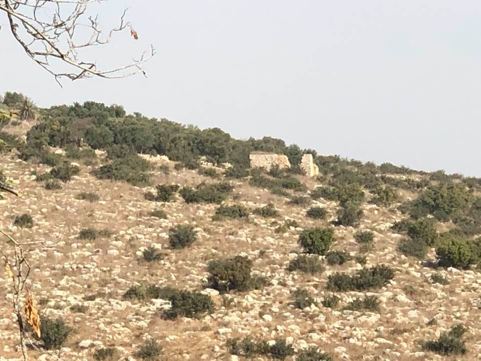
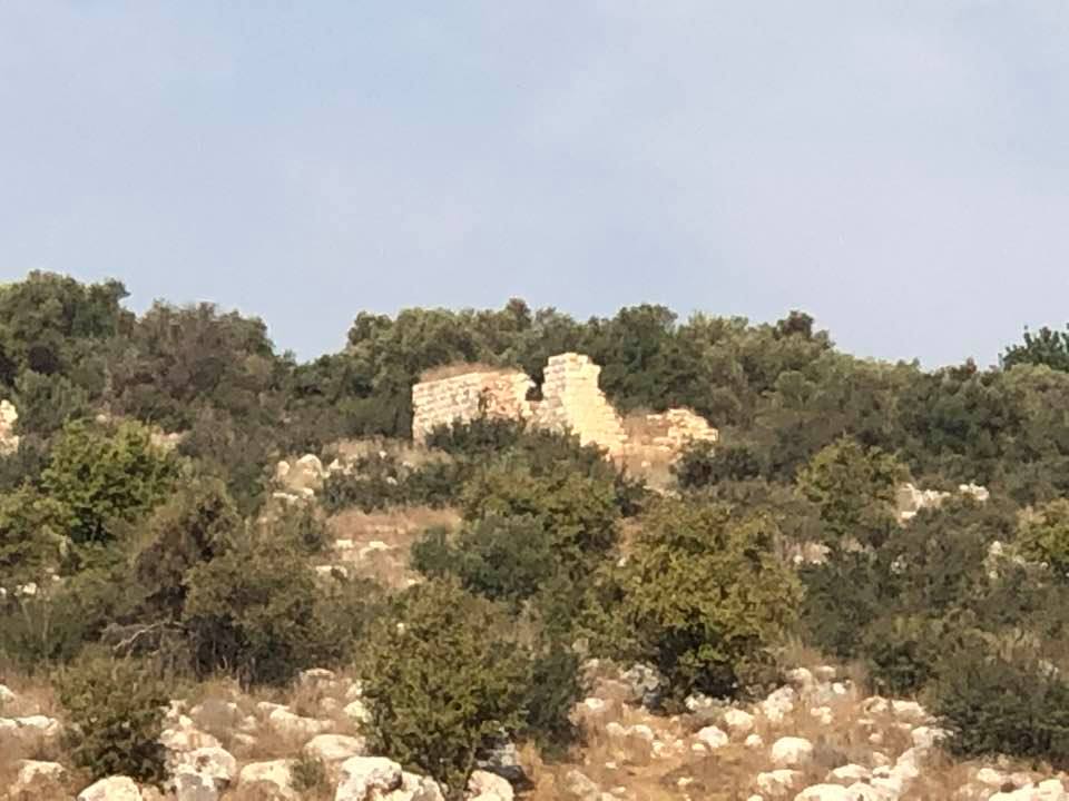
| Village Temains | Bayt Shanna was mostly destroyed with the exception of a small house on a hill. | ||||||||||||
| Ethnically Cleansing | Bayt Shanna inhabitants were completely ethnically cleansed. | ||||||||||||
| Pre-Nakba Land Ownership |
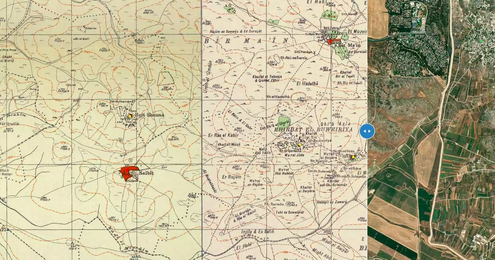
**Town Lands' Demarcation Maps |
||||||||||||
| Land Usage As of 1945 |
|
||||||||||||
| Population |
|
||||||||||||
| Number of Houses | In (1931): 71 (listed in the Jerusalem district; includes Salbit) | ||||||||||||
| Near By Towns |
|||||||||||||
|
|
|||||||||||||
| Archeological Sites | Two khirbats located to West and Northeast of the village center that contains the foundations of a church and buildings, cisterns, and rock-hewn presses. | ||||||||||||
| Exculsive Jewish Colonies Who Usurped Village Lands |
No Israeli settlements on village lands. | ||||||||||||
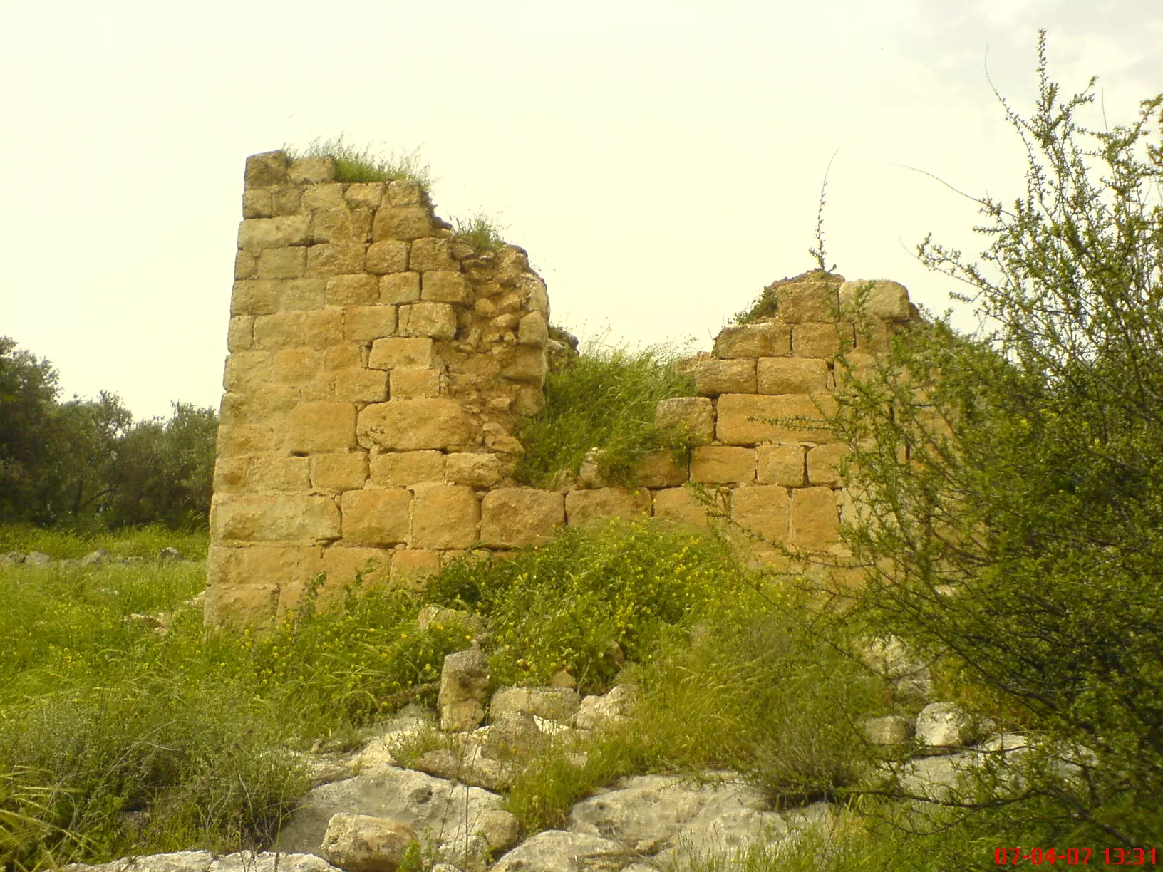
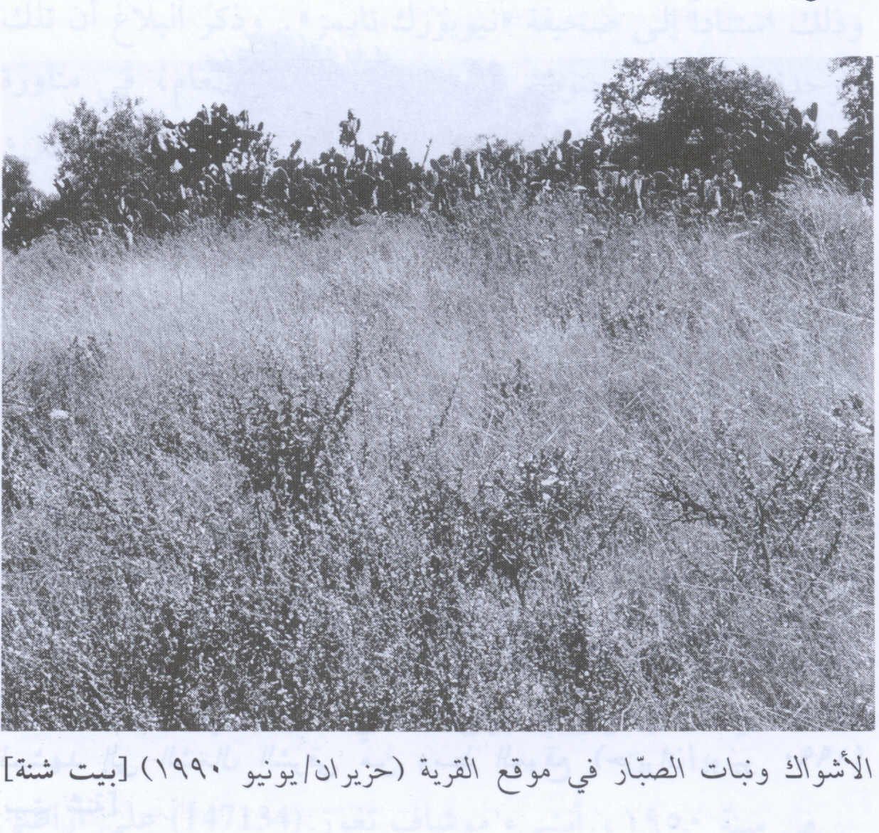
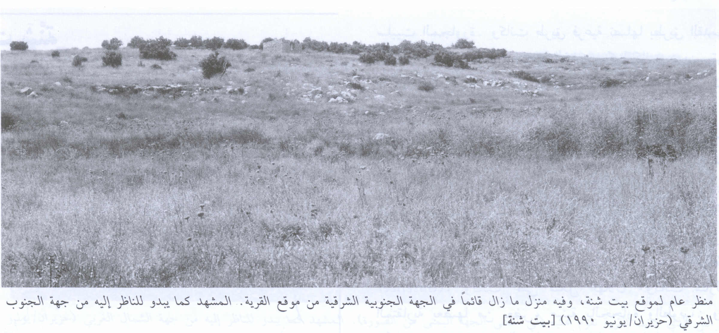
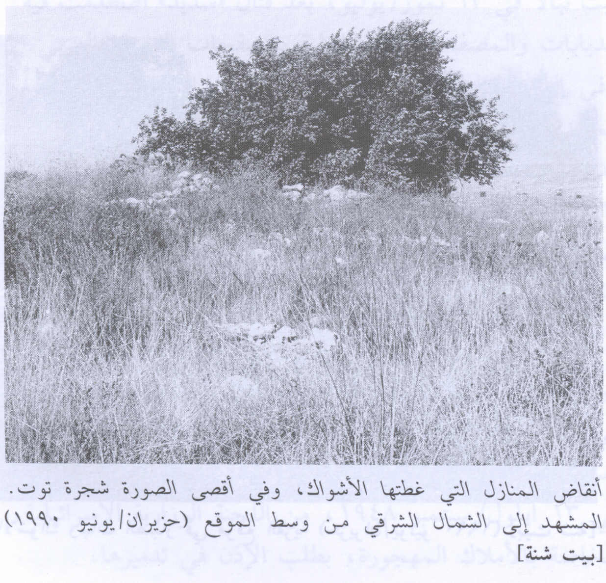
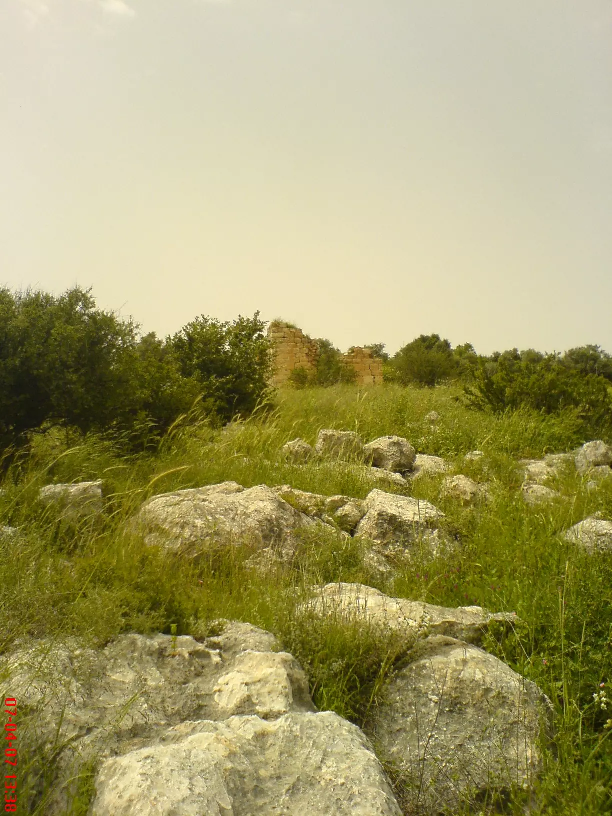
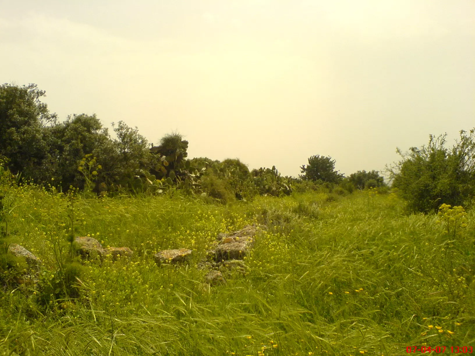
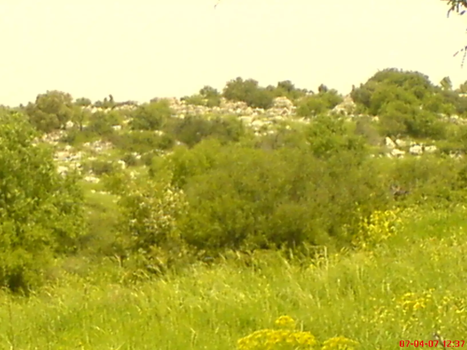
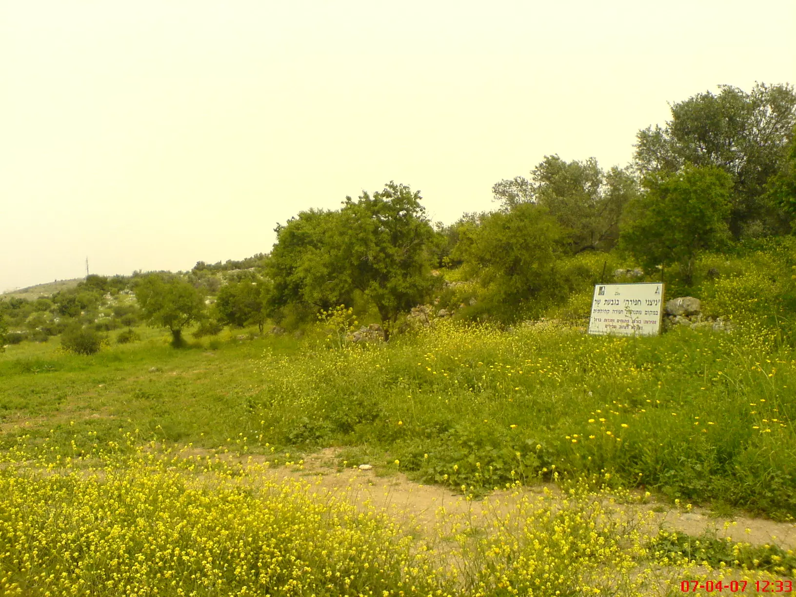
Village Before NakbaThe village, located on top of a high hill that was surrounded by lower hills, overlooked wide areas in all directions except the north. The hill sloped gradually towards the south, leading to a wadi that separated the village lands from those of the nearby village of Salbit. A secondary road linked it to the Jerusalem-Jaffa highway, to the southwest, and dirt paths led to several neighboring villages. In 1596 Bayt Shanna was a village in the nahiya of Ramla (liwa' of Gaza) with twenty-two inhabitants. It paid taxes on wheat, barley, fruit trees, and vineyards, as well as goats and beehives. In the late nineteenth century the site was not inhabited and only traces of ruins were observed there. In modern times it was classified as a hamlet by the Palestine Index Gazetteer. It had a crescent-shaped layout and its houses were built close to one another, constructed of stone and adobe brick. The residents of Bayt Shanna were Muslim. Their agricultural lands were alternately flat and undulating and were mainly rainfed. The more rugged lands were used for grazing. The villagers cultivated grain, olives, grapes, figs, apples, almonds, and vegetables. In 1944/45 a total of 865 dunums was allocated to cereals; 44 dunums were irrigated or used for orchards. Ancient ruins on the site included two khirbas west and northeast of the village, which contained the foundations of a church and other buildings, cisterns, and rock-hewn presses.Zionists Colonies on Village LandsThere are no Israeli settlements on village lands. The village site is close to the lands of the destroyed village of Salbit (148141), where the settlement of Sha'alvim (148142) was built in 1951.Village TodayThe stone rubble of the former houses covers the village site. Large mulberry, olive, and almond trees grow amid the rubble, most of which is covered by wild vegetation. The whole site is fenced in and appears to be used as a grazing area. On the hillside east of the village, a room made of masonry still stands. Fruit trees grow around it (see photos).SourceDr. Walid al-Khalidi, 1992: All That Remains. |
|||||||||||||
| Related Maps | Town Lands' Demarcation Maps خرائط للقضاء توضح حدود القرى والاودية Town's map on MapQuest View from satellite Help us map this town at WikiMapia |
||||||||||||
| Related Links | Wikipedia's Page Google Search Google For Images Google For Videos |
||||||||||||
| More Information | في كتاب كي لا ننسى في كتاب بلادنا فلسطين المزيد من موقع هوية |
||||||||||||
- Village Remains In 1990
Scanned from "All That Remains" by Dr. Walid Khalidi - General View Of the Village With a House Still Standing In 1990
Scanned from "All That Remains" by Dr. Walid Khalidi - Village House Rubble In 1990
Scanned from "All That Remains" by Dr. Walid Khalidi - One of the remaining house walls
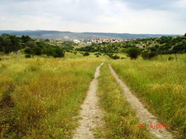
Posted by David Ash - Looking up the hill to the house in previous picture
Posted by David Ash 1 - Walking up to the remaining house (ruin)
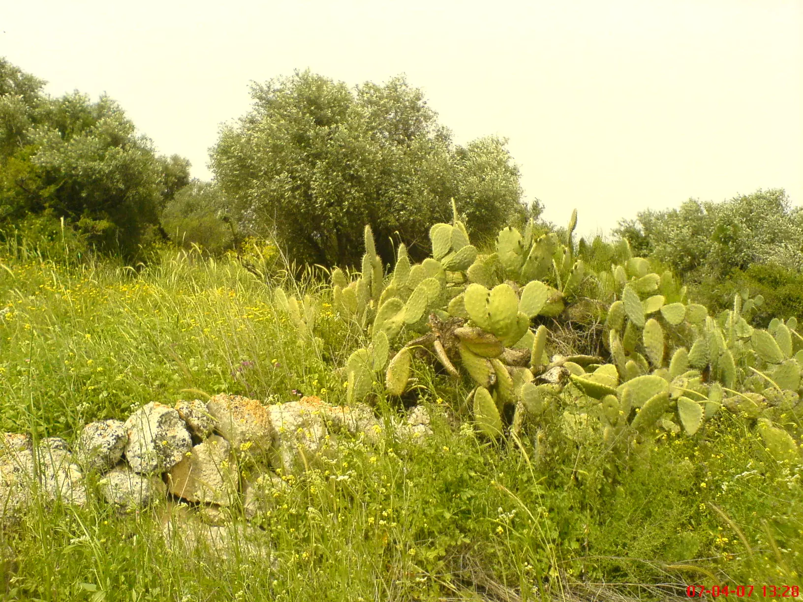
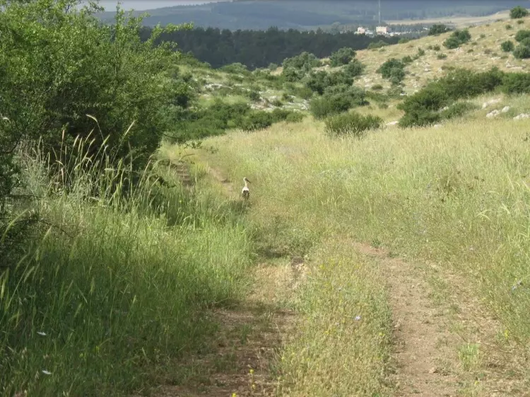
Posted by David Ash - Olive grove, cactus and sadly more ruins #2
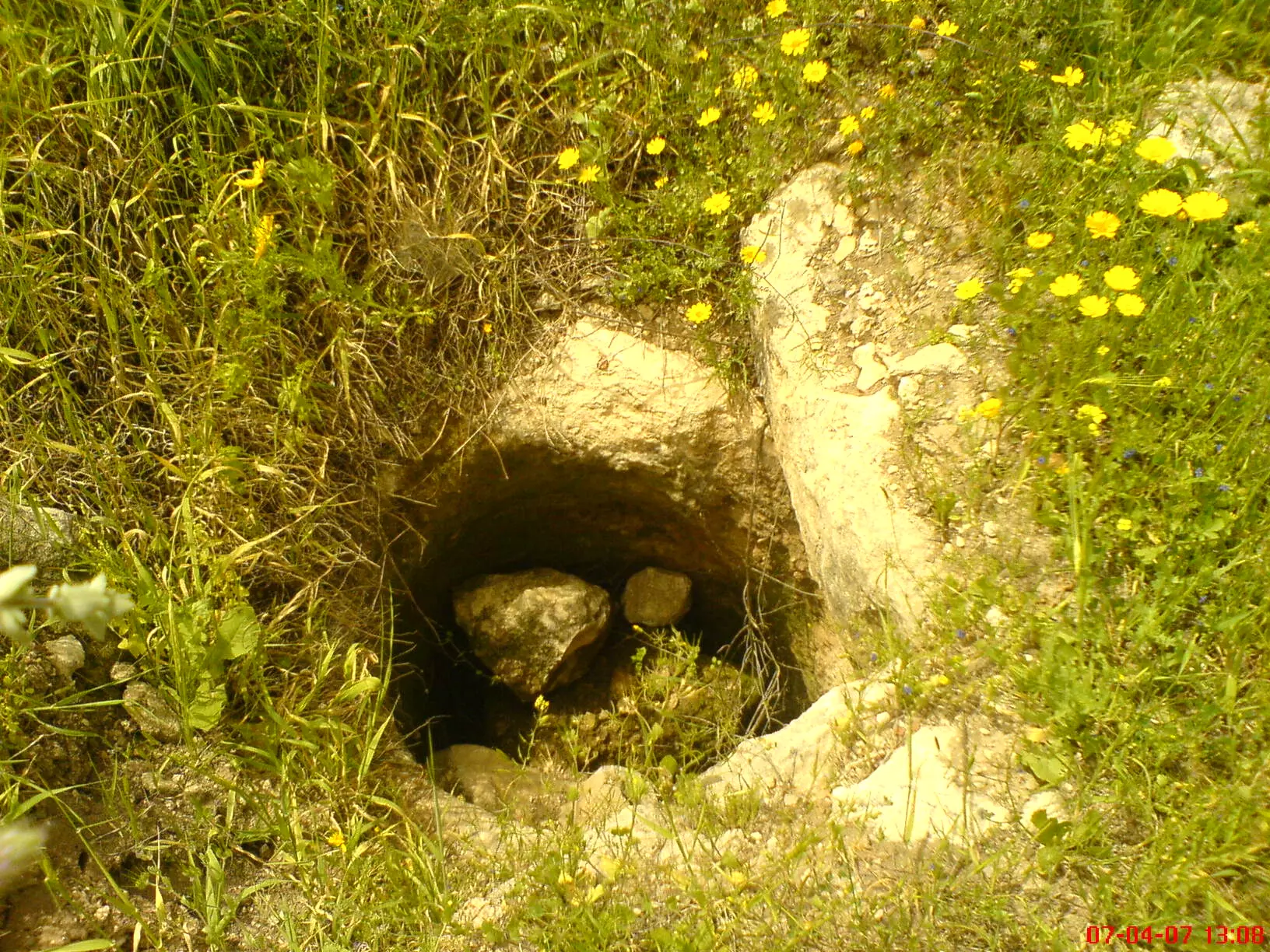
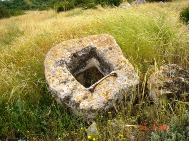
Posted by David Ash 1 - cistern used for collecting rain water/Beir #2
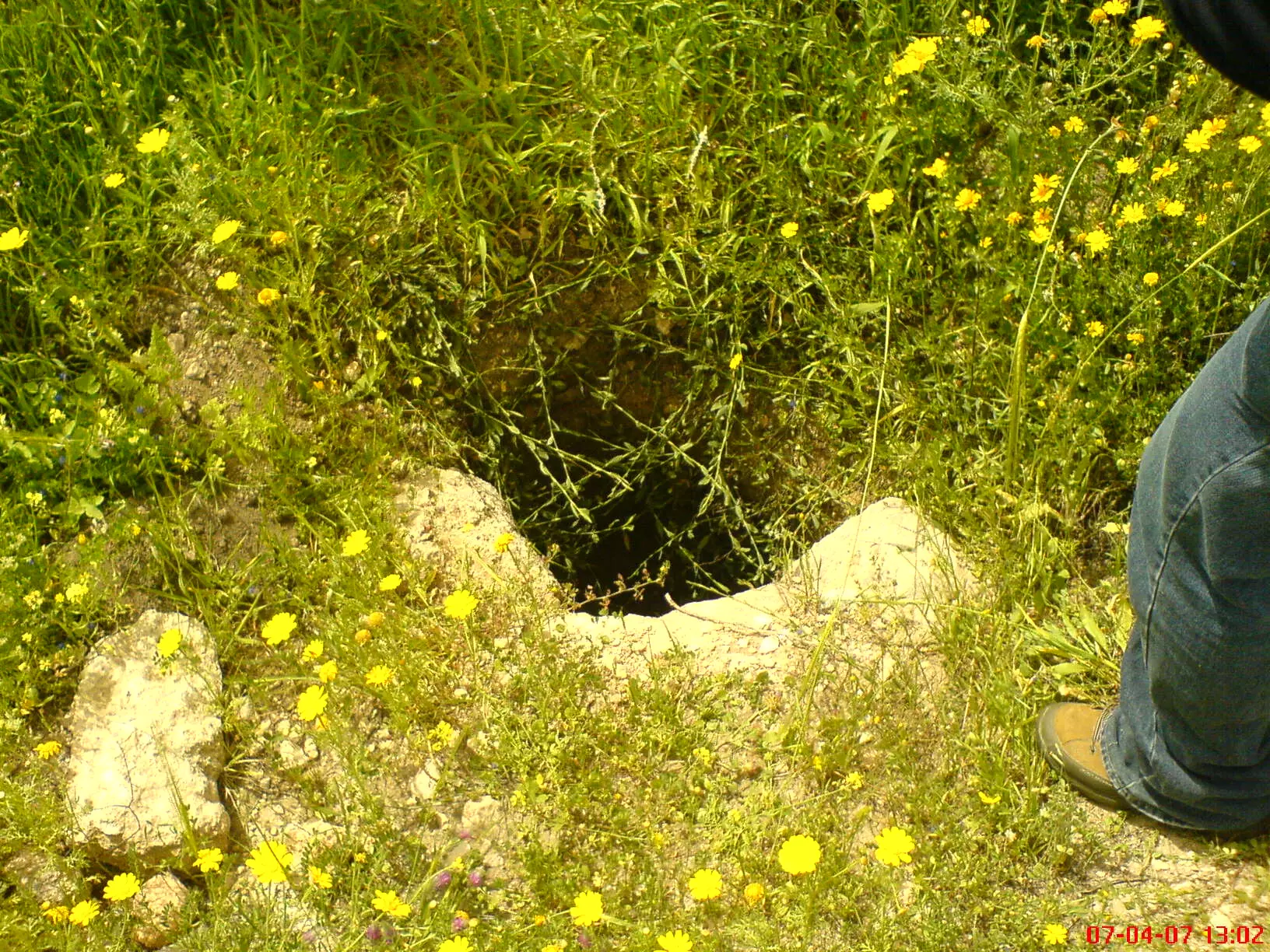
Posted by David Ash - cistern used for collecting rain water/Beir
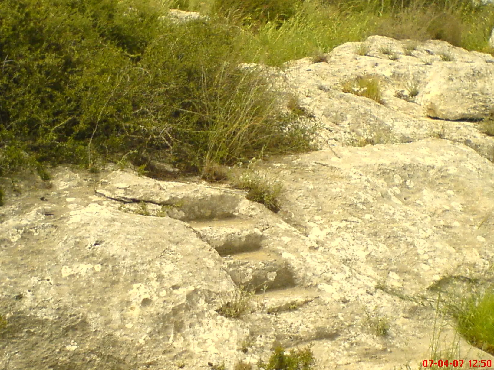
Posted by David Ash - Archaeological steps ruins in the village
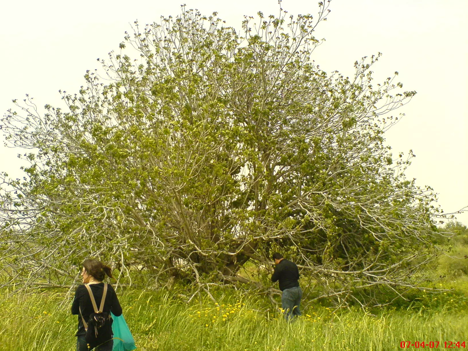
Posted by David Ash - An old tree (possibly a fig tree) as old as Nakba
Posted by David Ash - Olive grove, cactus and sadly more ruins #2
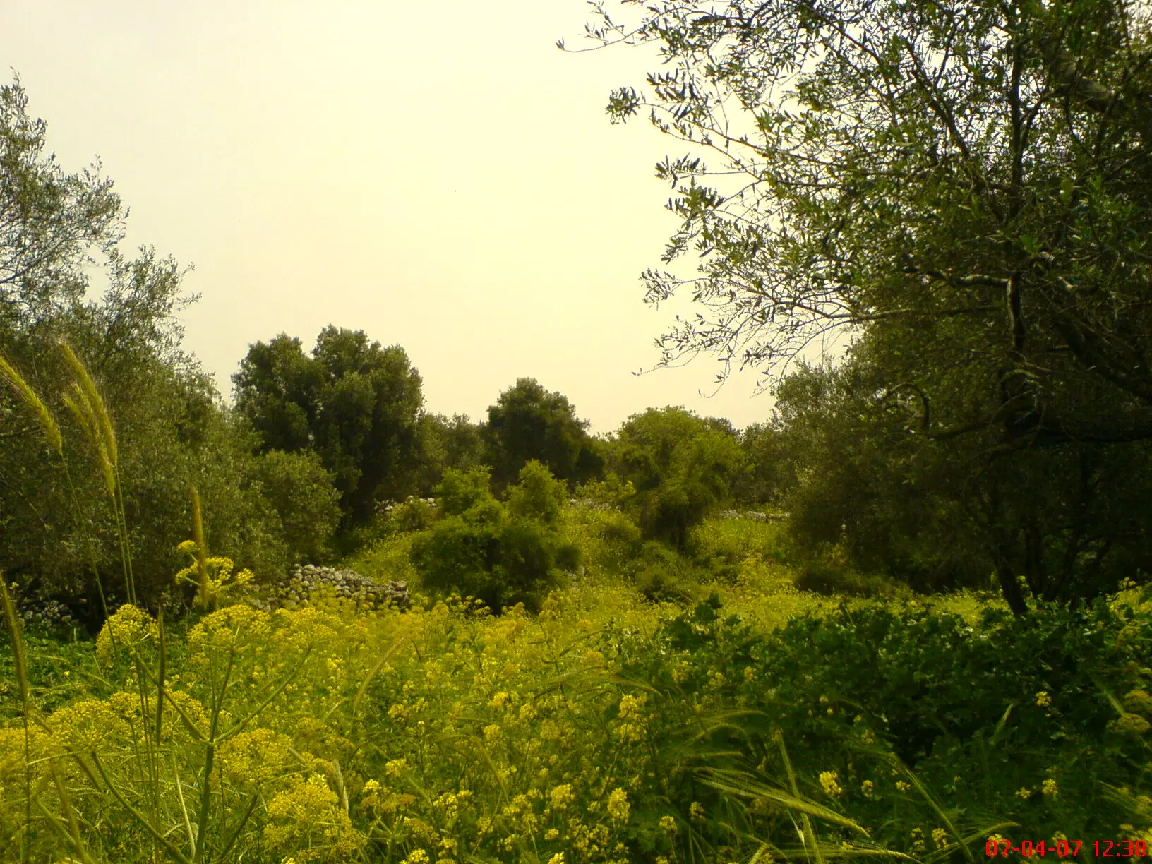
Posted by David Ash - Olive grove, cactus and sadly more ruins
Posted by David Ash - More ruins and destruction
Posted by David Ash - More ruins and destruction
Posted by David Ash - اسفل القرية من الجنوب
Posted by خالد دويات - اغطية احد الابار في القرية
Posted by خالد دويات - من جانب القريه
Posted by abu raya - بالقرب من القريه
Posted by abu raya - من بقايا القريه
Posted by abu raya - The "civilized" completely defaced our village. How else will the Jews be great and safe again?
- The "civilized" completely defaced our village. How else will the Jews be great and safe again? #2
- The "civilized" completely defaced our village. How else will the Jews be great and safe again? #3
Want to browse more? 80,000 pictures were grouped in these gallaries:
| Display Name | Clan/Hamolah | Country of Residence |
No links have been shared yet, be free to the first to share the first link.
 Fake Valor: Why Did Zionist Jews Hoist Nazis Flag on Their Ships in the 1930s?
What is new?
-
Facts About Oct. 7th Gaza Raid
-
Remined Us Please:: Who Did Rape Who? Palestinians Raped Israelis? Or, was the other way around?
-
When Prof. Edward Said was invited to debate Bibi Netanyahu in the 1980s, watch what happened!
-
Ezra Klein of the NY Times on the "Jewish Race".
-
Abusing Blood Libel!
-
Zionist FAQ: Isn't it true that Palestinians don't want peace? Palestinians never accepted the two-state solution
- Facts about Haavara (Transfer) Agreement between Ben-Gurion & Hitler
-
Haavara FAQs: Why Did Zionist Jews Hoist Nazis' Flags on Their Ships in the 1930s?
- Haavara FAQs: When Chaim Weizmann met FDR in mid-1943, why was he silent about rescuing European Jewry?
-
Dear ChatGPT: How did Palestinians resist Napoleon's invasion of their country in 1799?
-
Dear ChatGPT: Gaza had a vibrant Jewish community in the mid-17th century. What happened to them?
-
Dear ChatGPT: Why did the Jewish Agency suppress news of the Holocaust during WWII?
-
Video Playlist: Jews share their DNA tests to end the conflict for good.
-
A Tale of Two Conflicts: Examining the Definition of Genocide
-
Prof. Abraham Polak And The Suppressed History of the Khazars and European Jewry
-
How Ronald Reagan would have framed the genocide in Gaza if he were still alive?
-
Haavara FAQs: Let us do the math: how many German Jews did The Haavara Agreement save?
-
Zionist FAQs: The Hebron Massacre of 1929, "clearly proves" that Palestinians are antisemitic, how could you deny it?
-
Zionist FAQs: Why Anti-Zionist Is Not Antisemitism?
-
Zionist FAQs: Isn't it true that the KGB create Palestinian Nationalism in the early 1960s?
- Zionist FAQs: Muslims are killing Muslims all the time; why are Israeli Jews being singled out in the media?
- Zionist FAQs: How is Israel an apartheid state when 20% of its citizens are Arabs who enjoy full rights?
-
Haavara FAQs: Analysis of Herzl's Uganda Scheme and how it could have saved millions of Jews.
-
Haavara FAQs: Why did Hayim Greenberg describe American Jewry as "morally bankrupt" in early 1943?
-
Haavara FAQs: What if the Evian Conference was a resounding success? What would have been the impact of saving European Jewry on Zionism?
- Haavara FAQs: What if the six million were saved, how that would have impacted the Zionist project?
-
Haavara FAQs: How did Zionist leaders react when Europe's Jews lingered in the DP camps after WWII ended?
-
Why does the American Jewish community repeat lies that David Ben-Gurion had debunked before he died?
-
Who has the power to rename the Tatar/Khazar Gene Marker to Jewish IV?
-
Zionist FAQs: Why won't Egypt, Syria, and Jordan take their people back? Jews are indigenous to Palestine, and Arabs immigrated after Jews developed the country. Arabs should leave.
-
Haavara FAQs: Did Hitler and the Nazis conflate between Judaism and Zionist? If that wasn't case, then why?
-
Haavara FAQs: Winston Churchill and antisemitism, a collection of articles written Churchill.
-
Haavara FAQs: Broken by country, how many Jews survived vs. killed during the Holocaust?
-
Haavara FAQs: Why did European Jews vote with their feet and to immigrated to the Americas, not Palestine, after WWII?
-
Watch this American Jewish Girl describing Israeli Jews' cognitive dissonance like no other in under two minutes
-
Haavara FAQs: When the Nazis went out of their way to hide the Holocaust, Israeli Jews did the exact opposite by broadcasting their genocide of Gazans. But why?
-
Haavara FAQs: How Zionist Jews went out of their to show their appreciation to Nazism and Fascism?
- Haavara FAQs: Why Zionist leaders were against bombing the death camps & the Railroads leading to them?
-
Haavara FAQs: Hitler's message to the British and American people: If Jews are such noble citizens and you care about them, how come you're not letting them in? I will gladly ship them to you at my expense, even on luxury liners!
-
A shortlist of Zionist and Israeli false flag operations in the name Jews.
-
The Most Moral Army
- The Land of Kapos (Israel): Where the brave are boycotted and Kapos walk free.
- Why did early Zionists often named their communal enterprises "colonial"?
- Zionist Relations with Nazi Germany by Faris Glubb
-
Two NY Times advertisements by Zionists in the early 1943 that exposes Zionists' treason at the height of the calamity
- Facts Not Lies about the Palestinian-Israeli Conflict.
- Site's pictures have been categorized
- Campgain Against Lice
- A Survey of Palestine, the official source about Palestine before Nakba produced by the British Mandate; over 1200 pages.
- Satellite View & Google Earth: Over 6,000 placemarks identifying all destroyed towns, W. Bank & Gaza Strip Towns, & refugee camps.
- PalestineRemembered.com and its Nakba Oral History Project were featured on al-Jazeera Satellite TV.
- Nakba Oral History Video Podcast:
 Over 700 Oral History interviews (including 3,500+ hours of recording) can be viewed online.
 - Palestine Village Statistics Project
- Gaza Jail Break
- النسخة العربية للموقع الان متوفرة
- Videos: Documenting the destroyed villages in video: Tracing all that remains since Nakba.
- Videos: Responding to Zionist Propaganda
- Interview: The ethnic cleansing of Palestine: George Galloway interviews Israeli Historian Ilan Pappe.
- For Palestinians, memory matters. It provides a blueprint for their future By George Bisharat.
- Zionist FAQ now available in Hebrew שאלות שציונים שואלים, עכשיו בעברית
- Video: The Stephen Walt and John Mearsheimer report on the influence of the Israel Lobby on U.S. Foreign Policy
- The Palestinian-Israeli conflict for beginners
