 Click Image For Town Details
residents were uprooted; three Jewish settlements – Rosh Ha’ain, Giveat-Hashlosha and Nachsholim were established on its land.
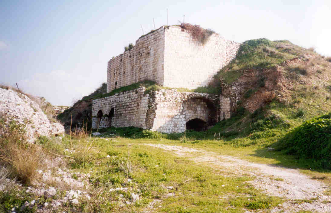
According to the survey, the village of Majdal Yaba was founded approximately 220 years ago on ancient ruins dating back to Roman times. The remains of the holy tomb of Sheikh Baraz el-Din from the early period of the al-Sahaba, the companions of the Prophet Muhammad (PBUH) are also situated there. The village had a well
operated by electricity provided by a cable connected to a quarry in the vicinity, and next to the well was a pool where the women of the village came to get water. There were also many pits to collect rainwater used to water sheep, goats and cattle, for laundry and sometimes for drinking. The houses in the village were built from stone with roofs of stone, cement and wood.
At a distance of three kilometers was a road to Rosh HaAyin [Ras al-Ain] railway station, an inferior road to Lod (al-Lid), which passed by Ben Shemen and the villages of Mujraah, Kulla, Beit Nabalah, and also an old road to Kalkilyah. A service bus to Lod arrived three times a day. Close to the village was Wadi al-Majdal, and also Wadi Rabah.
Majdal Yaba covered an area of 10,000 dunams. Approximately 1500 dunams of land, on the plateau near Rosh HaAyin, was planted with citrus and banana groves. There were also small numbers of fig trees and prickly pear cacti. Field crops were the main produce as well as some onions and vegetables. The village owned 400 heads of cattle, 3000 sheep and goats, 70 camels, 50 donkeys, 60 horses and mules.
There were 1,600 inhabitants in the village: approximately 500 men aged 18-48. Forty families owned 100 dunams of land and 300 families owned 400 dunams of land. A third of the villagers had no land at all. They earned their living by working in the quarries and citrus groves. The government supported the village school, built with village and government funds. The school had one hundred students and a teacher who came everyday from Jaffa. There were six guesthouses financed by each family. A mosque was being built at the time. The Imam of the village was Sheik Ibrahim Damra; it was noted that his political inclination tended to shift.


Post Your Comment
*It should be NOTED that your email address won't be shared, and all communications between members will be routed via the website's mail server.