| PalestineRemembered | About Us | Oral History | العربية | |
| Pictures | Zionist FAQs | Haavara | Maps | |
| Search |
| Camps |
| Districts |
| Acre |
| Baysan |
| Beersheba |
| Bethlehem |
| Gaza |
| Haifa |
| Hebron |
| Jaffa |
| Jericho |
| Jerusalem |
| Jinin |
| Nablus |
| Nazareth |
| Ramallah |
| al-Ramla |
| Safad |
| Tiberias |
| Tulkarm |
| Donate |
| Contact |
| Profile |
| Videos |
Welcome To 'Arab al-Bawati - عرب البواطي (خربة الحكمة) (ערב אל-בואטי)
|
District of Baysan
Ethnically cleansed days ago |
العربية Google Earth |
 |
Gallery (4) |
- Statistics & Facts
-
Before & After

- Satellite View
- Articles 1
- Pictures 4
- Oral History 2
- Members
- All That Remains
- Wikipedia
- Videos 1
- Guest Book
- Links
| Statistic & Fact | Value | |||||||||||||||
| Occupation Date | May 16, 1948 | |||||||||||||||
| Distance From District | 4 (km) Northeast of Baysan | |||||||||||||||
| Elevation | -225 (meters) | |||||||||||||||
| Before & After Nakba, Click Map For Details |
||||||||||||||||
|
||||||||||||||||
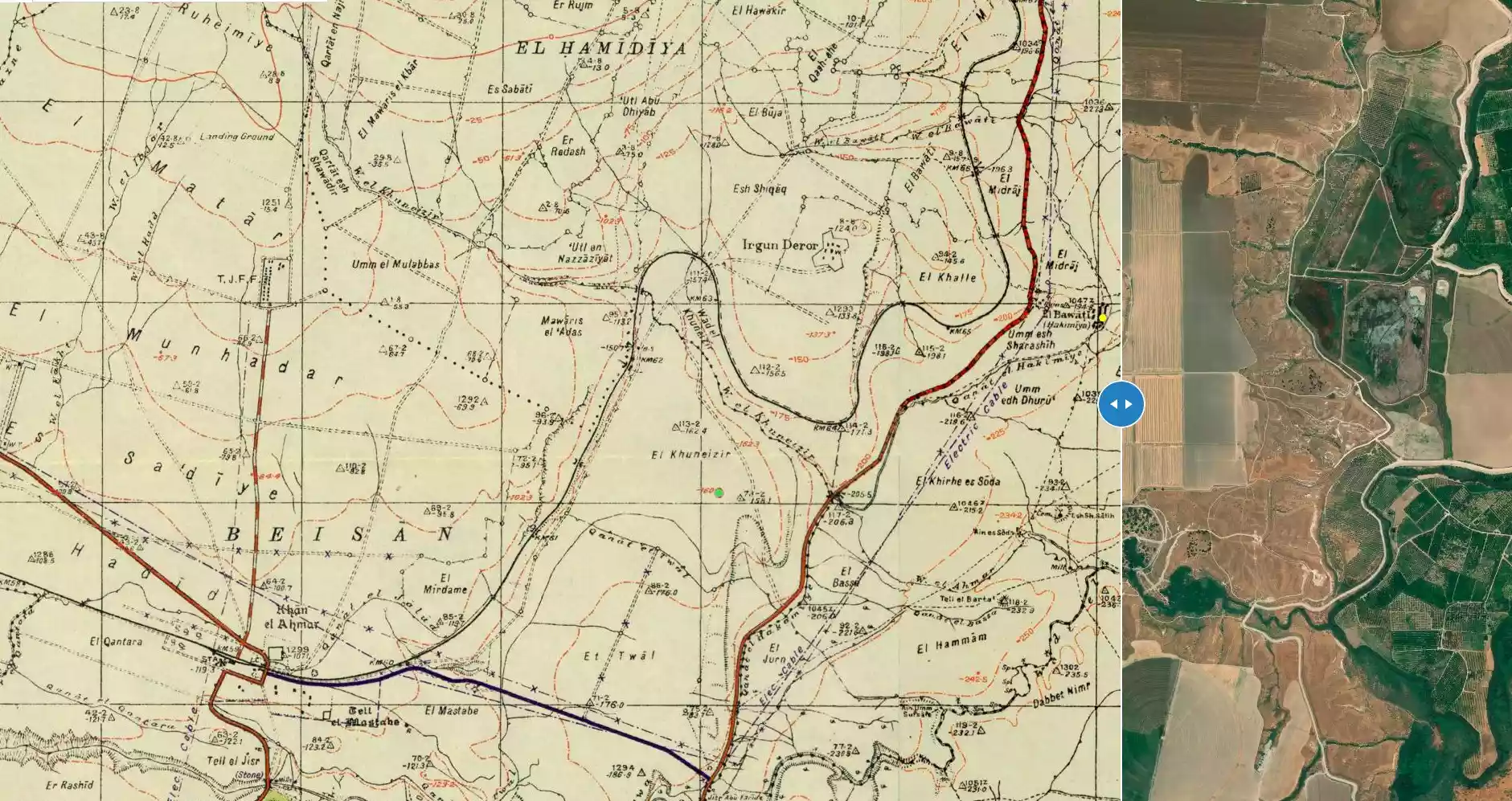
| Map Location | See location #16 on the map View from satellite |
|||||||||||||||
| Military Operation | Baysan valley clearing (Operation Gedion) | |||||||||||||||
| Attacking Units | Golani Brigade | |||||||||||||||
| Exodus Cause | Influence of fall of, or exoduce from, neighboring town | |||||||||||||||
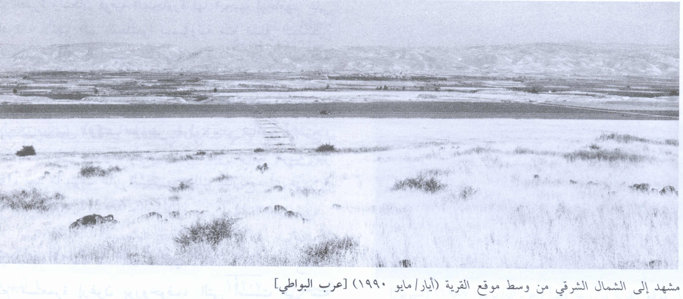
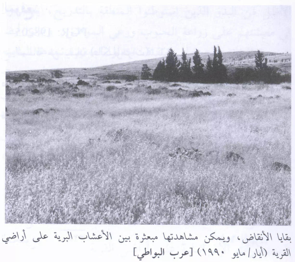
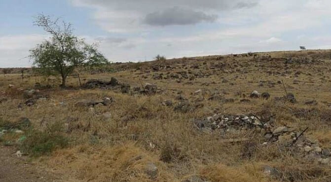
| Village Temains | The village was completely destroyed and defaced. | |||||||||||||||
| Ethnically Cleansing | 'Arab al-Bawati inhabitants were completely ethnically cleansed. | |||||||||||||||
| Clans | 'Arab al-Bawati was founded by a branch of the 'Arab al-Ghazzawiyya Bedouin tribe. | |||||||||||||||
| Pre-Nakba Land Ownership |
**Town Lands' Demarcation Maps |
|||||||||||||||
| Land Usage As of 1945 |
|
|||||||||||||||
| Population |
|
|||||||||||||||
| Number of Houses |
|
|||||||||||||||
| Near By Towns |
||||||||||||||||
|
||||||||||||||||
| Schools | 'Arab al-Bawati students used to attend school in Baysan City. | |||||||||||||||
| Archeological Sites | The village has a khirbat which contained the ruins of walls, pillars, the foundations of buildings, and Roman milestones. | |||||||||||||||
| Exculsive Jewish Colonies Who Usurped Village Lands |
No Israeli settlements on village lands. | |||||||||||||||
| Featured Video | ||||||||||||||||
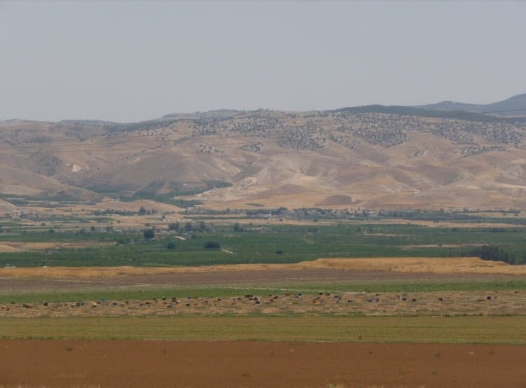
Village Before NakbaThe village stood on a hill that extended from the eastern side of a mountain; it overlooked wide areas east of the Jordan Valley. A highway that led to Baysan and Tiberias passed west of the village, and a secondary road linked it to adjacent villages. Arab al-Bawati was founded by a branch of the Arab al-Ghazzawiyya Bedouin tribe. Its houses, built of adobe brick, reeds, and cane, were scattered throughout the site and interspersed with a few goat-hair tents. The entire population was Muslim. In the southern portion of the village were several springs that supplied water for domestic use as well as irrigation. Some of the lands were planted in grain, vegetables, and fruit; some were devoted to animal grazing; and some were reserved for fisheries. Agriculture was both irrigated and rainfed. In 1944/45 a total of 3,135 dunums was allotted to cereals; 2,225 dunums were irrigated or used for orchards. The people of al-Bawati relied on Baysan for commercial, educational, and administrative services. Khirbat al-Bawati, on the village site, contained the ruins of walls, pillars, the foundations of buildings, and Roman milestones.Zionists Colonies on Village LandsThere are no Israeli settlements on village lands. Chamadya, to the west, was founded in 1942 on lands belonging to the village of al-Hamidiyya and the town of Baysan; it is the closest Israeli settlement. It was initially named Chermonim, but in 1952 its name was changed to resemble the original Arabic name more closely.Village TodayAll of the village houses have been demolished. The remains of basalt stone walls and the square and circular foundations of buildings can be seen among the weeds. The site is fenced in and the surrounding lands are planted in various crops. The fisheries once used by the villagers also remain. Irrigated fields stretch to the west of it.SourceDr. Walid al-Khalidi, 1992: All That Remains. |
||||||||||||||||
| Related Maps | Town Lands' Demarcation Maps خرائط للقضاء توضح حدود القرى والاودية Town's map on MapQuest View from satellite Help us map this town at WikiMapia |
|||||||||||||||
| Related Links | Wikipedia's Page Google Search Google For Images Google For Videos |
|||||||||||||||
| More Information | في كتاب كي لا ننسى في كتاب بلادنا فلسطين المزيد من موقع هوية |
|||||||||||||||
Want to browse more? 80,000 pictures were grouped in these gallaries:
| Display Name | Clan/Hamolah | Country of Residence |
- من قرى بيسان المهجرة: عرب البواطي وخربة الحكيمية مسقط راس الشيخ نمر العرسان. Duration: min 3 sec
No links have been shared yet, be free to the first to share the first link.
 Fake Valor: Why Did Zionist Jews Hoist Nazis Flag on Their Ships in the 1930s?
What is new?
-
Facts About Oct. 7th Gaza Raid
-
Remined Us Please:: Who Did Rape Who? Palestinians Raped Israelis? Or, was the other way around?
-
When Prof. Edward Said was invited to debate Bibi Netanyahu in the 1980s, watch what happened!
-
Ezra Klein of the NY Times on the "Jewish Race".
-
Abusing Blood Libel!
-
Zionist FAQ: Isn't it true that Palestinians don't want peace? Palestinians never accepted the two-state solution
- Facts about Haavara (Transfer) Agreement between Ben-Gurion & Hitler
-
Haavara FAQs: Why Did Zionist Jews Hoist Nazis' Flags on Their Ships in the 1930s?
-
Dear ChatGPT: Why did the Jewish Agency suppress news of the Holocaust during WWII?
-
Video Playlist: Jews share their DNA tests to end the conflict for good.
-
A Tale of Two Conflicts: Examining the Definition of Genocide
-
Prof. Abraham Polak And The Suppressed History of the Khazars and European Jewry
-
How Ronald Reagan would have framed the genocide in Gaza if he were still alive?
-
Haavara FAQs: Let us do the math: how many German Jews did The Haavara Agreement save?
-
Zionist FAQs: The Hebron Massacre of 1929, "clearly proves" that Palestinians are antisemitic, how could you deny it?
-
Zionist FAQs: Why Anti-Zionist Is Not Antisemitism?
-
Zionist FAQs: Isn't it true that the KGB create Palestinian Nationalism in the early 1960s?
- Zionist FAQs: Muslims are killing Muslims all the time; why are Israeli Jews being singled out in the media?
- Zionist FAQs: How is Israel an apartheid state when 20% of its citizens are Arabs who enjoy full rights?
-
Haavara FAQs: Analysis of Herzl's Uganda Scheme and how it could have saved millions of Jews.
-
Haavara FAQs: Why did Hayim Greenberg describe American Jewry as "morally bankrupt" in early 1943?
-
Haavara FAQs: What if the Evian Conference was a resounding success? What would have been the impact of saving European Jewry on Zionism?
- Haavara FAQs: What if the six million were saved, how that would have impacted the Zionist project?
-
Haavara FAQs: How did Zionist leaders react when Europe's Jews lingered in the DP camps after WWII ended?
-
Why does the American Jewish community repeat lies that David Ben-Gurion had debunked before he died?
-
Who has the power to rename the Tatar/Khazar Gene Marker to Jewish IV?
-
Zionist FAQs: Why won't Egypt, Syria, and Jordan take their people back? Jews are indigenous to Palestine, and Arabs immigrated after Jews developed the country. Arabs should leave.
-
Haavara FAQs: Did Hitler and the Nazis conflate between Judaism and Zionist? If that wasn't case, then why?
-
Haavara FAQs: Winston Churchill and antisemitism, a collection of articles written Churchill.
-
Haavara FAQs: Broken by country, how many Jews survived vs. killed during the Holocaust?
-
Haavara FAQs: Why did European Jews vote with their feet and to immigrated to the Americas, not Palestine, after WWII?
-
Watch this American Jewish Girl describing Israeli Jews' cognitive dissonance like no other in under two minutes
-
Haavara FAQs: When the Nazis went out of their way to hide the Holocaust, Israeli Jews did the exact opposite by broadcasting their genocide of Gazans. But why?
-
Haavara FAQs: How Zionist Jews went out of their to show their appreciation to Nazism and Fascism?
- Haavara FAQs: Why Zionist leaders were against bombing the death camps & the Railroads leading to them?
-
Haavara FAQs: Hitler's message to the British and American people: If Jews are such noble citizens and you care about them, how come you're not letting them in? I will gladly ship them to you at my expense, even on luxury liners!
-
A shortlist of Zionist and Israeli false flag operations in the name Jews.
-
The Most Moral Army
- The Land of Kapos (Israel): Where the brave are boycotted and Kapos walk free.
- Why did early Zionists often named their communal enterprises "colonial"?
- Zionist Relations with Nazi Germany by Faris Glubb
-
Two NY Times advertisements by Zionists in the early 1943 that exposes Zionists' treason at the height of the calamity
- Facts Not Lies about the Palestinian-Israeli Conflict.
- Site's pictures have been categorized
- Campgain Against Lice
- A Survey of Palestine, the official source about Palestine before Nakba produced by the British Mandate; over 1200 pages.
- Satellite View & Google Earth: Over 6,000 placemarks identifying all destroyed towns, W. Bank & Gaza Strip Towns, & refugee camps.
- PalestineRemembered.com and its Nakba Oral History Project were featured on al-Jazeera Satellite TV.
- Nakba Oral History Video Podcast:
 Over 700 Oral History interviews (including 3,500+ hours of recording) can be viewed online.
 - Palestine Village Statistics Project
- Gaza Jail Break
- النسخة العربية للموقع الان متوفرة
- Videos: Documenting the destroyed villages in video: Tracing all that remains since Nakba.
- Videos: Responding to Zionist Propaganda
- Interview: The ethnic cleansing of Palestine: George Galloway interviews Israeli Historian Ilan Pappe.
- For Palestinians, memory matters. It provides a blueprint for their future By George Bisharat.
- Zionist FAQ now available in Hebrew שאלות שציונים שואלים, עכשיו בעברית
- Video: The Stephen Walt and John Mearsheimer report on the influence of the Israel Lobby on U.S. Foreign Policy
- The Palestinian-Israeli conflict for beginners
