| PalestineRemembered | About Us | Oral History | العربية | |
| Pictures | Zionist FAQs | Haavara | Maps | |
| Search |
| Camps |
| Districts |
| Acre |
| Baysan |
| Beersheba |
| Bethlehem |
| Gaza |
| Haifa |
| Hebron |
| Jaffa |
| Jericho |
| Jerusalem |
| Jinin |
| Nablus |
| Nazareth |
| Ramallah |
| al-Ramla |
| Safad |
| Tiberias |
| Tulkarm |
| Donate |
| Contact |
| Profile |
| Videos |
Welcome To Danna - دنه (דנה)
|
District of Baysan
Ethnically cleansed days ago |
العربية Google Earth |
 |
Gallery (9) |
- Statistics & Facts
-
Before & After

- Satellite View
- Articles 1
- Pictures 9
- Aerial Views 1
- Oral History 2
- Members 9
- All That Remains
- Wikipedia
- Videos 1
- Guest Book 4
- Links
| Statistic & Fact | Value | ||||||||||||||||||
| Occupation Date | May 28, 1948 | ||||||||||||||||||
| Distance From District | 13 (km) North of Baysan | ||||||||||||||||||
| Elevation | 100 (meters) | ||||||||||||||||||
| Before & After Nakba, Click Map For Details |
|||||||||||||||||||
|
|||||||||||||||||||
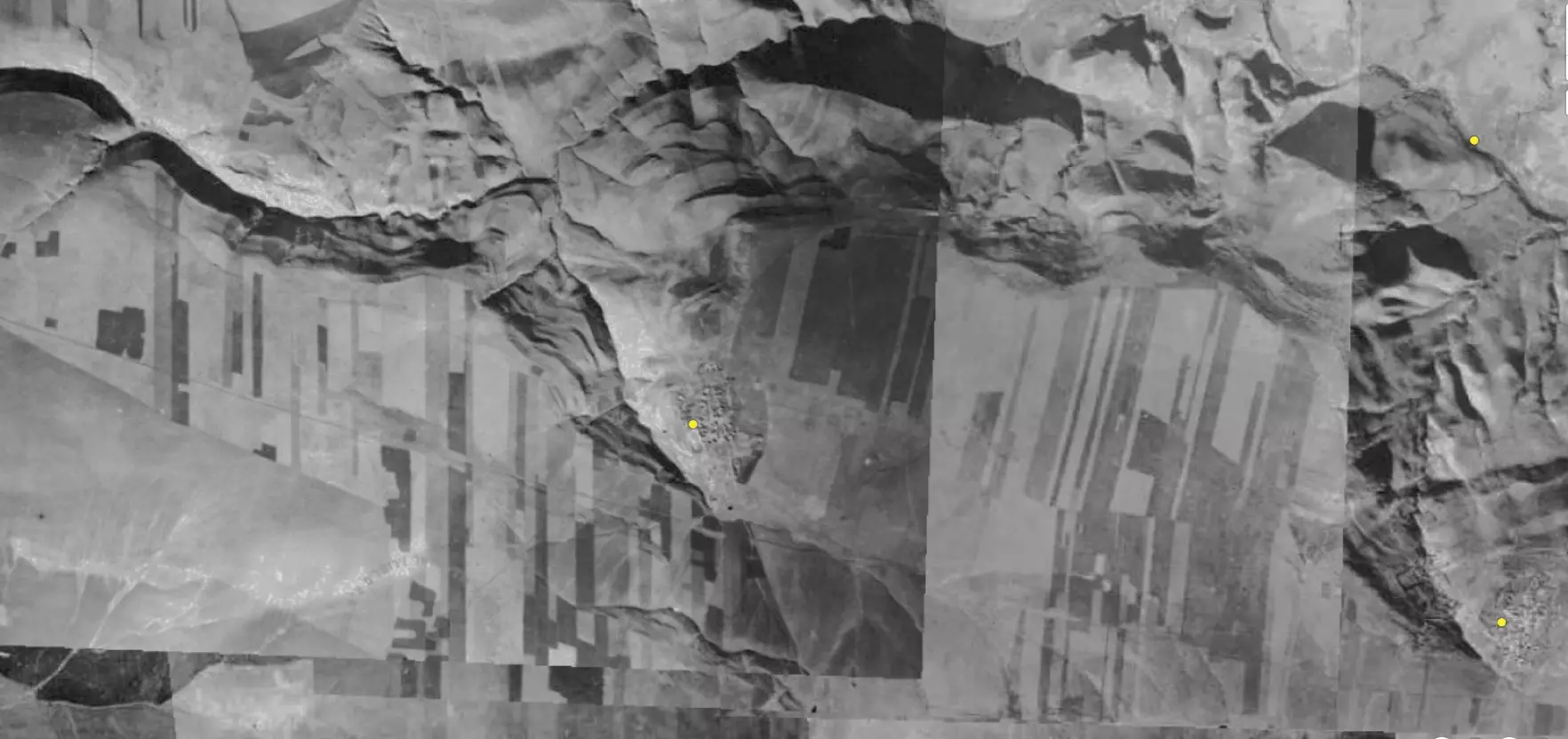
| Pre-Nakba Aerial View |
|||||||||||||||||||
|
|||||||||||||||||||
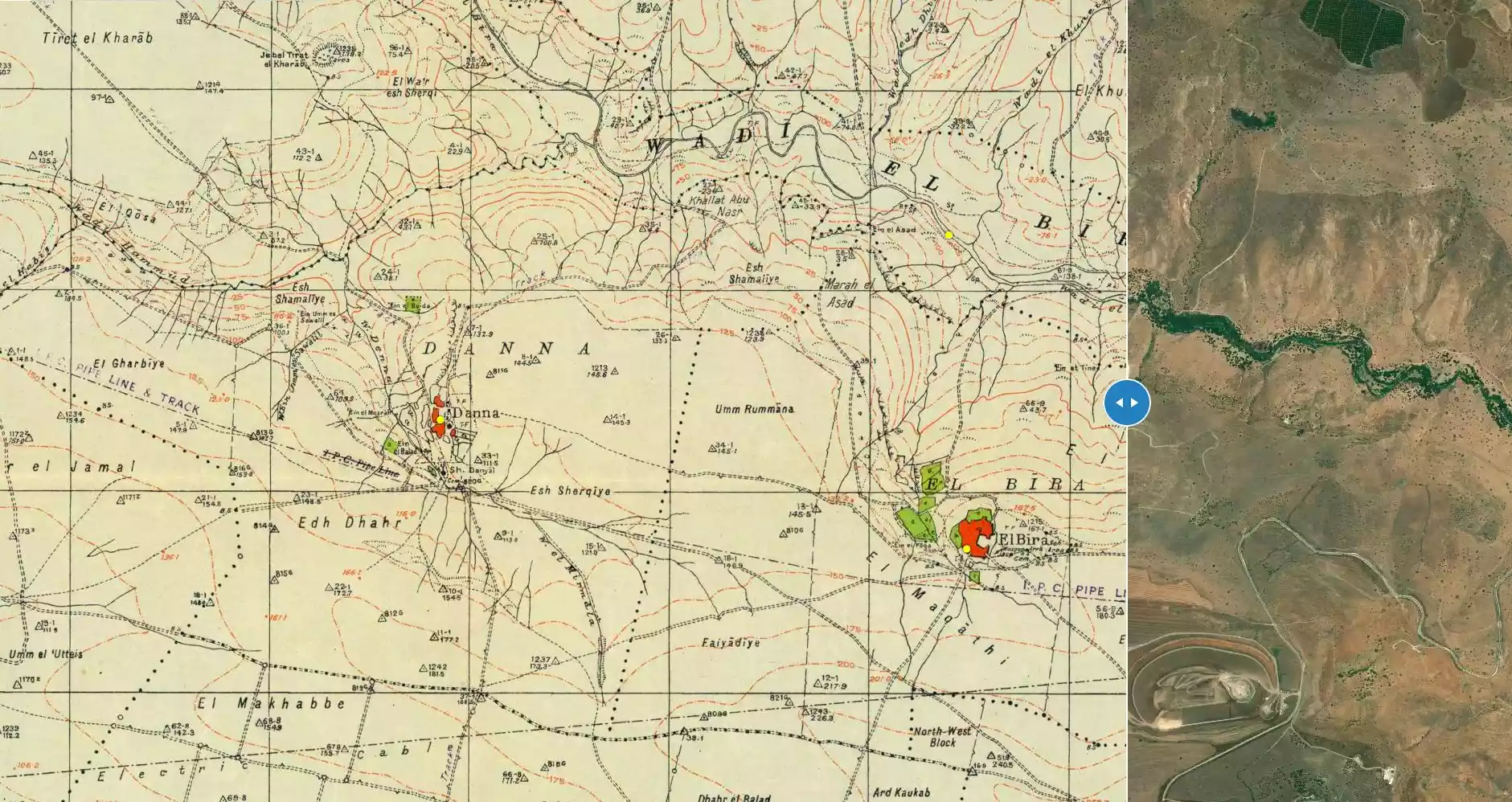
| Map Location | See location #4 on the map View from satellite |
||||||||||||||||||
| Military Operation | Gidion Operation | ||||||||||||||||||
| Attacking Units | Golani Brigade | ||||||||||||||||||
| Exodus Cause | Expulsion by Zionist troops | ||||||||||||||||||
| Village Temains | In September 1948, the village was completely destroyed and only house rubble left behind. | ||||||||||||||||||
| Ethnically Cleansing | Danna inhabitants were completely ethnically cleansed. | ||||||||||||||||||
| Pre-Nakba Land Ownership |
**Town Lands' Demarcation Maps |
||||||||||||||||||
| Land Usage As of 1945 |
|
||||||||||||||||||
| Population |
|
||||||||||||||||||
| Number of Houses |
|
||||||||||||||||||
| Near By Towns |
|||||||||||||||||||
|
|||||||||||||||||||
| Town's Name Through History | The Romans referred Danna by Tina'am. | ||||||||||||||||||
| Places of Warship | One mosque | ||||||||||||||||||
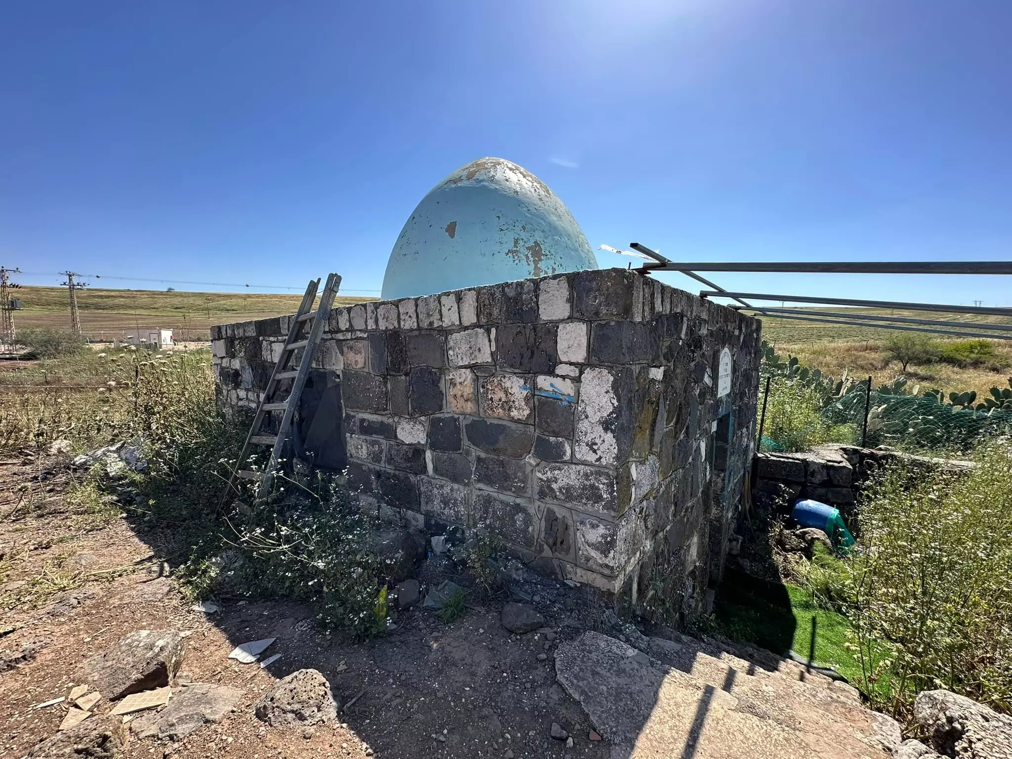
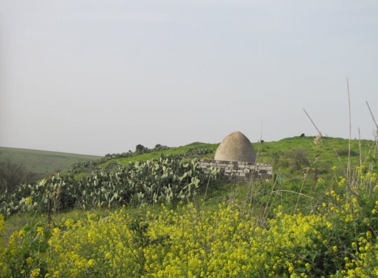
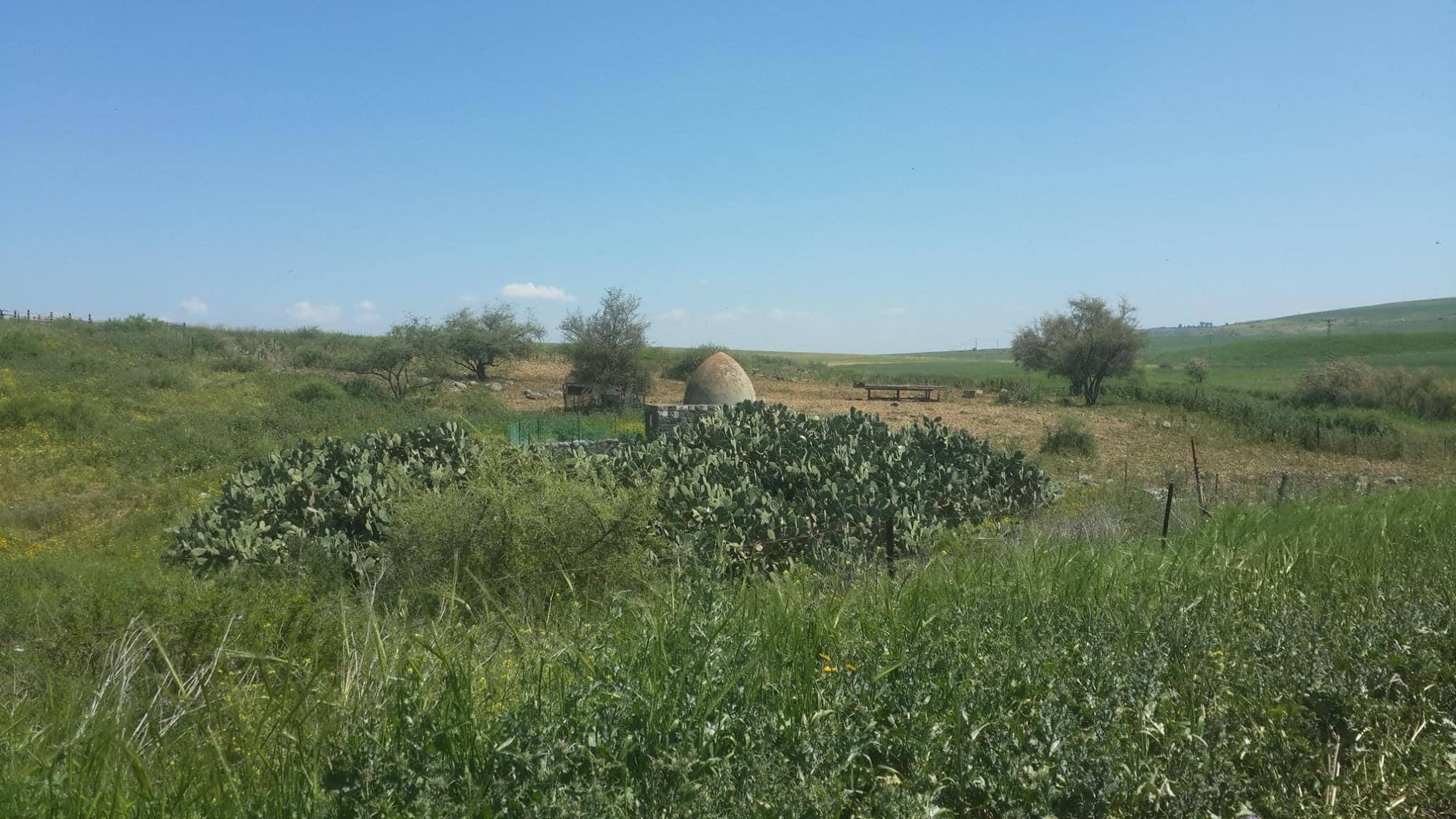
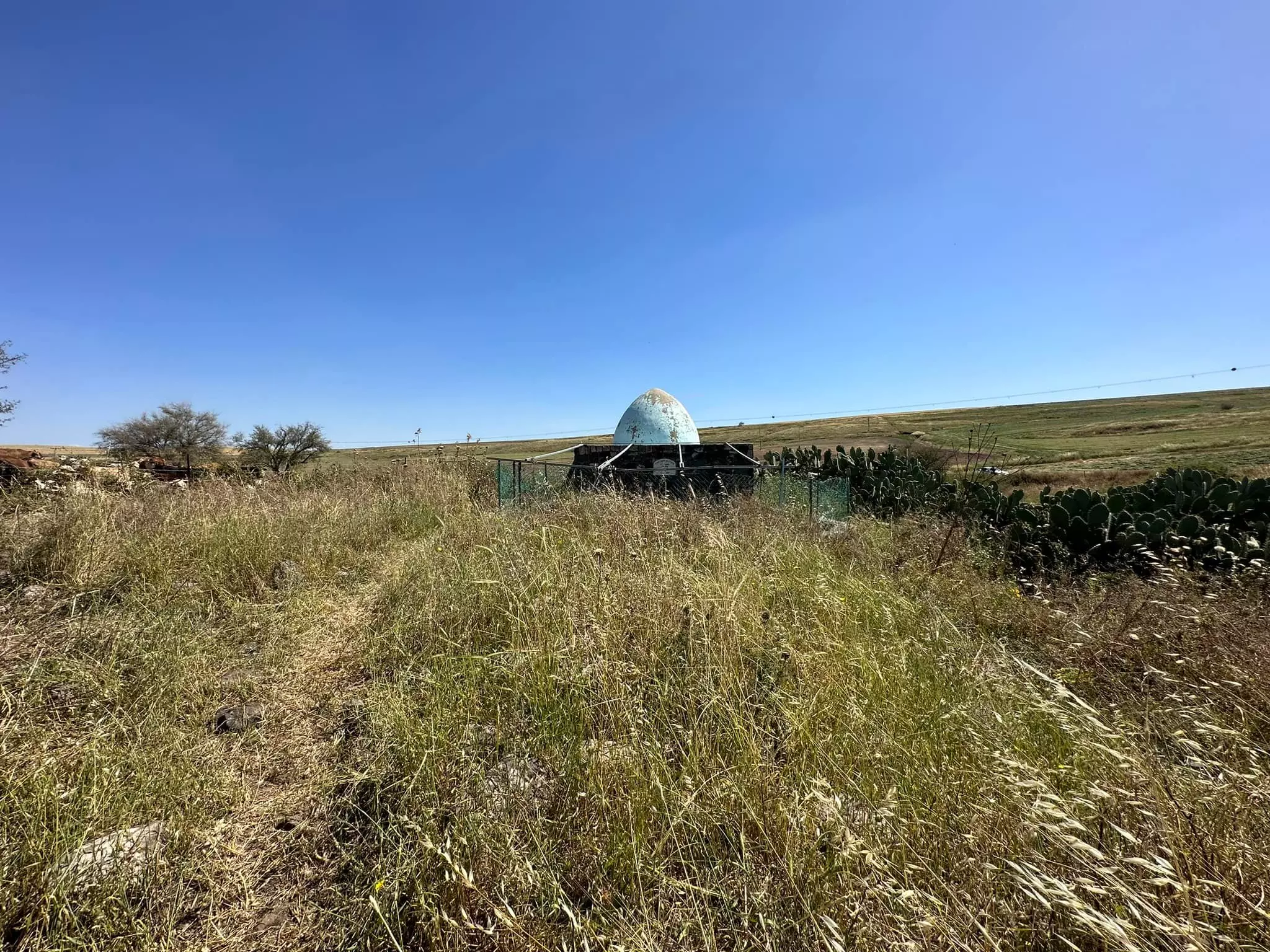
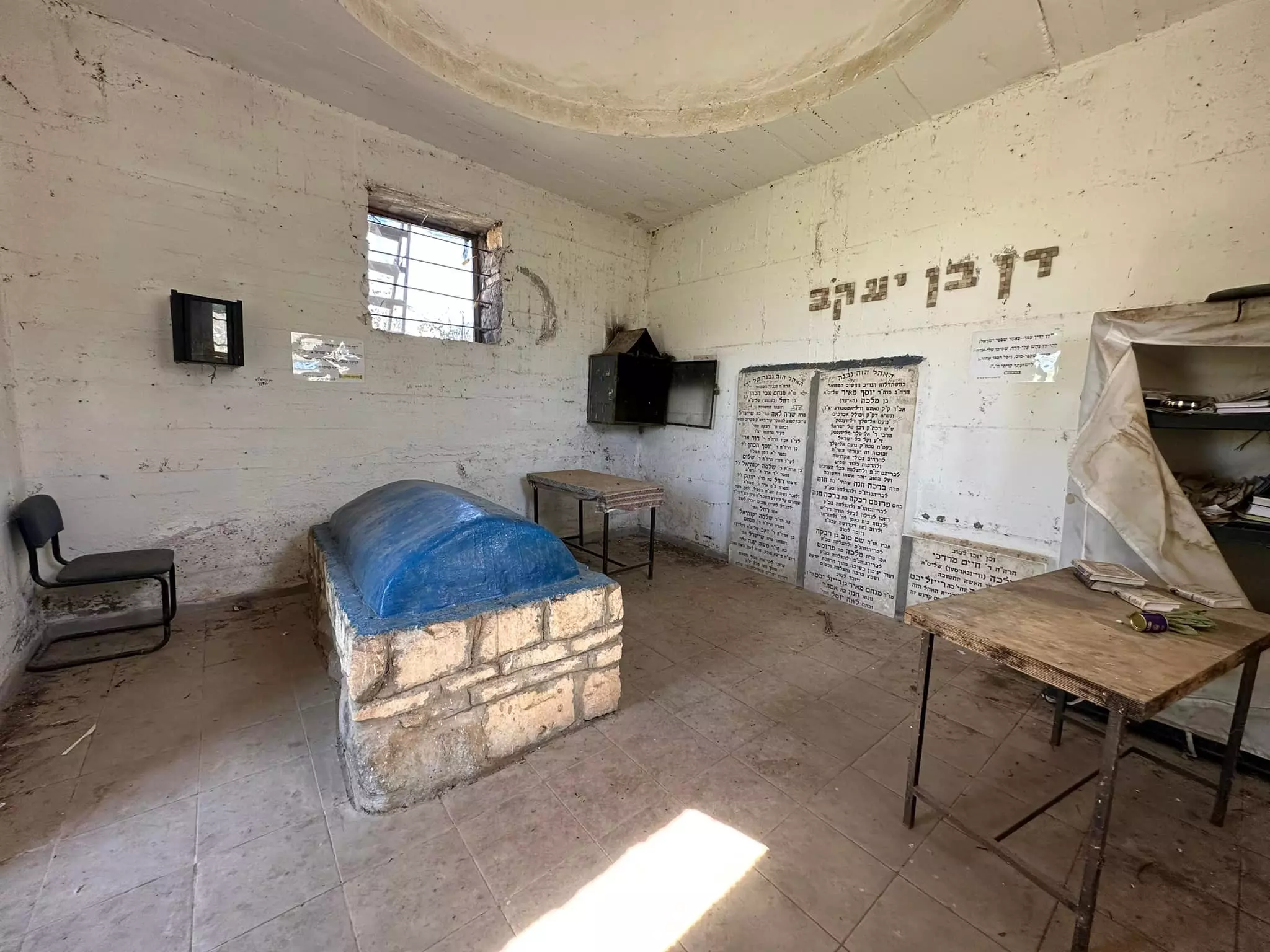
| Shrines / Maqams | A shrine for local sage known as al-Shaykh Daniyal. | ||||||||||||||||||
| Nearby Wadies & Rivers | Danna stands on the upper Northeastern slopes of Wadi Danna. | ||||||||||||||||||
| Exculsive Jewish Colonies Who Usurped Village Lands |
No Israeli settlements on village lands. | ||||||||||||||||||
| Featured Video | |||||||||||||||||||
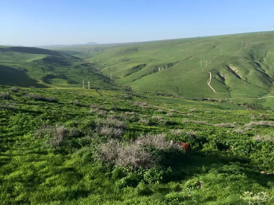
Village Before NakbaThe village stood on the upper northeastern slope of Wadi Danna, a tributary of Wadi al-Bira. It may have been built on the site of the village of Tina'am, which dated from the Roman period. A secondary road linked it to the Afula-Baysan highway, and the pipeline of the Iraq Petroleum Company passed through village land en route to Haifa. In 1596, Danna was a village in the nahiya of Shafa (liwa' of Lajjun), with a population of twenty-eight. It paid taxes to the Ottoman government on a number of crops, including wheat and barley, and on other types of produce, such as goats and beehives. The Swiss traveler Burckhardt, who passed through the area in the early nineteenth century, mentioned the village without providing a description.In the late nineteenth century, the village of Danna was situated on a slope, and was surrounded by farmland. There was a spring with a watering trough to the west. The village houses were built of stone and mud. The village was shaped like a rectangle whose longer sides were aligned in a north-south direction. During the British Mandate the village expanded and new houses, constructed of stone and adobe brick, were built along the road to the nearby village of Kafra. It was classified in this period as a hamlet in the Palestine Index Gazetteer. There were a few shops and a mosque that contained the shrine of a Shaykh Daniyal. The village spring provided water for the residents, all of whom were Muslims. They worked primarily in rainfed agriculture. In 1944/45 a total of 5,097 dunums was allotted to cereals; 14 dunums were irrigated or used for orchards. Grass and leafy vegetation grew on the slopes and peaks of the neighboring mountains and were used for grazing. Village Occupation and Ethnic CleaningThe inhabitants of Danna were expelled on 28 May 1948, the same day that the remaining townspeople of nearby Baysan were transferred to Nazareth by the Israeli army. The Golani Brigade was responsible for occupying the Baysan Valley and carrying out these expulsions.Morris reports that by September 1948, the destruction of the village was already underway. The demolition was criticized by a local kibbutz leader, who argued that the village might agree to allocate part of its land for settlement purposes. This indicates that at least some villagers may have remained in Danna or returned after their expulsion. But it is not clear what happened to them after that. Zionists Colonies on Village LandsThere are no Israeli settlements on village land.Village TodayBushes, cactus plants, thorns, and grass now grow around piles of rubble on the village site . Thick weeds grow in the wadi and near the spring. The lands in the area are cultivated by Israeli farmers.SourceDr. Walid al-Khalidi, 1992: All That Remains. |
|||||||||||||||||||
| Related Maps | Town Lands' Demarcation Maps خرائط للقضاء توضح حدود القرى والاودية Town's map on MapQuest View from satellite Help us map this town at WikiMapia |
||||||||||||||||||
| Related Links | Wikipedia's Page Google Search Google For Images Google For Videos |
||||||||||||||||||
| More Information | في كتاب كي لا ننسى في كتاب بلادنا فلسطين المزيد من موقع هوية |
||||||||||||||||||
- Village Site in 1987
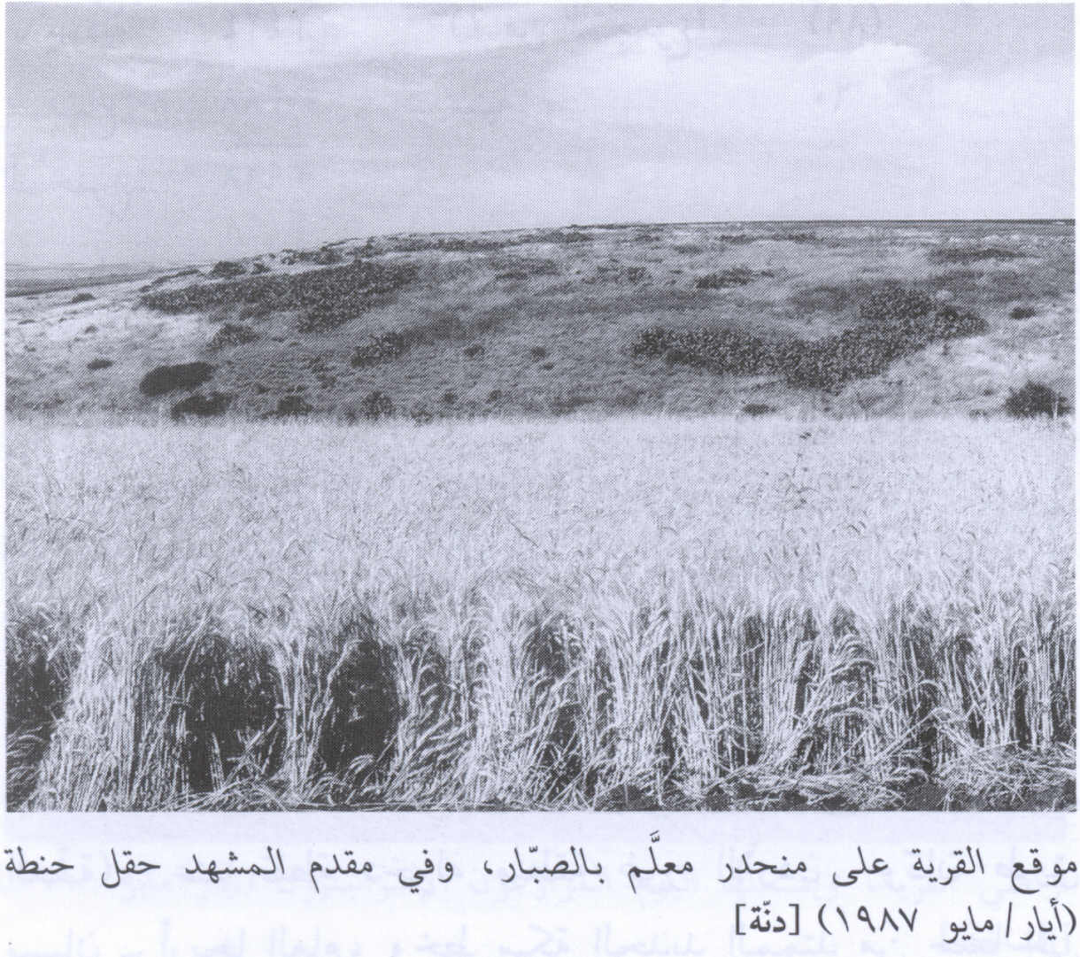
Scanned from "All That Remains" by Dr. Walid Khalidi - دنة منظر خلاب
Posted by فتحي ابو رضا \ العايدي - مقام الشيخ دانيال في موقع القريه
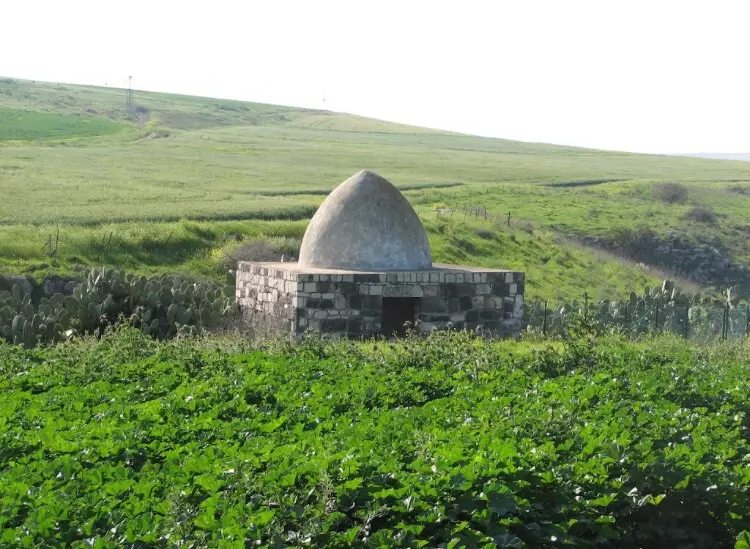
Posted by abu raya - موقع القريه ومقام الشيخ دانيال
Posted by abu raya - منظر عام لموقع قرية دنّة المهجرة (بيسان ) .
- Pre-Nakba Aerial view of the village / صورة من الجو للقرية اخذت قبل النكبة
- That is how the "civilized" erased and replaced us: Danna was completely obliterated except for a shrine/maqam for al-Sheikh Danyal, as you see. How else will the Jews be great & safe again? -- دنه باتت أثر بعد عين. من هنا مر الهمجّ
- That is how the "civilized" erased and replaced us: Danna was completely obliterated except for a shrine/maqam for al-Sheikh Danyal, as you see. How else will the Jews be great & safe again? -- دنه باتت أثر بعد عين. من هنا مر الهمجّ
#2
- That is how the "civilized" erased and replaced us: Danna was completely obliterated except for a shrine/maqam for al-Sheikh Danyal, as you see. How else will the Jews be great & safe again? -- دنه باتت أثر بعد عين. من هنا مر الهمجّ
#3
Want to browse more? 80,000 pictures were grouped in these gallaries:
| Display Name | Clan/Hamolah | Country of Residence |
| الحسيني | الحسيني | - |
| abu omar | abdeljabar | aqaba, jordan |
| omaralhossaini | - | riyadh, kingdom of saudi arabia |
| OMAR ALSHALABI | - | north carolina, usa |
| FADEL ALSHALABI | ALSHALABI | NORTH CAROLINA, USA |
| mowafi75 | - | - |
| saba al-shalabi | - | - |
| Ahmad Alkhatib Alsadi | السعدي | Jeddah-Saudi Arabia |
| lubna alshalabi | Al shalabi | - |
No links have been shared yet, be free to the first to share the first link.
 Fake Valor: Why Did Zionist Jews Hoist Nazis Flag on Their Ships in the 1930s?
What is new?
-
Facts About Oct. 7th Gaza Raid
-
Remined Us Please:: Who Did Rape Who? Palestinians Raped Israelis? Or, was the other way around?
-
When Prof. Edward Said was invited to debate Bibi Netanyahu in the 1980s, watch what happened!
-
Ezra Klein of the NY Times on the "Jewish Race".
-
Abusing Blood Libel!
-
Zionist FAQ: Isn't it true that Palestinians don't want peace? Palestinians never accepted the two-state solution
- Facts about Haavara (Transfer) Agreement between Ben-Gurion & Hitler
-
Haavara FAQs: Why Did Zionist Jews Hoist Nazis' Flags on Their Ships in the 1930s?
- Haavara FAQs: When Chaim Weizmann met FDR in mid-1943, why was he silent about rescuing European Jewry?
-
Dear ChatGPT: How did Palestinians resist Napoleon's invasion of their country in 1799?
-
Dear ChatGPT: Gaza had a vibrant Jewish community in the mid-17th century. What happened to them?
-
Dear ChatGPT: Why did the Jewish Agency suppress news of the Holocaust during WWII?
-
Video Playlist: Jews share their DNA tests to end the conflict for good.
-
A Tale of Two Conflicts: Examining the Definition of Genocide
-
Prof. Abraham Polak And The Suppressed History of the Khazars and European Jewry
-
How Ronald Reagan would have framed the genocide in Gaza if he were still alive?
-
Haavara FAQs: Let us do the math: how many German Jews did The Haavara Agreement save?
-
Zionist FAQs: The Hebron Massacre of 1929, "clearly proves" that Palestinians are antisemitic, how could you deny it?
-
Zionist FAQs: Why Anti-Zionist Is Not Antisemitism?
-
Zionist FAQs: Isn't it true that the KGB create Palestinian Nationalism in the early 1960s?
- Zionist FAQs: Muslims are killing Muslims all the time; why are Israeli Jews being singled out in the media?
- Zionist FAQs: How is Israel an apartheid state when 20% of its citizens are Arabs who enjoy full rights?
-
Haavara FAQs: Analysis of Herzl's Uganda Scheme and how it could have saved millions of Jews.
-
Haavara FAQs: Why did Hayim Greenberg describe American Jewry as "morally bankrupt" in early 1943?
-
Haavara FAQs: What if the Evian Conference was a resounding success? What would have been the impact of saving European Jewry on Zionism?
- Haavara FAQs: What if the six million were saved, how that would have impacted the Zionist project?
-
Haavara FAQs: How did Zionist leaders react when Europe's Jews lingered in the DP camps after WWII ended?
-
Why does the American Jewish community repeat lies that David Ben-Gurion had debunked before he died?
-
Who has the power to rename the Tatar/Khazar Gene Marker to Jewish IV?
-
Zionist FAQs: Why won't Egypt, Syria, and Jordan take their people back? Jews are indigenous to Palestine, and Arabs immigrated after Jews developed the country. Arabs should leave.
-
Haavara FAQs: Did Hitler and the Nazis conflate between Judaism and Zionist? If that wasn't case, then why?
-
Haavara FAQs: Winston Churchill and antisemitism, a collection of articles written Churchill.
-
Haavara FAQs: Broken by country, how many Jews survived vs. killed during the Holocaust?
-
Haavara FAQs: Why did European Jews vote with their feet and to immigrated to the Americas, not Palestine, after WWII?
-
Watch this American Jewish Girl describing Israeli Jews' cognitive dissonance like no other in under two minutes
-
Haavara FAQs: When the Nazis went out of their way to hide the Holocaust, Israeli Jews did the exact opposite by broadcasting their genocide of Gazans. But why?
-
Haavara FAQs: How Zionist Jews went out of their to show their appreciation to Nazism and Fascism?
- Haavara FAQs: Why Zionist leaders were against bombing the death camps & the Railroads leading to them?
-
Haavara FAQs: Hitler's message to the British and American people: If Jews are such noble citizens and you care about them, how come you're not letting them in? I will gladly ship them to you at my expense, even on luxury liners!
-
A shortlist of Zionist and Israeli false flag operations in the name Jews.
-
The Most Moral Army
- The Land of Kapos (Israel): Where the brave are boycotted and Kapos walk free.
- Why did early Zionists often named their communal enterprises "colonial"?
- Zionist Relations with Nazi Germany by Faris Glubb
-
Two NY Times advertisements by Zionists in the early 1943 that exposes Zionists' treason at the height of the calamity
- Facts Not Lies about the Palestinian-Israeli Conflict.
- Site's pictures have been categorized
- Campgain Against Lice
- A Survey of Palestine, the official source about Palestine before Nakba produced by the British Mandate; over 1200 pages.
- Satellite View & Google Earth: Over 6,000 placemarks identifying all destroyed towns, W. Bank & Gaza Strip Towns, & refugee camps.
- PalestineRemembered.com and its Nakba Oral History Project were featured on al-Jazeera Satellite TV.
- Nakba Oral History Video Podcast:
 Over 700 Oral History interviews (including 3,500+ hours of recording) can be viewed online.
 - Palestine Village Statistics Project
- Gaza Jail Break
- النسخة العربية للموقع الان متوفرة
- Videos: Documenting the destroyed villages in video: Tracing all that remains since Nakba.
- Videos: Responding to Zionist Propaganda
- Interview: The ethnic cleansing of Palestine: George Galloway interviews Israeli Historian Ilan Pappe.
- For Palestinians, memory matters. It provides a blueprint for their future By George Bisharat.
- Zionist FAQ now available in Hebrew שאלות שציונים שואלים, עכשיו בעברית
- Video: The Stephen Walt and John Mearsheimer report on the influence of the Israel Lobby on U.S. Foreign Policy
- The Palestinian-Israeli conflict for beginners
