| PalestineRemembered | About Us | Oral History | العربية | |
| Pictures | Zionist FAQs | Haavara | Maps | |
| Search |
| Camps |
| Districts |
| Acre |
| Baysan |
| Beersheba |
| Bethlehem |
| Gaza |
| Haifa |
| Hebron |
| Jaffa |
| Jericho |
| Jerusalem |
| Jinin |
| Nablus |
| Nazareth |
| Ramallah |
| al-Ramla |
| Safad |
| Tiberias |
| Tulkarm |
| Donate |
| Contact |
| Profile |
| Videos |
Welcome To al-Bira - البيرة (אל-בירה)
|
District of Baysan
Ethnically cleansed days ago |
العربية Google Earth |
 |
Gallery (27) |
- Statistics & Facts
-
Before & After

- Satellite View
- Articles 2
- Pictures 27
- Aerial Views 1
- Oral History 2
- Members 2
- All That Remains
- Wikipedia
- Videos 2
- Guest Book 3
- Links
| Statistic & Fact | Value | ||||||||||||||
| Occupation Date | May 16, 1948 | ||||||||||||||
| Distance From District | 7.5 (km) North of Baysan | ||||||||||||||
| Elevation | 150 (meters) | ||||||||||||||
| Before & After Nakba, Click Map For Details |
|||||||||||||||
|
|||||||||||||||
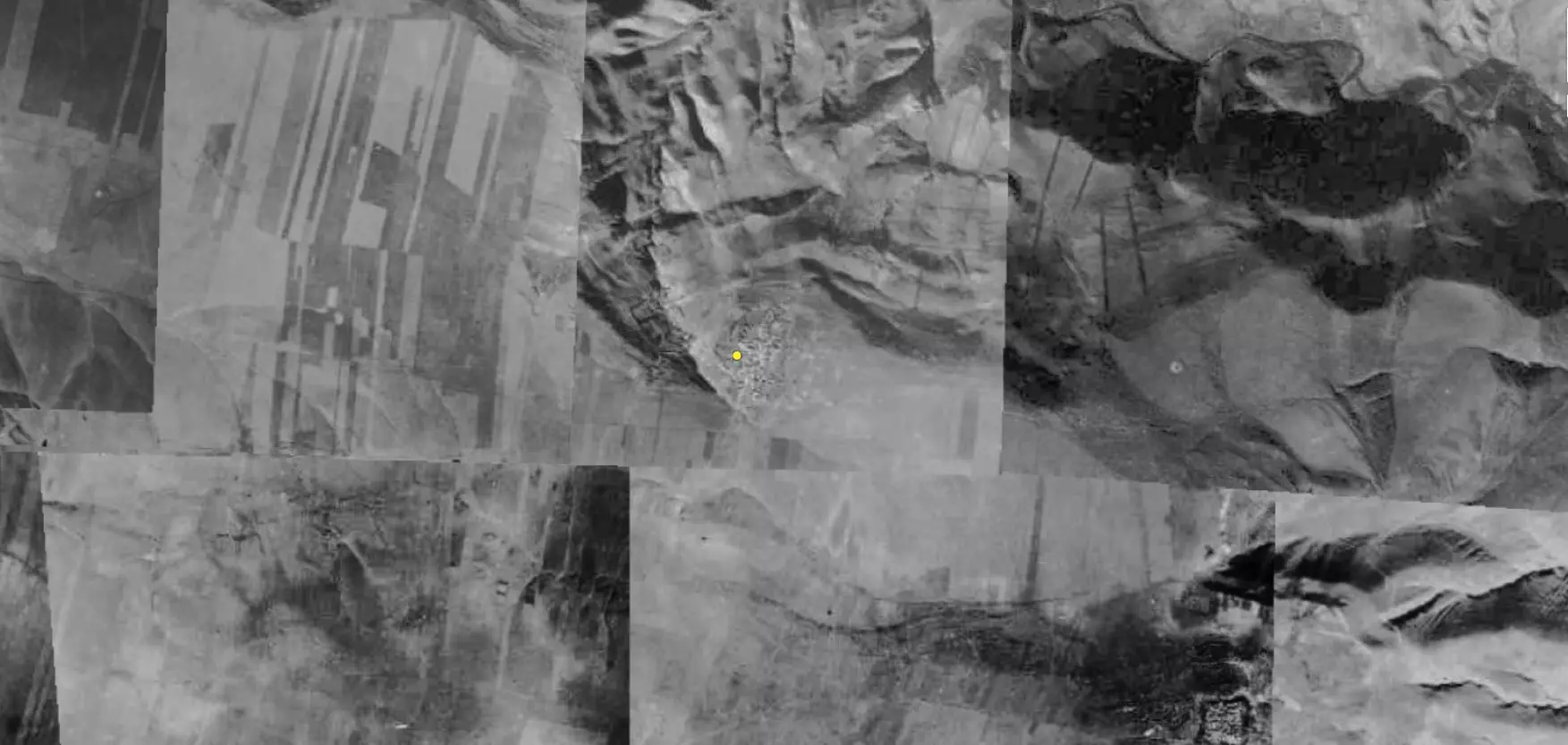
| Pre-Nakba Aerial View |
|||||||||||||||
|
|||||||||||||||
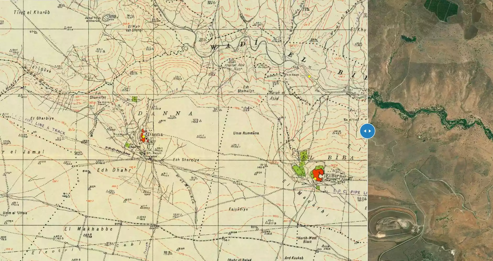
| Map Location | See location #5 on the map View from satellite |
||||||||||||||
| Military Operation | Operation Gideon | ||||||||||||||
| Attacking Units | Most likely by Golani Brigades | ||||||||||||||
| Exodus Cause | Influence of fall of, or exoduce from, neighboring town | ||||||||||||||
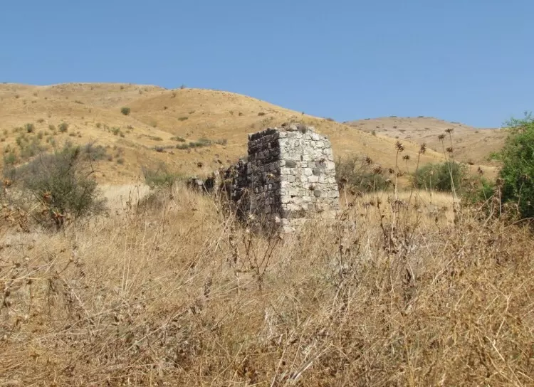
| Village Temains | al-Bira was completely destroyed, and only house walls and rubble left behind. | ||||||||||||||
| Ethnically Cleansing | al-Bira inhabitants were completely ethnically cleansed. | ||||||||||||||
| Pre-Nakba Land Ownership |
**Town Lands' Demarcation Maps |
||||||||||||||
| Land Usage As of 1945 |
|
||||||||||||||
| Population |
|
||||||||||||||
| Number of Houses |
|
||||||||||||||
| Near By Towns |
|||||||||||||||
|
|||||||||||||||
| Town's Name Through History | al-Bira was known by Beer in the Old Testament, and the Crusaders referred to it by Loberium. | ||||||||||||||
| Exculsive Jewish Colonies Who Usurped Village Lands |
No Israeli settlements on village lands. | ||||||||||||||
| Featured Video | |||||||||||||||
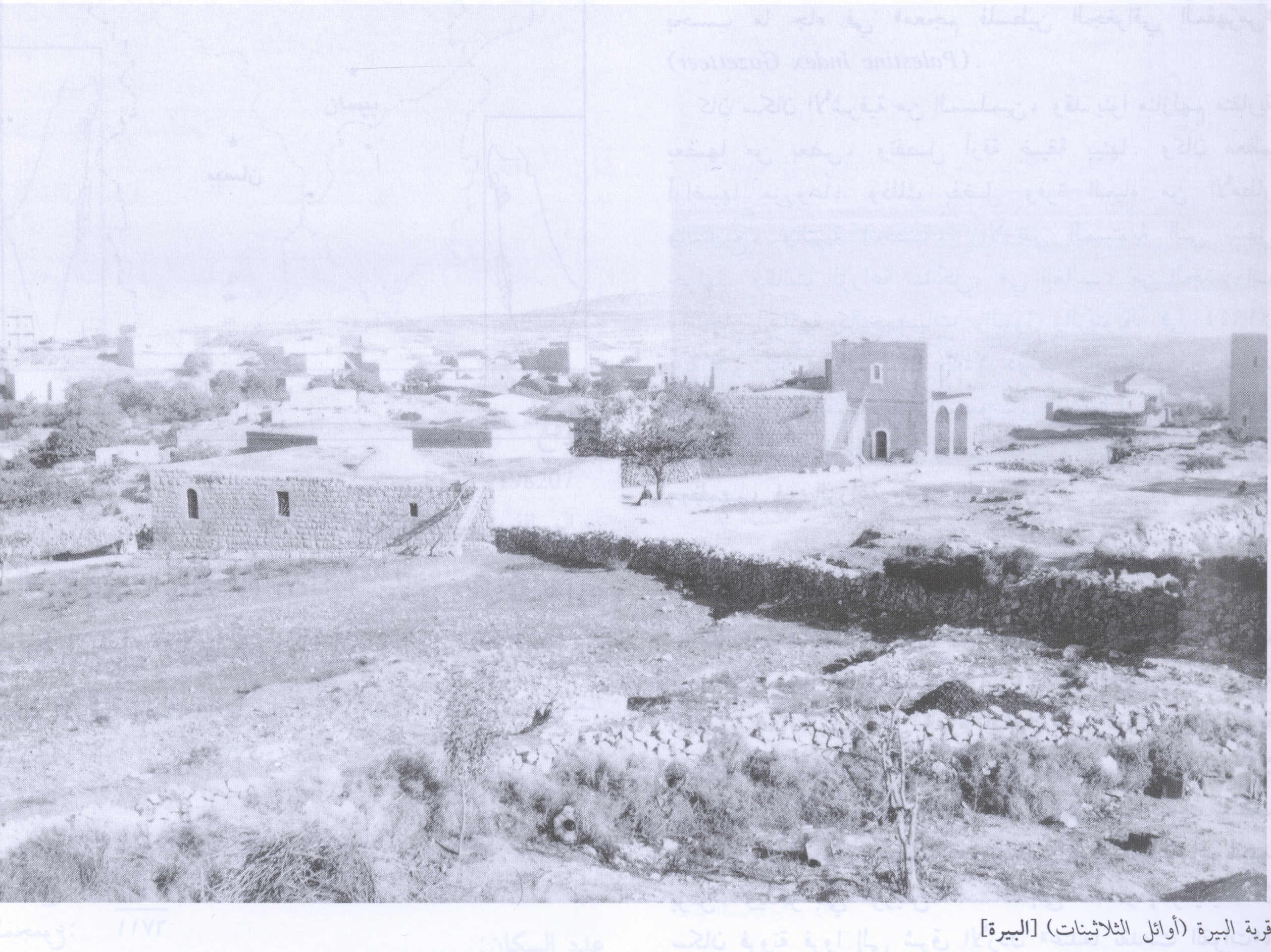
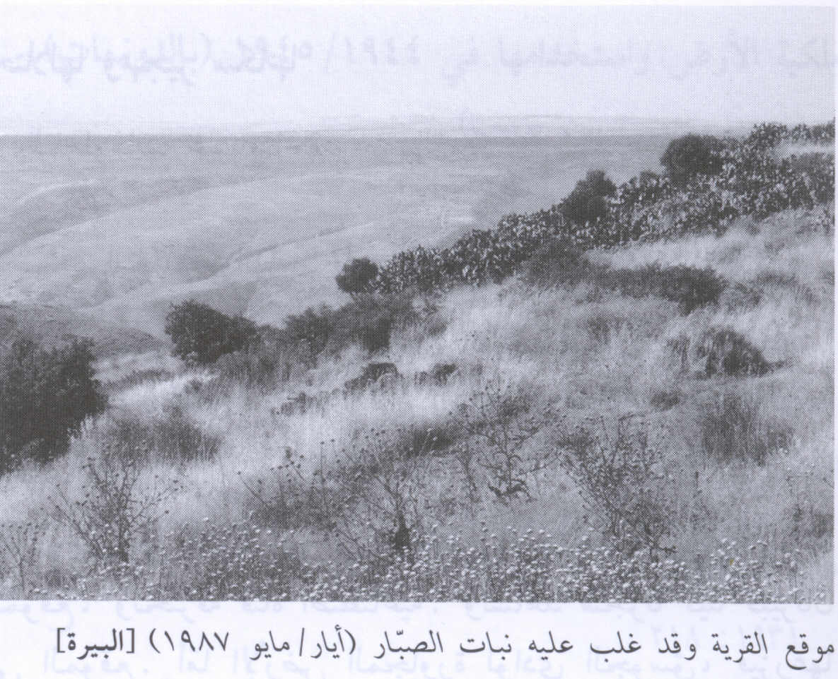
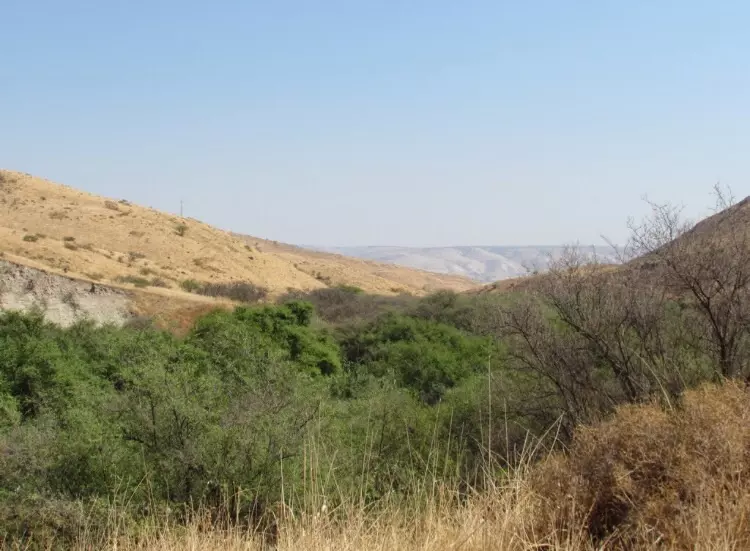
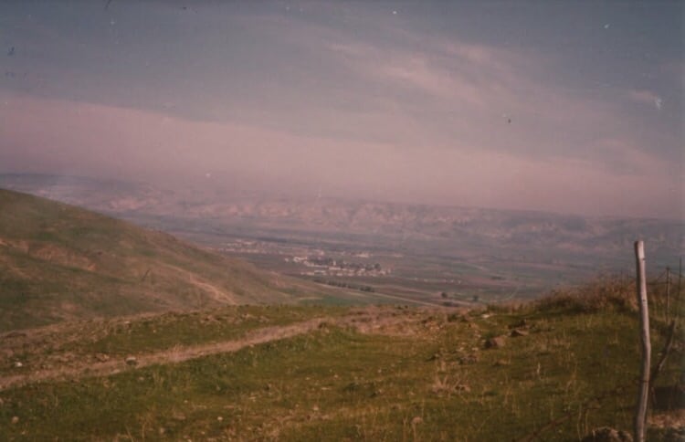
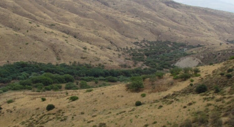
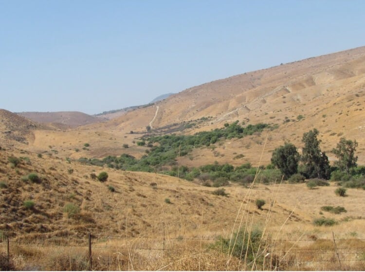
Village Before NakbaThe village stood on the edge of the high hill of al-Shafa, on the east side of a wadi that ran in a north-south direction until it met Wadi al-Bira, to the north. Secondary roads linked it to several surrounding villages; one of the roads passed through the village of al-Murassas and led south to a highway going to Baysan. The Iraq Petroleum Company pipeline, which carried oil to a refinery in Haifa, passed south of the village.It has been suggested that al-Bira is the site mentioned in the record of Thutmose III's military campaign in Palestine in 1468 B.C. Some biblical scholars have identified the site with a place named Beer in the Old Testament (Judges 9:21). The name suggests that there may once have been a fortress at the site. Little is known about it in the early Islamic period. The Arab geographers Yaqut al-Hamawi (d. 1228) and Abu al-Fida' (d. 1321) mentioned aI-Bira's strong fortress and vast lands. The Crusaders referred to it as Loberium. In 1596, al-Bira was a village in the nahiya of Shafa (liwa' of Lajjun), with a population of 297. It paid taxes on a number of crops, including wheat, barley, and olives, as well as on other types of produce such as goats and beehives. The village was rectangular in shape and most of its houses were built of stone. The entire population of al-Bira was Muslim. The village had only a few shops, and so the villagers depended on the neighboring town of Baysan, which served as a commercial outlet and administrative center. The village economy was based on agriculture, mainly rainfed grain. In 1944/45 a total of 4,667 dunums was allocated to cereals; 48 dunums were irrigated or used for orchards. AI-Bira was also known for the grazing lands in the grassy mountainous areas around the village. Zionists Colonies on Village LandsThere are no Israeli settlements on village lands.Village TodayThe only remains of the village are the walls of houses. The fenced-in site is covered with weeds, cactuses, and thorns. Fig and mulberry trees grow near a spring in the valley at the bottom of the site. The surrounding lands are used for grazing.SourceDr. Walid al-Khalidi, 1992: All That Remains. |
|||||||||||||||
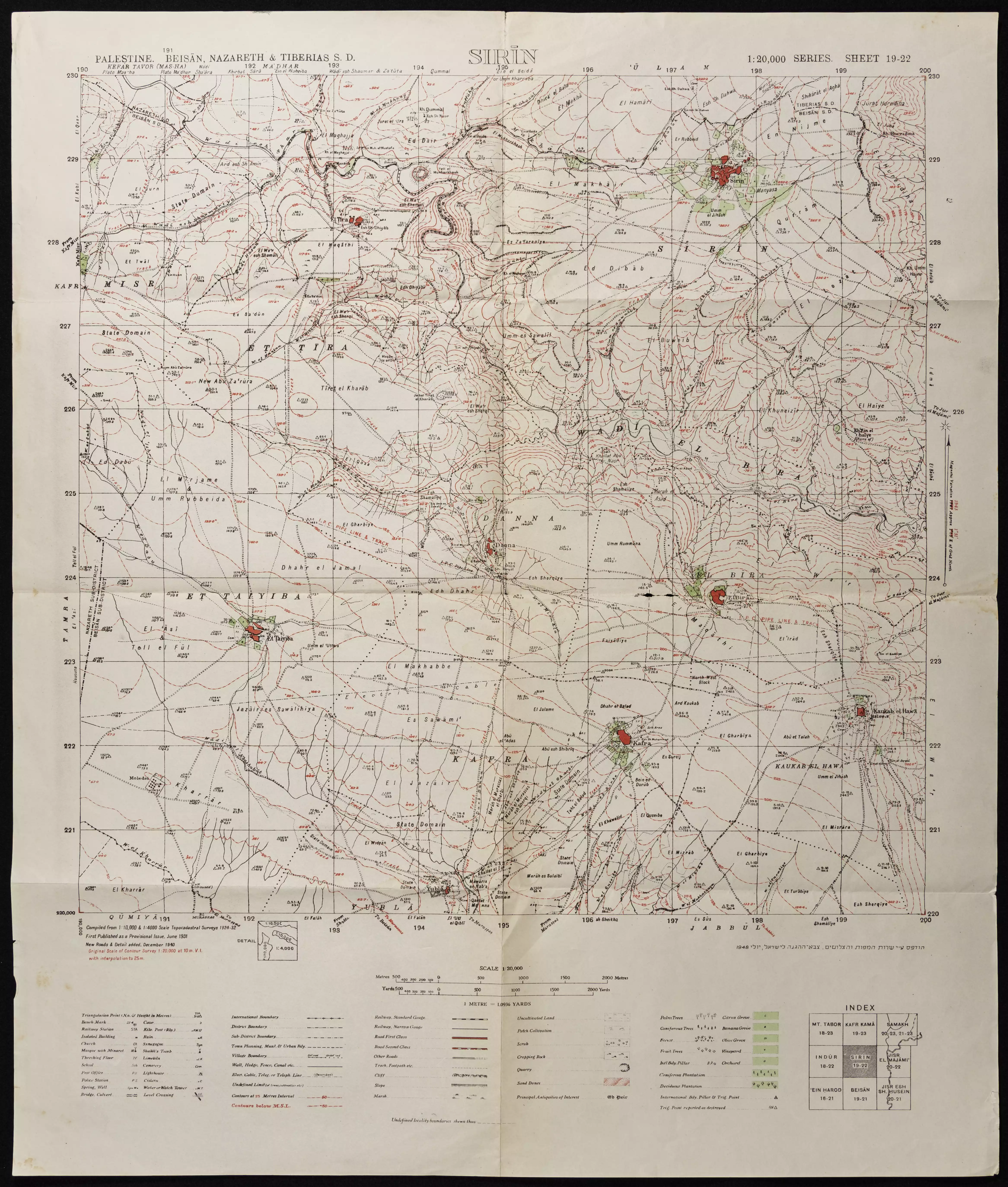
| Related Maps | Town Lands' Demarcation Maps خرائط للقضاء توضح حدود القرى والاودية Town's map on MapQuest View from satellite Help us map this town at WikiMapia |
||||||||||||||
| Related Links | Wikipedia's Page Google Search Google For Images Google For Videos |
||||||||||||||
| More Information | في كتاب كي لا ننسى في كتاب بلادنا فلسطين المزيد من موقع هوية |
||||||||||||||
- Village Site in 1930
Scanned from "All That Remains" by Dr. Walid Khalidi 1 - Village Site in 1987
Scanned from "All That Remains" by Dr. Walid Khalidi 1 - منظر عام في وادي البيرة ويعتبر من أجمل المناطق في فصل الربيع نظرا للطبيعة الخلابة فيه بعدسة محمد كريم ربيع 2005

Posted by محمد كريم 1 - وادي البيره من جانب القريه
Posted by abu raya - موقع القريه واثار الردم
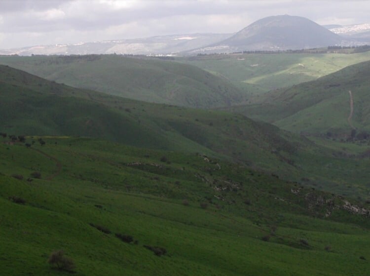
Posted by abu raya - موقع من شمال القريه ويظهر في الافق جبل طابور
Posted by abu raya - موقع قريب من القريه
Posted by abu raya - بنايه باقيه بالقرب من موقع القريه
Posted by abu raya - موقع القريه تحيط به السياج
Posted by abu raya - Pre-Nakba Aerial view of the village / صورة من الجو للقرية اخذت قبل النكبة
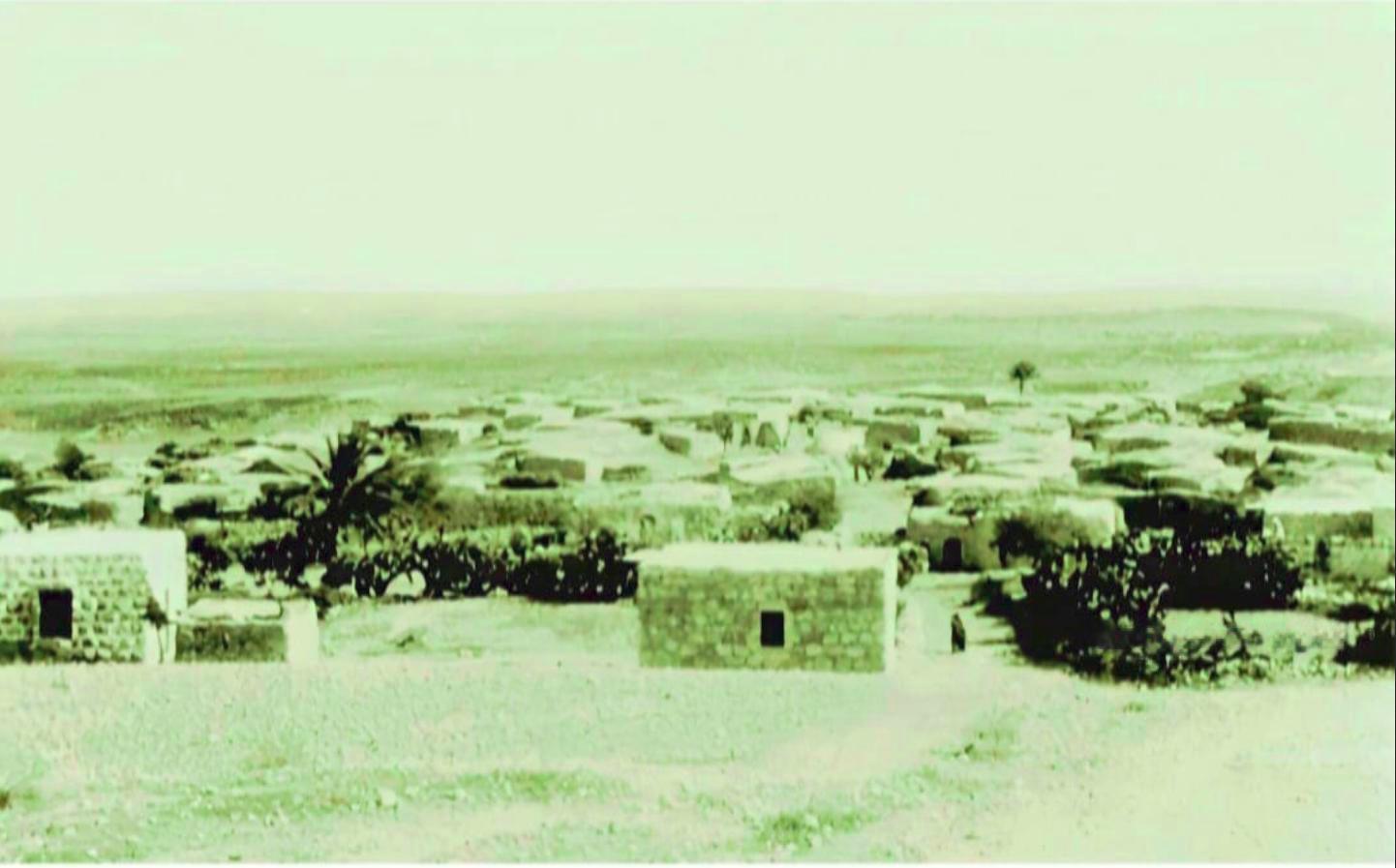
- صورة ساحرة لبلدة البيرة قضاء بيسان ثلاثينيات القرن العشرين..
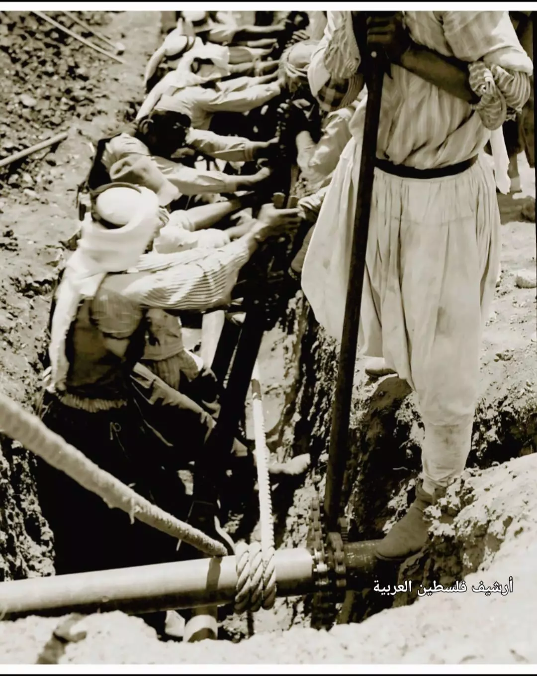
- تركيب أنابيب شركة نفط العراق للخط الواصل من الموصل نحو حيفا.. التقطت هذه الصورة جنوب البيرة عام 1934..
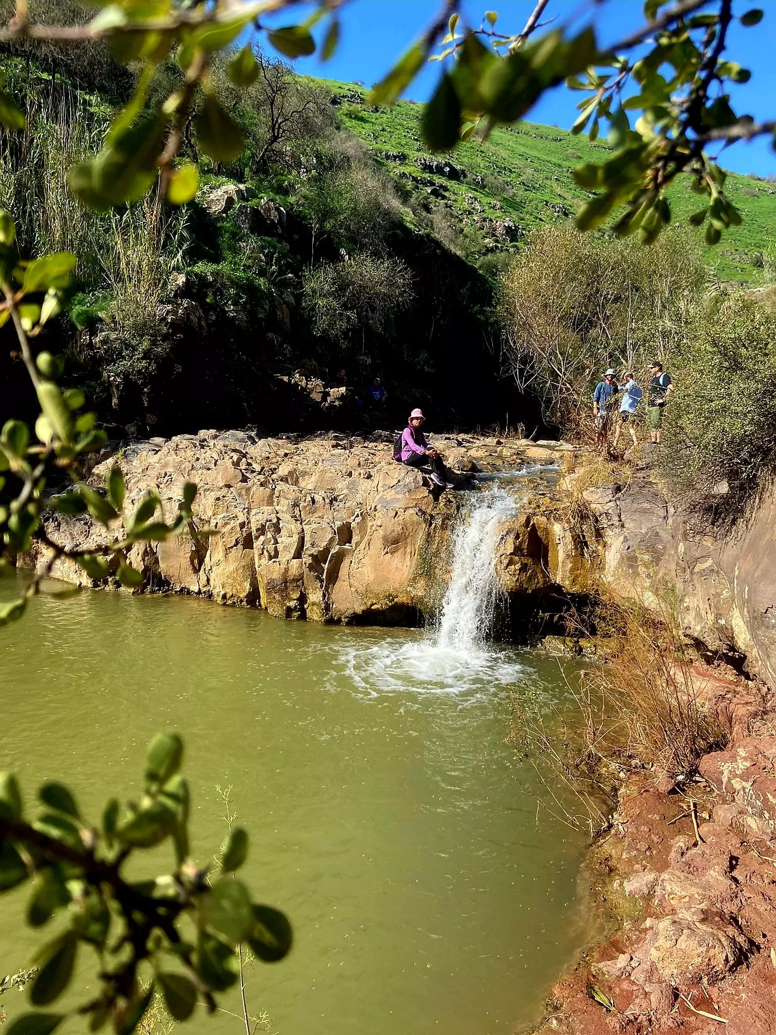
- Touring Wadi al-Bira -- Jan, 2024-- Nabela Salem -- في وادي البيره
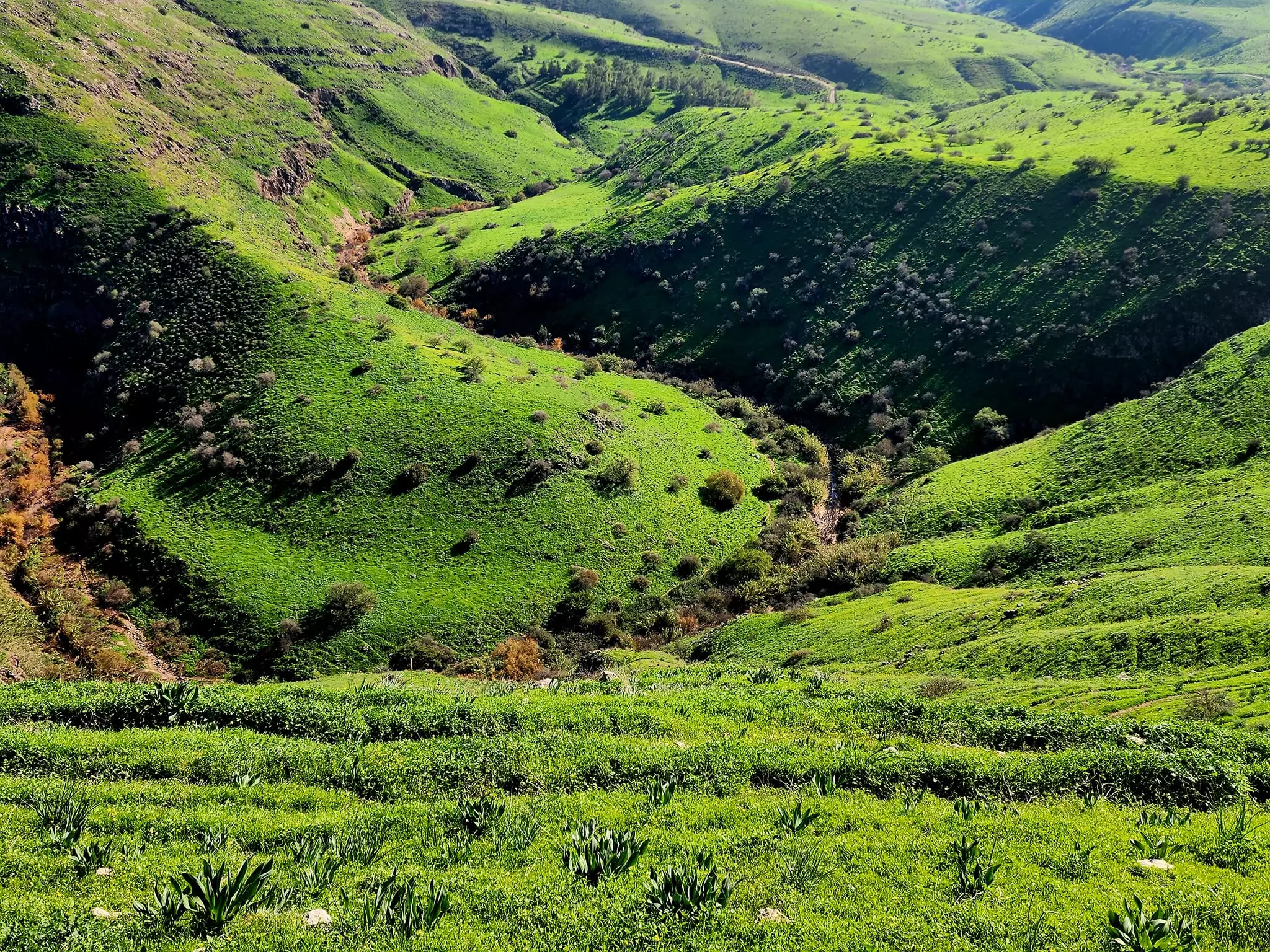
- Touring Wadi al-Bira -- Jan, 2024-- Nabela Salem -- في وادي البيره #2
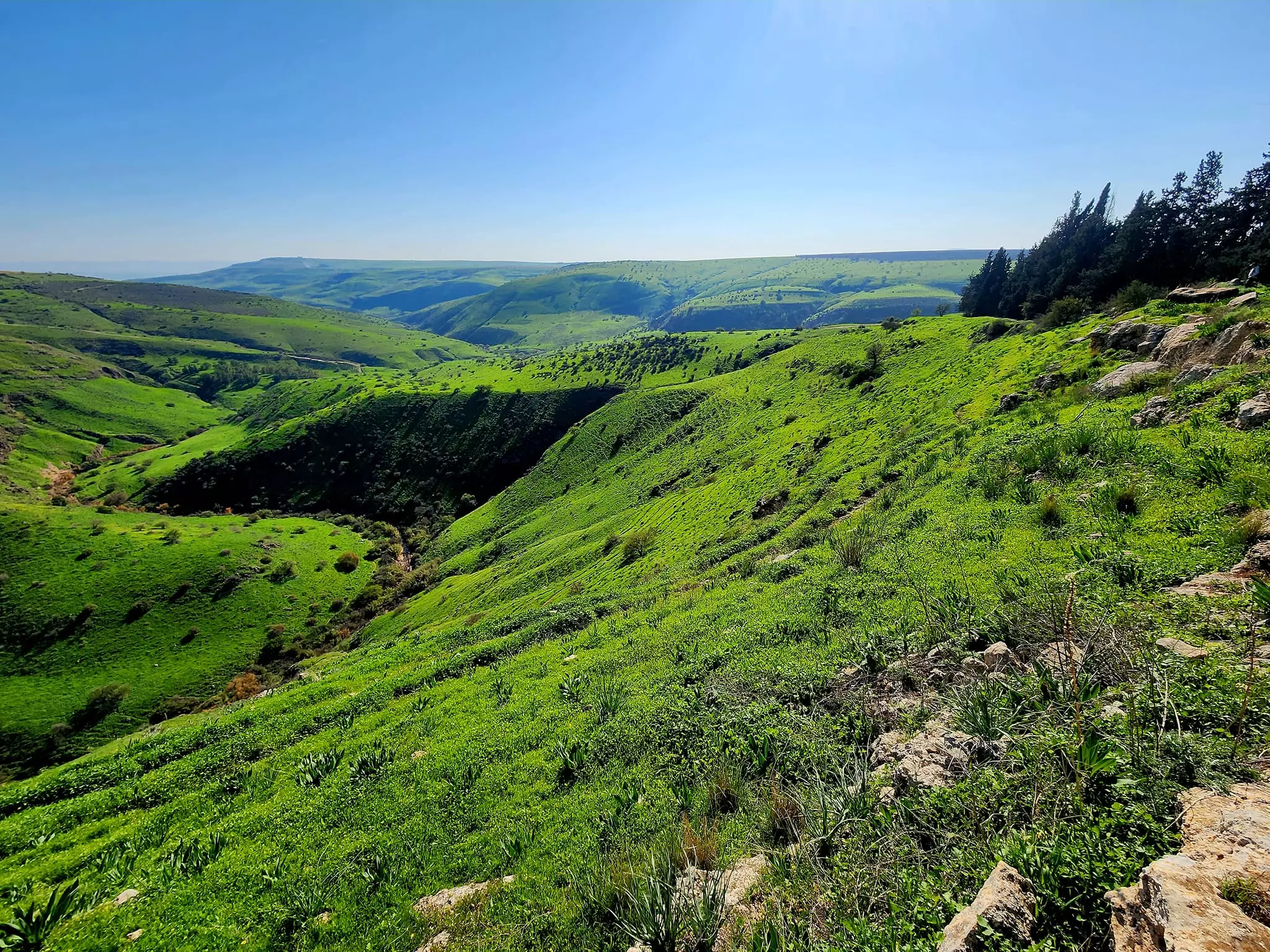
- Touring Wadi al-Bira -- Jan, 2024-- Nabela Salem -- في وادي البيره #3
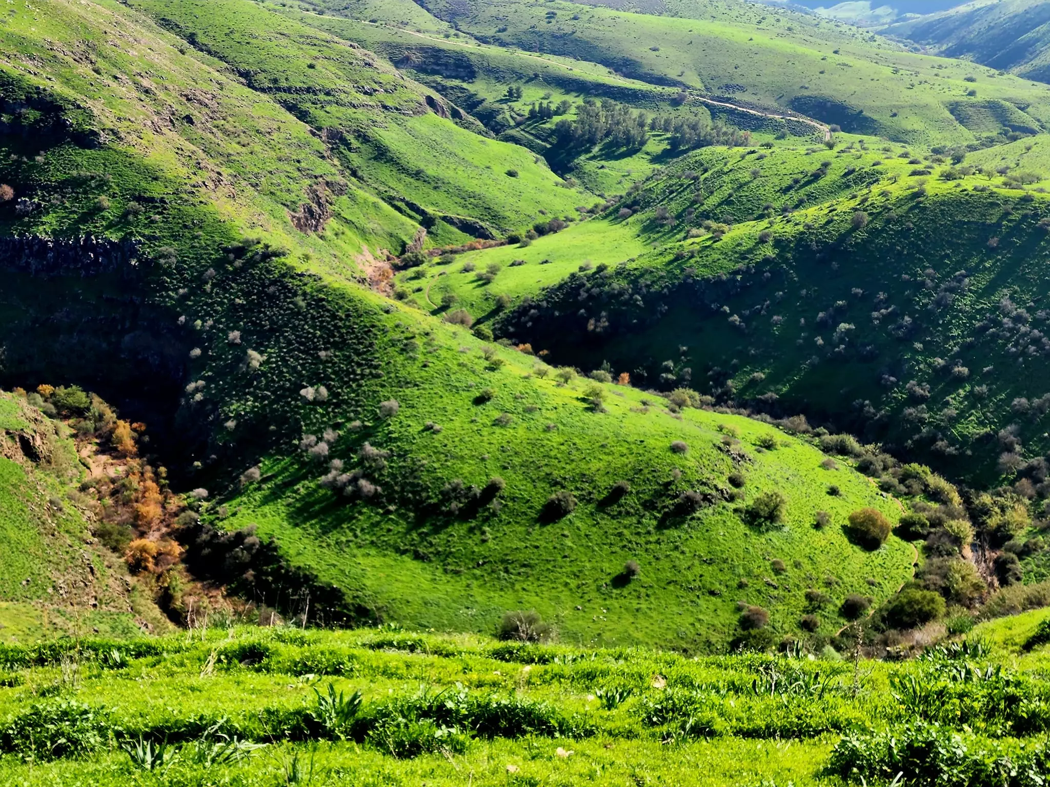
- Touring Wadi al-Bira -- Jan, 2024-- Nabela Salem -- في وادي البيره #4
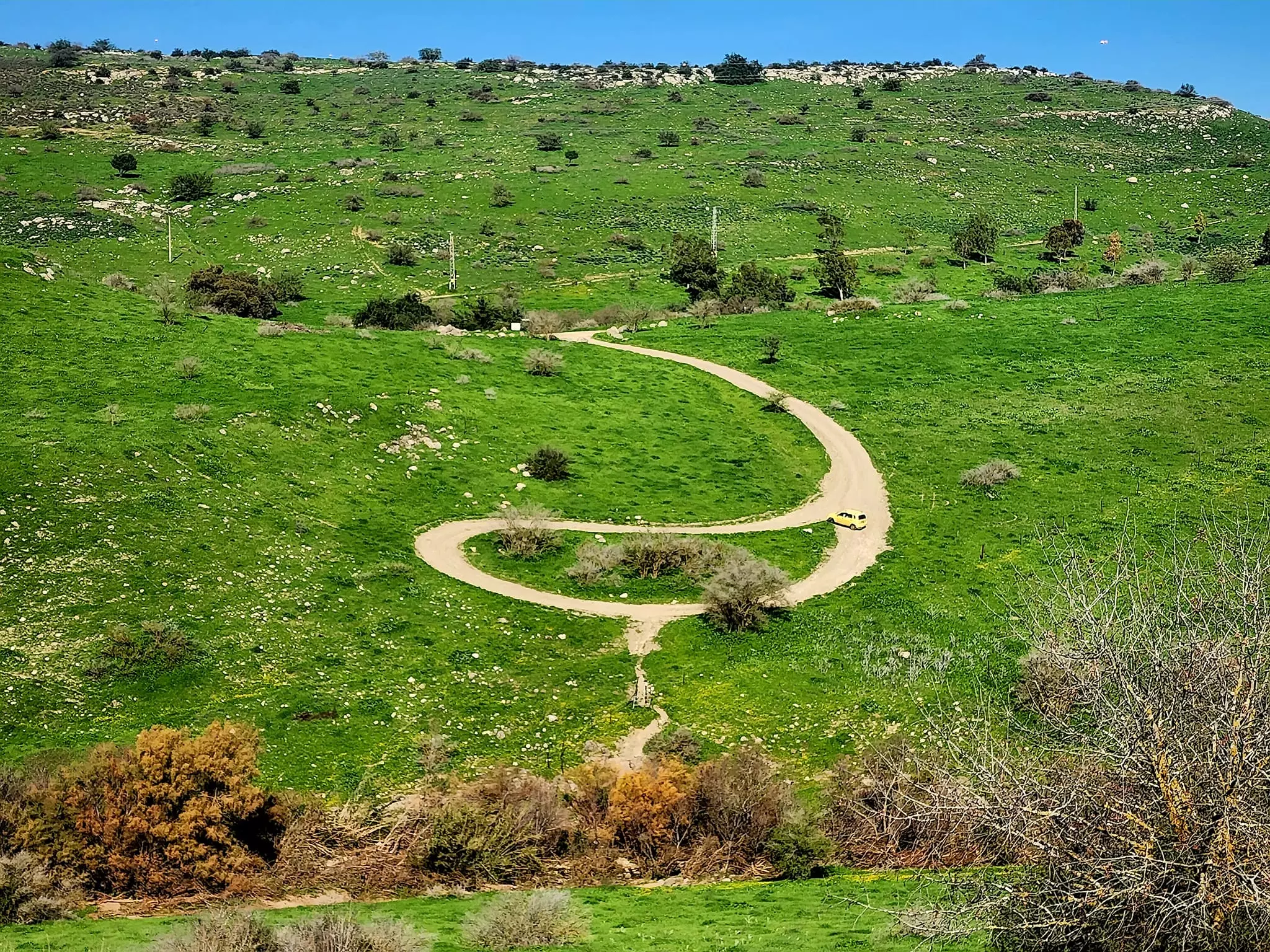
- Touring Wadi al-Bira -- Jan, 2024-- Nabela Salem -- في وادي البيره #5
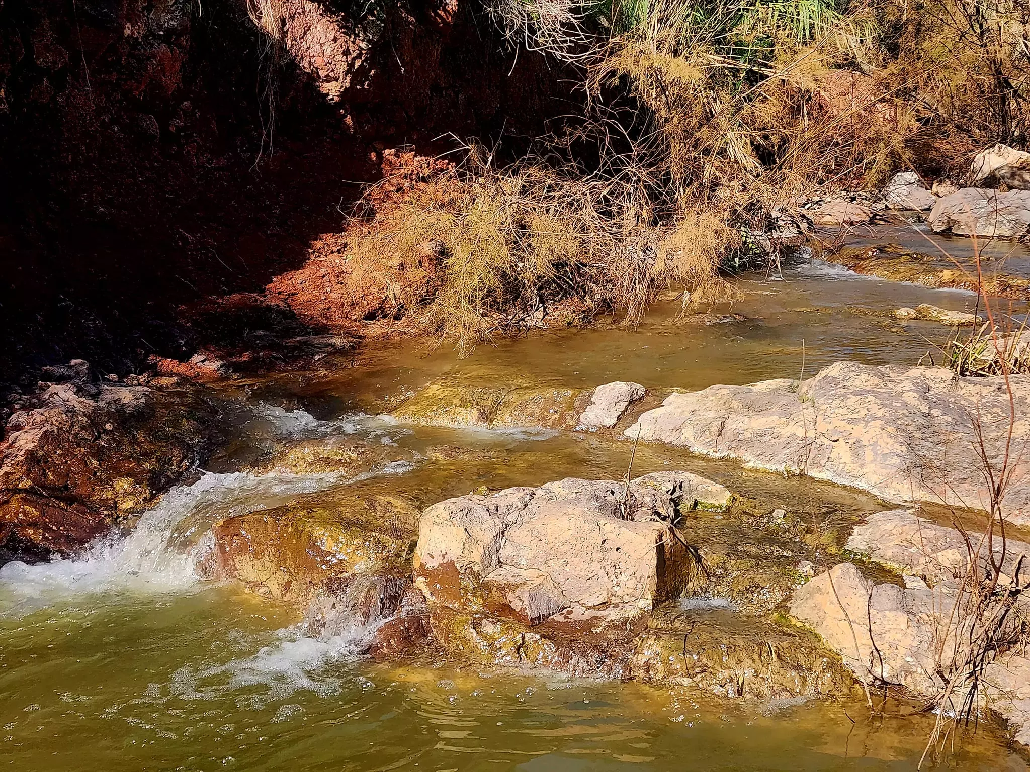
- Touring Wadi al-Bira -- Jan, 2024-- Nabela Salem -- في وادي البيره #6
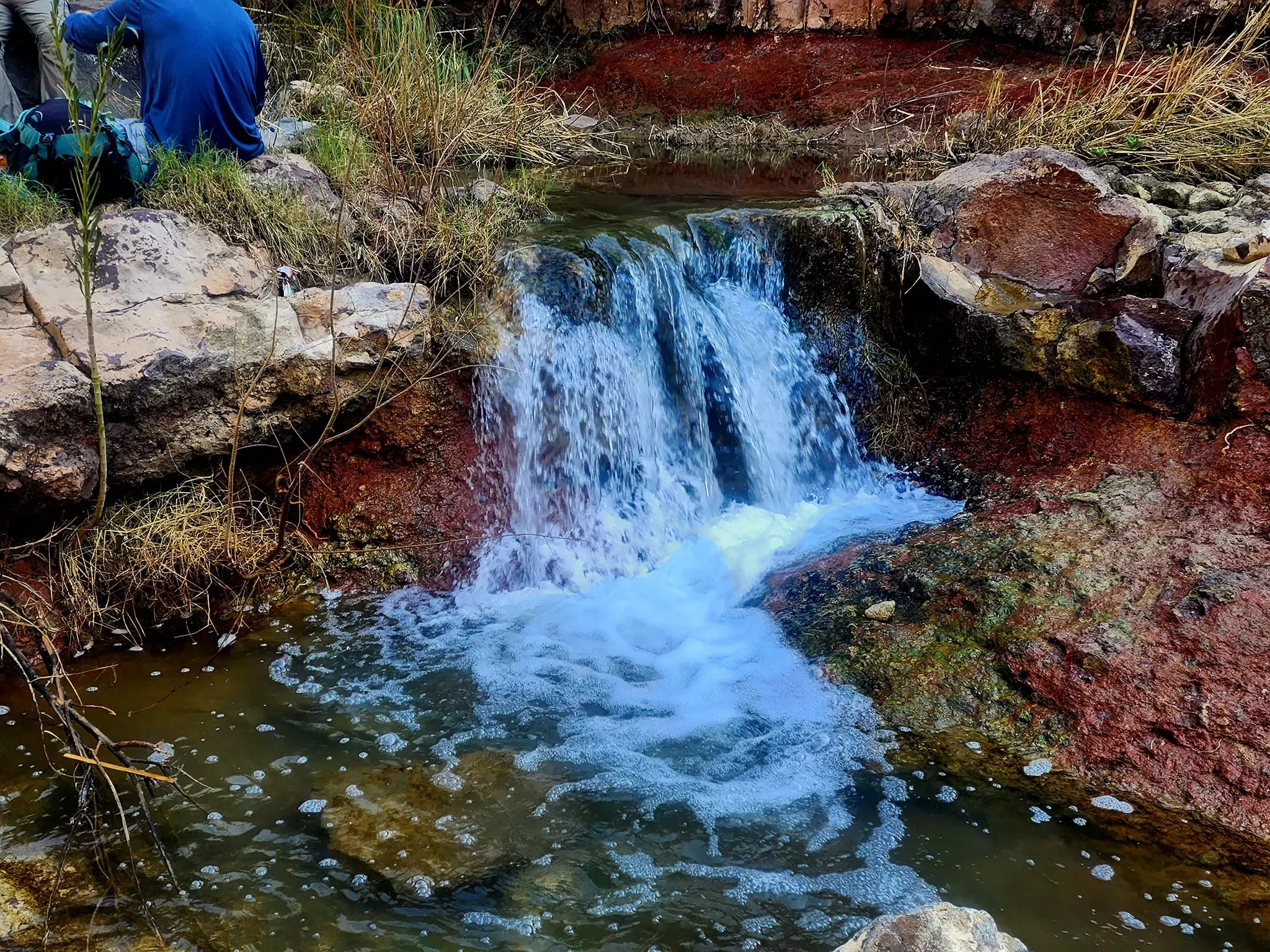
- Touring Wadi al-Bira -- Jan, 2024-- Nabela Salem -- في وادي البيره #7
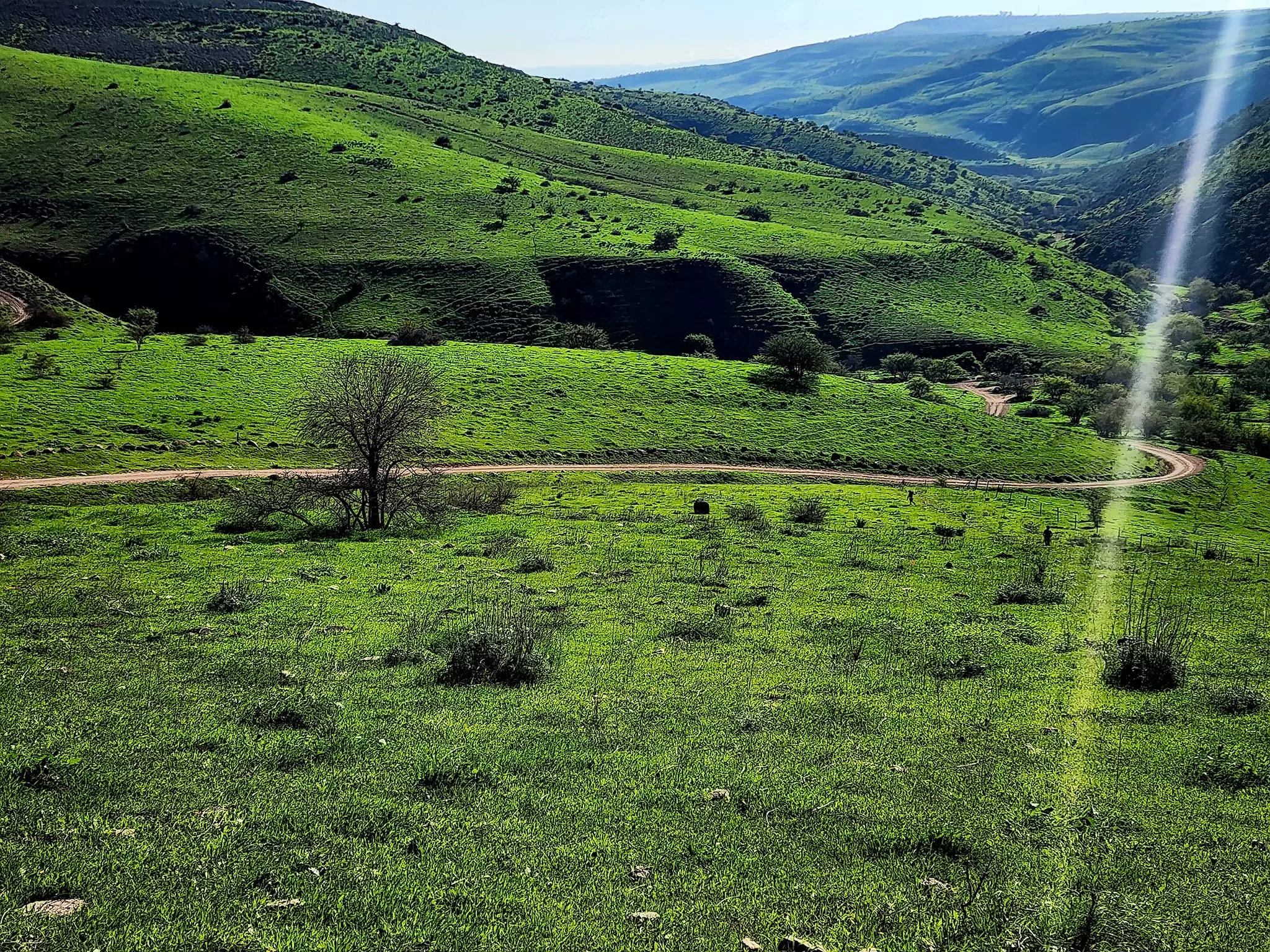
- Touring Wadi al-Bira -- Jan, 2024-- Nabela Salem -- في وادي البيره #8
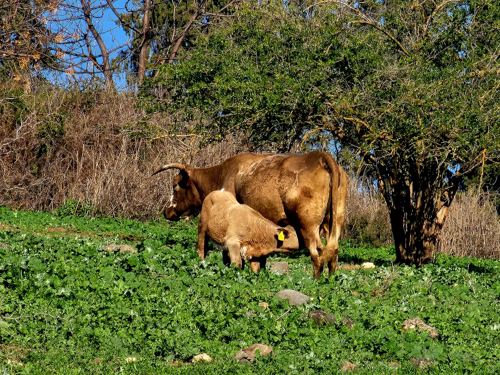
- Touring Wadi al-Bira -- Jan, 2024-- Nabela Salem -- في وادي البيره #9
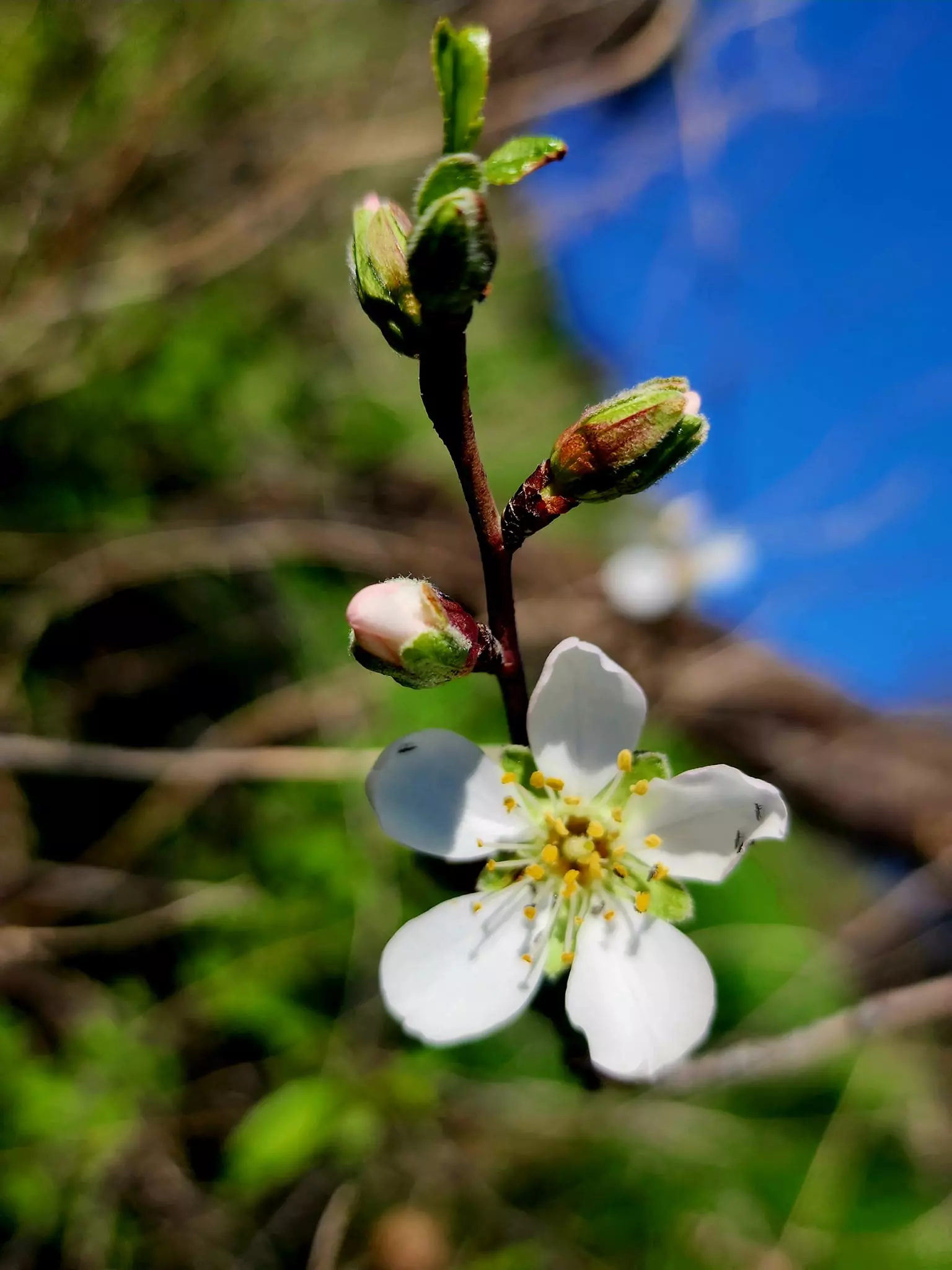
- Touring Wadi al-Bira -- Jan, 2024-- Nabela Salem -- في وادي البيره #10
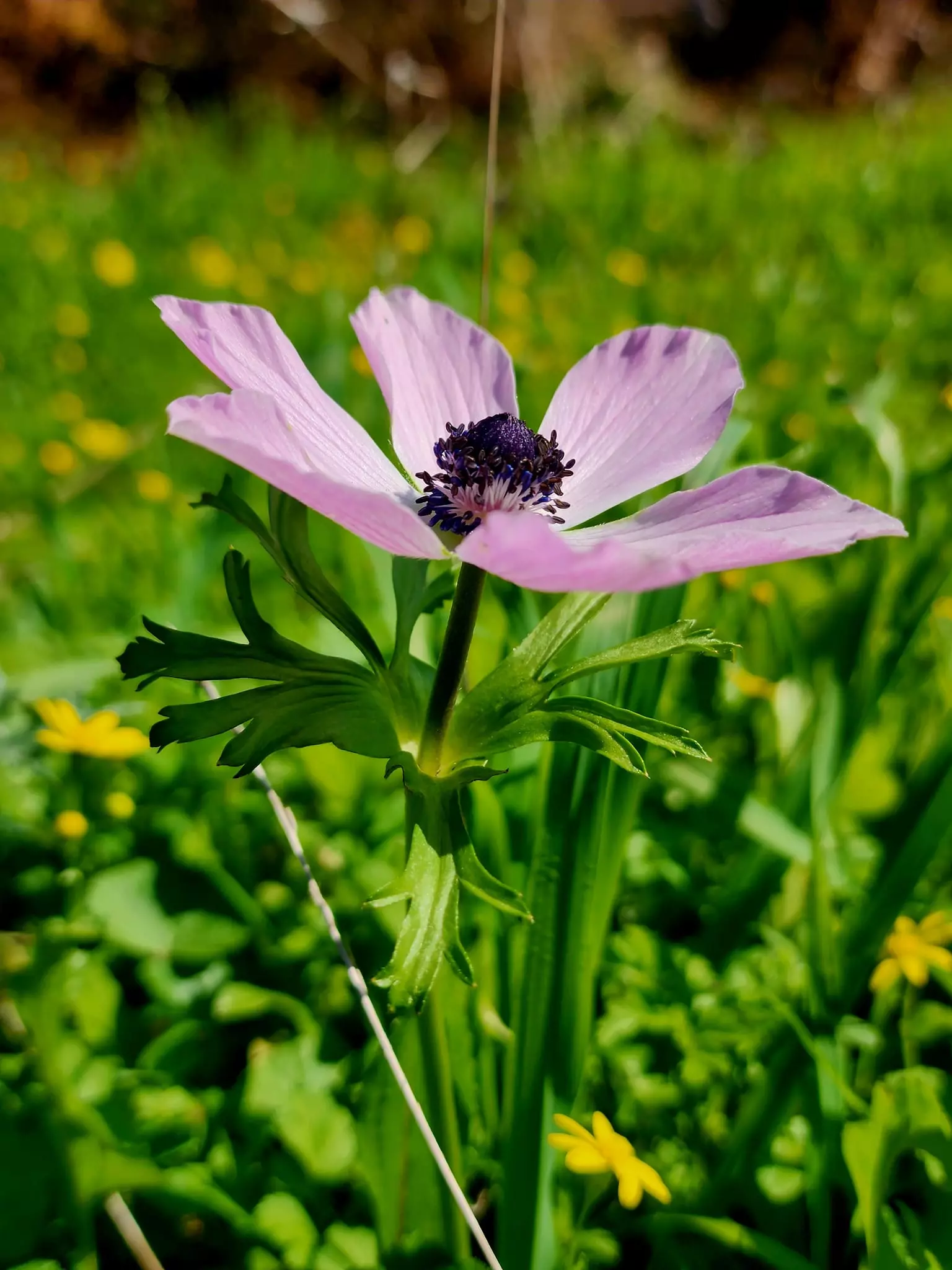
- Touring Wadi al-Bira -- Jan, 2024-- Nabela Salem -- في وادي البيره #11
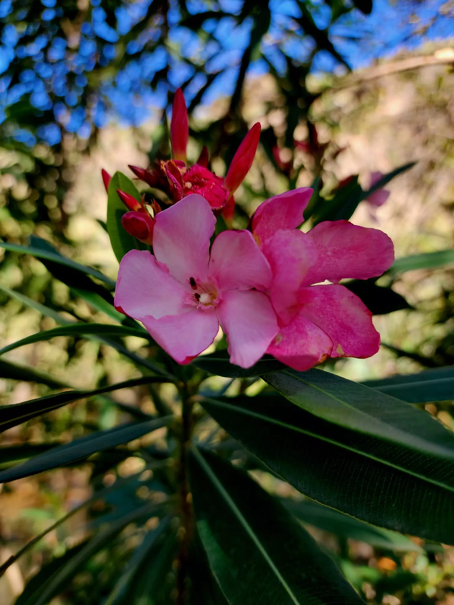
- Touring Wadi al-Bira -- Jan, 2024-- Nabela Salem -- في وادي البيره #12

- Touring Wadi al-Bira -- Jan, 2024-- Nabela Salem -- في وادي البيره #13
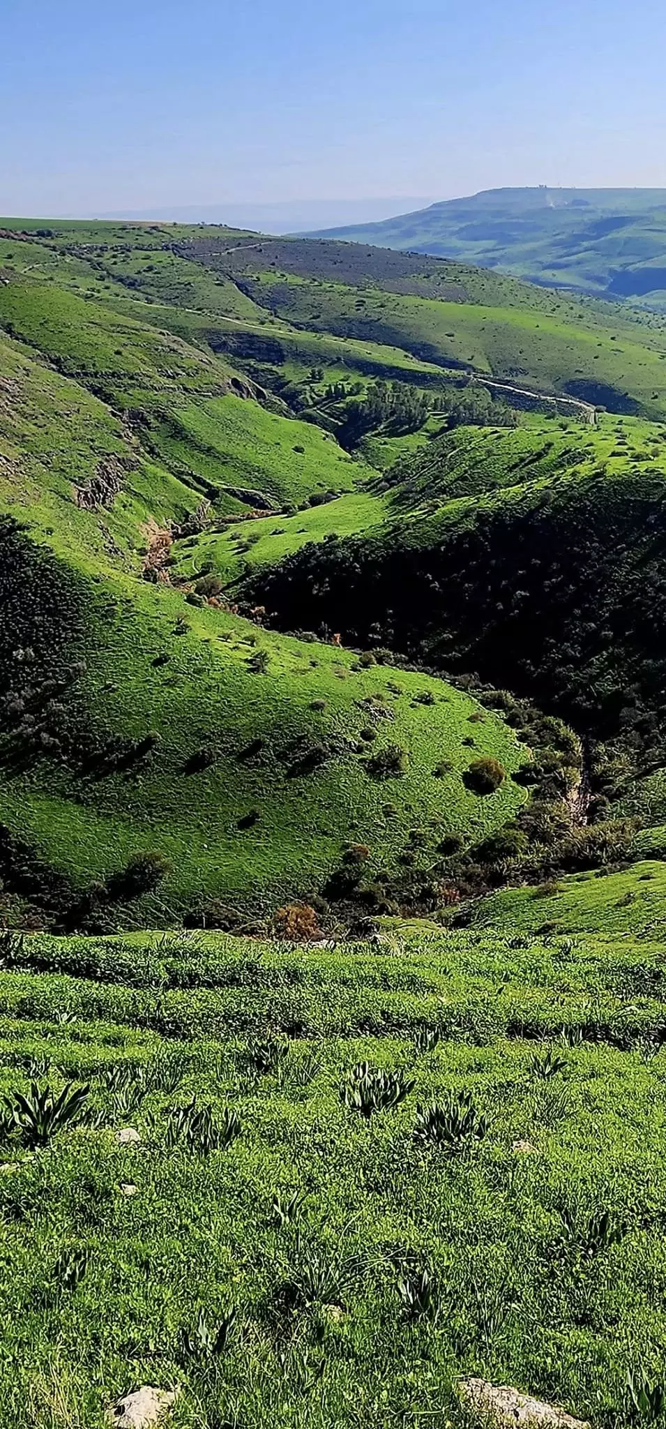
- Touring Wadi al-Bira -- Jan, 2024-- Nabela Salem -- في وادي البيره #14
- خارطة تُظهِر الحدود والطرق بأنواعها والأماكن المقدسة والطبيعة الطوبغرافية من تلال وسهول ومنحدرات والتشكيلة الطبيعية للأرض وأنواع المزروعات. نُشرت الخريطة فترة الانتداب البريطاني، تم إضافة تعديلات عليها من قِبَل خدمة الخرائط والصور التابعة للقوات العسكرية الاسرائيلية فترة الأربعينيات.
Want to browse more? 80,000 pictures were grouped in these gallaries:
| Display Name | Clan/Hamolah | Country of Residence |
| Awadh | Al Omari | Jeddah, KSA |
| malomari | - | jordan, jordan |
- لكي لا تنسى الأرض أصحابها.. شاهد جمال وادي البيرة المهجرة قضاء بيسان! Duration: 2 min 43 sec
- وادي البيرة في قرية البيرة المهجرة قضاء بيسان . Waze נחל תבור Duration: 22 sec
No links have been shared yet, be free to the first to share the first link.
 Fake Valor: Why Did Zionist Jews Hoist Nazis Flag on Their Ships in the 1930s?
What is new?
-
Facts About Oct. 7th Gaza Raid
-
Remined Us Please:: Who Did Rape Who? Palestinians Raped Israelis? Or, was the other way around?
-
When Prof. Edward Said was invited to debate Bibi Netanyahu in the 1980s, watch what happened!
-
Ezra Klein of the NY Times on the "Jewish Race".
-
Abusing Blood Libel!
-
Did Israeli Soldiers Activate The Hanniba Direective On Oct. 7th? You Be The Judge
-
Zionist FAQ: Isn't it true that Palestinians don't want peace? Palestinians never accepted the two-state solution
- Facts about Haavara (Transfer) Agreement between Ben-Gurion & Hitler
-
Haavara FAQs: Why Did Zionist Jews Hoist Nazis' Flags on Their Ships in the 1930s?
- Haavara FAQs: When Chaim Weizmann met FDR in mid-1943, why was he silent about rescuing European Jewry?
-
Dear ChatGPT: How did Palestinians resist Napoleon's invasion of their country in 1799?
-
Dear ChatGPT: Gaza had a vibrant Jewish community in the mid-17th century. What happened to them?
-
Dear ChatGPT: Why did the Jewish Agency suppress news of the Holocaust during WWII?
-
Video Playlist: Jews share their DNA tests to end the conflict for good.
-
A Tale of Two Conflicts: Examining the Definition of Genocide
-
Prof. Abraham Polak And The Suppressed History of the Khazars and European Jewry
-
How Ronald Reagan would have framed the genocide in Gaza if he were still alive?
-
Haavara FAQs: Let us do the math: how many German Jews did The Haavara Agreement save?
-
Zionist FAQs: The Hebron Massacre of 1929, "clearly proves" that Palestinians are antisemitic, how could you deny it?
-
Zionist FAQs: Why Anti-Zionist Is Not Antisemitism?
-
Zionist FAQs: Isn't it true that the KGB created Palestinian Nationalism in the early 1960s?
- Zionist FAQs: Muslims are killing Muslims all the time; why are Israeli Jews being singled out in the media?
- Zionist FAQs: How is Israel an apartheid state when 20% of its citizens are Arabs who enjoy full rights?
-
Haavara FAQs: Why Did Dorothy Thompson Flip From A Zionist Advocate to A Silenced Dissenter?
-
Haavara FAQs: Analysis of Herzl's Uganda Scheme and how it could have saved millions of Jews.
-
Haavara FAQs: Why did Hayim Greenberg describe American Jewry as "morally bankrupt" in early 1943?
-
Haavara FAQs: What if the Evian Conference was a resounding success? What would have been the impact of saving European Jewry on Zionism?
- Haavara FAQs: What if the six million were saved, how that would have impacted the Zionist project?
-
Haavara FAQs: How did Zionist leaders react when Europe's Jews lingered in the DP camps after WWII ended?
-
Why does the American Jewish community repeat lies that David Ben-Gurion had debunked before he died?
-
Who has the power to rename the Tatar/Khazar Gene Marker to Jewish IV?
-
Zionist FAQs: Why won't Egypt, Syria, and Jordan take their people back? Jews are indigenous to Palestine, and Arabs immigrated after Jews developed the country. Arabs should leave.
-
Haavara FAQs: Did Hitler and the Nazis conflate between Judaism and Zionist? If that wasn't case, then why?
-
Haavara FAQs: Winston Churchill and antisemitism, a collection of articles written Churchill.
-
Haavara FAQs: Broken by country, how many Jews survived vs. killed during the Holocaust?
-
Haavara FAQs: Why did European Jews vote with their feet and to immigrated to the Americas, not Palestine, after WWII?
-
Watch this American Jewish Girl describing Israeli Jews' cognitive dissonance like no other in under two minutes
-
Haavara FAQs: When the Nazis went out of their way to hide the Holocaust, Israeli Jews did the exact opposite by broadcasting their genocide of Gazans. But why?
-
Haavara FAQs: How Zionist Jews went out of their to show their appreciation to Nazism and Fascism?
- Haavara FAQs: Why Zionist leaders were against bombing the death camps & the Railroads leading to them?
-
Haavara FAQs: Hitler's message to the British and American people: If Jews are such noble citizens and you care about them, how come you're not letting them in? I will gladly ship them to you at my expense, even on luxury liners!
-
A shortlist of Zionist and Israeli false flag operations in the name Jews.
-
The Most Moral Army
- The Land of Kapos (Israel): Where the brave are boycotted and Kapos walk free.
- Why did early Zionists often named their communal enterprises "colonial"?
- Zionist Relations with Nazi Germany by Faris Glubb
-
Two NY Times advertisements by Zionists in the early 1943 that exposes Zionists' treason at the height of the calamity
- Facts Not Lies about the Palestinian-Israeli Conflict.
- Site's pictures have been categorized
- Campgain Against Lice
- A Survey of Palestine, the official source about Palestine before Nakba produced by the British Mandate; over 1200 pages.
- Satellite View & Google Earth: Over 6,000 placemarks identifying all destroyed towns, W. Bank & Gaza Strip Towns, & refugee camps.
- PalestineRemembered.com and its Nakba Oral History Project were featured on al-Jazeera Satellite TV.
- Nakba Oral History Video Podcast:
 Over 700 Oral History interviews (including 3,500+ hours of recording) can be viewed online.
 - Palestine Village Statistics Project
- Gaza Jail Break
- النسخة العربية للموقع الان متوفرة
- Videos: Documenting the destroyed villages in video: Tracing all that remains since Nakba.
- Videos: Responding to Zionist Propaganda
- Interview: The ethnic cleansing of Palestine: George Galloway interviews Israeli Historian Ilan Pappe.
- For Palestinians, memory matters. It provides a blueprint for their future By George Bisharat.
- Zionist FAQ now available in Hebrew שאלות שציונים שואלים, עכשיו בעברית
- Video: The Stephen Walt and John Mearsheimer report on the influence of the Israel Lobby on U.S. Foreign Policy
- The Palestinian-Israeli conflict for beginners
