| PalestineRemembered | About Us | Oral History | العربية | |
| Pictures | Zionist FAQs | Haavara | Maps | |
| Search |
| Camps |
| Districts |
| Acre |
| Baysan |
| Beersheba |
| Bethlehem |
| Gaza |
| Haifa |
| Hebron |
| Jaffa |
| Jericho |
| Jerusalem |
| Jinin |
| Nablus |
| Nazareth |
| Ramallah |
| al-Ramla |
| Safad |
| Tiberias |
| Tulkarm |
| Donate |
| Contact |
| Profile |
| Videos |
Welcome To Najd - نجد (נג'ד)
|
District of Gaza
Ethnically cleansed days ago |
العربية Google Earth |
 |
Gallery (44) |
- Statistics & Facts
-
Before & After

- Satellite View
- Articles 3
- Pictures 44
- Aerial Views 1
- Oral History 1
- Members 13
- Families
- All That Remains
- Wikipedia
- Videos 3
- Guest Book 4
- Links
| Statistic & Fact | Value | |||||||||||||||||||||
| Occupation Date | May 13, 1948 | |||||||||||||||||||||
| Distance From District | 14 (km) North East of Gaza | |||||||||||||||||||||
| Elevation | 50 (meters) | |||||||||||||||||||||
| Before & After Nakba, Click Map For Details |
||||||||||||||||||||||
|
||||||||||||||||||||||
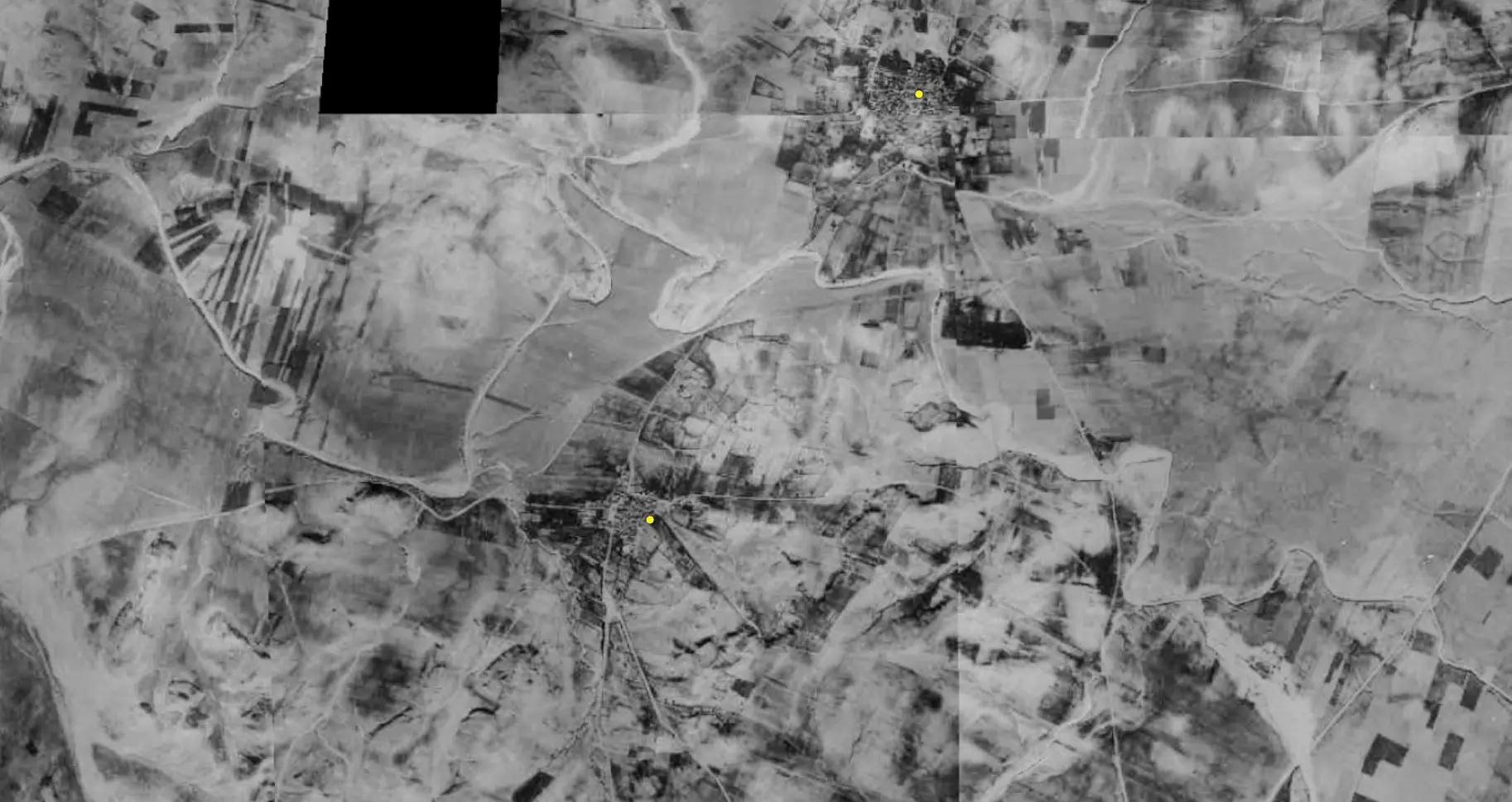
| Pre-Nakba Aerial View |
||||||||||||||||||||||
|
||||||||||||||||||||||
| Map Location | See location #42 on the map View from satellite |
|||||||||||||||||||||
| Military Operation | Operation Barak | |||||||||||||||||||||
| Attacking Units | Negev Brigade | |||||||||||||||||||||
| Exodus Cause | Expulsion by Zionist troops | |||||||||||||||||||||
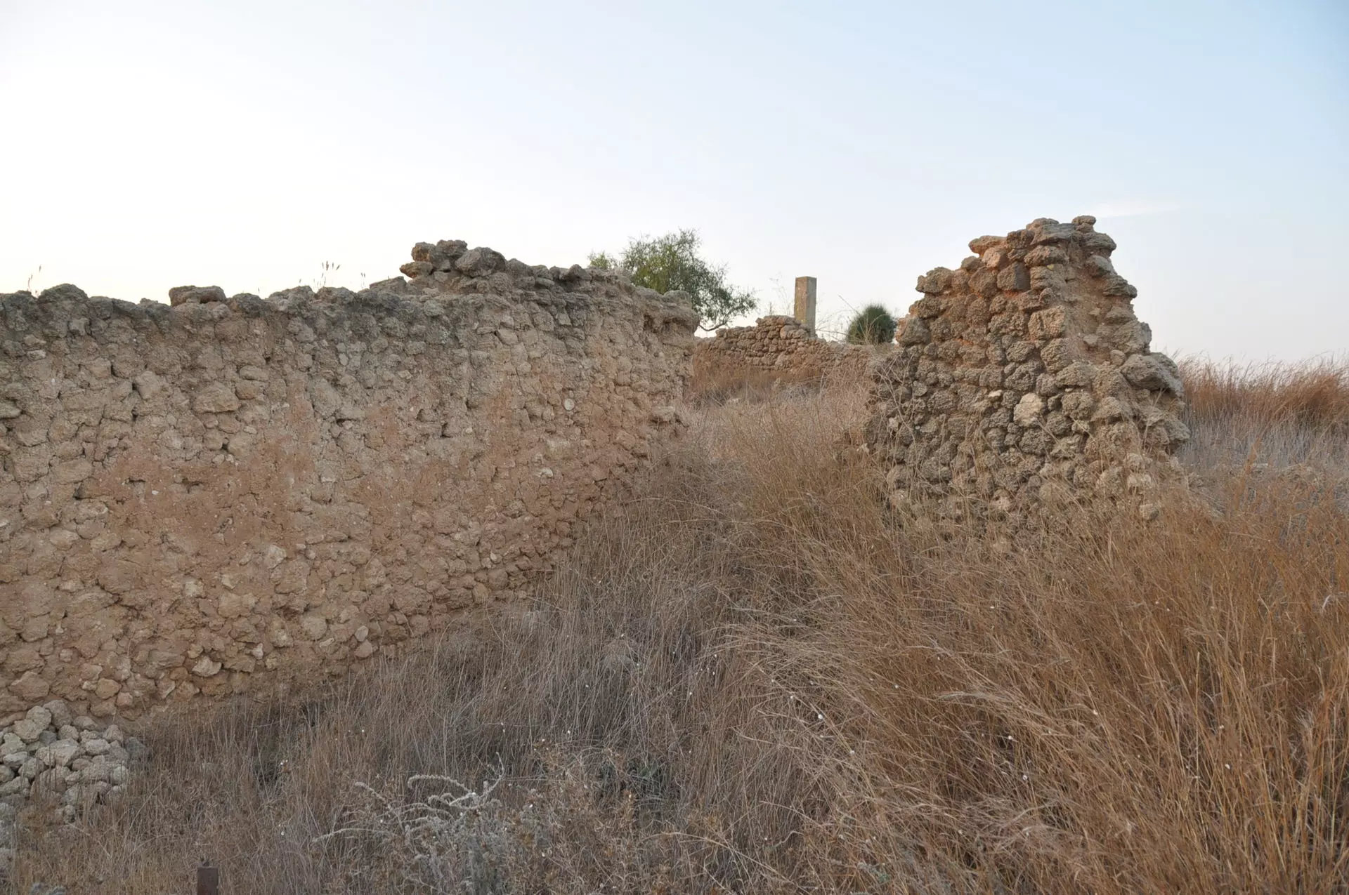
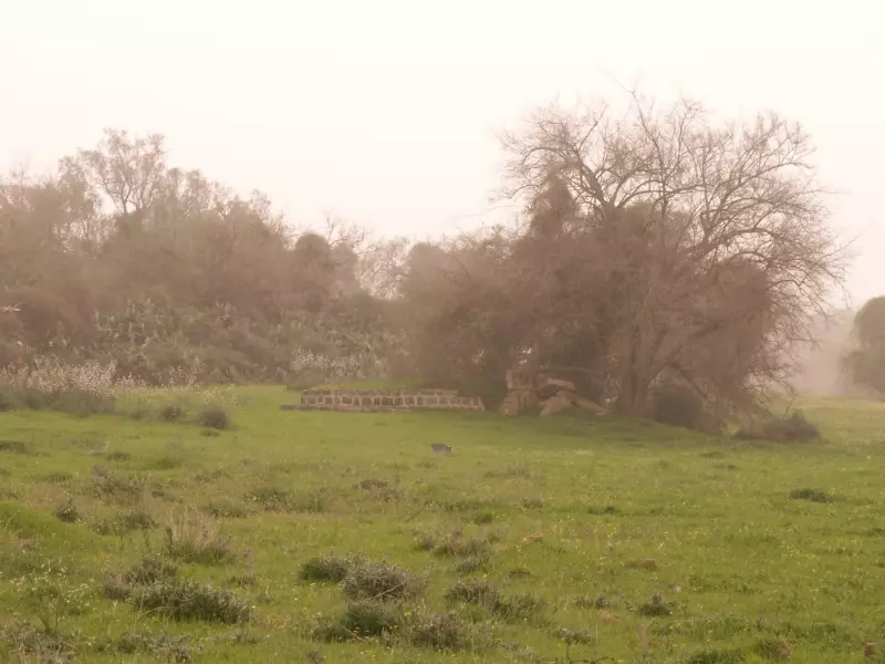
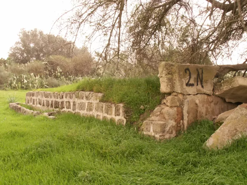
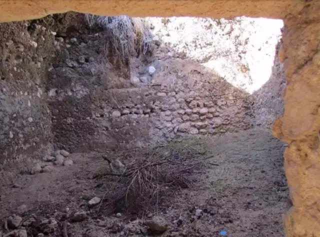
| Village Temains | The village has been completely defaced | |||||||||||||||||||||
| Ethnically Cleansing | Najd inhabitants were completely ethnically cleansed. | |||||||||||||||||||||
| Pre-Nakba Land Ownership |
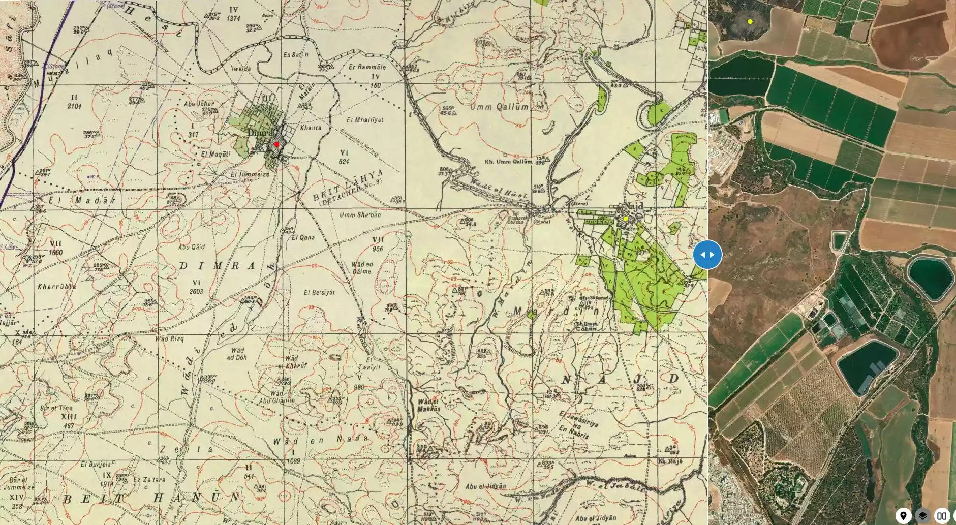
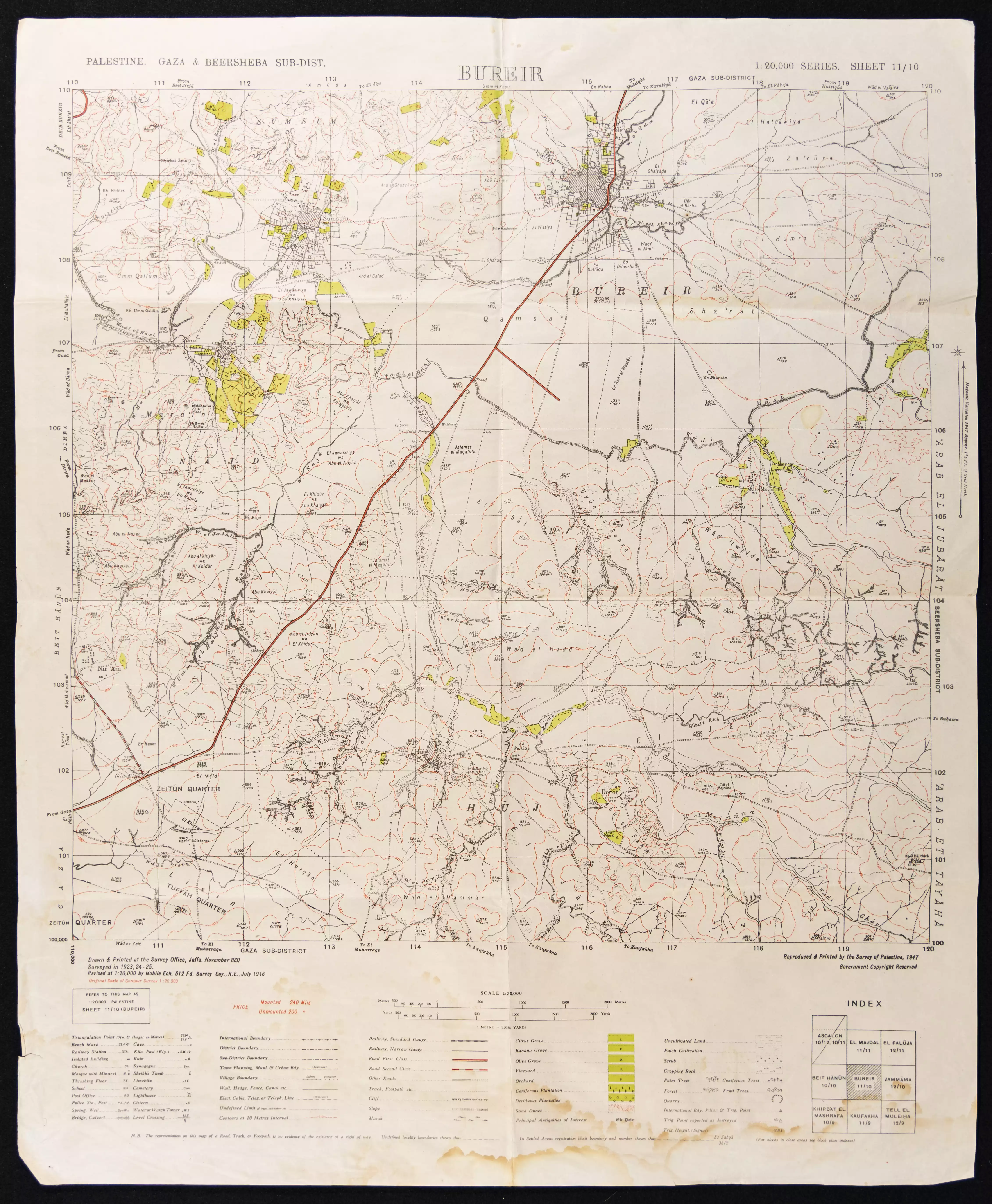
**Town Lands' Demarcation Maps |
|||||||||||||||||||||
| Land Usage As of 1945 |
|
|||||||||||||||||||||
| Population |
|
|||||||||||||||||||||
| Number of Houses |
|
|||||||||||||||||||||
| Schools | Najd students attended school in the nearby village of Simsim. | |||||||||||||||||||||
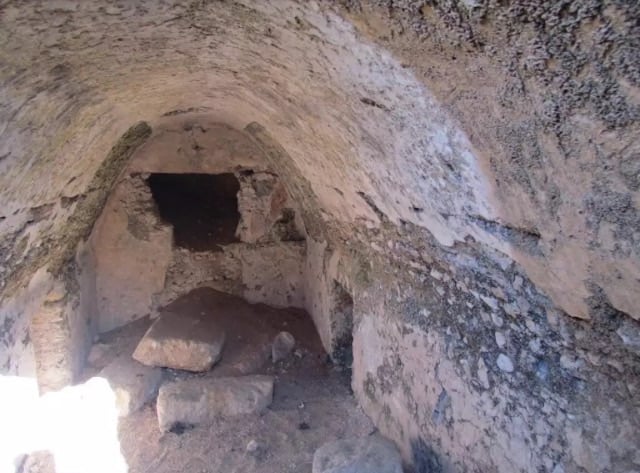
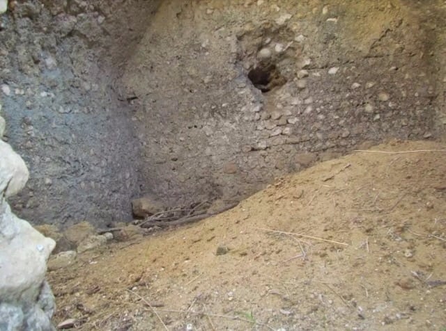
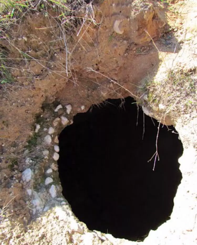
| Archeological Sites | Najd contained rough, stone foundations of ancient buildings, vaults, and cisterns | |||||||||||||||||||||
| Exculsive Jewish Colonies Who Usurped Village Lands |
Sderot and Or ha-Ner | |||||||||||||||||||||
| Featured Video | ||||||||||||||||||||||
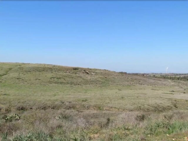
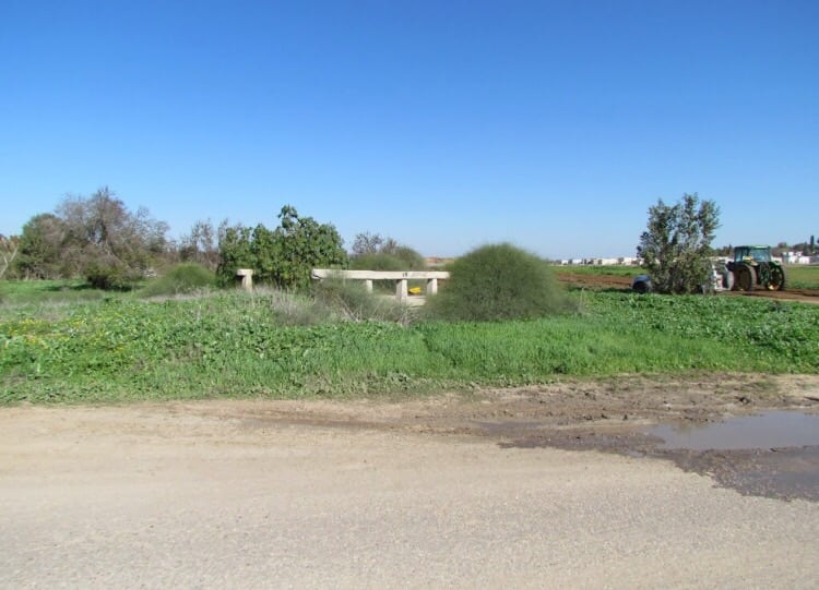
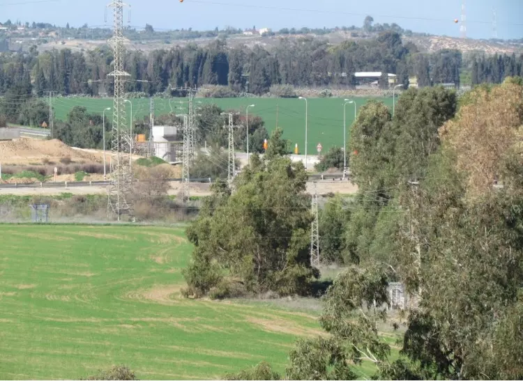
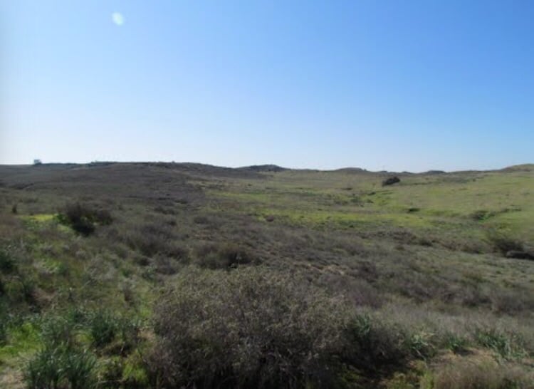
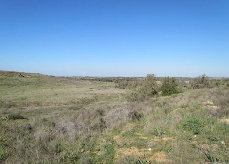
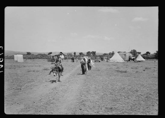
Village Before NakbaThe village stood on an elevated spot on the southern coastal plain, and overlooked the agricultural lands around it. Several secondary roads linked it to the coastal highway at points between al-Majdal and Gaza, as well as to villages in the vicinity. Its name meant 'elevated ground' in Arabic. In 1596, Najd was a village in the nahiya of Gaza (liwa' of Gaza), with a population of 215. It paid taxes on a number of crops, including wheat, barley, and fruit, as well as on other types of produce and property such as goats, beehives, and vineyards.Edward Robinson, an American biblical scholar who traveled in the area in 1838, noted that Najd lay south of a wadi. He observed the villagers winnowing barley by throwing it into the air against the wind with wooden forks. In the late nineteenth century, Najd was a small village with a well and a pond. As its population grew during the Mandate period, it expanded northwestward. The village population was Muslim, and children attended school in the village of Simsim, 2 km to the northeast. The residents of Najd worked primarily in agriculture and animal husbandry. Fields of grain and fruit trees surrounded Najd on all sides. Fruit trees were concentrated on the north and northeastern sides--where irrigation water was available from wells--and in the beds of the wadis that crossed the lands. In 1944/45 a total of 10 dunums was devoted to citrus and bananas and 11,916 dunums were allocated to cereals; 511 dunums were irrigated or used for orchards. Khirbat Najd was located south of the village and contained rough, stone foundations of ancient buildings, vaults, and cisterns. Village Occupation and Ethnic CleaningThe villagers of Najd were expelled on 13 May 1948, just before the establishment of the state of Israel. Israeli historian Benny Morris writes that the inhabitants of nearby Simsim were expelled at the same time by the Palmach's Negev Brigade. The Brigade launched a number of small pushes northwards and eastwards in coordination with the Giv'ati Brigade's southward expansion in the first half of May.Zionists Colonies on Village LandsTwo settlements were established on village lands: Sderot, founded in 1951 to the south of the site; and Or ha-Ner, founded in 1957 closer to the site, to the northeast.Village TodayThe site is fenced in. Some old trees grow on it, which suggests that it may have been reclassified as a nature conservation area. The site is overgrown with cactuses and Christ's thorn and sycamore trees and contains the crumbled walls of unidentified buildings whose former uses are difficult to determine. There is also an irrigation canal. The surrounding lands are cultivated by Israeli farmers.SourceDr. Walid al-Khalidi, 1992: All That Remains. |
||||||||||||||||||||||
| Related Maps | Town Lands' Demarcation Maps خرائط للقضاء توضح حدود القرى والاودية Town's map on MapQuest View from satellite Help us map this town at WikiMapia |
|||||||||||||||||||||
| Related Links | Wikipedia's Page Facebook Page Google Search Google For Images Google For Videos |
|||||||||||||||||||||
| More Information | في كتاب كي لا ننسى في كتاب بلادنا فلسطين المزيد من موقع هوية |
|||||||||||||||||||||
- Irrigation pool #1
Posted by Uri Zackhem - Irrigation pool #2

Posted by Uri Zackhem - Irrigation pool #3
Posted by Uri Zackhem - Irrigation pool #4
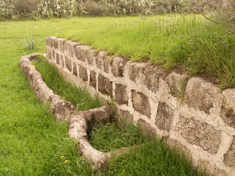
Posted by Uri Zackhem - Irrigation pool #5
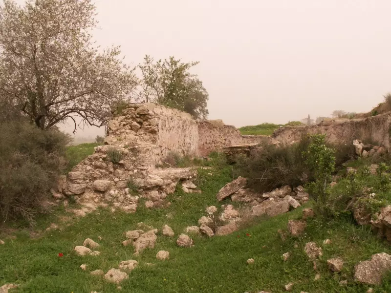
Posted by Uri Zackhem 1 - أنقاض إحدى المباني المدمرة. 1987

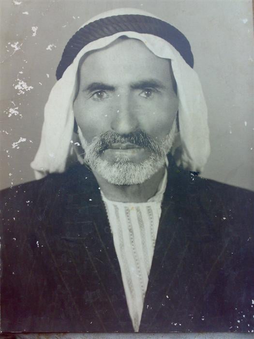
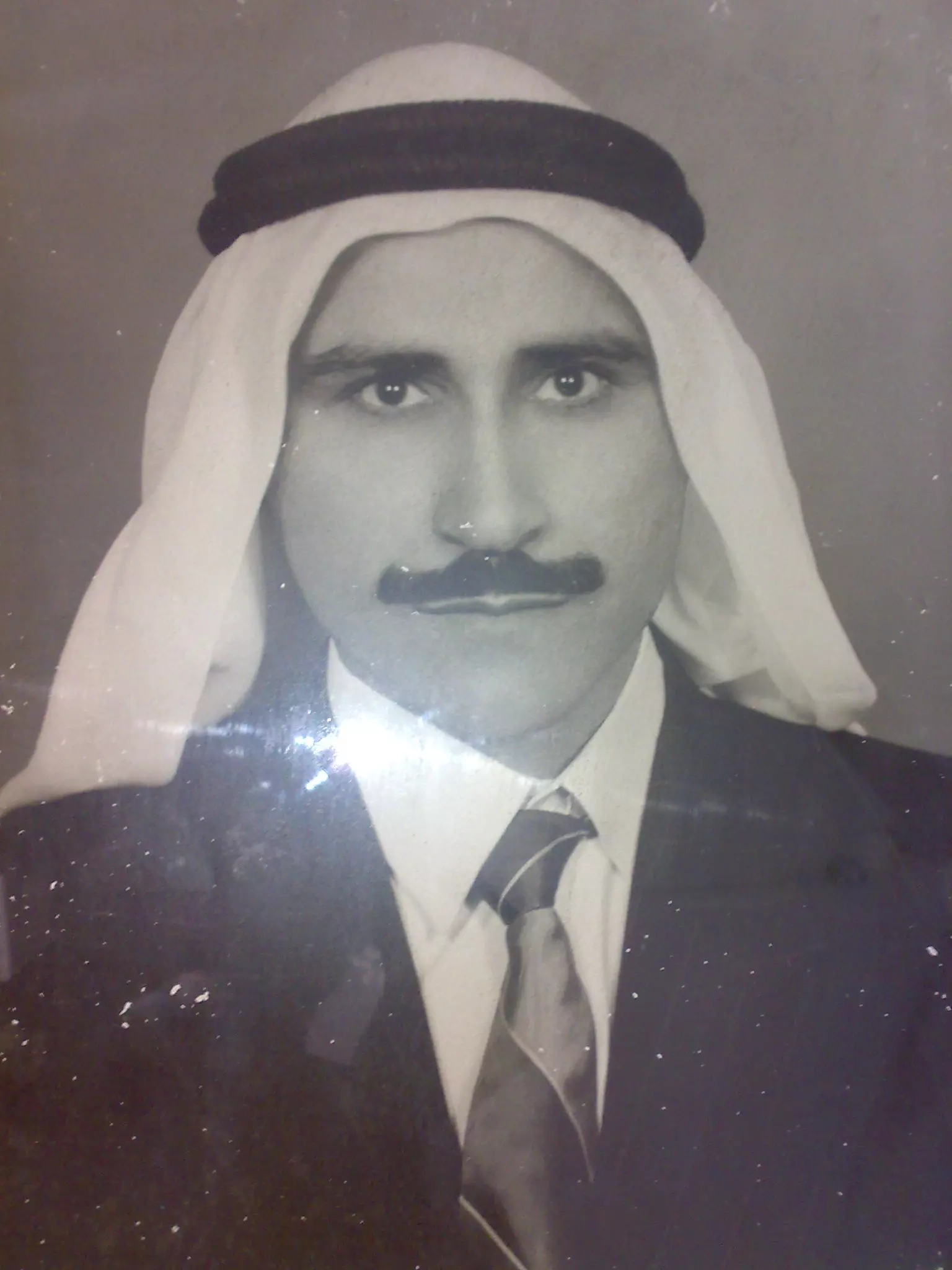
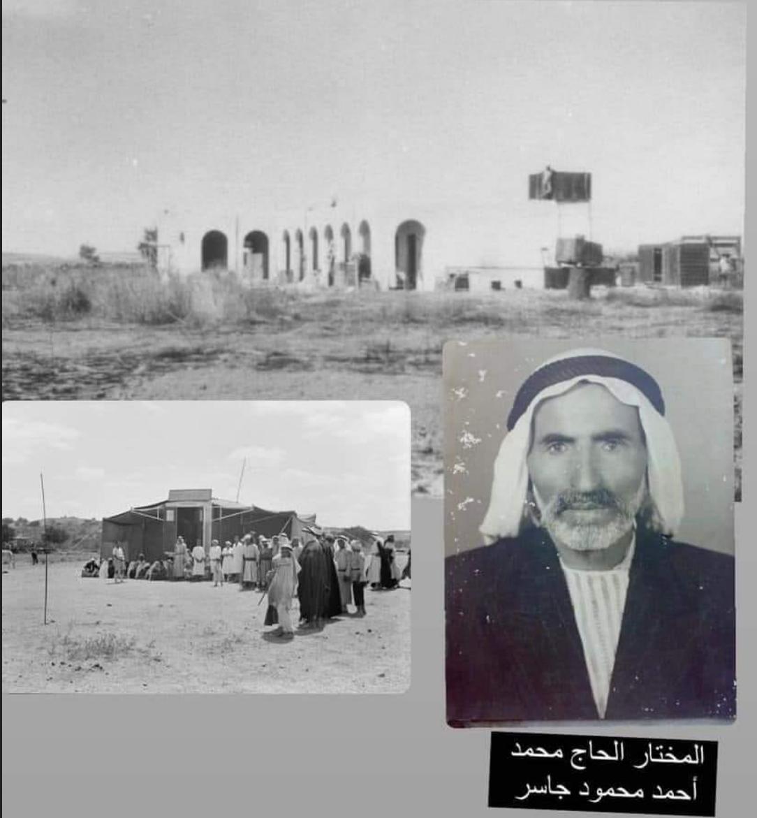
Scanned from "All That Remains" by Dr. Walid Khalidi - صورة مختار قرية نجد قبيل الهجره الحاج محمد احمد محمود جاسر وقد هاجر وعائلته الي مخيم جباليا للاجئين ودفن في مقبرتها
Posted by ابو العبد جاسر 3 - صورة الشهيد حسن محمد احمد جاسر ابن مختار قرية نجد حيث قام بمهمه جهاديه علي ارض قرية برير المهجره كلفته بها المخابرات التابعه للاداره المصريه الحاكمه لقطاع غزه حيث كان يعمل انذاك حيث اصيب برصاصات خطيره واعتقل هو ورفيق له في تلك المهمه ولم يخرج الا اثناء عملية تبادل للاسري بين الاحتلال والاداره المصريه خرج علي اثرها علي يعاني من الشلل النصفي السفلي واصابات اخري خطيره في انحاء جسمه بقي يعاني منها الي ان استشهد عام 1979 في مخيم جباليا للاجئين حيث هاجر ودفن قي مقبرة المخيم
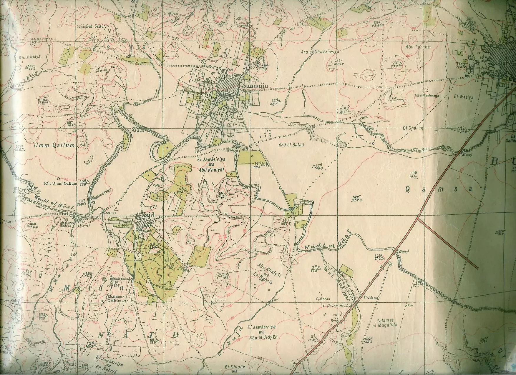
Posted by ابو العبد جاسر 1 - خريطة بريطانية منذ عام 1946 لقرية نجد وقرية سمسم موضح عليها اراضي لعائلات القريه مثل عائلة ابو جاسر والمشار اليهم الجواسريه والنبريص وغيرهم
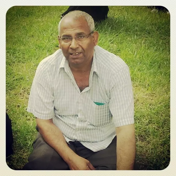
Posted by يوسف جاسر ( ابو العبد ) - المرحوم إبراهيم خضر " أبو صالح " من قرية نجد
Posted by أبو صالح - من اثار القريه
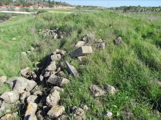
Posted by abu raya - اثار القريه
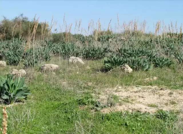
Posted by abu raya - اثار القريه
Posted by abu raya - من بقايا مباني القريه
Posted by abu raya - اثار القريه
Posted by abu raya - اثار القريه
Posted by abu raya - نجد
Posted by abu raya - نجد

Posted by abu raya - اراضي القريه
Posted by abu raya - اراضي القريه

Posted by abu raya - نجد
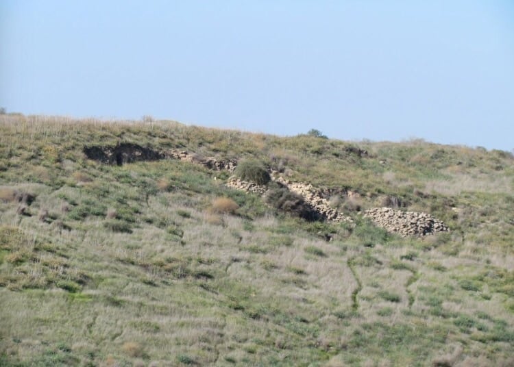
Posted by abu raya - نجد
Posted by abu raya - بىر قديم في القريه
Posted by abu raya - نجد
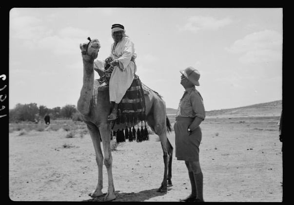
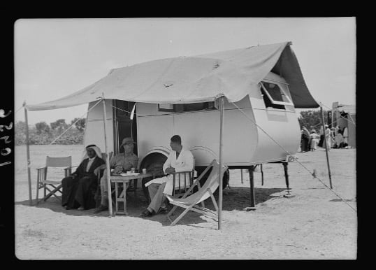
Posted by abu raya - قريه نجد سنه 1939
Posted by abu raya - نجد سنه 1939
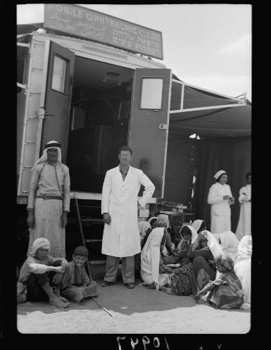
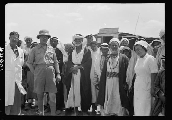
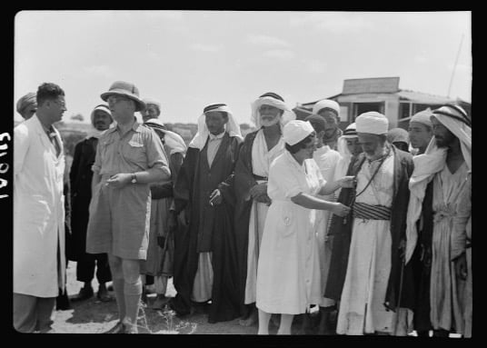
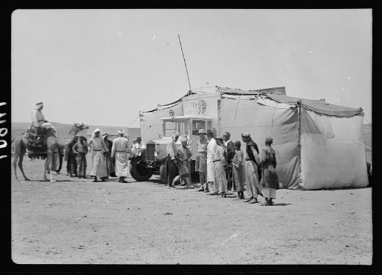
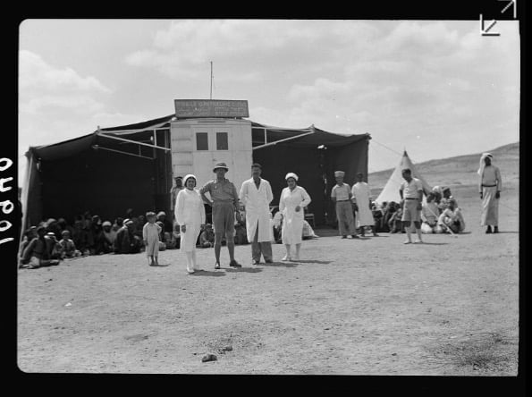
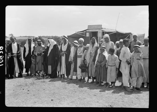
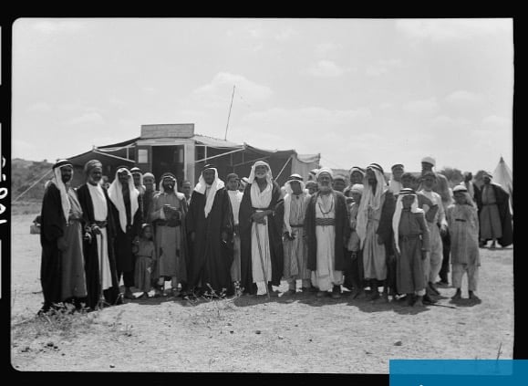
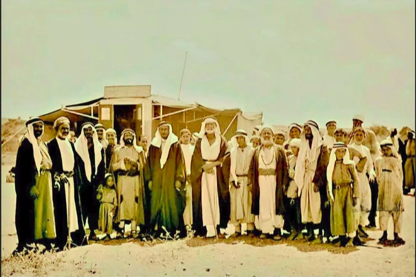
Posted by abu raya - عياده فحص العيون المتنقله في نجد سنه 1939
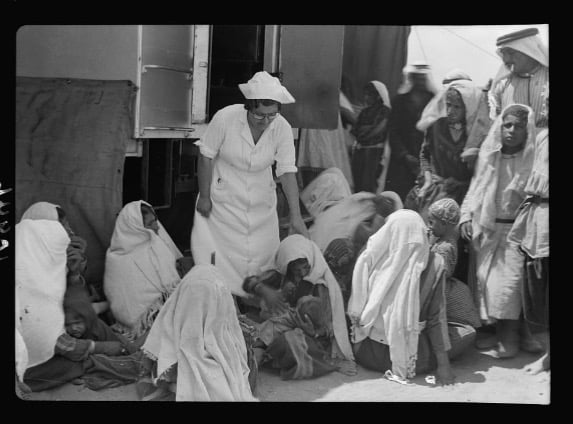
Posted by abu raya - عياده فحص العيون في نجد سنه 1939
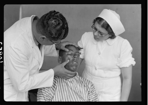
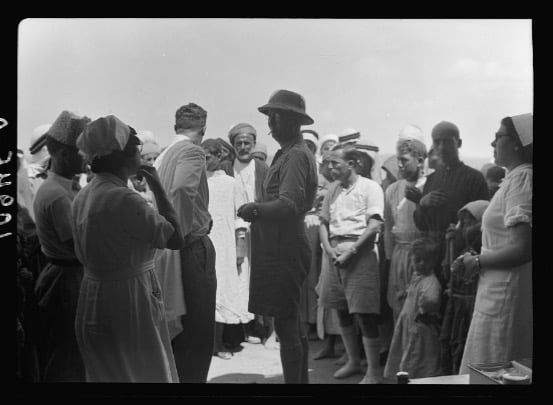
Posted by abu raya - عياده فحص العيون في نجد سنه 1939
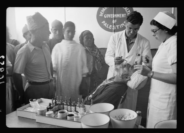
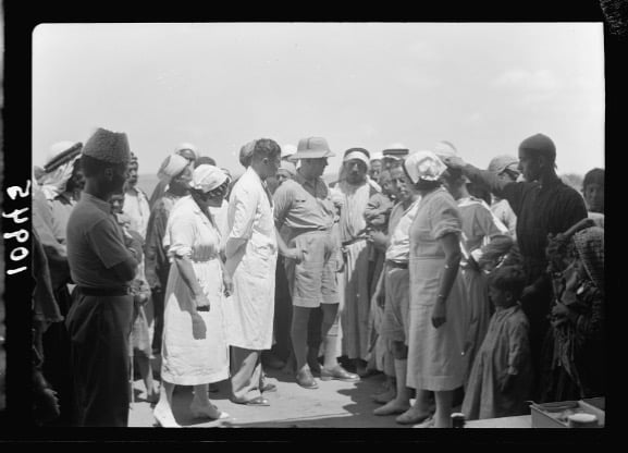
Posted by abu raya - عياده فحص العيون المتنقله في نجد سنه 1939
Posted by abu raya - عياده فحص العيون في نجد سنه 1939
Posted by abu raya - نجد سنه 1939
Posted by abu raya - نجد سنه 1939
Posted by abu raya - صوره من قريه نجد سنه 1939
Posted by abu raya - نجد سنه 1939
Posted by abu raya - عياده فحص العيون في نجد سنه 1939
Posted by abu raya - نجد سنه 1939
Posted by abu raya - نجد سنه 1939
Posted by abu raya - نجد سنه 1939
Posted by abu raya - Pre-Nakba Aerial view of the village / صورة من الجو للقرية اخذت قبل النكبة
- صورة تذكارية لرجال وشبان من قرية نجد قضاء غزة أربعينيات القرن العشرين..
- هذه الصور توثق قرية فلسطينية صغيرة كان اسمها "نجد"، لم يزد عد سكانها عن الـ 350 نسمة وكان مختارها هو الحاج محمد أحمد محمود جاسر، كان أهلها بسطاء يتعاشون على الزراعة تربية المواشي ولم يكن بها مدرسة فكان طلابها يمشون حتى قرية سمسم ليتعلمو في مدرسة جيرانهم تهجرت قرية نجد في 13 أيار 1948 لتصير حقولاً لمستوطنة ستبنى على أنقاضها وهي "سديروت" التي تسمعون عنها اليوم كثيراً.
نقلا عن الباحث فادي عاصلة
- That is how the "civilized" erased and replaced us: Najr was completely obliterated, as you see -- نجد باتت أثر بعد عين. من هنا مر الهمجّ
- خارطة تُظهِر الحدود والطرق بأنواعها والأماكن المقدسة والطبيعة الطوبغرافية من تلال وسهول ومنحدرات والتشكيلة الطبيعية للأرض وأنواع المزروعات. نُشرت الخريطة فترة الانتداب البريطاني، تم إضافة تعديلات عليها من قِبَل خدمة الخرائط والصور التابعة للقوات العسكرية الاسرائيلية فترة الأربعينيات.
Want to browse more? 80,000 pictures were grouped in these gallaries:
| Display Name | Clan/Hamolah | Country of Residence |
| أبو صالح | نجداوي | - |
| زياد النبريص | النبريص | - |
| علي عبدالحفيظ ابو الجديان | ابو الجديان | الخمس - ليبيا, نجد |
| حسن فلاح أبوالجديان | أبوالجديان | تبوك , السعودية |
| فلاح ابو الجديان | ابو الجديان | تبوك, السعودية |
| زياد | المصري | رام الله, رام الله |
| محمود عليان | عليان | البقعة, الأردن |
| محمد خضر | خضر | غزة, نجد |
| Ayman Murad | Murad | Palestine |
| هادي النبريص | النبريص | - |
| ياسر النبريص | النبريص | Ontario, Canada |
| نجداوي ابن نجداوي | جاسر | جباليا, نجد |
| hithambox | Zyadah | Gaza, Palestine |
- Tracing all that remains of Najd since Nakba Duration: 3 min 28 sec
- قرية نجد الفلسطينية المحتلة وتبقى في الذاكرة --انتاج فريد شاهين - ميار للانتاج الاعلامي Duration: 23 min 50 sec
- الذاكرة مفتاح العودة -- الحلقة 90 -- نجد
No links have been shared yet, be free to the first to share the first link.
 Fake Valor: Why Did Zionist Jews Hoist Nazis Flag on Their Ships in the 1930s?
What is new?
-
Facts About Oct. 7th Gaza Raid
-
Remined Us Please:: Who Did Rape Who? Palestinians Raped Israelis? Or, was the other way around?
-
When Prof. Edward Said was invited to debate Bibi Netanyahu in the 1980s, watch what happened!
-
Ezra Klein of the NY Times on the "Jewish Race".
-
Abusing Blood Libel!
-
Did Israeli Soldiers Activate The Hanniba Direective On Oct. 7th? You Be The Judge
-
Zionist FAQ: Isn't it true that Palestinians don't want peace? Palestinians never accepted the two-state solution
- Facts about Haavara (Transfer) Agreement between Ben-Gurion & Hitler
-
Haavara FAQs: Why Did Zionist Jews Hoist Nazis' Flags on Their Ships in the 1930s?
- Haavara FAQs: When Chaim Weizmann met FDR in mid-1943, why was he silent about rescuing European Jewry?
-
Dear ChatGPT: How did Palestinians resist Napoleon's invasion of their country in 1799?
-
Dear ChatGPT: Gaza had a vibrant Jewish community in the mid-17th century. What happened to them?
-
Dear ChatGPT: Why did the Jewish Agency suppress news of the Holocaust during WWII?
-
Video Playlist: Jews share their DNA tests to end the conflict for good.
-
A Tale of Two Conflicts: Examining the Definition of Genocide
-
Prof. Abraham Polak And The Suppressed History of the Khazars and European Jewry
-
How Ronald Reagan would have framed the genocide in Gaza if he were still alive?
-
Haavara FAQs: Let us do the math: how many German Jews did The Haavara Agreement save?
-
Zionist FAQs: The Hebron Massacre of 1929, "clearly proves" that Palestinians are antisemitic, how could you deny it?
-
Zionist FAQs: Why Anti-Zionist Is Not Antisemitism?
-
Zionist FAQs: Isn't it true that the KGB created Palestinian Nationalism in the early 1960s?
- Zionist FAQs: Muslims are killing Muslims all the time; why are Israeli Jews being singled out in the media?
- Zionist FAQs: How is Israel an apartheid state when 20% of its citizens are Arabs who enjoy full rights?
-
Haavara FAQs: Why Did Dorothy Thompson Flip From A Zionist Advocate to A Silenced Dissenter?
-
Haavara FAQs: Analysis of Herzl's Uganda Scheme and how it could have saved millions of Jews.
-
Haavara FAQs: Why did Hayim Greenberg describe American Jewry as "morally bankrupt" in early 1943?
-
Haavara FAQs: What if the Evian Conference was a resounding success? What would have been the impact of saving European Jewry on Zionism?
- Haavara FAQs: What if the six million were saved, how that would have impacted the Zionist project?
-
Haavara FAQs: How did Zionist leaders react when Europe's Jews lingered in the DP camps after WWII ended?
-
Why does the American Jewish community repeat lies that David Ben-Gurion had debunked before he died?
-
Who has the power to rename the Tatar/Khazar Gene Marker to Jewish IV?
-
Zionist FAQs: Why won't Egypt, Syria, and Jordan take their people back? Jews are indigenous to Palestine, and Arabs immigrated after Jews developed the country. Arabs should leave.
-
Haavara FAQs: Did Hitler and the Nazis conflate between Judaism and Zionist? If that wasn't case, then why?
-
Haavara FAQs: Winston Churchill and antisemitism, a collection of articles written Churchill.
-
Haavara FAQs: Broken by country, how many Jews survived vs. killed during the Holocaust?
-
Haavara FAQs: Why did European Jews vote with their feet and to immigrated to the Americas, not Palestine, after WWII?
-
Watch this American Jewish Girl describing Israeli Jews' cognitive dissonance like no other in under two minutes
-
Haavara FAQs: When the Nazis went out of their way to hide the Holocaust, Israeli Jews did the exact opposite by broadcasting their genocide of Gazans. But why?
-
Haavara FAQs: How Zionist Jews went out of their to show their appreciation to Nazism and Fascism?
- Haavara FAQs: Why Zionist leaders were against bombing the death camps & the Railroads leading to them?
-
Haavara FAQs: Hitler's message to the British and American people: If Jews are such noble citizens and you care about them, how come you're not letting them in? I will gladly ship them to you at my expense, even on luxury liners!
-
A shortlist of Zionist and Israeli false flag operations in the name Jews.
-
The Most Moral Army
- The Land of Kapos (Israel): Where the brave are boycotted and Kapos walk free.
- Why did early Zionists often named their communal enterprises "colonial"?
- Zionist Relations with Nazi Germany by Faris Glubb
-
Two NY Times advertisements by Zionists in the early 1943 that exposes Zionists' treason at the height of the calamity
- Facts Not Lies about the Palestinian-Israeli Conflict.
- Site's pictures have been categorized
- Campgain Against Lice
- A Survey of Palestine, the official source about Palestine before Nakba produced by the British Mandate; over 1200 pages.
- Satellite View & Google Earth: Over 6,000 placemarks identifying all destroyed towns, W. Bank & Gaza Strip Towns, & refugee camps.
- PalestineRemembered.com and its Nakba Oral History Project were featured on al-Jazeera Satellite TV.
- Nakba Oral History Video Podcast:
 Over 700 Oral History interviews (including 3,500+ hours of recording) can be viewed online.
 - Palestine Village Statistics Project
- Gaza Jail Break
- النسخة العربية للموقع الان متوفرة
- Videos: Documenting the destroyed villages in video: Tracing all that remains since Nakba.
- Videos: Responding to Zionist Propaganda
- Interview: The ethnic cleansing of Palestine: George Galloway interviews Israeli Historian Ilan Pappe.
- For Palestinians, memory matters. It provides a blueprint for their future By George Bisharat.
- Zionist FAQ now available in Hebrew שאלות שציונים שואלים, עכשיו בעברית
- Video: The Stephen Walt and John Mearsheimer report on the influence of the Israel Lobby on U.S. Foreign Policy
- The Palestinian-Israeli conflict for beginners
