| PalestineRemembered | About Us | Oral History | العربية | |
| Pictures | Zionist FAQs | Haavara | Maps | |
| Search |
| Camps |
| Districts |
| Acre |
| Baysan |
| Beersheba |
| Bethlehem |
| Gaza |
| Haifa |
| Hebron |
| Jaffa |
| Jericho |
| Jerusalem |
| Jinin |
| Nablus |
| Nazareth |
| Ramallah |
| al-Ramla |
| Safad |
| Tiberias |
| Tulkarm |
| Donate |
| Contact |
| Profile |
| Videos |
Welcome To Abu Shusha - ابو شوشة (אבו שושה)
|
District of Haifa
Ethnically cleansed days ago |
العربية Google Earth |
 |
Gallery (29) |
- Statistics & Facts
-
Before & After

- Satellite View
- Articles 4
- Pictures 29
- Oral History 1
- Members 5
- All That Remains
- Wikipedia
- Videos 1
- Guest Book 12
- Links
| Statistic & Fact | Value | ||||||||||||
| Occupation Date | April 9, 1948 | ||||||||||||
| Distance From District | 26 (km) South East of Haifa | ||||||||||||
| Elevation | 125 (meters) | ||||||||||||
| Before & After Nakba, Click Map For Details |
|||||||||||||
|
|||||||||||||
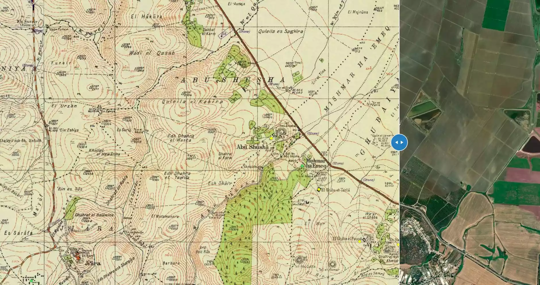
| Map Location | See location #28 on the map View from satellite |
||||||||||||
| Military Operation | The Battle for Mishmar ha-'Emeq. | ||||||||||||
| Attacking Units | Combination of First Battalion of the Palmach, Carmeli and Alexandroni Brigades. | ||||||||||||
| Defenders | Arab Liberation Army | ||||||||||||
| Exodus Cause | Military assault by Zionist troops | ||||||||||||
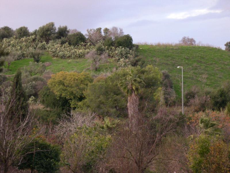
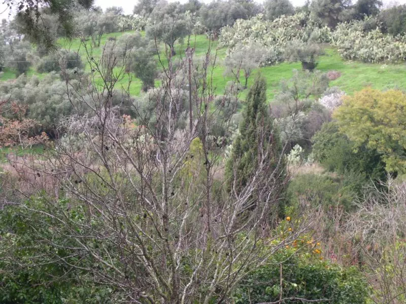
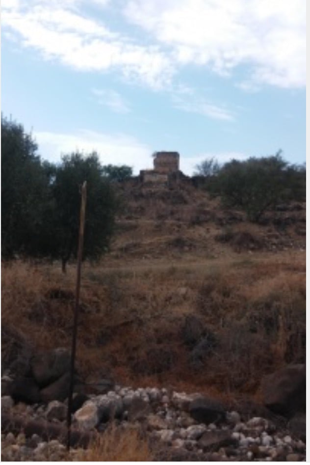
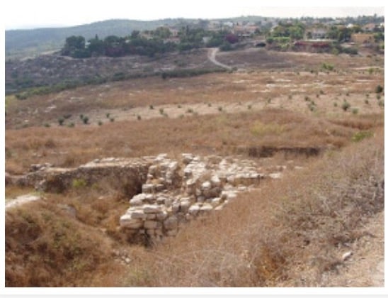
| Village Temains | The village has been completely destroyed, and only house rubble left behind. | ||||||||||||
| Ethnically Cleansing | Many of Abu Shusha's inhabitant fled during the battle, and it was completely ethnically cleansed soon after occupation. | ||||||||||||
| Pre-Nakba Land Ownership |
**Town Lands' Demarcation Maps |
||||||||||||
| Land Usage As of 1945 |
|
||||||||||||
| Population |
|
||||||||||||
| Number of Houses |
|
||||||||||||
| Near By Towns |
|||||||||||||
|
|||||||||||||
| Town's Name Through History | The Romans referred to Abu Shusha by Gaba Hippeon. | ||||||||||||
| Schools | Abu Shusha had an elementary school for boys. | ||||||||||||
| Places of Warship | One mosque | ||||||||||||
| Water Supply | Water was available from many sources, including two nearby wadis and a spring. | ||||||||||||
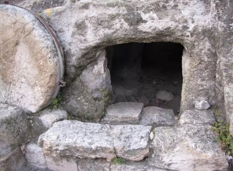
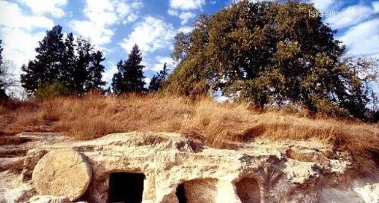
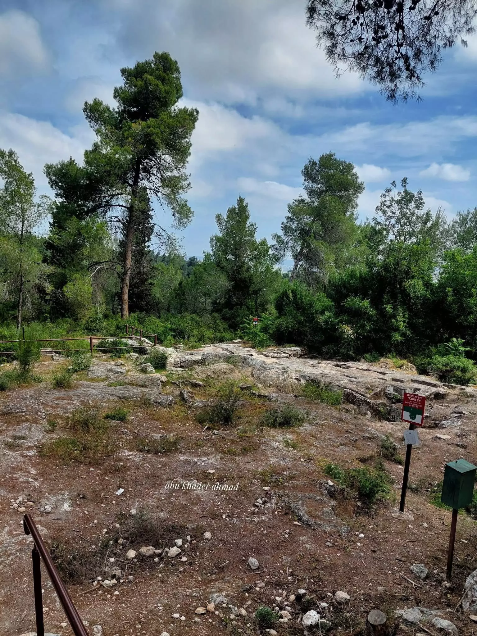
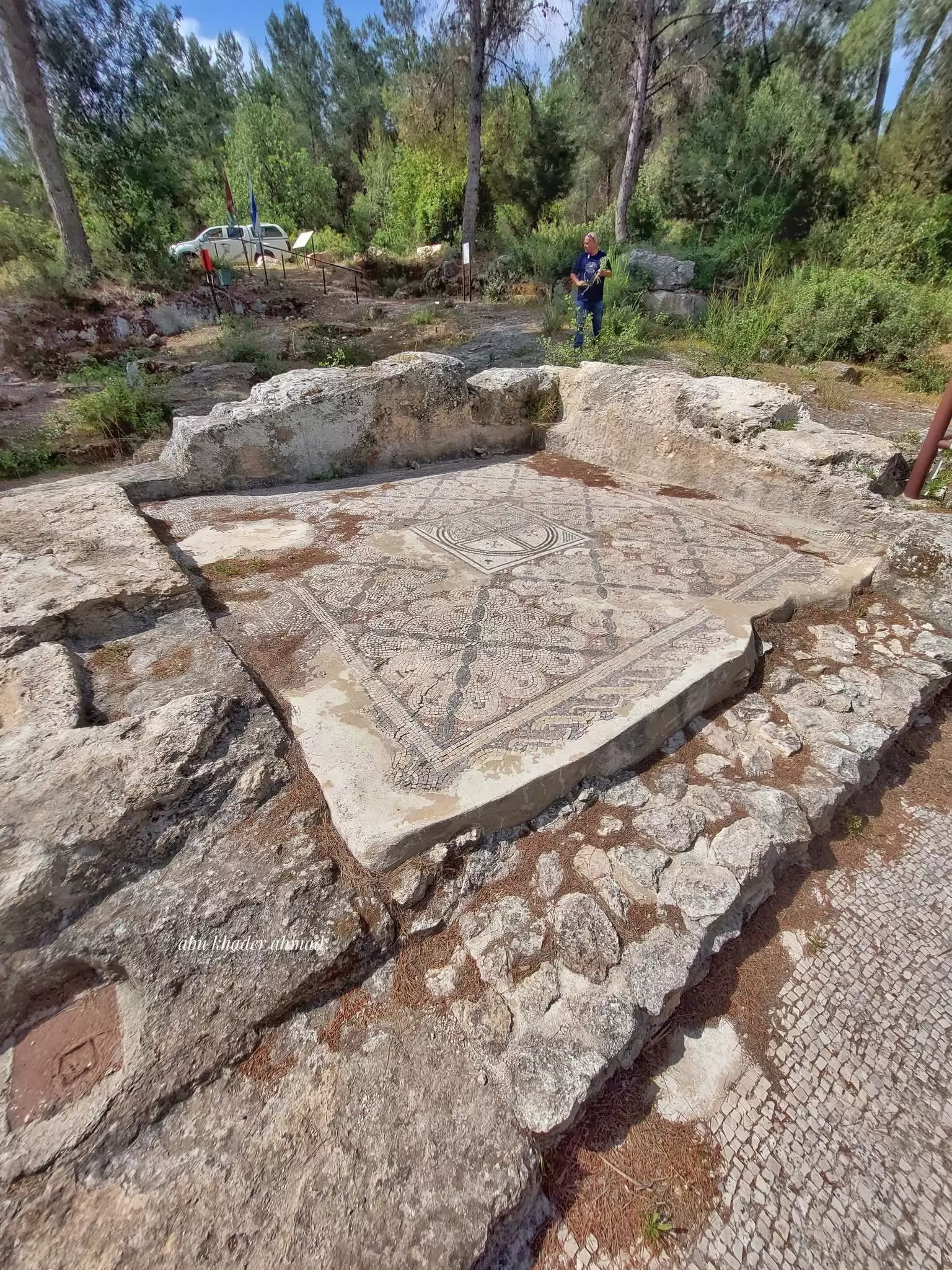
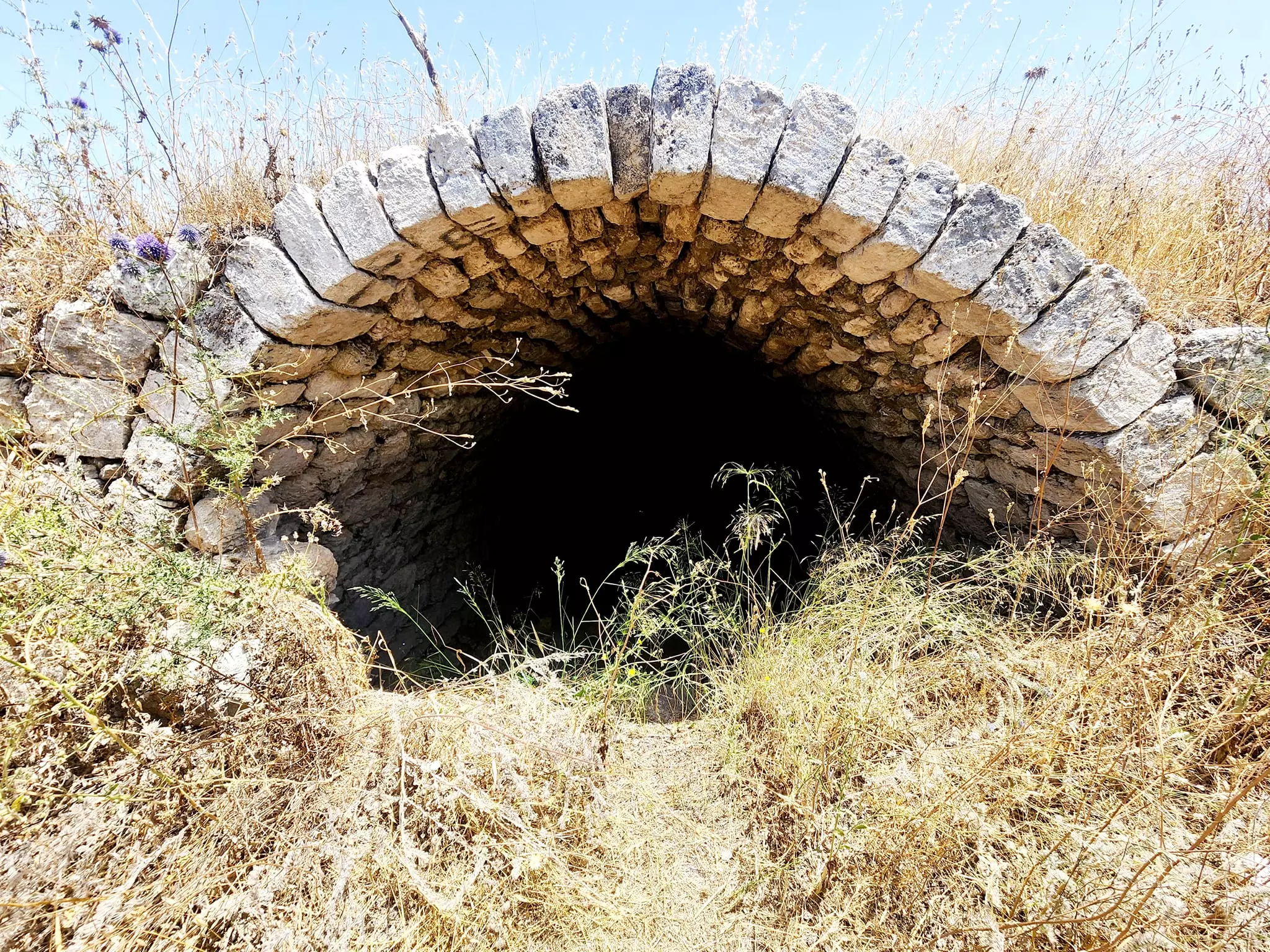
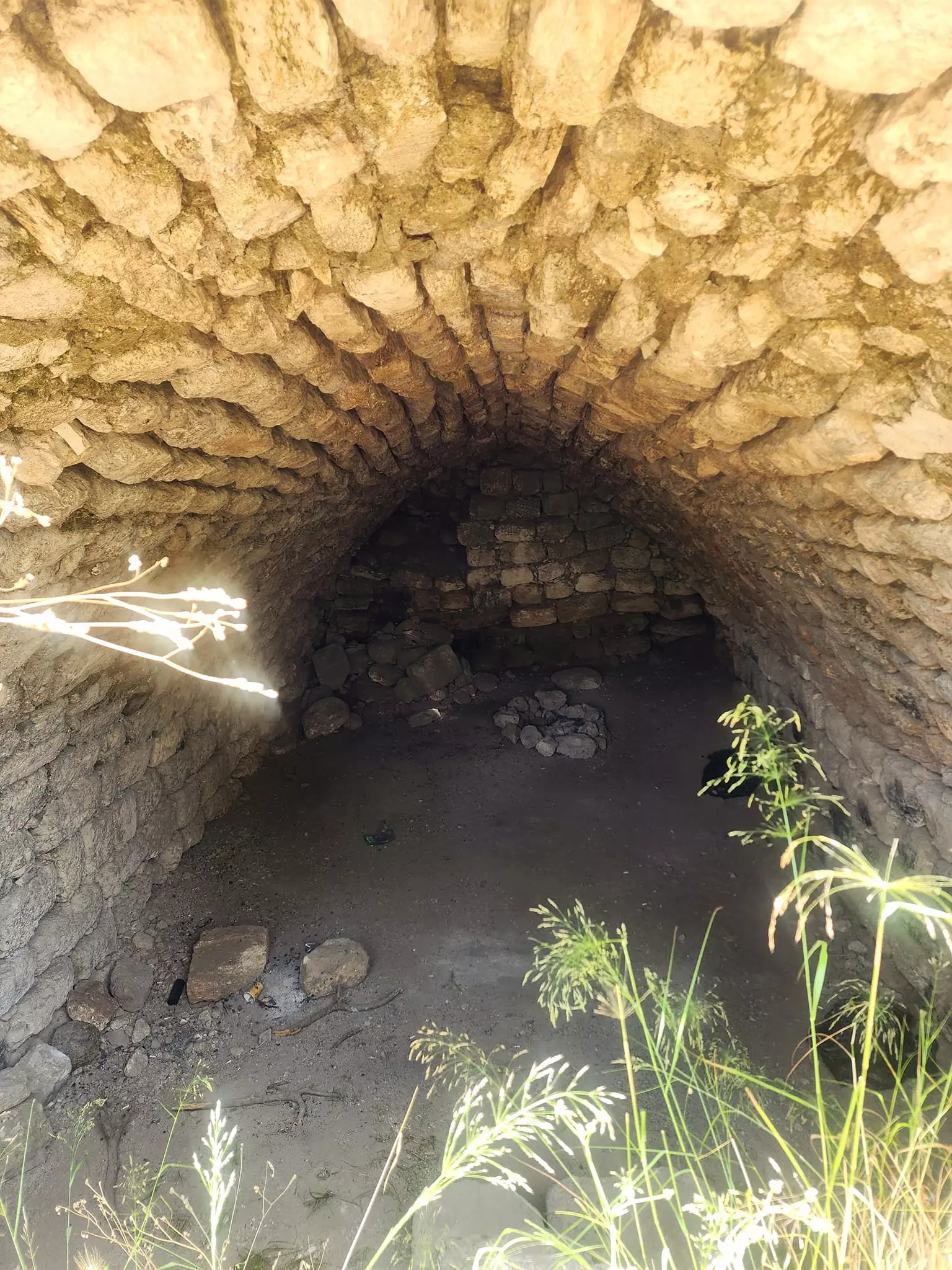
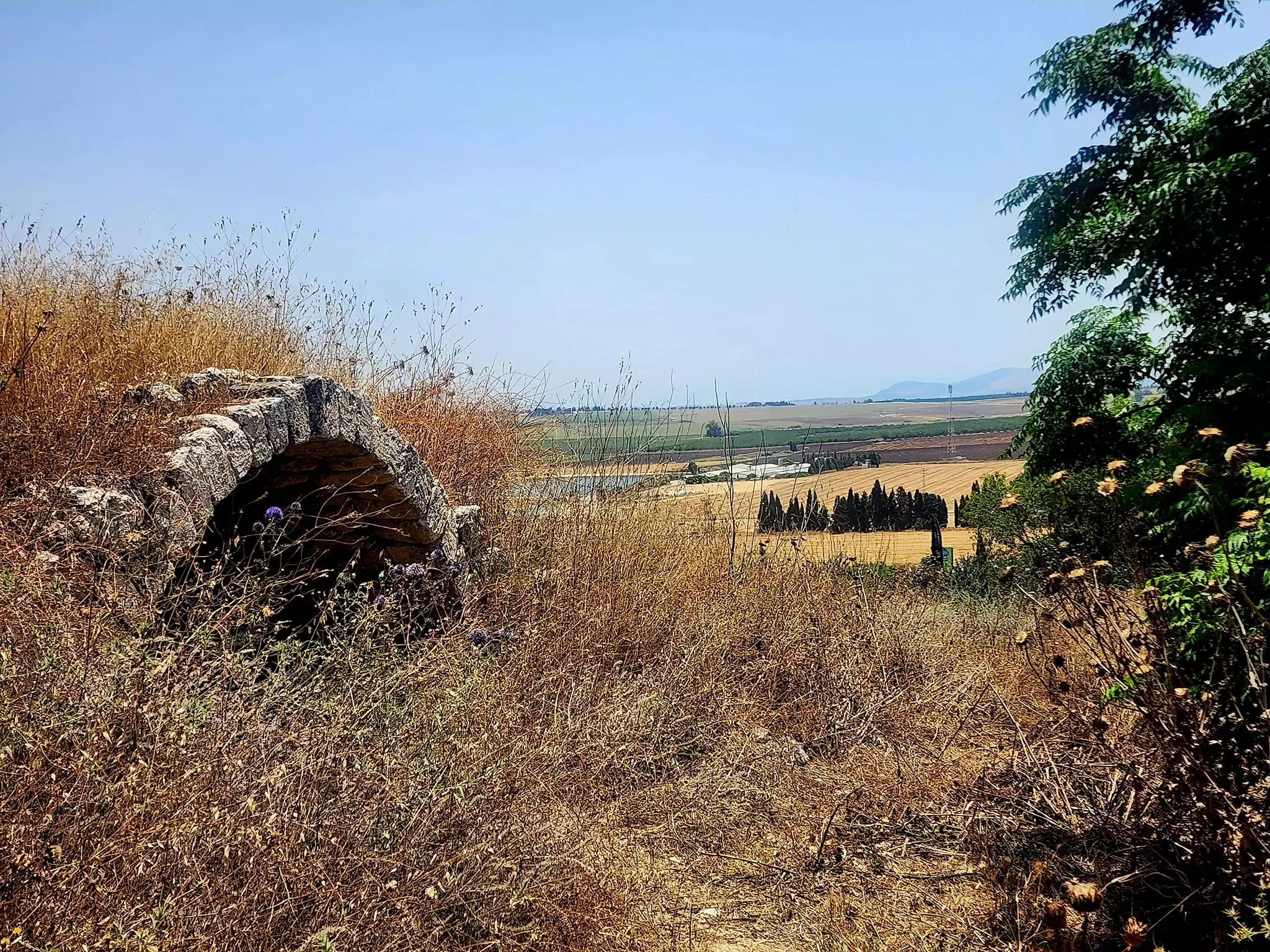
| Archeological Sites | Tel Abu Shusha, and on Abu Shusha itself contained numerous indications of a long and rich cultural past. | ||||||||||||
| Exculsive Jewish Colonies Who Usurped Village Lands |
Mishmar ha-'Emeq occupies part of village lands. | ||||||||||||
| Featured Video | |||||||||||||
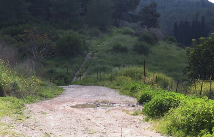
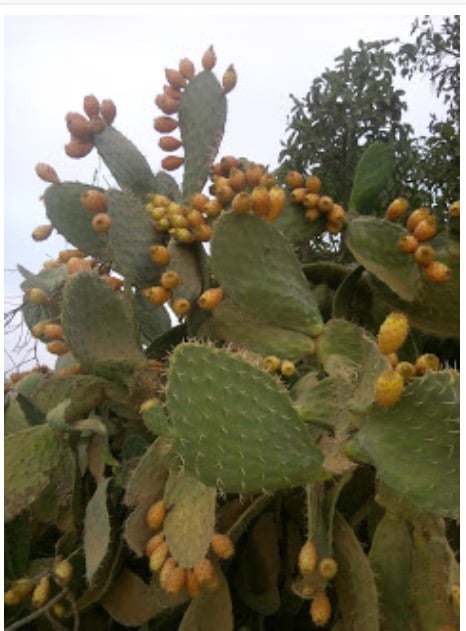
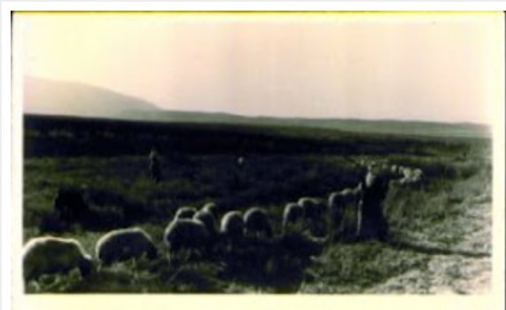
Village Before NakbaThe village was located on both sides of a small, wide wadi on the western edge of the plain of Marj ibn Amir. It was west of the archaeological site of Tall Abu Shusha. The village was linked to Haifa and Jenin by the highway that ran between these two cities. It has recently been suggested that Tall Abu Shusha might be identified with the Roman town of Gaba Hippeon. The tell is a large and old site that appears to date to the Early Bronze Age. In the late nineteenth century, Abu Shusha was described as a small hamlet, on the edge of a plain, that drew its water from a spring to the west. Some of its houses were built of masonry and had roofs of mud and straw, whereas others were made of concrete. Its population was Muslim. Abu Shusha had a mosque and an elementary school. Water was available from many sources, including two wadis and a spring which supplied water for domestic use.The village economy was centered on animal husbandry and agriculture, grain being the main crop. The villagers also grew vegetables, tobacco, and various types of fruit trees, including nearly 600 dunums of olive trees. Agriculture was both rainfed and irrigated, with irrigation being especially important for vegetables. A grain mill, named after the village, was situated on the northeastern edge of the site. In 1944/45 a total of 4,939 dunums was allotted to cereals; 931 dunums were irrigated or used for orchards. The archaeological evidence in the village, on Tall Abu Shusha, and on Abu Shusha's lands as well, contained numerous indications of a long and rich cultural past. Village Occupation and Ethnic CleaningIn early April 1948 Abu Shusha was raided by units of the Giv'ati Brigade's Second Battalion. The History of the Haganah states that a guard from a nearby Jewish settlement was killed on land belonging to the village, and orders were issued to carry out a 'retaliatory operation.' After midnight on 1 April, the unit destroyed one house and the village well. After the mission was completed, a firefight ensued with units of the local Palestinian militia, in which one Jewish soldier was fatally wounded. The History makes no mention of Arab casualties.Later, Abu Shusha became one of the first villages of Marj ibn Amir to fall in the wake of the battle of Mishmar ha-Emeq. The battle began on 4 April 1948 when the Arab Liberation Army (ALA) launched an offensive aimed at occupying the Jewish kibbutz of Mishmar ha-Emeq. This was probably in retaliation for the role of the settlement in the attack on al-Ghubayya al-Tahta. The New York Times called the ALA attack 'the greatest pitched battle yet fought in four and a half months of fighting in Palestine.' It failed in its objective. After the ALA's attack on the settlement ended in a standoff, a truce was proposed with British mediation, but the Haganah rejected the offer. The Haganah commanders decided instead to counterattack extensively, occupying and destroying the surrounding villages. The New York Times reported that on the night of 8-9 April, units of the Haganah that had been besieged in Mishmar ha-Emeq broke out, occupying three villages: Abu Shusha, Abu Zurayq, and al-Naghnaghiyya. The units involved belonged to the First Battalion of the Palmach and to the Carmeli and Alexandroni Brigades. Writing about the villages captured in the battle of Mishmar ha-Emeq, a high-ranking official of the Jewish National Fund stated: 'Our army is steadily conquering Arab villages and the inhabitants are afraid and flee like mice.' By 12 April five villages around Mishmar ha-Emeq had been occupied by Palmach forces, and by 14 April ten villages were in Palmach hands. Israeli historian Benny Morris indicates that those villagers who had not fled were expelled and that each village was systematically destroyed on the night it was occupied. But the New York Times reports that Abu Shusha was evacuated again on the night of 11-12 April, only to be reoccupied on 12 April. In Abu Shusha, the Haganah blew up 'many' houses as a 'punitive measure,' in the words of the Times correspondent. Having seized the village, Zionist forces gained control of the Jenin-Haifa road. Zionists Colonies on Village LandsThe settlement of Mishmar ha-Emeq, founded in 1926, is less than 1 km south of the site but is not on village land.Village TodayThe only remaining sign of the village is the debris of houses, overgrown with cactuses. The grain mill is gone. On the hilly lands around the site, olive trees grow in a fenced-in area that serves as a pasture. The adjacent lands in Marj ibn Amir are planted in various crops, especially cotton.SourceDr. Walid al-Khalidi, 1992: All That Remains. |
|||||||||||||
| Related Maps | Town Lands' Demarcation Maps خرائط للقضاء توضح حدود القرى والاودية Town's map on MapQuest View from satellite Help us map this town at WikiMapia |
||||||||||||
| Related Links | Wikipedia's Page Google Search Google For Images Google For Videos |
||||||||||||
| More Information | في كتاب كي لا ننسى في كتاب بلادنا فلسطين في كتاب النكبة والفردوس المفقود المزيد من موقع هوية |
||||||||||||
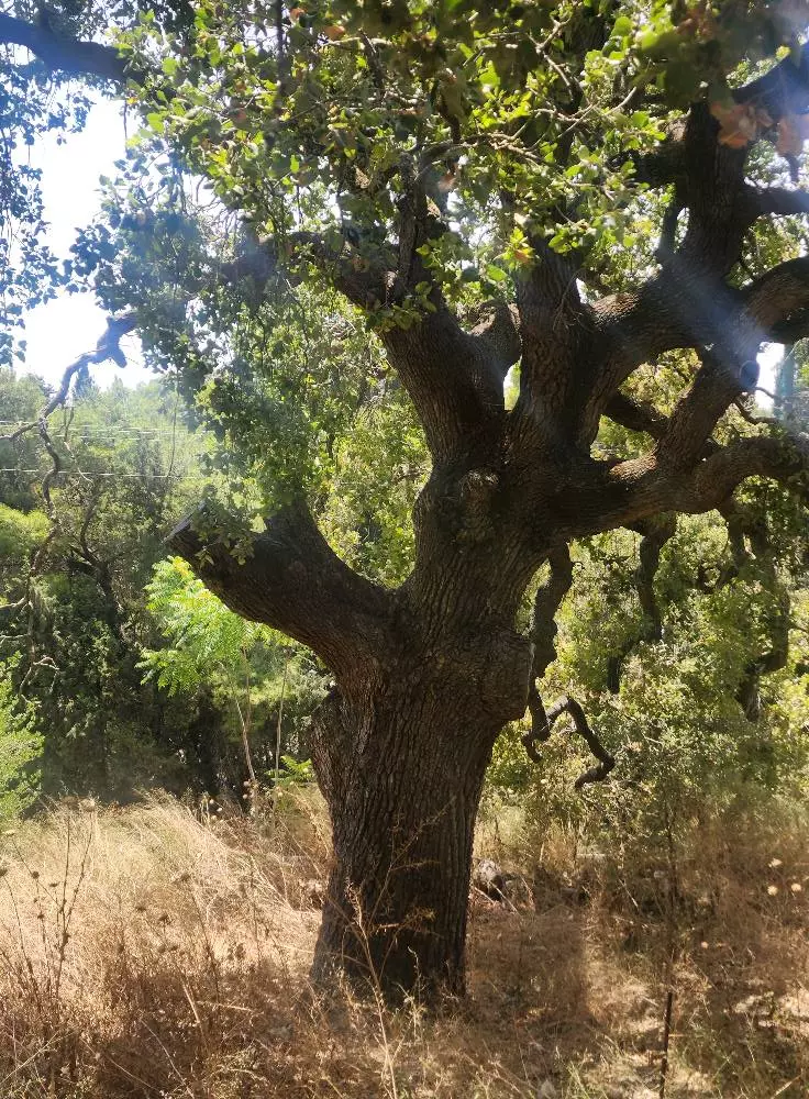
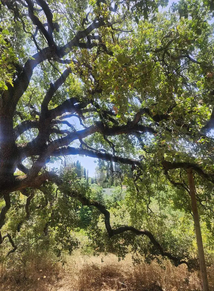
- General view of Abu Shusha #1, 2003
Posted by kfir adam 1 - General view of Abu Shusha #2, 2003
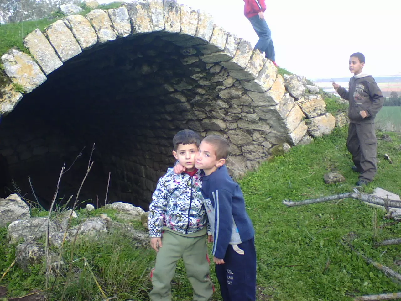
Posted by kfir adam 1 - أبو شوشة: براعم ديرتنا يمرحون عند مدخل الخان، تصوير محمد يونس شباط 2008
Posted by محمد سلامة يونس 2 - الاثار القديمه في ابو شوشه
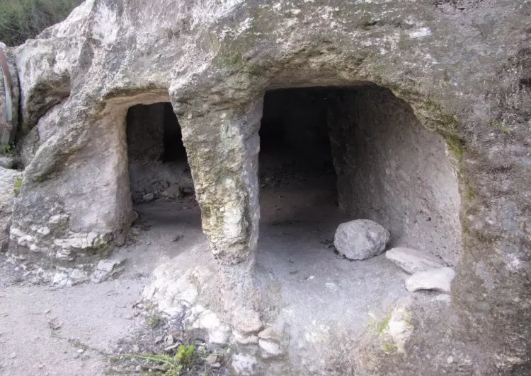
Posted by abu raya - ابو شوشه
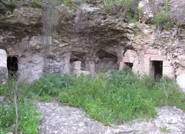
Posted by abu raya - ابو شوشه
Posted by abu raya - ابو شوشه
Posted by abu raya - ابو شوشه
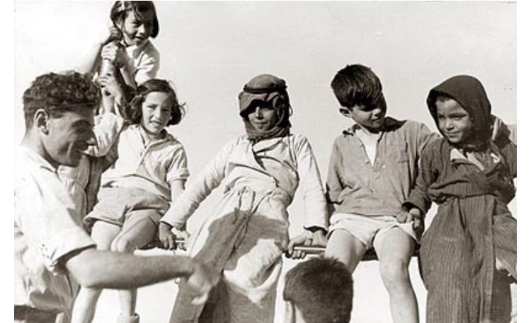
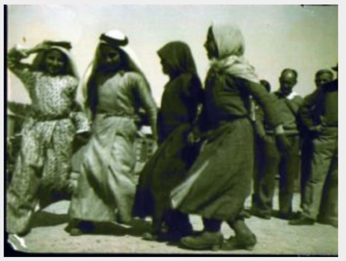
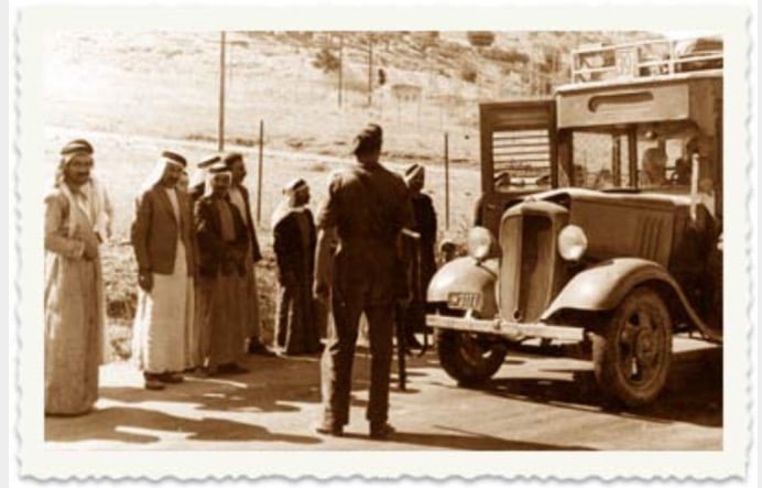
Posted by abu raya - ابو شوشه قبل النكبه
Posted by abu raya - ابو شوشه قبل النكبه
Posted by abu raya - ابو شوشه
Posted by abu raya - الصبار في ابو شوشه
Posted by abu raya - موقع ابو شوشه
Posted by abu raya - صوره من ابو شوشه قبل النكبه
Posted by abu raya - ابو شوشه قبل النكبه
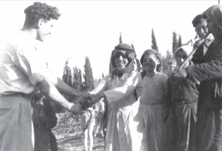
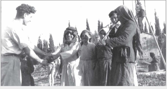
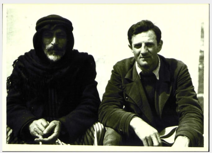
Posted by abu raya - صوره لمختار ابو شوشه برفقه مختار مستوطنه عين هشوفيط قبل النكبه
Posted by abu raya - ابو شوشه قبا النكبه
Posted by abu raya - ابو شوشه
Posted by abu raya - ابو شوشه قبل النكبه
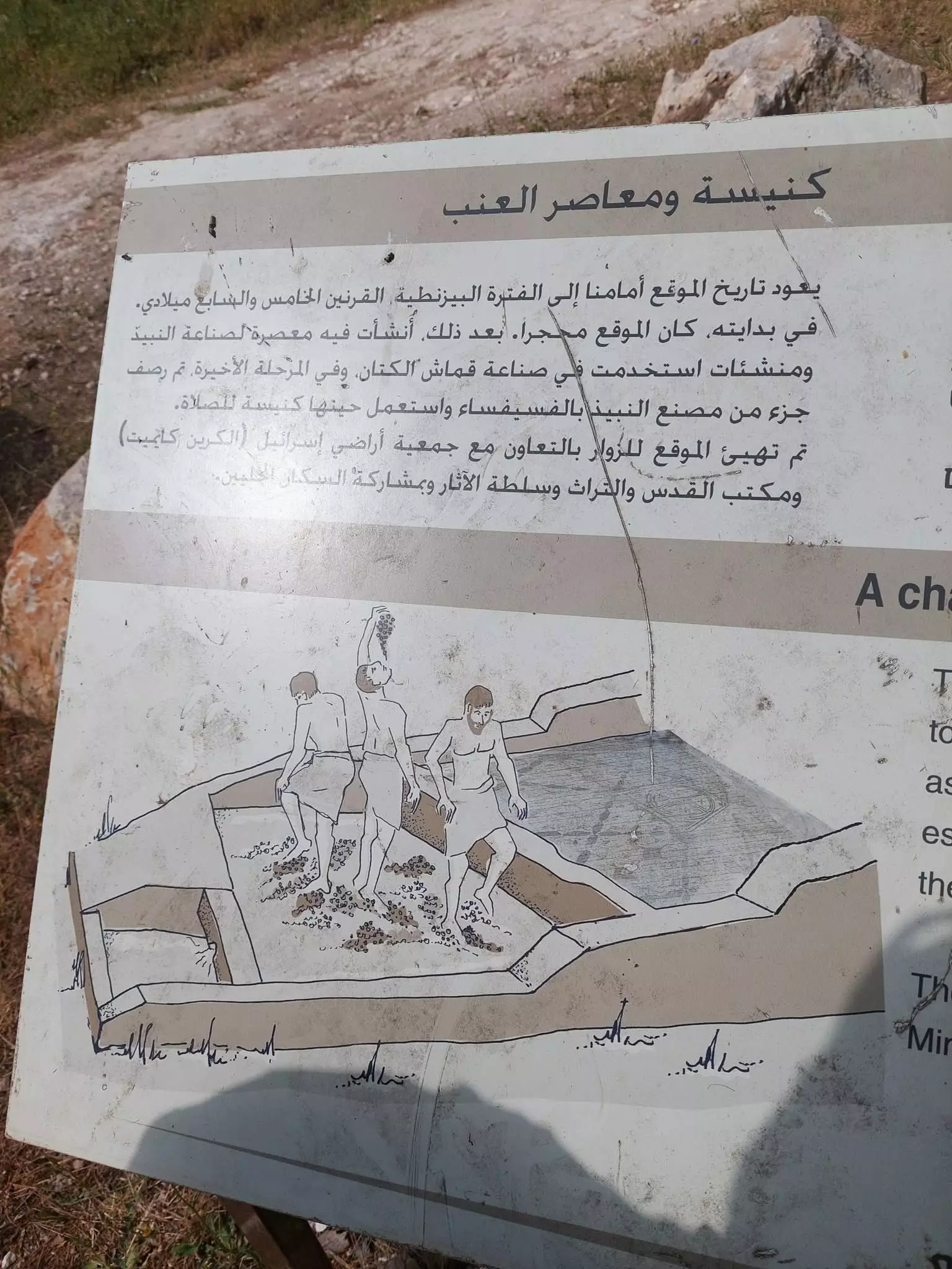
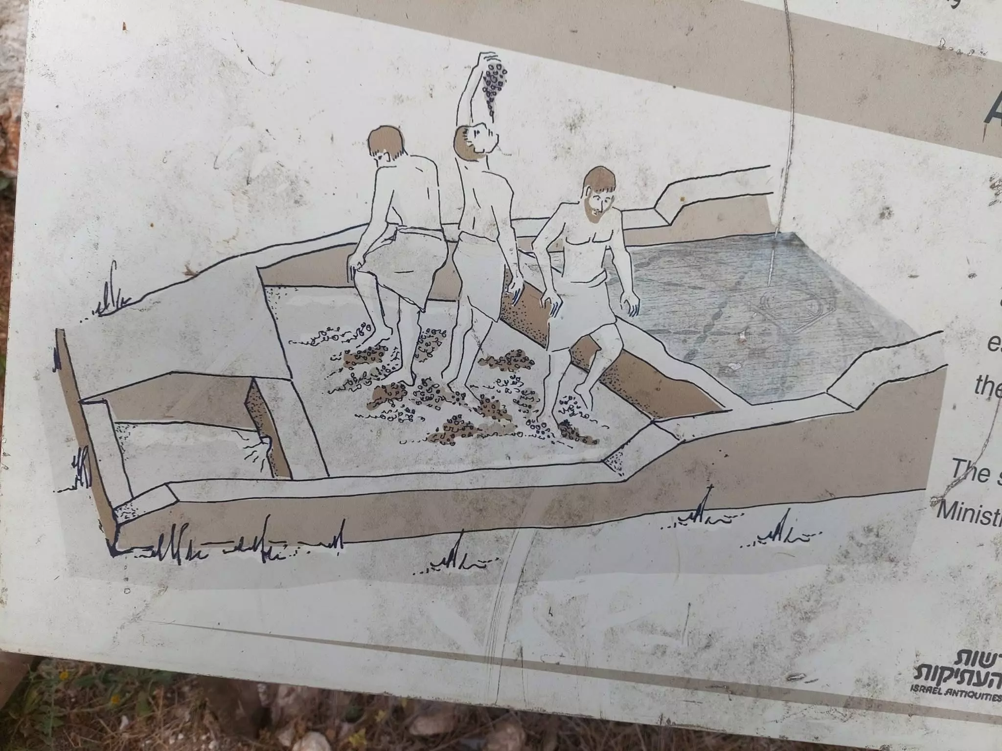
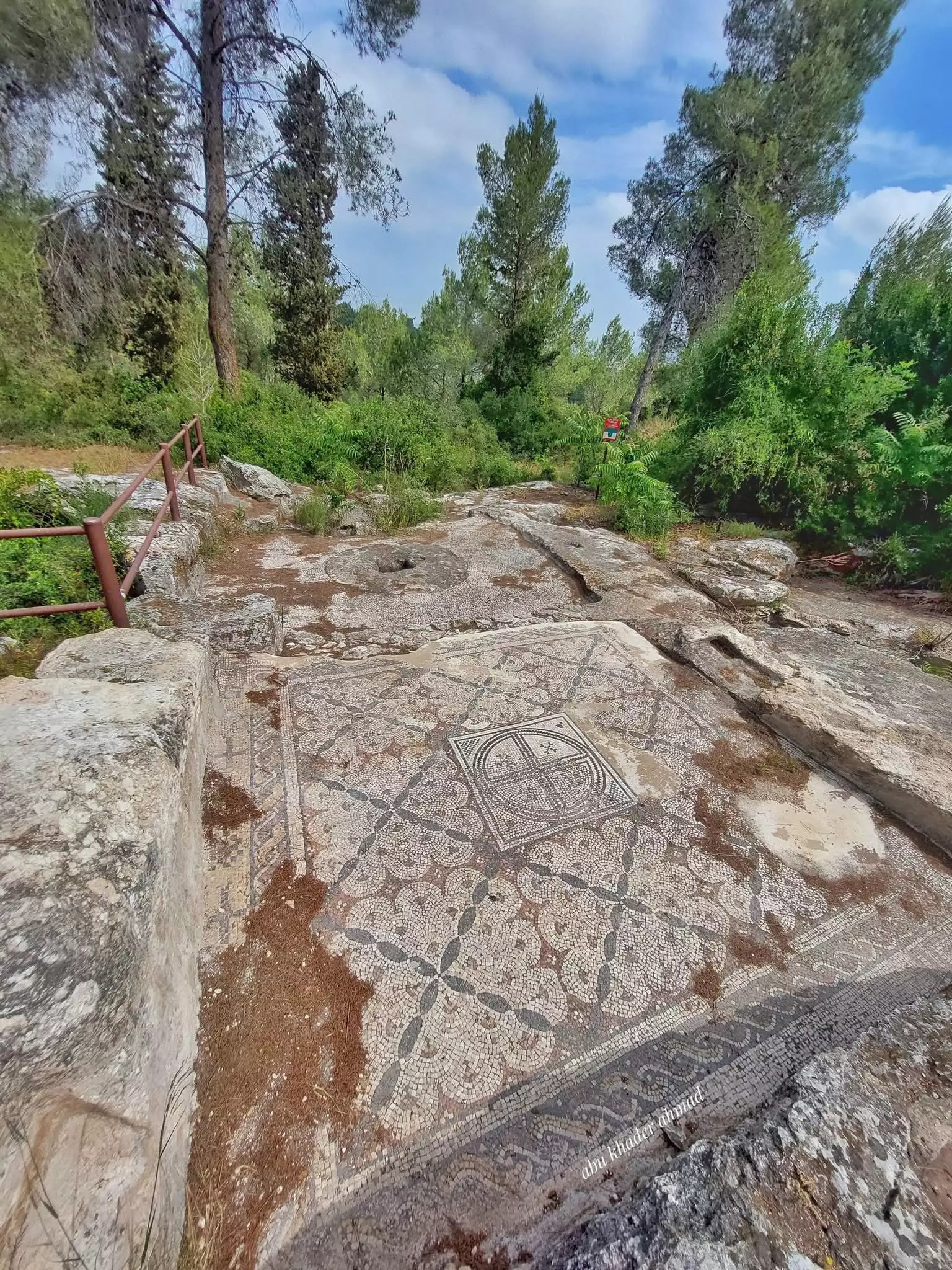
Posted by abu raya - معصرة عنب منذ القرن الخامس حتى السابع الميلادي -- : Abu Khader Ahmad Jbaren
- معصرة عنب منذ القرن الخامس حتى السابع الميلادي -- : Abu Khader Ahmad Jbaren #2
- معصرة عنب منذ القرن الخامس حتى السابع الميلادي -- : Abu Khader Ahmad Jbaren #3
- معصرة عنب منذ القرن الخامس حتى السابع الميلادي -- : Abu Khader Ahmad Jbaren #4
- معصرة عنب منذ القرن الخامس حتى السابع الميلادي -- : Abu Khader Ahmad Jbaren #5
- The "civilized" obliterated, as you see below, our village way after the battle to hinder our return. How else will Jews become great & safe again? -- ابو شوشة باتت أثر بعد عين. من هنا مر الهمجّ
- The "civilized" obliterated, as you see below, our village way after the battle to hinder our return. How else will Jews become great & safe again? -- ابو شوشة باتت أثر بعد عين. من هنا مر الهمجّ #2
- The "civilized" obliterated, as you see below, our village way after the battle to hinder our return. How else will Jews become great & safe again? -- ابو شوشة باتت أثر بعد عين. من هنا مر الهمجّ #3
- The "civilized" obliterated, as you see below, our village way after the battle to hinder our return. How else will Jews become great & safe again? -- ابو شوشة باتت أثر بعد عين. من هنا مر الهمجّ #4
- The "civilized" obliterated, as you see below, our village way after the battle to hinder our return. How else will Jews become great & safe again? -- ابو شوشة باتت أثر بعد عين. من هنا مر الهمجّ #5
Want to browse more? 80,000 pictures were grouped in these gallaries:
| Display Name | Clan/Hamolah | Country of Residence |
| اسامة الشقيري | الشقيرات | اربد, الاردن |
| شيرين | الشقيرات | عمان, الاردن |
| sh_palestine | - | - |
| ابراهيم معين كامل بشر | بشر | الاردن, ام الزينات |
| abu_jehad | شقيرات | - |
No links have been shared yet, be free to the first to share the first link.
 Fake Valor: Why Did Zionist Jews Hoist Nazis Flag on Their Ships in the 1930s?
What is new?
-
Facts About Oct. 7th Gaza Raid
-
Remined Us Please:: Who Did Rape Who? Palestinians Raped Israelis? Or, was the other way around?
-
When Prof. Edward Said was invited to debate Bibi Netanyahu in the 1980s, watch what happened!
-
Ezra Klein of the NY Times on the "Jewish Race".
-
Abusing Blood Libel!
-
Did Israeli Soldiers Activate The Hanniba Direective On Oct. 7th? You Be The Judge
-
Zionist FAQ: Isn't it true that Palestinians don't want peace? Palestinians never accepted the two-state solution
- Facts about Haavara (Transfer) Agreement between Ben-Gurion & Hitler
-
Haavara FAQs: Why Did Zionist Jews Hoist Nazis' Flags on Their Ships in the 1930s?
- Haavara FAQs: When Chaim Weizmann met FDR in mid-1943, why was he silent about rescuing European Jewry?
-
Dear ChatGPT: How did Palestinians resist Napoleon's invasion of their country in 1799?
-
Dear ChatGPT: Gaza had a vibrant Jewish community in the mid-17th century. What happened to them?
-
Dear ChatGPT: Why did the Jewish Agency suppress news of the Holocaust during WWII?
-
Video Playlist: Jews share their DNA tests to end the conflict for good.
-
A Tale of Two Conflicts: Examining the Definition of Genocide
-
Prof. Abraham Polak And The Suppressed History of the Khazars and European Jewry
-
How Ronald Reagan would have framed the genocide in Gaza if he were still alive?
-
Haavara FAQs: Let us do the math: how many German Jews did The Haavara Agreement save?
-
Zionist FAQs: The Hebron Massacre of 1929, "clearly proves" that Palestinians are antisemitic, how could you deny it?
-
Zionist FAQs: Why Anti-Zionist Is Not Antisemitism?
-
Zionist FAQs: Isn't it true that the KGB created Palestinian Nationalism in the early 1960s?
- Zionist FAQs: Muslims are killing Muslims all the time; why are Israeli Jews being singled out in the media?
- Zionist FAQs: How is Israel an apartheid state when 20% of its citizens are Arabs who enjoy full rights?
-
Haavara FAQs: Why Did Dorothy Thompson Flip From A Zionist Advocate to A Silenced Dissenter?
-
Haavara FAQs: Analysis of Herzl's Uganda Scheme and how it could have saved millions of Jews.
-
Haavara FAQs: Why did Hayim Greenberg describe American Jewry as "morally bankrupt" in early 1943?
-
Haavara FAQs: What if the Evian Conference was a resounding success? What would have been the impact of saving European Jewry on Zionism?
- Haavara FAQs: What if the six million were saved, how that would have impacted the Zionist project?
-
Haavara FAQs: How did Zionist leaders react when Europe's Jews lingered in the DP camps after WWII ended?
-
Why does the American Jewish community repeat lies that David Ben-Gurion had debunked before he died?
-
Who has the power to rename the Tatar/Khazar Gene Marker to Jewish IV?
-
Zionist FAQs: Why won't Egypt, Syria, and Jordan take their people back? Jews are indigenous to Palestine, and Arabs immigrated after Jews developed the country. Arabs should leave.
-
Haavara FAQs: Did Hitler and the Nazis conflate between Judaism and Zionist? If that wasn't case, then why?
-
Haavara FAQs: Winston Churchill and antisemitism, a collection of articles written Churchill.
-
Haavara FAQs: Broken by country, how many Jews survived vs. killed during the Holocaust?
-
Haavara FAQs: Why did European Jews vote with their feet and to immigrated to the Americas, not Palestine, after WWII?
-
Watch this American Jewish Girl describing Israeli Jews' cognitive dissonance like no other in under two minutes
-
Haavara FAQs: When the Nazis went out of their way to hide the Holocaust, Israeli Jews did the exact opposite by broadcasting their genocide of Gazans. But why?
-
Haavara FAQs: How Zionist Jews went out of their to show their appreciation to Nazism and Fascism?
- Haavara FAQs: Why Zionist leaders were against bombing the death camps & the Railroads leading to them?
-
Haavara FAQs: Hitler's message to the British and American people: If Jews are such noble citizens and you care about them, how come you're not letting them in? I will gladly ship them to you at my expense, even on luxury liners!
-
A shortlist of Zionist and Israeli false flag operations in the name Jews.
-
The Most Moral Army
- The Land of Kapos (Israel): Where the brave are boycotted and Kapos walk free.
- Why did early Zionists often named their communal enterprises "colonial"?
- Zionist Relations with Nazi Germany by Faris Glubb
-
Two NY Times advertisements by Zionists in the early 1943 that exposes Zionists' treason at the height of the calamity
- Facts Not Lies about the Palestinian-Israeli Conflict.
- Site's pictures have been categorized
- Campgain Against Lice
- A Survey of Palestine, the official source about Palestine before Nakba produced by the British Mandate; over 1200 pages.
- Satellite View & Google Earth: Over 6,000 placemarks identifying all destroyed towns, W. Bank & Gaza Strip Towns, & refugee camps.
- PalestineRemembered.com and its Nakba Oral History Project were featured on al-Jazeera Satellite TV.
- Nakba Oral History Video Podcast:
 Over 700 Oral History interviews (including 3,500+ hours of recording) can be viewed online.
 - Palestine Village Statistics Project
- Gaza Jail Break
- النسخة العربية للموقع الان متوفرة
- Videos: Documenting the destroyed villages in video: Tracing all that remains since Nakba.
- Videos: Responding to Zionist Propaganda
- Interview: The ethnic cleansing of Palestine: George Galloway interviews Israeli Historian Ilan Pappe.
- For Palestinians, memory matters. It provides a blueprint for their future By George Bisharat.
- Zionist FAQ now available in Hebrew שאלות שציונים שואלים, עכשיו בעברית
- Video: The Stephen Walt and John Mearsheimer report on the influence of the Israel Lobby on U.S. Foreign Policy
- The Palestinian-Israeli conflict for beginners
