| PalestineRemembered | About Us | Oral History | العربية | |
| Pictures | Zionist FAQs | Haavara | Maps | |
| Search |
| Camps |
| Districts |
| Acre |
| Baysan |
| Beersheba |
| Bethlehem |
| Gaza |
| Haifa |
| Hebron |
| Jaffa |
| Jericho |
| Jerusalem |
| Jinin |
| Nablus |
| Nazareth |
| Ramallah |
| al-Ramla |
| Safad |
| Tiberias |
| Tulkarm |
| Donate |
| Contact |
| Profile |
| Videos |
Welcome To Hawsha - هوشة (הושה)
|
District of Haifa
Ethnically cleansed days ago |
العربية Google Earth |
 |
Gallery (108) |
- Statistics & Facts
-
Before & After

- Satellite View
- Articles 7
- Pictures 108
- Oral History 3
- Members 1
- All That Remains
- Wikipedia
- Videos 3
- Guest Book 3
- Links 1
| Statistic & Fact | Value | ||||||||||||
| Occupation Date | April 16, 1948 | ||||||||||||
| Distance From District | 13 (km) East of Haifa | ||||||||||||
| Elevation | 100 (meters) | ||||||||||||
| Before & After Nakba, Click Map For Details |
|||||||||||||
|
|||||||||||||
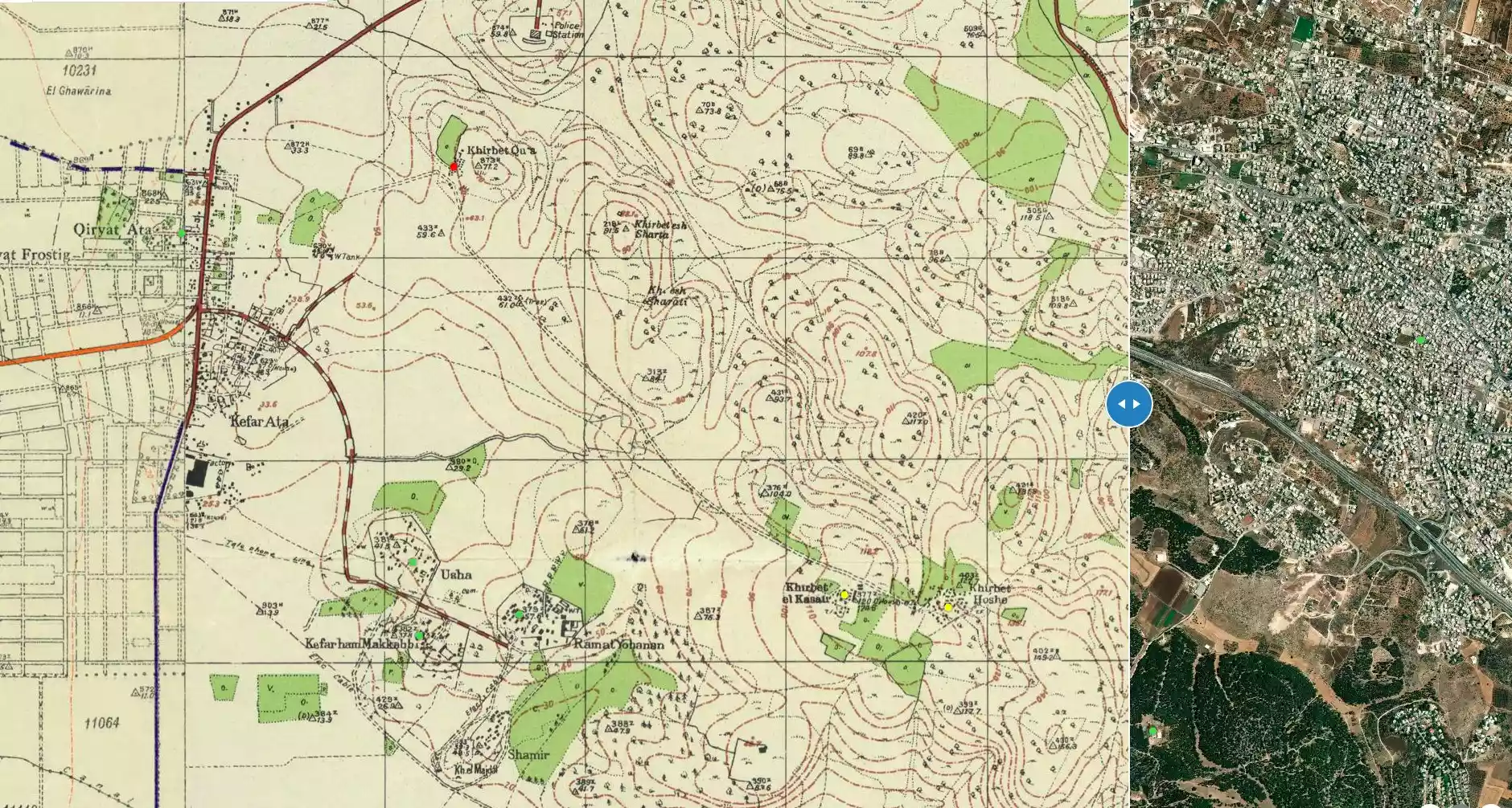
| Map Location | See location #3 on the map View from satellite |
||||||||||||
| Military Operation | Mishmar Ha'emek Battle | ||||||||||||
| Attacking Units | Carmeli Brigade | ||||||||||||
| Defenders | Local militia & Arab Liberation Army | ||||||||||||
| Exodus Cause | Military assault by Zionist troops | ||||||||||||
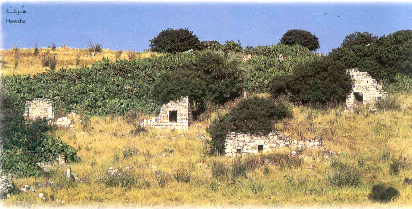
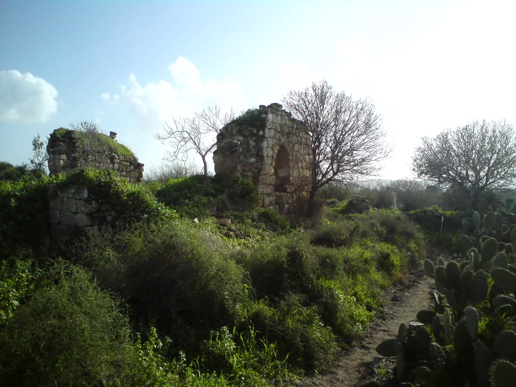
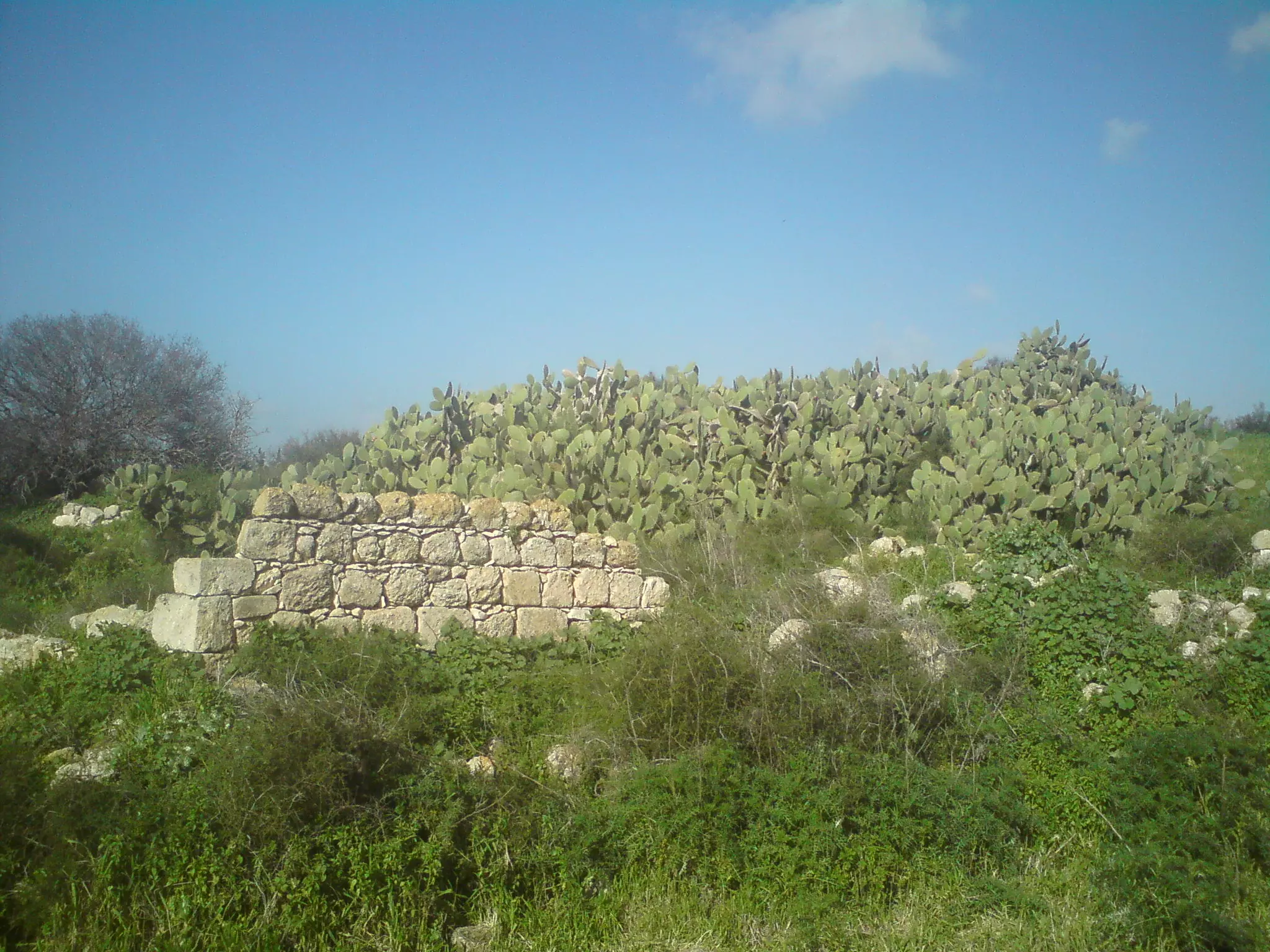
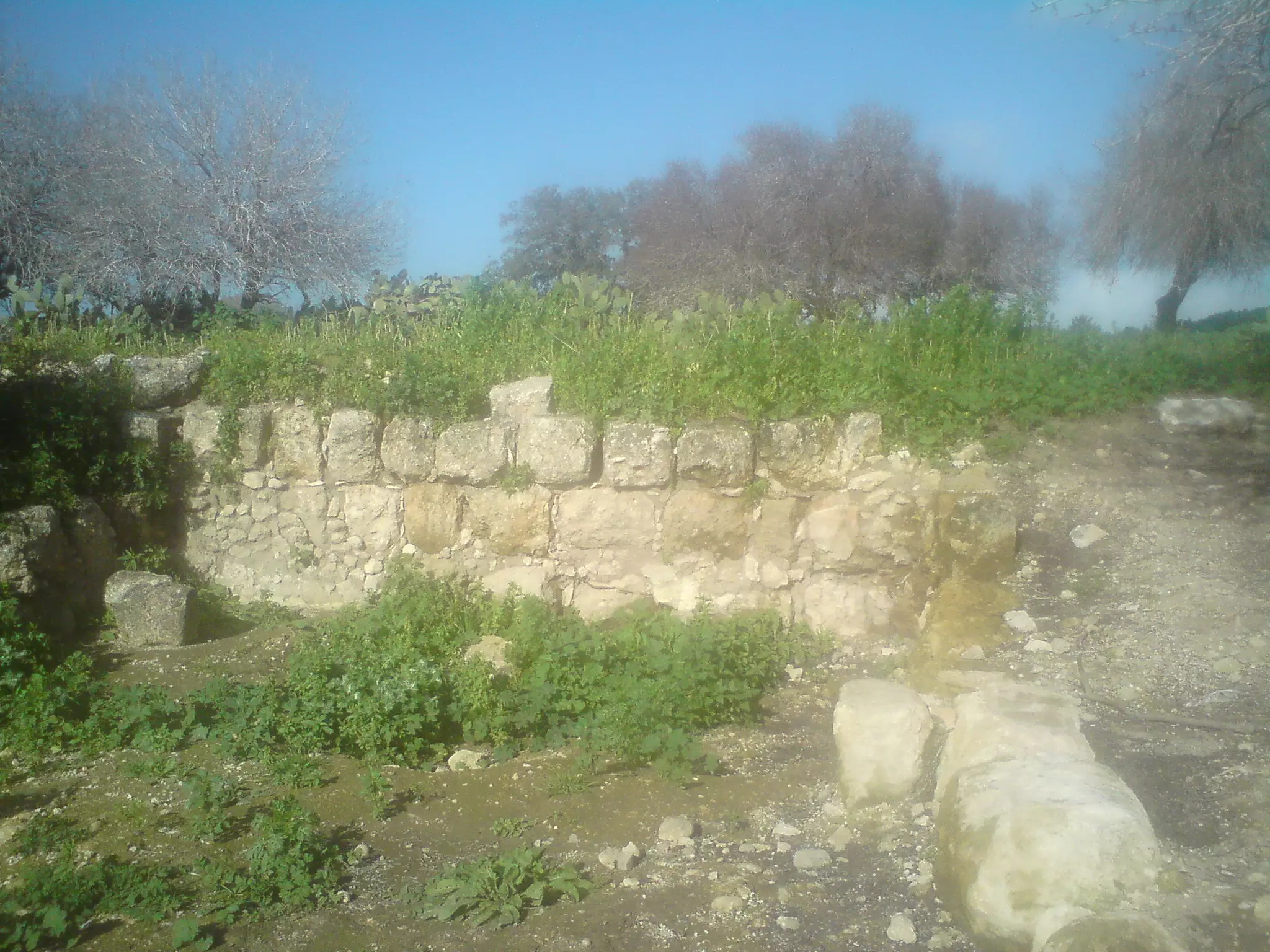
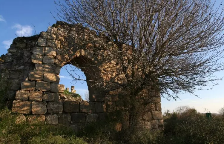
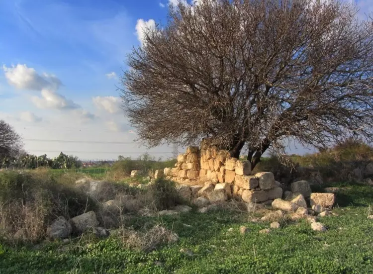
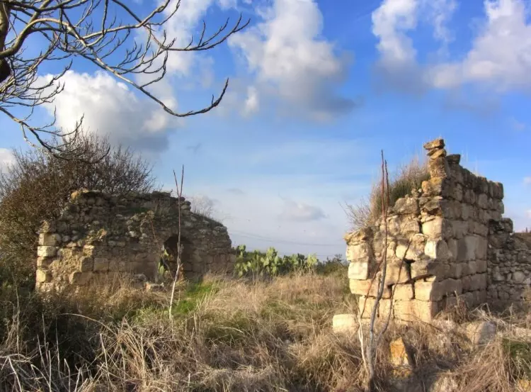
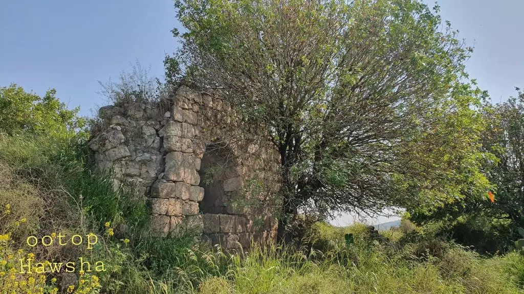
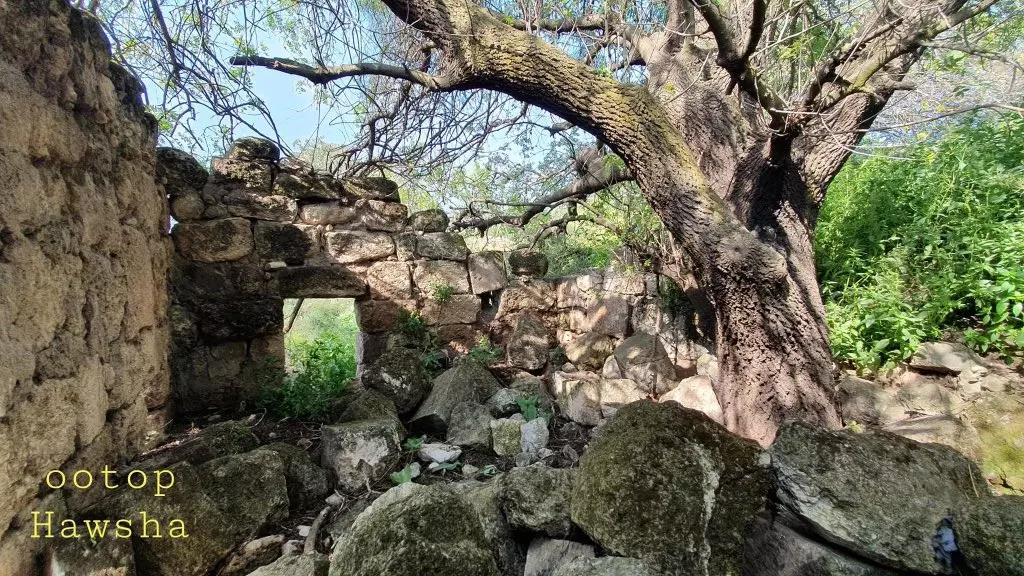
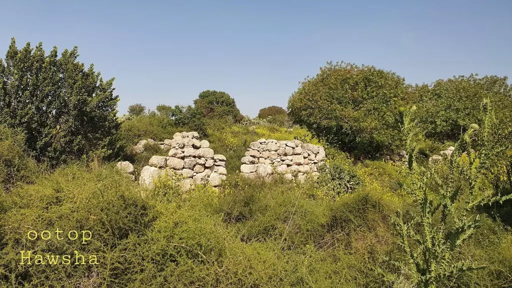
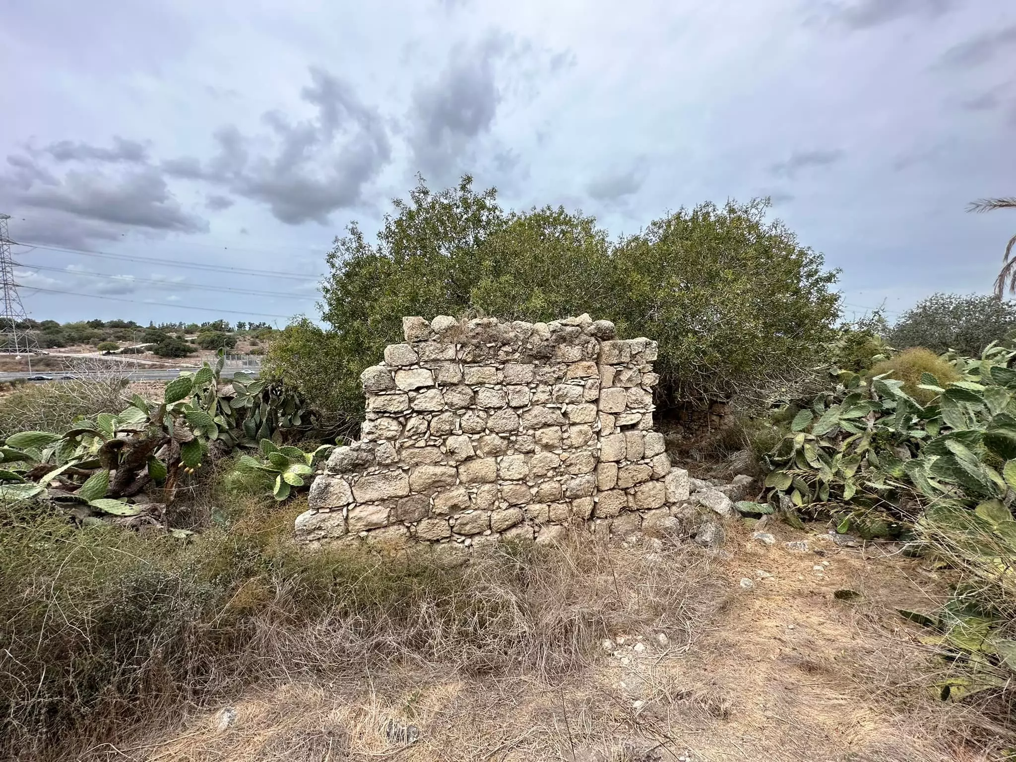
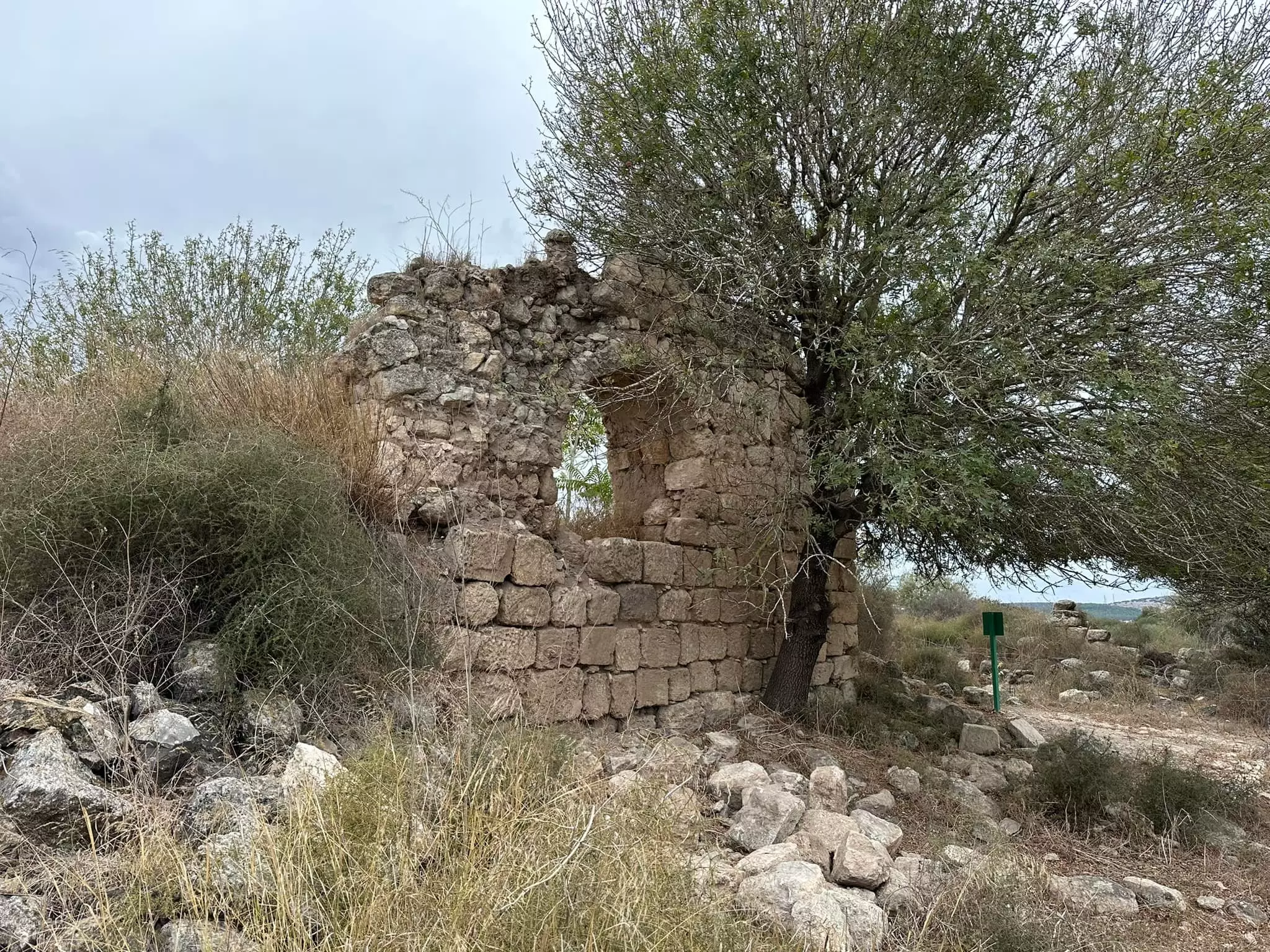
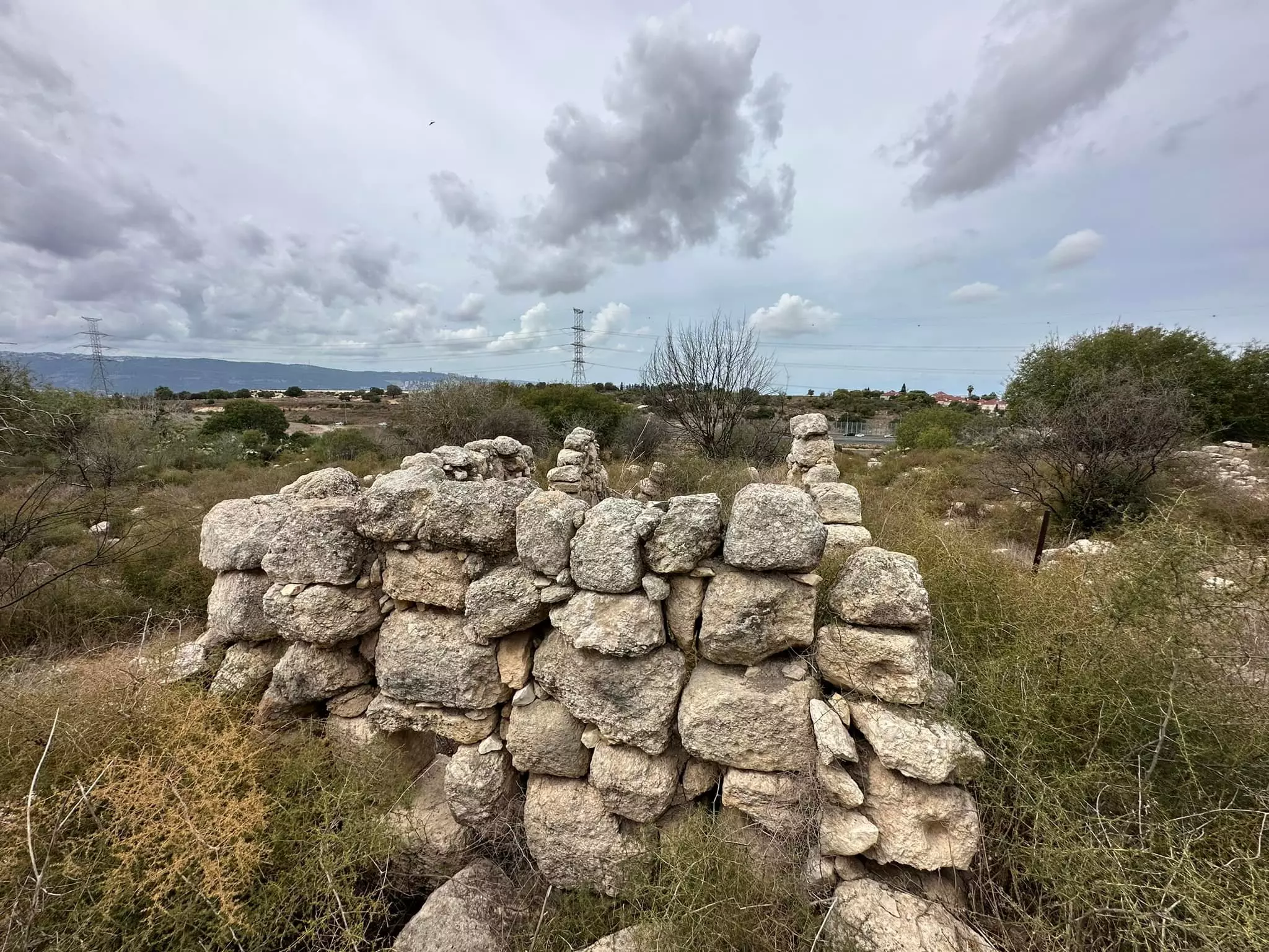
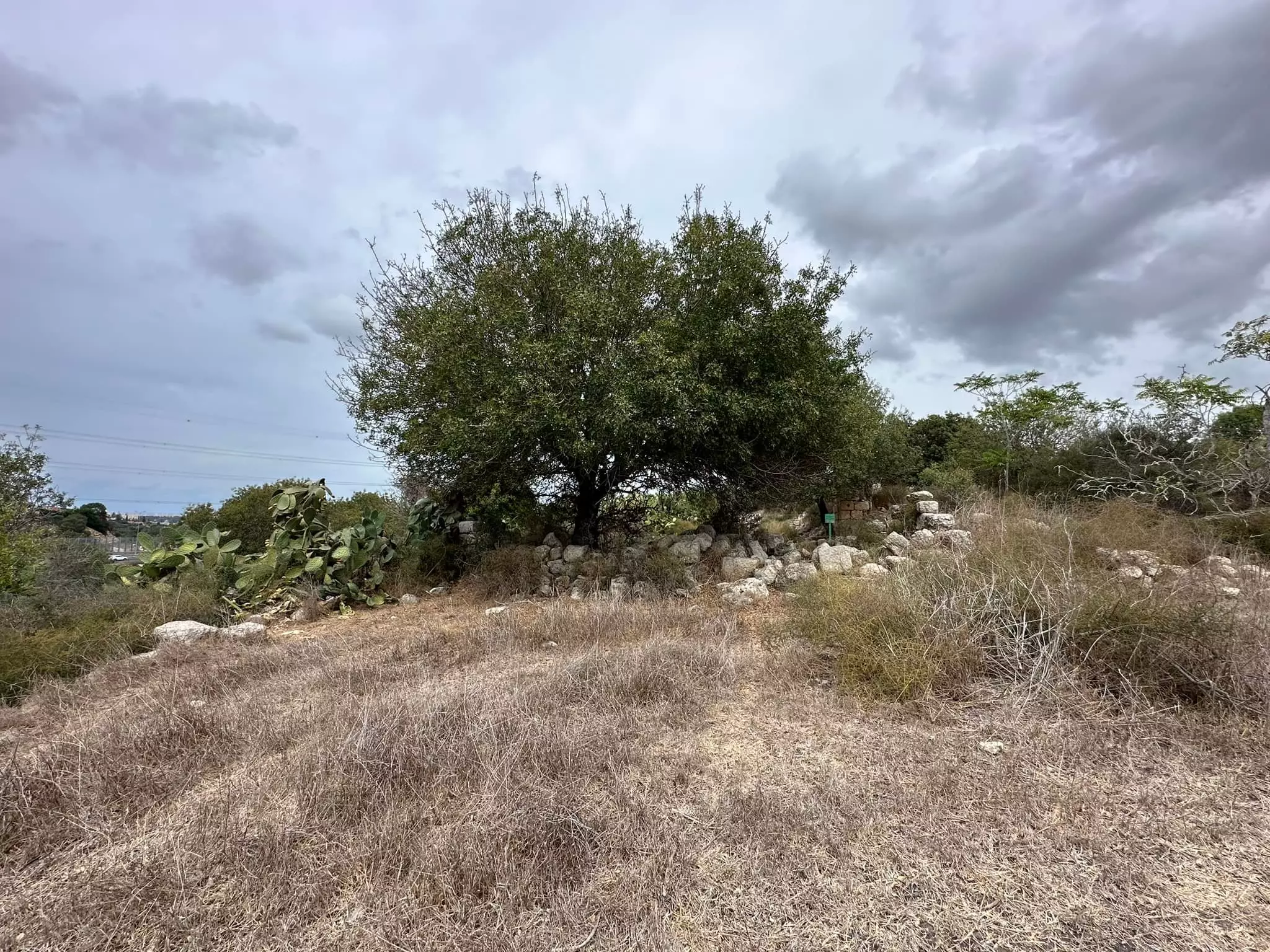
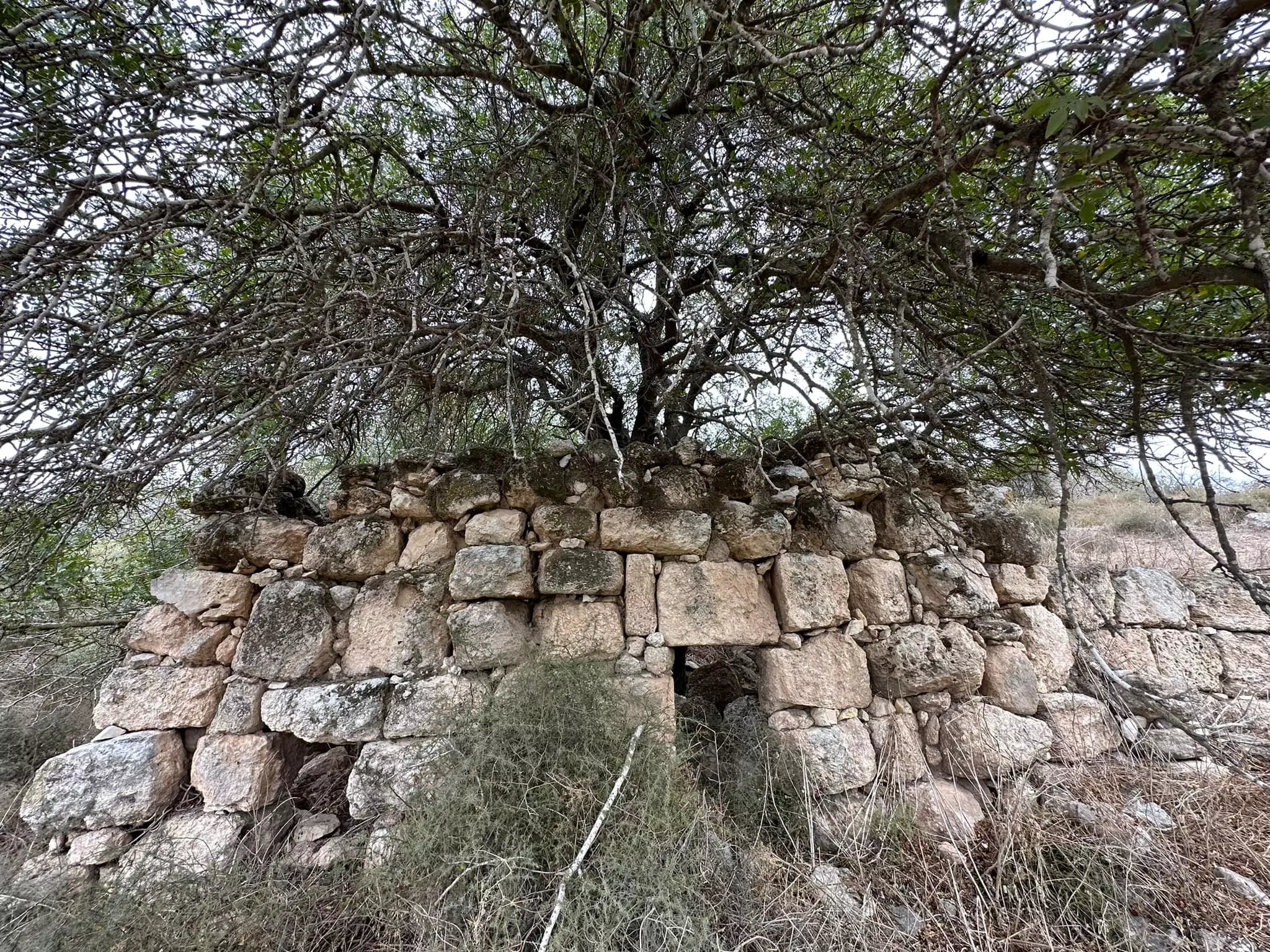
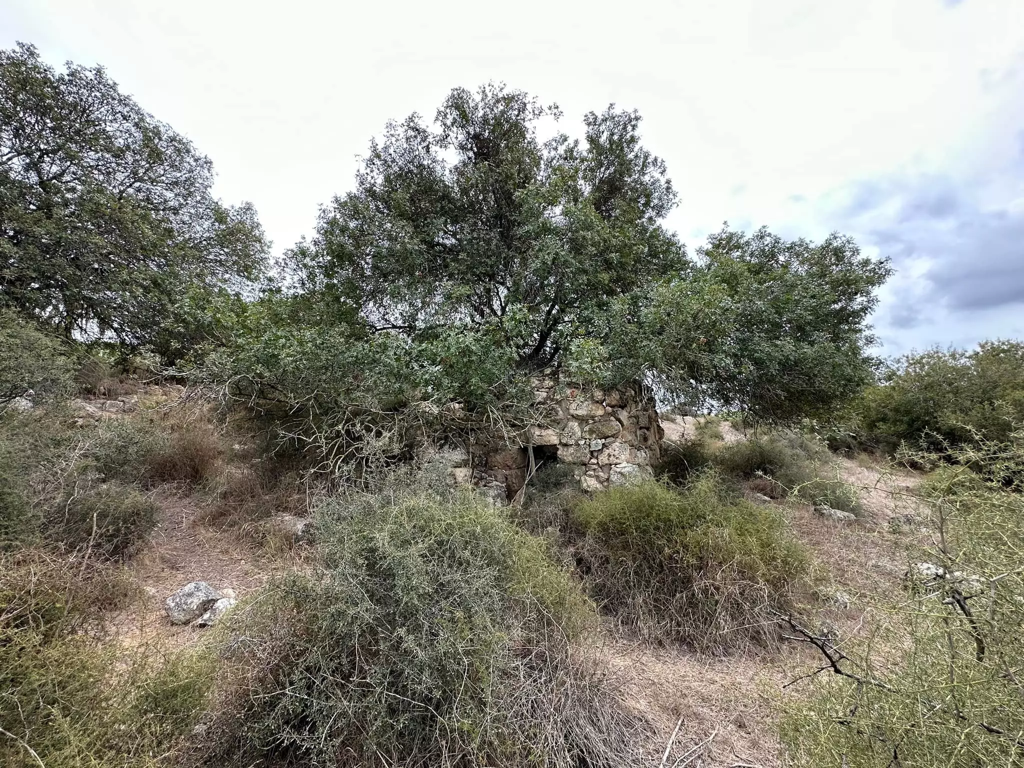
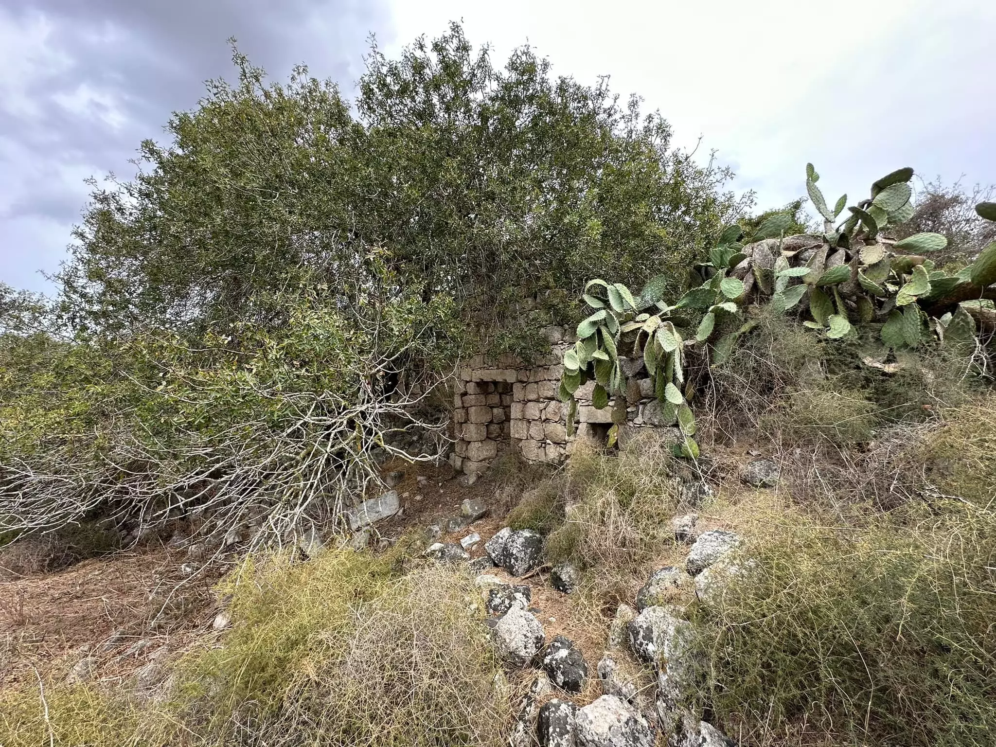
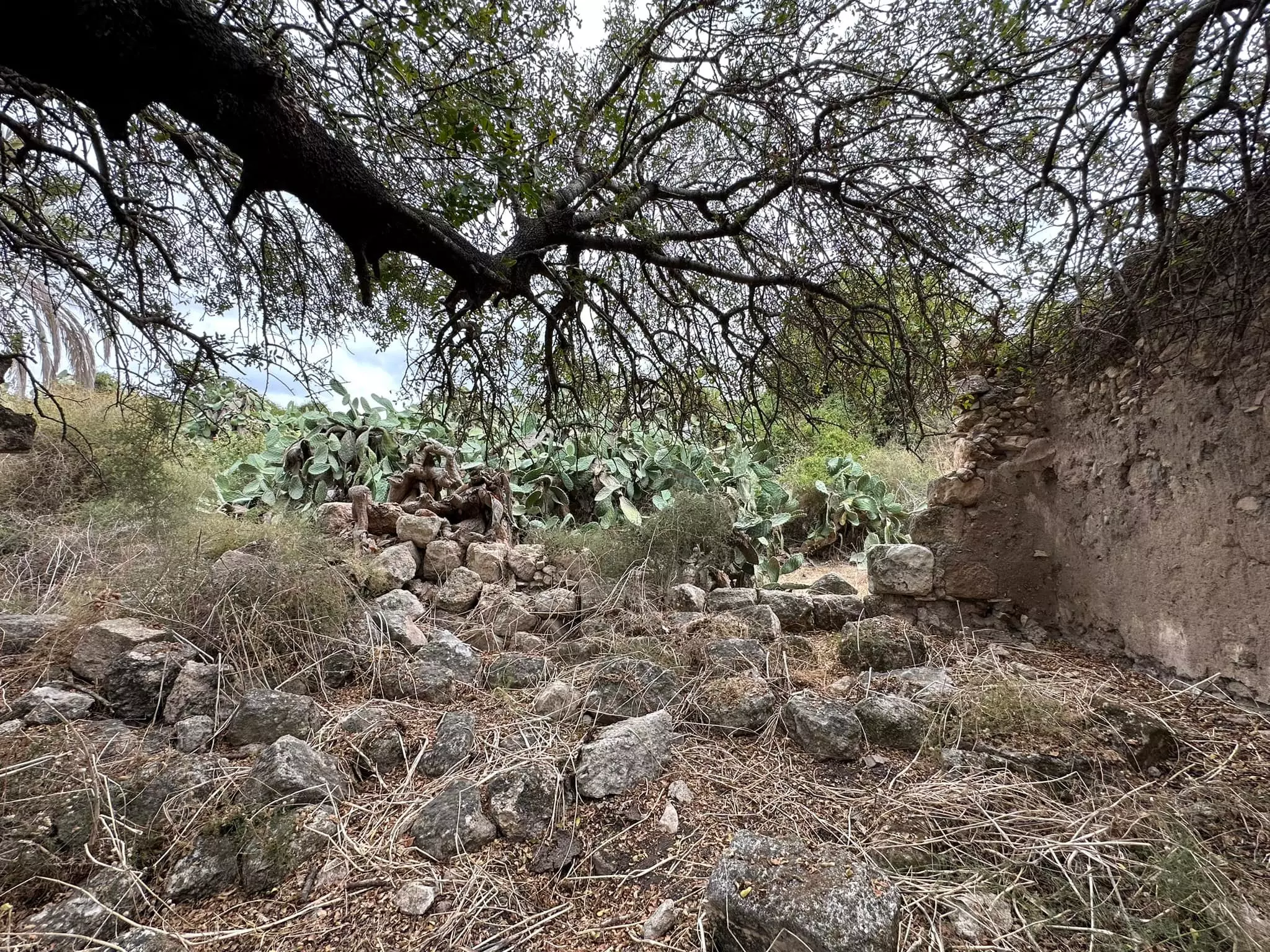
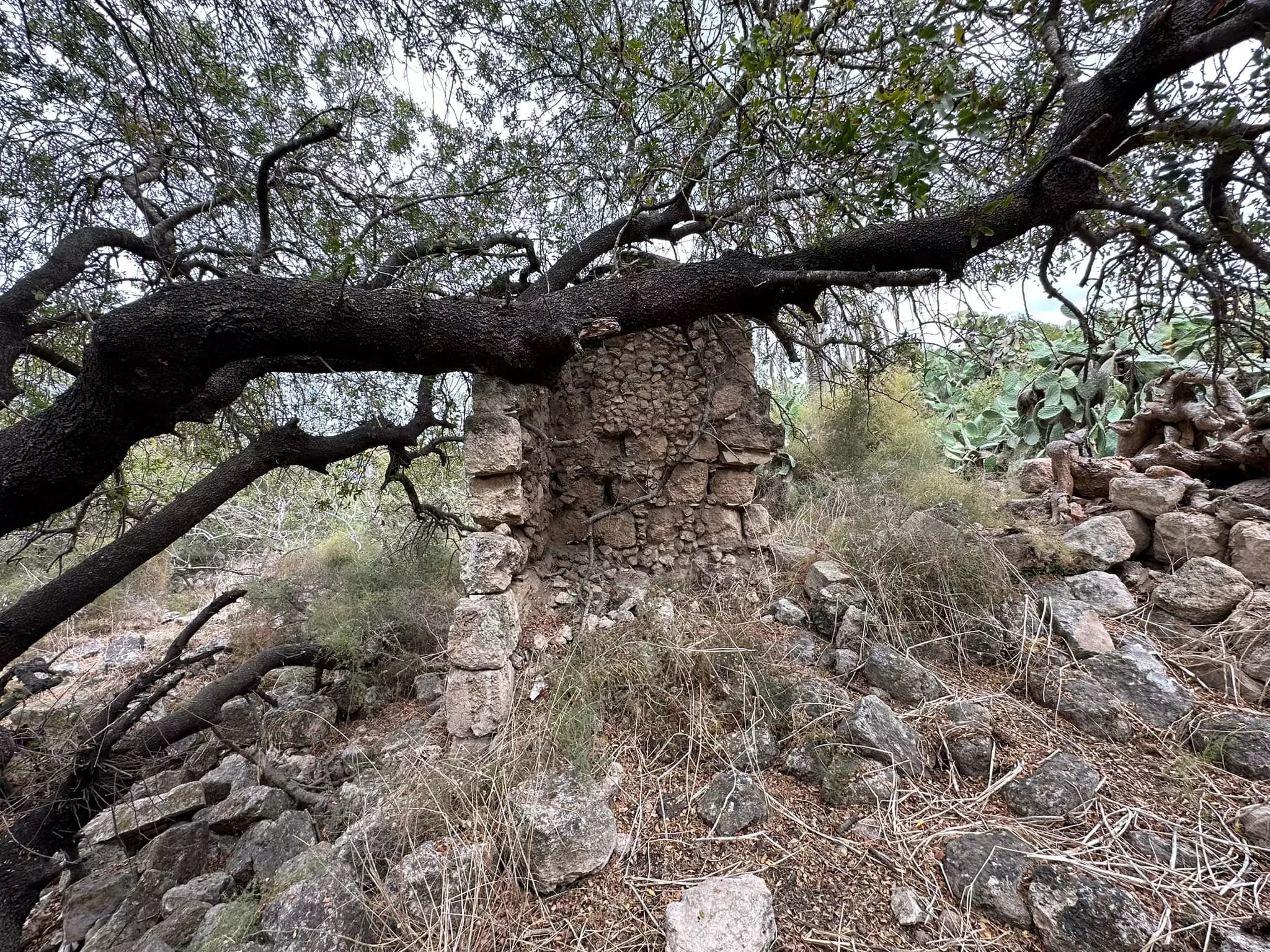
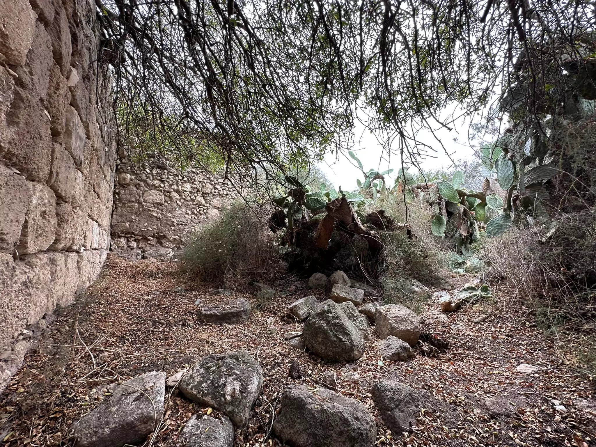
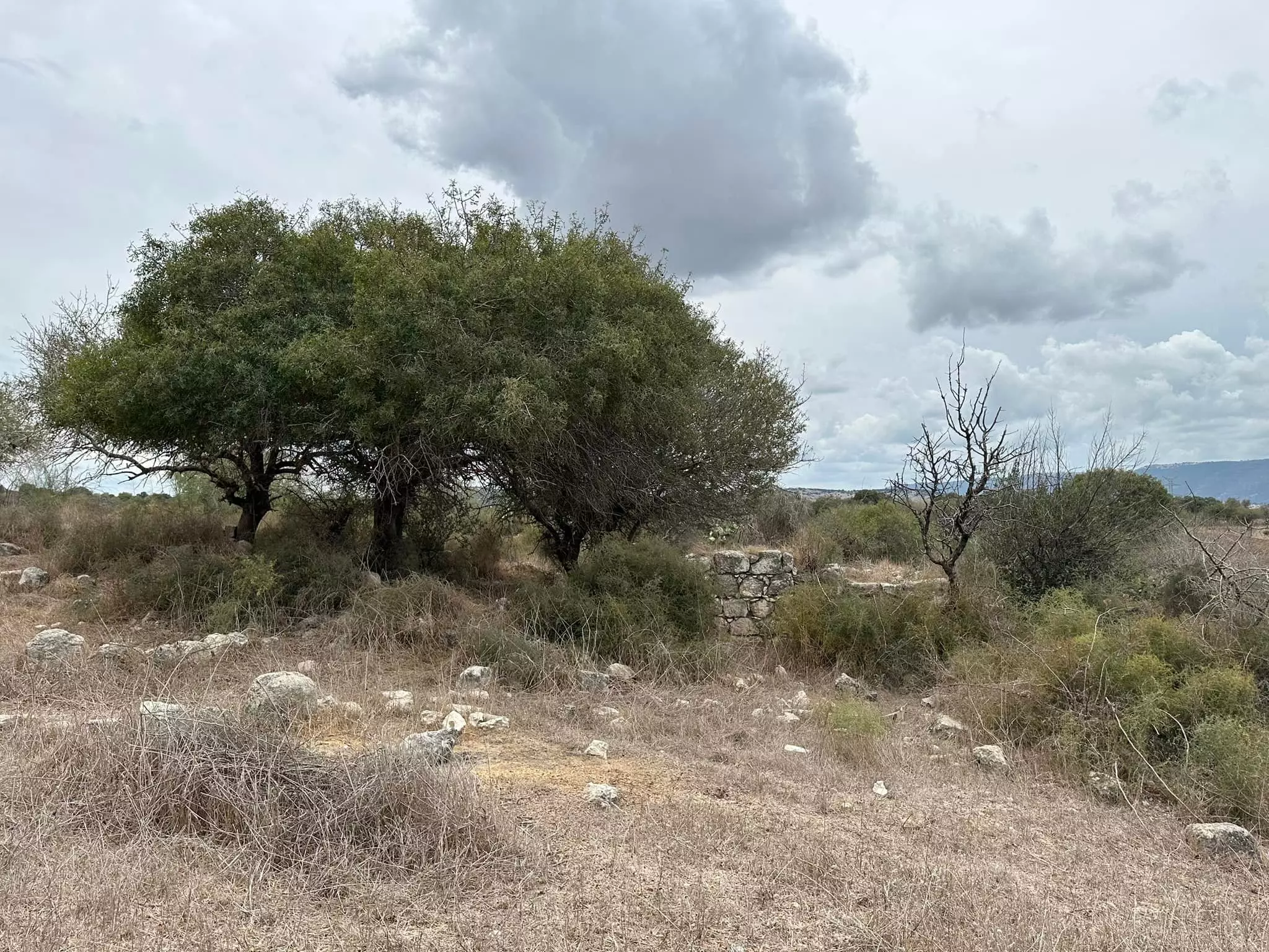
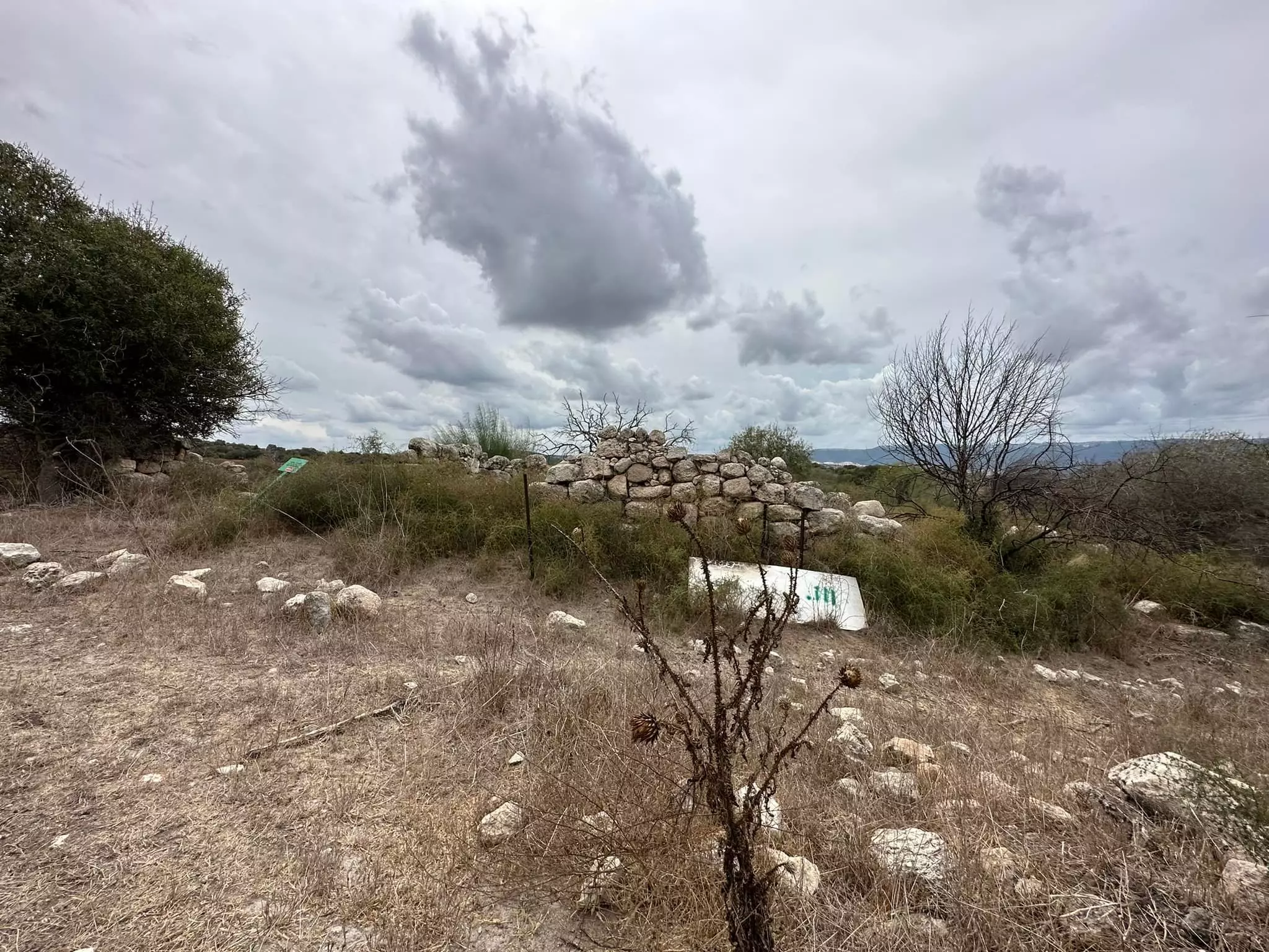
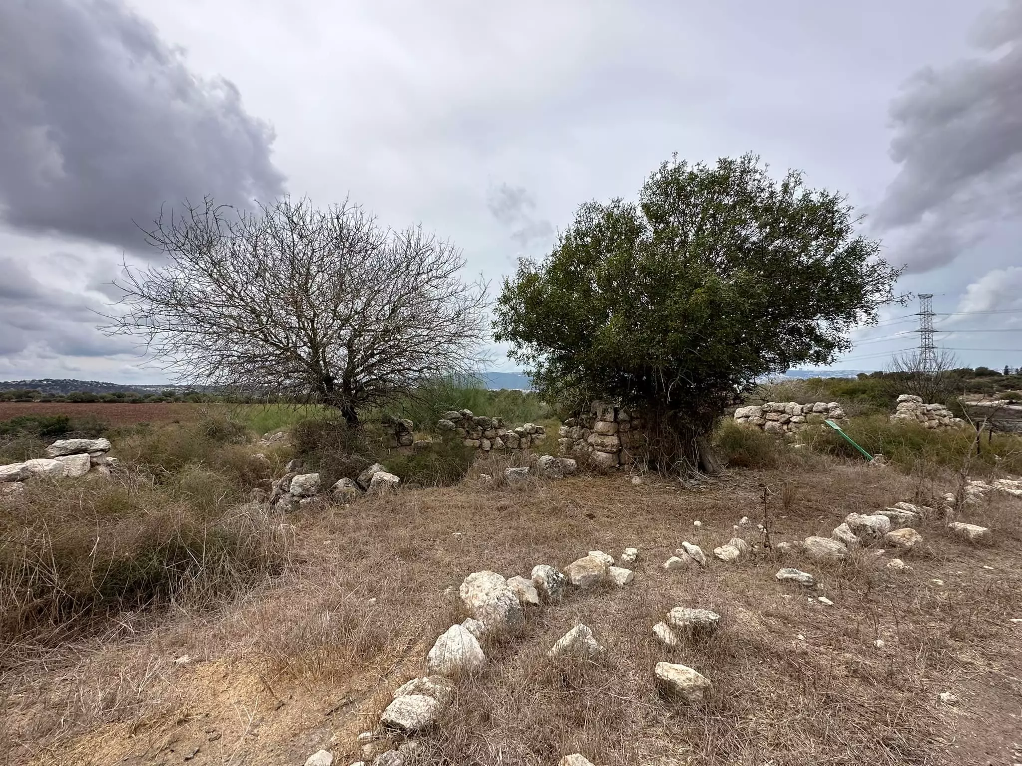
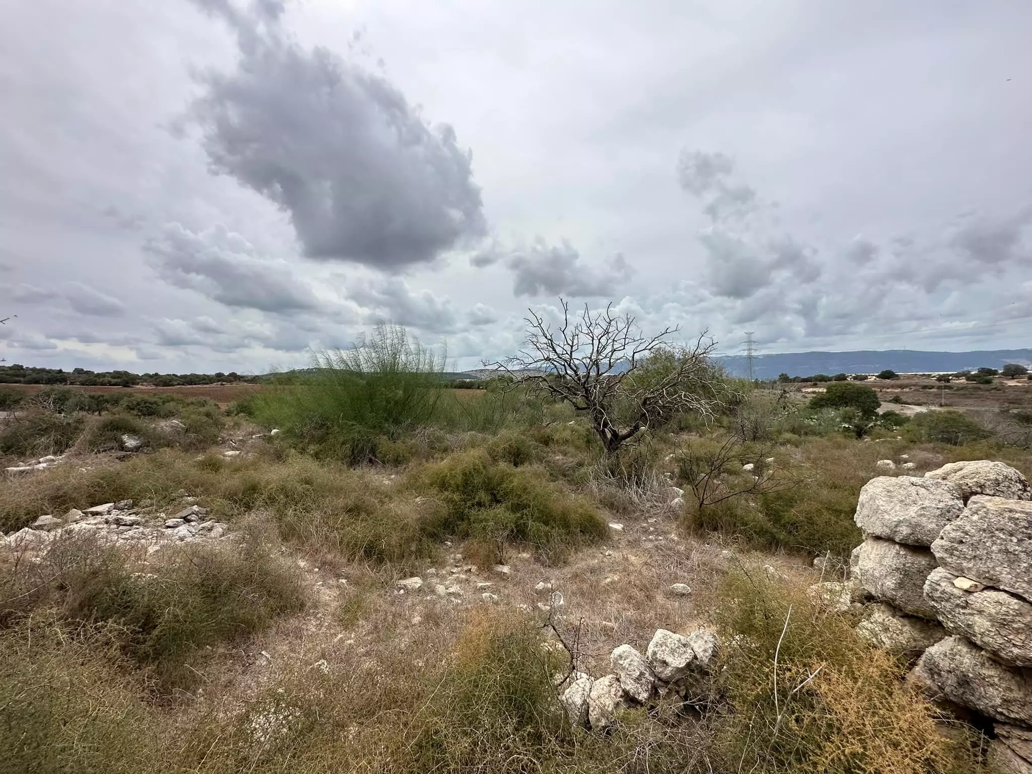
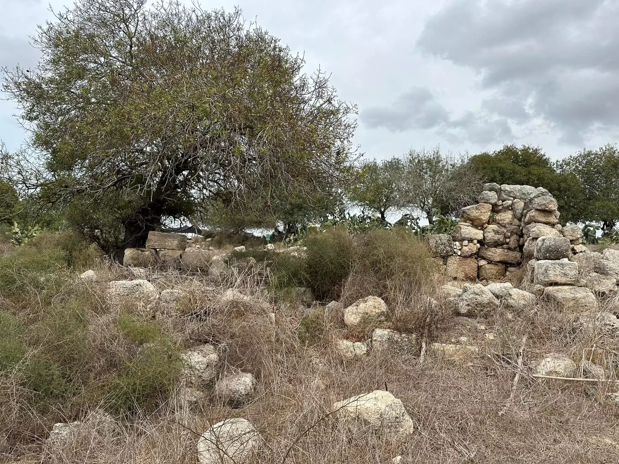
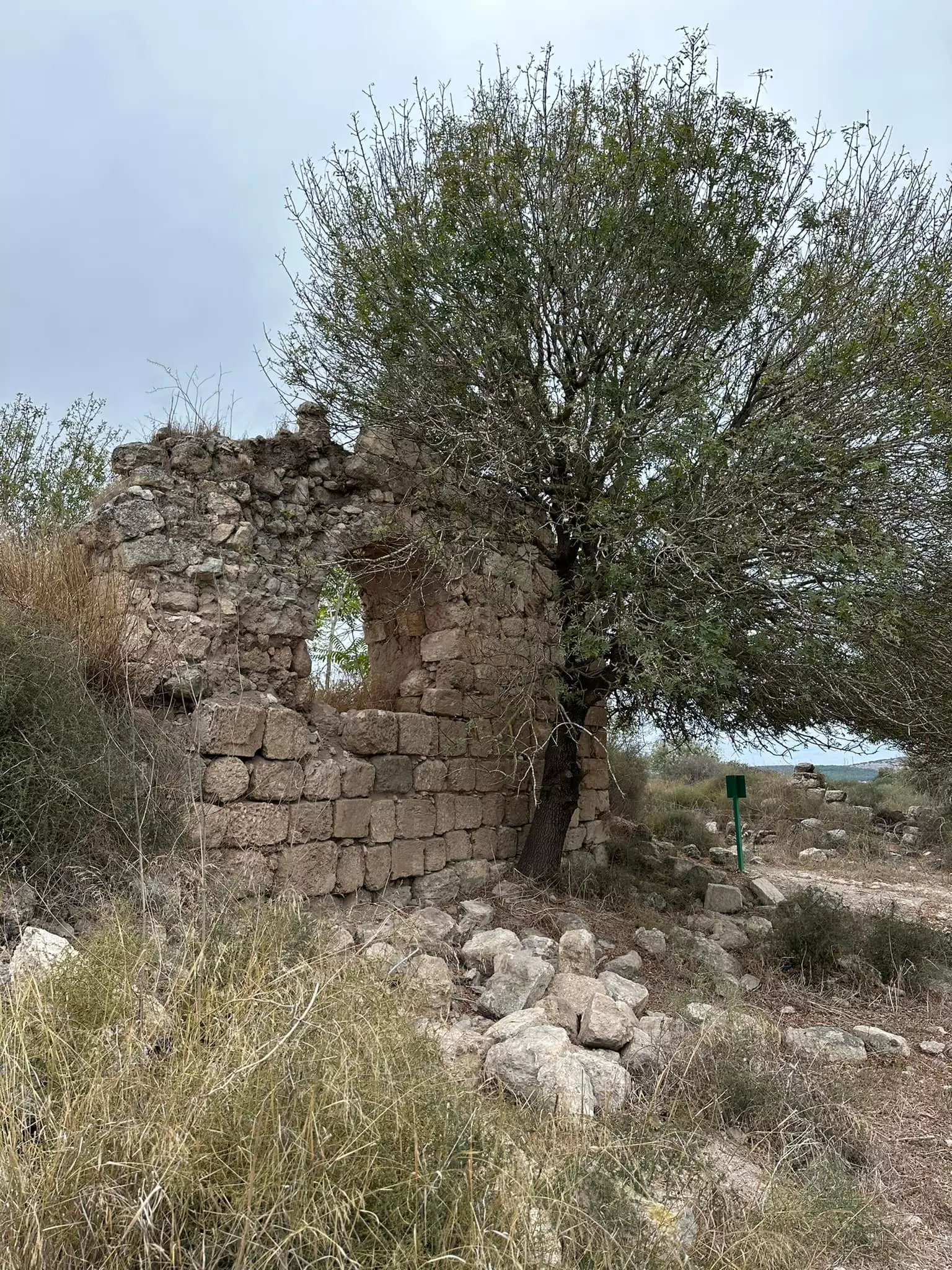
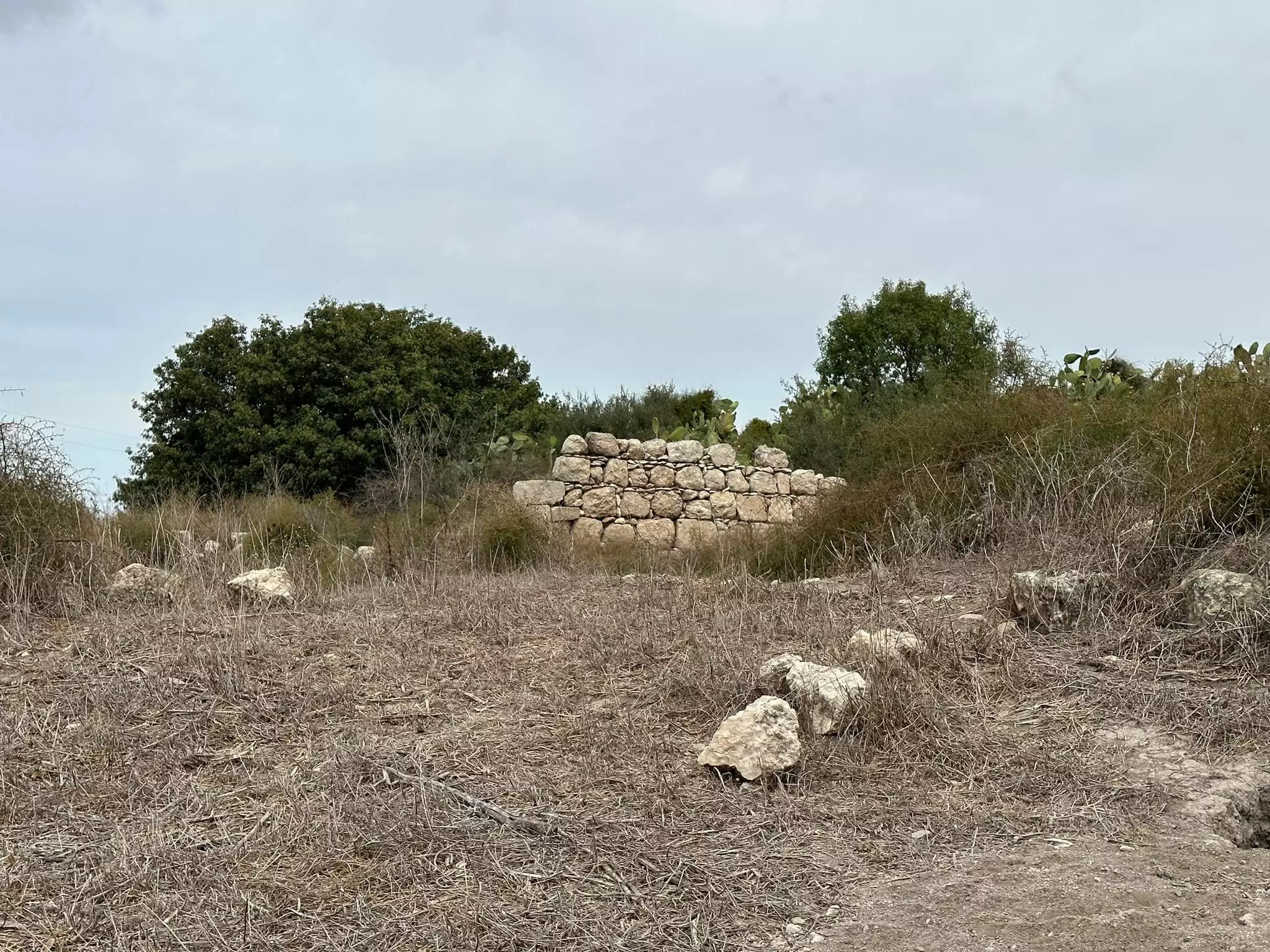
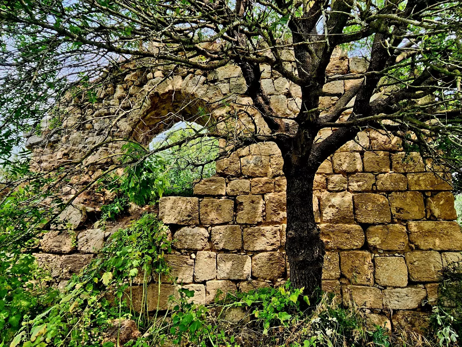
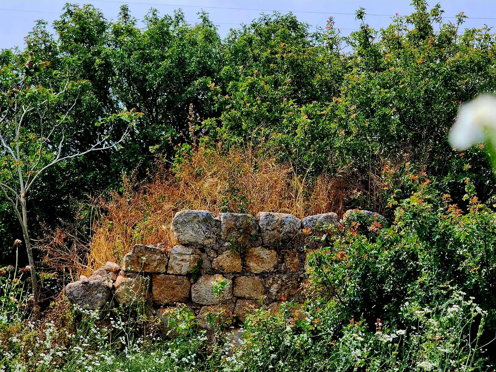
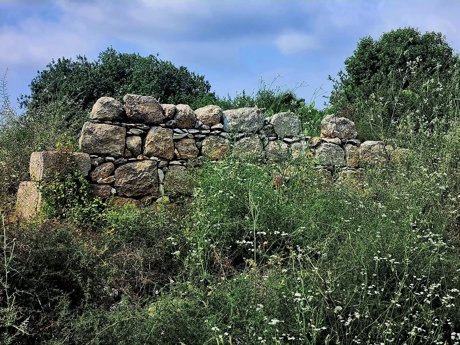
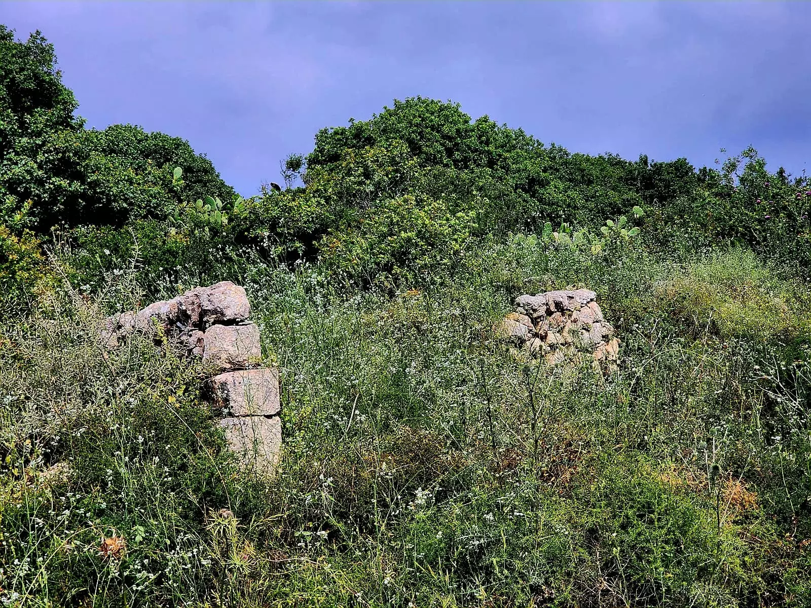
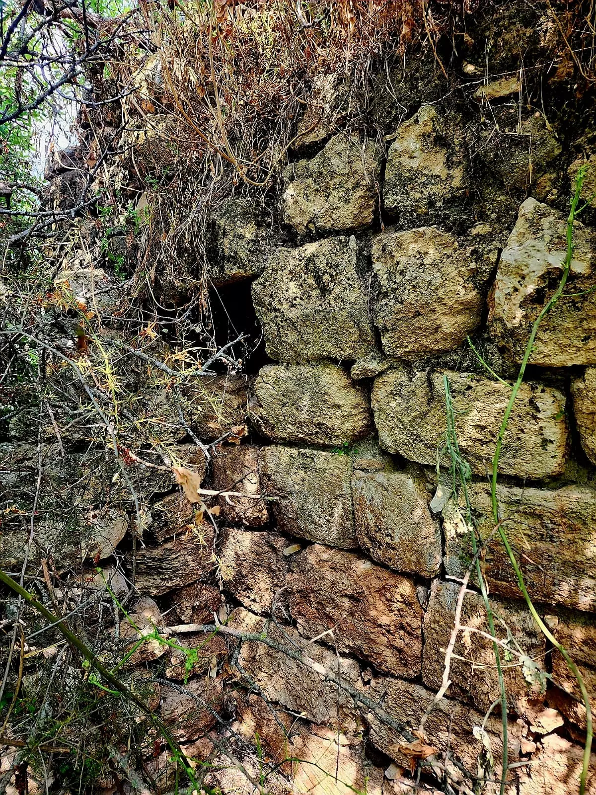
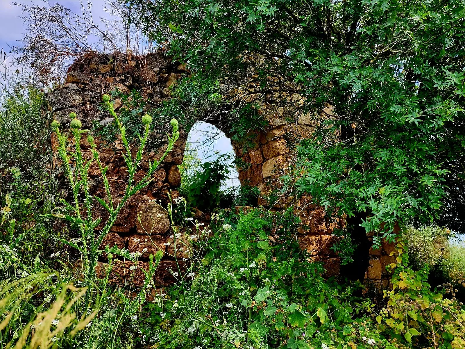
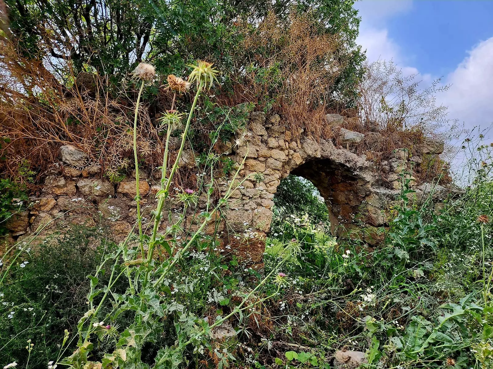
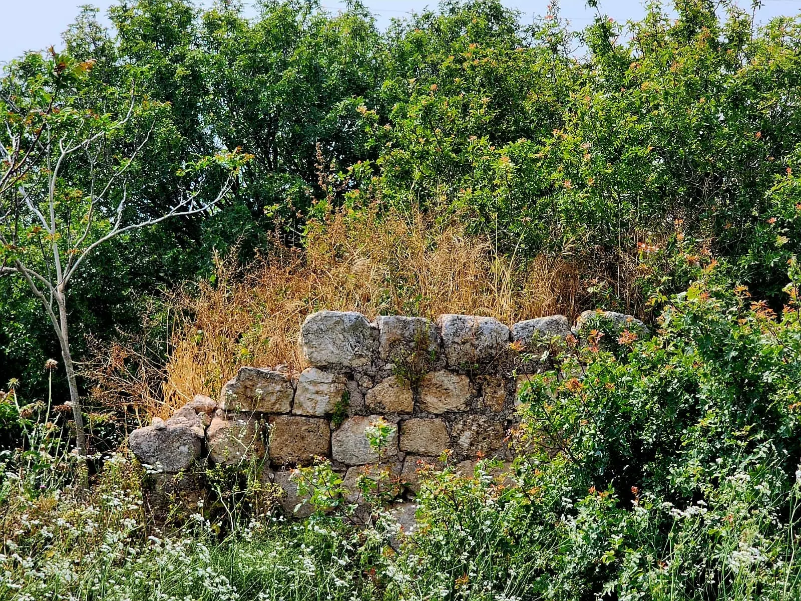
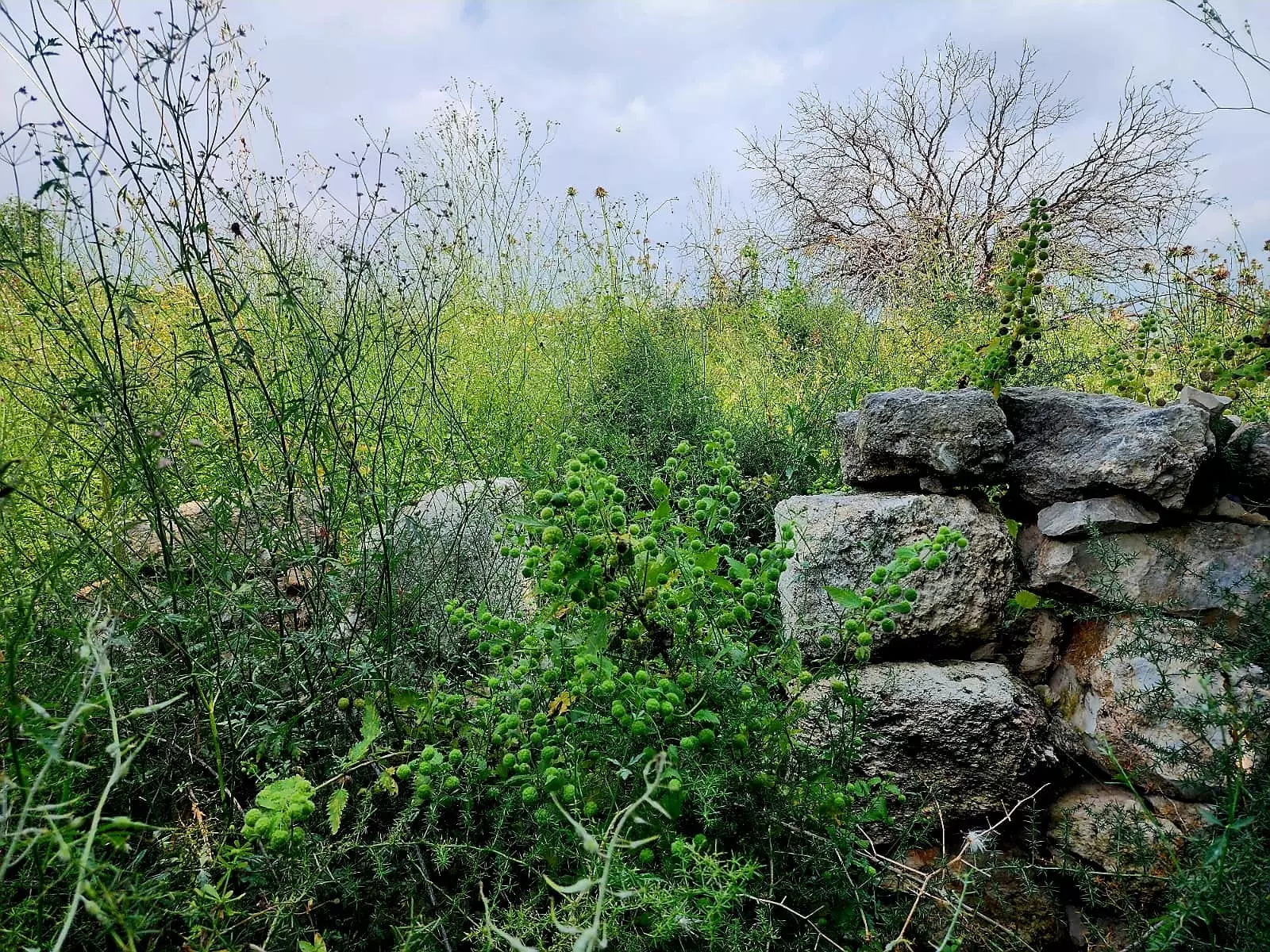
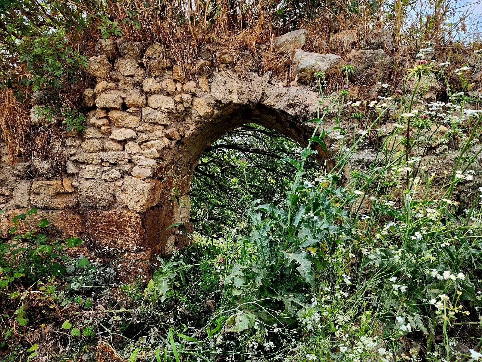
| Village Temains | The village has been completely destroyed, and only house rubble left behind. | ||||||||||||
| Ethnically Cleansing | Hawsha inhabitants were completely ethnically cleansed. | ||||||||||||
| Pre-Nakba Land Ownership |
|
||||||||||||
| Population |
|
||||||||||||
| Number of Houses |
|
||||||||||||
| Near By Towns |
|||||||||||||
|
|||||||||||||
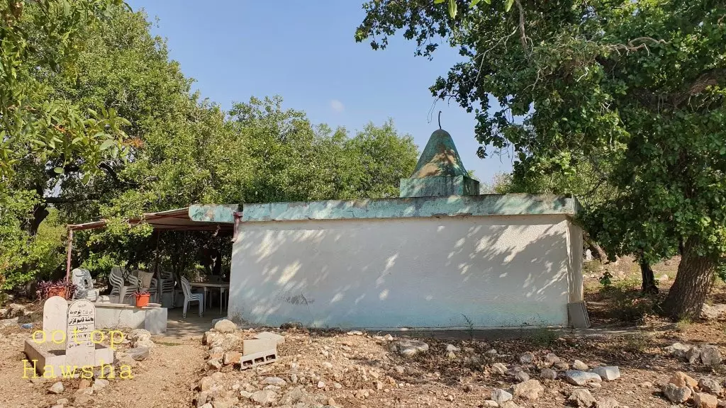
| Town's Name Through History | Hawsha may have been named after al-Nabi Hushan, and for whom the village maintained a Shrine/Maqam for. | ||||||||||||
| Shrines / Maqams | Maqam for a Nabi Hushan | ||||||||||||
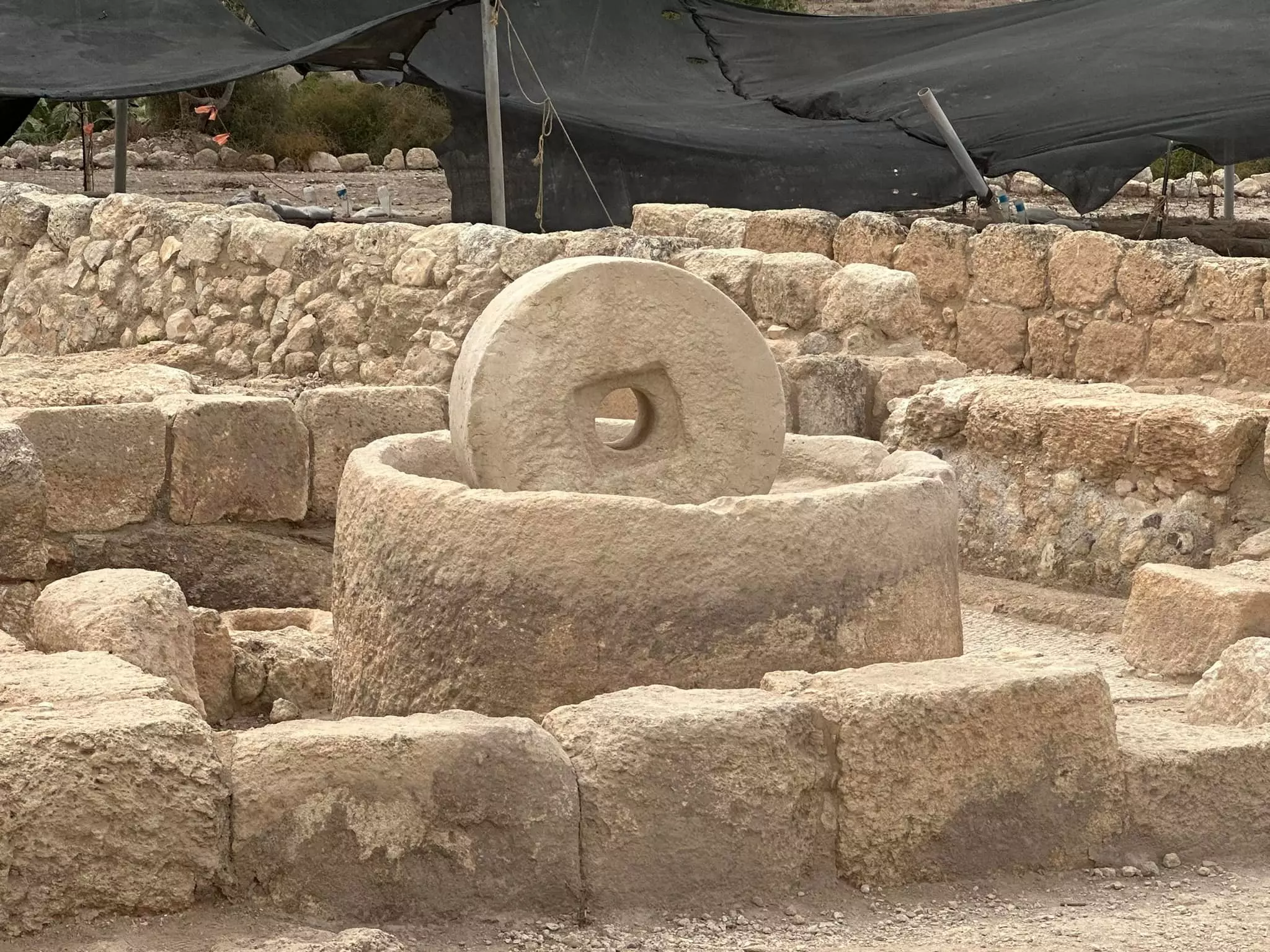
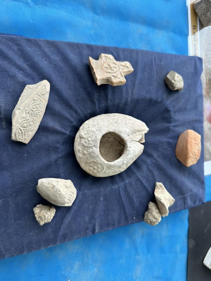
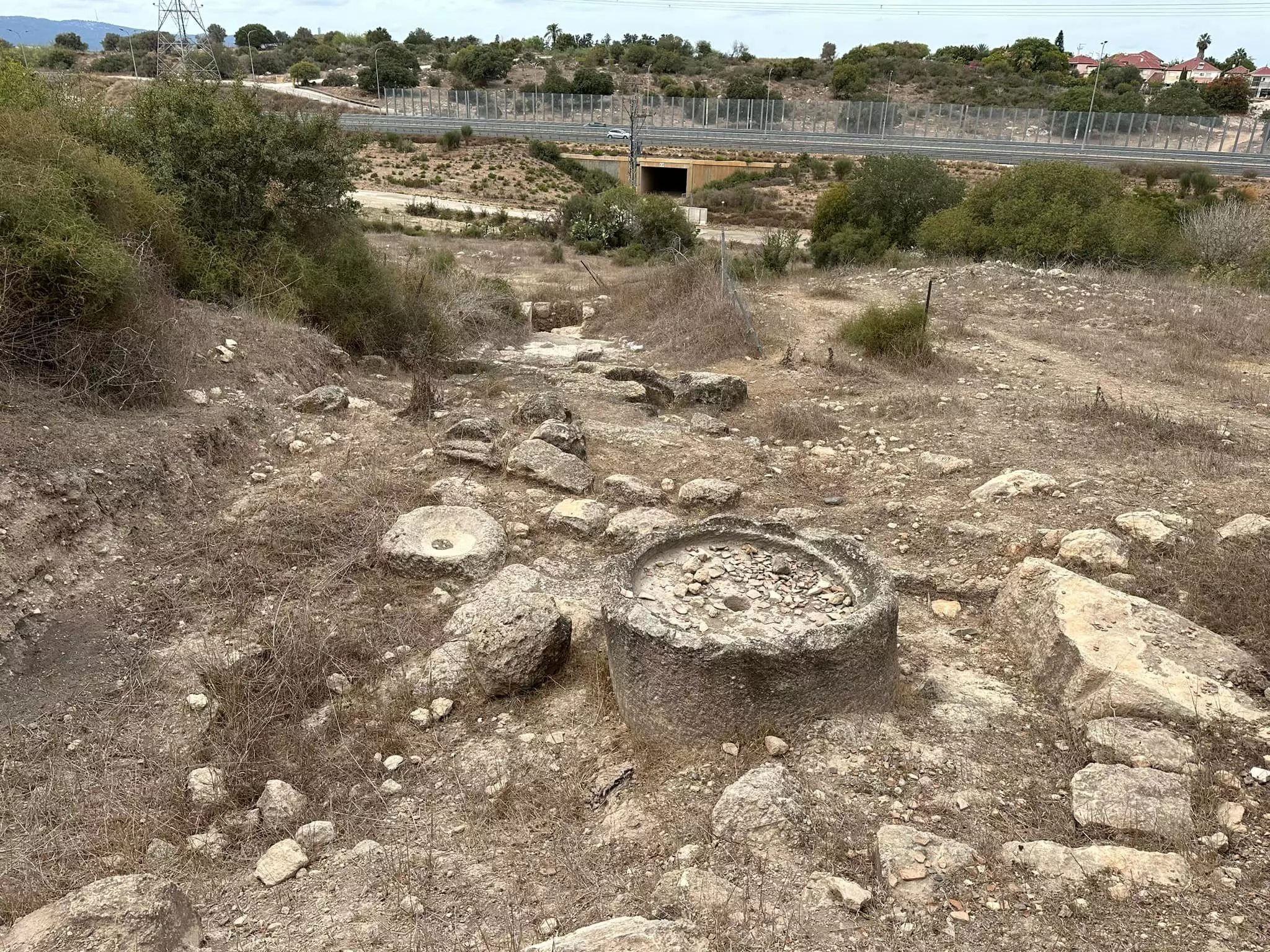
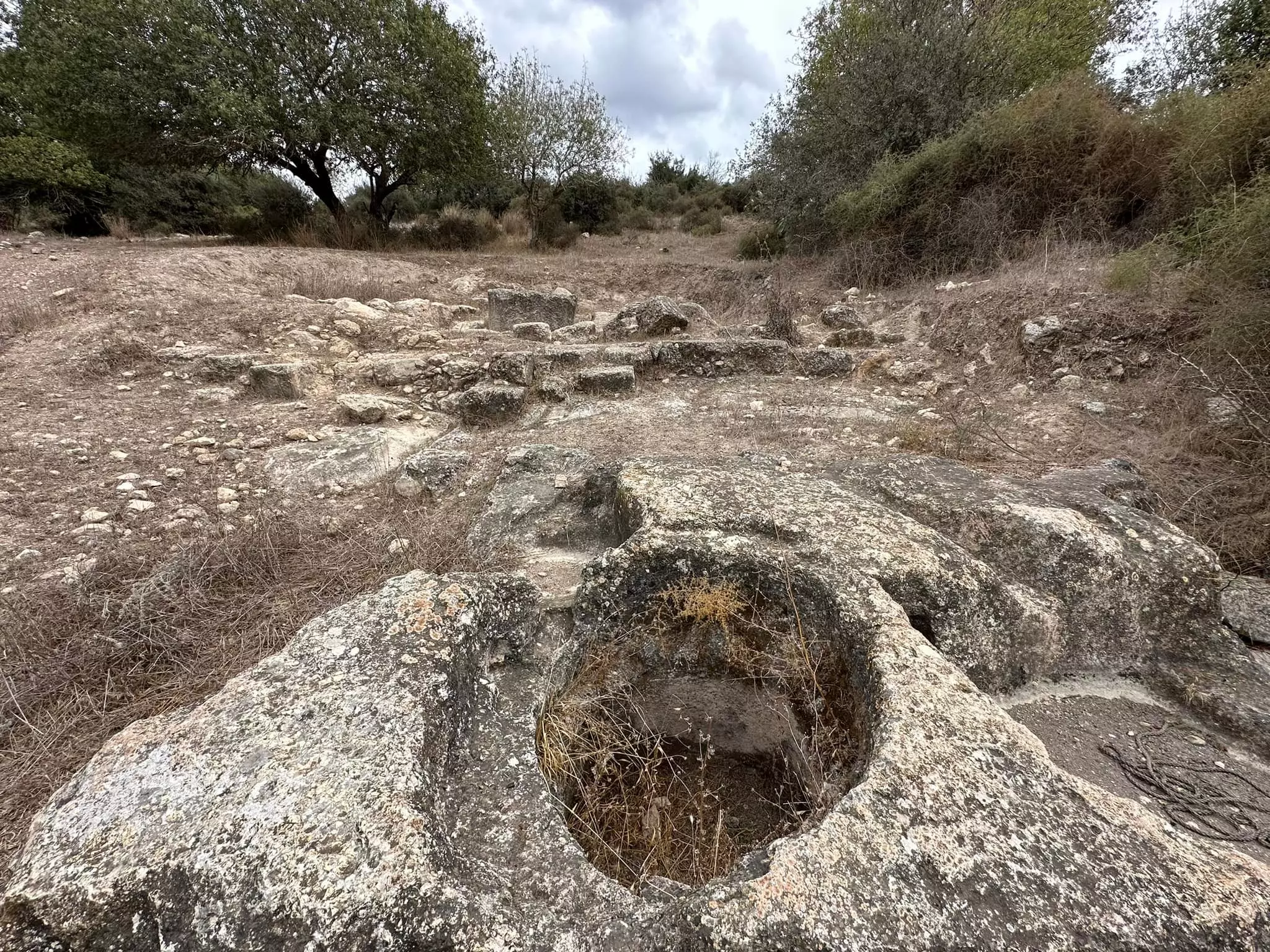
| Archeological Sites | Hawsha contained a number of ancient ruins which consisted of the foundations of buildings, a maqam (shrine) for a Nabi Hushan, a well, rock-cut tombs, and a mosaic floor. | ||||||||||||
| Exculsive Jewish Colonies Who Usurped Village Lands |
Usha, Arab township of Shefa 'Amr, and Ramat Yochanan. | ||||||||||||
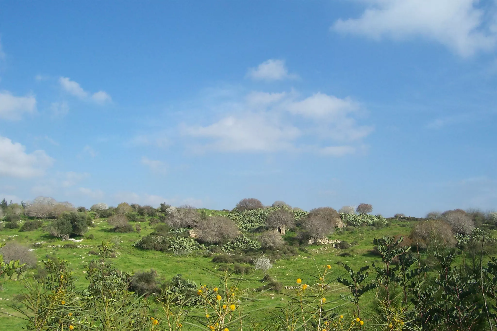
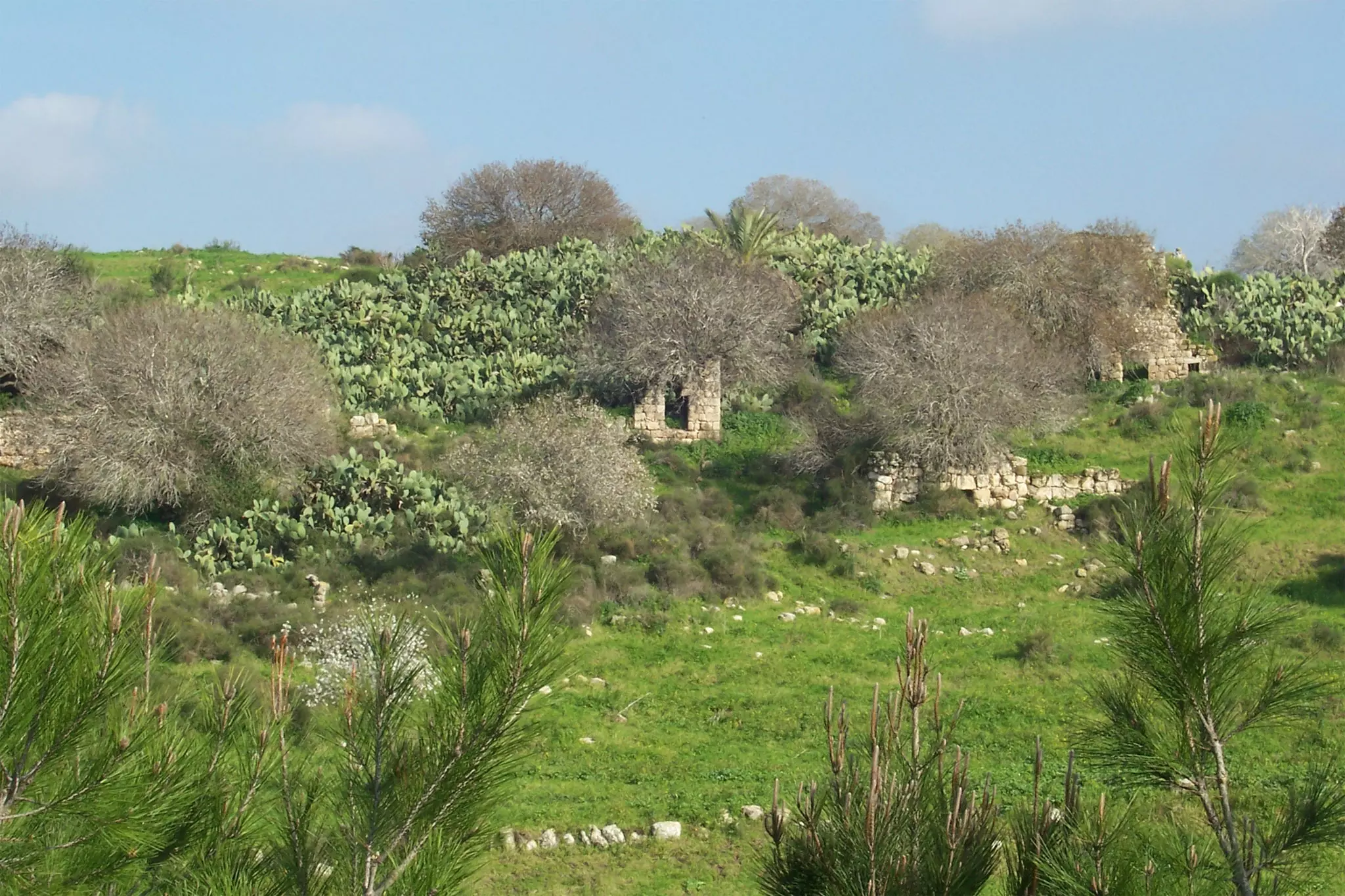
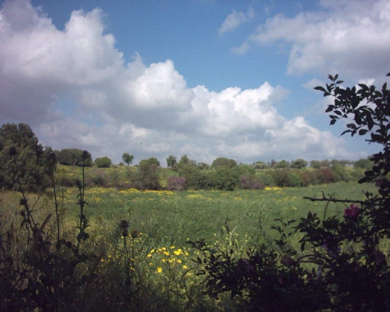
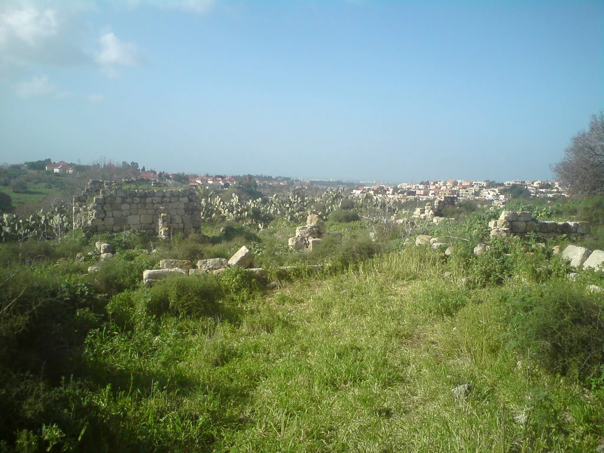
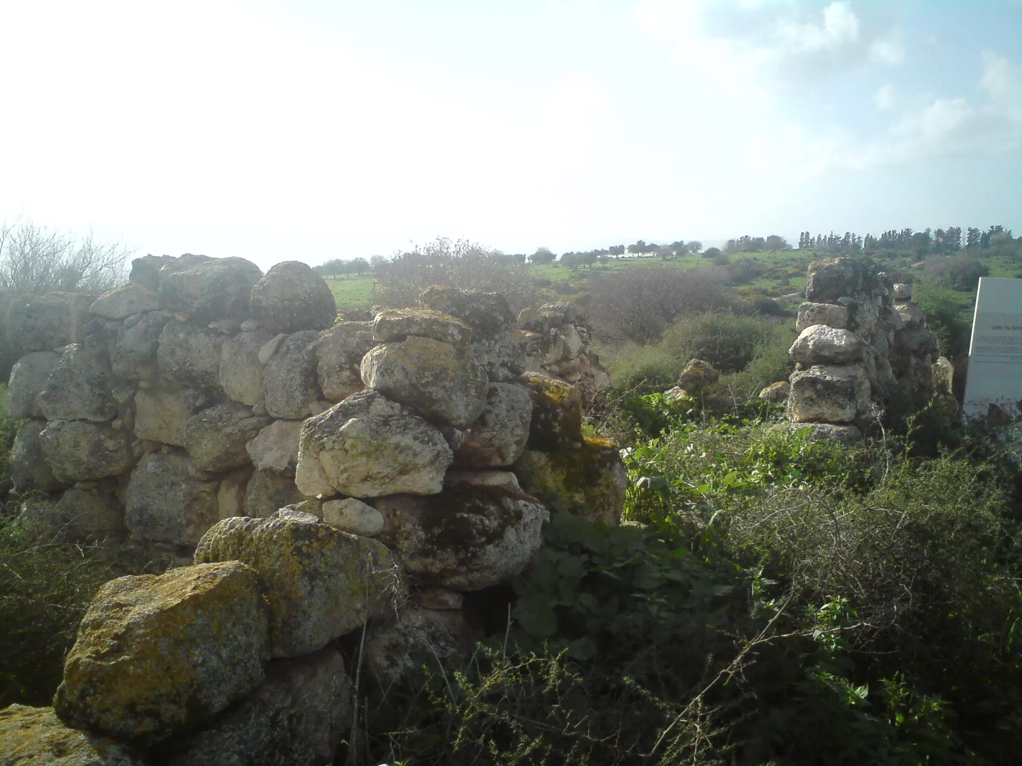
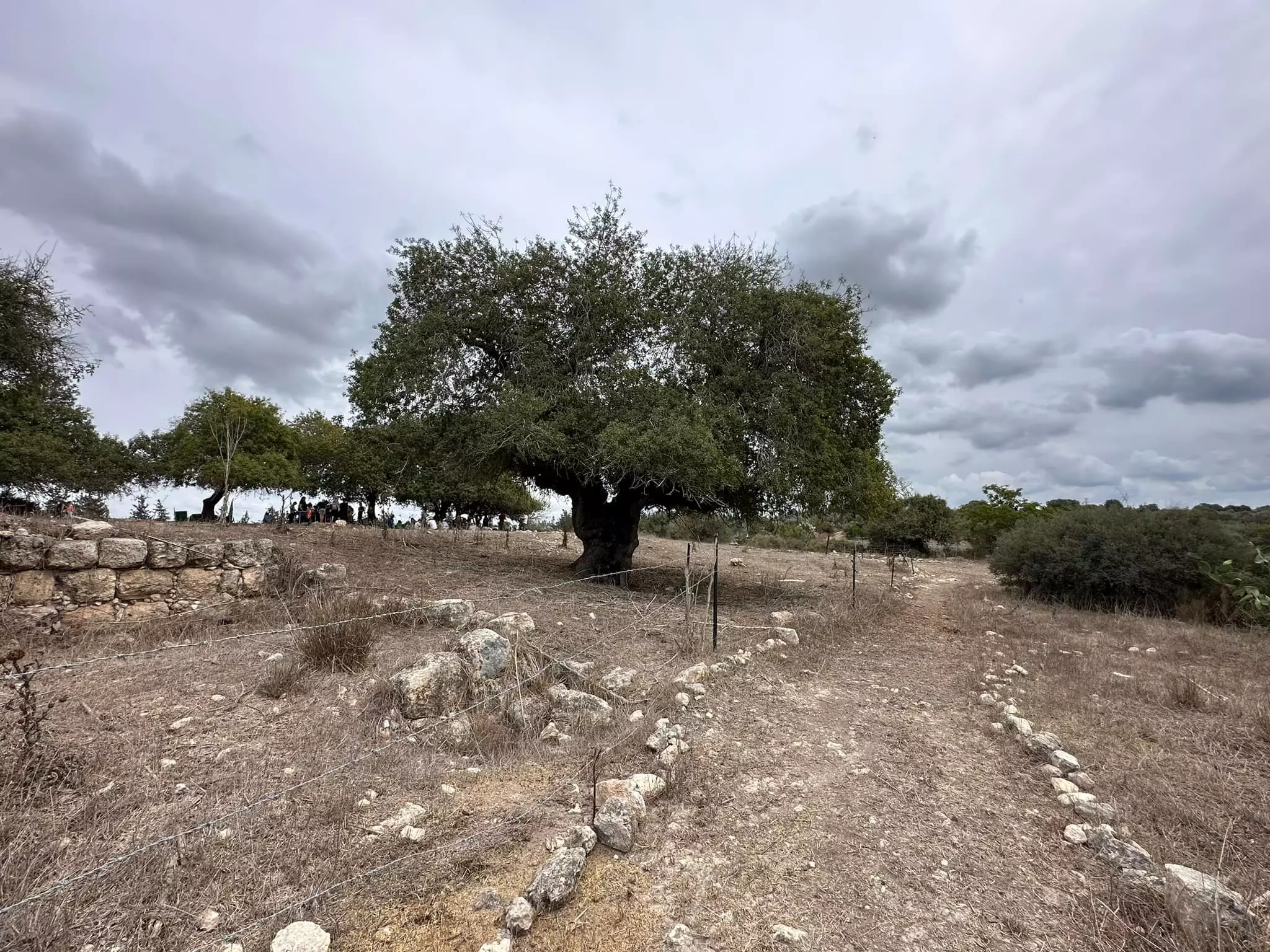
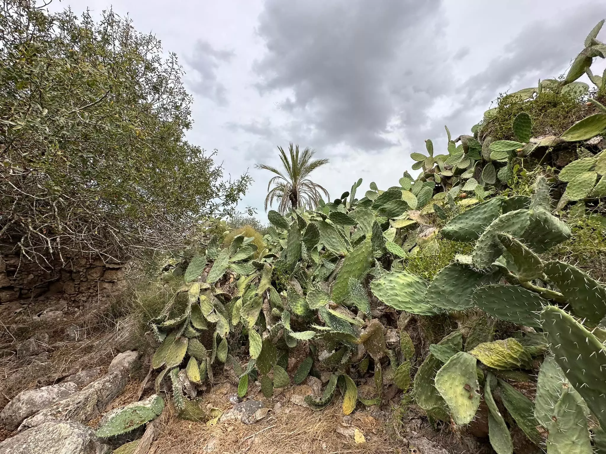
Village Before NakbaThe village was situated in the low-lying hills that separated the Plain of Haifa from Marj ibn Amir. A wide wadi passed to the west of it and formed the boundary between Hawsha and the village of Khirbat al-Kasayir. Hawsha has been tentatively identified with the biblical town of Hosha, a border settlement of the Israelite tribe of Asher (Joshua 19:29). Hawsha was classified as a hamlet by the Mandate-era Palestine Index Gazetteer and was oriented along an east-west axis. Its houses were clustered together around the village center, where there was a cistern. The residents were Muslim; they shared a cemetery with nearby Khirbat al-Kasayir. The village economy was based on animal husbandry and agriculture. Grain was the primary crop, and was concentrated in the southwestern village lands; a small area in the north was set aside for fruit and olive trees. The site contained a number of ancient ruins which consisted of the foundations of buildings, a maqam (shrine) for a Nabi Hushan, a well, rock-cut tombs, and a mosaic floor.Village Occupation and Ethnic CleaningIn mid-April 1948, a fierce battle between the Haganah and the Arab Liberation Army (ALA) centered around this village and the adjacent village of Khirbat al-Kasayir, according to the History of the Haganah. An ALA battalion made up of Druze from Syria and Palestine reportedly took up positions in these villages on 12 April and began to snipe at neighboring Jewish settlements, with the aim of relieving the pressure on their comrades fighting in the battle of Mishrnar ha-Emeq, to the south (see Abu Shusha and al-Ghubayya al-Tahta, Haifa sub-disctrict). Two days later, a unit of the Haganah's Carmeli Brigade attacked the two villages, engaging in hand-to-hand combat. After the Zionists lost the battle, a decision was made to occupy the two villages. As the brigade commander Moshe Carmel later wrote: 'Since these two villages were far from the main roads and from the British area of interest, there was reason to suppose that [the British] would not intervene against us.' Thus, at dawn on 16 April, two companies from the Carmeli Brigade occupied the two villages 'easily,' since they contained only a few guards. ALA forces immediately launched a counterattack that went on for the whole day, and 'the enemy soldiers displayed extreme courage in this battle,' according to the Haganah account. The fighting proceeded at close quarters and was sometimes conducted with knives. The ALA Druze unit was on the verge of winning the battle, when a machine gun delivered to the Zionist forces swung the balance in their favor. The New York Times correspondent wrote that 'many Arabs were killed' in the fighting with the Haganah around the two villages. By nightfall, the Carmeli Brigade had captured both villages and spent the night fortifying their positions there, but the ALA attack was not resumed. The following day the Haganah claimed to the Times that it had killed '130 Druze tribesmen' when it seized Hawsha.The History of the Haganah states that the outcome of the battle over this village strengthened the position of those members of the local Druze community who called for nonintervention in the war with the Zionists, and 'cleared the way after some time for the participation of Druze fighters in the ranks of the Israel Defense Forces.' It is not clear when the village was depopulated, but this probably transpired as the battle began, if one credits the claim that it was largely empty on 16 April. Zionists Colonies on Village LandsThe settlement of Usha was built in 1937, about 2 km west of the village site. The village lands have been added to those of the town of Shafa Amr. The settlement of Ramat Yochanan is also nearby.Village TodayThe village has been destroyed, and the fenced-in area has been declared an archaeological site. Not one house from the village has been left intact, although parts of the walls of about twenty houses are still standing, and the outlines of windows and doorways in the masonry are visible. A sole palm tree stands on the site, which is otherwise overgrown with cactuses and fig trees. The cemetery lies south of the site and still serves as a burial ground for nearby Bedouin. A maqam (shrine) also lies close by. There is a cypress grove north of the site and an avocado orchard south of it.SourceDr. Walid al-Khalidi, 1992: All That Remains. |
|||||||||||||
| Related Maps | Town Lands' Demarcation Maps خرائط للقضاء توضح حدود القرى والاودية Town's map on MapQuest View from satellite Help us map this town at WikiMapia |
||||||||||||
| Related Links | Wikipedia's Page Featured Article Google Search Google For Images Google For Videos |
||||||||||||
| More Information | في كتاب كي لا ننسى في كتاب بلادنا فلسطين في كتاب النكبة والفردوس المفقود المزيد من موقع هوية |
||||||||||||
- امل تصحيح اسم قريتي هو هوشه والكساير، هوشة يسكنها المغاربة والكساير يسكنها عائلتا حمدان وخضر
- عائلة الناطور وعائلة الحنفي هم بالفعل من الكساير وهم من أصول مصرية أتوا إلى فلسطين ضمن البعثات الدينية
- معارك شفا عمر، هوشة والكساير - للأستاذ عارف العارف
- والدي رحمه الله من مواليد هوشة
- نبذة تاريخية عن قرية هوشة (قضاء حيفا) من كتاب (كي لا ننسى)
- The Algerians of Palestine 1830-1948
- الجزائريون في فلسطين 1830-1948
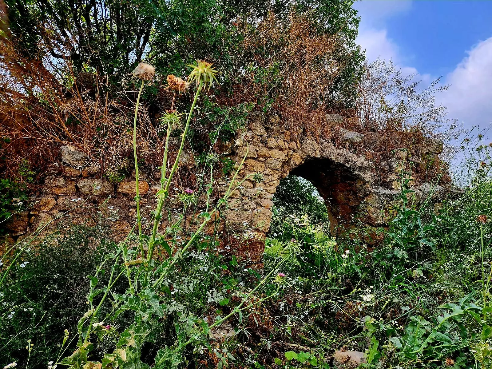
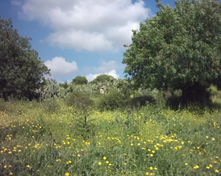
- صورة من الناحبة الغربية لقرية هوشة -في فصل الربيع - تصوير الفنان سلام ذياب 2007
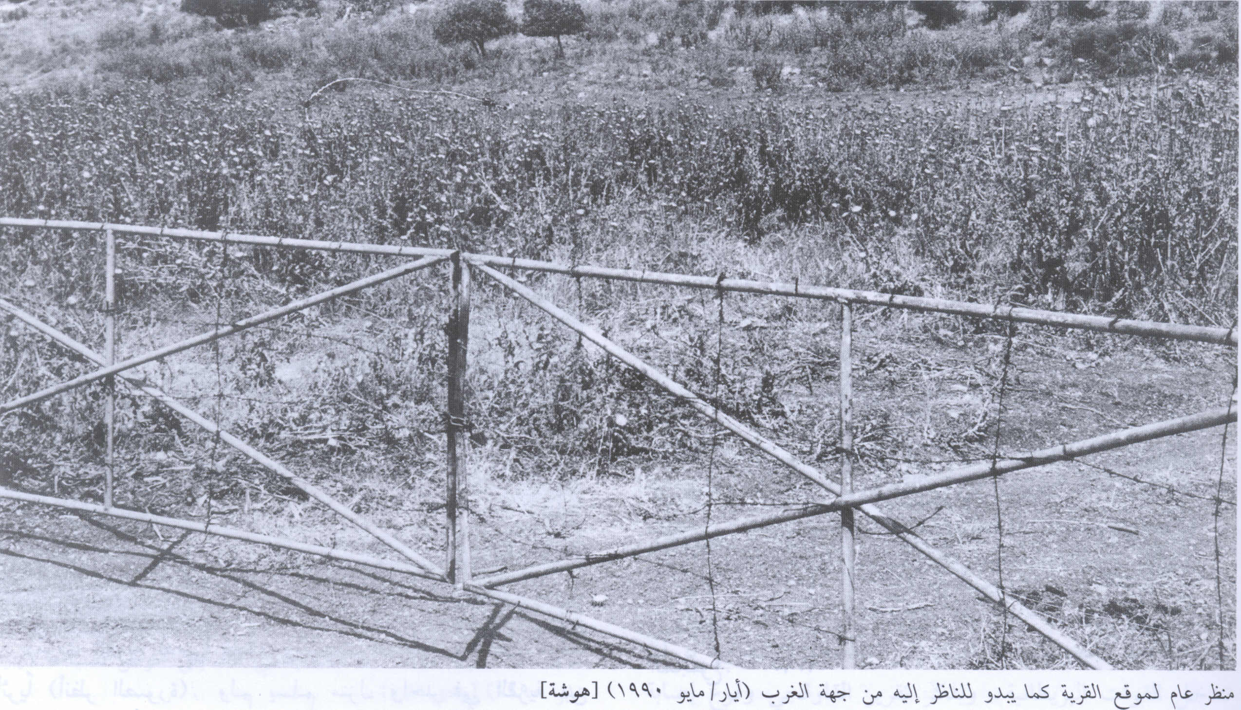
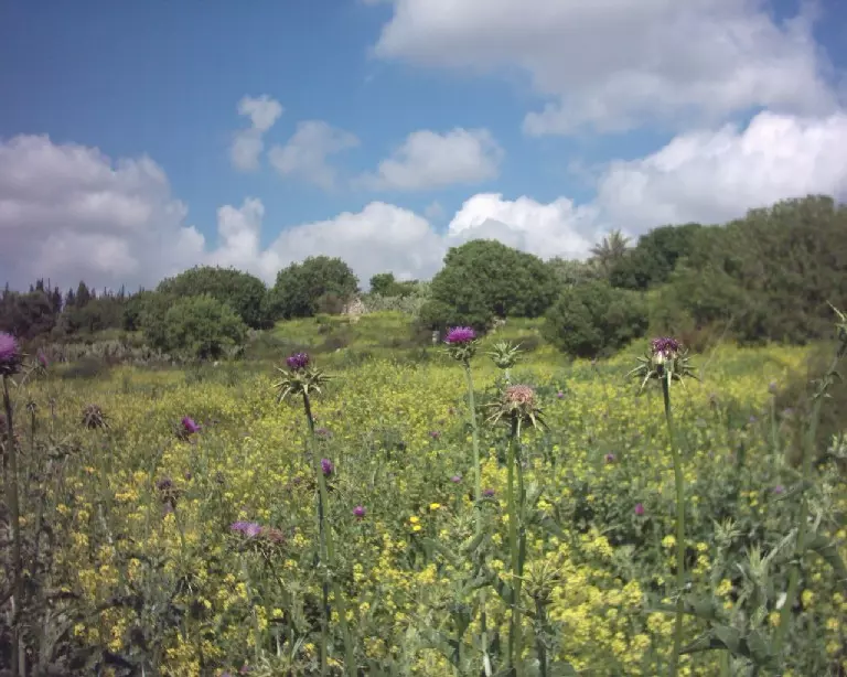
Posted by salam diab - Village Site In 1990
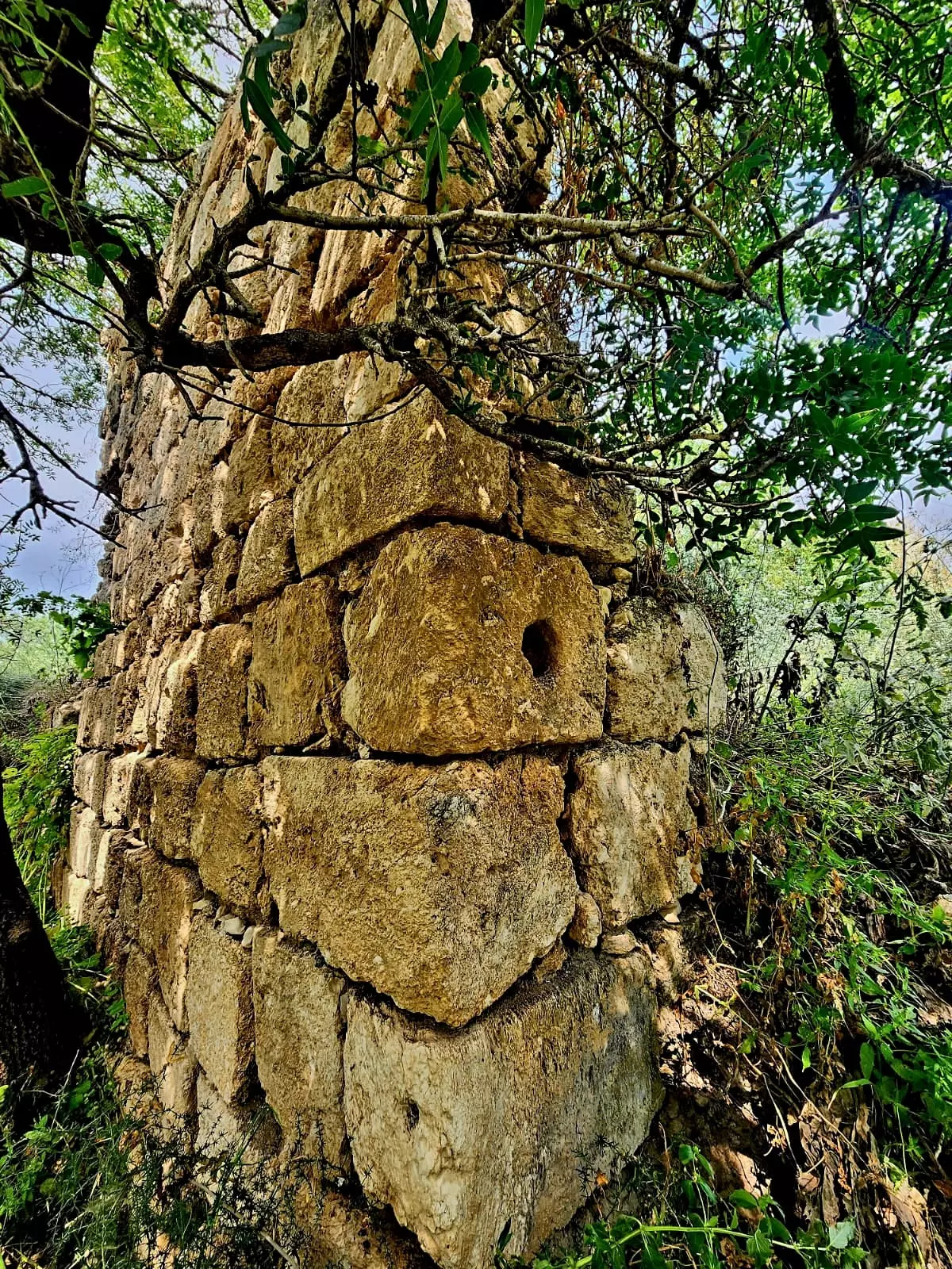
Scanned from "All That Remains" by Dr. Walid Khalidi 1 - بيوت قرية هوشة تنتظر اهلها- الناحية الغربية - فصل الربيع - تصوير الفنان سلام ذياب 2007
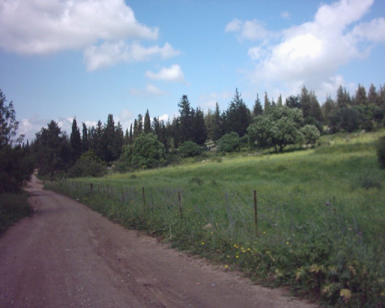
Posted by salam diab 1 - الطريق الى هوشة التي تبدأغربي شفاعمرو - ربيع 2003
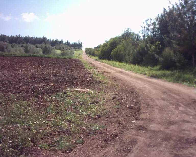
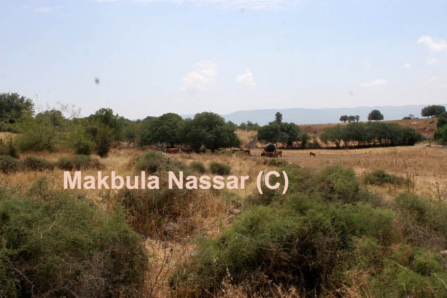
Posted by Makbula Nassar - الطريق المار بجانب اراضي الهوشة والموازي للشارع الرئيسي المتوجه الى حيفا - ربيع 2003
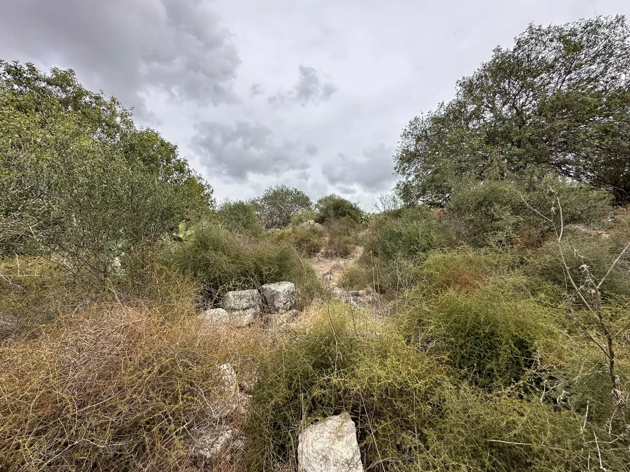
Posted by Makbula Nassar - اثار القرية التي يمكن رؤيتها من الشارع الرئيسي الواصل الى حيفا غربي القرية- ربيع 2003
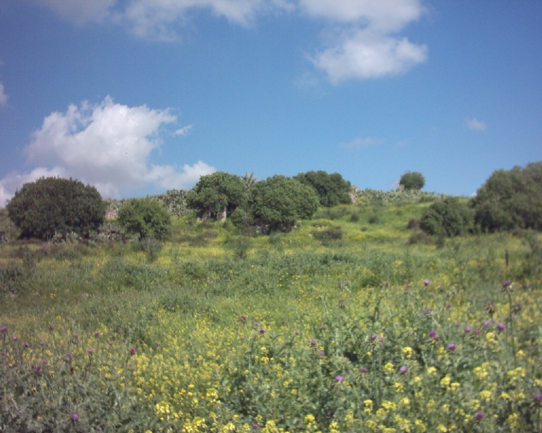
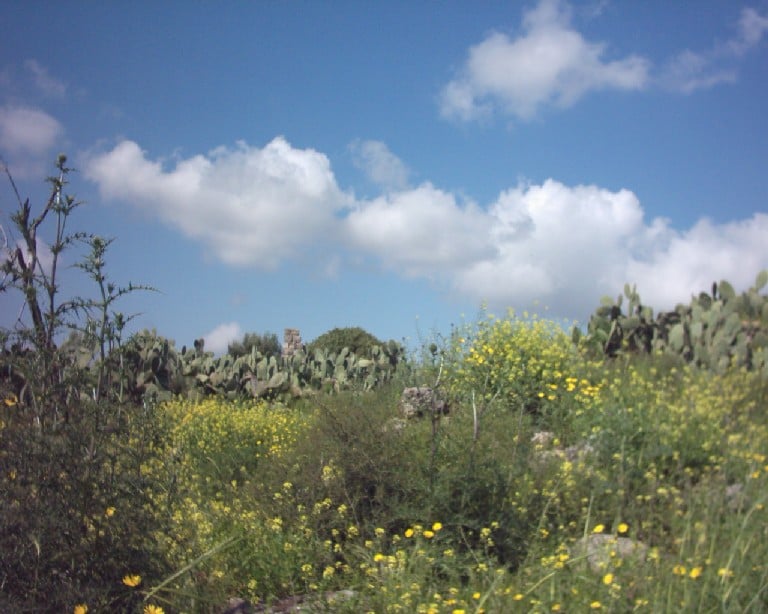
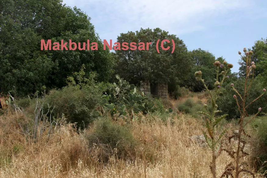
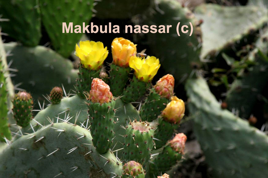
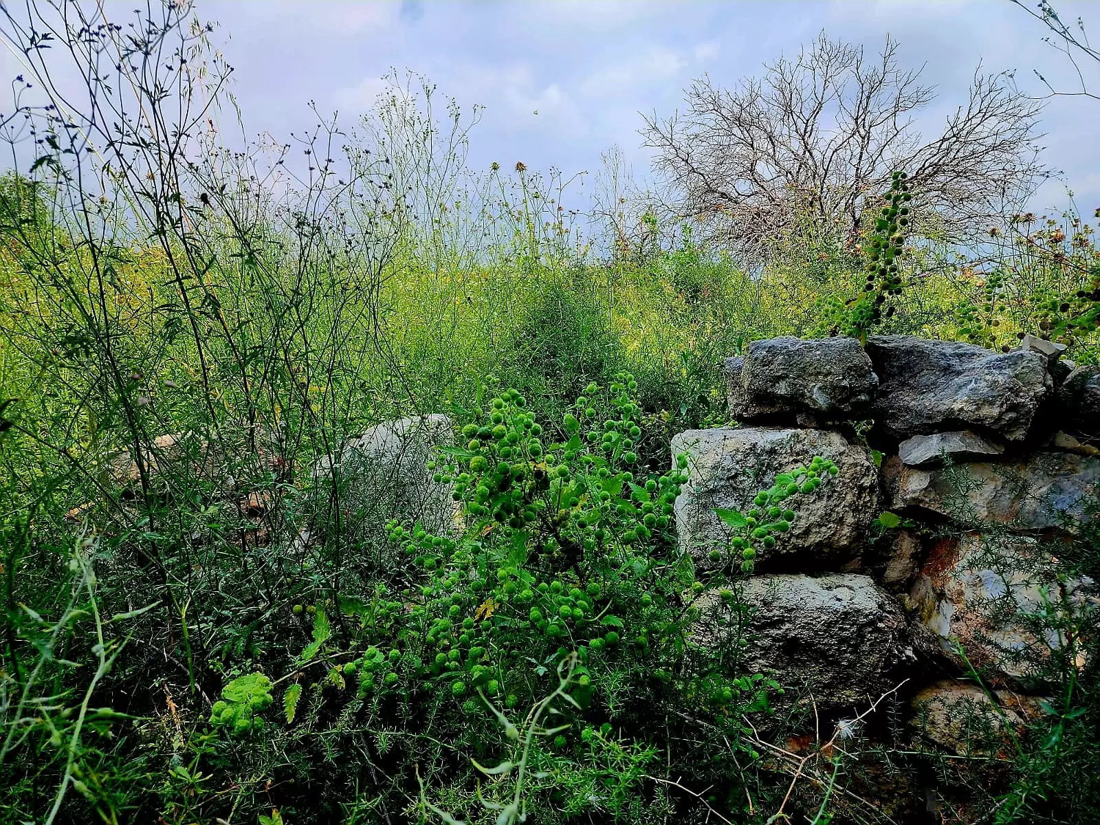
Posted by Makbula Nassar - الصبار في الهوشة تظهر من بينه اثار للقرية - ربيع 2003
Posted by Makbula Nassar - الصبار تظهر أثار للبيوت بينه - ربيع 2003
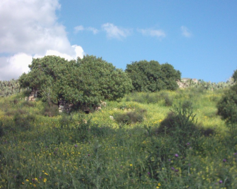
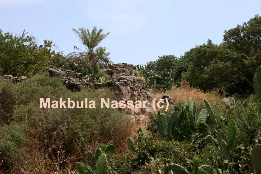
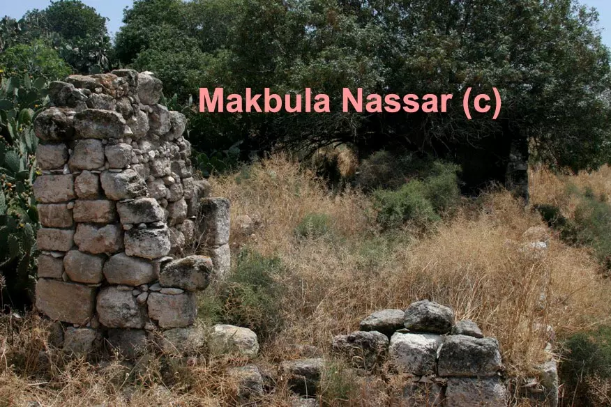
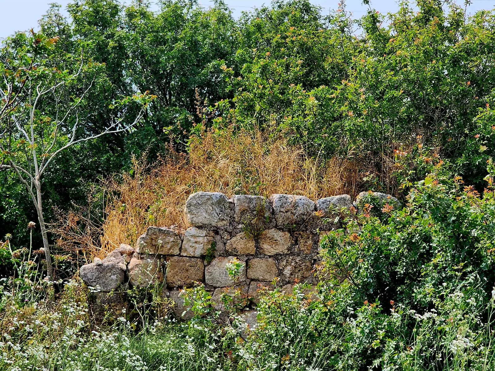
Posted by Makbula Nassar 1 - اثار للقرية من الجهة الغربية - ربيع 2003
Posted by Makbula Nassar - اثار للقرية من الجهة الغربية - ربيع 2003
Posted by Makbula Nassar - مقبرة القرية - ربيع 2003
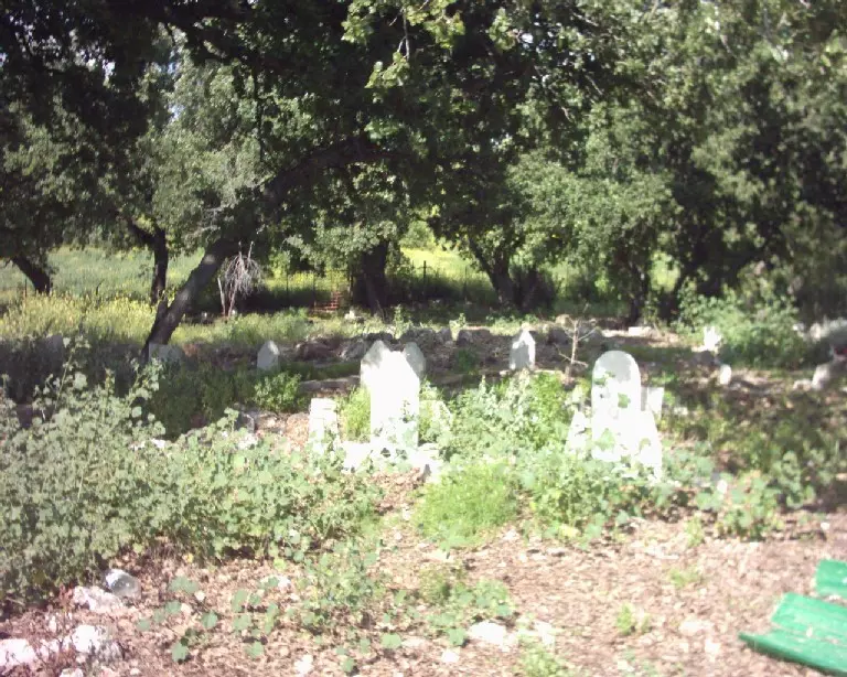
Posted by Makbula Nassar 1 - منظر للقرية من داخل المقبرة في الجهة الجنوبية- ربيع 2003
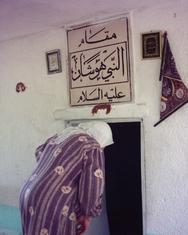
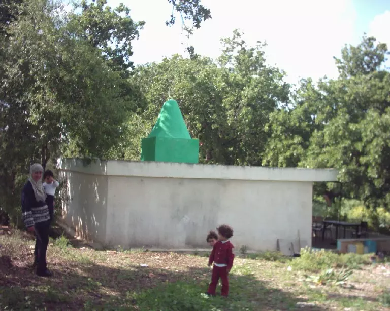
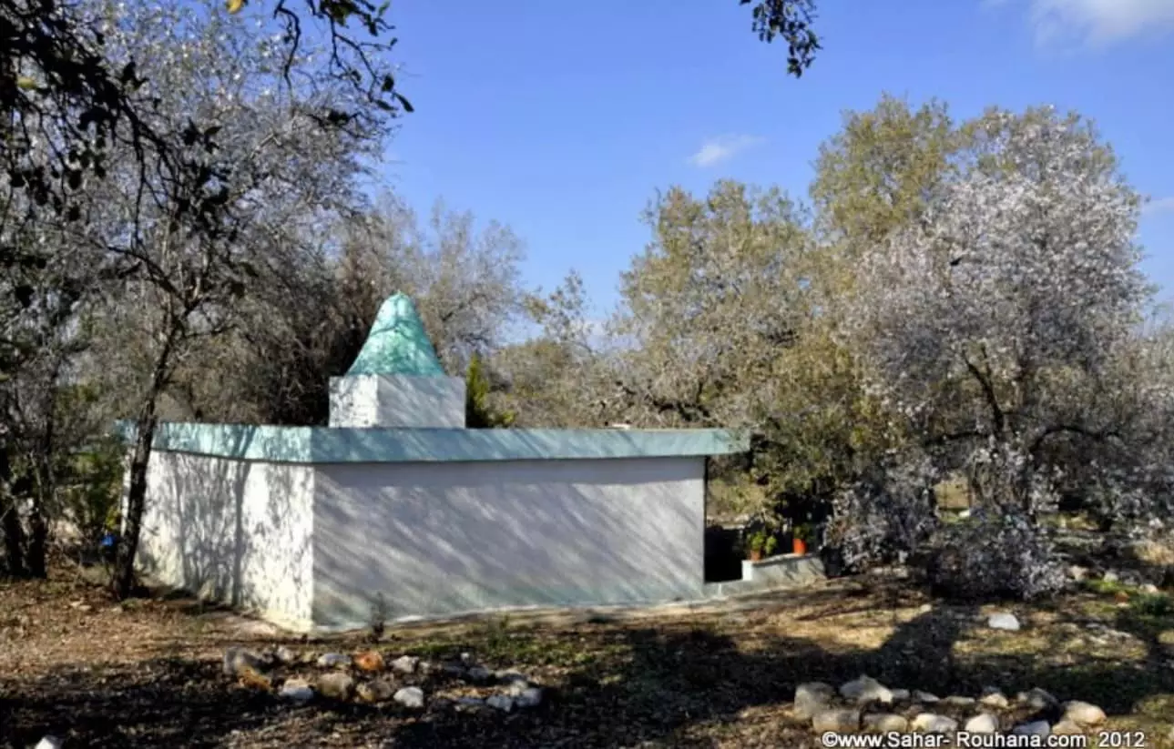
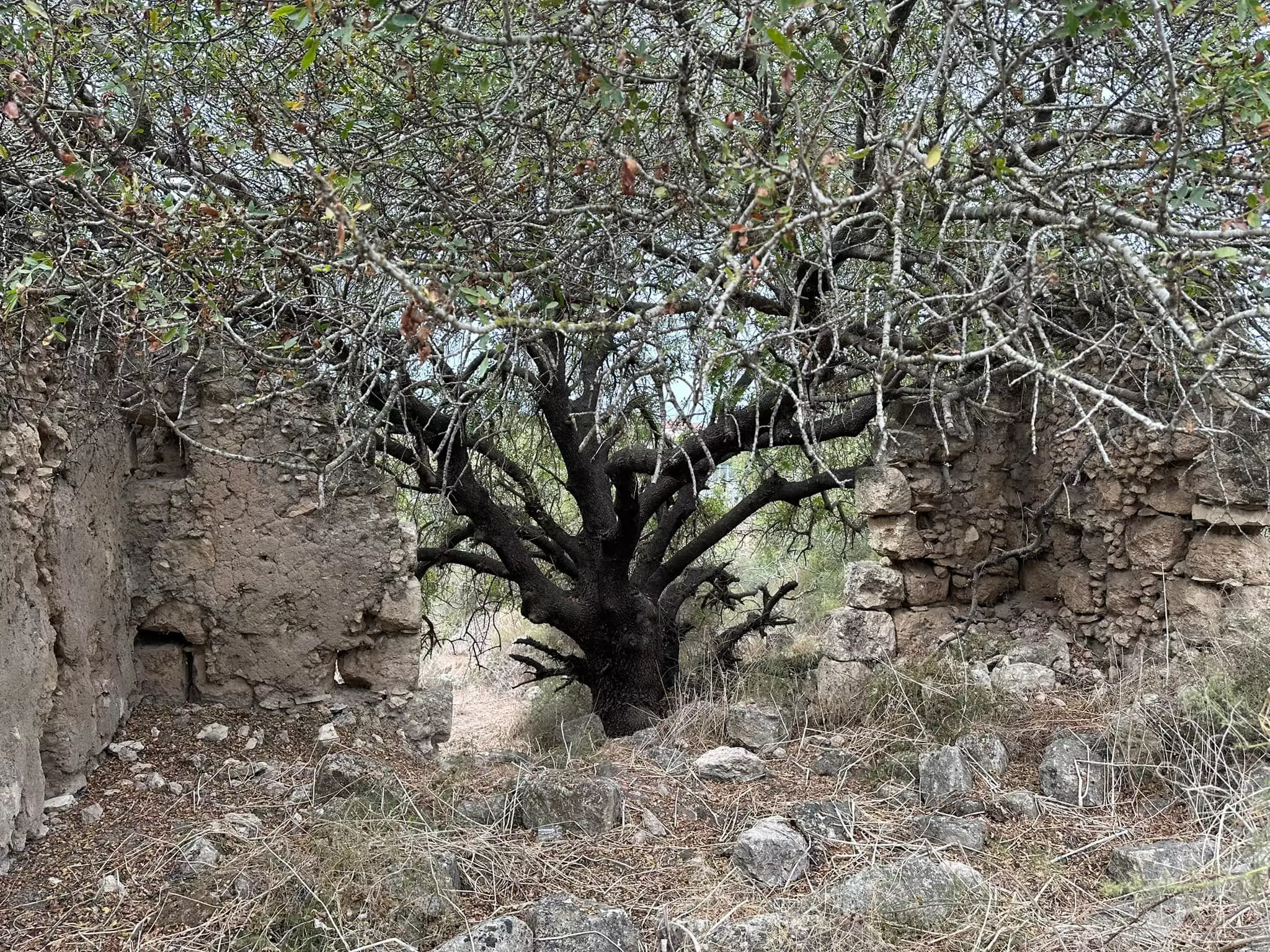
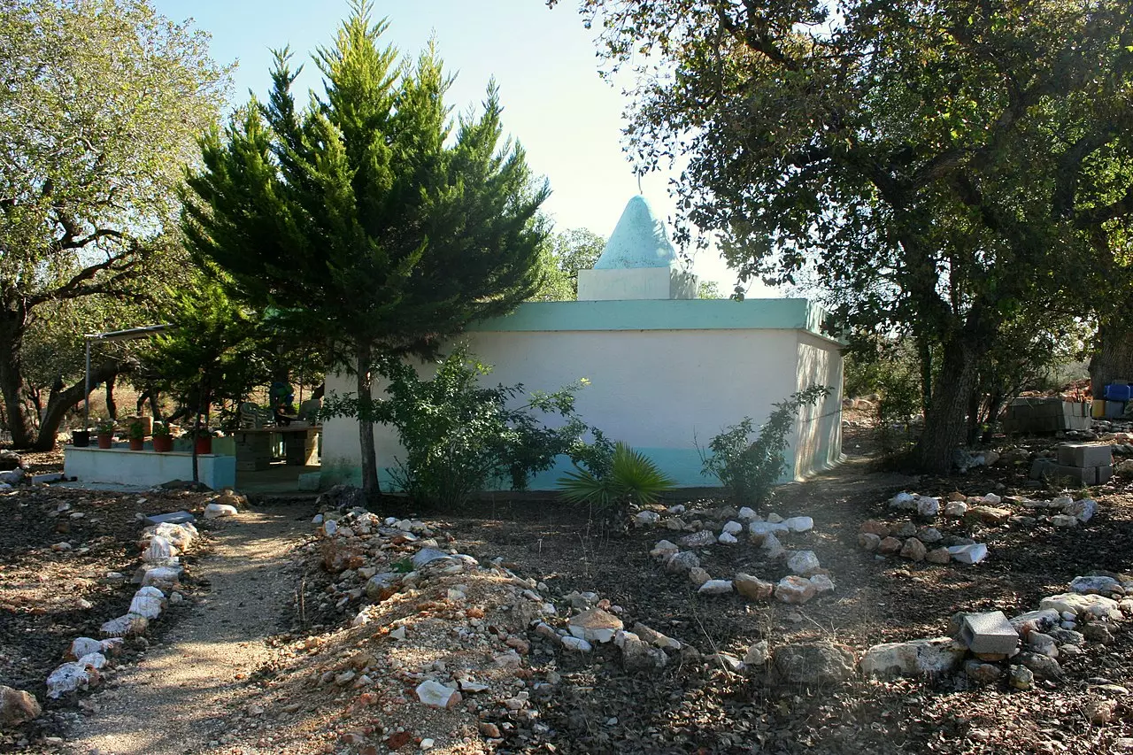
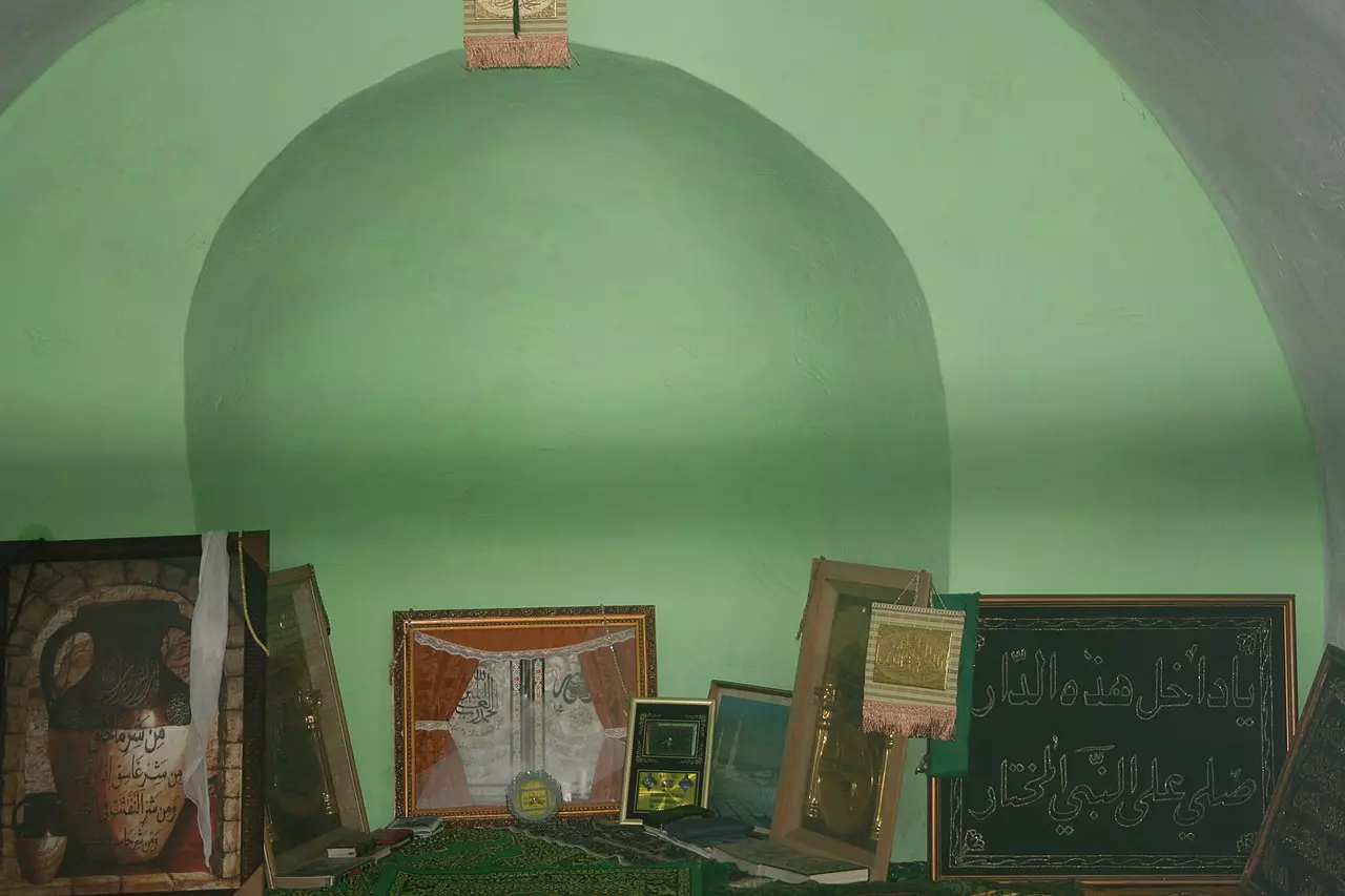
Posted by Makbula Nassar - مقام النبي هوشان الموجود في مقبرة القرية - ربيع 2003
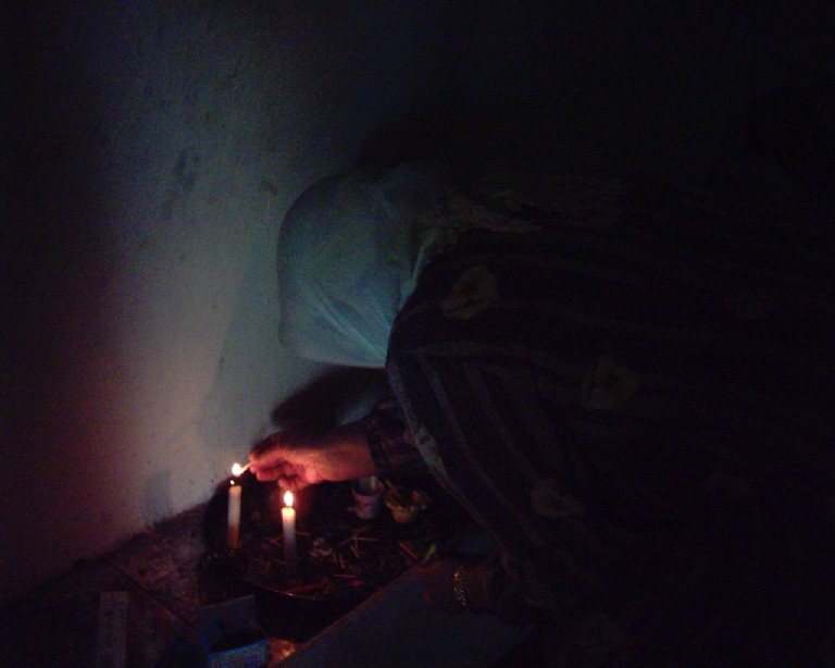
Posted by Makbula Nassar 2 - سيدة من عائلة ناطور تشعل الشموع في المقام - ربيع 2003
Posted by Makbula Nassar 1 - مقام النبي هوشان الموجود في مقبرة القرية - ربيع 2003
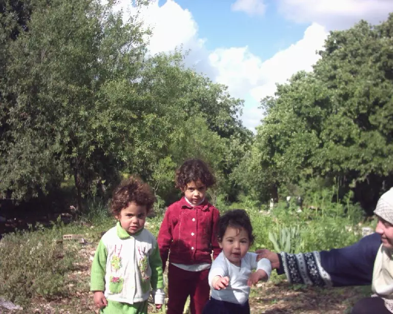
Posted by Makbula Nassar 1 - اطفال من عائلة ناطور التي تسكن في شفاعمرو خلال زيارة العائلة الى المقام في قريتهم - ربيع 2003
Posted by Makbula Nassar - Few remaining house in Hawsha and over-grown cactus trees
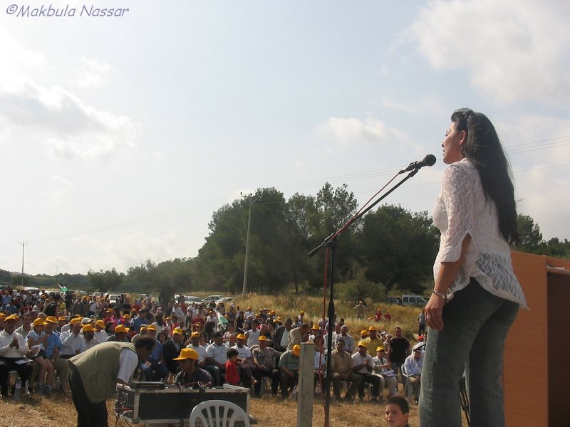
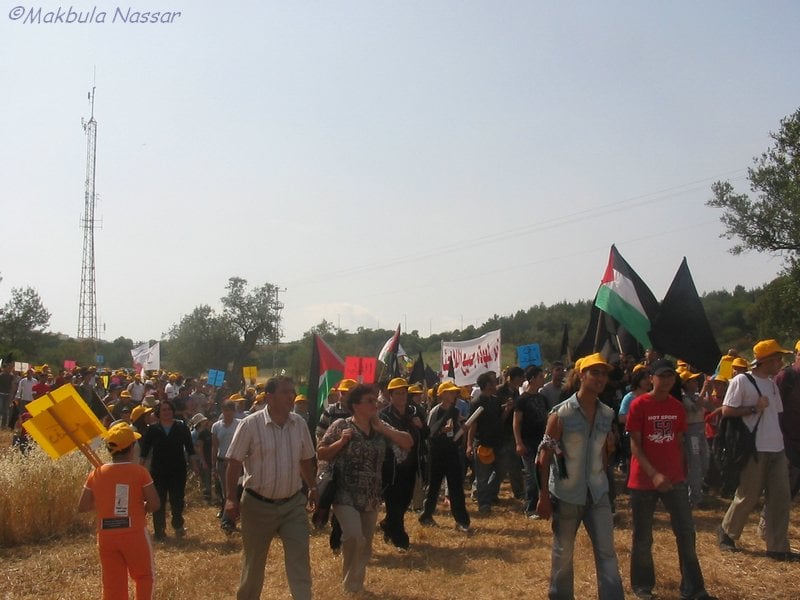
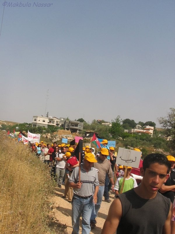
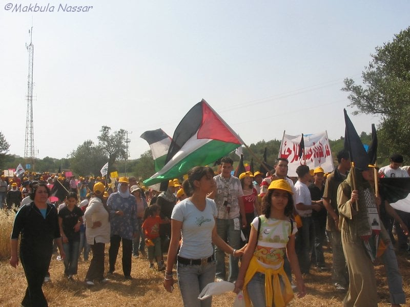
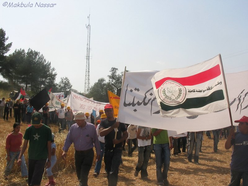
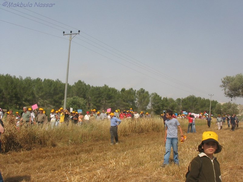
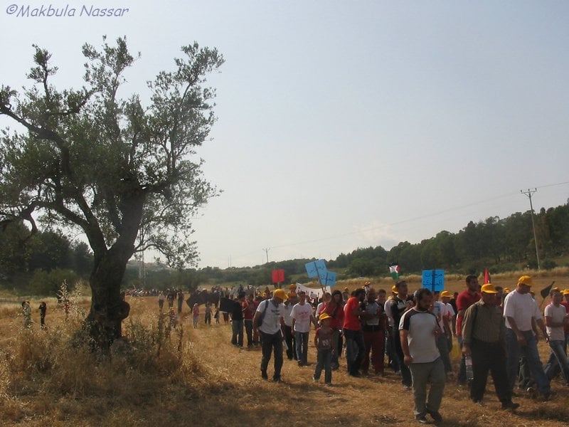
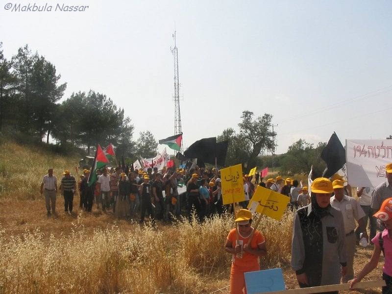
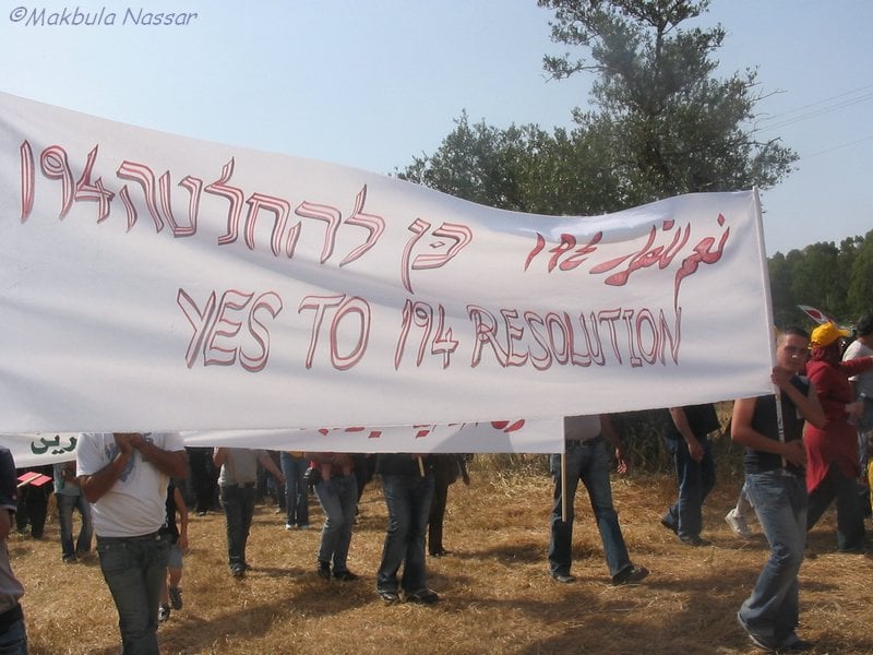
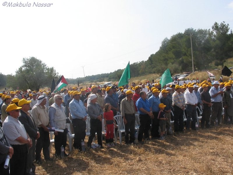
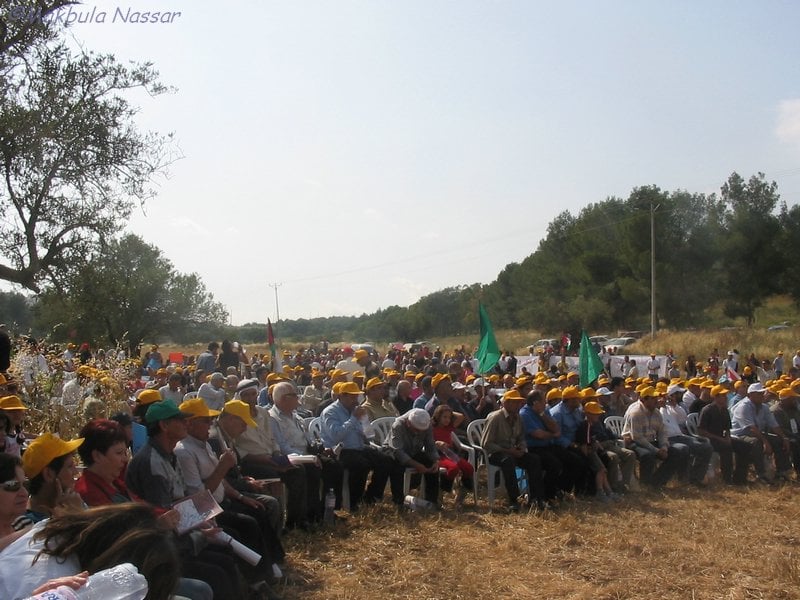
- مسيرة العودة - قرية الهوشة المهجرة , 12/5/2005
Posted by Makbula Nassar - مسيرة العودة - قرية الهوشة المهجرة , 12/5/2005
Posted by Makbula Nassar - مسيرة العودة - قرية الهوشة المهجرة , 12/5/2005
Posted by Makbula Nassar - مسيرة العودة - قرية الهوشة المهجرة , 12/5/2005
Posted by Makbula Nassar - مسيرة العودة - قرية الهوشة المهجرة , 12/5/2005
Posted by Makbula Nassar - مسيرة العودة - قرية الهوشة المهجرة , 12/5/2005
Posted by Makbula Nassar - مسيرة العودة - قرية الهوشة المهجرة , 12/5/2005
Posted by Makbula Nassar - مسيرة العودة - قرية الهوشة المهجرة , 12/5/2005
Posted by Makbula Nassar - مسيرة العودة - قرية الهوشة المهجرة , 12/5/2005
Posted by Makbula Nassar - مسيرة العودة - قرية الهوشة المهجرة , 12/5/2005
Posted by Makbula Nassar - مسيرة العودة - قرية الهوشة المهجرة , 12/5/2005
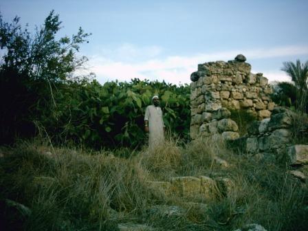
Posted by Makbula Nassar - هوشه والكساير - الشيخ كريم عثامنه بجانب احد بقايا الابنيه
Posted by ابو علي 1 - أنقاض البيوت المدمرة
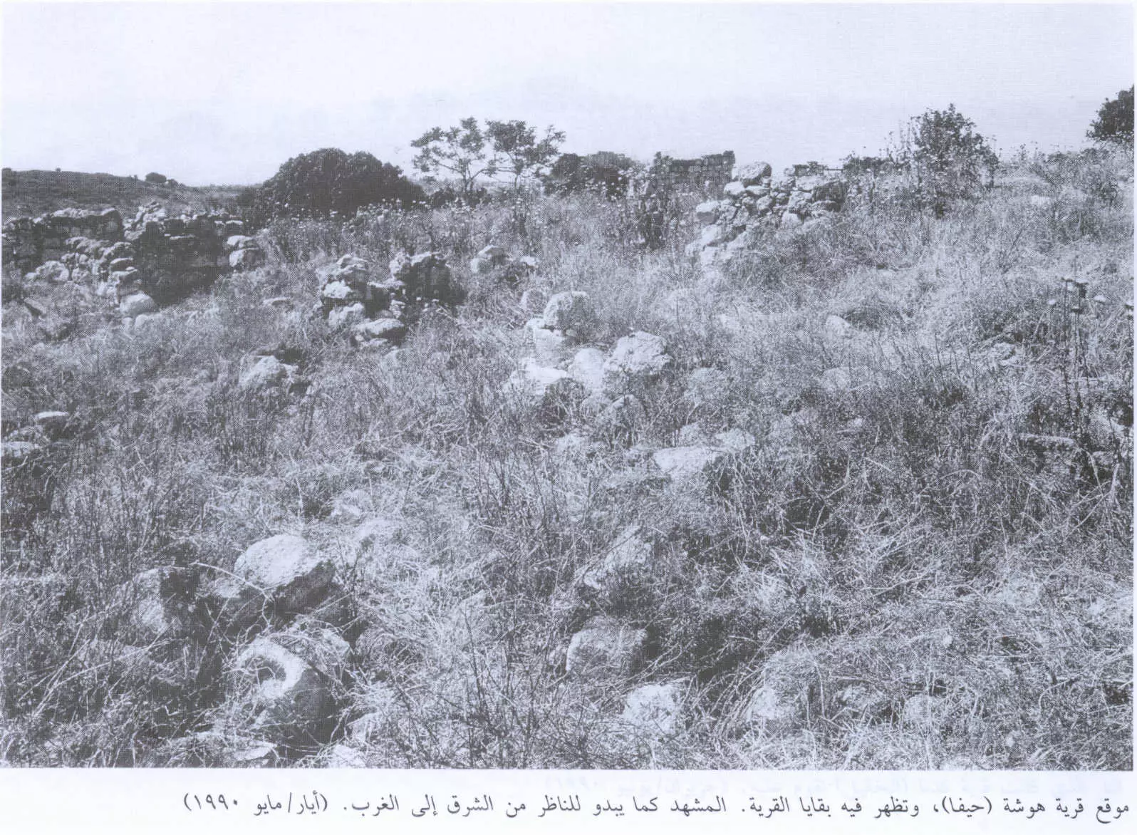
Posted by ابو علي 1 - أنقاض القرية المدمرة كما تبدو للمشاهد من الشرق الى الغرب، اُنقر الصورة لتكبيرها. 1990
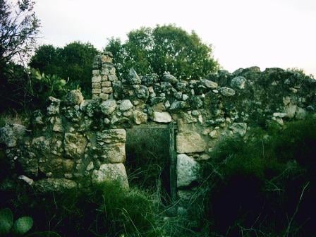
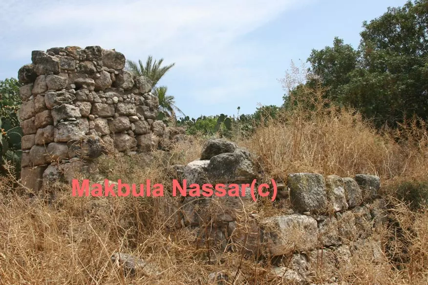
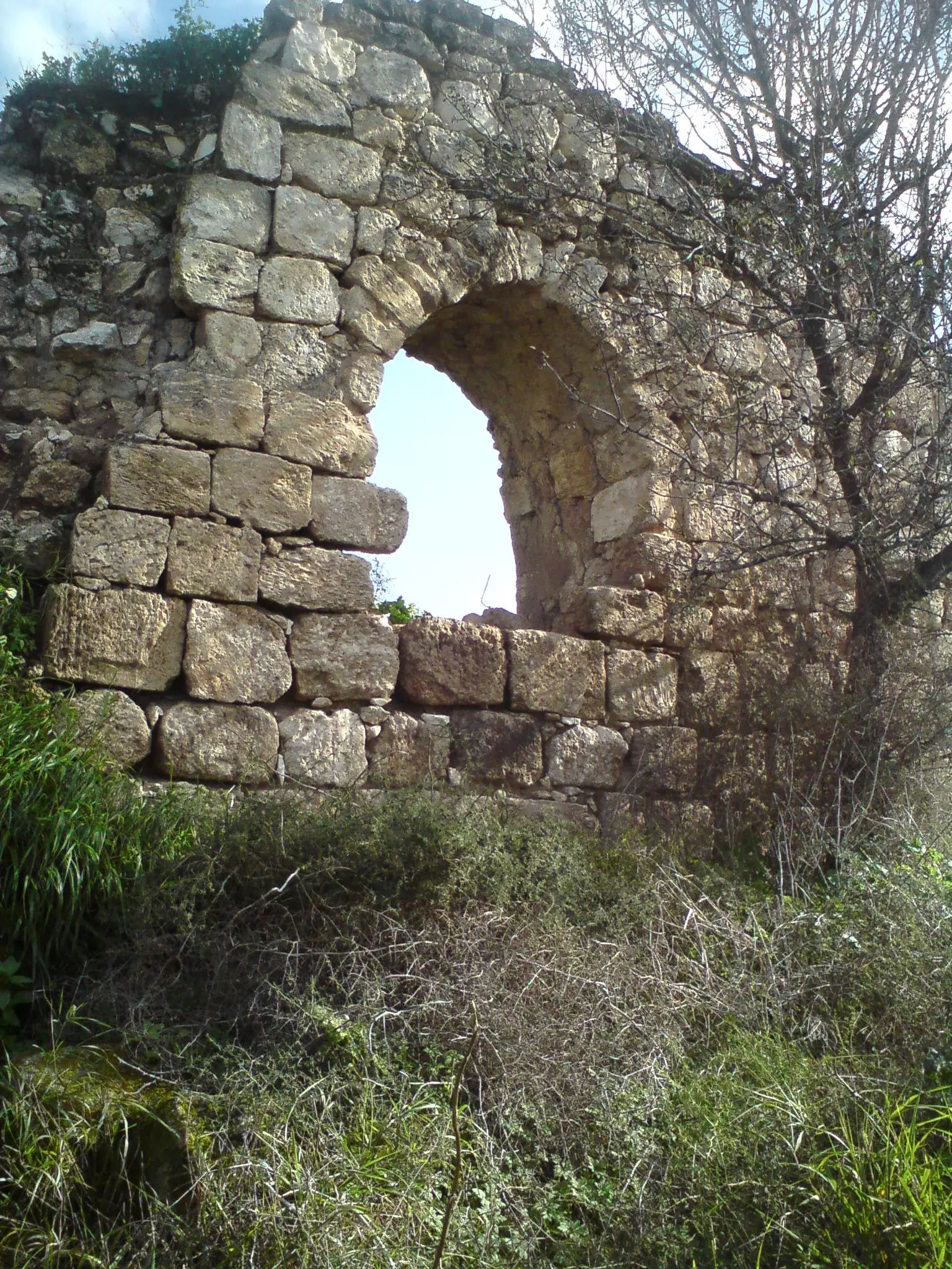
Scanned from "All That Remains" by Dr. Walid Khalidi - اثار البيوت الباقية في الهوشة- تصوير مقبولة نصار -11.5.08
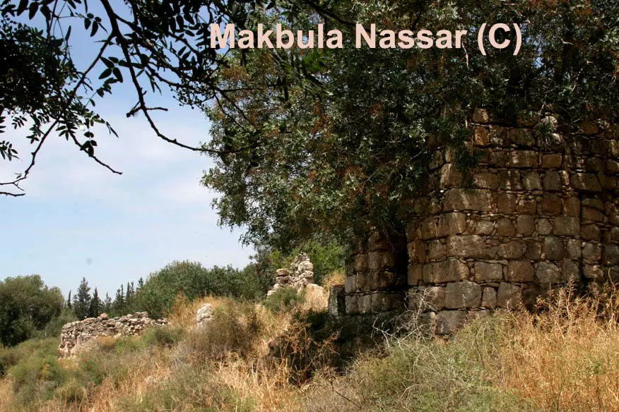
Posted by Makbula Nassar - اثار البيوت الباقية في الهوشة- تصوير مقبولة نصار -11.5.08

Posted by Makbula Nassar - اثار البيوت الباقية في الهوشة- تصوير مقبولة نصار -11.5.08
Posted by Makbula Nassar - اثار البيوت الباقية في الهوشة- تصوير مقبولة نصار -11.5.08
Posted by Makbula Nassar - اثار البيوت الباقية في الهوشة- تصوير مقبولة نصار -11.5.08
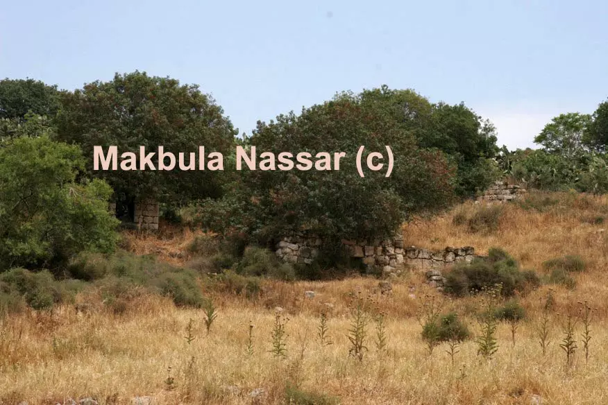
Posted by Makbula Nassar - الاثار الباقية في الهوشة- تصوير مقبولة نصار -11.5.08
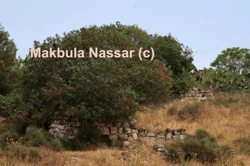
Posted by Makbula Nassar - الاثار الباقية في الهوشة- تصوير مقبولة نصار -11.5.08
Posted by Makbula Nassar - الاثار الباقية في الهوشة- تصوير مقبولة نصار -11.5.08
Posted by Makbula Nassar - الاثار الباقية في الهوشة- تصوير مقبولة نصار -11.5.08
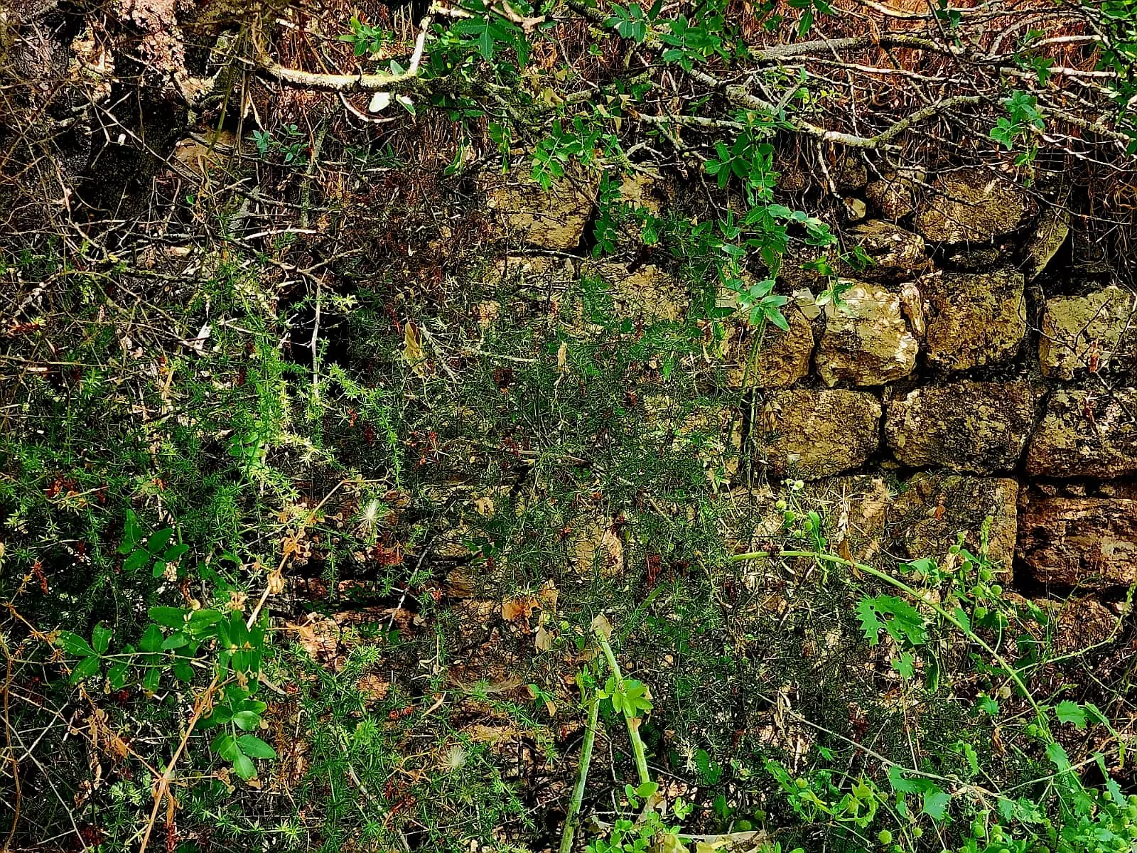
Posted by Makbula Nassar - الصبار في الهوشة - تصوير مقبولة نصار 11.5.08
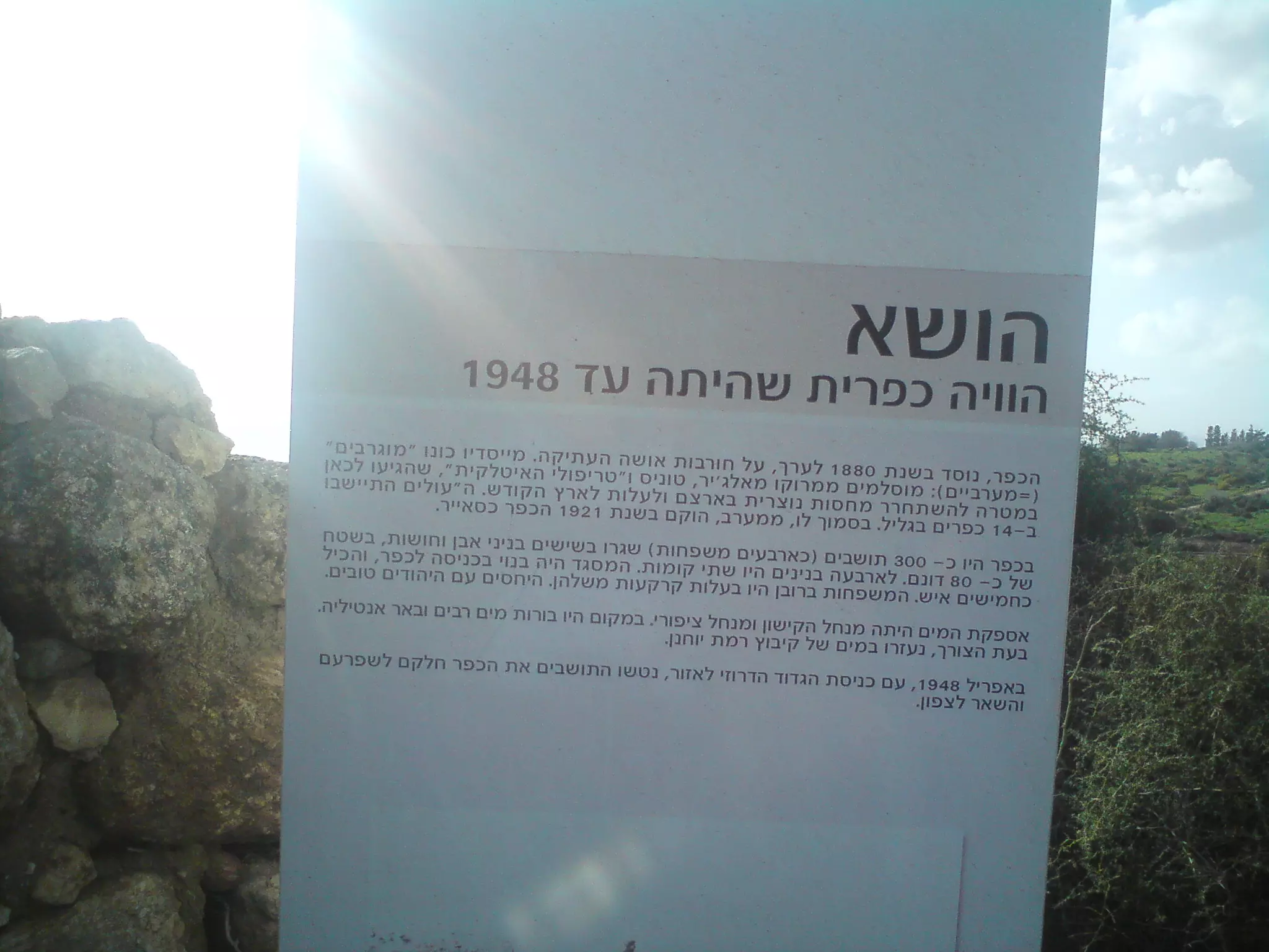
Posted by Makbula Nassar - تاريخ هوشة كما يقرأه الزائر على لوحة وضعها المغتصبون، وفيها تزييف واضح للرواية التاريخية للتهجير
Posted by وليد ياسين - عقد حجري لاحد بيوت هوشة ما زال شامخا حتى اليوم
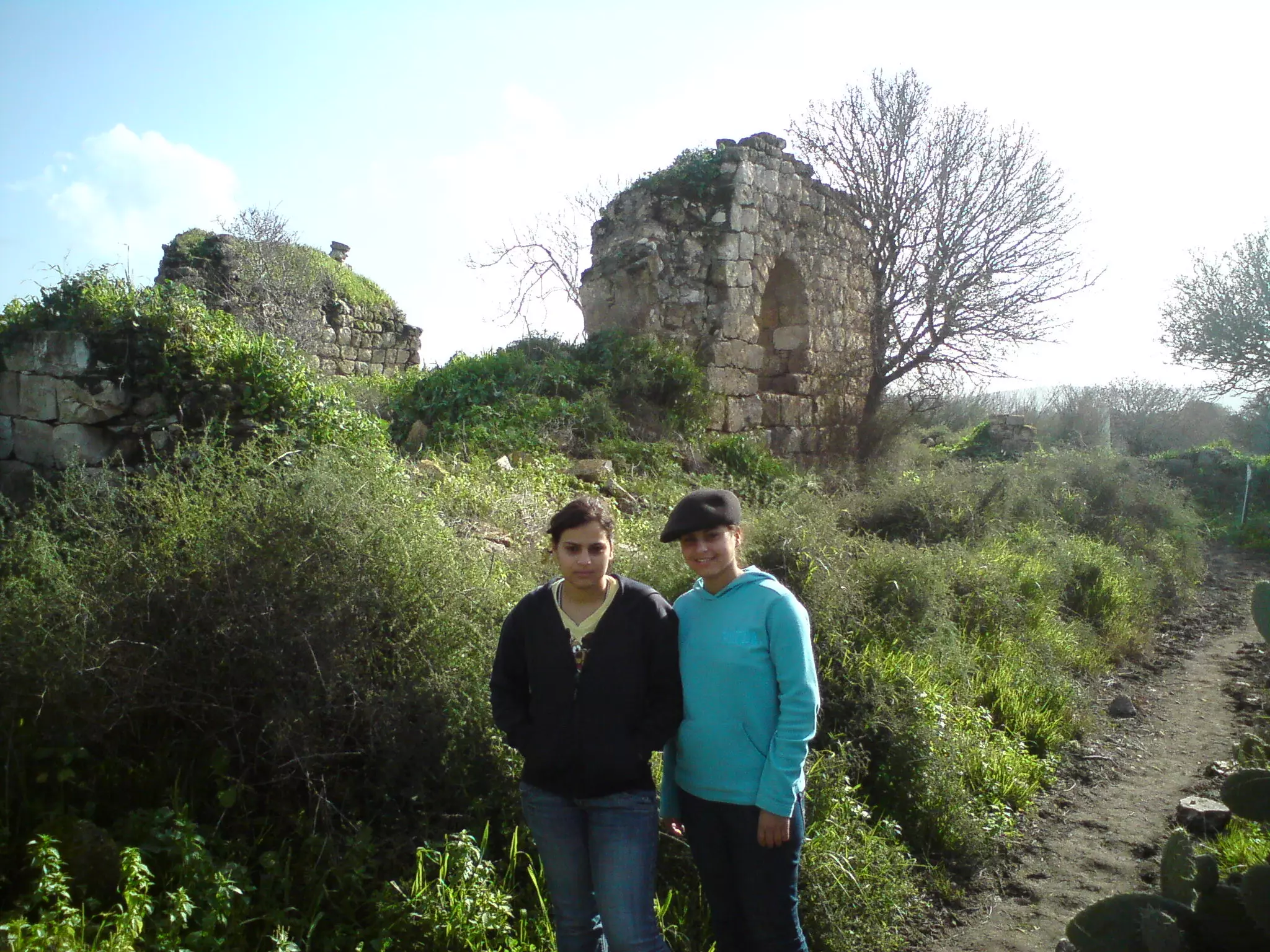
Posted by وليد ياسين - ابنتاي ديما واسيل امام بقايا البيوت المدمرة في هوشة
Posted by وليد ياسين 1 - بعض اثار البيوت في هوشة المدمرة
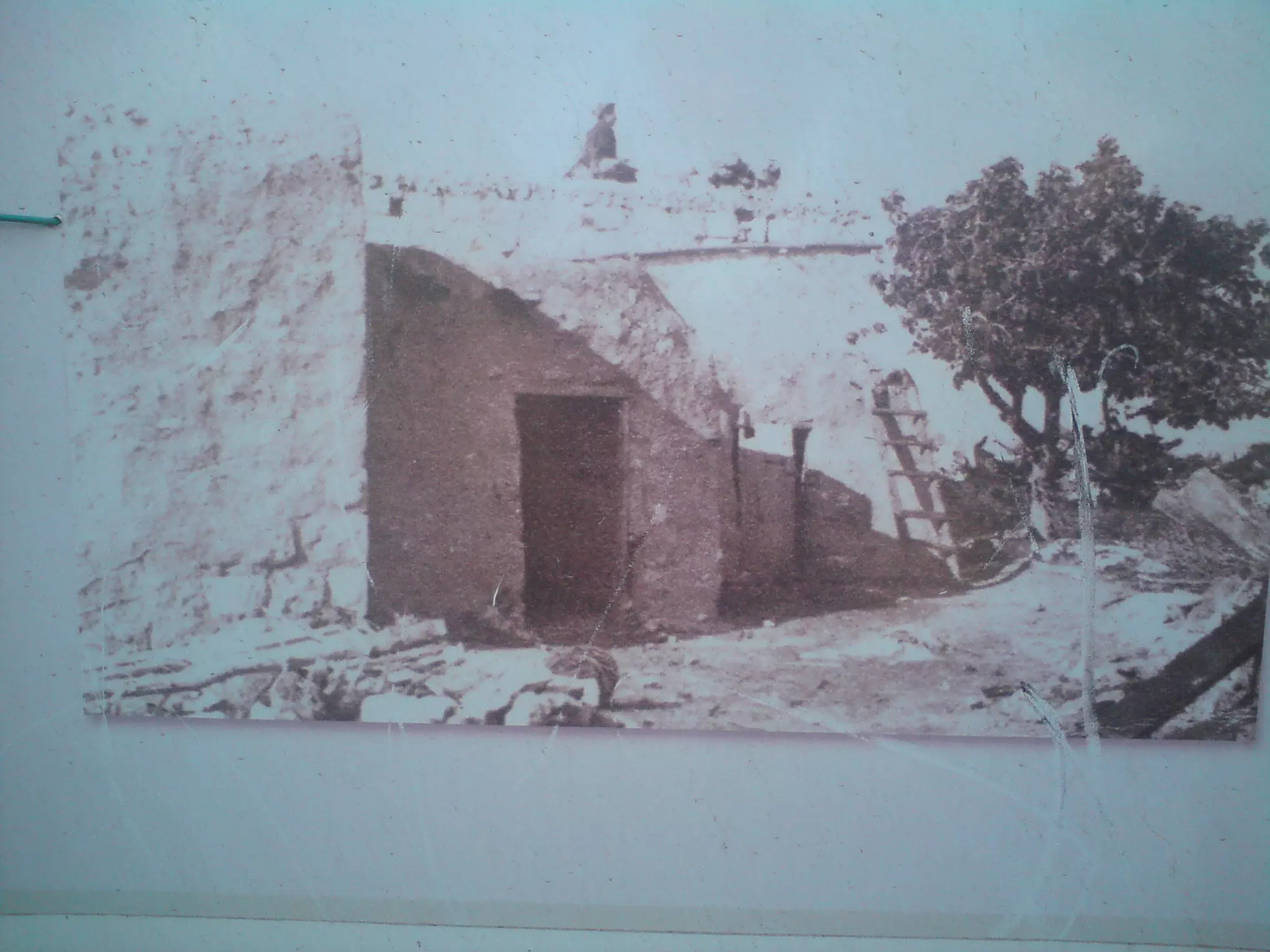
Posted by وليد ياسين - صورة من الأرشيف الصهيوني لهوشة قبل تدميرها من قبل العصابات الصهيونية
Posted by وليد ياسين - بقايا جدار احد بيوت هوشة
Posted by وليد ياسين - مشهد عام لبقايا البيوت المدمرة في هوشة
Posted by وليد ياسين - جدار وجانب من باحة احد المنازل المدمرة في هوشة
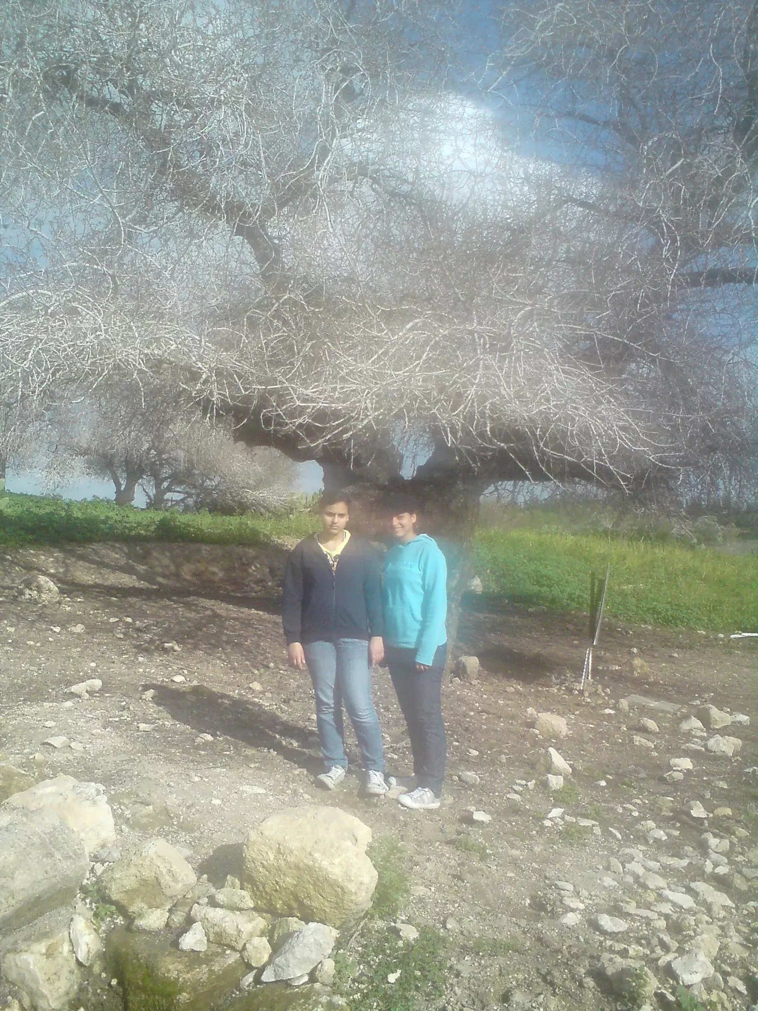
Posted by وليد ياسين - ابنتاي اسيل وديما امام شجرة معمرة في هوشة
Posted by وليد ياسين - آثار احد ابار المياه في هوشة
Posted by وليد ياسين - بقايا احد بيوت هوشة المدمرة
Posted by وليد ياسين - اثار بيوت هوشه
Posted by abu raya - هوشه
Posted by abu raya - من موقع القريه
Posted by abu raya - بيوت القريه
Posted by abu raya - اثار بيوت هوشه
Posted by abu raya - هوشه
Posted by abu raya - مقام منسوب لهوشان
- انقاض القرية المدمرة
- انقاض القرية المدمرة #2
- انقاض القرية المدمرة #3
- That is how the "civilized" erased and replaced us: Hawsha was completely obliterated, as you see -- هوشة باتت أثر بعد عين. من هنا مر الهمجّ
- That is how the "civilized" erased and replaced us: Hawsha was completely obliterated, as you see -- هوشة باتت أثر بعد عين. من هنا مر الهمجّ #2
- That is how the "civilized" erased and replaced us: Hawsha was completely obliterated, as you see -- هوشة باتت أثر بعد عين. من هنا مر الهمجّ #3
- That is how the "civilized" erased and replaced us: Hawsha was completely obliterated, as you see -- هوشة باتت أثر بعد عين. من هنا مر الهمجّ #4
- That is how the "civilized" erased and replaced us: Hawsha was completely obliterated, as you see -- هوشة باتت أثر بعد عين. من هنا مر الهمجّ #5
- That is how the "civilized" erased and replaced us: Hawsha was completely obliterated, as you see -- هوشة باتت أثر بعد عين. من هنا مر الهمجّ #6
- That is how the "civilized" erased and replaced us: Hawsha was completely obliterated, as you see -- هوشة باتت أثر بعد عين. من هنا مر الهمجّ #7
- That is how the "civilized" erased and replaced us: Hawsha was completely obliterated, as you see -- هوشة باتت أثر بعد عين. من هنا مر الهمجّ #8
- That is how the "civilized" erased and replaced us: Hawsha was completely obliterated, as you see -- هوشة باتت أثر بعد عين. من هنا مر الهمجّ #9
- That is how the "civilized" erased and replaced us: Hawsha was completely obliterated, as you see -- هوشة باتت أثر بعد عين. من هنا مر الهمجّ #10
- That is how the "civilized" erased and replaced us: Hawsha was completely obliterated, as you see -- هوشة باتت أثر بعد عين. من هنا مر الهمجّ #11
- That is how the "civilized" erased and replaced us: Hawsha was completely obliterated, as you see -- هوشة باتت أثر بعد عين. من هنا مر الهمجّ #12
- That is how the "civilized" erased and replaced us: Hawsha was completely obliterated, as you see -- هوشة باتت أثر بعد عين. من هنا مر الهمجّ #13
- That is how the "civilized" erased and replaced us: Hawsha was completely obliterated, as you see -- هوشة باتت أثر بعد عين. من هنا مر الهمجّ #14
- That is how the "civilized" erased and replaced us: Hawsha was completely obliterated, as you see -- هوشة باتت أثر بعد عين. من هنا مر الهمجّ #15
- That is how the "civilized" erased and replaced us: Hawsha was completely obliterated, as you see -- هوشة باتت أثر بعد عين. من هنا مر الهمجّ #16
- That is how the "civilized" erased and replaced us: Hawsha was completely obliterated, as you see -- هوشة باتت أثر بعد عين. من هنا مر الهمجّ #17
- That is how the "civilized" erased and replaced us: Hawsha was completely obliterated, as you see -- هوشة باتت أثر بعد عين. من هنا مر الهمجّ #18
- That is how the "civilized" erased and replaced us: Hawsha was completely obliterated, as you see -- هوشة باتت أثر بعد عين. من هنا مر الهمجّ #19
- That is how the "civilized" erased and replaced us: Hawsha was completely obliterated, as you see -- هوشة باتت أثر بعد عين. من هنا مر الهمجّ #20
- That is how the "civilized" erased and replaced us: Hawsha was completely obliterated, as you see -- هوشة باتت أثر بعد عين. من هنا مر الهمجّ #21
- That is how the "civilized" erased and replaced us: Hawsha was completely obliterated, as you see -- هوشة باتت أثر بعد عين. من هنا مر الهمجّ #22
- That is how the "civilized" erased and replaced us: Hawsha was completely obliterated, as you see -- هوشة باتت أثر بعد عين. من هنا مر الهمجّ #23
- That is how the "civilized" erased and replaced us: Hawsha was completely obliterated, as you see -- هوشة باتت أثر بعد عين. من هنا مر الهمجّ #24
- That is how the "civilized" erased and replaced us: Hawsha was completely obliterated, as you see -- هوشة باتت أثر بعد عين. من هنا مر الهمجّ #25
- That is how the "civilized" erased and replaced us: Hawsha was completely obliterated, as you see -- هوشة باتت أثر بعد عين. من هنا مر الهمجّ #26
- That is how the "civilized" erased and replaced us: Hawsha was completely obliterated, as you see -- هوشة باتت أثر بعد عين. من هنا مر الهمجّ #27
- Nabi Hushan shrine in the cemetery that was used by the villagers of Hawsha and al-Kayasir.
- Nabi Hushan shrine in the cemetery that was used by the villagers of Hawsha and al-Kayasir. #2
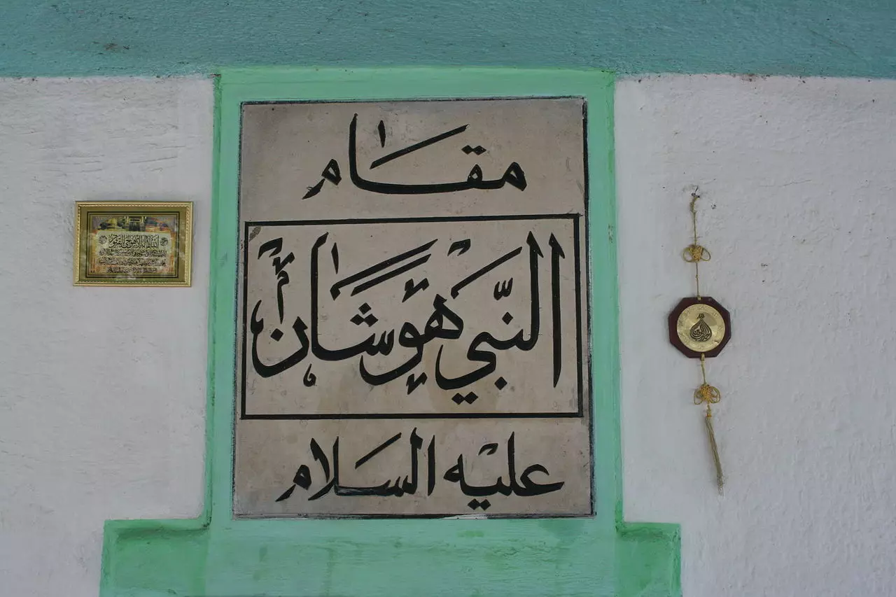
- Nabi Hushan shrine in the cemetery that was used by the villagers of Hawsha and al-Kayasir. #3
- Let us see how the most "liberal and civilized" of world Jewry has obliterated our village. How else will the Jews be great and safe again? -- القرية دمرت بالكامل.. من هنا مر الهمج
- Let us see how the most "liberal and civilized" of world Jewry has obliterated our village. How else will the Jews be great and safe again? -- القرية دمرت بالكامل.. من هنا مر الهمج #2
- Let us see how the most "liberal and civilized" of world Jewry has obliterated our village. How else will the Jews be great and safe again? -- القرية دمرت بالكامل.. من هنا مر الهمج #3
- Let us see how the most "liberal and civilized" of world Jewry has obliterated our village. How else will the Jews be great and safe again? -- القرية دمرت بالكامل.. من هنا مر الهمج #4
- Let us see how the most "liberal and civilized" of world Jewry has obliterated our village. How else will the Jews be great and safe again? -- القرية دمرت بالكامل.. من هنا مر الهمج #5
- Let us see how the most "liberal and civilized" of world Jewry has obliterated our village. How else will the Jews be great and safe again? -- القرية دمرت بالكامل.. من هنا مر الهمج #6
- Let us see how the most "liberal and civilized" of world Jewry has obliterated our village. How else will the Jews be great and safe again? -- القرية دمرت بالكامل.. من هنا مر الهمج #7
- Let us see how the most "liberal and civilized" of world Jewry has obliterated our village. How else will the Jews be great and safe again? -- القرية دمرت بالكامل.. من هنا مر الهمج #8
- Let us see how the most "liberal and civilized" of world Jewry has obliterated our village. How else will the Jews be great and safe again? -- القرية دمرت بالكامل.. من هنا مر الهمج #9
- Let us see how the most "liberal and civilized" of world Jewry has obliterated our village. How else will the Jews be great and safe again? -- القرية دمرت بالكامل.. من هنا مر الهمج #10
- Let us see how the most "liberal and civilized" of world Jewry has obliterated our village. How else will the Jews be great and safe again? -- القرية دمرت بالكامل.. من هنا مر الهمج #11
- Let us see how the most "liberal and civilized" of world Jewry has obliterated our village. How else will the Jews be great and safe again? -- القرية دمرت بالكامل.. من هنا مر الهمج #12
- Let us see how the most "liberal and civilized" of world Jewry has obliterated our village. How else will the Jews be great and safe again? -- القرية دمرت بالكامل.. من هنا مر الهمج #13
- Let us see how the most "liberal and civilized" of world Jewry has obliterated our village. How else will the Jews be great and safe again? -- القرية دمرت بالكامل.. من هنا مر الهمج #14
- Let us see how the most "liberal and civilized" of world Jewry has obliterated our village. How else will the Jews be great and safe again? -- القرية دمرت بالكامل.. من هنا مر الهمج #15
- Let us see how the most "liberal and civilized" of world Jewry has obliterated our village. How else will the Jews be great and safe again? -- القرية دمرت بالكامل.. من هنا مر الهمج #16
Want to browse more? 80,000 pictures were grouped in these gallaries:
| Display Name | Clan/Hamolah | Country of Residence |
| الأخضر | الأخضر | دمشق |
- في موقع قرية هوشة المهجرة ( قضاء حيفا ) . Duration: min 14 sec
- الذاكرة مفتاح العودة -الحلقة 72- قرية هوشة Duration: 23 min 22 sec
- الذاكرة مفتاح العودة - الحلقة 70- قرية الحواسية Duration: 23 min 22 sec
 Fake Valor: Why Did Zionist Jews Hoist Nazis Flag on Their Ships in the 1930s?
What is new?
-
Facts About Oct. 7th Gaza Raid
-
Remined Us Please:: Who Did Rape Who? Palestinians Raped Israelis? Or, was the other way around?
-
When Prof. Edward Said was invited to debate Bibi Netanyahu in the 1980s, watch what happened!
-
Ezra Klein of the NY Times on the "Jewish Race".
-
Abusing Blood Libel!
-
Zionist FAQ: Isn't it true that Palestinians don't want peace? Palestinians never accepted the two-state solution
- Facts about Haavara (Transfer) Agreement between Ben-Gurion & Hitler
-
Haavara FAQs: Why Did Zionist Jews Hoist Nazis' Flags on Their Ships in the 1930s?
-
Dear ChatGPT: Why did the Jewish Agency suppress news of the Holocaust during WWII?
-
Video Playlist: Jews share their DNA tests to end the conflict for good.
-
A Tale of Two Conflicts: Examining the Definition of Genocide
-
Prof. Abraham Polak And The Suppressed History of the Khazars and European Jewry
-
How Ronald Reagan would have framed the genocide in Gaza if he were still alive?
-
Haavara FAQs: Let us do the math: how many German Jews did The Haavara Agreement save?
-
Zionist FAQs: The Hebron Massacre of 1929, "clearly proves" that Palestinians are antisemitic, how could you deny it?
-
Zionist FAQs: Why Anti-Zionist Is Not Antisemitism?
-
Zionist FAQs: Isn't it true that the KGB create Palestinian Nationalism in the early 1960s?
- Zionist FAQs: Muslims are killing Muslims all the time; why are Israeli Jews being singled out in the media?
- Zionist FAQs: How is Israel an apartheid state when 20% of its citizens are Arabs who enjoy full rights?
-
Haavara FAQs: Analysis of Herzl's Uganda Scheme and how it could have saved millions of Jews.
-
Haavara FAQs: Why did Hayim Greenberg describe American Jewry as "morally bankrupt" in early 1943?
-
Haavara FAQs: What if the Evian Conference was a resounding success? What would have been the impact of saving European Jewry on Zionism?
- Haavara FAQs: What if the six million were saved, how that would have impacted the Zionist project?
-
Haavara FAQs: How did Zionist leaders react when Europe's Jews lingered in the DP camps after WWII ended?
-
Why does the American Jewish community repeat lies that David Ben-Gurion had debunked before he died?
-
Who has the power to rename the Tatar/Khazar Gene Marker to Jewish IV?
-
Zionist FAQs: Why won't Egypt, Syria, and Jordan take their people back? Jews are indigenous to Palestine, and Arabs immigrated after Jews developed the country. Arabs should leave.
-
Haavara FAQs: Did Hitler and the Nazis conflate between Judaism and Zionist? If that wasn't case, then why?
-
Haavara FAQs: Winston Churchill and antisemitism, a collection of articles written Churchill.
-
Haavara FAQs: Broken by country, how many Jews survived vs. killed during the Holocaust?
-
Haavara FAQs: Why did European Jews vote with their feet and to immigrated to the Americas, not Palestine, after WWII?
-
Watch this American Jewish Girl describing Israeli Jews' cognitive dissonance like no other in under two minutes
-
Haavara FAQs: When the Nazis went out of their way to hide the Holocaust, Israeli Jews did the exact opposite by broadcasting their genocide of Gazans. But why?
-
Haavara FAQs: How Zionist Jews went out of their to show their appreciation to Nazism and Fascism?
- Haavara FAQs: Why Zionist leaders were against bombing the death camps & the Railroads leading to them?
-
Haavara FAQs: Hitler's message to the British and American people: If Jews are such noble citizens and you care about them, how come you're not letting them in? I will gladly ship them to you at my expense, even on luxury liners!
-
A shortlist of Zionist and Israeli false flag operations in the name Jews.
-
The Most Moral Army
- The Land of Kapos (Israel): Where the brave are boycotted and Kapos walk free.
- Why did early Zionists often named their communal enterprises "colonial"?
- Zionist Relations with Nazi Germany by Faris Glubb
-
Two NY Times advertisements by Zionists in the early 1943 that exposes Zionists' treason at the height of the calamity
- Facts Not Lies about the Palestinian-Israeli Conflict.
- Site's pictures have been categorized
- Campgain Against Lice
- A Survey of Palestine, the official source about Palestine before Nakba produced by the British Mandate; over 1200 pages.
- Satellite View & Google Earth: Over 6,000 placemarks identifying all destroyed towns, W. Bank & Gaza Strip Towns, & refugee camps.
- PalestineRemembered.com and its Nakba Oral History Project were featured on al-Jazeera Satellite TV.
- Nakba Oral History Video Podcast:
 Over 700 Oral History interviews (including 3,500+ hours of recording) can be viewed online.
 - Palestine Village Statistics Project
- Gaza Jail Break
- النسخة العربية للموقع الان متوفرة
- Videos: Documenting the destroyed villages in video: Tracing all that remains since Nakba.
- Videos: Responding to Zionist Propaganda
- Interview: The ethnic cleansing of Palestine: George Galloway interviews Israeli Historian Ilan Pappe.
- For Palestinians, memory matters. It provides a blueprint for their future By George Bisharat.
- Zionist FAQ now available in Hebrew שאלות שציונים שואלים, עכשיו בעברית
- Video: The Stephen Walt and John Mearsheimer report on the influence of the Israel Lobby on U.S. Foreign Policy
- The Palestinian-Israeli conflict for beginners
