| PalestineRemembered | About Us | Oral History | العربية | |
| Pictures | Zionist FAQs | Haavara | Maps | |
| Search |
| Camps |
| Districts |
| Acre |
| Baysan |
| Beersheba |
| Bethlehem |
| Gaza |
| Haifa |
| Hebron |
| Jaffa |
| Jericho |
| Jerusalem |
| Jinin |
| Nablus |
| Nazareth |
| Ramallah |
| al-Ramla |
| Safad |
| Tiberias |
| Tulkarm |
| Donate |
| Contact |
| Profile |
| Videos |
Welcome To al-Damun - الدامون (א-דאמון)
|
District of Acre
Ethnically cleansed days ago |
العربية Google Earth |
 |
Gallery (105) |
- Statistics & Facts
-
Before & After

- Satellite View
- Articles 3
- Pictures 105
- Aerial Views 2
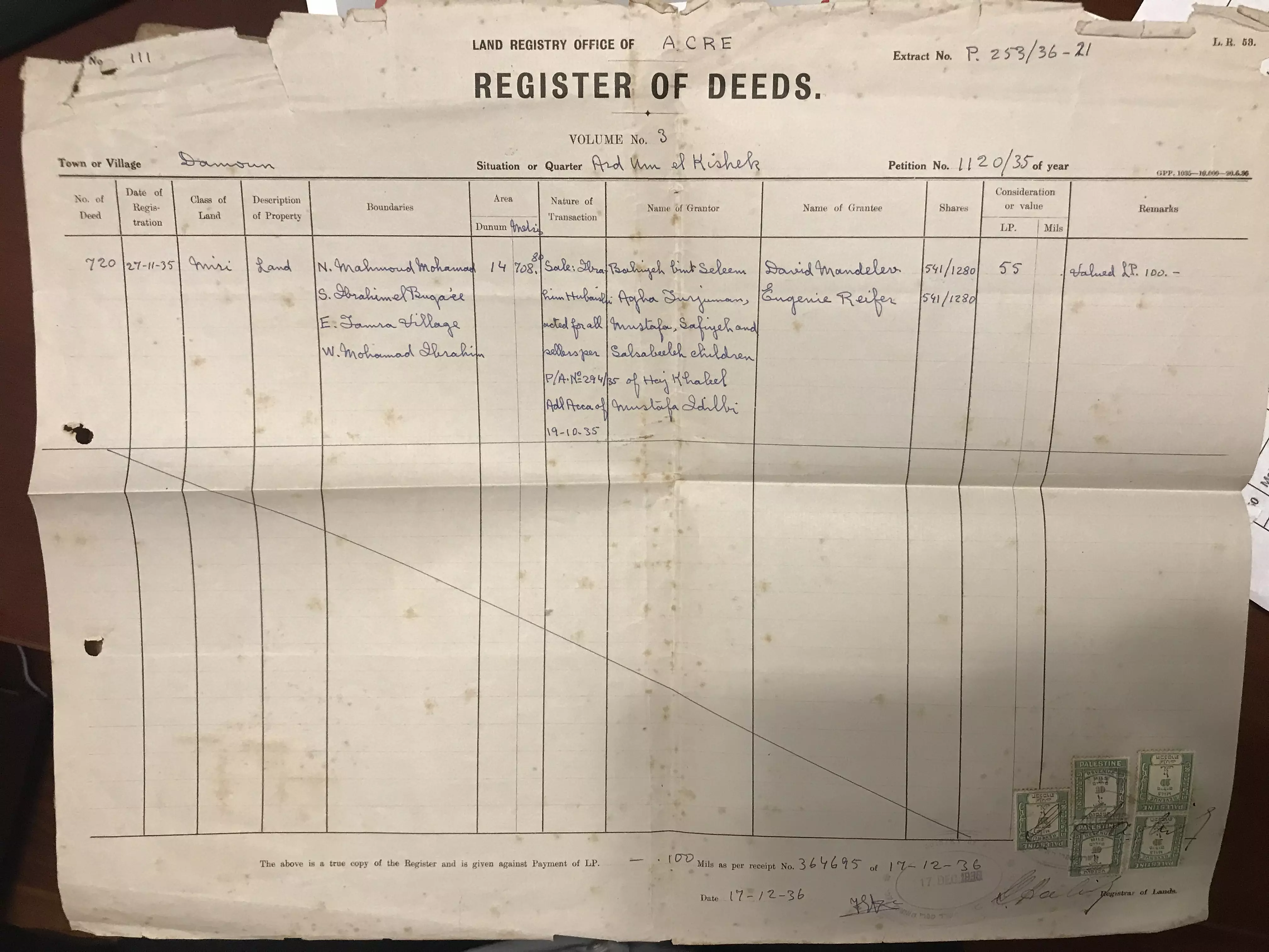
- Land Deeds 1
- Oral History 13
- Members 39
- All That Remains
- Town's Map
- Wikipedia
- Videos 5
- Guest Book 32
- Links 2
| Statistic & Fact | Value | |||||||||||||||||||||
| Occupation Date | July 15, 1948 | |||||||||||||||||||||
| Distance From District | 11.5 (km) Southeast of Acre | |||||||||||||||||||||
| Elevation | 35 (meters) | |||||||||||||||||||||
| Before & After Nakba, Click Map For Details |
||||||||||||||||||||||
|
||||||||||||||||||||||
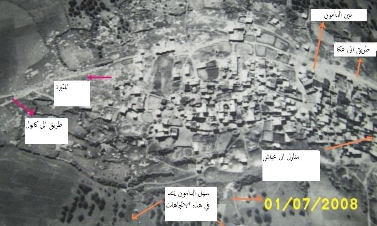
| Pre-Nakba Aerial View |
||||||||||||||||||||||
|
||||||||||||||||||||||
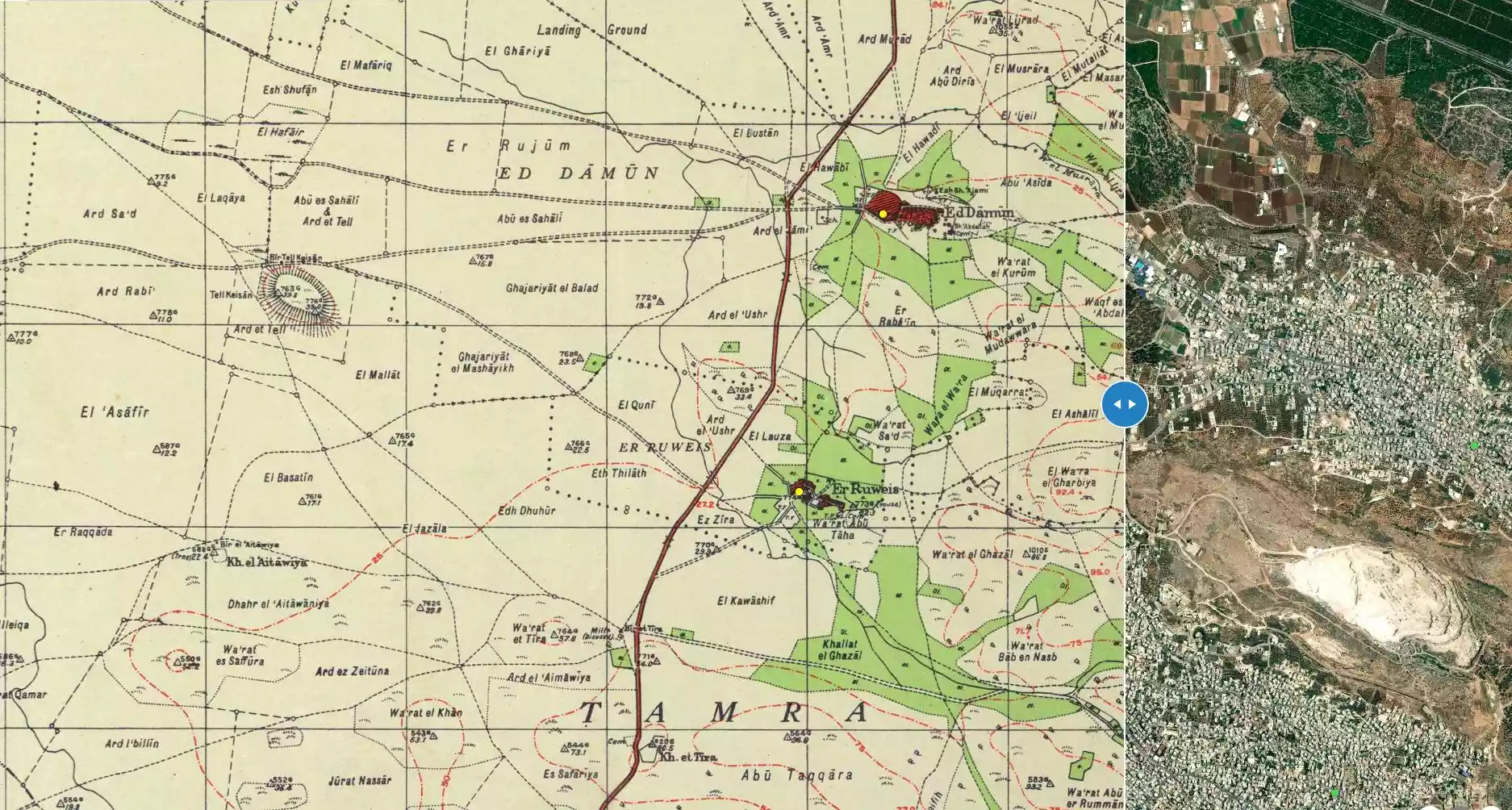
| Map Location | See location #24 on the map View from satellite |
|||||||||||||||||||||
| Military Operation | Dekel | |||||||||||||||||||||
| Attacking Units | Sheva' (Seventh) Brigade | |||||||||||||||||||||
| Exodus Cause | Military assault by Zionist troops | |||||||||||||||||||||
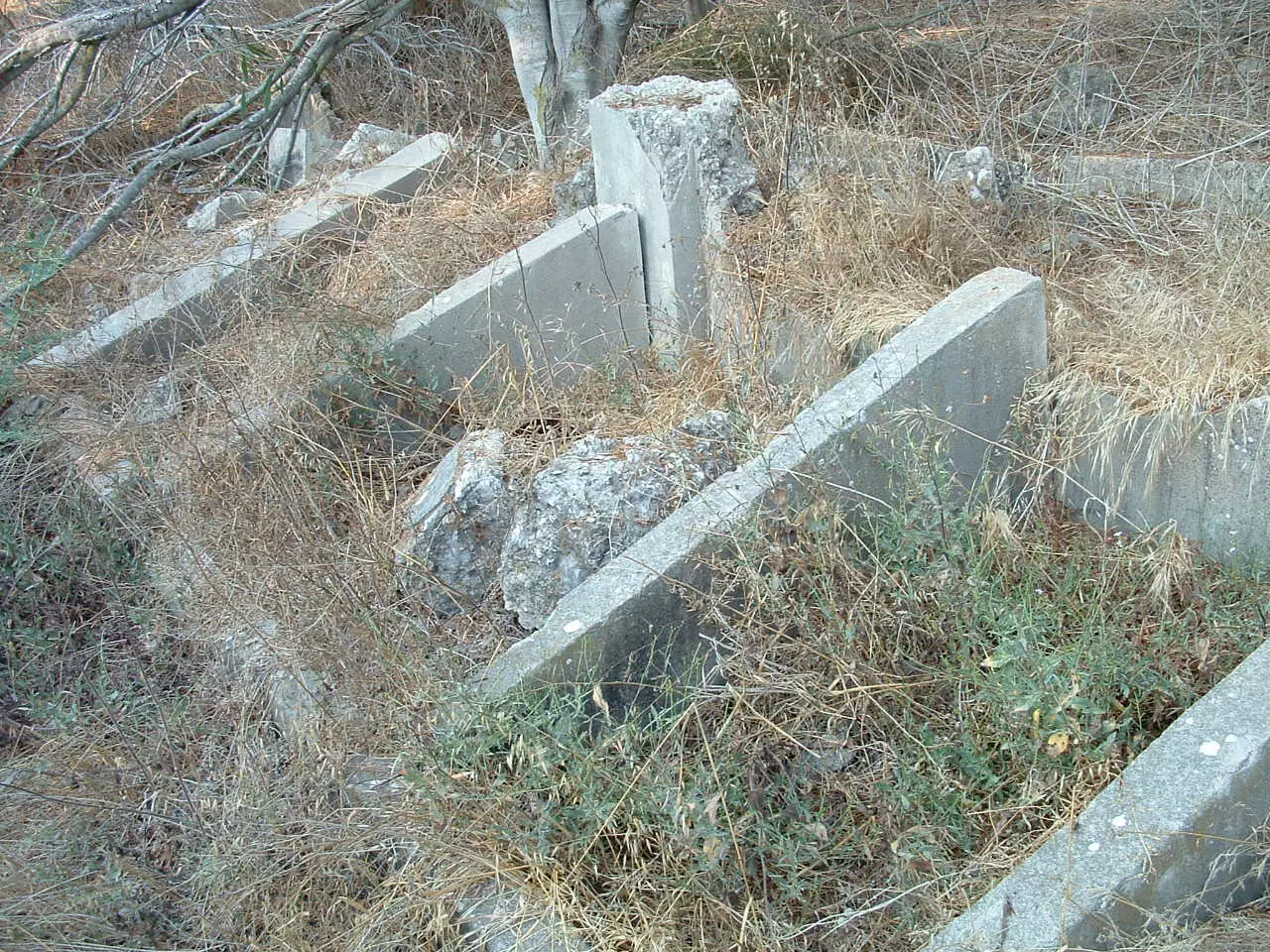
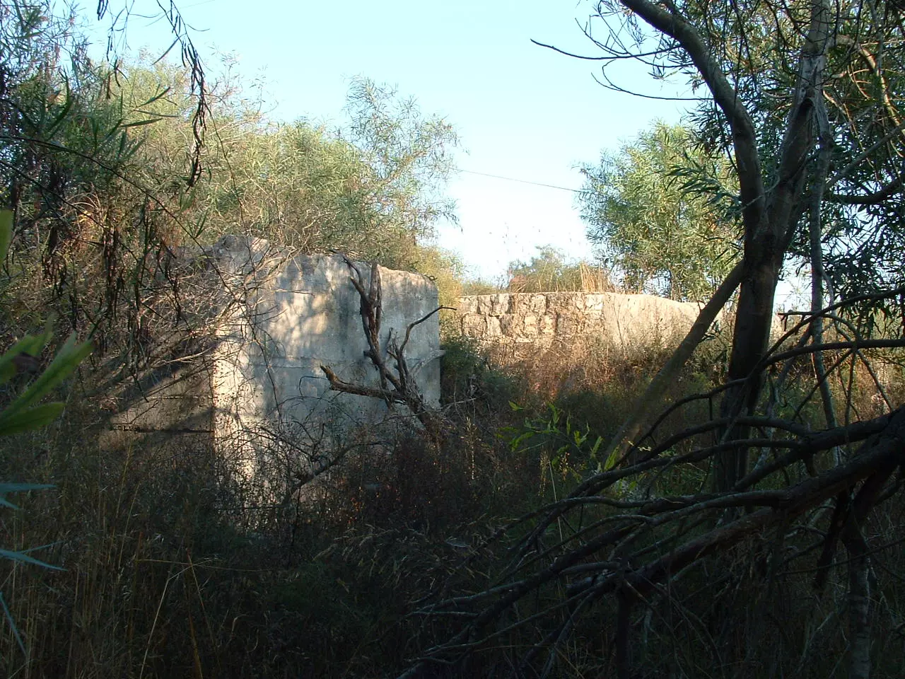
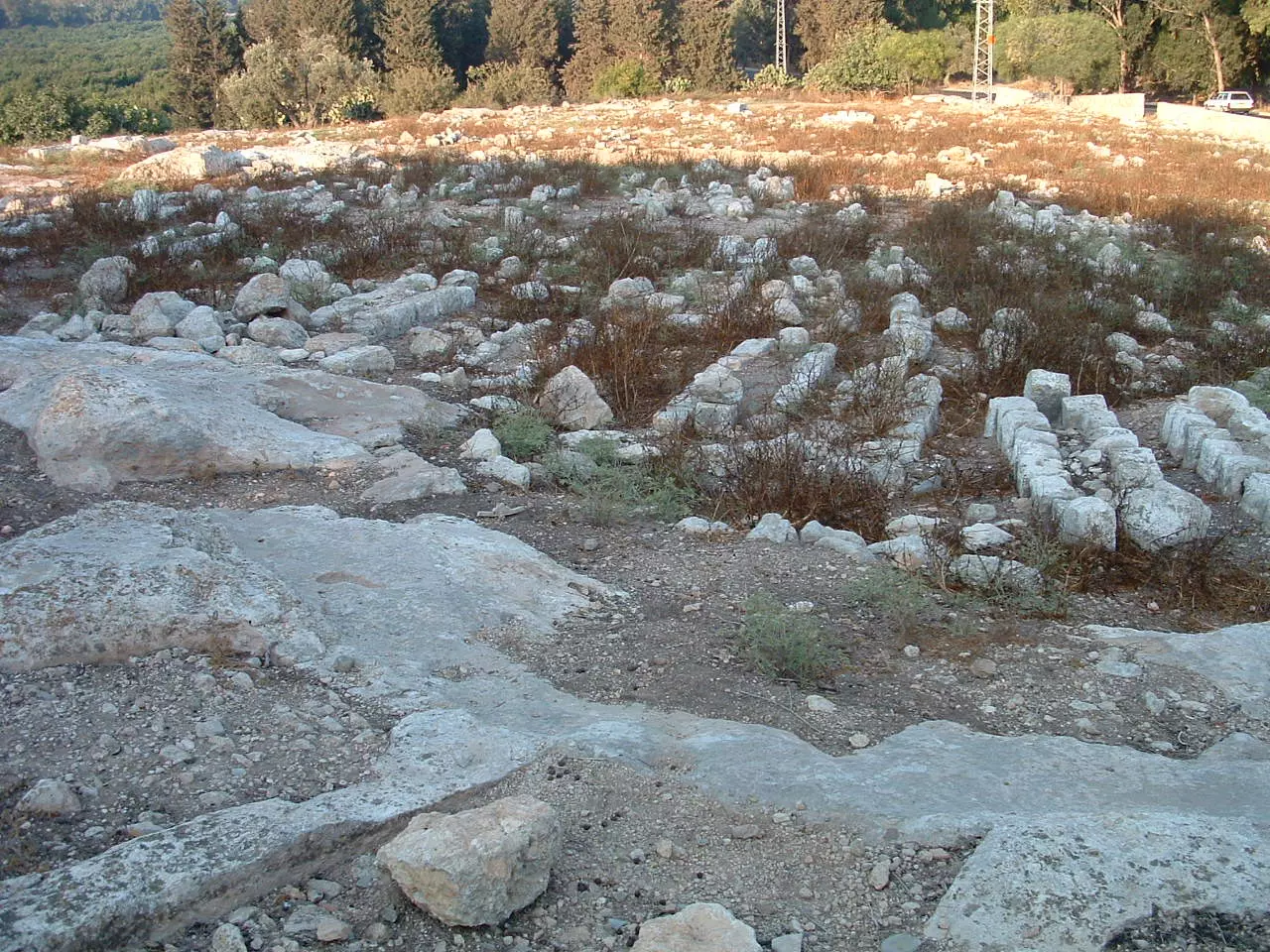
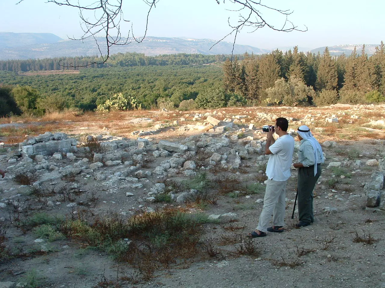
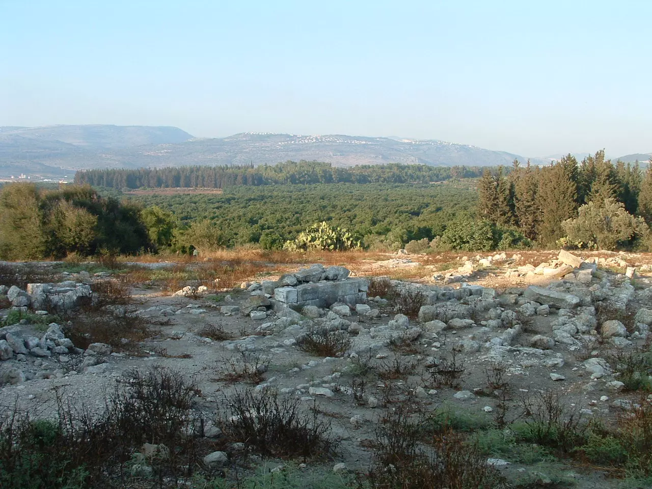
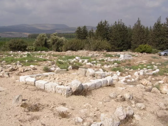
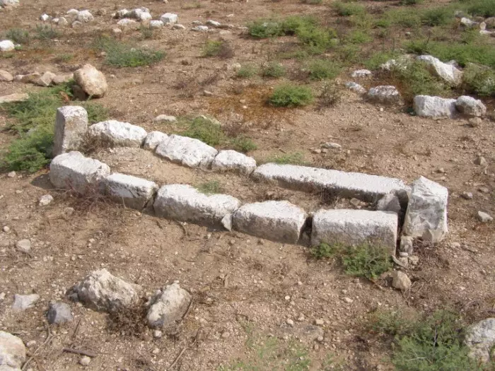
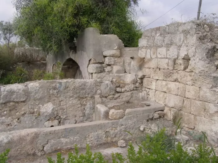
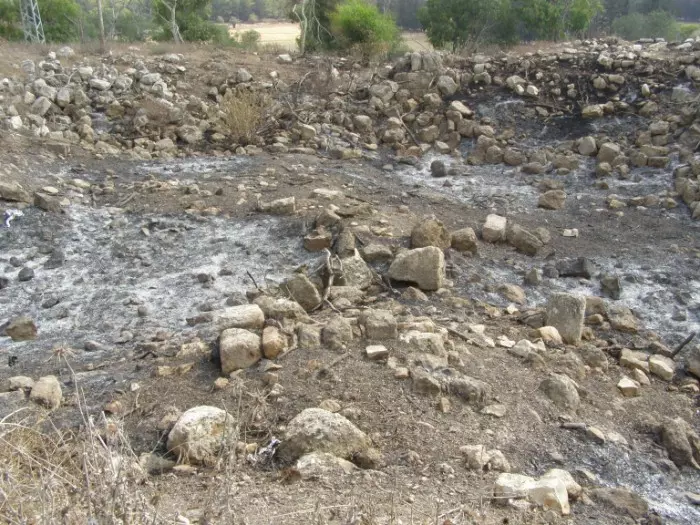
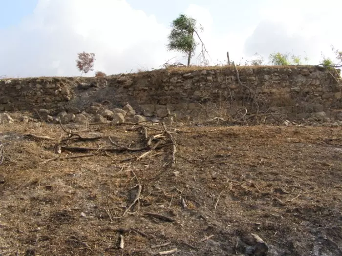
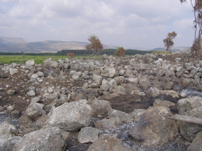
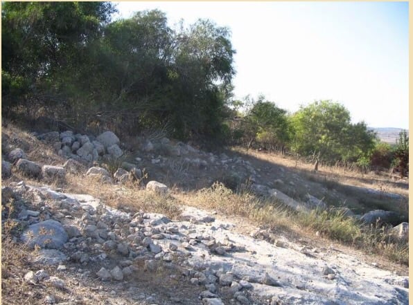
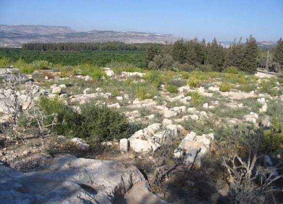
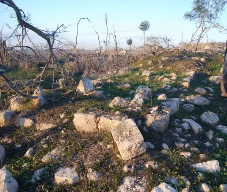
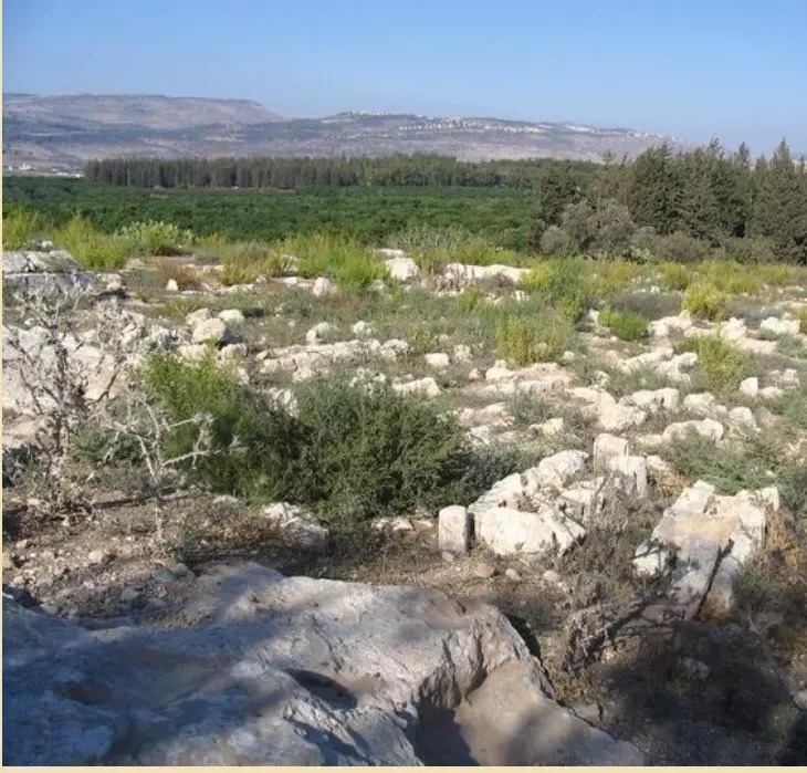
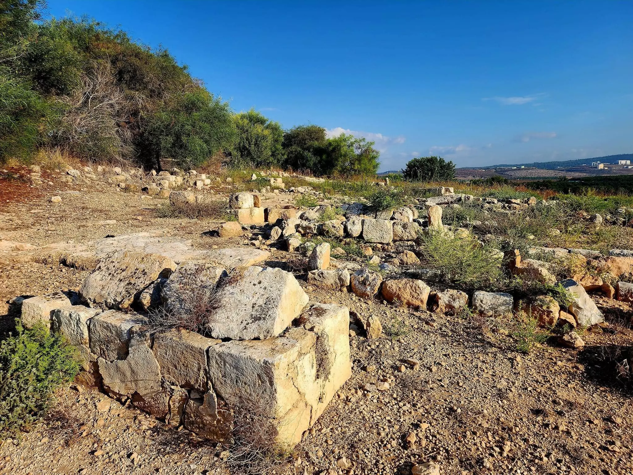
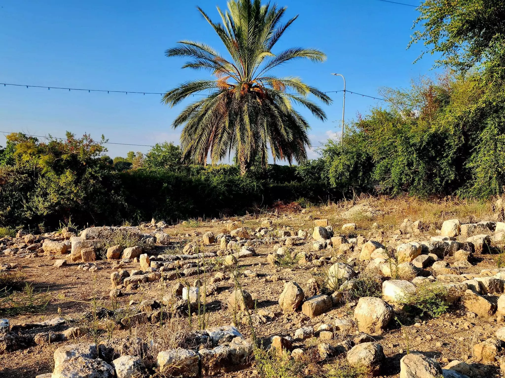
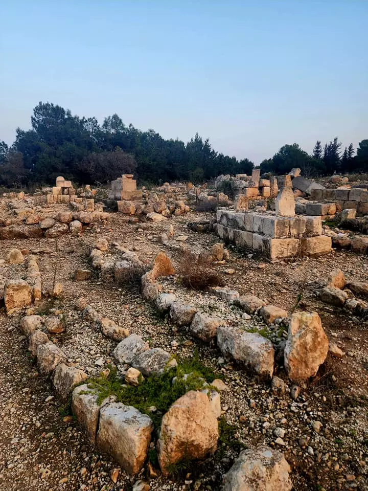
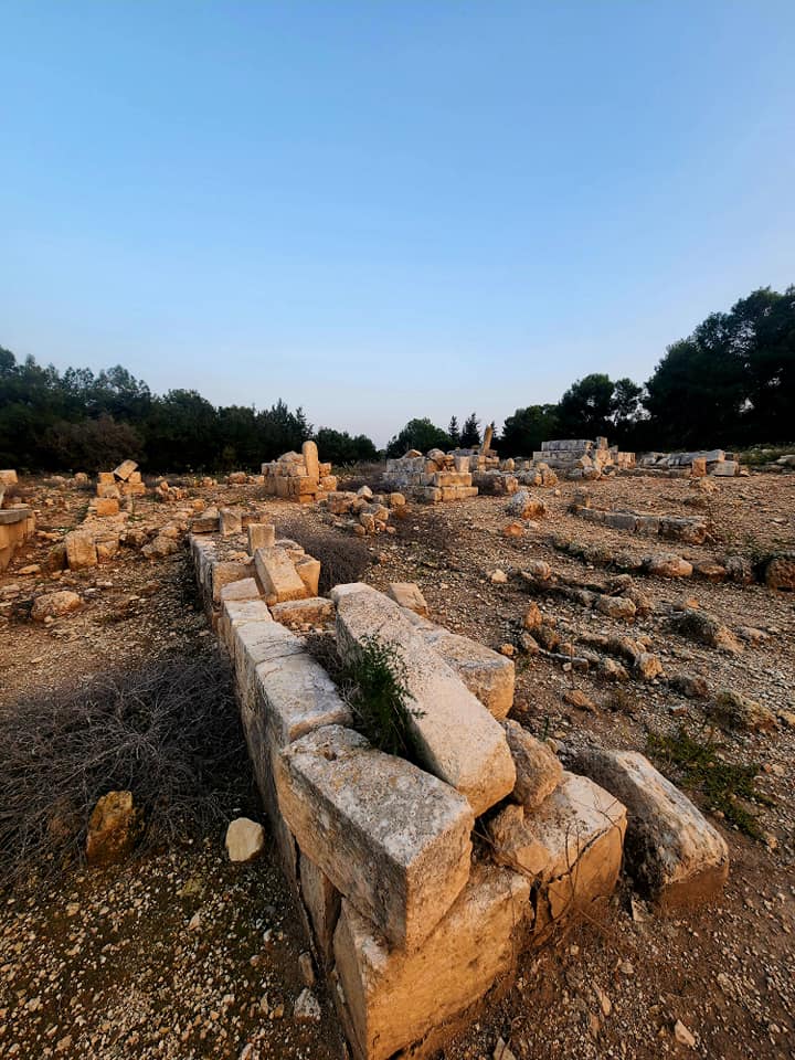
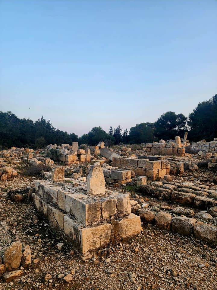
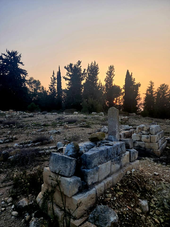
| Village Temains | The village was completely destroyed soon after occupation, and only house rubble left behind. | |||||||||||||||||||||
| Ethnically Cleansing | al-Damun inhabitants were completely ethnically cleansed. | |||||||||||||||||||||
| Pre-Nakba Land Ownership |
**Town Lands' Demarcation Maps |
|||||||||||||||||||||
| Land Usage As of 1945 |
|
|||||||||||||||||||||
| Population |
|
|||||||||||||||||||||
| Number of Houses |
|
|||||||||||||||||||||
| Near By Towns |
||||||||||||||||||||||
|
||||||||||||||||||||||
| Town's Name Through History | The Crusaders referred to al-Damun by Damar. | |||||||||||||||||||||
| Schools | al-Damun had one elementary school for boys which was founded by the Ottomans in 1886. | |||||||||||||||||||||
| Places of Warship | One famous mosque | |||||||||||||||||||||
| Nearby Wadies & Rivers | al-Damun borders al-Na'amin River. | |||||||||||||||||||||
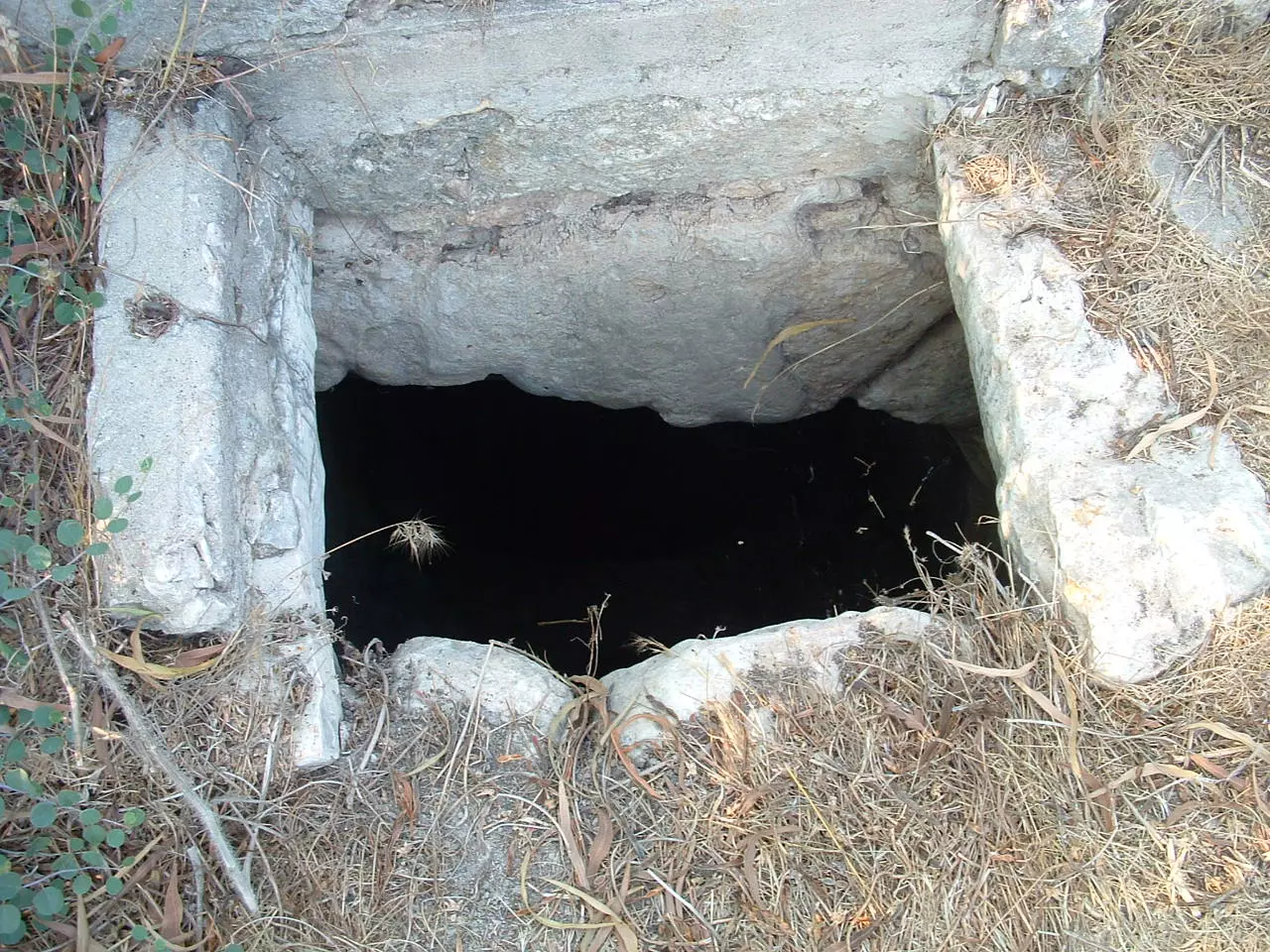
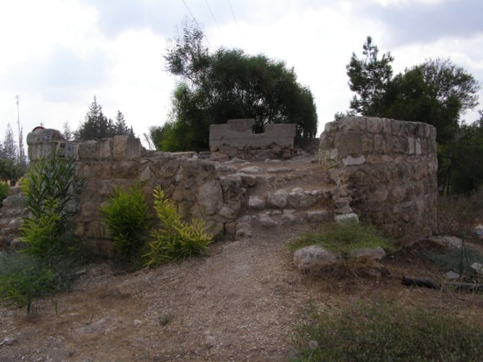
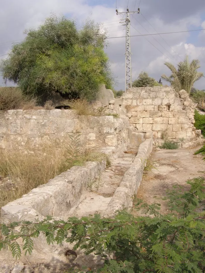
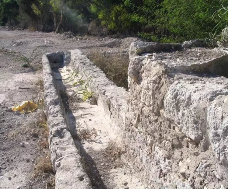
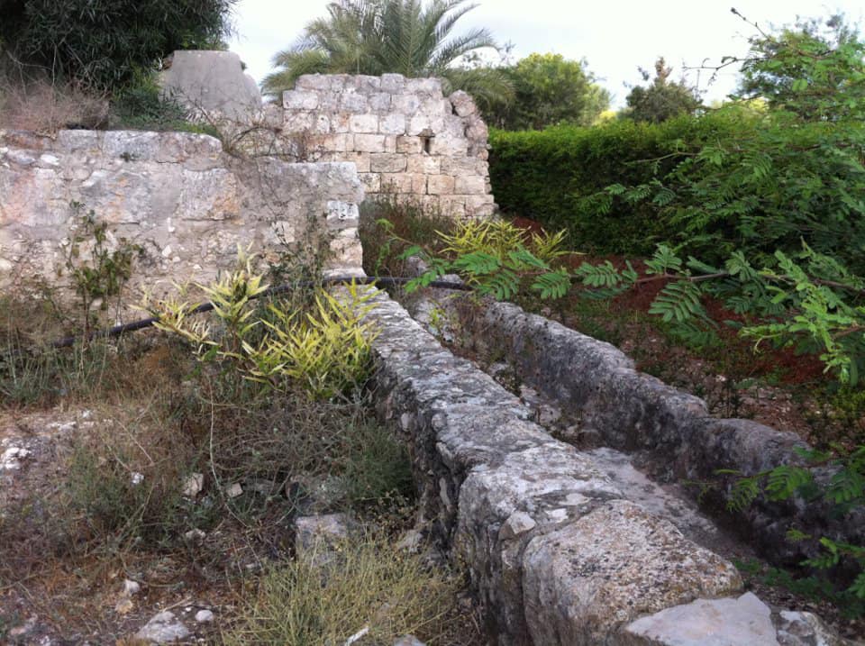
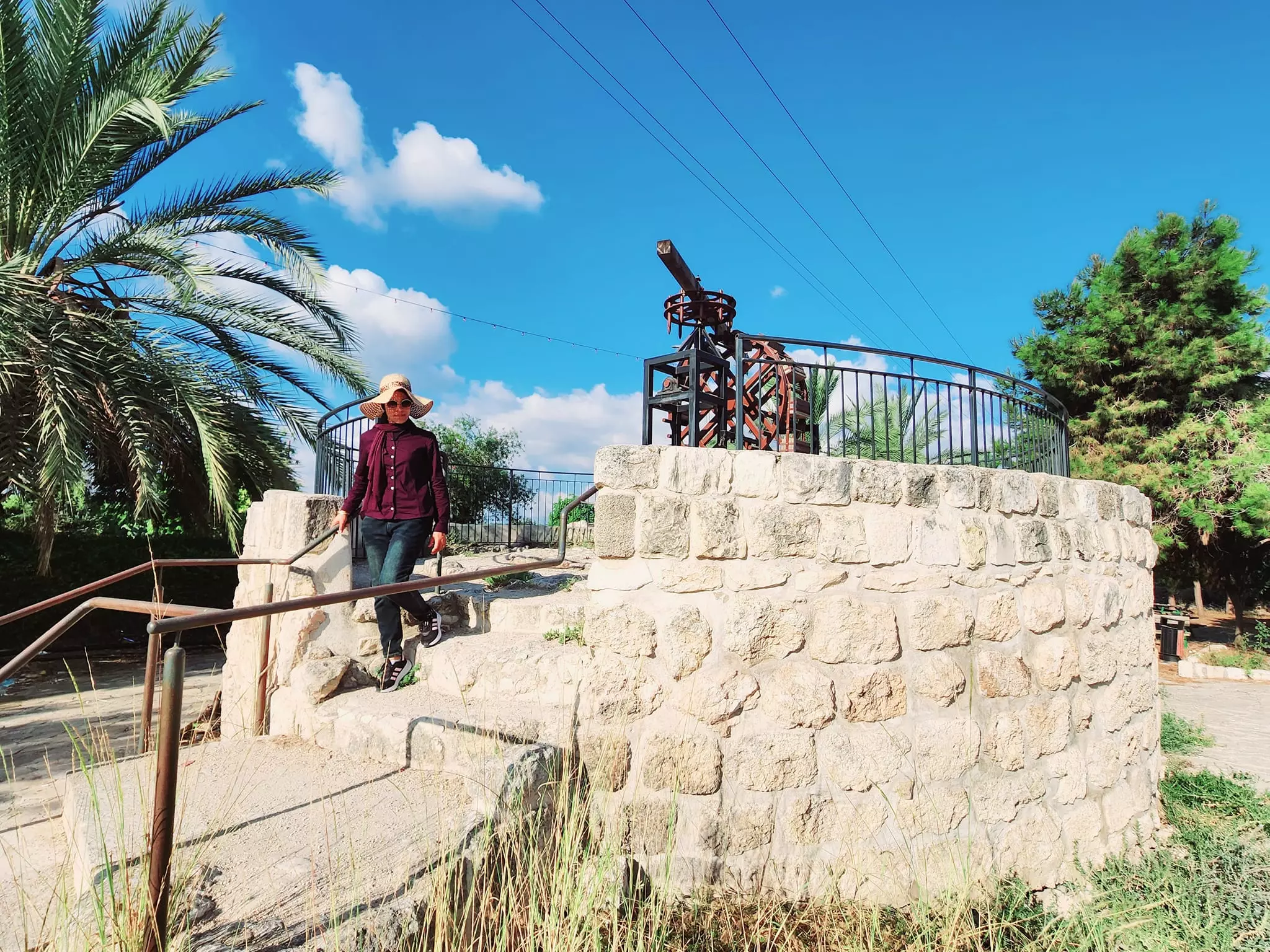
| Water Supply | Several nearby springs were used to provide drinking water, and al-Na'amin's River water was utilized for irrigation. | |||||||||||||||||||||
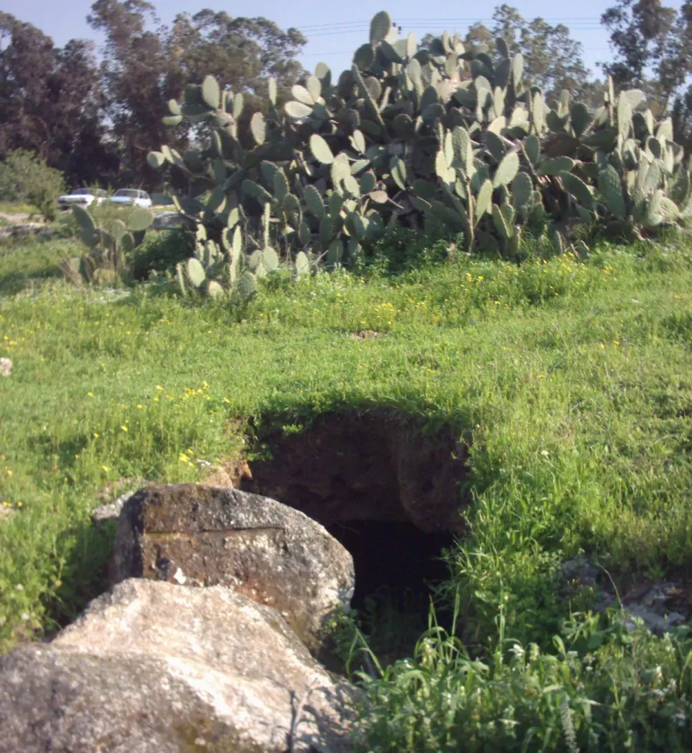
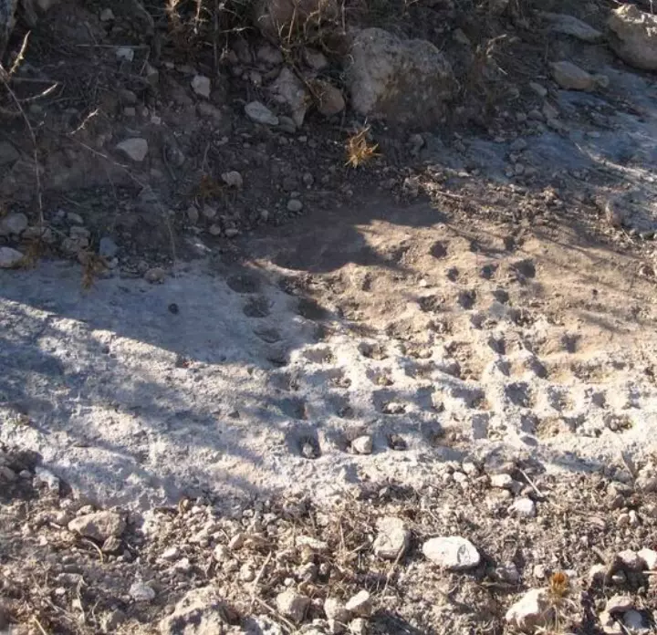
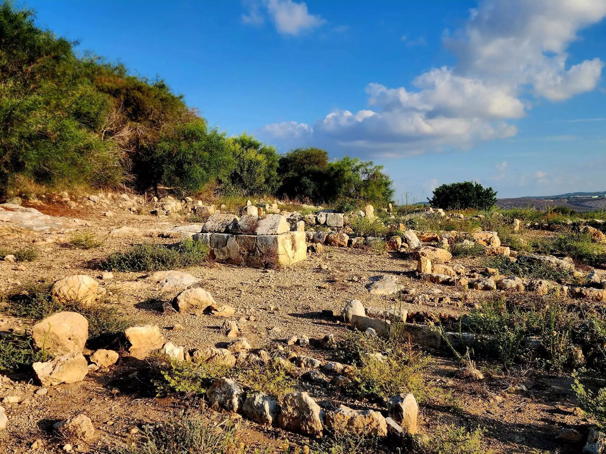
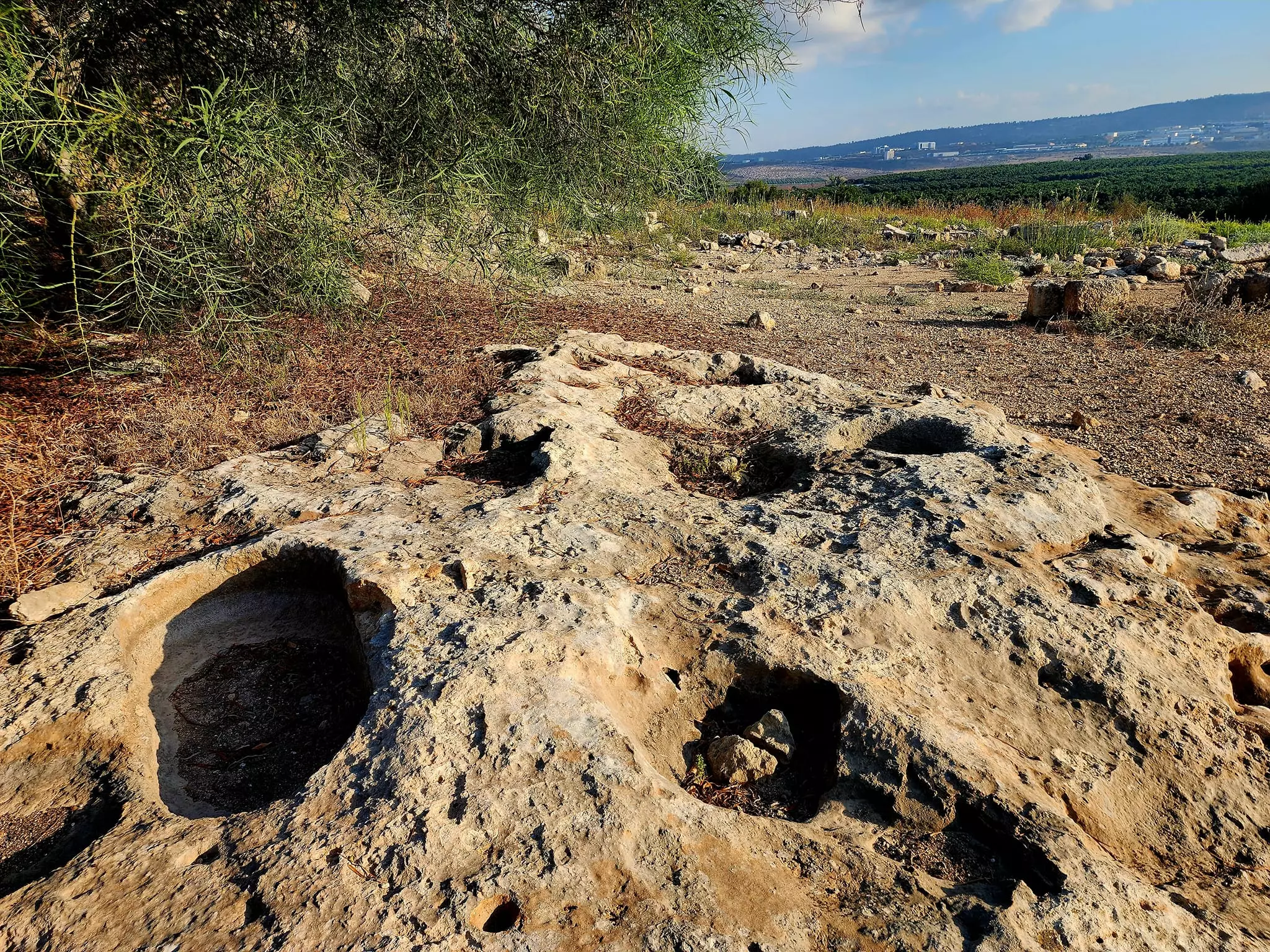
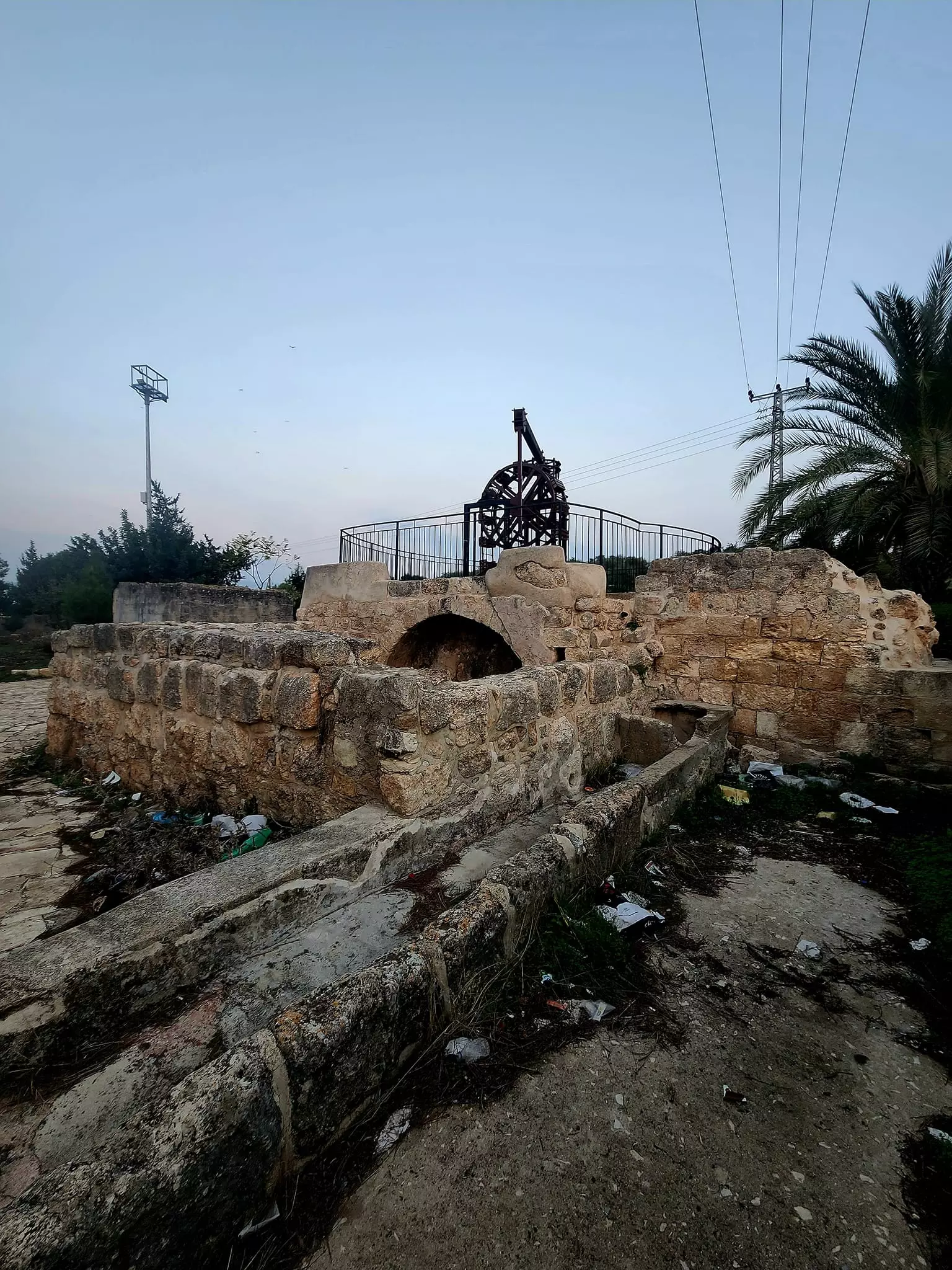
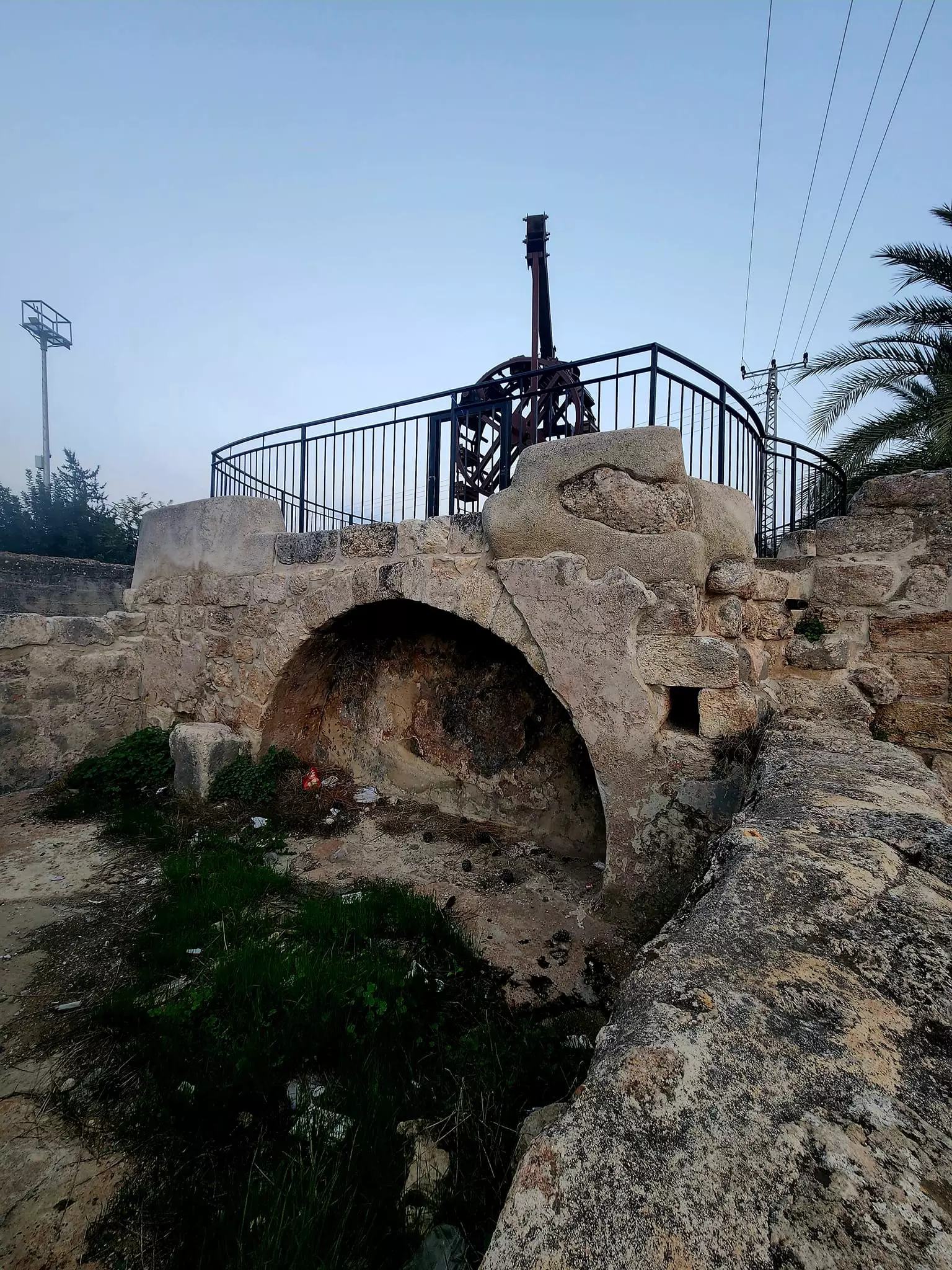
| Archeological Sites | al-Damun has a khirba/tall that contains the foundations of a wall, fortifications, and a well. | |||||||||||||||||||||
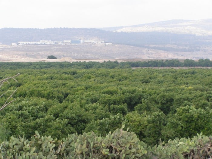
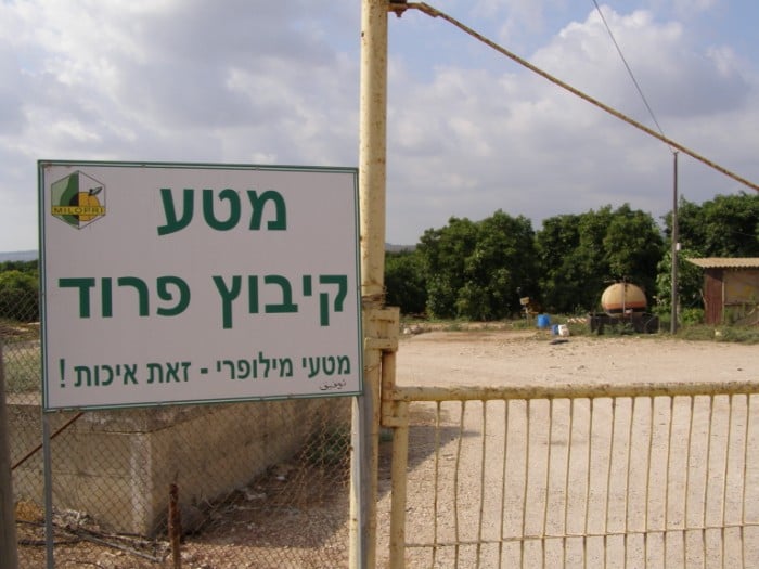
| Exculsive Jewish Colonies Who Usurped Village Lands |
Yas'ur | |||||||||||||||||||||
| Featured Video | ||||||||||||||||||||||
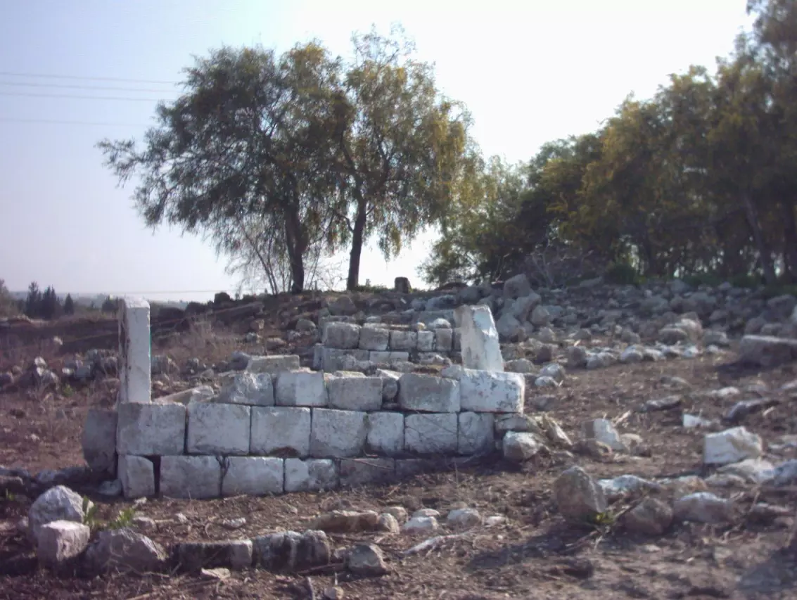
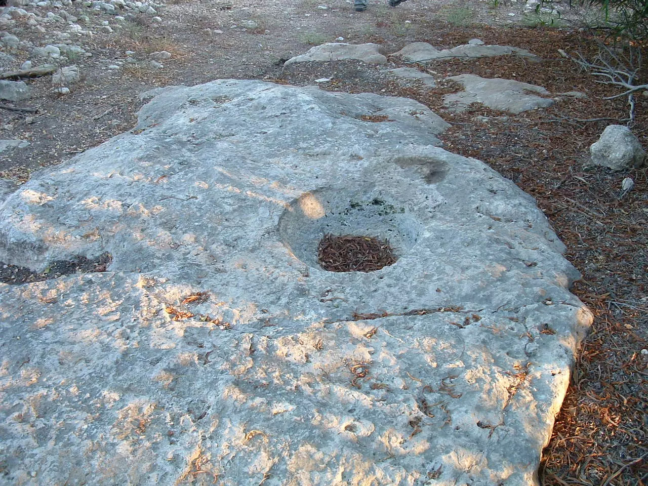
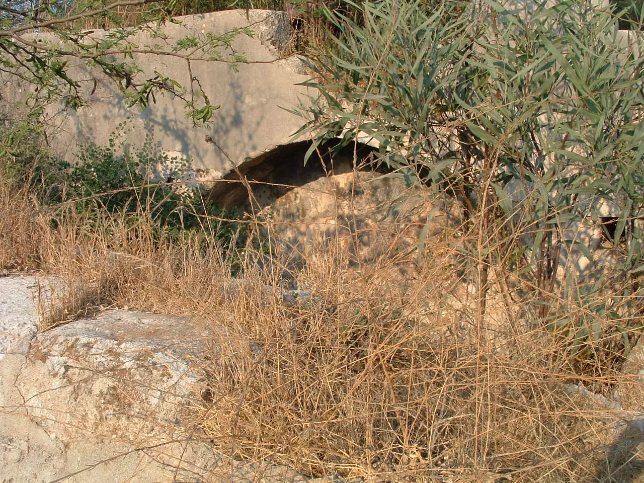
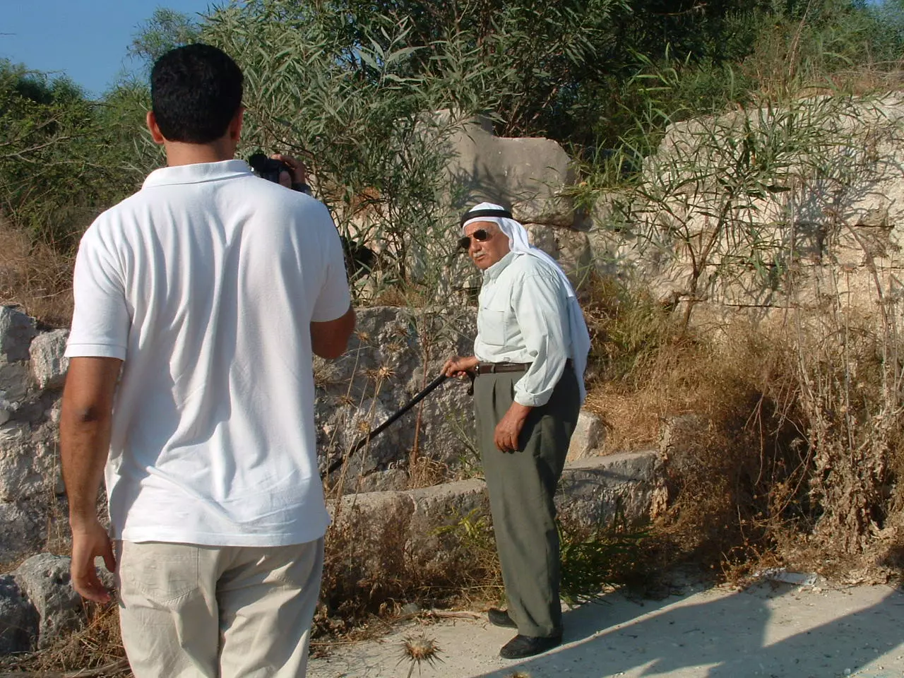
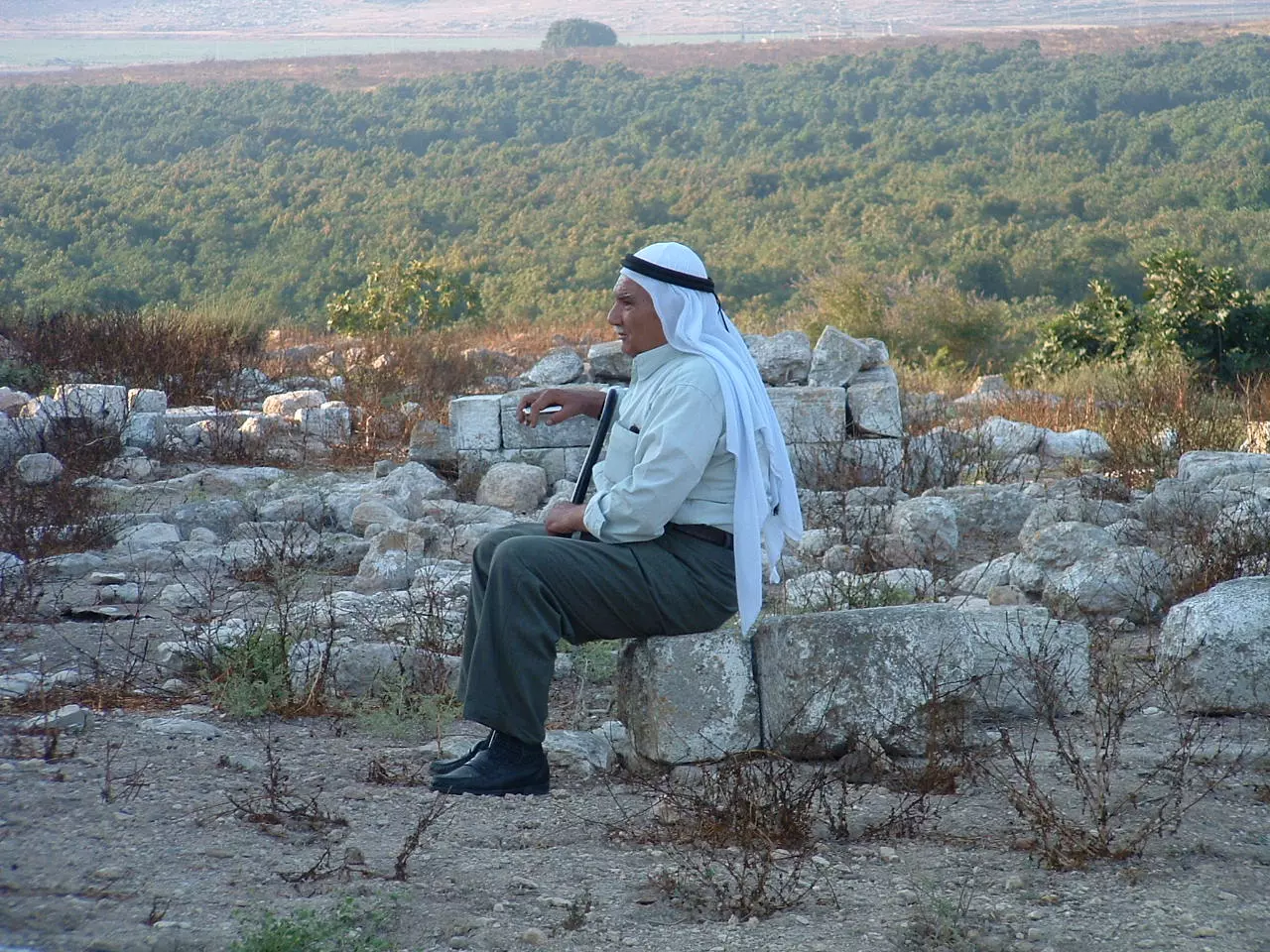
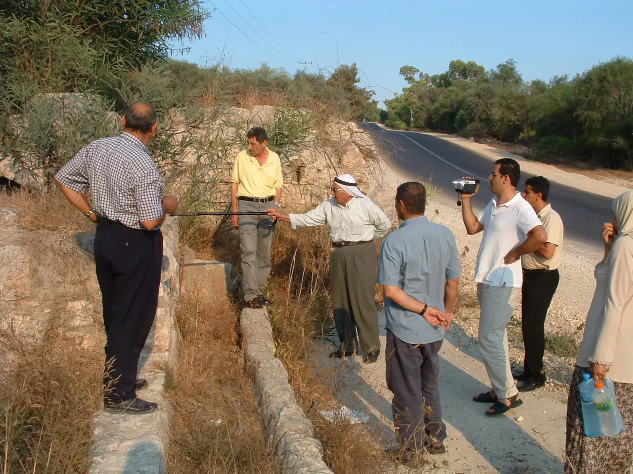
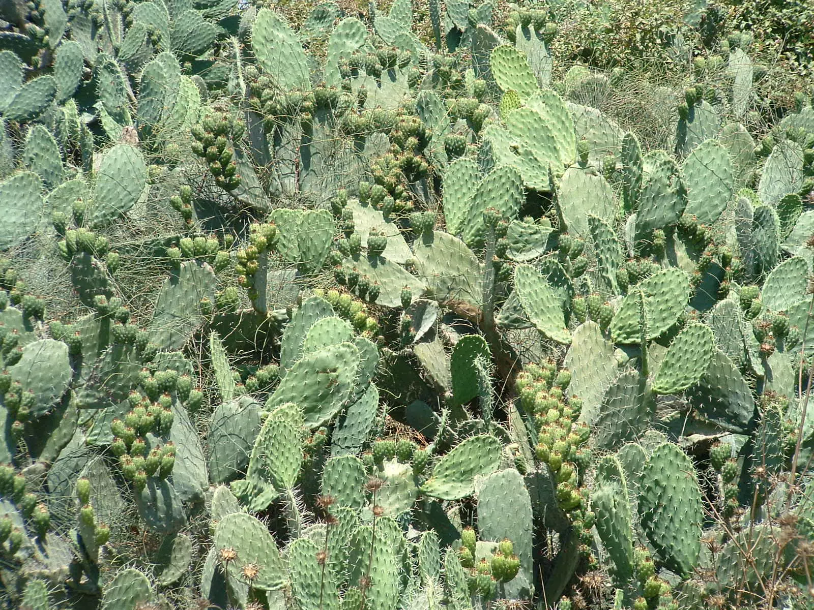
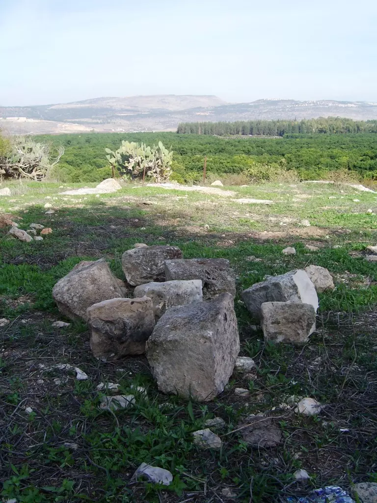
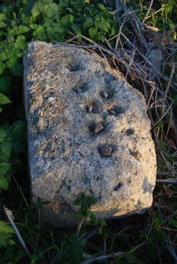
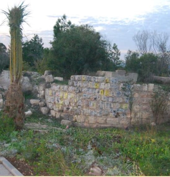
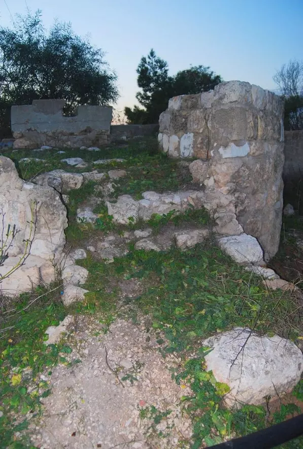
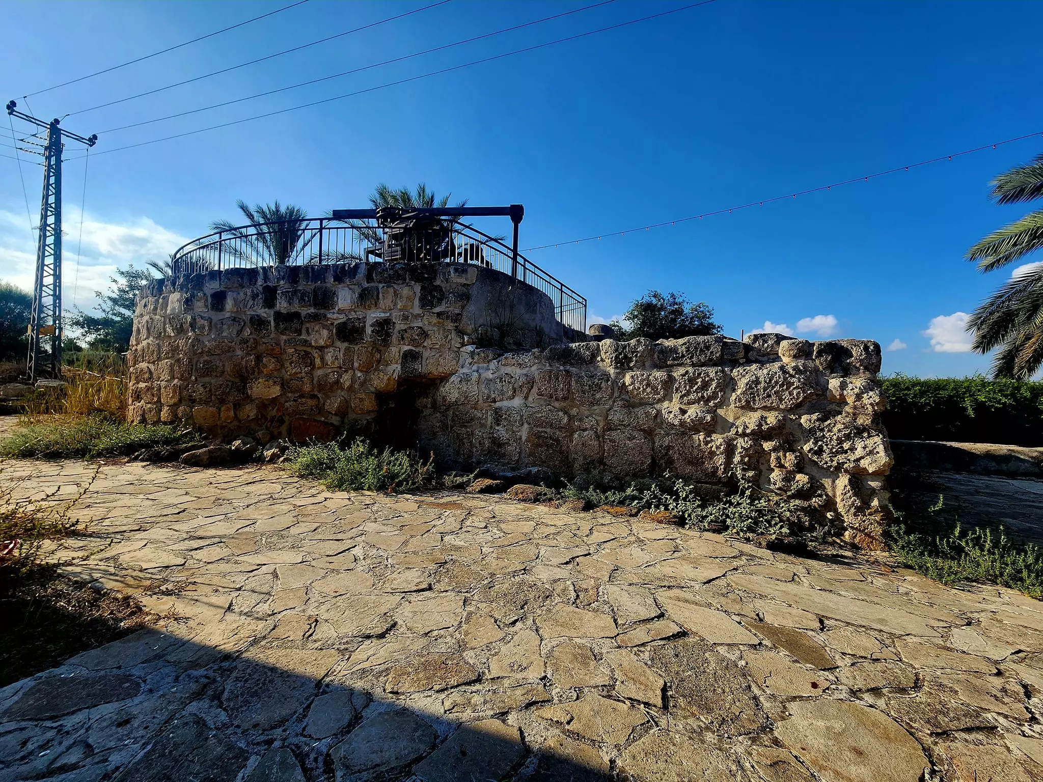
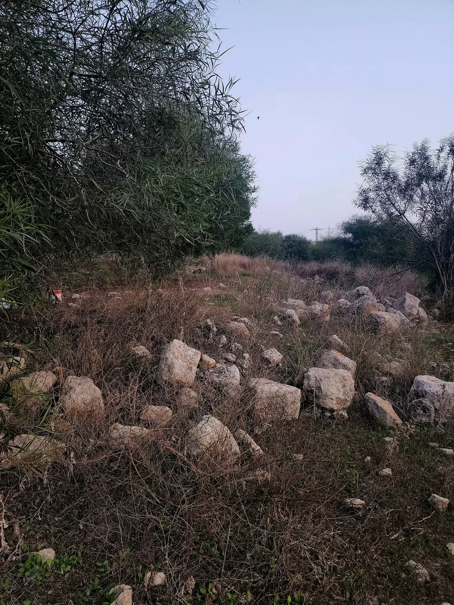
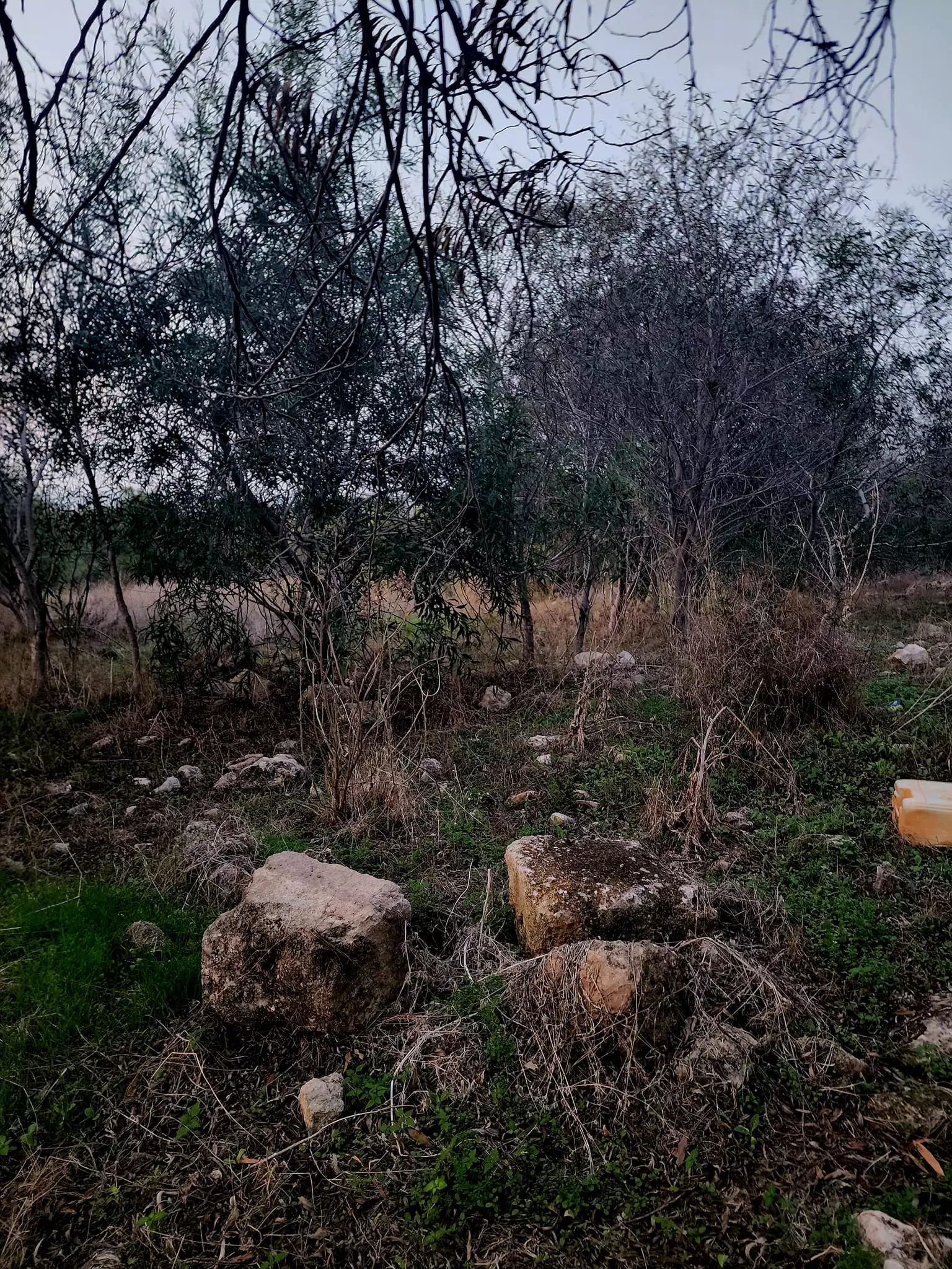
Village Before NakbaThe village was spread across the flat top and sides of a rocky hill, on the eastern tip of the Acre plain. Secondary roads linked it to the Acre-Safad and Acre-Haifa highways. Its inhabitants traced their origins back to the al-Zaydaniyya tribe, which had emigrated from the Hijaz in the Arabian peninsula. The Muslim traveler Nasir Khusraw mentioned that he visited al-Damun in 1047, saying that he reached it from al-Birwa and visited the shrine of Dhu al-Kifl, a saintly personage mentioned in the Qur'an (sura XXI, aya 85). The Crusaders referred to it as Damar. In the nineteenth century, al-Damun was a village surrounded by olive groves; its population in 1859 was estimated at 800. It contained two small mosques.At the beginning of this century, al-Damun's houses were clustered along one road. Starting in 1935, the villagers began to build them with reinforced concrete. The population consisted of 1,240 Muslims and 70 Christians. Al-Damun had an elementary school, established by the Ottomans in 1886, and a renowned mosque. The inhabitants drew their drinking water from springs and irrigated some of their crops from the Na'amin River. They also engaged in allied activities, especially the plaiting of mats and baskets from the esparto grass and rushes that grew on the river banks. Grain-wheat, sorghum, and barley-and olives were the chief crops, but the village was also known for its watermelons and cantaloupes. In 1944/45 a total of 16,256 dunums was planted in cereals; 706 dunums were irrigated or used for orchards, of which 484 dunums were planted with olive trees. West of the village lay a tell that contained the foundations of a wall, fortifications, and a well. Village Occupation and Ethnic CleaningAfter the initial Israeli successes in central Galilee during the first stage of Operation Dekel , units of the Sheva' (Seventh) Brigade moved westwards to take control of a number of western Galilee villages. Al-Damun was among them, falling in the second stage of Operation Dekel on 15-16 July 1948, according to Israeli historian Benny Morris. However, Palestinian historian Aref al-Aref dates its capture much earlier, in late May 1948, following the fall of Acre. Morris reports that the inhabitants were demoralized by the fall of Acre and Nazareth, and that some fled during the bombardment that preceded the attack on the village. The remainder were expelled and the village itself was completely destroyed, according to both al-Aref and Morris.Zionists Colonies on Village LandsThere are no Israeli settlements on village land. Yas'ur built on lands belonging to the neighboring al-Birwa, uses the lands of al-Damun for agriculture. This settlement, nearly 3 km northwest of al-Damun, was established in January 1949.Village TodayThe site is overgrown with thorns, cactuses, olive trees, and pines. Stone and concrete rubble is scattered around it. The structure that formerly protected the central water source (a spring) and regulated its flow stands untended and is collapsing in several places. The cemetery is extant, although the markers over a few graves are collapsing. The settlement of Yas'ur uses the land around the site, particularly the lands in the Acre valley, for agricultural purposes.SourceDr. Walid al-Khalidi, 1992: All That Remains. |
||||||||||||||||||||||
| Related Maps | Town Lands' Demarcation Maps خرائط للقضاء توضح حدود القرى والاودية Town's map on MapQuest View from satellite Help us map this town at WikiMapia |
|||||||||||||||||||||
| Related Links | Wikipedia's Page Facebook Page Google Search Google For Images Google For Videos |
|||||||||||||||||||||
| More Information | مخطط البلد في كتاب كي لا ننسى في كتاب بلادنا فلسطين المزيد من موقع هوية |
|||||||||||||||||||||
- مقبرة الدامون بعد ترميم السور المقابل لشارع الدامون كابول
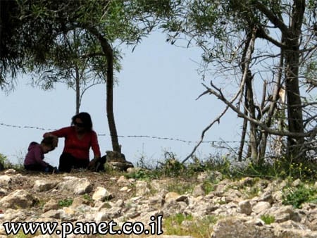
Posted by Makbula Nassar 1 - احدى المغر المنتشرة حول منطقة المقبرة في الدامون
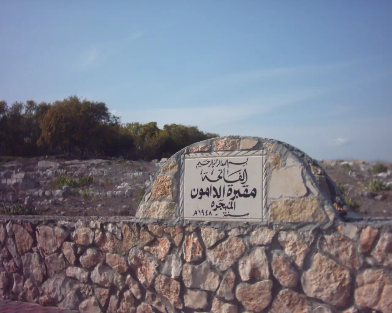
Posted by Makbula Nassar - Village Cemetery In 2003
Posted by Makbula Nassar 2 - الزيتون والصبار في مدخل قرية الدامون 2003
Posted by Makbula Nassar 1 - احد القبور الواضحة , من مقبرة الدامون 30/3/2003 الصورة ملتقطة من الجانب الداخلي للمقبرة, التي يقوم اهل القرية يتنظيفها بشكل مستمر , المقبرة واقعة الى يمين الشارع المؤدي الى قرية كابول

Posted by Makbula Nassar 3 - juron almacbara
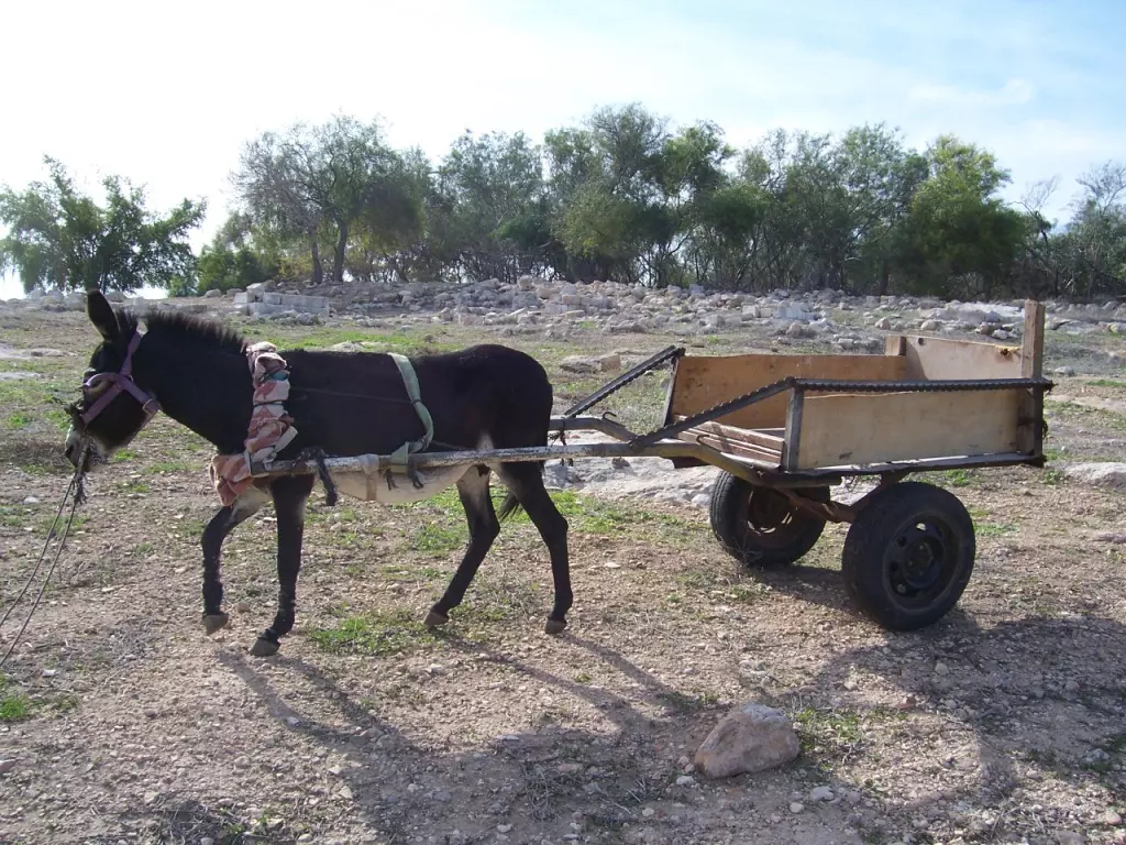
Posted by Muhammad Zidane 1 - Oil Press
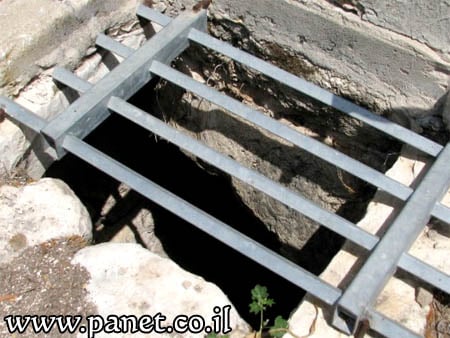
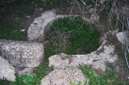
Posted by Muhammad Zidane 2 - Water Well
Posted by Muhammad Zidane 2 - A Spring- Al- nabe3
Posted by Muhammad Zidane 1 - The road to al-Damun
Posted by Muhammad Zidane 2 - Another picture for the water well-Al-beer
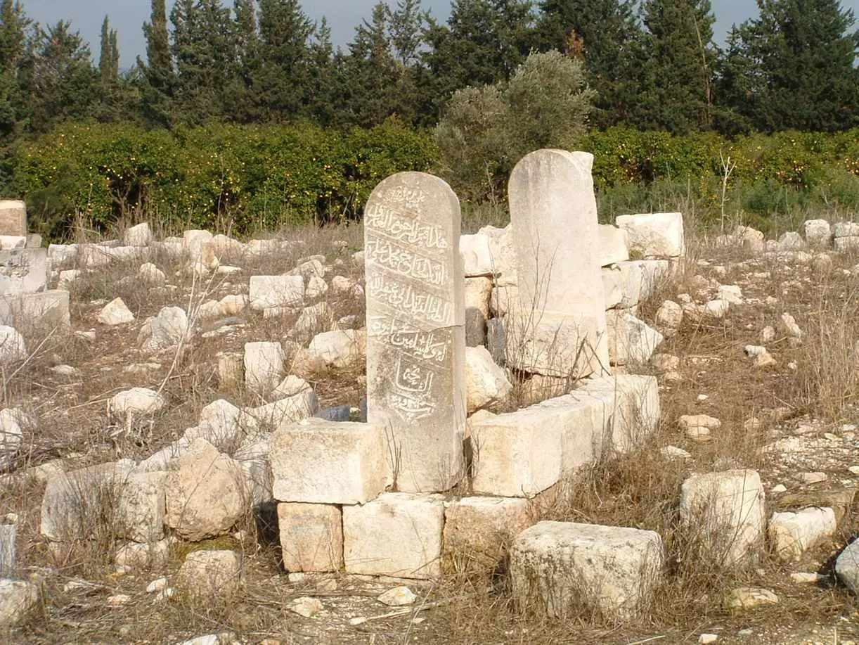
Posted by Muhammad Zidane 2 - al-Damun's Cemetery -Al- maqbara
Posted by Muhammad Zidane 2 - Zidane family at the Cemetery
Posted by Muhammad Zidane 1 - cemetery #2
Posted by Muhammad Zidane 2 - At the spring, el-3ein
Posted by Muhammad Zidane 1 - Mahmud Ali A3mar El Zidane at the Cemetery again
Posted by Muhammad Zidane 1 - Zidane family at El- 3ein
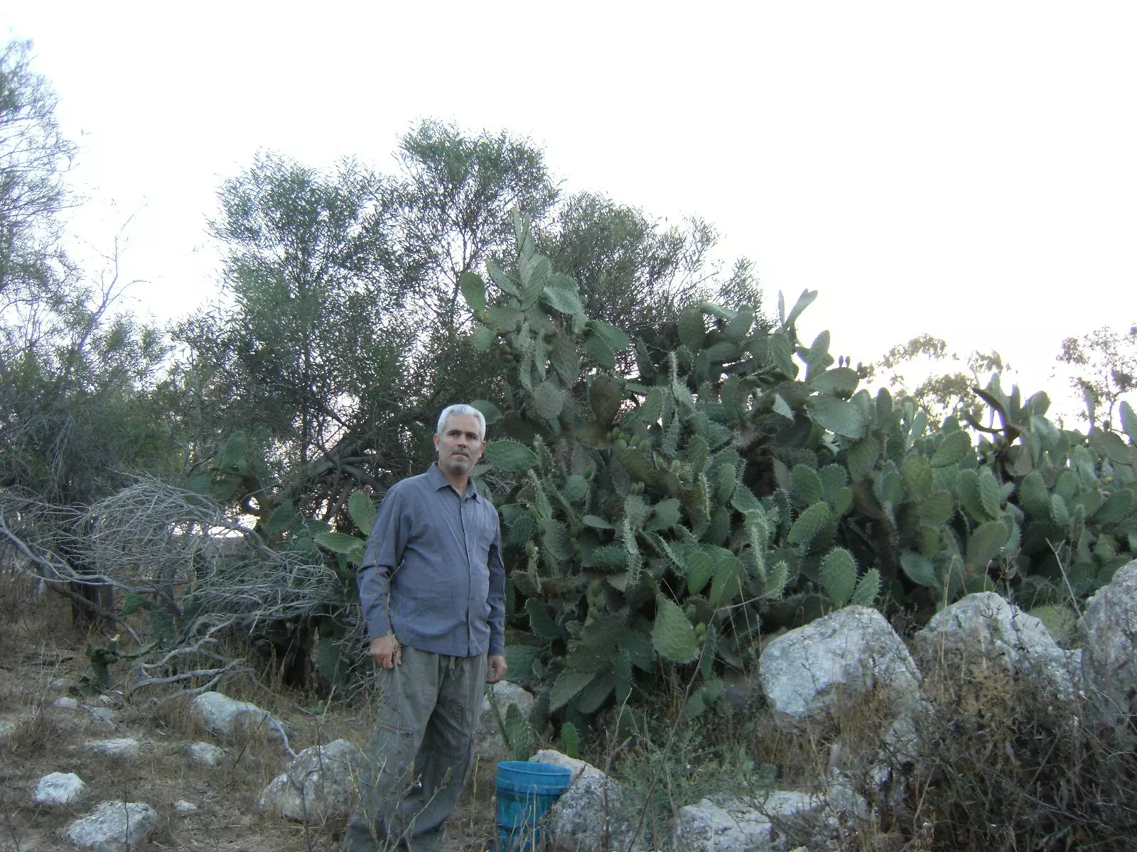
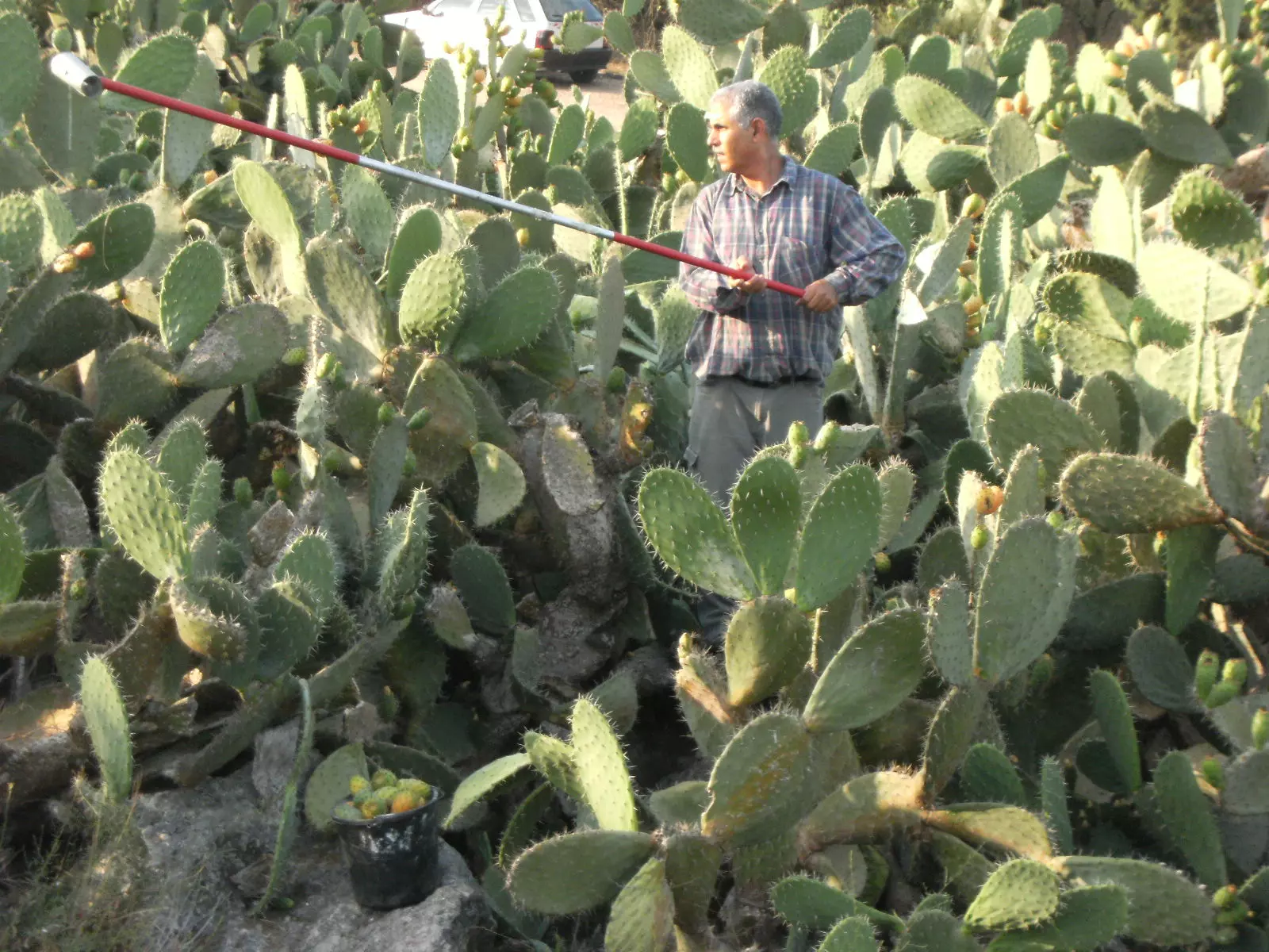
Posted by Muhammad Zidane 2 - Cactus trees at al-Damun, an eternal witness to the war crime -Al Sebar
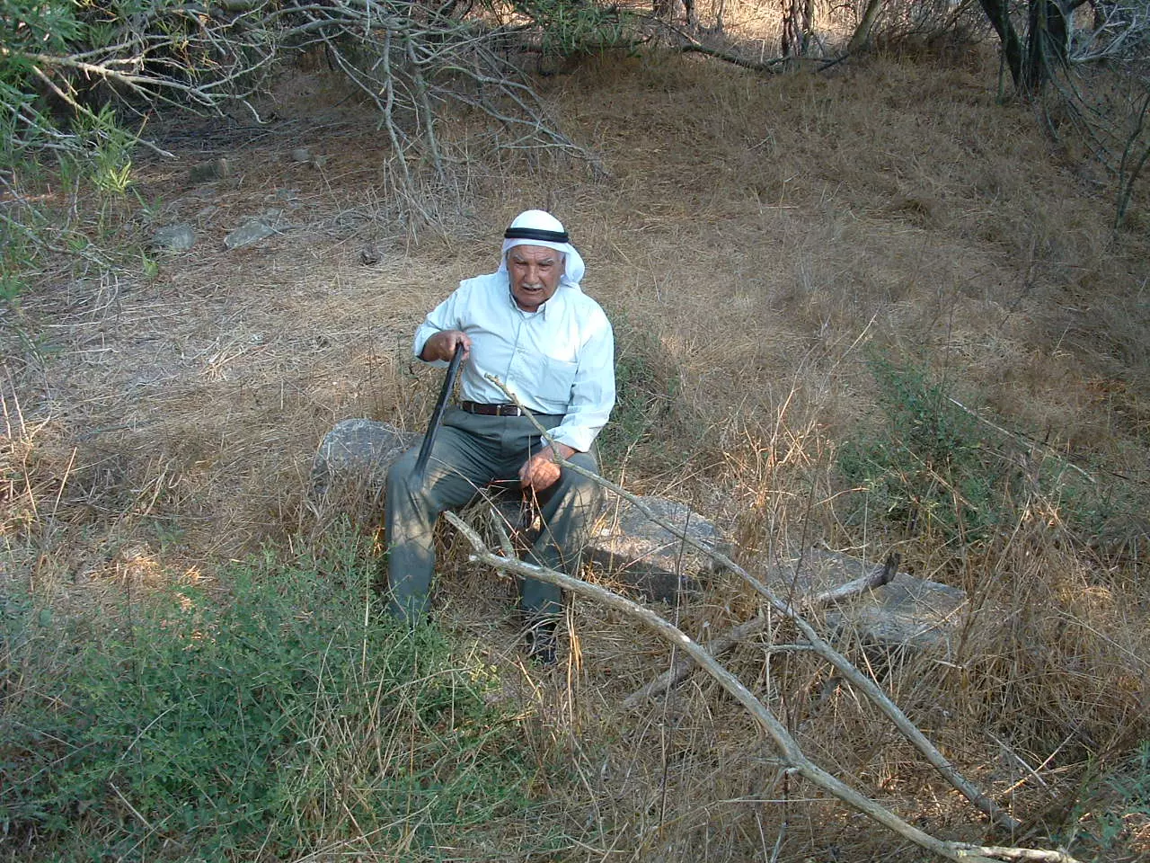
Posted by Muhammad Zidane 10 - Seated in the remainders of his house
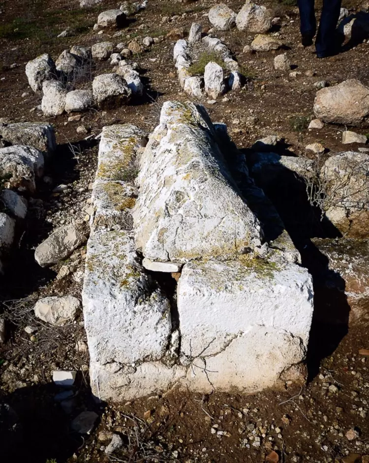
Posted by Muhammad Zidane 2 - The tombstone of Hedar el Bukaei2
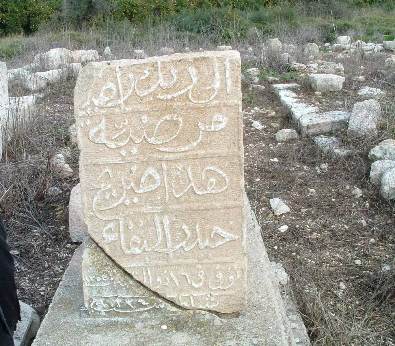
Posted by Muhammad Zidane - The tombstone of Muhammad Ali Taha Zidane
Posted by Muhammad Zidane 3 - خطر السرقة يتهدد حجارة القرى المهجرة 3 كانون اول 2005 ... فامرتهم بتفريغ العربتين من الحجارة ...
Posted by salam diab 3 - خطر السرقة يتهدد حجارة بيوت ومقبرة الدامون... فامرتهم بتفريغ العربتين من الحجارة 3 كانون اول 2005 ... تصوير سلام ذياب
Posted by salam diab 1 - حجارة مقبرة الدامون المتبقية بعد افشال محاولة السرقة 3 كانون اول 2005 ... تصوير سلام ذياب
Posted by salam diab - dont forget
Posted by zeadane wael - Ad Damoon in our hearts
Posted by Waleed Ayyash 2 - zikra al nakba 2009
Posted by Waleed Ayyash 1 - al damoon in my heart 1
Posted by Waleed Ayyash 1 - al damoon in my heart 2
Posted by Waleed Ayyash 1 - al damoon in my heart 3
Posted by Waleed Ayyash 2 - al damoon in my heart 5
Posted by Waleed Ayyash 2 - al damoon in my heart 6
Posted by Waleed Ayyash 1 - picture of al damoon before 1948
Posted by Waleed Ayyash 2 - the town's well
Posted by Waleed Ayyash 1 - مقبرة القرية 8 2009
Posted by Raneen G. 1 - مقبرة القرية 8 2009
Posted by Raneen G. - مقبرة القرية 8 2009
Posted by Raneen G. - عين الدامون 8 2009
Posted by Raneen G. - عين الدامون 8 2009
Posted by Raneen G. - عين الدامون 8 2009
Posted by Raneen G. 1 - اراضي القرية 8 2009
Posted by Raneen G. - محمد اسعد ابو علي ابن قرية الدامون
Posted by Raneen G. 1 - كيبوتس فرود المبني على اراضي الدامون 8 2009
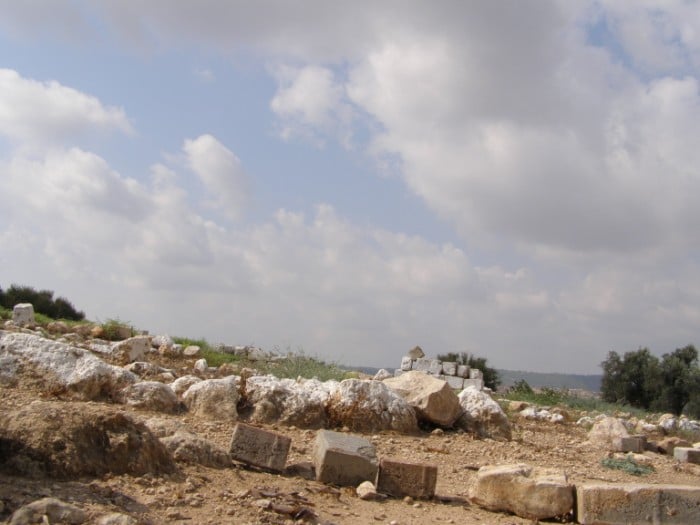
Posted by Raneen G. - انقاض القرية 8 2009
Posted by Raneen G. 1 - انقاض القرية 8 2009
Posted by Raneen G. - انقاض القرية 8 2009
Posted by Raneen G. - damoon
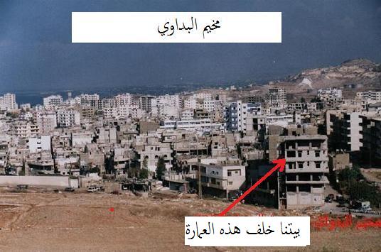
Posted by Waleed Ayyash 2 - مخيم البداوي
Posted by Waleed Ayyash - sons of damoon remembering annakba
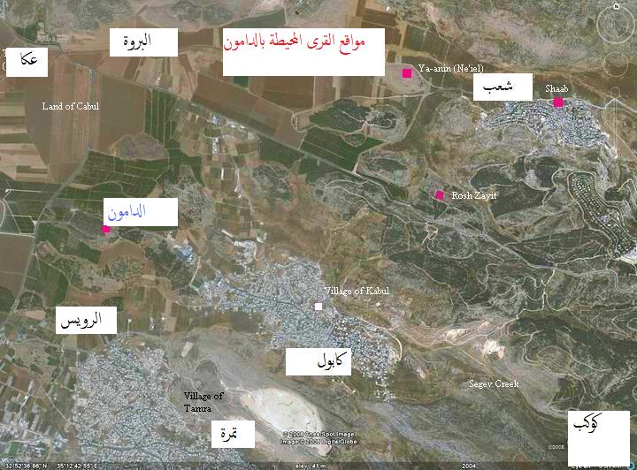
Posted by Waleed Ayyash - google earth picture of ad damoon and near by villages and towns
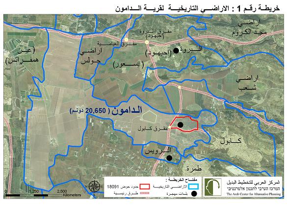
Posted by Waleed Ayyash - اراضي الدامون التاريخية
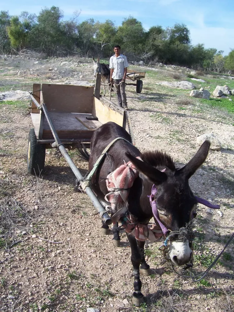
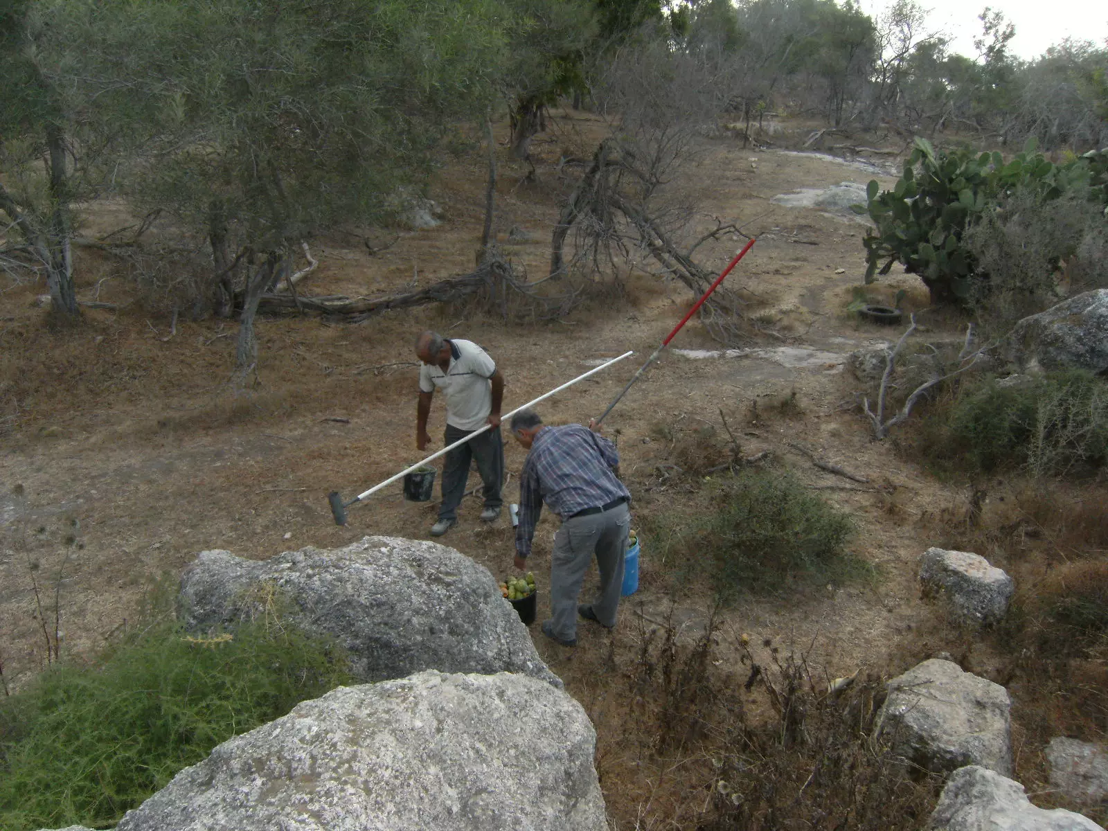
Posted by عمر عصفور - اهل الدامون مازالو ياكلون من خيراتها
Posted by maruf morad - من خيراتك يا بلدي
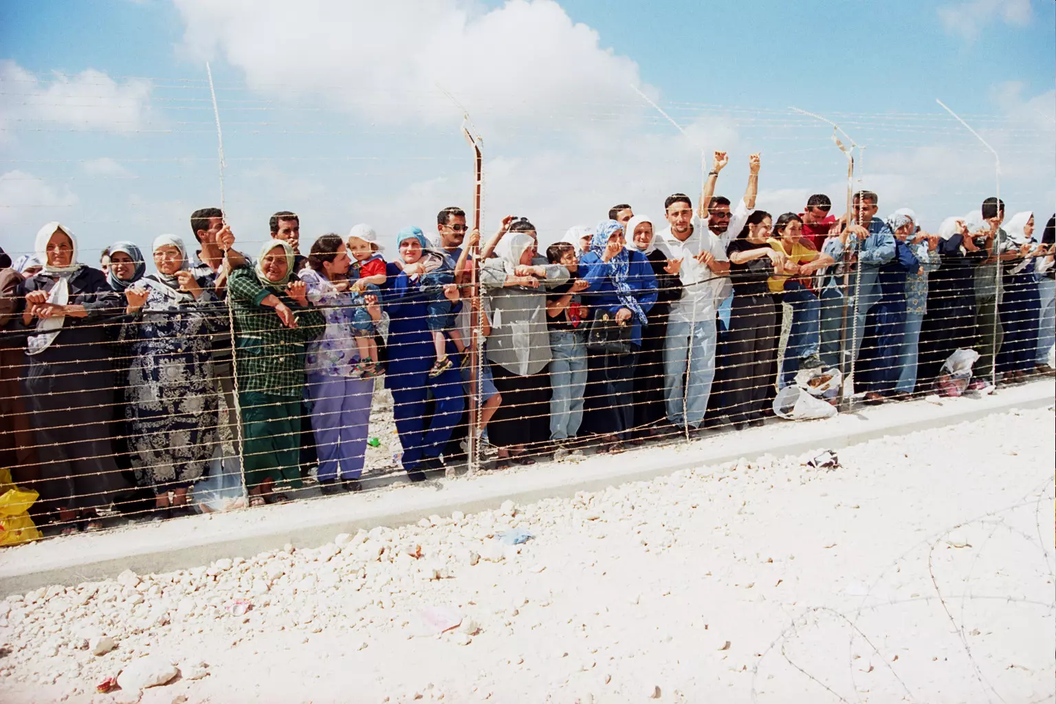
Posted by maruf morad - اشتاقت البلاد لصحابها - دوامنة على الحدود اللبنانية مع فلسطين عام 2000
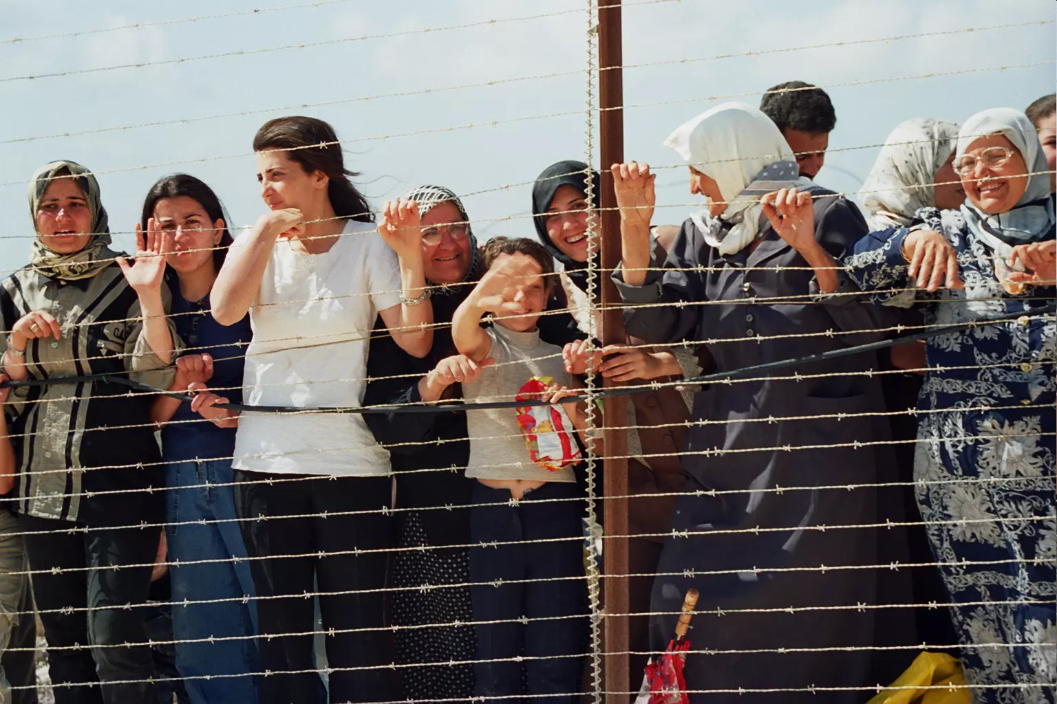
Posted by maruf morad - ينتظرون العودة - دوامنة على الحدود اللبنانية مع فلسطين عام 2000
Posted by maruf morad - غنى الحادي وقال: طيب صبرك يا دامون...
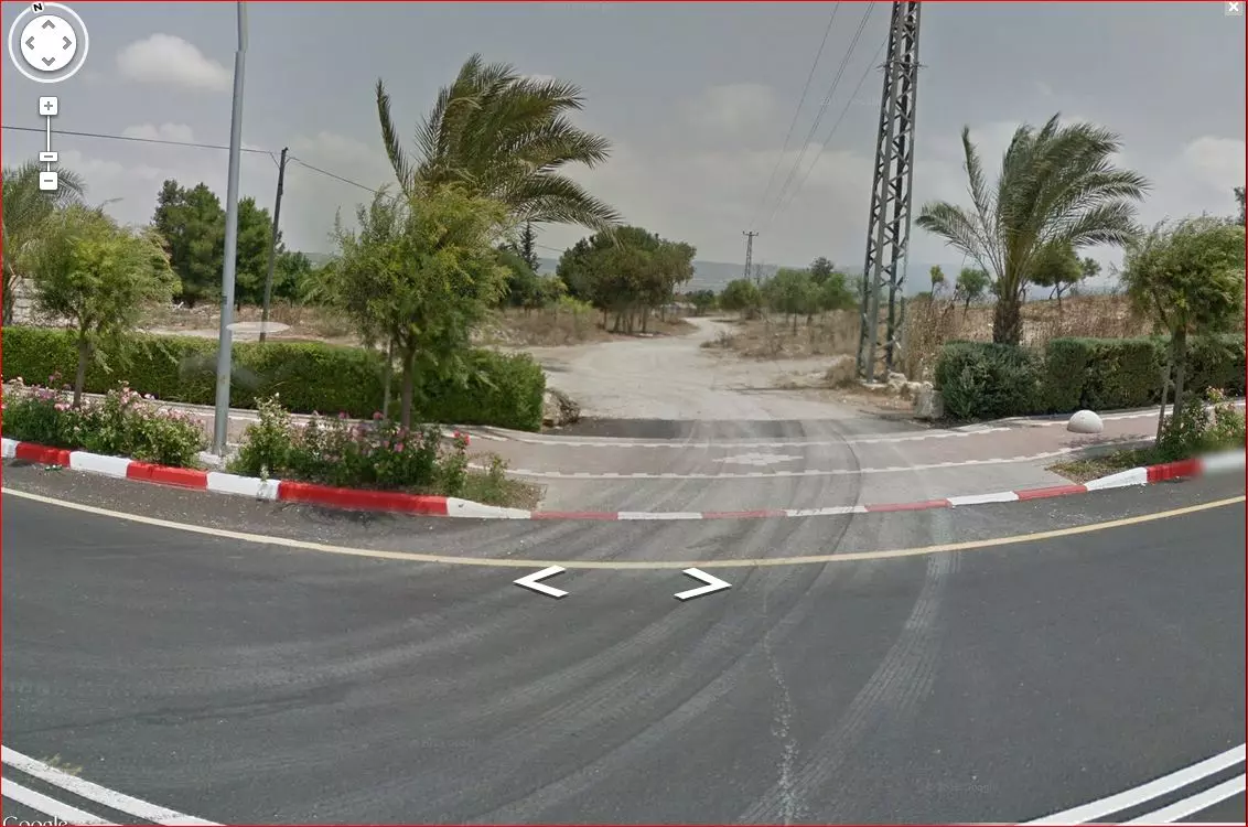
Posted by maruf morad - Entrance to Damun as seen by Google Street View
- مقبره الدامون
Posted by abu raya - اثار بيوت القريه
Posted by abu raya - مقبره واراضي القريه
Posted by abu raya - اثار جامع القريه
Posted by abu raya - مقبره القريه
Posted by abu raya - اثار بنايات القريه
Posted by abu raya - بقايا ردم بيوت القريه
Posted by abu raya - بقايا لمكان مصادر مياه القريه
Posted by abu raya - قناه تجمع مياه القريه
Posted by abu raya - الدامون
Posted by abu raya - الدامون
Posted by abu raya - بقايا معصره الزيتون
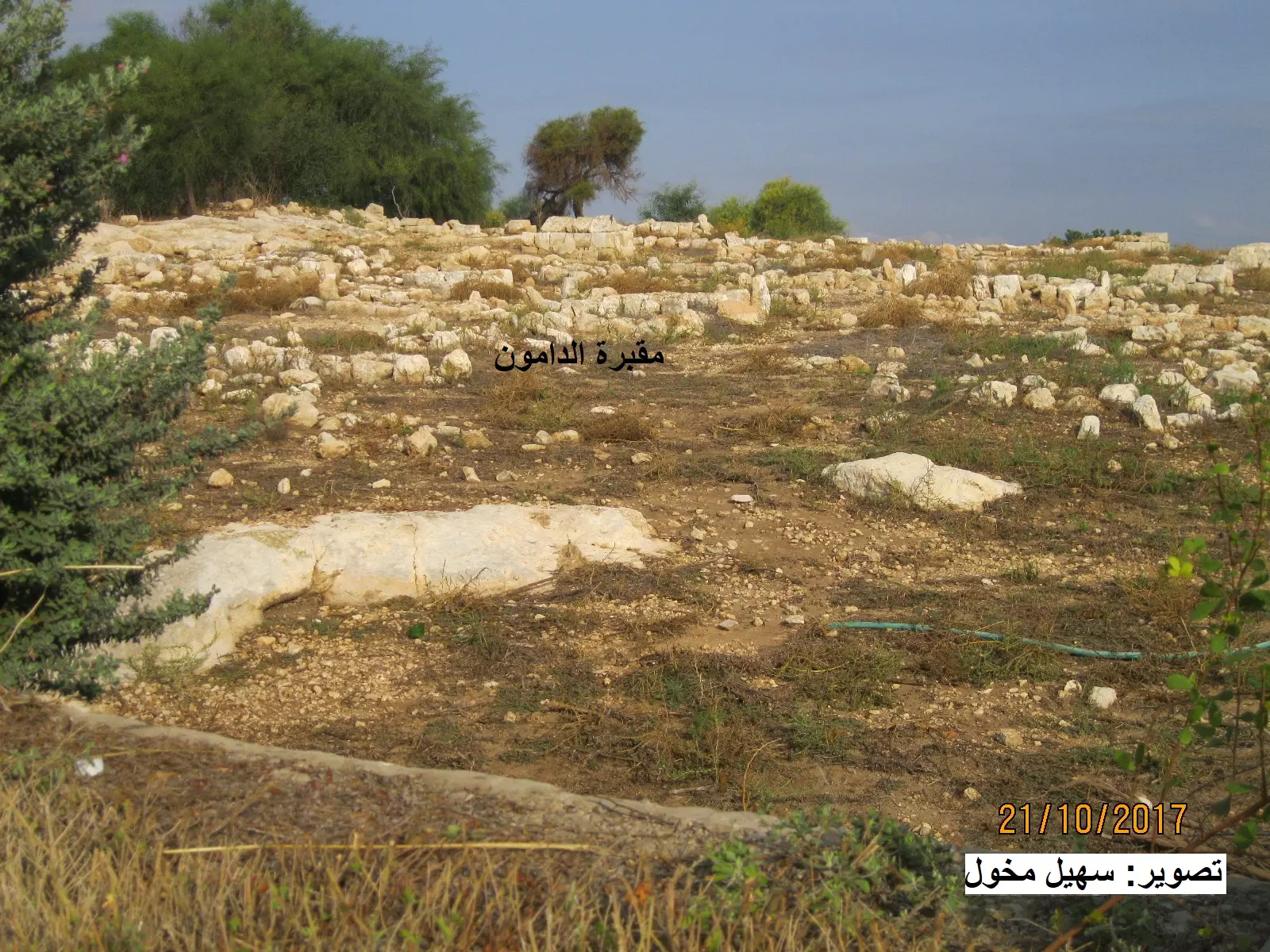
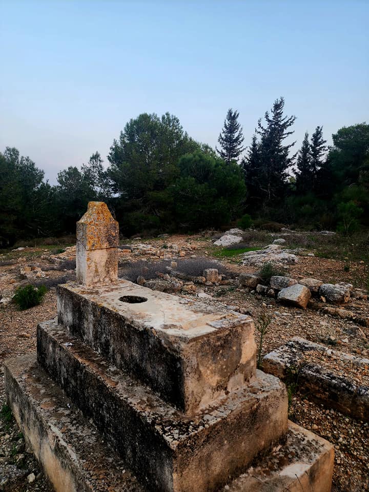
Posted by abu raya - مقبرة الدامون - تصوير: سهيل مخول
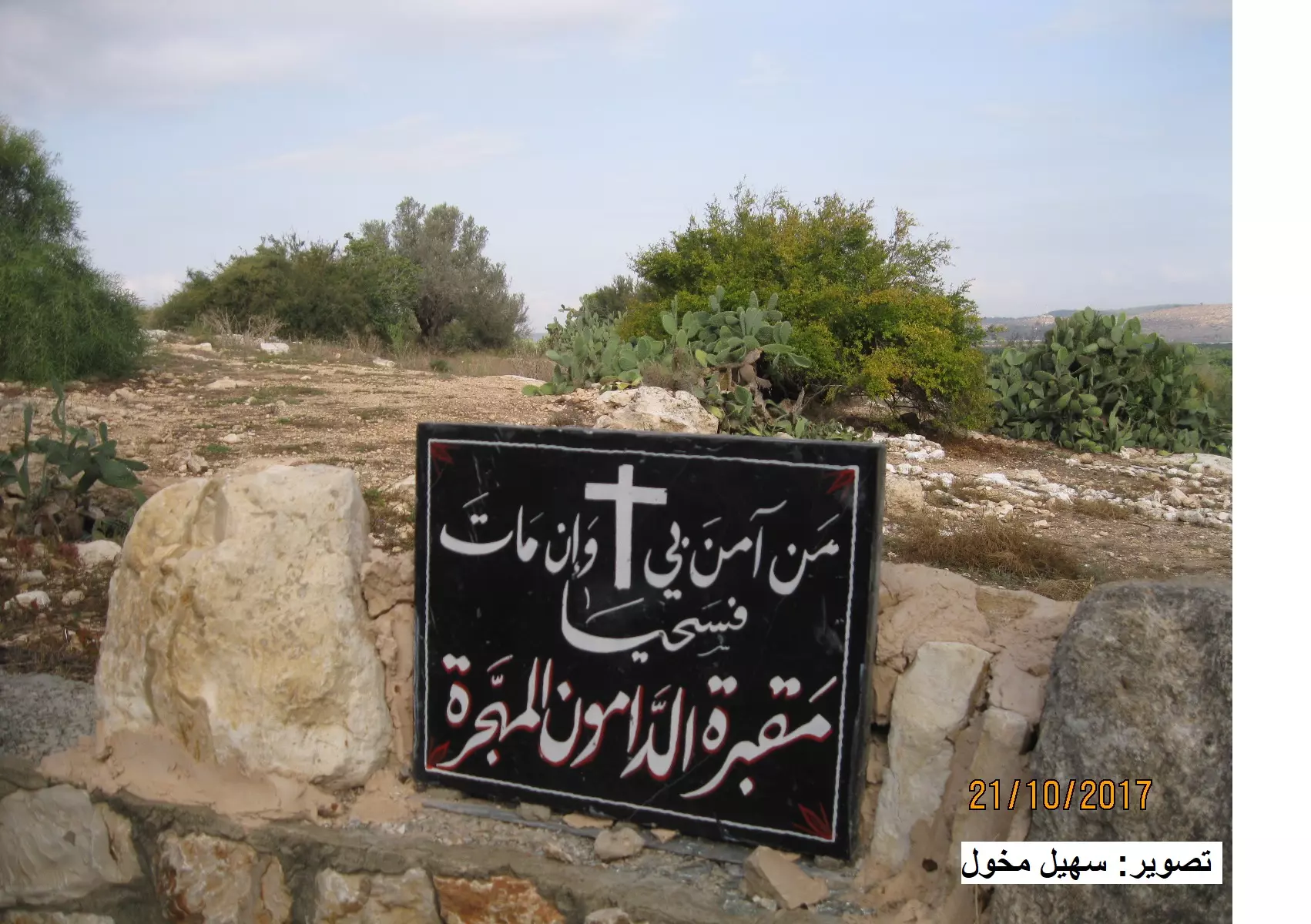
Posted by سهيل مخول - مقبرة الدامون - تصوير: سهيل مخول
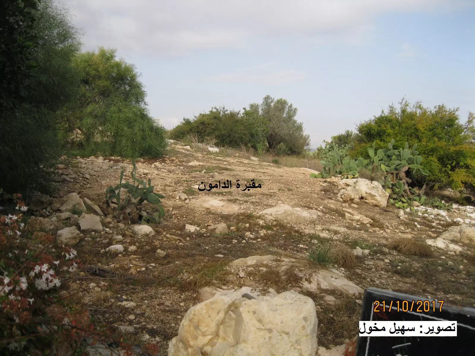
Posted by سهيل مخول - مقبرة الدامون - تصوير: سهيل مخول
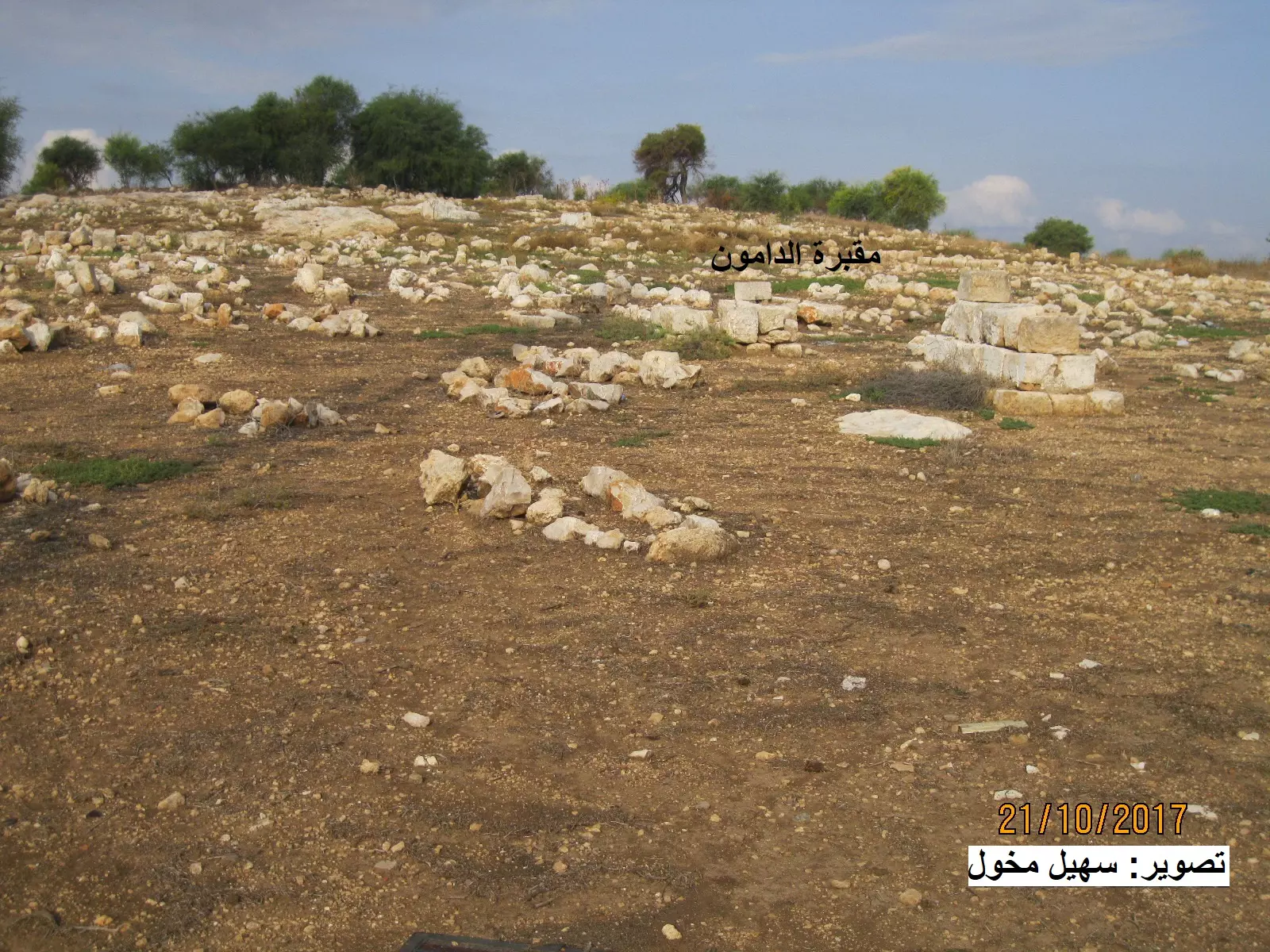
Posted by سهيل مخول - مقبرة الدامون - تصوير: سهيل مخول
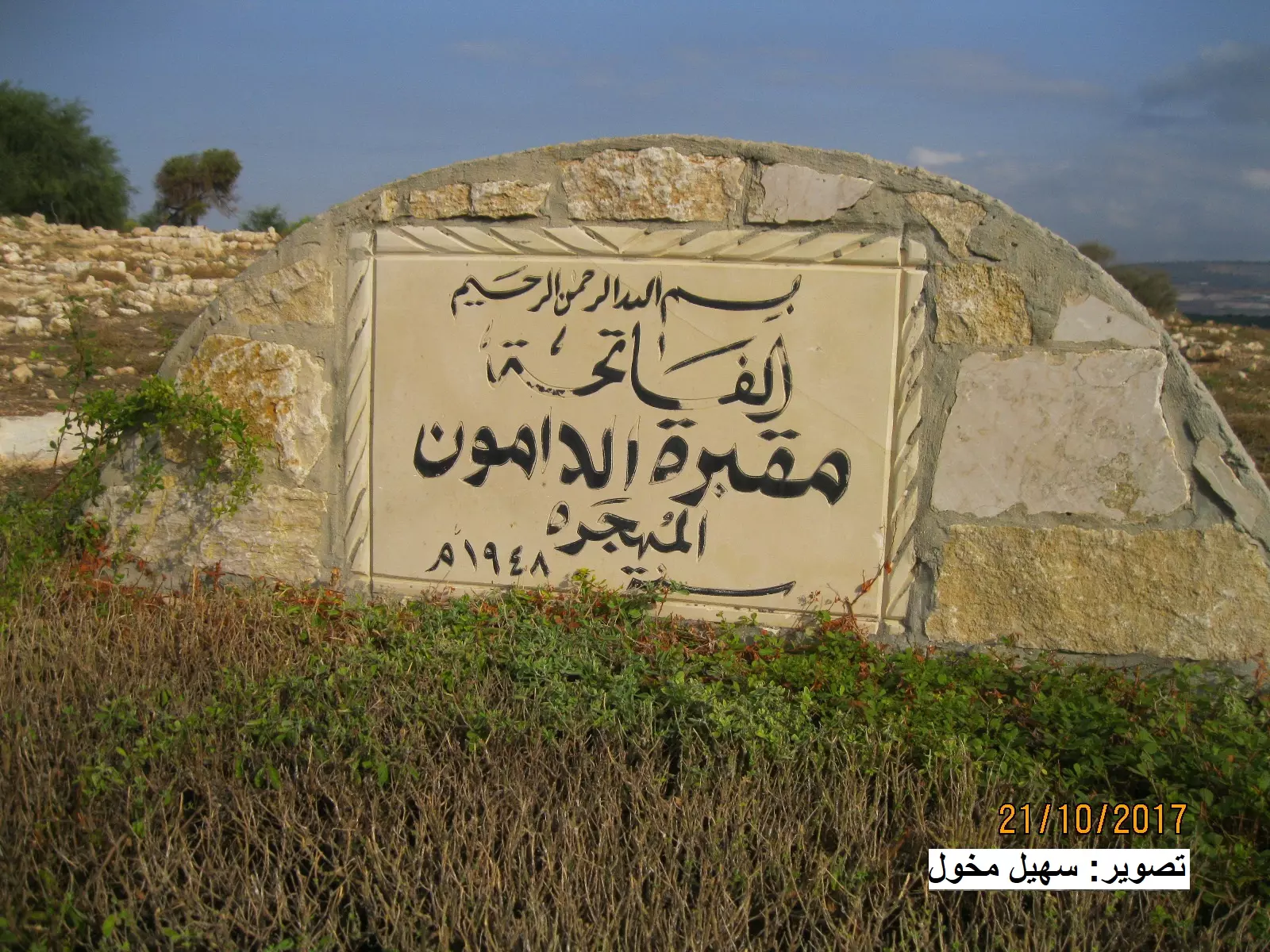
Posted by سهيل مخول - مقبرة الدامون - تصوير: سهيل مخول
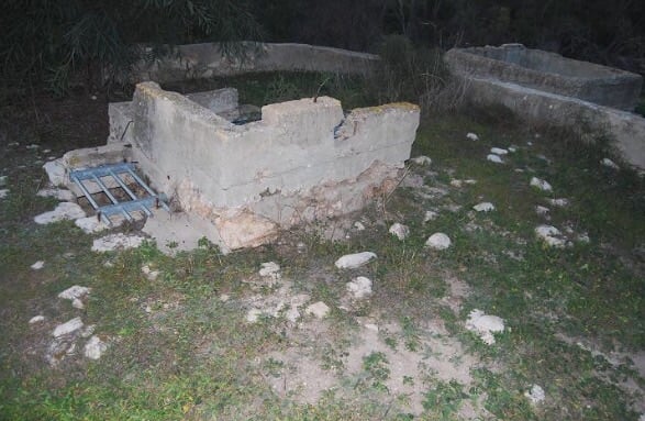
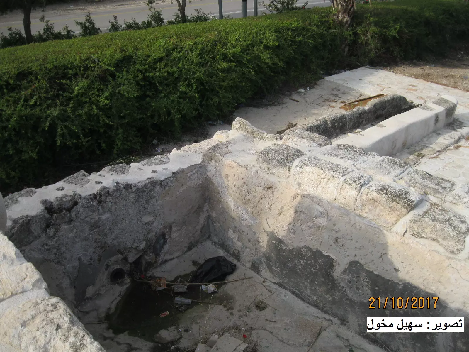
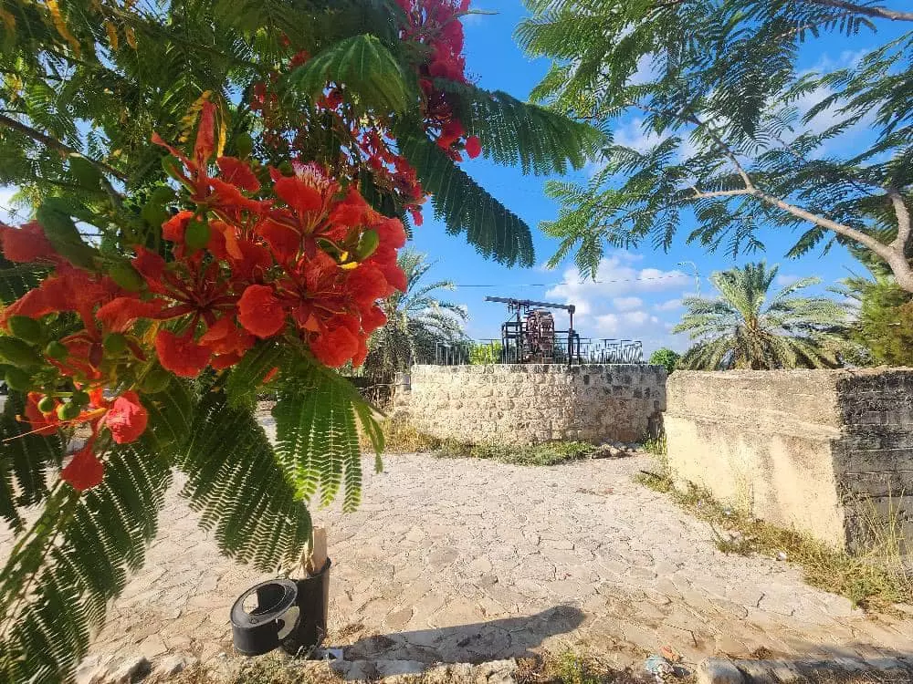
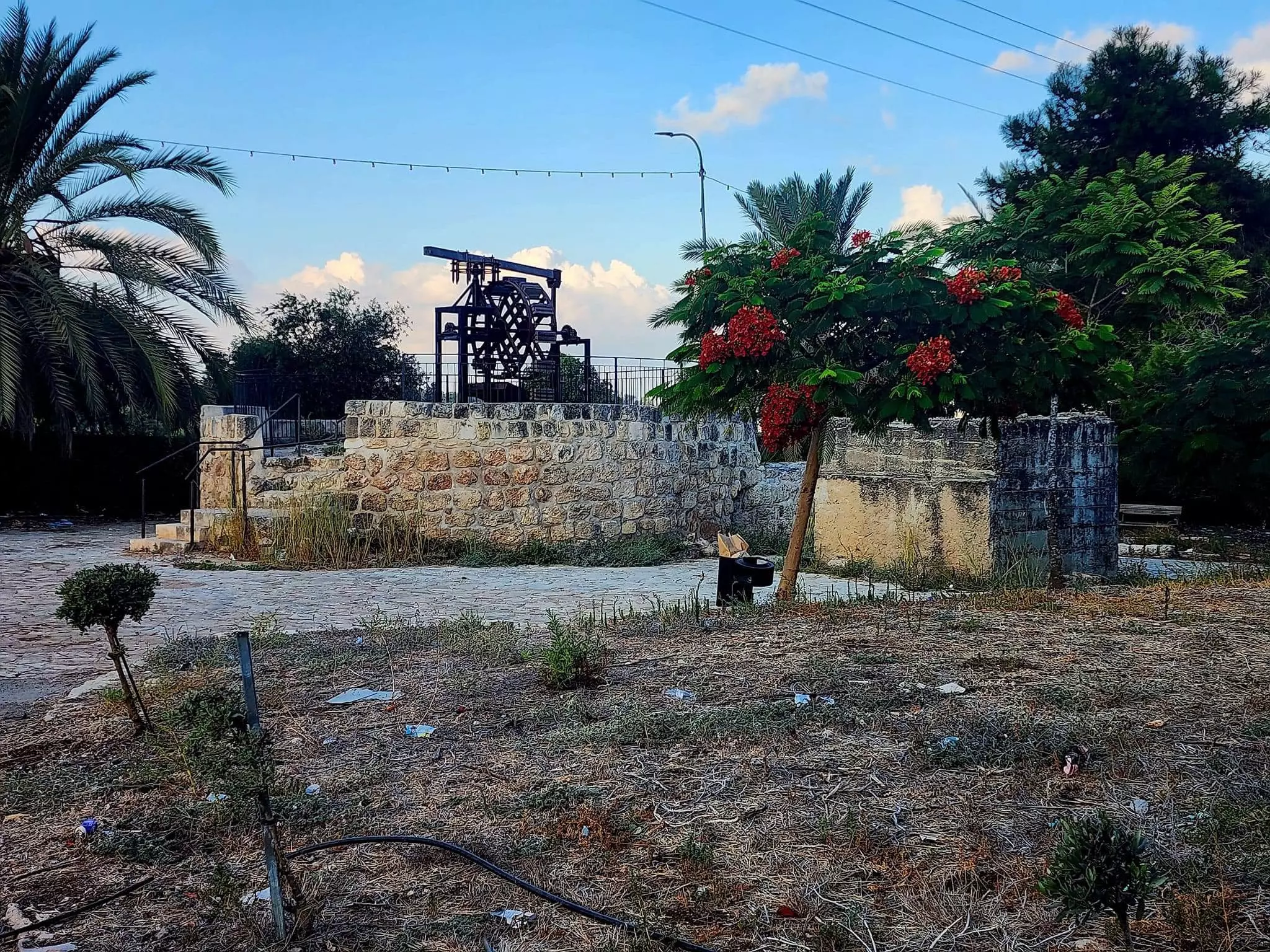
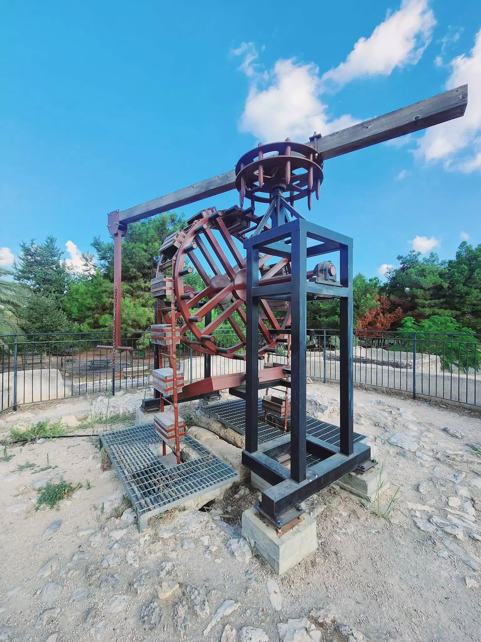
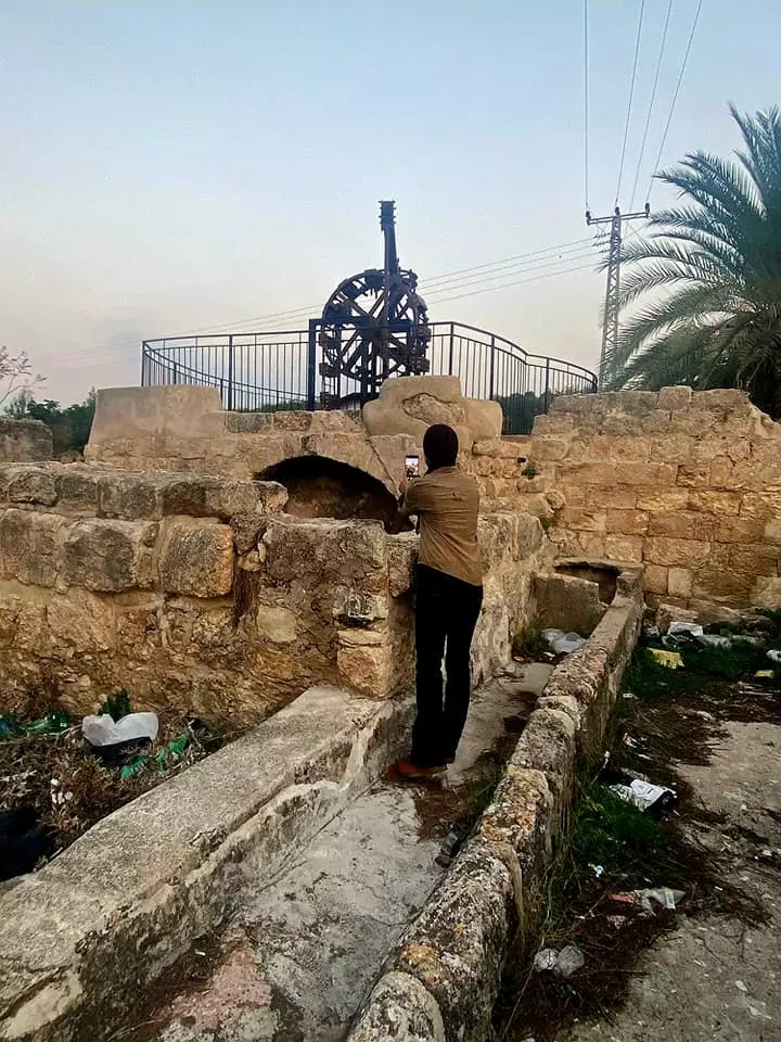
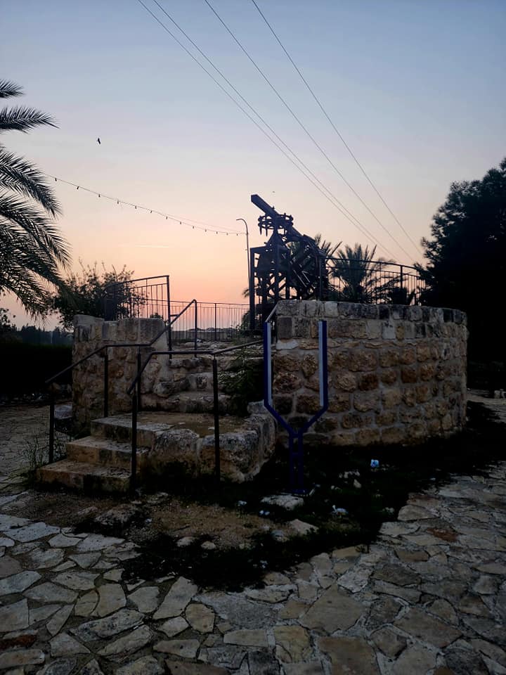
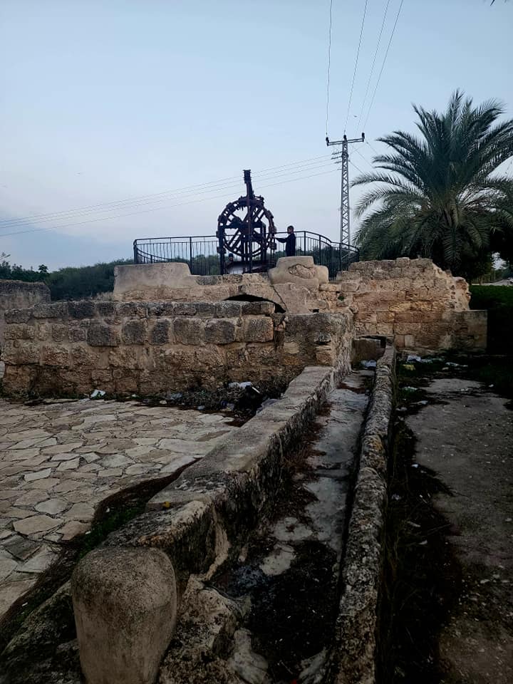
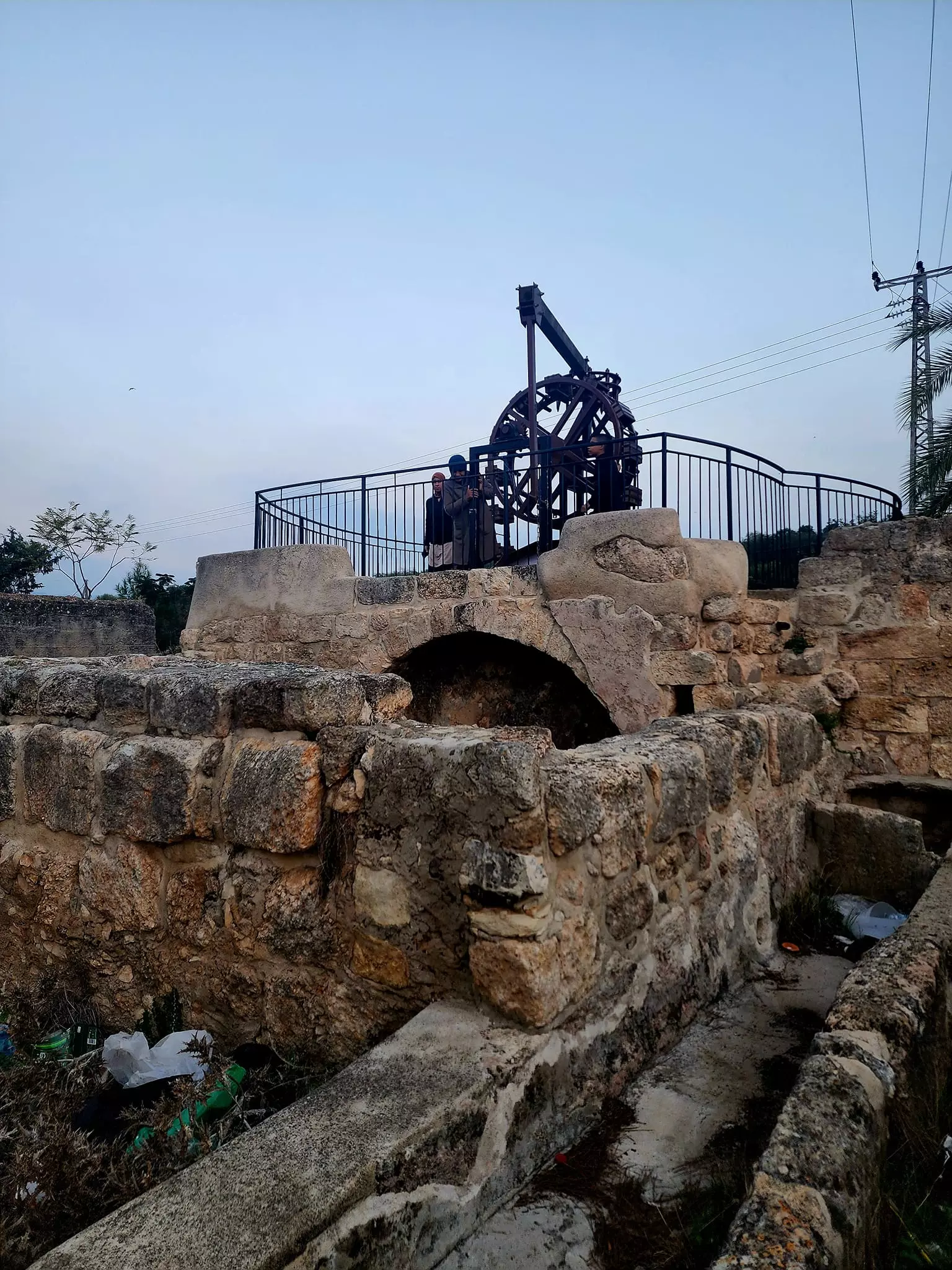
Posted by سهيل مخول - ترميم بئر الماء والحنانة في الدامون
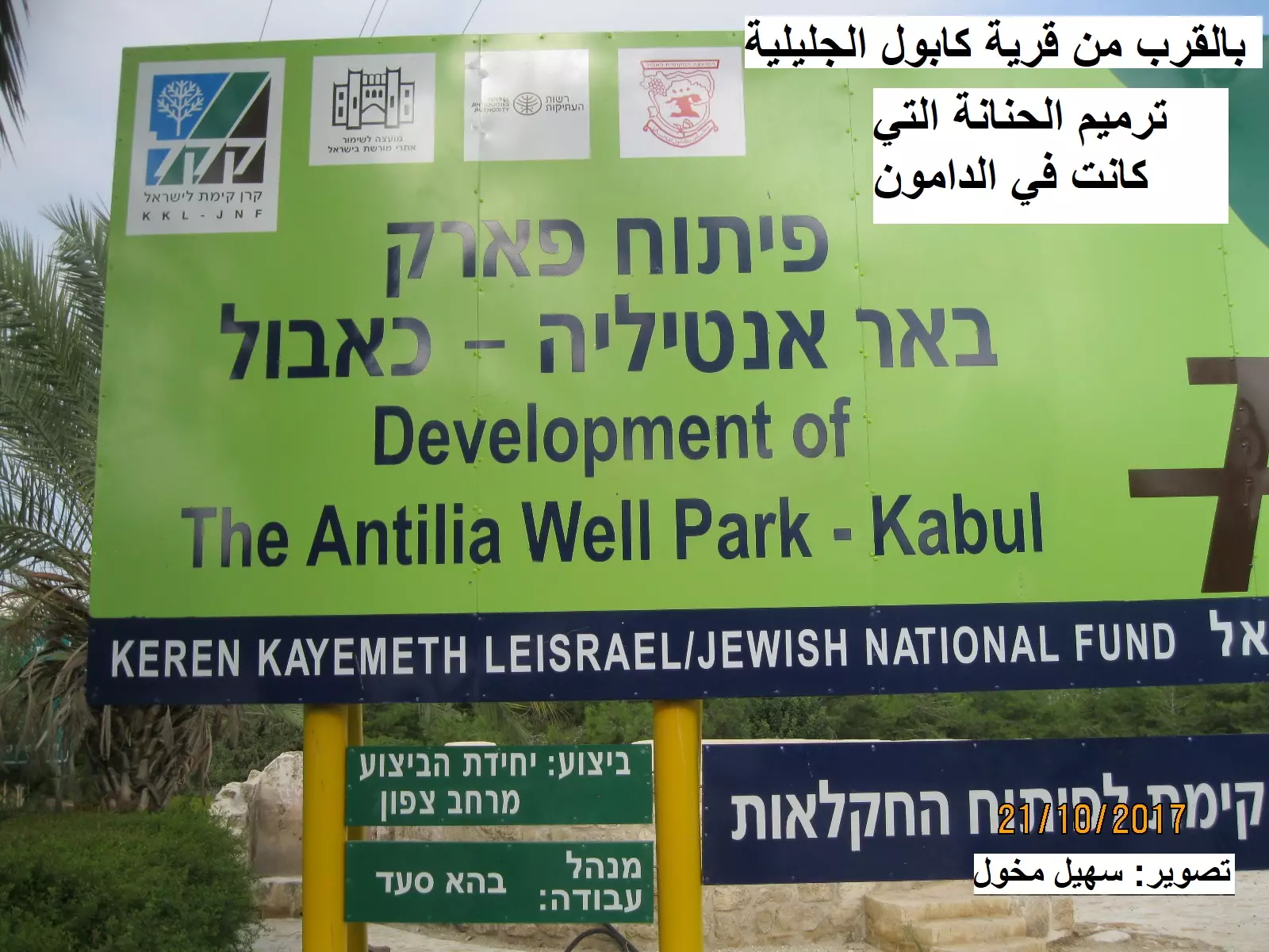
Posted by سهيل مخول - ترميم بئر الماء والحنانة في الدامون
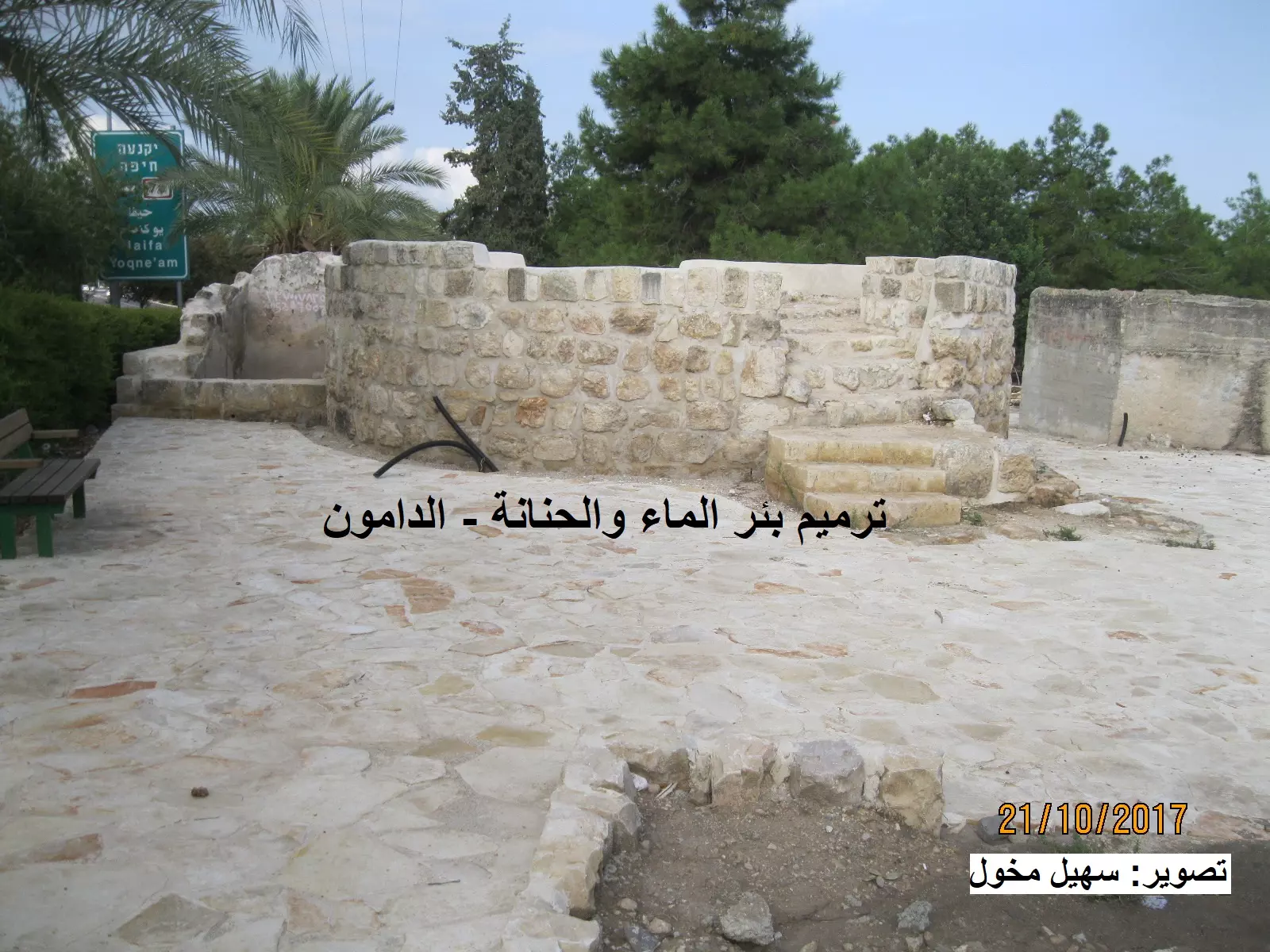
Posted by سهيل مخول - ترميم بئر الماء والحنانة في الدامون
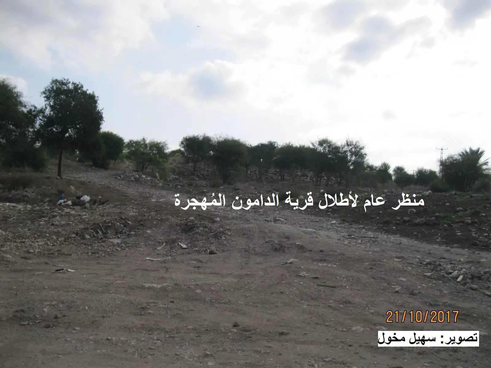
Posted by سهيل مخول - منظر عام لأطلال قرية الدامون المُهجرة
Posted by سهيل مخول - Traitors who sold land
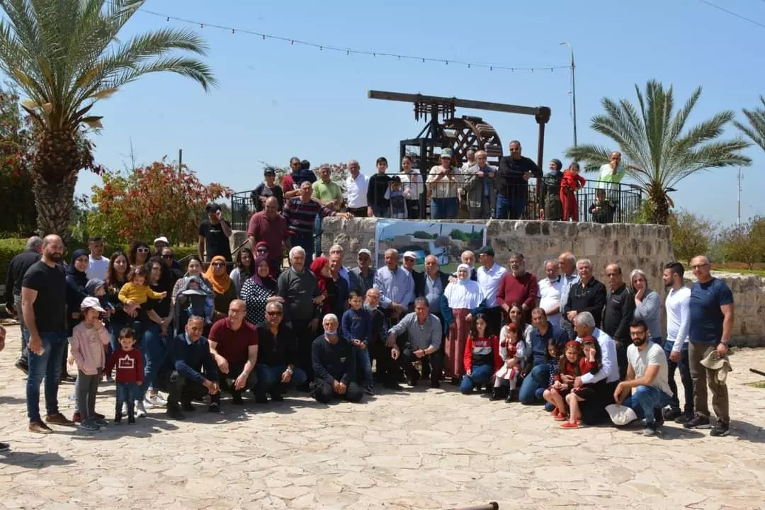
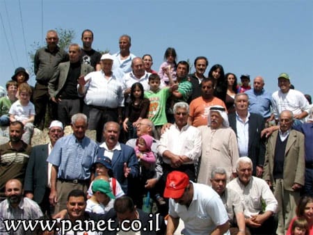
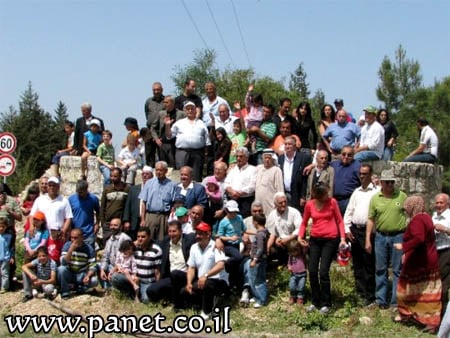
Posted by Joehar Hamdan - لمّة اجيال العودة
- Let us see how the civilized destroyed al-Damun and its grave sites. How else will the Jews be great again?
- Let us see how the civilized destroyed al-Damun and its grave sites. How else will the Jews be great again? #2
- Let us see how the civilized destroyed al-Damun and its grave sites. How else will the Jews be great again? #3
- Let us see how the civilized destroyed al-Damun and its grave sites. How else will the Jews be great again? #4
- Let us see how the civilized destroyed al-Damun and its grave sites. How else will the Jews be great again? #5
- Let us see how the civilized destroyed al-Damun and its grave sites. How else will the Jews be great again? #6
- قناه تجمع مياه القريه
- على اراضي قرية الدامون المهجرة قضاء عكا مع ابو عمر بكار فحماوي
والعم سليمان فرعتاوي ابو رحيب الذي يسكن في مدينة طمرة -- Nabela Salem
- على اراضي قرية الدامون المهجرة قضاء عكا مع ابو عمر بكار فحماوي
والعم سليمان فرعتاوي ابو رحيب الذي يسكن في مدينة طمرة -- Nabela Salem #2
- على اراضي قرية الدامون المهجرة قضاء عكا مع ابو عمر بكار فحماوي
والعم سليمان فرعتاوي ابو رحيب الذي يسكن في مدينة طمرة -- Nabela Salem #3
- على اراضي قرية الدامون المهجرة قضاء عكا مع ابو عمر بكار فحماوي
والعم سليمان فرعتاوي ابو رحيب الذي يسكن في مدينة طمرة -- Nabela Salem #4
- Let us see how the most "liberal and civilized" of world Jewry has obliterated our village except for the main water well and cemetery. How else will the Jews be great and safe again? -- القرية دمرت بالكامل بإستثناء بضعة مبناني.. من هنا مر الهمج
- Let us see how the most "liberal and civilized" of world Jewry has obliterated our village except for the main water well and cemetery. How else will the Jews be great and safe again? -- القرية دمرت بالكامل بإستثناء بضعة مبناني.. من هنا مر الهمج
#2
- Let us see how the most "liberal and civilized" of world Jewry has obliterated our village except for the main water well and cemetery. How else will the Jews be great and safe again? -- القرية دمرت بالكامل بإستثناء بضعة مبناني.. من هنا مر الهمج
#3
- Let us see how the most "liberal and civilized" of world Jewry has obliterated our village except for the main water well and cemetery. How else will the Jews be great and safe again? -- القرية دمرت بالكامل بإستثناء بضعة مبناني.. من هنا مر الهمج
#4
- Let us see how the most "liberal and civilized" of world Jewry has obliterated our village except for the main water well and cemetery. How else will the Jews be great and safe again? -- القرية دمرت بالكامل بإستثناء بضعة مبناني.. من هنا مر الهمج
#5
- Let us see how the most "liberal and civilized" of world Jewry has obliterated our village except for the main water well and cemetery. How else will the Jews be great and safe again? -- القرية دمرت بالكامل بإستثناء بضعة مبناني.. من هنا مر الهمج
#6
- Let us see how the most "liberal and civilized" of world Jewry has obliterated our village except for the main water well and cemetery. How else will the Jews be great and safe again? -- القرية دمرت بالكامل بإستثناء بضعة مبناني.. من هنا مر الهمج
#7
- Let us see how the most "liberal and civilized" of world Jewry has obliterated our village except for the main water well and cemetery. How else will the Jews be great and safe again? -- القرية دمرت بالكامل بإستثناء بضعة مبناني.. من هنا مر الهمج
#8
- Let us see how the most "liberal and civilized" of world Jewry has obliterated our village except for the main water well and cemetery. How else will the Jews be great and safe again? -- القرية دمرت بالكامل بإستثناء بضعة مبناني.. من هنا مر الهمج
#9
- Let us see how the most "liberal and civilized" of world Jewry has obliterated our village except for the main water well and cemetery. How else will the Jews be great and safe again? -- القرية دمرت بالكامل بإستثناء بضعة مبناني.. من هنا مر الهمج
#10
- Let us see how the most "liberal and civilized" of world Jewry has obliterated our village except for the main water well and cemetery. How else will the Jews be great and safe again? -- القرية دمرت بالكامل بإستثناء بضعة مبناني.. من هنا مر الهمج
#11
- Let us see how the most "liberal and civilized" of world Jewry has obliterated our village except for the main water well and cemetery. How else will the Jews be great and safe again? -- القرية دمرت بالكامل بإستثناء بضعة مبناني.. من هنا مر الهمج
#12
- Let us see how the most "liberal and civilized" of world Jewry has obliterated our village except for the main water well and cemetery. How else will the Jews be great and safe again? -- القرية دمرت بالكامل بإستثناء بضعة مبناني.. من هنا مر الهمج
#13
- Let us see how the most "liberal and civilized" of world Jewry has obliterated our village except for the main water well and cemetery. How else will the Jews be great and safe again? -- القرية دمرت بالكامل بإستثناء بضعة مبناني.. من هنا مر الهمج
#14
Want to browse more? 80,000 pictures were grouped in these gallaries:
| Display Name | Clan/Hamolah | Country of Residence |
| Hadi_Sami_Bekai | - | - |
| Husni_Bekai | - | - |
| hamade | Hamade | London, UK |
| Abdullah Elmustapha | Elbeqai | Alberta, Canada |
| daher | ZEDAN | ISRAEL, ISRAEL |
| Abdallah Elbeqai (Mustafa) | Elbeqai | Alberta, canada |
| فيصل سعود البقاعي | - | - |
| hasan | ayash | 'مخيم البداوي, لبنان |
| محمد اللوباني | - | - |
| red eagle | - | دبي |
| Waleed Ayyash | - | - |
| محمود الداموني | الداموني | - |
| tayssir | elkhatib | - |
| Samer Bikaie | - | Abu Dhabi, UAE |
| bokai | - | palastine, شفاعمرو |
| maruf morad | morad | - |
| wael bokai | - | plasten |
| JuberBas | Abu Bassal | Acre, Acre |
| abdullah lubani | - | AMMAN, JORDAN |
| Bette Damouny | - | Florida, USA |
| IBRAHIM | illo | libya, libya |
| Mourad | AyaSh | TripoLi, lebanon |
| mohamad beqai | - | - |
| AHMAD EL BEKAI | - | uae, dubai |
| Samer ElBekai | - | Canada |
| nedaa bokaie | - | palestine, palestine |
| Muhammad Zidane | Zidane | Catalonia, Spain |
| Ayyash | AL Ayyash | Athens, Greece |
| Eman | zidany | Manama, Bahrain |
| Emad Al-Zidany | Al-Zidany | Manama, Bahrain |
| alaa abu ali | Tripoli, Lebanon | |
| mohamad ayash | Ayash | Tripoli, Lebanon |
| raed zeidani | zeidani | tyre, lebanon |
| MOHAMMAD MOSTAFA DAOUD | daoud | tripoli, lebanon |
| Ayman | ayman | tripoly, باريس |
| Khadijah al Ayashi | al Ayashi | Lebanon |
| othman othman | - | - |
| Tarik Zeidany | zeidany | tripoli, Lebanon |
| Samer Zidany | - | Ontario, Canada |
- برنامج 48 | قرية الدامون ... شواهد باقية رغم التهجير Duration: 24 min 29 sec
- Return to Damun 30/05/15
- أجيال ما قبل النكبة: حُرَّاس الهوية والذاكرة: مقابلة مع حسين عبد القادر زيداني Duration: 21 min
- بئر مائة وحنانة الدامون المهجرة (قضاء عكا ) بعدسة إبراهيم ابو عمار Duration: min 26 sec
- الذاكرة مفتاح العودة-الحلقة 41- قرية الدامون Duration: 23 min 22 sec
 Fake Valor: Why Did Zionist Jews Hoist Nazis Flag on Their Ships in the 1930s?
What is new?
-
Facts About Oct. 7th Gaza Raid
-
Remined Us Please:: Who Did Rape Who? Palestinians Raped Israelis? Or, was the other way around?
-
When Prof. Edward Said was invited to debate Bibi Netanyahu in the 1980s, watch what happened!
-
Ezra Klein of the NY Times on the "Jewish Race".
-
Abusing Blood Libel!
-
Did Israeli Soldiers Activate The Hanniba Direective On Oct. 7th? You Be The Judge
-
Zionist FAQ: Isn't it true that Palestinians don't want peace? Palestinians never accepted the two-state solution
- Facts about Haavara (Transfer) Agreement between Ben-Gurion & Hitler
-
Haavara FAQs: Why Did Zionist Jews Hoist Nazis' Flags on Their Ships in the 1930s?
- Haavara FAQs: When Chaim Weizmann met FDR in mid-1943, why was he silent about rescuing European Jewry?
-
Dear ChatGPT: How did Palestinians resist Napoleon's invasion of their country in 1799?
-
Dear ChatGPT: Gaza had a vibrant Jewish community in the mid-17th century. What happened to them?
-
Dear ChatGPT: Why did the Jewish Agency suppress news of the Holocaust during WWII?
-
Video Playlist: Jews share their DNA tests to end the conflict for good.
-
A Tale of Two Conflicts: Examining the Definition of Genocide
-
Prof. Abraham Polak And The Suppressed History of the Khazars and European Jewry
-
How Ronald Reagan would have framed the genocide in Gaza if he were still alive?
-
Haavara FAQs: Let us do the math: how many German Jews did The Haavara Agreement save?
-
Zionist FAQs: The Hebron Massacre of 1929, "clearly proves" that Palestinians are antisemitic, how could you deny it?
-
Zionist FAQs: Why Anti-Zionist Is Not Antisemitism?
-
Zionist FAQs: Isn't it true that the KGB created Palestinian Nationalism in the early 1960s?
- Zionist FAQs: Muslims are killing Muslims all the time; why are Israeli Jews being singled out in the media?
- Zionist FAQs: How is Israel an apartheid state when 20% of its citizens are Arabs who enjoy full rights?
-
Haavara FAQs: Why Did Dorothy Thompson Flip From A Zionist Advocate to A Silenced Dissenter?
-
Haavara FAQs: Analysis of Herzl's Uganda Scheme and how it could have saved millions of Jews.
-
Haavara FAQs: Why did Hayim Greenberg describe American Jewry as "morally bankrupt" in early 1943?
-
Haavara FAQs: What if the Evian Conference was a resounding success? What would have been the impact of saving European Jewry on Zionism?
- Haavara FAQs: What if the six million were saved, how that would have impacted the Zionist project?
-
Haavara FAQs: How did Zionist leaders react when Europe's Jews lingered in the DP camps after WWII ended?
-
Why does the American Jewish community repeat lies that David Ben-Gurion had debunked before he died?
-
Who has the power to rename the Tatar/Khazar Gene Marker to Jewish IV?
-
Zionist FAQs: Why won't Egypt, Syria, and Jordan take their people back? Jews are indigenous to Palestine, and Arabs immigrated after Jews developed the country. Arabs should leave.
-
Haavara FAQs: Did Hitler and the Nazis conflate between Judaism and Zionist? If that wasn't case, then why?
-
Haavara FAQs: Winston Churchill and antisemitism, a collection of articles written Churchill.
-
Haavara FAQs: Broken by country, how many Jews survived vs. killed during the Holocaust?
-
Haavara FAQs: Why did European Jews vote with their feet and to immigrated to the Americas, not Palestine, after WWII?
-
Watch this American Jewish Girl describing Israeli Jews' cognitive dissonance like no other in under two minutes
-
Haavara FAQs: When the Nazis went out of their way to hide the Holocaust, Israeli Jews did the exact opposite by broadcasting their genocide of Gazans. But why?
-
Haavara FAQs: How Zionist Jews went out of their to show their appreciation to Nazism and Fascism?
- Haavara FAQs: Why Zionist leaders were against bombing the death camps & the Railroads leading to them?
-
Haavara FAQs: Hitler's message to the British and American people: If Jews are such noble citizens and you care about them, how come you're not letting them in? I will gladly ship them to you at my expense, even on luxury liners!
-
A shortlist of Zionist and Israeli false flag operations in the name Jews.
-
The Most Moral Army
- The Land of Kapos (Israel): Where the brave are boycotted and Kapos walk free.
- Why did early Zionists often named their communal enterprises "colonial"?
- Zionist Relations with Nazi Germany by Faris Glubb
-
Two NY Times advertisements by Zionists in the early 1943 that exposes Zionists' treason at the height of the calamity
- Facts Not Lies about the Palestinian-Israeli Conflict.
- Site's pictures have been categorized
- Campgain Against Lice
- A Survey of Palestine, the official source about Palestine before Nakba produced by the British Mandate; over 1200 pages.
- Satellite View & Google Earth: Over 6,000 placemarks identifying all destroyed towns, W. Bank & Gaza Strip Towns, & refugee camps.
- PalestineRemembered.com and its Nakba Oral History Project were featured on al-Jazeera Satellite TV.
- Nakba Oral History Video Podcast:
 Over 700 Oral History interviews (including 3,500+ hours of recording) can be viewed online.
 - Palestine Village Statistics Project
- Gaza Jail Break
- النسخة العربية للموقع الان متوفرة
- Videos: Documenting the destroyed villages in video: Tracing all that remains since Nakba.
- Videos: Responding to Zionist Propaganda
- Interview: The ethnic cleansing of Palestine: George Galloway interviews Israeli Historian Ilan Pappe.
- For Palestinians, memory matters. It provides a blueprint for their future By George Bisharat.
- Zionist FAQ now available in Hebrew שאלות שציונים שואלים, עכשיו בעברית
- Video: The Stephen Walt and John Mearsheimer report on the influence of the Israel Lobby on U.S. Foreign Policy
- The Palestinian-Israeli conflict for beginners
