| PalestineRemembered | About Us | Oral History | العربية | |
| Pictures | Zionist FAQs | Haavara | Maps | |
| Search |
| Camps |
| Districts |
| Acre |
| Baysan |
| Beersheba |
| Bethlehem |
| Gaza |
| Haifa |
| Hebron |
| Jaffa |
| Jericho |
| Jerusalem |
| Jinin |
| Nablus |
| Nazareth |
| Ramallah |
| al-Ramla |
| Safad |
| Tiberias |
| Tulkarm |
| Donate |
| Contact |
| Profile |
| Videos |
Welcome To Kabara - كبارة (כבארה)
|
District of Haifa
Ethnically cleansed days ago |
العربية Google Earth |
 |
Gallery (19) |
- Statistics & Facts
-
Before & After

- Satellite View
- Articles 1
- Pictures 19
- Members
- All That Remains
- Videos
- Guest Book 2
- Links
| Statistic & Fact | Value | |||||||||||||||||||||
| Occupation Date | April 30, 1948 | |||||||||||||||||||||
| Distance From District | 30 (km) South East of Haifa | |||||||||||||||||||||
| Elevation | 25 (meters) | |||||||||||||||||||||
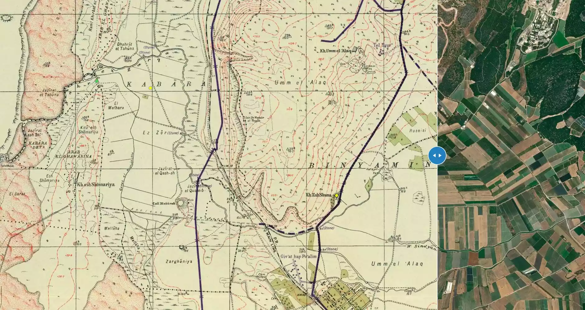
| Before & After Nakba, Click Map For Details |
||||||||||||||||||||||
|
||||||||||||||||||||||
| Map Location | See location #38 on the map View from satellite |
|||||||||||||||||||||
| Military Operation | Possibly the Coastal Clearing Operation | |||||||||||||||||||||
| Exodus Cause | Expulsion by Zionist troops | |||||||||||||||||||||
| Village Temains | The village has been completely destroyed, and only house rubble left behind. | |||||||||||||||||||||
| Ethnically Cleansing | Kabara inhabitants were completely ethnically cleansed. | |||||||||||||||||||||
| Pre-Nakba Land Ownership |
|
|||||||||||||||||||||
| Land Usage As of 1945 |
|
|||||||||||||||||||||
| Population |
|
|||||||||||||||||||||
| Number of Houses |
|
|||||||||||||||||||||
| Near By Towns |
||||||||||||||||||||||
|
||||||||||||||||||||||
| Town's Name Through History | The Crusades referred to Kabara by Pain Perdu. | |||||||||||||||||||||
| Archeological Sites | A nearby cave contained a deep Middle Palaeolithic deposit that was covered by a Natufian layer dating to about the 9th millennium B.C. | |||||||||||||||||||||
| Exculsive Jewish Colonies Who Usurped Village Lands |
Ma'yan Tzevi, Ma'agan Mikha'el, & Beyt Chananya | |||||||||||||||||||||
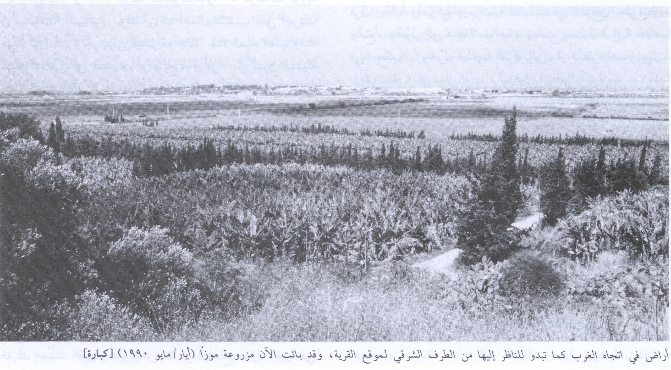
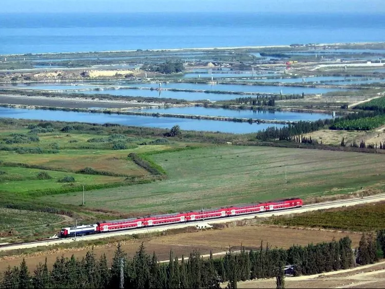
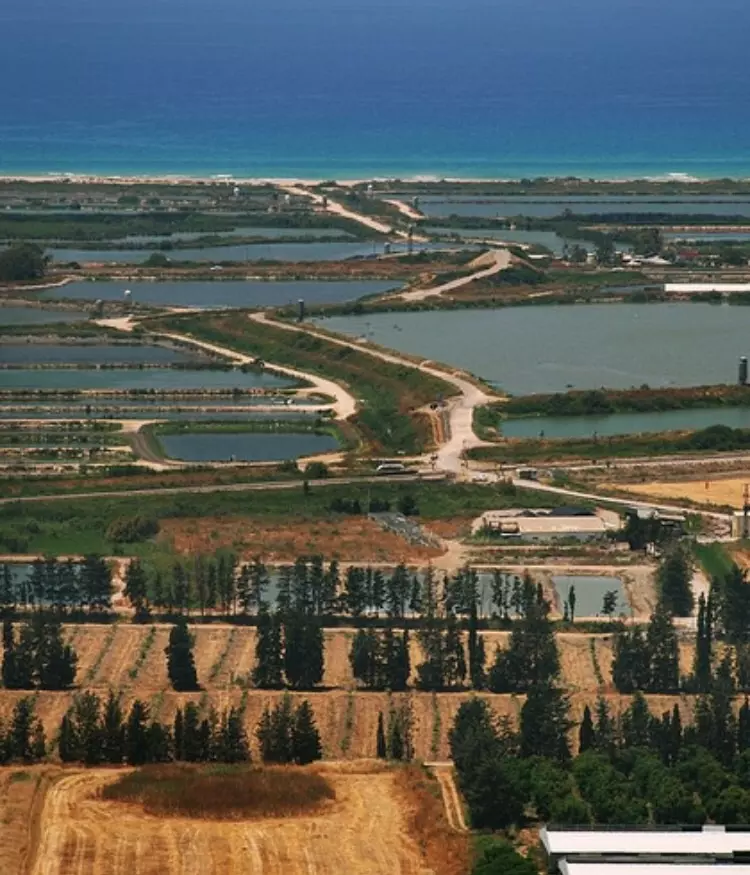
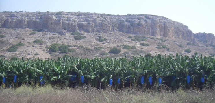
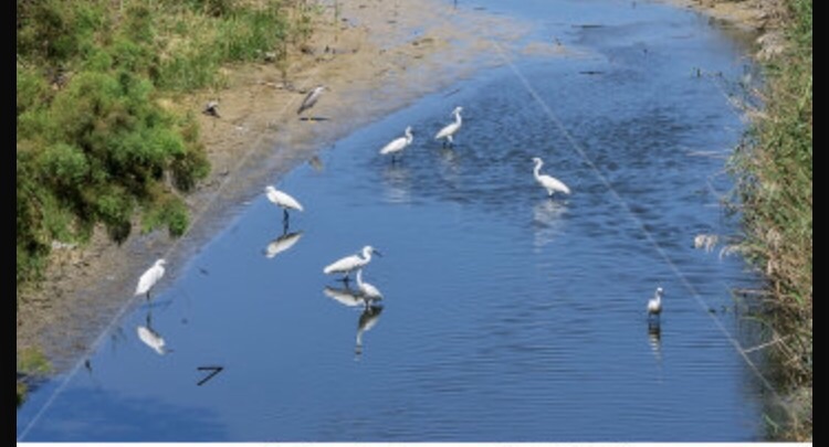
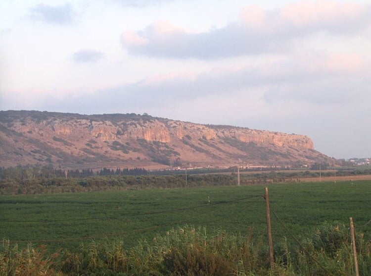
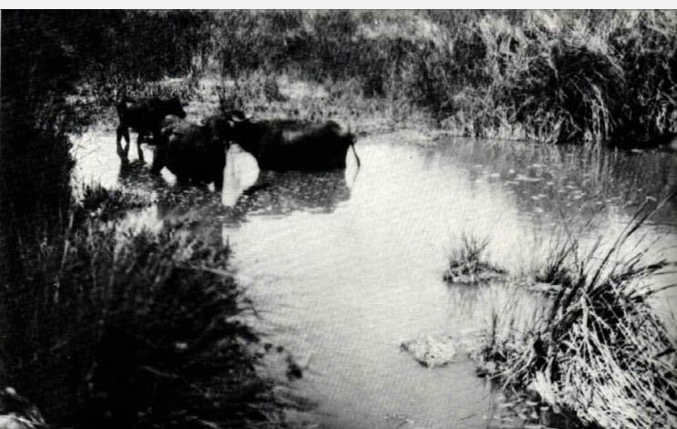
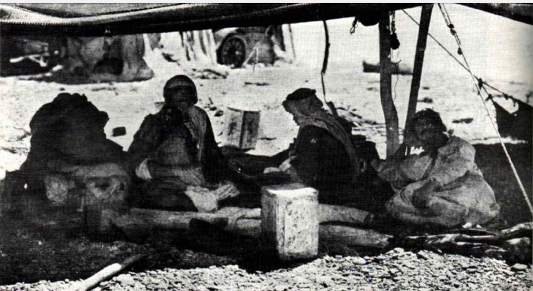
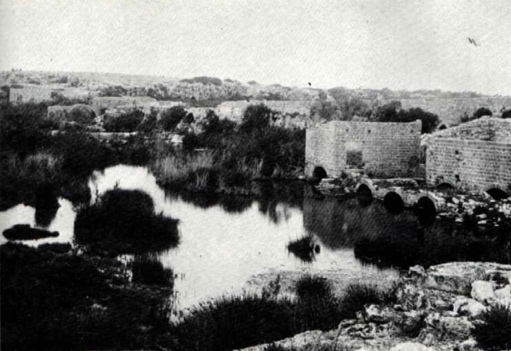
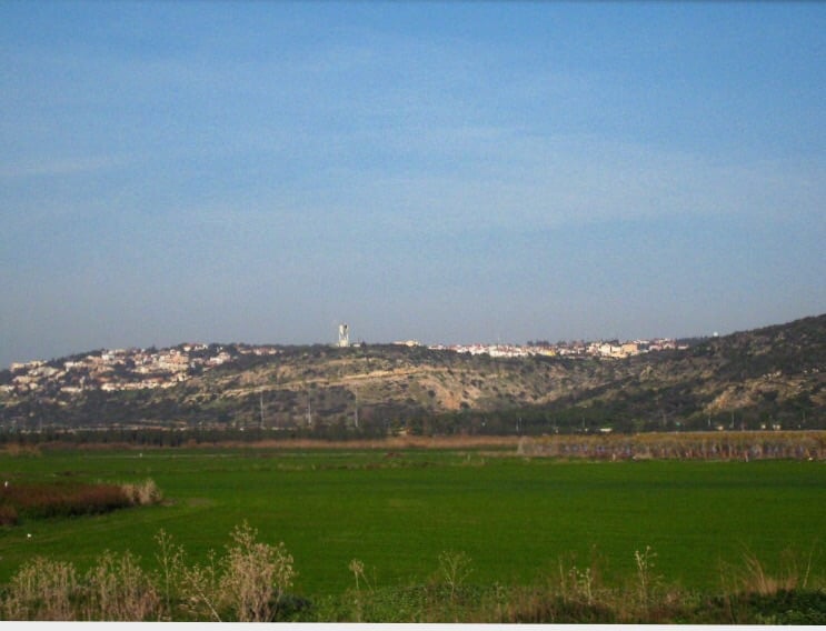
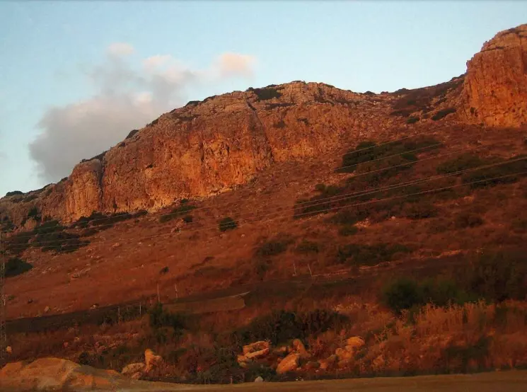
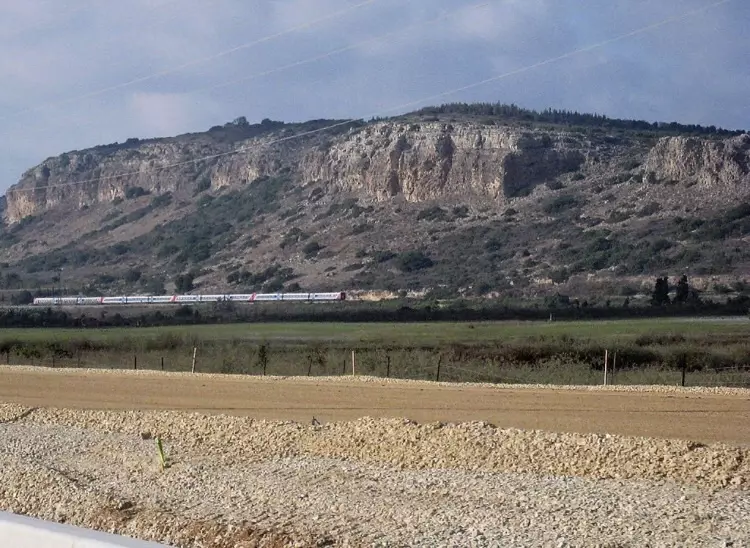
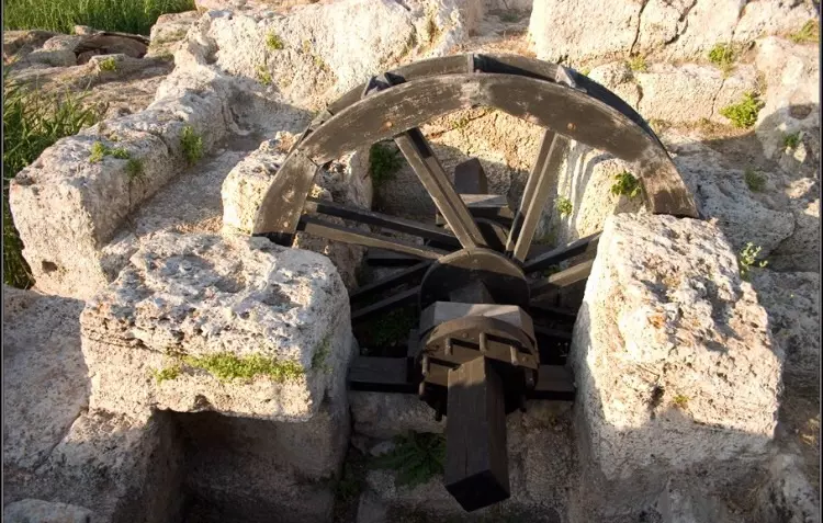
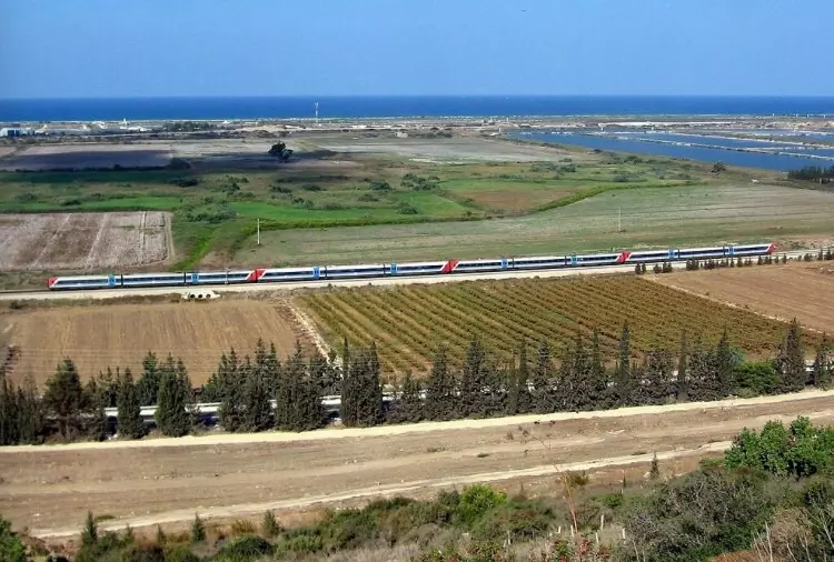
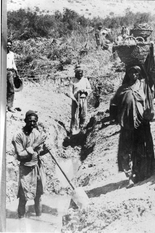
Village Before NakbaThe village was situated on the coastal plain, at the foot of the western slopes of Mount Carmel, just east of the coastal highway. Its name was probably a plural of kubri, a loanword from the Turkish word for bridge (köprü), and referred to the numerous bridges built across the nearby al-Zarqa River. Kabara has been identified with the Crusader locality of Pain Perdu. The population was Muslim. The village's economy depended on agriculture and animal husbandry. In 1944/45 only 2 dunums of land were devoted to citrus and bananas, while 1,001 dunums were allotted to cereals; 20 dunums were irrigated or used for orchards. Above the village (on the slopes of Mount Carmel) and to the east of it lay a cave known as Mugharat al-Kabara , an important prehistoric site discovered in 1929 and excavated by several teams, most recently (1982) by a French-Israeli team. The cave contained a deep Middle Palaeolithic deposit that was covered by a Natufian layer dating to about the ninth millenium B.C.Village Occupation and Ethnic CleaningNo information could be found about the occupation of this village. It was probably occupied during the second campaign to 'clear' the northern coastal plain of all Arab communities between Tel Aviv and the settlement of Zikhron Ya'aqov, south of Haifa. This would suggest that it was captured either in April or the first half of May 1948. However, it may have held out until late May, like the nearby village of al-Tantura.Zionists Colonies on Village LandsThe settlement of Ma'yan Tzevi, founded in 1938, is on village lands to the north of the site. Two other settlements, Ma'agan Mikha'el and Beyt Chananya , were built on village lands in 1949 and 1950, respectively, after the village had been depopulated.Village TodayThe rubble from the village houses has been moved up the slope where it is now visible, covered with dirt. Cactuses and banana trees, as well as isolated fig, carob, and olive trees, grow on the site.SourceDr. Walid al-Khalidi, 1992: All That Remains. |
||||||||||||||||||||||
| Related Maps | Town Lands' Demarcation Maps خرائط للقضاء توضح حدود القرى والاودية Town's map on MapQuest View from satellite Help us map this town at WikiMapia |
|||||||||||||||||||||
| More Information | في كتاب كي لا ننسى في كتاب بلادنا فلسطين المزيد من موقع هوية |
|||||||||||||||||||||
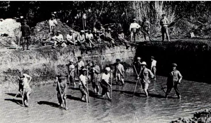
- Village Rubble In 1987
Scanned from "All That Remains" by Dr. Walid Khalidi - من قرية كبارة الخضيرة عام 1920
- اراضي القريه
Posted by abu raya - اراضي القريه من جبل الكرمل حتى البحر المتوسط
Posted by abu raya - موقع القريه من الجهه الشماليه
Posted by abu raya - وادي التماسيح يمر من القريه
Posted by abu raya - شاطى البحر من جانب القريه
Posted by abu raya - موقع القريه في وسط الصوره ومن الخلف جبل الكرمل
Posted by abu raya - صوره قديمه من القريه ووادي التماسيح
Posted by abu raya - كباره قبل النكبه
Posted by abu raya - بيوت القريه ووادي التماسيح قبل النكبه
Posted by abu raya - صوره قديمه من القريه
Posted by abu raya - منظر من غرب القريه باتجاه سفوح الكرمل
Posted by abu raya - منحدرات الكرمل بالقرب من القريه
Posted by abu raya - منظر لموقع القريه بين اشجار السرو بالقرب من منحدرات الكرمل
Posted by abu raya - قنوات سحب المياه من وادي التماسيح كان يستعملها سكان القريه
Posted by abu raya - نظره لاراضي القريه وموقعها من جبل الكرمل

Posted by abu raya - نظره لاراضي القريه وموقعها من جبل الكرمل
Posted by abu raya - كباره 1924
Posted by أبو اليزن السعافين
Want to browse more? 80,000 pictures were grouped in these gallaries:
| Display Name | Clan/Hamolah | Country of Residence |
No links have been shared yet, be free to the first to share the first link.
 Fake Valor: Why Did Zionist Jews Hoist Nazis Flag on Their Ships in the 1930s?
What is new?
-
Facts About Oct. 7th Gaza Raid
-
Remined Us Please:: Who Did Rape Who? Palestinians Raped Israelis? Or, was the other way around?
-
When Prof. Edward Said was invited to debate Bibi Netanyahu in the 1980s, watch what happened!
-
Ezra Klein of the NY Times on the "Jewish Race".
-
Abusing Blood Libel!
-
Zionist FAQ: Isn't it true that Palestinians don't want peace? Palestinians never accepted the two-state solution
- Facts about Haavara (Transfer) Agreement between Ben-Gurion & Hitler
-
Haavara FAQs: Why Did Zionist Jews Hoist Nazis' Flags on Their Ships in the 1930s?
-
Dear ChatGPT: Why did the Jewish Agency suppress news of the Holocaust during WWII?
-
Video Playlist: Jews share their DNA tests to end the conflict for good.
-
A Tale of Two Conflicts: Examining the Definition of Genocide
-
Prof. Abraham Polak And The Suppressed History of the Khazars and European Jewry
-
How Ronald Reagan would have framed the genocide in Gaza if he were still alive?
-
Haavara FAQs: Let us do the math: how many German Jews did The Haavara Agreement save?
-
Zionist FAQs: The Hebron Massacre of 1929, "clearly proves" that Palestinians are antisemitic, how could you deny it?
-
Zionist FAQs: Why Anti-Zionist Is Not Antisemitism?
-
Zionist FAQs: Isn't it true that the KGB create Palestinian Nationalism in the early 1960s?
- Zionist FAQs: Muslims are killing Muslims all the time; why are Israeli Jews being singled out in the media?
- Zionist FAQs: How is Israel an apartheid state when 20% of its citizens are Arabs who enjoy full rights?
-
Haavara FAQs: Analysis of Herzl's Uganda Scheme and how it could have saved millions of Jews.
-
Haavara FAQs: Why did Hayim Greenberg describe American Jewry as "morally bankrupt" in early 1943?
-
Haavara FAQs: What if the Evian Conference was a resounding success? What would have been the impact of saving European Jewry on Zionism?
- Haavara FAQs: What if the six million were saved, how that would have impacted the Zionist project?
-
Haavara FAQs: How did Zionist leaders react when Europe's Jews lingered in the DP camps after WWII ended?
-
Why does the American Jewish community repeat lies that David Ben-Gurion had debunked before he died?
-
Who has the power to rename the Tatar/Khazar Gene Marker to Jewish IV?
-
Zionist FAQs: Why won't Egypt, Syria, and Jordan take their people back? Jews are indigenous to Palestine, and Arabs immigrated after Jews developed the country. Arabs should leave.
-
Haavara FAQs: Did Hitler and the Nazis conflate between Judaism and Zionist? If that wasn't case, then why?
-
Haavara FAQs: Winston Churchill and antisemitism, a collection of articles written Churchill.
-
Haavara FAQs: Broken by country, how many Jews survived vs. killed during the Holocaust?
-
Haavara FAQs: Why did European Jews vote with their feet and to immigrated to the Americas, not Palestine, after WWII?
-
Watch this American Jewish Girl describing Israeli Jews' cognitive dissonance like no other in under two minutes
-
Haavara FAQs: When the Nazis went out of their way to hide the Holocaust, Israeli Jews did the exact opposite by broadcasting their genocide of Gazans. But why?
-
Haavara FAQs: How Zionist Jews went out of their to show their appreciation to Nazism and Fascism?
- Haavara FAQs: Why Zionist leaders were against bombing the death camps & the Railroads leading to them?
-
Haavara FAQs: Hitler's message to the British and American people: If Jews are such noble citizens and you care about them, how come you're not letting them in? I will gladly ship them to you at my expense, even on luxury liners!
-
A shortlist of Zionist and Israeli false flag operations in the name Jews.
-
The Most Moral Army
- The Land of Kapos (Israel): Where the brave are boycotted and Kapos walk free.
- Why did early Zionists often named their communal enterprises "colonial"?
- Zionist Relations with Nazi Germany by Faris Glubb
-
Two NY Times advertisements by Zionists in the early 1943 that exposes Zionists' treason at the height of the calamity
- Facts Not Lies about the Palestinian-Israeli Conflict.
- Site's pictures have been categorized
- Campgain Against Lice
- A Survey of Palestine, the official source about Palestine before Nakba produced by the British Mandate; over 1200 pages.
- Satellite View & Google Earth: Over 6,000 placemarks identifying all destroyed towns, W. Bank & Gaza Strip Towns, & refugee camps.
- PalestineRemembered.com and its Nakba Oral History Project were featured on al-Jazeera Satellite TV.
- Nakba Oral History Video Podcast:
 Over 700 Oral History interviews (including 3,500+ hours of recording) can be viewed online.
 - Palestine Village Statistics Project
- Gaza Jail Break
- النسخة العربية للموقع الان متوفرة
- Videos: Documenting the destroyed villages in video: Tracing all that remains since Nakba.
- Videos: Responding to Zionist Propaganda
- Interview: The ethnic cleansing of Palestine: George Galloway interviews Israeli Historian Ilan Pappe.
- For Palestinians, memory matters. It provides a blueprint for their future By George Bisharat.
- Zionist FAQ now available in Hebrew שאלות שציונים שואלים, עכשיו בעברית
- Video: The Stephen Walt and John Mearsheimer report on the influence of the Israel Lobby on U.S. Foreign Policy
- The Palestinian-Israeli conflict for beginners
