| PalestineRemembered | About Us | Oral History | العربية | |
| Pictures | Zionist FAQs | Haavara | Maps | |
| Search |
| Camps |
| Districts |
| Acre |
| Baysan |
| Beersheba |
| Bethlehem |
| Gaza |
| Haifa |
| Hebron |
| Jaffa |
| Jericho |
| Jerusalem |
| Jinin |
| Nablus |
| Nazareth |
| Ramallah |
| al-Ramla |
| Safad |
| Tiberias |
| Tulkarm |
| Donate |
| Contact |
| Profile |
| Videos |
Welcome To Qisarya - قيسارية (קיסאריה)
|
District of Haifa
Ethnically cleansed days ago |
العربية Google Earth |
 |
Gallery (180) |
- Statistics & Facts
-
Before & After

- Satellite View
- Articles 1
- Pictures 180
- Aerial Views 1
- Oral History 1
- Members 8
- Families
- All That Remains
- Wikipedia
- Videos 1
- Guest Book 11
- Links 1
| Statistic & Fact | Value | |||||||||||||||||||||
| Occupation Date | February 15, 1948 | |||||||||||||||||||||
| Distance From District | 37 (km) South West of Haifa | |||||||||||||||||||||
| Elevation | less than 25 (meters) | |||||||||||||||||||||
| Before & After Nakba, Click Map For Details |
||||||||||||||||||||||
|
||||||||||||||||||||||
| Map Location | See location #46 on the map View from satellite |
|||||||||||||||||||||
| Military Operation | Coastal Clearing | |||||||||||||||||||||
| Attacking Units | Palmach troops, headed by Yitzhak Rabin, occupied and destroyed the village. | |||||||||||||||||||||
| Acts of Terror | Massacre occured by Zionist troops against the town's inhabitants. | |||||||||||||||||||||
| Exodus Cause | Expulsion by Zionist troops | |||||||||||||||||||||
| Village Temains | The village had been mostly destroyed by Yitzhak Rabin with the exception of few houses. It should be also noted that the Nobel Prize winner made sure soon after the 1967 war that the villages of Yalu, 'Imwas, Bayt Nuba, and al-Latrun (South East of al-Ramla) were all completely defaced; we demand restitution! | |||||||||||||||||||||
| Ethnically Cleansing | Qisarya inhabitants were terrorized out of their homes by the Haganah between January 12th and February 15th 1948 | |||||||||||||||||||||
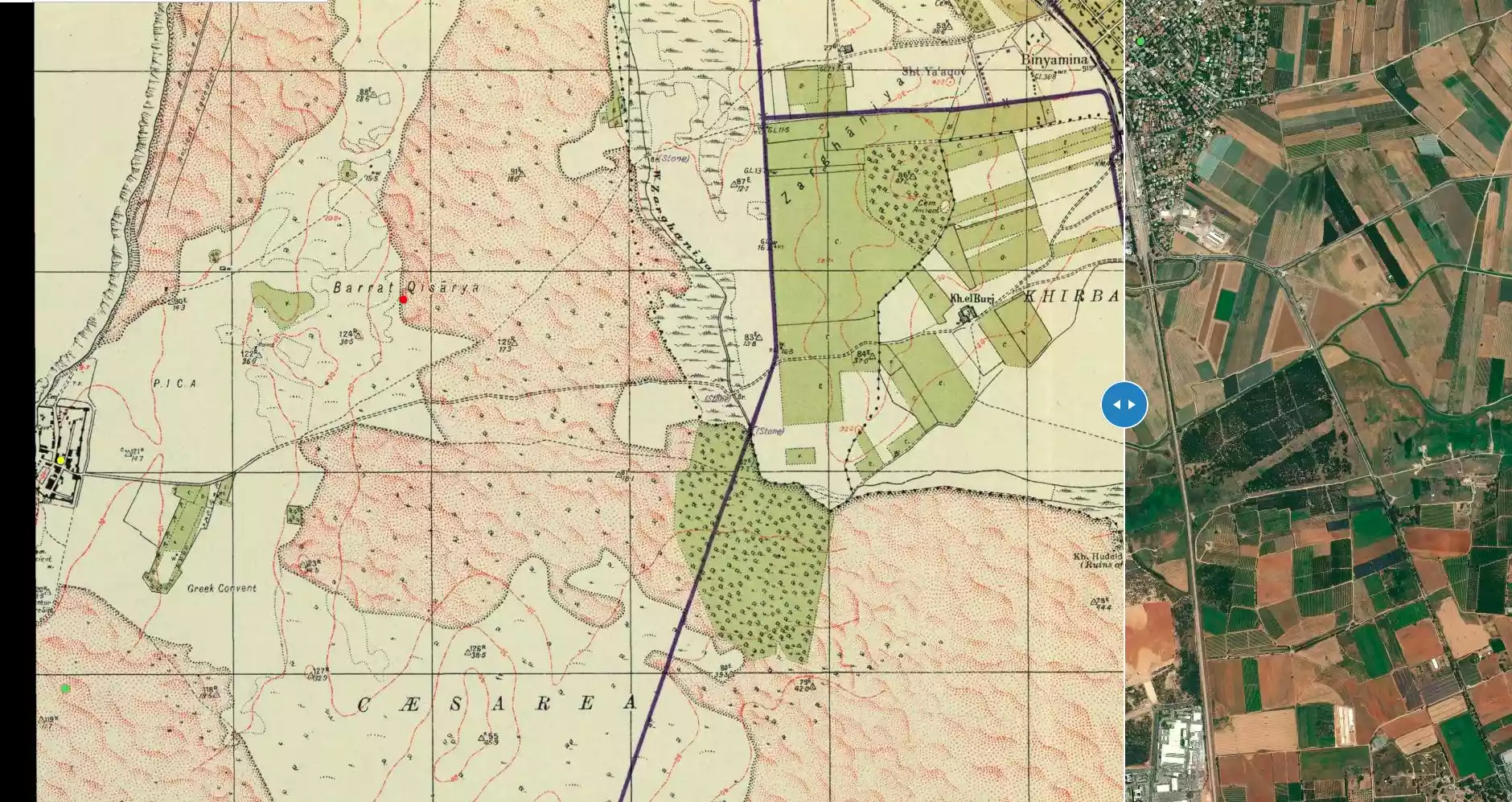
| Pre-Nakba Land Ownership |
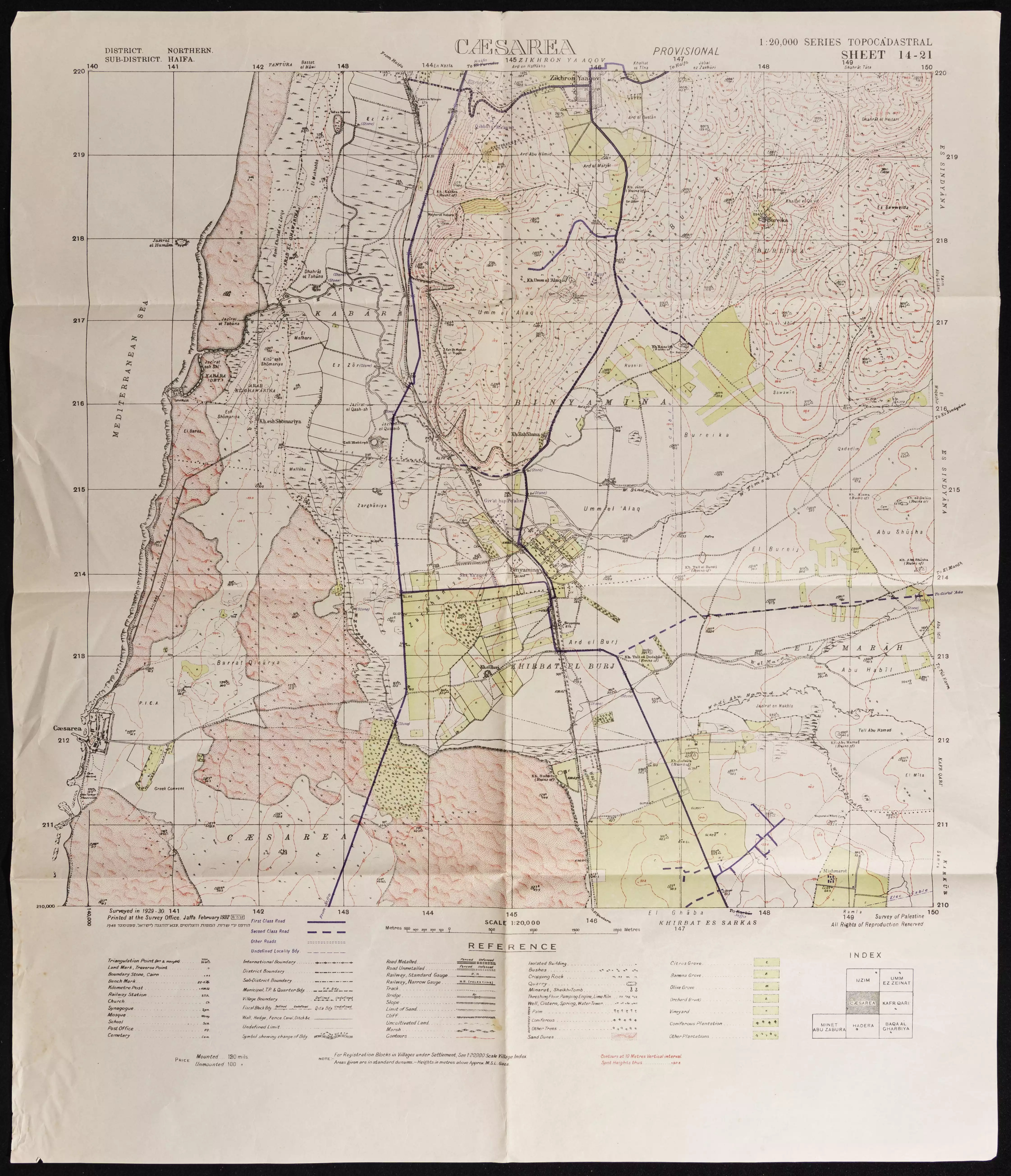
**Town Lands' Demarcation Maps |
|||||||||||||||||||||
| Land Usage As of 1945 |
|
|||||||||||||||||||||
| Population |
|
|||||||||||||||||||||
| Number of Houses |
|
|||||||||||||||||||||
| Near By Towns |
||||||||||||||||||||||
|
||||||||||||||||||||||
| Town's Name Through History | Original Qisarya port's was called Strato's Tower by the Phoenician, and later on the Romans referred to the village by Caesarea. | |||||||||||||||||||||
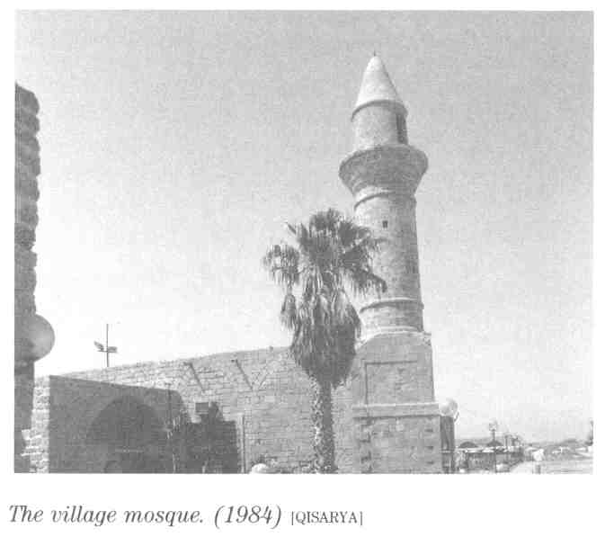
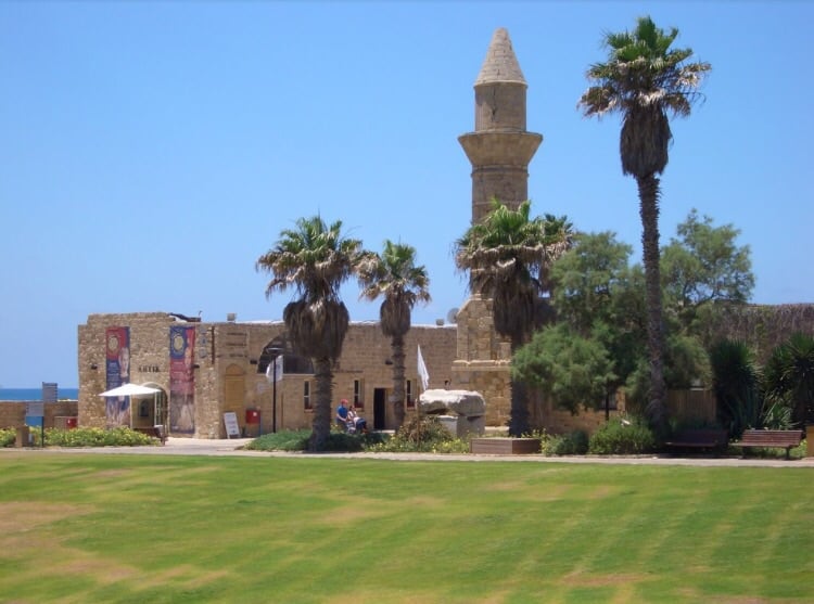
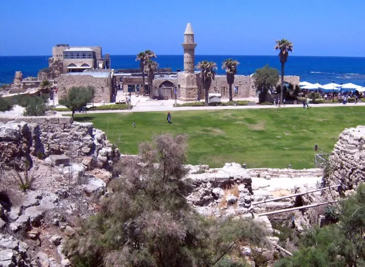
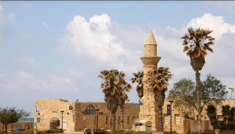
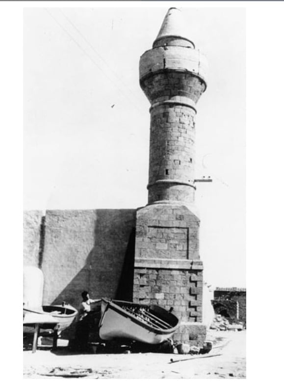
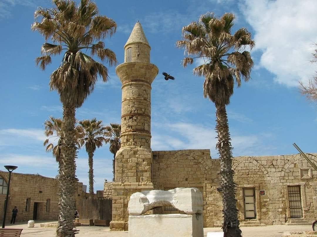
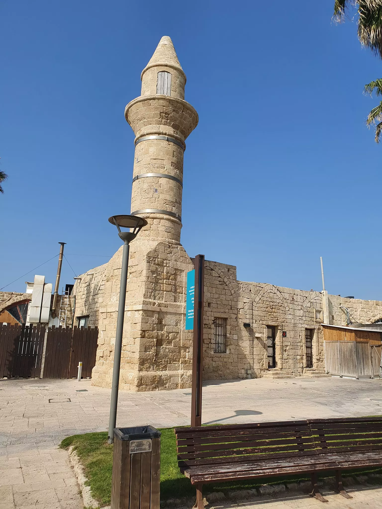
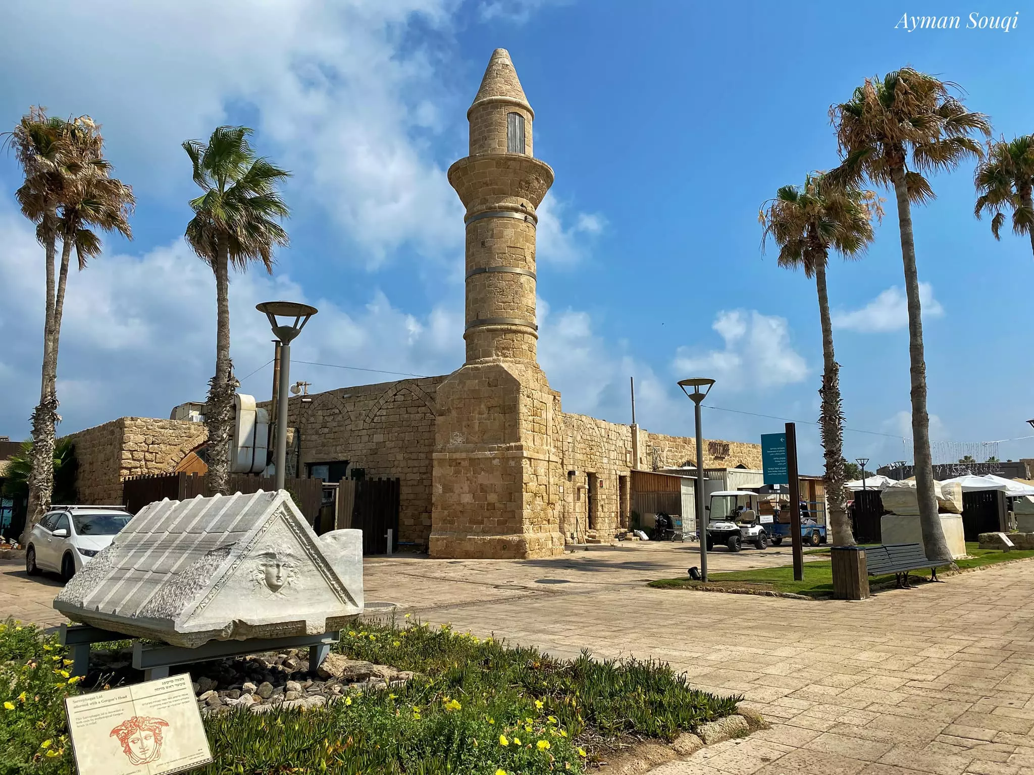
| Schools | Qisarya had an elementary school for boys, which was founded in 1884 by Ottomans. | |||||||||||||||||||||
| Inhabitants Place of Origin | In 1878, Muslim Bosnians settled in Qisarya after the Austrian invasion of their country. | |||||||||||||||||||||
| Town's Notable People | The celebrated rhetorician and belle lettrist 'Abd al-Hamid al-Katib ( d. A.D. 750) | |||||||||||||||||||||
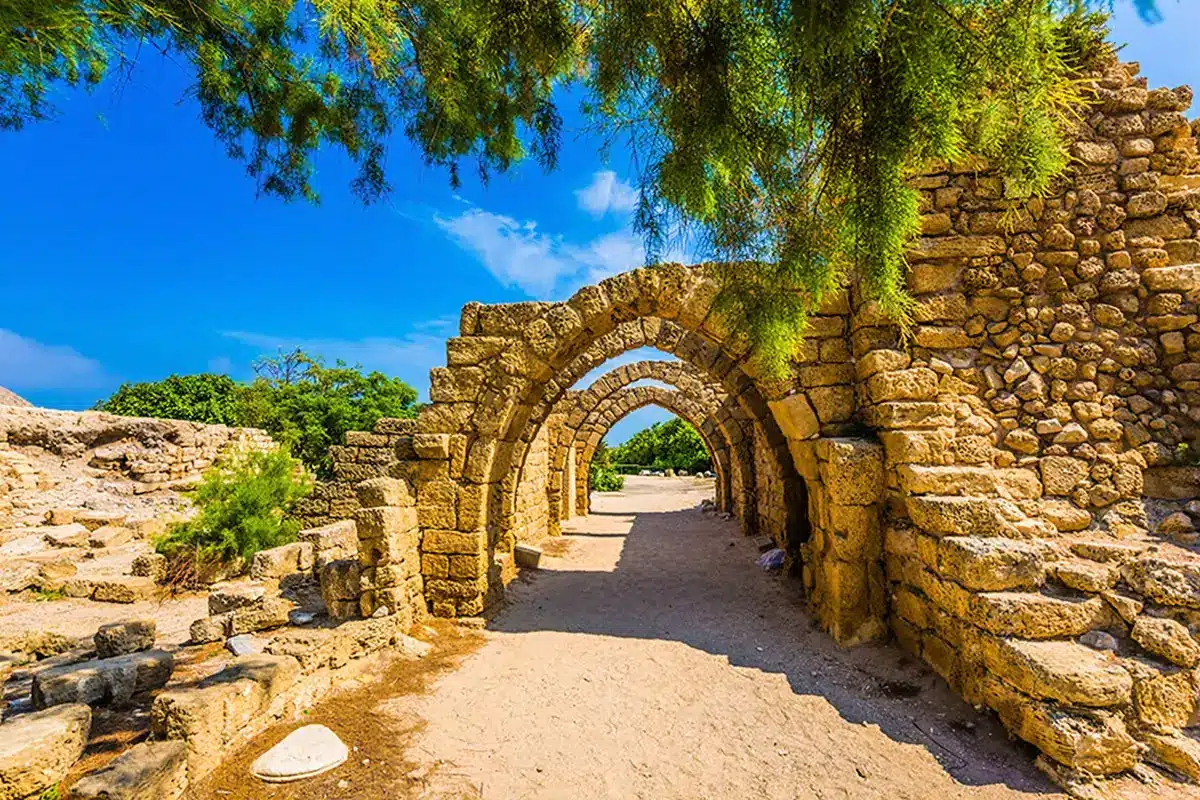
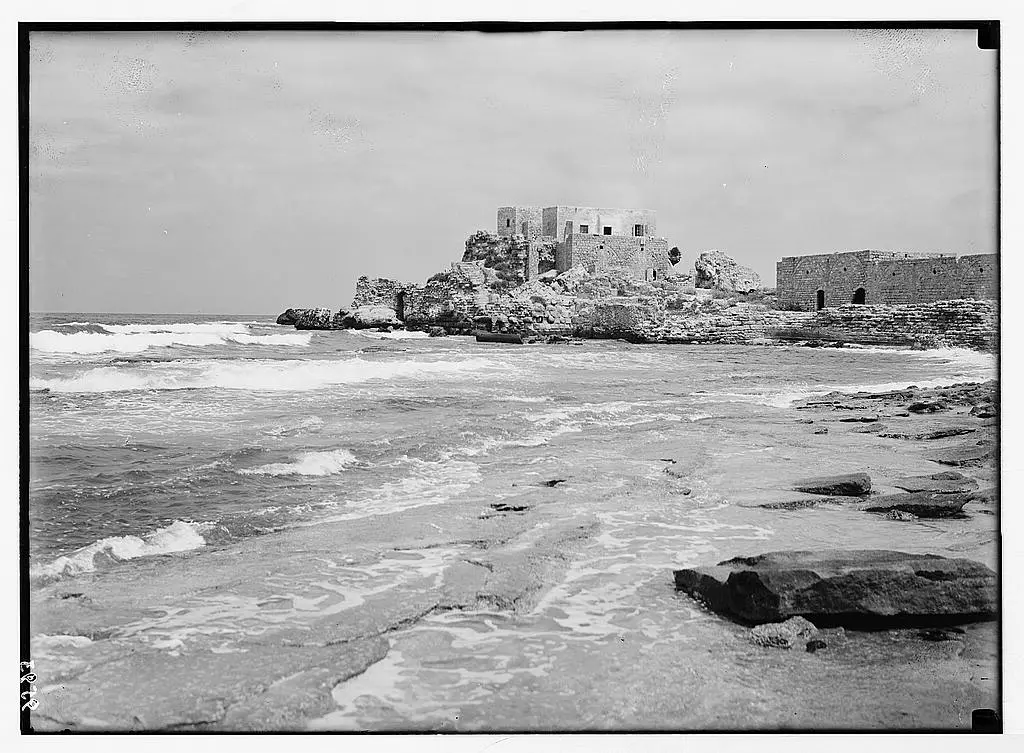
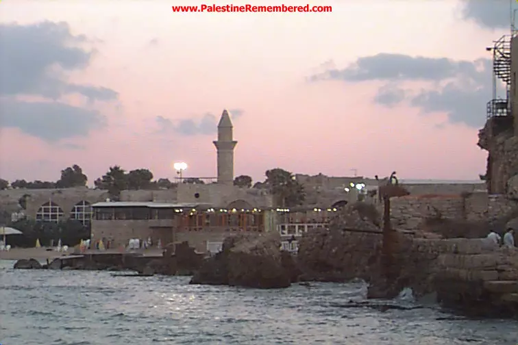
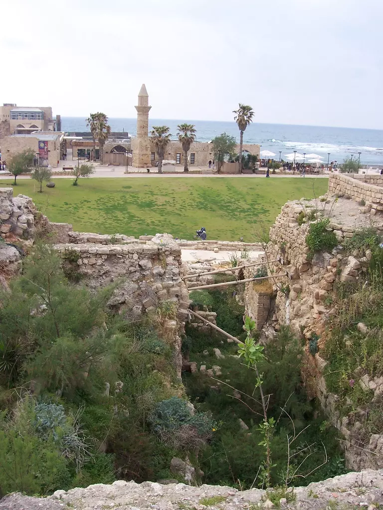
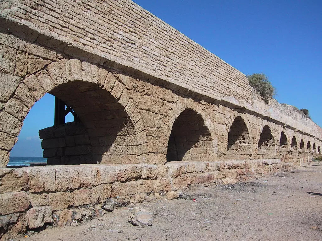
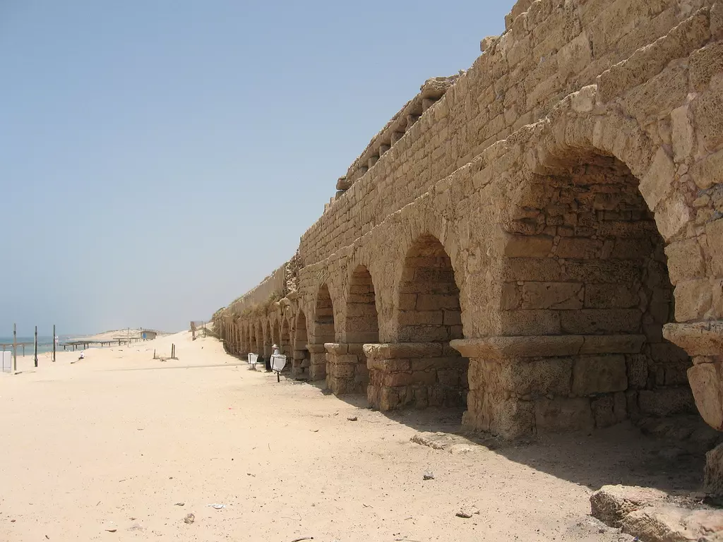
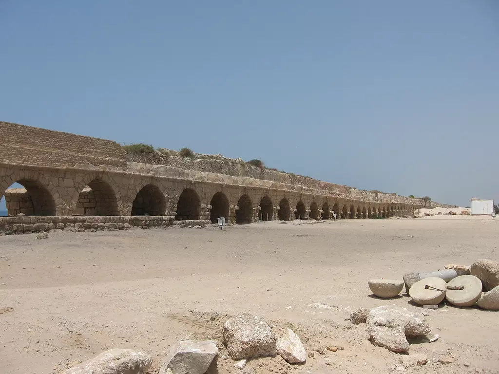
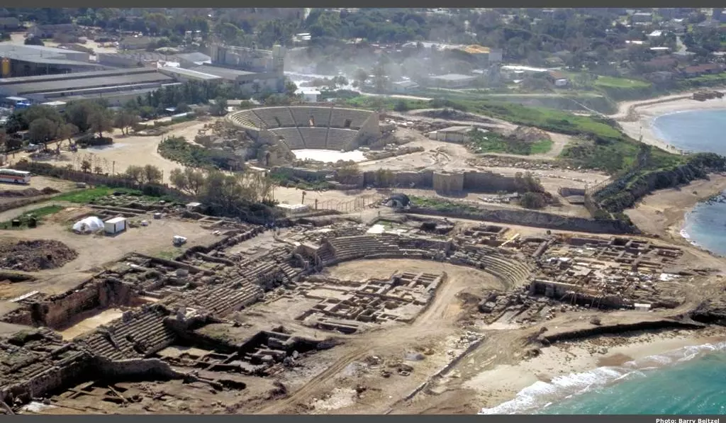
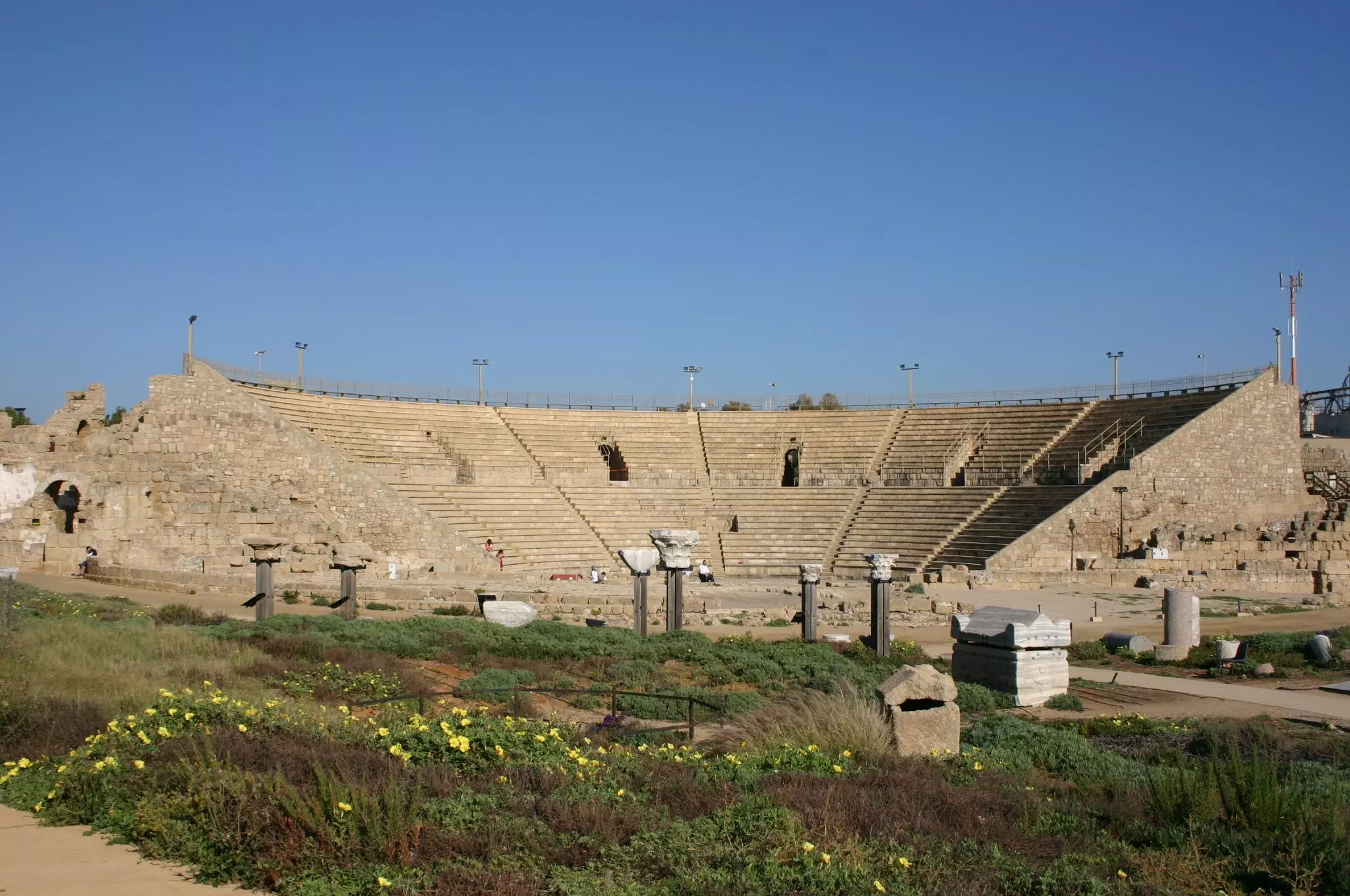
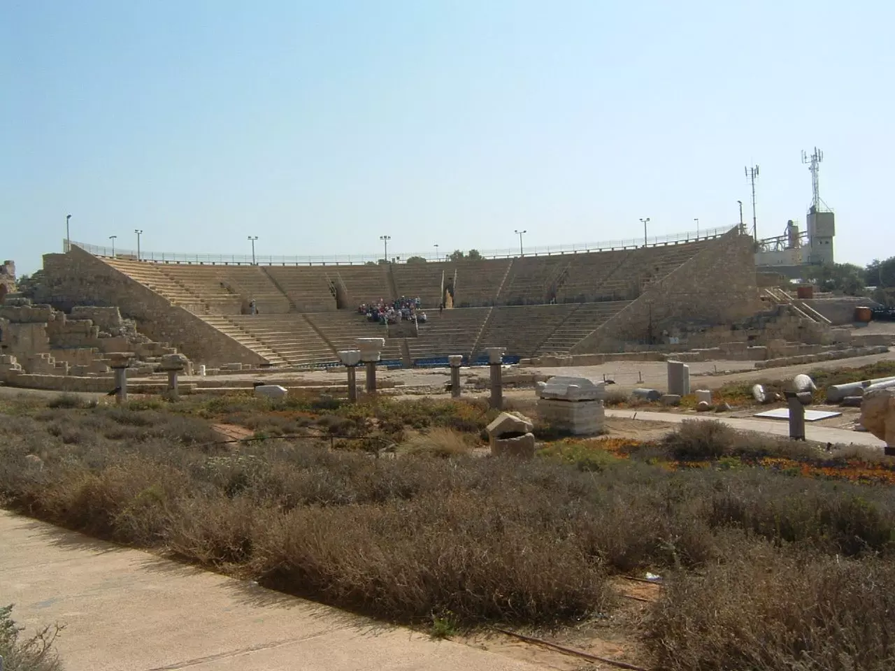
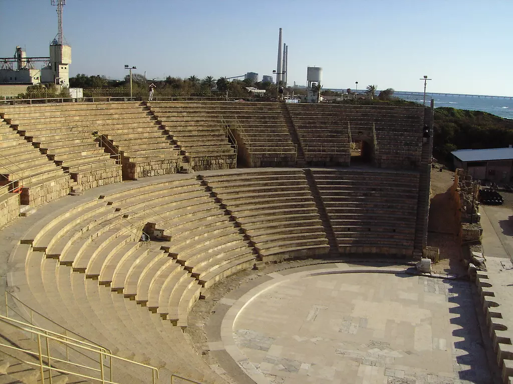
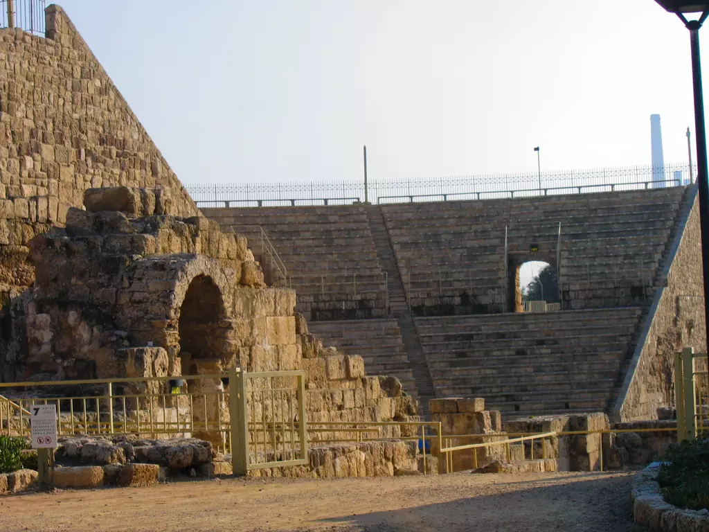
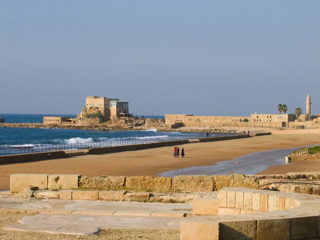
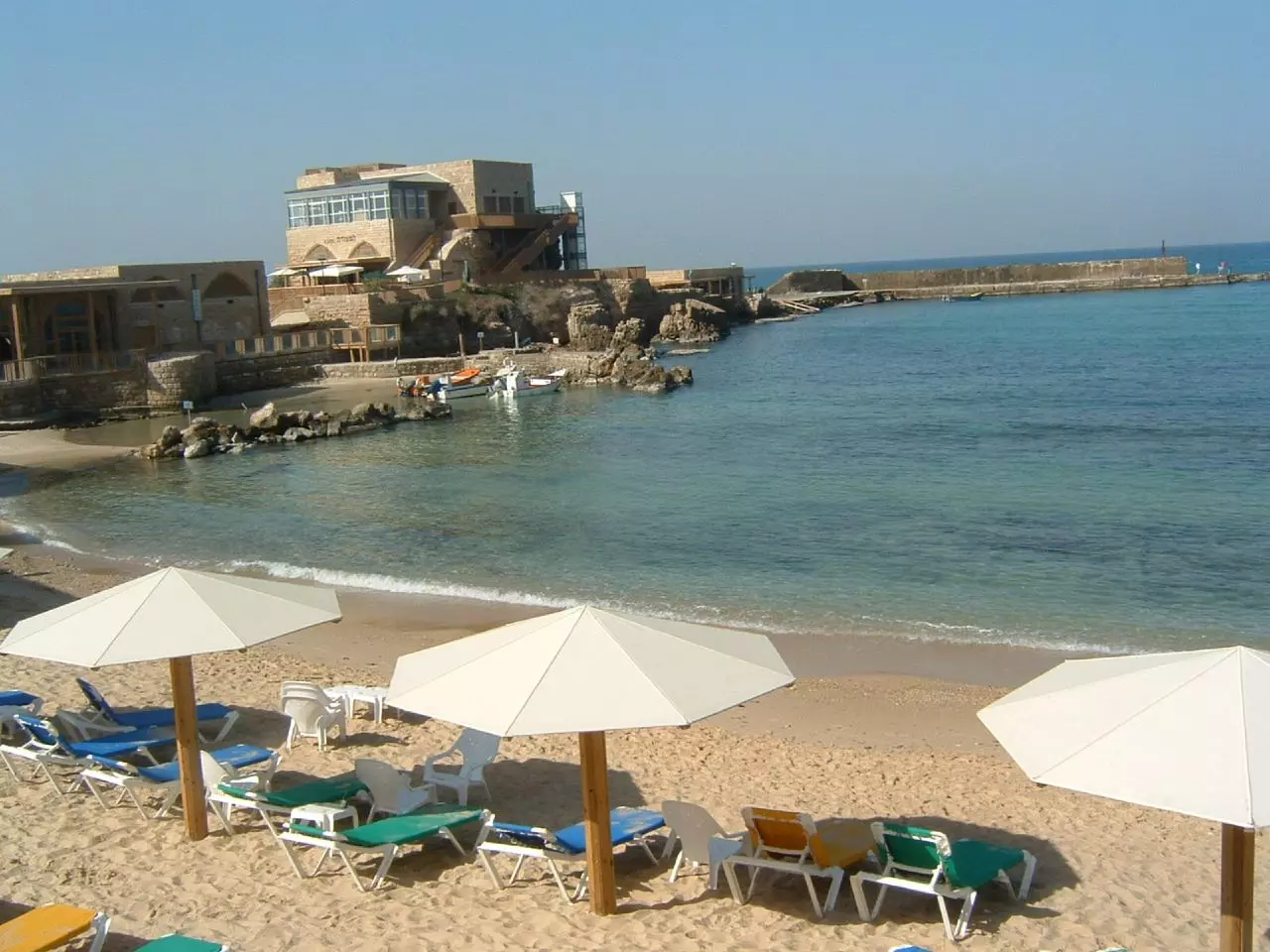
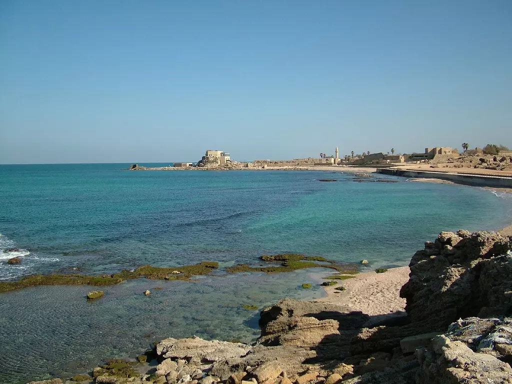
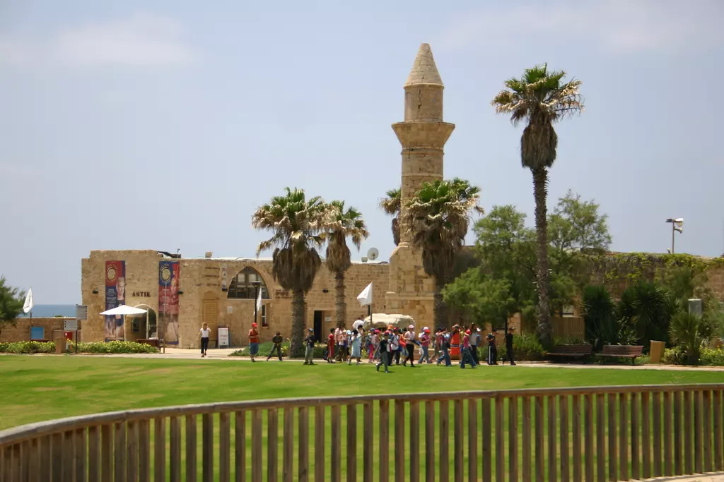
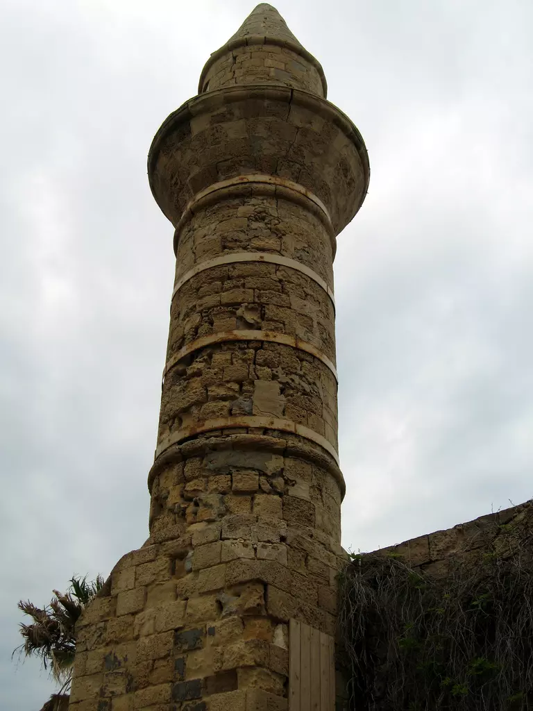
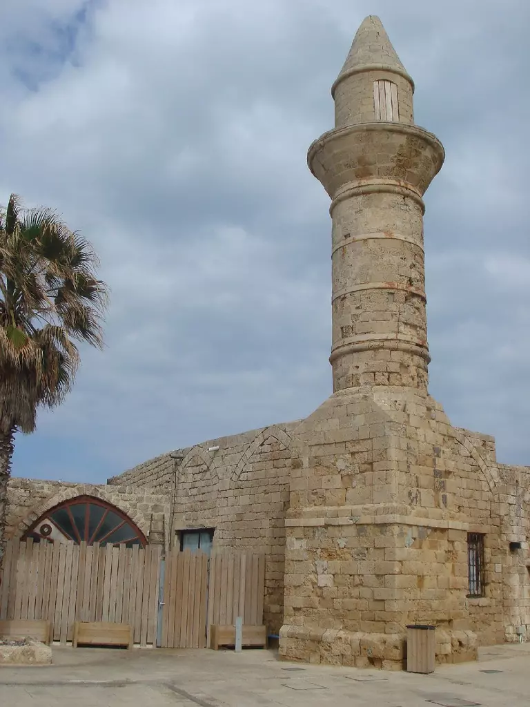
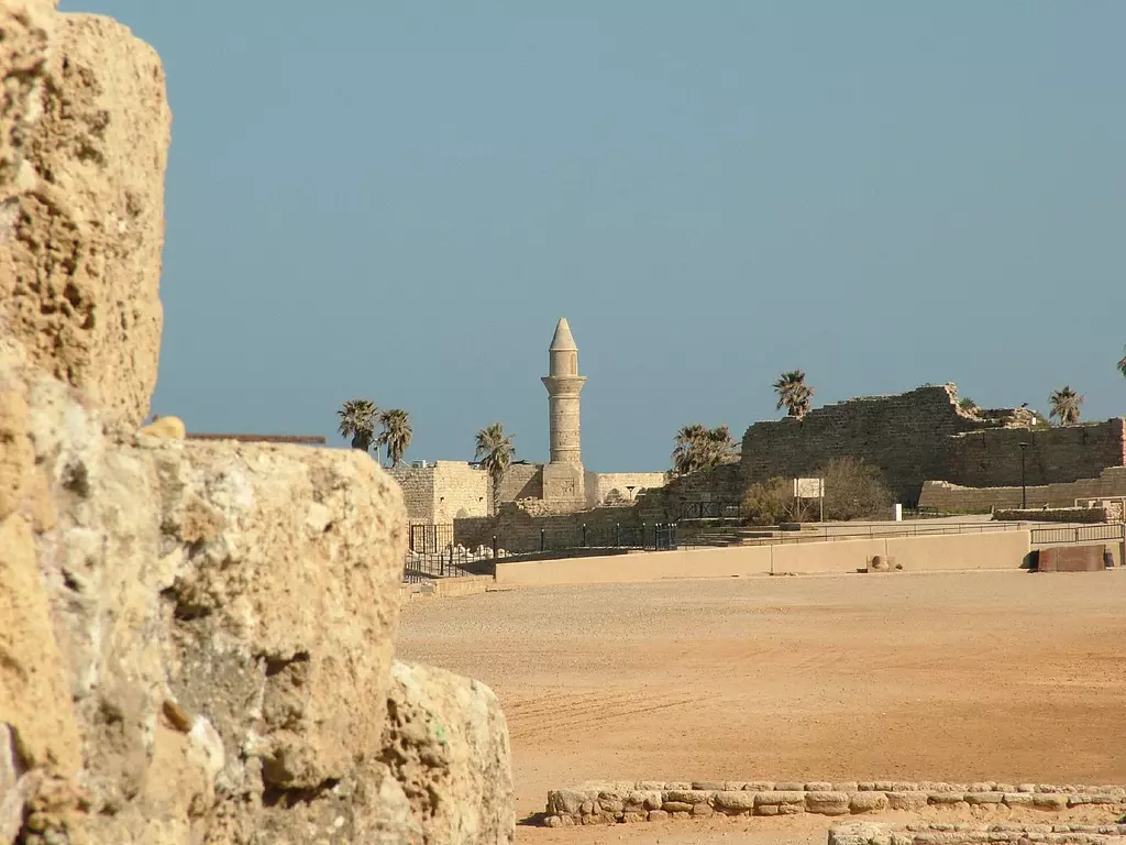
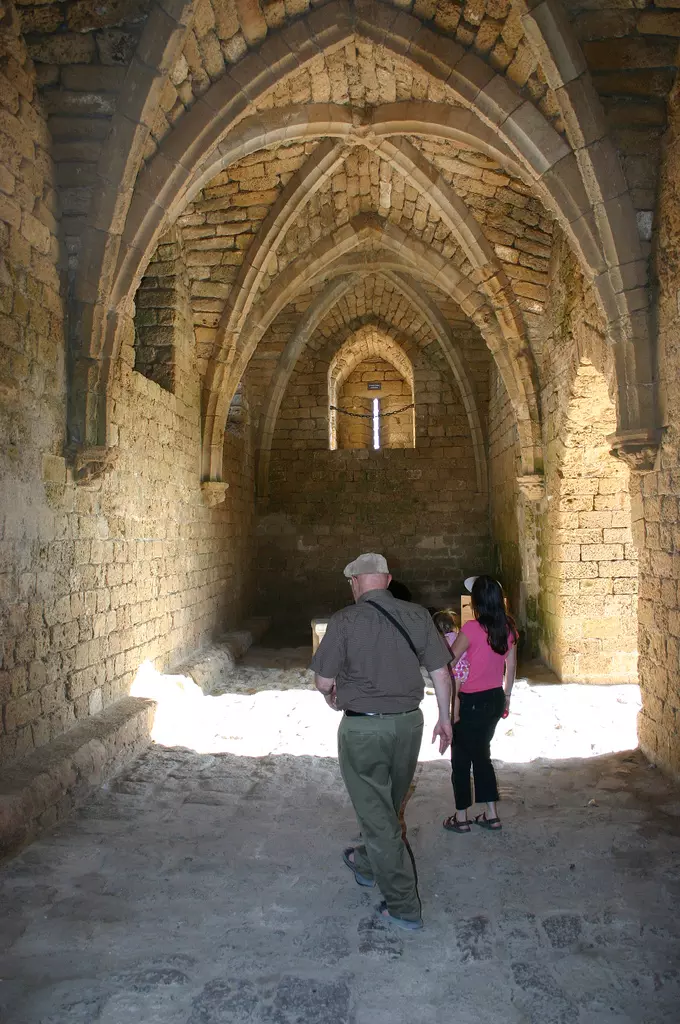
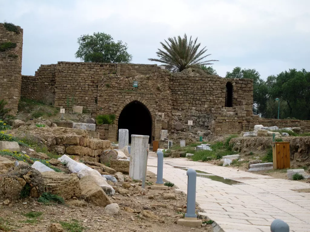
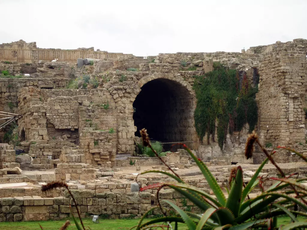
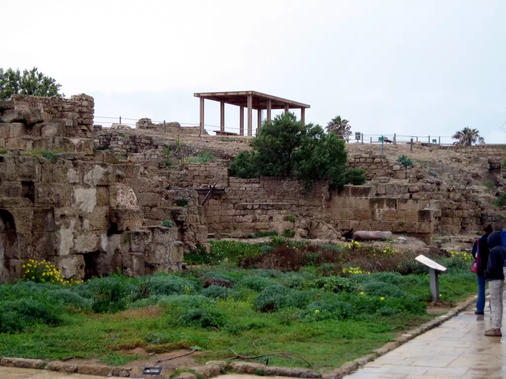
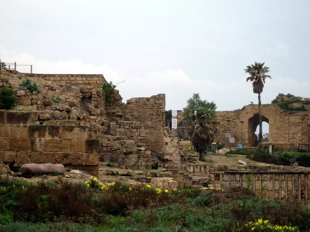
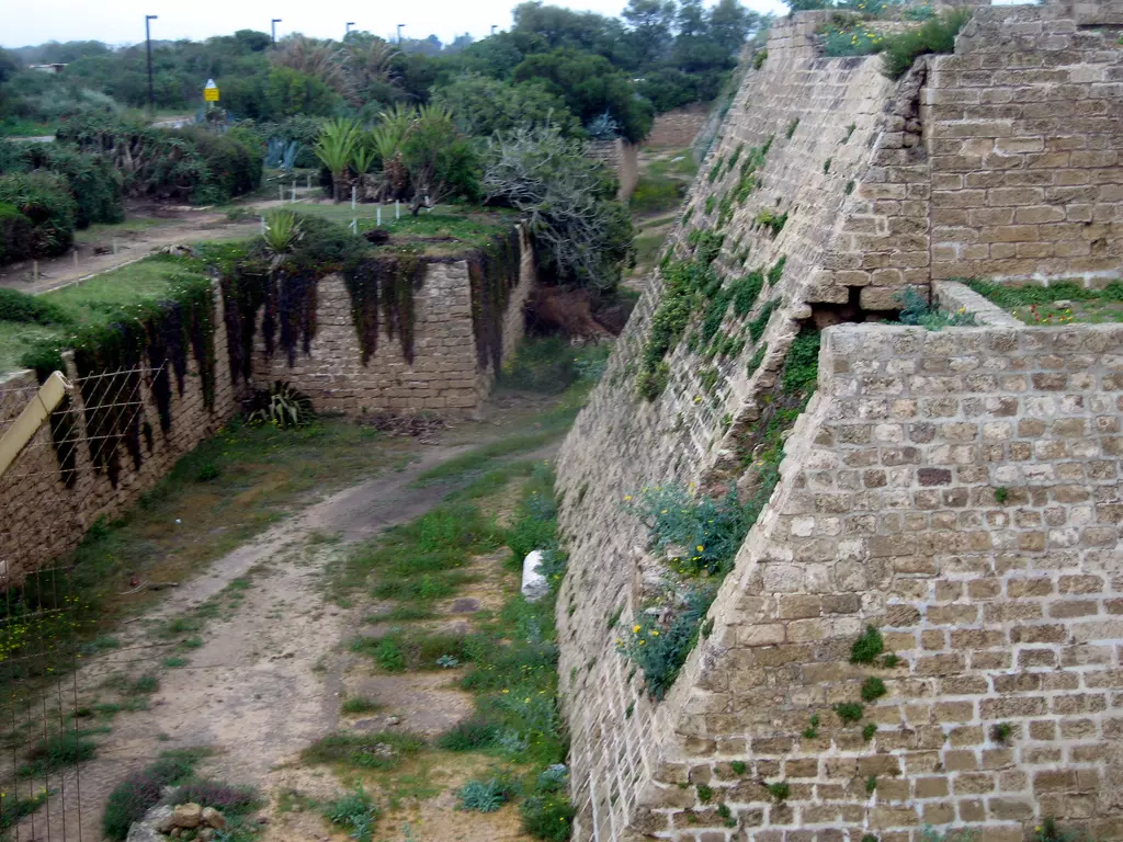
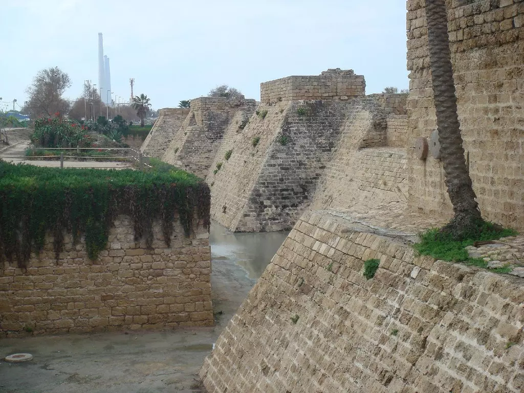
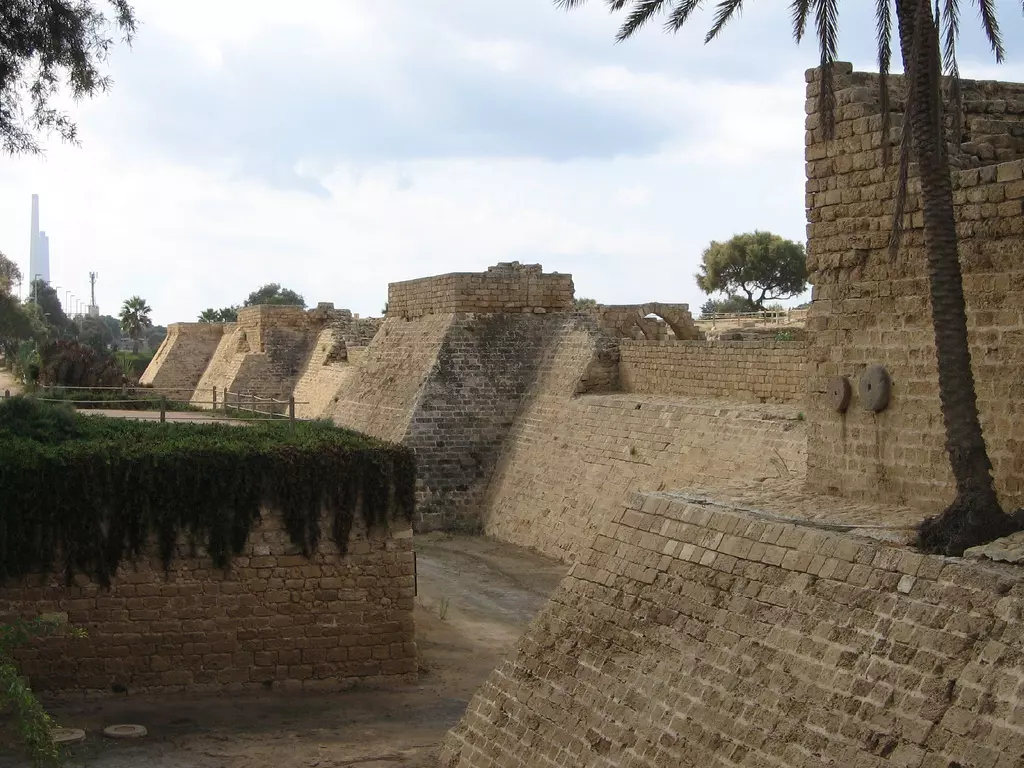
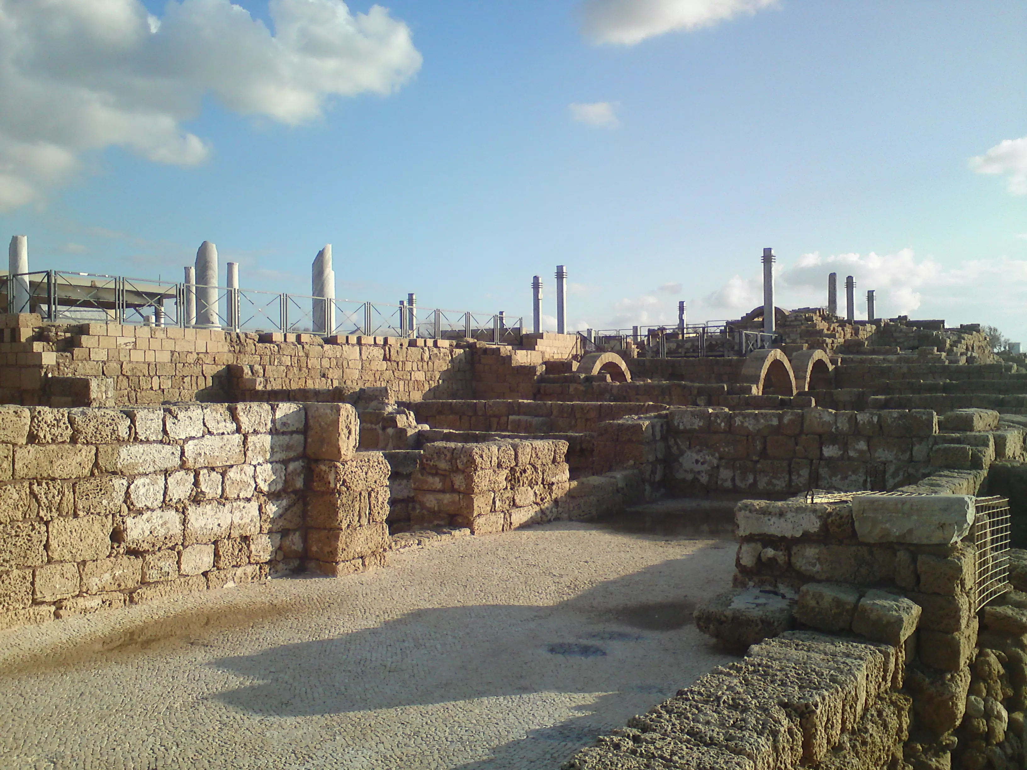
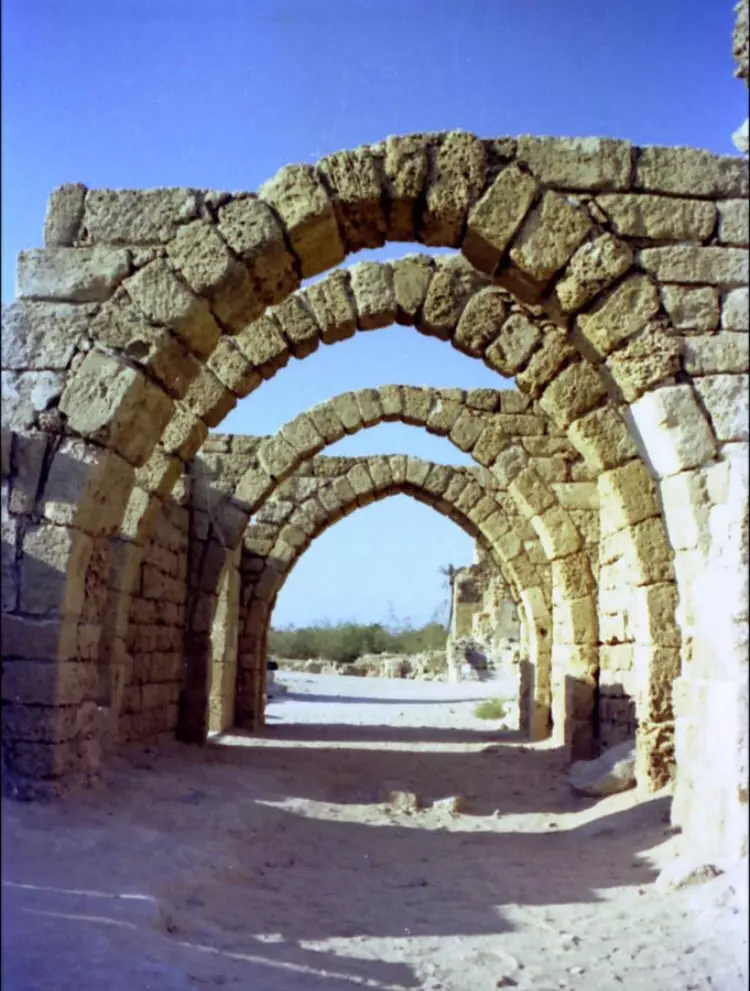
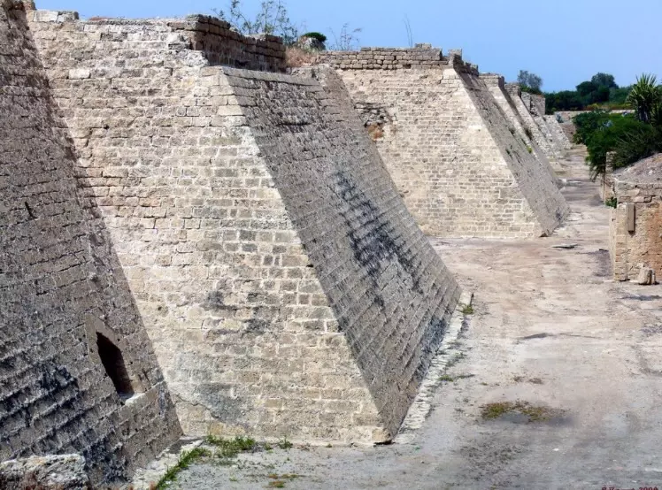
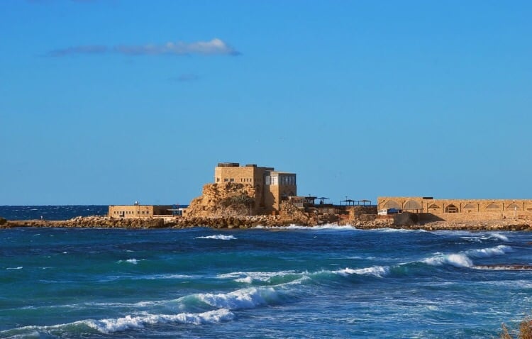
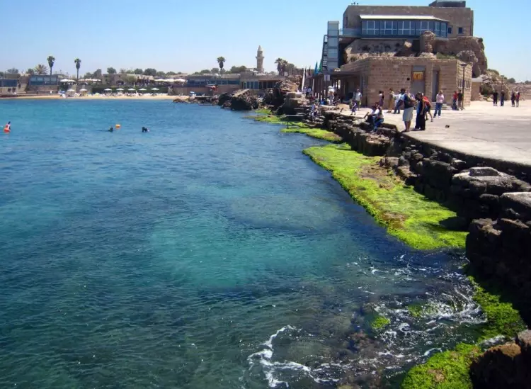
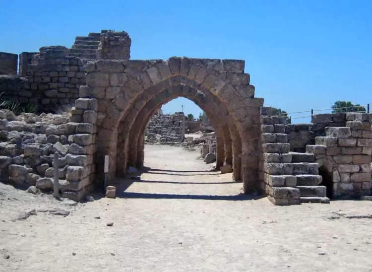
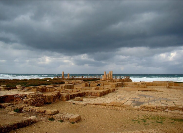
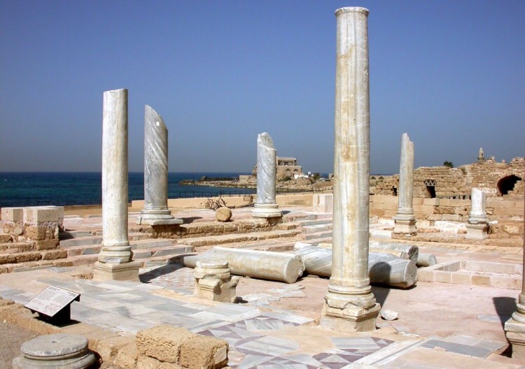
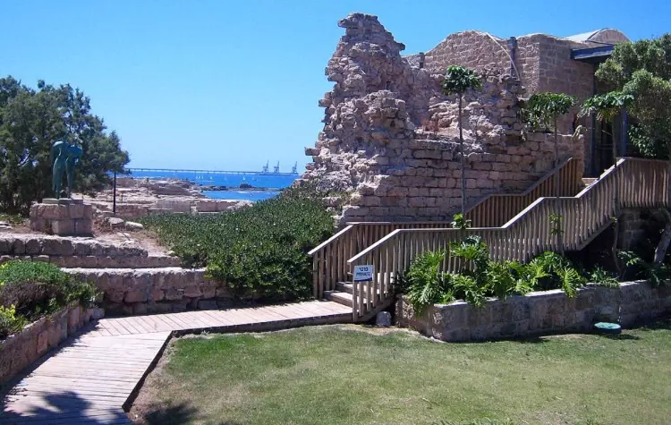
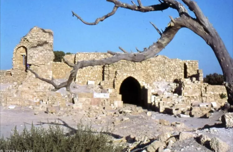
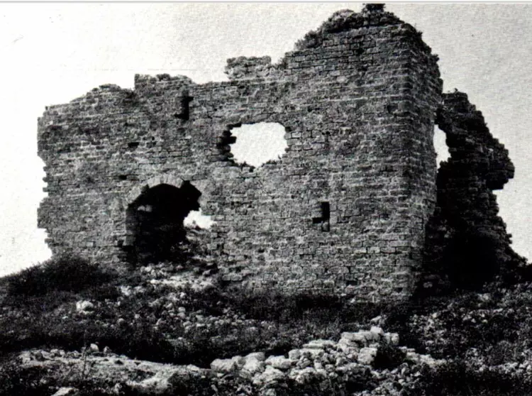
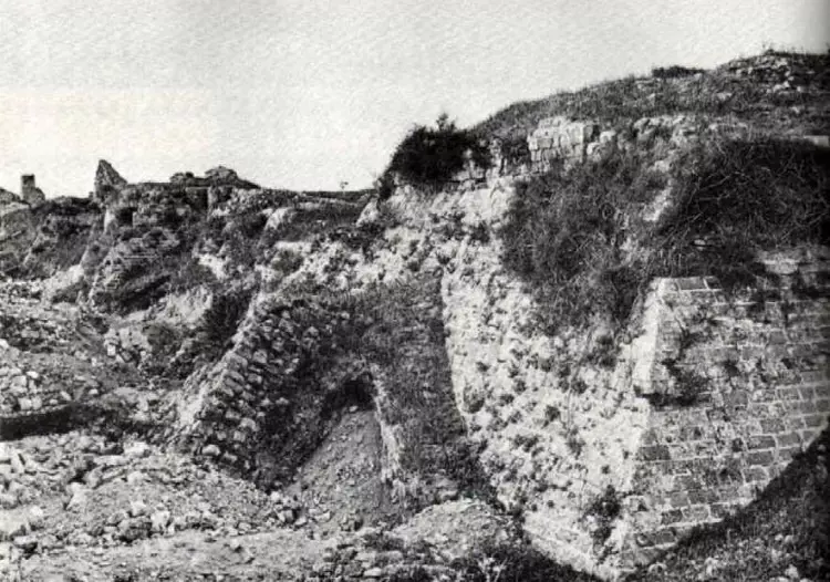
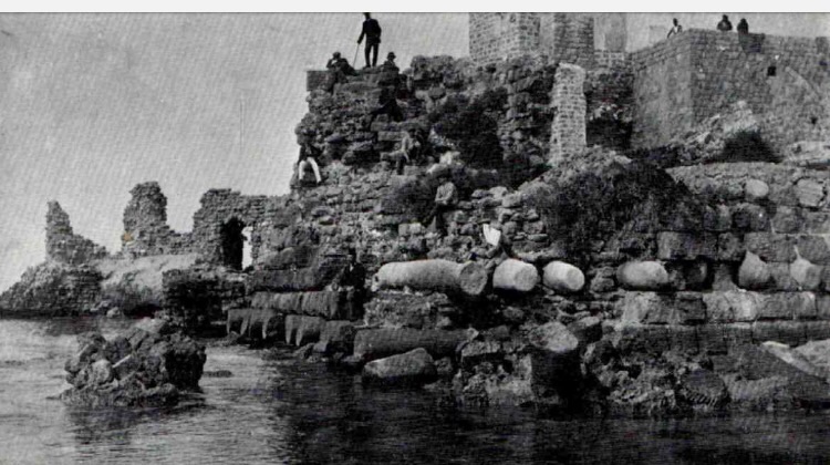
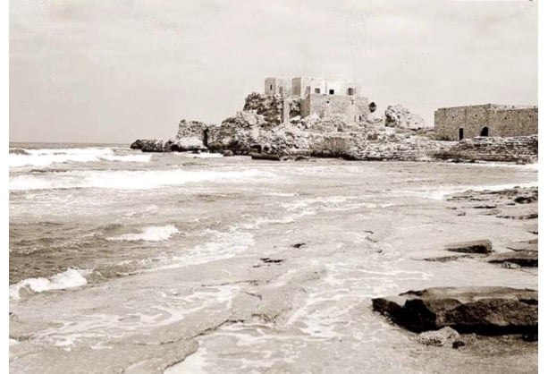
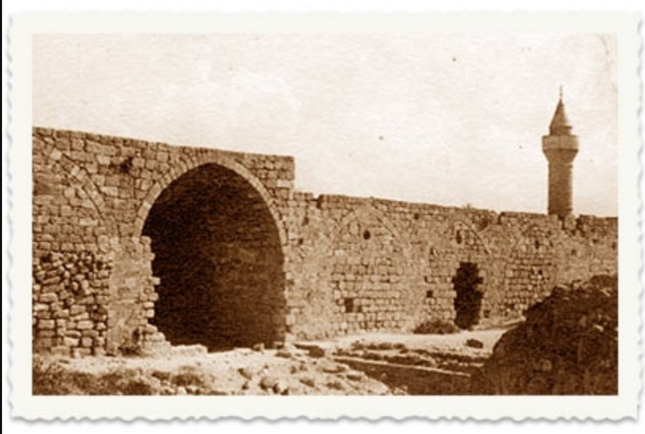
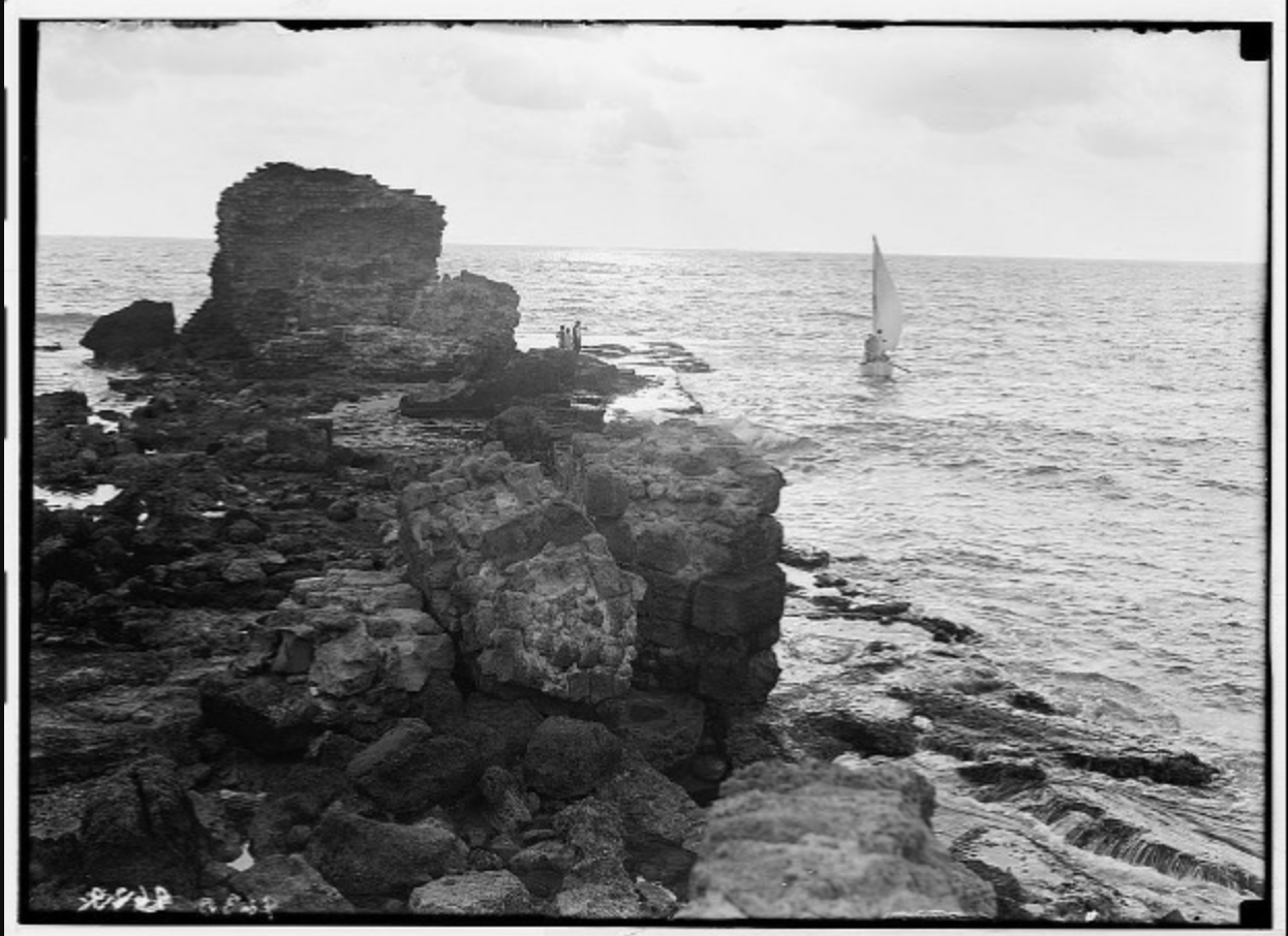
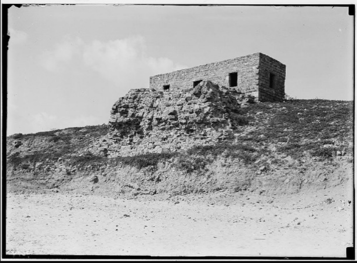
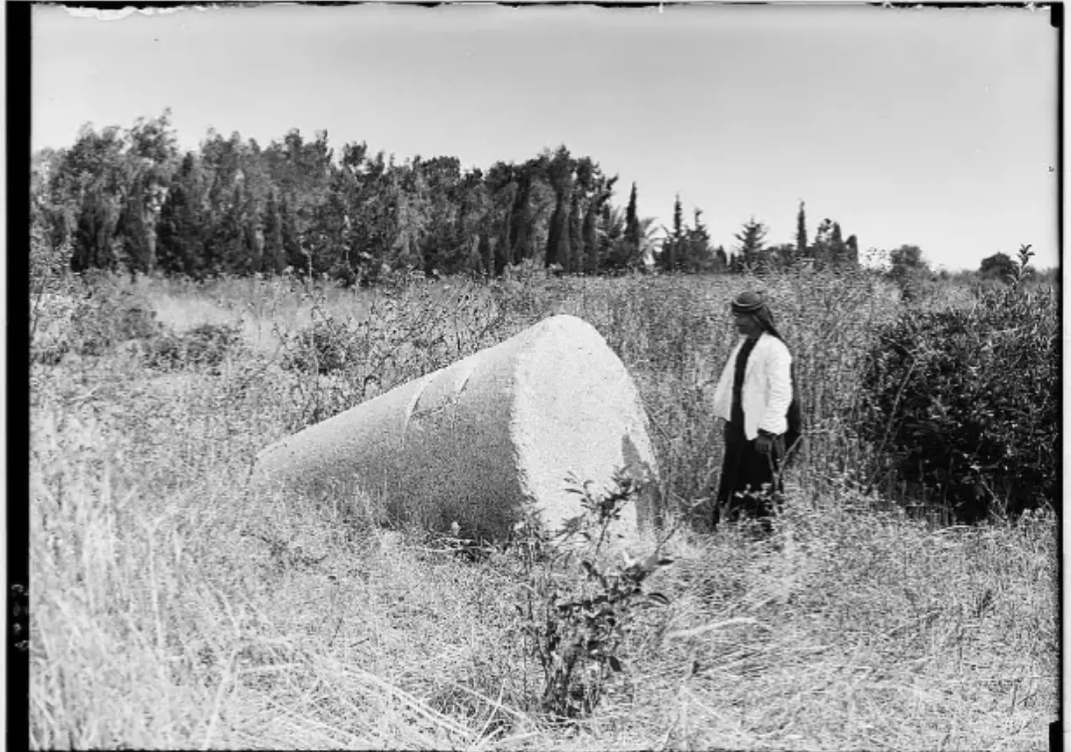
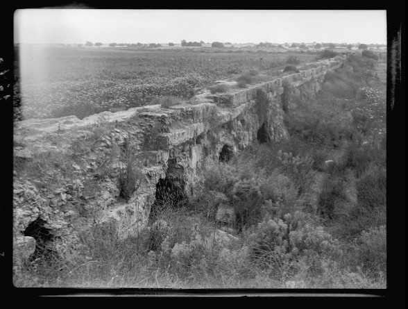
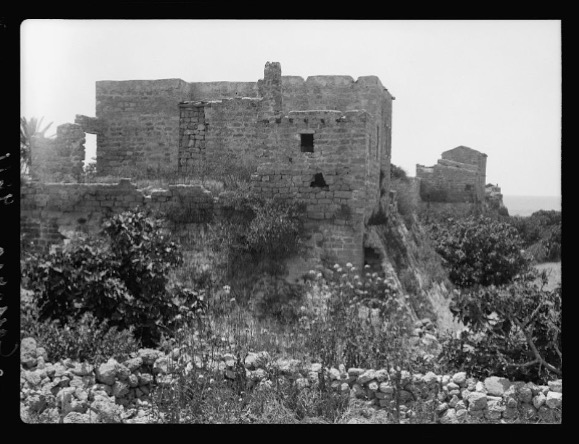
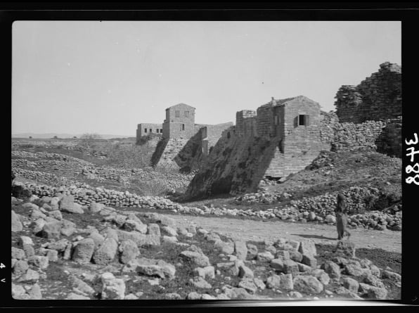
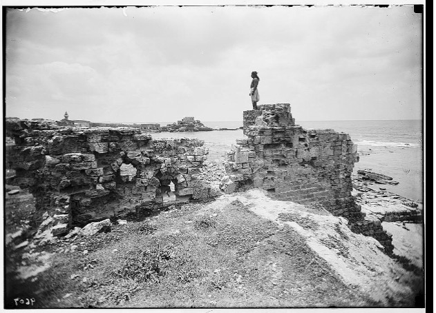
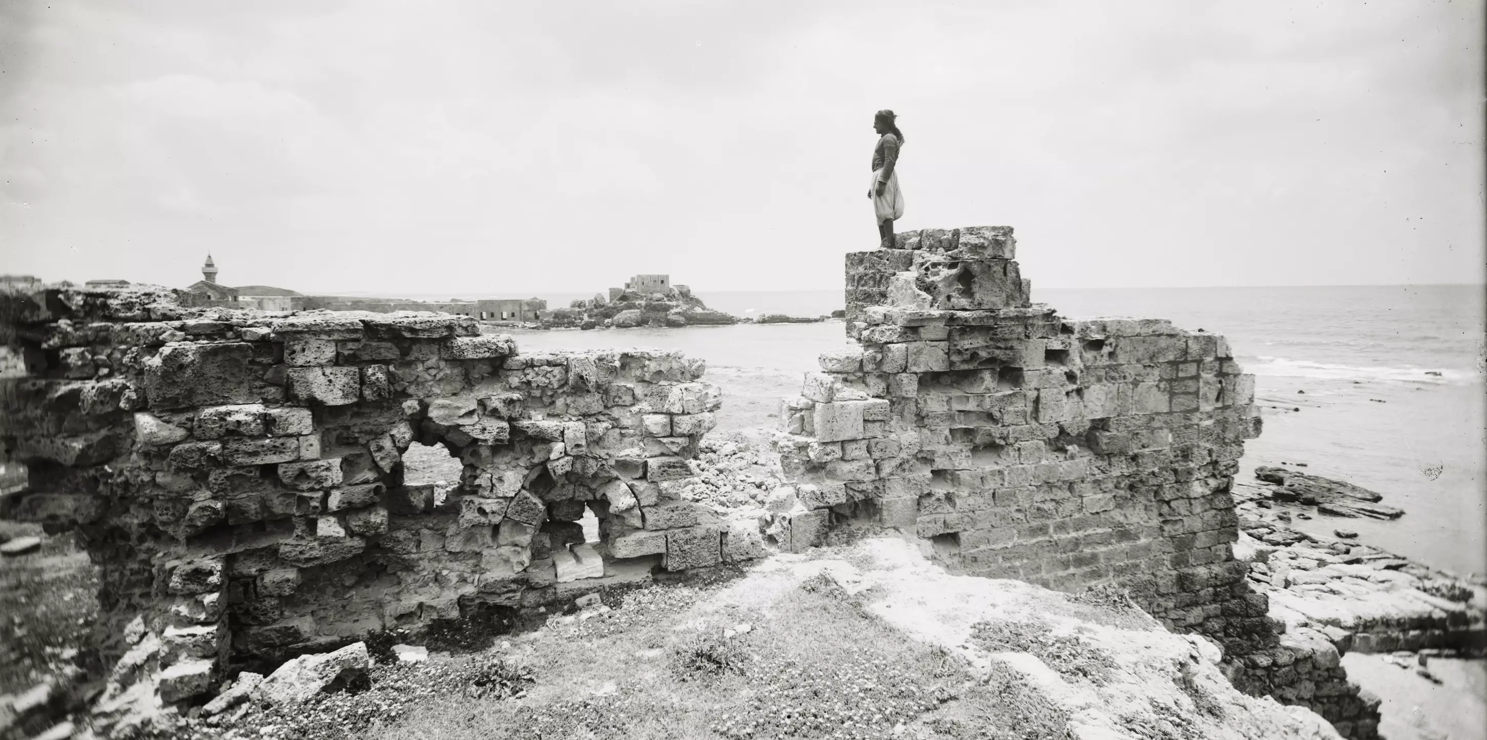
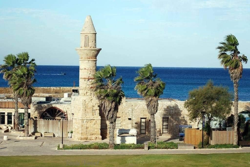
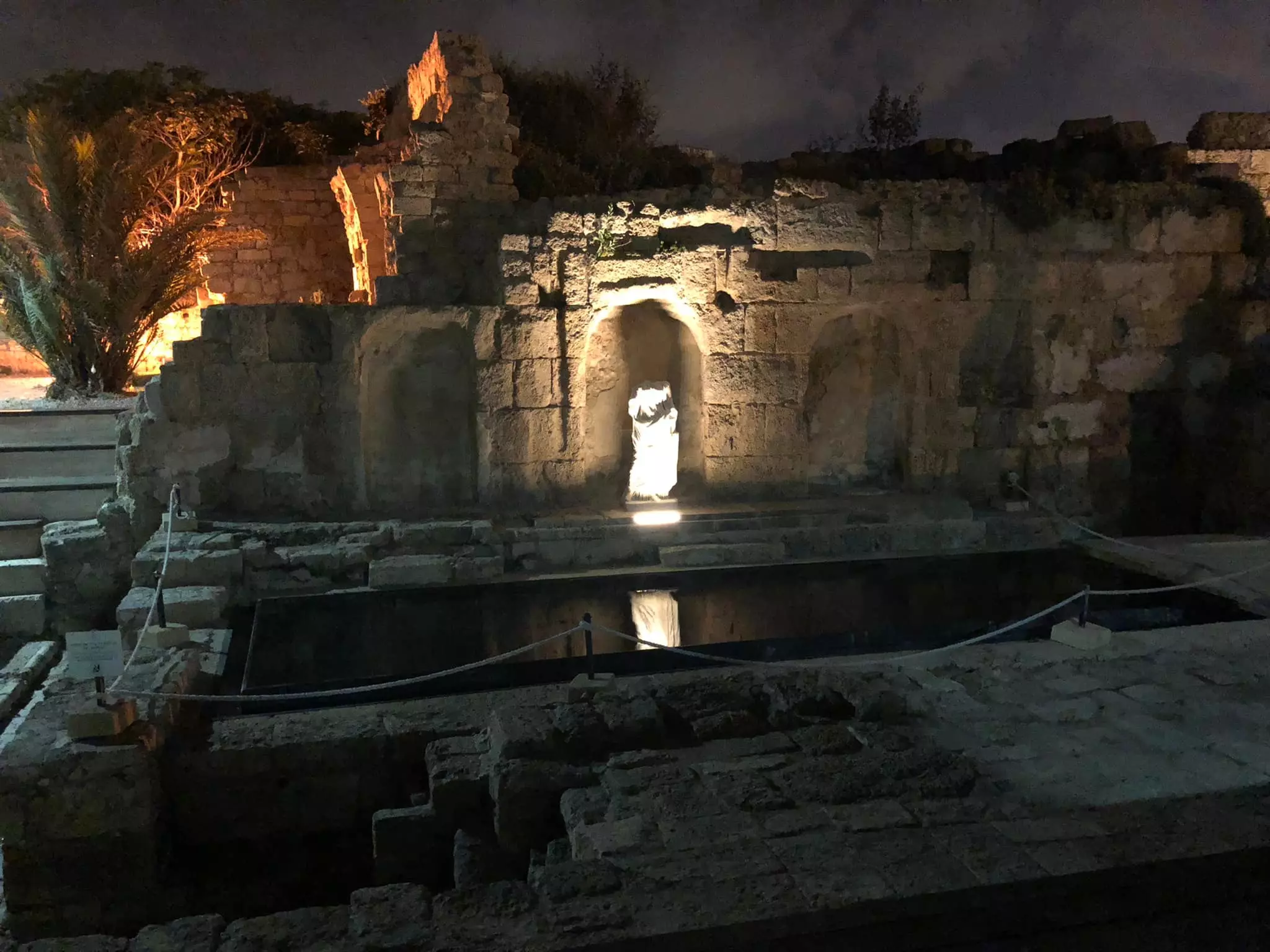
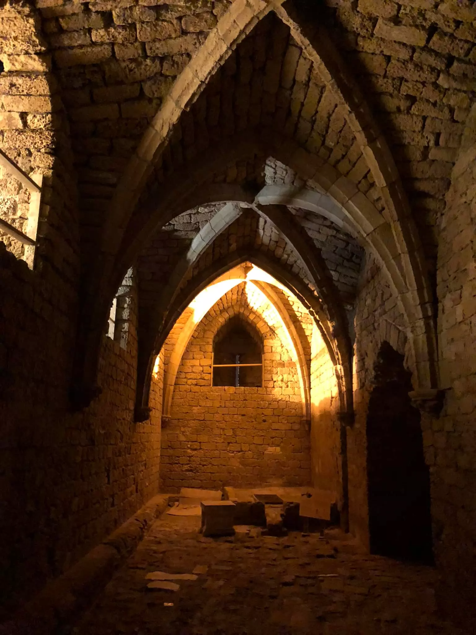
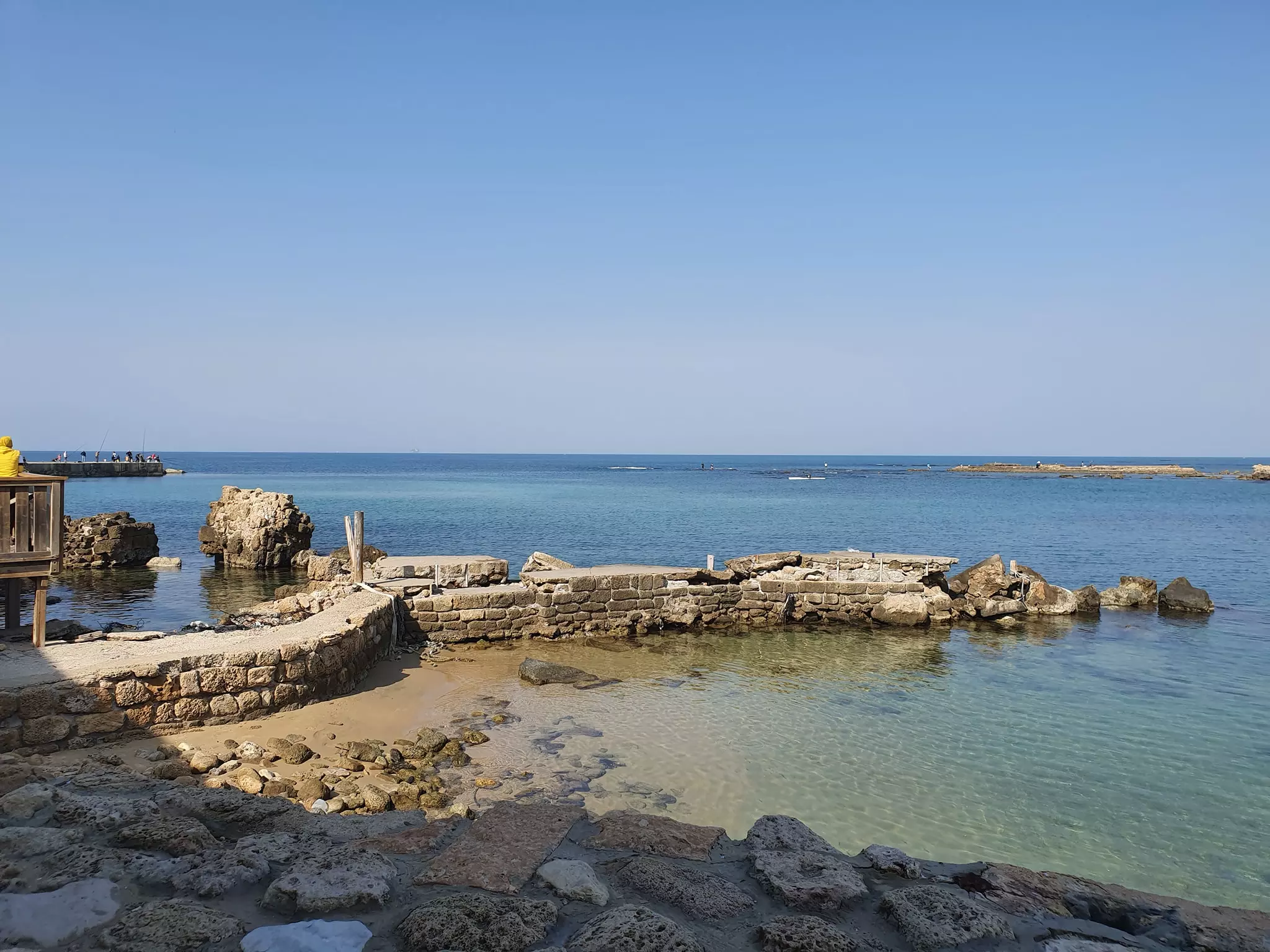
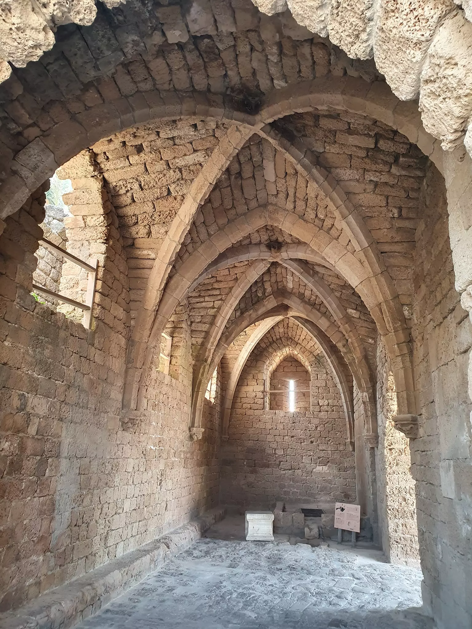
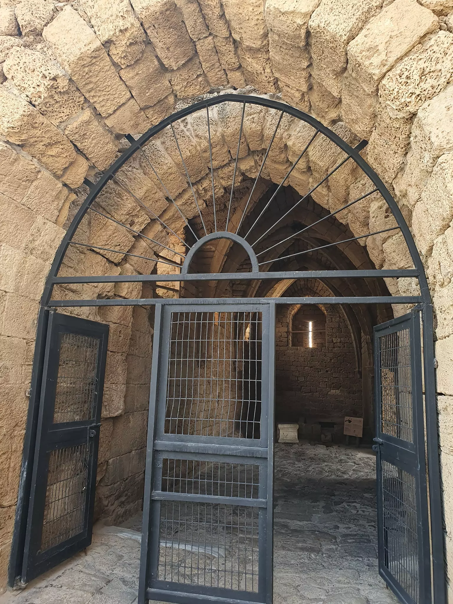
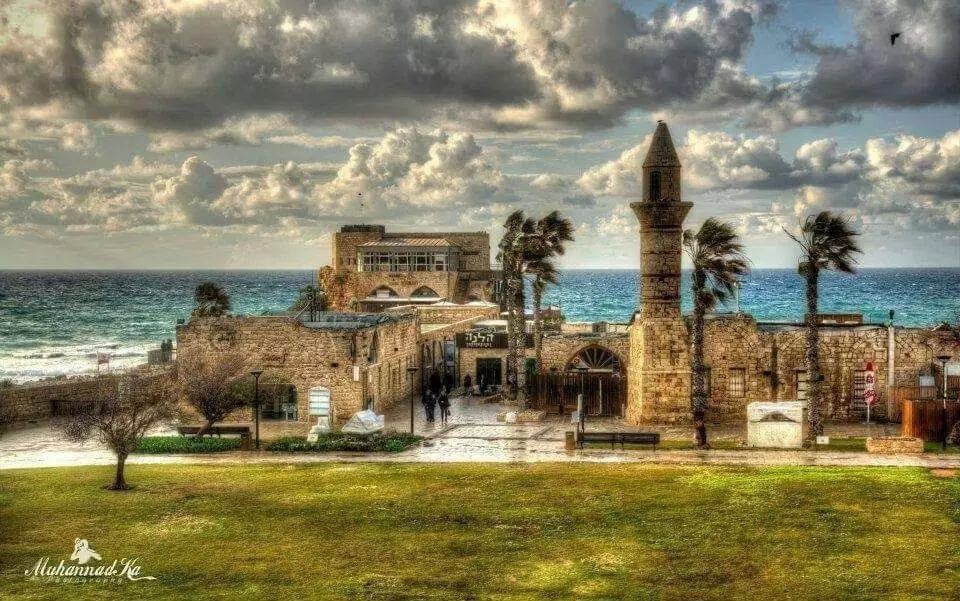
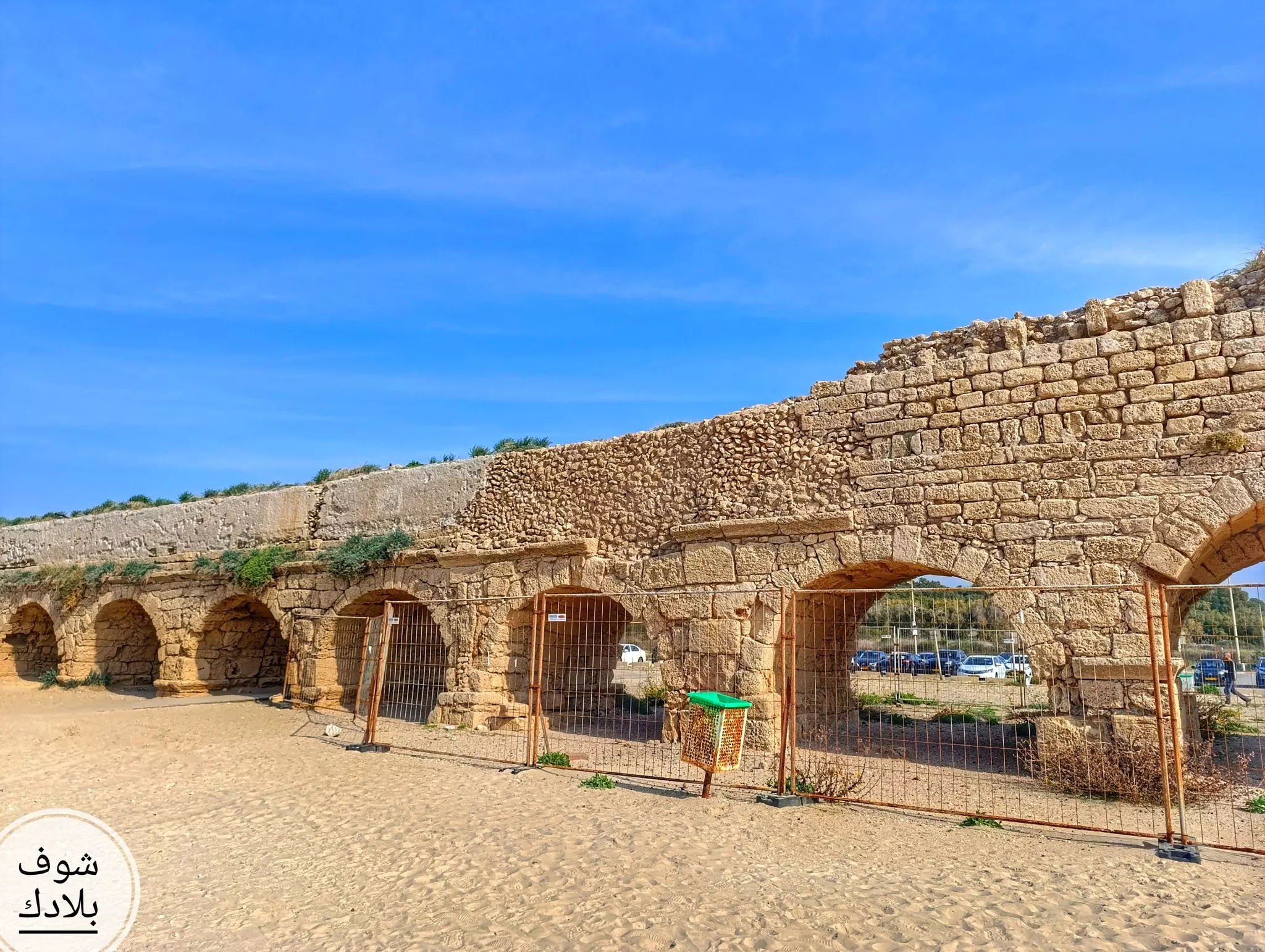
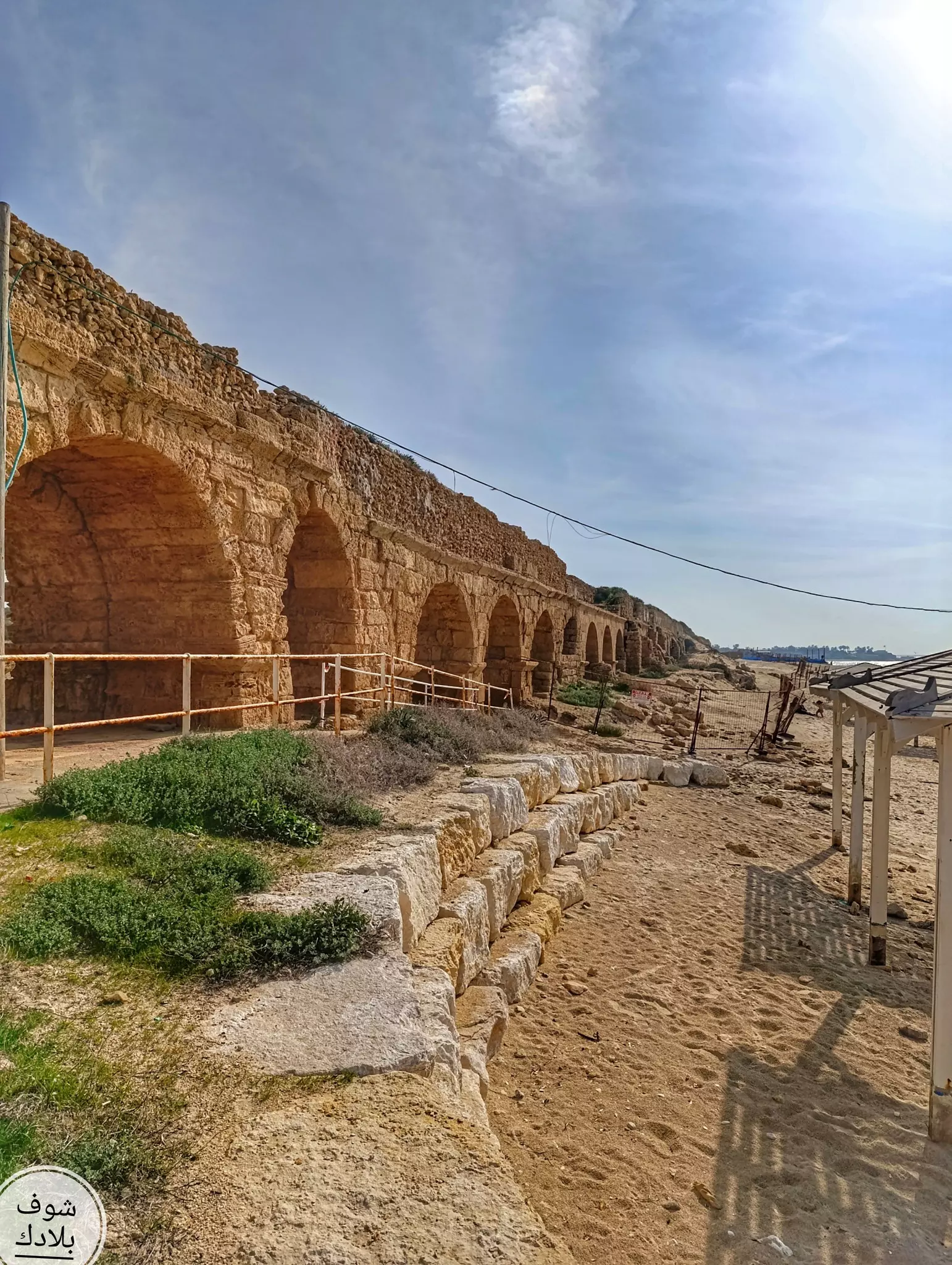
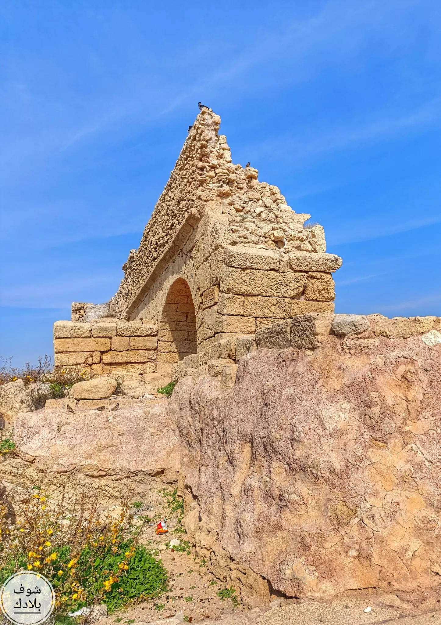
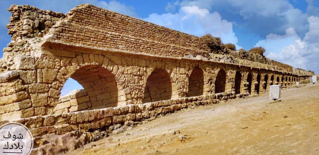
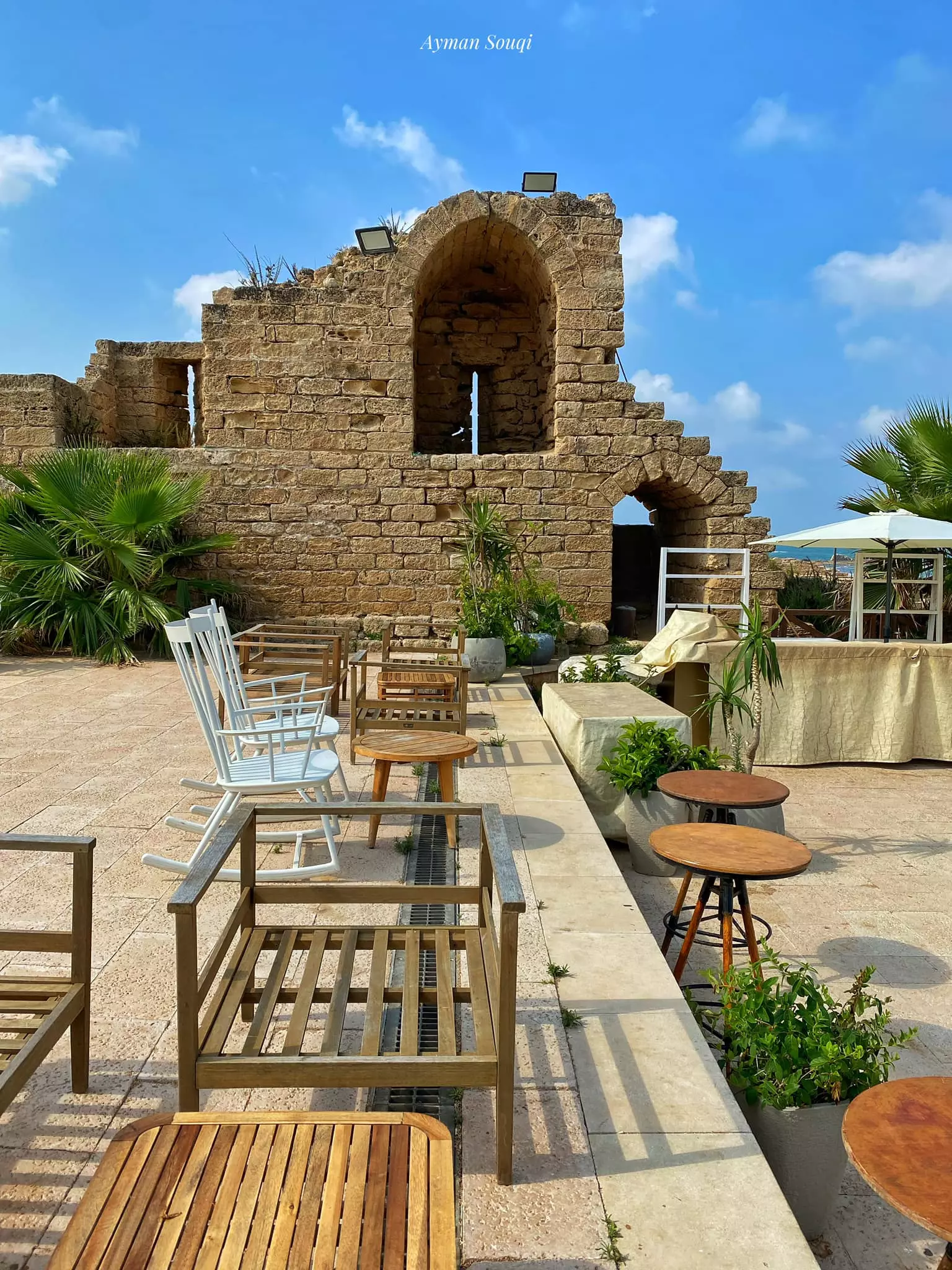
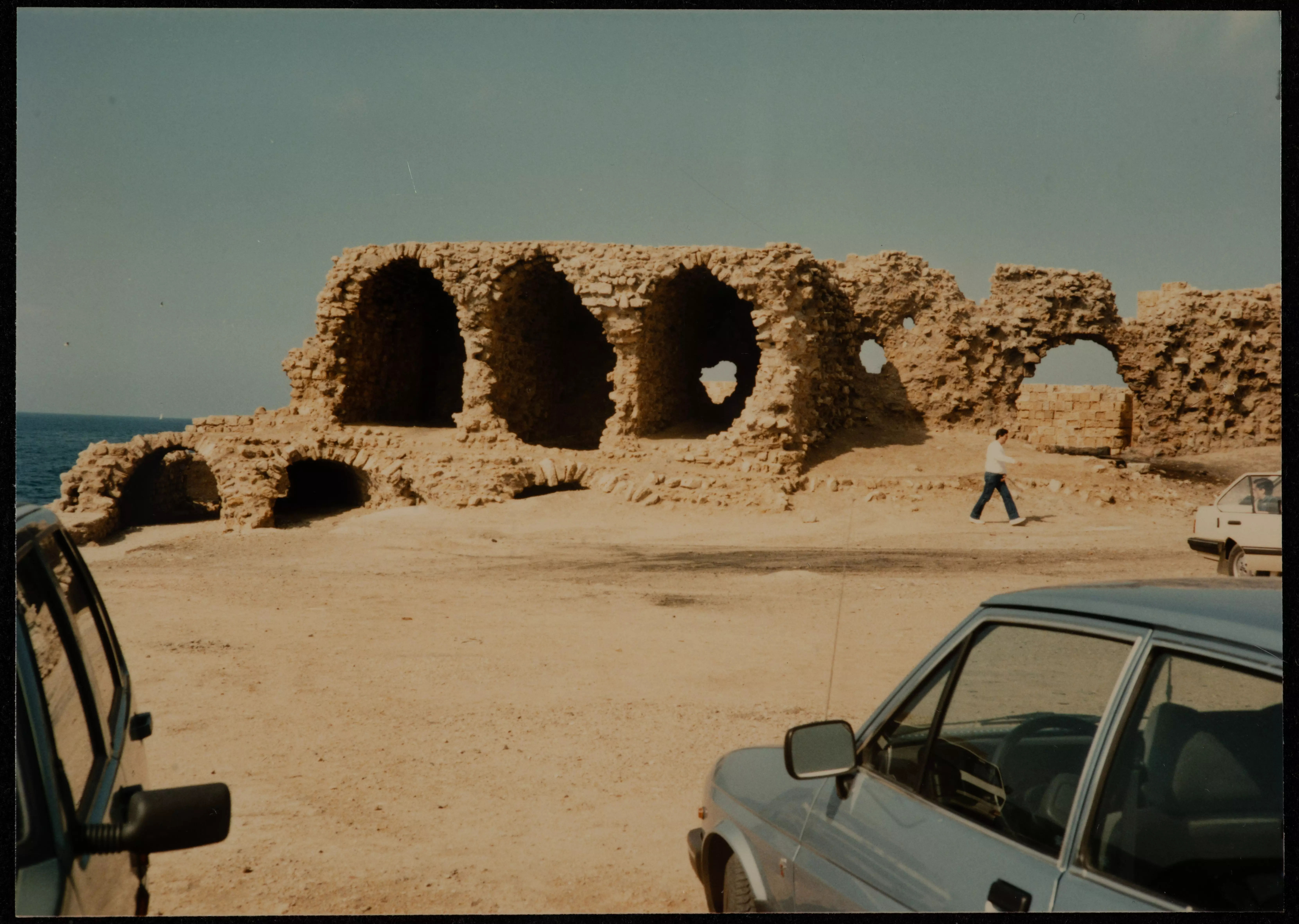
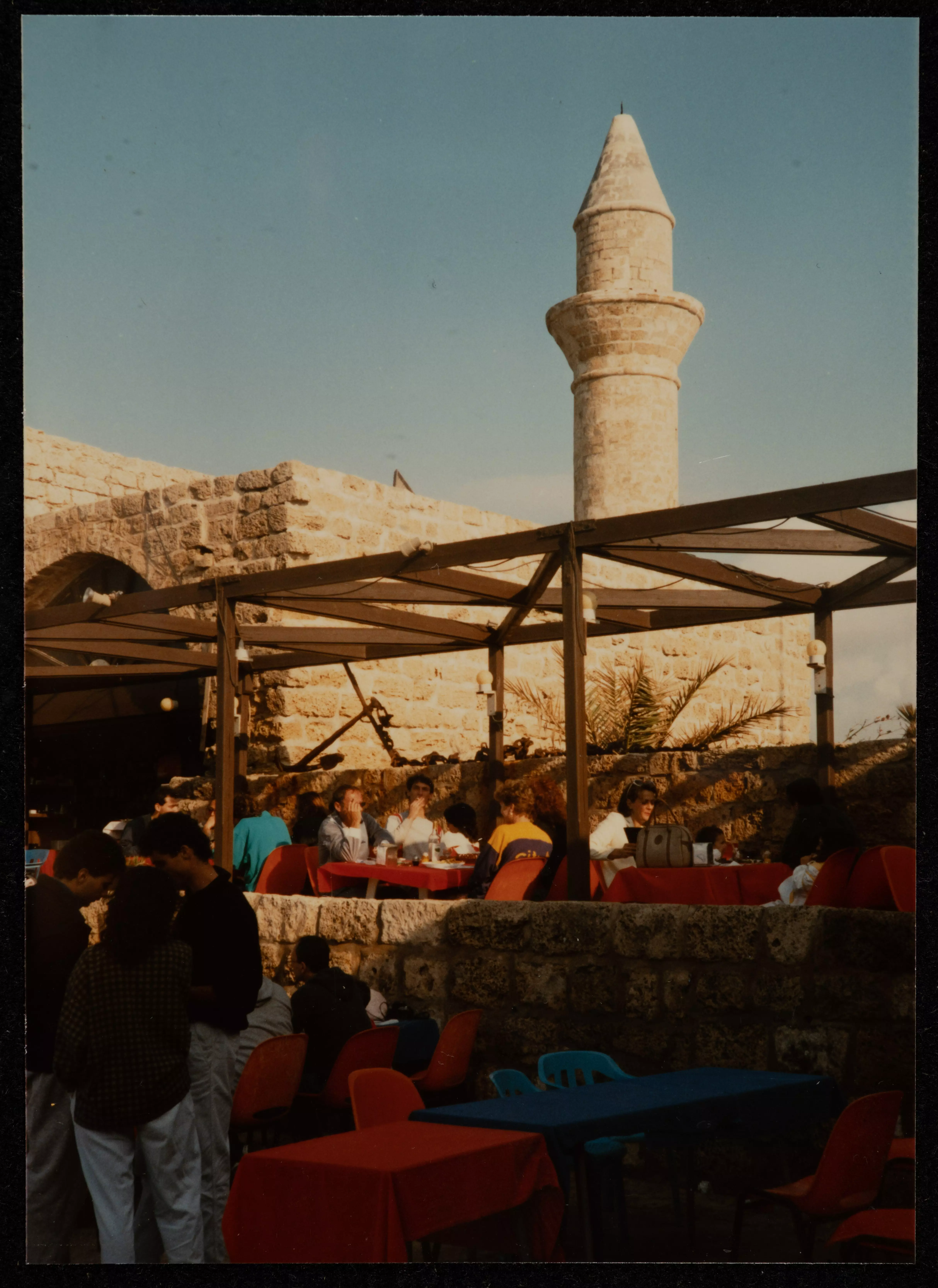
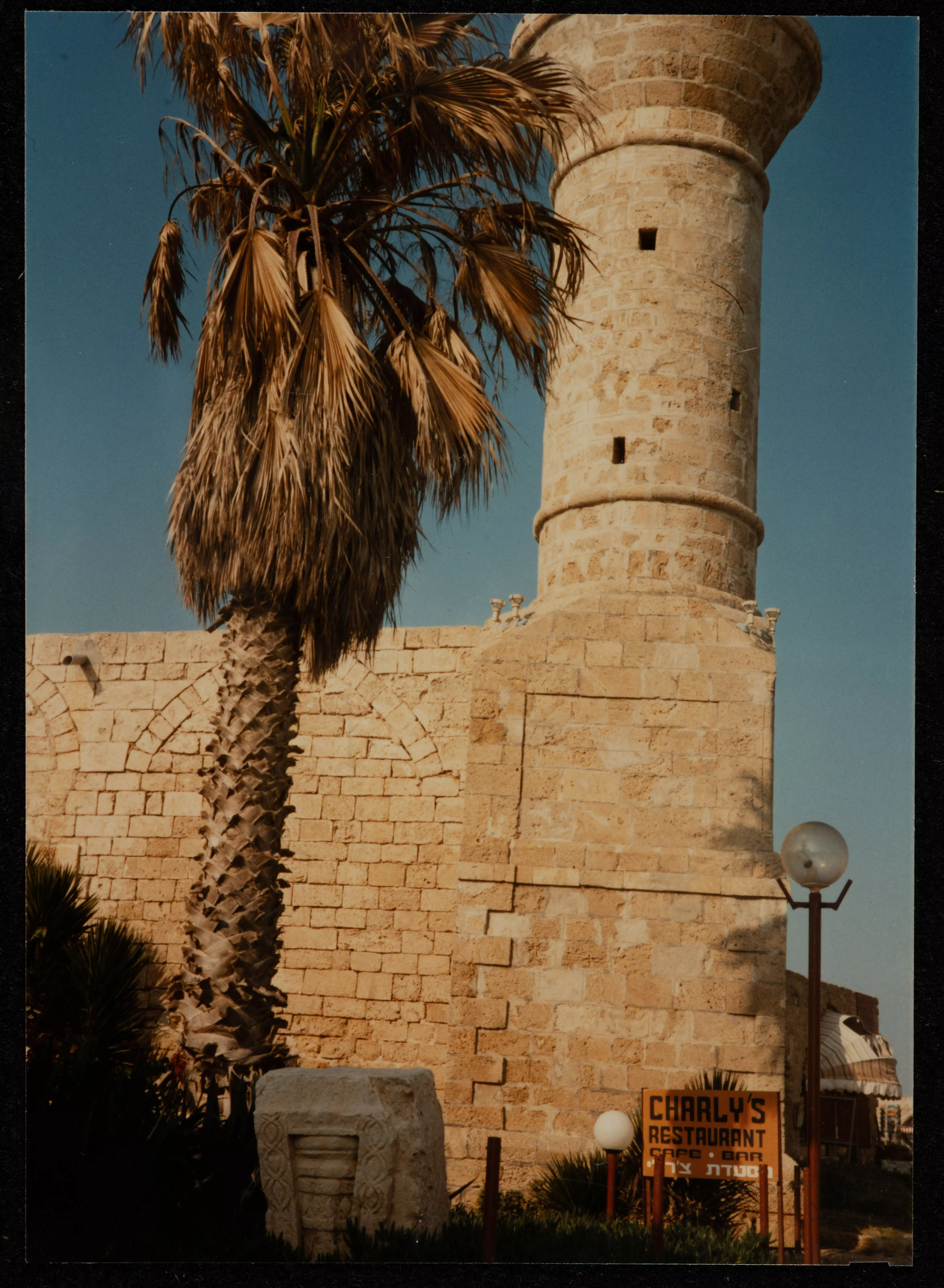
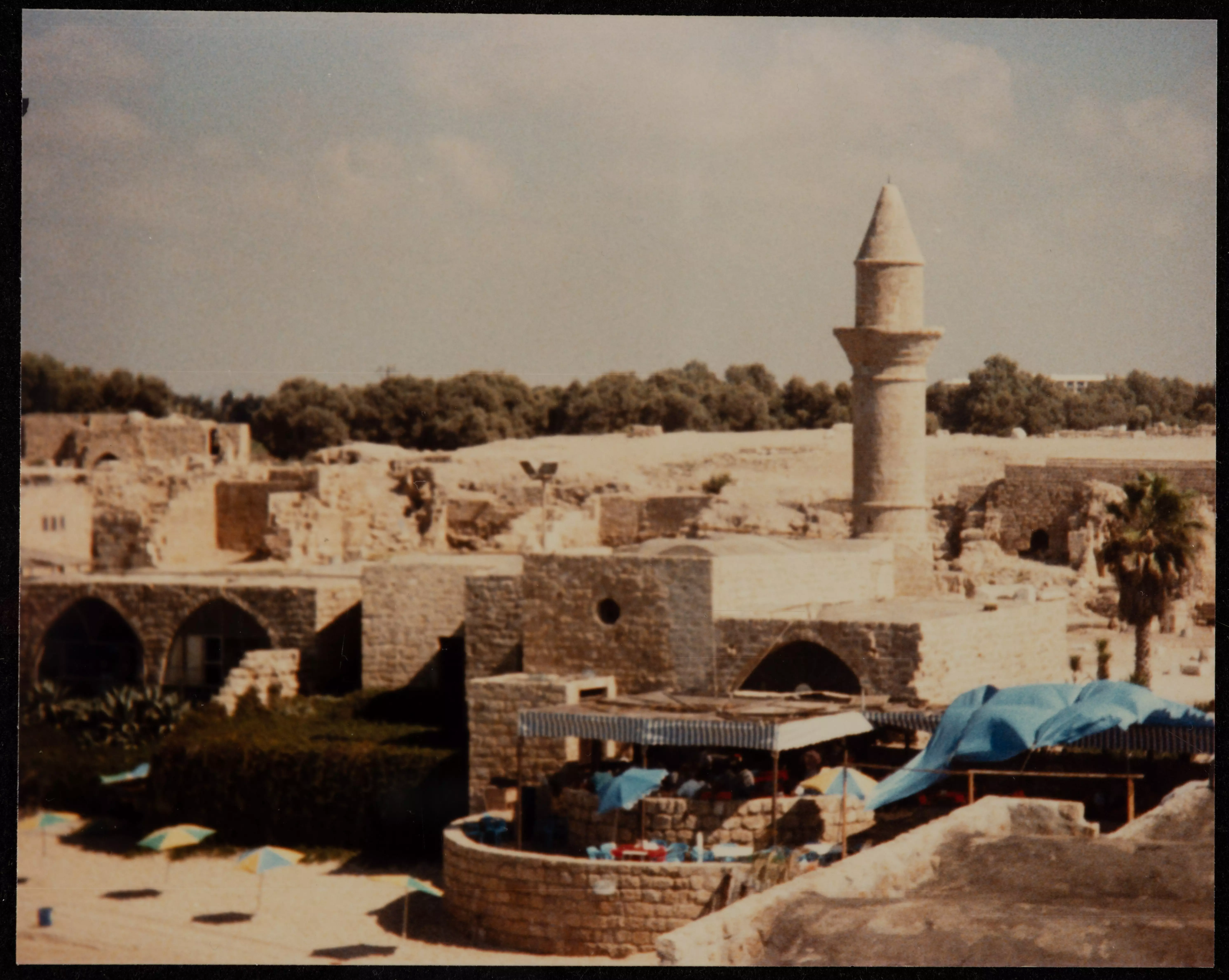
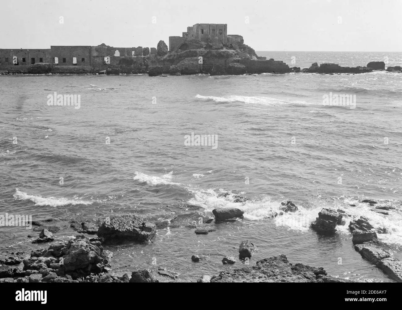
| Archeological Sites | Qisarya contained high and low aqueducts of the city, the theater, parts of the city wall, the hippodrome, storage vaults inside the harbor, and a Crusader fortress. | |||||||||||||||||||||
| Exculsive Jewish Colonies Who Usurped Village Lands |
Sedot Yam , Or 'Aqiva, & the Qesarya. | |||||||||||||||||||||
| Featured Video | ||||||||||||||||||||||
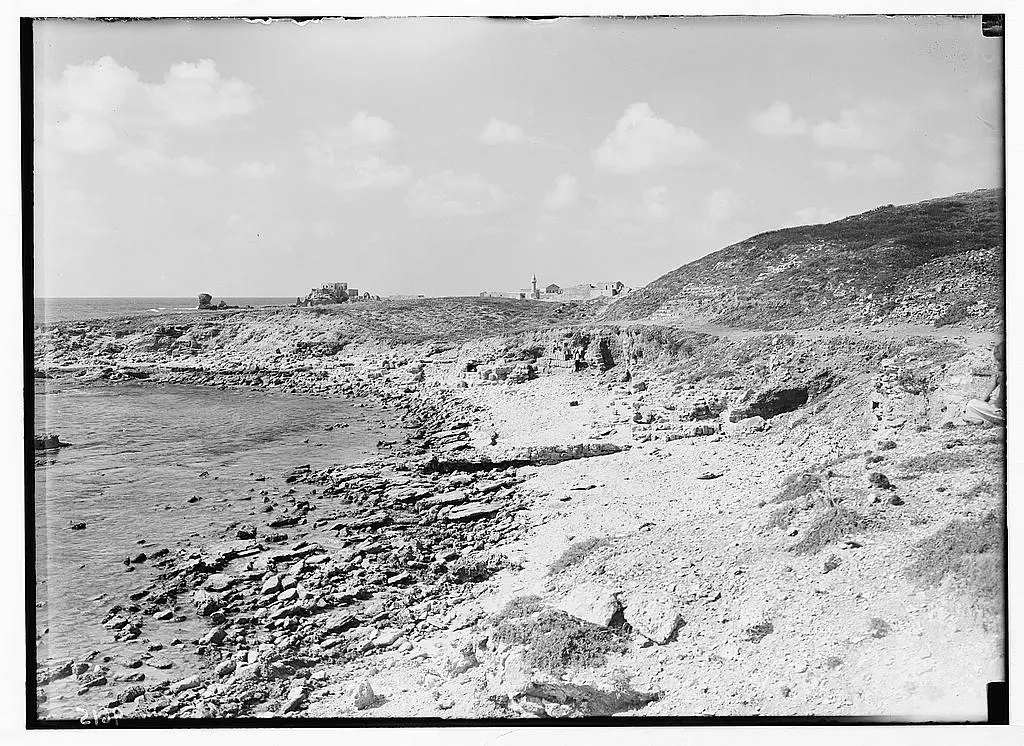
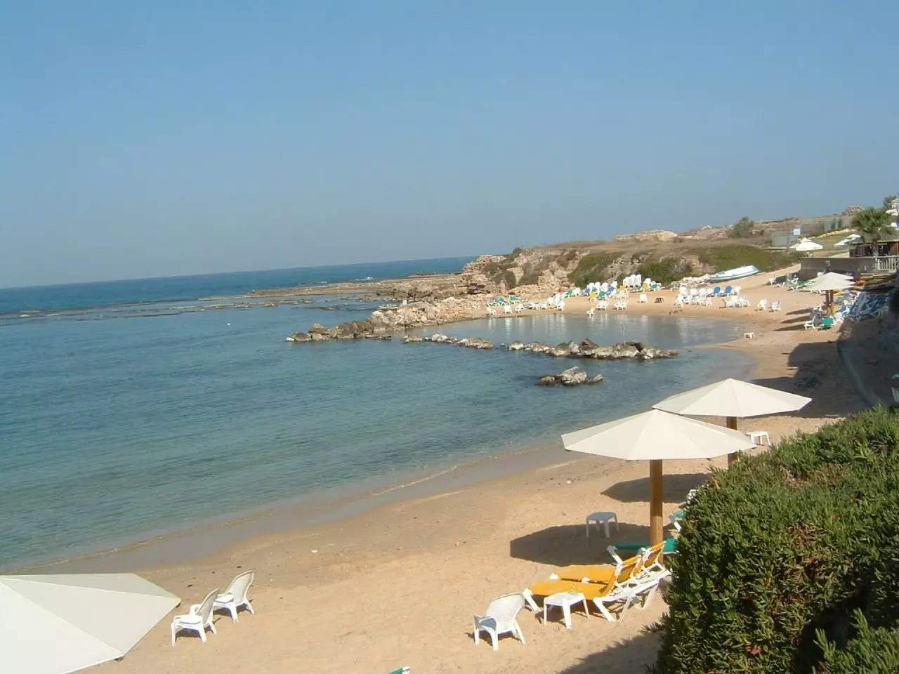
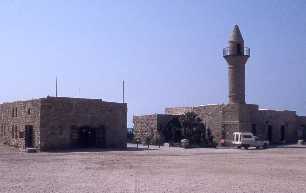
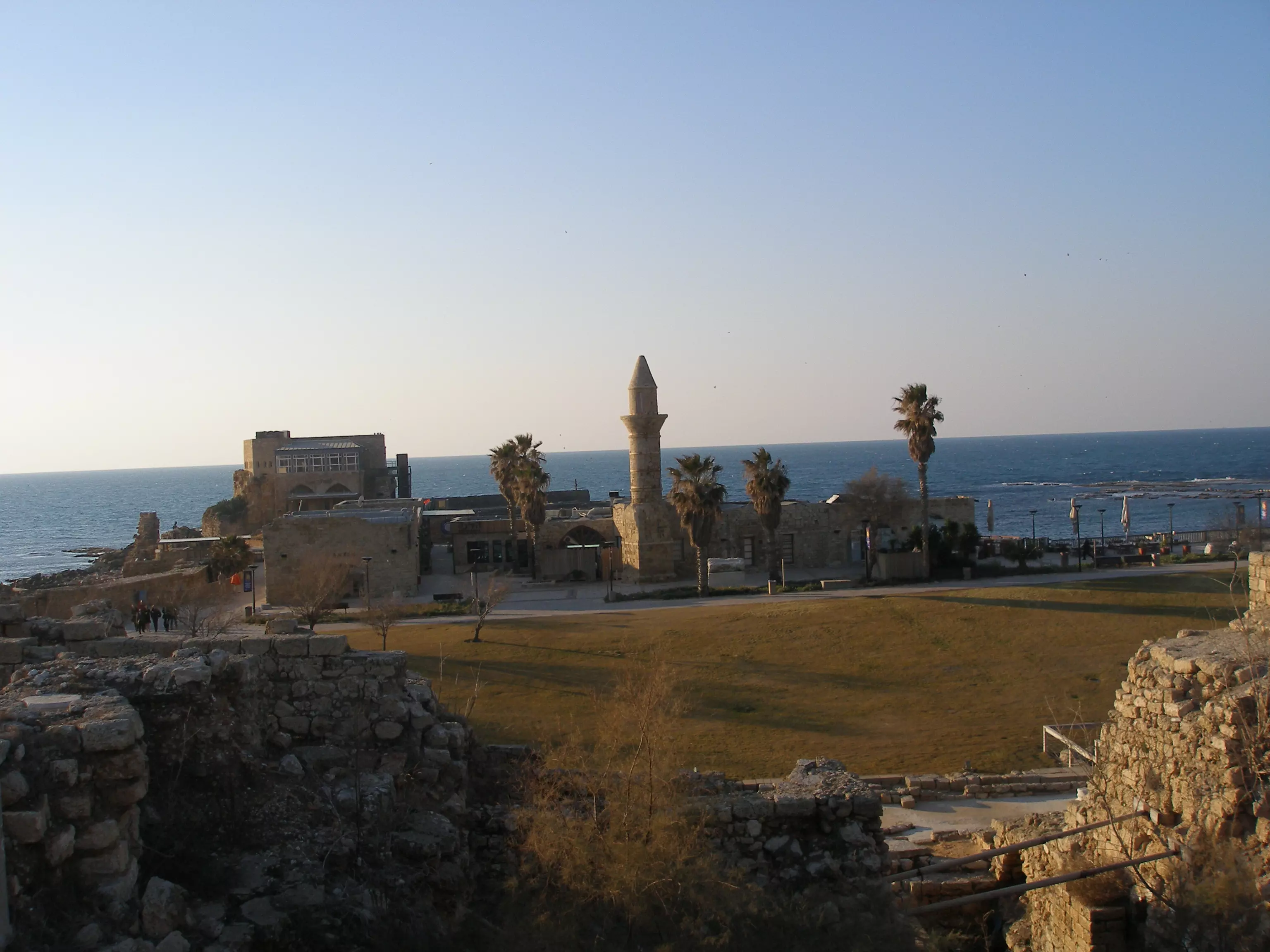
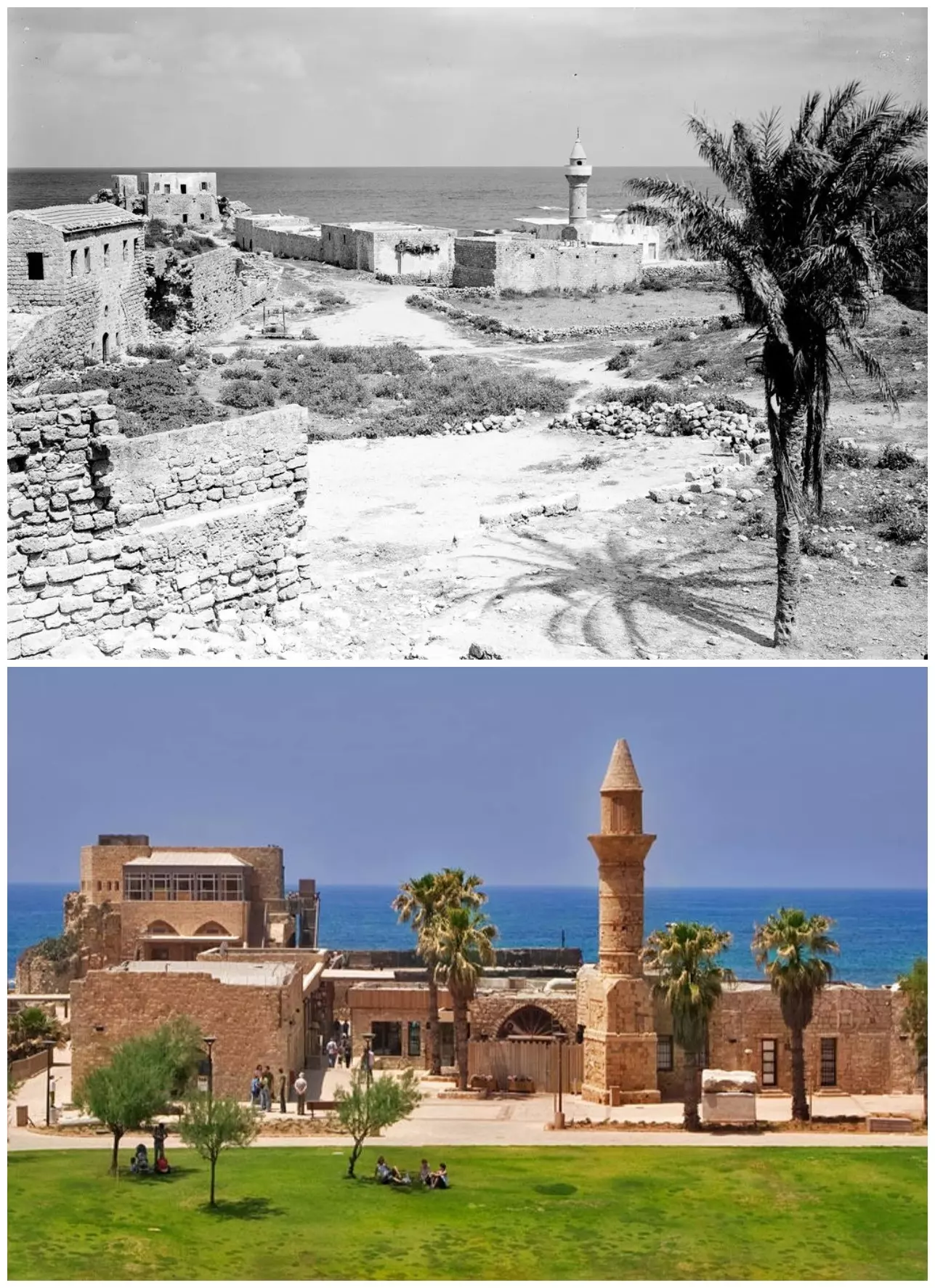
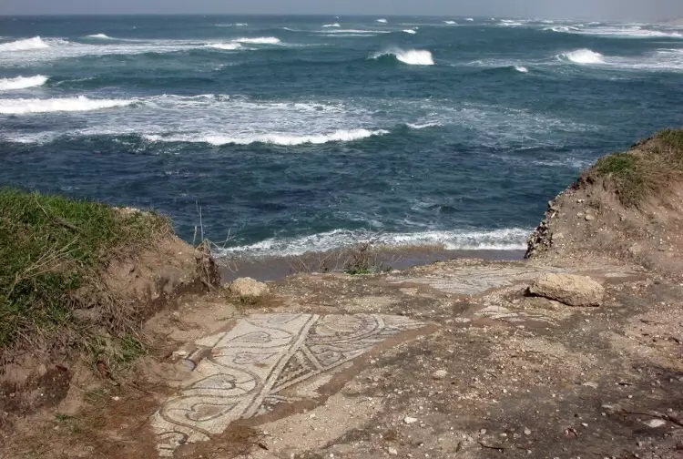
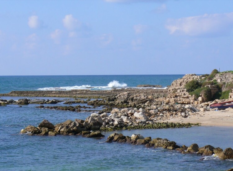
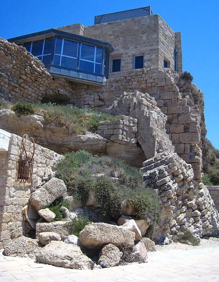
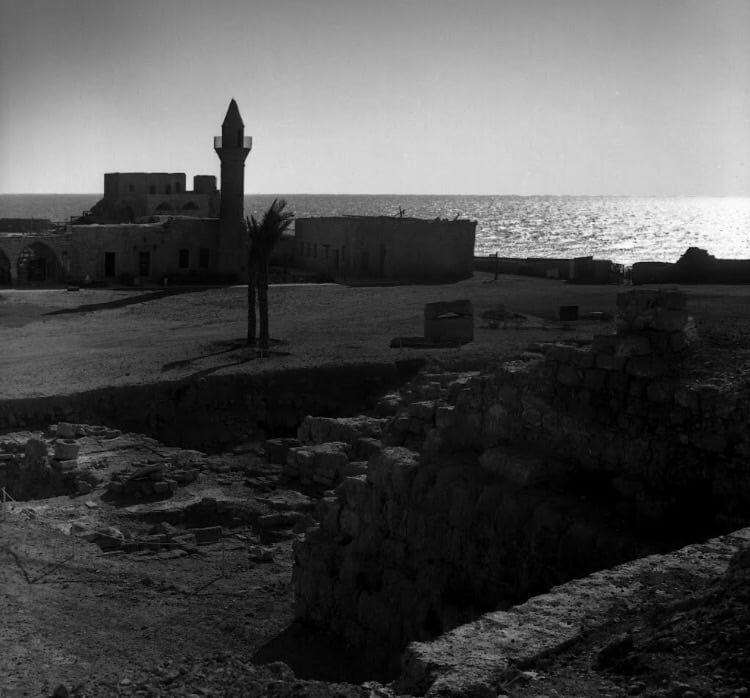
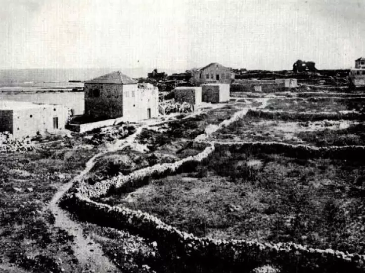
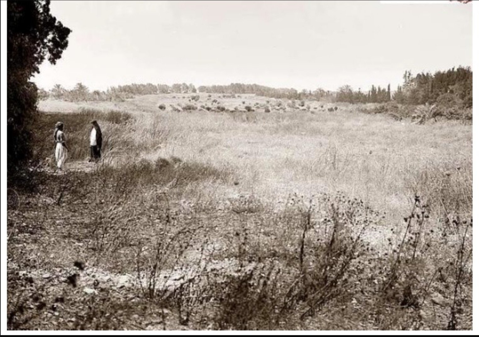
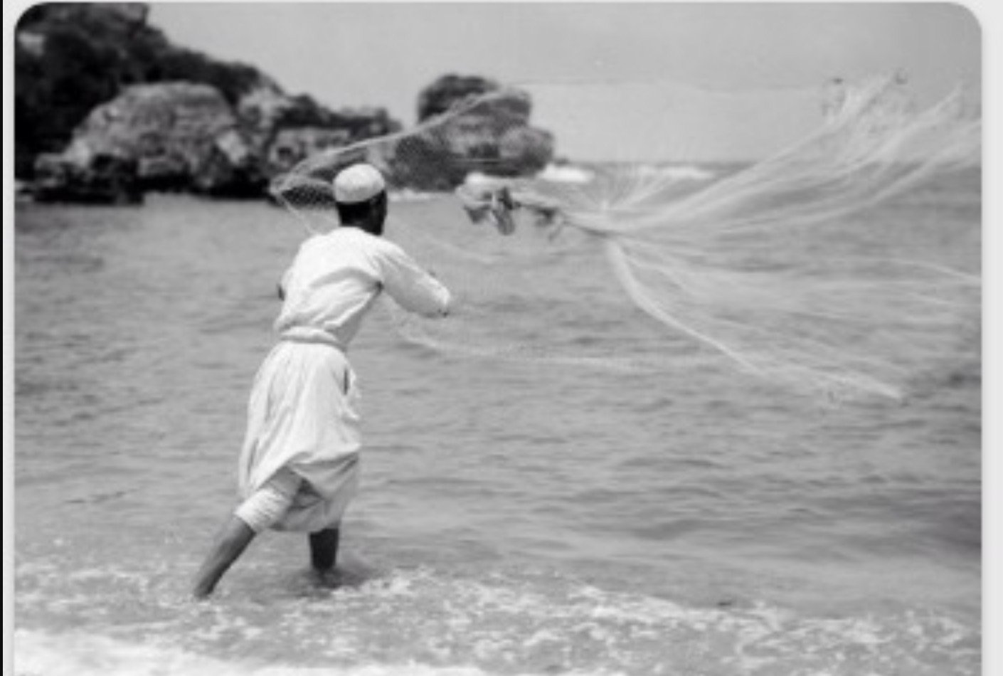
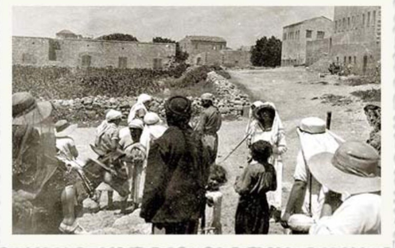
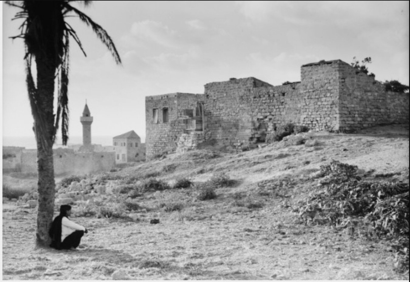
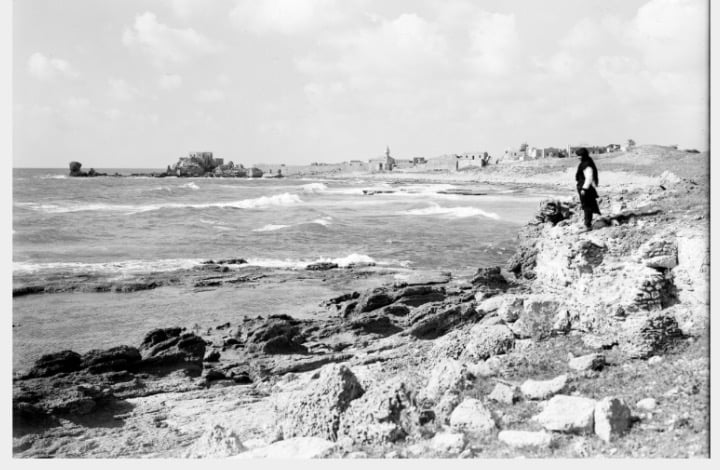
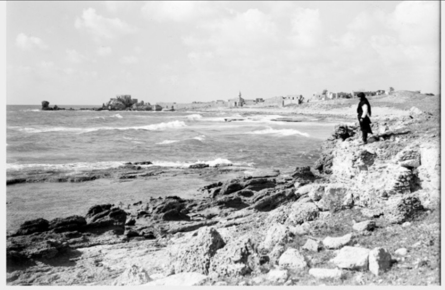
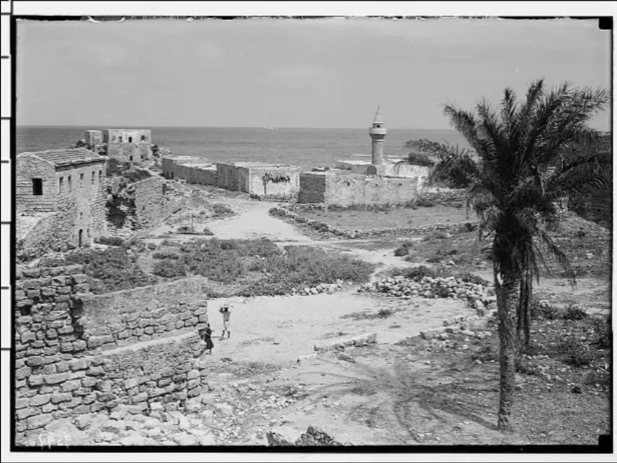
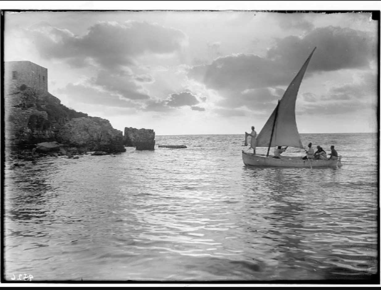
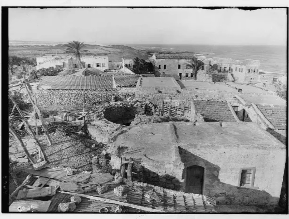
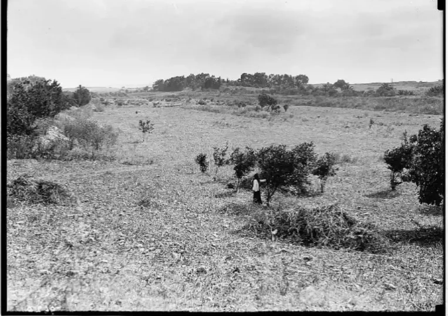
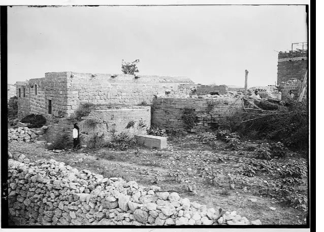
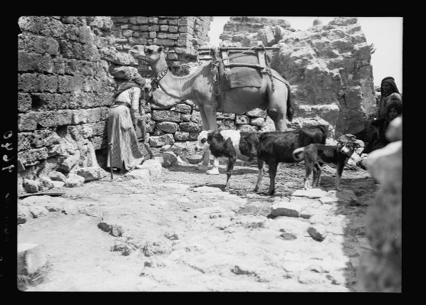
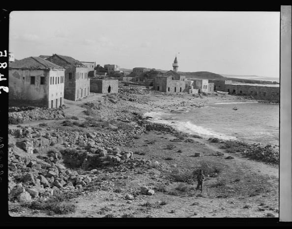
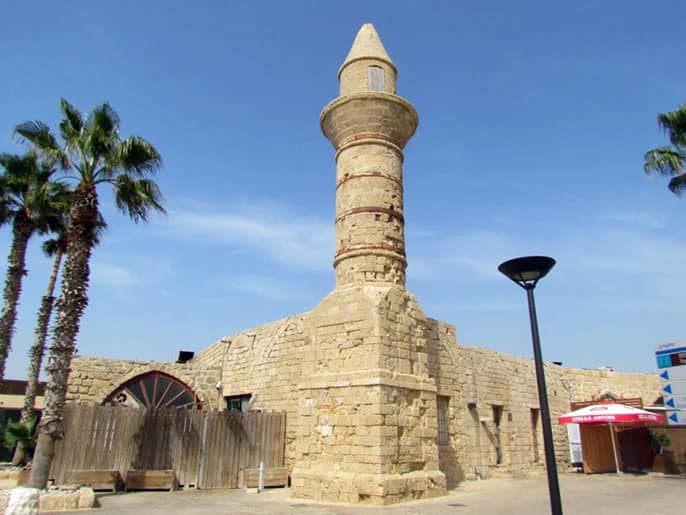
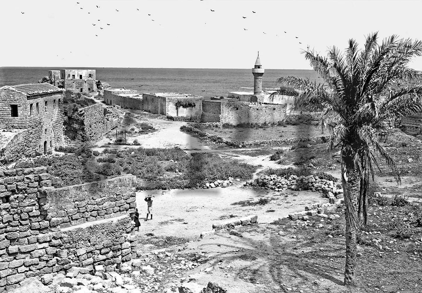
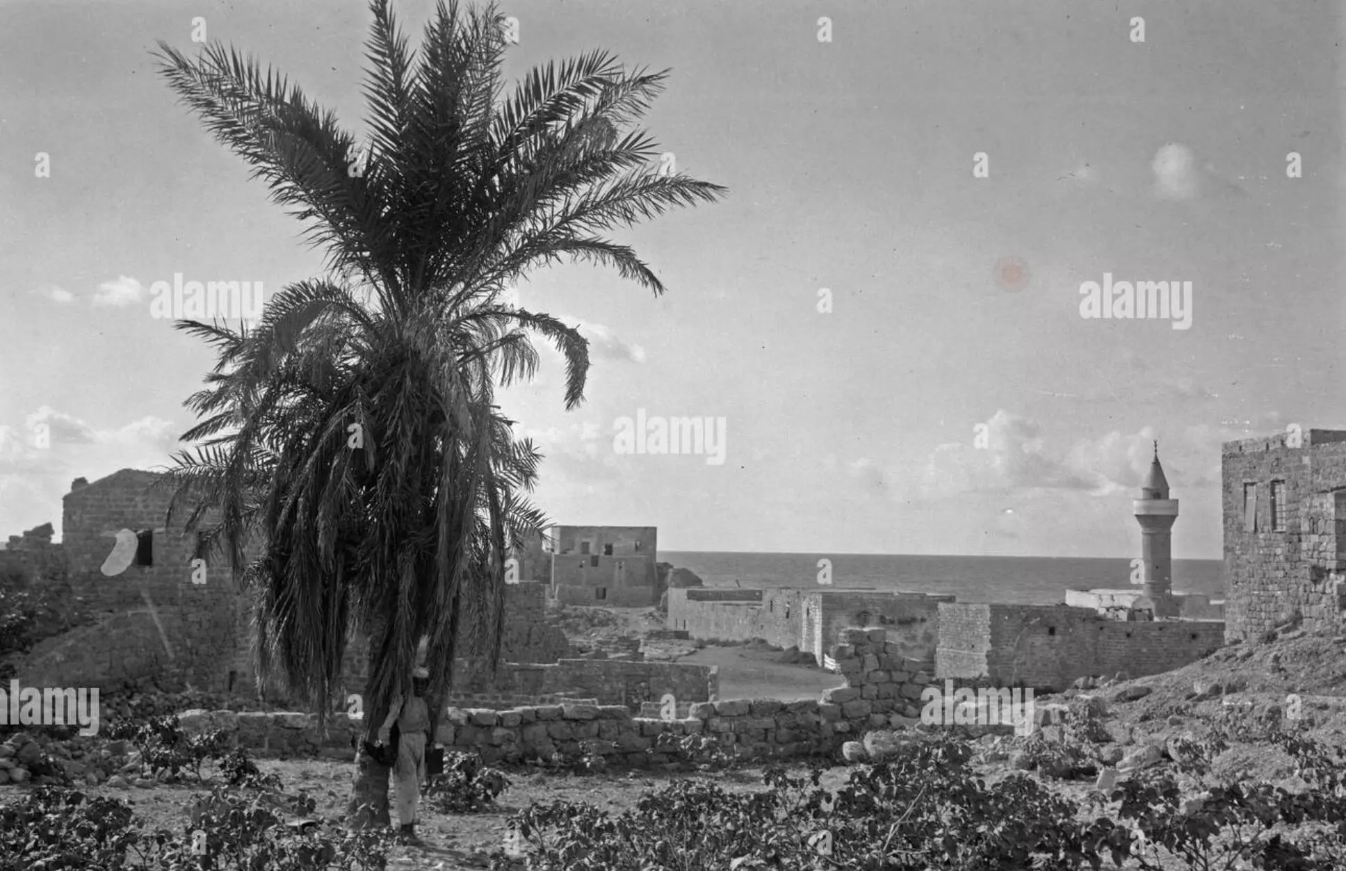
Village Before NakbaThe village was situated on the seacoast inside the wellbuilt ruins of an ancient port city, originally called Strato's Tower. Qisarya is an Arabized form of Caesarea, the name of the Roman successor to Strato's Tower. This first city was established by Strato, ruler of Sidon in the late fourth century B.C., as a Phoenician trading colony. Herod the Great (d. 4 B.C.) built the town he named Caesarea (after his patron, Augustus Caesar) between 22 and 10 B.C. It developed into a prosperous harbor under the Romans and remained so under the Byzantines. (Recent underwater excavations of the harbor have shown it to be a masterpiece of marine construction.) It was the site of the first non-Jewish convert to Christianity (Acts 10). Already in the third century it was a center of Christian scholarship, thanks to the presence and library of Origin (d. ca. A.D. 254). It was Eusebius of Caesarea (4th century A.D.) who produced the first useful list of town names for Palestine, known as the Onomasticon.Caesarea passed into the hands of the Arabs around A.D. 640 and received ample attention from Arab and Muslim geographers and chroniclers. Al-Ya'qubi (d. A.D. 897) said that it was the last city taken in the Arab conquest. Nasir Khusraw, writing in 1047, described it as a pretty town with streams, palm trees, a handsome mosque from which worshippers could enjoy a view of the sea, and a formidable wall. The town was also the home of a number of renowned Arab figures, especially Abd al-Hamid al-Katib (d. A.D. 750), the celebrated rhetorician and belle lettrist. The fortunes of Qisarya appear to have dwindled subsequently, however. Yaqut al-Hamawi (d. 1228) reported that it was more like a village than a town. The Crusaders pillaged it at first, then built a harbor and made the town the seat of an archbishop, until it was captured and leveled in 1265 by the Mamluk sultan Baybars (1233-77). Qisarya only recovered in 1878 when Muslims from Bosnia settled in it after escaping the Austrian occupation of their country. Oliphant, an English Zionist activist and mystic, said that five months after their arrival the Bosnian immigrants had built twenty stone houses with vaults and storage compartments. In 1945 Qisarya's Arab population was comprised of 930 Muslims and 30 Christians. The general outline of the village paralleled the shore, extending north to south. Its houses were made of stones mortared with either mud or cement; some of the Bedouin around Qisarya, however, lived in tents. The coastal highway ran about 4 km to the east. A boys' elementary school was founded in the village in about 1884, during Ottoman rule. The people of the village drew water for domestic use from several wells. Their economy was based on agriculture. In 1944/45 a total of 18 dunums was devoted to citrus and bananas and 1,020 dunums were allotted to cereals; 108 dunums were irrigated or used for orchards. Thanks to recent excavations many ruins of Caesarea are now visible. These include the high and low aqueducts of the city, the theater, parts of the city wall (from both the Roman and Byzantine periods), the hippodrome, storage vaults inside the harbor, and the later Crusader fortress. Village Occupation and Ethnic Cleaning'Caesarea was the first pre-planned, organized expulsion of an Arab community by the Haganah in 1948,' according to Israeli historian Benny Morris. The village was captured by a Palmach unit on 15 February and the inhabitants 'fled or were ordered to leave,' although some had already left out of fear of attack. When twenty villagers insisted on remaining in their homes even after the village was captured, a Palmach unit destroyed the village houses on 20 February. The decision to destroy the houses was taken in early February during a Haganah General Staff meeting. But Morris claims that the houses were Jewish property leased by Arabs from the Palestine Jewish Colonization Association (PICA), and that the Palmach officer in command of operations, Yitzhak Rabin, disagreed with the decision to destroy the village. An official of the left-wing Mapam party also objected, saying that the villagers had' done all in their power to keep peace in their village and around it...' Thirty houses were demolished; six were spared for lack of explosives. The demolition occurred in the general context of clearing the coastal plain north of Tel Aviv in the early months of 1948 (see Khirbat al-Shuna, Haifa sub-district).Zionists Colonies on Village LandsThe kibbutz of Sedot Yam was established on what were traditionally village lands in 1940, 1 km south of the village site. Another settlement, Or 'Aqiva, was founded northeast of the village in 1951 it is now a small town with over 7,000 inhabitants and extends onto village lands. The Israeli rural locality of Qesarya was recognized by the Israeli government in 1977.Village TodayMost of the houses have been demolished. The site has been excavated in recent years, largely by Italian, American, and Israeli teams, and turned into a tourist area. Most of the few remaining houses are now restaurants, and the village mosque has been converted into a bar (see photos section).SourceDr. Walid al-Khalidi, 1992: All That Remains. |
||||||||||||||||||||||
| Related Maps | Town Lands' Demarcation Maps خرائط للقضاء توضح حدود القرى والاودية Town's map on MapQuest View from satellite Help us map this town at WikiMapia |
|||||||||||||||||||||
| Related Links | Wikipedia's Page Facebook Page Google Search Google For Images Google For Videos |
|||||||||||||||||||||
| More Information | في كتاب كي لا ننسى في كتاب بلادنا فلسطين المزيد من موقع هوية |
|||||||||||||||||||||
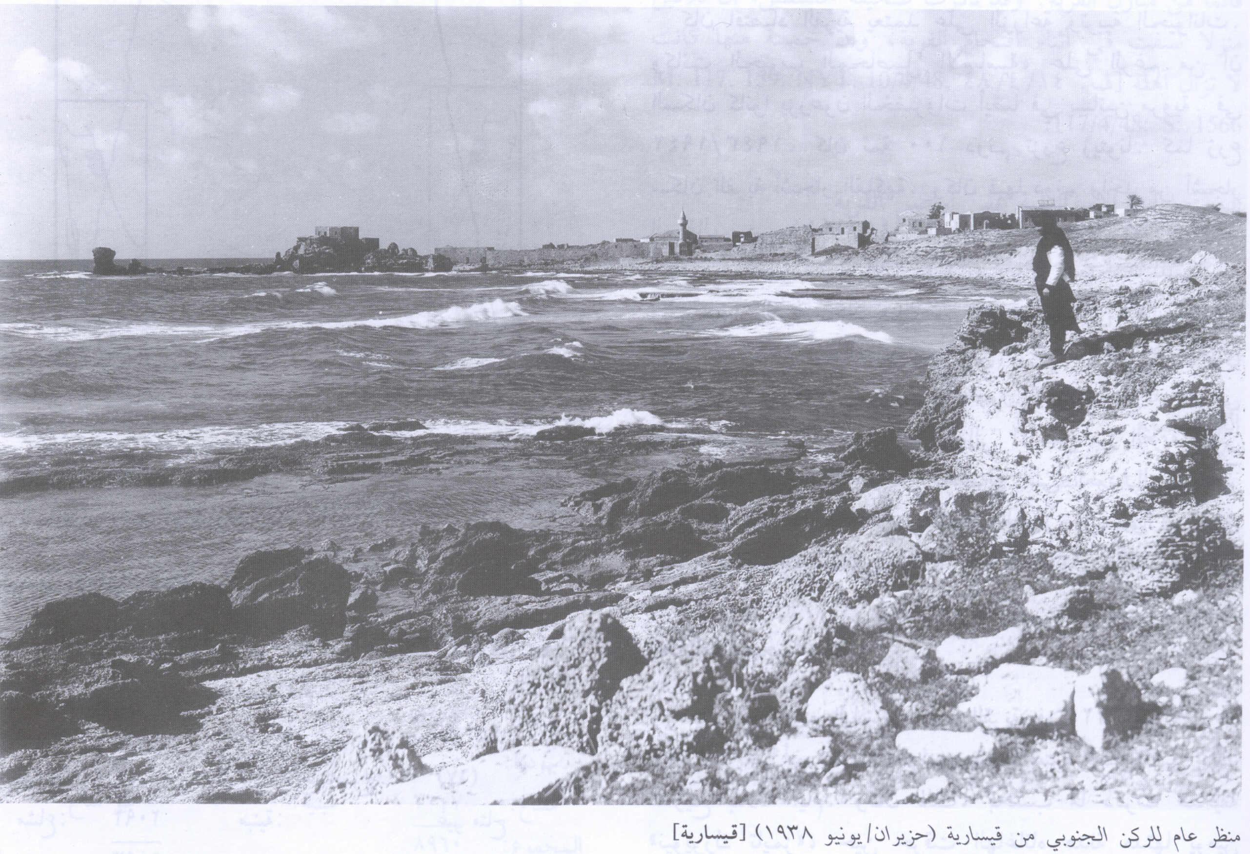
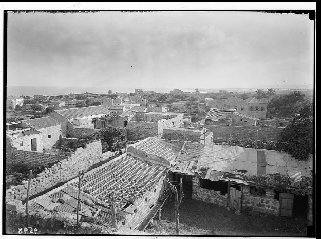
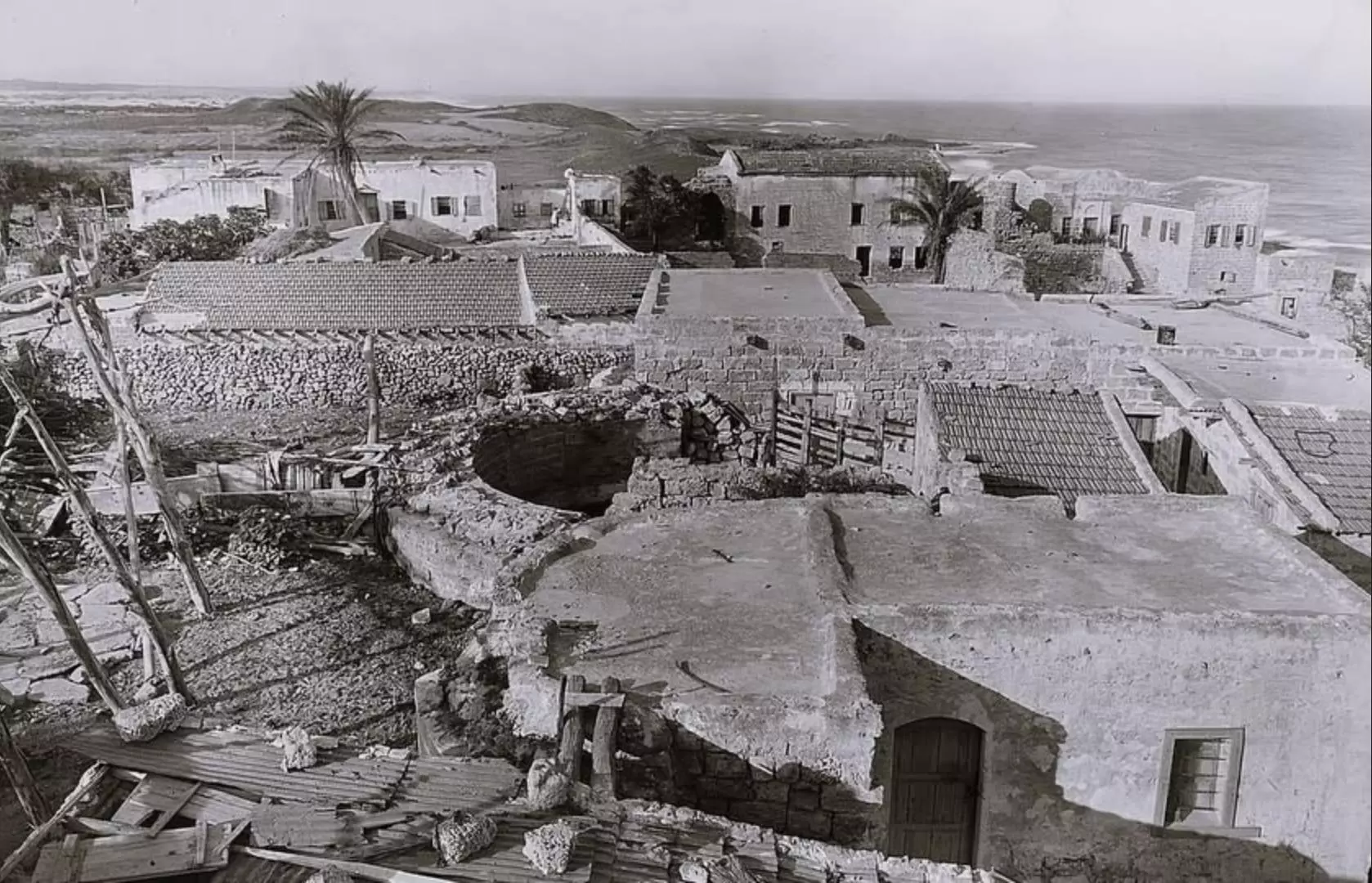
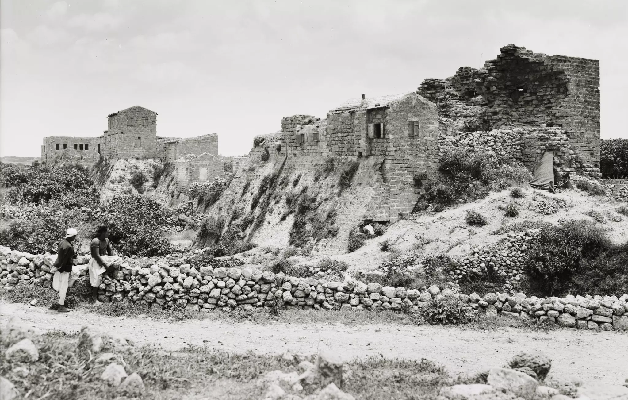
- General View- 1938
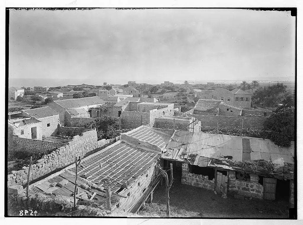
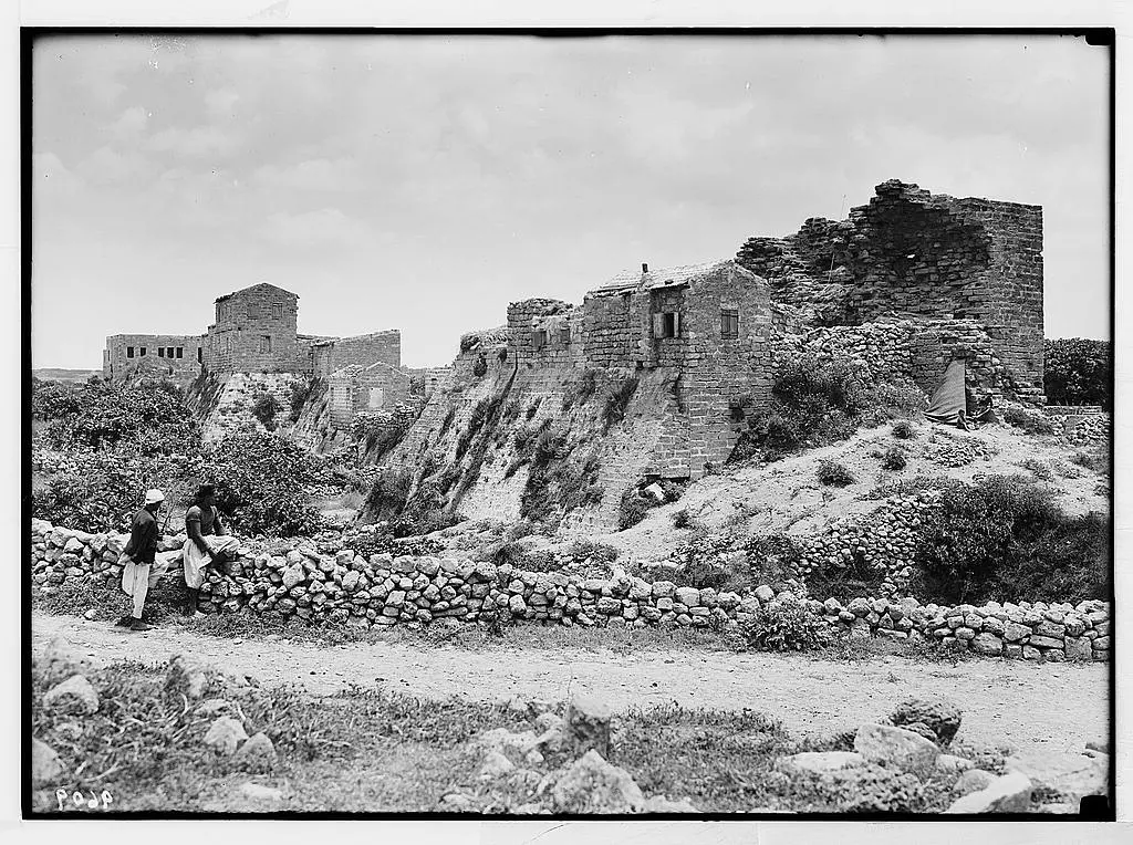
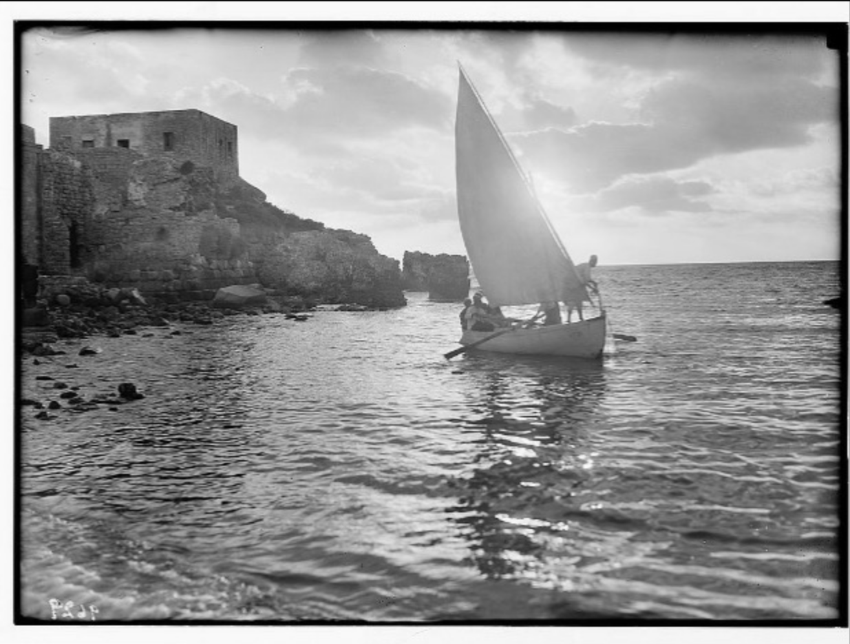
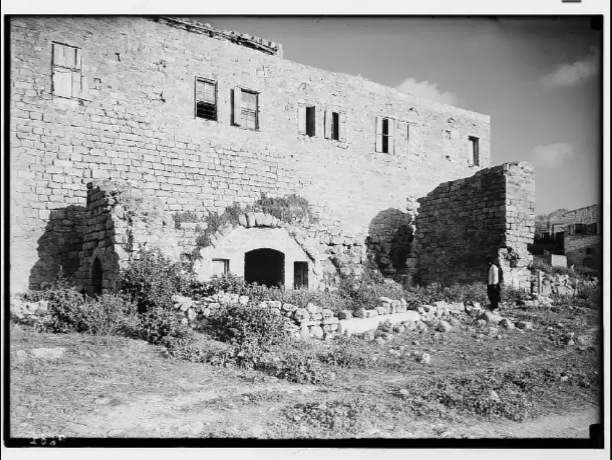
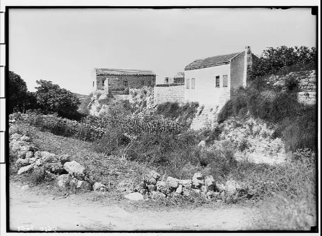
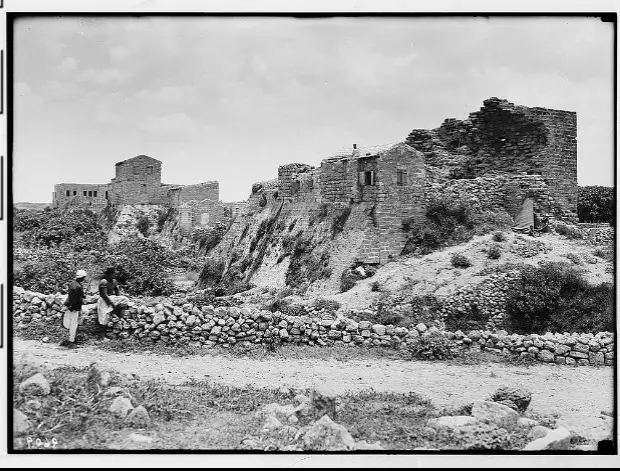
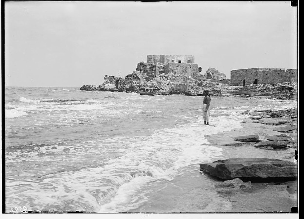
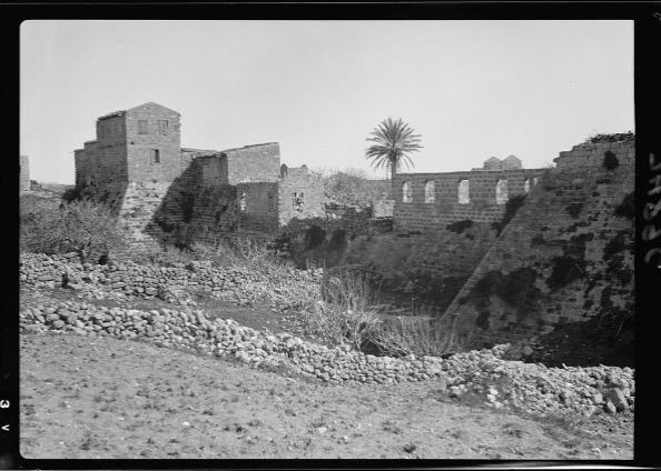
1 - General View the nearby castle ruins #2, before 1935
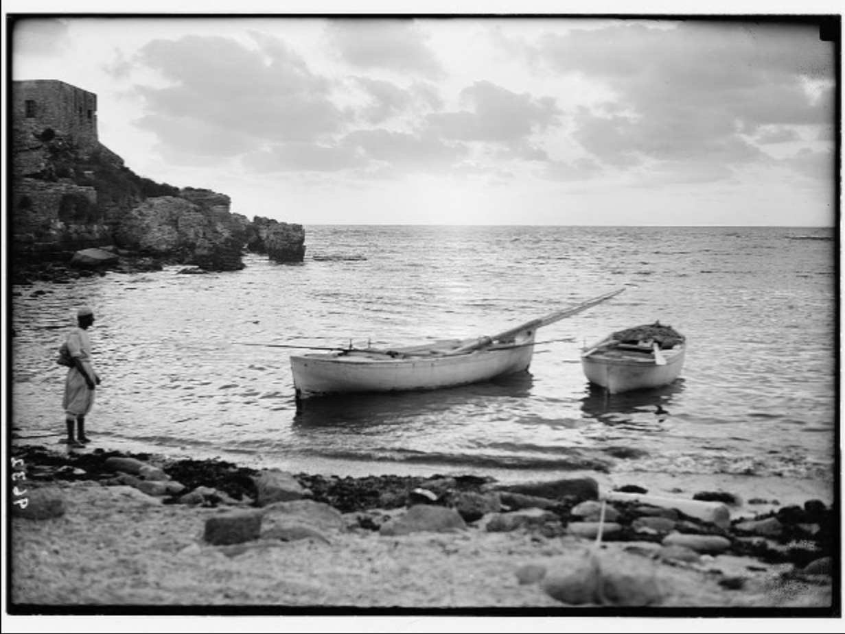
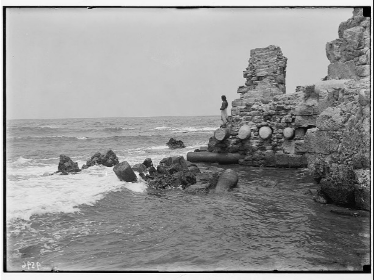
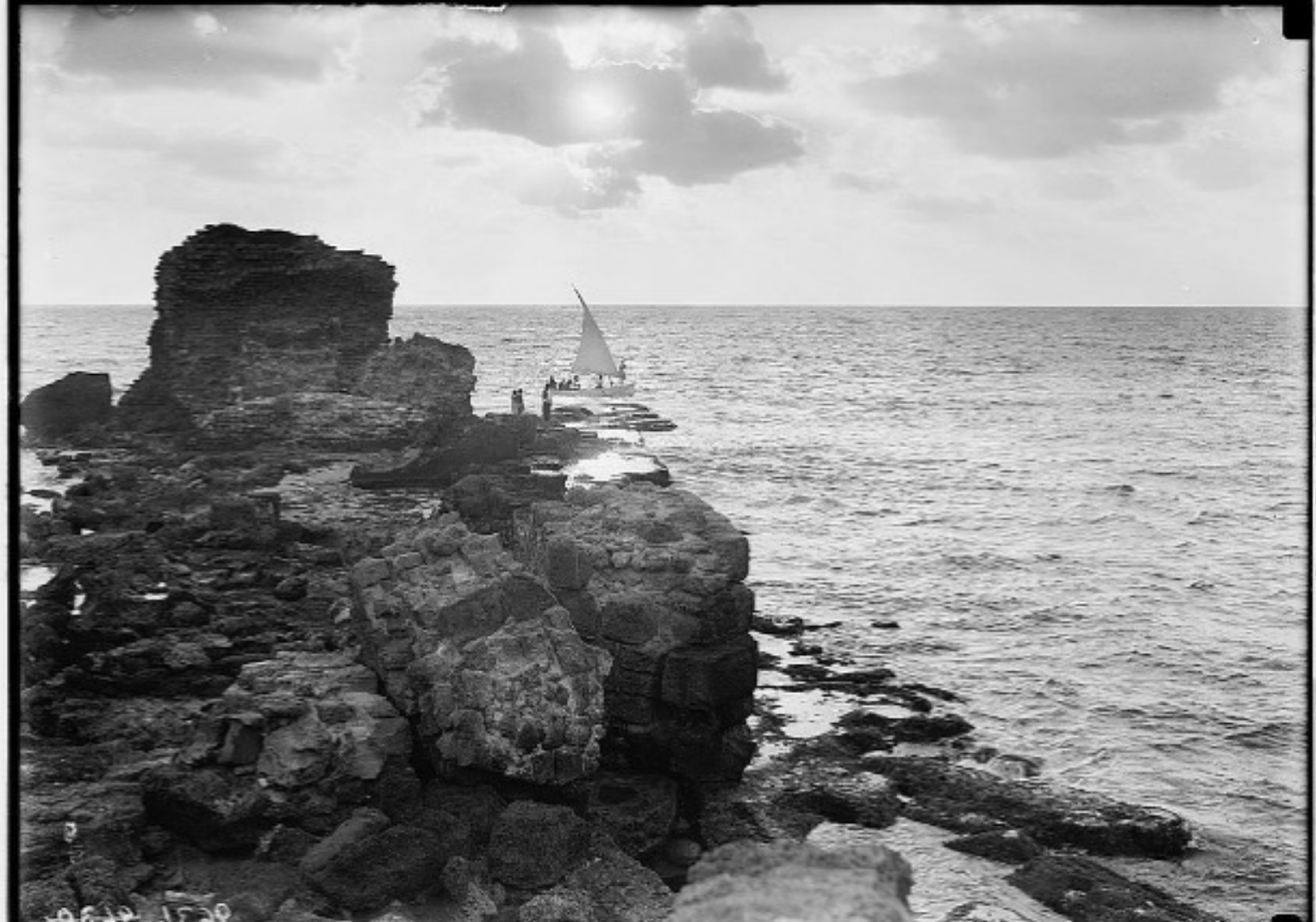
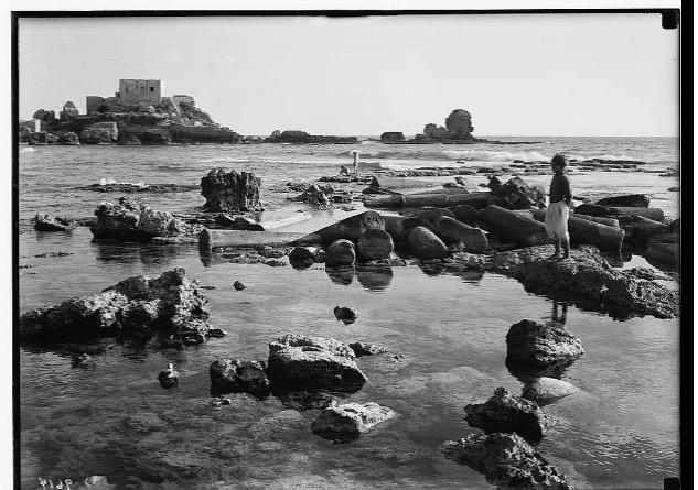
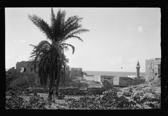
1 - General View from the southern coast, before 1935
- General View the nearby castle ruins, before 1935
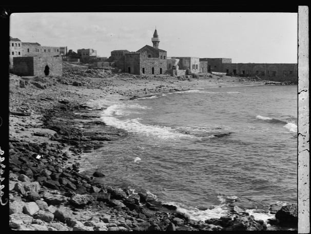
- General View Of Qisarya From The Coast Pre 1935
Scanned from "All That Remains" by Dr. Walid Khalidi 5 - Village Mosque In 1984
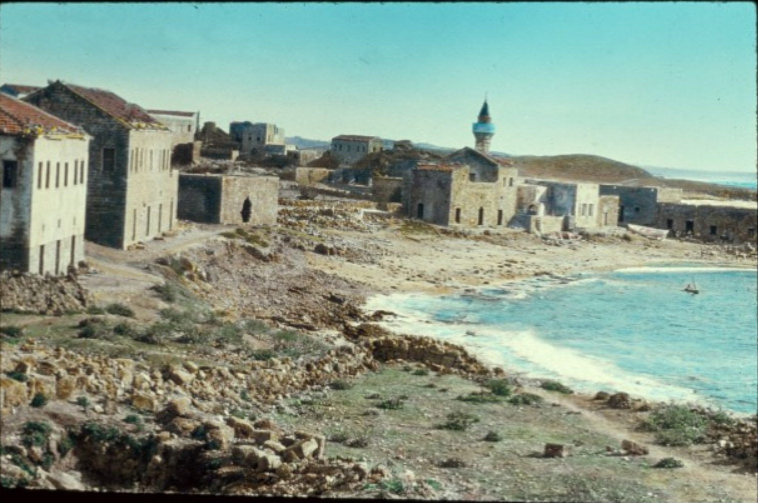
Scanned from "All That Remains" by Dr. Walid Khalidi 1 - General View Of Qisarya In The 1990s
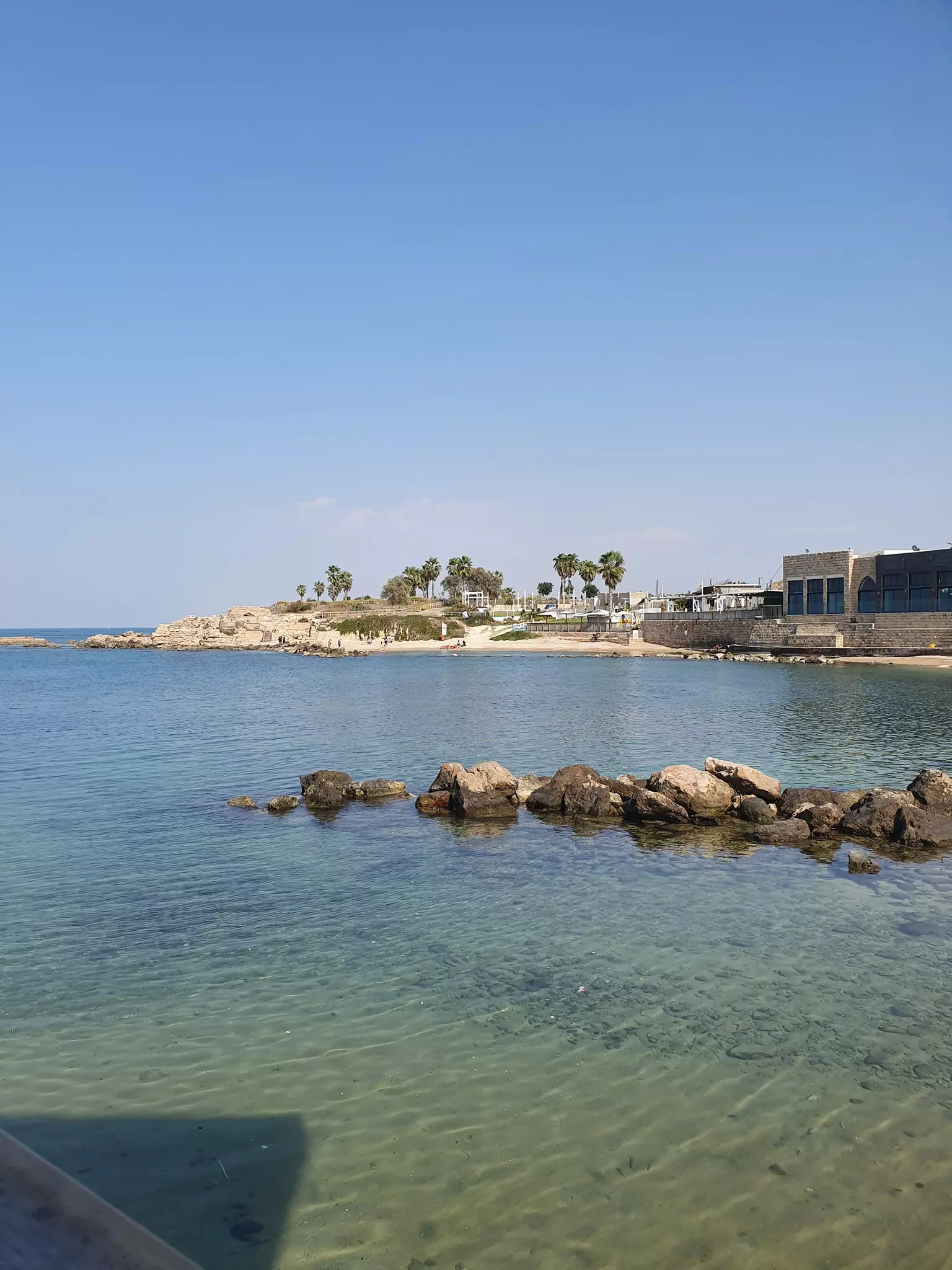
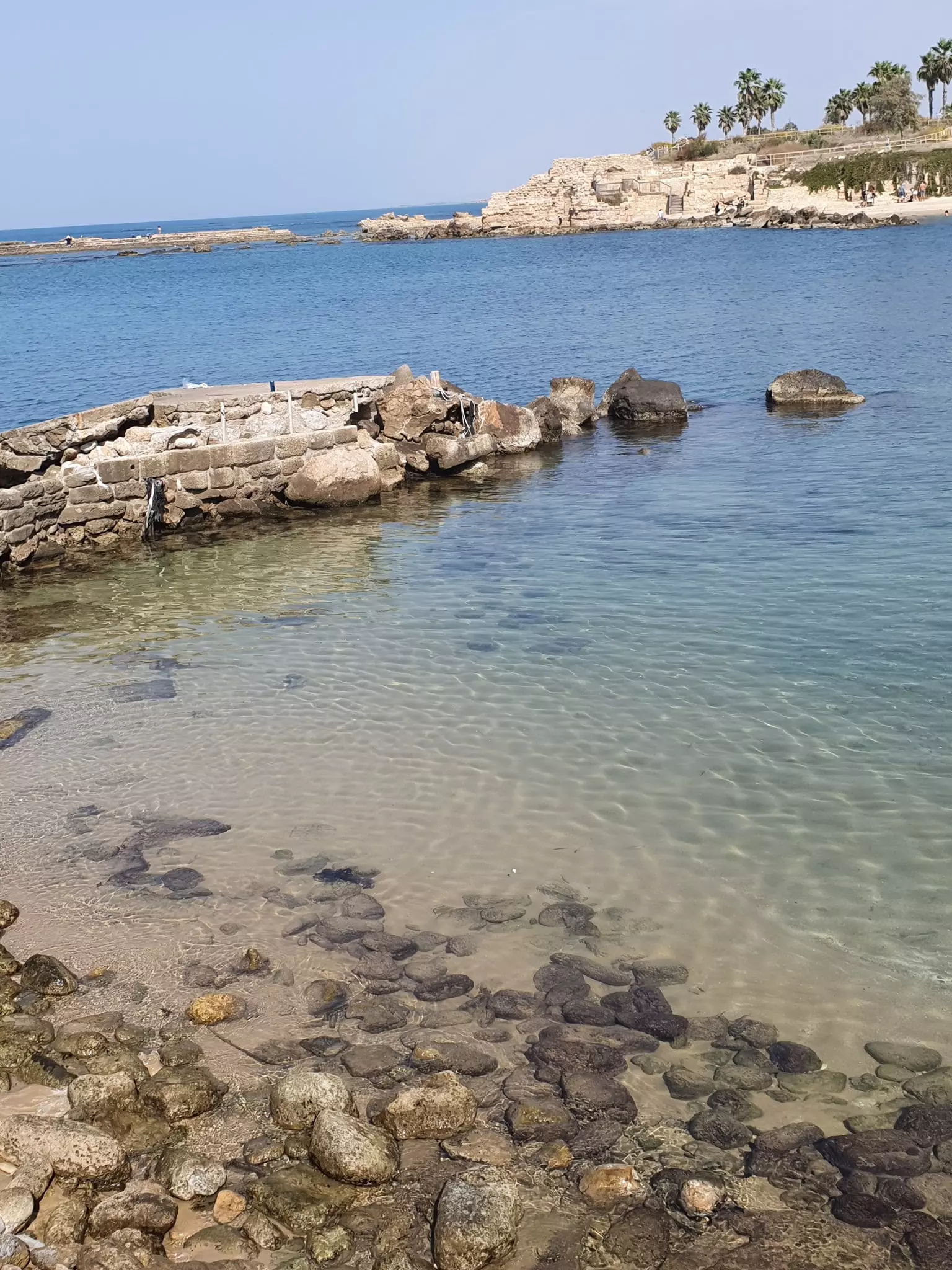
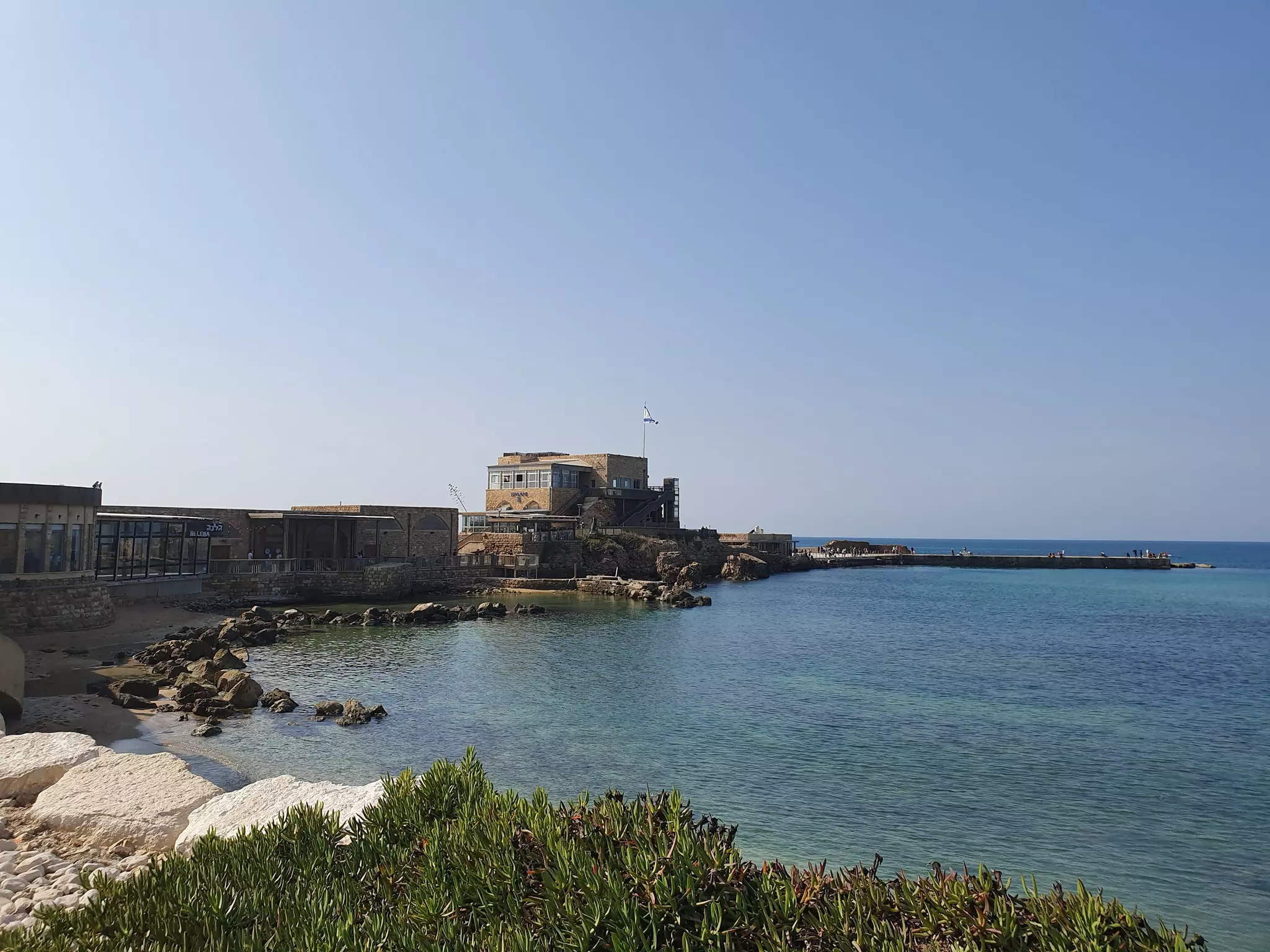
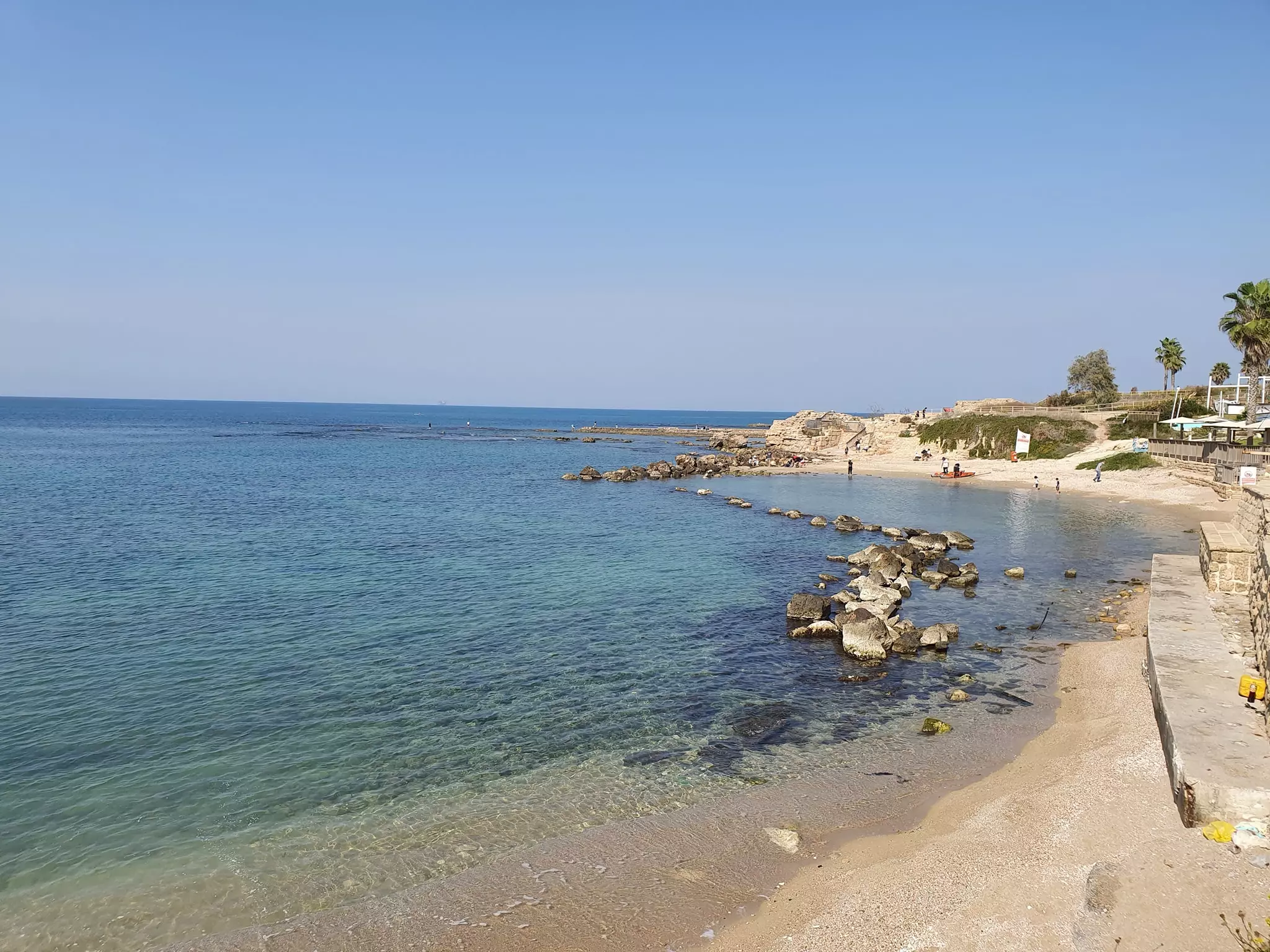
- General view for old port area from the top of the roman coliseum
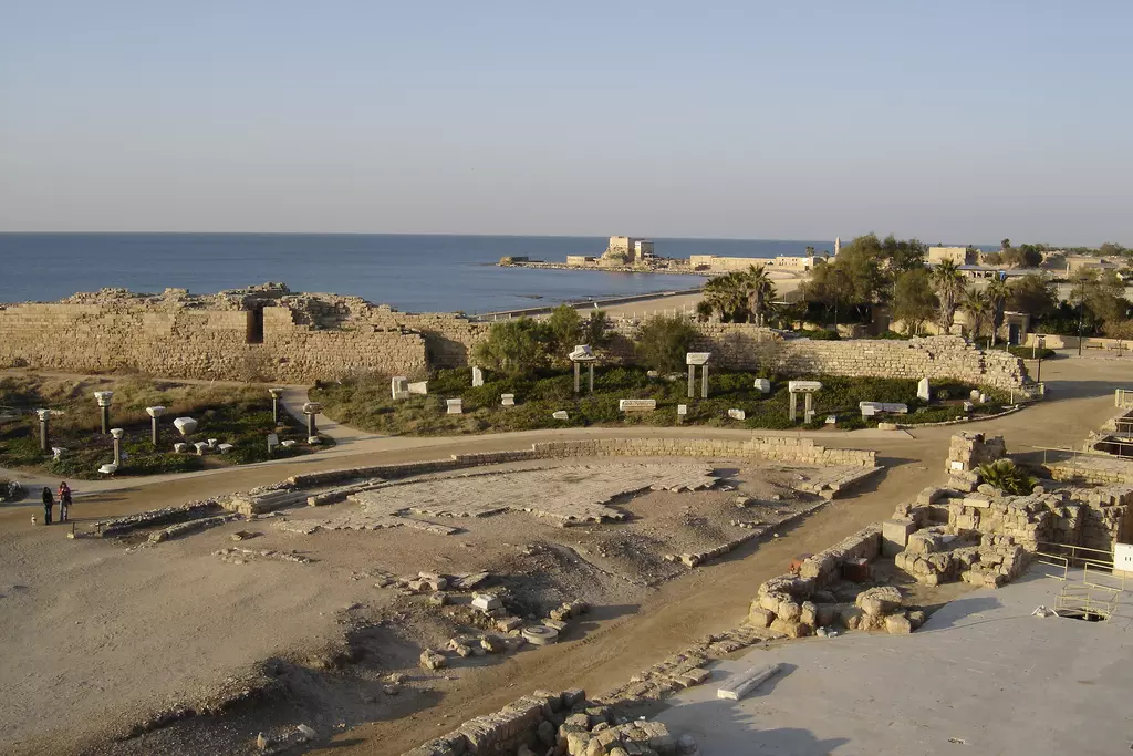
- General view for old port area
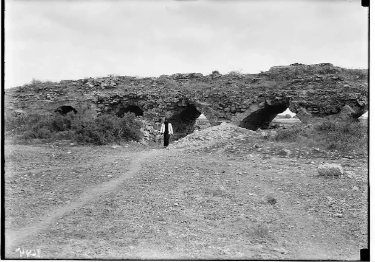
2 - The Roman aqueduct from the beach area
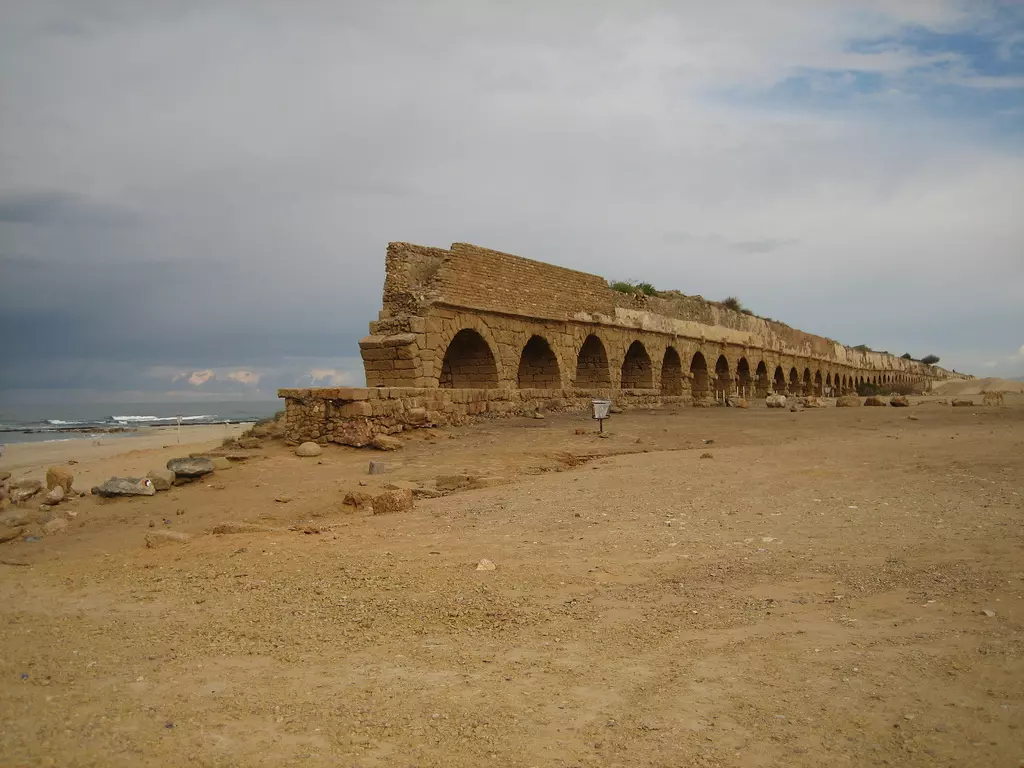
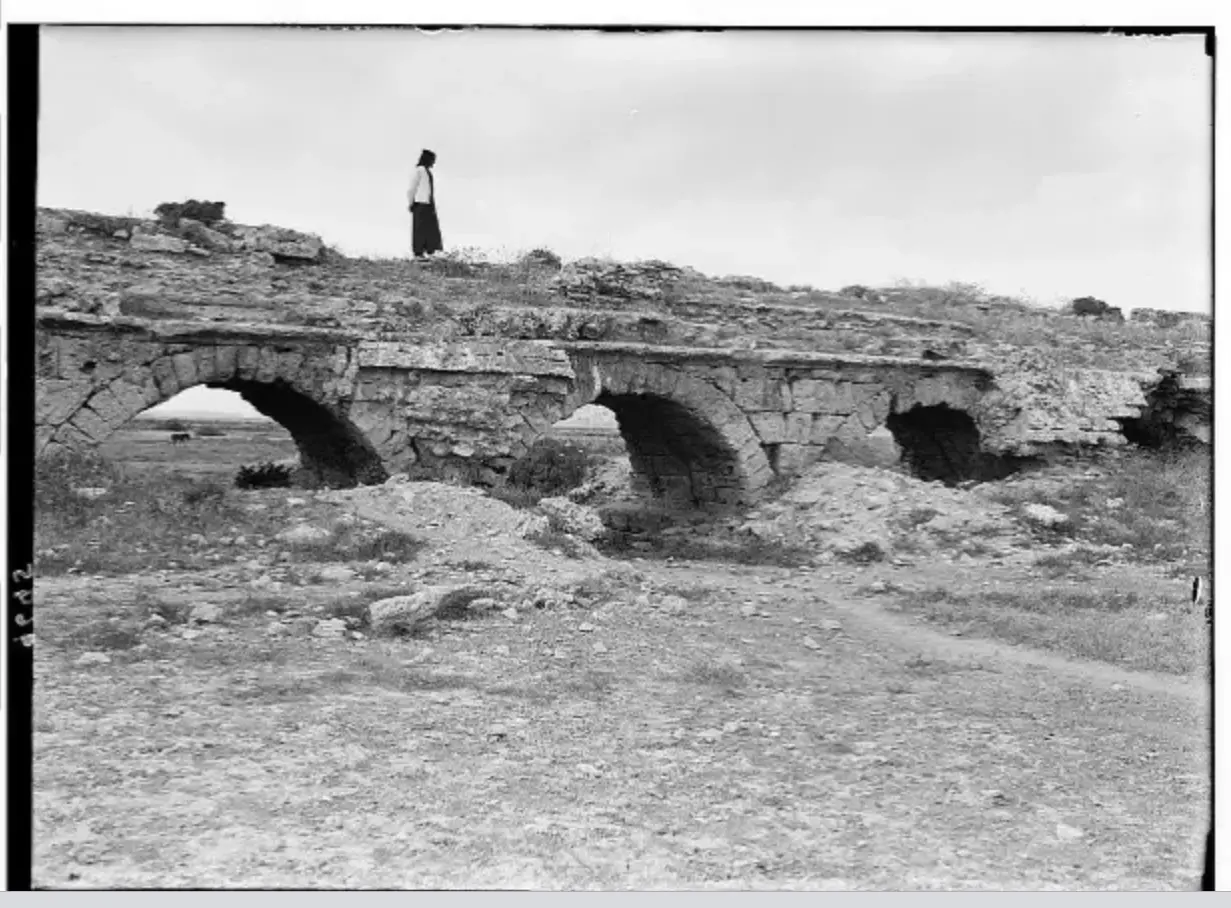
- The Roman aqueduct from the beach area #2
- The Roman aqueduct from the beach area #3
- The Roman aqueduct from the beach area #4
- Aerial view of the roman ruins
- The roman coliseum #1
- The roman coliseum #2
- The roman coliseum #3
- The roman coliseum #4
1 - The beach area #1
2 - The beach area #2

- The beach area #3
1 - The beach area #4
- The beach area #5
- The mosque #1
2 - The mosque #2
1 - The mosque #3
- The mosque #4

- The mosque #5
1 - The mosque #6
- The gate to the old port
- The ruins at the castle #1
- The ruins at the castle #2
- The ruins at the castle #3
- The ruins at the castle #4
- The ruins at the castle #5
- The ruins at the castle #6
- The ruins at the castle #7
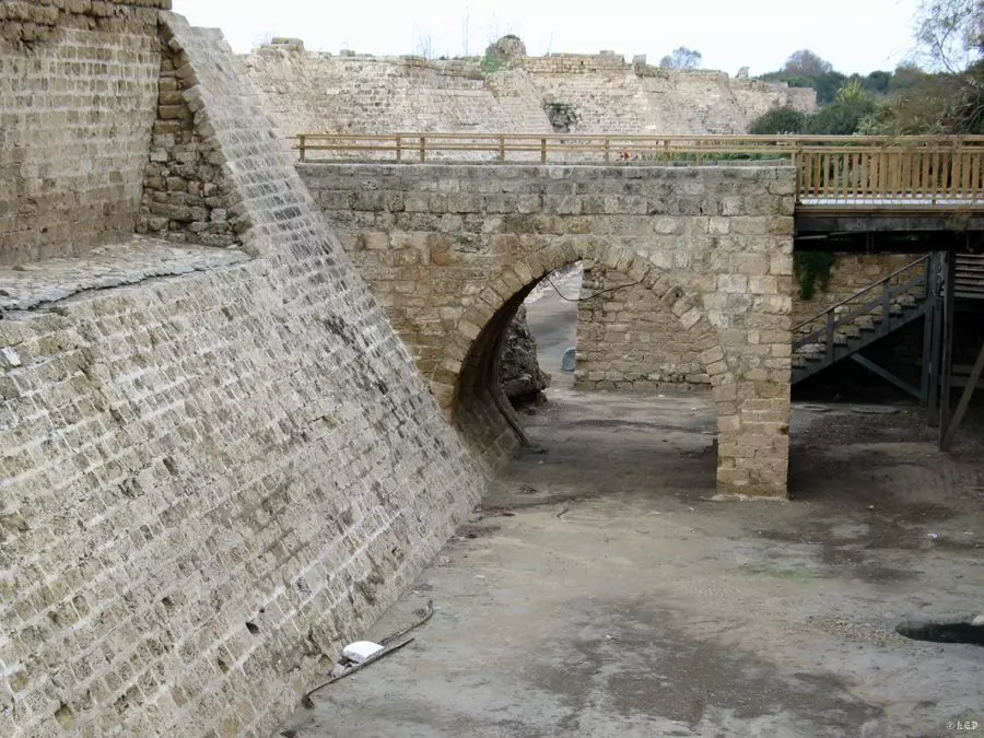
- The ruins at the castle #8
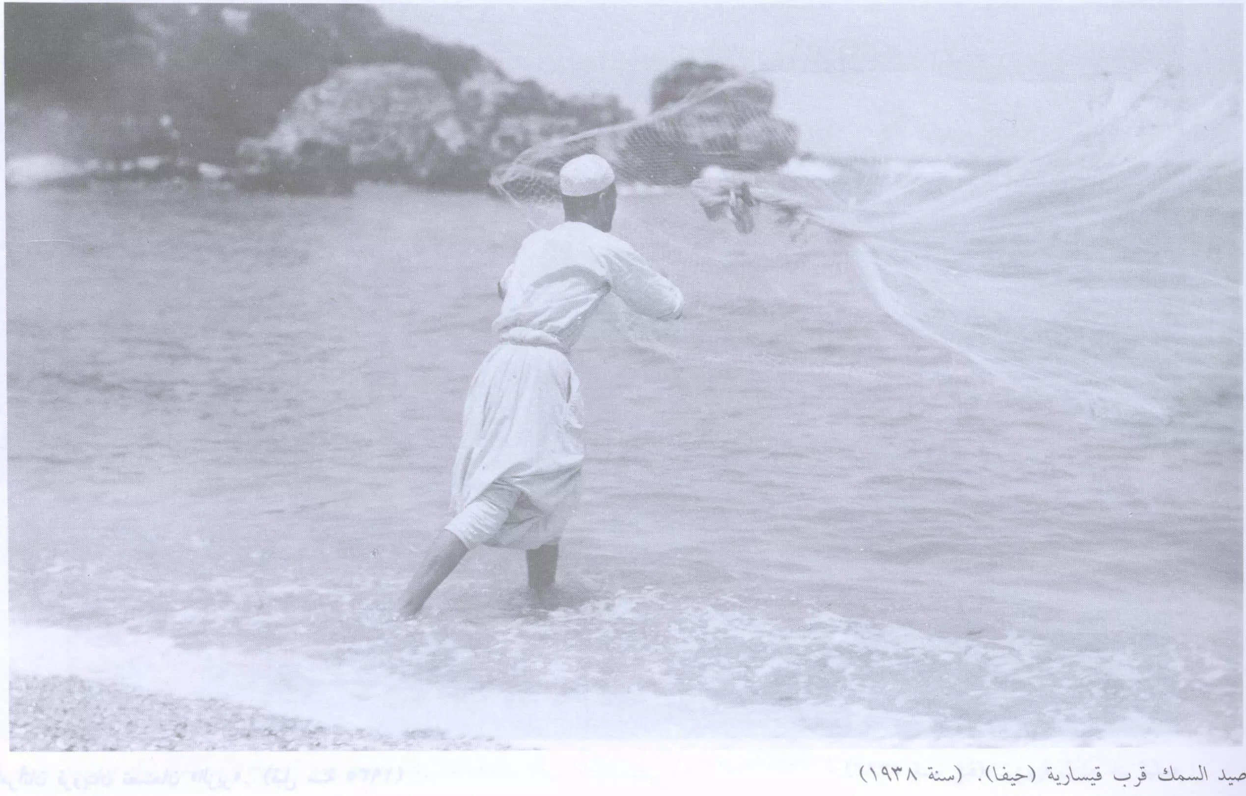
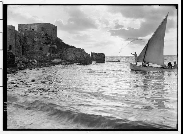
- صيد السمك في القرية عام 1938
Scanned from "All That Remains" by Dr. Walid Khalidi - Mesjed in Kasaria
Posted by Ahmed Alokby - صورة هذه الصورة بتاريخ 2011-1-6 صورها لكم صدقي الاسدي
Posted by SODKI - صورة للمدينة قبل تهجيرها ويظهر مسجدها عام 1934 وصورة المدينة اليوم بعد احتلالها ...! -- منقول من صفحة أحمد مروات
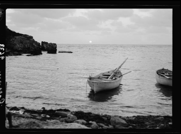
- الغروب على شاطئ قيسارية
- سياح في قيسارية العربيةعام 1930
- اثار قيساريا
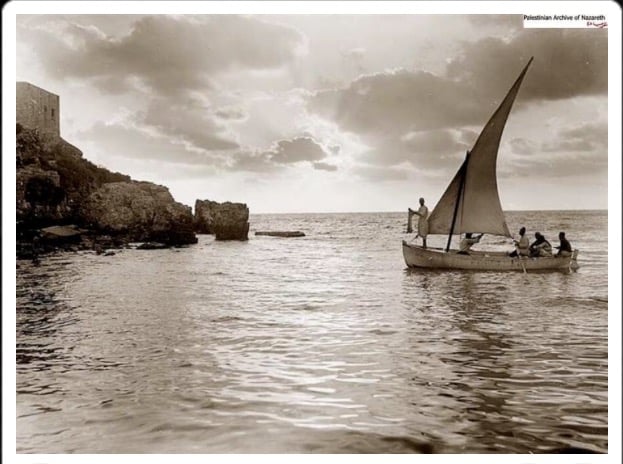
Posted by abu raya - شاطى قيساريا
Posted by abu raya - شاطى قيساريا

Posted by abu raya - شاطى قيساريا
Posted by abu raya - جامع قيساريا
Posted by abu raya - اسوار قيساريا القديمه
Posted by abu raya - شاطى قيساريا واثار الفيفساء بجانب البحر

Posted by abu raya - منظر من قيساريا
Posted by abu raya - منظر لجامع قيساريا
Posted by abu raya - قيساريا
Posted by abu raya - قيساريا
Posted by abu raya - الاثار الرومانيه في قيساريا
Posted by abu raya - الاثار الرومانيه
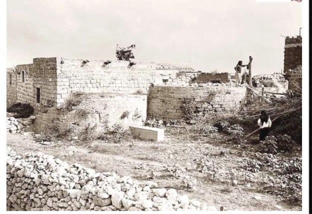
Posted by abu raya - ما تبقى من بيوت قيساريا
Posted by abu raya - منظر من قيساريا
Posted by abu raya - المسجد
Posted by abu raya - منظر عام لقيساريا وميناىها القديم

Posted by abu raya - اثار قيساريا
Posted by abu raya - قيساريا
Posted by abu raya - قيساريا
Posted by abu raya - قيساريا
Posted by abu raya - قيساريا قبل النكبه
Posted by abu raya - قيساريا
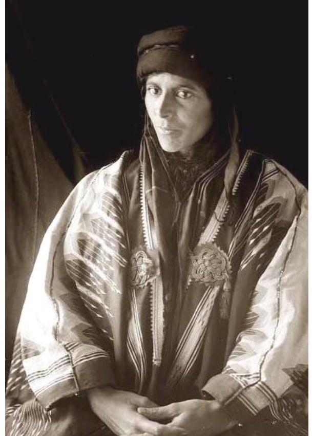
Posted by abu raya - صوره قديمه قبل النكبه لسيده من قيساريا
Posted by abu raya - قيساريه قبل النكبه
Posted by abu raya - قيساريه قبل النكبه
Posted by abu raya - قيساريه قبل النكبه
Posted by abu raya - قيساريه قبل النكبه
Posted by abu raya - قيساريه قبل النكبه
Posted by abu raya - قيساريه قبل النكبه
Posted by abu raya - قيساريه قبل النكبه
Posted by abu raya - قيساريه قبل النكبه
Posted by abu raya - قيساريه قبل النكبه
Posted by abu raya - جامع قيساريا قبل النكبه
Posted by abu raya - جامع قيساريا سنه 1948
Posted by abu raya - قيساريا قبل النكبه
Posted by abu raya - قيساريا قبل النكبه
Posted by abu raya - قيساريا قبل النكبه
Posted by abu raya - قيساريا قبل النكبه
Posted by abu raya - قيساريا قبل النكبه
Posted by abu raya - قيساريا قبل النكبه
Posted by abu raya - قيساريا قبل النكبه
Posted by abu raya - قيساريا قبل النكبه
Posted by abu raya - قيساريا قبل النكبه
Posted by abu raya - قيساريا قبل النكبه
Posted by abu raya - قيساريا قبل النكبه
Posted by abu raya - قيساريا قبل النكبه
Posted by abu raya - قيساريا قبل النكبه
Posted by abu raya - قيساريا قبل النكبه
Posted by abu raya - قيساريا قبل النكبه
Posted by abu raya - قيساريا قبل النكبه
Posted by abu raya - قيساريا قبل النكبه
Posted by abu raya - قيساريا قبل النكبه
Posted by abu raya - قيساريا قبل النكبه
Posted by abu raya - قيساريا قبل النكبه
Posted by abu raya - قيساريا قبل النكبه
Posted by abu raya - قيساريا قبل النكبه
Posted by abu raya - من قيساريا قبل النكبه
Posted by abu raya - قيساريا قبل النكبه
Posted by abu raya - قيساريا قبل النكبه
Posted by abu raya - قيساريا قبل النكبه
Posted by abu raya - قيساريا قبل النكبه
Posted by abu raya - قيساريا قبل النكبه
Posted by abu raya - قيساريا قبل النكبه
Posted by abu raya - قيساريا قبل النكبه
Posted by abu raya - قيساريا قبل النكبه
Posted by abu raya - قيساريا قبل النكبه
Posted by abu raya - قيساريا قبل النكبه
Posted by abu raya - قيساريا قبل النكبه
Posted by abu raya - قيساريا قبل النكبه
Posted by abu raya - قيساريا قبل النكبه
Posted by abu raya - قيساريا قبل النكبه
Posted by abu raya - قيساريا قبل النكبه
Posted by abu raya - قيساريا قبل النكبه

Posted by abu raya - قيساريا قبل النكبه
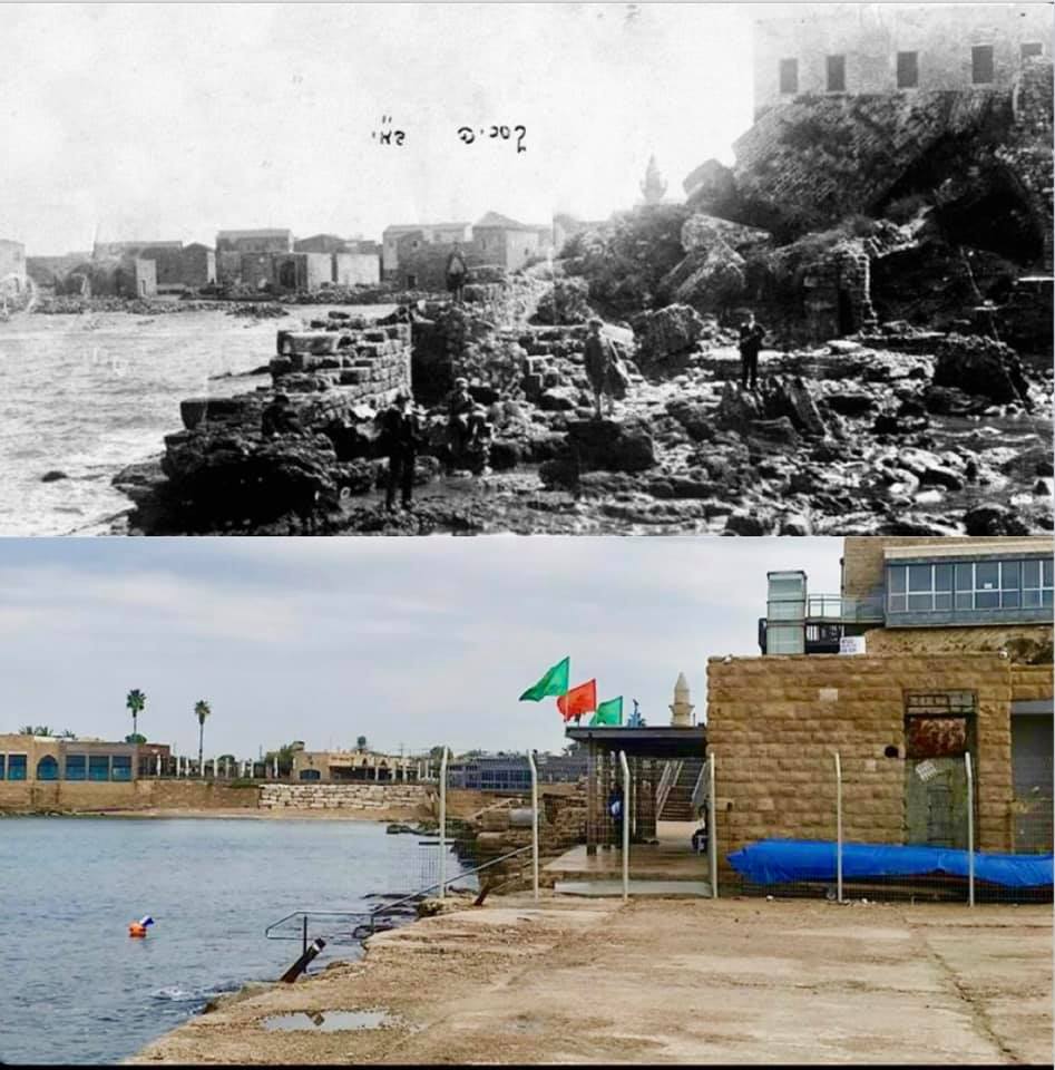
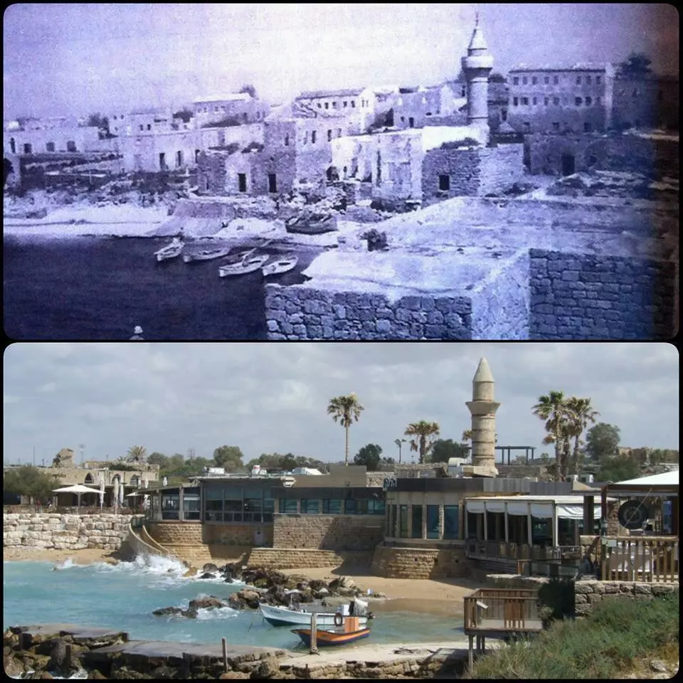
Posted by abu raya - قرية قيسارية بين الامس واليوم سنة 1930-2019
- قيسارية البوسنية سنة 1943 واليوم 2016 مقاهي ومطاعم ونوادي ليلية
- صورة نادرة من قيسارية البوسنية سنة 1920
- بلدة قيساريا بغد تهجير اهلها عام 1948
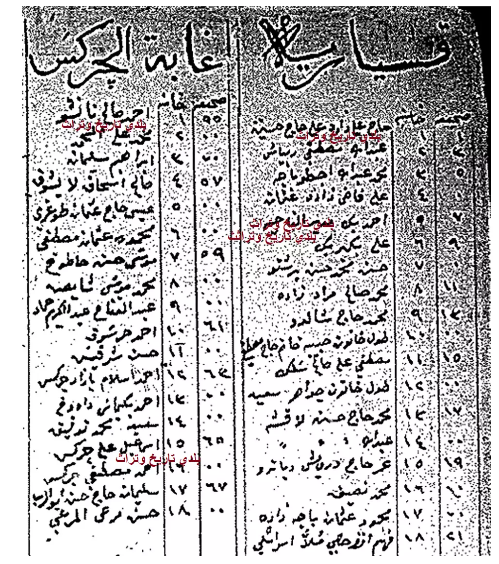
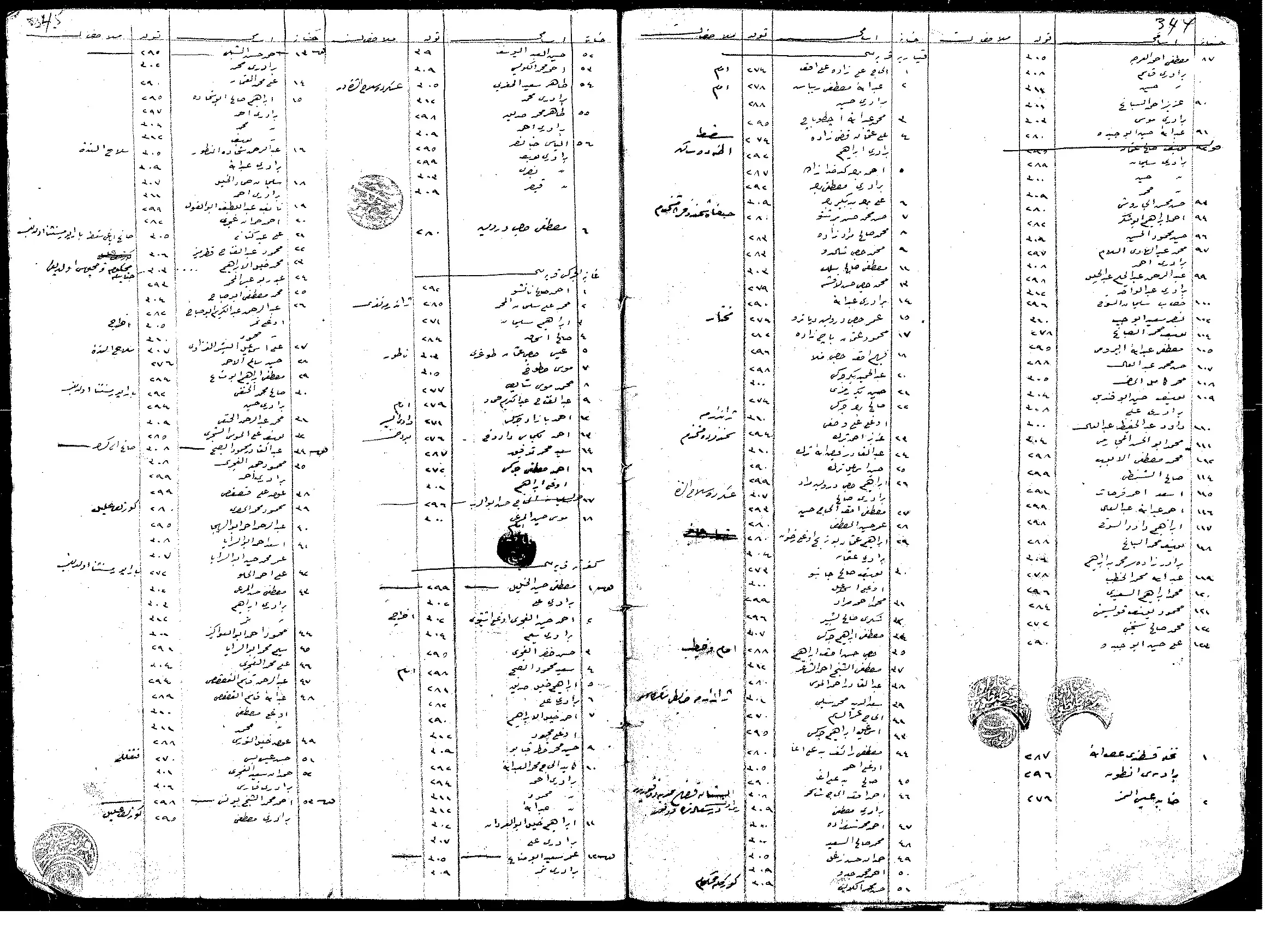
- قائمة بسكان (غابة الشكرس) وبلدة (قيسارية) من سجل النفوس العثماني. لاحظوا وجود العديد من الاسماء الاّ عربية مع بعض اخوانهم من التركمان والعرب مثل عائلة ابو الرب / غوادرة من بني سعيدان.
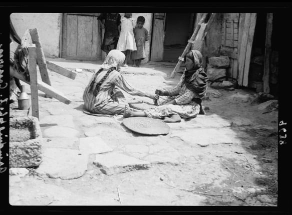
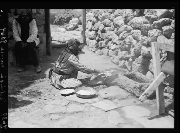
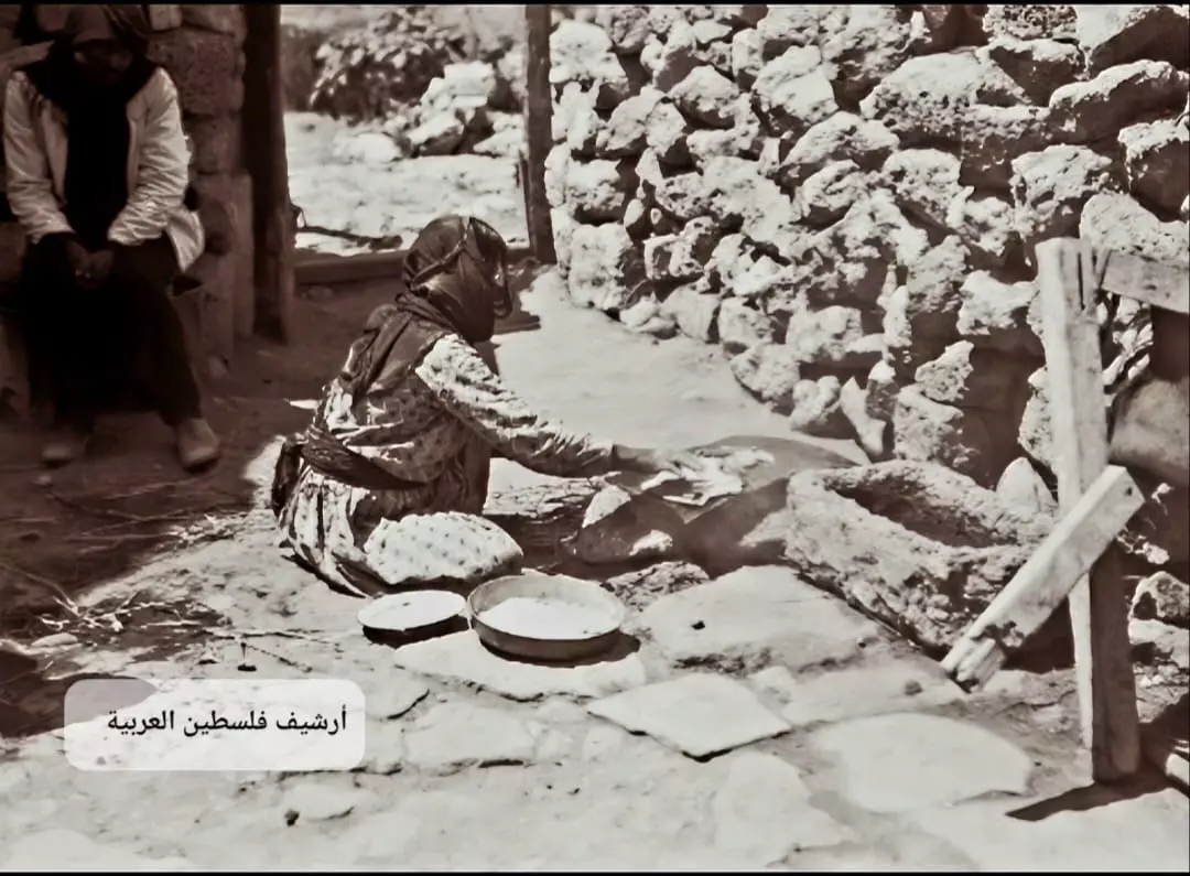
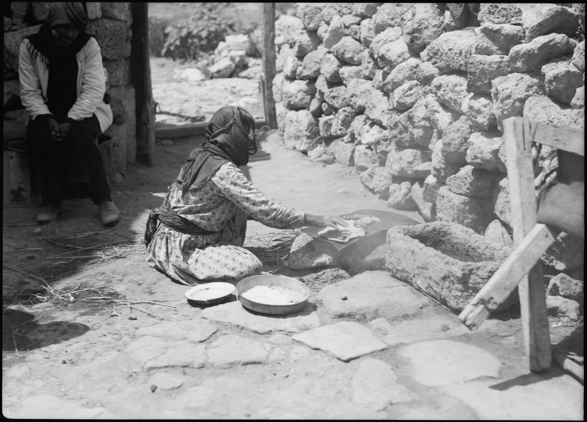
- خبز "الصاج" في أحد بيوت قرية قيسارية قضاء حيفا 1934..
- السجلات العثمانية _ سجل نفوس رب الاسرة من سجلات المخاتير العثمانية قيسارية
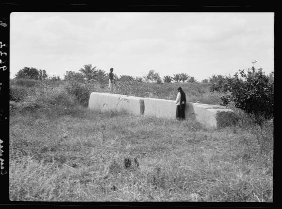
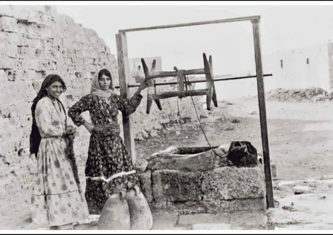
Posted by Wadi Alhawarith - فتاتان قرب بئر الماء في قيسارية قضاء حيفا 1943..
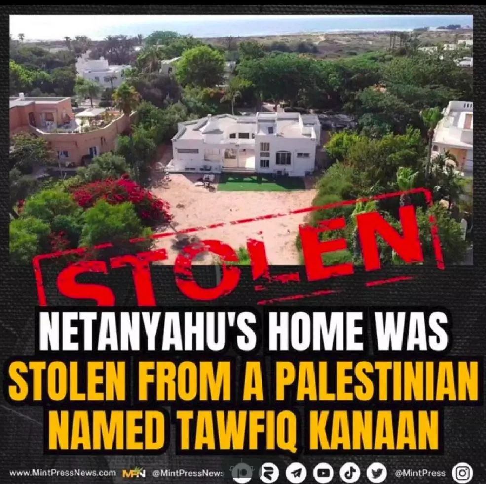
- Bibi Netanyahu' house which was looted from a Palestinian family in Qisariya
- During the pre-Nakba period, Qisariya
- During the pre-Nakba period
- A pre-Nakba scene before the savages arrived
- الشراك في قيسارية
- حاجز الشيخ جراح ...
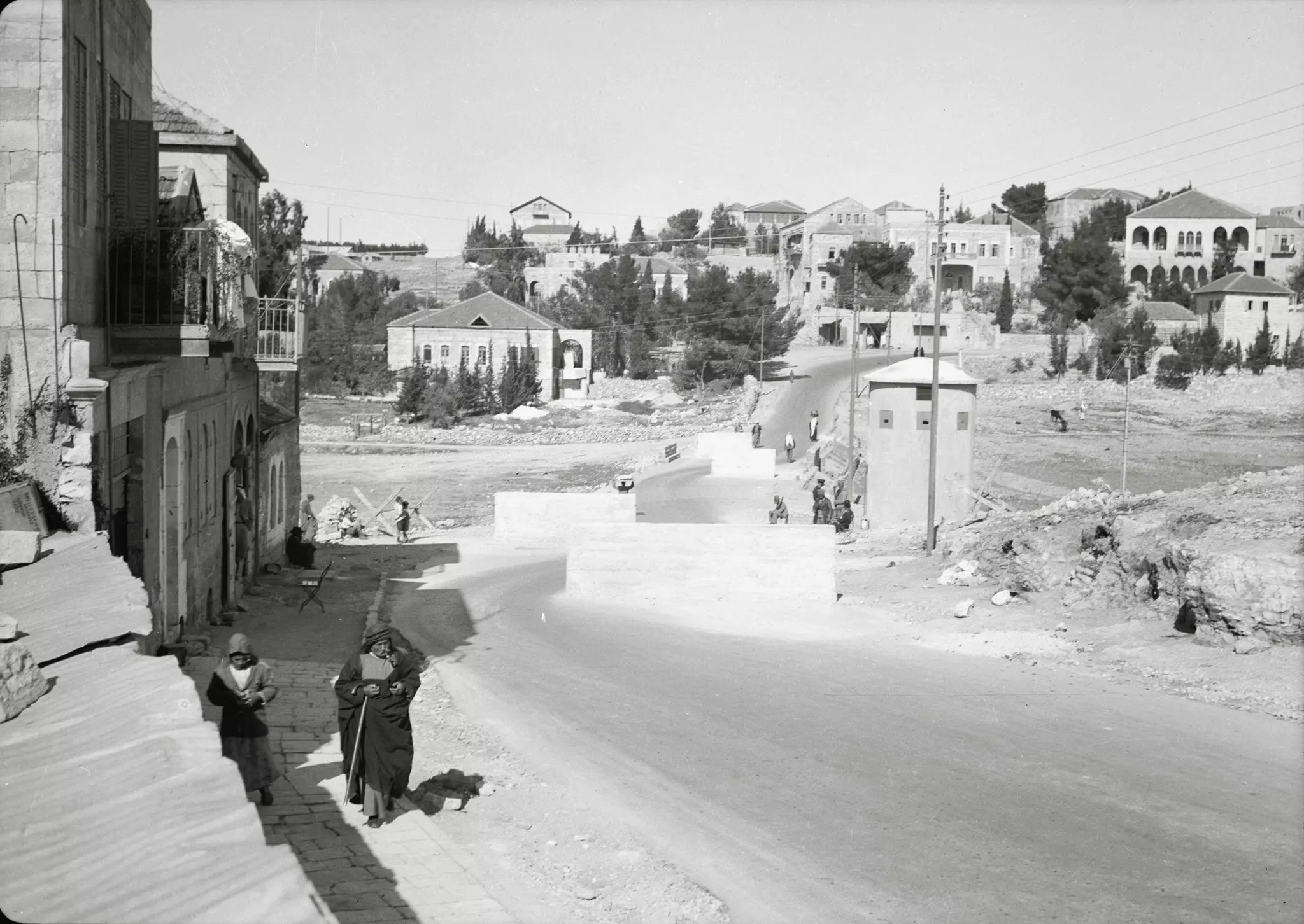
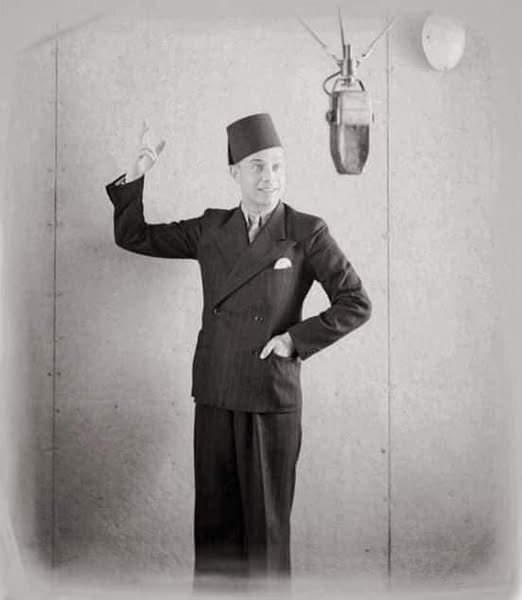
- المذيع محمد بشناق من قرية قيسارية
أول اذاعي يطلق انفاسه عبر المذياع عام ١٩٣٦ بعبارة "هنا القدس" من اذاعة فلسطين ..!
بدأ كمذيع في مدينة القدس منذ افتتاح محطة دار الاذاعة الفلسطينية عام ١٩٣٦ .. حتى عام ١٩٣٨ وكان يبدا بجملتة المشهورة (سيداتي سادتي هنا القدس ).
من صفحة الباحث: Mahmuod Sharafy
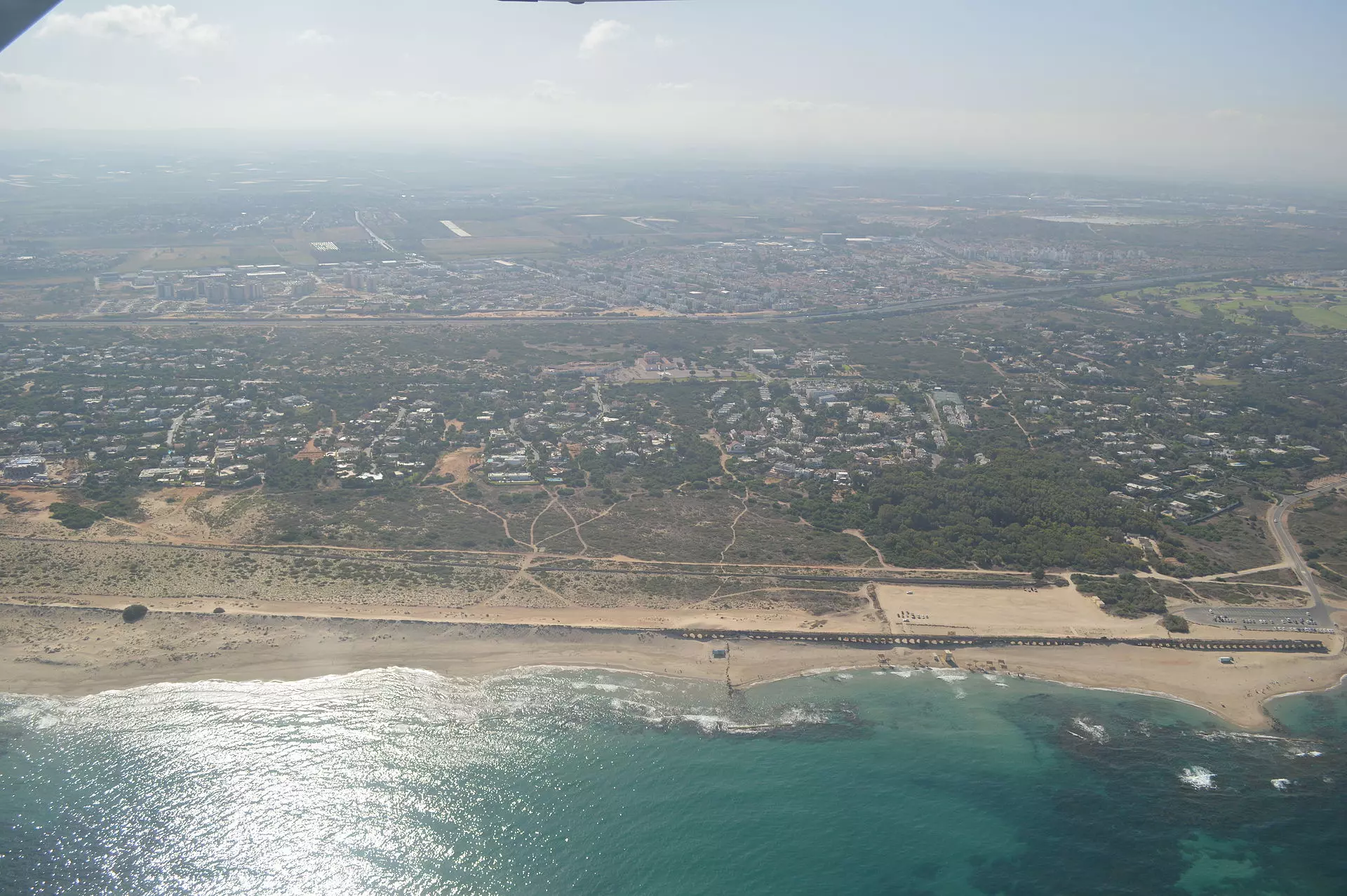
- The town from the air
- The main mosque, now closed after the "civilized" landed on us from Europe
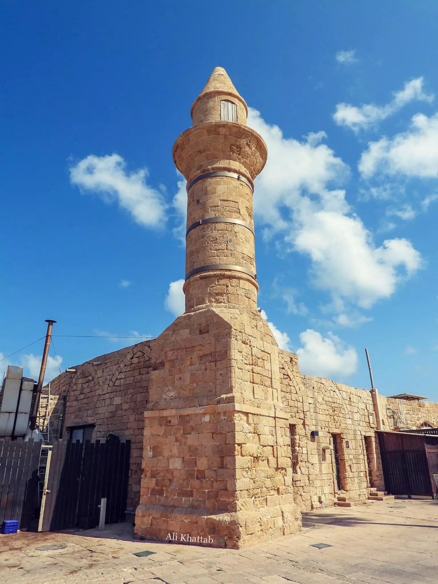
- مسجد قيسارية
- مسجد قيسارية #2
- مسجد قيسارية #3
- That is how the "civilized" erased and replaced us: Qisarya was completely obliterated except for a few remaining structures, as you see -- قيسارية باتت أثر بعد عين. من هنا مر الهمجّ
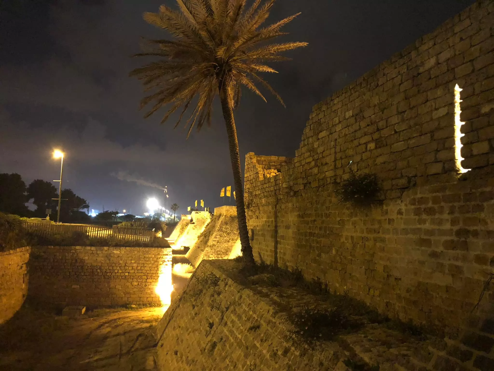
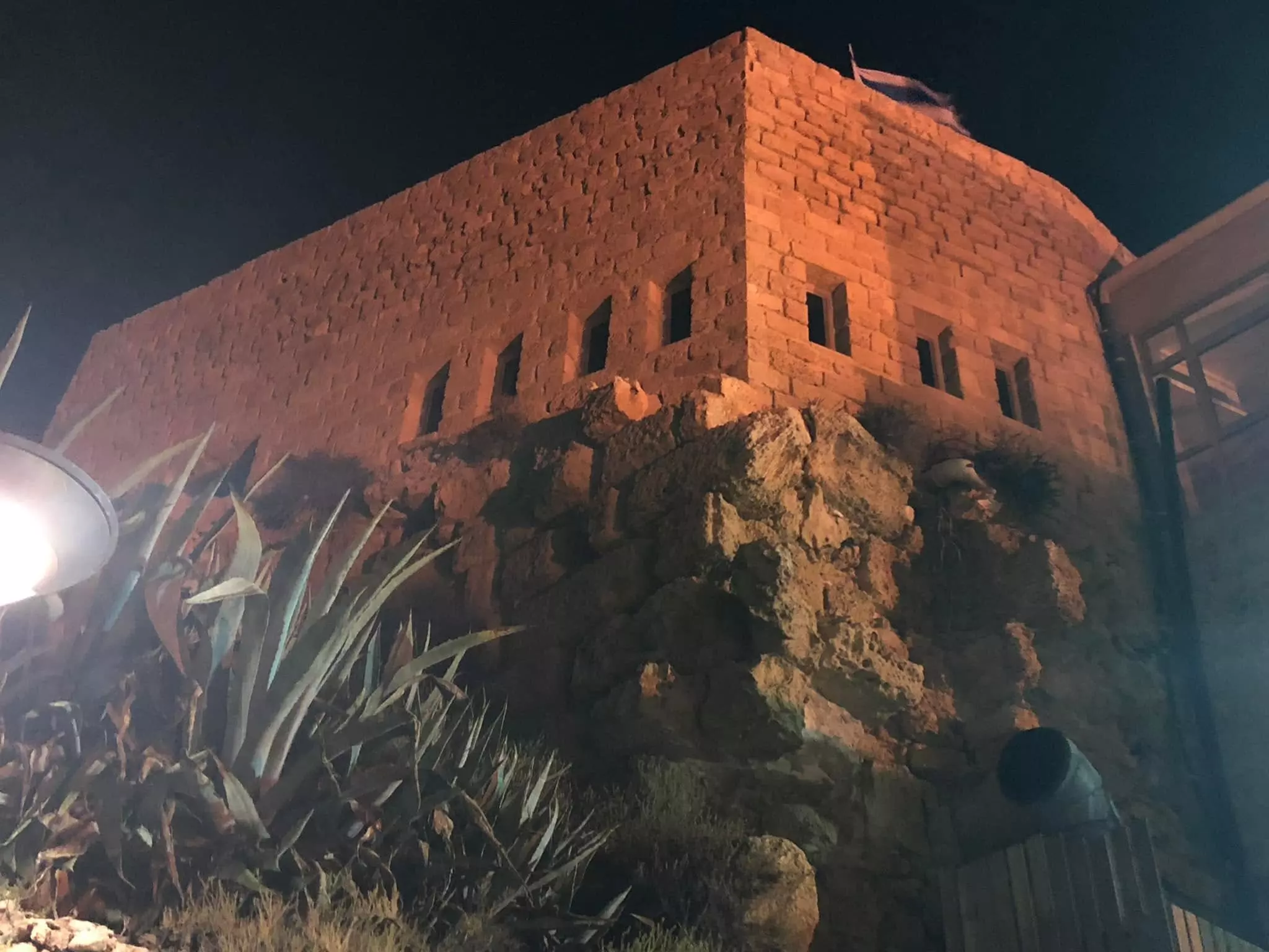
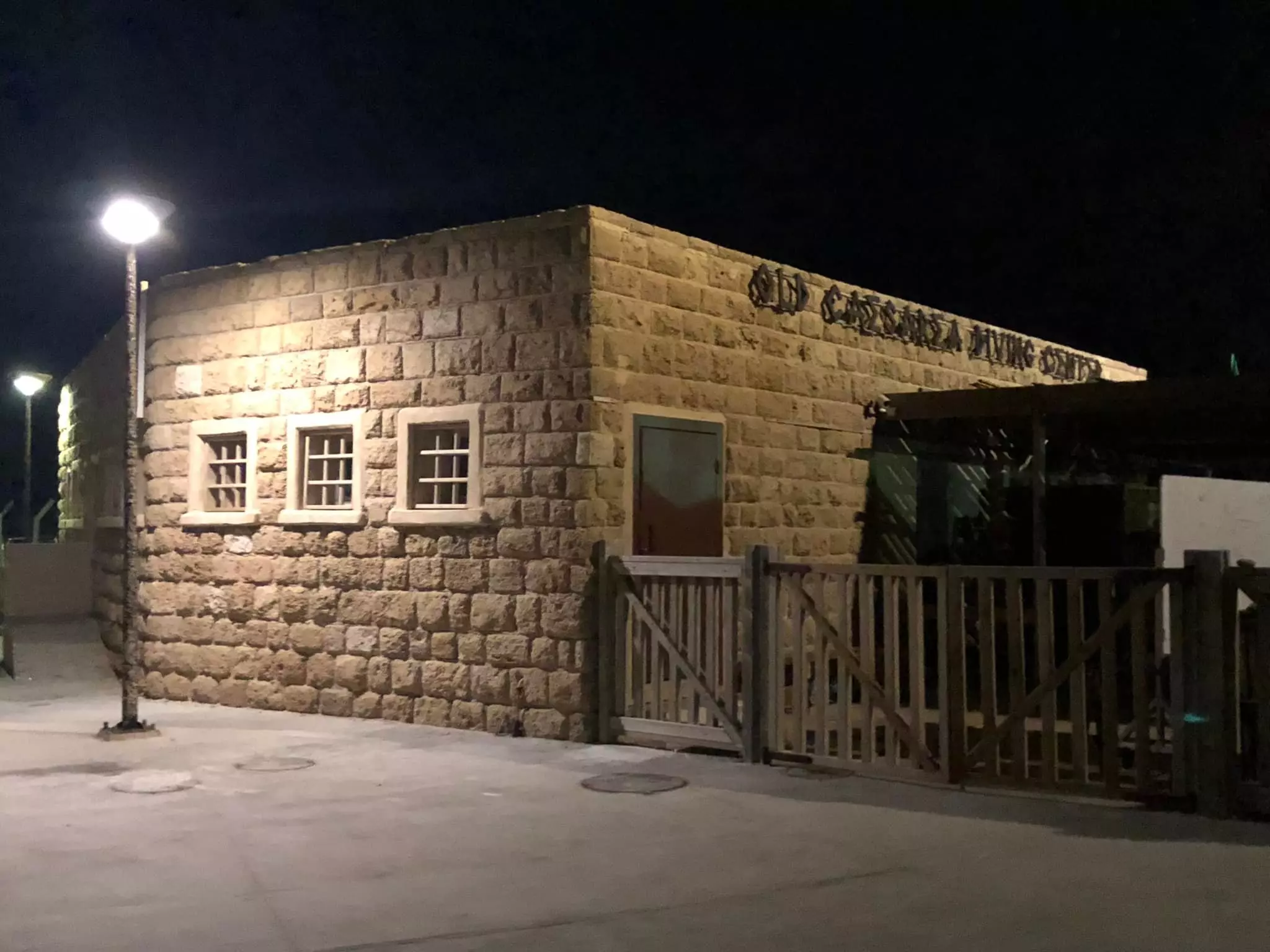
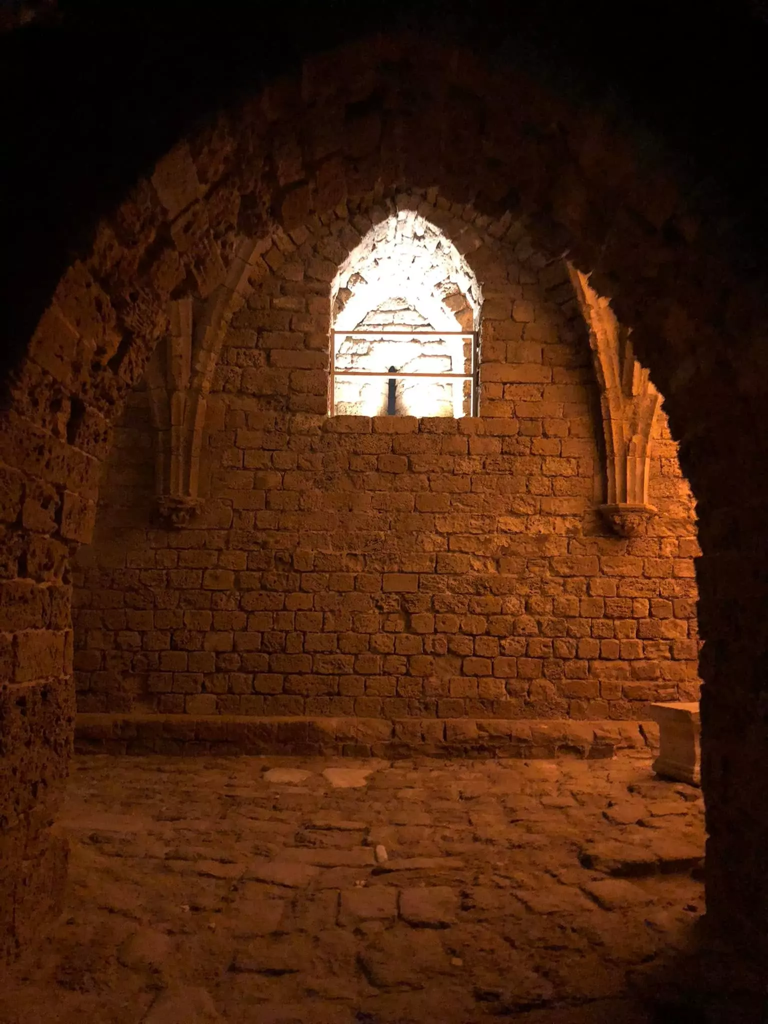
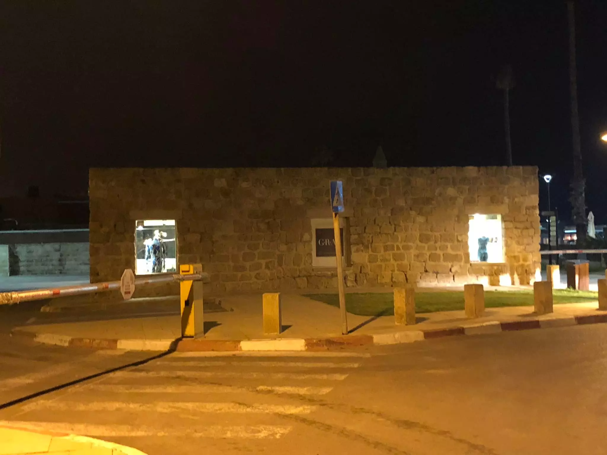
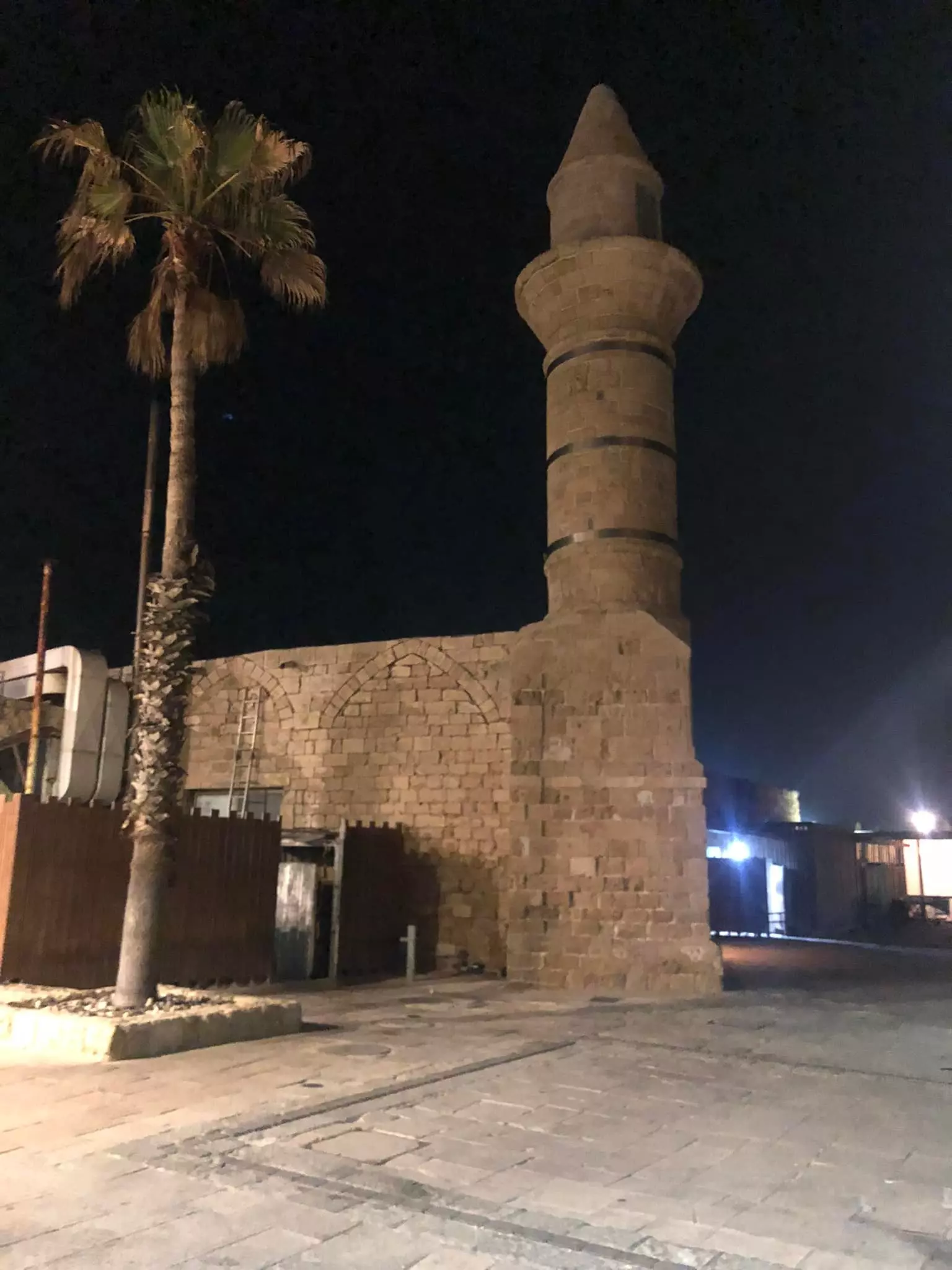
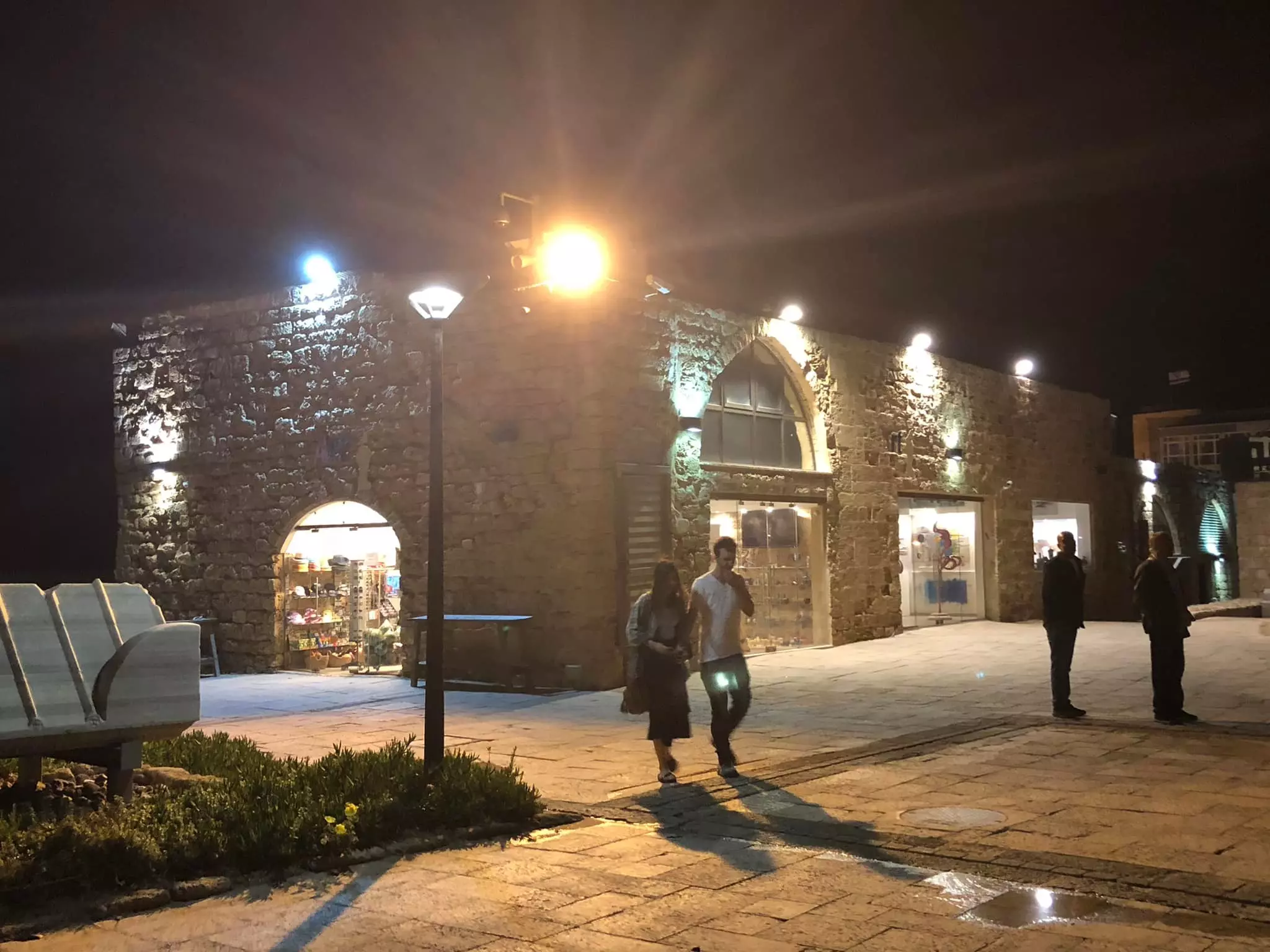
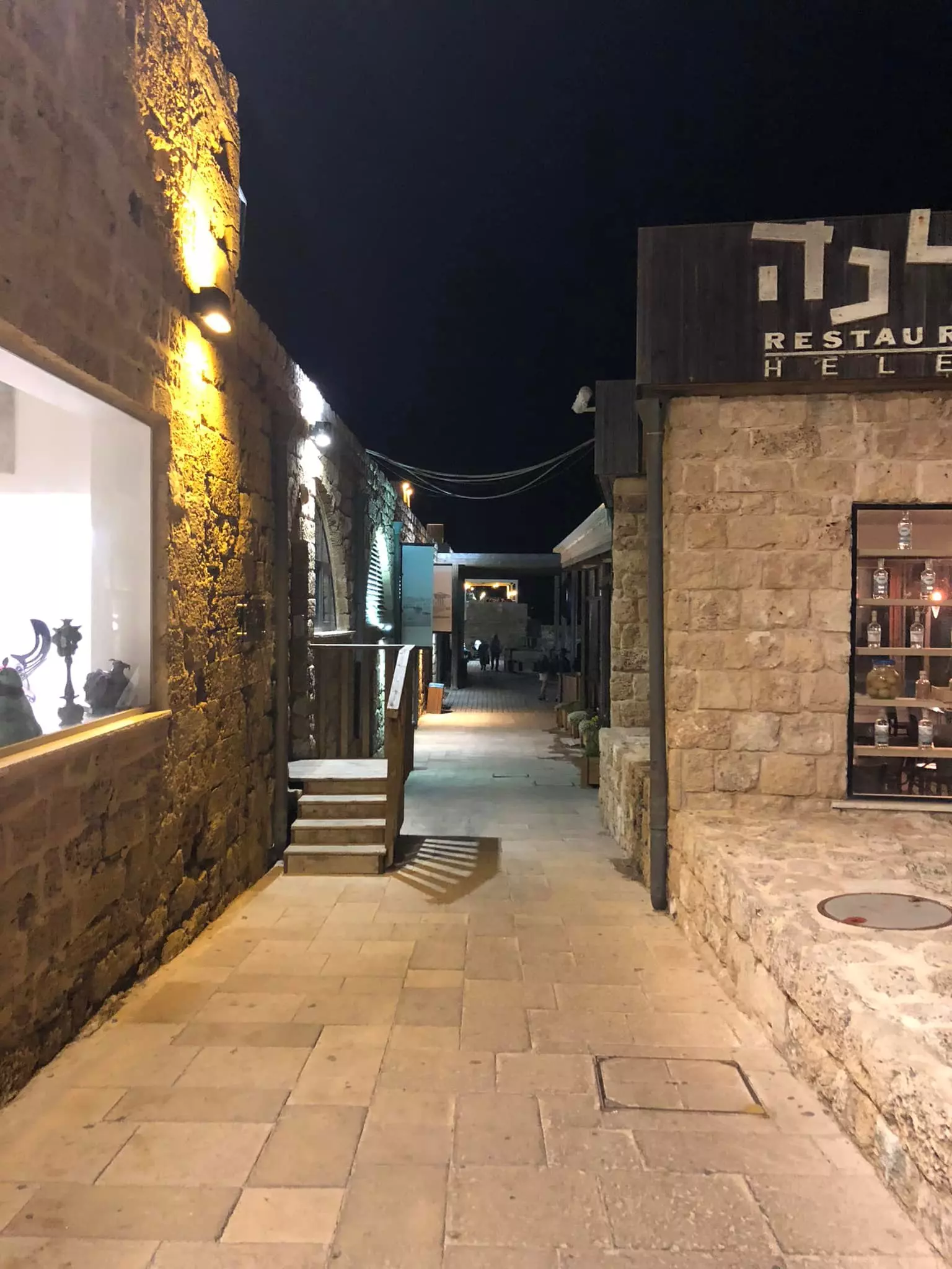
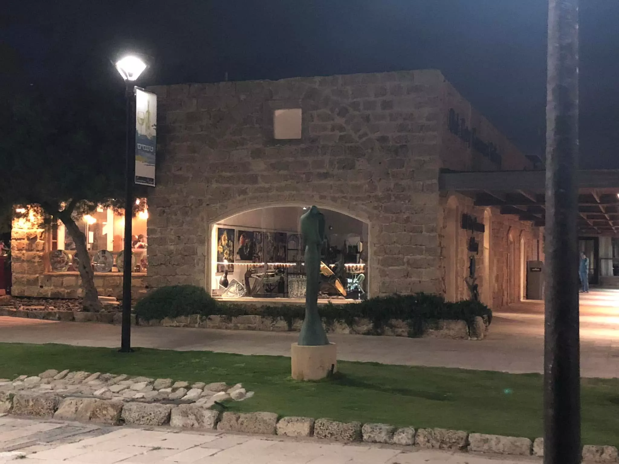
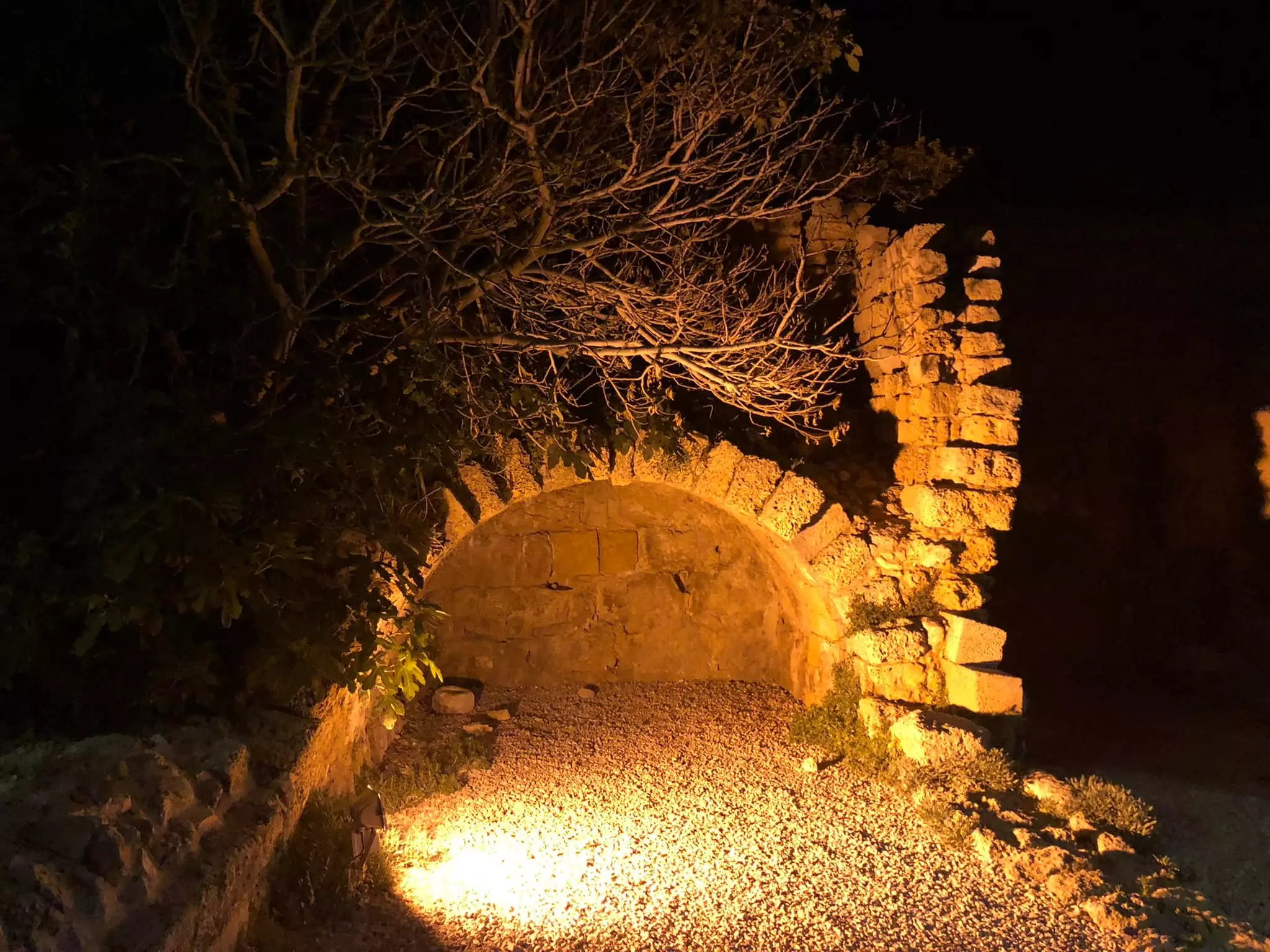
- Let us tour Qisarya at night, March 2022 -- Iyad Jaber
- Let us tour Qisarya at night, March 2022 -- Iyad Jaber #2
- Let us tour Qisarya at night, March 2022 -- Iyad Jaber #3
- Let us tour Qisarya at night, March 2022 -- Iyad Jaber #4
- Let us tour Qisarya at night, March 2022 -- Iyad Jaber #5
- Let us tour Qisarya at night, March 2022 -- Iyad Jaber #6
- Let us tour Qisarya at night, March 2022 -- Iyad Jaber #7
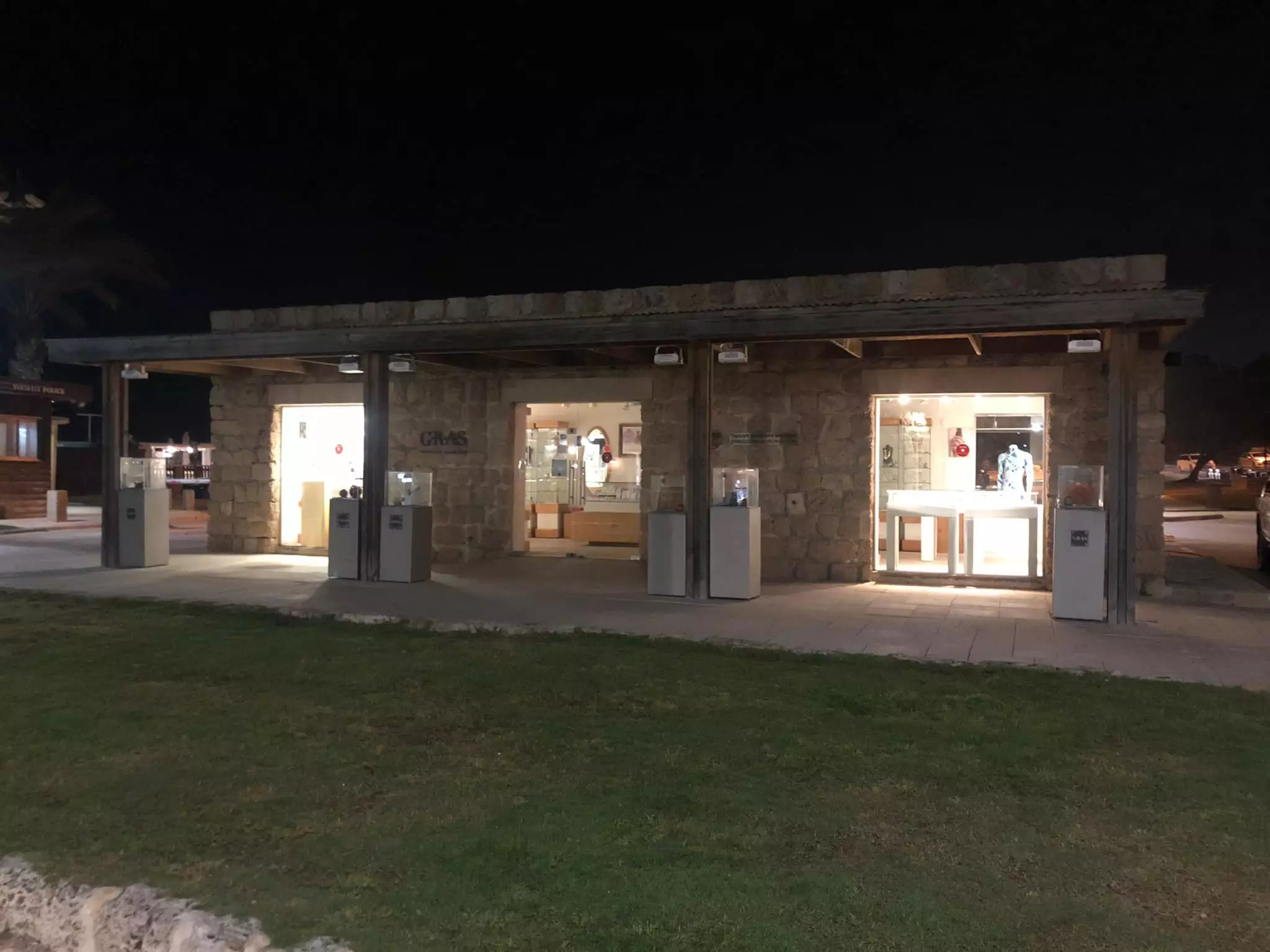
- Let us tour Qisarya at night, March 2022 -- Iyad Jaber #8
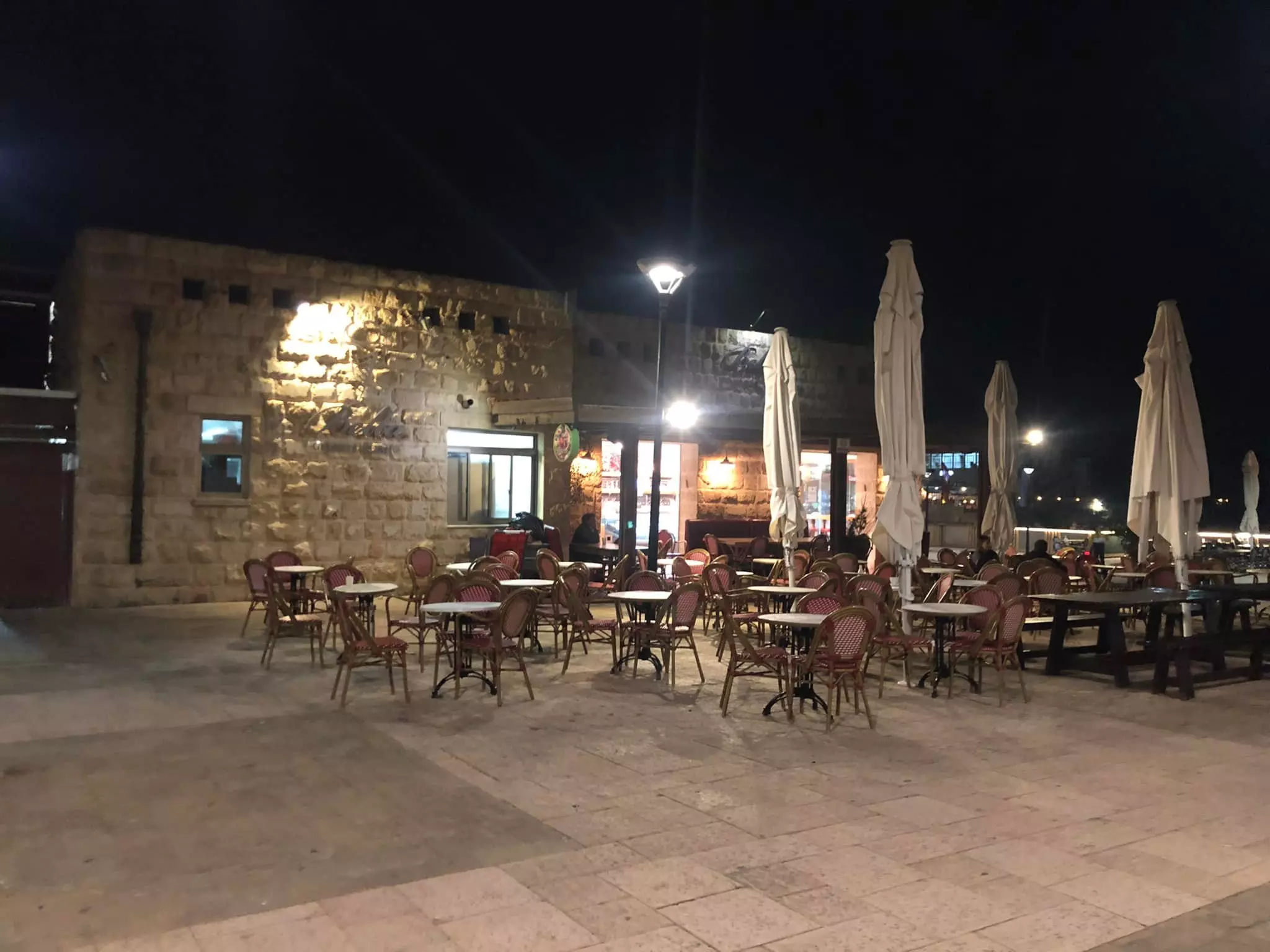
- Let us tour Qisarya at night, March 2022 -- Iyad Jaber #9
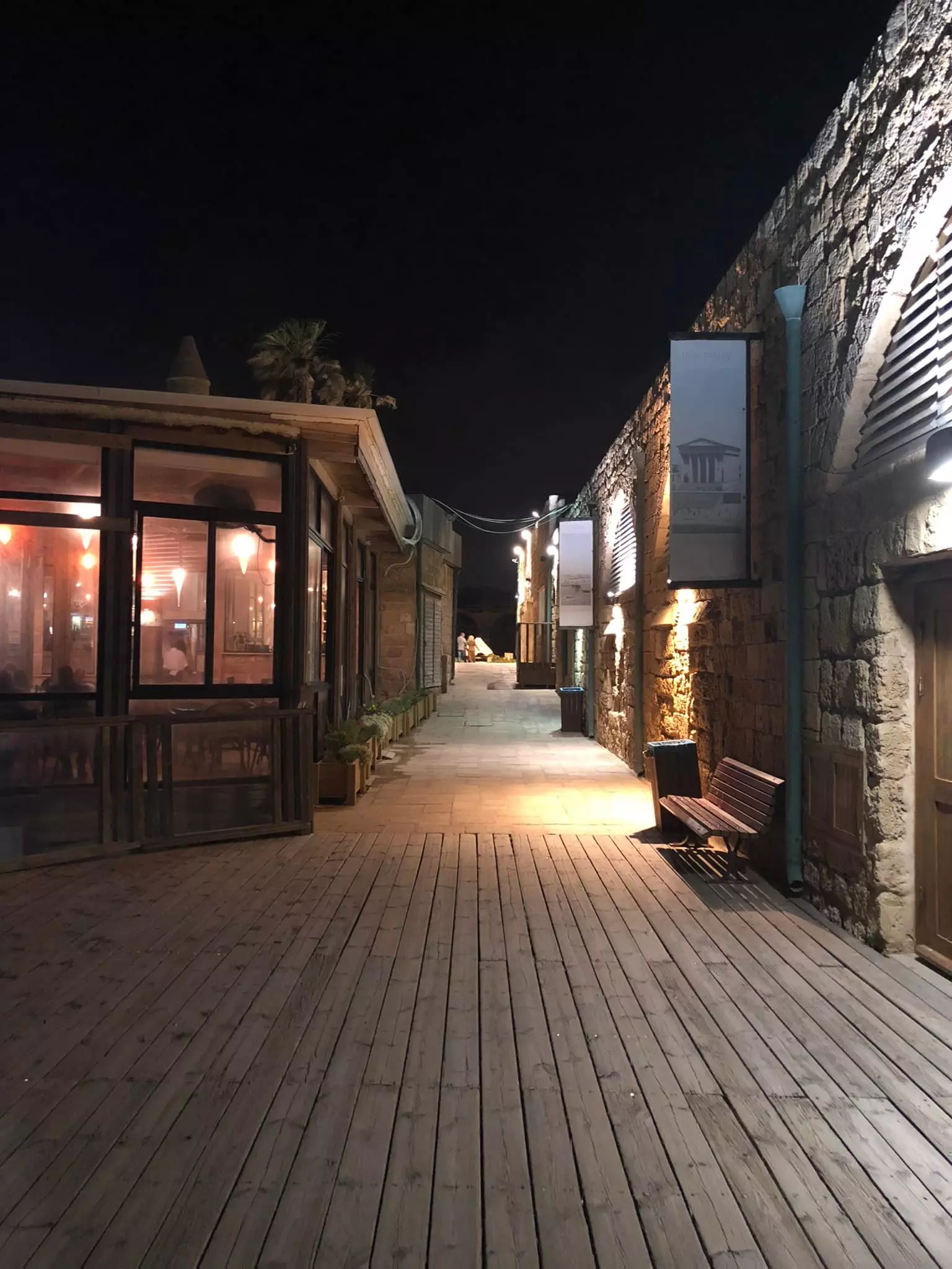
- Let us tour Qisarya at night, March 2022 -- Iyad Jaber #10
- Let us tour Qisarya at night, March 2022 -- Iyad Jaber #11
- Let us tour Qisarya at night, March 2022 -- Iyad Jaber #12
- Let us tour Qisarya at night, March 2022 -- Iyad Jaber #13
- Let us tour Qisarya at night, March 2022 -- Iyad Jaber #14
- Let us tour Qisarya at night, March 2022 -- Iyad Jaber #15
- Let us see how the most "liberal and civilized" of world Jewry has obliterated our village except for its famous Bosnian mosque and a few other structures. How else will the Jews be great and safe again?
- Let us see how the most "liberal and civilized" of world Jewry has obliterated our village except for its famous Bosnian mosque and a few other structures. How else will the Jews be great and safe again? #2
- Let us see how the most "liberal and civilized" of world Jewry has obliterated our village except for its famous Bosnian mosque and a few other structures. How else will the Jews be great and safe again? #3
- Let us see how the most "liberal and civilized" of world Jewry has obliterated our village except for its famous Bosnian mosque and a few other structures. How else will the Jews be great and safe again? #4
- Let us see how the most "liberal and civilized" of world Jewry has obliterated our village except for its famous Bosnian mosque and a few other structures. How else will the Jews be great and safe again? #5
- Let us see how the most "liberal and civilized" of world Jewry has obliterated our village except for its famous Bosnian mosque and a few other structures. How else will the Jews be great and safe again? #6
- Let us see how the most "liberal and civilized" of world Jewry has obliterated our village except for its famous Bosnian mosque and a few other structures. How else will the Jews be great and safe again? #7
- Let us see how the most "liberal and civilized" of world Jewry has obliterated our village except for its famous Bosnian mosque and a few other structures. How else will the Jews be great and safe again? #8
- Let us see how the most "liberal and civilized" of world Jewry has obliterated our village except for its famous Bosnian mosque and a few other structures. How else will the Jews be great and safe again? #9
- مسجد قيساريه اليوم مطعم وخماره April 2020
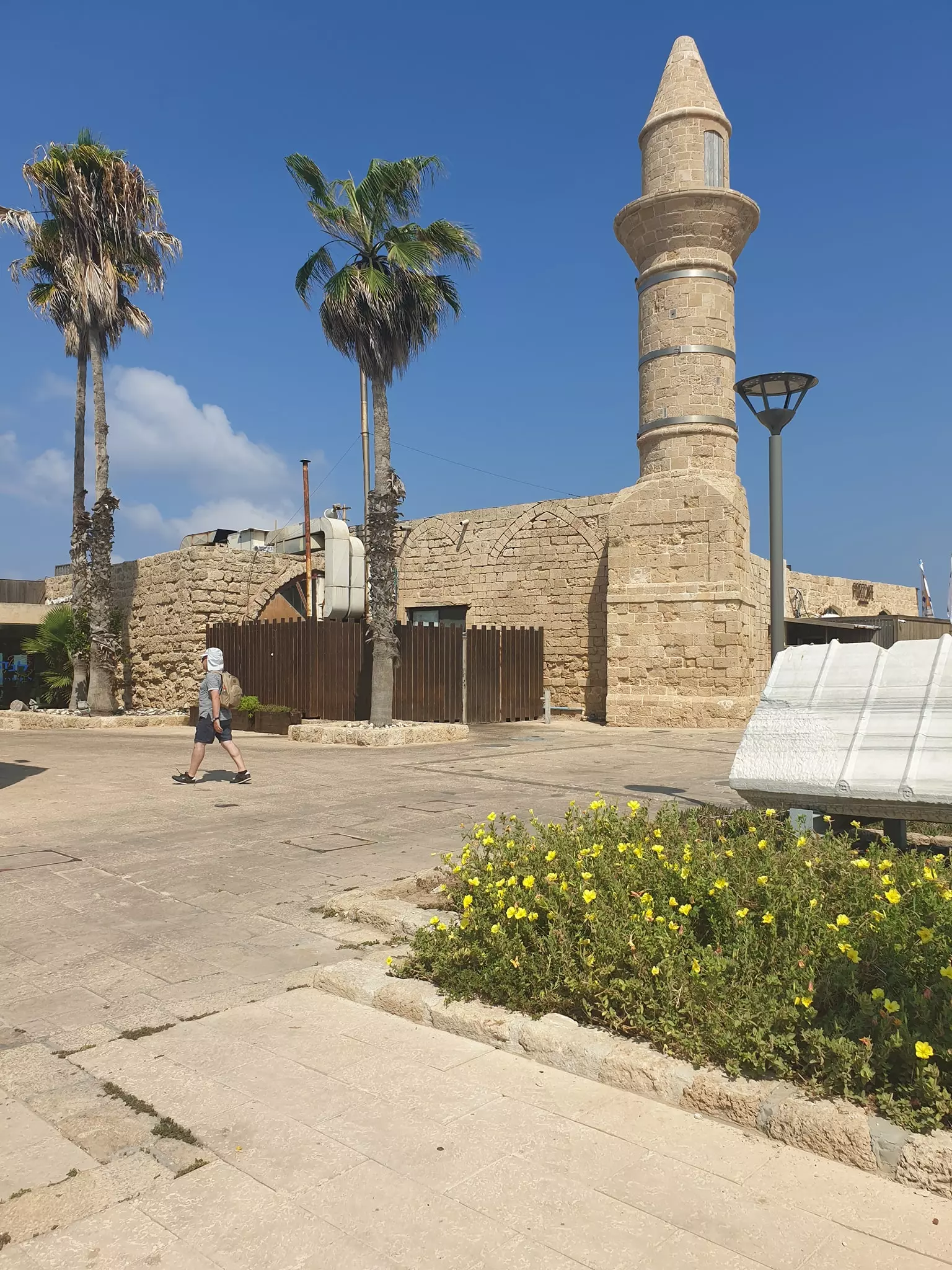
- مسجد قيسارية محطات مجد وانين عذاب
بني المسجد الجامع في قيسارية في عهد الخليفة الأموي عبد الملك بن مروان، ثم أعيد ترميمه في العهد المملوكي، ومن ثم في القرن التاسع عشر على يد مواطنين بوسنيين هاربين من ملاحقة السلطات النمساوية
- The Roman aqueduct that used to supply water to Qisariya, Fairouz Jubran
- The Roman aqueduct that used to supply water to Qisariya, Fairouz Jubran #2
- The Roman aqueduct that used to supply water to Qisariya, Fairouz Jubran #3
- The Roman aqueduct that used to supply water to Qisariya, Fairouz Jubran #4
- We are coming back, dear Qisariya, stay tuned
- في كوخنا يستريح العدو من البندقية,
يتركها فوق كرسي جدي . ويأكل من خبزنا
..
📍قيساريا
- The Roman Aqueduct, Qisarya, 1980- 1989
- Rare pictures of Qisariya's grand mosque during the 1980s -- Sameih Hamadah
- Rare pictures of Qisariya's grand mosque during the 1980s -- Sameih Hamadah #2
- Rare pictures of Qisariya's grand mosque during the 1980s -- Sameih Hamadah #3
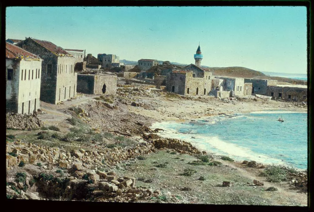
- A rare view of the village in 1900
- General view, 1933
- General view, 1933 #2
- خارطة تُظهِر الحدود والطرق بأنواعها والأماكن المقدسة والطبيعة الطوبغرافية من تلال وسهول ومنحدرات والتشكيلة الطبيعية للأرض وأنواع المزروعات. نُشرت الخريطة فترة الانتداب البريطاني، تم إضافة تعديلات عليها من قِبَل خدمة الخرائط والصور التابعة للقوات العسكرية الاسرائيلية فترة الأربعينيات.
Want to browse more? 80,000 pictures were grouped in these gallaries:
| Display Name | Clan/Hamolah | Country of Residence |
| انس الزغل | الزغل | الزرقاء, الاردن |
| ابو الوليد | الزغل | الرصيفة , الاردن |
| Arja | العرجة | - |
| خالد | الزبيدي | - |
| Hussein Bushnaq | Bushnaq | - |
| ABU IBRAHIM AL-SHAER | - | - |
| abuwaleed | alshaer | - |
| KAMAL JABR | al -jammal | Damascus, Syria |
- سلسلة حكاية قرية من فلسطين | قرية قيسارية (8) موسوعة القرى الفلسطينية Duration: 6 min 33 sec
 Fake Valor: Why Did Zionist Jews Hoist Nazis Flag on Their Ships in the 1930s?
What is new?
-
Facts About Oct. 7th Gaza Raid
-
Remined Us Please:: Who Did Rape Who? Palestinians Raped Israelis? Or, was the other way around?
-
When Prof. Edward Said was invited to debate Bibi Netanyahu in the 1980s, watch what happened!
-
Ezra Klein of the NY Times on the "Jewish Race".
-
Abusing Blood Libel!
-
Did Israeli Soldiers Activate The Hanniba Direective On Oct. 7th? You Be The Judge
-
Zionist FAQ: Isn't it true that Palestinians don't want peace? Palestinians never accepted the two-state solution
- Facts about Haavara (Transfer) Agreement between Ben-Gurion & Hitler
-
Haavara FAQs: Why Did Zionist Jews Hoist Nazis' Flags on Their Ships in the 1930s?
- Haavara FAQs: When Chaim Weizmann met FDR in mid-1943, why was he silent about rescuing European Jewry?
-
Dear ChatGPT: How did Palestinians resist Napoleon's invasion of their country in 1799?
-
Dear ChatGPT: Gaza had a vibrant Jewish community in the mid-17th century. What happened to them?
-
Dear ChatGPT: Why did the Jewish Agency suppress news of the Holocaust during WWII?
-
Video Playlist: Jews share their DNA tests to end the conflict for good.
-
A Tale of Two Conflicts: Examining the Definition of Genocide
-
Prof. Abraham Polak And The Suppressed History of the Khazars and European Jewry
-
How Ronald Reagan would have framed the genocide in Gaza if he were still alive?
-
Haavara FAQs: Let us do the math: how many German Jews did The Haavara Agreement save?
-
Zionist FAQs: The Hebron Massacre of 1929, "clearly proves" that Palestinians are antisemitic, how could you deny it?
-
Zionist FAQs: Why Anti-Zionist Is Not Antisemitism?
-
Zionist FAQs: Isn't it true that the KGB created Palestinian Nationalism in the early 1960s?
- Zionist FAQs: Muslims are killing Muslims all the time; why are Israeli Jews being singled out in the media?
- Zionist FAQs: How is Israel an apartheid state when 20% of its citizens are Arabs who enjoy full rights?
-
Haavara FAQs: Why Did Dorothy Thompson Flip From A Zionist Advocate to A Silenced Dissenter?
-
Haavara FAQs: Analysis of Herzl's Uganda Scheme and how it could have saved millions of Jews.
-
Haavara FAQs: Why did Hayim Greenberg describe American Jewry as "morally bankrupt" in early 1943?
-
Haavara FAQs: What if the Evian Conference was a resounding success? What would have been the impact of saving European Jewry on Zionism?
- Haavara FAQs: What if the six million were saved, how that would have impacted the Zionist project?
-
Haavara FAQs: How did Zionist leaders react when Europe's Jews lingered in the DP camps after WWII ended?
-
Why does the American Jewish community repeat lies that David Ben-Gurion had debunked before he died?
-
Who has the power to rename the Tatar/Khazar Gene Marker to Jewish IV?
-
Zionist FAQs: Why won't Egypt, Syria, and Jordan take their people back? Jews are indigenous to Palestine, and Arabs immigrated after Jews developed the country. Arabs should leave.
-
Haavara FAQs: Did Hitler and the Nazis conflate between Judaism and Zionist? If that wasn't case, then why?
-
Haavara FAQs: Winston Churchill and antisemitism, a collection of articles written Churchill.
-
Haavara FAQs: Broken by country, how many Jews survived vs. killed during the Holocaust?
-
Haavara FAQs: Why did European Jews vote with their feet and to immigrated to the Americas, not Palestine, after WWII?
-
Watch this American Jewish Girl describing Israeli Jews' cognitive dissonance like no other in under two minutes
-
Haavara FAQs: When the Nazis went out of their way to hide the Holocaust, Israeli Jews did the exact opposite by broadcasting their genocide of Gazans. But why?
-
Haavara FAQs: How Zionist Jews went out of their to show their appreciation to Nazism and Fascism?
- Haavara FAQs: Why Zionist leaders were against bombing the death camps & the Railroads leading to them?
-
Haavara FAQs: Hitler's message to the British and American people: If Jews are such noble citizens and you care about them, how come you're not letting them in? I will gladly ship them to you at my expense, even on luxury liners!
-
A shortlist of Zionist and Israeli false flag operations in the name Jews.
-
The Most Moral Army
- The Land of Kapos (Israel): Where the brave are boycotted and Kapos walk free.
- Why did early Zionists often named their communal enterprises "colonial"?
- Zionist Relations with Nazi Germany by Faris Glubb
-
Two NY Times advertisements by Zionists in the early 1943 that exposes Zionists' treason at the height of the calamity
- Facts Not Lies about the Palestinian-Israeli Conflict.
- Site's pictures have been categorized
- Campgain Against Lice
- A Survey of Palestine, the official source about Palestine before Nakba produced by the British Mandate; over 1200 pages.
- Satellite View & Google Earth: Over 6,000 placemarks identifying all destroyed towns, W. Bank & Gaza Strip Towns, & refugee camps.
- PalestineRemembered.com and its Nakba Oral History Project were featured on al-Jazeera Satellite TV.
- Nakba Oral History Video Podcast:
 Over 700 Oral History interviews (including 3,500+ hours of recording) can be viewed online.
 - Palestine Village Statistics Project
- Gaza Jail Break
- النسخة العربية للموقع الان متوفرة
- Videos: Documenting the destroyed villages in video: Tracing all that remains since Nakba.
- Videos: Responding to Zionist Propaganda
- Interview: The ethnic cleansing of Palestine: George Galloway interviews Israeli Historian Ilan Pappe.
- For Palestinians, memory matters. It provides a blueprint for their future By George Bisharat.
- Zionist FAQ now available in Hebrew שאלות שציונים שואלים, עכשיו בעברית
- Video: The Stephen Walt and John Mearsheimer report on the influence of the Israel Lobby on U.S. Foreign Policy
- The Palestinian-Israeli conflict for beginners
