| PalestineRemembered | About Us | Oral History | العربية | |
| Pictures | Zionist FAQs | Haavara | Maps | |
| Search |
| Camps |
| Districts |
| Acre |
| Baysan |
| Beersheba |
| Bethlehem |
| Gaza |
| Haifa |
| Hebron |
| Jaffa |
| Jericho |
| Jerusalem |
| Jinin |
| Nablus |
| Nazareth |
| Ramallah |
| al-Ramla |
| Safad |
| Tiberias |
| Tulkarm |
| Donate |
| Contact |
| Profile |
| Videos |
Welcome To Wadi 'Ara - وادي عارة (ואדי עארה)
|
District of Haifa
Ethnically cleansed days ago |
العربية Google Earth |
 |
Gallery (11) |
- Statistics & Facts
-
Before & After

- Satellite View
- Articles 3
- Pictures 11
- Aerial Views 1
- Oral History 1
- Members
- All That Remains
- Wikipedia
- Videos 1
- Guest Book 9
- Links
| Statistic & Fact | Value | ||||||||||||
| Occupation Date | February 27, 1948 | ||||||||||||
| Distance From District | 38.5 (km) South of Haifa | ||||||||||||
| Elevation | 75 (meters) | ||||||||||||
| Before & After Nakba, Click Map For Details |
|||||||||||||
|
|||||||||||||
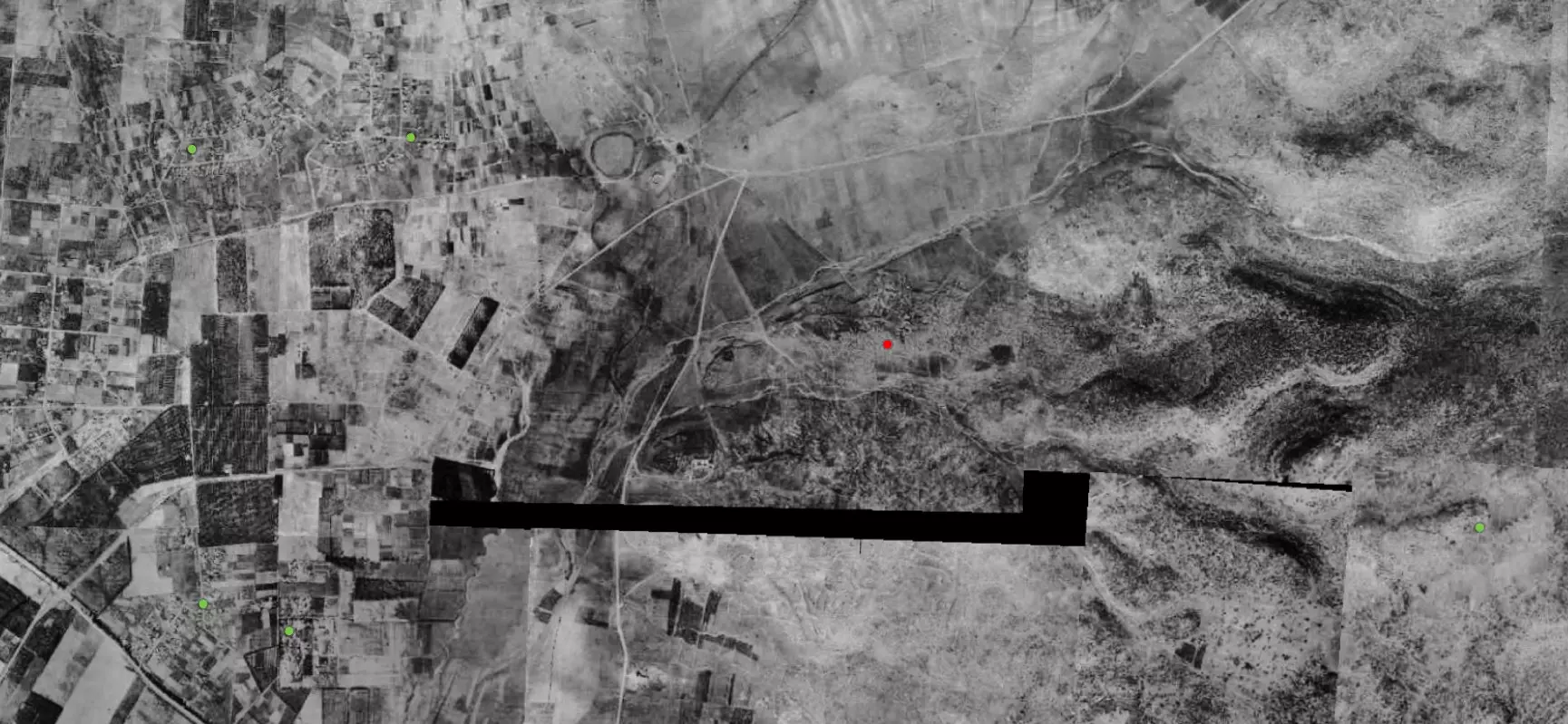
| Pre-Nakba Aerial View |
|||||||||||||
|
|||||||||||||
| Map Location | See location #47 on the map View from satellite |
||||||||||||
| Defenders | Arab Liberation Army | ||||||||||||
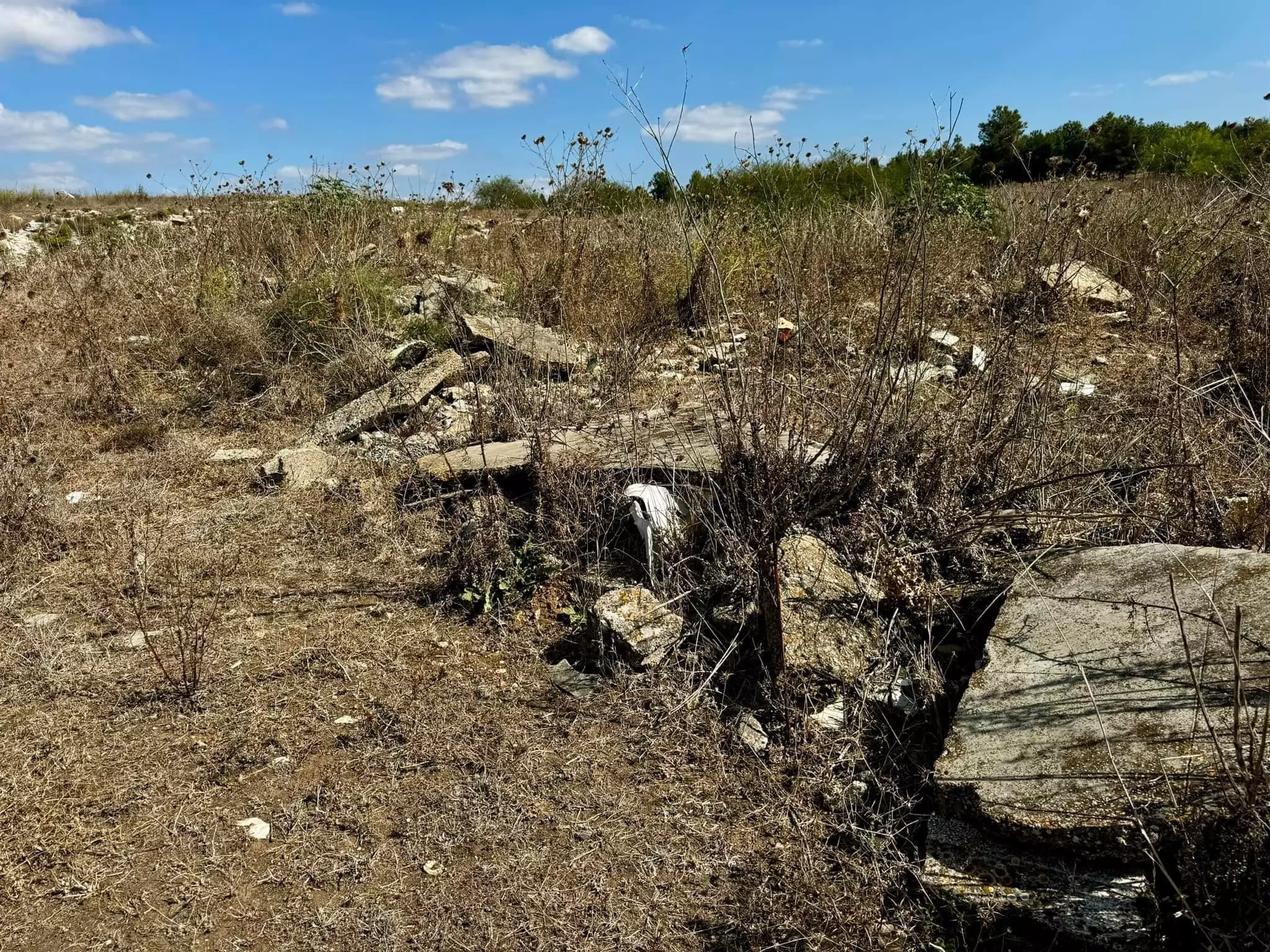
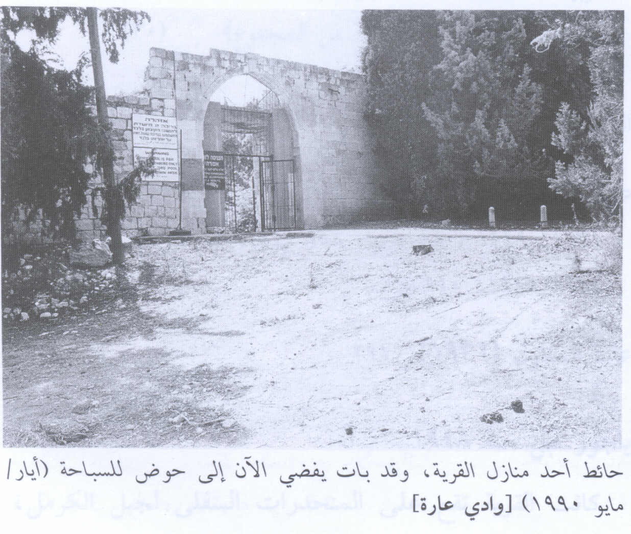
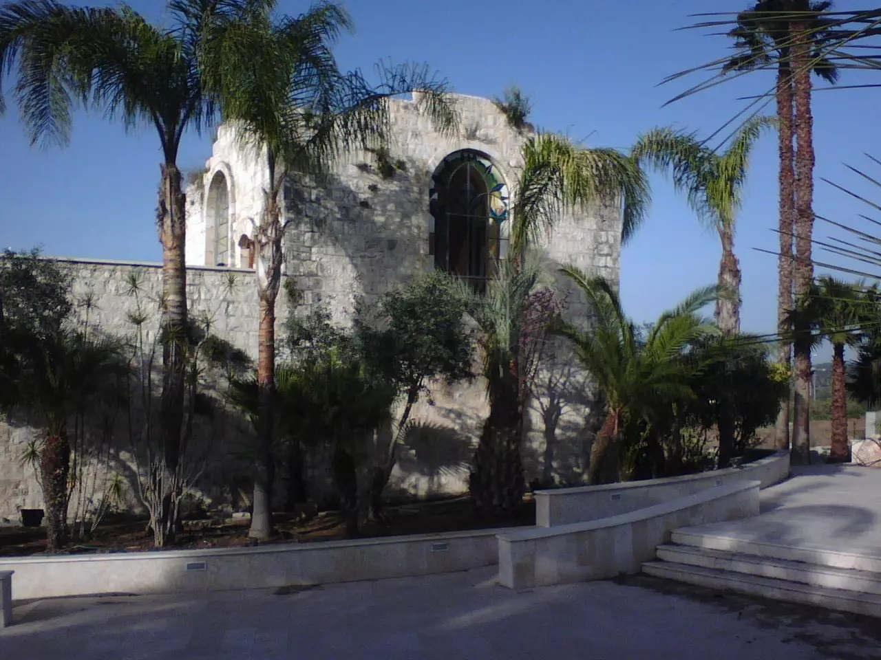
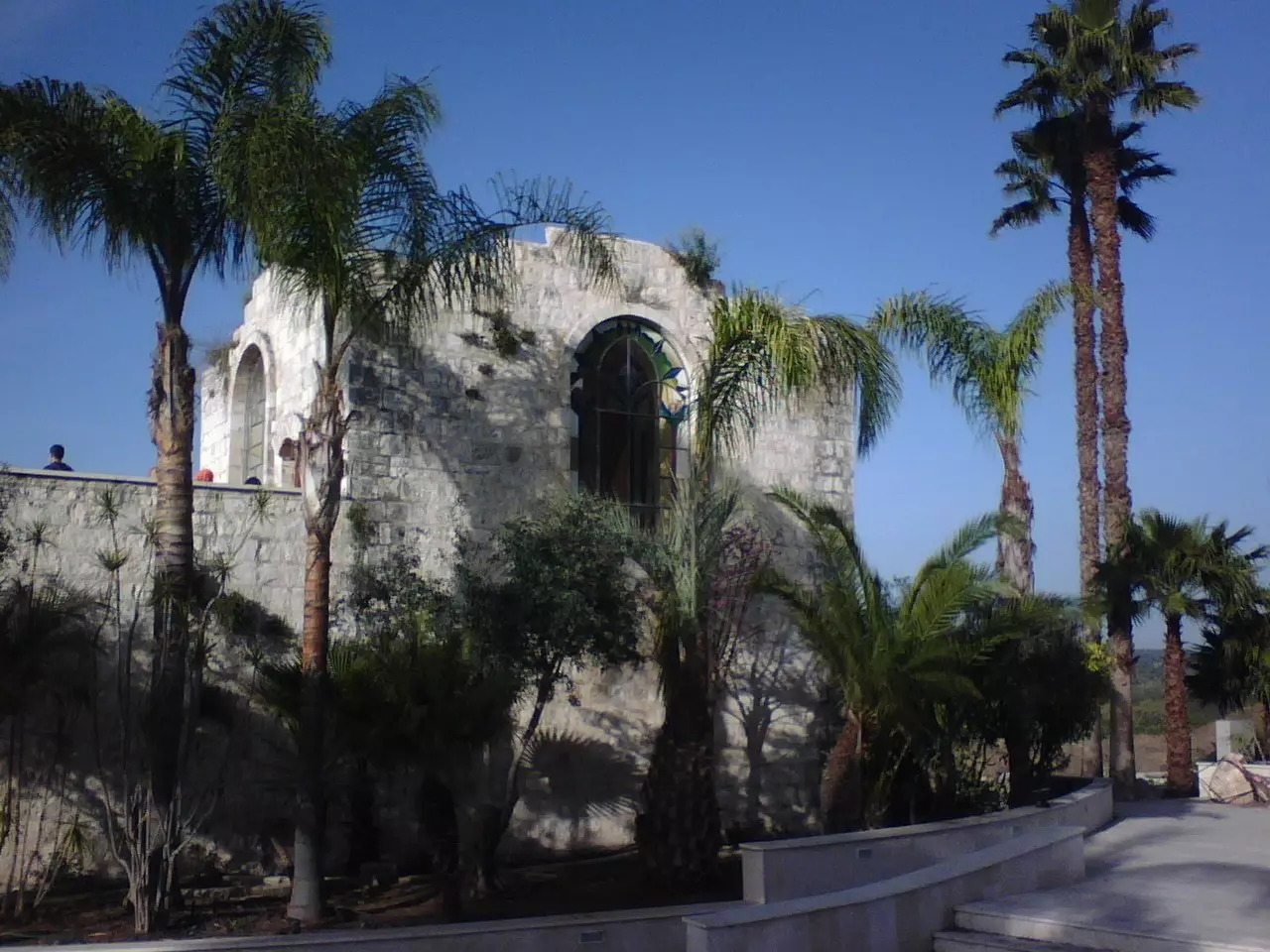
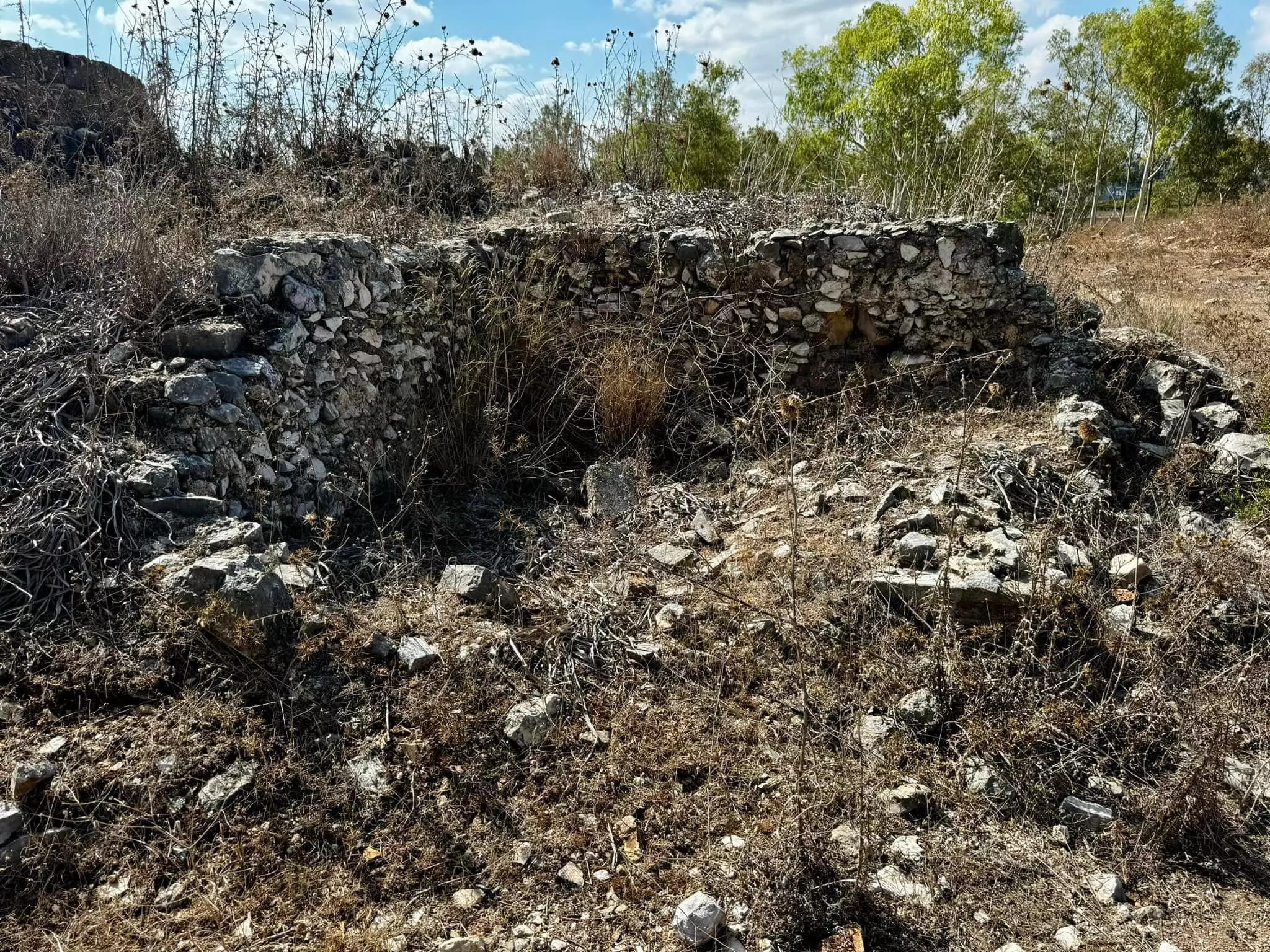
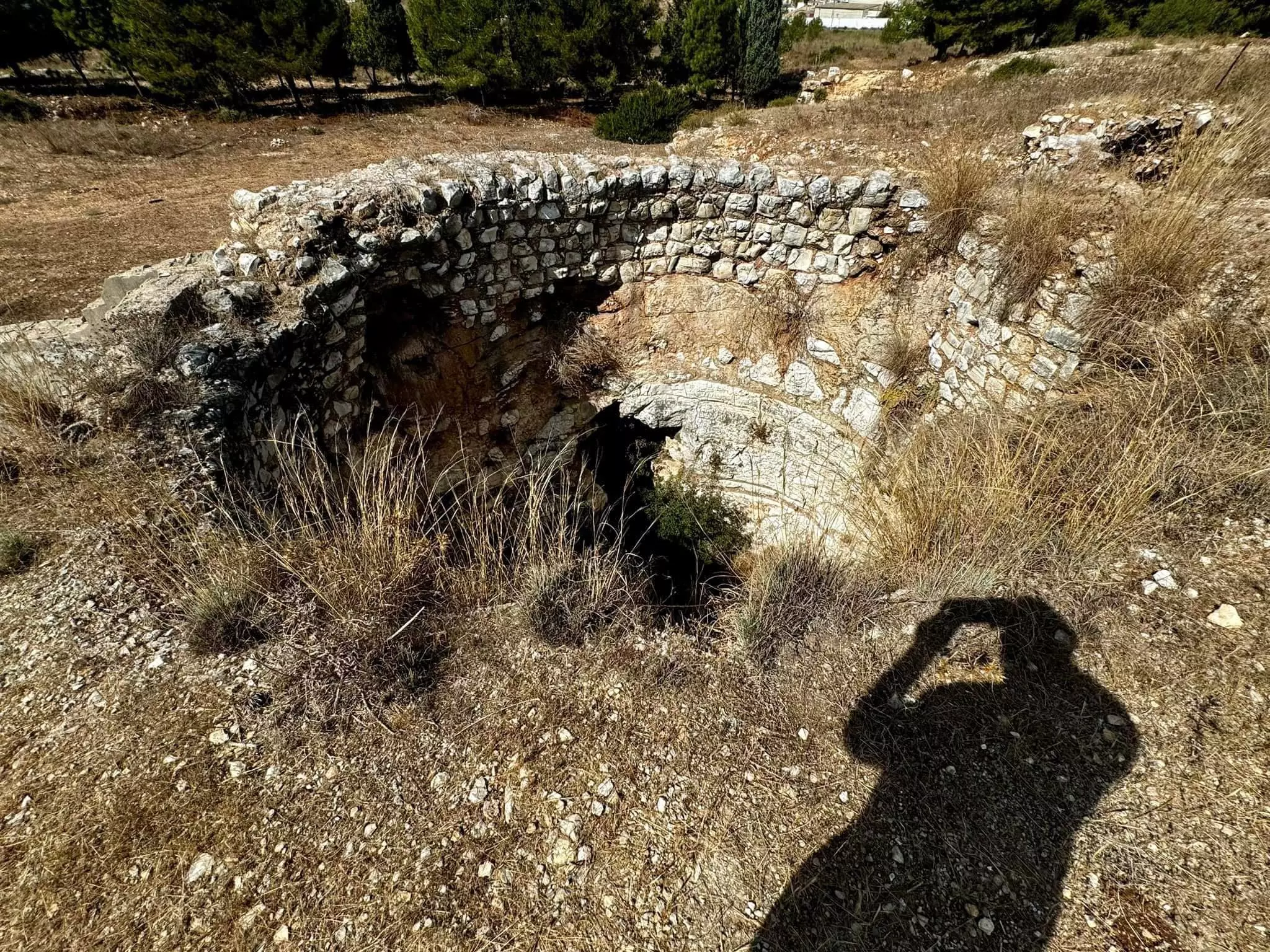
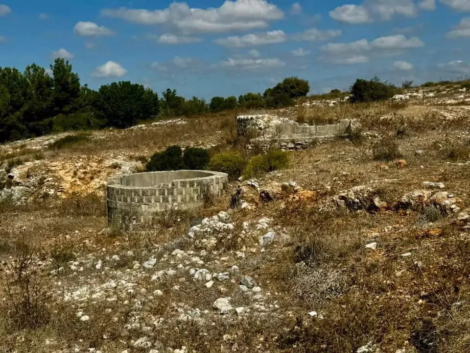
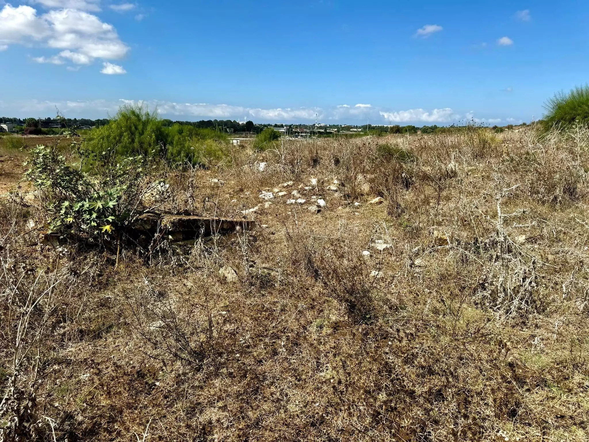
| Village Temains | The village has been mostly destroyed with the exception of two village houses. | ||||||||||||
| Ethnically Cleansing | On 27th of February 1948, Wadi 'Ara was mostly ethnically cleansed, and few villagers were allowed to stay until July 1949, then the village was completely cleansed. | ||||||||||||
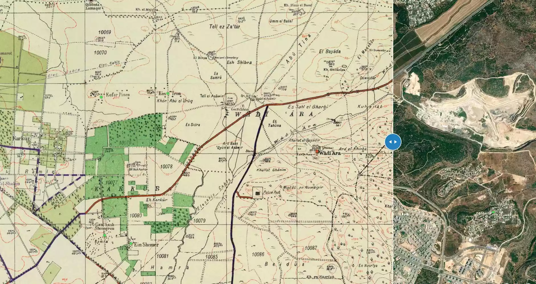
| Pre-Nakba Land Ownership |
**Town Lands' Demarcation Maps |
||||||||||||
| Land Usage As of 1945 |
|
||||||||||||
| Population |
|
||||||||||||
| Number of Houses |
|
||||||||||||
| Near By Towns |
|||||||||||||
|
|||||||||||||
| Town's Name Through History | The village was named after the nearby Wadi 'Ara. | ||||||||||||
| Nearby Wadies & Rivers | The village overlooked Wadi 'Ara. | ||||||||||||
| Archeological Sites | Wadi 'Ara had Tall al-'Asawir which contained burial caves dating from the fourth to the second millennium B.C. | ||||||||||||
| Exculsive Jewish Colonies Who Usurped Village Lands |
'En 'Iron, Kibbutz Barqay, & Ma'anit | ||||||||||||
| Featured Video | |||||||||||||
Village Before NakbaThe village, which stood on an elongated hill that ran from east to west, overlooked Wadi Ara (the wadi after which it was named) to the north. There was another broad wadi to the south of the village. The village site was strategically valuable because it controlled the western gateway of Wadi Ara, which connected the coastal plain with the plain of Marj ibn Amir. The village of Wadi Ara was also close to the Hadera-Afula highway, which ran southwest-northeast and intersected the Haifa-Jenin highway about 13 km to the northeast. Yet another road passed near the wadi, leading west to the coastal highway. The Muslim geographer Ibn Khurdadhbi (d. A.D. 912) described it as a stopping place between al-Lajjun and Qalansuwa. The village of Wadi Ara was classified as a hamlet by the Palestine Index Gazetteer. Its overall plan was square, and its houses were made of masonry. The village's population was Muslim. Agriculture and animal husbandry constituted the backbone of its economy. In 1944/45 a total of 6,400 dunums was allotted to cereals. The archaeological site of Tall al-Asawir, a low mound occupying thirty dunums of land, lay to the northwest. It was excavated in 1953 and was found to contain burial caves dating from the fourth to the second millenium B.C.Village Occupation and Ethnic CleaningIsraeli historian Benny Morris says that the villagers, fearing an Israeli attack, fled as early as 27 February 1948. If so, this was the earliest flight in the whole area. Morris does not indicate what precipitated the evacuation. However, an Arab source provides the probable cause. The records of Arab Liberation Army (ALA) commander Fawzi al-Qawuqji indicate that a Jewish force from the settlement of Ma'anit attacked Palestinian villagers in the area of Wadi Ara during the night of 27-28 February 1948. The ALA dispatched a company to defend them which engaged the Haganah force at dawn, and might have reached the Jewish settlement were it not for the intervention of a British force. One casualty was reported among the villagers, three among the ALA, and twenty-five among the Haganah.The area was also the scene of 'heavy fighting' in later months, and Qawuqji reported on 8 May that 'our forces have been engaging enemy forces in the Ara area.' The following day, a Haganah force including a number of armored cars set off from the settlement of En ha-Shofet and penetrated as far as Ara, but the ALA detachments 'resisted and repelled this attack and forced the enemy to retreat....' It is not clear when the village was eventually occupied, but at the end of the war, it lay close to the armistice lines drawn between Jordanian- and Israeli-held territory in 1949. As part of the armistice agreement of 3 April 1949, relatively large areas of land in the Wadi Ara region were ceded under duress to Israel. These may have included lands belonging to the village. Some of the inhabitants of this region remained in their villages at least until July 1949, for Morris makes a reference to 'the Wadi Ara villages' that stayed put and could not be expelled by Israel because of international political considerations. Zionists Colonies on Village Lands'En Iron was built in 1934 on what were traditionally village lands. Ma'anit, founded in 1942, is just south of the site it is not on village land. Kibbutz Barqay was established on the village site on 10 May 1949.Village TodayThe site is occupied by Kibbutz Barqay. Only two village houses remain, both on the eastern edge of the site. One of them has arched windows and a spiral staircase leading up to a room on the roof. The second has a large entrance that is used today as a gate for the kibbutz's swimming pool. Fig trees and cactuses are scattered east of the houses.SourceDr. Walid al-Khalidi, 1992: All That Remains. |
|||||||||||||
| Related Maps | Town Lands' Demarcation Maps خرائط للقضاء توضح حدود القرى والاودية Town's map on MapQuest View from satellite Help us map this town at WikiMapia |
||||||||||||
| Related Links | Wikipedia's Page Google Search Google For Images Google For Videos |
||||||||||||
| More Information | في كتاب كي لا ننسى في كتاب بلادنا فلسطين المزيد من موقع هوية |
||||||||||||
- Large Village House Still Standing In 1990
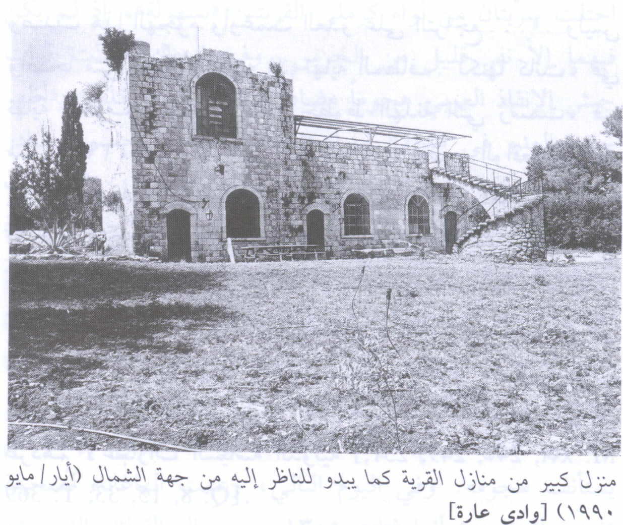
Scanned from "All That Remains" by Dr. Walid Khalidi 1 - Remaining Wall Of Village House In 1990.
Scanned from "All That Remains" by Dr. Walid Khalidi - بيت الأفندي في خربة وادي عارة (لعائلة عبد الهادي)، تصوير محمد يونس، ديرتنا
Posted by محمد سلامة يونس - منظر آخر لعلية الأفندي في وادي عارة وقد حولت لصالة احتفالات، تصوير محمد يونس، آذار 2008/ جمعية ديرتنا
Posted by محمد سلامة يونس - Pre-Nakba Aerial view of the village / صورة من الجو للقرية اخذت قبل النكبة
- A tour of Palestinian homes that were destroyed by the "most civilized". How else will the Jews be great again? Mazletov
- A tour of Palestinian homes that were destroyed by the "most civilized". How else will the Jews be great again? Mazletov #2
- A tour of Palestinian homes that were destroyed by the "most civilized". How else will the Jews be great again? Mazletov #3
- A tour of Palestinian homes that were destroyed by the "most civilized". How else will the Jews be great again? Mazletov #4
- A tour of Palestinian homes that were destroyed by the "most civilized". How else will the Jews be great again? Mazletov #5
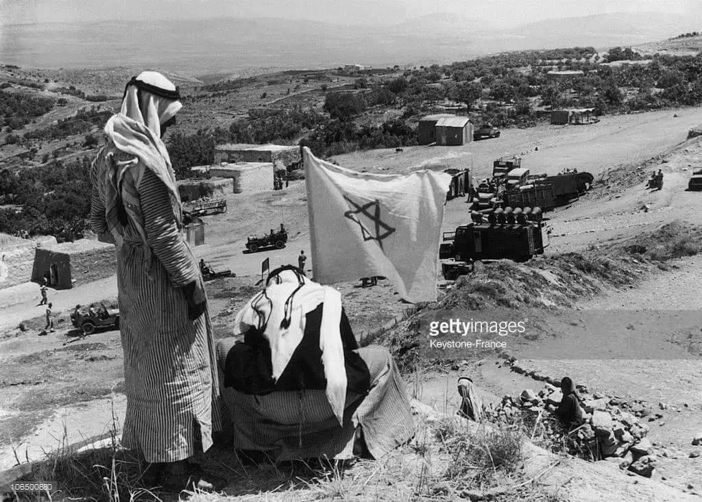
- عرب !! يرفعون العلم الصهيوني في وادي عارة بعد احتلالها عام 1949م حيث أجبر الفلسطينيون في وادي عارة على رفع العلم الاسرائيلي لمنع هدم قراهم وتهجيرهم بعد اعلان الدولة وتوقيع اسرائيل اتفاقية رودوس مع الاردن وتم بموجبها تسليم قرى وادي عارة لاسرائيل بلا حرب
Want to browse more? 80,000 pictures were grouped in these gallaries:
| Display Name | Clan/Hamolah | Country of Residence |
- جولة ميدانية مصوّرة في محيط قرية وادي عارة المهجرة (قضاء حيفا) Duration: min 48 sec
No links have been shared yet, be free to the first to share the first link.
 Fake Valor: Why Did Zionist Jews Hoist Nazis Flag on Their Ships in the 1930s?
What is new?
-
Facts About Oct. 7th Gaza Raid
-
Remined Us Please:: Who Did Rape Who? Palestinians Raped Israelis? Or, was the other way around?
-
When Prof. Edward Said was invited to debate Bibi Netanyahu in the 1980s, watch what happened!
-
Ezra Klein of the NY Times on the "Jewish Race".
-
Abusing Blood Libel!
-
Zionist FAQ: Isn't it true that Palestinians don't want peace? Palestinians never accepted the two-state solution
- Facts about Haavara (Transfer) Agreement between Ben-Gurion & Hitler
-
Haavara FAQs: Why Did Zionist Jews Hoist Nazis' Flags on Their Ships in the 1930s?
-
Dear ChatGPT: Why did the Jewish Agency suppress news of the Holocaust during WWII?
-
Video Playlist: Jews share their DNA tests to end the conflict for good.
-
A Tale of Two Conflicts: Examining the Definition of Genocide
-
Prof. Abraham Polak And The Suppressed History of the Khazars and European Jewry
-
How Ronald Reagan would have framed the genocide in Gaza if he were still alive?
-
Haavara FAQs: Let us do the math: how many German Jews did The Haavara Agreement save?
-
Zionist FAQs: The Hebron Massacre of 1929, "clearly proves" that Palestinians are antisemitic, how could you deny it?
-
Zionist FAQs: Why Anti-Zionist Is Not Antisemitism?
-
Zionist FAQs: Isn't it true that the KGB create Palestinian Nationalism in the early 1960s?
- Zionist FAQs: Muslims are killing Muslims all the time; why are Israeli Jews being singled out in the media?
- Zionist FAQs: How is Israel an apartheid state when 20% of its citizens are Arabs who enjoy full rights?
-
Haavara FAQs: Analysis of Herzl's Uganda Scheme and how it could have saved millions of Jews.
-
Haavara FAQs: Why did Hayim Greenberg describe American Jewry as "morally bankrupt" in early 1943?
-
Haavara FAQs: What if the Evian Conference was a resounding success? What would have been the impact of saving European Jewry on Zionism?
- Haavara FAQs: What if the six million were saved, how that would have impacted the Zionist project?
-
Haavara FAQs: How did Zionist leaders react when Europe's Jews lingered in the DP camps after WWII ended?
-
Why does the American Jewish community repeat lies that David Ben-Gurion had debunked before he died?
-
Who has the power to rename the Tatar/Khazar Gene Marker to Jewish IV?
-
Zionist FAQs: Why won't Egypt, Syria, and Jordan take their people back? Jews are indigenous to Palestine, and Arabs immigrated after Jews developed the country. Arabs should leave.
-
Haavara FAQs: Did Hitler and the Nazis conflate between Judaism and Zionist? If that wasn't case, then why?
-
Haavara FAQs: Winston Churchill and antisemitism, a collection of articles written Churchill.
-
Haavara FAQs: Broken by country, how many Jews survived vs. killed during the Holocaust?
-
Haavara FAQs: Why did European Jews vote with their feet and to immigrated to the Americas, not Palestine, after WWII?
-
Watch this American Jewish Girl describing Israeli Jews' cognitive dissonance like no other in under two minutes
-
Haavara FAQs: When the Nazis went out of their way to hide the Holocaust, Israeli Jews did the exact opposite by broadcasting their genocide of Gazans. But why?
-
Haavara FAQs: How Zionist Jews went out of their to show their appreciation to Nazism and Fascism?
- Haavara FAQs: Why Zionist leaders were against bombing the death camps & the Railroads leading to them?
-
Haavara FAQs: Hitler's message to the British and American people: If Jews are such noble citizens and you care about them, how come you're not letting them in? I will gladly ship them to you at my expense, even on luxury liners!
-
A shortlist of Zionist and Israeli false flag operations in the name Jews.
-
The Most Moral Army
- The Land of Kapos (Israel): Where the brave are boycotted and Kapos walk free.
- Why did early Zionists often named their communal enterprises "colonial"?
- Zionist Relations with Nazi Germany by Faris Glubb
-
Two NY Times advertisements by Zionists in the early 1943 that exposes Zionists' treason at the height of the calamity
- Facts Not Lies about the Palestinian-Israeli Conflict.
- Site's pictures have been categorized
- Campgain Against Lice
- A Survey of Palestine, the official source about Palestine before Nakba produced by the British Mandate; over 1200 pages.
- Satellite View & Google Earth: Over 6,000 placemarks identifying all destroyed towns, W. Bank & Gaza Strip Towns, & refugee camps.
- PalestineRemembered.com and its Nakba Oral History Project were featured on al-Jazeera Satellite TV.
- Nakba Oral History Video Podcast:
 Over 700 Oral History interviews (including 3,500+ hours of recording) can be viewed online.
 - Palestine Village Statistics Project
- Gaza Jail Break
- النسخة العربية للموقع الان متوفرة
- Videos: Documenting the destroyed villages in video: Tracing all that remains since Nakba.
- Videos: Responding to Zionist Propaganda
- Interview: The ethnic cleansing of Palestine: George Galloway interviews Israeli Historian Ilan Pappe.
- For Palestinians, memory matters. It provides a blueprint for their future By George Bisharat.
- Zionist FAQ now available in Hebrew שאלות שציונים שואלים, עכשיו בעברית
- Video: The Stephen Walt and John Mearsheimer report on the influence of the Israel Lobby on U.S. Foreign Policy
- The Palestinian-Israeli conflict for beginners
